Last updated - May 2024

Sylvan Lake - Custer State Park
If you enjoy my blog, please consider signing up below to get email notifications of my latest posts. I will not share your email.

Mount Rushmore National Memorial
A Black Hills Vacation
The Black Hills rest in the western portion of South Dakota, and have an abundance of things to do with your children on a family trip. If you live in the Midwest, this is a great destination that is relatively close-by for those daring to do a road trip. If you live elsewhere and are looking for a less-crowded option for an amazing summer vacation, the Black Hills promises to be a memorable trip with a little bit of everything offered from National Parks and Monuments to water parks and zoos.
Black Hills Lodging Options
Rapid City is an hour to the west of Badlands National Park, and this would be my suggestion for where to make a basecamp for anyone travelling to the Black Hills for a vacation lasting a few days or longer. Within Rapid City, we’ve camped in KOAs, enjoyed cabins in nearby Custer State Park, and we have stayed in multiple hotels that have nice, heated indoor pools.

Camping at the KOA near Devil’s Tower National Monument - Despite how many times we’ve stayed in the Black Hills, I don’t often take pictures of our hotel or campsites. During this family trip in 2016, we were headed out to Yellowstone and Grand Tetons National Parks. We left the Minneapolis / St. Paul area going first towards Theodore Roosevelt National Park in North Dakota. On the way home. we spent the night near Devil’s Tower (with an awesome campsite view!), and of course we stopped in Badlands National Park (one of my favorite National Parks) before driving back. This was atypical for us though, we usually spend the night in or near Rapid City, SD.
Logistics and Helpful Information
It’s difficult to remember exactly how many times we’ve been to the Black Hills, but it’s at least nine. We’ve spent entire vacations in the Black Hills, and we’ve stopped for just 1-2 nights as we journey along I-90 to other destinations. Of my favorite places to explore in the Unites States, I would rank the Black Hills third (Moab, UT, being first, followed by Sedona, AZ). I love the Black Hills! We don’t just stop here as a place to get out of the car. I truly enjoy it. Badlands National Park is one of my favorite National Parks, and Sunday Gulch in Custer State Park is one of my top 10 favorite hikes in the United States.
Summer is the most obvious time to visit the Black Hills because that’s simply when road trips typically happen. But, that’s when everyone else is traveling too. We haven’t been to the Black Hills in the winter months (Dec - Feb) yet, but so far my favorite time to visit has been towards the end of October. The crowds were minimal and the weather was still amazing. We have had some fantastic trips during Spring Break as well, but I’ll note that we book everything last minute if travelling in March, after confirming with the 10 day forecast that there would be no snow and the weather looks warm enough to hike.
For anyone traveling in the summer, just watch out for early August. Annually, there is a motorcycle rally in Sturgis. There will be so many people this week, this is not the atmosphere most people are looking for - check the calendar through Google and avoid this week.
One last logistical note is just a change we’ve observed over the years. The Black Hills, Rapid City, and Custer, are slowly starting to feel more and more like the touristy cities of Wisconsin Dells and Branson, Missouri. That’s fun if you like to spend money on the museums and unique manmade experiences, but expect to spend a fair bit of cash. There still are many places to hike in the Black Hills at minimal cost or for free, however, but it requires a bit of pre-planning to know where to go. We typically pick the cheaper, more natural things to do; therefore I won’t have much for reviews of the sightseeing adventures that will be seen on the numerous billboards

Custer State Park - Peter Norbeck Visitor Center - Wildlife Loop Road
Things To Do in the Black Hills
The Black Hills can be either a short stop to see some highlights for anyone traveling along I-90, or it could be a vacation destination on its own. There are several different places to see and things to do. This area of the country is a must-stop place when we travel west on road trips, so we have been to the Black Hills several times. As we live in Minnesota, our order of destinations to stop at typically starts east, as we head west. As such, that’s the order I’ll present various things to do while visiting the Black Hills (east-to-west).
In the map below, I use hyperlinks to jump to different sections within the post. At the end of each section there is a link back to the map. Simply reading the post top to bottom is also an option. I also have links to separate posts that I’ve written, with more information about each place to visit in the Black Hills.

1) Badlands National Park - Beautiful National Park to drive through with several short hike options and abundant wildlife
2) Minuteman Missile National Historic Site - Three different locations - Minuteman Missile National Historic Site Visitor Center, Delta-01 Launch Control (underground bunker - tickets required), and Delta-09 Missile Silo
3) Wall, SD - Wall Drug - Quick stop for free water, 5 cent coffee and food at café, check out the gift shops, and if visiting in the summer months, the Wall Drug Backyard features an animatronic T-Rex
4) Rapid City, SD - Largest city in the Black Hills, with a population over 70,000 - convenient lodging location with several touristy activity options, restaurants, and places to buy anything that may have been forgotten when packing
5) Mount Rushmore National Memorial - Iconic 60ft face statues of George Washington, Thomas Jefferson, Theodore Roosevelt, and Abraham Lincoln carved into Six Grandfathers Mountain
6) Hippie Hole - A short 0.6 mile out-and-back hike to a swimming hole (with optional cliff jumping) - Note that the drive out to the trailhead is going to take a bit of adventurous spirit and a car with a bit of wheel clearance
7) Custer State Park - Sylvan Lake - Multiple hiking options as well as a swimming beach with canoe and kayak rentals available
8) Custer State Park - Needles Highway (SD-87) - Incredibly scenic drive past granite pillars (hoodoos). Note that this highway is closed during winter months
9) Custer State Park - Wildlife Loop - This is a fun drive to find bison, pronghorn, deer, burros, and prairie dogs
10) Wind Cave National Park - Wind Cave is the densest known cave system in the world (with the greatest passage volume per cubic mile) and it contains 95% of the world’s known boxwork. Tours can be booked through the National Park System and are required to enter Wind Cave.
11) Mammoth Site - An active dig site at the location of a pre-historical sink hole with more than 60 mammoths discovered to-date. Take a guided tour around the dig, and children can sign up for a pretend dig in a nearby classroom where they will learn the basics of excavation.
12) Jewel Cave National Monument - Jewel Cave has over 220 miles of passages mapped to-date, making it the second longest known cave in the United States, and the fifth longest known cave in the world. Tours can be booked through the National Park System and are required to enter Jewel Cave.
13) Crazy Horse - View the largest mountain carving in the world, which is still being sculpted today
14) Spearfish Canyon - Enjoy several short hikes to beautiful waterfalls set in a stunning canyon, with just short drives in-between each
15) Devils Tower National Monument - An hour detour from I-90 to visit a 867ft high rock formation with a 1.6 mile loop trail surrounding it
1) Badlands National Park

Badlands National Park - Notch Trail
Where is Badlands?
Badlands National Park is located in the western part of South Dakota, just off of I-90. The majority of the park is visible by taking the Badlands Loop Road between the Northeast and Pinnacles entrances (exits 131 and 110, respectively, from I-90).
The Northeast entrance to the park is not quite four hours west of Sioux Falls. Rapid City is an hour to the west of the Badlands.

Map of Badlands National Park from Rapid City, SD
Best Things to Do at Badlands
I would recommend at least a half day to experience the best of Badlands National Park. For anyone with more time, it’s possible to fill up two days with longer hikes, exploration down to the much less visited Stronghold Unit (within the Pine Ridge Reservation), and / or combining the visit to Badlands with the Minuteman Missile National Historic Site.

Map of Best Things to Do in Badlands National Park
If travelling from the east, leave I-90 at exit 131, and enter the Badlands at the Northeast Entrance. Follow Badlands Loop Road back to I-90 at exit 110, near Wall Drug.

Sunrise over Big Badlands Overlook in October 2023
It’s extremely difficult to time this perfectly, but a sunrise at Big Badlands Overlook is the best way to start a trip to Badlands National Park. Even if the sunrise doesn’t work out, for anyone traveling from the east, start with a stop at the Big Badlands Overview. (This sunrise was on my birthday - what an epic start to my next year around the sun)

View of the rocks from Door Trail
The next main pullout is the trailhead to Door, Window, and Notch Trails. Window is the easiest trail, and it’s wheelchair accessible along a 0.2 mile out-and-back flat boardwalk. Door is just slightly more difficult at 0.8 miles out-and-back. A boardwalk goes most, but not the entire way.

Ladder along Notch Trail - my favorite trail within Badlands National Park
Notch is a fun 1.55 mile out-and-back trail, but is not wheelchair or stroller accessible. Notch includes the use of a ladder and the second half of the trail follows along the top of the Badlands rocks, which have several significant drop-offs. This is my favorite trail within Badlands National Park, but it wouldn’t be the right trail for someone with a fear of heights.

View from the end of Notch Trail
The Cliff Shelf Nature Trail is another great short hike. This trail is a 0.6 mile loop, entirely along boardwalks, but there are multiple steps, resulting in an overall elevation gain of 130ft.
Mountain Sheep along the Cliff Shelf Nature Trail
The Ben Reifel Visitor Center has a small exhibit area, and there is a helpful short video that explains how the rocks within the park were formed. These rocks crumble, just like dry hardened mud, which is very different than a typical mountain or canyon. The video will be helpful for anyone puzzling over the park’s terrain.

Badlands White River Valley Overlook
The rest of Badlands Loop Road is beautiful, and there are several viewpoints to stop at. My favorite views are at White River Valley Overlook and Panorama Point.

Badland’s Panorama Point

Prairie Dogs near Prairie Homestead (next to I-90 110 exit)
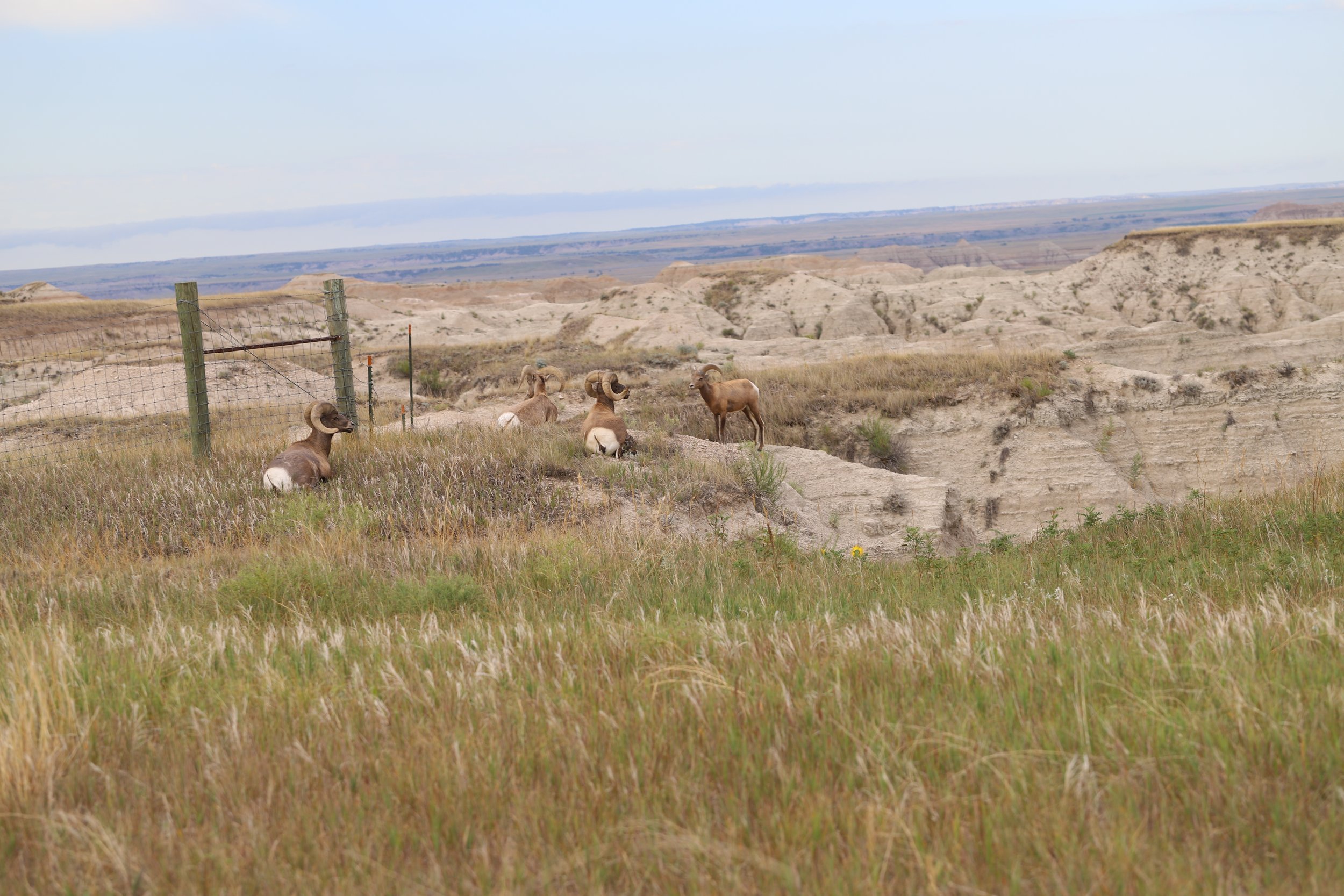
For anyone interested in wildlife, there are lots of prairie dog towns along the road. There is a particularly large one near the Prairie Wind Overlook. We typically find Mountain Sheep near the Ancient Hunters Overlook.

Mountain Sheep near Ancient Hunters Overlook
We’ve seen bison on every trip through Badlands, but where we see them changes each time. They are large animals and there are so many places in the park where it’s possible to look across large distances. Just keep looking to find them.
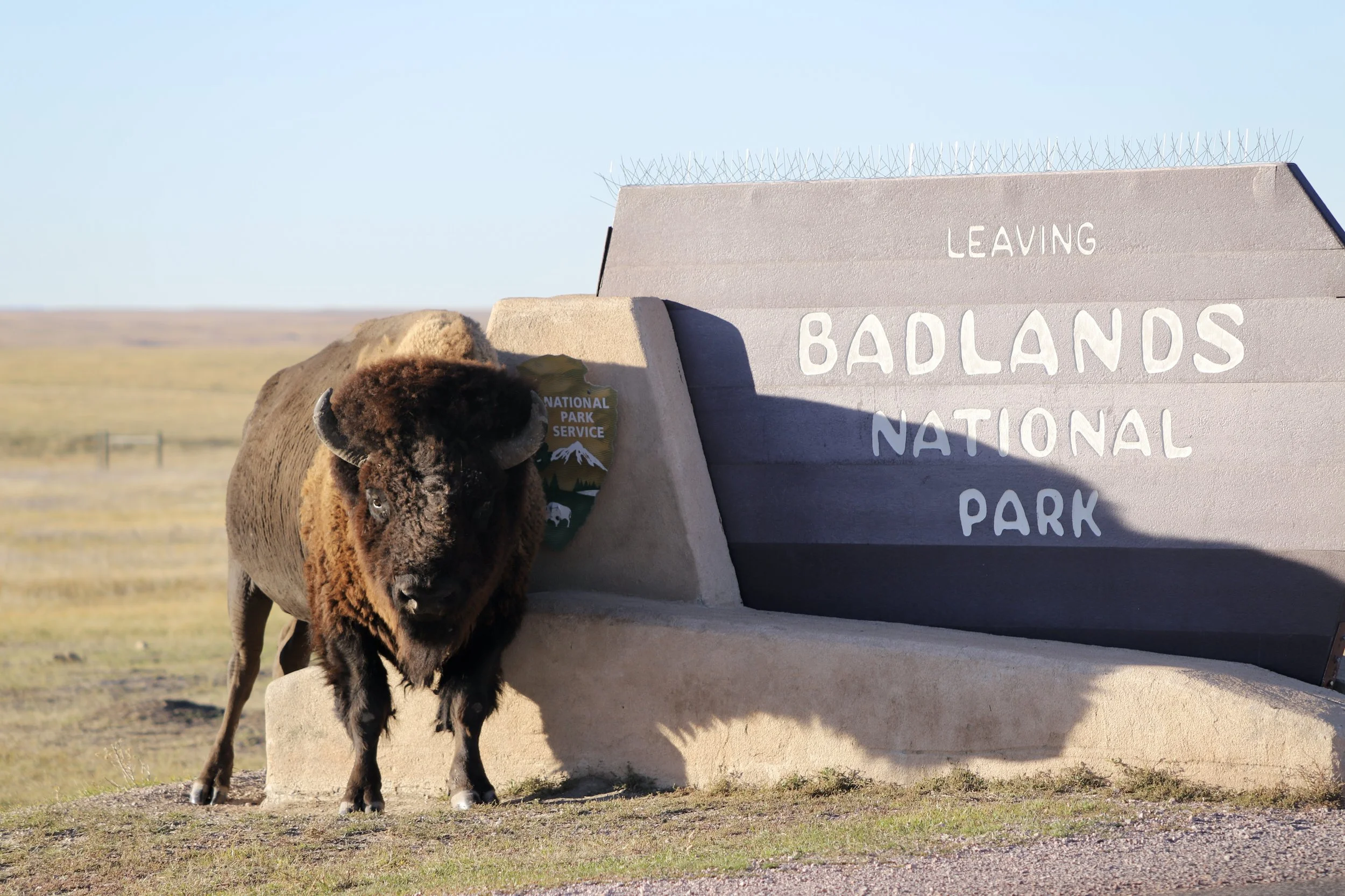
Sometimes the bison are just in the perfect spot…
More Information on Badlands
For more information on what to do at Badlands National Park, including additional viewpoints, hikes, more pictures, and detailed hiking maps, refer to my post on Badlands National Park.
2) Minute Man Missile National Historic Site

Where is Minuteman Missile Site?
To fully explore the Minuteman Missile National Historic Sites, there are three different locations, requiring a drive in-between each. The Minuteman Missile Sites are located off of I-90 in-between the entrances to Badlands National Park (exits 110 and 131 from I-90).

Locations of Minuteman Missile National Historic Sites - Visitor Center, Delta-01 (underground bunker launch site - tickets required for tour), and Delta-09 Missile Silo
Best Things to Do at Minuteman Missile Site
Visiting the Minuteman Missile National Historic sites takes a bit of pre-planning and patience. To visit the underground bunker, where the missile launch control was located, pre-purchase of tour tickets is required from the National Park website. When we visited in 2023, only 6 visitors were allowed on each tour… Like I said - patience and pre-planning. It’s simply a fantastic tour though. At the end of the tour, they will play the sounds of what the various alarms would have sounded like had a nuclear bomb been launched from the facility. Obviously, this experience so much more real than just watching videos in school. Being here felt humbling, but also there was this realization of how much responsibility we have to make sure we don’t ever misuse this power in the future.

Delta-01 Launch Control
The National Historic Site Visitor Center and Minute Missile Silo site are both open to the public without ticket reservation. The film in the visitor center is worth watching - a lot of it is repetitive with information from delta-01, so if you weren’t lucky enough to get tickets, you can still learn the same information. And the film has more information, more stories, and more perspectives. The delta-09 missile silo site has limited hours. It’s only open some days of the week and it closes by 3pm. Check their website so you know the hours, and stop there first if you need to. The visitor center is open later.

Exterior of Delta-01 Launch Control Site
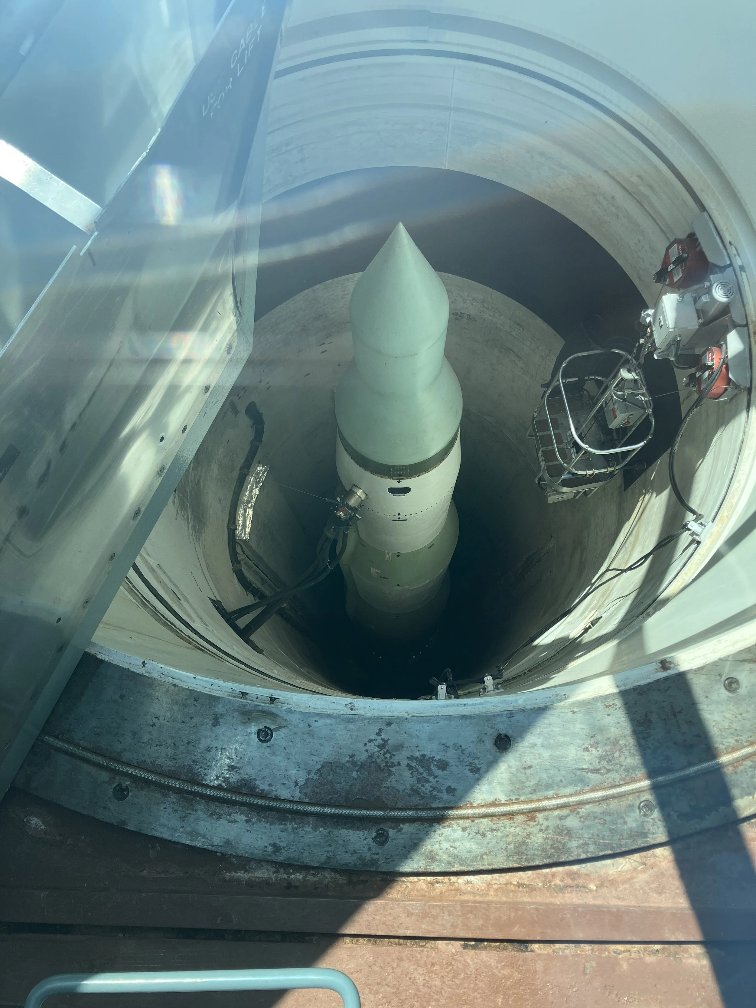
Delta-09 - Training missile on display
More Information on Minuteman Missile National Historic Site
For more information on what to do at Minute Man Missile National Historic site, refer to this link: Minuteman Missile Site.
3) Wall, SD - Wall Drug

How many signs have you seen for Wall Drug in your life? Not just along I-90, but everywhere? I’d highly recommend at least a 10-minute stop, if nothing more than to take a picture and say you’ve been here.
For me, Wall Drug is a part of visiting the Badlands. We love to stop for supper at the Wall Drug Café after we are done hiking. We don’t do much beyond that, but it’s tasty, relatively cheap food, and a nice stop before the last hour drive out to Rapid City, where we typically spend the night. The café does close at 6pm however, so supper needs to be early.
Where is Wall Drug?
The exit for Wall Drug from I-90 is the same as the Pinnacles Badlands entrance (exit 110). To get to Wall Drug, drive down South Blvd, turn on Main Street. The main stores are between 5th and 6th Avenue. There will be shops on both sides. The café is at the front. Keep walking all the way to the back to find the Wall Drug Backyard. The café and gift stores are all connected to each other inside. It’s pretty obvious how to get to Wall Drug, just follow the signs.

Map of Wall Drug
Best Things to Do at Wall Drug

Wall Drug Café
There are three main things to do at Wall Drug - eat at the café, shop at the gift stores, and explore the Wall Drug Backyard. The Wall Drug Café is cafeteria style, just grab what you want, pay, and bring it to the table - which makes for a quick meal; helpful on a long day of driving.
Wall Drug Backyard
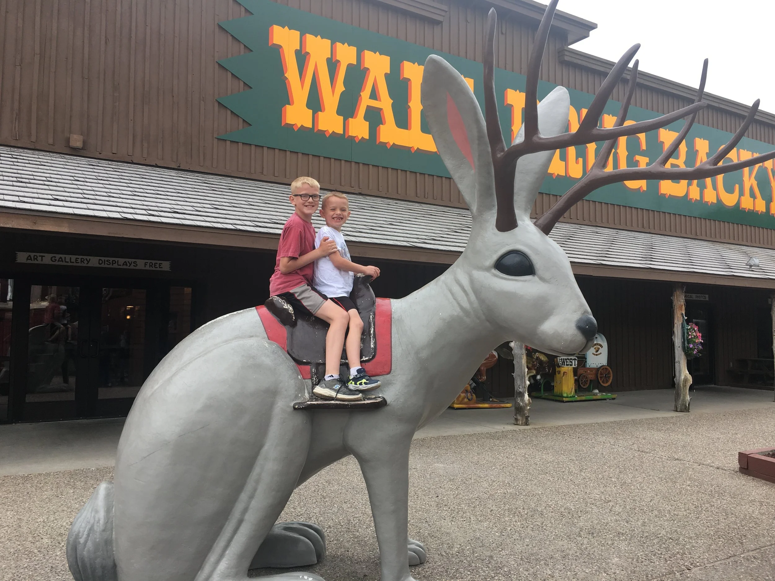
Behind the café and gift stores is a place referred to as the Backyard. This is where to find the animated and pretty life-like T-Rex. Both of my boys were fascinated and terrified by this roaring dinosaur. It is scary, so for anyone traveling with younger kids, be mindful of potential fear. The Backyard also has some silly things to take pictures of - like a giant jackalope and a small Mount Rushmore, and there are some gift stores more aimed at younger-aged children. The Backyard section of Wall Drug is typically only open in the summer months, but one March that was particularly warm, they opened it for the weekend.

Infamous Wall Drug T-Rex
One other note on traveling through Wall Drug with kids that I’m going to share – there are gift shops everywhere. We are clear with our boys before we get out of the car what our purpose is (getting one thing or not getting anything besides food) to avoid spending too much time wandering through the shops, and to avoid any overwhelming cases of the “gimmies” (Berenstain Bears reference…)
4) Rapid City, SD
Where is Rapid City?
Rapid City is in the southwest corner of South Dakota, located just off if I-90. Rapid City is about 5 hours west of Sioux Falls, 5 hours east of Billings, and 6 hours north of Denver.
Best Things to Do in Rapid City?
When we visit the Black Hills, we typically stay in Rapid City. The population of the city is over 70,000, so there are plenty of hotels and campgrounds. Several of the hotels have indoor pools, and some of the newer hotels now have indoor waterparks. There are lots of restaurants, as well as general stores like Target and Walmart. This makes Rapid City an easy city for lodging.
The other really convenient thing about staying in Rapid City is that it’s centrally located to various attractions around the Black Hills. It’s an hour west of the Badlands, 30 minutes northeast of Mount Rushmore, 1 hour northeast of Sylvan Lake and Jewel Cave, 1 hour north of Wind Cave and Hot Springs, and 90 minutes east of Devil’s Tower. For a vacation just in Custer State Park, this drive wouldn’t be the best option, but for someone wanting to see all of these things, Rapid City is a decent location to minimize the daily driving time.
Rapid City also has a lot of touristy non-hiking options. There are private caves that offer tours, ropes courses, ziplines, waterparks, and zoos. The only place I’ve been to though in Rapid City is Reptile Gardens. I was eight - my parents took me. I got to sit on a huge tortoise. I remember it being cool. We talked about going there again over the years on various trips, but tickets for 4 people are almost $100, and there are so many other places to explore for free (or at least much cheaper options). We’ve stayed busy in the Black Hills without ever venturing to Rapid City attractions.
5) Mount Rushmore National Memorial
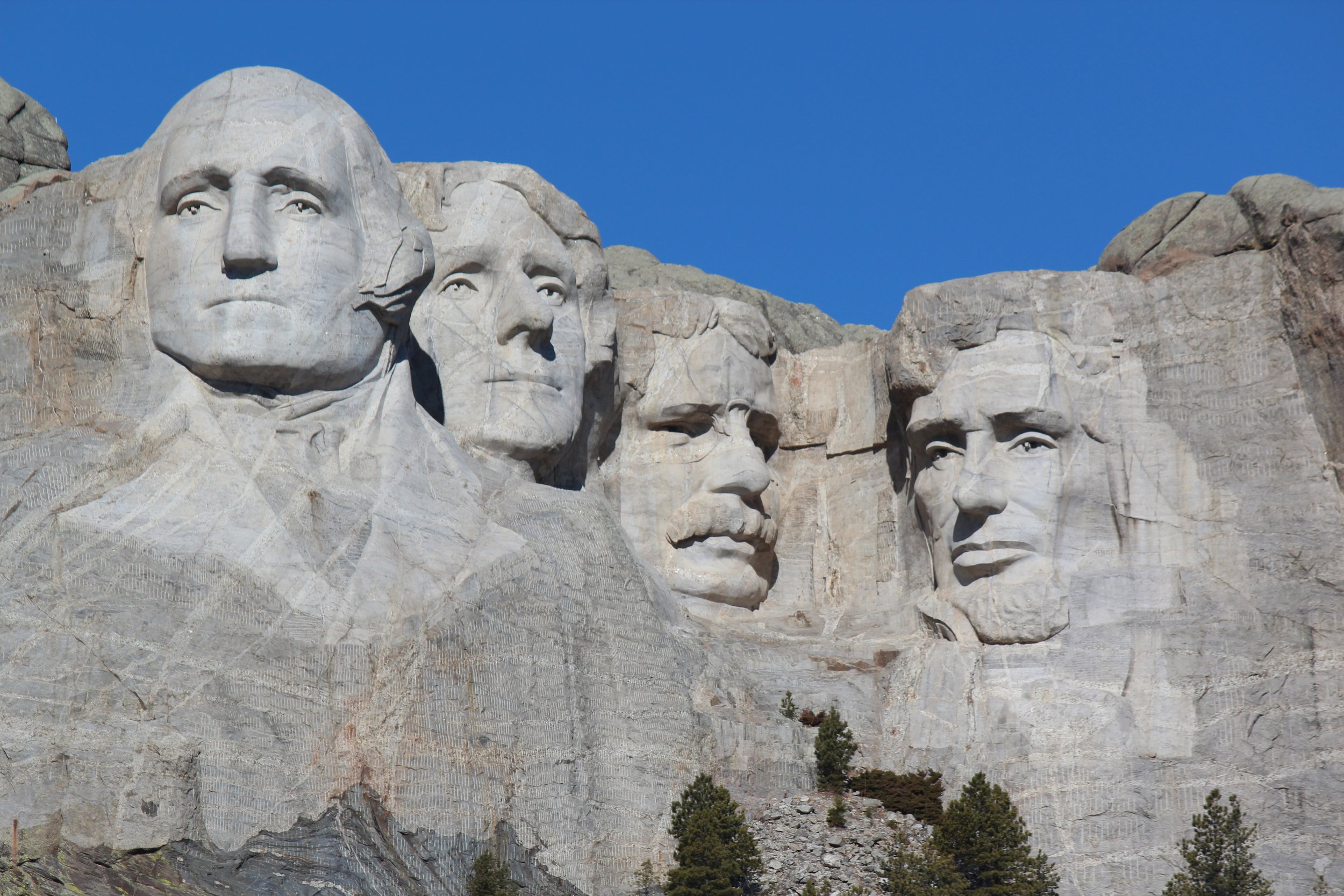
Mount Rushmore - 60ft face statues of George Washington, Thomas Jefferson, Theodore Roosevelt, and Abraham Lincoln carved into Six Grandfathers Mountain
Where is Mount Rushmore?
Mount Rushmore is about a half hour southwest of Rapid City, and a similar distance east of Sylvan Lake. Due to it’s location, Mount Rushmore pairs well with a day trip to Custer State Park. The distance between Mount Rushmore and the Hippie Hole swimming area is also about 30 minutes.

Map to Mount Rushmore National Memorial
Best Things to Do at Mount Rushmore?

Parking (black stars), Information Center (yellow star), Avenue of Flags (green), Visitor Center (red star), Presidential Trail (purple), Sculptor’s Studio (blue star), George Washington Profile (orange star)
2-3 hours is about the right amount of time to budget for most trips to Mount Rushmore. The park is free to visit, but there is a cost per car to park ($10 as of 2023).

Avenue of Flags - Mount Rushmore. This picture makes sense… Just keep looking if it’s not obvious.
Start by enjoying the short walk down Avenue of Flags to the Visitor Center, where there is a quick movie to watch, in addition to some displays with supporting information. For those with more time, the Presidential Trail is a short 0.6 mile loop along paved surfaces, boardwalk, and stone patio. There are 422 steps however, making this trail neither wheelchair or stroller friendly. This path stays at the base of the mountain. There are no trails up to the statue.
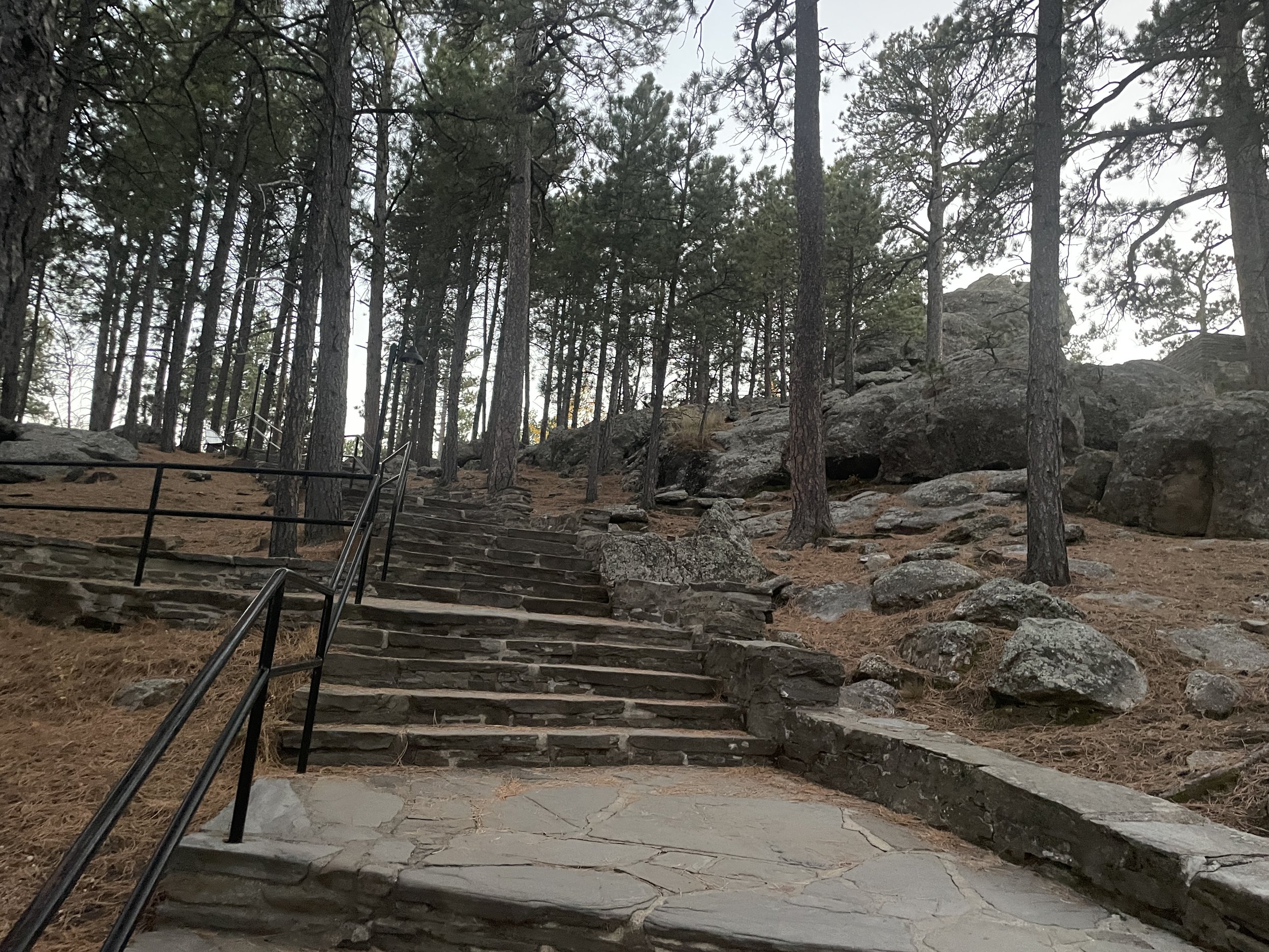
Steps along Presidential Trail
The monument is lit in the evening year-round, and in the summer months there is a 45-minute ranger-led lighting and flag ceremony. My favorite time of day to visit Mount Rushmore is just before dusk, to enjoy the monument in both types of light.
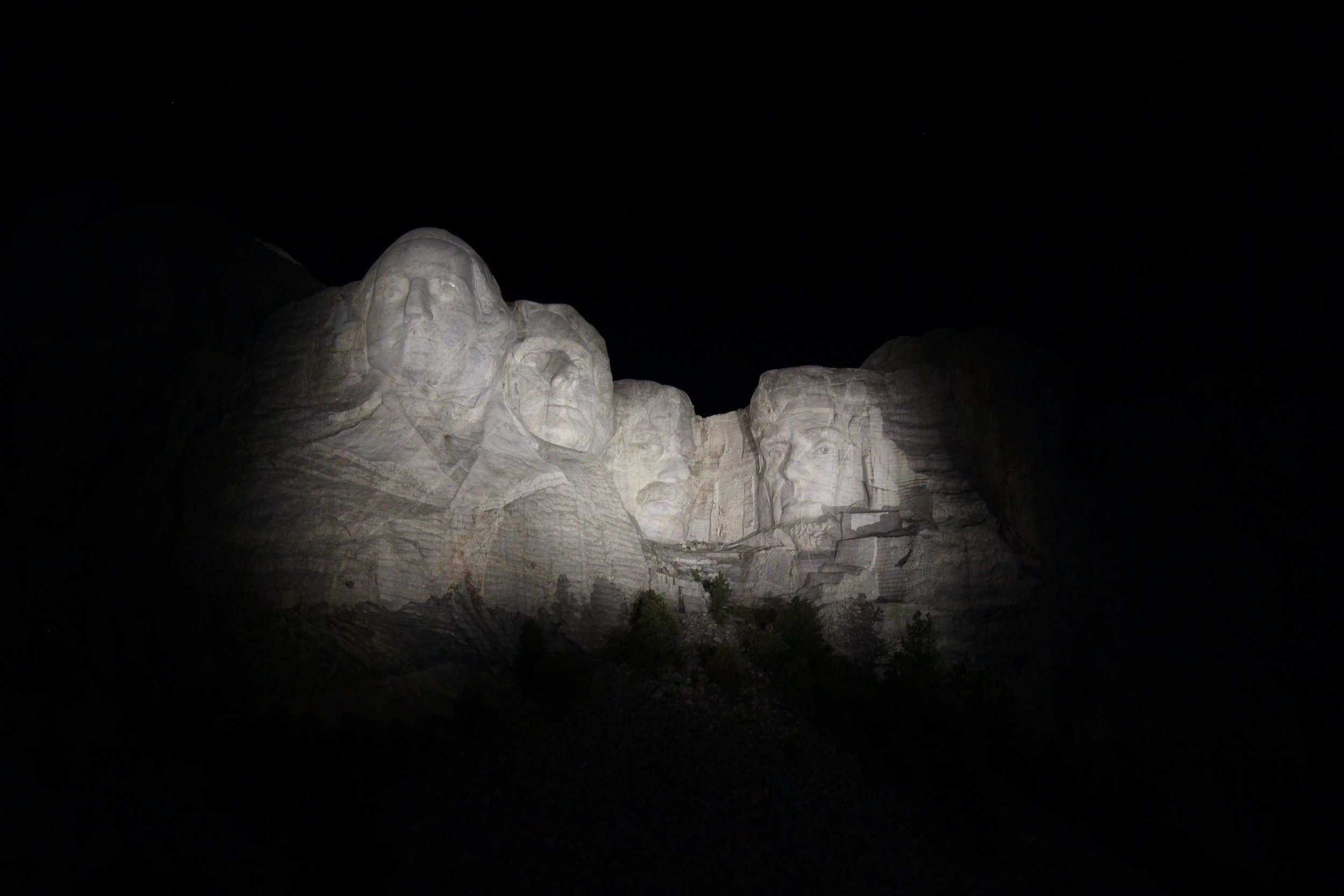
Mount Rushmore lit up at night
More Information about Mount Rushmore
For more information on what to do at Mount Rushmore National Memorial, including additional viewpoints, more pictures, and museum information, refer to my post on Mount Rushmore.
6) Hippie Hole

Hippie Hole Swimming Area
Where is Hippie Hole?
Although it’s possible to simply search for “Hippie Hole” in GoogleMaps, getting here is going to require a bit of an adventurous spirit due to loss of cellular service and unlabeled, extremely rugged dirt roads. Write down how to get where you are going after you leave the Hippie Hole trailhead, as it will be a while before you-gain cellular service.
Despite being out on some questionable dirt roads, Hippie Hole isn’t too far from other interesting things to do in the Black Hills. It’s about a 30 minute drive from both Rapid City and Mount Rushmore.

Hippie Hole Location - Black stars indicate parking options. The official trailhead is the second, closer black star.
We did not feel comfortable driving on the extremely rough roads all the way to the official Hippie Hole parking lot, so we turned around and drove back to a pullout with plenty of space park. From where we parked (first black star), and the hike out-and-back was 2.6 miles, with an elevation gain of 750ft. The hike from the official parking lot is 0.6 miles out and back.
What is Hippie Hole?
Hippie Hole is a hikable swimming hole that has an optional cliff jump. The water is not clear, therefore the bottom is not visible. If I can’t see the bottom, I don’t jump. But we had a great time swimming. I would recommend going earlier in the morning to avoid the crowds. Expect the water to be extremely cold.

Getting used to the water temp… Swimming at Hippie Hole takes some courage in the cold water.

Hippie Hole - Behind the waterfall
More Information about Hiking / Swimming at Hippie Hole
For more information on the drive to the trailhead, hiking information, and more pictures, visit my Hippie Hole Trail Guide.
Custer State Park

Custer State Park - View from Little Devil’s Tower
There are three distinct sections of Custer State Park: Sylvan Lake, Needles Highway, and the Wildlife Loop Road. I would recommend hiking at Sylvan Lake in the cooler morning, and then swimming or renting canoes or kayaks in the afternoon. Drive down Needles Highway on the way to the Wildlife Loop Road, and drive around near dusk, when the animals are more active.
Custer State Park requires an entry fee, and because it’s a State Park and not a National Park, the America the Beautiful Pass will not work. As of 2024, the entry fee for a car was $20 / day.
Where is Custer State Park?
Custer State Park is almost an hour south of Rapid City. With over 71,000 acres of protected land, Custer is South Dakota’s largest State Park, and currently ranks 8th in largest State Parks across the United States. Additionally, it takes almost an hour to drive from Sylvan Lake to the Wildlife Station Visitor Center (on the southeast portion of the Wildlife Loop Road). Plan to spend most of a day to enjoy Custer State Park, due to its size. For anyone wanting to hike some of the longer trails, two days may be required.
Note that the Needles Highway (SD-87) will shutdown in winter months, as the road is not plowed. Access to Sylvan Lake remains open all year.

7) Custer State Park - Sylvan Lake - Multiple hiking options as well as a swimming beach with canoe and kayak rentals available
8) Custer State Park - Needles Highway (SD-87) - Incredibly scenic drive past granite pillars (hoodoos). Note that this highway is closed during winter months
9) Custer State Park - Wildlife Loop - This is a fun drive to find bison, pronghorn, deer, burros, and prairie dogs
7) Custer State Park - Sylvan Lake
The most stunning hikes in the Black Hills are those in the Sylvan Lake area, which include a summit to Black Elk Peak and views from Little Devils Tower. Sunday Gulch is also accessible from these trailheads, and this trail is one of my favorite hikes in the United States. Sylvan Lake also includes a swimming beach and offers canoe / kayak rental.

Custer State Park - Sylvan Lake
What are the Best Things to Do at Sylvan Lake?
Below are my favorite trails.

Custer State Park - Trailheads from Sylvan Lake
Sylvan Lake Shore Trail - The Sylvan Lake Shore Trail is an easy 1.1 mile flat loop, which has beautiful views of the lake from every angle.
Non-motorized boats, such as canoes and kayaks, are also allowed on the lake, and can be rented from the Sylvan Lake Lodge. For more information, here is my trail guide for the Lake Shore Trail.
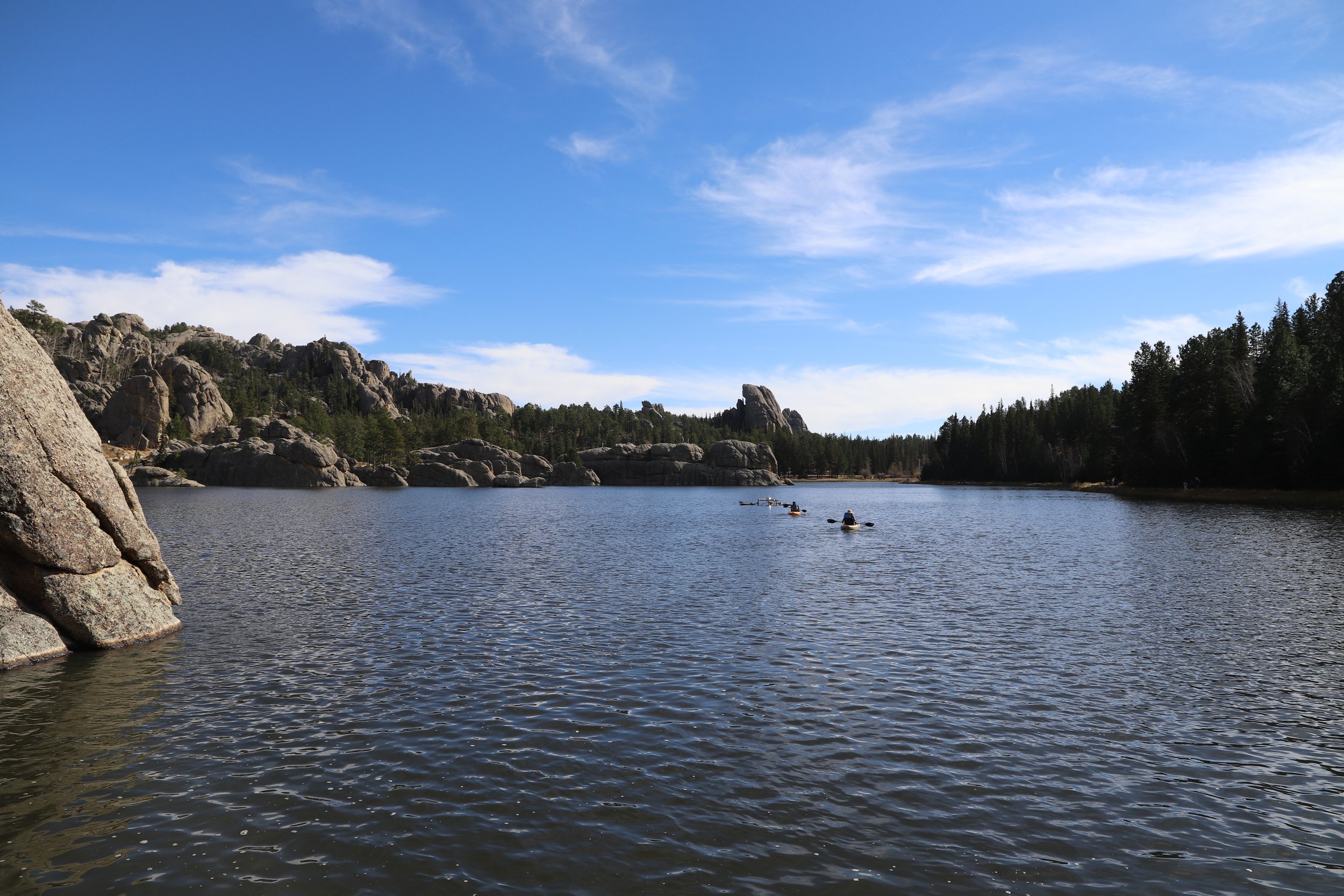
Custer State Park - Kayaks on Sylvan Lake
Sunday Gulch Trail - Sunday Gulch is a 3.1 mile loop with an elevation gain of 700ft. This can be added on to the 1.1 mile Lake Shore Trail, or there is a separate trailhead off of Needles Highway (SD-87). Although short, it’s rather steep in spots, making this a great kick-your-butt sort of morning or afternoon activity. Behind Sylvan Lake, the water pours over the rocks and sometimes onto the steps. There’s a bit of magic in this section of the trail, and it’s fun to hop across the rocks trying to keep dry feet. This trail is one of my favorites in the United States.

Custer State Park - Steps along the Sunday Gulch Trail
At the bottom of the trail, there are large rocks with holes large enough to explore in. Then, what goes down must go back up, and the trail has several switch backs up to some beautiful view of the valley below.

Custer State Park - Views along the Sunday Gulch Trail
For more information, here is my trail guide for Sunday Gulch.
Black Elk Peak / Little Devils Tower - Black Elk Peak and Little Devils Tower are separate trails, but they can easily be combined into the same hike, and that’s what I would recommend doing. The spur out to Little Devils Tower only adds 0.8 miles and 200ft in elevation gain when hiking out to Black Elk Peak.
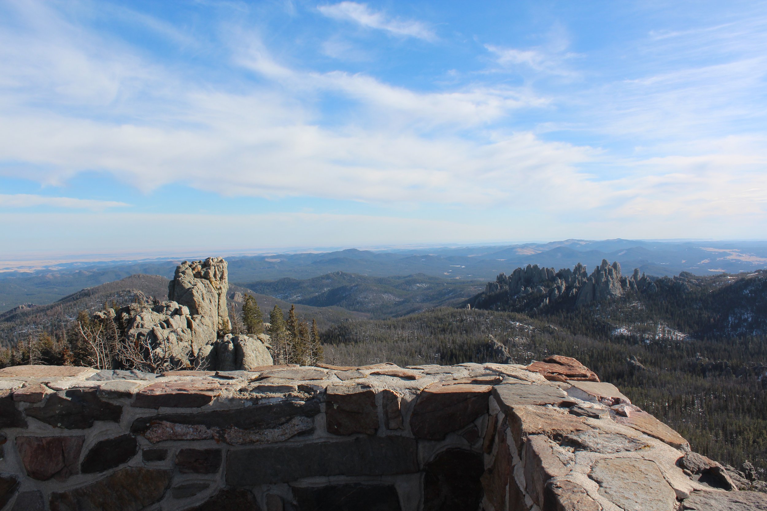
Custer State Park - View from Black Elk Peak (formerly Harney Peak)
There are three main hiking options - out-and-back from Sylvan Lake (7.6 miles for Black Elk Peak / 1350ft elevation gain / add 0.8 for Little Devils Tower), a loop hike from Sylvan Lake (7 miles for Black Elk Peak / add 0.8 miles for Little Devils Tower), or an out-and-back from Cathedral Spires Trailhead (shortest option 5.6 miles / add 1.0 mile for Little Devils Tower). I would recommend the Cathedral Spires Trailhead off of Needles Highway.
Combining Black Elk Peak / Little Devils Tower and Sunday Gulch on the same day would be a tough day of hiking. Not impossible, but I would split that across two days if that’s an option.
A specific out-and-back hike to Little Devils Tower from the Cathedral Spires Trailhead is 2.6 miles / 750ft elevation.

Custer State Park - View of the observation tower on Black Elk Peak from Little Devils Tower
Black Elk Peak (at 7,242ft) is the highest point in South Dakota, and the goal of the hike is to get to the stone observation tower at the top, which is open and can be climbed up to the top.
I like the view better from Little Devils Tower, though, for two reasons - 1) It’s closer to Cathedral Spires so the rocks look more dramatic 2) The observation tower is visible from Little Devils Tower.

Custer State Park - View of Cathedral Rocks from Little Devils Tower
One big difference in the hikes to Little Devils Tower and Black Elk Peak to be aware of is that although the trail to Black Elk Peak ascends to a higher elevation than Little Devils Tower, it’s an easier trail. The last part of the Little Devils Tower trail requires significant rock scrambling.
For more information, here are my trail guides to Black Elk Peak and Little Devils Tower.
More Information about Sylvan Lake
For more hikes, trail maps, additional pictures, and more travel tips, visit my post on Sylvan Lake.
8) Custer State Park - Needles Highway
Needles Highway is one of the most scenic highways in the country, and has incredible granite pillars. These are the type of rock formations that I stare at and think “magic.”

Custer State Park - Needles Highway (SDD-87)
What are the Best Things to Do Along Needles Highway?
It’s probably obvious, but the best thing to do at Needles Highway is to simply drive it. Needles Highway (SD-87) is a 14-mile long road starting near Sylvan Lake and ending near Legion Lake. This is an incredible drive, with several pullouts to stop and get out. There is a short walk to the iconic Needle’s Eye, and there is one main hiking trailhead at Cathedral Spires. Expect the drive to take 45 minutes to an hour. Also note that this is a very curvy road. This would not be an ideal destination for anyone the tends to have car sickness.
Needles Highway is typically open April - October, but it is not maintained in the winter. The X’s on the map indicate the approximate location where the Needles Highway is closed due to snow. For anyone traveling in fall or spring months, www.sd511.org provides current road conditions and closures. Just use the map on the link, zoom in, and click on SD-87 (between US 385 and US 16) to see if Needles Highway is open or closed. In the winter months, Needles Highway can be used for hiking, snowshoeing, and/or cross-country skiing.

Needles Highway SD-87 - X’s mark where the highway is closed in the winter months. There is a pullout at Needles Eye for a small number of cars to park. The rock formation, Needles Eye, is less than 200ft west of the tunnel.
I would recommend stopping at all of the pullouts to fully enjoy the highway, but if that’s not an option, then pick two. Near the Needles Eye Tunnel, there is a small pullout that can be used for parking. From this parking area, one can get great pictures of the tunnel and the rock formation known as Needle’s Eye.

Custer State Park - Needle’s Eye
The second stop I would recommend is the trailhead at Cathedral Spires. Walk a short distance along the trail to enjoy the scenery, or hike out-and-back to the Cathedral Spires rocks along a 2.3 mile trail (with an elevation gain of 1,075). The Cathedral Spires Trailhead is also the option for the shortest hike to both Little Devils Tower and Black Elk Peak.

Custer State Park - Needles Highway - Cathedral Spires Trailhead
More Information about Needles Highway
For more information about Needles Highway, including additional maps, hiking information, and more pictures, visit my post on Needles Highway.
9) Custer State Park - Wildlife Loop
The Wildlife Loop Road is the other place to visit within Custer State Park. Along this 18-mile road, there will be herds of bison, pronghorn, and deer. Burros will saunter up to car windows (and poke their heads inside if the windows are rolled down). Prairie dog towns are also scattered throughout the drive.

Custer State Park - Wildlife Loop
What are the Best Things to Do Along the Wildlife Loop?
This is another place in Custer to just plan on enjoying the drive. The maximum speed limit is 25 mph, and both wildlife crossing the road and people in cars taking pictures are going to slow that speed down even further. If a small herd of bison cross the road, it’s going to take a bit of patience. Get out the camera, and expect the drive could take 1.5-2 hours. The Wildlife Loop Road is open year round.

Custer State Park - Wildlife Loop Road
What’s the best time of day to drive this loop? On a hot summer day, while you may be appreciated the air conditioning of your car, the animals are going to be hot, likely trying to stay in the shade, and are probably going to be less active. In the summer months, my suggestion would be to go either in the early morning, or an hour or two before sunset.

Custer State Park - Pronghorn along the Wildlife Loop Road
Creatures you might find on or near the road include bison, burros, prairie dogs, antelope, and deer. Give the bison plenty of space if you see them on the road. The burros though are a different story - and they will be so bold as to walk up to your car and if your window is open, they might stick their head in. Don’t share any food with them. This only encourages them to continue this behavior.

Custer State Park - Burro who came said “Hello” to us on one of our trips around the Wildlife Loop
There are a few places to hike within this part of Custer State Park. I’ve hiked most of these trails, but I prefer the trails near Sylvan Lake. Here is the information for anyone interested:
Badger Clark Historic Trail - Near Legion Lake, the trailhead takes off from Badger Clark Road. This is a 1 mile loop hike that was partially built by Badger Clark, a poet laureate. This hike goes through the forest and up a hillside, with no truly amazing landscape views. It’s a nice walk, but nothing more.
Creekside Trail - This is a paved surface 2-mile one way trail between Game Lodge Campground and Grace Coolidge Campground. The views are similar to those seen along the Wildlife Loop Road.
Legion Lake Shore Trail - 1 mile loop hike around Legion Lake. Note that there is a nearby trail called Legion Lake Trail, which does not go around the lake and only includes views of the lake. I prefer the trail around Sylvan Lake
Lover’s Leap Trail - This 3-mile loop trail is more strenuous. It starts at the Peter Norbeck Visitor Center, across Highway 16A (behind the schoolhouse). I have not had a chance to hike along this trail yet, and therefore can’t give a recommendation for this one.
More Information about the Wildlife Loop Road
For more information about the Wildlife Loop Road, including additional pictures, visit my post on Wildlife Loop Road.
10) Wind Cave National Park
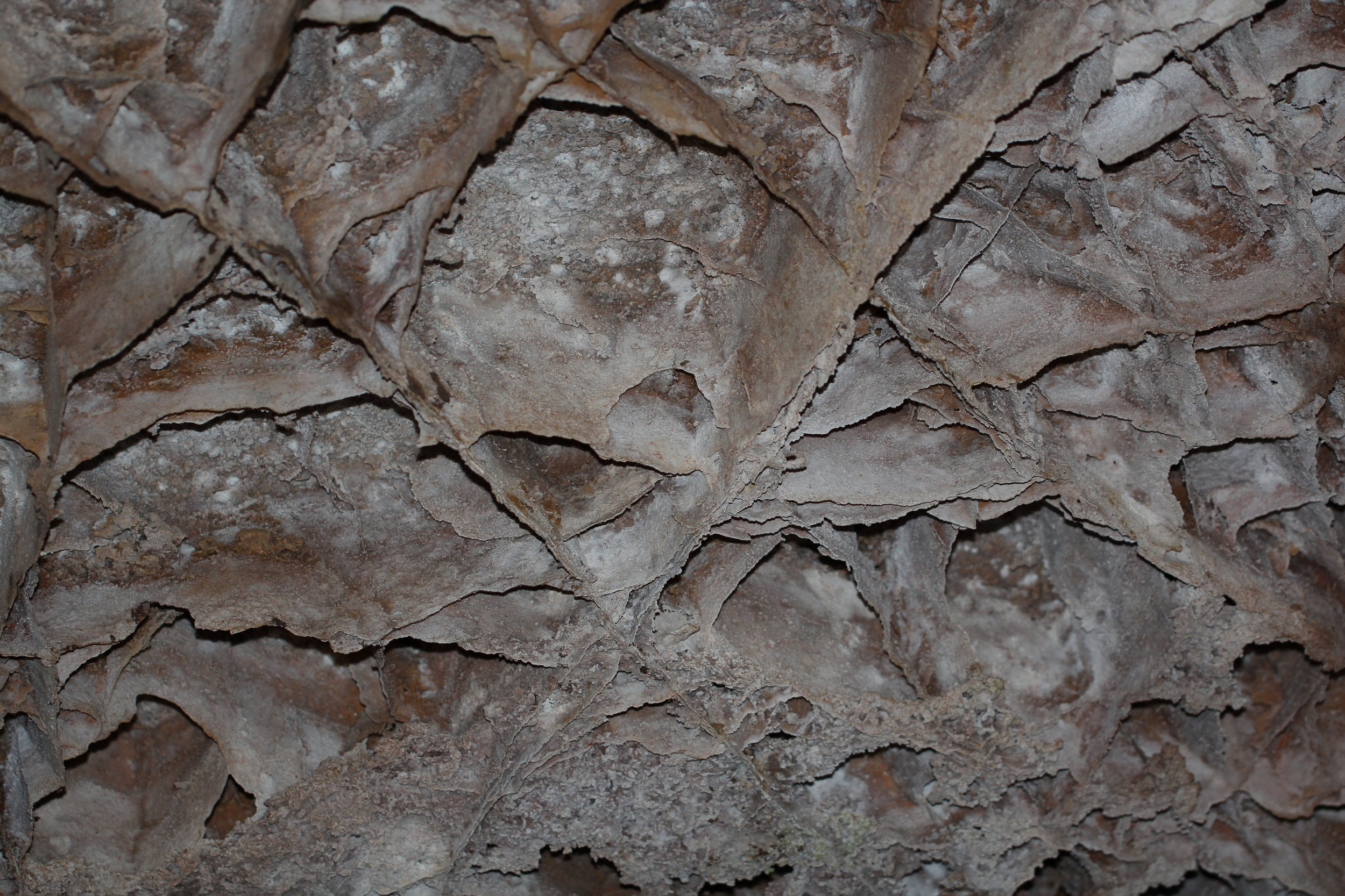
Wind Cave Boxwork
Wind Cave is the densest known cave system in the world (with the greatest passage volume per cubic mile), and the sixth longest known cave in the world. Wind Cave also houses 95% of the world’s known boxwork structures.
Where is Wind Cave National Park?
Wind Cave is about an hour south of Rapid City and 15 minutes north of Hot Springs. The Visitor Center is located off of US Highway 385.

Wind Cave National Park Location
What are the Best Things to Do at Wind Cave National Park?
My preference would be to visit Jewel Cave over Wind Cave, but any cave is fun to explore. The best thing to do at Wind Cave National Park is to go on a cave tour, which should be pre-booked on the National Park website.
Cave tour options include:
Garden of Eden - 60 minutes along a 1/3 mile trail
Natural Entrance - 80 minutes and travels 2/3 mile underground. This tour starts in a natural entry point. This is the most common tour for families, and this is the tour that we have taken.
Fairgrounds - 90 minutes, also travels 2/3 mile and starts with an elevator. This trail includes more stair steps than the other tours.
There are also two specialty tours. The Candlelight Tour has a minimum age of 8, and the Wild Cave Tour (spelunking) has a minimum age of 16.
More Information about Wind Cave
For more information, here is my post on Wind Cave National Park.
11) Mammoth Site
For those looking for an educational non-hiking option, the Mammoth Site in Hot Springs is a fun choice. This is the site of an ancient sink hole that mammoths and other animals fell into, lured by warm water during the Ice Age. After falling in, they were unable to climb out of this hole. Thus far 61 different mammoths have been discovered through excavations.

Inside the Mammoth Dig Site - Hot Springs, SD
Where is the Mammoth Site?
The Mammoth Site is in Hot Springs, SD, about an hour south of Rapid City. It’s just off of US-18.

Mammoth Site Location
What are the Best Things to Do at the Mammoth Site?
There is a 30-minute guided tour around the mammoth site which is still an active dig site. This site is enclosed, so the weather outside does not matter. For anyone with children between 4 and 12, there is also a separate Junior Paleontology program that our boys really enjoyed. There is a nearby classroom with four large pits of sand that have re-casted mammoth bones hidden inside. The children are given real tools paleontologists use. They learn the basics of excavation, and then they participated in a simulated dig. My older son was 10 when we did this. I was worried since he was on the upper end of the age recommendation, that he might think it was a bit hokey. I was happily surprised - he had an amazing time digging, and it was one of his favorite things we did on vacation. I would highly recommend stopping here. I learned a lot and my kids both had a great time. Here is a link to sign up for classes: https://www.mammothsite.org/what-we-do/education/summer-classes.html

Mammoth Dig Site - Junior Paleontologist Excavation
12) Jewel Cave National Monument

Jewel Cave - Cave Bacon
Jewel Cave is the second longest known cave in the United States and the fifth longest in the world. Jewel Cave has numerous beautiful, colorful, and sparkling cave structure formations, making for an impressionable caving experience.
Where is Jewel Cave National Monument?
Jewel Cave is about an hour southwest of Rapid City and an hour northwest of Hot Springs. The closest town in Custer, which is 15 minutes east. The Visitor Center is located off of US Highway 16.

Jewel Cave National Monument Location
What are the Best Things to Do at Jewel Cave?
The best thing to do at Jewel Cave National Monument is to go on a cave tour, which should be pre-booked on the National Park website.
Cave tour options include:
Scenic Tour - 80 minutes along a 1/2 mile trail, which includes more than 700 stairs. This trek includes cave formations including stalactites, stalagmites, cave popcorn, and cave bacon. I’ve been on this tour several times, and it’s phenomenal.
Lantern Tour - This tour option departs from the historic entrance and all light on the tour is provided by lanterns carried by individuals on the cave tour. Children need to be at least 8 years old.
Wild Cave Tour - This is a 3-4 hour spelunking tour which requires all participants to be at least 16 years old.
More Information about Jewel Cave
For more information, here is my post on Jewel Cave National Monument.
13) Crazy Horse
Crazy Horse Memorial is the largest mountain carving in the world and it is still in the process of being sculpted.

Crazy Horse Memorial
Where is Crazy Horse?
Crazy Horse is about 15 minutes north of Custer along US-385. It’s not quite an hour southwest of Rapid City, a half hour east of Jewel Cave, and 40 minutes north of Wind Cave.

Crazy Horse Location
What are the Best Things to Do at Crazy Horse?
There isn’t much to do at Crazy Horse, yet anyways. Admission to the site provides access to view the monument, and there is a cultural center with information about Crazy Horse, the people of the Black Hills, and stories of how the monument is being sculpted.
14) Spearfish Canyon
Spearfish Canyon is a great day-long destination from the Black Hills for anyone looking for short hikes to several beautiful waterfalls. There is minimal driving in-between each trail. There are no fees for any of the trailheads.
Where is Spearfish Canyon
The entrance to Spearfish Canyon is 45 minutes west of Rapid City and an hour east of Devil’s Tower National Monument. To access Spearfish Canyon, exit I-90 in Spearfish and take E. Colorado Blvd to US Highway 14A / Spearfish Canyon Byway. All trailheads are along Spearfish Canyon Byway, with the exception of Roughlock Falls, which requires a short drive along Roughlock Falls Road.
Food and bathrooms are available in the city of Spearfish, before entering Spearfish Canyon Byway, as well as near Spearfish Canyon Lodge.

Map to Spearfish Canyon
What are the Best Things to Do along Spearfish Canyon?
My favorite hike along Spearfish Canyon is Devil’s Bathtub, and I have to give a shout out to the namesake - Spearfish Falls. Bridal Veil is visible from the road - no hiking required. For those with more time, Roughlock Falls is another nice short hike. For anyone that wants a bit more adventure and is up for a steeper scramble, check out Community Caves.

Trailhead locations along Spearfish Canyon include Community Caves, Bridal Veil Falls (view from road, no hiking required), Devil’s Bathtub, Roughlock Falls, and Spearfish Falls
Community Cave - An out-and-back hike to Community Caves is just 0.6 miles, but the elevation gain is 325ft, and it’s all in one spot, a tricky steep scramble up the hillside. This trail is not well-marked, and I would recommend using AllTrails to find the “cave.” Cave is in quotations as it’s really just sandstone coves that aren’t very deep. It’s still a fun spot to explore though. There may be a small waterfall as well depending on recent rain or snow melt.

Spearfish Canyon - Waterfall at Community Caves
Bridal Veil Falls - Bridal Veil falls is viewed directly from the highway. There is a pullout to park, and to get a good look at the falls, just walk across the road. As this road is in the bottom of a canyon, waterfall pictures lit by the sun are going to be difficult to obtain.

Spearfish Canyon - Bridal Veil Falls
Devil’s Bathtub - Devil’s Bathtub is a fun, enchanting 1.75 mile out-and-back hike. The trail is overall pretty flat, but there are some creek crossings that will either require wet feet or some rock hopping. At the end, there is a small spot to swim and slide down the rocks. This is my favorite hike along Spearfish Canyon.

Spearfish Canyon - Devil’s Bathtub swimming and rock sliding
Spearfish Falls- There is a short 0.8 mile out-and-back hike to the canyon namesake waterfall. The trail descends approximately 80ft to reach the waterfall. Much fo the trail surface is covered with boardwalks. Parking for this trailhead is next to the Spearfish Canyon Lodge / restaraunt.

Spearfish Canyon - Spearfish Falls
Roughlock Falls - There are two trailhead options for Roughlock Falls. Pick the parking lot along the dirt road - Roughlock Falls Road (go up the hill, don’t park at the bottom). From here, it’s a 0.5 mile out-and-back walk along mainly boardwalks. There are two different waterfalls side by side, and several angles to enjoy the falls.

Spearfish Canyon - Roughlock Falls - there are better angles to view both waterfalls from, but I like this photo because both waterfalls are visible together.
More Information about Spearfish Canyon
For more information about Spearfish Canyon, including maps of each trail, additional pictures, and trail reviews, here is my post on Spearfish Canyon.
15) Devils Tower National Monument

Devil’s Tower National Monument - viewed from Tower Trail
Devils Tower is this odd and spectacular rock formation that rises 867ft from the ground with nothing else around it, and it can be visible for miles. Devils Tower is also known as Bear Lodge by the Native American Tribes. Although there isn’t much to do around Devils Tower other than walk the 1.6 mile loop around the rock formation (unless you rock climb), it’s worth the hour detour from I-90, as the place has a sacred feeling surrounding it. Plan on a 2-3 hour stop to see the prairie dogs, enjoy the hike, and read a bit about the legend and history at the Visitor Center.
Where is Devils Tower National Monument?
Devils Tower is approximately 90 minutes west of Rapid City and one hour west of Spearfish Canyon. From I-90, take US highway 14 to Wyoming Highway 24, and then Wyoming Highway 110. As mentioned above, Devils Tower is about an hour detour from I-90.

Devils Tower National Monument Location
What are the Best Things to Do at Devils Tower National Monument?
On the way into Devil’s Tower, enjoy a prairie dog town (for anyone not yet tired of prairie dogs…). Then stop at the small visitor center for a park map and a Junior Ranger book.
The main trail at Devils Tower is a 1.6 mile loop around Devils Tower - Tower Trail. There are several spots along the trail for fantastic pictures.

Devil’s Tower - Super Dad carrying both kids (who were working on Junior Ranger badges - Ask for the books at the visitor centers - they are free.)
More Information about Devils Tower National Monument
For more information about Devils Tower, including maps, and additional pictures, here is my post on Devils Tower National Monument.
More from www.NatureImpactsUs.com
To see more of my posts, click on any pin. There will be a hyperlink to my post on that particular hike.