
View of the Hoover Dam Bypass from the Gold Strike Hot Springs Trail
If you enjoy my blog, please consider signing up below for email notification of my latest posts. I will not share your email.

Gold Strike Hot Springs
Hoover Dam Hot Springs - AZ or NV?
An alumni of Arizona State University, I’d travelled over the Hoover Dam several times during my journeys while at college and then again later in life when I would return for Spring Break trips, and I was so surprised to find out years later that just below the Hoover Dam there are two hot springs accessible by day hiking trails. Any trail that involves soaking in a hot spring is guaranteed to be an amazing hike, plus there’s the added fun of talking about “hot lava” throughout the trek. So after learning of these trails, we checked them out on back to back trips through Las Vegas.
The hot springs on the Nevada side of the Colorado River are known as Gold Strike Hot Springs. The springs on the Arizona side are referred to by a couple of different names - Arizona Hot Springs and Ringbolt Hot Springs, and the trail to get there is also referenced as White Rock Canyon. Both trails are maintained by the National Park System and are free to hike. They are also both closed between the months of May and September due to extreme heat and exposure to sun. Both trails are worthy of the day long adventure from Las Vegas if you are visiting in a non-summer month when the temperatures are reasonable. Neither trail has shade during the day, and even hiking in March, it was pretty warm. We went through a lot of water on both hikes.
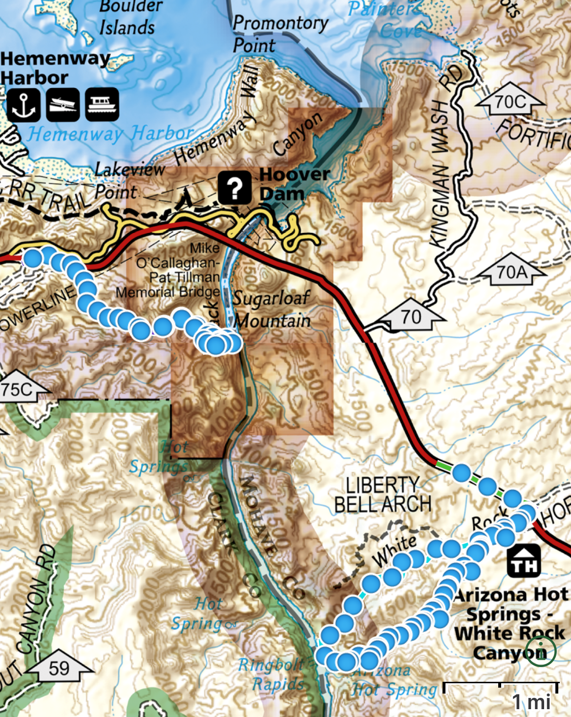
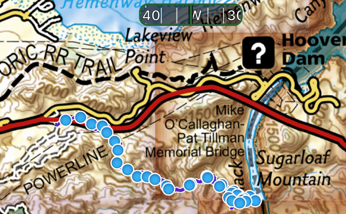
Map from GAIA app of both hot spring trails below the Hoover Dam
As you can see in the map, Gold Strike is just below the Hoover Dam, and the pictures for the bypass bridge are from the trail as it reaches the Colorado River. The AZ Hot Springs are further down the river.
Which trail to pick? That’s a hard recommendation to give. They are two very different trails and two very different hot springs. Below are my high-level thoughts on both trails to help you pick the best one for you, and later in the post I have added more details on the location of the trailhead and the trails themselves, providing information first on the Nevada side and then the Arizona side as that was the order we hiked them in. At the end oft the post, I also have a couple of other things to do nearby.
Gold Strike Hot Spring (NV) Overview
Ropes along the Gold Strike Hot Springs Trail
My boys and I hiked Gold Strike during a trip in March 2021. They were aged 8 and 12. Gold Strike was not only our favorite hike on this Spring Break trip, it is still one of our favorite hikes ever. This is what I would call an extreme hike, and it’s important to know what you are getting into if you pick this trail. You will need to use your arms to scamper up and over multiple boulders, and there are several ropes that require quite a bit of upper body strength to navigate over the largest boulders. It wasn’t obvious always how to use the ropes to get around the obstacles, and sometimes we had to try a few different ideas before we figured it out. That’s why we thought this trail was fun; because of these challenges. If you are looking for a hike that only requires your legs, then pick the Arizona Hot Springs.
Gold Strike Hot Springs
The Gold Strike Hot Springs were quite warm and deep enough to sit in, though not deep enough to soak in (at least when we were there). They were also very close to the Colorado River. This allowed us to play in the hot springs, jump in the river and then go back and warm up in the hot springs. We brought sandals and used them to walk back and forth as the rocks are quite sharp and bumpy. Note that you need hiking boots for the rest of the hike to get up and down the ropes.
Arizona Hot Springs (Ringbolt Hot Springs) Overview
Ringbolt Hot Springs Trail
We hiked the AZ Hot Springs in March 2022. In comparison, the Arizona Hot Springs is a moderate hike. You can hike it as a loop or an out and back. If you do the out and back there is a 1000ft elevation gain on the way back to the parking lot. If you hike the loop, you will go all the way to the Colorado River and the total elevation gain will be 1,500ft. If doing the loop, there is a ladder you will need to go up or down on (depending on which way you are hiking), but other than that you don’t need to use your arms to access these hot springs.
The challenge of this hike, in addition to the elevation gain, is route finding. The trail is well trod, but any trail in the open desert looks very similar to a wash, and there were not many signs or markers along the trail. Even with our GPS GAIA app, we still lost the trail without realizing it for about a quarter of a mile. Bring a GPS app with you if you hike this trail.
Swimming in the AZ Hot Springs
The best part of the White Rock Canyon Trail was the AZ Hot Springs themselves, and I’d rank this hot spring as my favorite hot spring that I’ve found so far. They are wonderfully warm and really deep. If we had more time, I could have soaked for hours. In the picture above, we are standing, and I’m holding my younger son up slightly, so you can get an idea of how deep it is.
The last comparison between the trails is the distance to the river from the hot springs. The Gold Strike Hot Springs were feet away and we enjoyed walking back and forth. The AZ Hot Springs are still at least a quarter of a mile to the river, which is too far to play back and forth between.
One other thing to know about the White Rock Canyon Trail is that if you want to hike it as a loop, you will need to carry your stuff over your head through the hot springs and continue down the ladder. Plan appropriately in how you pack your stuff so you can carry it.
Overall, I’d recommend both trails. If you are looking for a fun and challenging trail with hot springs at the end, pick Gold Strike. If you are hiking to enjoy the hot springs, then pick AZ Hot Springs.
Gold Strike Hot Springs Trail
Gold Strike Hot Springs Map from GAIA GPS app
The Gold Strike Hot Springs trail is about 5 miles total (out and back) with a return elevation gain of 1,000ft. This is a canyon, so you hike down to the hot springs and river and then ascend to return to your car. Other than the moments of climbing up and down the boulders, the trail doesn’t feel very steep, and honestly I was surprised to check my app to realize I’d hiked up that far.
Bring sandals to slip your feet into between the hot springs and the river, a swimsuit and towel, sun screen, and plenty of water. You should also have a first aid kit in case you slip on the boulders.
Gold Strike Hot Springs Trailhead Location
From the Las Vegas Strip, the trailhead for Gold Strike Hot Springs is 40 minutes (35 miles) away. You will exit I11 at the same roundabout you would take to get to the Lake Mead Overlook, which is prior to the Hoover Dam security checkpoint and the bypass bridge. You’ll turn right at the roundabout and there’s a small gravel parking lot that does not currently require a fee. It will feel like you are in the wrong spot.
You’ll head down what seems like a gravel road rather than a trail. You should see this kiosk I have pictured below. Even with seeing this at the trailhead, it still felt like we weren’t on a trail. Just keep going. You are going the right way.
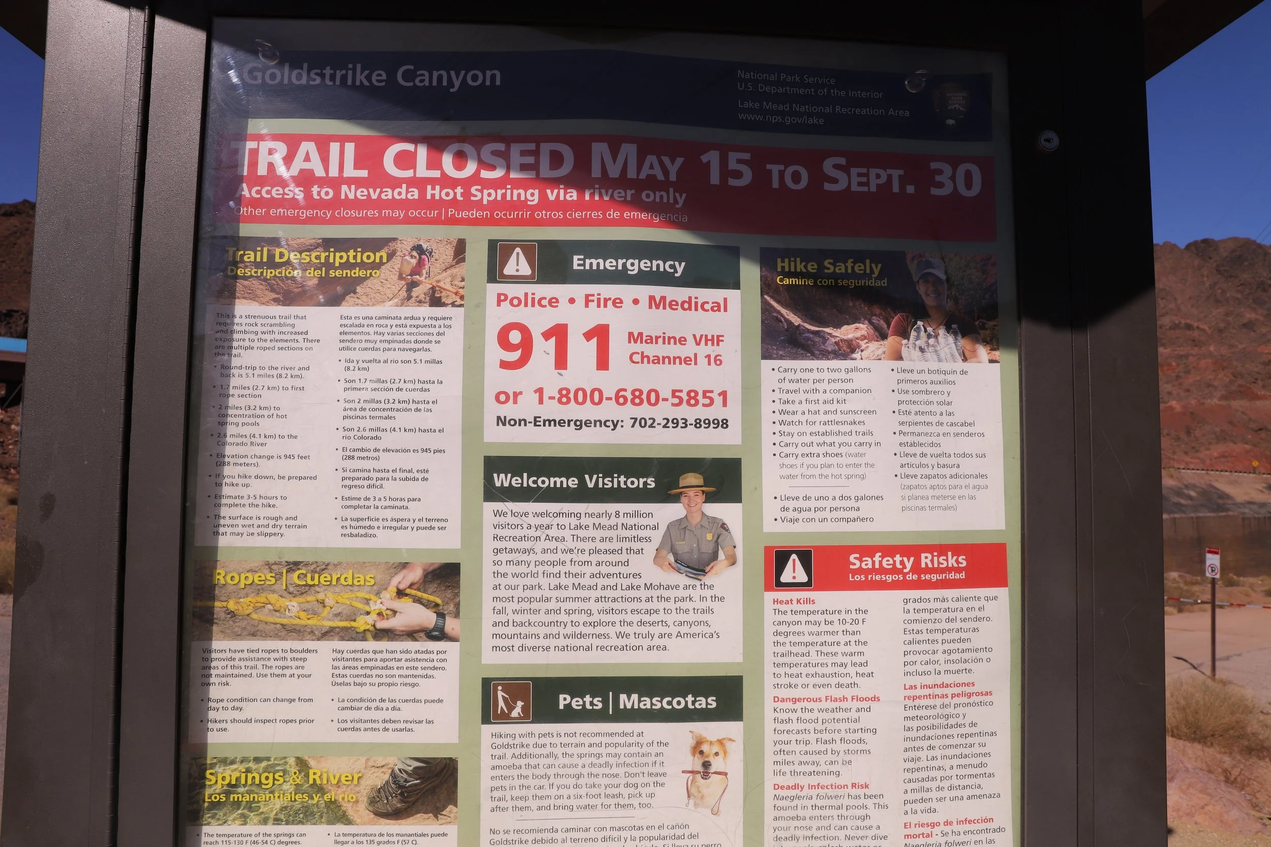
Gold Strike Hot Springs trailhead kiosk
Hiking Gold Strike Hot Springs
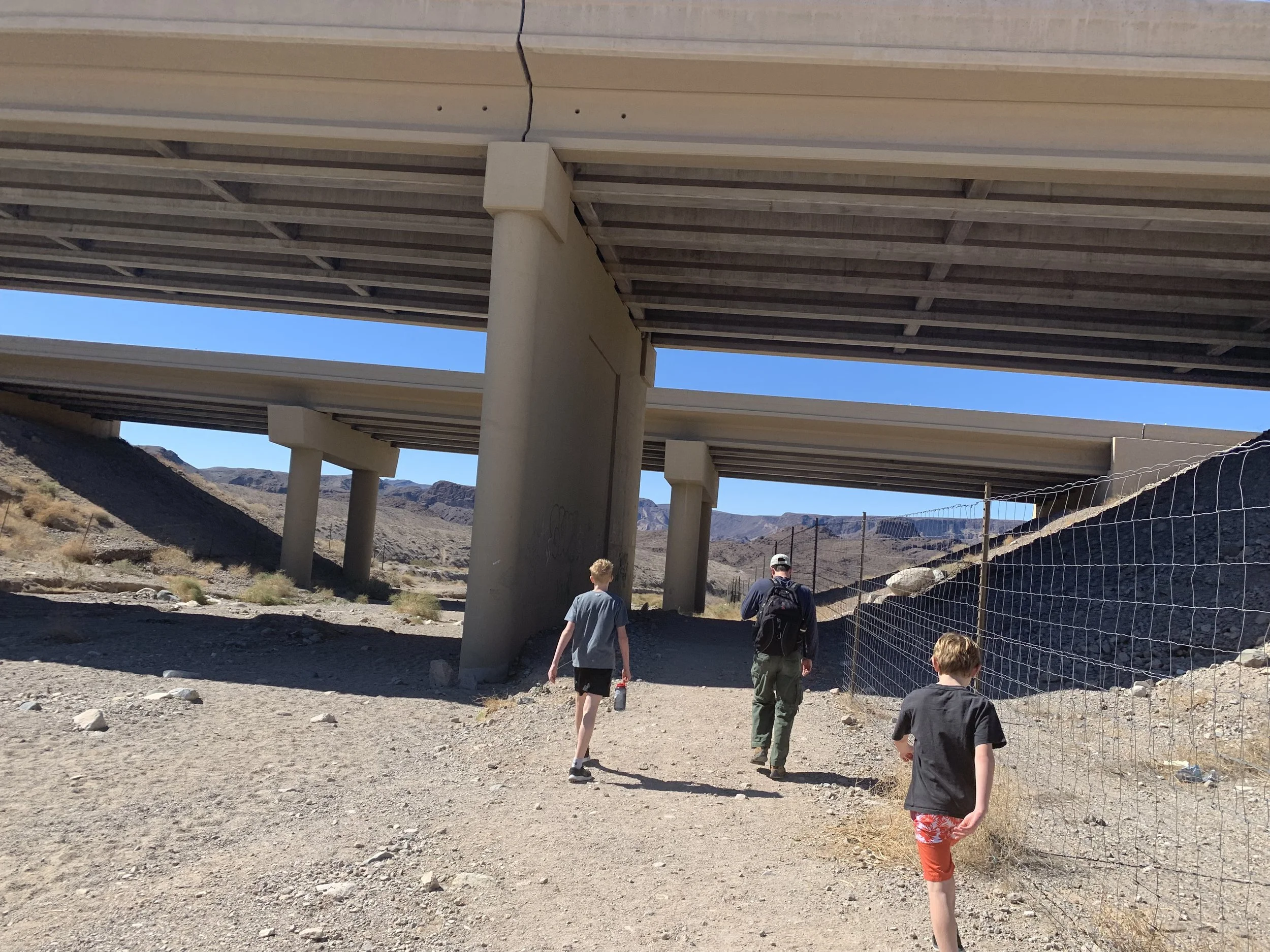
Early on in the trail, which still feels like a road, you will look up and see the beginning of the Hoover Dam bypass. You are going the right way, just keep going.
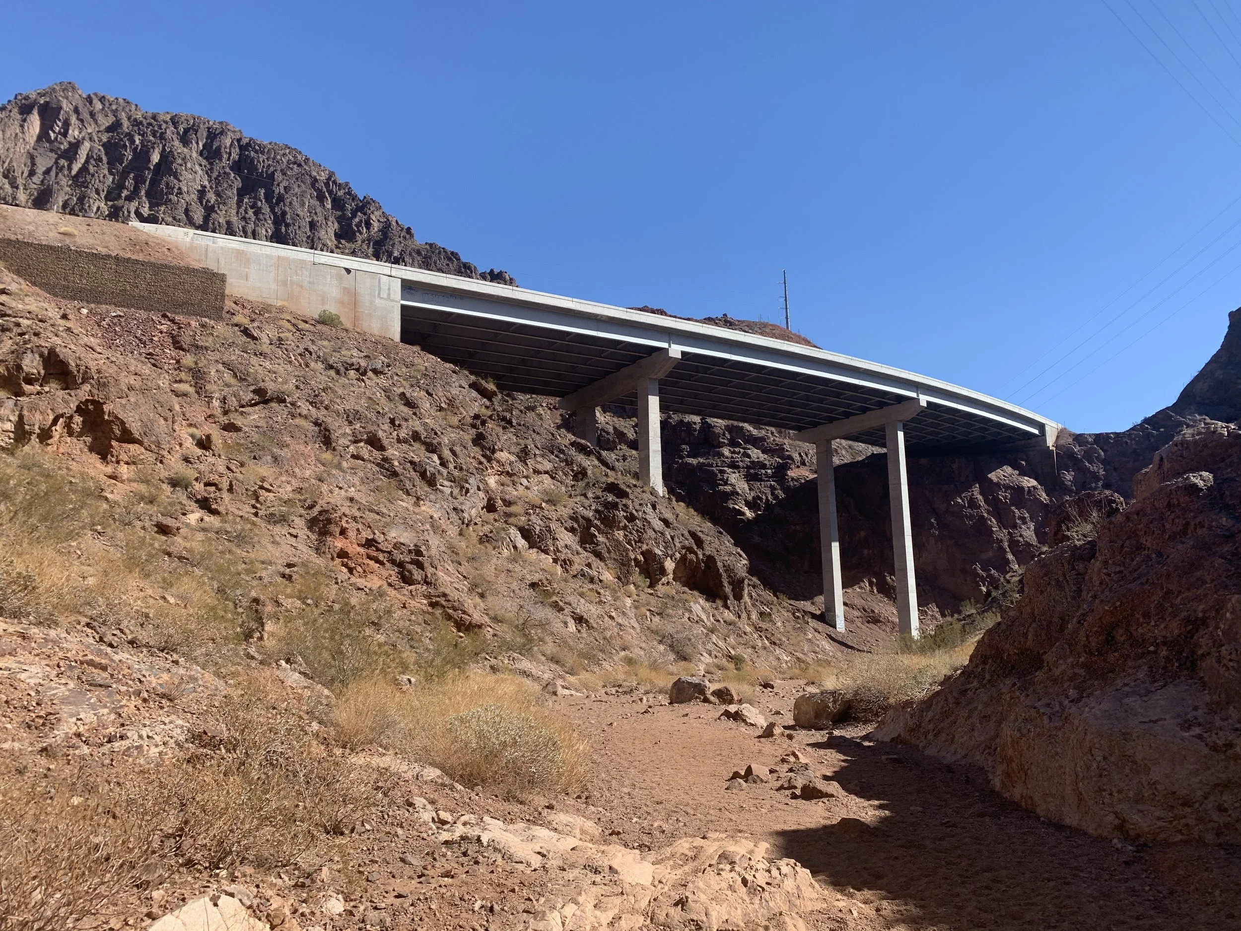
The Gold Strike trail goes near the beginning of the Hoover Dam bypass bridge
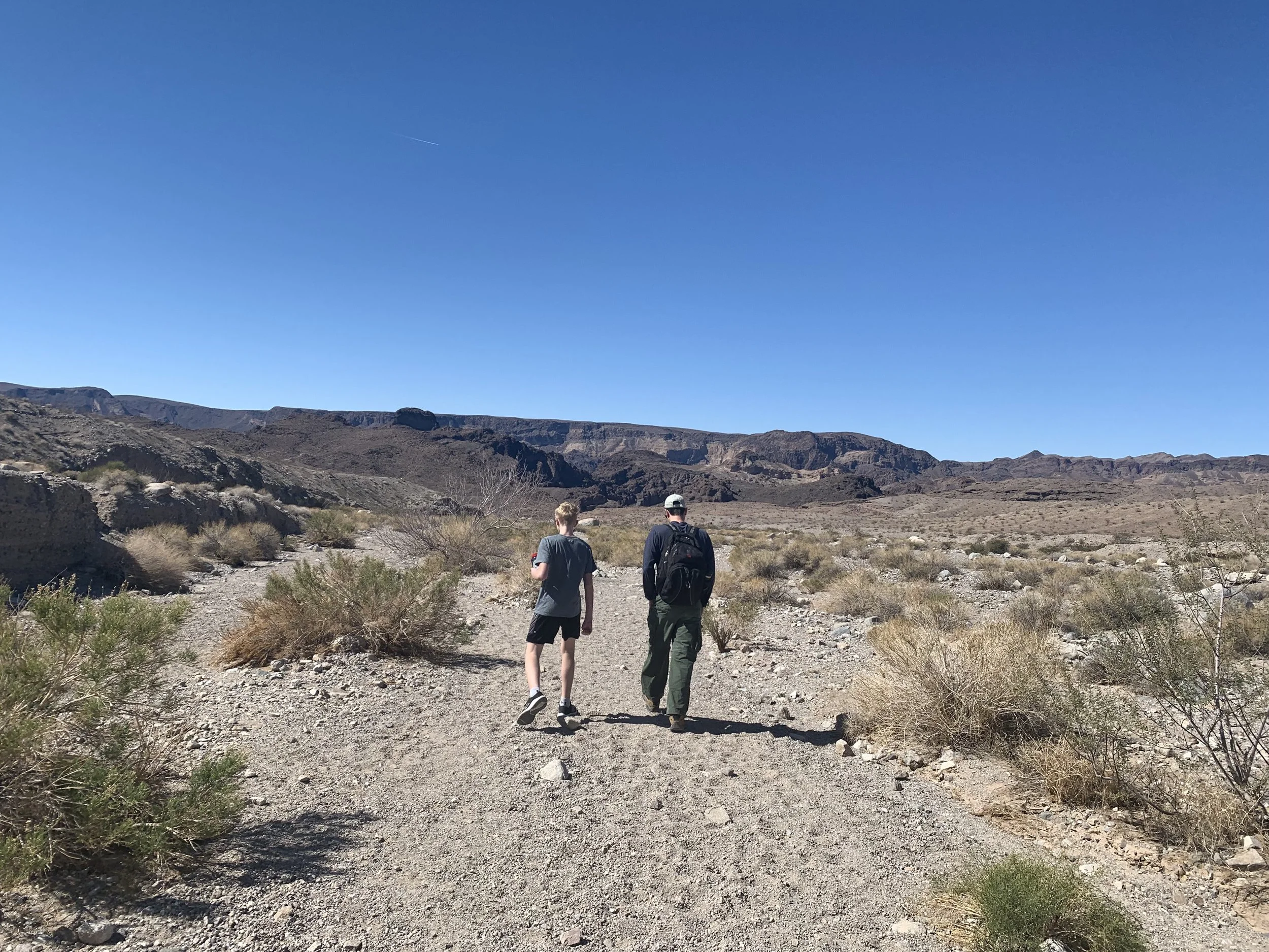
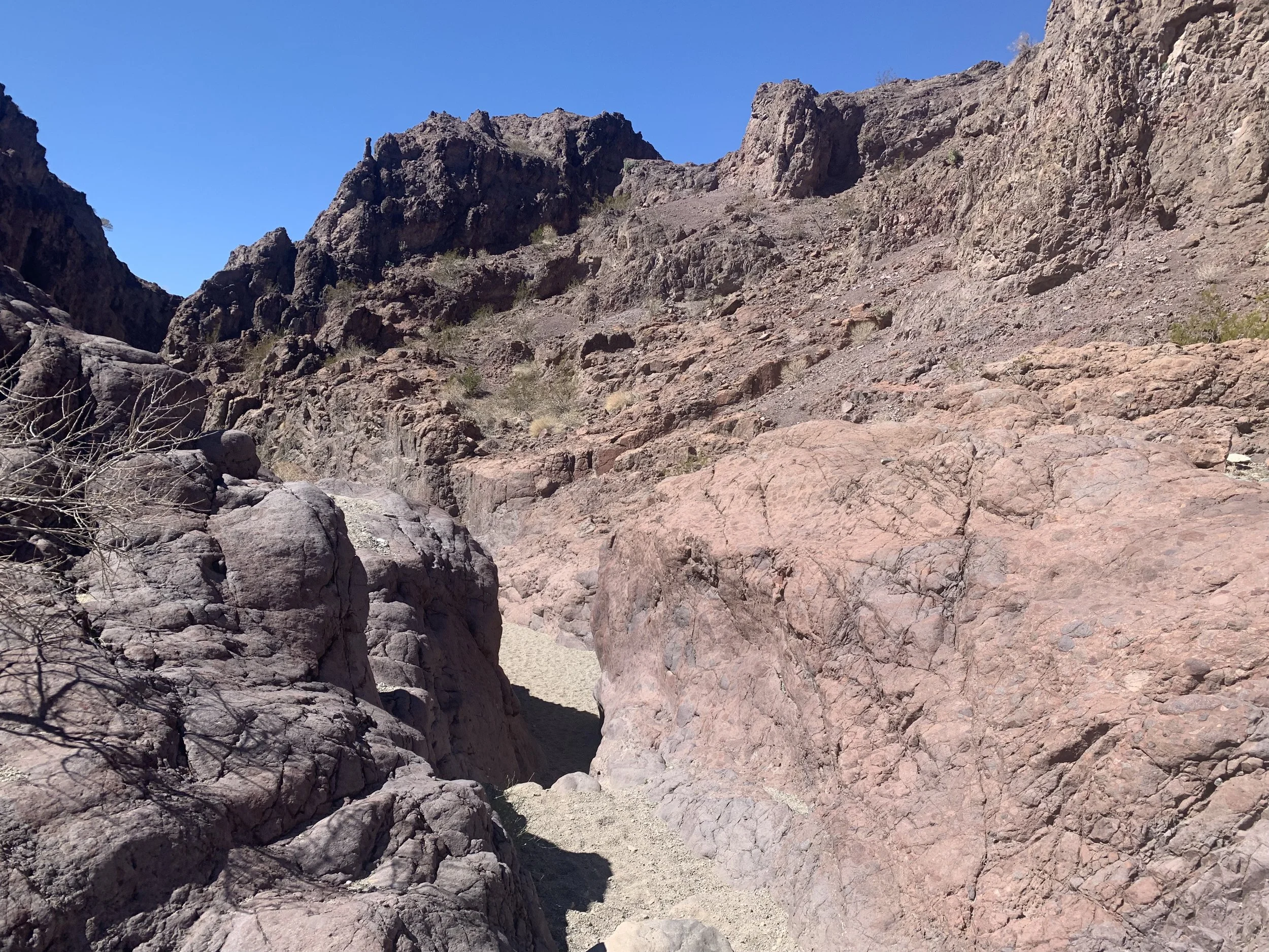
Eventually the trail will begin to narrow and feel like a wide sandy trail. The path is easy to follow; I never felt lost. It just doesn’t feel like a trail at the beginning. Eventually when things look like the below picture, you will start to be more comfortable. (Or maybe it’s just me that sometimes worries I am not going the right way??)
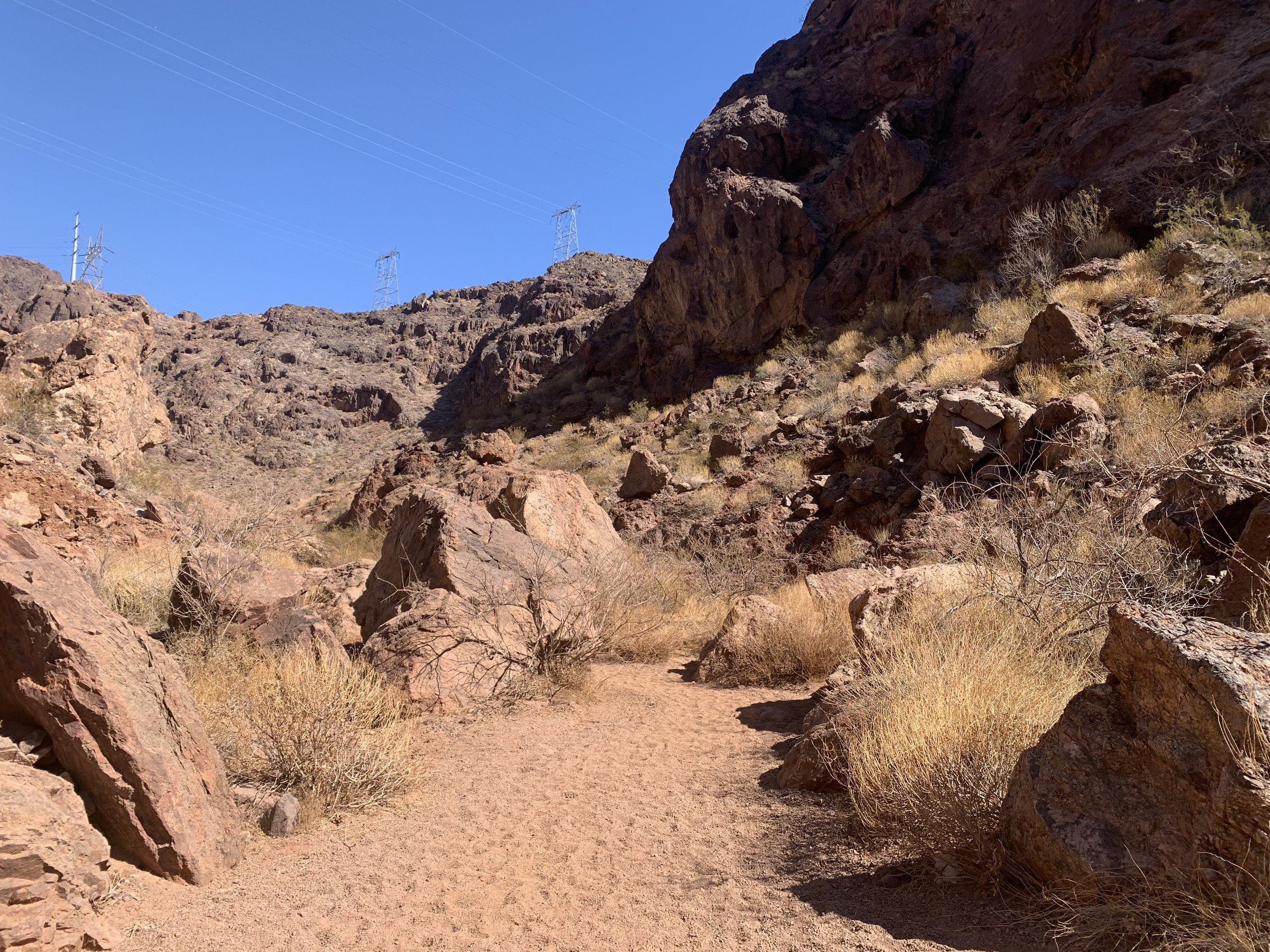
Gold Strike Hot Springs Trail
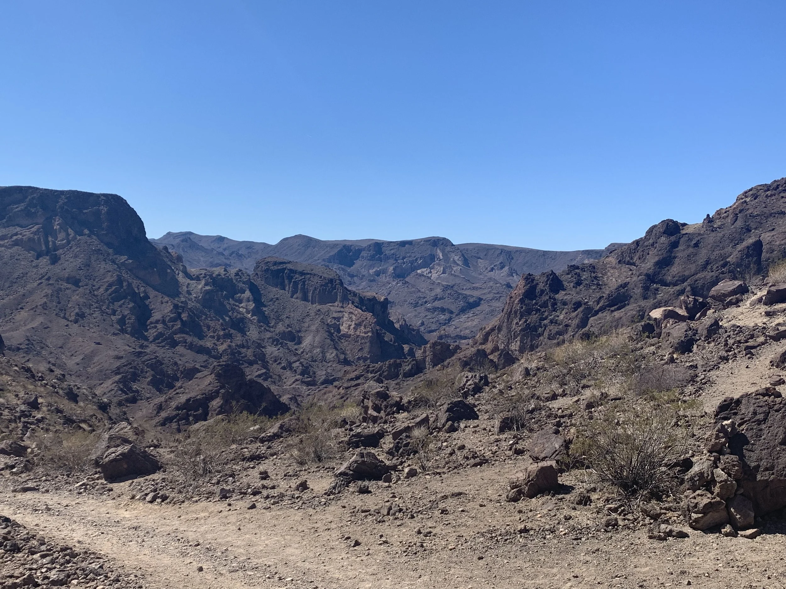
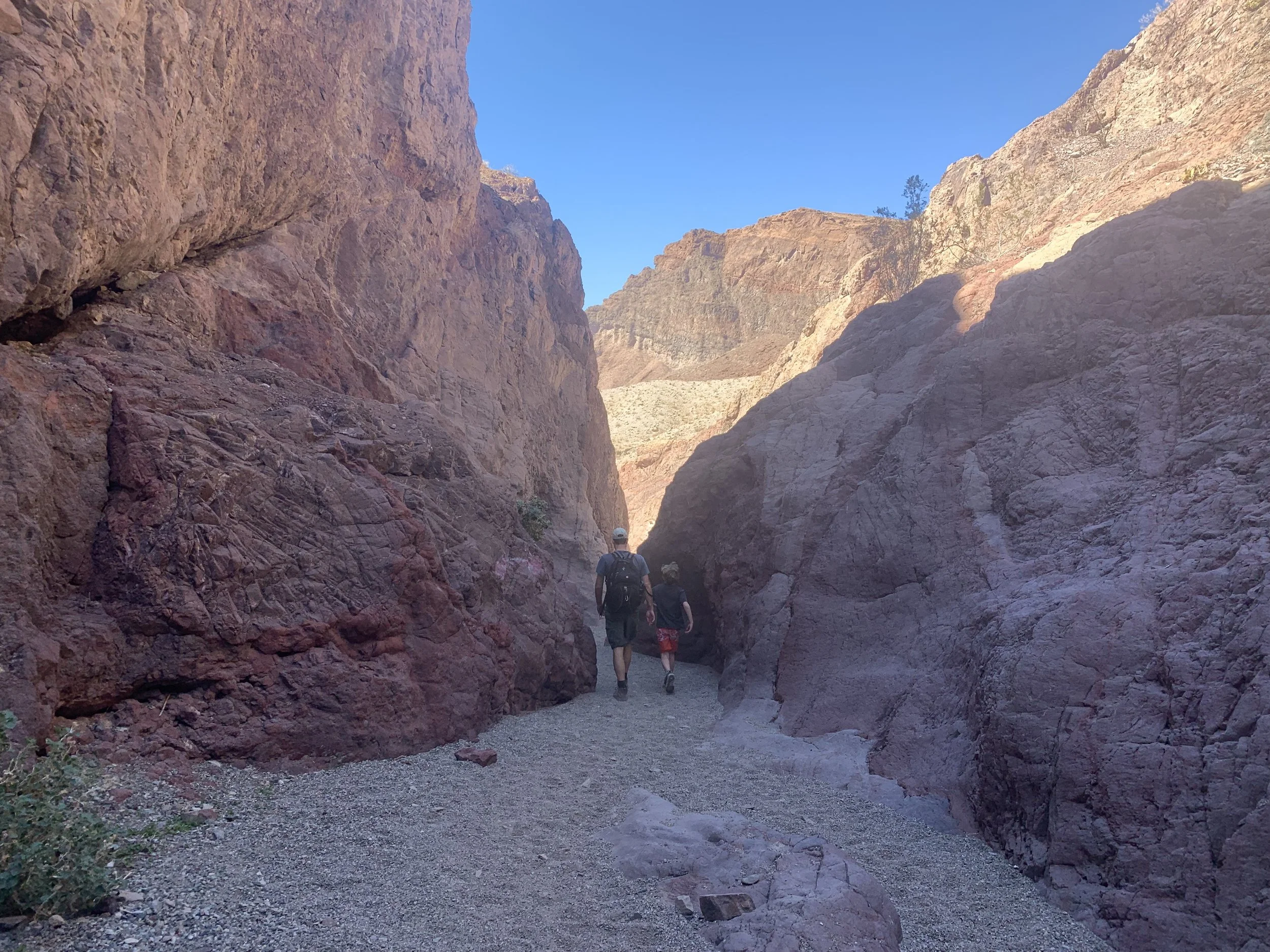
Eventually the trail narrows, and if you are hiking in the morning, you will enjoy the canyon shade. Don’t expect the shade to last for long though.
Gold Strike Hot Springs Trail
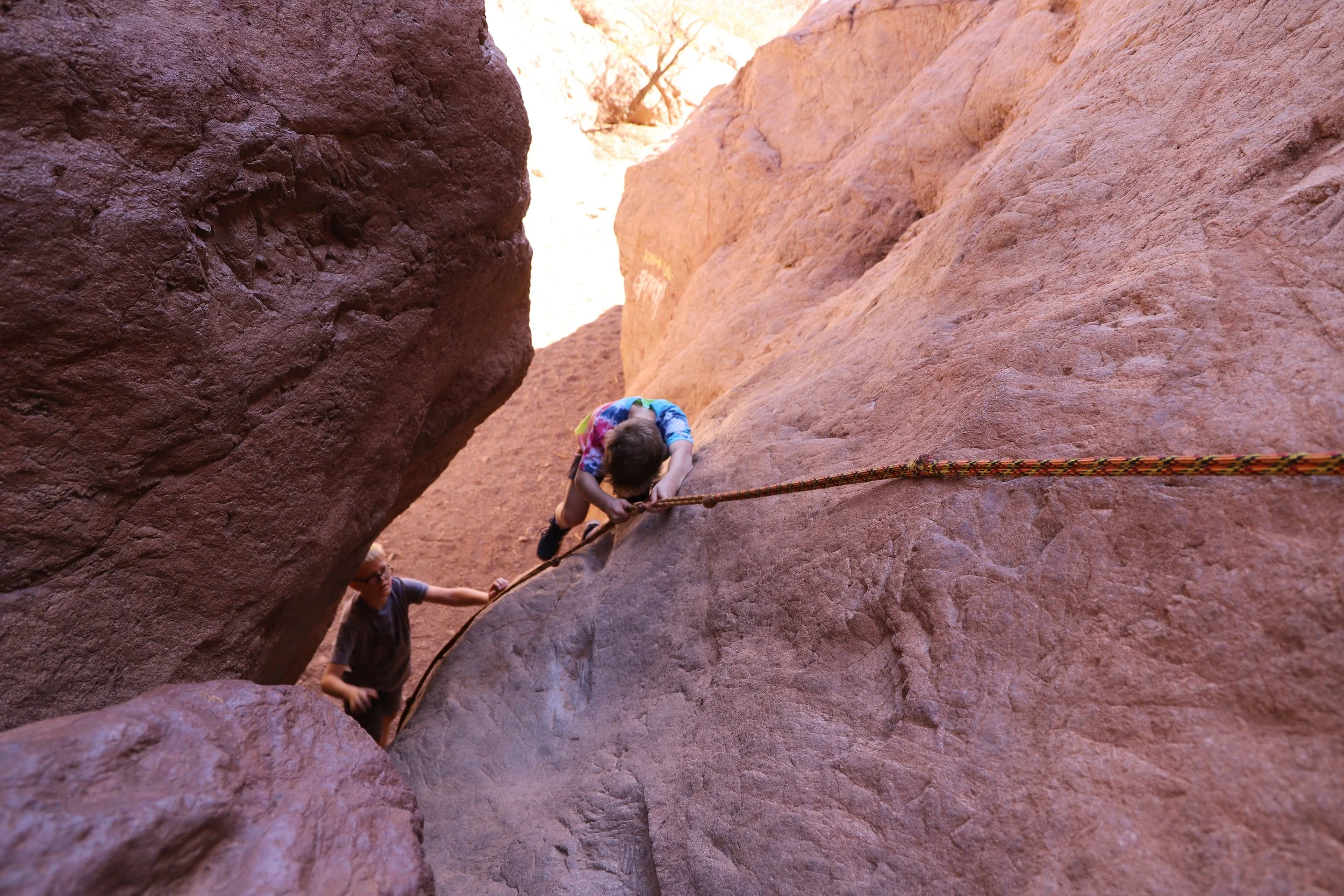
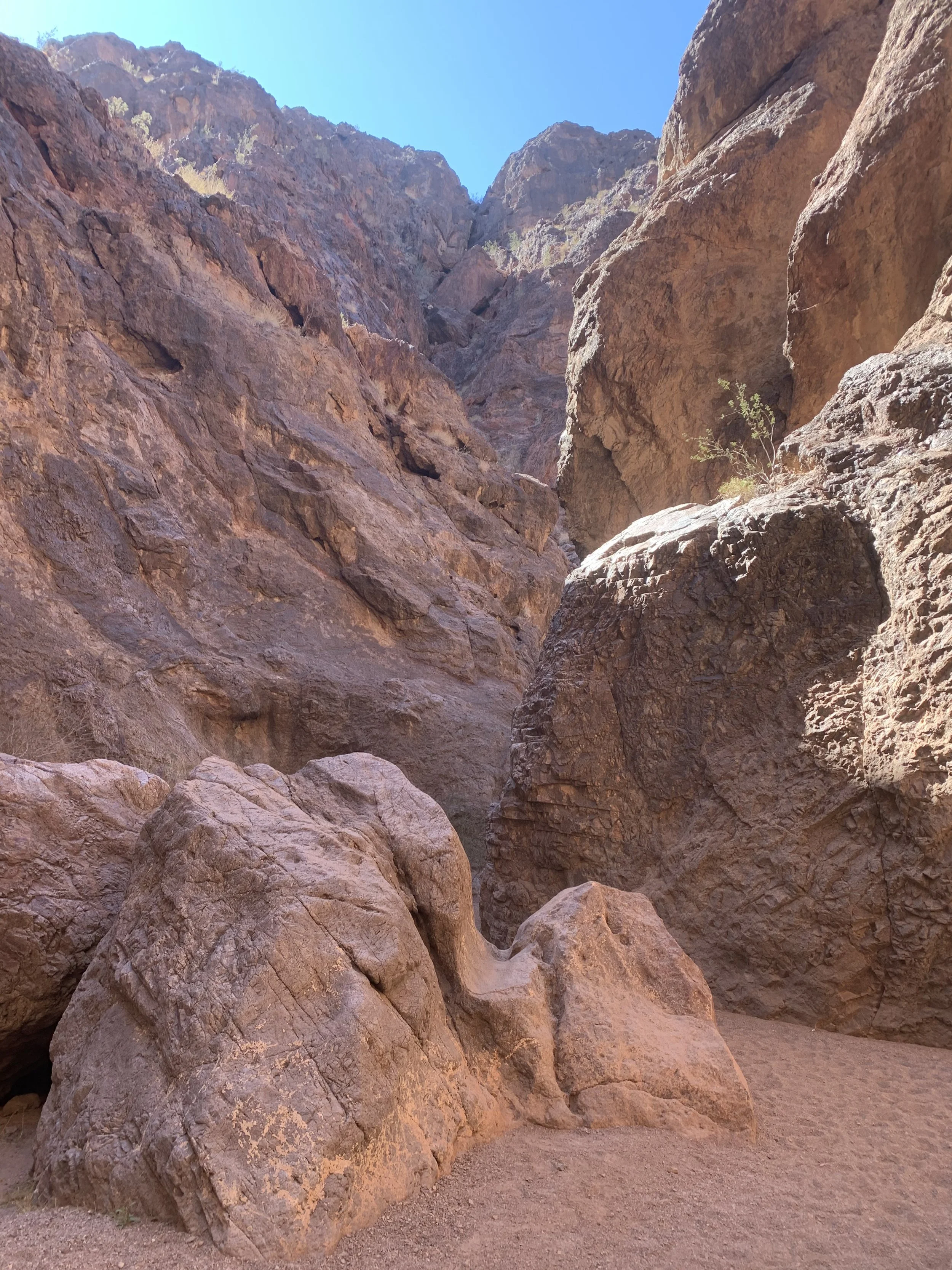
I’ve mentioned there are ropes along this trail that you will need to use. Eventually you will start questioning if what you’ve heard was incorrect and there are no ropes. It’s more than a mile and a half from the trailhead before you will get to the first rope, so just keep walking. As you descend further and further into the canyon, the boulders become become bigger and bigger obstacles. You’ll know you are getting closer to the hot springs when you encounter your first rope. Unfortunately I didn’t remember to count them as we went up and down, but I think there were maybe about nine of them? Some are easier than others to navigate.
Boulders along the Gold Strike Hot Springs Trail
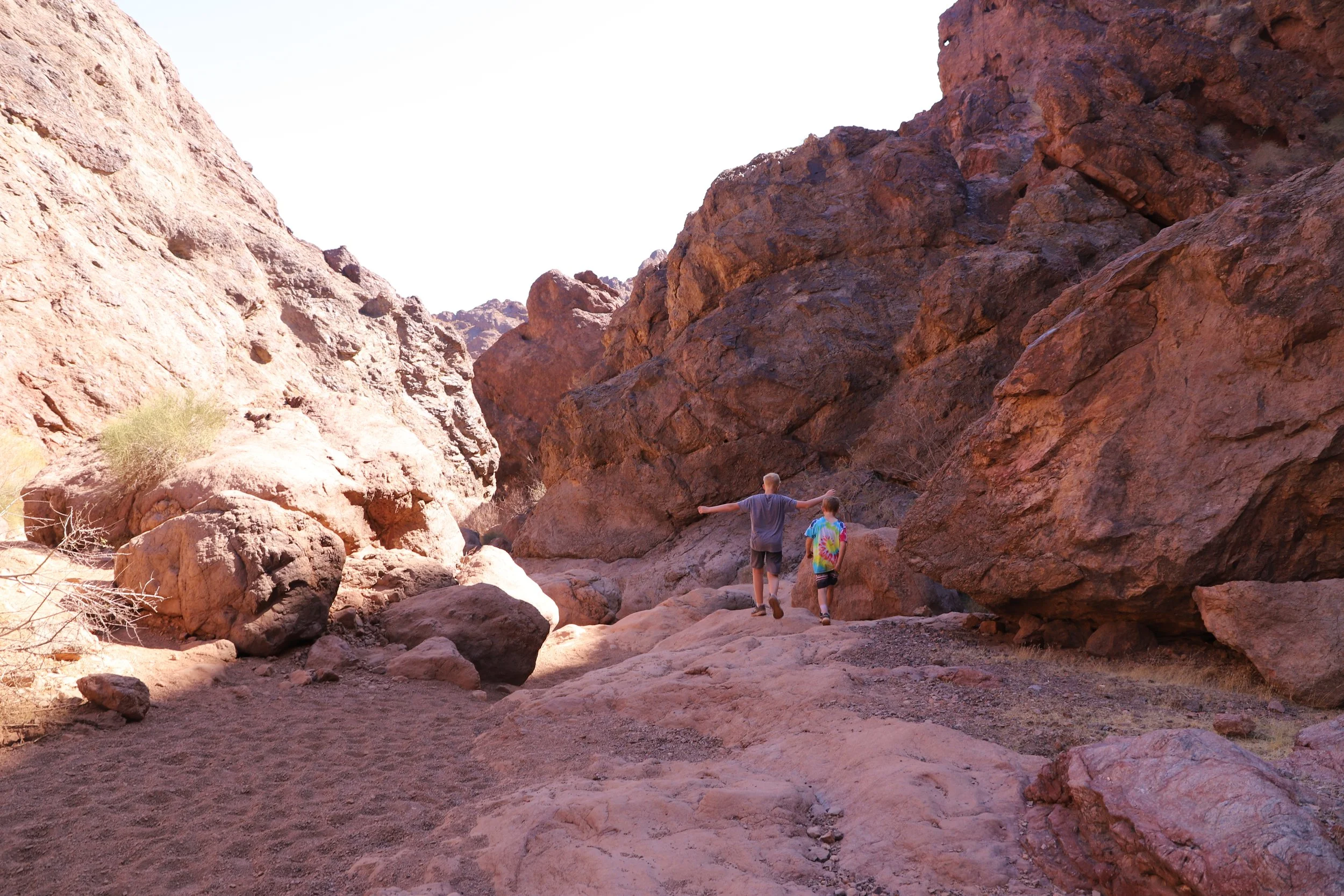
Perspective helps. In the below picture is my 12 year old, so you can get an idea of just how many and how big the boulders are that you need to scramble up and around without ropes. The ones with ropes are quite a bit taller a person, sometimes taller than two people.
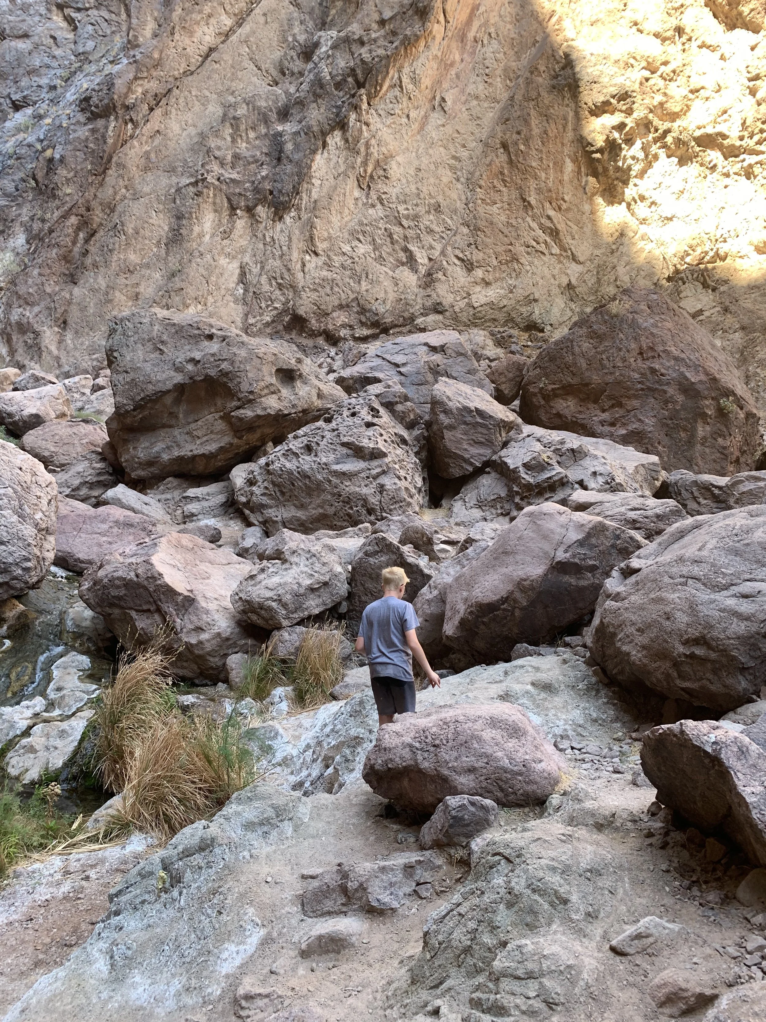
Scrambling around the boulders on the Gold Strike Hot Spring trail
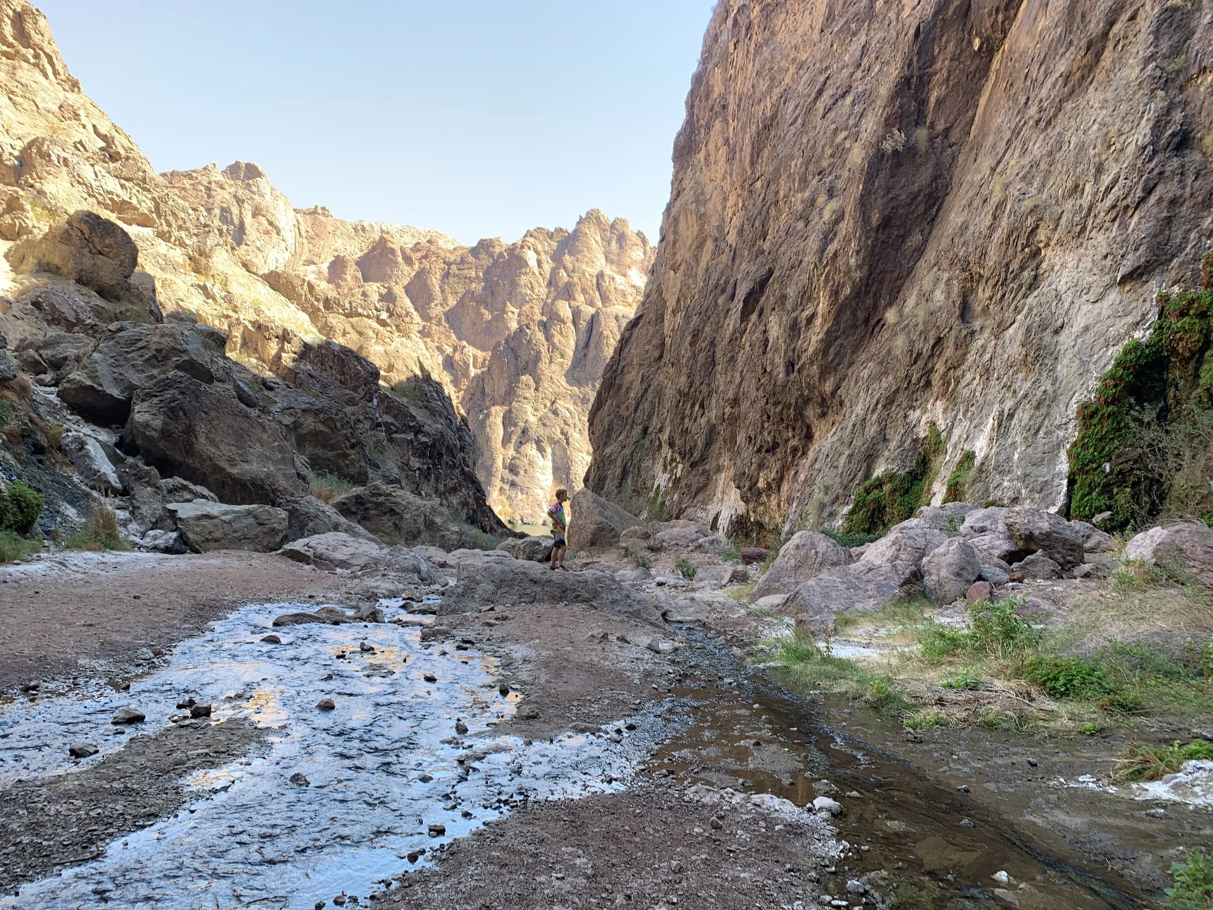
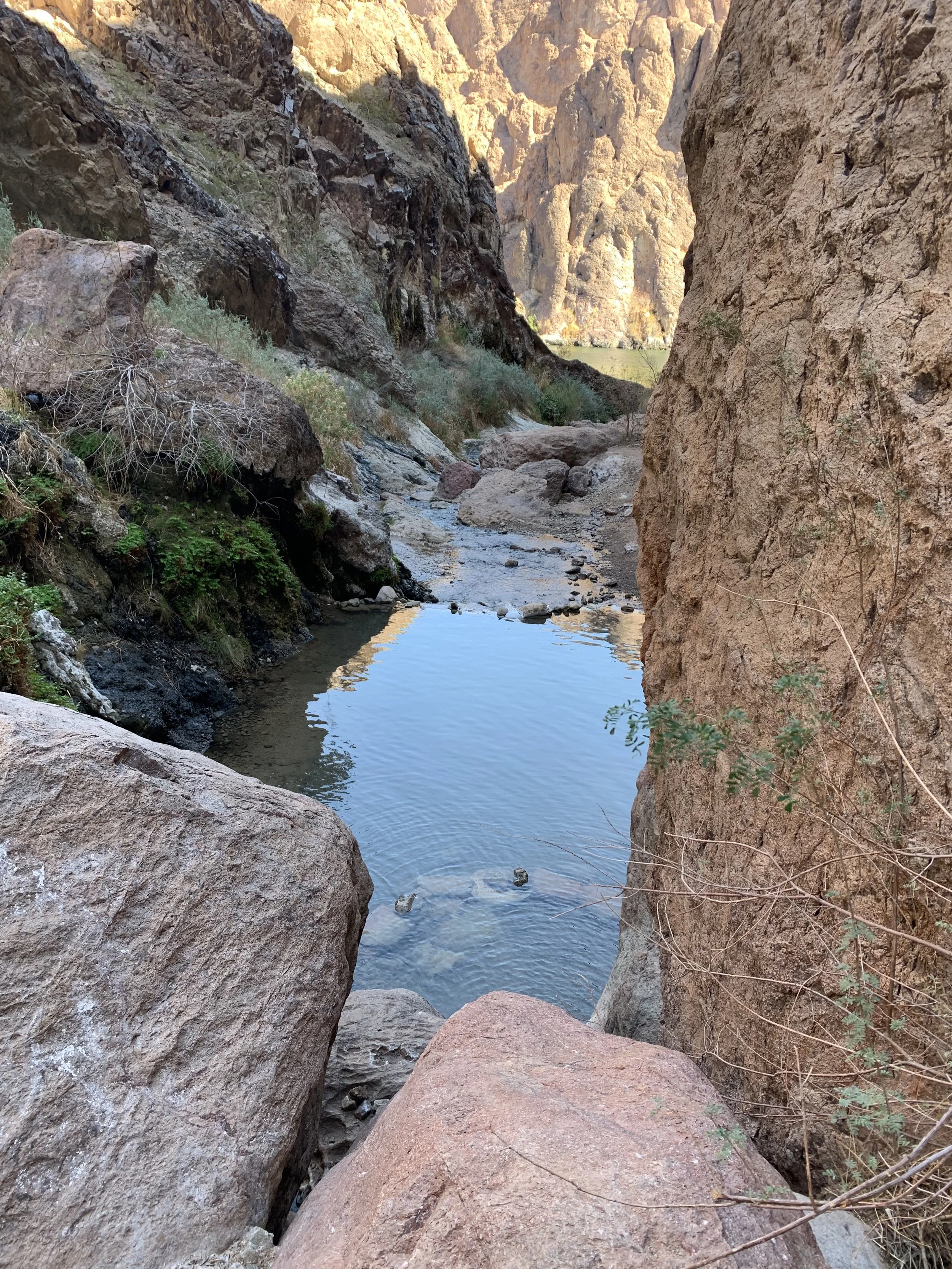
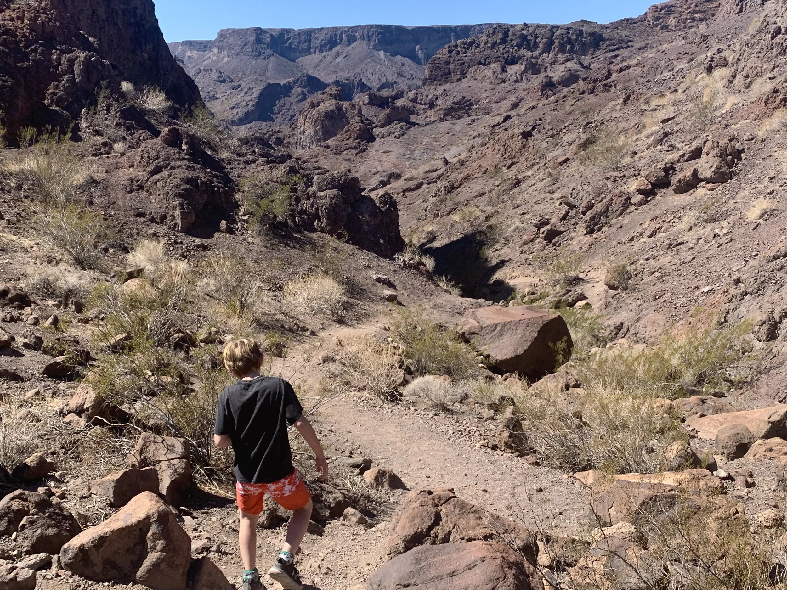
We didn’t run into anyone as we were hiking down to the hot springs, which is why I kept questioning if I was in the right place. Eventually you will see streams of water that smell a little bit like sulfur. At this point, I started to think maybe the hot springs had dried up and this was all that was left, and maybe that’s why we hadn’t seen anyone else hiking. Keep going. The trailhead kiosk says the hot springs start at 2 miles and the river is at 2.5 miles. I have a picture shortly with both the river and hot springs in it, so you can see how close they really are. I mapped the springs closer to 2.5 miles from the trailhead. You haven’t missed the hot springs, just keep going.
Trickles of water - not a dried up hot spring
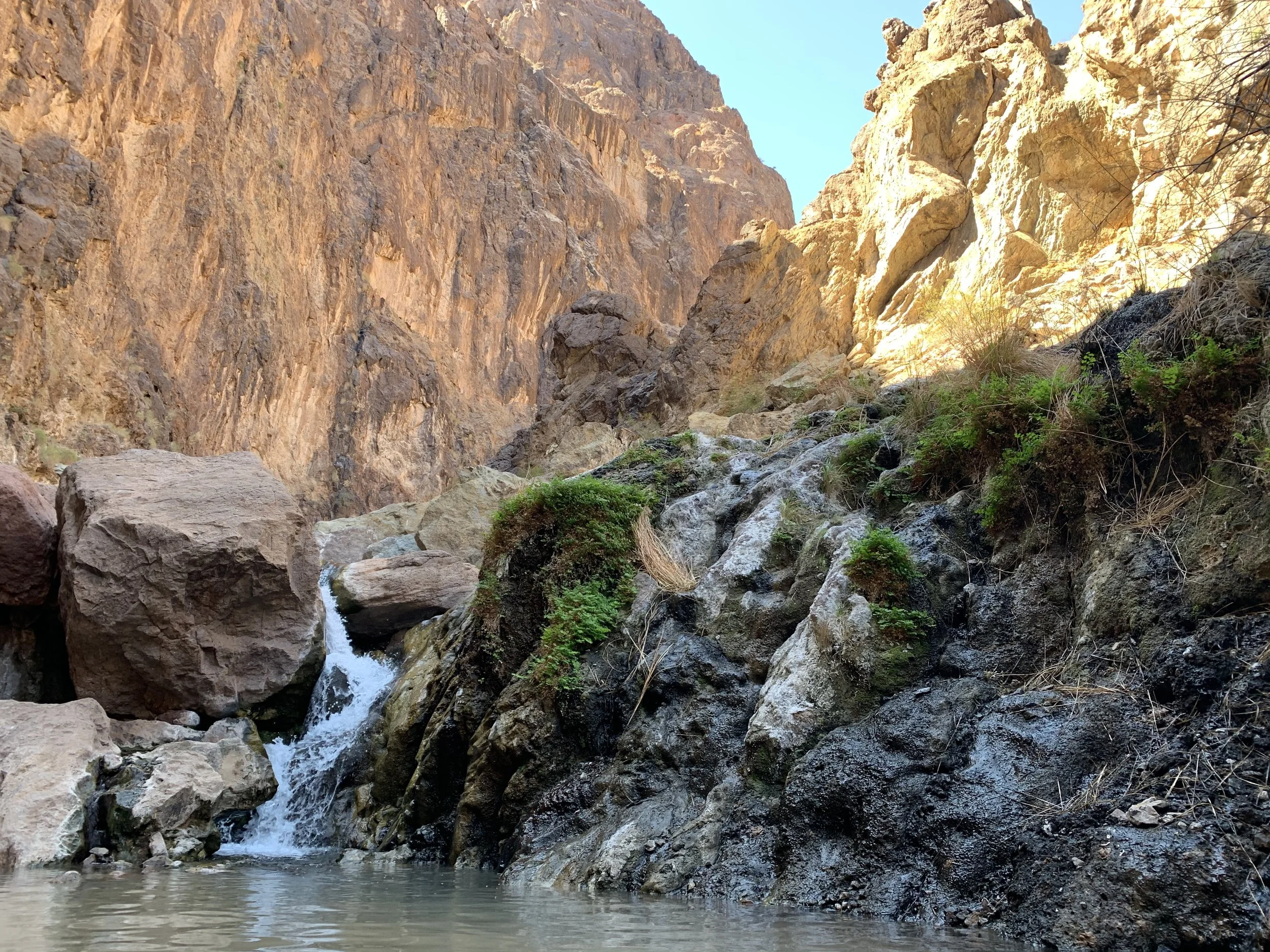
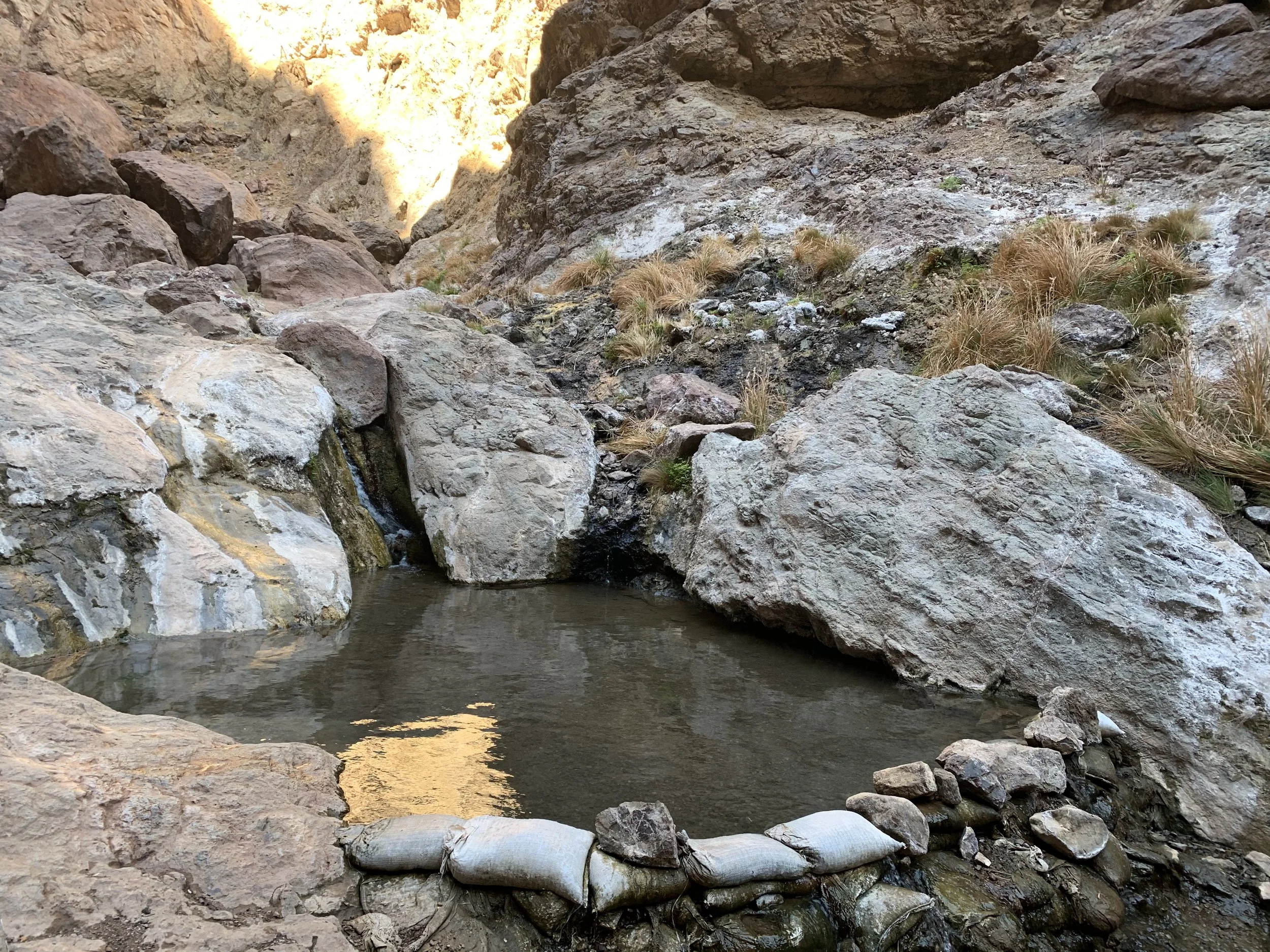
The hot springs are pretty obvious. They are maintained by sand bags, and a warm waterfall enters the best of the pools.

Best of the pools to enjoy at the Gold Strike Hot Springs
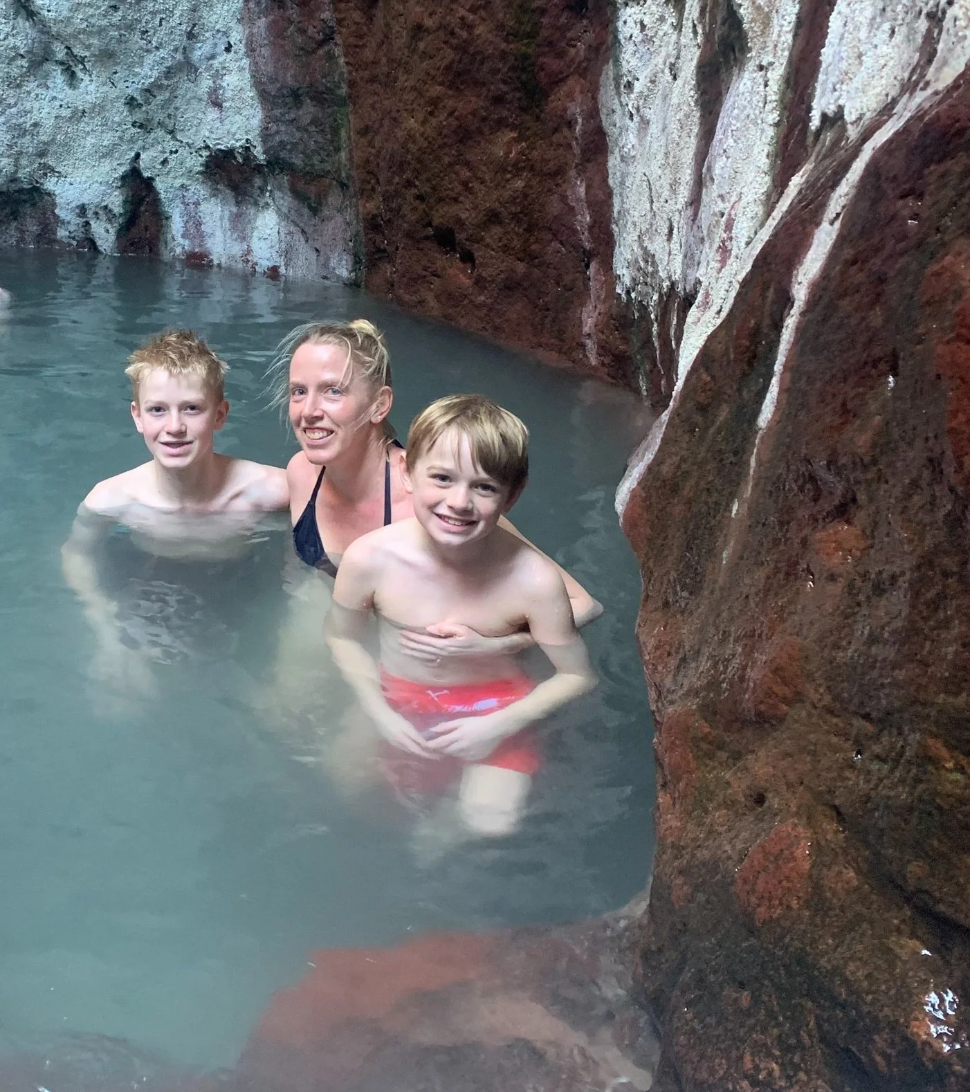
This is my 8 year old and I sitting in the hot springs for perspective. Deep enough to enjoy, not really deep enough to soak your back in, at least when we were there. The sand bags don’t go very high though, so I’m guessing this is what the level of water typically is.
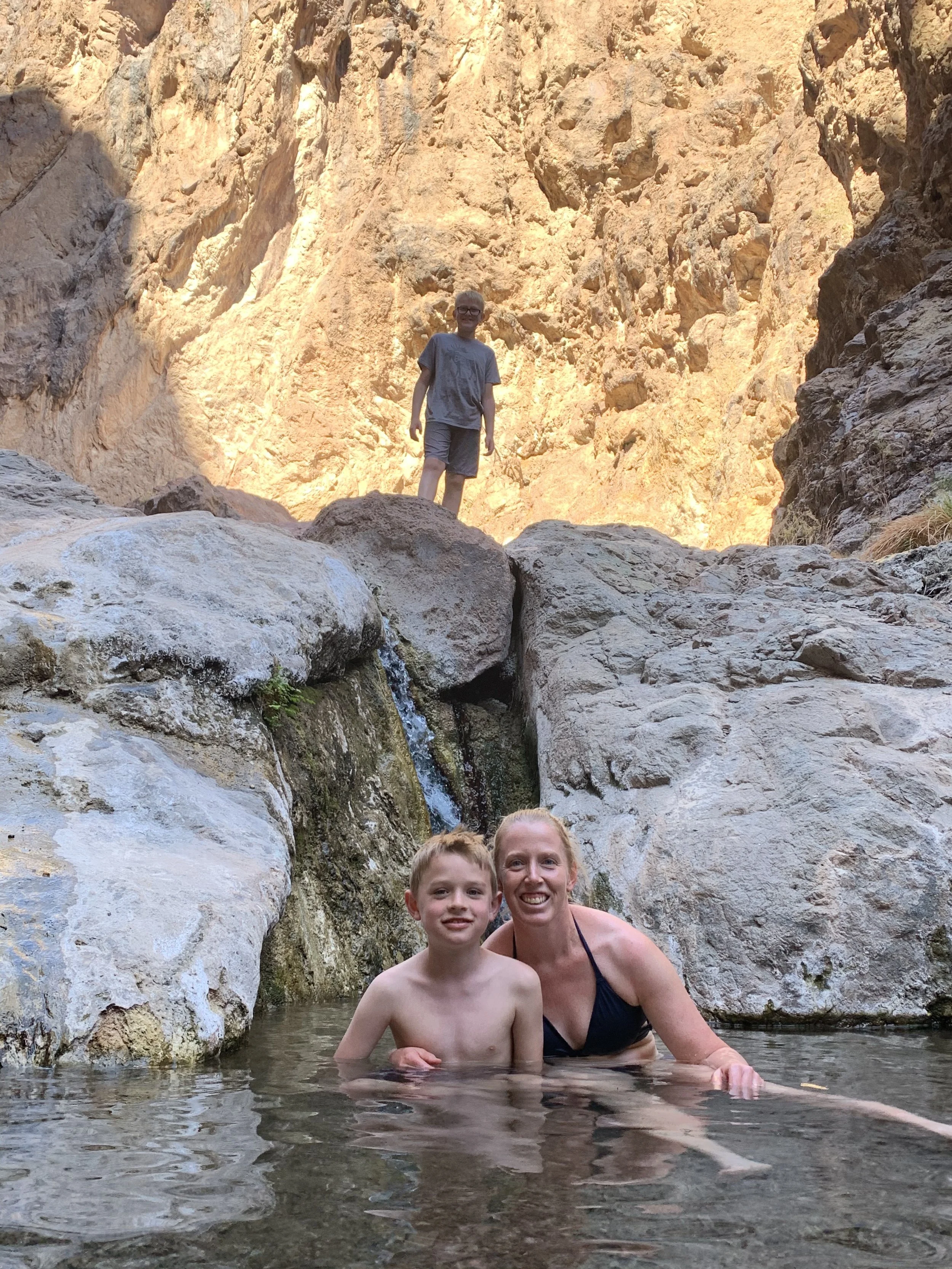
Enjoying the hot springs with my boys
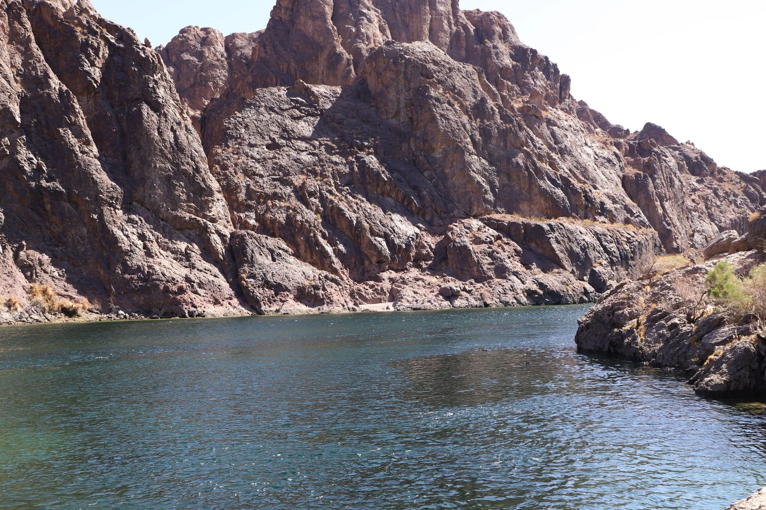
Below is the picture I mentioned previously. You’ll see the hot springs as well as the river. It was just a few minutes to walk between the springs and the river. We jumped back and forth a few times, enjoying being hot and then cooling off quickly as the Colorado River was very cold.
Gold Strike Hot Springs and the Colorado River
I had the below picture as my background for work meetings for several months and frequently got questions about where was this taken from. No one I talked with had ever heard of the hot springs below the Hoover Dam. We did run into 10 or so people enjoying the hot springs and the river while we were down there, and a ton of people were walking down as we were going back to the car. I would recommend going in the late morning to enjoy a bit more privacy. Overall, I think this treasure is a pretty well kept secret for how incredible the hike, hot springs, and views are.
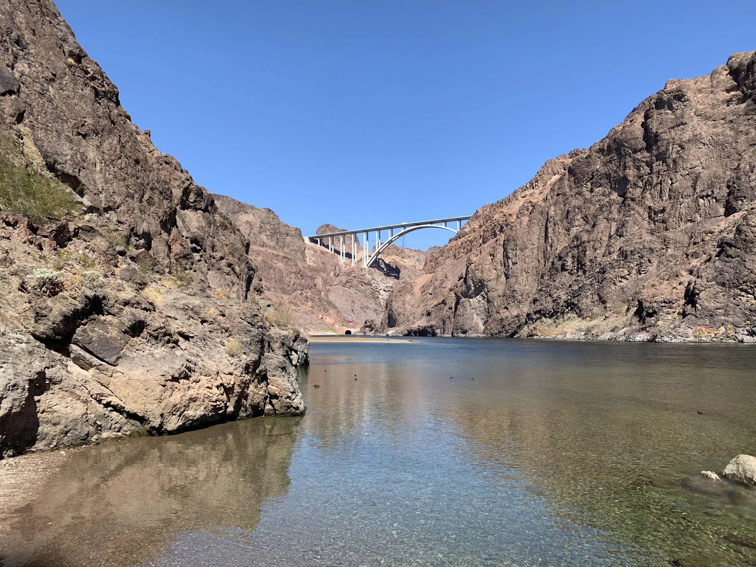
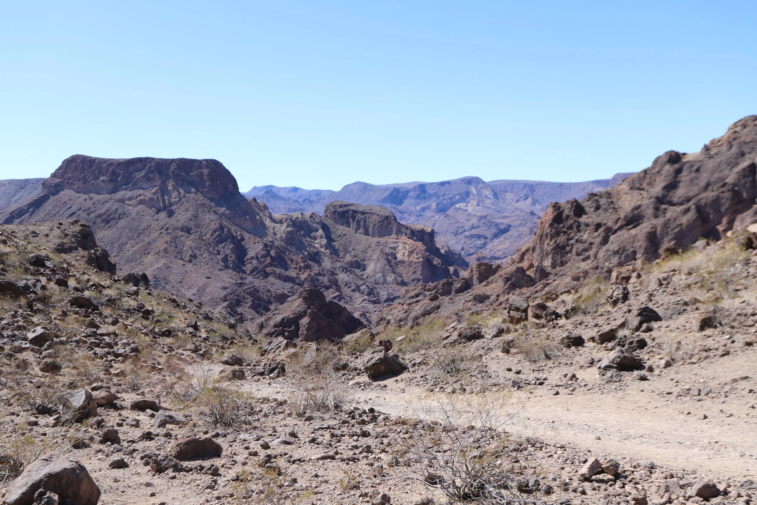
Hoover Dam Bypass Bridge view from the end of the Gold Strike Hot Spring trail
Looking downstream the Colorado River at the end of the Gold Strike Hot Spring trail
White Rock Canyon Trail to AZ (Ringbolt) Hot Springs
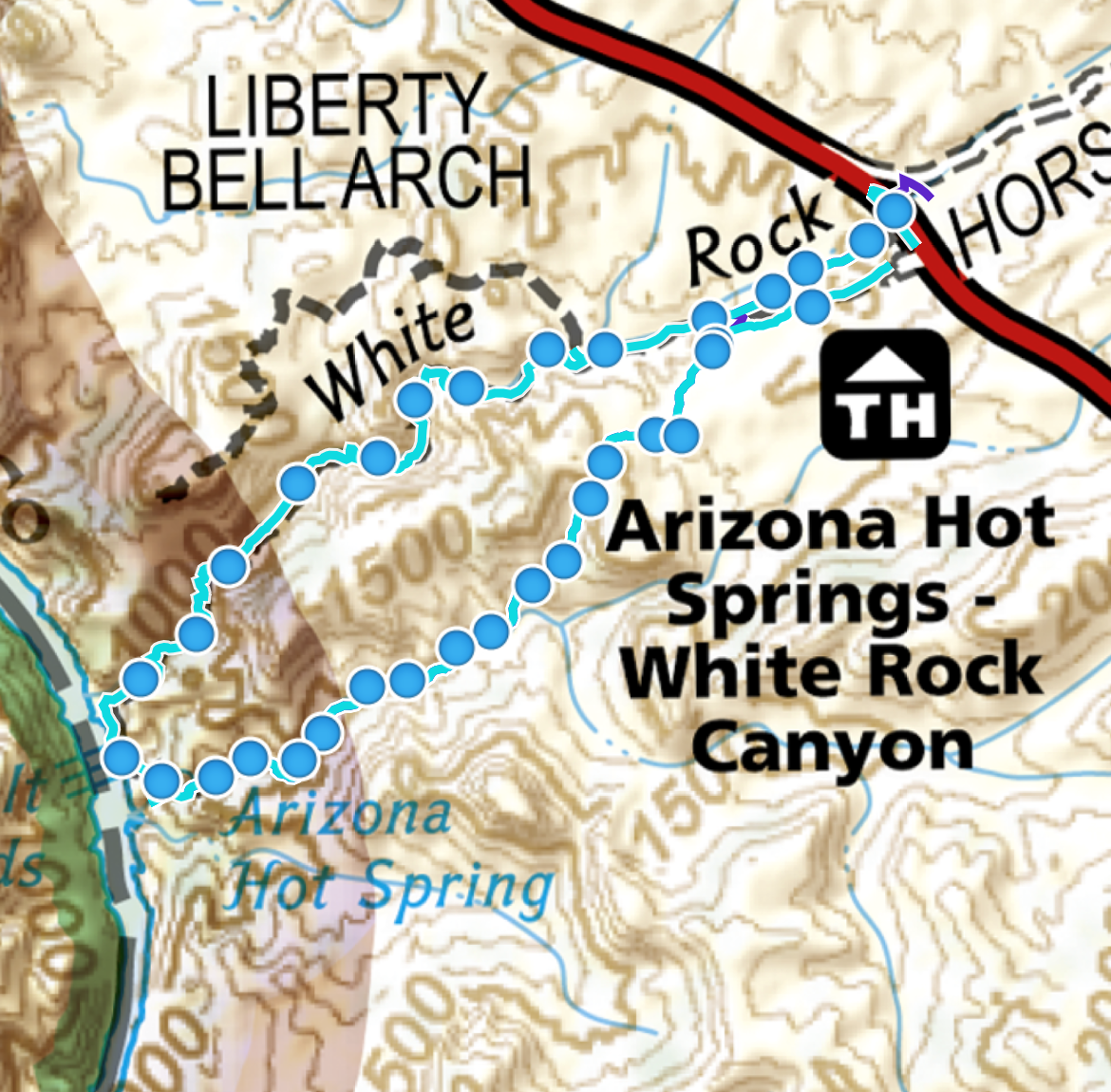
White Rock Canyon to AZ (Ringbolt) Hot Springs Map from GAIA GPS app
There are two options to hike to the Arizona Hot Springs. The first is a loop hike. This is approximately 6 miles, and the elevation gain is 1,500ft. There is one ladder on the trail. If you want to hike up the ladder, then hike counterclockwise, and vise versa, go clockwise if you prefer to hike down the ladder. You will be hiking through the hot springs with waist to chest height water so make sure you have a way of carrying all of your things without getting them wet.
The second option is an out and back hike. The mileage is the same, but the elevation gain is only 1,000ft. To hike to the hot springs, start off clockwise. You will not need to deal with the ladder, as this is at the end of the springs. You save on elevation as you won’t walk all the way down to the river.
Originally we planned to hike the whole loop, but at the springs decided it would be easier to not deal with keeping our stuff dry and avoided the extra 500ft in elevation gain. The elevation gain on this trail felt much steeper than on the Gold Strike Trail. It was more of a constant uphill in the sun, and some parts were extremely steep.
You probably want to bring water sandals, regardless of which way you hike. The water is so deep, you won’t be able to see your feet as you step, and there may be glass. We didn’t notice any trash, but people were drinking in the springs. This is a very exposed trail, with no shade at any time of the day, so bring more water than you think you might need, and extra to share with a hiker in need if you come across someone. My last suggestion is to hike this trail with a GPS. We got lost for a moment on the way back, even though we were hiking back the same way we had entered. Washes in the desert look the same as trails, and this trail isn’t marked well with signs. Having GPS turned on got us turned back around in less than 0.25 miles, once we realized we weren’t following the trail we’d made on our way to the springs.
White Rock Canyon Trailhead Location
Ringbolt Arizona Hot Spring Trailhead
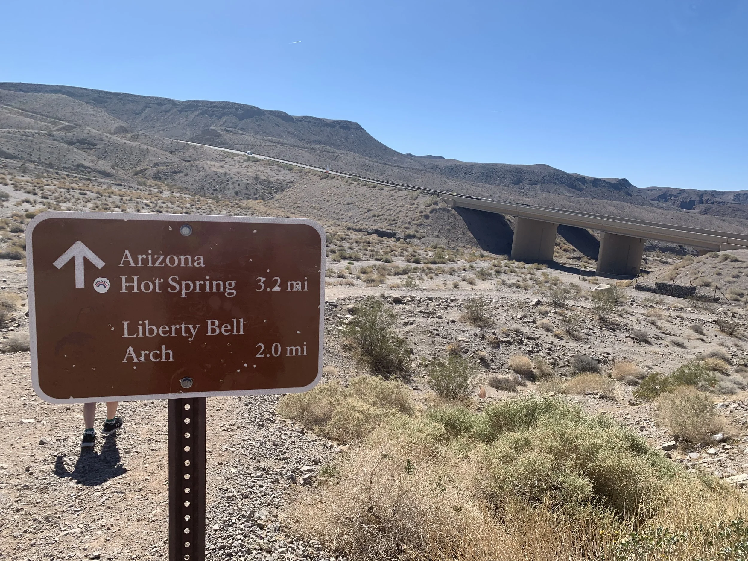
From the Las Vegas Strip, the trailhead for the Arizona Hot Springs is a similar distance (45 minutes, 40 miles). You will take I11 over the Hoover Dam bypass bridge. When you cross into Arizona, the name of the road changes to US Hwy 93. If you are using GoogleMaps, type “Arizona Hot Springs Trailhead” or “White Rock Canyon Trailhead” as your destination. “Arizona Hot Springs” will take you too far down 93 and you will need to turn around to get to the parking lot. The parking lot will be on your left. The trail is going to start by going under the Hwy 93 bridge.
The parking lot is paved, there are several signs. You will know you are in the right spot. There are a few different trails from the same parking lot. Aim towards the Hwy 93 bridge and look for the sign pictured above.
Hiking White Rock Canyon Trail to AZ (Ringbolt) Hot Springs
The Ringbolt trail starts off traveling under US Hwy 93
As I mentioned, the first landmark you will come to as you are walking towards the springs is the Hwy 93 bridge, which you will pass underneath. Notice in my pictures there are no canyon walls or trees to provide any shade. This is an extremely exposed trail, and even in March, that sun was hot.
White Rock Canyon Trail to AZ Hot Springs
The first part of the trail is flat, wide, and honestly boring. But the destination of this trail is worth the hike!
Descending into White Rock Canyon
Eventually you will make it to the canyon and start the descent down. This part of the trail is beautiful, but you can see from the below picture that there is a significant slope on the trail, and this wasn’t the steepest section.
Walking down White Rock Canyon to the Arizona Hot Springs
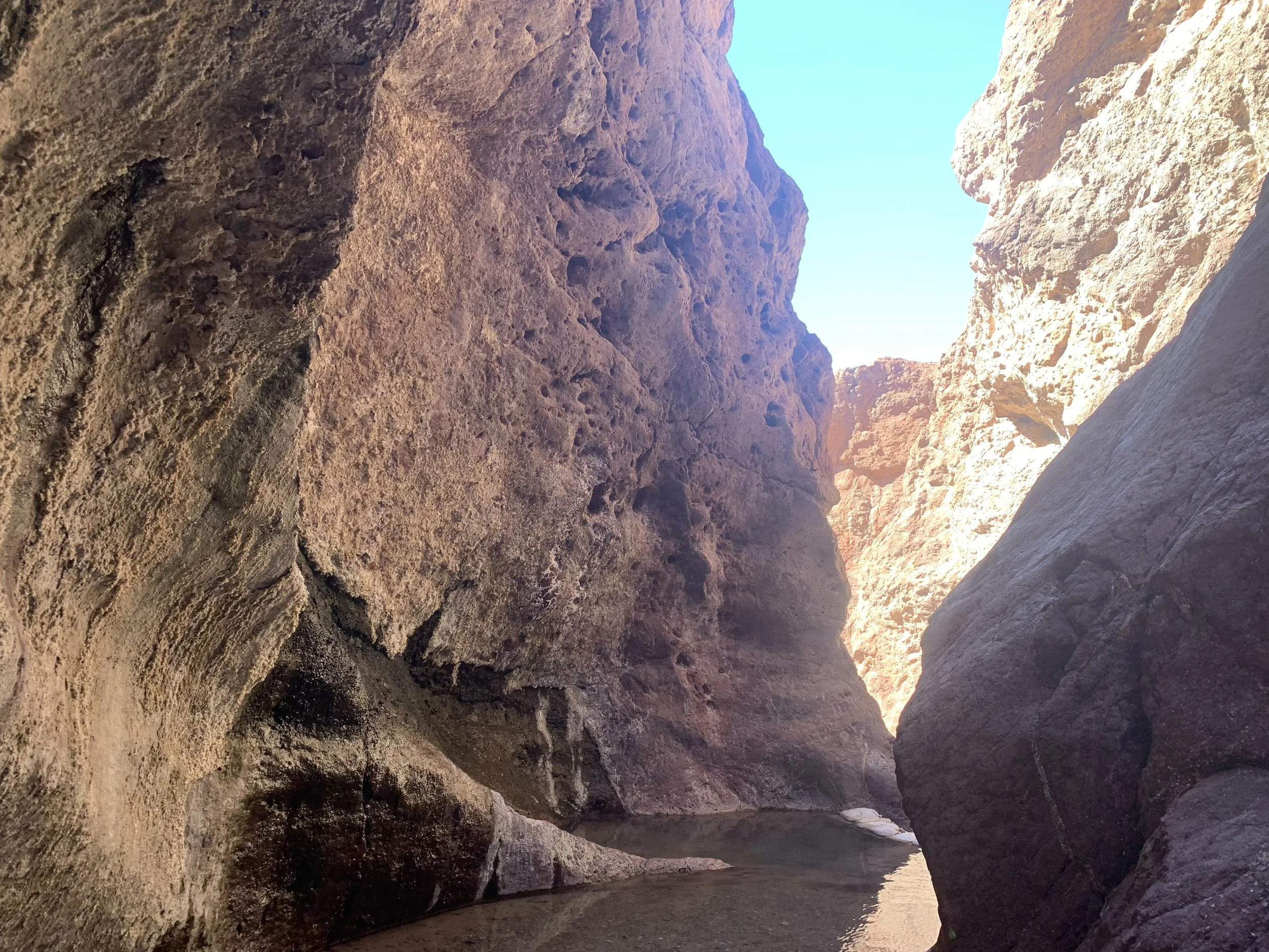
As you near the hot springs, the trail narrows quite a bit, and this was my favorite section of the hike.
Nearing the Arizona Hot Springs
Just before the hot springs
The below picture is looking back towards the trail. If you are hiking clockwise you will round the corner in the back of the photo and enter the hot springs. You will have to then climb up and over the sand bags, and then keep going to another set of sand bags, and the ladder is on the other side. This is the trail, if you are hiking the loop. You will need to carry your things over your head in the second pool to keep them out of the water.
This water was so much fun. It was so warm and felt amazing. I didn’t notice too much of a sulfur smell. By far, this is the best hot spring I’ve been in so far. You can see in the background that were a few other people in the pool above us, but we had this section to ourselves the whole time we were there.
The water is warm enough to swim in, but remember to keep your face out of the water. It’s not like a hot tub that is chemically treated to keep away unhealthy bacteria.

Thoroughly enjoying the Arizona Hot Springs!
Arizona (Ringbolt) Hot Springs
In the back of the above picture, you can see the water ends at another set of sandbags. And in the below picture, there is the ladder down to keep walking towards the river. This was where we stopped. We’ve already played in the Colorado River, so we thought we’d save the effort of that extra descent and we turned around. Some day I’d love to return and try the entire loop.
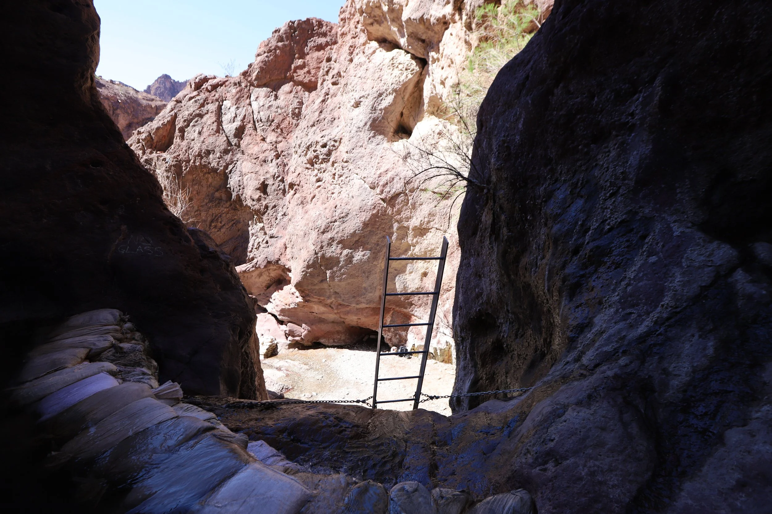
Ladder descending to continue past the Arizona Hot Springs and eventually towards the Colorado River
Other Things to do Nearby
Neither hike is a full day. We spent 5 hours at Gold Strike primarily due to giving ourselves enough time to enjoy the hot springs, whereas we only spent 3 hours at Arizona Hot Springs. We should have given ourselves another hour at least to fully enjoy soaking. Regardless though, you will likely need something else to fill out your day if you are not yet on your way to another destination. Here are two ideas:
Hoover Dam
Hoover Dam
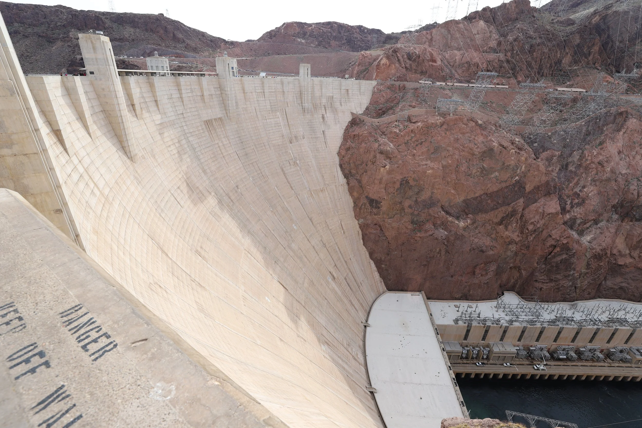
Starting with the obvious, actually stop at the Hoover Dam. There are lots of different things to do here. You can go all in and visit the museum, take a tour, and listen to a presentation. If you have time, I would do it. How they built this thing is incredible, the men who built it and the stories of those who died building it, and you’ll also learn how this influenced Las Vegas as we know it today. If you don’t have time for the whole tour, you can also just pay and park in the ramp, and then go for a walk over the dam. You can look on both sides of it and get a sense of just how big it is, as well as see how far the water levels have dropped recently.
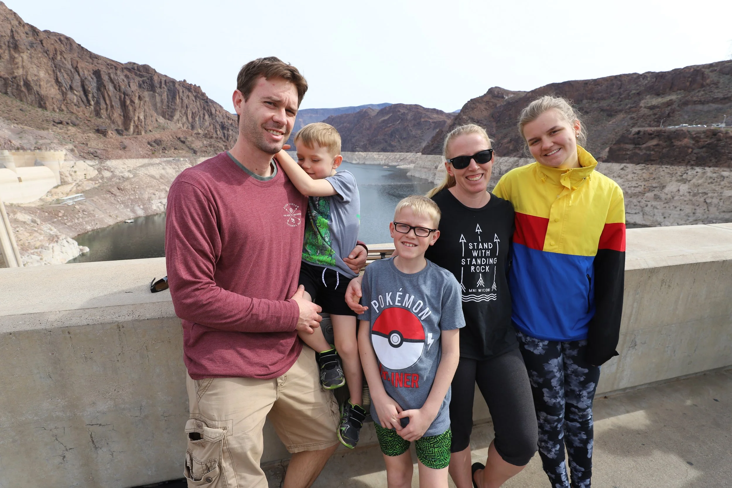
My family in 2018 at Hoover Dam
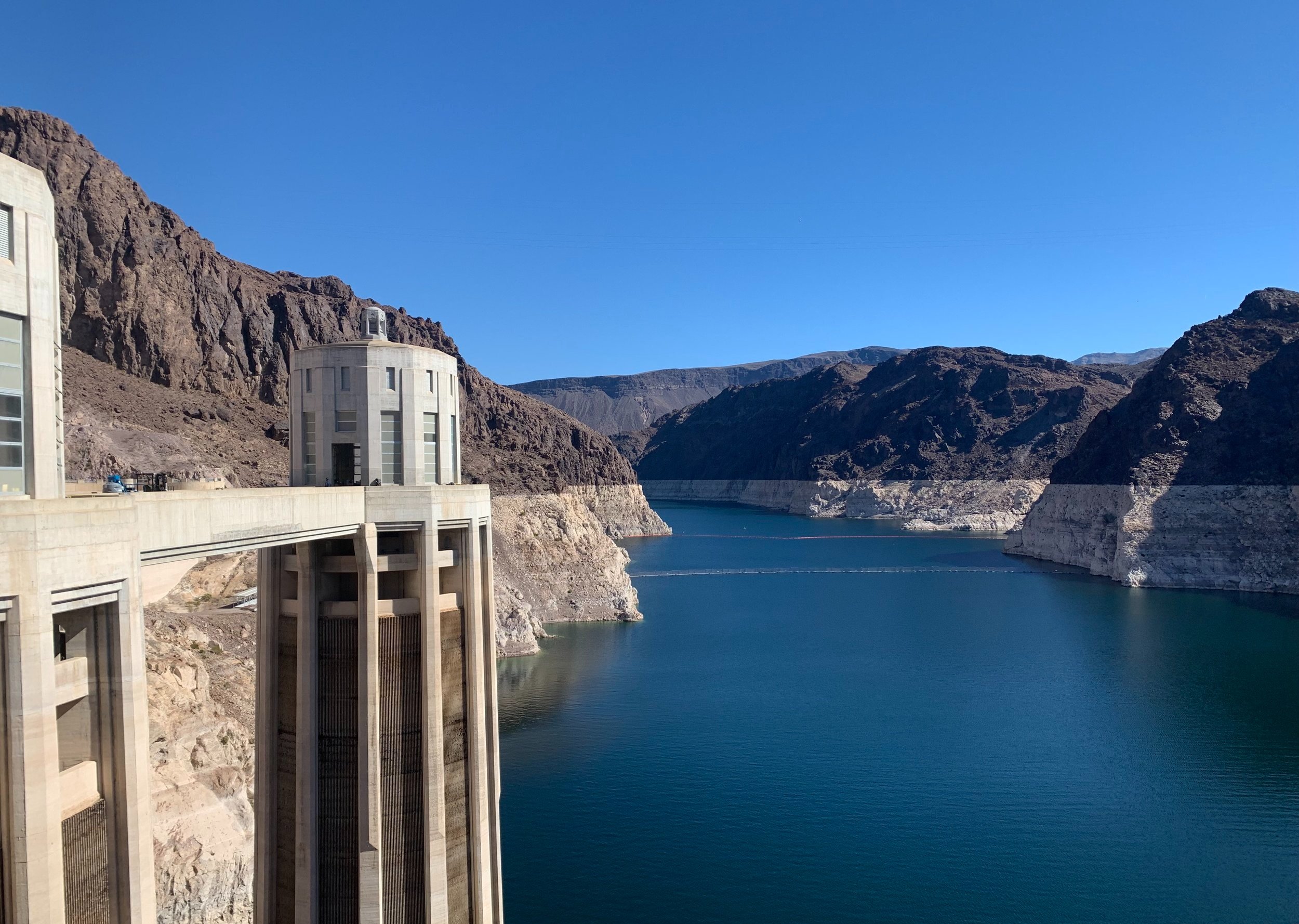
Same view as the picture above but in 2022. It’s difficult to see, but the water level dropped 27ft between our visit in March 2018 and March 2022.
One last option which is free, is to pull off of I11 and drive towards the visitor center. Before you get to the paid ramp, there is a parking lot on your right and a short trail to walk to and over the Hoover Dam Bypass Bridge. The AllTrails app has this marked as a 1.5 mile total (out and back) to walk from the parking lot, across the bridge, and back. I haven’t had the chance to do this yet myself, as we typically pay for parking at the ramp and walk across the Hoover Dam
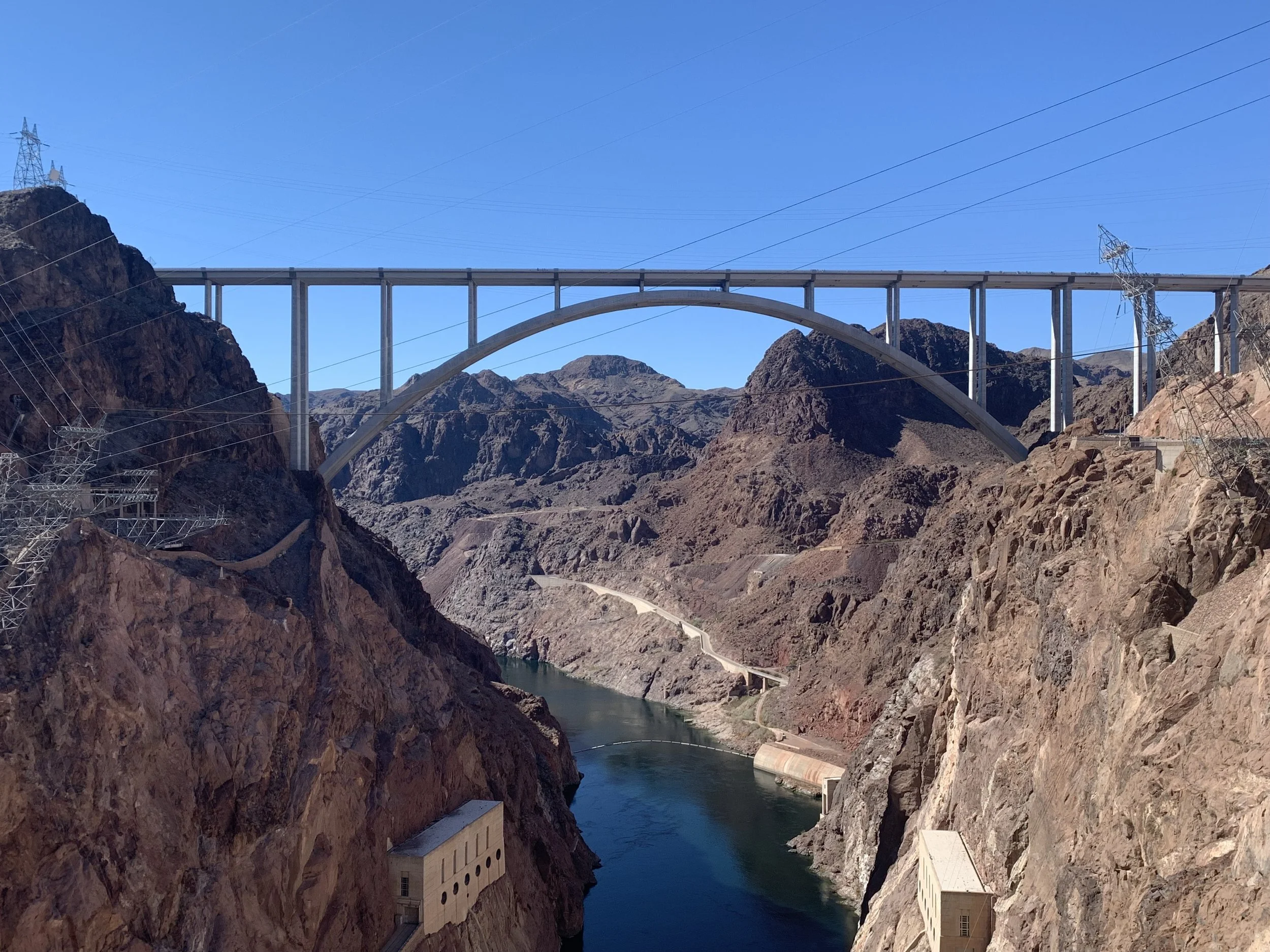
Hoover Dam Bypass Bridge has a pedestrian option to walk across it
Eldorado Canyon Mine Tour
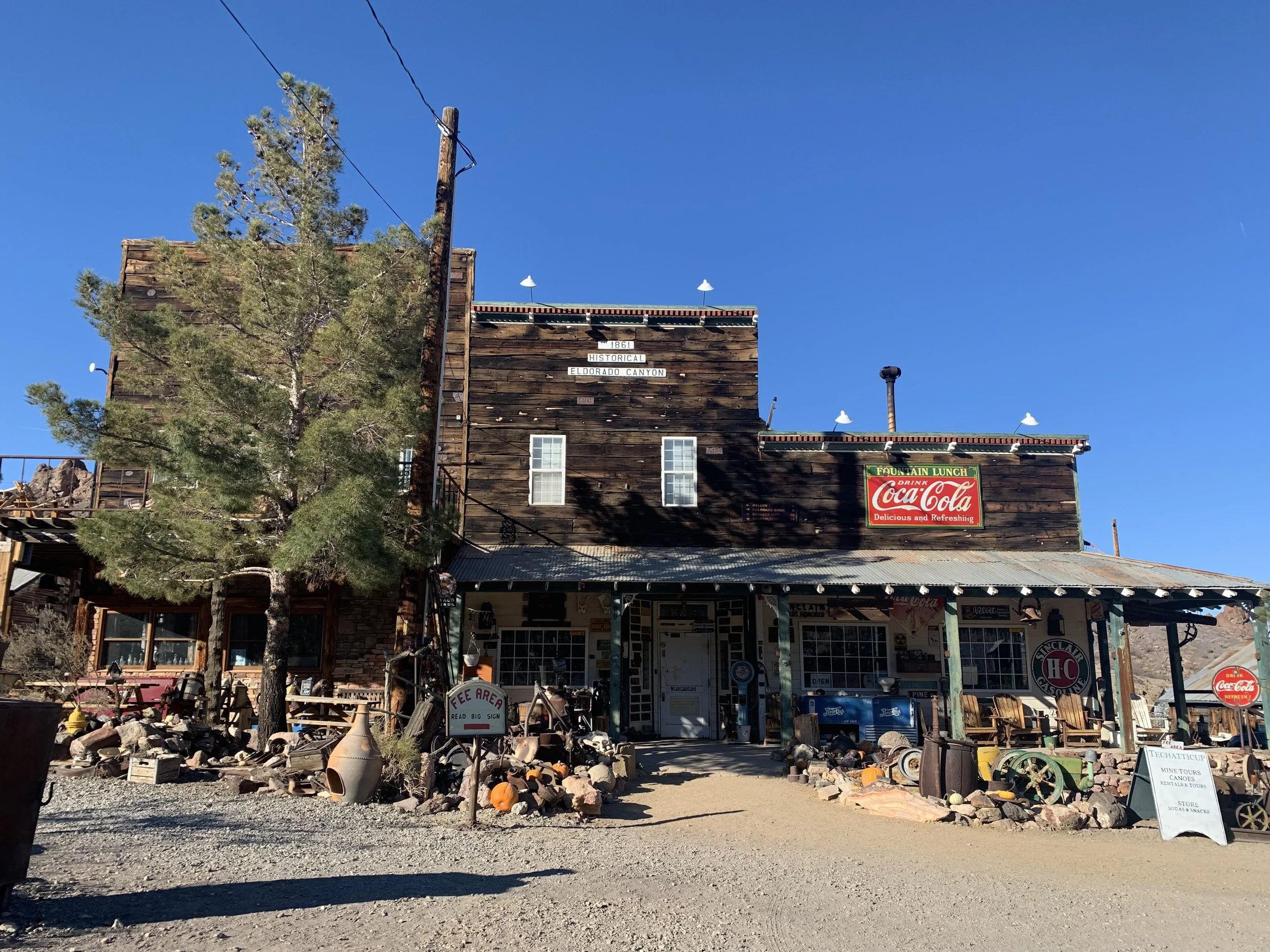
Eldorado Canyon Mine Tour
A second idea is to take a tour of the Eldorado Canyon Mine. This is about the most uniquely Las Vegas thing I’ve done so far. The tour claims this is the oldest, richest, and most famous gold mine in southern Nevada. The tour also claims ownership of the mine changed hands at least once through murder. Not sure if either is true, but this definitely was a gold mine. The owners have spent a lot of time cleaning it out and restoring it, and it was fascinating to walk through. The tour guide was funny. We wished he spent a bit more time on the history of the mine versus history in general as he had several tangents that weren’t exactly accurate according to my husband, who is a history teacher. Regardless, this was a fun way to spend a couple of hours, and it was family friendly. They have a ton of other things on their property that are fun to walk around. From the last picture below, you can get a sense of the owner’s humor by reading the rules.
The mine is about 40 minutes from the Hoover Dam and just under an hour from the Las Vegas Strip.
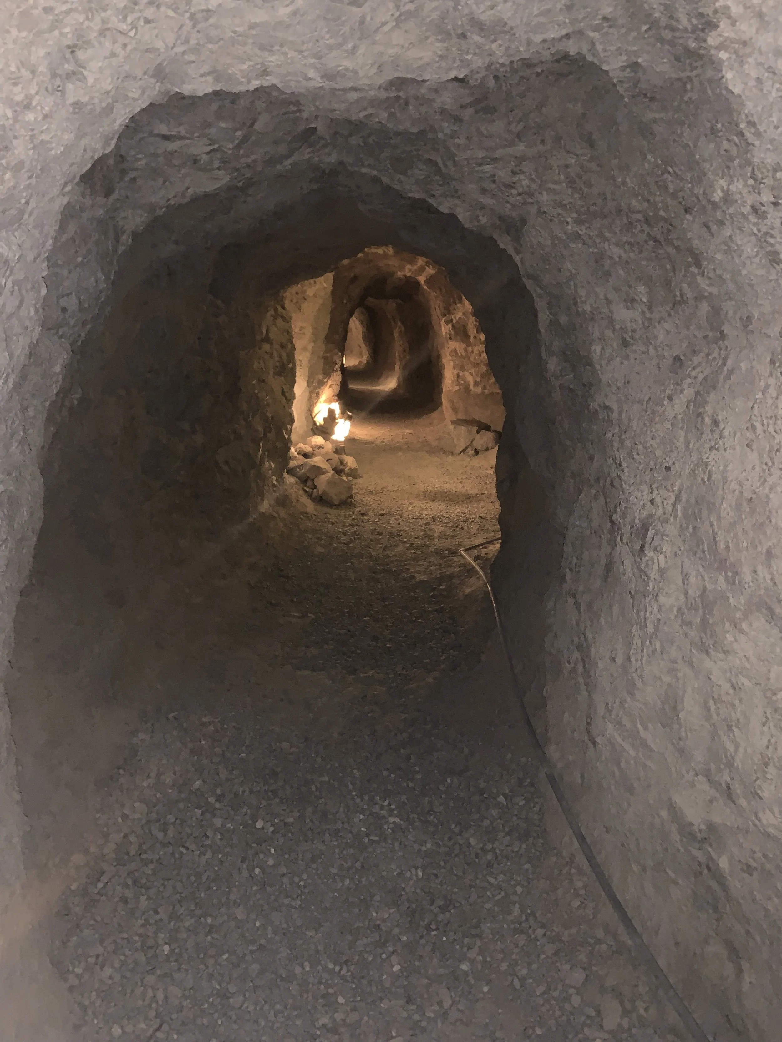
Tunnels left behind in the mine
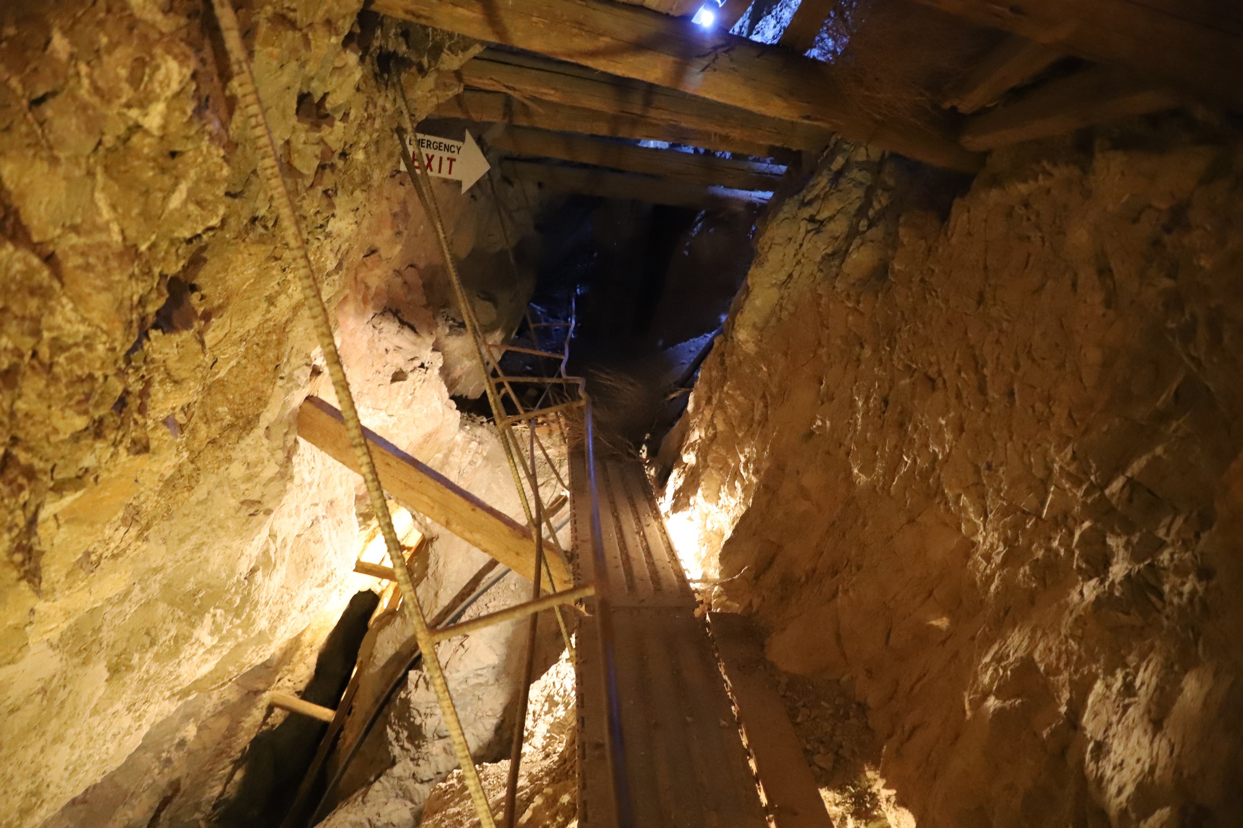
A little unnerving, but it was fascinating to get to walk through a gold mine. In this part of the tour as you cross the bridge, you can look above and below and see different levels of the mountain that were mined.
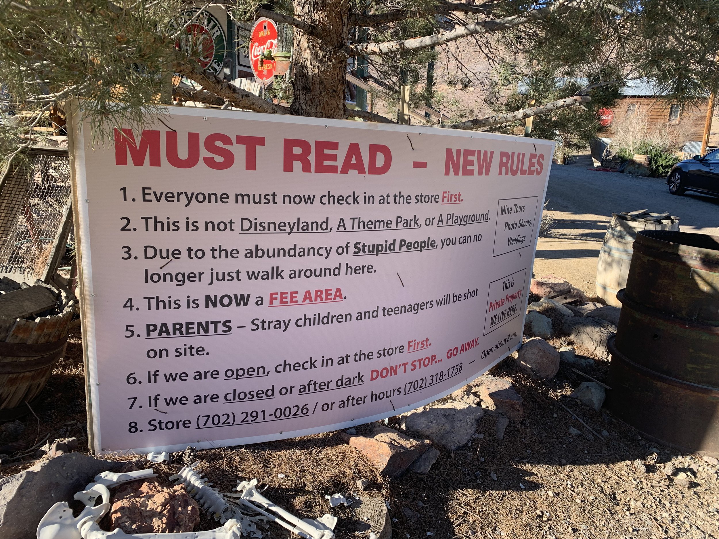
A bit of the dry humor you will find at Eldorado Canyon Mine Tours
More from www.NatureImpactsUs.com
Posts are linked to each pin below.