

View of Las Vegas Valley from Calico Tanks Trail
If you enjoy my blog, please consider signing up below to get email notifications of my latest posts. I will not share your email.

Above the Lights
If you look west from the Las Vegas valley, you will see mountains with thick stripes of deep red and golden yellow. Aim your car in this direction, and you will find Red Rock Canyon National Conservation Area. This is a beautiful place to spend one day, or several. This park offers multiple shorter and longer trail options, and is a great place to soak up that warm winter or spring sun.
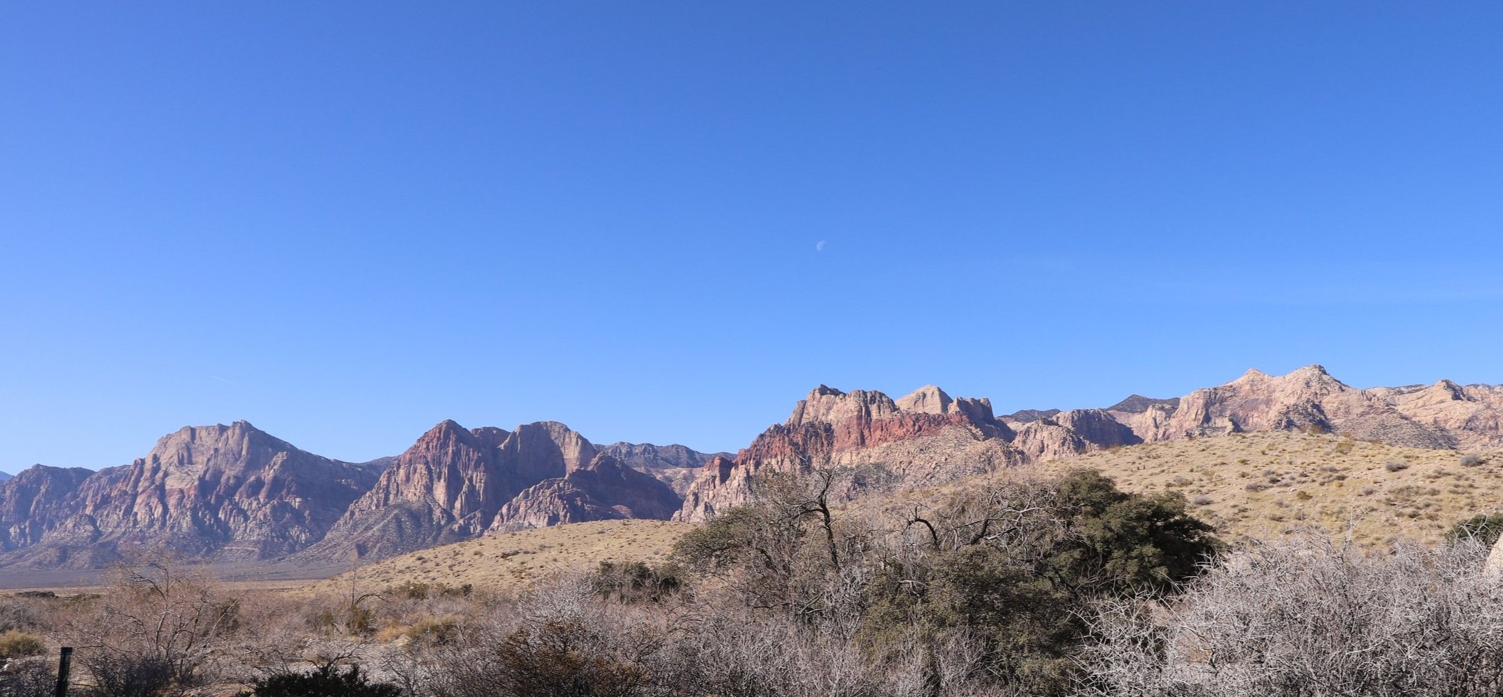
Red Rock Canyon with the thick stripes of mineral deposits within the mountains
Planning Your Trip to Red Rock Canyon
Red Rock Canyon Timed Entry Reservations
Two important logistical items if you plan to visit Red Rock Canyon: First, there is a reservation system. This is independent of actually paying to get into the park. Only a certain number of visitors are currently allowed into the park (specifically the one-way scenic drive within the park). You need to go to the following website and apply for a timed-entry onto the scenic drive: Red Rock Canyon Reservations. If this link is broken, search in Google for “Red Rock Canyon Reservations” and look for the RedRockCanyonLV website. The reservation itself is free, but you will need to also pay to enter the park. Snag that reservation as soon as you know the date/time you would like to hike.
When to Visit
The second consideration is when to visit. Technically you don’t need a reservation to hike June 1-Sep 30. The reason you can hike here without a reservation during the summer months is that it’s really really hot in Las Vegas in the summer, so there are not many visitors. Flights to Las Vegas are often cheap, so this city may be your flight in and out, but don’t stay in the city if you travel in the summer. Instead, head up in elevation to find those cooler temps - for example: Bryce, Sequoia, or Yosemite National Parks.
Payment
Red Rock Canyon is part of the National Park System even though it’s a National Conservation Area. You can get in for free with an annual National Park Pass. If you don’t have this, then there will be an entry fee you will need to pay. Currently in 2023, it’s $20 per car for the day. And remember, you need to enter the park at the time of your timed-entry reservation.
Distance
Red Rock Canyon is a little over a 30 minute drive from the Las Vegas Strip, depending on traffic.
Hiking with Kids
There are lots of great options for shorter hikes with kids at Red Rock Canyon, however, if you haven’t yet been to Valley of Fire (also assuming you traveling in a non-summer month) consider looking into it. Valley of Fire has more dramatic features and lots of nooks and crannies for kids to play in as they hike. If you are not hiking with kids, Red Rock Canyon is a better choice due to the longer hiking options.
If you would like to learn more about Valley of Fire, click here.

Lost Creek Children’s Discovery Trail
Hiking Red Rock Canyon

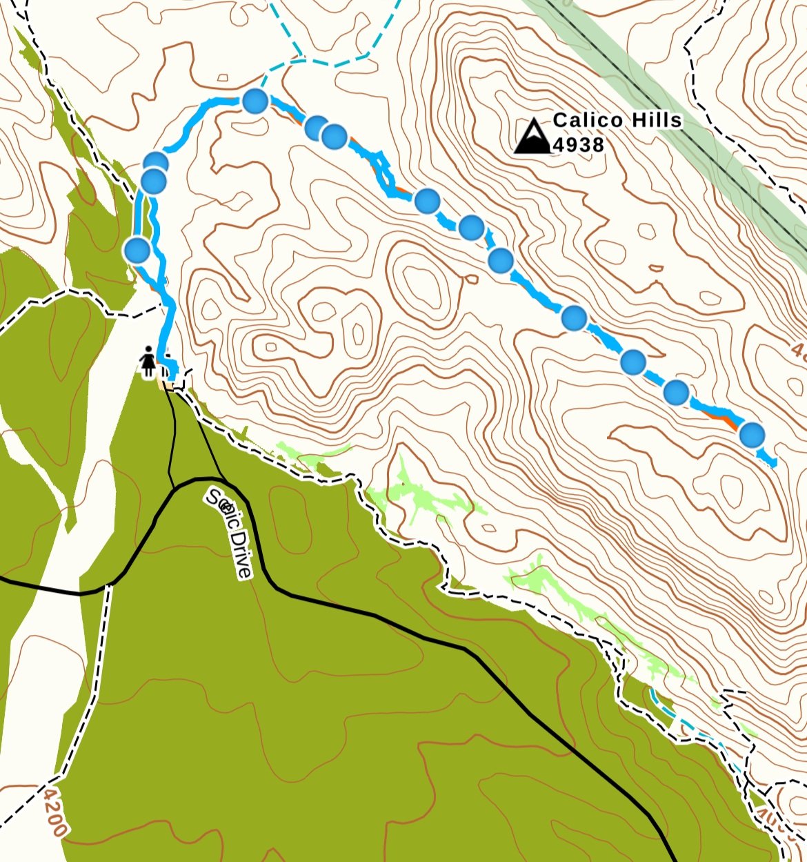
Red Rock Canyon Map from GAIA app. 1) Visitor Center, 2) Calico Tank Trail, 3) High Point Overlook, 4) Petroglyph Wall, 5) Lost Creek Children’s Discovery Trail, 6) Ice Box Canyon
I enjoyed an entire day here with my boys in March 2021 (then aged 8 and 12 years old). In order, we hiked Calico Tanks, stopped to see the view at High Point Overlook, walked to Petroglyph Wall, hiked Lost Creek Children’s Discovery Trail, and Ice Box Canyon.
The only other place that I wished we had stopped was Calico Hills. This was one of the first parking lots along the scenic one-way road, and I was anxious to get started hiking as I had a full day planned. But being that it’s a one-way road, I couldn’t go back at the end, and all day long I thought about those multi-colored rocks that I hadn’t stopped at to explore.
If I were traveling without younger children, I would have also like to hike Turtlehead Peak.
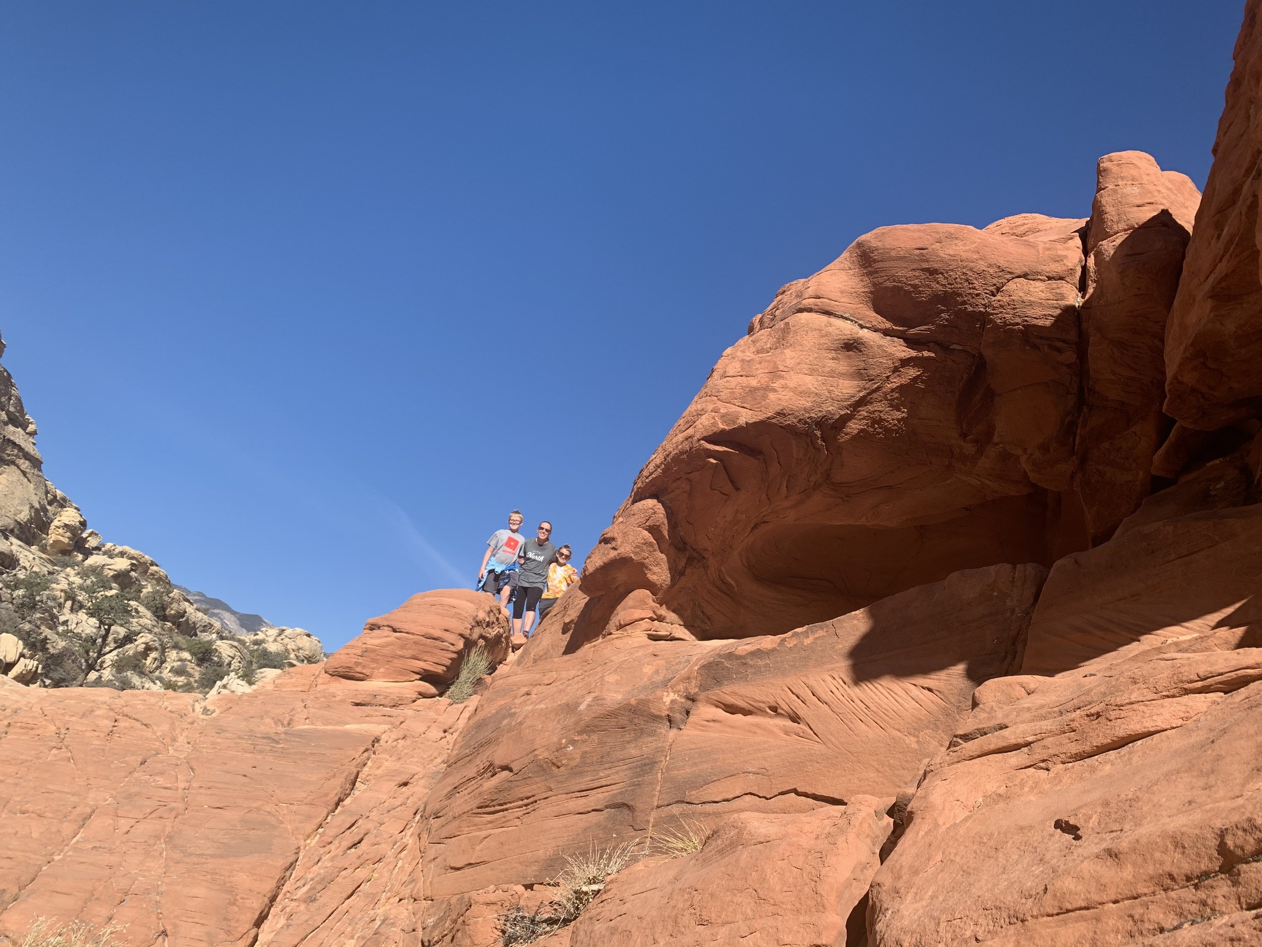
Calico Tanks Trail
Visitor Center
In addition to regretting not stopping and climbing the rocks at Calico Hills, the other fatal flaw I made was failing to stop at the Visitor Center when I first arrived. It’s always my preference to get started hiking in the morning and enjoy the visitor center when I’m tired; plus I can reward the boys after they’ve hiked. The very first stop after you pass the timed entry however is the visitor center, which I skipped. At the end of the day, both of my kids wanted to get t-shirts and pick out a stuffed animal as souvenirs. I had to go through the timed entry location again, but this time, I did not have a ticket with the current time. I did a bit of begging, promising we were only going to stop at the visitor center. They let me me in, but were visibly not happy about it. If you think you might want to stop at the visitor center, hit this first in your day.

Location of Red Rocks Visitor Center (marked by the “i”) - It’s the first turn off as you enter the Scenic Drive.
Calico Tanks Trail
2.4 miles / 390ft in elevation gain
Calico Tanks Trail Map from GAIA app
I would rate Calico Tanks as a moderate to moderately easy trail with the note that towards the end, there is slick rock and boulders that you will need to climb if you choose to complete the trail. As you’ll hear below, the end view was the only thing I didn’t like about this trail, so if you prefer to just stroll amongst the amazing colored rocks and skip the ascent, you will still have a fantastic hike. Out of all of the hikes we did, this was my favorite.

Calico Tanks Trailhead
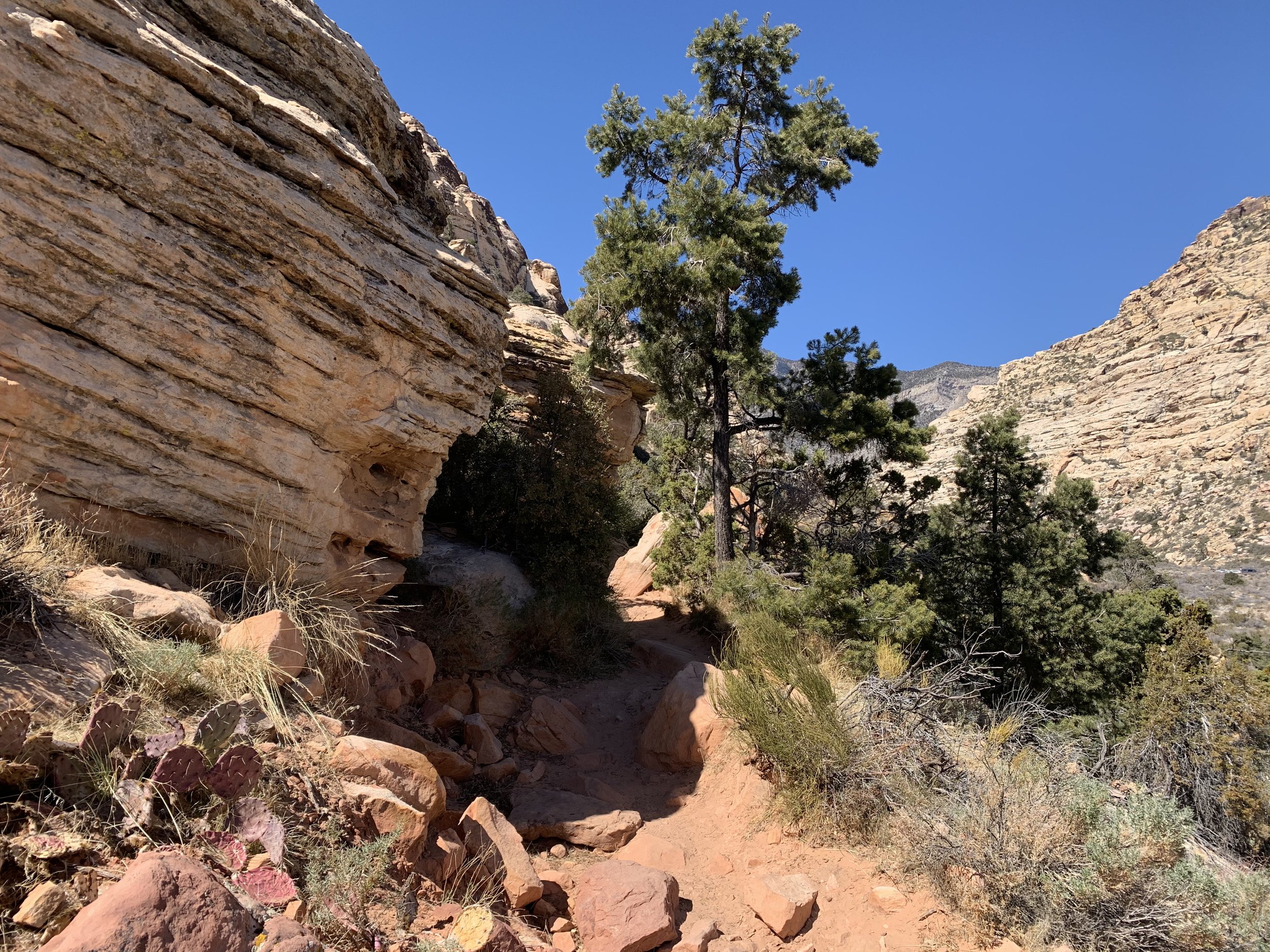
Straight off the trailhead, BAM, there is this amazing rock! It’s too bad it wasn’t lit up in the sunlight, but you can still see clearly, that rock is two strikingly different colors. Imagine how dramatically the environment must have changed suddenly to create those two layers.

Calico Tanks
Along the beginning of the trail, you can look off to your left and enjoy the mountains. I live in MN where, unfortunately, we do not have mountains. I don’t need too much to calm down from my “busy working mom” life when I’m hiking in the southwest. Just gazing at the mountains will do it.

Hiking up Calico Tanks
Eventually the sand trail turns and starts slowly climbing upwards into the rocks. My boys liked this trail. They would run ahead of me and explore under and around the rocks looking for critters and climbing up the larger boulders while they waited for me to catch up. This was my first hiking trip with them when they were consistently in the lead. Did I get old or did they just get faster?

Calico Tanks Trail
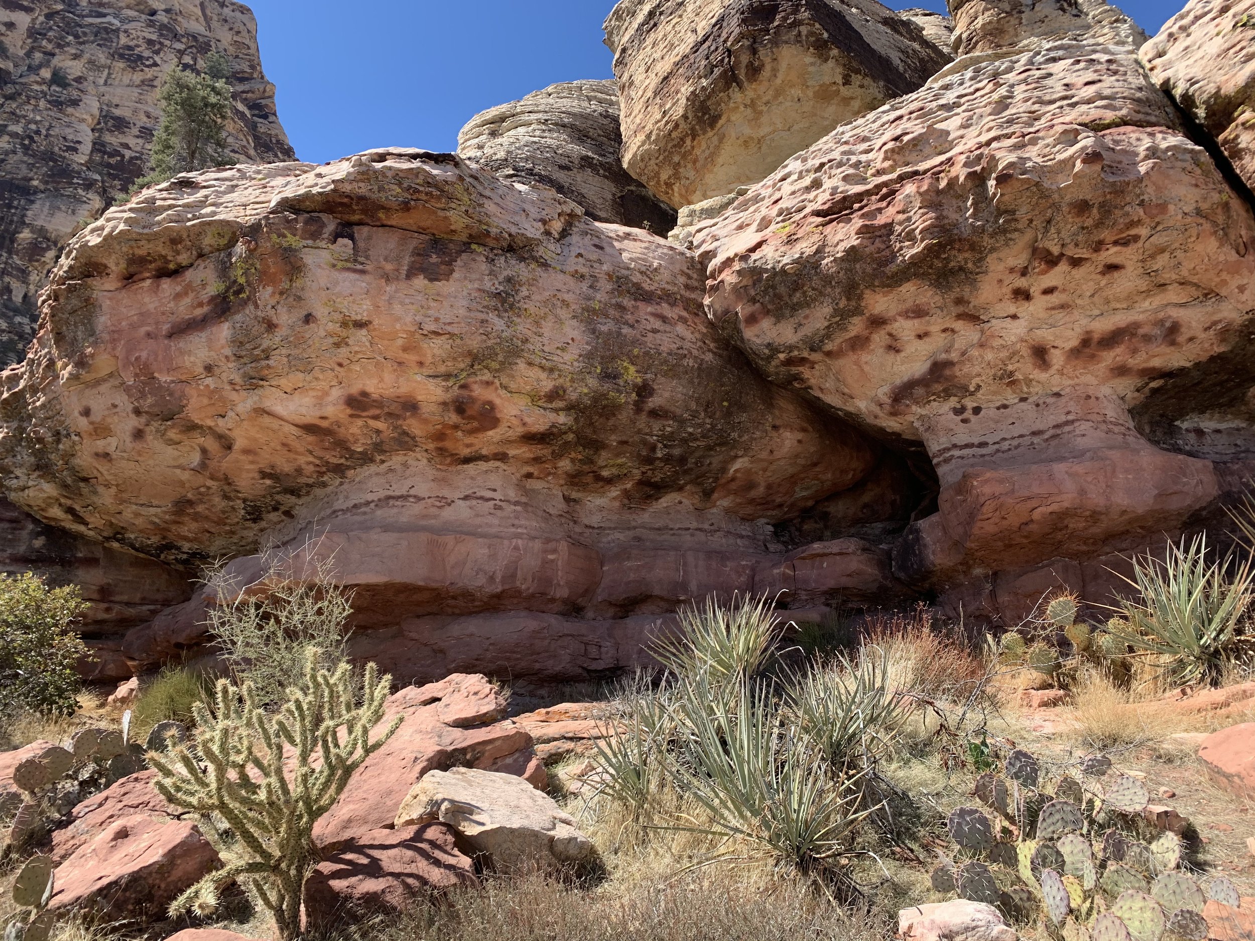
Lots of pictures along this trail as I really loved the various colors of the rock.

Steps along Calico Tanks (heading back down towards trailhead)
The above picture is actually of us hiking back, but it does show the steepness of the end of the trail for you to note if mobility is difficult.

Calico Tanks near the end of the trail
The last part of this trail is the ascent, and a lot of the trail is over the rocks themselves. I loved this part of the trail - the challenge, the colors, wondering what view I was hiking towards and how could it be prettier than what I was hiking past.

Nearing the end of Calico Tanks
And then we hit the end of the trail. And we were greeted with a view of the Las Vegas Valley, it’s smog, and… the Stratosphere. I was so let down. This is a terrible view of our planet and how we are not taking care of it to ensure that we preserve it for our children’s children’s children.

Views from end of Calico Tanks Trail
There were fun rocks to climb up and pose in front of at the end of the trail, but again, Stratosphere in the background. I don’t have something against the craziness of the Las Vegas Strip, and I truly am fascinated by the Bellagio Fountains, it’s just not exactly want I want to be confronted with as I’m hiking. The wilderness surrounding Las Vegas has so much more to offer than what you’ll find within.
For reference, this hike took us 2 hours.
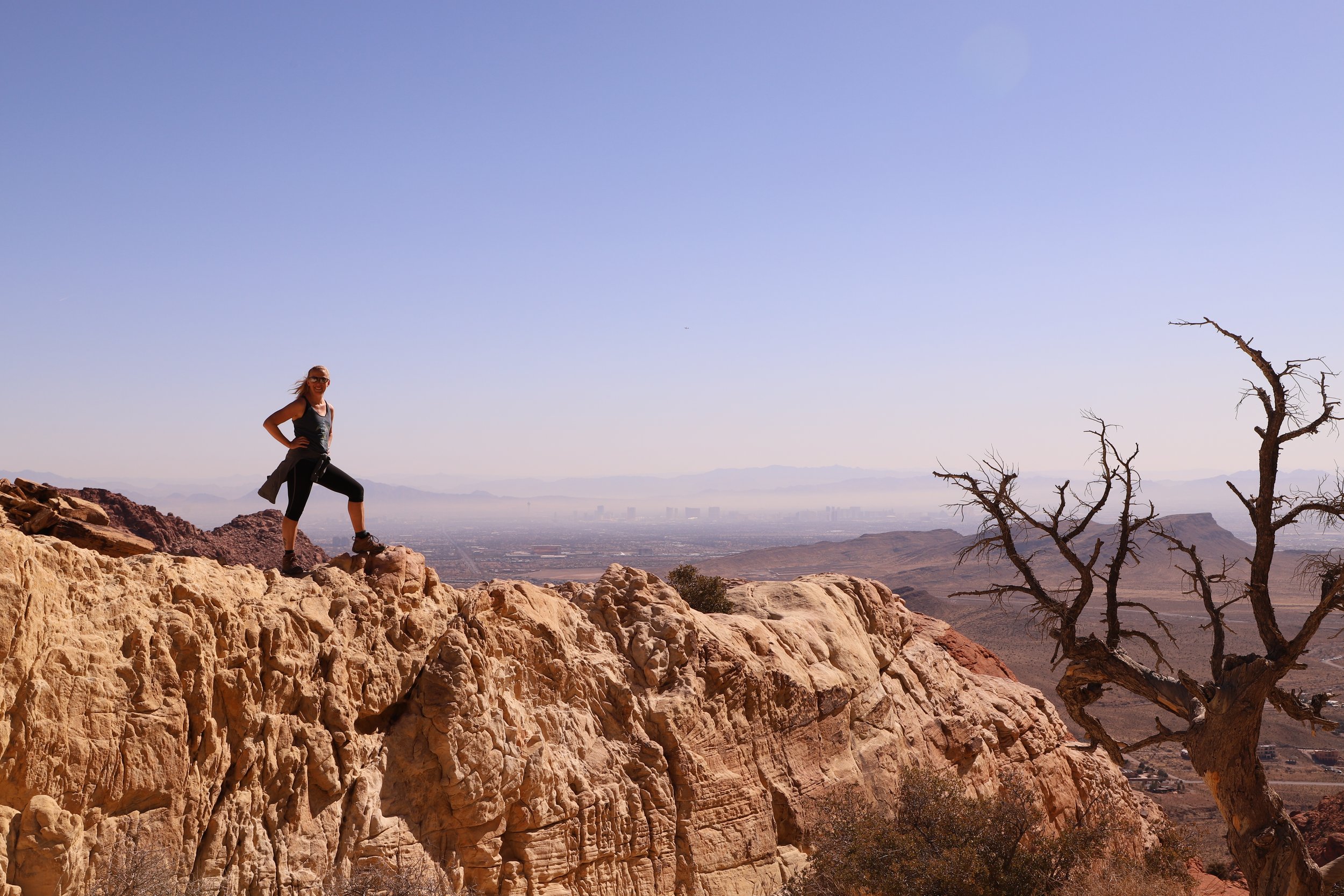
End of Trail - View of Las Vegas Valley from Calico Tanks
High Point Overlook

View from High Point Overlook
There isn’t a hike at the High Point Overlook, but it is a pretty place to stop along the scenic drive and observe the mountains that surround you. We enjoyed our picnic lunch here.
Petroglyph Wall Trail
0.4 miles / 50ft elevation gain

Petroglyph Wall and Lost Creek Children’s Discovery trails just off of the Scenic Loop Drive from GAIA app
To get to the Petroglyph Wall Trail, you will momentarily turn off of the Scenic Drive and onto Rocky Gap Road. Note that Rocky Gap Road is a two way road, so you will just turn around to return to the Scenic Drive.
This was not an exciting trail and took us only twelve minutes to stroll to the wall, take a picture, and walk back to the car, but I do love looking at petroglyphs and trying to imagine what the message means. A quick stop if you are looking for those really short hikes.

Petroglyphs along Petroglyph Wall Trail
Lost Creek Children’s Discovery Trail
0.83 mile loop / 80ft elevation gain

Lost Creek Children’s Discovery Trail Map from GAIA app

Lost Creek Children’s Discovery Trailhead
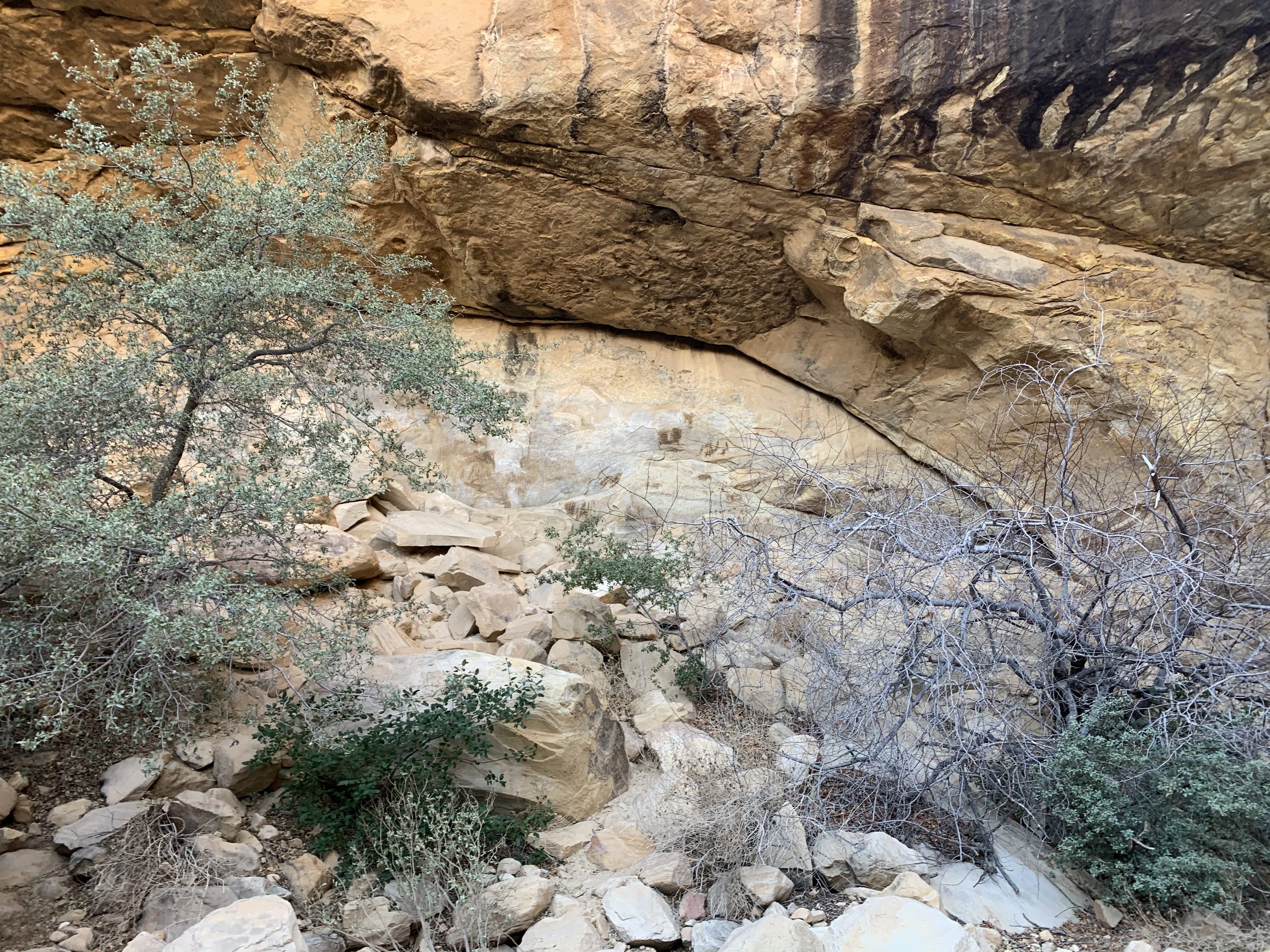
Before returning to the Scenic Loop Drive, we stopped at the trailhead for Lost Creek Children’s Discovery Trail. This was my second favorite hike. It didn’t have amazing views or any particular feature that I would describe as noteworthy, but it was one of those rare trails that had a magical feeling to it. Although it was a short trail, we spent almost an hour here, reading the signs, exploring the ruins, and feeling like we were a part of the trail. We enjoyed this spot within the park all to ourselves.
Lost Creek Children’s Discovery Trail
This trail has several cave-like places to explore and signs of people who lived in the region at various times.
Lost Creek Children’s Discovery Trail
I think part of the reason I liked this trail so much were the interpretive signs. They had interesting and relevant facts. Lots of the information focused on water, and as we gazed around and looked at the desert we were in, we could see signs of where water sometimes would be, for example there is a boardwalk over a portion of the trail that was quite dry while we were there. But we did start to wonder as we were reading and talking along the hike - where are all of these plants getting their water from? And then we stumbled across this sign that showed a Mesquite with 150ft deep roots - look at that drawing! The roots are multiple times deeper than the actual tree. Each plant I greeted along the trail after reading this sign I met with a greater appreciation, realizing there was much more to it than I could see.

Simple interpretive signs along the Lost Creek Children’s Discovery Trail with interesting and relative facts give the desert
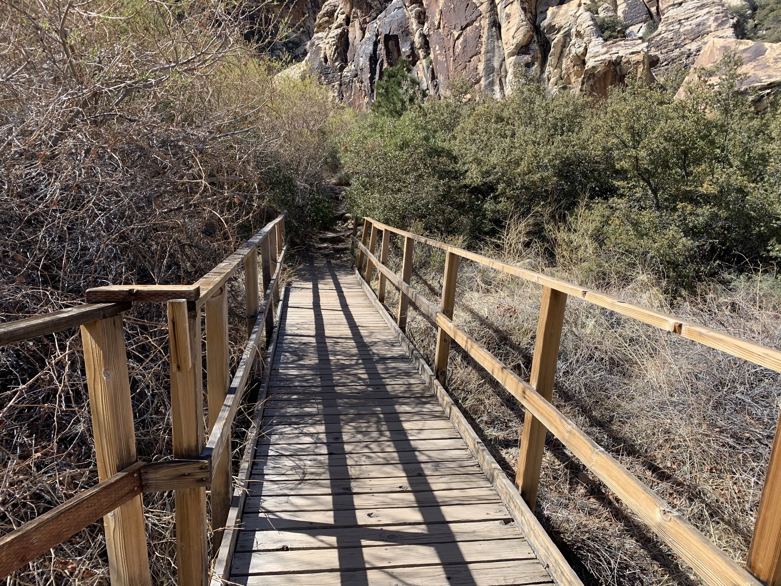
A couple more pictures here to show the diversity along this trail.
Lost Creek Children’s Discovery Trail
Lost Creek Children’s Discovery Trail
Ice Box Canyon
2.5 miles / 600ft elevation gain

Map of Ice Box Canyon Trail. Clip of the Lost Creek Children’s Discovery Trail is at the top. From GAIA app

Ice Box Canyon Trailhead
Back on the scenic drive, our last stop was at the trailhead for Ice Box Canyon. This was the only place we needed to wait patiently for a parking spot, likely because it was simply later in the day. It was less than 10 minutes we waited though. Despite the trailhead parking lot being full, the trail itself was pretty quiet.

Ice Box Canyon
Essentially this trail walks towards the canyon that you face when you start the hike. Up until you reach the canyon, the trail is pretty easy although not a smooth walk. This is more of a stare at your feet sort of hike and pause to look around. Until we got close to the canyon walls, we were also exposed in the heat of the midday sun.
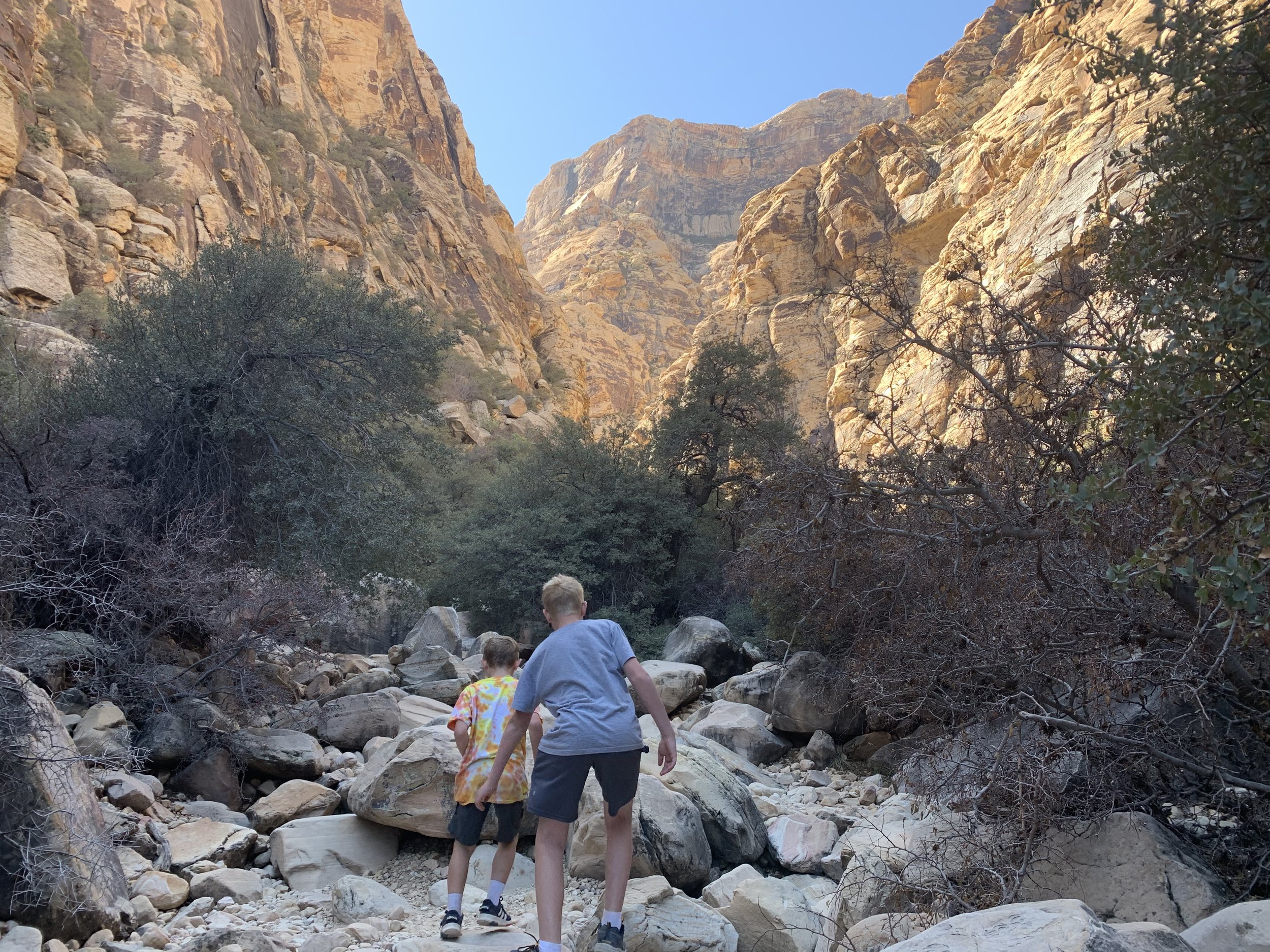
Extremely rough terrain in Ice Box Canyon
By the time you get to the canyon, the trail pretty much disappears and you just hike in the wash in the middle of the canyon. Remember canyons are formed by violent water actually tearing out the rocks of the walls. As such, there is quite of a bit of the “canyon” left at its base. This “trail” within the canyon essentially involves climbing up and over a boulder, followed by climbing up and over another boulder, and repeat the majority of the way to the waterfall. This was a perfect trail for two elementary aged boys! It was not the perfect trail for the majority of the hikers we passed on our way back to the car who frequently asked us if the trail got easier. Several of them turned around when we said it didn’t change. I don’t know how the park could possible make a trail that wouldn’t wash way in such a tight canyon.
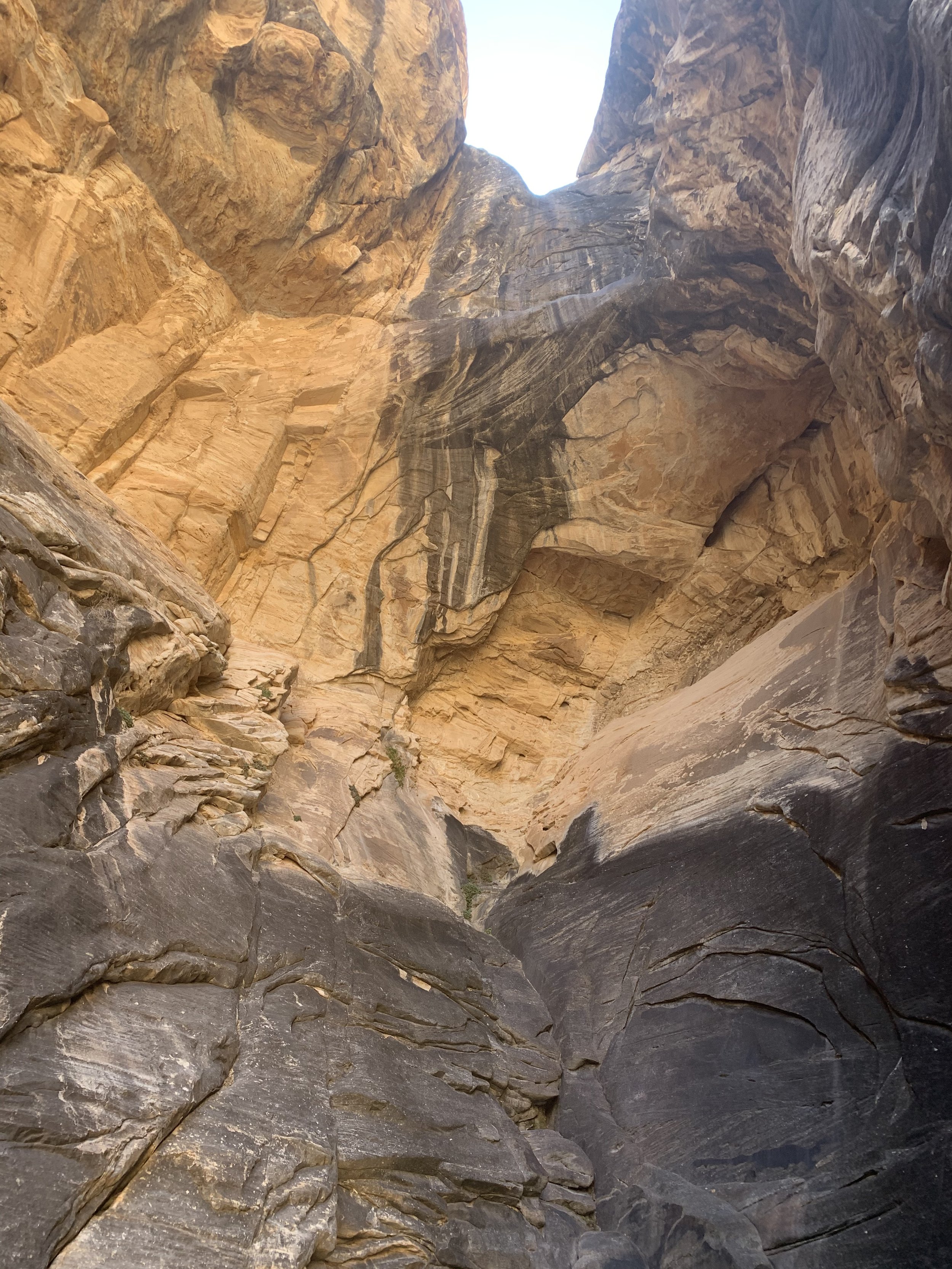
“Waterfall” in Ice Box Canyon
Unfortunately, there wasn’t any water flowing when we made it to the end of the trail, but I honestly hadn’t expected to see water as the entire trail was dry. You can tell though that this is sometimes a waterfall by the color difference on the rock wall.
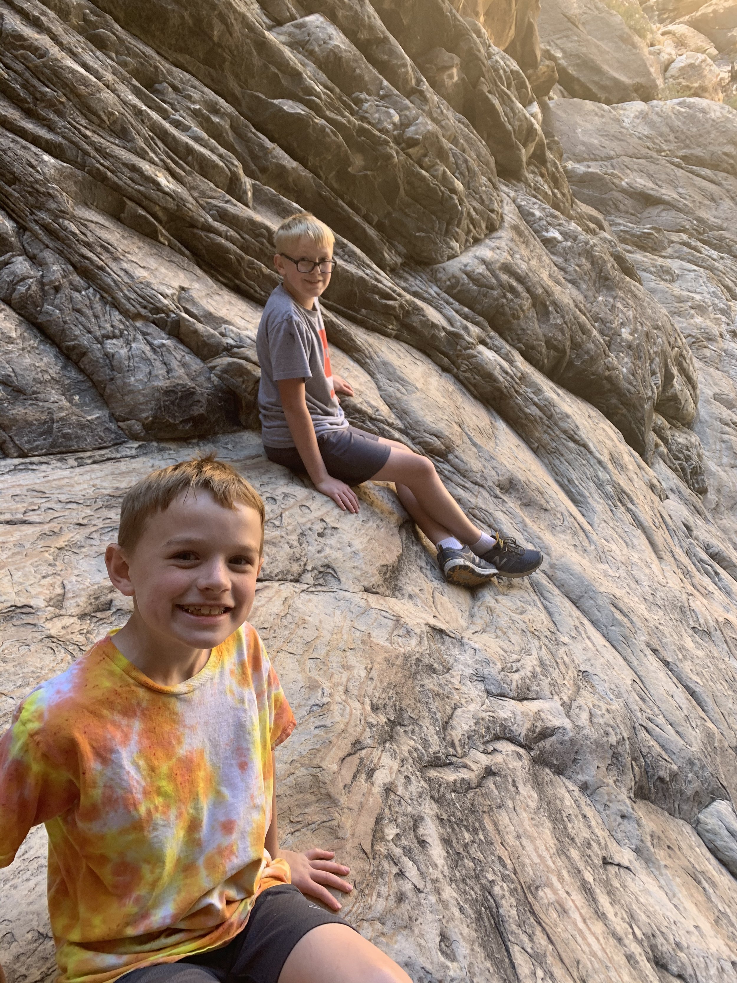
Scaling up the rocks at the end of the Ice Box Canyon
Although we did not get to see a waterfall, because the rocks were dry, we were able to climb up them and see the water tanks left behind.
There are occasional moments when hiking with my boys that I pause and wonder if what we are doing is a great idea. Climbing up to see the water tanks was one of those moments as the rocks were worn pretty smooth. I did start to worry that I was going to be the mom that fell into the water tank in Ice Box Canyon… There was a group of college-aged men already up there though, and with their encouragement and help guiding us on how to climb up, we did make it just fine. We were rewarded with an incredible view and one of my favorite pictures within this park (below).

Water Tanks from the Dry Waterfall in Ice Box Canyon - view looking back out into Ice Box Canyon back towards the Trailhead
More from www.NatureImpactsUs.com
Posts are linked to each below pin.