
Canyonlands - Mesa Arch
If you enjoy my blog, please consider signing up below to get email notifications of my latest posts. I will not share your email.
Planning Your Trip to Canyonlands National Park
If you are planning a trip to Moab, and thinking about hiking both Arches and Canyonlands National Parks, the first thing to realize is that Canyonlands is four times bigger than Arches, and more importantly, it has three distinctly different districts within the park which do not have roads that connect. The three districts are: Island in the Sky, the Needles, and the Maze. The drive between the Island in the Sky and Needles visitor centers is two hours (one-way). The Maze is only accessible by 4x4 vehicles, therefore I have not made it to this section of the park yet, similar to most individuals who have visited Canyonlands. See the below map where I have the different sections highlighted, and the stars indicate the different entrances into the park.

Three Sections of Canyonlands National Park
Island of the Sky is the district of the National Park that has canyons formed by both the Colorado and Green Rivers, with the pinnacle point being Grand View Point, where the rivers merge together. Personally, I think you can see most of Island in the Sky from your car, or with pretty short hikes. If you are going to Island in the Sky, also consider stopping at nearby Dead Horse Point State Park, which actually has better views of the Colorado River than can be seen in Canyonlands.
View from the main drive through Island in the Sky. The La Sal Mountains are in the background.
The Needles district of Canyonlands is completely different. There’s no canyons, which makes me wonder a little bit why the name Canyonlands was picked for the entire park (versus a district name). The Needles is full of these dramatic colored hoodoos - spiral-shaped rocks formed by the wind. The overall views of Canyonlands are more dramatic in the Island of the Sky district, but my favorite hikes are in the Needles - specifically, my favorite hike in the entire park in Chesler Park Loop.

The Needles Hoodoos along Chesler Park Loop
Where should you spend the night(s)?
Island in the Sky
Moab is the closest city to Island in the Sky, and it’s right next to Arches, and several other non-National Park trails to arches and canyons. Moab has several hotels and restaurant options, as well as campgrounds. If you love to hike, you could easily enjoy 5+ days in Moab. Plus there is mountain biking, off-road vehicles, and whitewater rafting if you are looking for a more diverse vacation.
The Needles
If you are hiking in the Needles, there isn’t much lodging close by, short of camping. Moab is an hour and a half drive to the Needles Visitor Center, which is fine for one day of hiking, but likely too far to plan for multiple days of driving back and forth. Monitcello is the closest town at one hour away, but the choice of hotels is limited.
One other off-the-beaten-road option to consider for lodging if you’d like to hike in the Needles is Monument Valley. This is a 2.5 hour drive from the Needles Visitor Center, but depending on where you are starting from or ending up on your road trip, Monument Valley is another cool place to visit, and then you can hike the Needles on the day you drive to or from Moab, UT. Monument Valley has only one hotel - Goulding’s Lodge, but I’ve stayed there twice on my treks to Canyonlands, and I’ve found it to be a nice and decently priced hotel.
Monument Valley makes a great destination if you are driving between Page, AZ, and Moab, UT. You can hike the Needles district of Canyonlands as you travel between Monument Valley and Moab. Here is a link to my post on visiting Monument Valley Trial Park
Exploring Island in the Sky
The Island in the Sky portion of Canyonlands involves canyons cut by both the Colorado River (east side) and the Green River (west). It looks like canyons inside of other canyons when the Green River joins the Colorado River at the southern-most section of this part of the park, marked by the Grand View Point. This part of the canyon is smaller than what you find at Grand Canyon National Park, but you’ll likely feel this is a more intimate place to feel connected with the canyon due to multiple-fold less people in Canyonlands. The colors of the canyon are similar in both National Parks.
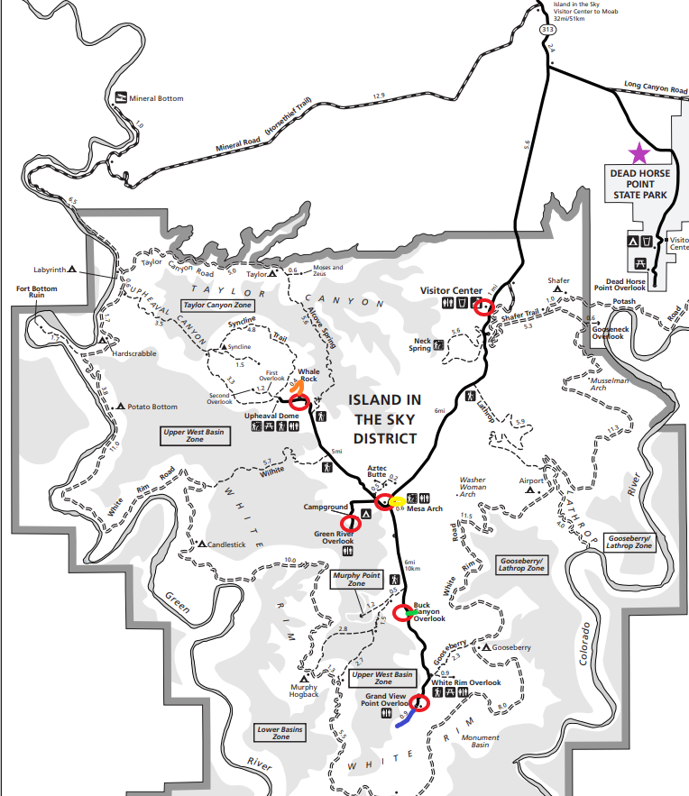
1 - Mesa Arch, 2 - Buck Canyon Overlook, 3 - Grand View Point Overlook, 4 - Whale Rock, 5 - Green River Overlook, 6 - Dead Horse Point State Park
To see the majority of the views that Island of the Sky has to offer, I think you can cover it in six stops that I have marked in red circles on the above map, and four of those stops include short and easy to moderately difficult hikes. I have the hikes marked with colors that I will refer to below.
Visitor Center
Nothing requires you to stop at the Visitor Center. You shouldn’t need to check on trail conditions or pick up any permits, unless you are heading off on one of the 4x4 roads. There are signs up throughout this park that also explain what you are seeing as you stop at the various view points.
If you want a Canyonlands souvenir though, the visitor center is the best place to shop as most stores in Moab simply have things that state Arches or Moab. If you are collecting National Park Passport Stamps or are working on a Junior Ranger Badge, both things can also be obtained at the visitor center. Expect this to be a quick stop though.
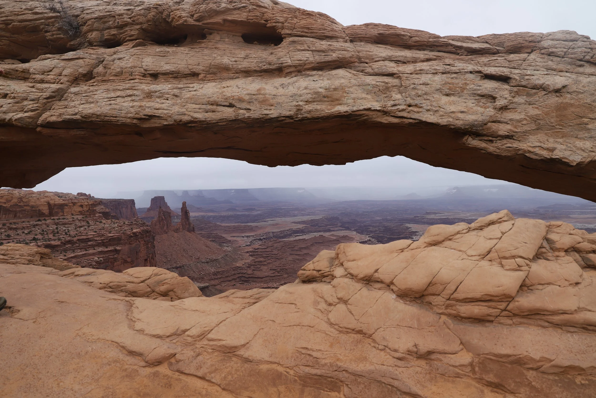
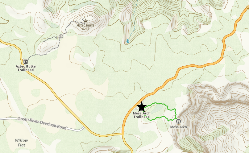
Mesa Arch
0.5 mile loop / elevation gain - N/A
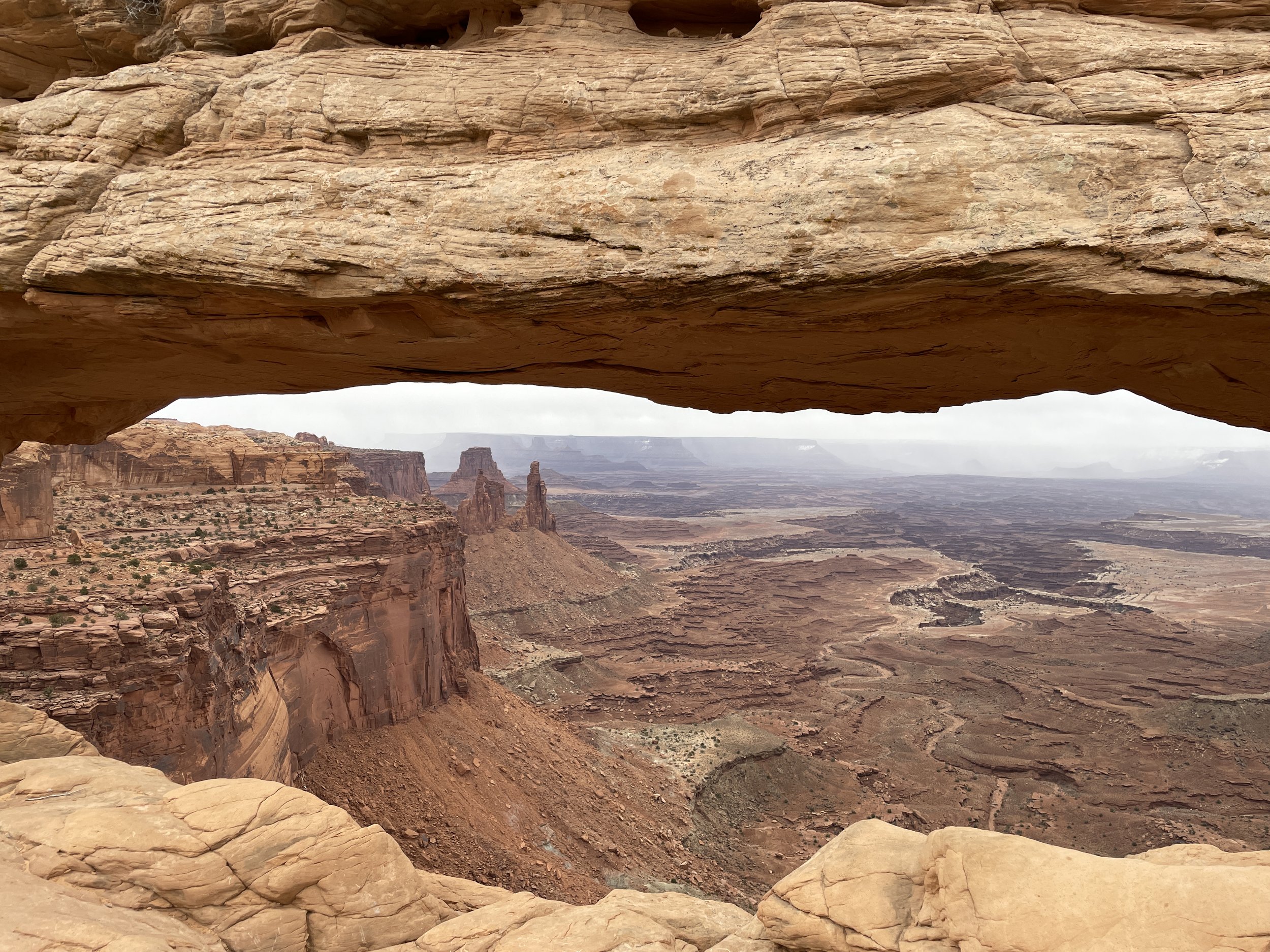
Mesa Arch
Mesa Arch might be the best sunrise photo opportunity in the park, if you can convince the people traveling with you to get out of bed to actually see the sun rise, which so far, I have not yet been able to do. This trail is marked in yellow on the above map. This is a short loop, but you will need to get our your car to view the arch. It’s a good point in time anyway to stretch your legs.

Mesa Arch
Buck Canyon Overlook
0.1 miles out-and-back / elevation gain - N/A

View of Buck Canyon Overlook
This view of the canyon is a little different at Buck Canyon Overlook than from Grand View Point, so it’s worth stopping here. The hike out and back is just 0.1 miles, but you can see the view pretty much from where you get out the car. This trail is marked in green on the map above.

Buck Canyon Overlook
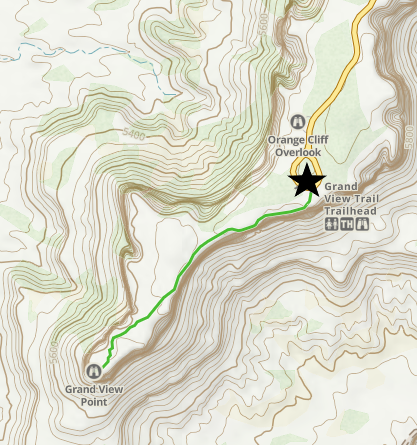
Grand View Point Overlook
1.8 miles / elevation gain - 75ft

Grand View Point Overlook
This trail starts off paved and leads to an impressive overlook. If you want to keep going, there are more and more views of the canyon, and you can of course turn around at any point. There is a bit of up and down along this trail, making it a moderately difficult hike. This trail is marked in blue on the above map. You will be able to see the rivers here.
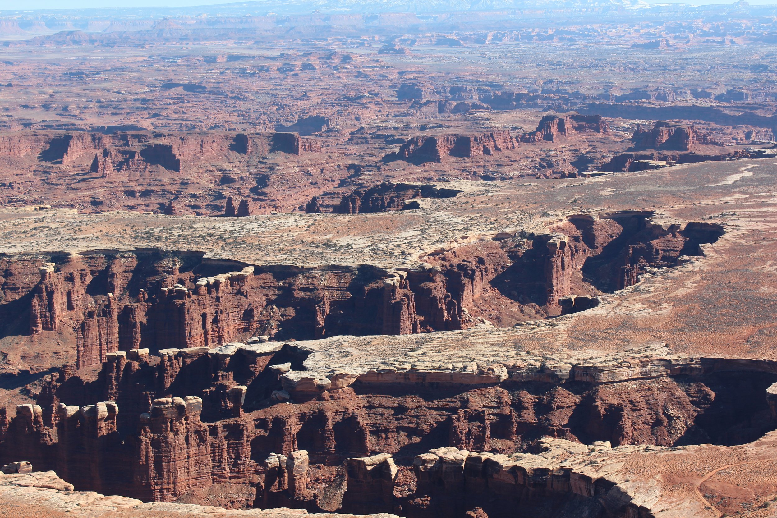
Views from the Grand View Point Trail
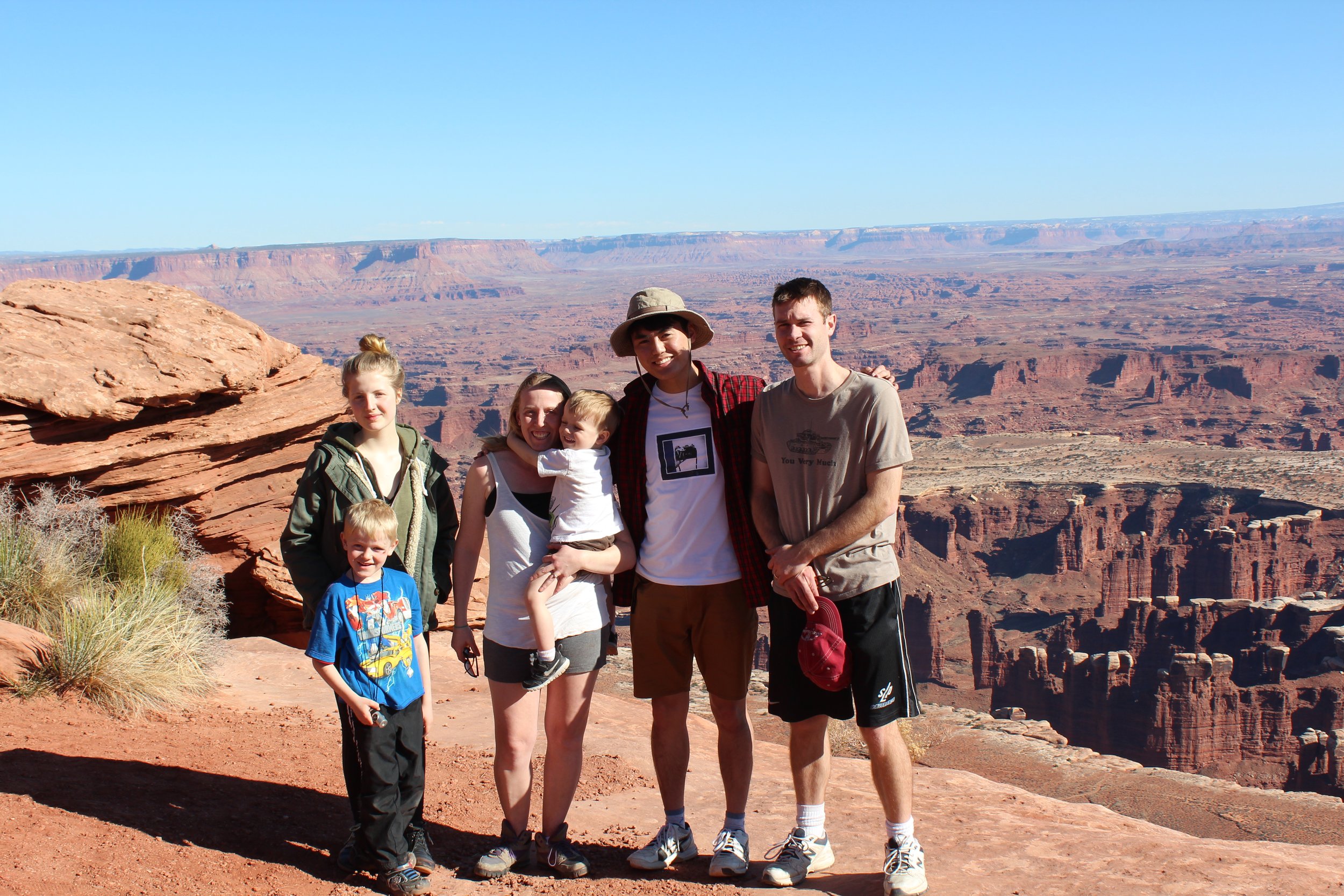
Grand View Point Overlook Trail - Picture from our 2015 Spring Break - the craziest to date of all of our Spring Break road trips driving from Minneapolis all the way to the Grand Canyon with a minivan, two exchange students, a six year-old, and a two year-old. If we could do it, I guarantee you can have the awesome road trip too!

View from Grand View Point Overlook
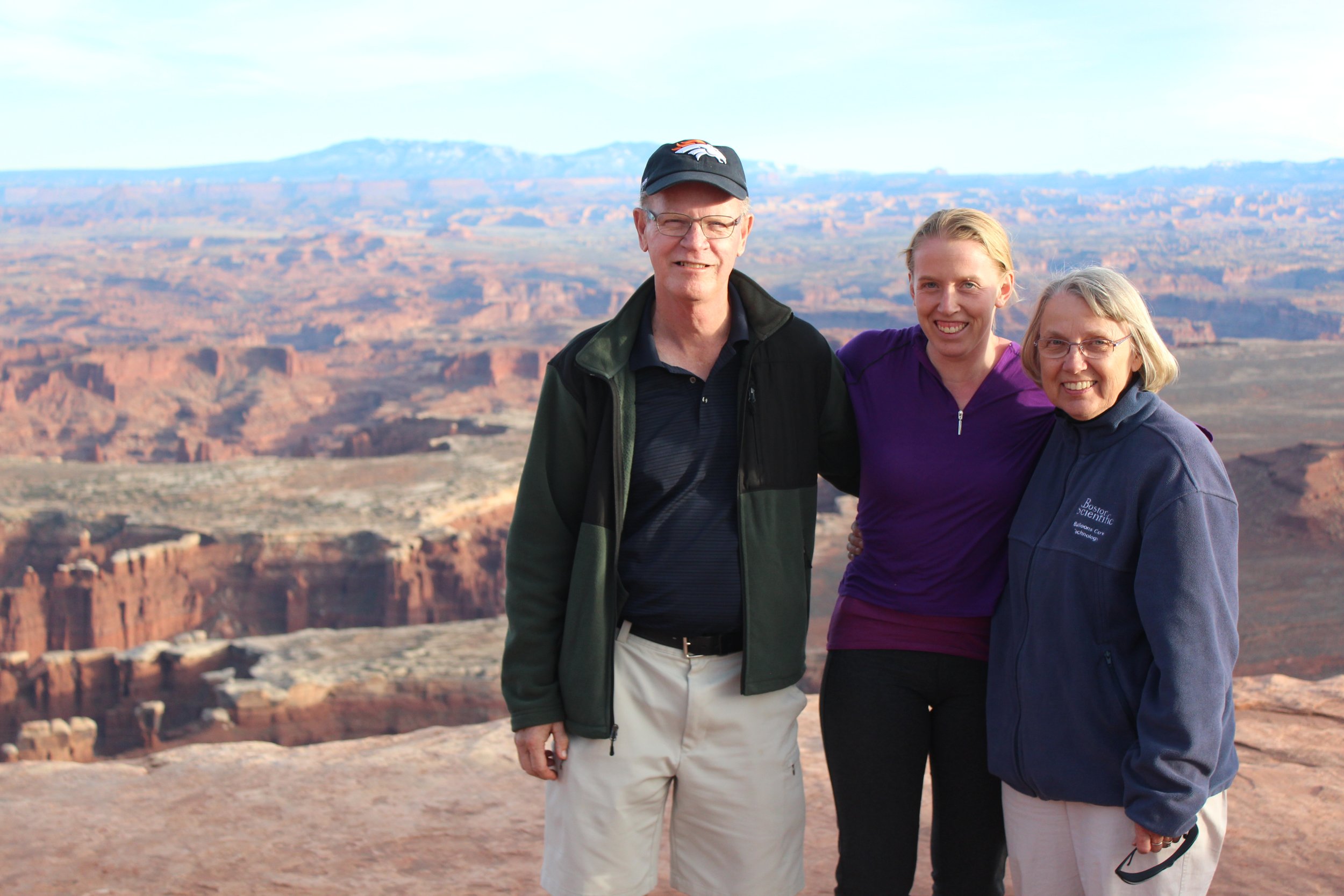
Hiking with my parents in March 2016
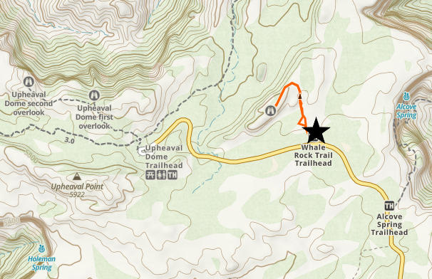
Whale Rock
0.8 miles / elevation gain - 220ft

View of the Green River from on top of Whale Rock - hiking on a rainy day in March 2023
If you are looking to get out of the car and do a slight amount of rock scrambling along some slickrock, Whale Rock is a great short hike option. I have this trail marked in orange on the map above.

Views from Whale Rock of the Green River
The trail takes you up and onto Whale Rock where you can explore as far as you’d like.

Whale Rock
Green River Overlook

View from Green River Overlook
If you are looking for a sunset picture, views from the Green River Overlook might be your best option. We’ve been to Canyonlands Island in the Sky four times. On the third time in March 2018, we honestly weren’t looking to hike, we just wanted to watch the sunset and observe the night sky. We had spend the whole day driving and just made it into the park for the sunset. We had bought a telescope specifically for this night in our trip, because the moon was rising late and we should have had the perfect night sky. We waited for dusk, and then just as night was falling, a big cloud swept across the sky, and covered up every single star… Sometimes you just can’t win, but it makes those rare moments when everything actually does work out simply amazing.
Dead Horse Point State Park
On the map above, I’d also put a star next to Dead Horse Point State Park, which is obviously outside of Canyonland National Park, but it’s just a couple minutes to detour before heading back to Moab. You will need to pay the additional UT State Park fee for admission, but if you are looking for the best view of the Colorado River, it’s here, at Dead Horse Point Overlook. The overlook is at the very end of the park, and it’s more of a walk from the parking lot to view, although you can continue to walk along the rim further if you wish.

Dead Horse Point Overlook - Dead Horse Point State Park
Exploring the Needles
The Needles district looks nothing like Island in the sky, nor does it resemble a canyon, despite the park’s name. It’s marked by these huge rugged hoodoos that look a little bit like big needles. Each trail takes you some place distinctly different, which makes it such a fun part of the park to explore.
Consider either a day drive out to the Needles district if you are staying in Moab, or plan for hiking here on your way traveling between cities.
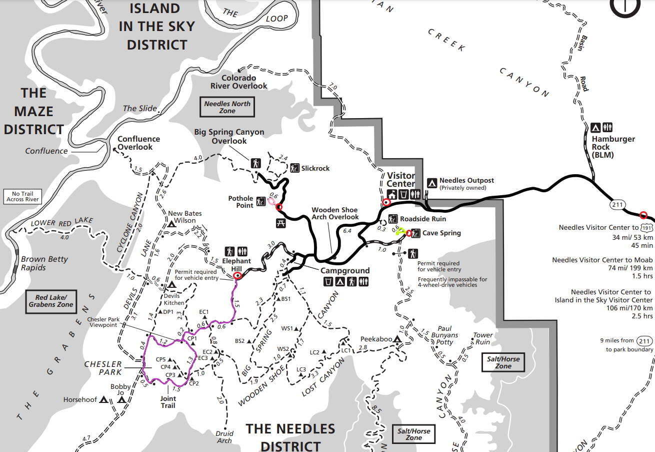
7 - Newspaper Rock, 8 - Cave Spring, 9 - Pothole Point, 10 - Chesler Park
I have five proposed stops with two short hike options or one long hike option for one-day hiking itineraries.
Newspaper Rock

Newspaper Rock
The first circle I have on the map along UT Hwy 211 is not particularly marking anything on the map. As you drive into the park along 211, you will see a sign for Newspaper Rock (it’s a little further away on a section of the map not shown). There’s a big sign with a decent sized parking lot. This stop does not require any hiking. This rock is actually visible from the road, but you’ll be driving to fast to appreciate it.
According to the road sign, different petroglyphs on Newspaper Rock have a time spread between the earliest image and the most modern image of more than 2,000 years, which is pretty incredible to look at a human history record with that long of a timeline, as viewed now in the twenty-first century.

Newspaper Rock
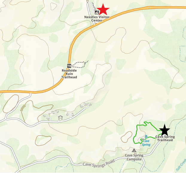
The Needles Visitor Center
This is a really small visitor center, but if you are heading out on any long hikes, make sure to double check the weather and the trail conditions with the Park Rangers. There is also a small gift store.
Cave Spring
0.6 mile loop / elevation gain - 67ft

Cowboy Camp
This is a short and pretty easy hike that I have highlighted in lime green on the above map for the Needles. The only thing that makes this trail potentially difficult is that there are two ladders you will need to climb. Assuming that you’re going to be more comfortable hiking up the ladder, rather than down, plan to hike in a clockwise direction. A reminder of which direction to hike is included on the main trail sign.

Cowboy Camp
The first interesting thing on this trail that you will find is a historic cowboy camp. Although this trail is called “Cave” Spring, I’m assuming it’s named after this spot where the cowboy camp is located. It’s not actually a cave, but more of an overhang that protects the camp.

Inside the “cave” which is really more of just an overhang
If you explore the cave a little further, you will find pictographs (paintings) of lots and lots of hand prints. These are from Puebloans. The hand prints made me wonder if they are each from a different person. Maybe they had to overcome some type of challenge and then could add their hand print? Or maybe it was a rite of passage when they reached a certain age?

Handprint pictographs along the “cave” wall
Past the camp is the first ladder. It’s pretty sturdy, and rather a fun hiking challenge. But if ladders aren’t your thing, this might not be the perfect hike for you. There is a second one later on that is very similar.

The Cave Spring Trail requires the use of two ladders
The rest of the trail then loops back to the parking lot on top of the rocks.

Cave Spring Trail
Hiking with my seven year old son along Cave Spring Trail
View from the last part of the Cave Spring Loop
Pothole Point
0.6 mile loop / elevation gain - 30ft
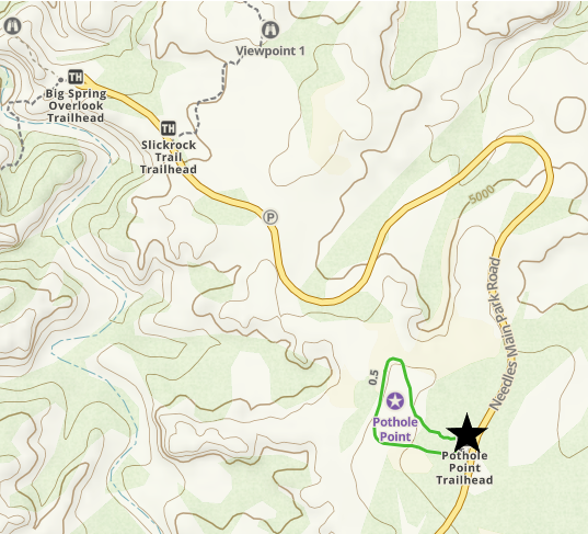

Pothole Point
Pothole Point is a second quick and easy hike through the Canyonlands Needles District, which can easily be combined with the Cave Spring Trail. The direction of the loop you choose to hike doesn’t matter on this trail. This trail is marked in pink on the above map.
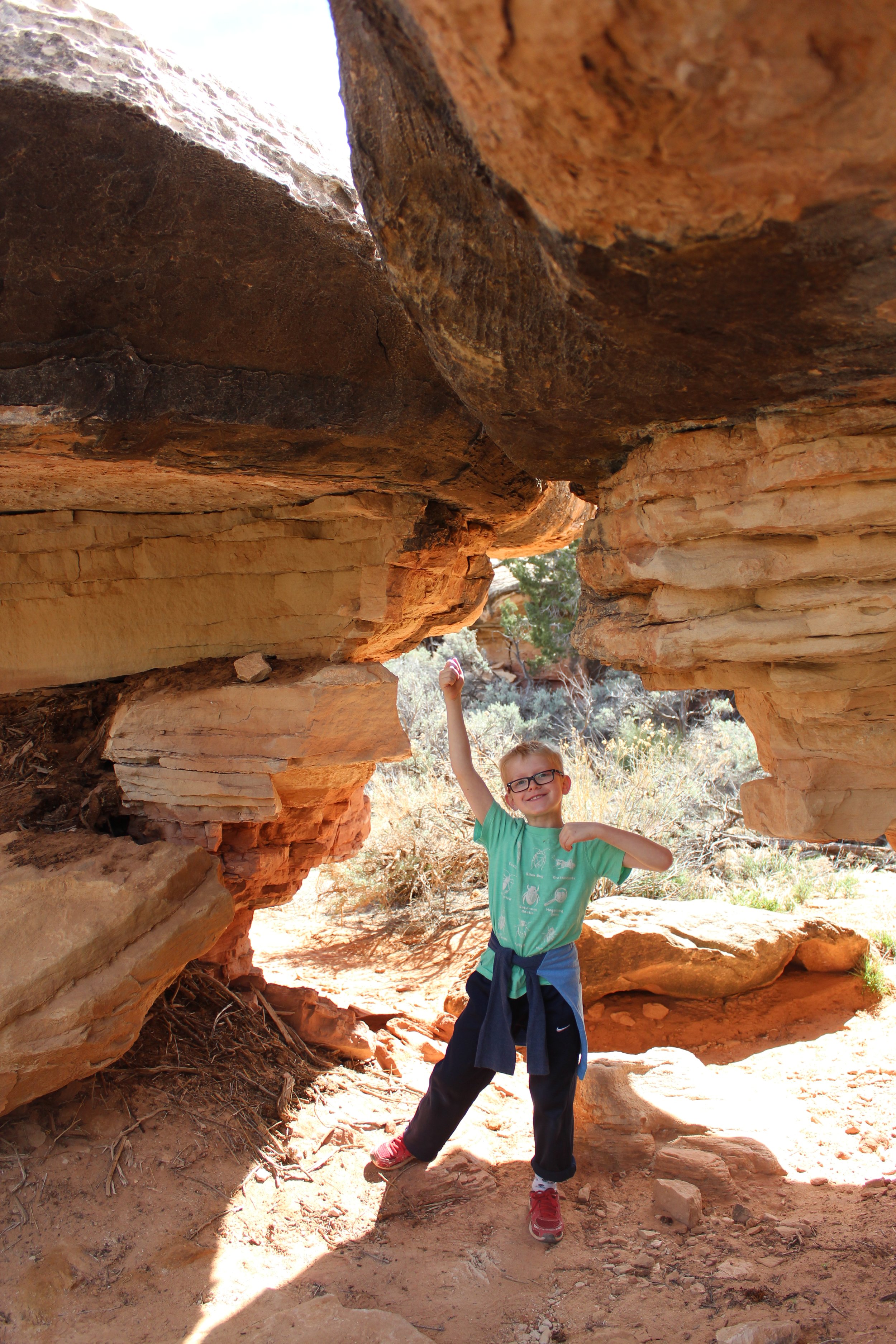
The trail starts off through the desert on a sandy trail and takes you over to the tops of very large and flat rocks. Somehow, there came to be these large boulder rocks that are now just resting here. My seven year-old son had a great time playing in, under, and through these huge rocks.

Pothole Point Trail

Pothole Point Trail
Playing on the Pothole Point Trail

Pothole Point Trail
Off in the distance you will see the “Needles.” If you want to see these up close, keep reading below for Chesler Park. Even if you don’t want to do the whole thing, you can hike the beginning portion of the trail to walk along the edge of them.

Needles as viewed from Pothole Point
The namesake of this trail - the potholes - are the coolest part of this hike. This seemingly random pool of water in the desert.

Pothole Point
And reflection pictures are always fun to take.

Pothole Point

Walking back along the Pothole Point Trail
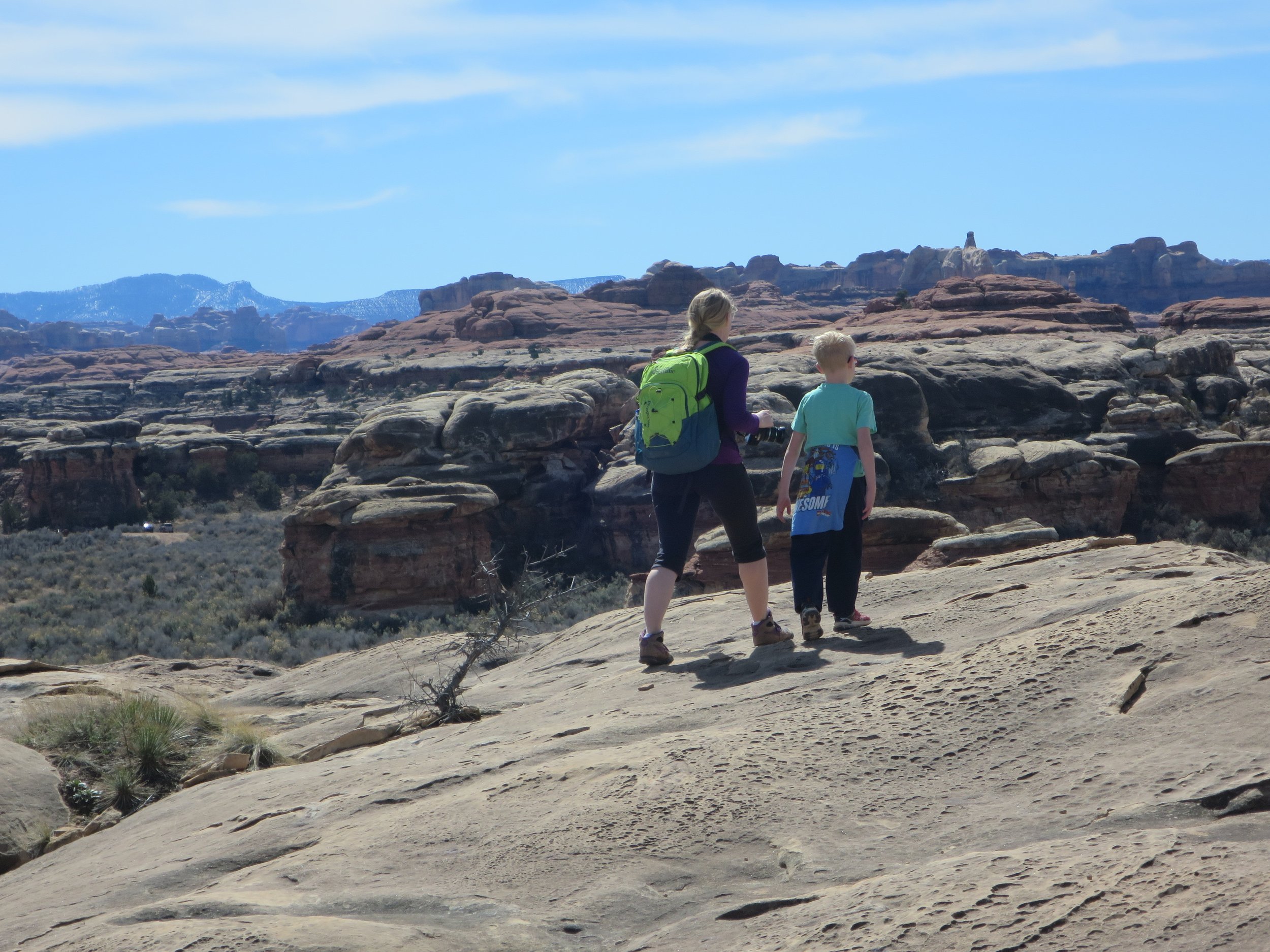
Chesler Park
10.7 mile loop / elevation gain - 1,378ft

Hiking along the Chesler Park Trail
Out of all of the hikes that I’ve done so far in Canyonlands National Park, Chesler Loop is by far my favorite. You aren’t hiking 10.7 miles to take a picture of one cool thing. You are hiking 10.7 miles through an amazing landscape where about every direction you can turn there is something incredible to take a picture of, though the photo won’t express an iota of what you are actually seeing. This trail is marked in purple on the map above.
This is a really long a difficult hike if you complete the entire loop. Consider walking in one or two miles and turning around if you want something shorter and easier. Even just the beginning part of this trail is still my favorite in this National Park.
A couple of logistical items for hiking over 10 miles in a day - bring 2 liters of water per person and plenty of salty hiking snacks high in calorie count - homemade trail mixes or lunchables (club crackers, salami, and sliced cheese) are favorites of ours to make with a quick stop at the grocery store the night before. Don’t forget sunscreen and a basic first aid kit as well.
There is a bathroom at both the trailhead and about the halfway point along the loop (at the end of the 4x4 trail just before the trail splits off again).
Make sure you have a map - ideally a GPS downloaded map with your route pre-marked - I use GAIA. Check-in with the Park Rangers regarding trail conditions. And make sure someone outside of your hiking party knows where you are hiking and expects you to check-in when you are done.
How long this trail takes, obviously, depends on how fast you walk and how many times you stop. For reference though, hiking with my 14 and 10 year-old sons, we did it in just under 6 hours. Keep in mind that this wasn’t our first 10 mile hike.

Chesler Park starts at the Elephant Hill Trailhead
Don’t type “Chelser Park Trail” into GoogleMaps. It will assume you have a 4x4 vehicle, which you probably don’t, and even if you do, you need to have a park permit to be able to use the 4x4 road. If your map is telling you have a 45 minute drive (or longer) from the visitor center - you are mapped to the incorrect location.
Instead, set GoogleMaps to “Elephant Hill Trailhead.” It should take you about 20 minutes to get there from the Needles Visitor Center. You will turn off of UT Hwy 211 at the Campground. Follow this road all the way through the campground to the end. There is a pit toilet and small parking lot. The Elephant Hill Trailhead is not right next to the bathroom. Turn and walk back towards the road. It will be essentially in the direction straight ahead of you when you walk out of the bathroom. I’ve got a picture above of the trailhead sign you are looking for. The beginning is just a little confusing as there is a 4x4 road that will be labeled something about Chelser Park as well as other trailheads. Again, having that downloaded map can be really helpful.
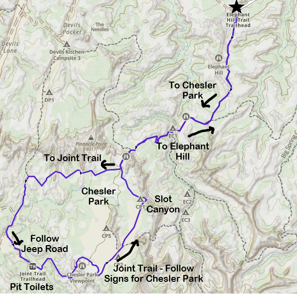
Chesler Park Loop (GAIA App)
Above is our recorded walk as we hiked Chesler Park using the GAIA app. To start the hike, follow the signs towards Chesler Park. Note that Chesler Park is just a backpacking campground. There’s nothing particular special about this one place. The whole hike is phenomenal. If you don’t want to hike the whole thing, I would suggest two different turnaround points. The first is the section of the trail where it drops down into this beautiful valley of the hoodoos, just before starting the loop portion of Chesler Park. Out and back from there is about 5 miles. If you can hang on just a little bit further, there is an awesome slot canyon if you turn left at the loop and hike in about a half mile. This would result in just over a 6 mile hike.
If you are intending to hike the whole loop, hike it counterclockwise and turn right. Follow the signs towards Devil’s Kitchen (stay on the loop though, don’t actually go to Devil’s Kitchen) and then follow the signs to Joint Trail. Going counterclockwise is significantly easier than clockwise. You will hike up, but it’s along a much more gradual slope than what you will climbing down as you hike between the boulders and hoodoos. Eventually the trail joins up with a sandy 4x4 Jeep Trail for just 0.5 miles. At the end of the Jeep Trail is the second pit toilet. Joint Trail then splits off. As you hike on Joint Trail, follow the signs for Chesler Park. You will hit the slot canyon on your way back. And then as you return from the loop, remember your car is parked at Elephant Hill, so follow those signs to retrace your steps back.

Labeled signs will mark the directions, but the names change for different sections of the loop.
The trail from the parking lot climbs up to the top of these rocks, so it’s a little steep at the beginning, but this won’t last very long.

Beginning of the trail towards Chesler Loop
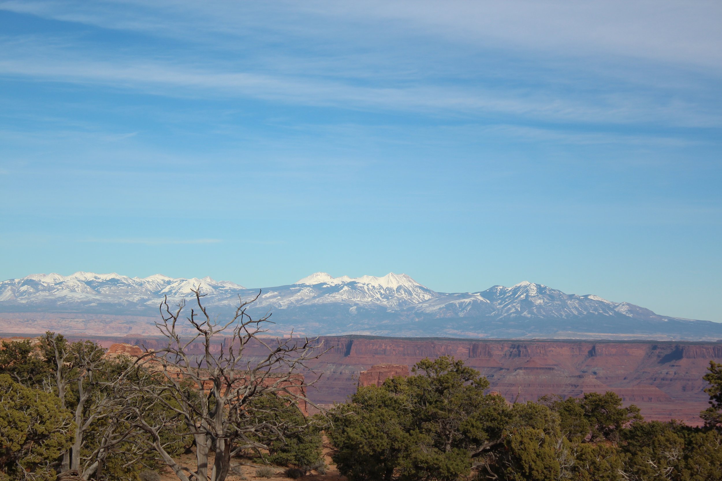
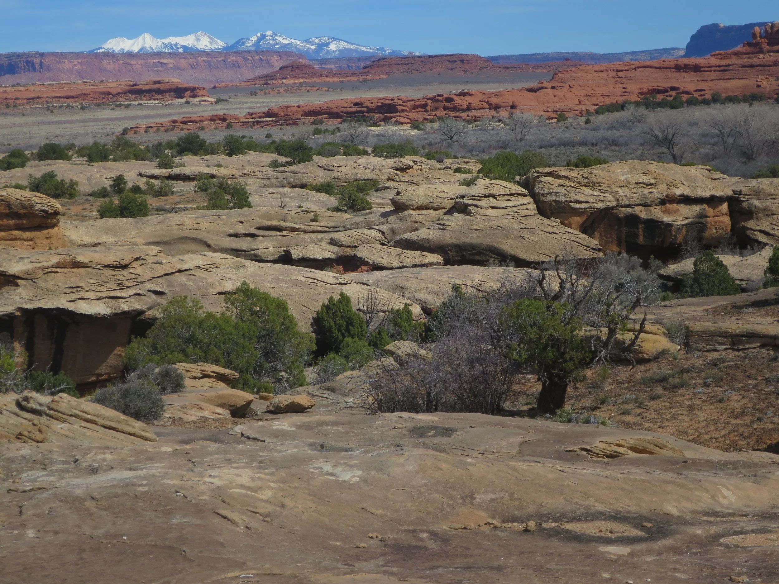
I simply love the desert red rocks in front of the snowy La Sal Mountains, and it was pretty to see Canyonlands itself in snow when we hiked here in March 2023.

More views along the beginning of the trail, once you’re at the top
I talked about being able to hike in the Needles that you can see from Pothole Point, and here they are. It doesn’t take too long before the trail goes right in-between them and you can see just how big they are.

Hiking towards Chesler Park
This part of the trail goes quickly because it’s pretty flat and it didn’t take us long to walk to those needles.
Hiking towards Chesler Park
This loop is pretty amazing in how it was designed to squeeze between and through the boulders and hoodoos. The trail takes you into the scenery so much so that you’ll feel a part of these needles by the end of the hike.

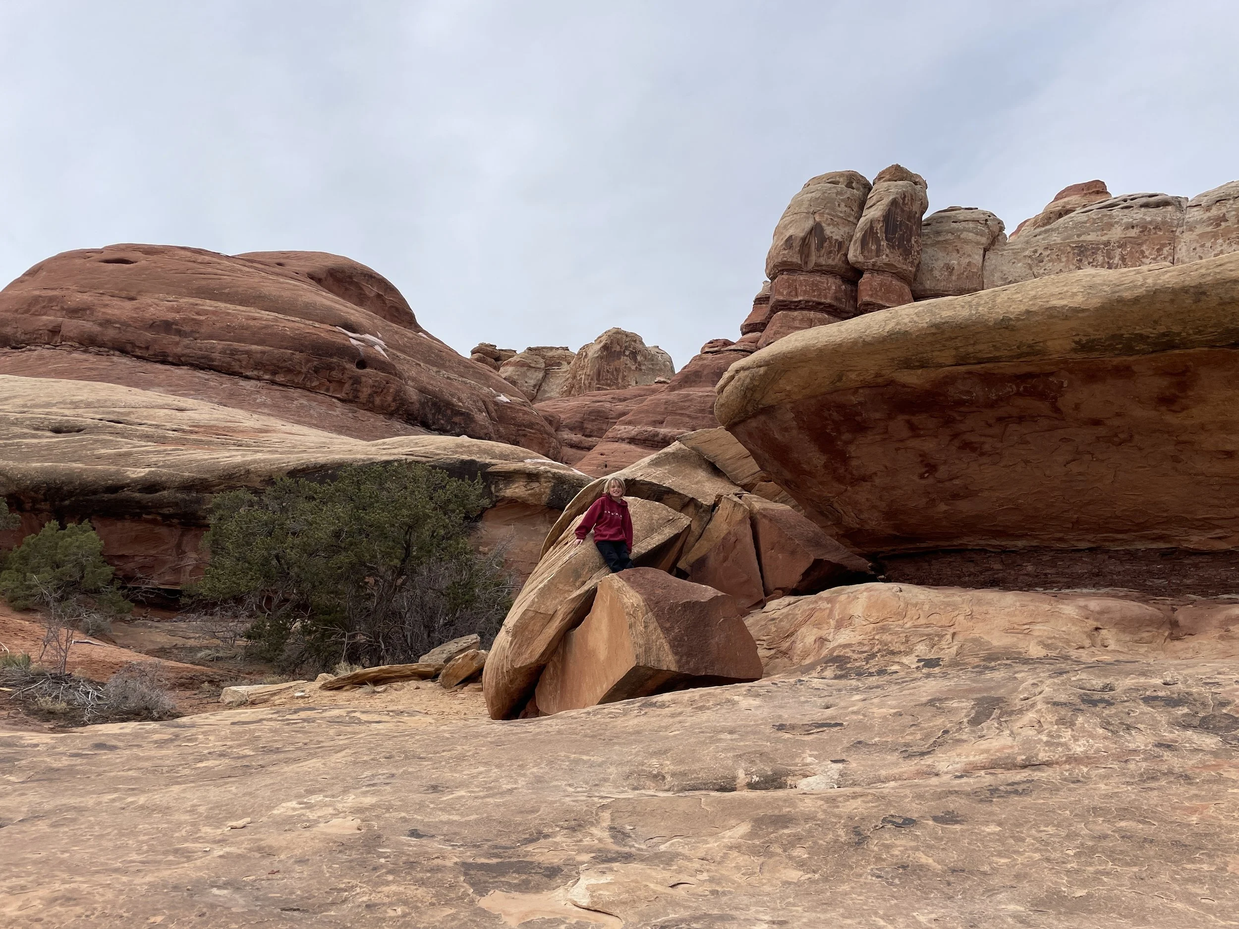
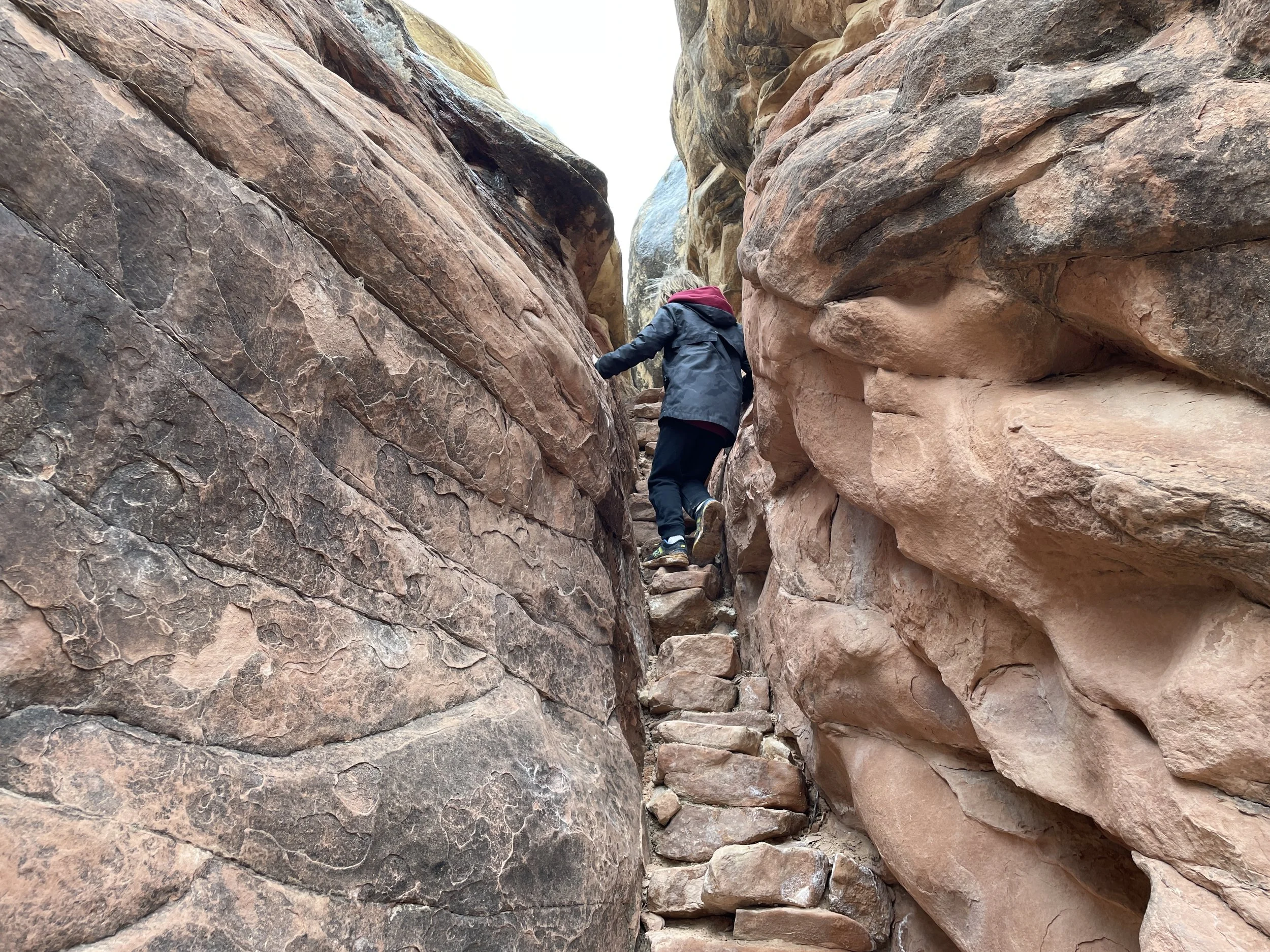
First tight squeeze of the trail
Just before reaching the beginning of the loop, the trail goes down into a beautiful valley and you will find yourself surrounded by the needles. The rocks were simply too big to get any great pictures, but this was one of my favorite sections of the trail. If you are looking to turn around early, enjoy this valley and turn around before the trail starts ascending.

Trail descends into a beautiful valley
This is the view now on the other side of the valley after you have climbed back out of it. You are in the needles at this point, and they are everywhere.

Hiking towards Chesler Park
We hiked the trail counter-clockwise, and these are some views as we started climbing down between the needles.

Starting off counterclockwise (going right) at the loop

Hiking counterclockwise, and following the signs first toward Devil’s Kitchen and then towards Joint Trail

More Needles

More needles
Here you can start to see how dramatically the trail descends behind my son. I was extremely happy we had the tip to hike counterclockwise. Although we did hike back up later in the loop, it was along more of a sloped open section, and we didn’t need to climb up any boulders.

Hiking Chesler Loop Counterclockwise towards the Joint Trail
You can see below that we have fully descended to the bottom. Although we were hiking up, we did this part slower, and we chatted, and I didn’t really think the elevation change was too difficult as it’s sloped pretty gently.

Chesler Park Loop hiking towards Joint Trail
I didn’t happen to take any pictures of the Jeep 4x4 trail, but it’s simply sandy. We didn’t see or hear any vehicles along the road, and it just seemed like a slightly wider trail.
Next you will follow Joint Trail (continuing to climb up) following the signs back to Chesler Park. This part of the trail opens way up and you’ll be walking in more of a field with the needles off in the distance. You will also walk past several campsites.
I’d heard there was a slot canyon, and when we came across the below picture, I was disappointed, as I thought this was what was being referred to. It’s not. Just keep going.
Hiking back to Chesler Park
Next you’ll come into this beautiful cave-like portion of the trail. Again, how this trail was designed is incredible. About here I also started to wonder if I should be exploring beyond the trail to find the slot canyon. Feel free to explore, but the slot canyon is very much part of the formal trail. Just keep going.

“Cave” along the Chesler Park Loop
Here is the very impressive slot canyon that is part of the Chesler Park Loop Trail. A cool last unique feature of the hike to fully enjoy.

Chesler Park Slot Canyon
And onwards back to the car, through the needles again. You have about 3 miles left to get back to your car. It’s a little rough having to retrace your steps after such a long hike on this out-and-back section, but at least the scenery is still gorgeous!

What are other things nearby that you can do?
My post on hiking at Arches National Park is linked below. Arches is my favorite National Park.

I also have a proposed six-day hiking itinerary for the city of Moab, UT, linked here, which includes trails outside of the National Parks.
Additionally, there are two other National Monuments nearby that I haven’t had the chance to visit yet.
1) Bears Ears National Monument is under 30 minutes from the Needles Visitor Center
2) Natural Bridges is between Monument Valley and the Needles (although it adds about an hour to your drive between)
Other Hiking Options
If you are looking for more hiking suggestions, please check out my below map with additional posts linked to the pins.