
Kanab Sand Caves (near Zion National Park)
If you enjoy my blog, please consider signing up below for email notifications of my latest posts. I will not share your email.
Sand Mining Caves
There is a short hike alongside US-89 to a manmade cave known as both Moqui Caverns and Kanab Sand Caves. The cave is located about a half hour from the east entrance to Zion Nation Park, 10 minutes north of Kanab, Utah. This is a free place to hike and explore, unlike the nearby Moqui Cave, which is a museum that has a fee.
I don’t quite understand what Sand Cave / Moqui Cavern was used for historically other that it had something to do with the sand mining industry in the 1930s-40s. The mined sand was used to manufacture glass and casting iron.
There are a lot of cool things to do in and near Zion National Park. The Moqui Caverns are a quick activity (30-60 minutes) to tack onto a trek east of the National Park, like heading out to Coral Pink Sand Dunes, or a way to spend a short bit of time for anyone staying in Kanab, UT. I don’t know that I would say these caves are worth a special effort to get to though. This is one of the rare instances where I might say the pictures are better than the hike. There is a lot of graffiti in the caves, and the caverns are manmade instead of a natural feature. To be very honest, although I’m spending time writing up a blogpost, I would actually suggest spending any extra time in the east part of Zion National Park instead, where there aren’t crowds or formal trailheads, but you may find little waterfalls or petroglyphs if you explore into the canyon from any of the pullouts. I guess I’m trying to say that if / when (I’ve been to Zion six times, so I’m assuming I’ll be back again), I head to Zion again, I’d rather go back and explore further into the eastern part of Zion than return to these sand caves, if that advice is worth anything.
Moqui Caverns
Moqui Caverns Location
The Moqui Caverns (or Kanab Sand Caves) are about 50 minutes from Zion’s Visitor Center in Springdale, or 30 minutes from the National Park’s east entrance. Kanab, UT, is the closest town (about 10 minutes south of the caverns), which has both restaurants and hotels. (Here is a link to a vacation planning guide for Kanab.) Belly of the Dragon and Coral Pink Sand Dunes State Park are other nearby places to explore that can be easily combined with a trek to the Moqui Caverns.
The Moqui Caverns are accessible directly from US-89. When we hiked to the caverns in 2019, there was a pullout from US-89 on the south side, about 300 yards from the Moqui Cave. Parking there was a bit nerve wracking because we had to cross US-89 to get to the caverns. There is now a formal parking area on the north side of US-89, about 0.3 miles south of Moqui Cave. The distance to the cavern from either parking area is approximately the same. The caves will be visible in the hills on the north side of US-89.

Map of Moqui Caverns (Kanab Sand Caves) and other nearby places to visit (within an hour drive)
Logistics
As of 2025, it’s free to park and explore the Moqui Caverns (Kanab Sand Caves). Again, the Moqui Caverns are different than Moqui Cave. Moqui Caves requires a fee to enter the museum. This is a short hike that will likely take less than an hour to complete. Moqui Cave is just a bit north of Moqui Caverns.
There is a decently steep rock scramble required to get up to the caverns. There are pictures on the internet of parents doing this hike with toddlers. My boys were in elementary school when we did this hike, and I was a little bit nervous even at their age. I can’t imagine parents of kids even younger than that end up thinking this hike was worth it.
Hiking Up to the Moqui Caverns
I have the two parking areas marked in the map below with black stars. My recommendation would be to park at the southern lot, which is on the correct side of US-89 and does not require crossing the highway. When we visited in 2019, our only option was to park in the northern lot and cross the highway.
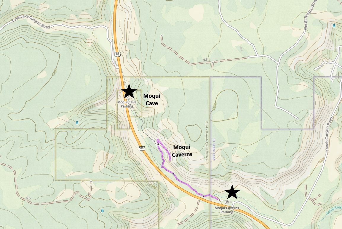
Hiking Map to Moqui Caverns
The Moqui Caverns (Kanab Sand Caves) are going to visible on the north side of US-89. From the highway, the caverns look like this.
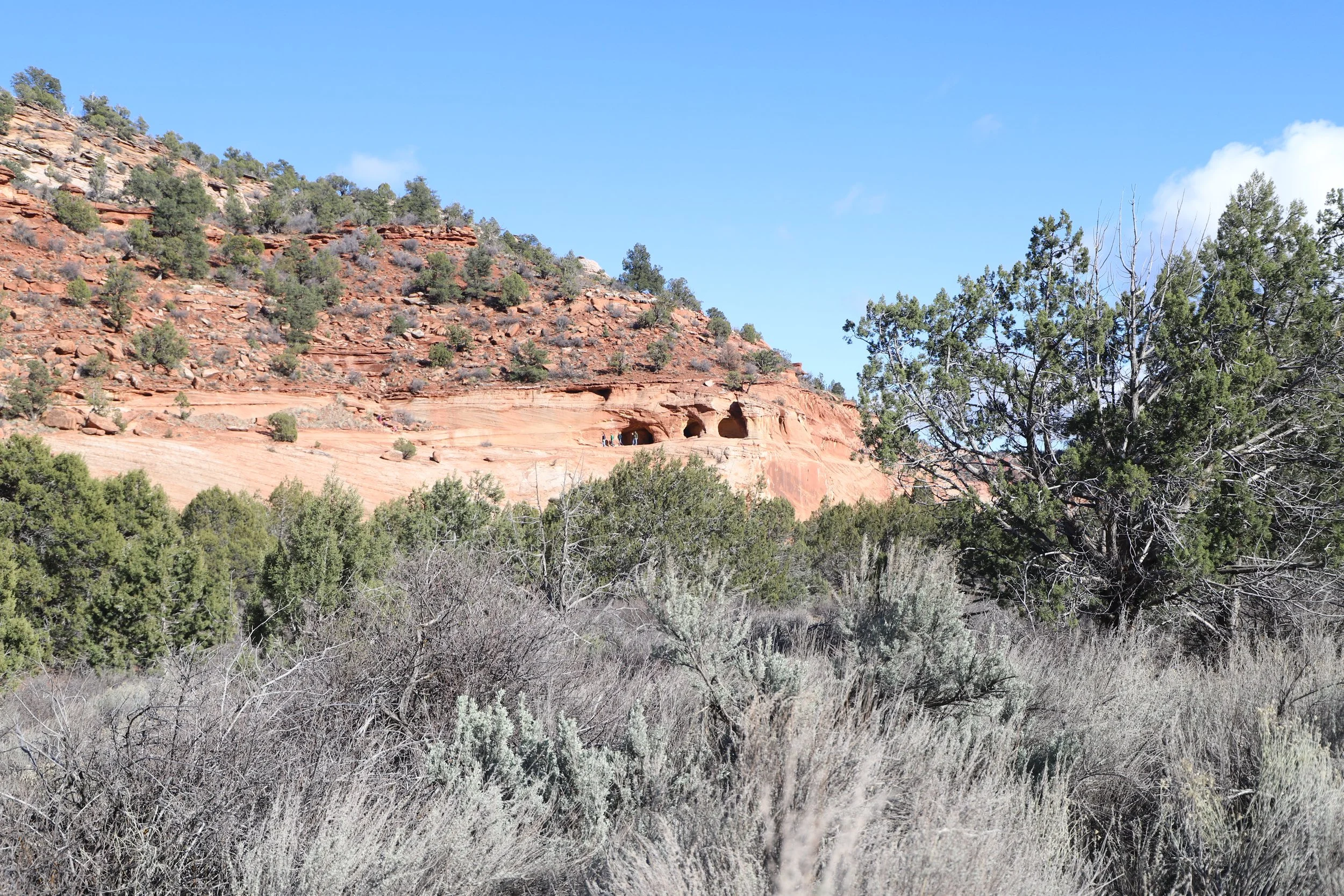
Moqui Caverns (Kanab Sand Caves) as seen from US-89
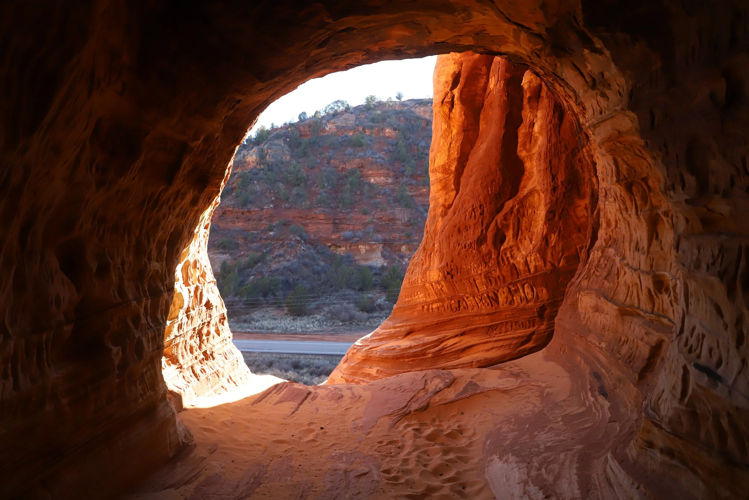
There is a short (<0.5 mile walk) to get to the bottom of the cavern entrance. There is no formal “trail” up the sandstone to get to the entrance. It’s more of a rock scramble in whichever manner you may feel is the safest… This picture below shows US-89 off on the left, and the sandstone cliff that must be scaled up in order to get into the caverns. I wasn’t super thrilled at how sketchy this hike up (and down) felt.
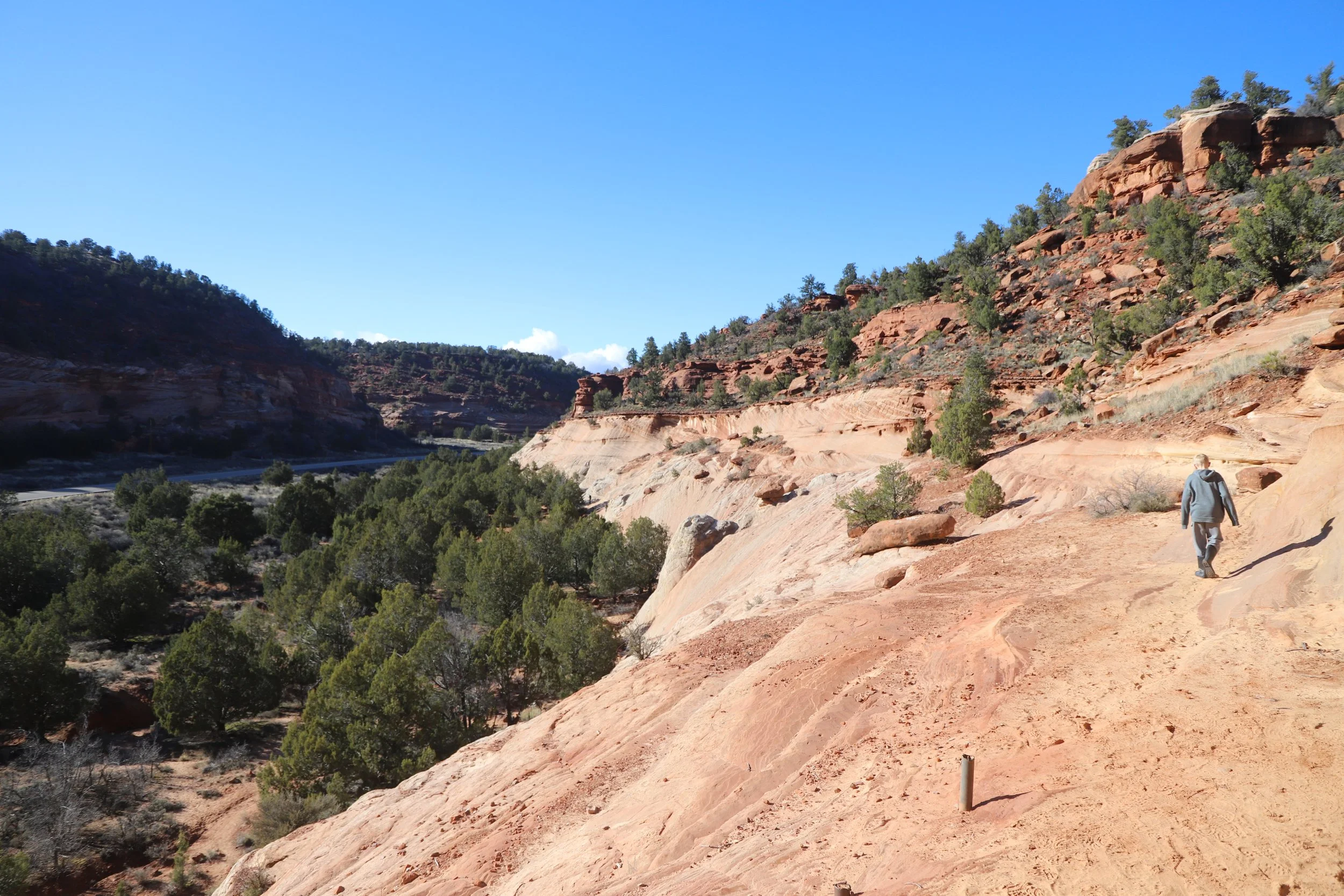
On our way back down the cliff after viewing the Moqui Caverns
Once you’ve made it up the sandstone, the caverns have an easy entrance to walk towards.
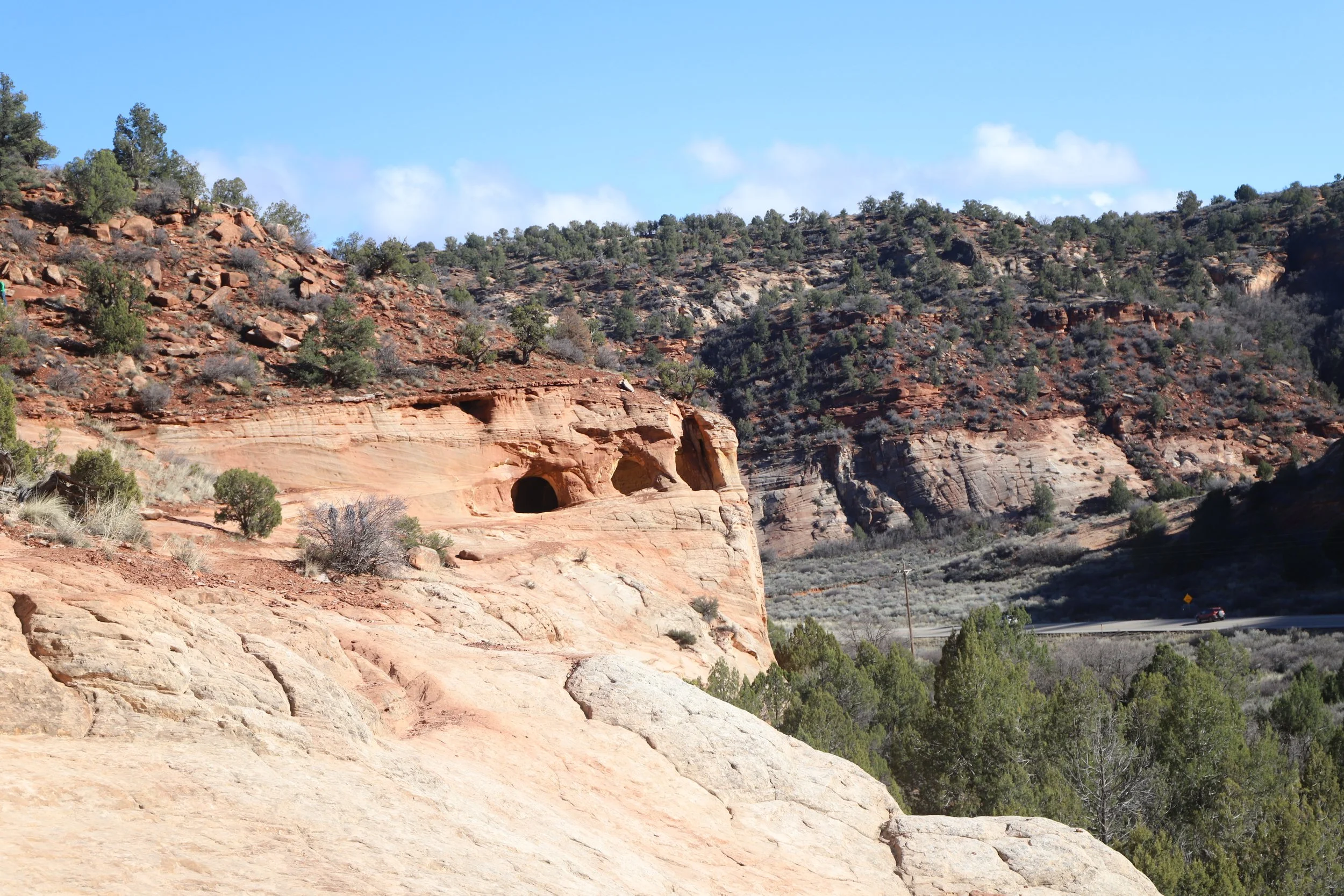
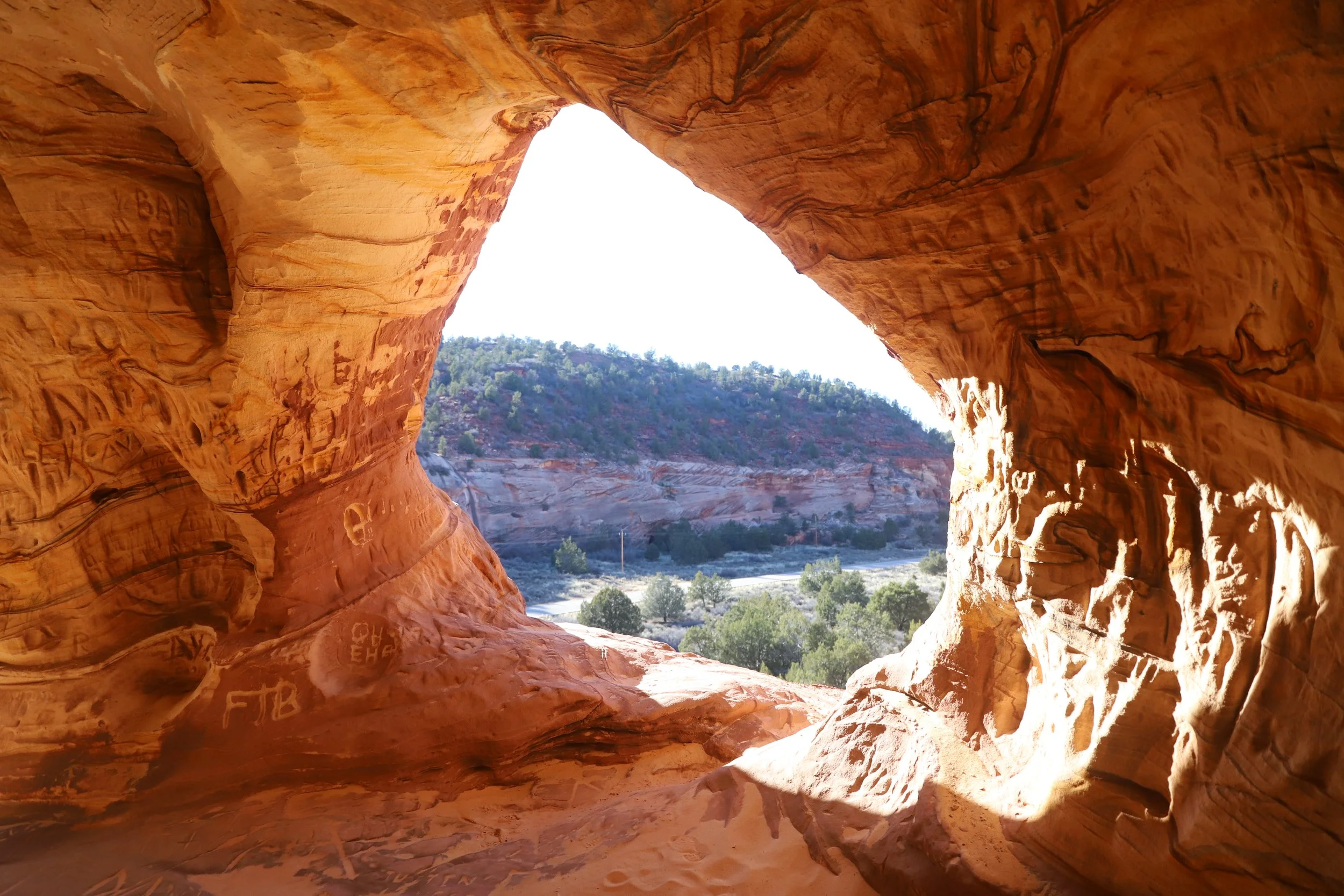
Entrance to Moqui Caverns (Kanab Sand Caves)
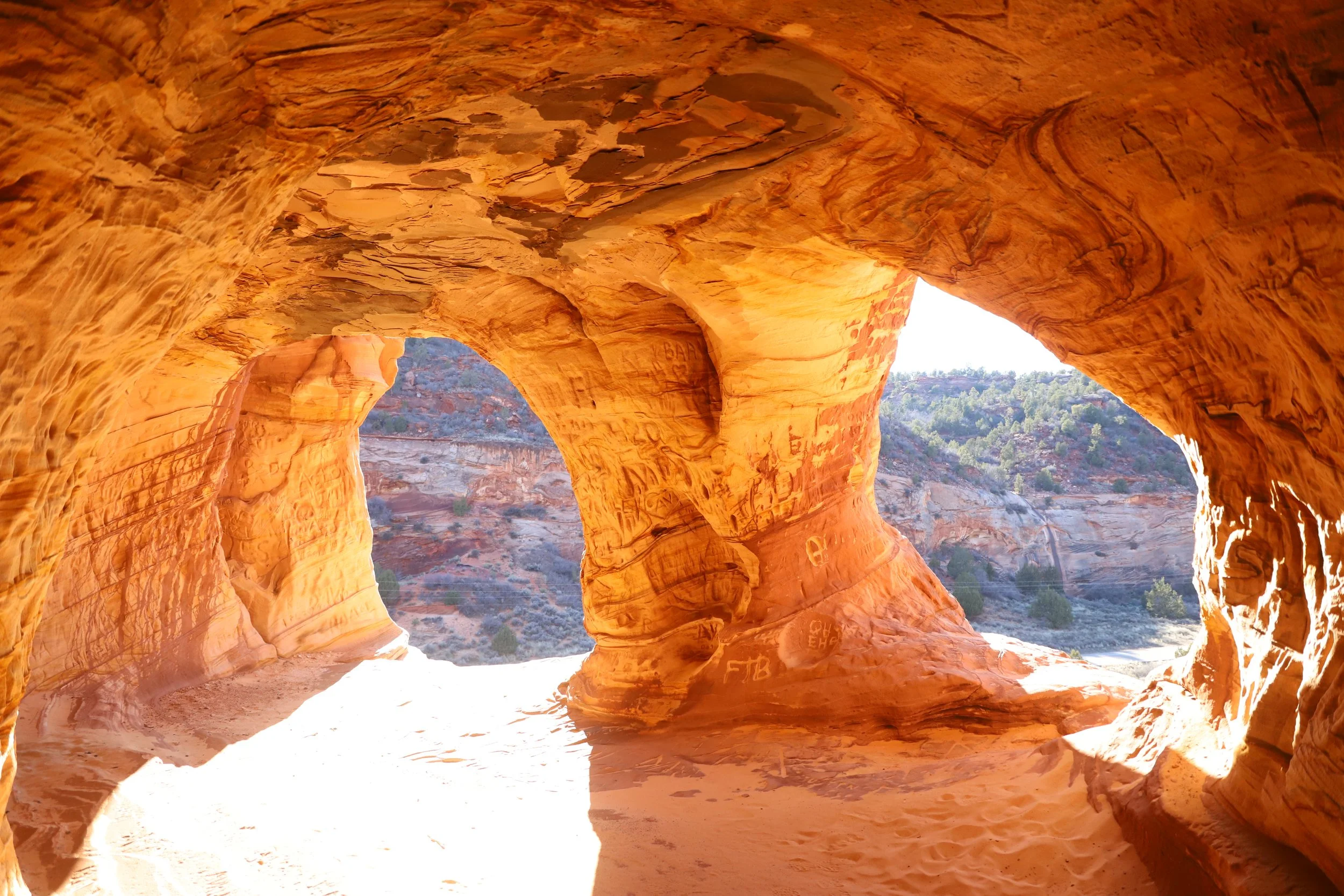
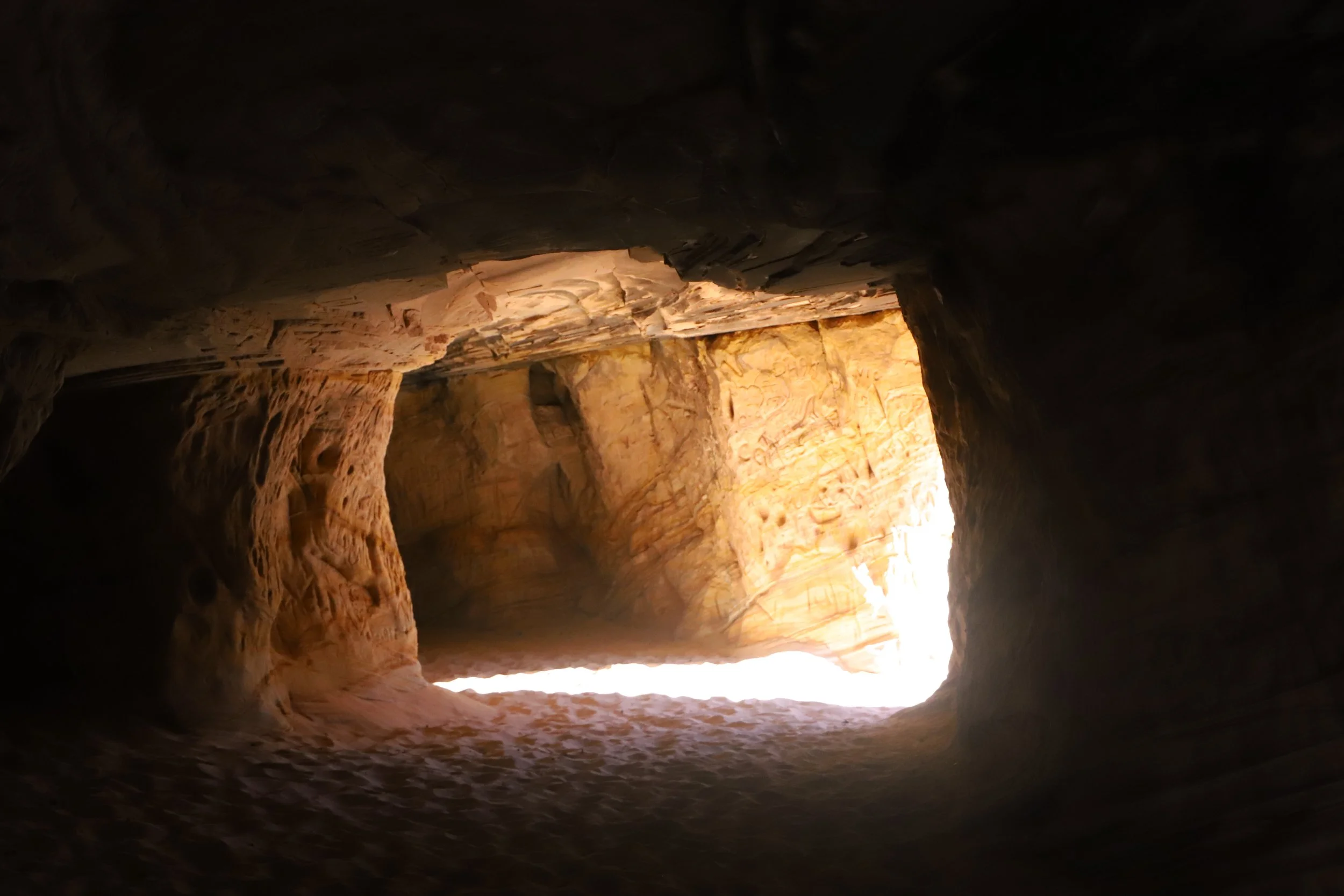
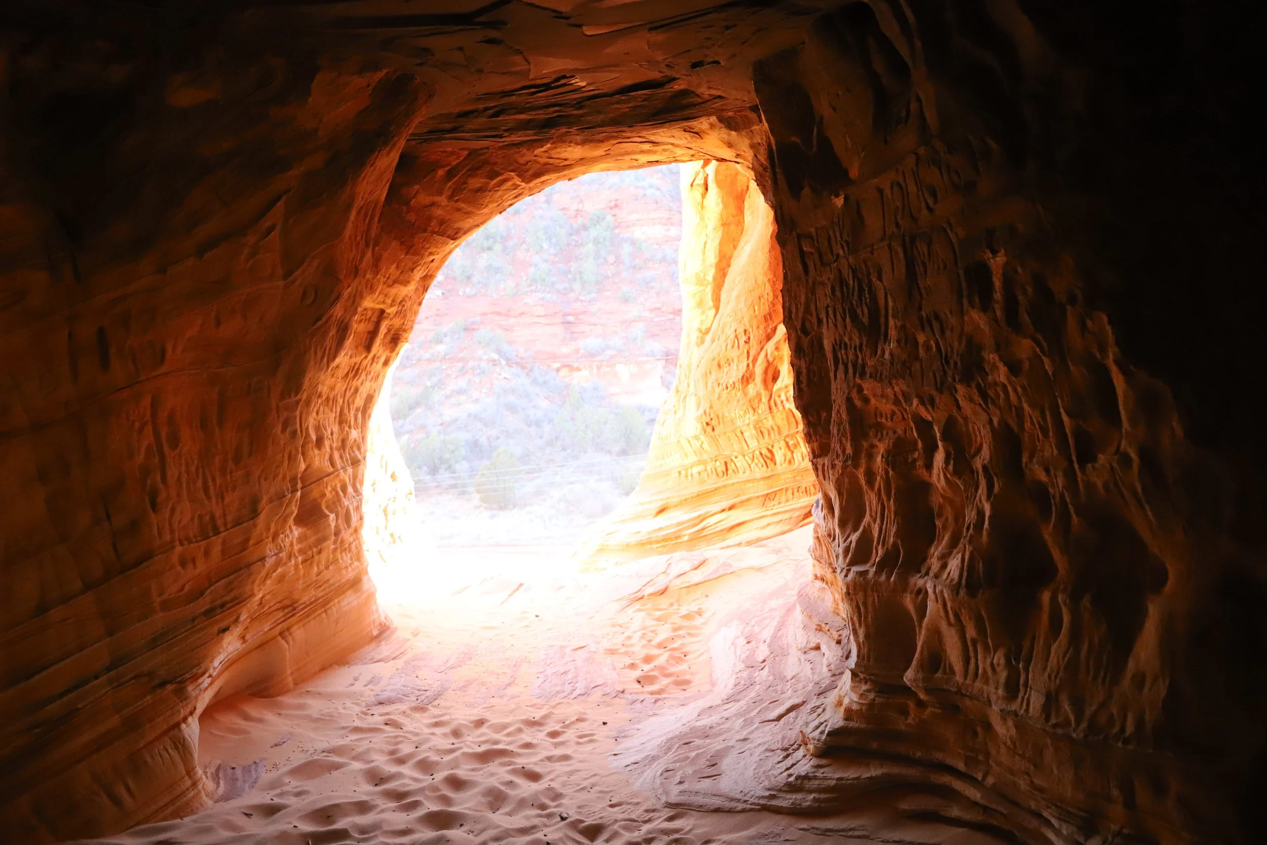
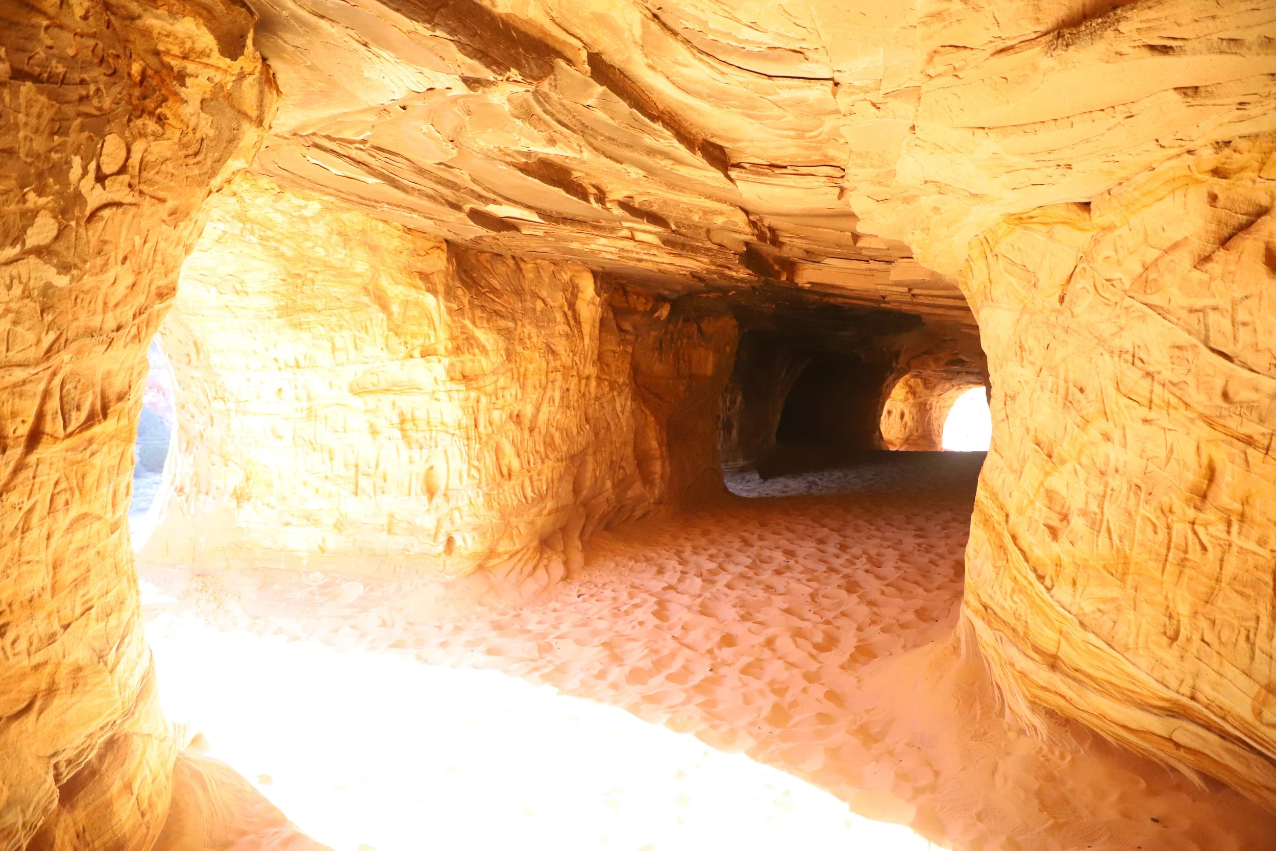
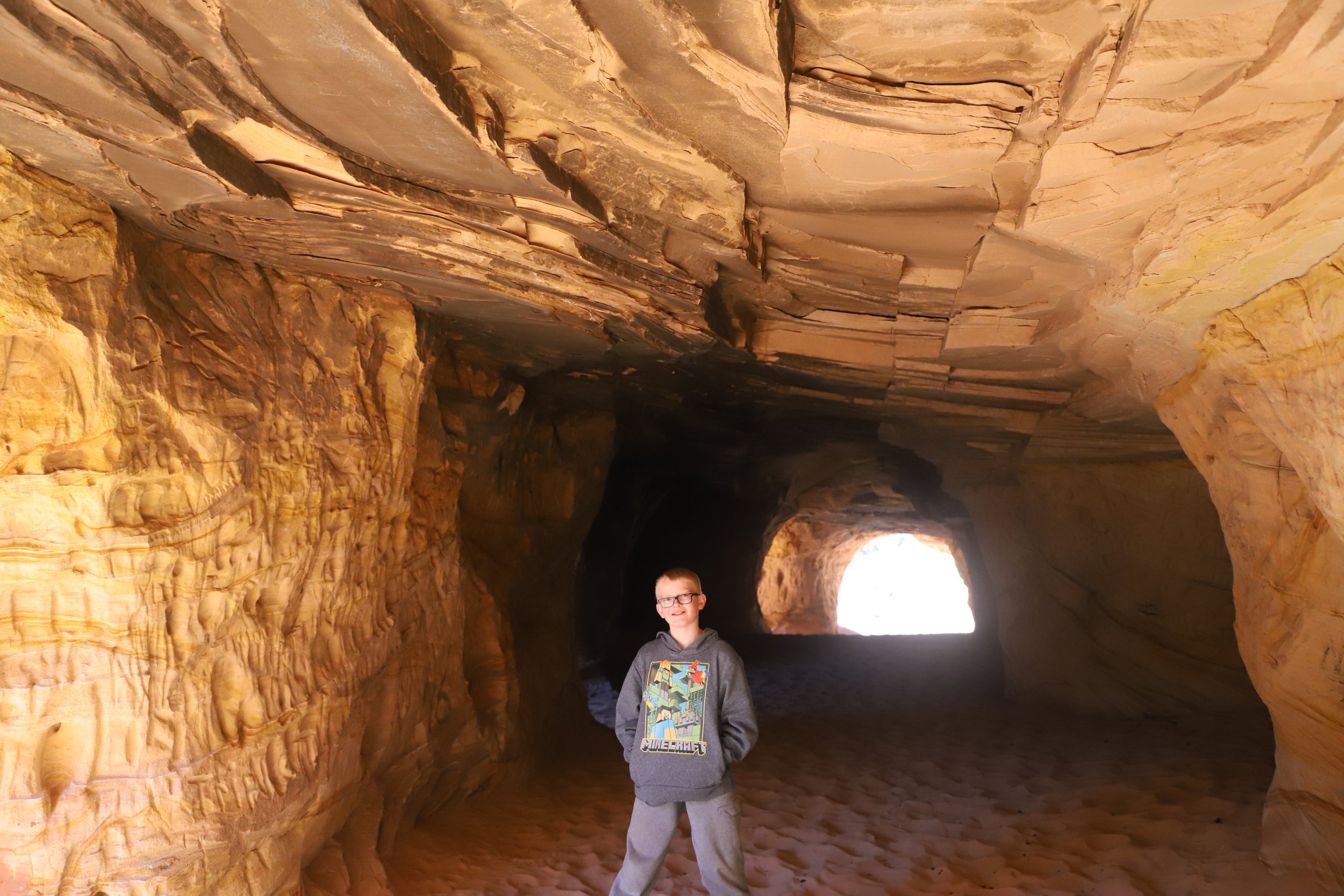
I have several pictures included below to show our hike. The cavern is relatively small, although there are several “windows” cut through the rock. The best time for pictures is in the late afternoon / early evening based on the sun angle. We were here about 5:30pm in March.
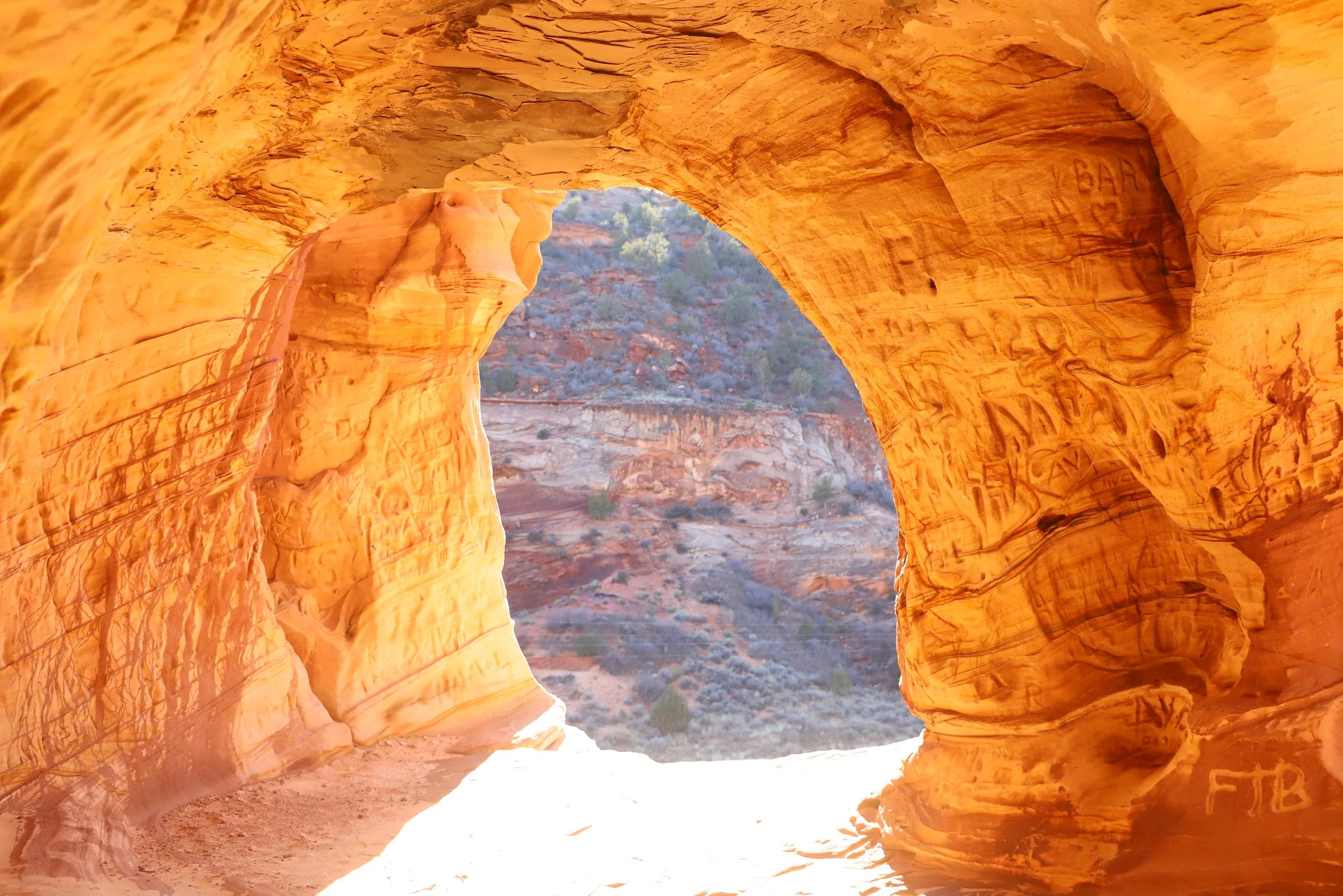
Moqui Caverns
There is a lot of graffiti left behind from 100 years of man’s history here. I don’t know that I quite understood that these were manmade caves when I was researching this on the internet.
Kanab Sand Caves
I think my boys enjoyed exploring the caverns. The caves were perfect for their size.
Exploring the Kanab Sand Caves (Moqui Caverns)
I actually think these pictures turned out pretty well, but I don’t have any desire to return. I usually have the opposite feelings when I write a blogpost.
Exploring the Moqui Caverns
I’ve included these last two pictures so you can get a better feel of these caverns. They are manmade, and they feel manmade. They are decently large, but still very finite. Compared with what you might find on an unmarked trail on the east side of Zion, I’d pick Zion National Park.
Moqui Caverns (Kanab Sand Caves)
Moqui Caverns (Kanab Sand Caves)
Other Things to Do Nearby (within an hour drive)
Below are hyperlinks to other places I’ve visited that are located within an hour’s drive from Kanab’s Sand Caves.
Zion National Park
Zion National Park is probably the reason for traveling to this part of Utah. There are so many fantastic hikes for all types of hikers - beginners through advanced. The east entrance to Zion National Park is a 30-minute drive west of Kanab’s Sand Caves.
Belly of the Dragon
Belly of the Dragon is a cool place to stop for hikers of all ages. There’s a little cave that has been formed through the rock under US-89. Belly of the Dragon is a 15-minute drive southeast of Kanab’s Sand Caves.
Peekaboo Slot Canyon
Peekaboo is a short and beautiful slot canyon near Kanab (not to be confused with the Peekaboo Slot Canyon in Escalante). This canyon requires an off-road vehicle to get to the trailhead. The off-road pullout from US-89 to Peekaboo Slot Canyon is a 15-minute drive southeast of Kanab’s Sand Caves.
Coral Pink Sand Dunes State Park
(west) Coral Pink Sand Dunes State Park is a fun place to explore a sand dune habitat and play in the sand. Walk up a dune and have fun running down, sledding down, or rolling down. Repeat over and over. This state park is a 20-minute drive southwest of the Kanab Sand Caves.
Water Canyon
Water Canyon, managed the Bureau of Land Management, is a rugged, wild canyon about an hour southwest of the Kanab Sand Caves that has something for all adventurous souls. Enjoy a 2 mile out-and-back hike to the waterfall, a 6 mile out-and-back hike to White Dome or hike up into Water Canyon and rappel out.
More from www.NatureImpactsUs.com
In the map below, there are additional posts I’ve written attached to each pin. Use two fingers to move around within the map.