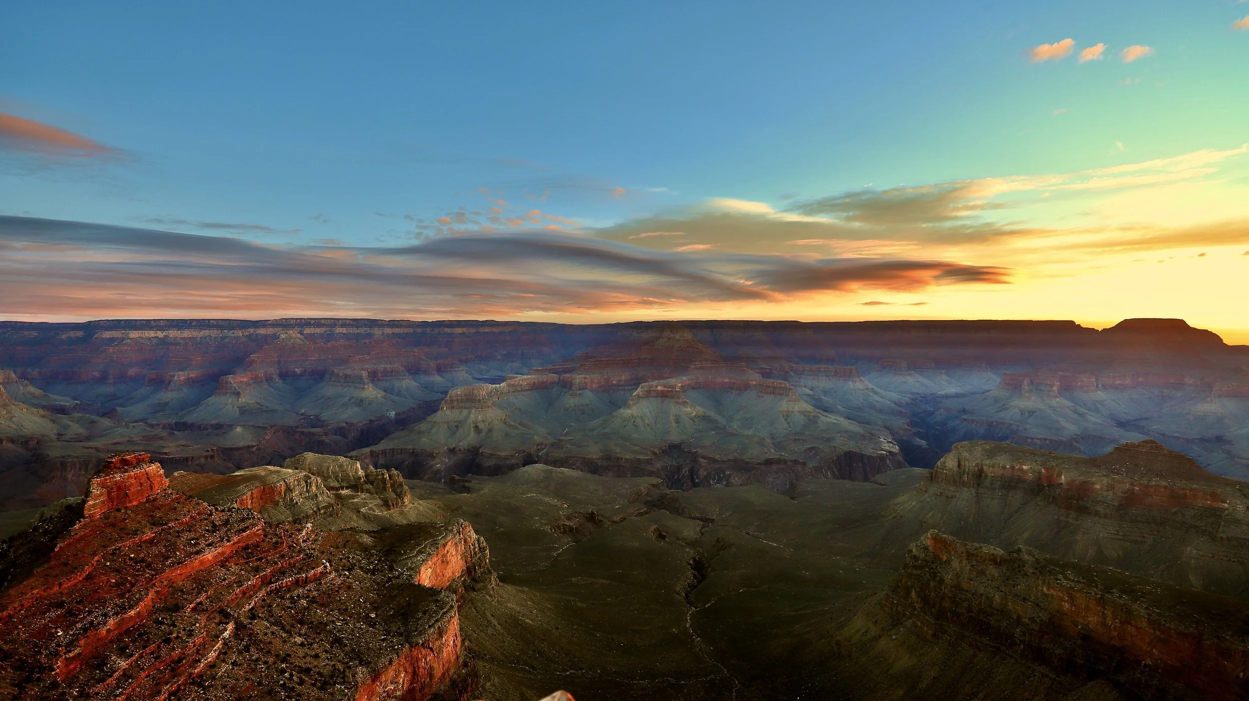
My family and I last visited the Grand Canyon at the end of June 2026. We stayed on the south side and hiked down to the river and back. I’ve been working on this post on and off for more than a month, combining our most recent pictures with a similar hike in March 2018, and a Rim-to-Rim-to-Rim hike in June 2016.
However, canyons are carved by water. “Are” carved, not “were” carved. On Aug 29, 2026, a flashflood washed out several of the foot bridges over the Bright Angel Creek in the inner canyon, along the North Kaibab Trail. It’s going to take the National Park Service awhile to repair the trail, clean out the debris, and rebuild the bridges. The Rim-to-Rim hike is not possible for the foreseeable future.
After a period of reflection, I decided to finish this blog and post as-is. Although this entire hike is not currently possible, the Grand Canyon isn’t going anywhere. The trail and bridges will be rebuilt, and hopefully this will be a useful tool for anyone planning a hike someday in the future. Until then - keep training, and listen for the other trails calling your name.
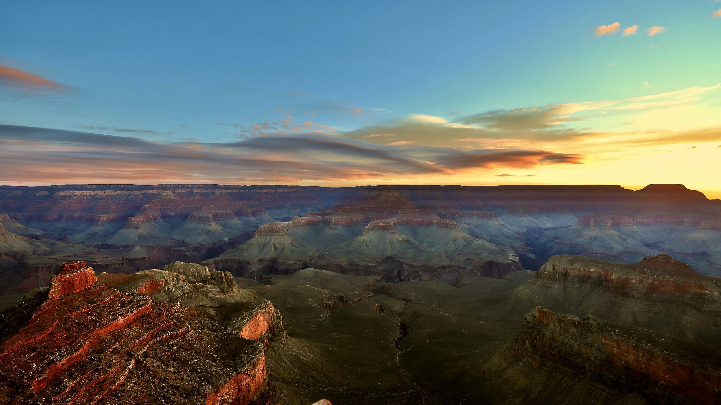
March 2018 - Life only has so many sunrises. Enjoy at least one of them at Ooh Aah Point
If you enjoy my blog, please consider signing up below for email notifications of my latest posts. I will not share your email.
A Life-Changing Hike
I love sharing my hiking stories to help others plan the perfect trip, but I’ll admit, this is a hard post for me to write. I’m worried I won’t be able to capture the inspiration of this trail or be able to put into words how much this trail has meant to me and how it has shaped my life. How can any trail change a life? That’s hard to explain.
I’ve been to the bottom of the Grand Canyon four times. Twice with my husband on a rim-to-rim-to-rim hike in June 2016. We returned in March 2018 with our exchange student from Finland and hiked down to the Colorado River along South Kaibab and back up Bright Angel. In June 2026, we repeated this same hike with our teenage sons.
These hikes take incredible preparation - intense training (6 months for each trip), learning the trail - knowing mile markers to be near at approximate times due to intense heat at the bottom of the canyon and understanding where there are places to refill water, having back up plans to deal with potential emergencies, and closer to the actual hike date - double-checking trail status, water availability, and expected weather before arriving on the trail.
Most people that visit the Grand Canyon stay on the South Rim and perhaps venture into the canyon a mile or so on either South Kaibab or Bright Angel trails. That’s the smart way to visit this National Park, and my official recommendation. Hiking all the way to the Colorado River (via the South Rim or on a Rim-to-Rim trail) is ridiculously difficult. As much as I love these trails, I would never suggest that someone hike to the Colorado River. The heat, distance, elevation gain - hiking down into a mile-deep hole and then having to turn around and hike back up it - If you aren’t prepared, if you overheat, if you run out of water, if you aren’t paying attention to where you are, if you are not in shape, if the weather changes unexpectedly - these trails take people’s lives each year. My first bit of advice is to just enjoy my pictures. But I also get it - There’s been moments in my life where I hear this canyon calling my name, and it’s a powerful force to ignore. For anyone that just wants to scroll through pictures, click here to skip all of the planning logistics. For anyone considering hiking these trails below the rim, hopefully this information is helpful. I would encourage you to also read other blogs for additional perspectives, as I’m sure there are things I have forgotten to include.

Which Trail Option?
Note that as of 29Aug2026, North Kaibab Trail is closed for the foreseeable future due to damage caused by a flashflood. Additionally, Phantom Ranch, Bright Angel Campground, Cottonwood Campground, and the transcanyon waterline suffered severe damage. Check the NPS website for current trail information and status of water access with the canyon.
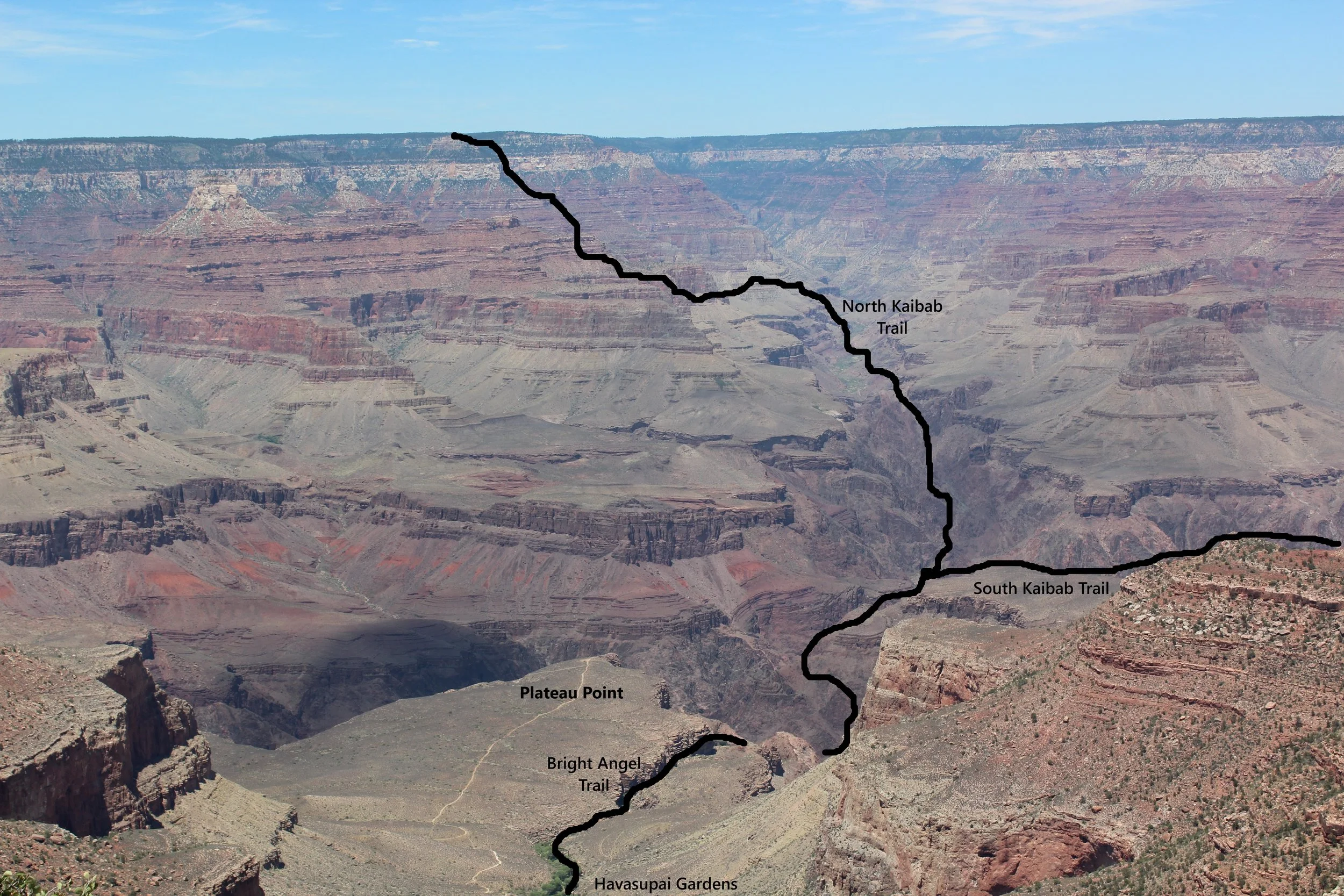
Approximate locations of the Rim-to-Rim trails as viewed from the South Rim near Bright Angel Trailhead
There are three main ways to hike the Grand Canyon which include a trek to the Colorado River - South Kaibab to Bright Angel, South Kaibab to North Kaibab, or North Kaibab to Bright Angel. These are all extremely difficult hikes with very real dangers. These hikes require advanced planning and committed training.
There are two trails on the South Rim - South Kaibab and Bright Angel. Pick South Kaibab to go down and Bright Angel to go up. South Kaibab is my favorite Grand Canyon Trail. There are so many unique views of the canyon, and it doesn’t take very long before I feel in the canyon on this trail. The significant problem with South Kaibab, however, is that there is no access to water (manmade or natural) other than at the trailhead and end point (Bright Angel Campground). Water is important for drinking, obviously, but it has a second purpose in the Grand Canyon, especially in summer months. The fastest way to cool off or stay cool in the heat is to soak your shirt and a bandana. Put the wet shirt back on and tie the bandana around your forehead. Each time, it’s taken us about 6 hours to hike back up to the South Rim from the River. It would be a really tough decision with limited water to pick drinking or cooling off. I go through a lot of water in 6 hours when hiking up a mile-deep hole in the desert…
Assuming the waterline is on, Bright Angel has 3 points along the hike to access water, making it a much safer trail to ascend. Additionally, there may be a small amount of water running down the creek near the trail below Havasupai Gardens Campground. Check the waterline status before hiking and have a way to filter and sterilize water from the creek. The Bright Angel trailhead is also 360ft lower than South Kaibab trailhead. The downside to Bright Angel is that it is a terribly boring trail between the rim and Havasupai Gardens Campgrounds - it’s the same view over and over again each, switchback. If you only want to walk down part way into the canyon and return, pick South Kaibab. Just carry a lot of extra water.
South Kaibab to Bright Angel
Of the three trail options to hike to the Colorado River, descending and ascending the South Rim is the easiest, but this is still a crazy hard hike. This option involves hiking 17.1 miles with an elevation gain of 4,340ft. For context, the hole you are going to climb out of is 0.8 mile deep. Before you consider this hike, imagine being at the bottom of a hole. Look up and picture how tall the wall would be if it were a mile high. Just because I’ve been to the bottom of this hole 4 times does not mean this trail is easy. It means I’ve spent a year and a half of my life training for various hikes in the Grand Canyon.
South Rim to North Rim
Anyone thinking of a Rim-to-Rim hike may be wondering which way to pick. South Rim to North Rim is significantly harder as the North Rim requires an additional climb of 1,401ft. However, hiking this direction includes hiking the South Kaibab Trail. My advice - pick this option unless you plan on returning soon. You would be upset you missed the South Kaibab Trail.
Hiking the South Rim to the North Rim involves 21.3 miles, an elevation climb of 5,741ft (more than a mile) and a plan to get to where you are going after the North Kaibab Trailhead. There is a campground 1.5 miles away (requires hiking) and the Kaibab Lodge 16 miles away. There is a shuttle between the North Kaibab Trailhead and the Kaibab Lodge that can be reserved ahead of time. This is the link to the Trans-Canyon Shuttle. This same company offers bus rides between the North Rim and South Rim for anyone that wants to hike just one direction.
Note that we were on the North Rim in June 2016. There are pictures in this post of the Grand Canyon Lodge and associated cabins we stayed at. Tragically, all of this infrastructure was burned down in the Dragon Bravo Fire in July 2025. As of September 2026, the North Rim Campground does not have access to water as a result of the fire, but water can be purchased at the nearby General Store.
Continue to check the North Rim National Park website for status of what’s open and what isn’t if you are considering hiking at the North Rim. With back-to-back natural disasters, it’s going to be awhile to repair this side of the park.
One other note which might not be obvious for anyone planning their first hiking trip here. Even though the North Rim is in Arizona, it’s at 8,241ft in elevation… It snows here, a lot. The roads to the North Rim are only accessible May 15 - Oct 15, which means the campgrounds, lodges, general stores, etc. are only open May 15 - Oct 15.
North Rim to South Rim
Starting on the North Rim is going to have the same logistical problems as ending on the North Rim. You have to have a place to sleep, access to food and water, and a way to get to the trailhead before dawn.
Hiking North Rim to South Rim (ascending along Bright Angel) is a 23.7-mile trek with an elevation gain of 4,340ft. Longer but much easier than the other direction. The biggest downside is missing out on the South Kaibab trail.
Lodging within the Inner Canyon
Within the Grand Canyon, there are 3 campgrounds (Bright Angel - bottom, Cottonwood - along North Kaibab, and Havasupai Gardens - along Bright Angel Trail). Phantom Ranch is the one non-camping option and it’s at the bottom, near Bright Angel Campground. Reserving a night at one of the campgrounds or Phantom Ranch provides you a permit. Day hikes do not require a permit. You cannot sleep below the rim without a permit. Those benches along the trail are off limits - sleeping on one without a permit can result in a fine.
Note that Bright Angel Campground, Cottonwood Campground, and Phantom Ranch were all impacted by the 29Aug2026 flashflood. Check the National Park website for current status.
Parking and Shuttles on the South Rim
There is no parking at the South Kaibab Trailhead, which is fine. You are going to return via the Bright Angel Trail, and the two trailheads are not close enough to each to walk between. This hike requires the use of the free NPS shuttles.
There are two options for parking and using a shuttle to the South Kaibab Trailhead. The first option is the Visitor Center. This only works for day hikes, as overnight parking is not allowed in this lot. The other problem with parking at the Visitor Center is that you will need the Blue Shuttle to get back to your car from the Bright Angel Trailhead, and this bus does not run throughout the night.
A better option is to park at Lot C. This lot is not for the average visitor - it’s for the hikers. After parking in Lot C, walk over the railroad tracks to get to the main road which runs in front of Bright Angel Lodge. This is where the Hiker Express Shuttle will pick you up - right in Front of Bright Angel Lodge. And it’s really close to the Bright Angel Trailhead, so when you hike up, you are within a short walking distance to your car.
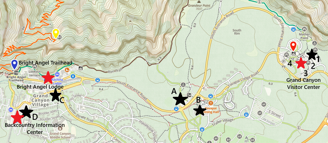
Grand Canyon Parking Lots are highlighted in black stars. The hiker’s express stops are shown with red stars. The Bright Angel Trailhead is also included for reference, as this is where you will end your hike. Lot C is within walking distance of the Bright Angel Trailhead. Any other parking lot will need the use of the blue shuttle to return to after your hike.
There are two options for shuttle buses to the South Kaibab Trailhead. Most visitors will use the Orange Shuttle from the Visitor Center. But this bus only runs during the day. Any version of a hike that involves descending to the Colorado River and back is going to include some non-hot daylight hours. This means hiking really early in the morning. If you want to do this hike - you get up early. The bottom of the Grand Canyon is extremely hot in the summer. You do not want to be down there in the sun at mid-day.
The National Park Service offers a special Hiker Express Shuttle schedule for those that want an early start to hiking. It runs just once an hour in the early morning until the Orange Shuttle starts. The hours change based on time of year and sunrise. In June the earliest option is 4:00am. In March, the earliest option is 6:00am. Be in front of Bright Angel Lodge at 4:00am (or whichever is the earliest time based on when you hike). The bus stop is the same stop where the Blue Shuttle stops. It doesn’t have a separate sign that states “Hikers Express.” It’s the same stop.
The Hikers Express Shuttle stops at Bright Angel Lodge, Backcountry Information Center, and the Visitor Center and drops everyone off at the South Kaibab Trailhead. It takes about 30 minutes between Bright Angel Lodge and being dropped off at the trailhead.
Choosing to Descend into the Grand Canyon…
It’s hard to fit 48 miles of trails into one map - but I think this sort of map might be helpful for initial planning purposes.
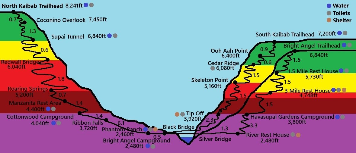
Green - Spontaneous Hiking Decisions are OK
Yellow - Have a Plan, Be Prepared
Red - Caution - Train 6+ months and carry enough for yourself, your party, and any hiker you pass that might need help
Maroon - There’s No Reason to Hike Here and Back in a day - Turn Around Before, or Plan to Hike to the Bottom and Rest
Purple - Below 4,000ft in Elevation - DANGER - Extreme Heat in Summer Months between 10am and 4pm (Avoid hiking during these times)
Hikes within the Green Zones:
Bright Angel to 1.5 Mile Rest House - Don’t bother. The view at the top is the same as the view at the rest house and it requires a trek back up of 1,110ft in elevation. A hike down South Kaibab is a much better option, or for something even easier, take the Red Shuttle out towards Hermits Rest and stop along the way, and hike the Rim Trail.
South Kaibab to Cedar Ridge - Amazing views! Bring enough water - it’s a trek back up of 1,120ft in elevation. The watchout is going to be wanting to go further. Only proceed if you are prepared and have a plan.
North Kaibab to Coconino Overlook & Supai Tunnel - A trek back from Coconino Overlook only involves 750ft in elevation. The view is amazing. The trail back is steep. A significant difference between this trail and the ones on the South Rim is that on North Kaibab the beginning of the trail is very wooded and the canyon isn’t really visible until about Coconino Overlook. It’s a beautiful valley though and this is a wonderful overlook - it’s just very different than the South Rim.
I wouldn’t bother hiking all the way down to Supai Tunnel. It’s just switchbacks in the same valley so same view, and the hike back to the rim requires 1,760ft - that’s a hard hike!
Having a Plan and Being Prepared
Hiking into the Grand Canyon, beyond the green zones requires a plan. Consider what could happen and make sure you are prepared for at least the most obvious scenarios. Remember that if you need a rescue mission, it’s people (just like you) that are now responsible to help you. So, let’s have a plan that doesn’t involve the need for Search and Rescue. The following are problems that we ensure we are prepared for before we descend on these trails:
Water Sources
Always check the status of the transcanyon waterline before hiking! This waterline frequently breaks and needs to be shut down for repairs. As a result, water sources may not be available. When we hiked in June 2016, there was a leak in the waterline just past “the Box” section of the trail. This was awesome! It was an extra place to soak shirts in cool water. But… we reported it to the Rangers when we stopped at the Visitor Center the next day. They shut the line down a few days afterwards to repair it.
Additionally, this waterline was significantly damaged in the same flashflood that took out the foot bridges along the North Kaibab Trail on 29Aug2026. Being realistic, for the foreseeable future, I would assume that water will be turned off. This means more water weight on the ascent. Any training for this hike should include walking uphill with a full backpack or weight vest. Water is heavy!
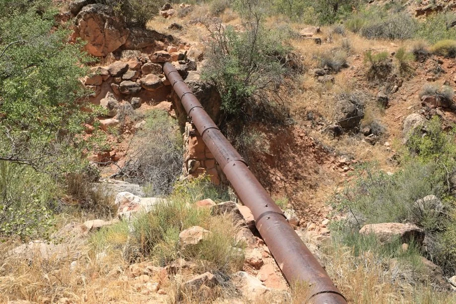
Transcanyon Waterline (built in the 1960s) supplies water between Roaring Springs and the South Rim. This waterline was critically damaged during the flashflood on 29Aug2026, resulting in severely restricted water supply on the South Rim and along the various trails within the canyon. Luckily a new waterline was in the works prior to the flood that starts near Bright Angel Campgorund and will supply the South Rim in the future. Hopes are now on finishing construction of this waterline rather than repairing the old line.
Hiking in June 2026, we each had a gallon of water in our backpack and a 1L water bottle that we carried by hand or had in a sling over our shoulder. We also each had one empty and one full 500mL water bottle in our backpack. The full one was to give to a hiker that might need water somewhere along the hike (yes, I have given that bottle away more than once - I always carry extra water). The empty bottle is to fill up with electrolyte packets and mix with water. On the way up, we alternate the 1L water bottle with 500mL electrolytes. (I bring extra electrolyte packets as well - and yes, I’ve given those away too). I was the only one to refill at 3 Mile Rest House, but I ended up dumping most of it at 1.5 Mile Rest House due to the weight. We all soaked shirts at each water station we passed.
There is no water along South Kaibab. On Bright Angel, there is water from the waterline at 1.5 & 3 Mile Rest Houses and Havasupai Gardens Campground. There is also a small creek below the Gardens that the trail crosses over a handful of times. If water is flowing, this could be filtered and sterilized for drinking.
There isn’t a safe spot to swim or get into the Colorado River. Bright Angel Creek is the best spot if you want to jump into something, and the water can be filtered and sterilized for drinking. Throughout “the Box” section of the trail, the Bright Angel Creek is close enough to the trail to be accessed if needed. Additionally, on a hot day at the bottom, a great place to cool off is at Ribbon Falls. Along North Kaibab, there is water from the waterline at Bright Angel Campground, Cottonwood Campground, Manzanita Rest Area, and Supai Tunnel.
First Aid
Our most common injury are blisters on our feet. We use Foot Glide to try and prevent or minimize the blisters. It looks a little like a deodorant bottle for feet, but it feels different. We rub it all over our feet before putting socks on. Before hiking back up the canyon, we take our boots and socks off, let them rest a bit, and reapply it a second time. I think this stuff helps, but 17+ miles of hiking still might result in at a least a couple of blisters.

Can be purchased through Amazon. I would guess a store like REI would have it too, or something similiar
To treat blisters, my favorite product is Moleskin. It’s like a really thick Band-Aid that can be cut to any size. We treat the blisters with neosporin and then add Moleskin over it, sometimes holding it in place with Athletic Tape, depending on where it is. The Moleskin acts as padding. It really helps minimize the pain. Remember to pack a small scissors to cut the Moleskin into the desired shape.

Same as Foot Glide - this can be purchased through Amazon, but check a store like REI if you prefer.
Third problem I deal with - not sure how common this is - but hiking down is worse than hiking up on my knees. I need working knees to be able to hike back up, so I’ve got to take care of them hiking down. First, I do a lot of preventive work while training - single-leg deadlifts, single-leg calf raises, single-leg glute bridges, single-leg anything - stand on one leg - work the muscles around the knees. I also wear knee braces on the way down and use hiking poles. I take the braces off and fold up my poles for the hike back up.
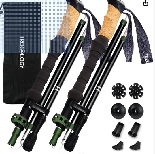
Something like this should work - I don’t know that the brand matters. The collapsable poles are nice because you aren’t stuck using them the whole hike. But they are going to need to be replaced at some point if you hike enough due to the pieces that move.
I’m not sure how I would actually hike up and out of the canyon if I sprained one of my ankles, but I do carry a small and large ace bandages to wrap an ankle just in case. Maybe if I hiked slow enough, I could hobble out with poles? Hopefully this doesn’t ever happen.
Training and Being Able to Assist Others
Near that red region of the map is entering really hard hike territory - even just out-and-back hikes. I can tell you I’ve trained 6 months each time I’ve hiked in the Grand Canyon to make sure I can haul myself back out of the canyon. Hiking into the canyon is optional - hiking out is mandatory.
Training for me is 5 days a week, combining running, walking uphill on a treadmill, stair climbers, and hiking hills, in addition to a ton of pushups, sit-ups, squats, lounges, more squats, and more lounges. Train to and past the point of wanting to stop. The mental training is just as important for this hike as the physical training. If you want more information on training, here is a summary of how I specifically trained for our Rim-to-Rim-to-Rim hike.
In addition to being able to get myself out of the canyon, my goal hiking is that I can take care of others I find on the trail that might need assistance. I’m down there, the Park Rangers are not. Let’s use me first since before requiring another person to hike into the Canyon. Plus, Search and Rescue isn’t going to be immediate. That person probably has a better chance with help from another hiker than waiting. Not everyone is going to ask for help right away - sometimes I need to talk with people a bit before I realize something is wrong or they feel comfortable asking for help. In backcountry, we stop and talk with every hiker we see going the other direction. If you pass us going the same way, I’m going to assume you are fine. If I ask how a hiker is and stop walking while I wait for an answer, the other hiker will stop as well. We ask how things are going. If it’s super hot, we specifically ask if they have enough water. I notice if the other hiker smiles. If they don’t, my first assumption is that they are just tired - legit if they are hiking uphill. But I’ll keep talking to them for a bit and if something still feels off, I will just ask. I might have something that can help. We’ve given water bottles, electrolytes, umbrellas (for shade), helped people find shady spots, and wrapped up knees with extra ace bandages. If you are on the other side of this equation and need something, don’t be scared to ask. I once forgot to pack sunscreen on a day in early April when hiking in New Mexico… Rookie spring mistake for a Minnesotan… The first hiker I passed, I asked if they had any extra, and of course they shared. Hikers take care of hikers.
Weather
The last really difficult hurdle to plan for in the Grand Canyon is the weather. A mile-deep hole can very easily result in a rim that is comfortable or even cold, while the bottom bakes in the sun over 100 deg F. Additionally, there’s no shade at the bottom. With the North Rim services only open May 15 - Oct 15, the most dangerous time of year to be at the bottom (the summer months) is when you are most likely to be at the bottom…
For heat, the elevation to be absolutely paranoid about what time of day you are hiking is 4,000ft (if you are hiking in the summer). That’s approximately Cottonwood Campground on the North Kaibab, Tip Off on South Kaibab, and Havasupai Gardens Campground on Bright Angel. Try to avoid hiking the trails below these points between 10am and 4pm in the summer months. That’s a really hard time to avoid for anyone day hiking… - My advice on this is to be creative and have a back-up plan if needed. The following are helpful strategies for dealing with the heat:
Wear a bra you are comfortable in if others see you. You are going to take your shirt off at every water station, soak it, and put it back on. Although there aren’t many people on these trails, we all congregate near water to take breaks.
Manage your time thoughtfully. Take short breaks until you are back above 4,000ft elevation, then enjoy a nice, long rest. That’s hard to do when Phantom Ranch is a tempting place to stop.
Pack an umbrella and use it as portable shade. Sit under it or hike with it. Don’t forget that you packed it in your bag. Get it out and use it.
Pack a headlamp. The coolest time of the day is at night. We hiked up Bright Angel the first time at night. We had a full moon; the canyon was incredible.
Break the trip into multiple days and enjoy the campgrounds or Phantom Ranch.
In addition to the heat, the other primary weather concern is flash flooding. The area of the trail that is most susceptible to flash floods is “the Box” section along the North Kaibab Trail, a 4-mile section upstream of Phantom Ranch where the canyon walls tighten to just 30-50ft across. Water flows down, so any water not absorbed into the ground will flow from the rim of the canyon into the canyon. In a section this tight, there isn’t anywhere for the excess water to go, creating the potential for dangerous flashfloods, such as what occurred on 29Aug2026. There’s not much you can do in a flashflood other than to stay out of this section if there is rain in the forecast, and that’s a hard decision for hikers to make who have been prepping and training for this hike for months or maybe years. Check the forecast before hiking and talk with Park Rangers - they will have the most current weather information.
Logistics over - let’s hike this thing!
South Kaibab Trail
THERE IS NO WATER ALONG THIS TRAIL
Marked locations along the trail are Ooh Aah Point, Cedar Ridge, Skeleton Point, Tip Off (or tipoff - I see it spelled both ways), and Black Bridge. For an out-and-back hike, do not go past the half-way point, marked between Skeleton Point and Tip Off. Due to the lower elevations of Tip Off and below, the corresponding heat, the large amount of elevation to climb on the return hike up, and the fact that South Kaibab has no water sources (manmade or natural), it is not safe to go beyond this point and hike back. Bring plenty of water with you for however far you plan to hike, and keep in mind it will take twice as long to hike up as it did to hike down.
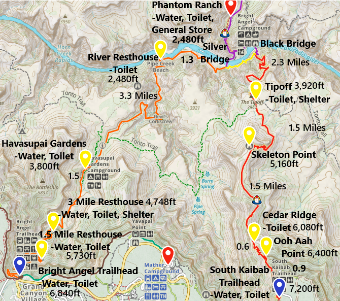
South Rim Trails - South Kaibab and Bright Angel. Mileage, elevation, and services are indicated. Verify the water is on inside the canyon before hiking. The pipe is old and requires frequent repairs, in which case the water is turned off.
I’m not sure if this helps or just clogs up my post, but I’ve included our hiking times. I figure more information might be better for someone curious about hiking these trails.
Trailhead - 7,200ft
(0 Miles / 0ft elevation change from trailhead)
Services - Toilets and Water
June 2016 & 2026 - 4:30am & 4:40am / March 2018 - 6:27am
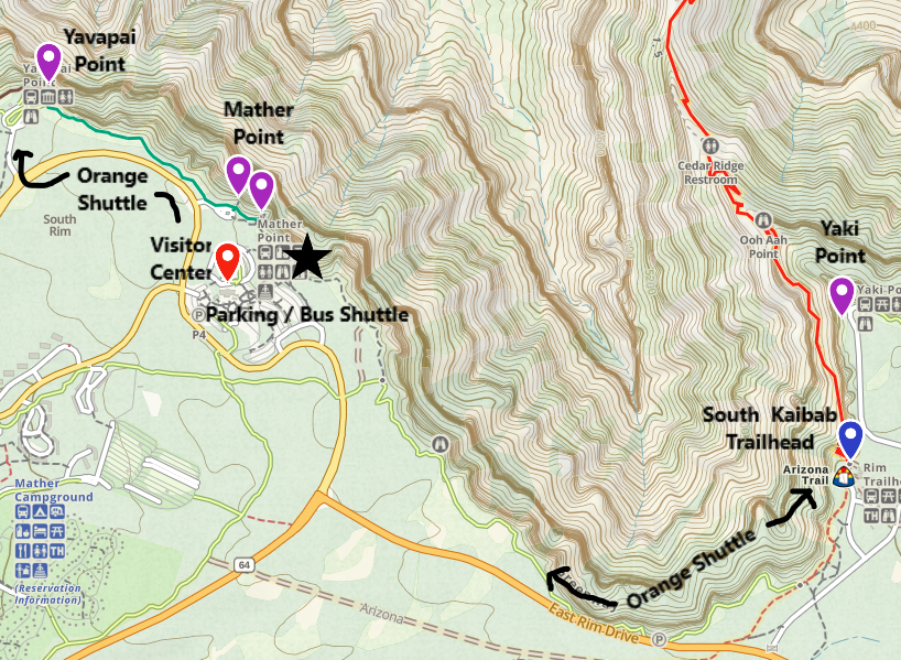
View of South Kaibab Trailhead - There is no parking at the trailhead. In the early hours of the morning, use the Hiker Express Shuttle - a one-way shuttle starting at the Bright Angel Lodge, and stopping at the Backcountry Information Center, Visitor Center, and South Kaibab Trailhead. Throughout the remainder of the day, the Orange Shuttle offers service between the South Kaibab Trailhead, Visitor Center, Yavapai Geology Museum, Mater Point, Pipe Creek Vista, and Yaki Point.
Yes, it’s early… But the best hikes include a sunrise, and the one at Ooh Aah Point is epic.
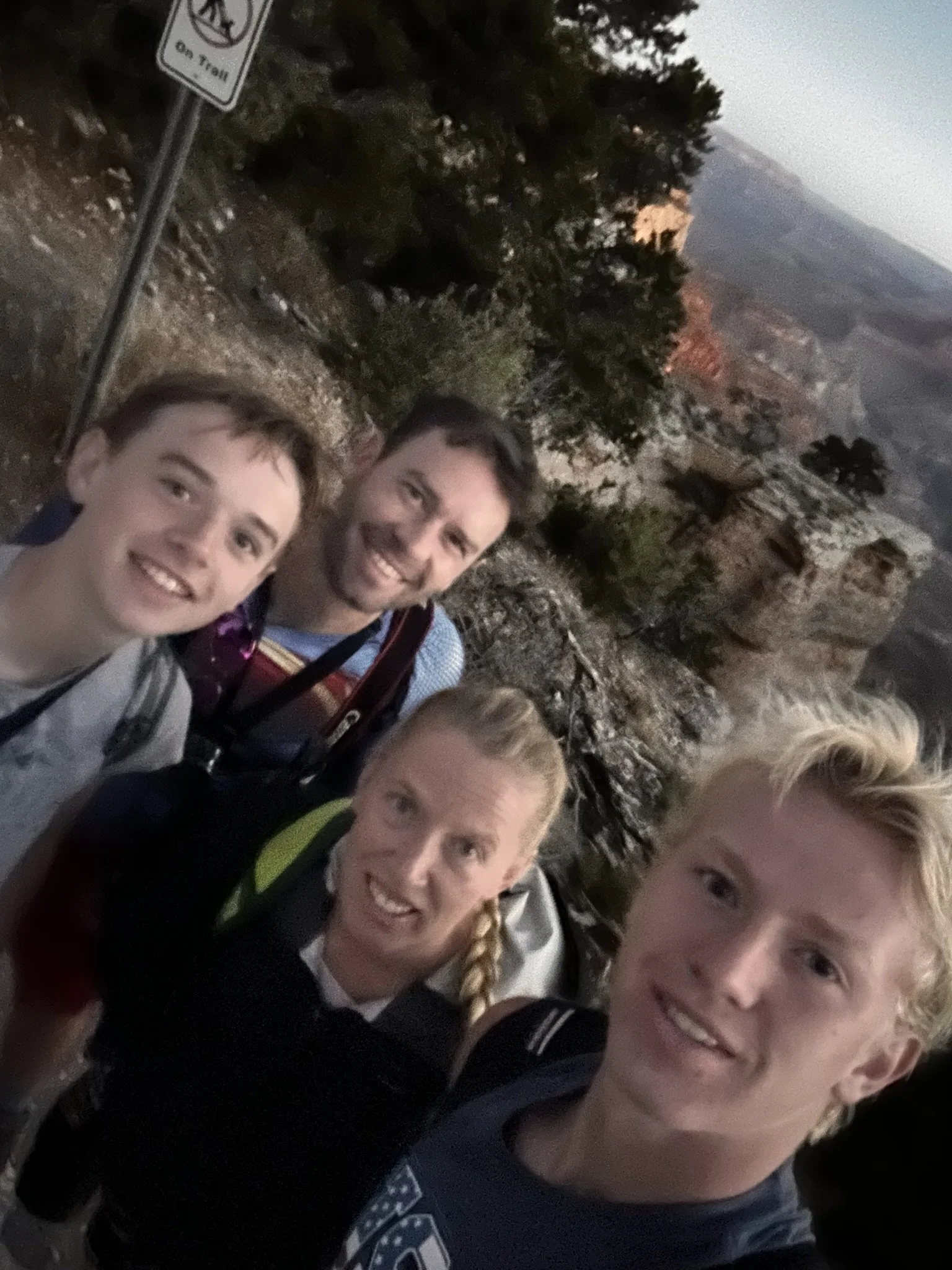
June 2026 (4:40am) - South Kaibab Trailhead with our boys (both teenagers)
The hike is a little chilly in the morning and it’s dark (even in the summer). I’ve used headlamps at the start of the hike, but honestly that’s a bit silly. You can see just about everything by the time you actually start hiking even though the sun hasn’t risen yet. A light-weight jacket is helpful though at the beginning of the trail.
All three times we’ve hiked this trail we’ve been immediately passed by a mule train. They have the right of away. Move to the side or just wait at the trailhead for them to start. They walk fast. You won’t pass them - even if you try…
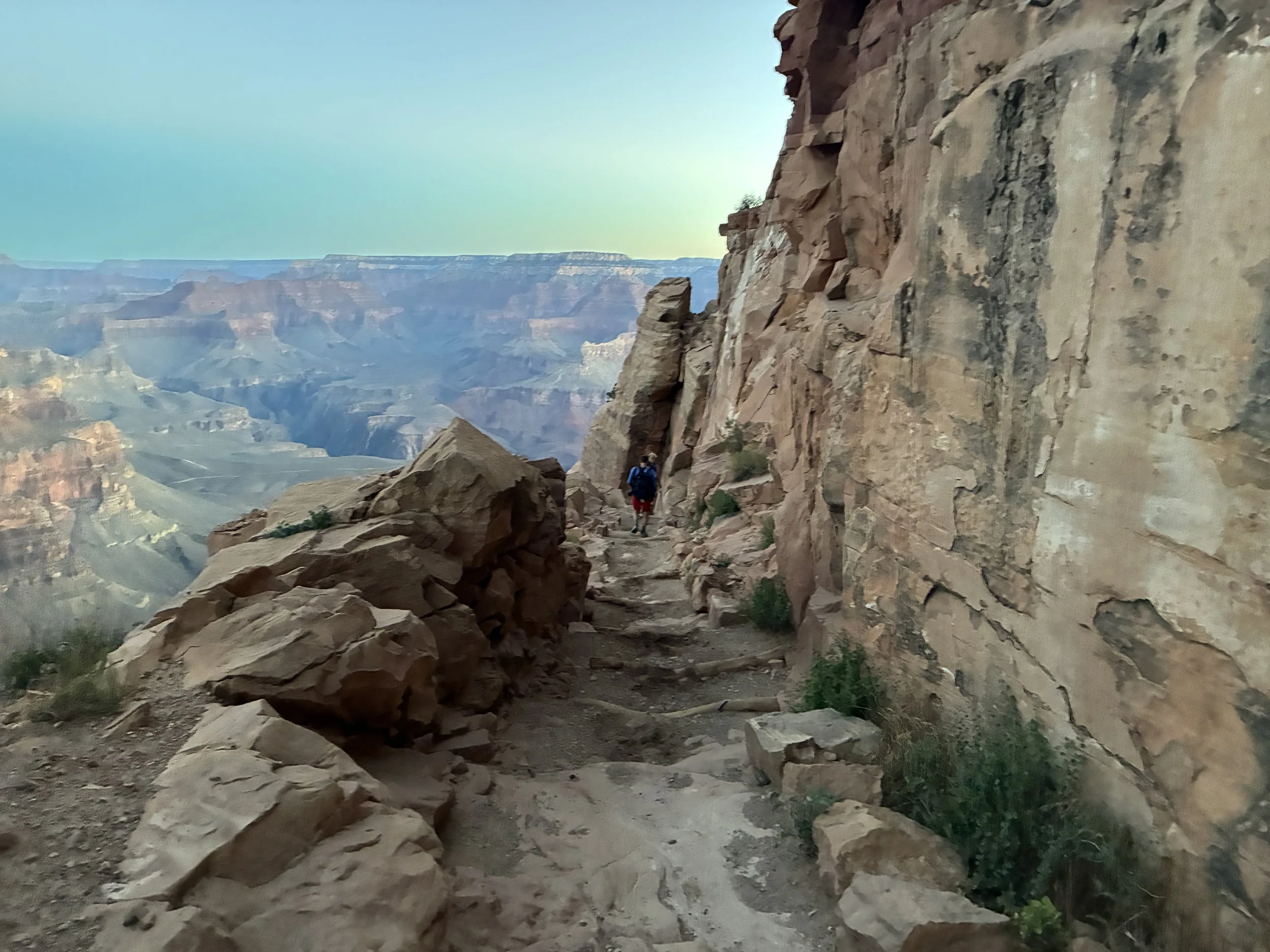
June 2026 (4:48am) - Hiking to Ooh Aah Point
The descent to Ooh Aah Point will seem fast. We’ve been so excited each time - going down this section is really easy, it’s just possible to start making out the canyon walls in the early dawn light, and it is stunning. There are lots of switchbacks… but that’s kind of a theme throughout this whole hike. It’s much too early in the day to worry about having to hike back up so just enjoy these first moments.
Ooh Aah Point - 6,410ft
(0.9 Miles / -790ft elevation from trailhead)
Services - None, but AMAZING SUNRISES!
June 2016 & 2026 - 4:52am & 5:00am / March 2018 - 6:51am
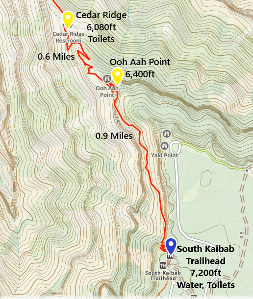
One-way distance between the South Kaibab Trailhead and Ooh Aah Point is 0.9 miles. Our average hiking time is 22 minutes.
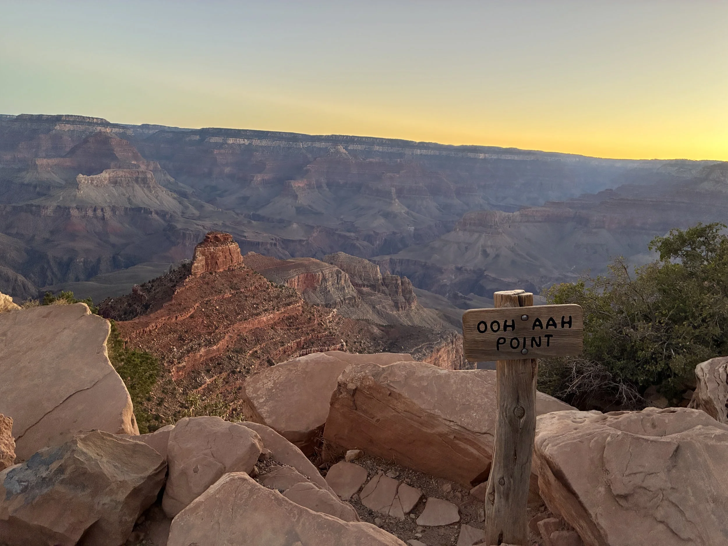
June 2026 (5:00am) - Sunrise at Ooh Aah Point
I think the three sunrises at Ooh Aah Point have best some of the best in my life. It’s aptly named. Even if you aren’t planning on hiking all the way to the river, it’s worth it to get up early and use the Hiker’s Express Shuttle just to witness the sunrise.
In March 2018, we weren’t worried about the heat of midday, and we just stopped here and actually watched the sunrise. On both of our trips in June, we took pictures and fully enjoyed the sunrise as we hiked, but we didn’t take a longer break until reaching the bottom. I can’t state this enough - how you hike this thing, even at the beginning, is crazy important to be safe in the summer if you are going lower than 4,000ft in elevation.
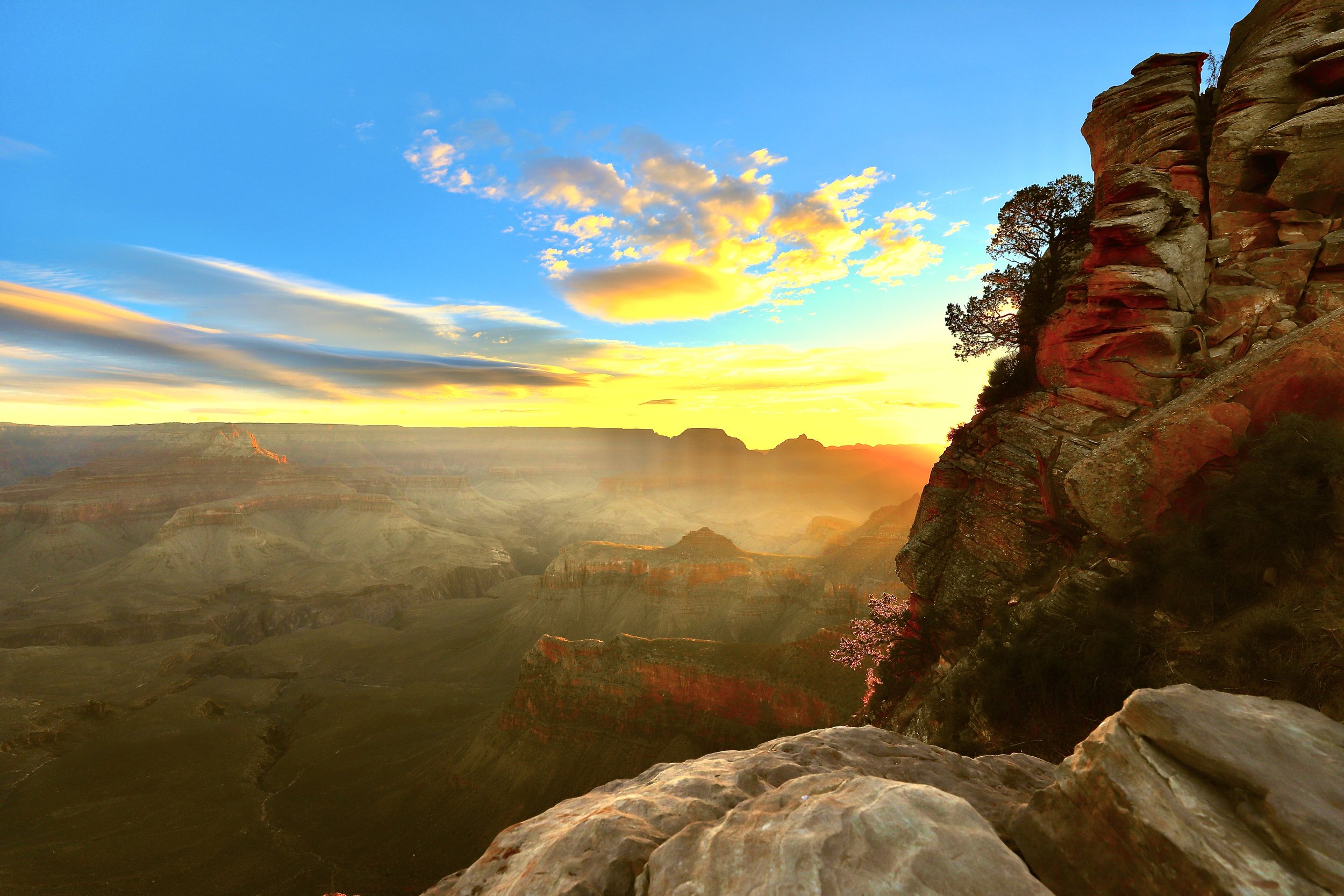
March 2018 (7:02am) - Sunrise at Ooh Aah Point
At Ooh Aah Point, it’s pretty much a 360 view of the Grand Canyon. The trail behind you, the sun rising on your right, and past this point the trail heads straight down into the canyon, stretching for miles in front of you, and on the left the sun is lighting up the canyon walls.
There are several switchbacks following Ooh Aah Point, but the trail is going to be aimed at that large rock structure in the picture below, known as O’Neill Butte, for the next couple of miles.
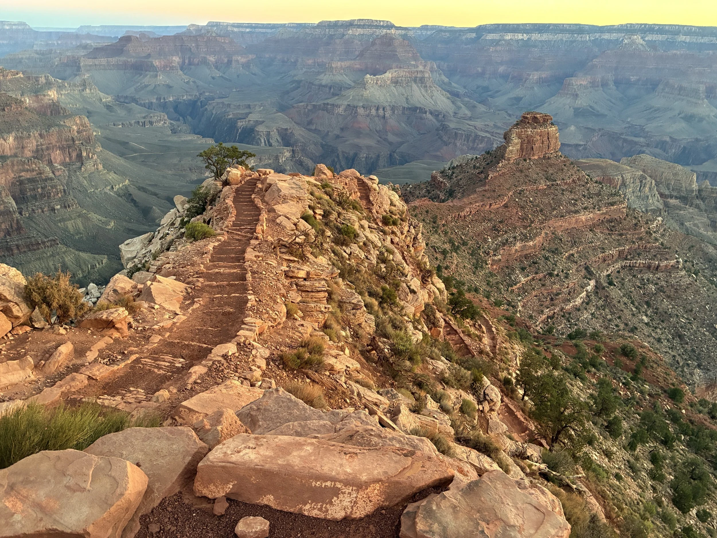
June 2026 (5:08am) - Leaving Ooh Aah and heading towards Cedar Ridge
Cedar Ridge - 6,080ft
(1.5 Miles / -1120ft elevation from trailhead)
Services - Toilets
June 2016 & 2026 - 5:04am & 5:16am / March 2018 - 7:23am
Avg Total Hike Time (41 minutes)
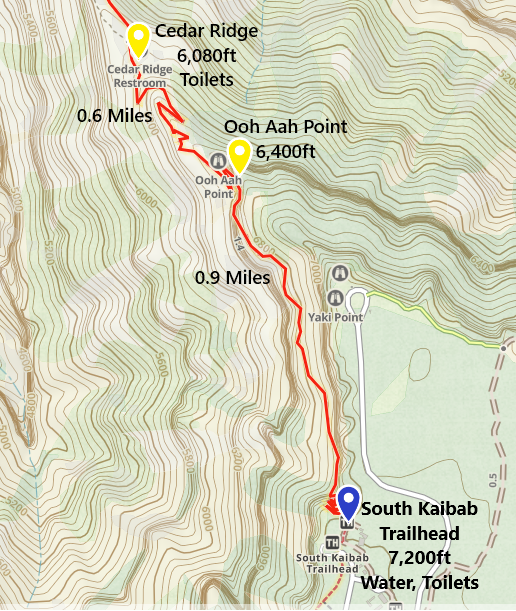
One-way distance between Ooh Aah Point and Cedar Ridge is 0.6 miles. Our average hiking time this section is 20 minutes.
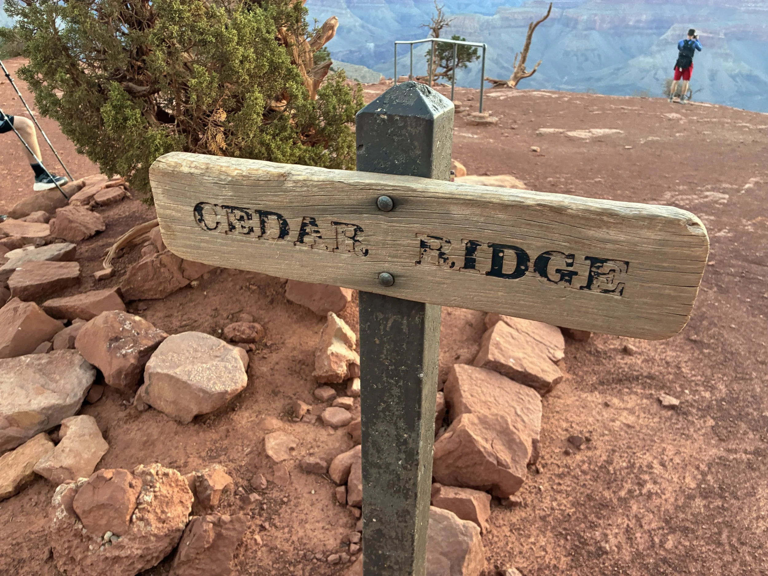
June 2026 (5:16am) - Cedar Ridge
My first visit to the Grand Canyon was with my parents when I was in 8th grade. My dad and I made it to Cedar Ridge. My mom had stopped a bit earlier on this trail. Cedar Ridge was our turn around point, and this was tough for me. Not because it was hard to hike back up to the rim, but because I had to turn around without getting a glimpse of the Colorado River, and even more, I didn’t get to put my feet into the water that had the audacity to carve this canyon. I think I knew then that this would be an important place in my life, even though it would be 20 years before I found myself on this trail again.
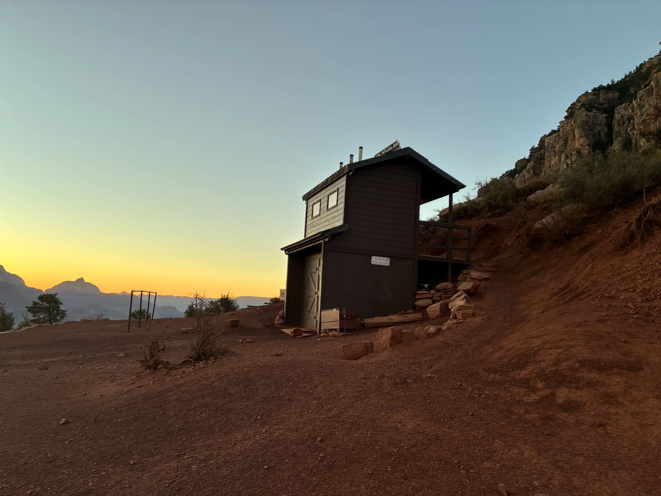
June 2026 (5:16am) - Cedar Ridge Toilets
Going down is still pretty easy - with hiking poles and knee braces. I’m going to feel it by the time we are at the bottom, but right now every part of me still feels pretty good. Below Cedar Ridge, the view starts to change slightly. It’s possible to start seeing the next section of rock, although the Colorado River is not yet visible. The trail will still aim towards O’Neill Butte before eventually dropping below it.
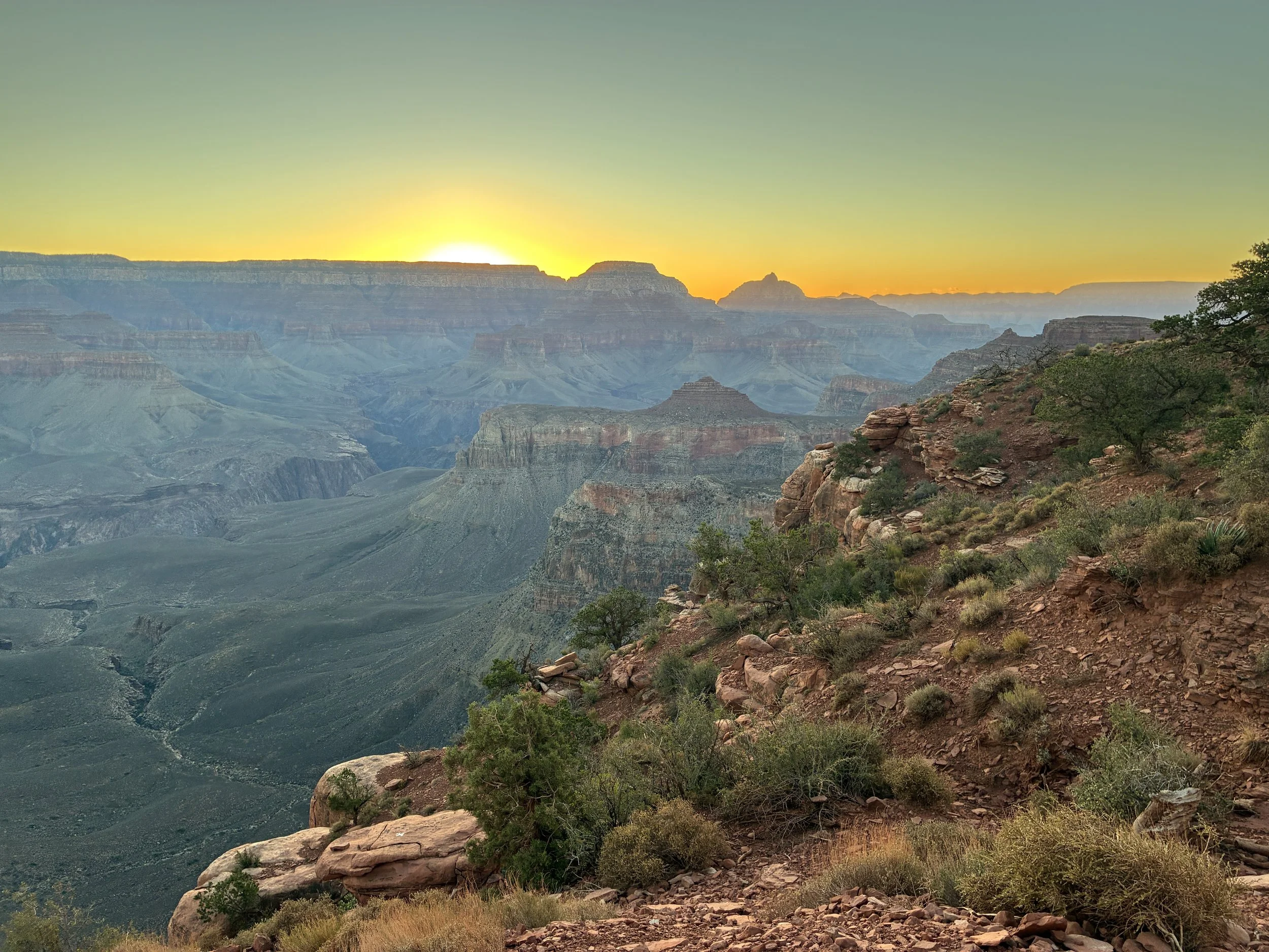
June 2026 (5:20am) - Hiking down to Skeleton Point
On our trip in June 2026, it had rained the evening before. There were still puddles on the trail.
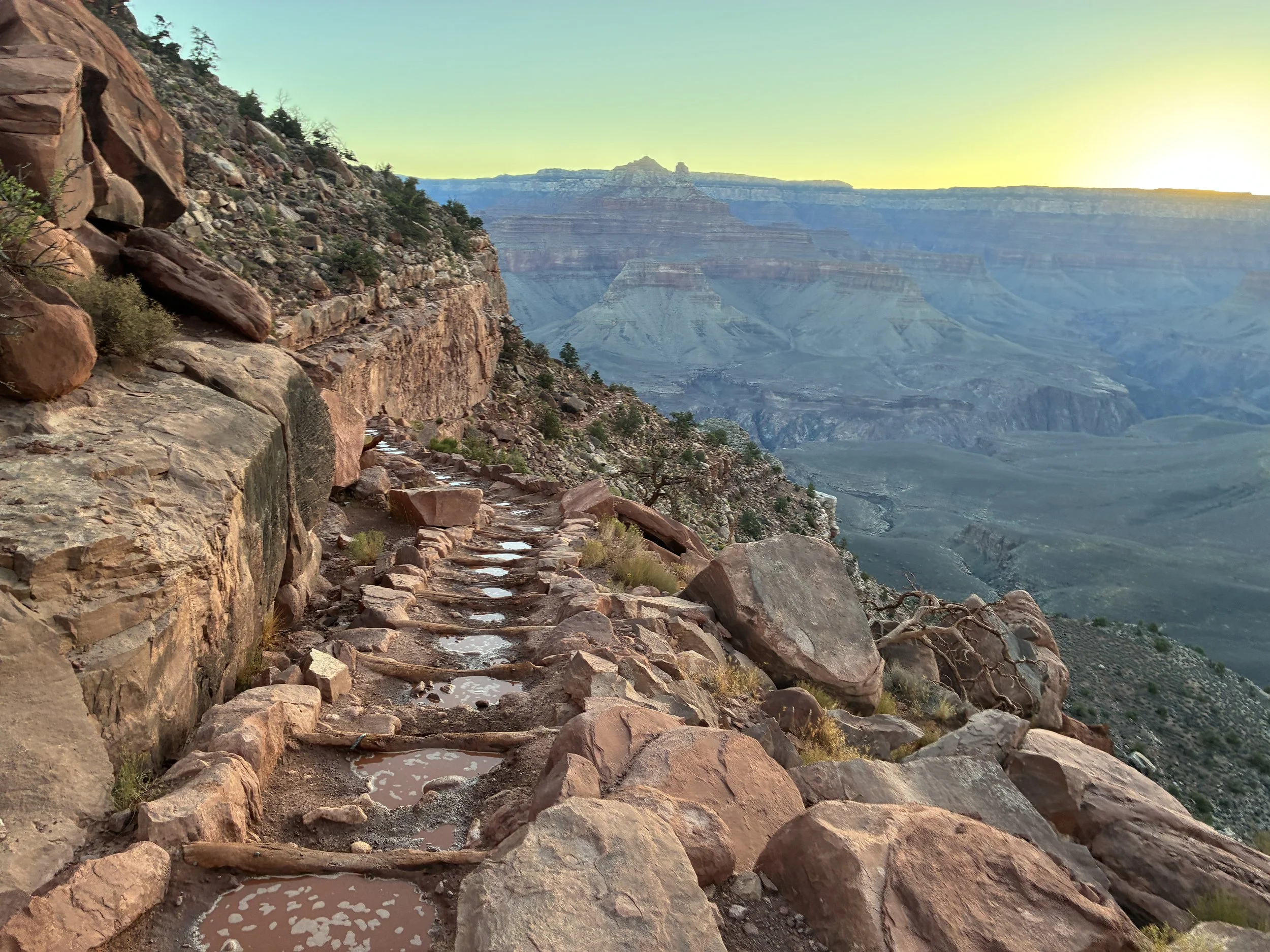
June 2026 (5:31am) - Hiking to Skeleton Point trying to avoid the puddles from the rainfall the day before
O’Neill Butte is now above us, off on the left. The next big rock structure is called Natural Arch, although I’m not sure why - I haven’t ever noticed an arch formation. If you zoom in on the picture below, there are some wicked switchbacks between Skeleton Point and Tipoff. The view from those switchbacks is my favorite section of the South Kaibab Trail.
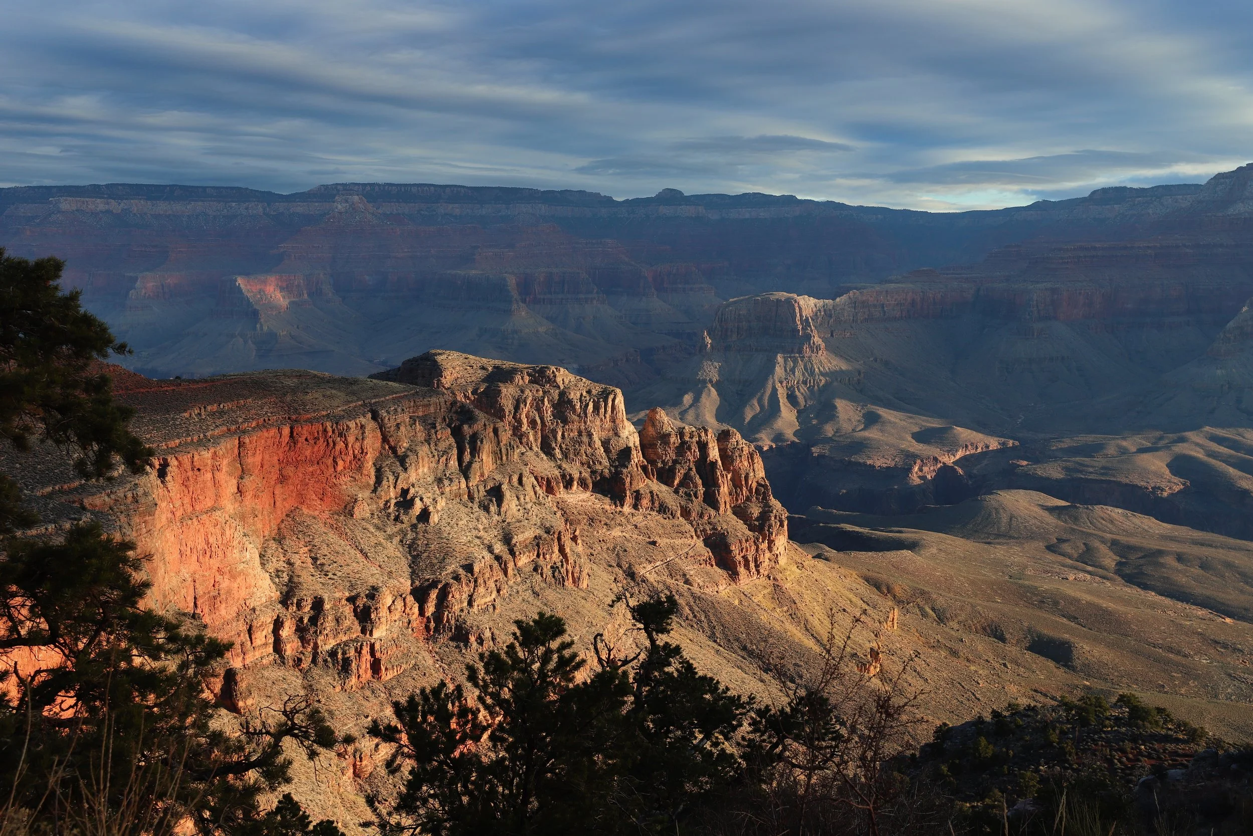
March 2018 (8:38am) - First glimpse of the trail below Skeleton Point
The view changes significantly before arriving at Skeleton Point. It’s now obvious we are hiking “in” the canyon. It’s above and below us, and there are sections within the rock wall where the trail is almost flat. It’s not possible to see the Colorado River yet, but the last steep section where the rock drops straight down to the water is now visible.
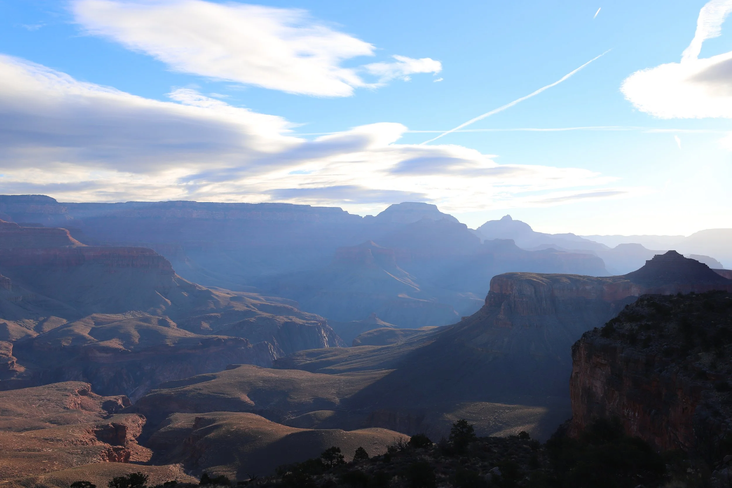
March 2018 (8:44am) - This is where it starts to feel like being “in” the canyon
Skeleton Point - 5,160ft
(3 Miles / -2040ft elevation from trailhead)
Services - None - First view of Colorado River
June 2016 & 2026 - 5:48am & 5:54am / March 2018 - 8:05am
Avg Total Hike Time (1 hour & 17 minutes)
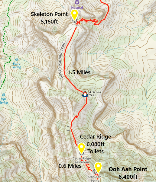
One-way distance between Cedar Ridge and Skeleton Point is 1.5 miles. Our average hiking time this section is 41 minutes.
For an out-and-back hike, with proper planning and training, a short distance after Skeleton Point is a smart place to turn around. The Colorado River is visible in a couple of minutes and the view from the switchbacks is incredible.
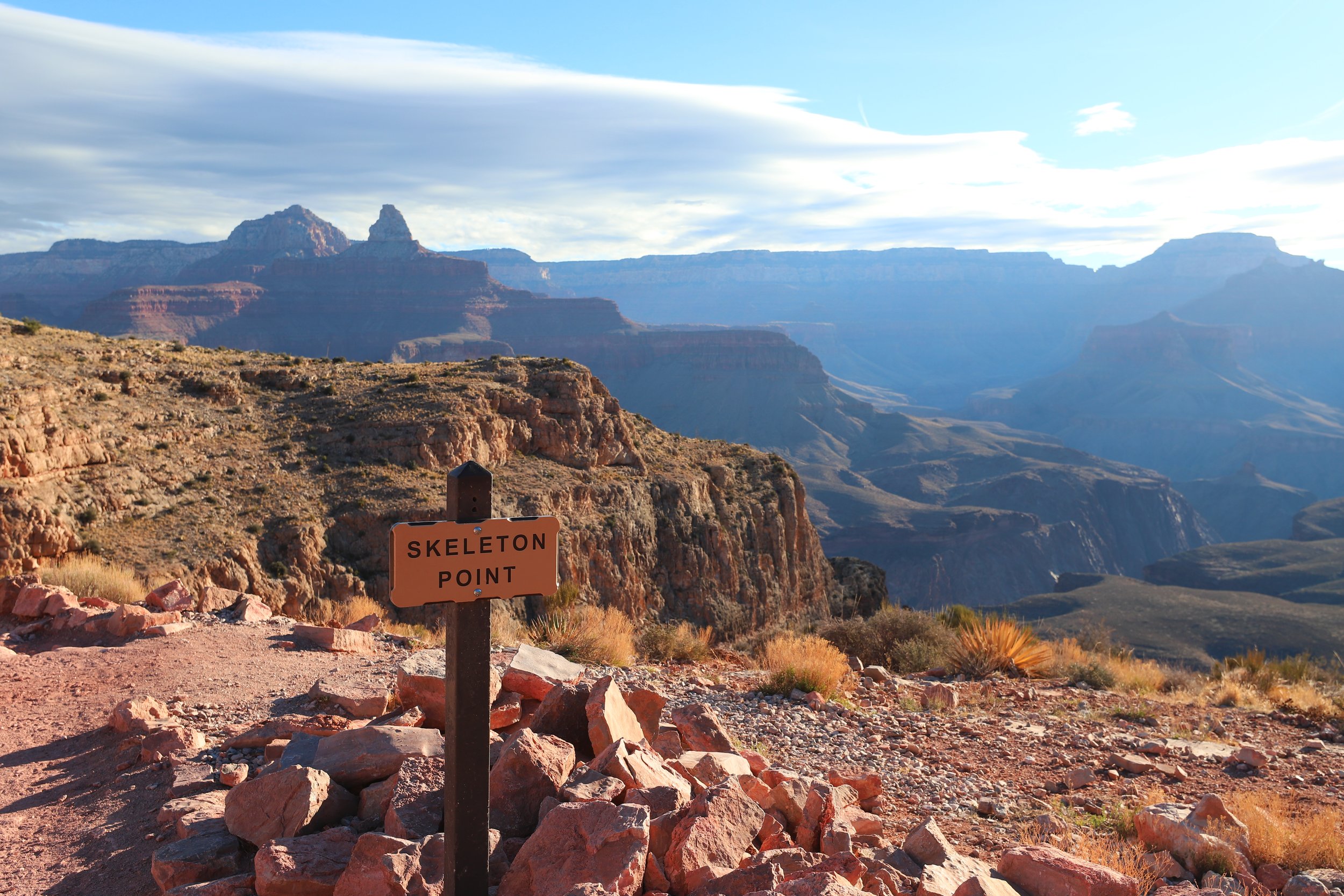
March 2018 (9:02am) - Skeleton Point
Hiking between Skeleton Point and Tipoff is my favorite section along South Kaibab. Every view is amazing.
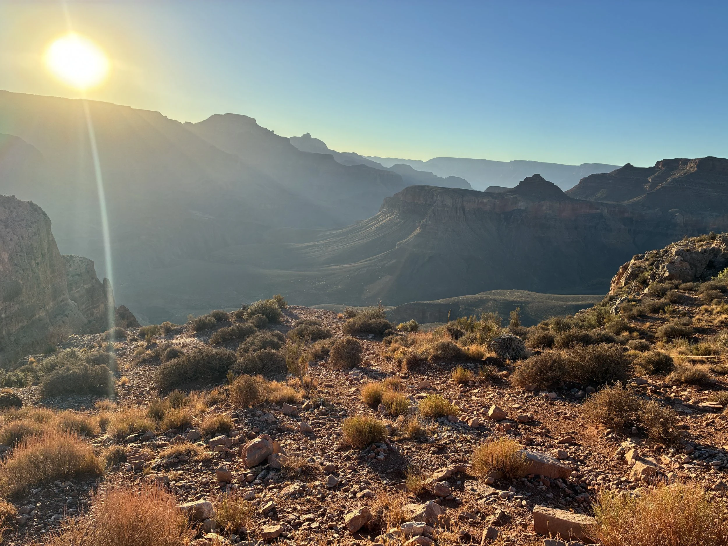
June 2026 (5:56am) - Hiking to Tipoff - Just before the switchbacks start
As promised, here is in the first glimpse of the Colorado River. Note that the Colorado River is actually also visible from the South Rim without any descent at all along the road to Hermits Rest (Get on the Red Shuttle and hike the Rim Trail between Powell and Hopi or Mohave). I hadn’t hiked at any of the stops along this road until 2026. I would highly suggest these quiet rim hikes over the South Kaibab Trail to any hiker of any ability (unless you are looking for a sunrise… That hike to Ooh Aah is worth it.)
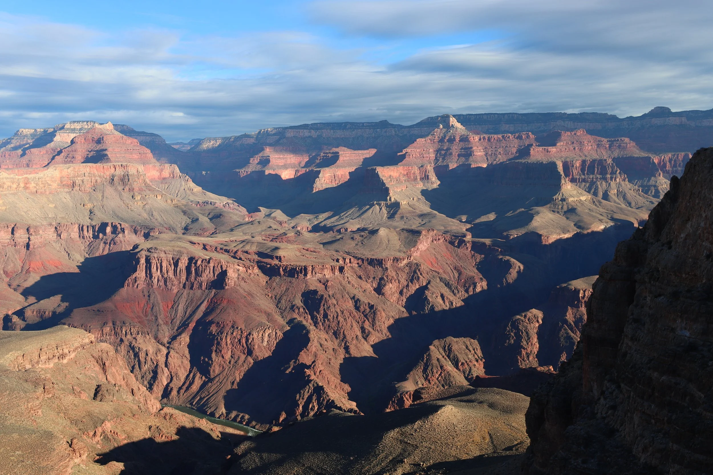
March 2018 (9:05am) - The first glimpse of the Colorado River along the South Kaibab Trail is just a couple of minutes past Skeleton Point
We have the picture below blown up to a 16x20 portrait, and it’s hanging, framed, in our family room. Although this is my favorite view along the South Kaibab trail, this is also the point in the trail where I start thinking about needing to hike back up…
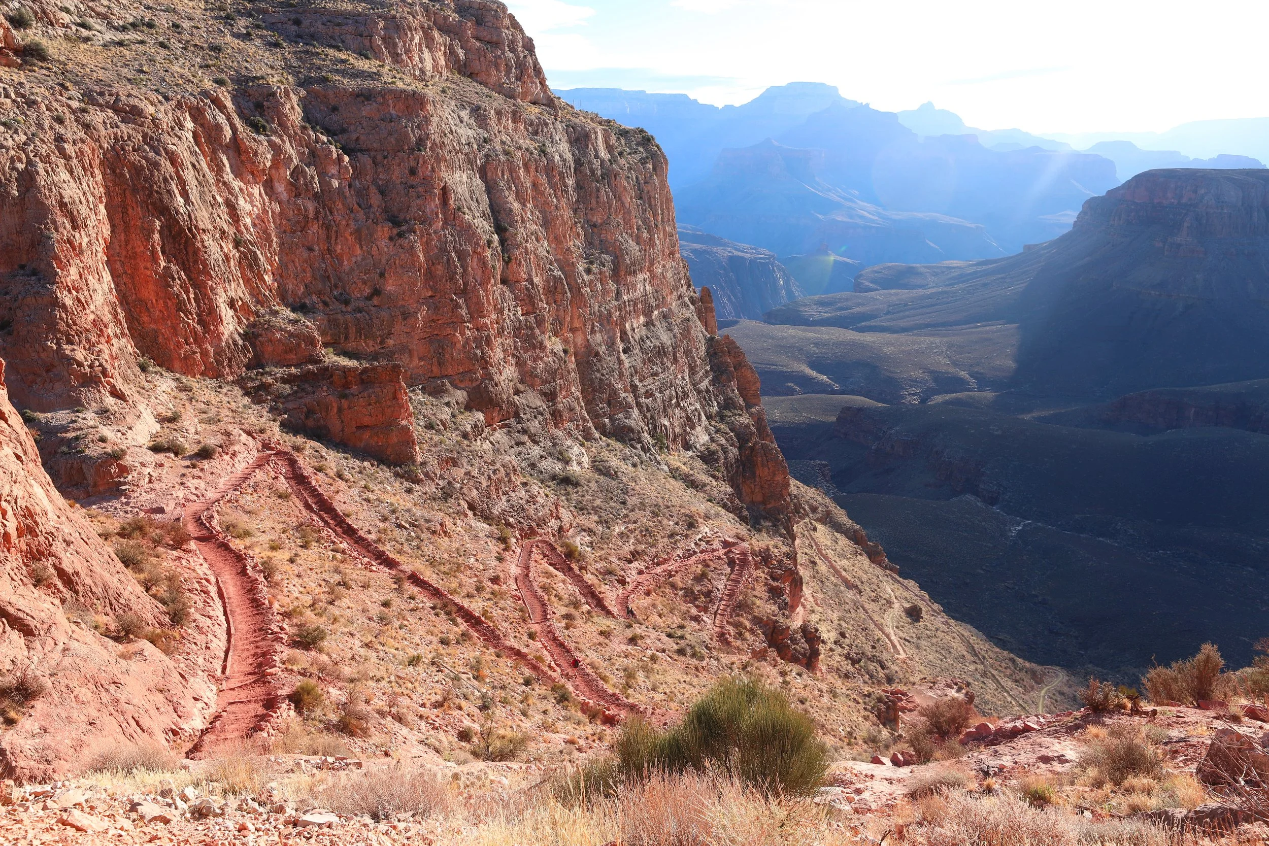
March 2018 (9:06am) - My favorite part of the South Kaibab Trail, between Skeleton Point and Tipoff
This picture is from just a few switchbacks below the picture above it. Hopefully you can see why it’s my favorite part of the trail.
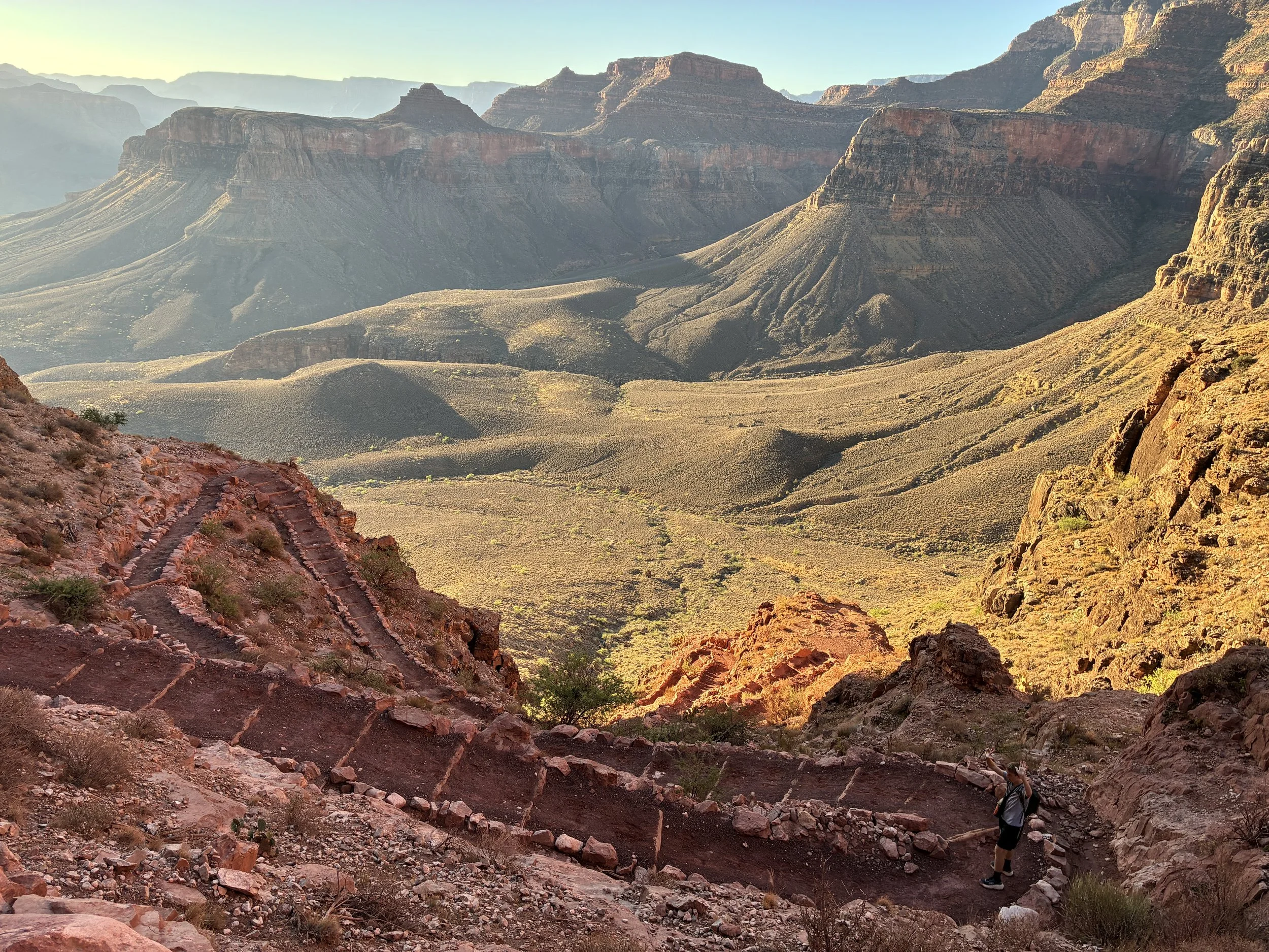
June 2026 (6:10am) - Hiking down the switchbacks on the way to Tipoff
About halfway down this set of switch backs there is a sign that I think of as the “Point of No Return.” It’s essentially the halfway point between the South Kaibab Trailhead (3.5 miles) and Phantom Ranch (3.8 miles).
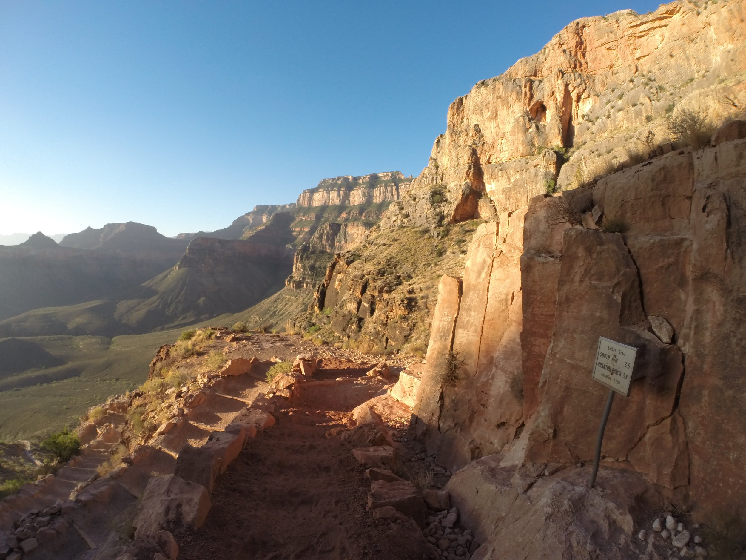
June 2016 (5:58am) - The “point of no return” - halfway between South Kaibab Trailhead and Phantom Ranch
The trail flattens out one last time as it nears Tipoff.
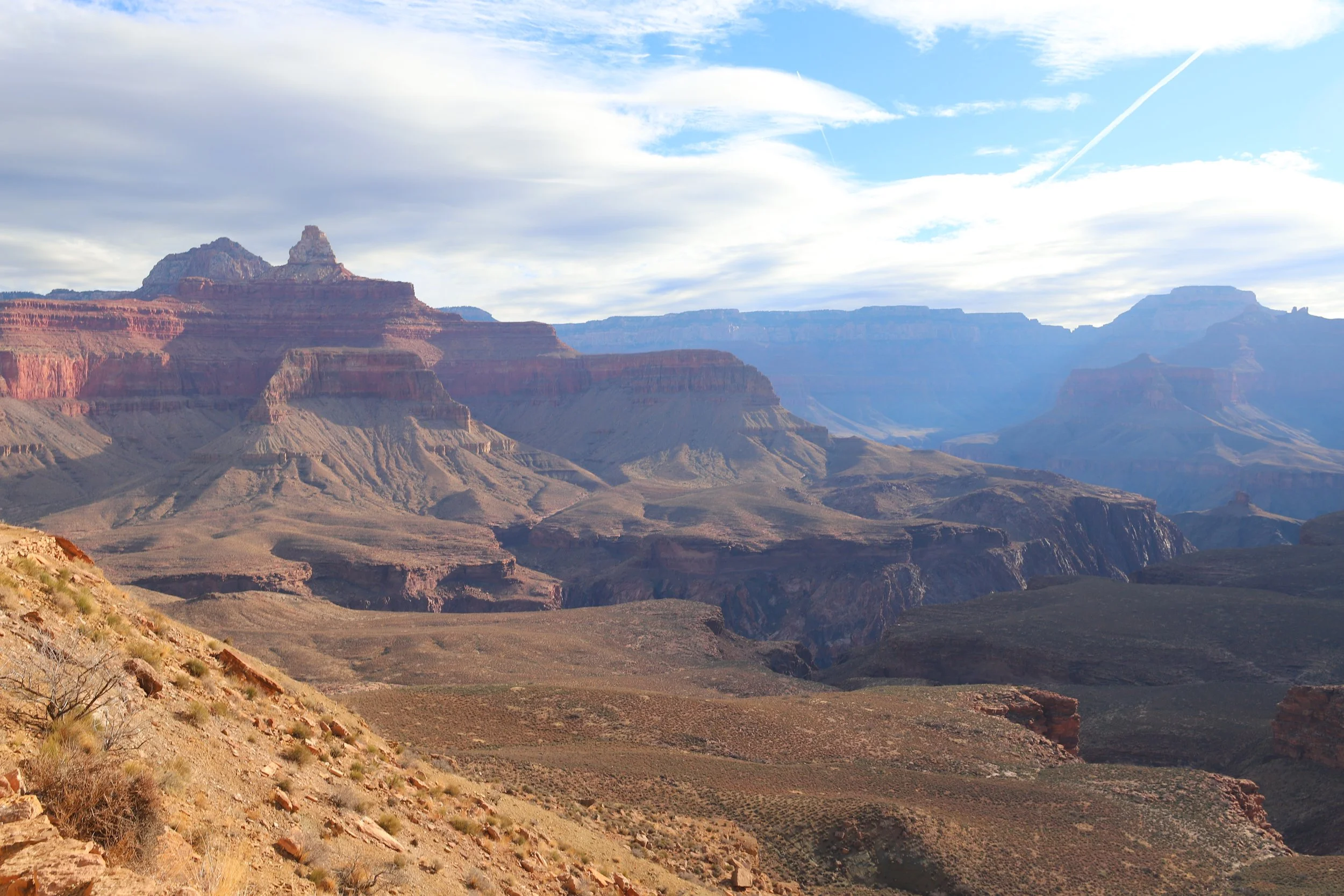
March 2018 (9:28am) - Almost to Tipoff
Tip Off - 3,920ft
(4.5 Miles / -3280ft elevation from trailhead)
Services - Toilets, Shelter, Trailhead Intersection with Tonto (connects with Bright Angel just below Havasupai Gardens Campground)
June 2016 & 2026 - 6:38am & 6:40am / March 2018 - 8:55am
Avg Total Hike Time (2 hours & 5 minutes)
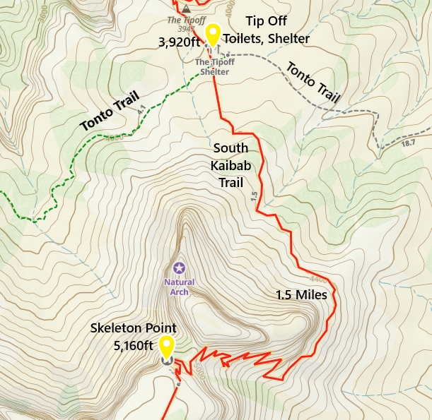
One-way distance between Skeleton Point and Tip Off is 1.5 miles. Our average hiking time this section is 49 minutes.
In addition to toilets and a small shelter, Tip Off is also the intersection with the Tonto Trail. For anyone wanting to hike a loop but not go all the way to the Colorado River, turn here and take Tonto to the west. It joins with the Bright Angel Trail just below Havasupai Gardens. The Tonto Trail between South Kaibab and Bright Angel is 4 miles. I haven’t had the chance to hike Tonto yet, but some day I’d like to combine this with a trek out to Plateau Point before ascending up Bright Angel.
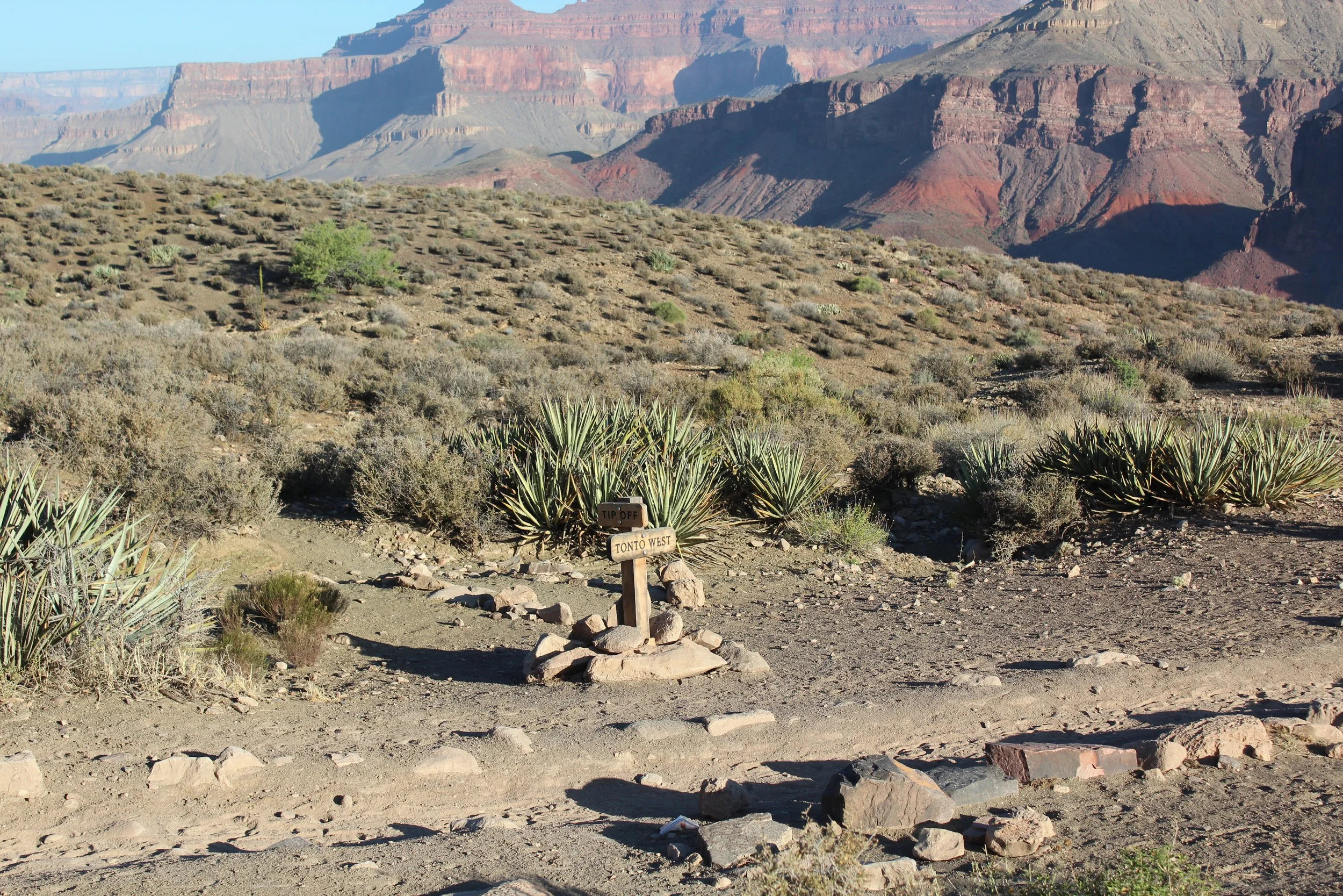
June 2016 (6:32am) - Tipoff and the Tonto Trail junction
The problem with hiking just one way is that you have to remember to turn around to see the views in the other direction. This is looking back at the Natural Arch structure. The trail zigzagged down behind and then wrapped around it.
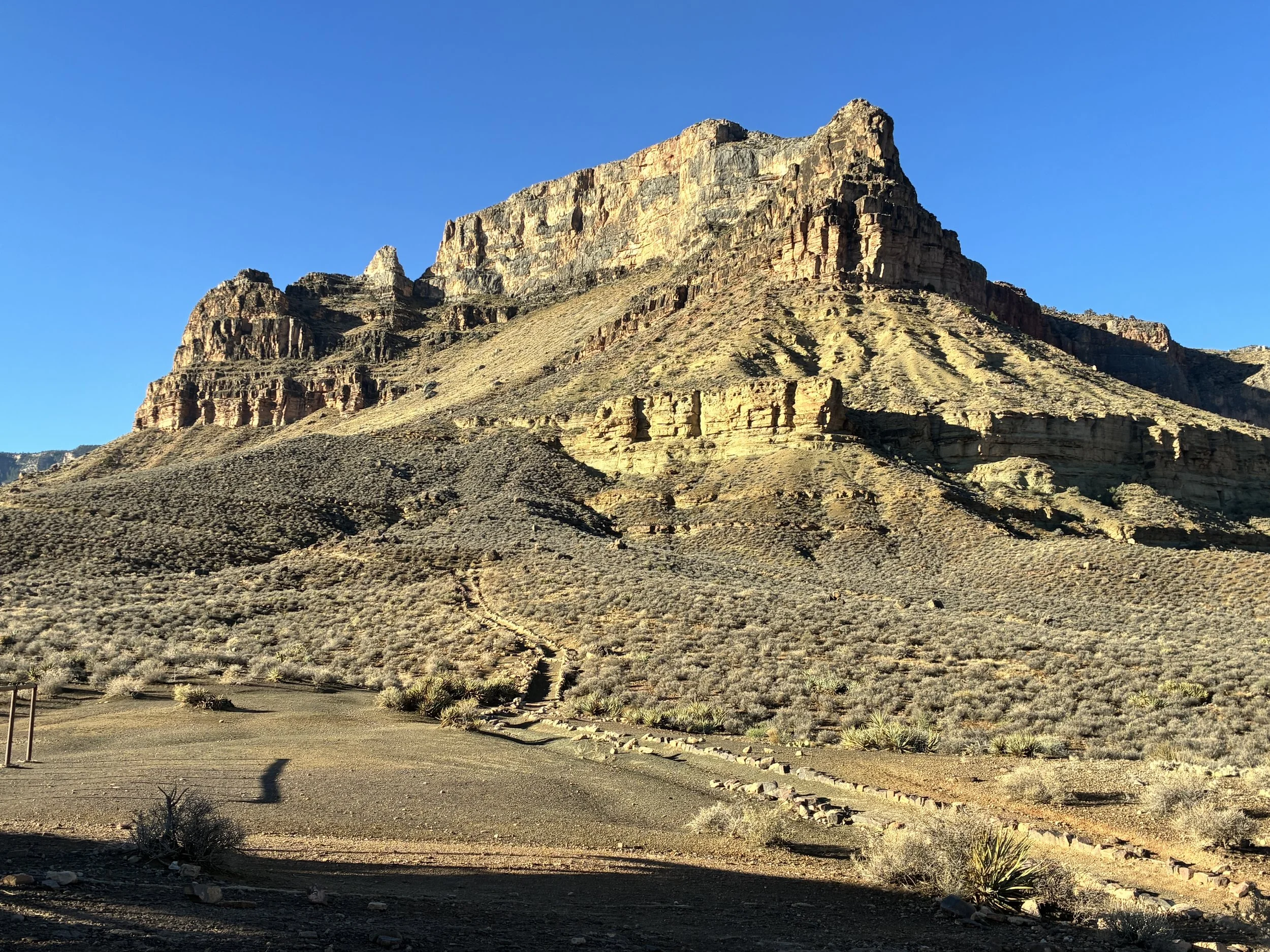
June 2026 (6:43am) - Looking back up towards Skeleton Point
There are a handful of shelter areas along the trail at Tip Off, Phantom, River Rest, and 3 Mile Rest House. This knowledge might help for anyone that needs some shade, or an option to get out of the rain.
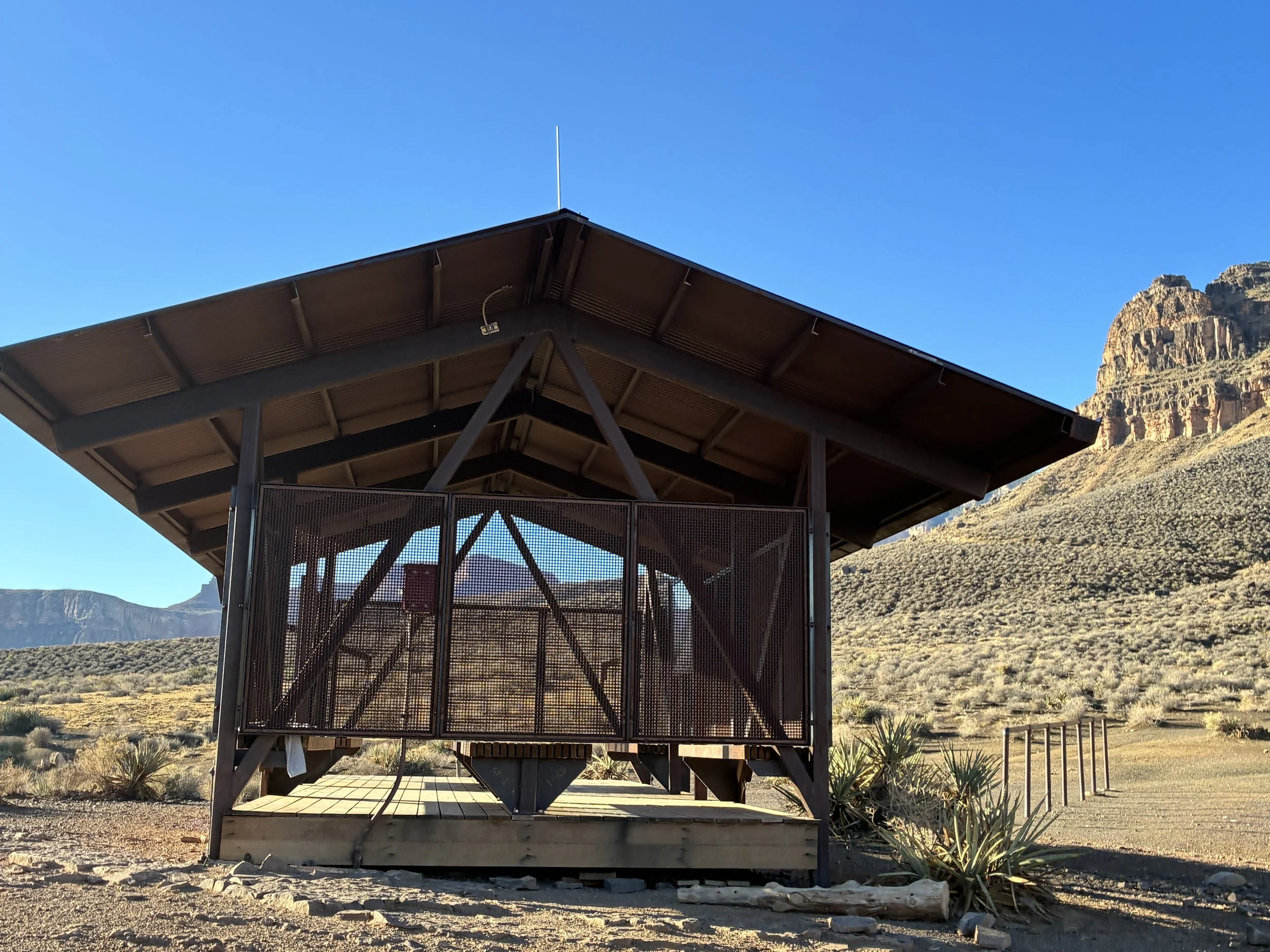
June 2026 (6:43am) - Shelter at Tipoff
From Tipoff to the Colorado River, it’s just dramatic switchback after dramatic switchback. Bright Angel is an easier trail to climb up, but it has some extremely difficult sections as well. Those who choose to go down in a canyon also choose to climb back up…
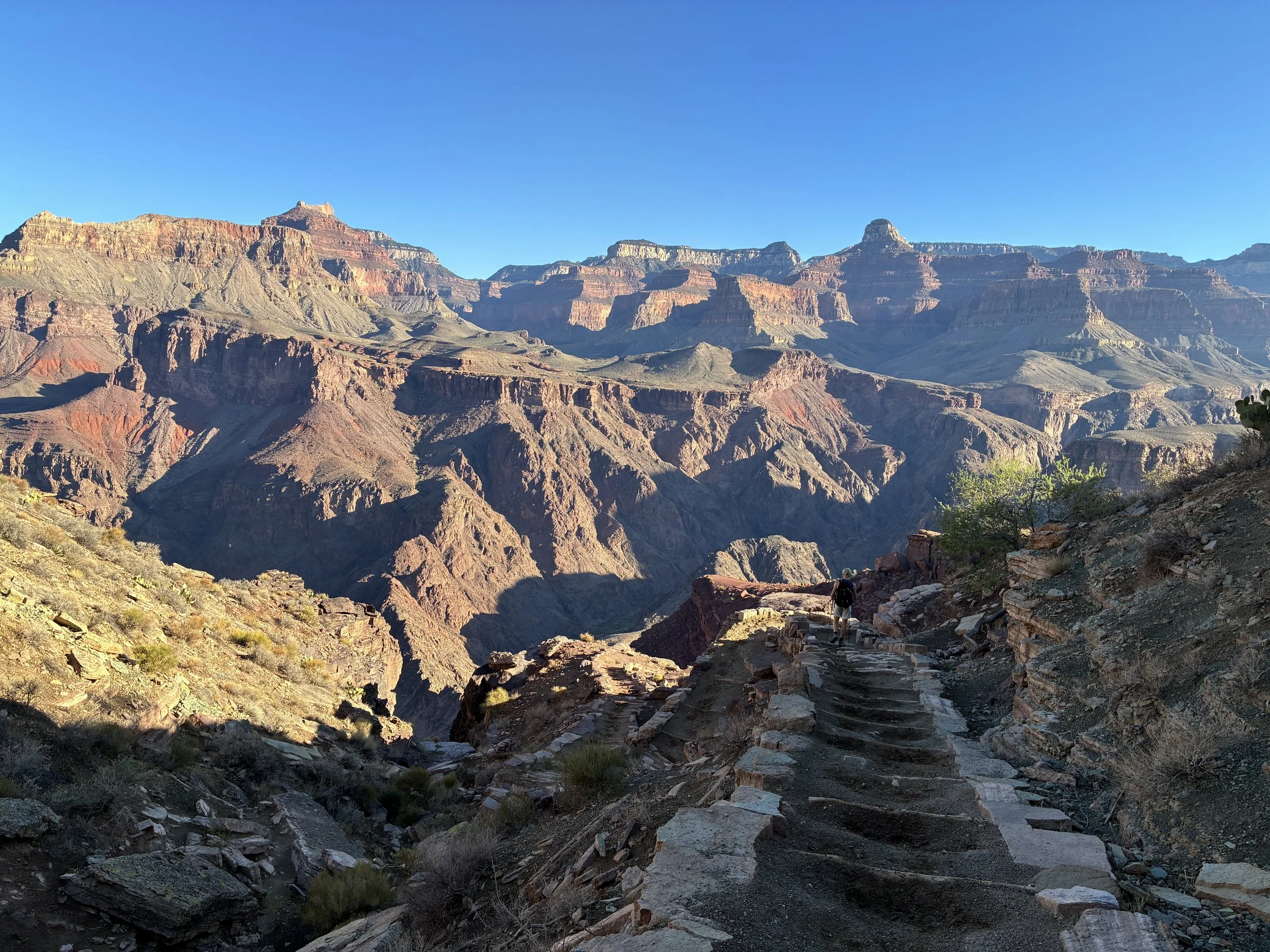
June 2026 (6:53am) - Hiking down to the Colorado River
After making it around this rock structure, the trail down to the river is going to be visible.
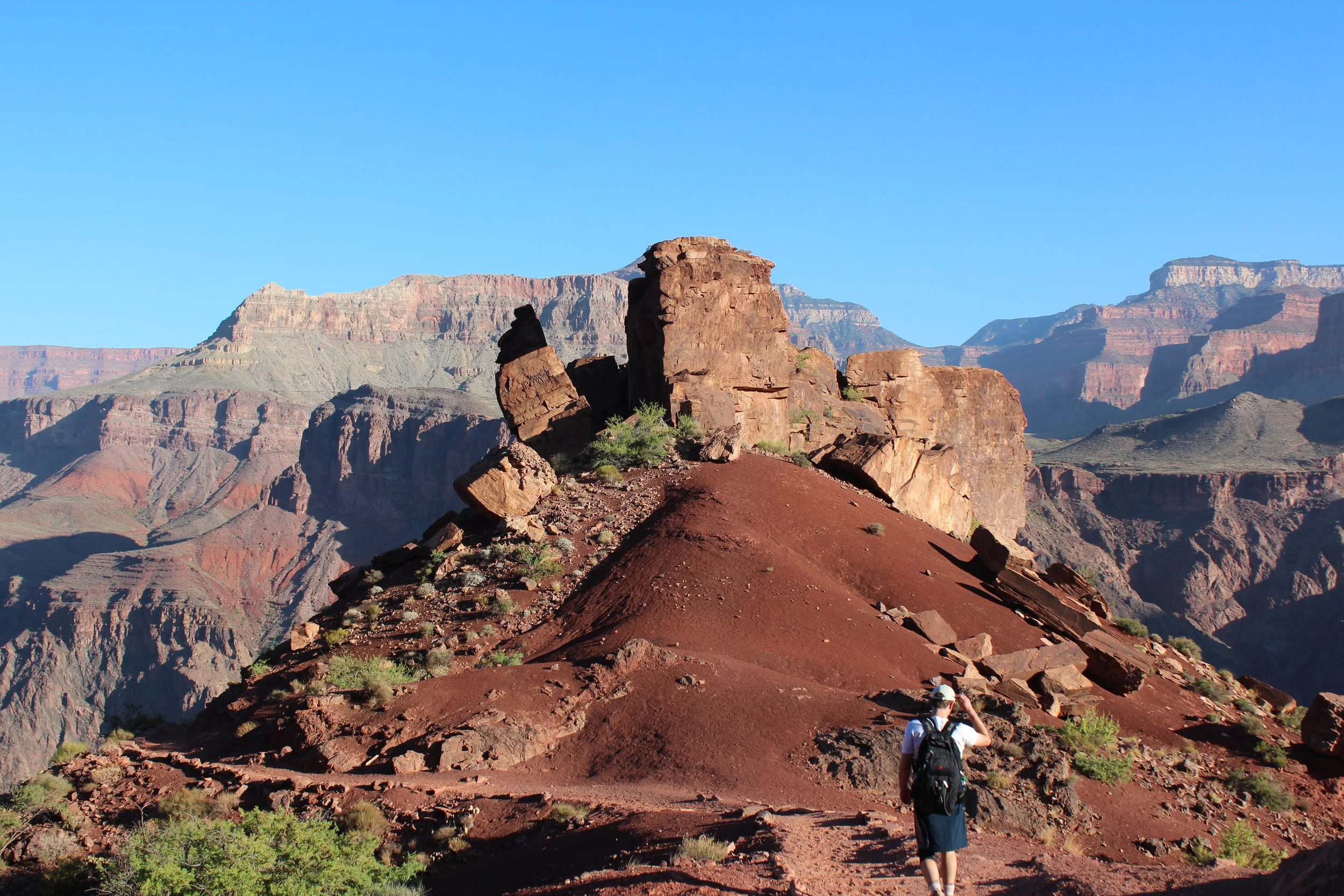
June 2016 (6:52am) - Last section before hitting the steep switchbacks heading down to the water
The final descent… This section goes relatively quickly, but by this point in the trail, I’m feeling every step down in each of my joints. This might be a good time to talk about Canyon Toes. When I buy hiking boots, I buy a half size bigger than my regular shoes. Throughout a full day of hiking, feet swell. The larger boot helps accommodate that problem, but it creates another issue if the laces aren’t tied tight enough. If your foot can slip forward and hit the end of the boot, eventually it can damage your foot enough to cause toenails to fall off. It’s not immediate - for me it’s usually 4-6 weeks after the hike. They grow back - don’t worry. Lace those boots tight (said with experience…)
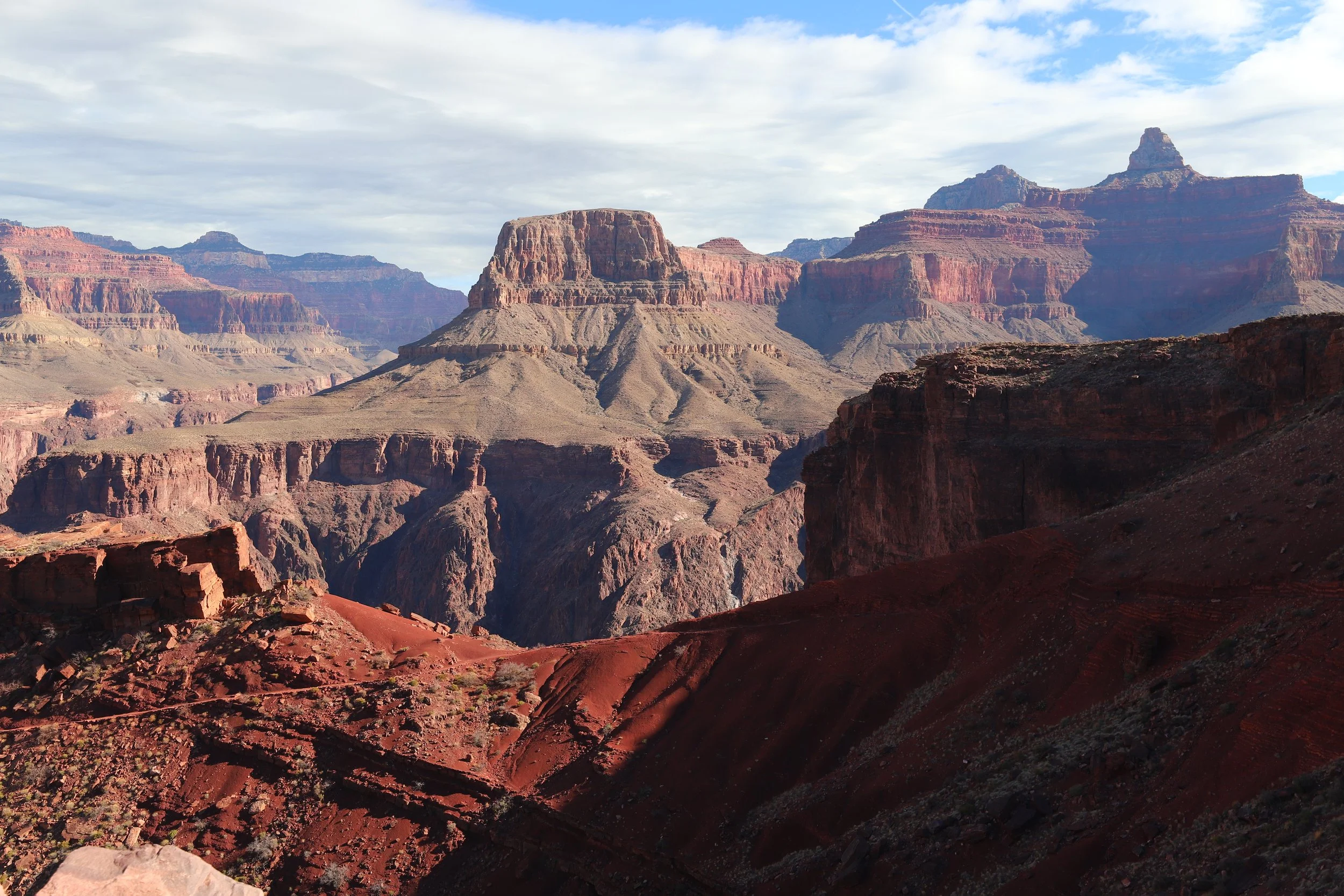
March 2018 (10:12am) - Descending South Kaibab Trail below Tipoff
This section of the trail is just ridiculous. The power of nature is so apparent from this point forward.
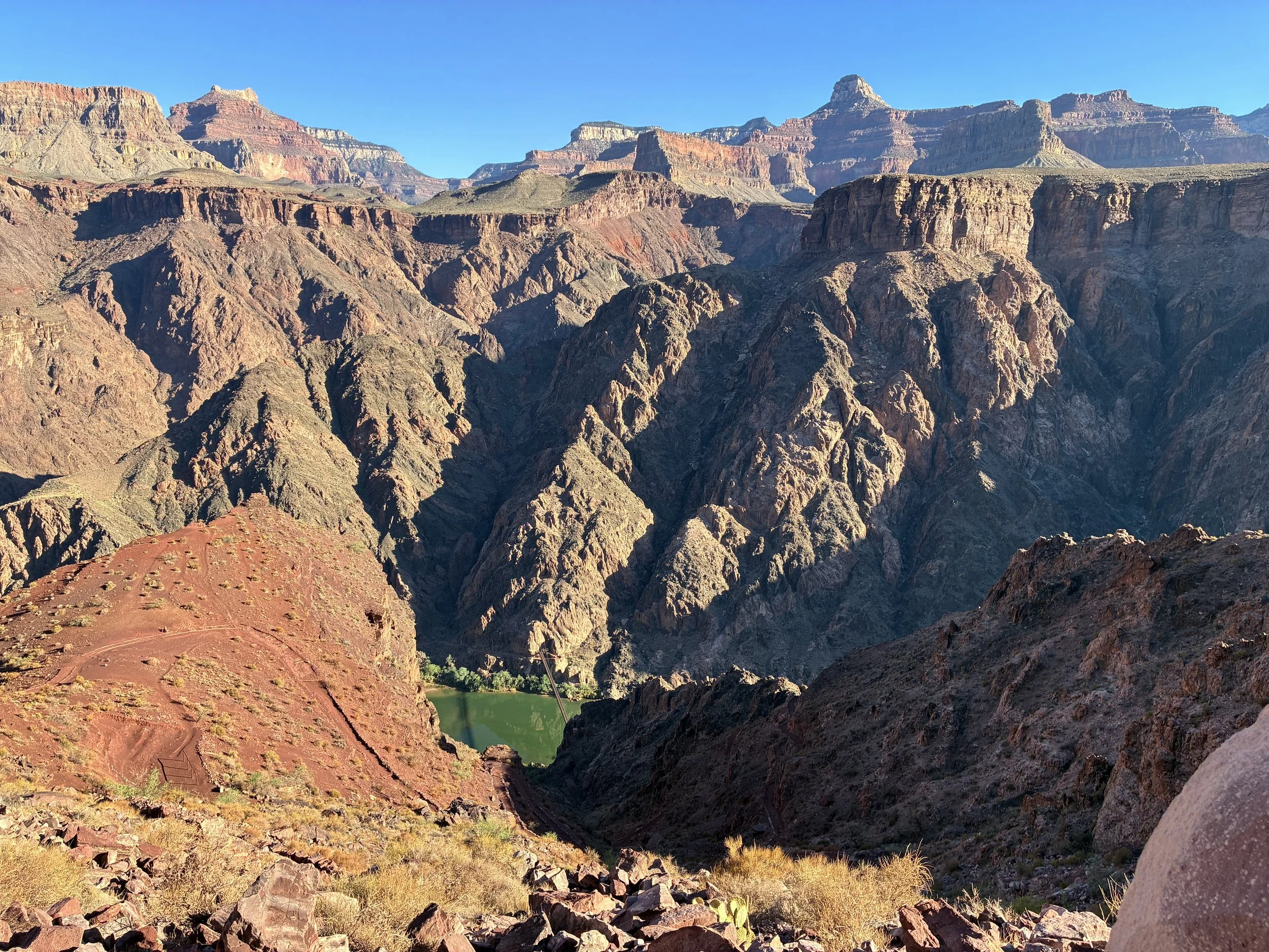
June 2026 (7:12am) - First glimpse of Black Bridge
From here, looking upstream, the black bridge is visible. Looking downstream, the silver bridge is visible. Also visible - the crazy switchbacks you still need to hike down. At the bottom, the black bridge will cross the Colorado River, and the trail connecting to Phantom Ranch and Bright Angel Campground continues on the other north side of the river.
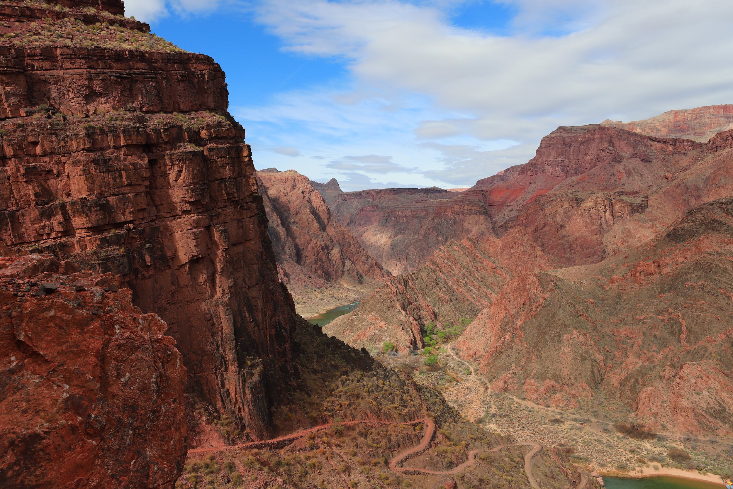
March 2018 (10:53am) - The switchbacks are just getting started
I’m not exactly sure what the newer building is by the river, but it has something to do with building a new waterline to the South Rim. Currently the waterline starts near Roaring Springs and travels all the way to the South Rim. I mentioned earlier that this pipeline is old, breaks frequently, and was significantly damaged in the flashflood on 29Aug2026. There is a new pipeline being built that starts here, at the bottom of the canyon, and it will eventually service the South Rim when construction is complete.
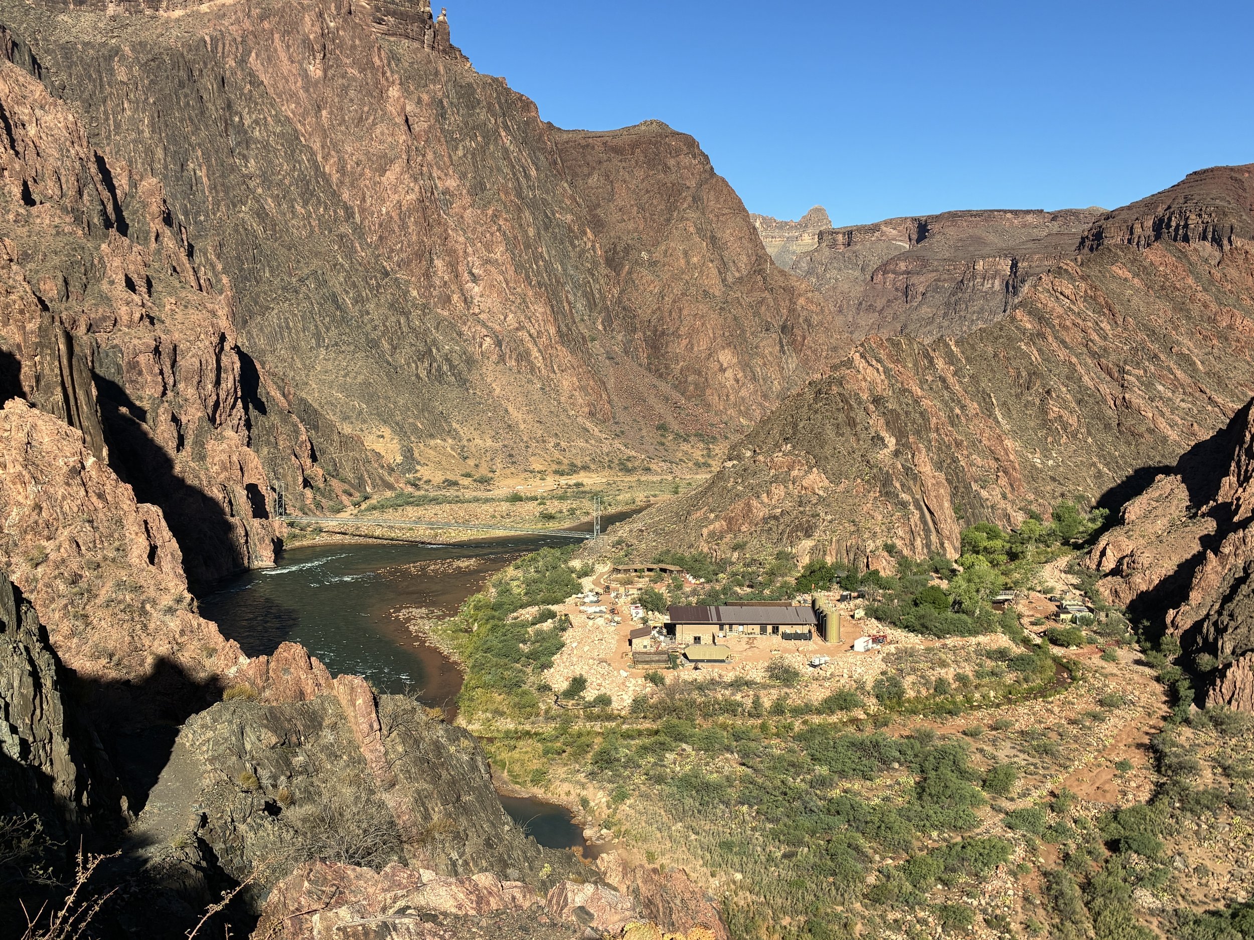
June 2026 (7:29am) - Looking at the Colorado River and the infrastructure for the new waterline
There is also a trail near the bottom of the canyon that stays on the south side of the Colorado River. This River Trail bypasses the Black and Silver Bridges and connects with Bright Angel Trail. Without stopping at Bright Angel Campground or Phantom Ranch, there is no access to water from the waterline until reaching Havasupai Gardens Campground.
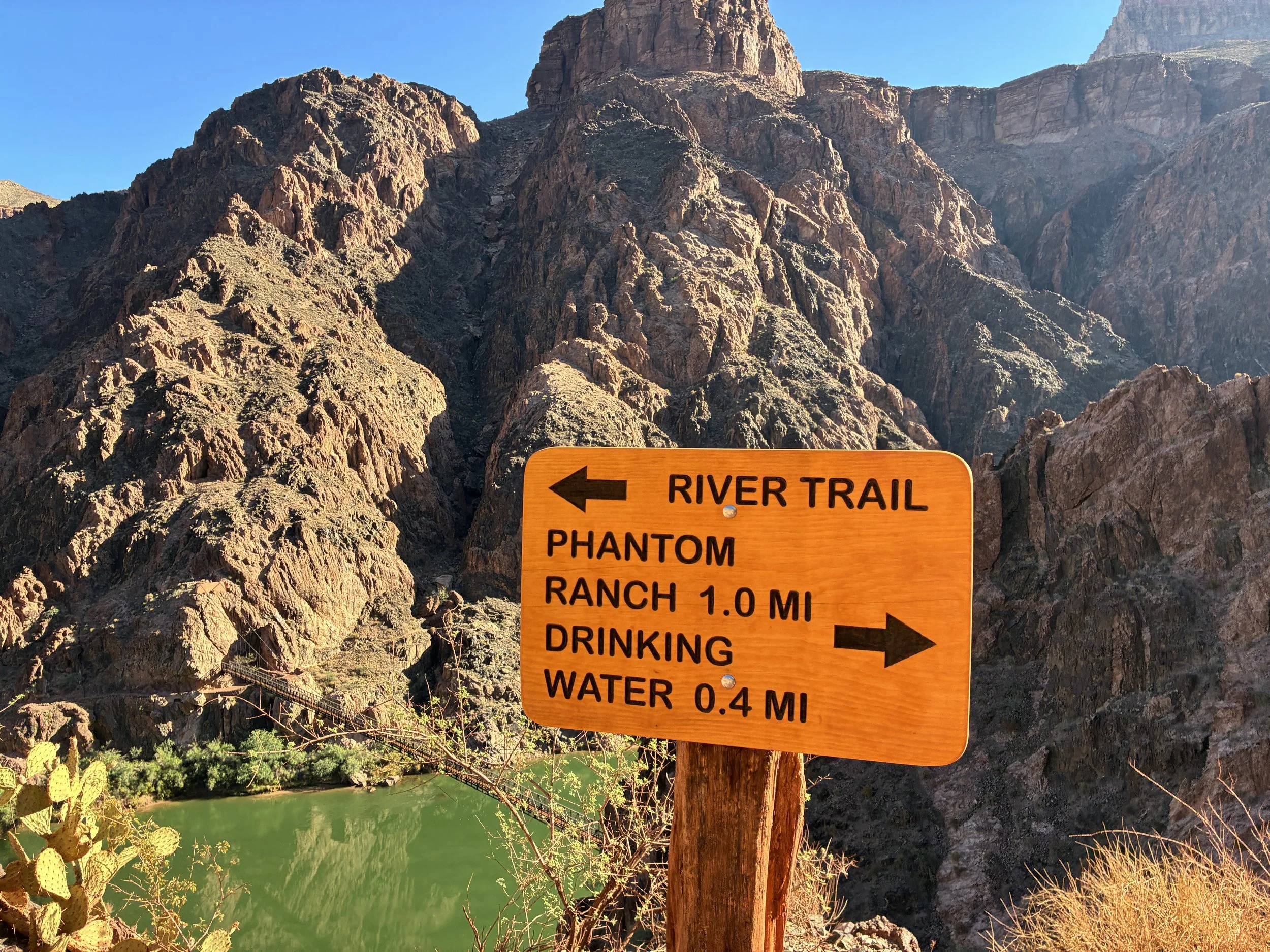
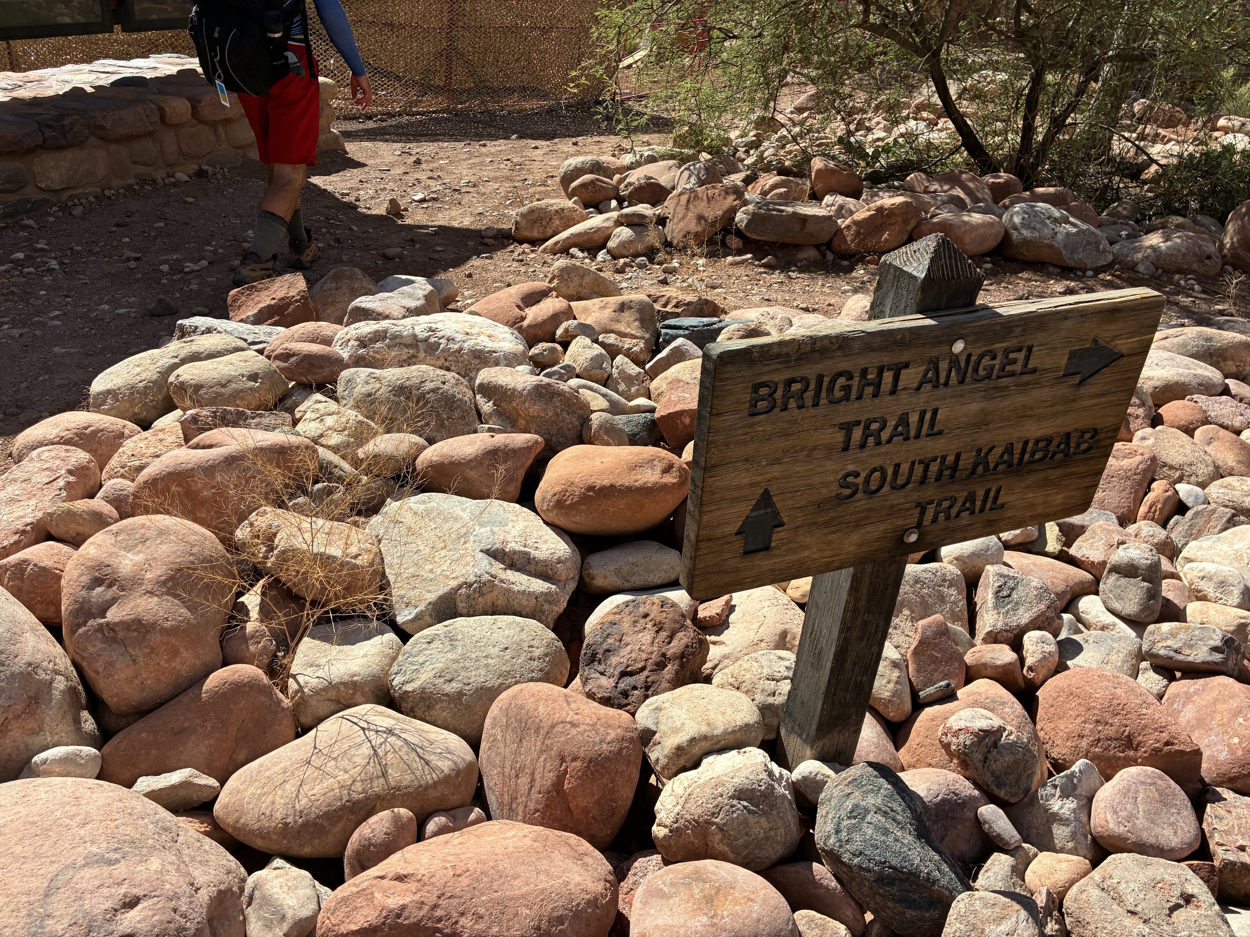
June 2026 (7:30am) - It is possible to continue to Bright Angel without stopping at Phantom. Go to the left here at the sign, rather than descending all the way to Black Bridge.
The engineering of Black Bridge is incredible! It’s built right into the rock on the south side and cables keep it in place.
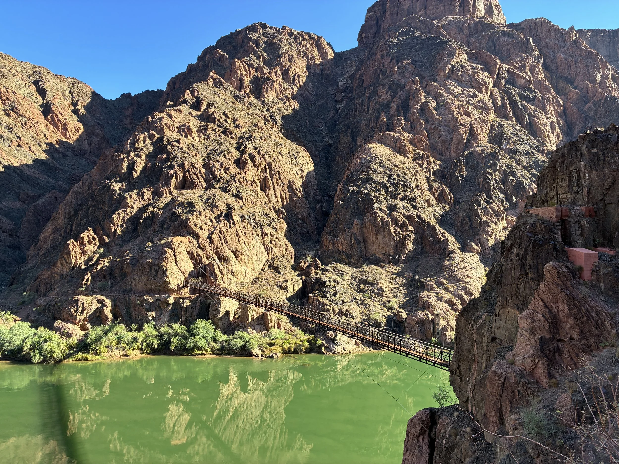
June 2026 (7:33am) - Black Bridge over the Colorado River
There’s a short tunnel through the rock to get to Black Bridge.
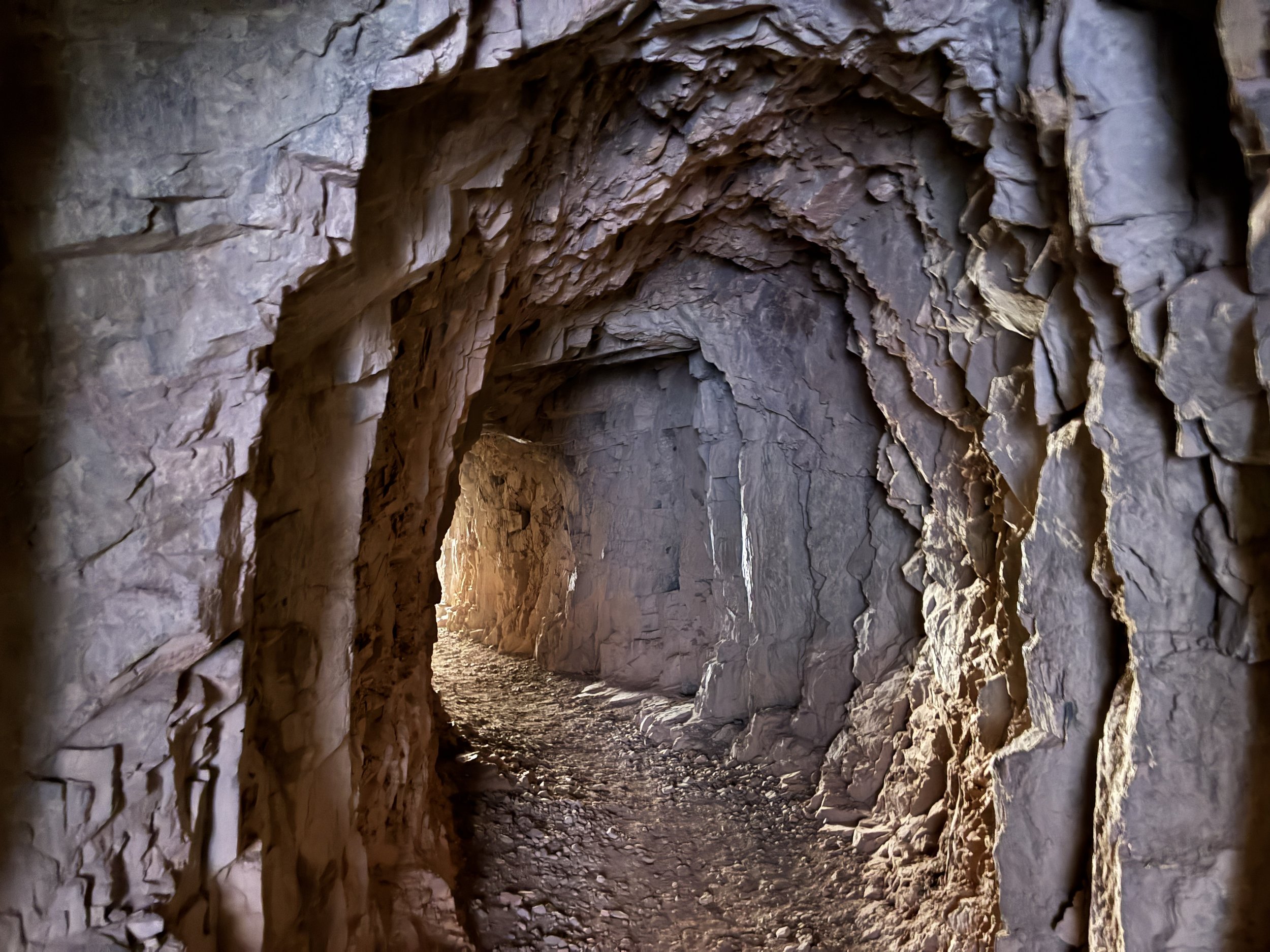
June 2026 (7:35am) - Tunnel through the canyon to get to Black Bridge at the bottom of the Grand Canyon
Black Bridge over Colorado River - 2,500ft
(6.5 Miles / -4700ft elevation from trailhead)
Services - None
June 2016 & 2026 - 7:27am & 7:35am / March 2018 - 10:14am
Avg Total Hike Time (3 hours & 6 minutes)
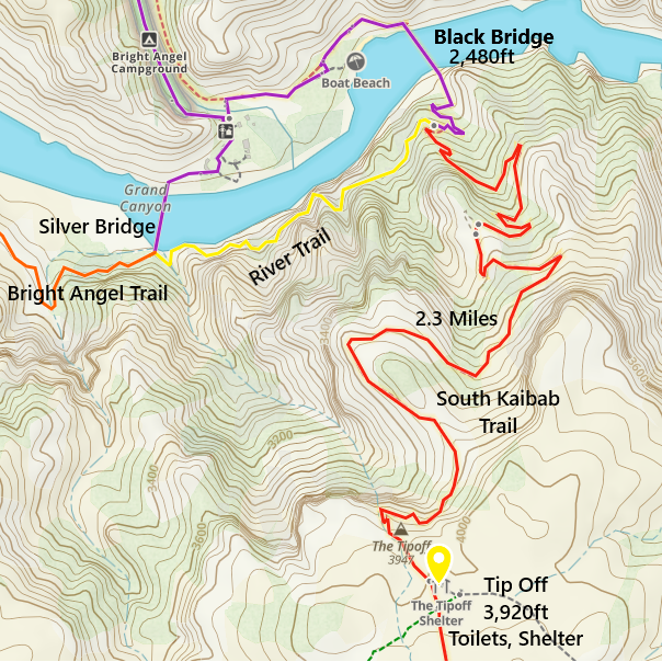
One-way distance between Tip Off and Black Bridge is 2 miles. Our average hiking time this section is 1 hour.
There are no beaches or safe spots to swim at the bottom of this trail along the Colorado River. The Black Bridge goes right over it and there are no trails leading to the river. There are ways to get down to it, but it’s all off trail. Be careful - the current is very strong. Bright Angel Creek is a much safer body of water to enter.
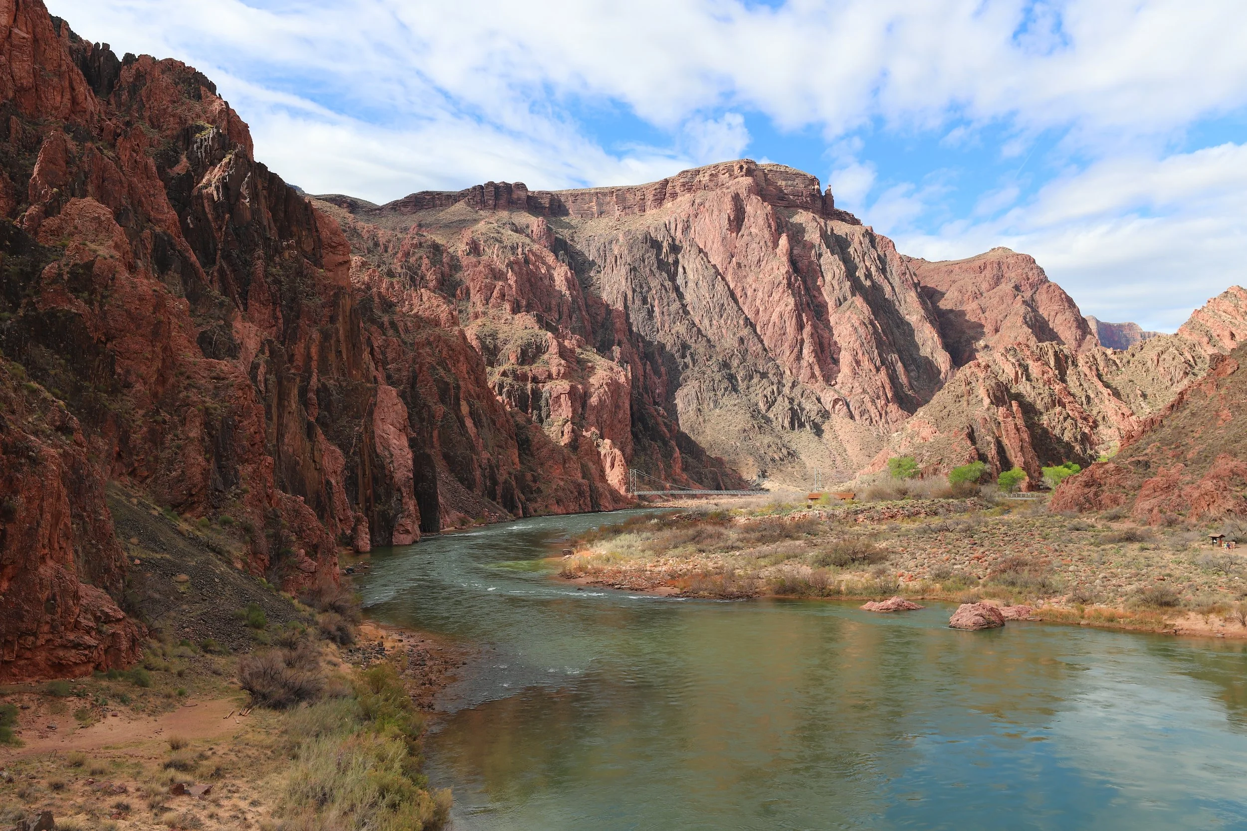
March 2018 (11:08am) - Looking downstream towards the Silver Bridge. Photo taken from the Black Bridge.
From here to Phantom Ranch, the trail is flat.
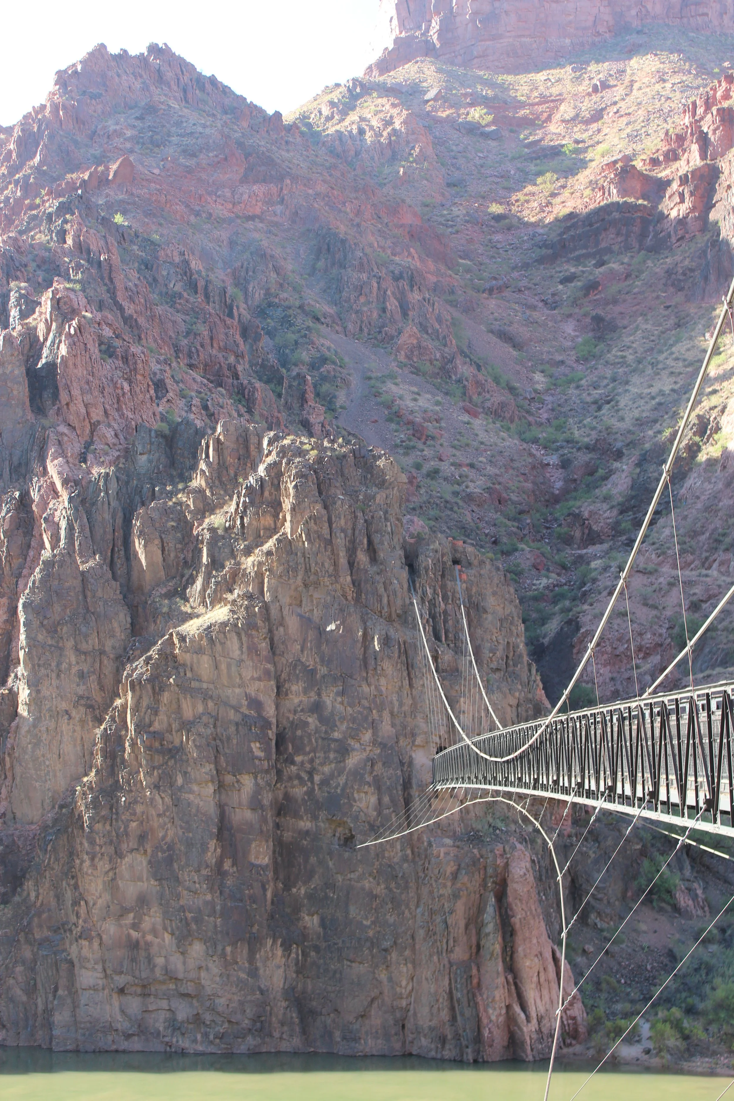
June 2016 (7:34am) - Looking back towards Black Bridge after crossing it. See how the bridge just starts in the wall???
In March 2018, we did find a way to get down to the Colorado River, and we put our feet in the River, carefully.
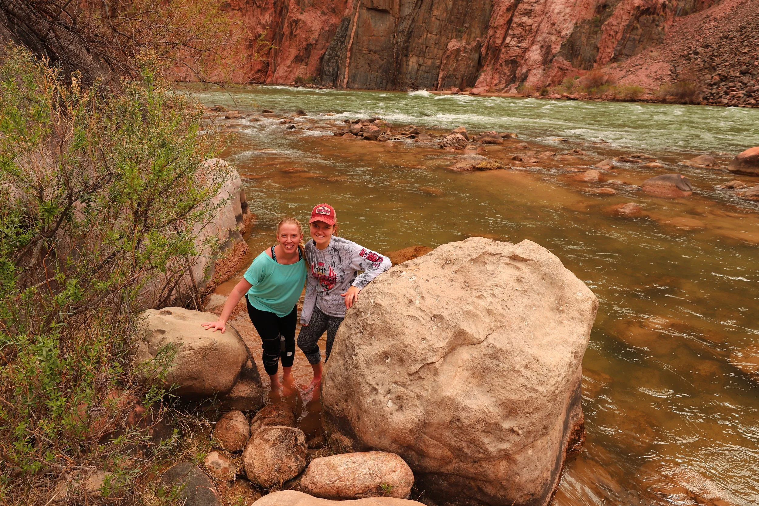
March 2018 (12:39pm) - This was the one time we explored off trail to get down to the Colorado River. We took our shoes off and just rested our feet in the river to say we did it. We did not venture into the river.
Bright Angel Campground - 2,500ft
(6.8 Miles / -4700ft elevation from South Kaibab Trailhead)
Services - Toilets, Water
June 2016 & 2026 - 7:36am & 7:45am / March 2018 -10:24am
Avg Total Hike Time (3 hours & 16 minutes)
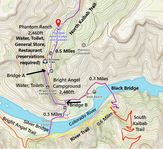
One-way distance between Black Bridge and Bright Angel Campground is 0.3 miles. Our average hiking time this section is 10 minutes.
We haven’t stayed at Bright Angel Campground, and as such, we haven’t ever crossed the footbridge that is just visible on the left of the picture below. This bridge connected the north side of the campground to Phantom Ranch. This bridge washed downstream during the 29Aug2026 flashflood.
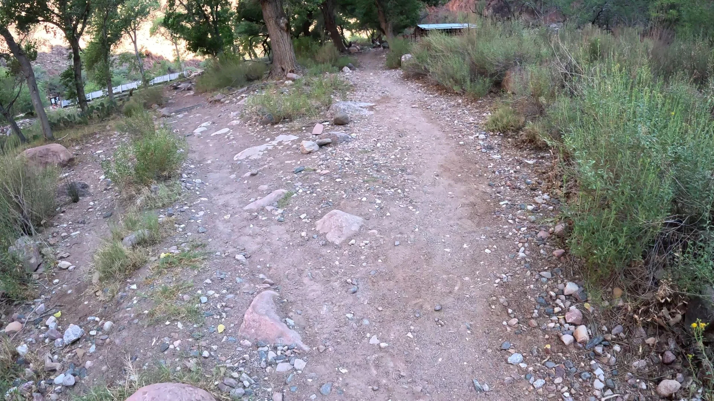
June 2026 (7:53am) - Bridge A on the left - This bridge connects Phantom Ranch to the north end of Bright Angel Campground. Rim-to-Rim hikers, or hikers just stopping at Phantom Ranch will not need to cross this bridge. (I’m not sure what this bridge was actually called - I’ve labeled it as Bridge A on my map)
The picture below is my favorite section of the trail near Phantom Ranch. It’s between Bright Angel Campground and Phantom Ranch, and it’s taken looking back at the South Rim. This section of the trail is so different than the South Rim. There are large trees and several resulting spots with shade. The cicadids are loud. After hiking without people nearby, it’s a little strange to come in contact with people again.
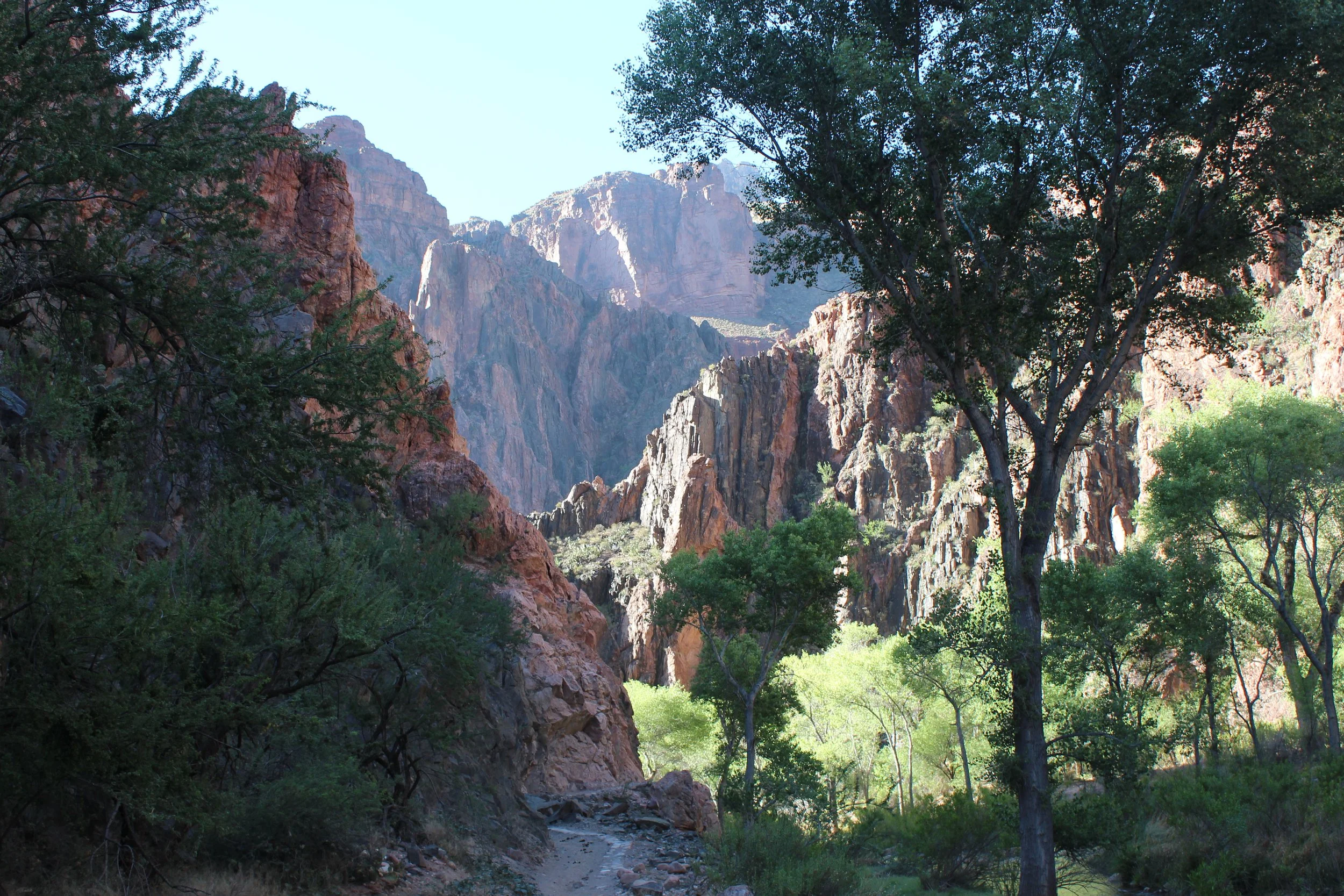
June 2016 (7:49am) - Hiking to Phantom Ranch, past Bright Angel Campground. We stopped and looked backwards. This photo is looking up towards the South Rim.
Phantom Ranch - 2,500ft
(7.3 Miles / -4700ft elevation from South Kaibab Trailhead)
Services - Toilets, Water, Shelter, General Store (small) - General Store has sweet lemonade. There is also a restaurant, but reservations are required.
June 2016 (Day 1) & 2026 - 7:53am & 7:55am / March 2018 -10:36am
June 2016 (Day 2) - 8:30pm
Avg Total Hike Time (3 hours & 29 minutes)
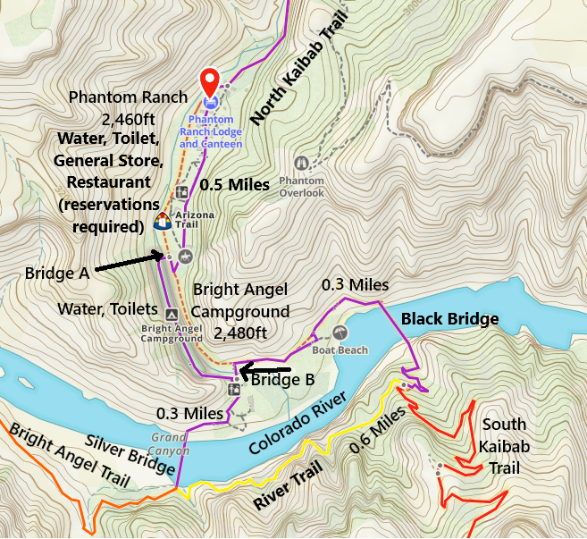
One-way distance between Bright Angel Campground and Phantom Ranch is 0.5 miles. Our average hiking time this section is 13 minutes.
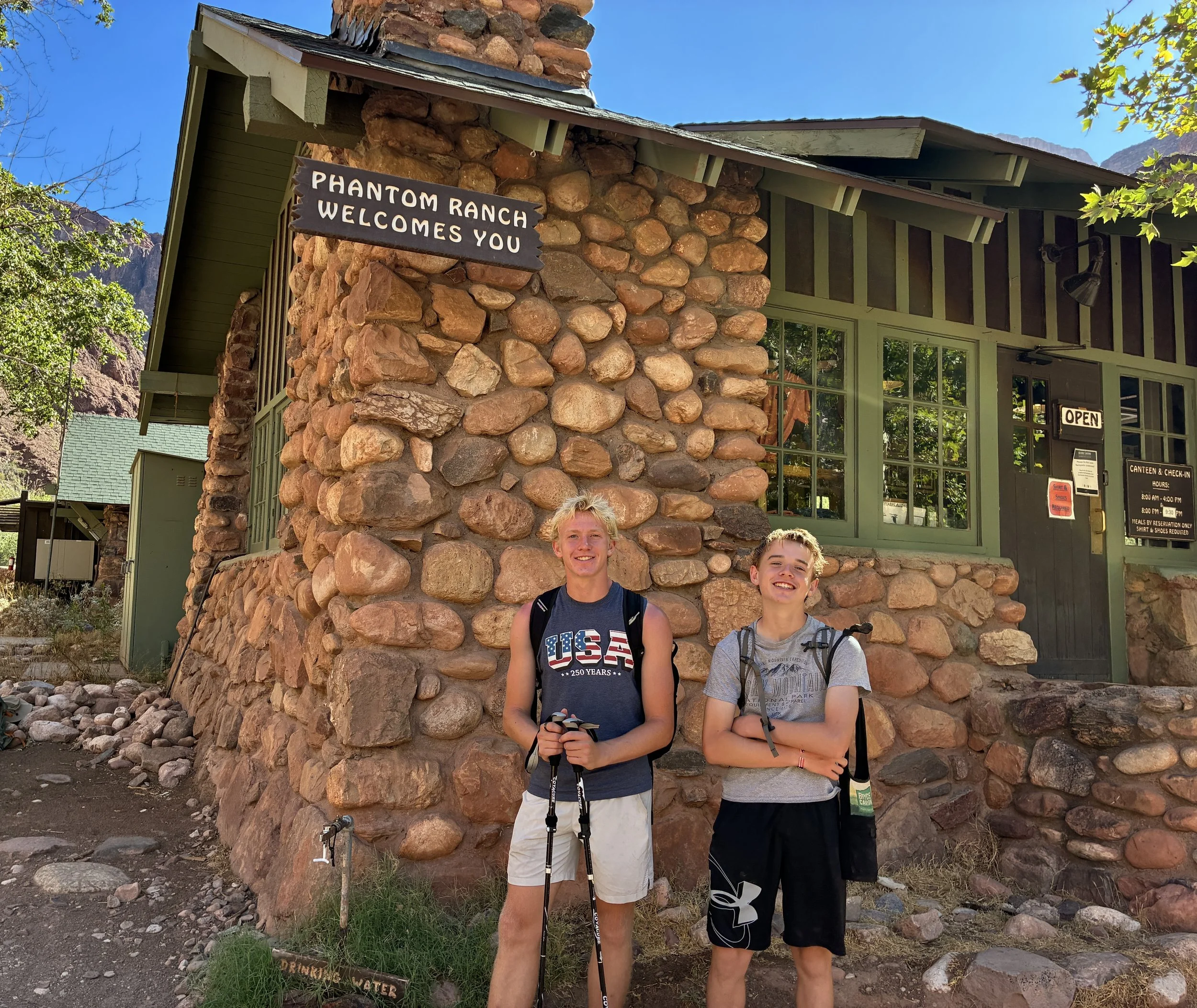
June 2026 (8:33am)- We arrived right before it opened at 8, had lemonade, used the bathroom, took care of foot blisters, and ate PB&J sandwiches. We left just after 8:30am.
Inside Phantom Ranch, there is sweet lemonade. $7 / glass in 2026, but the refills are cheap. So good - they could charge anything and it would be worth it. There is a small general store but it’s better if you don’t need to buy something - everything is marked up. But that makes sense, the only way to get stuff to the store is to have mules carry it.
Speaking of mules, there is a spot to drop mail inside Phantom Ranch. The mail will be stamped “mailed by mule” as a mule employed by the US Postal Service will carry it back up to the South Rim. It’s fun to send postcards - make sure to send one to yourself so you can see the stamp.
There is also a canteen (restaurant) at Phantom Ranch that guests can use. Reservations must be made ahead of time.
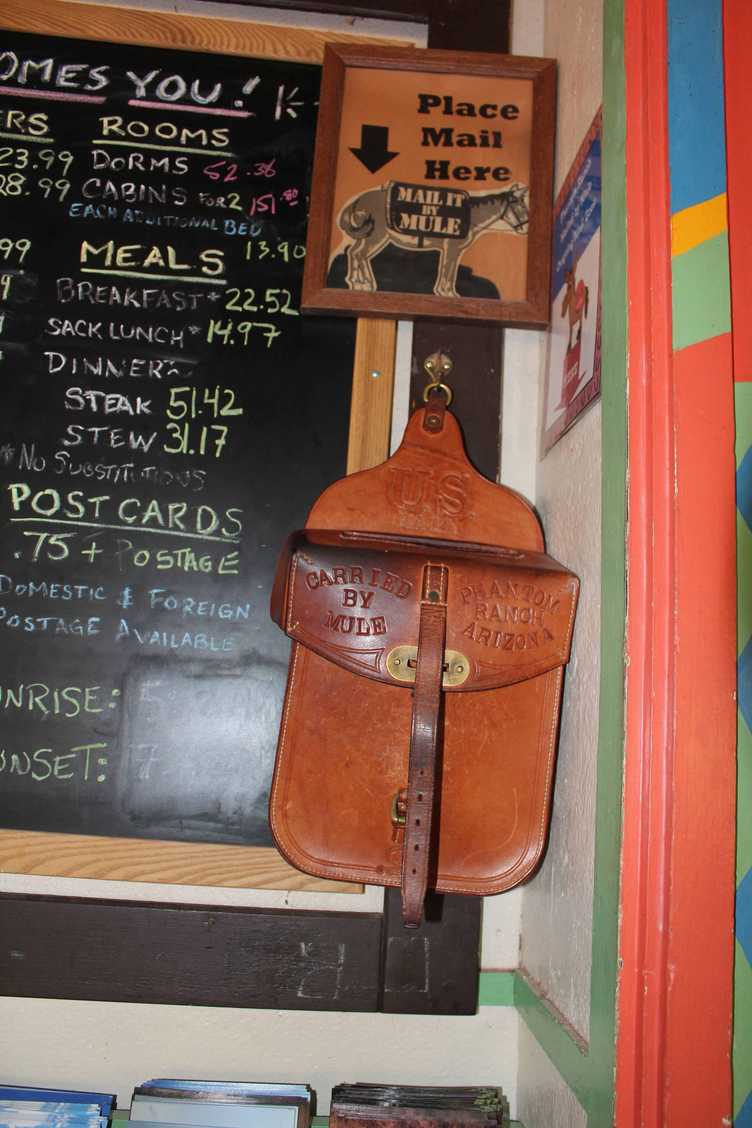
June 2016 (8:35am) - Look for this bag to mail any postcards. Postcards can be purchased in Phantom Ranch.
To skip the North Kaibab Trail and get to hiking up Bright Angel Trail, click here.
North Kaibab Trail
This section of the trail is going to be closed for the foreseeable future due to the flashflood 29Aug2026. According to the National Park Service, several footbridges were washed out. There are four bridges along “the Box” portion of the trail and a fifth just downstream of Manzanita Rest Area. I’m not exactly sure which bridges (if any) remain. Consider that it isn’t just the process of rebuilding these bridges that needs to happen. The materials needed to rebuild the bridges have to get down into a mile deep hole and into a remote section of the canyon 4 miles long in a rather treacherous section of canyon backcountry. For the moment, enjoy my pictures. If you’d like to skip straight to hiking up Bright Angel, click the hyperlink.
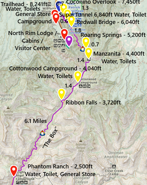
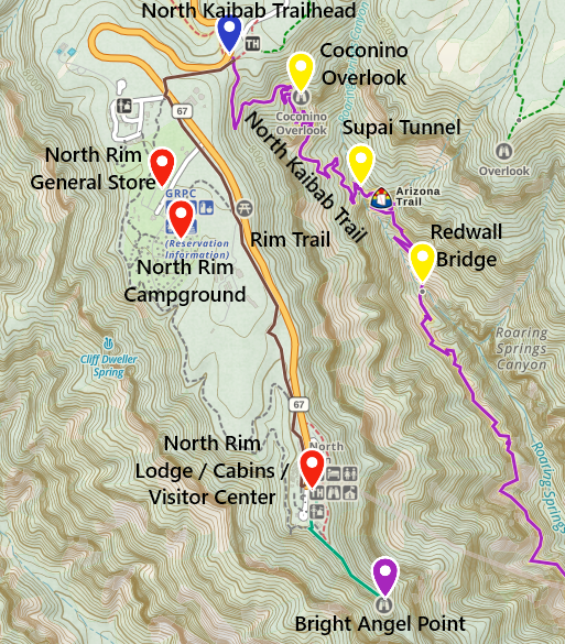
North Kaibab Trail - the marked locations are at Phantom Ranch, Ribbon Falls (bypass off of the main North Kaibab Trail), Cottonwood Campground, Manzanita Rest Area, Roaring Springs, Redwall Bridge, Supai Tunnel, Coconino Overlook, and the North Kaibab Trailhead. Mileage, elevation, and services are indicated. Verify the water is on inside the canyon before hiking. The pipe is old and requires frequent repairs, in which case the water is turned off.
Inner Canyon between Phantom and Ribbon Falls “the Box”
The first 4 miles of North Kaibab Trail, upstream from Phantom Ranch, is known as “the Box.” This tight section of trail is just 30-50ft wide. Although the trail has a slight incline, this section of the hike is pretty easy and it’s close to water. When I planned the trip, this section seemed like I didn’t need to worry about it. Hiking it though, I realized this is probably the most dangerous section of the whole trail. There are two potential problems. The first is heat. For the most part, when we hiked to the North Rim on Day 1, we were early enough that the sun had not yet peaked over the wall and the trail remained in the shade. The second day as we hiked south, we intentionally chose to hike in the evening. It was after 6pm when we entered this section of trail and it was back in the shade. But the rock walls were still hot after sitting in the sun all day. Walking past the walls, even at night, we could still feel the day’s heat radiating off the rock surfaces. This is not a section of the trail to be caught in once the sun rises in the summer. The second problem I sensed the moment we started this hike. I checked the forecast and we checked in with Park Rangers the day before. There was no rain predicted. But looking up at the canyon walls - I could feel the potential danger of flash flooding. You can see in the pictures below, there aren’t many places to scramble up higher, and there’s not much to grab onto.
The first foot bridge is about 0.75 miles from Phantom Ranch.
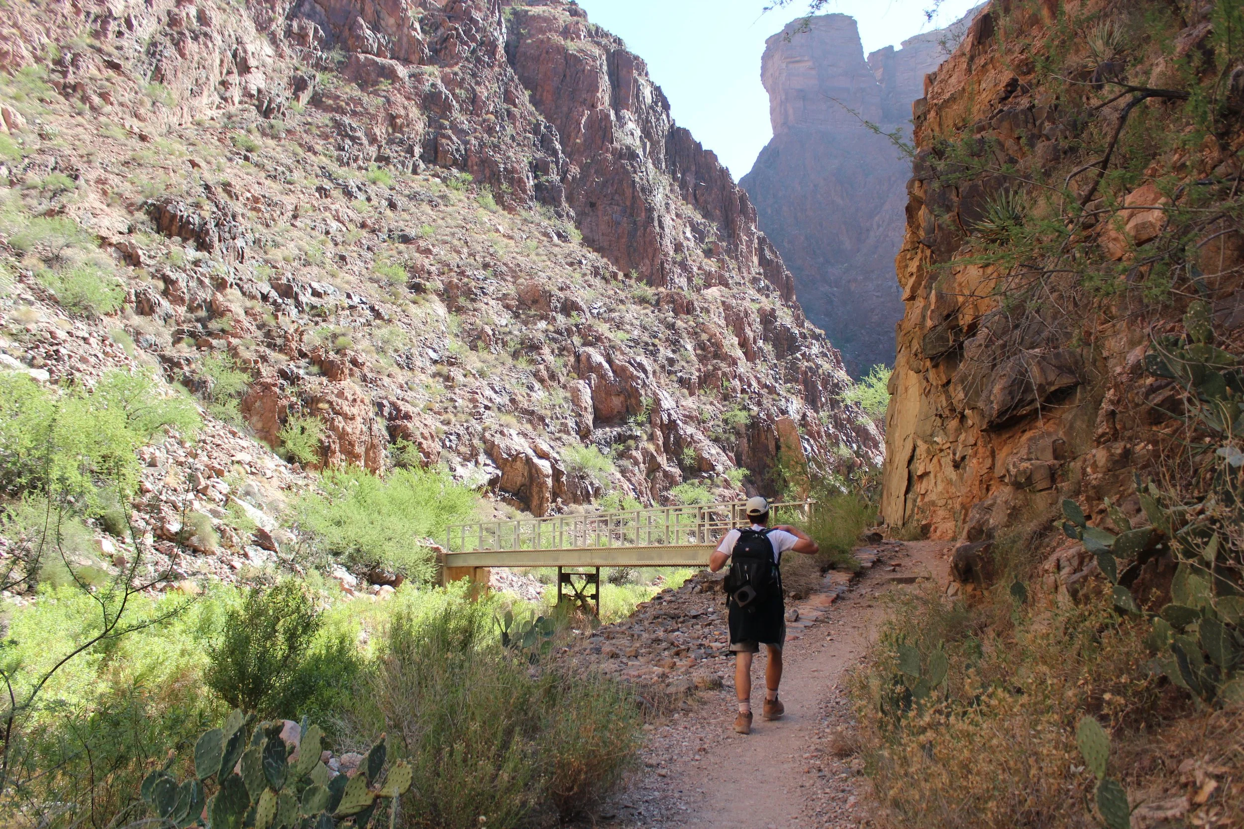
June 2016 (day 1 - 9:03am) - This is the first footbridge upstream of Phantom Ranch
It’s such a different feeling down in the canyon than at the South Rim. There aren’t many people, the walls are tight, the only thing we can really see are the high rock walls surrounding us, and we can hear the Bright Angel Creek because the trail is right next to it. Compared to the South Rim with the sounds of civilization, crowded viewpoints, smells of nearby food prepared for tourists, and being able to see the vastness of the Grand Canyon. It’s just so different down here. The South Rim was built to manage large crowds of people. The Inner Canyon has you wondering if you have any right to be there.
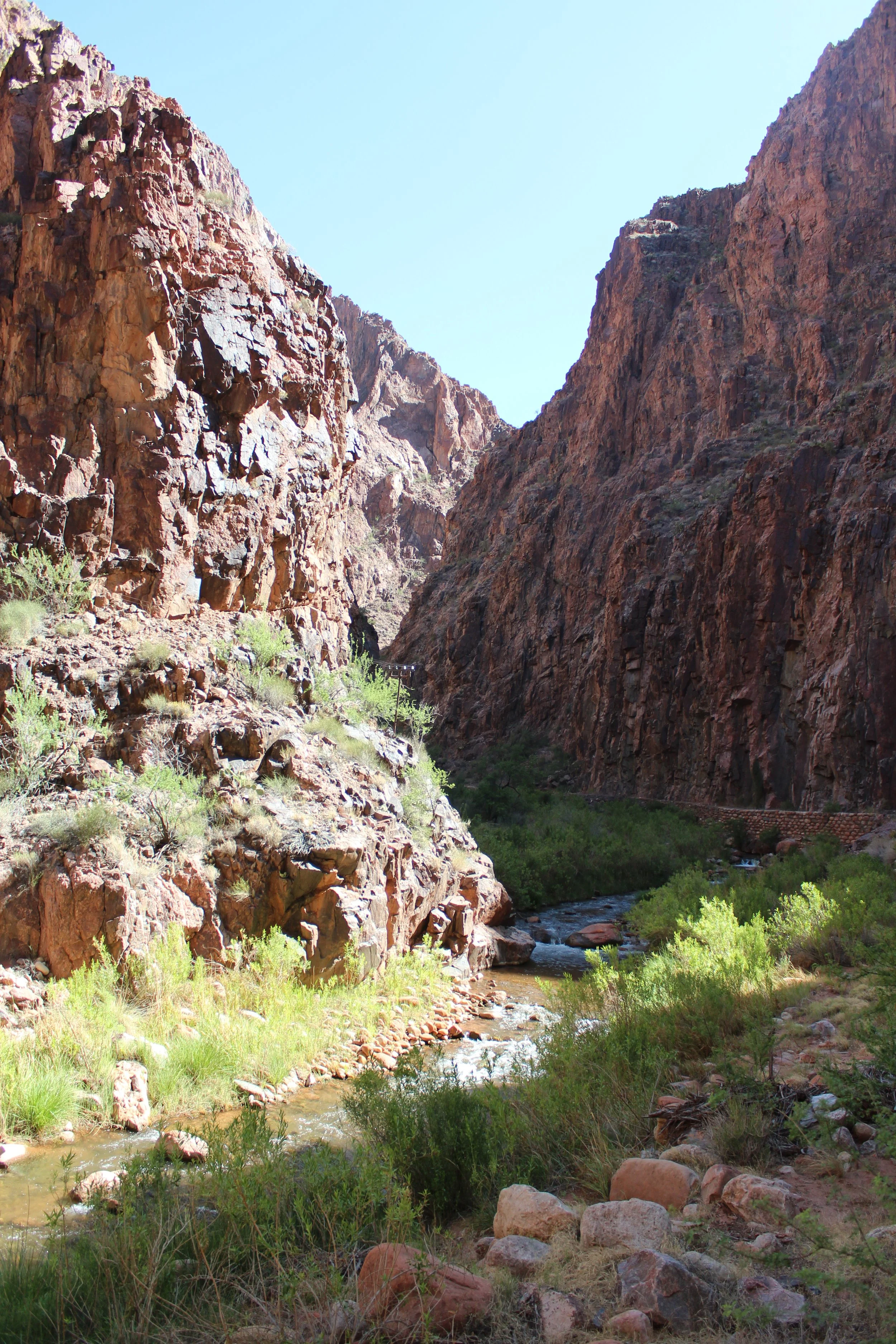
June 2016 (Day 1 - 9:04am) - Completely peaceful and easy walking through the beginning of the “the Box”
After the intensity of the South Kaibab Trail, this section of the hike was peaceful, easy, quiet. The second footbridge is about 0.25 miles from the first.
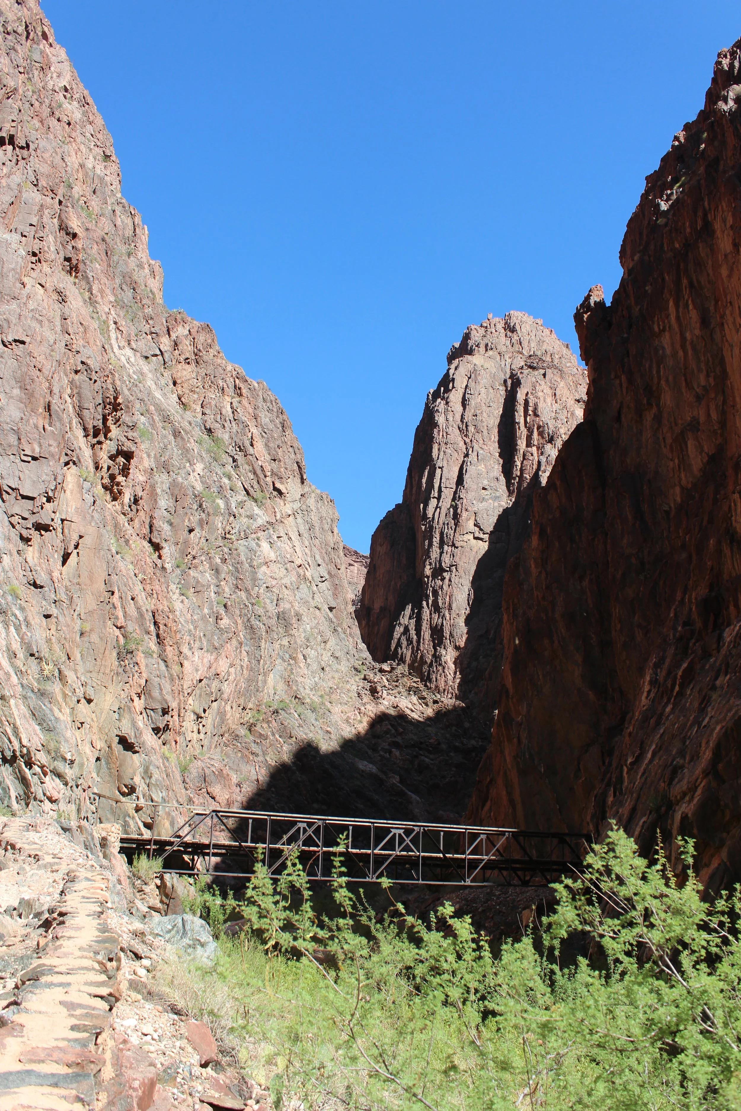
June 2016 (Day 1 - 9:12am) - This is the second foot bridge, and I have seen a photo of this bridge after the flashflood. I’m not sure if it’s structurally sound, but it was still present.
It’s 4 miles of the same thing - steep canyon walls, a quiet creek. We were doing our best to scurry and hike quickly, but the hours and miles that we had hiked already by this point were starting to catch up with us. A little bit of panic is starting to settle in my stomach. Bridge 3 is 2 miles from the Bridge 2.
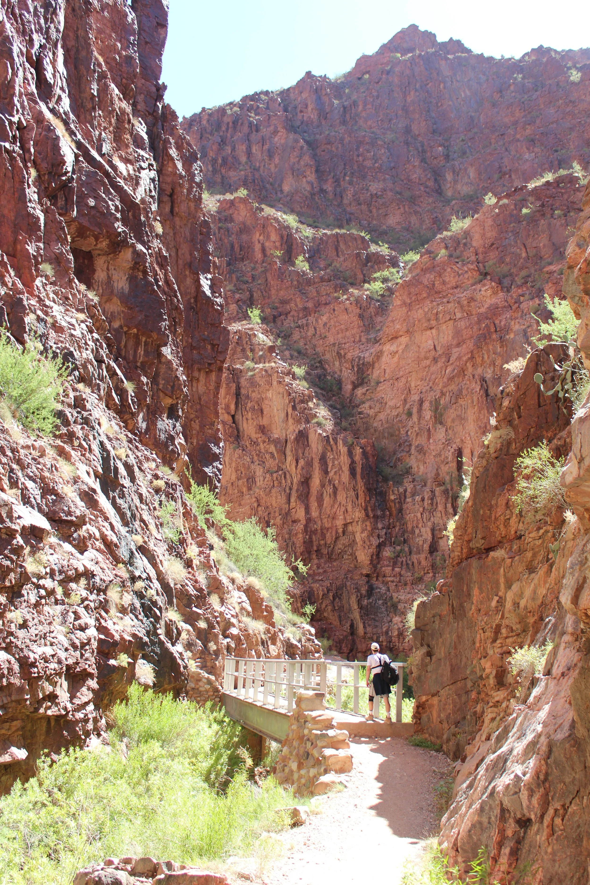
June 2016 (Day 1 - 10:00am) - This is the third footbridge.
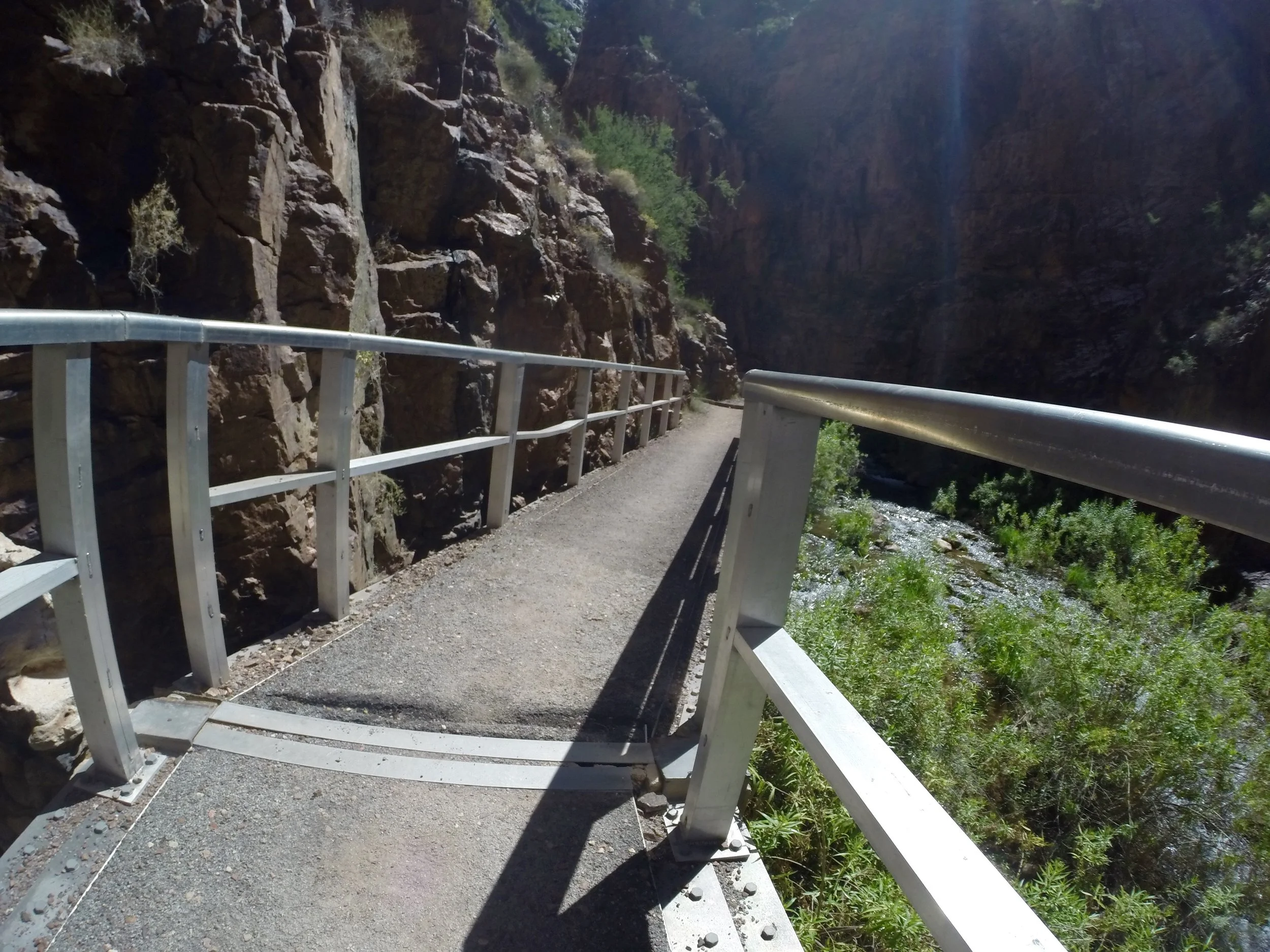
June 2016 (Day 1 - 10:02am) - Walking over the third footbridge upstream of Phantom Ranch.
I don’t think I would hike Rim-to-Rim in a day again. I would love a chance to stay at Phantom Ranch - Both to enjoy the night aspect of the canyon (without a daunting ascent ahead of me) and to be able to enjoy this section of trail early in the morning hours before the heat of the day. These pictures are amazing, but when I remember this day, I can feel how hot I was by this point.
Bridge 4 is 0.25 miles from Bridge 3. The Park Services states to be out of the Inner Canyon by 10:00am. They are not joking. By 10:19am, we were already feeling the heat, and nowhere near Cottonwood Campground.
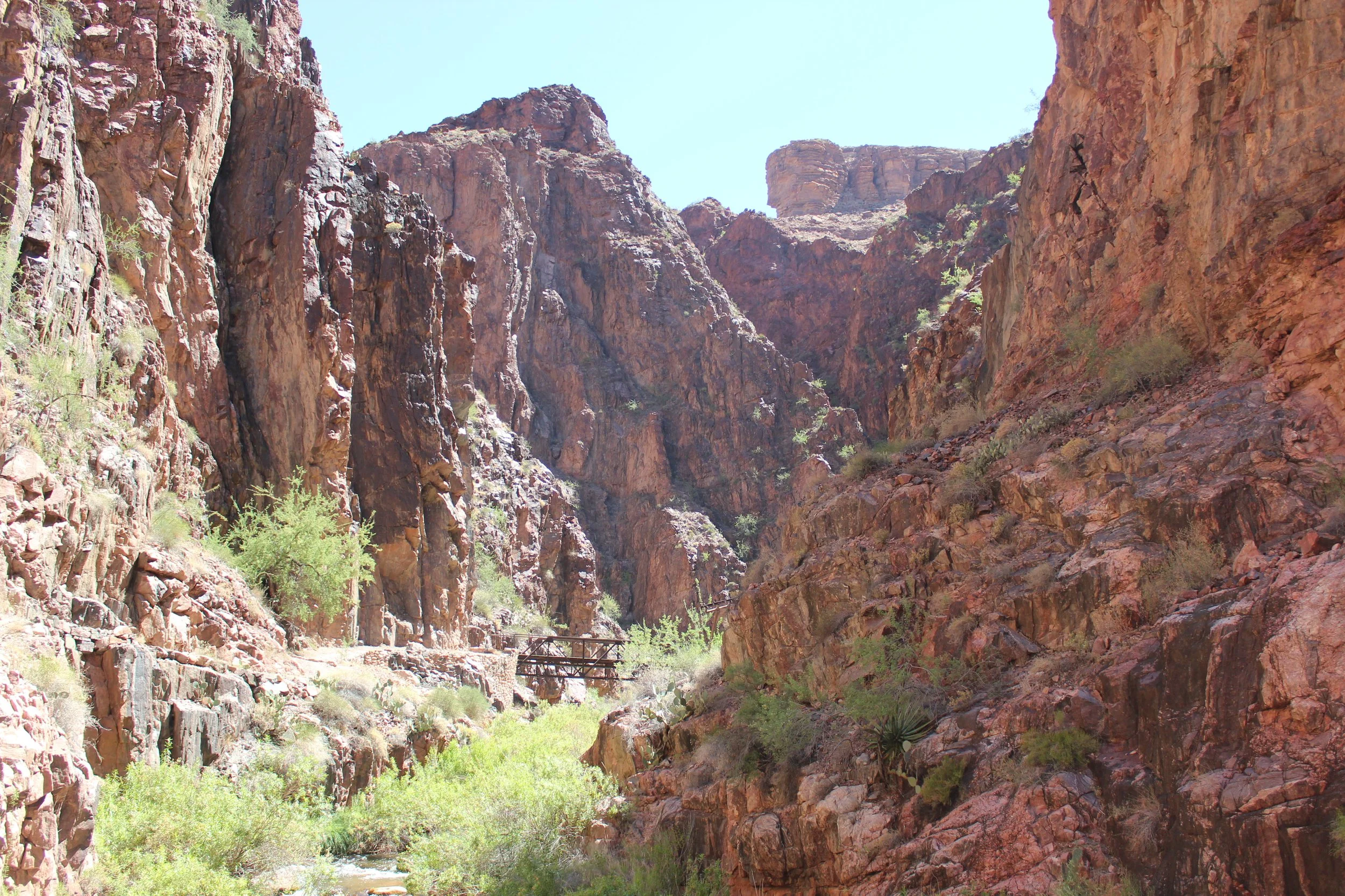
June 2016 (Day 1- 10:19am) - This is the fourth and last footbridge prior to Ribbon Falls
After crossing Bridge 4, the Box section is just about over. After the Box, the canyon opens up into the sunshine and the heat of the day. My husband and I affectionately call this part of the trail “the Crockpot.” It felt like we were being slowly cooked. There is no shade, the elevation is still quite low, and it’s Arizona in the summertime… We hadn’t figured out yet that we should take our shirts off and soak them. We know we aren’t near our mile marker by the right time for the time of day. We need a plan B.
We came across hikers heading in the opposite direction. They could tell we were hot. There is a trail junction just upstream of us, and the hikers told us to bypass “False Hill” along the North Kaibab Trail, find Ribbon Falls, and get in the water. This was the absolute best idea. The one caution I have is that the trail is harder to follow to Ribbon Falls. There was one point we weren’t sure where we were. I didn’t yet have a smart phone and we didn’t have any type of GPS or trail tracking apps. But we did come across another group of hikers also trying to find the falls, and we found it together.
There are two benefits of hiking a slightly longer distance to Ribbon Falls. The first is getting in the water, soaking in Bright Angel Creek, and the second is bypassing “False Hill” - a seemingly unnecessary trek up and back down the canyon wall 275ft.
When we crossed Bright Angel Creek to get to Ribbon Falls, we just took our boots off and got into the water - so cold, such a smart idea. Shirts and head bandanas wet - we were doing better already.
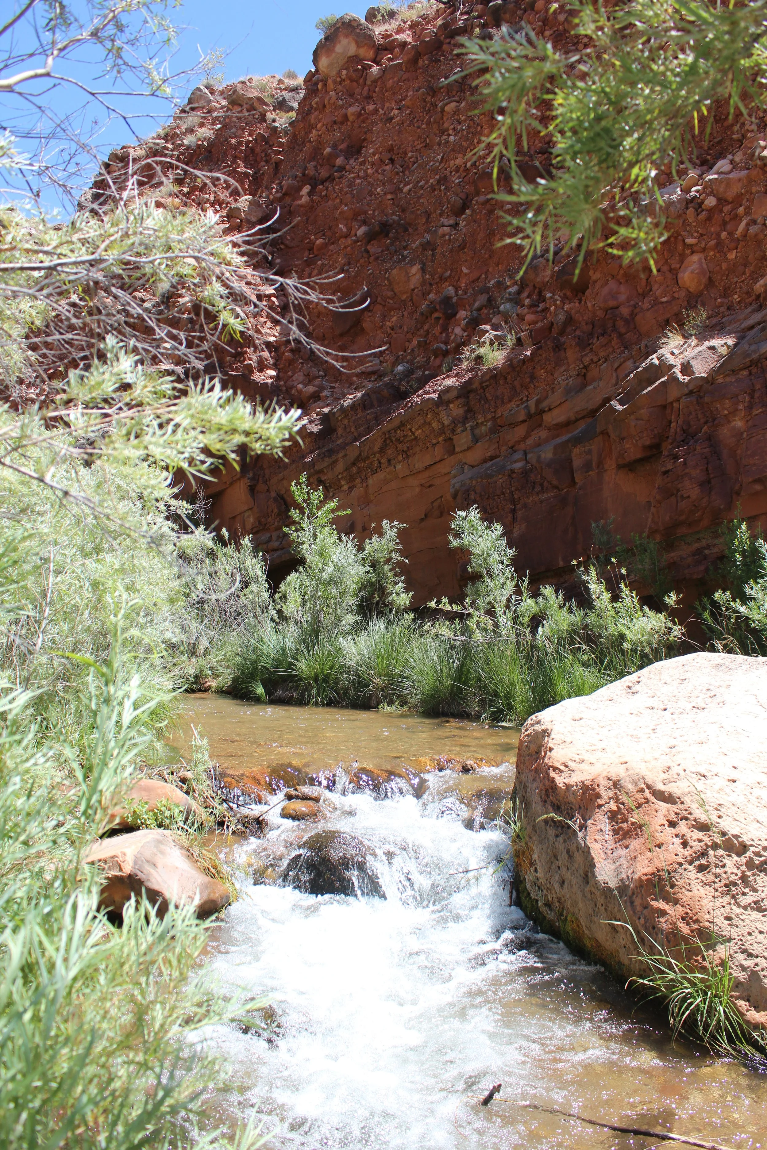
June 2016 (Day 1- 11:25am) - I’m not sure if we were actually on the trail or if we just ended up finding Ribbon Falls. There were moments it was not obvious where to go. There was not a footbridge when we crossed Bright Angel Creek to get to Ribbon Falls. That was fine. We were hot. It felt great to walk through the water for a bit.
Ribbon Falls - 3,760ft
(13.4 Miles from South Kaibab Trailhead / +1,260ft elevation from Phantom Ranch)
(7.9 miles / -4,481ft elevation from North Kaibab Trailhead)
Services - None. GREAT place to cool off and avoid “false hill” - a completely unnecessary 200ft rise in the trail…
June 2016 Day 1 - 11:50am
Total Day 1 Hike Time - 7 hours & 21 minutes
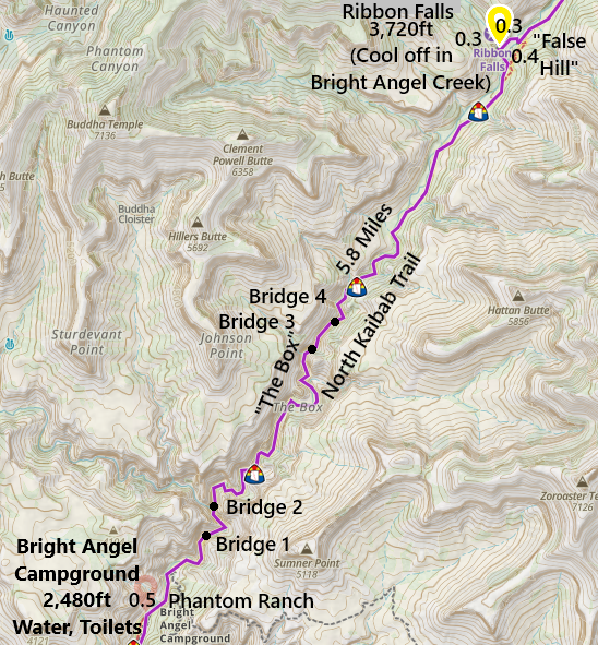
One-way distance between Phantom Ranch and Ribbon Falls is 6.1 Miles. We stopped at Ribbon Falls on the way up to the North Rim. It took us 3 hours to hike this section (with the break at Phantom Ranch included). We did not stop at Ribbon Falls on the return hike.
We enjoyed Ribbon Falls for a bit. There’s a way to get up the rock and go behind the waterfall, and plenty of places to get wet. There’s nothing quite like a desert waterfall.
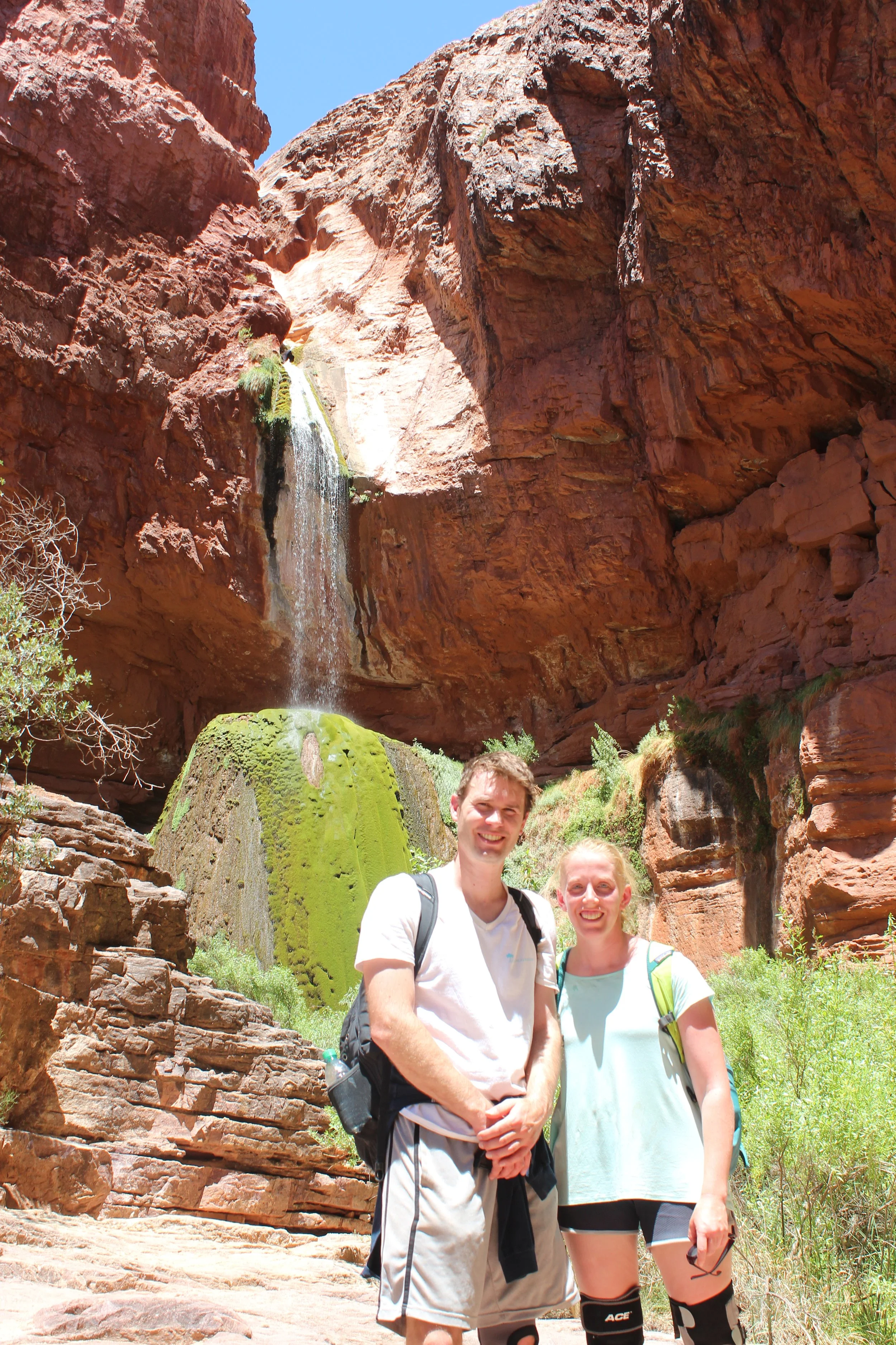
June 2016 (Day 1- 11:48am) - Ribbon Falls - Assuming it will be a while before we hear about the status of Ribbon Falls, but we are wondering if the flashflood changed this waterfall. This was such a fun place to stop on our hike.
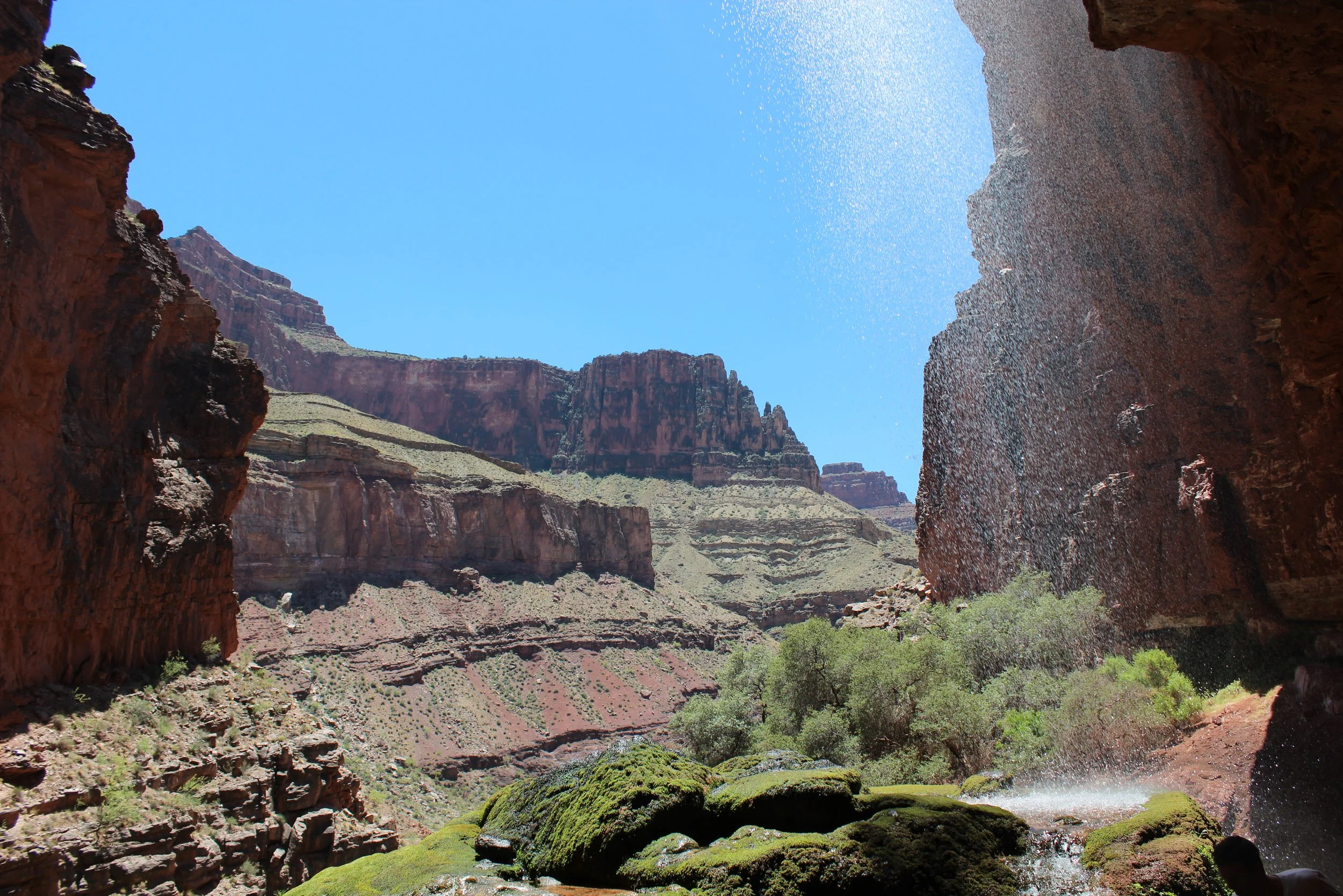
June 2016 (Day 1 - 11:54am) - Viewing the Grand Canyon from behind Ribbon Falls
We completely changed our return hike itinerary to avoid the heat. Plan C? Plan D? I’m not sure which version we were on. Be prepared but be flexible... We didn’t arrive at the box until after 6pm. This was an incredibly fast and easy hike back to Phantom. We don’t have any pictures though, as it was too dark for the photos to turn out.
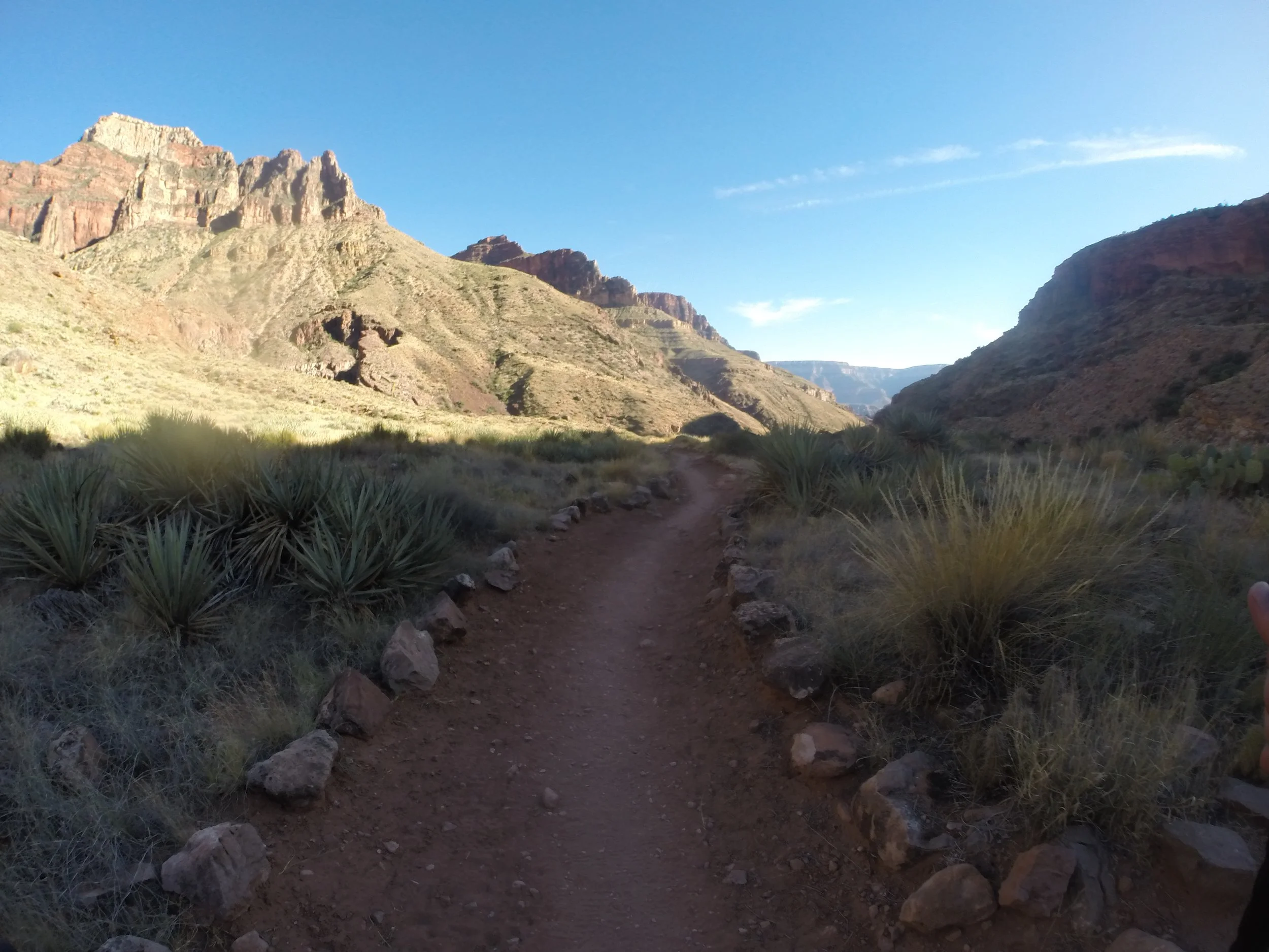
June 2016 (Day 2 - 5:43pm) - This section the hardest on Day 1 due to the heat and the easiest section on Day 2. The evening canyon shadows are blessed.
Cottonwood Campground - 4,040ft
(14.8 Miles from South Kaibab Trailhead / +1,540ft elevation from Phantom Ranch)
(6.5 miles / -4,481ft elevation from North Kaibab Trailhead)
Services - Water, Toilets, Campground - permit required
June 2016 Day 1 - ? / Day 2 - 5:30pm
Day 1 Hike Time - ? I didn’t record the time and I don’t have a picture with a timestamp.
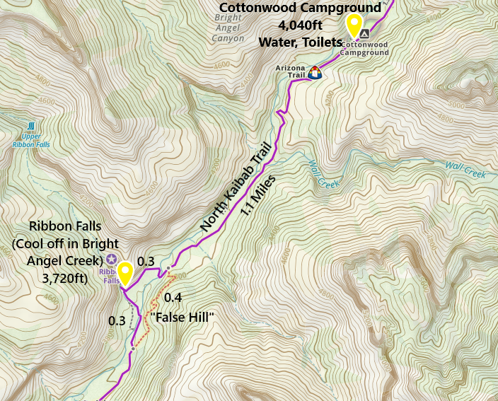
One-way distance between Ribbon Falls and Cottonwood Campground is 1.4 miles. I don’t have the time that we arrived at the campground. On Day 2, the hike between Cottonwood Campground and Phantom Ranch is 7.6 miles. This took us 3 hours.
From this point forward, I have day 1 and day 2 pictures mixed together for each section of the trail.
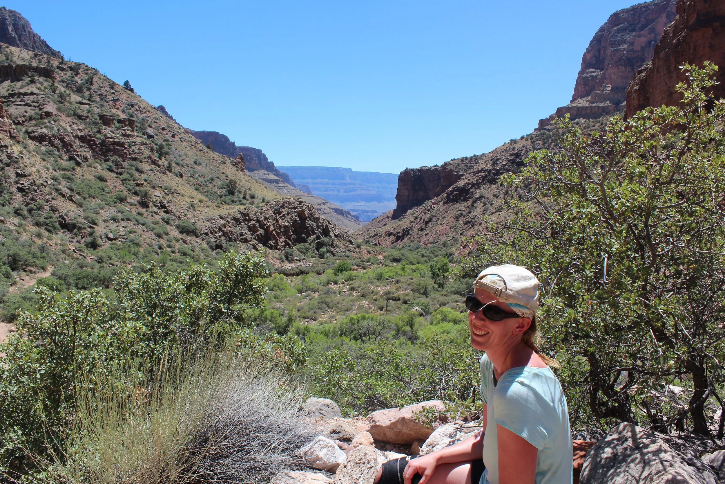
On our day to the North Rim, this was still hot and in the sun. On the second day returning to the South Rim, much of the trail was in the shade. On Day 1, this section was awful, on Day 2, I loved this section of the Canyon.
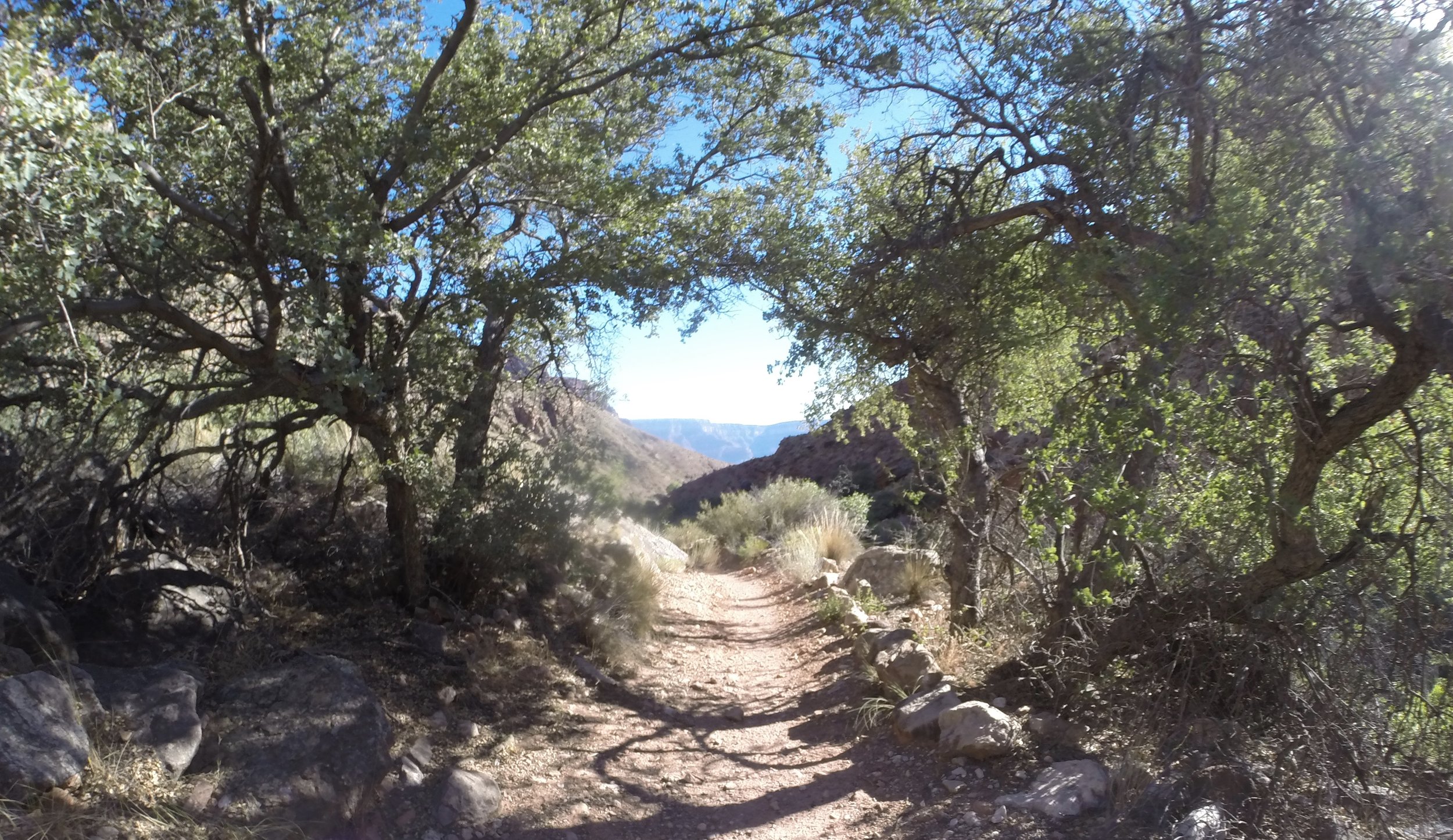
June 2016 (Day 2 - 5:14pm) - Past Ribbon Falls the canyon opens wide. There are a few spots close to Cottonwood that have trees. Enjoy those moments - there aren’t many.
The reason the National Park Service warns not to hike the inner canyon section between 10am and 4pm has to do with the hours the trail is in the sun. In addition to being in the sun on our day north-bound, the trail is now at a decent incline up. From here to Manzanita Rest Area was the hardest portion of our hike. Not physically the hardest, but mentally the hardest knowing we just had to keep going. We had to get up in elevation where we knew it would cool off and then we could take a nice long break. Hiking back down in the evening on day 2 - this was the easiest portion of the trail.
I look at this picture and all I can think of is “crockpot.” Luckily, this was almost the end of the extreme heat.
June 2016 (Day 1 - 1:55pm) Oofff - it’s just hot. This is not the time of day to be in this part of the canyon in the summer months.
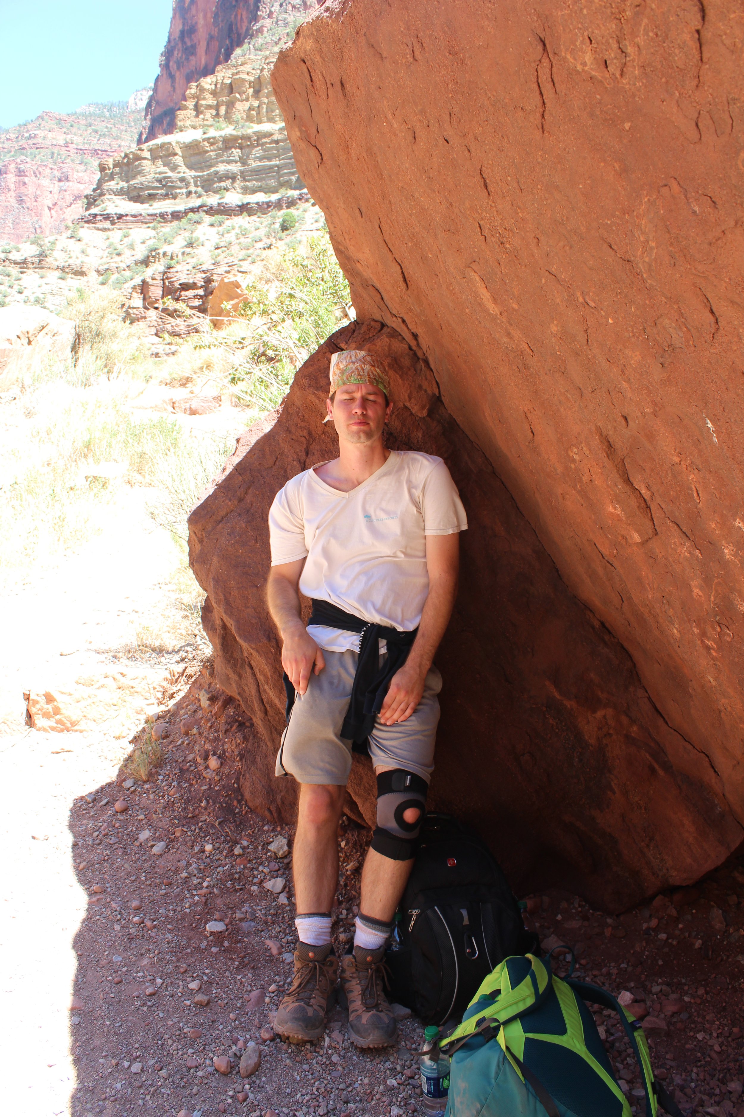
June 2016 (Day 1 - 2:06pm) - SHADE!!! 2 minute “nap”. There aren’t trees big enough to form shade. This trail is just exposed to the sun.
This bridge is a great sign! Manzanita Rest Area is just around the corner. There is both a water source from the waterline and a spot to get back into Bright Angel Creek (the last time - the trail will next head straight up from here to the North Rim).
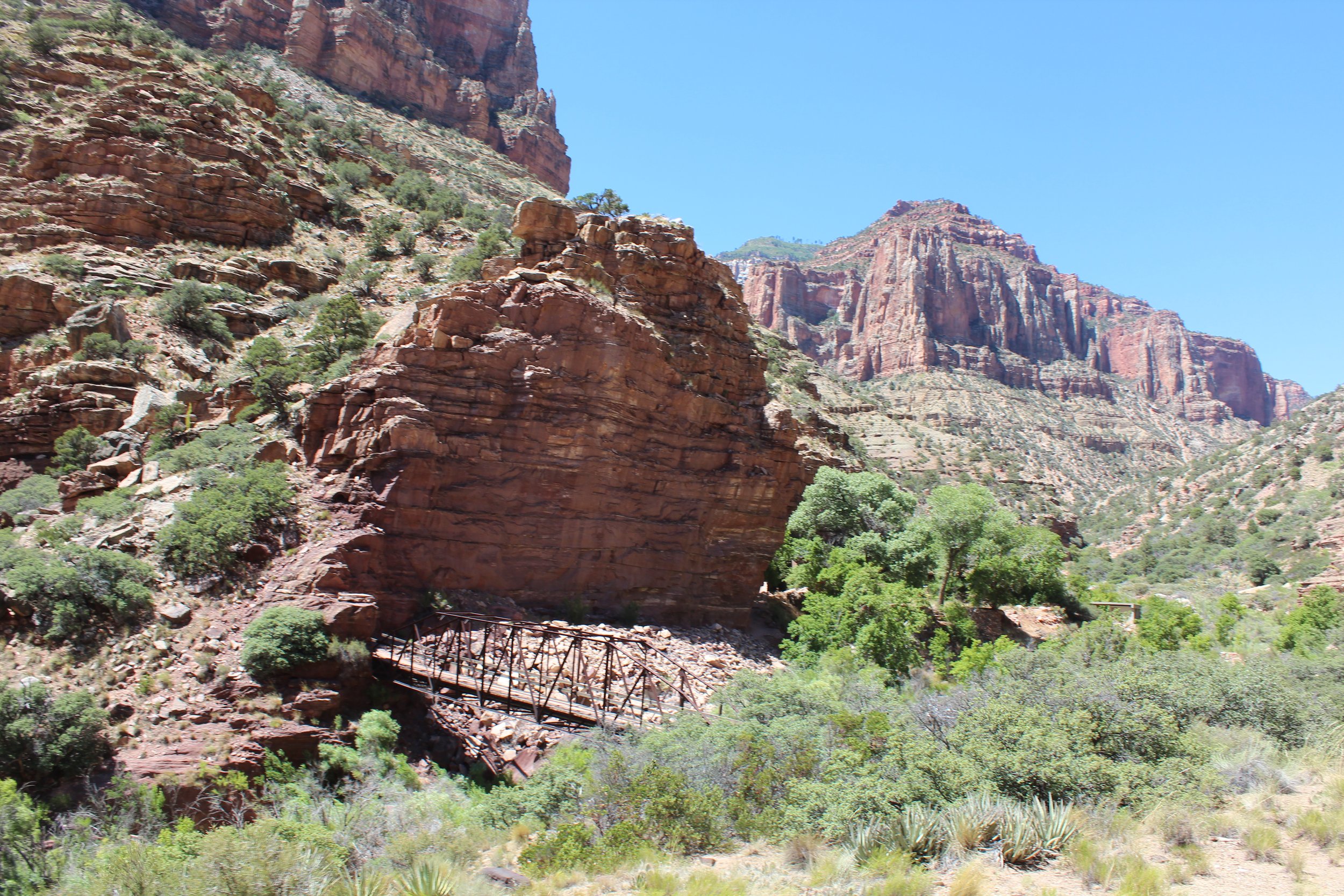
June 2016 (Day 1 - 2:10pm) - Bridge near Manzanita Rest Area
Manzanita Rest Area / Pump House - 4,400ft
(16.2 Miles from South Kaibab Trailhead / +1900ft elevation from Phantom Ranch)
(5.1 miles / -3841ft elevation from North Kaibab Trailhead)
Services - Water, Toilets
June 2016 Day 1 - 2:17pm / Day 2 - 4:27pm
Total Day 1 Hike Time - 9 hours & 43 minutes
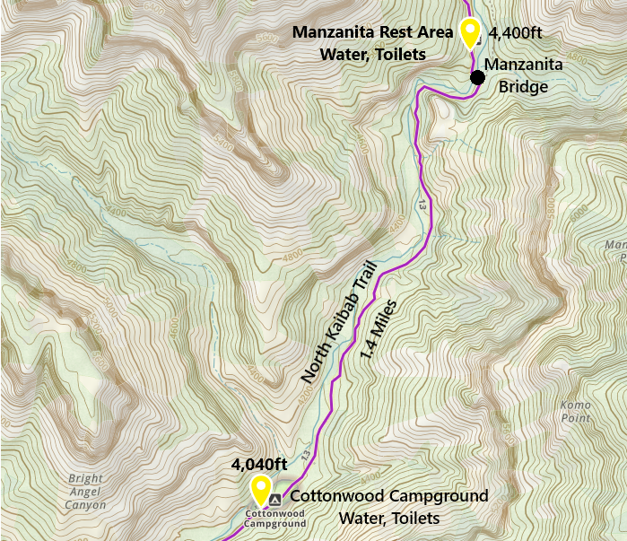
One-way distance between Cottonwood Campground and Manzanita Rest Area is 1.4 miles. On Day 2, this section took us 1 hour and 3 minutes. I don’t know the time from Day 1.
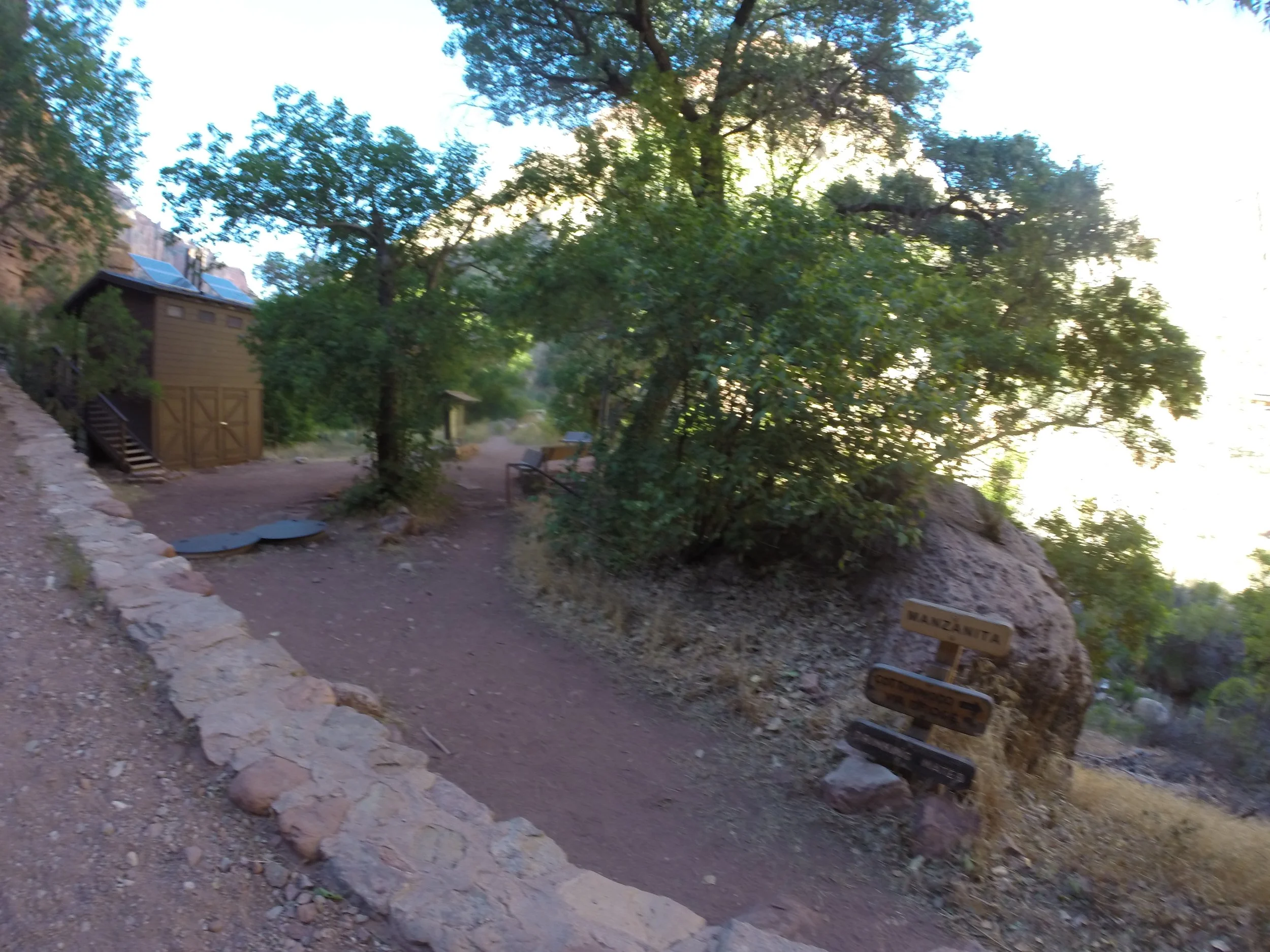
June 2016 (Day 2 - 4:27pm) - Stopping at Manzanita Rest Area
On our return hike, we stopped for a longer rest here at Manzanita. I took my boots off and sat on one of these rocks with my feet in the water. I had open blisters. I thought about bacteria and infection; I put my feet in the water anyway. I wanted to know that Bright Angel Creek would be flowing inside of me ever after.
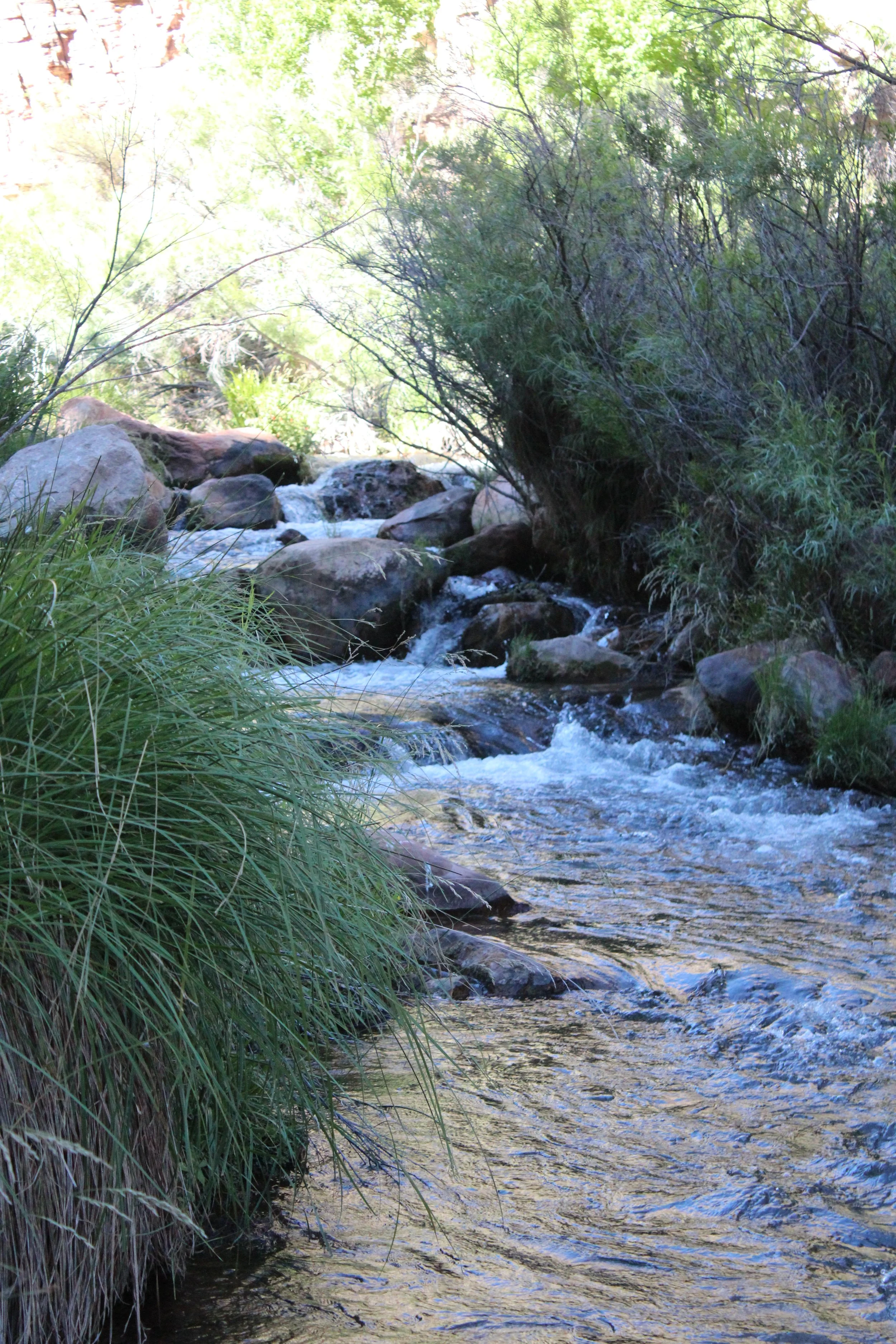
June 2016 (Day 2 - 4:29pm) Some moments of the hike I remember more than others. Stopping here and sitting on the rocks with my feet in the creek was important. I can still feel the cool water splashing over my toes.
Roaring Springs - 5,200ft
(16.9 Miles from South Kaibab Trailhead / +2,700ft elevation from Phantom Ranch)
(4.4 miles / -3,041ft elevation from North Kaibab Trailhead)
Services - None. Waterfall is quite far from trail
June 2016 Day 1 - 2:52pm / Day 2 - 4:00pm
Total Day 1 Hike Time - 10 hours & 24 minutes
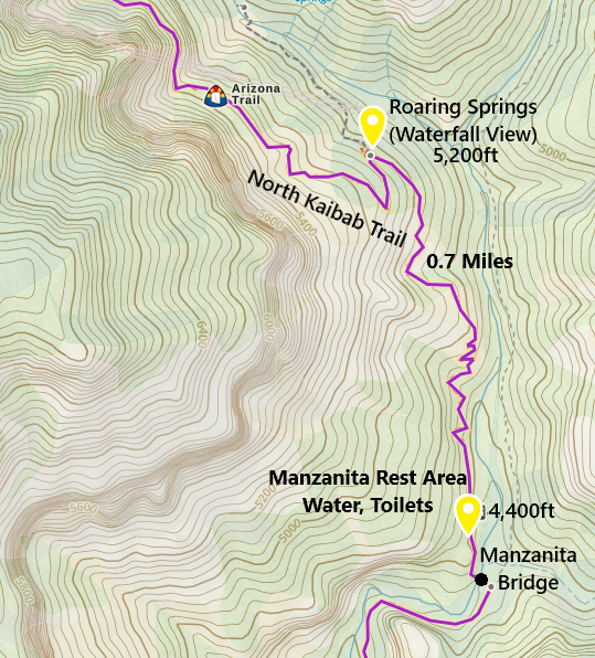
One-way distance between Manzanita Rest Area and Roaring Springs is 0.7 miles. The way up took us 35 minutes. The way down took 27 minutes.
From here on, the challenge is no longer heat, it’s just climbing up. We had a dinner reservation at the North Rim Grand Canyon Lodge for 8:00pm. That was the motivation I needed to keep going. And honestly, we hiked up pretty quickly.
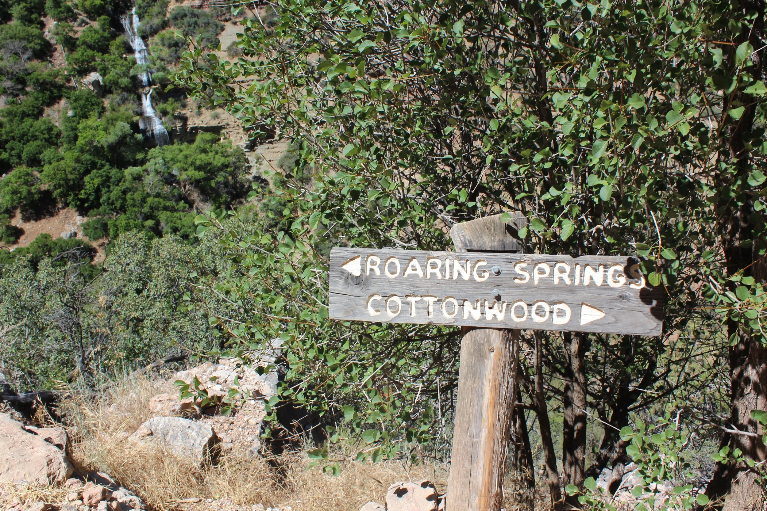
June 2016 (Day 1 - 2:50pm) - Roaring Springs
Roaring Springs isn’t all that exciting. This is about how far away the trail is from the waterfall. It’s on the other side of the canyon. But, it is intriguing. Look at where it starts. There isn’t a stream or creek. It comes straight out of the canyon wall. Meaning, there must be a cave inside the rock where water flows from, which must be refilled each winter by melting snow. That’s a lot of snow!
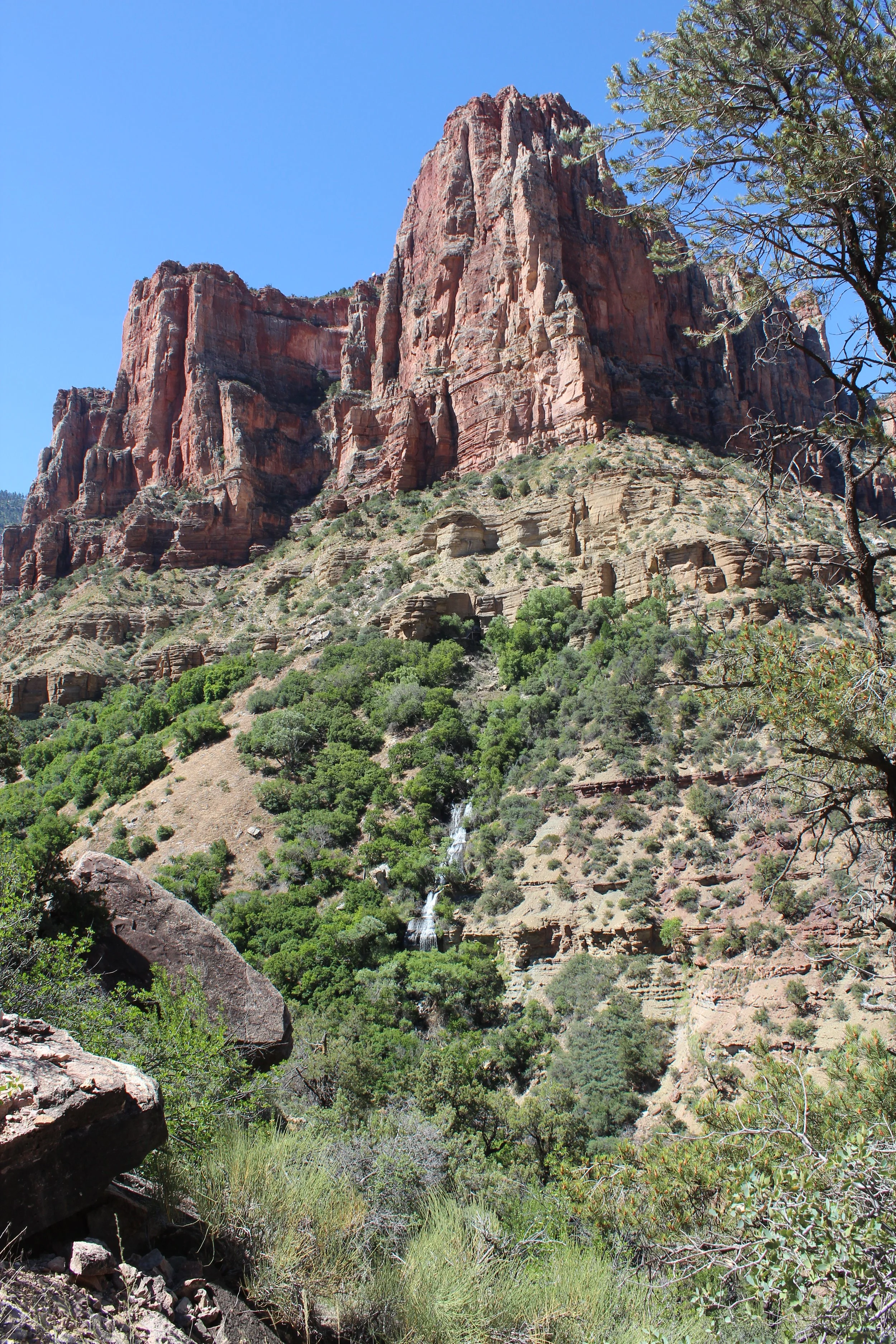
June 2016 (Day 1 - 2:50pm) - Roaring Springs
From here to Redwall Bridge is the sketchiest section of the trail. There are moments that we couldn’t see the bottom of the canyon. We walked single file and I had my hand on the rocks while I hiked. By this point my stomach was pretty upset. I thought it was from being scared of the height. Day 2 though, this section of the North Kaibab Trail was my favorite - the engineering side of me was fascinated by the trail design. I think on day 1 I was having symptoms from the heat. Eventually I figured it out and downed a bunch of salty crackers and drank more electrolytes.
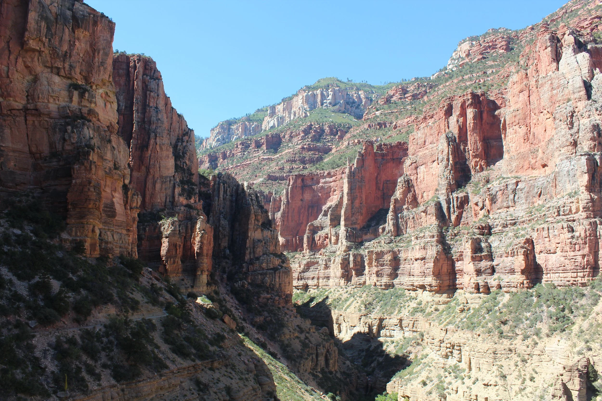
June 2016 (Day 1 - 3:23pm) - Starting the steep ascent to the North Rim
For anyone with a true fear of heights, this would be a difficult portion of the trail to hike.
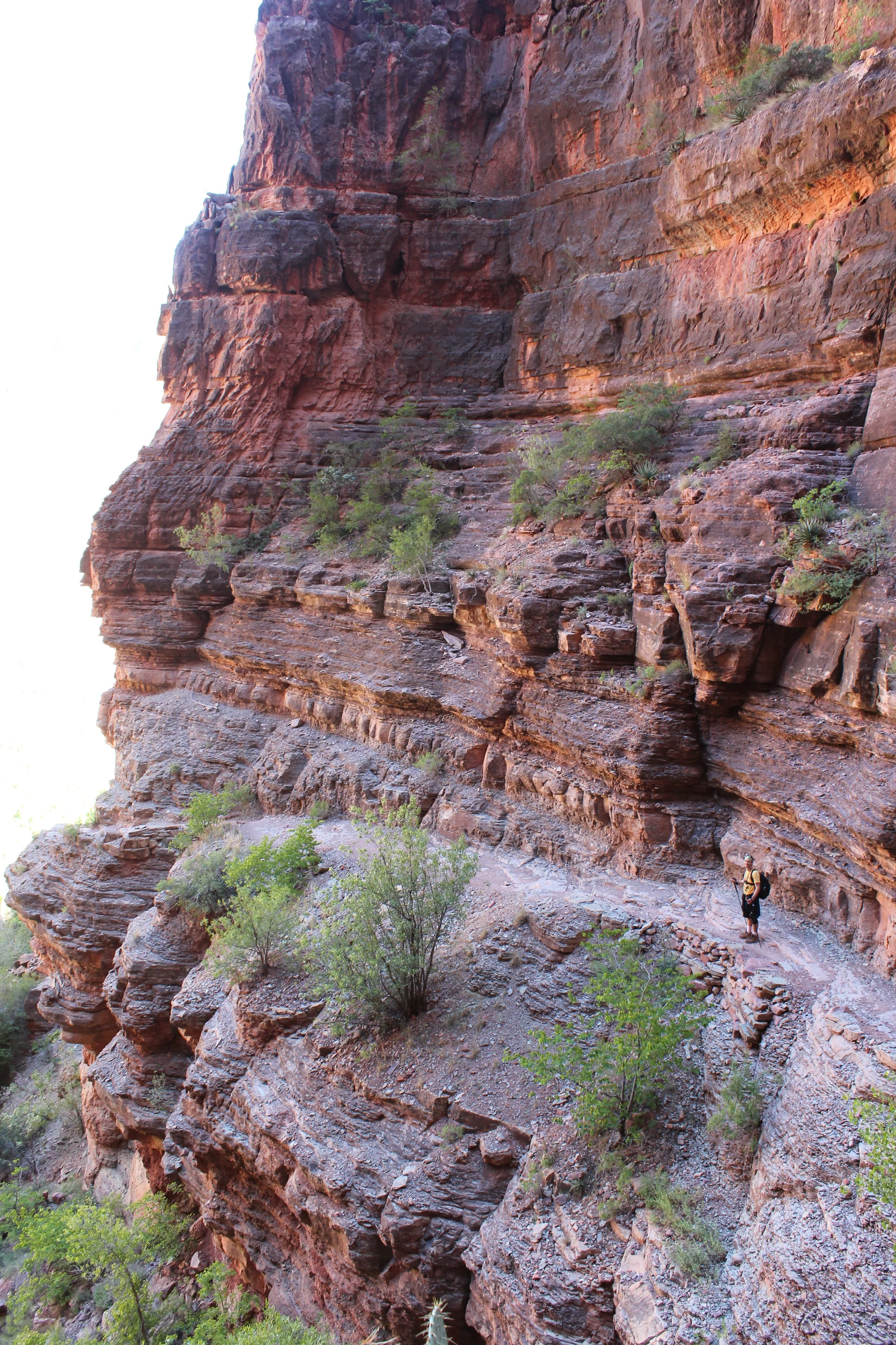
June 2016 (Day 2 - 3:36pm) - This trail… Amazing how it was built, and a little sketchy to walk along
There’s so much wonder and awe in feeling so small. Plus - how did they possibly design this trail???
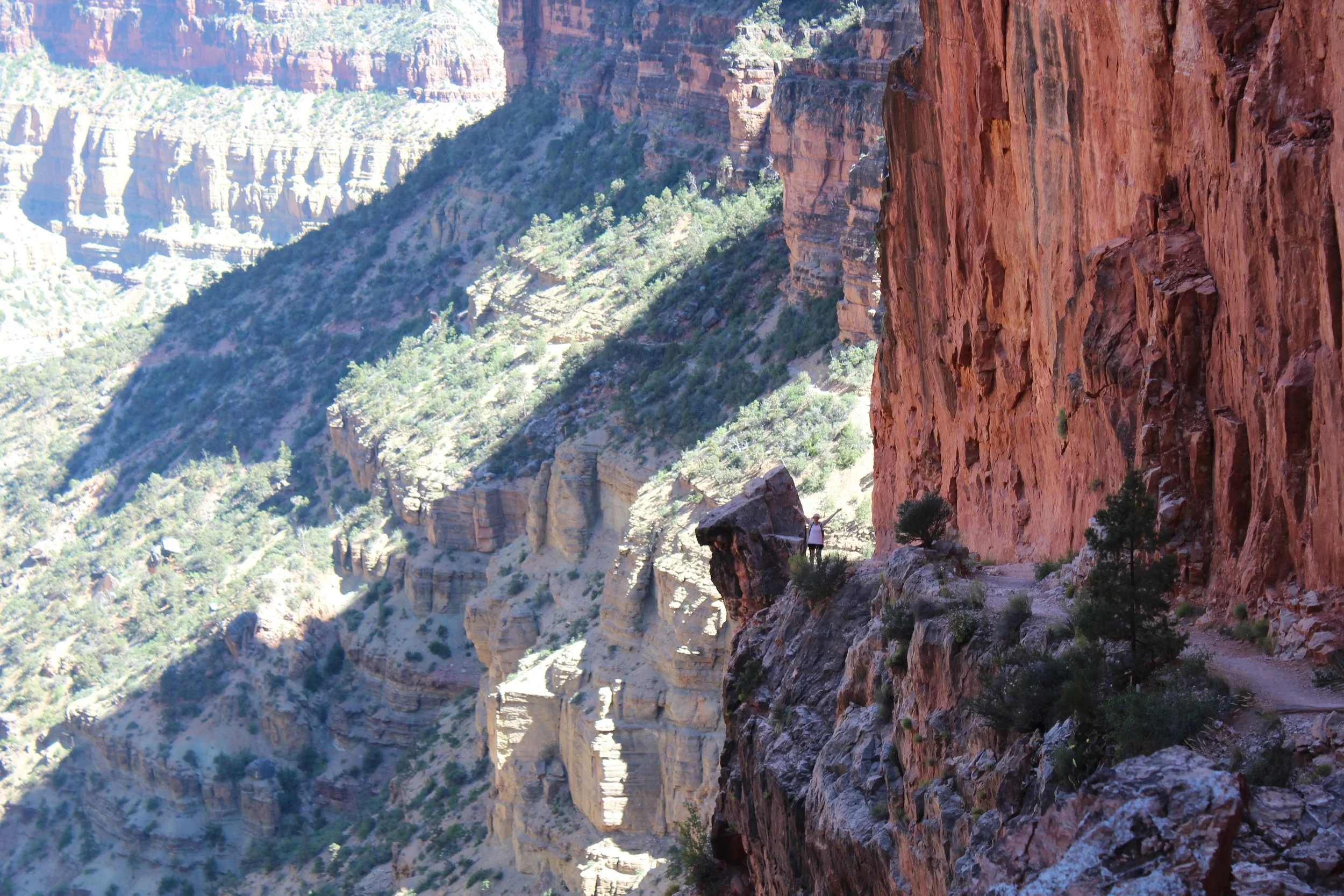
June 2016 (Day 2 - 3:14pm) - This is my favorite spot on the North Kaibab Trail after Ribbon Falls. Being right next to the tall canyon walls, I love how small am I am. And any problem or thing I might be worried about has to be even smaller.
Redwall Bridge - 6,040ft
(18.7 Miles from South Kaibab Trailhead / +3,540ft elevation from Phantom Ranch)
(2.6 miles / -2,201ft elevation from North Kaibab Trailhead)
Services - None
June 2016 Day 1 - 4:28pm / Day 2 - 2:46pm
Total Day 1 Hike Time - 12 hours
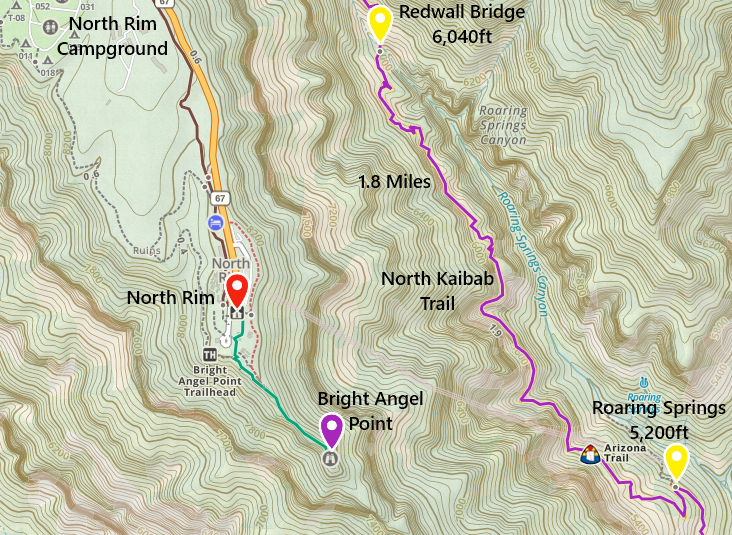
One-way distance between Roaring Springs and the Redwall Bridge is 1.8 miles. The way up took us 96 minutes. The way down took 74 minutes.
The Redwall Bridge is incredible and also not something someone with a true fear of heights would want to walk across. For an out-and-back hike from the North Rim, this is where I would stop and turn around. It’s worth the trek back up.
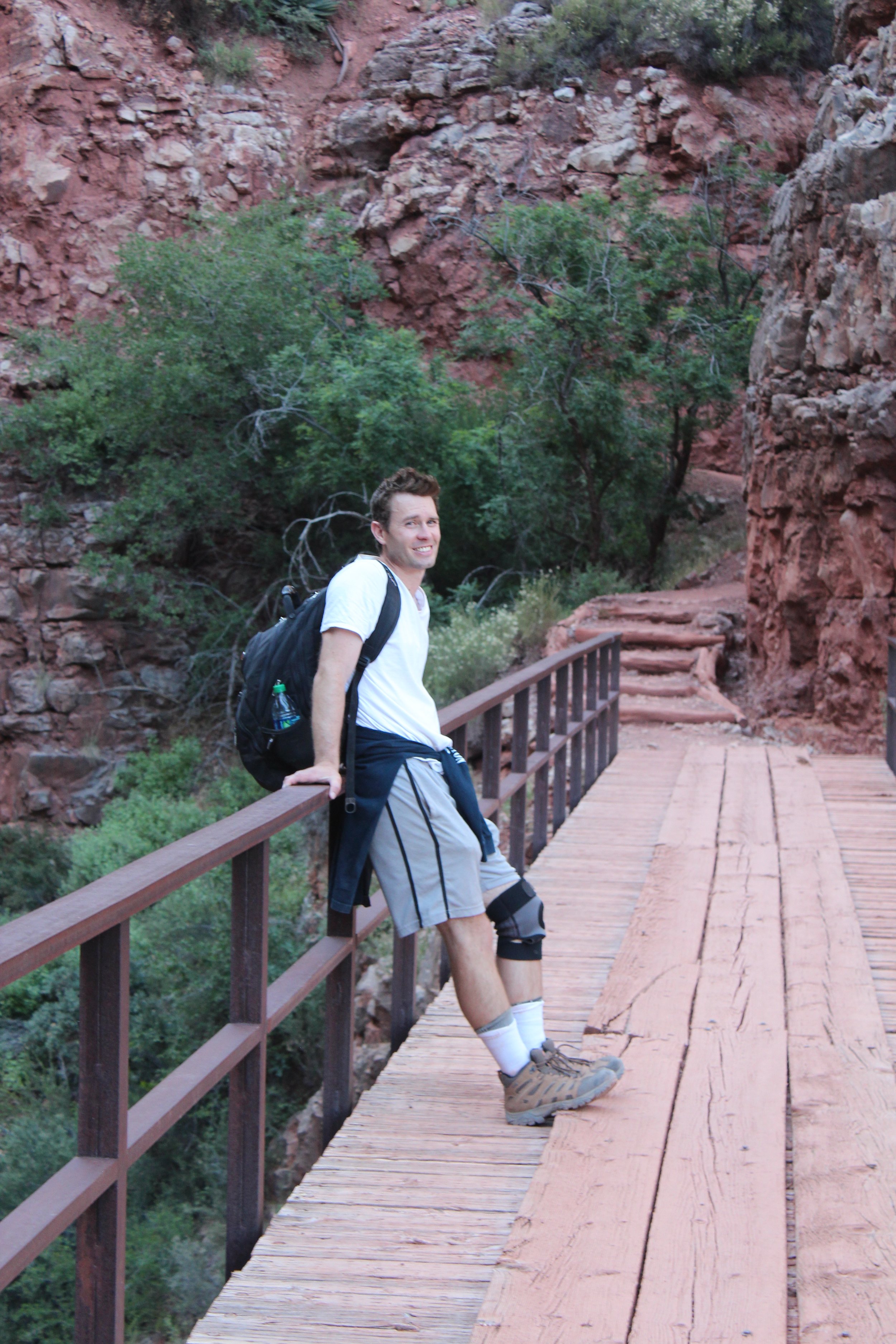
June 2016 (Day 1 - 4:26pm) Redwall Bridge - smiling but everything hurts, and there’s a lot of trail left to get up to the rim
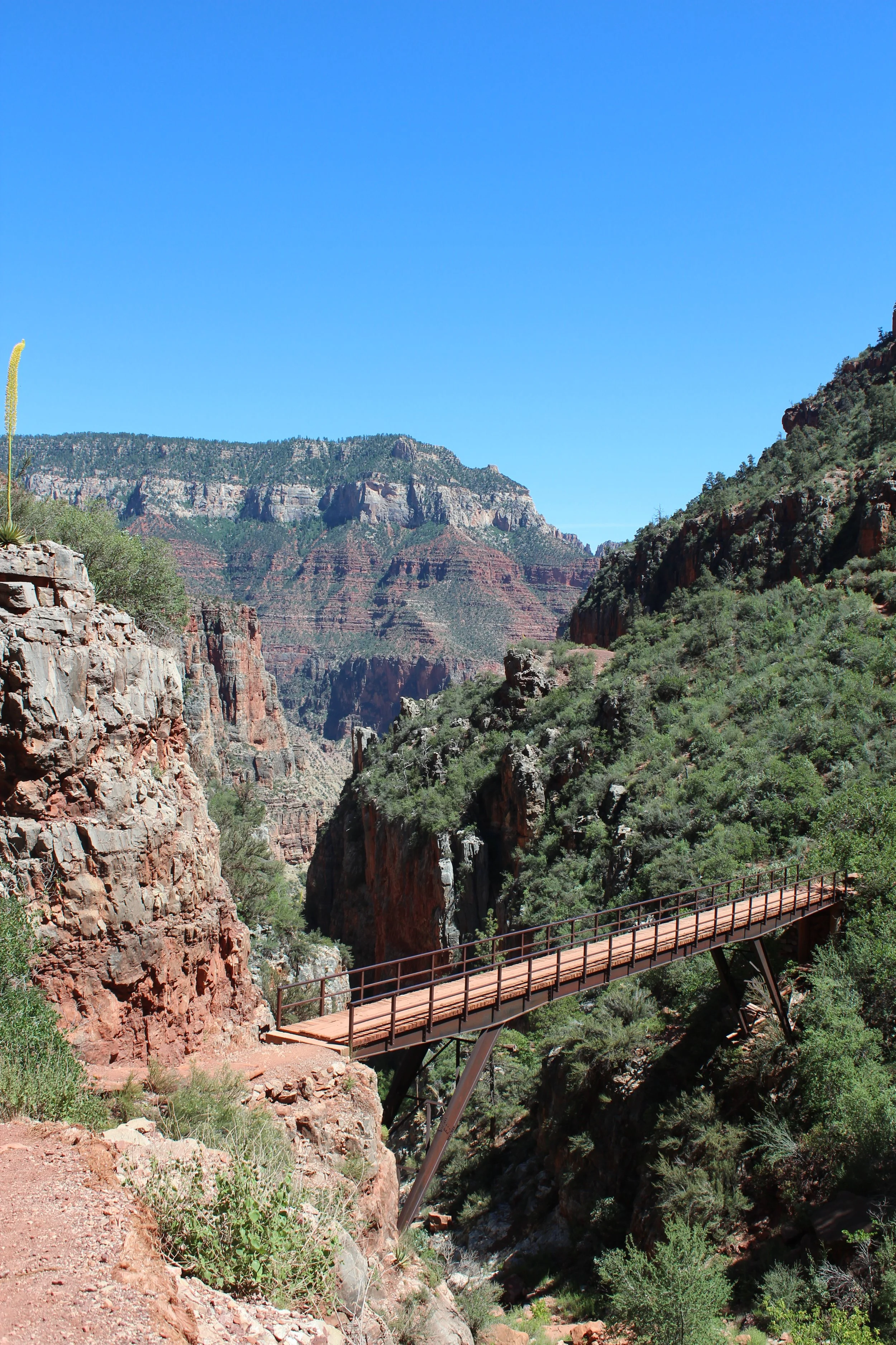
June 2016 (Day 2 - 2:46pm) - A better picture of Redwall Bridge - this one is pretty amazing too! And I was thrilled we had a bridge and didn’t need to walk down and back up!
Supai Tunnel - 6,840ft
(19.3 Miles from South Kaibab Trailhead / +4,340ft elevation from Phantom Ranch)
(2 miles / -1,401ft elevation from North Kaibab Trailhead)
Services - Water, Toilets
June 2016 Day 1 - 5:11pm/ Day 2 - 2:15pm
Total Day 1 Hike Time -12 hours & 40 minutes
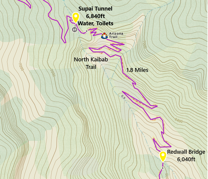
One-way distance between Redwall Bridge and Supai Tunnel is 1.8 miles. The way up took us 40 minutes. The way down took 31 minutes.
We didn’t stop too many times between Redwall Bridge and the Supai Tunnel. Our eyes were on the time. Dinner reservations are a great motivator at the end of a long day hiking. We were so excited to see this landmark! Only 2 miles left to the trailhead!
There are toilets and water from the waterline at Supai Tunnel, but it’s just a hole in the rock. For an out-and-back destination, I would either recommend stopping at Coconino Overlook or continue down to Redwall Bridge.
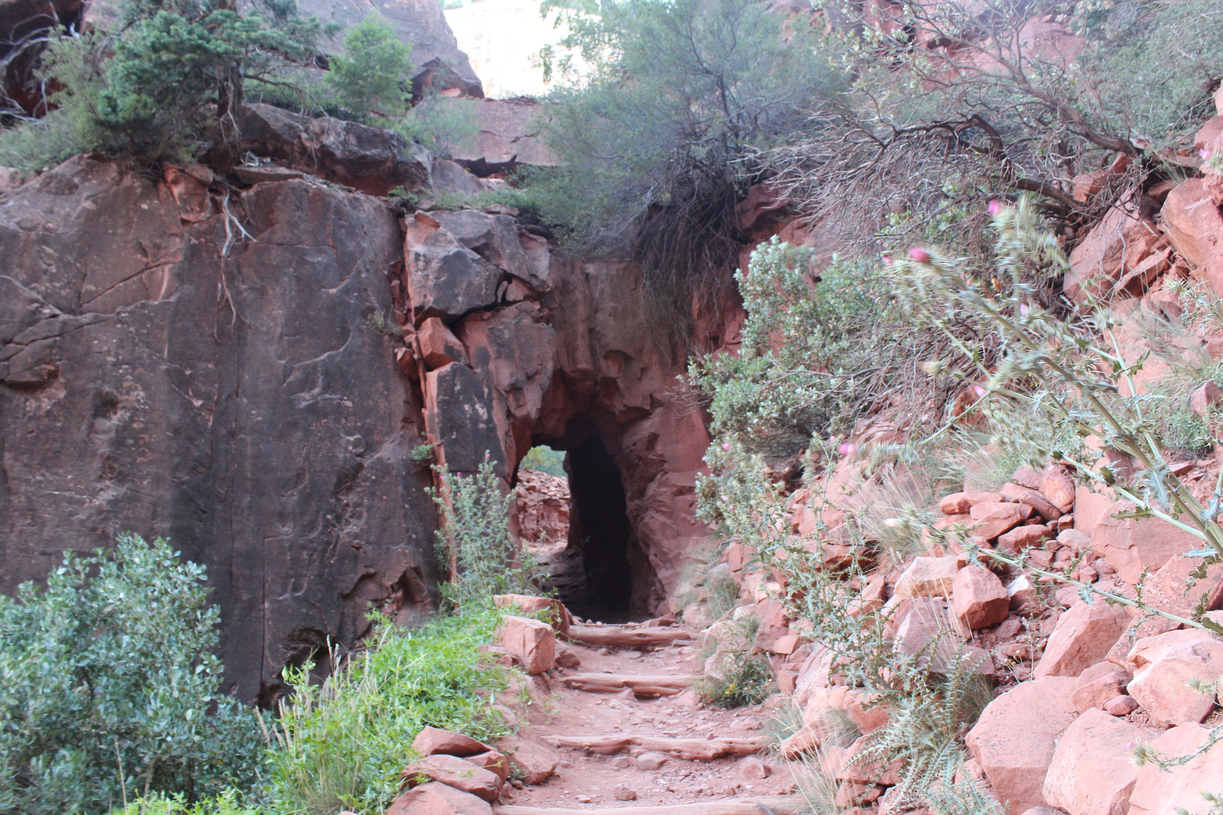
June 2016 (Day 1 - 5:09pm) - Supai Tunnel - I have never been so excited to see a hole a rock! Almost there!
Uggh, I’m no longer hot looking at these pictures, but exhausted. A fun South Rim to North Rim fact - After 17 miles of hiking, you get to hike up the equivalent of the Empire State Building 3.5 times. Yep, I don’t know why I love this canyon so much… It’s really hard to put it into words.
June 2016 (Day 2 - 2:14pm) I’m so glad we hiked back and had more time to appreciate this part of the canyon. So much of my focus on day 1 was just trying to get to the rim, day 2 we were trying to go slow to miss the sun at the bottom.
From here to the trailhead, we hiked 30 minutes and took a 10-minute break. Each step forward is one less you need to take.
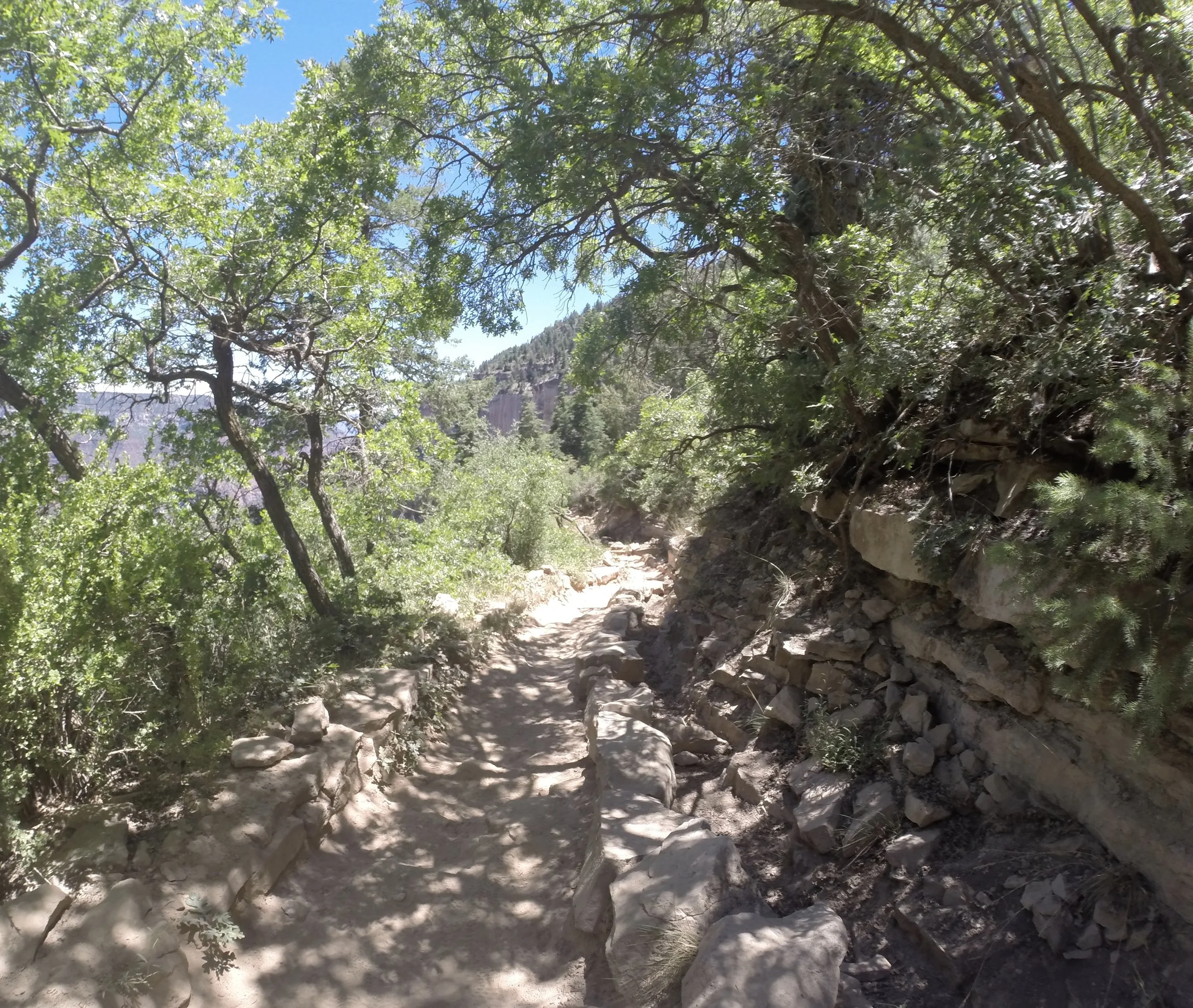
June 2016 (Day 2 - 1:17pm) - So much of the trail is covered in trees on the North Rim. Coconino is really the first viewpoint of the canyon.
Coconino Overlook - 7,450ft
(20.6 Miles from South Kaibab Trailhead / +4,950ft elevation from Phantom Ranch)
(0.7 miles / -791ft elevation from North Kaibab Trailhead)
Services - None
June 2016 Day 1 - 6:13pm / Day 2 - 1:08pm
Total Day 1 Hike Time - 13 hours 42 minutes
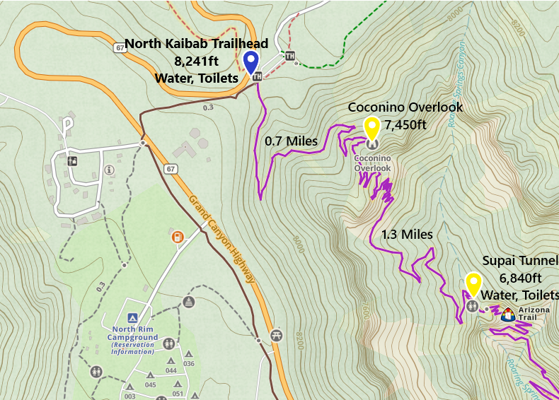
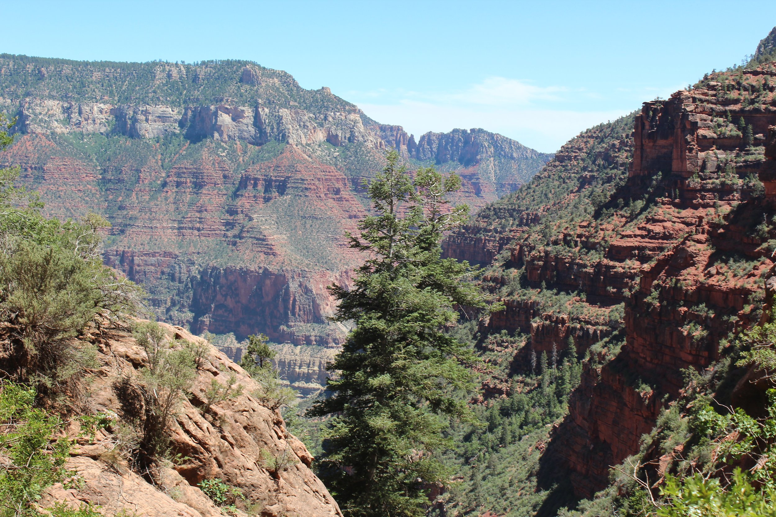
One-way distance between Supai Tunnel and Coconino Overlook is 1.3 miles. The way up took us 62 minutes. The way down took 67 minutes.
Coconino Overlook is beautiful and a completely different canyon than what is visible from the South Rim. On our hike up to the trailhead, we still have 1.5 miles to hike after the trailhead to the Grand Canyon Lodge, where we were spending the evening. We found a couple on the trail who offered to give us a ride to the Lodge. It ended up not working out. They got too far ahead of us, drove to the Lodge and thought we would be walking on the road when they came back to look for us. We were on the Rim Trail so they didn’t see us. But thinking we had a ride was the motivation I needed to get myself out of the canyon. My feet still worked. I was capable of doing this!
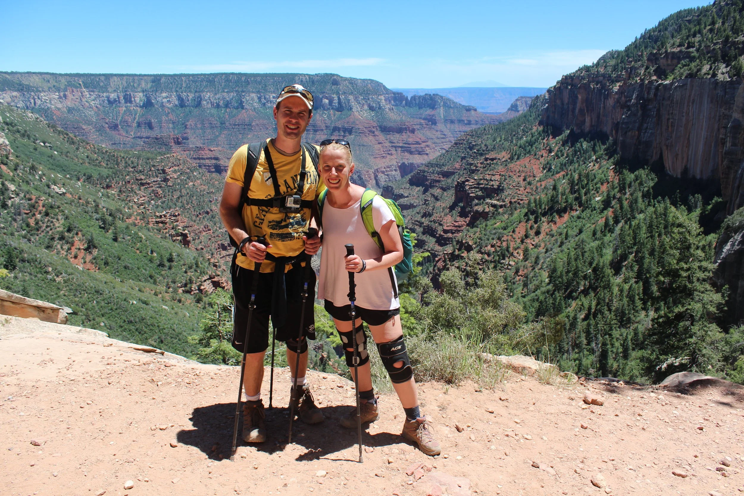
June 2016 (Day 2 - 1:10pm) - Apparent that this is day 2… We look refreshed again! Coconino Overlook would make the perfect out-and-back hike from the North Rim.
The canyon isn’t very visible between the trailhead and Coconino Overlook. There’s a lot of pine trees. Again, it’s very different than the South Rim due to the higher elevation.
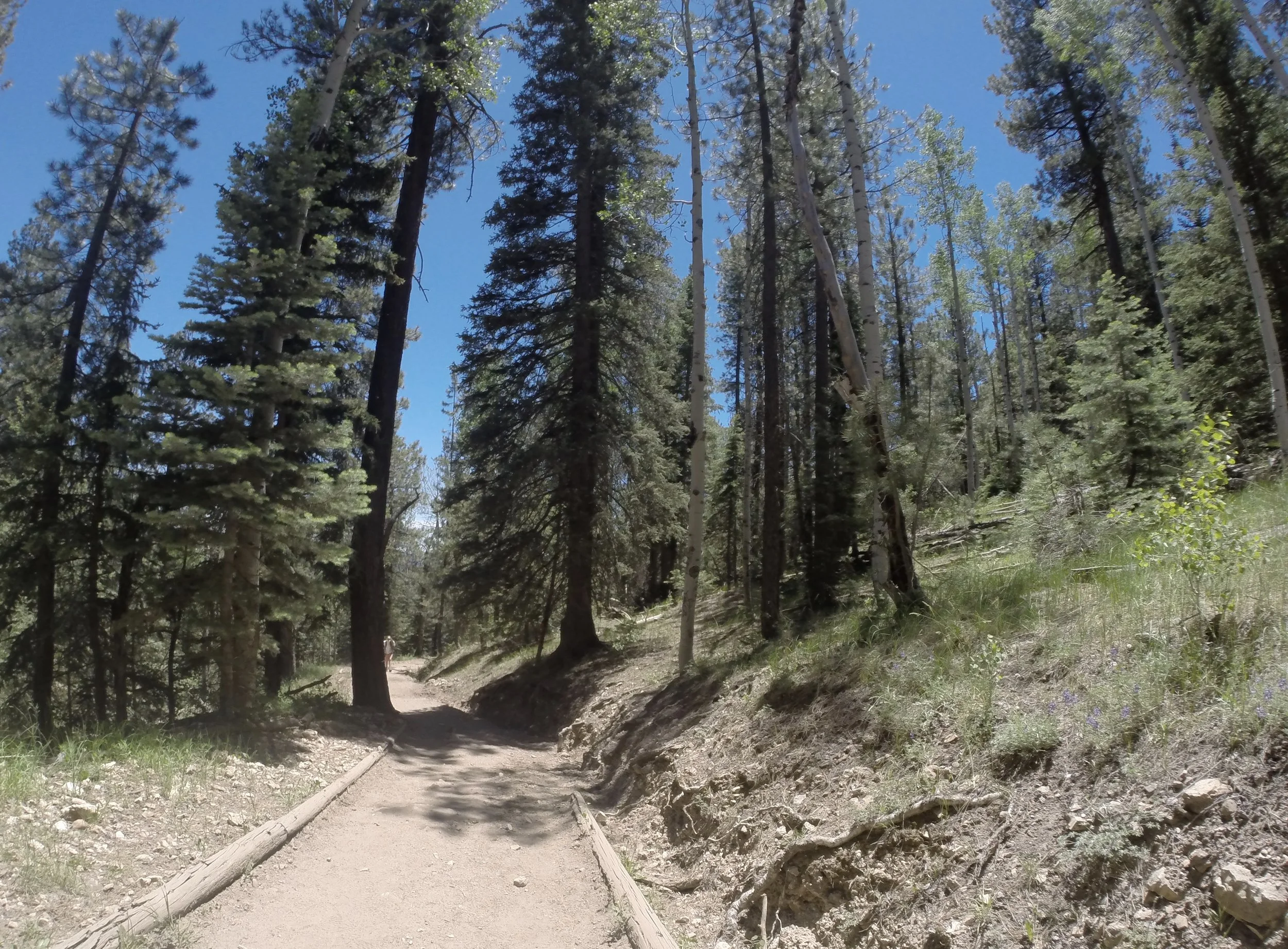
June 2016 (Day 2 - 12:52pm) - Up from Coconino, the rest of North Kaibab was almost disorienting. After hiking all day in a hot canyon, all of a sudden, we were in a much cooler pine tree forest.
North Kaibab Trailhead - 8,241ft
(2137 Miles from South Kaibab Trailhead / +5,741ft elevation from Phantom Ranch)
Services - Water, Toilets
June 2016 Day 1 - 6:39pm / Day 2 - 12:50pm
Total Day 1 Hike Time - 14 hours & 8 minutes
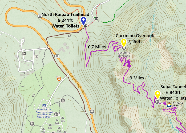
One-way distance between Coconino Overlook and the North Kaibab Trailhead is 0.7 miles. The way up took us 26 minutes. The way down took 18 minutes.
These are the You’ve Made It steps! The parking lot is on the other side.
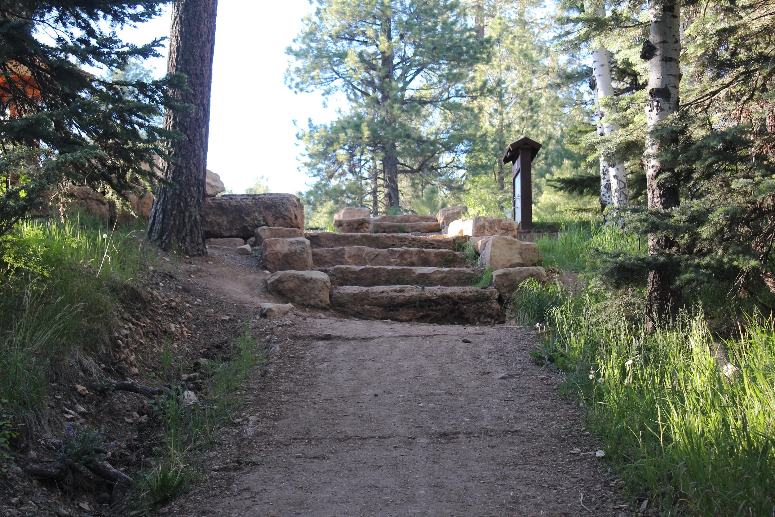
June 2016 (Day 1 - 6:39pm) - If ever there is a “tah-dah” moment, it’s climbing these steps, which signal the end of the North Kaibab Trail!
Rim Trail to Grand Canyon Lodge
Lodge - 8,240ft
(22.8 Miles from South Kaibab Trailhead / +4,950ft elevation from Phantom Ranch)
Services - Currently closed - The North Rim Lodge burned down in a fire in the summer of 2025. The Campground and General Store are open during regular summer months (May 15 - Oct 15). Check the National Park Service website for current information. Kaibab Lodge is open, but at 16 miles away requires a bus shuttle which should be reserved ahead of time.
June 2016 Day 1 - 7:26pm / Day 2 - ?
Total Day 1 Hike Time - 14 hours 55 minutes
One-way distance between the North Kaibab Trailhead and the Grand Canyon Lodge is 1.5 miles. Although the net elevation change is zero, note that there is a 150ft hill, and you will feel every inch of that uphill by this point in your day… This section took us 47 minutes on Day 1. We hiked side trails and viewpoints on Day 2 before going to North Kaibab, so I don’t have an official start time.
Our hike was not done yet. We still had 1.5 miles left to get to the Grand Canyon Lodge. Although it’s a “Rim Trail”, this trail has a giant hill in the middle of it. Probably not really giant, but after hiking the Grand Canyon Rim to Rim, I felt every step. I think I had done a good job of not complaining up until this point. And then I think I didn’t stop wining about how much I hurt until we got to the lodge…
Unfortunately, this amazing Grand Canyon Lodge burned down in the Dragon Bravo Fire in July 2025.
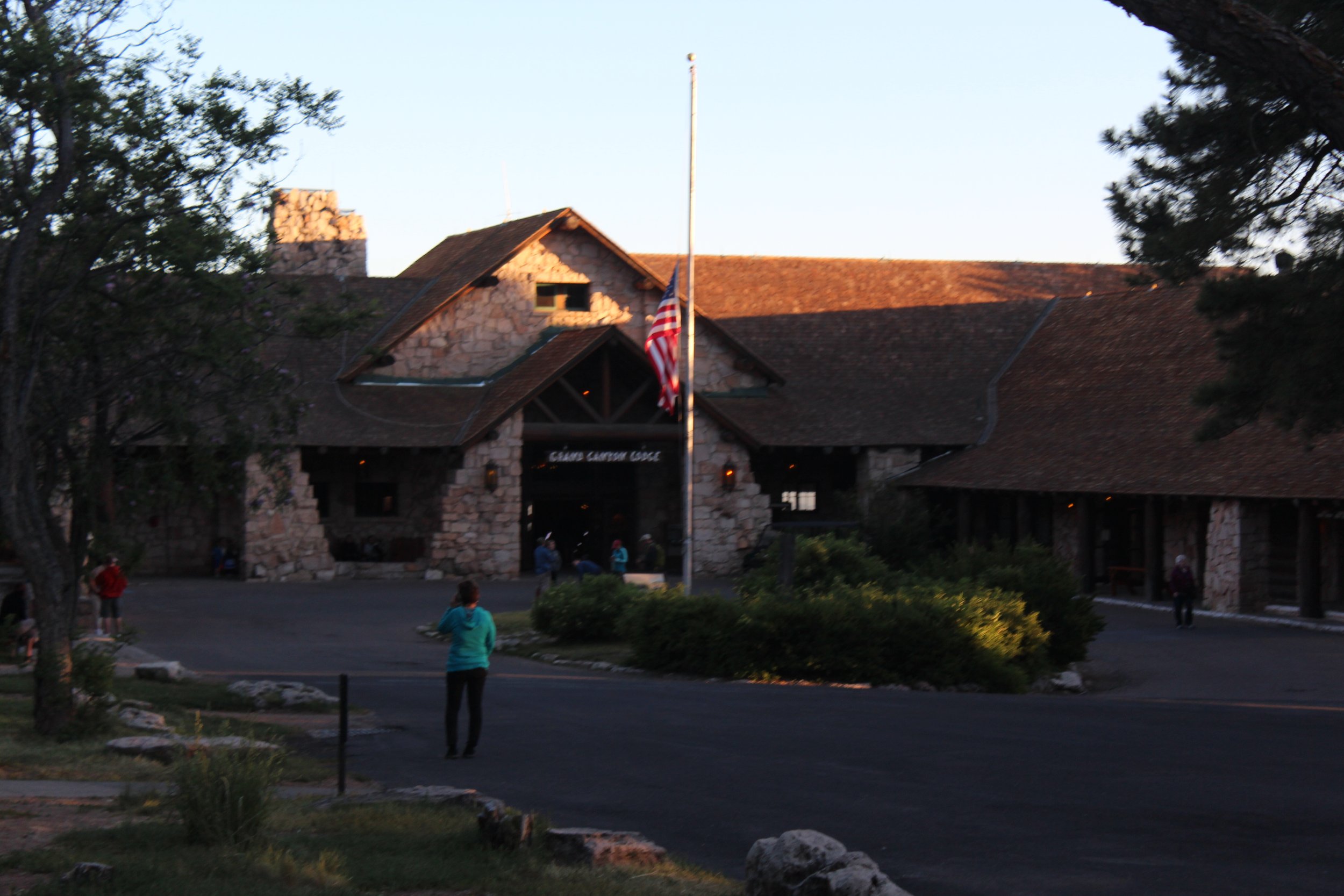
June 2016 (Day 1 - 7:24pm) - I’m still heartbroken the lodge has burned down. This was an amazing place to end our first day and start our second. It was a lodge full of hikers and each person had their own story. We’d met so many of them already on the trail earlier and we enjoyed hearing about the rest of their journey.
This is what success looks like - dirty, tired, and painful. Not able to think about handling another day of heat, we called the Trans-Canyon bus company and scheduled a ride back to the South Rim for the following afternoon.
We celebrated our accomplishment with an amazing supper, conservation with other hikers, and convinced the Lodge staff to give us a ride to our cabin with their golf cart service so we didn’t have to walk. Their staff was the best! No questions asked!
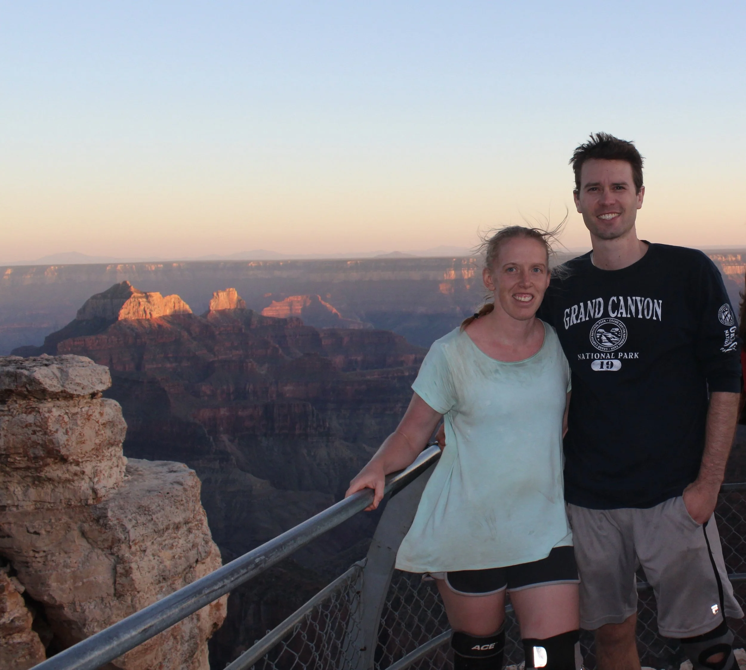
June 2016 (Day 1 - 7:39pm) We made it to Bright Angel Point just in time to see the sun set, 15 hours after we set off down the South Kaibab Trail
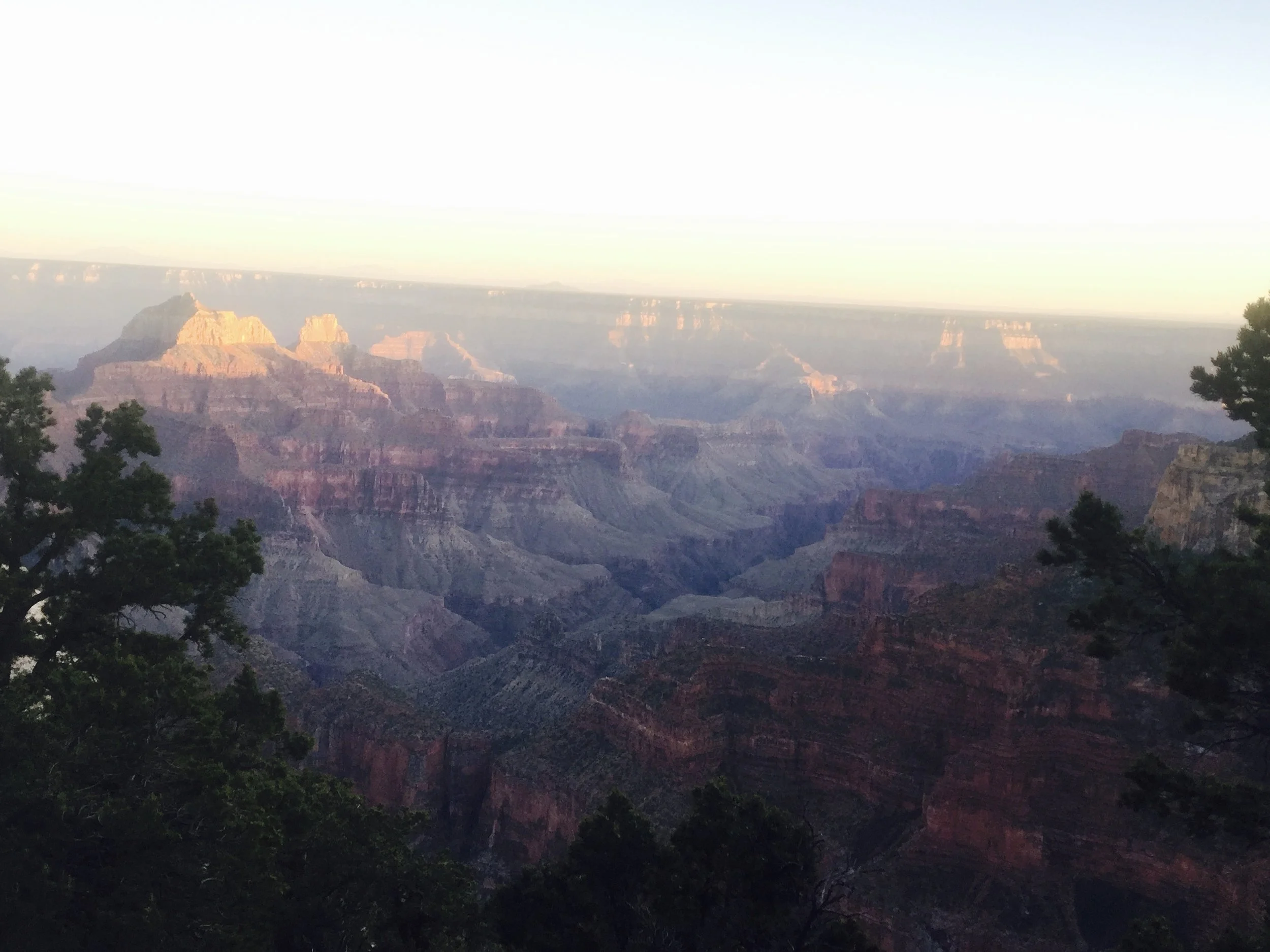
June 2016 (Day 1 - 8:00pm) - Sunset on Bright Angel Point on the North Rim. We are looking at the inner canyon we just walked through, and the South Rim is now on the other side.
The cabins we stayed at burned down as well in the Dragon Bravo Fire.
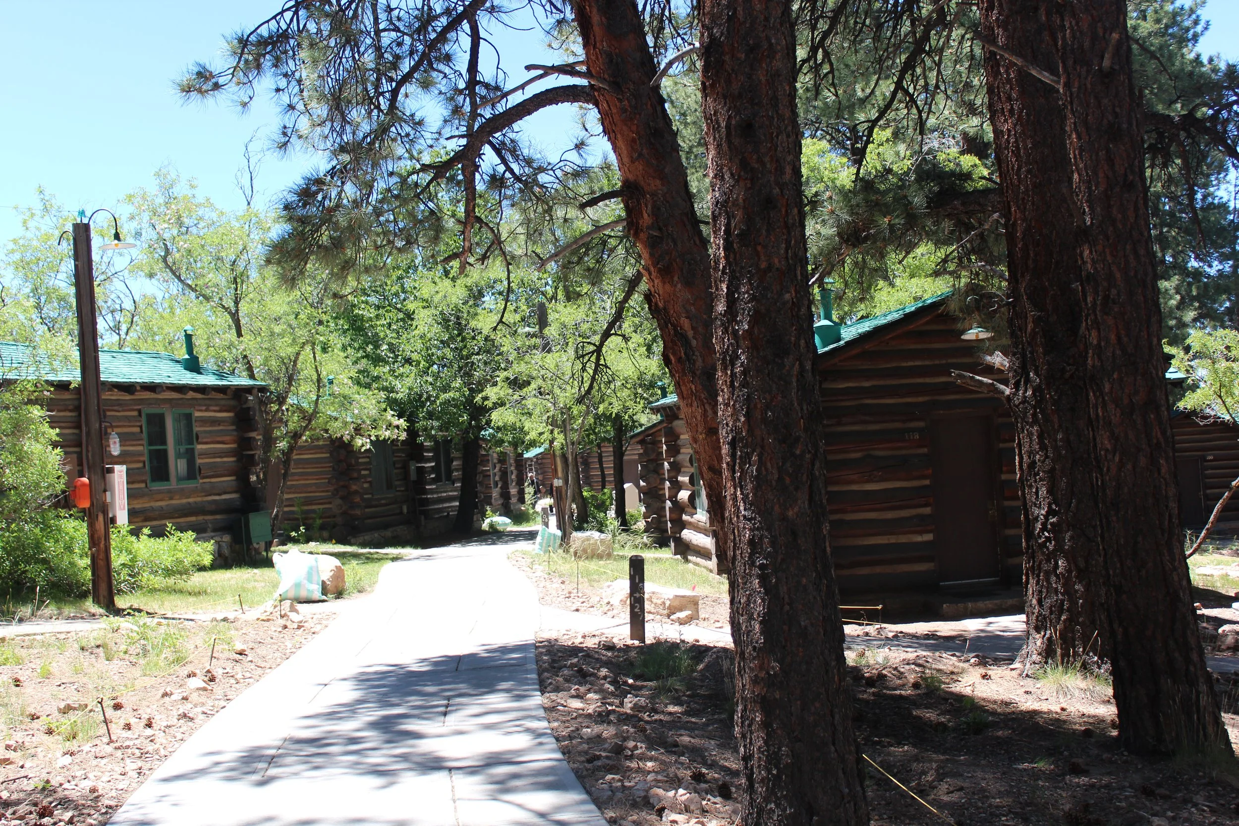
June 2016 (Day 2 - 10:00am) - Cabins along the North Rim before being burned down in the Dragon Bravo Fire
This was the view that greeted us when we woke up in the morning. We ventured out to several of the rim viewpoints and stopped at the gift store. We felt refreshed, hydrated and even my knees were doing ok. We had breakfast at the lodge, which had these floor to ceiling windows looking out at the canyon - that same canyon that had been calling to me since I was 14. We chatted with other hikers. “If I never go back into that hole again, it will be too soon.” “But you’re going to hike back though, aren’t you?” Uggh… I can’t explain this. It’s a really deep hole in a huge rock but a place where I feel alive…. We called the bus company back and cancelled our reservation. They kept $10. I think they’ve since changed their cancellation policy… We spent the next hour figuring out how to hike back safely by staying out of the heat, and then we double checked our plans with Park Rangers.
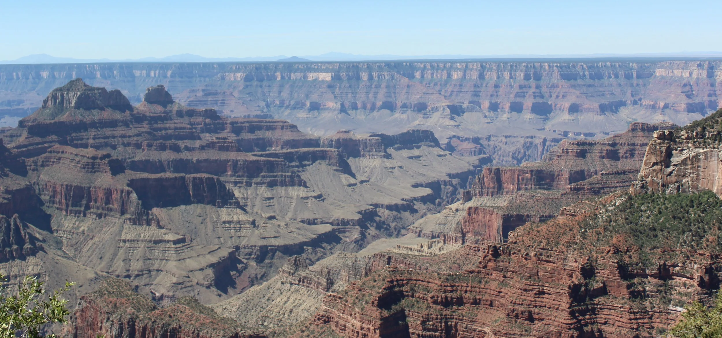
June 2016 (Day 2 - 10:50am) - North Rim - Get on a bus to drive around or hike through??? I say I didn’t hurt at this point - that’s honestly relative… But isn’t it obvious why picked hiking back???
Live life without regret. I’m so proud I decided I could do this.
North Kaibab to Bright Angel
This is just a quick summary of how we hiked back to the South Rim (for anyone curious in hiking North Rim to South Rim). To completely avoid the heat, we enjoyed the North Rim all morning and did not leave from the trailhead until just before 1:00pm. We bought lunch at the General Store - I was so tired of Peanut Butter and Jelly sandwiches…. I think we each had 10 over two days… I will only eat PB&J if I’m on a trail that’s too hot to keep meat and cheese cold…
Our goal on day 2 was to hike down slow enough that by the time we hit Cottonwood Campground, the sun would already be past the canyon walls, leaving the trail in the shade. We knew we would be hiking Bright Angel in the late night / early morning, but we had a full moon, headlamps, and extra batteries. This was a safe plan for us, even though this was our first hike at night and felt a little bit weird. We got to enjoy the North Kaibab trail again in the daylight hours, and we did not have any issues with the heat on the way back, even though it was hotter day than our first day of hiking.
North Rim Trailhead - 8,241ft
24.3 Miles (Rim-to-Rim-to-Rim Hike)
Day 2 - 12:50pm
Coconino Overlook - 7,450ft
(0.7 Miles / -750ft elevation from trailhead)
25 Miles (Rim-to-Rim-to-Rim Hike)
Day 2 - 1:08pm
Supai Tunnel - 6,840ft
(2 Miles / -1,401ft elevation from trailhead)
26.3 Miles (Rim-to-Rim-to-Rim Hike)
Day 2 - 2:15pm
Redwall Bridge - 6,040ft
(2.6 Miles / -2,201ft elevation from trailhead)
26.9 Miles (Rim-to-Rim-to-Rim Hike)
Day 2 - 2:46pm
Roaring Springs - 5,200ft
(4.4 Miles / -3,041ft elevation from trailhead)
28.7 Miles (Rim-to-Rim-to-Rim Hike)
Day 2 - 4:00pm
Manzanita Rest Pump House - 4,400ft
(5.1 Miles / 3,841ft elevation from trailhead)
29.4 Miles (Rim-to-Rim-to-Rim Hike)
Day 2 - 4:27pm
Cottonwood Campground - 4,040ft
(6.5 Miles / -4,201ft elevation from trailhead)
30.8 Miles (Rim-to-Rim-to-Rim Hike)
Day 2 - 5:30pm
Up to this point in our hike, it was pretty easy and we were feeling pretty good. By the time we hit “the Box” it was about 6:30pm. Even though the trail was in the evening shade, the heat coming off the rocks was intense. There was no breeze. And it’s a little hard to just focus on getting to Phantom Ranch when we knew we still had to get out of the canyon. For the most part, we were able to tuck those feelings of panic in a pocket…
Phantom Ranch - 2,500ft
(13.4 Miles / -5,741ft elevation from trailhead)
37.7 Miles (Rim-to-Rim-to-Rim Hike)
Day 2 - 8:30pm
We were surprised and excited to realize that Phantom Ranch re-opened in the evening. That lemonade was amazing! Electrolytes (and peanut better & jelly sandwiches) were starting to get old… We didn’t stay inside too long. It was full of hikers spending the night in the canyon. They were celebrating their accomplishments of the day while we weren’t yet done with ours. We quickly moved outside and finished our lemonade on the park benches. Eventually I laid down on one and when I looked up, I saw the Grand Canyon bathed in moonlight. I felt amazingly lucky and blessed to be down here - to see the canyon this way down at the river. Coupled with thoughts that had now fledged into full panic mode - how do I get out of this hole again??? We both hurt so much that it was surprising to observe we could still keep moving.
We hiked Bright Angel in the dark. Obviously, we didn’t take any photos, so I don’t have time stamps on the way up. We finished at 2:50am. We didn’t cheer, we didn’t give high 5’s to each other, nor did we cry. We just hobbled together on the way to back to parking lot C, happy to get into the car and turn the heat on - it’s cold at night on the rim, even in the summer. Our hotel was the Red Feather in Tusayan. McDonalds was still open that late at night. I wanted something other than PB&J. My husband wanted several glasses of cold milk. We checked into the hotel. They were so happy we were safe, they offered us a free late check-out. We slept until noon.
The problem with hiking Bright Angel in the dark…. is that we didn’t see the trail. So, yep, we found ourselves back here in March 2018 with the goal of just hiking down to the river on South Kaibab and up on Bright Angel so we could see the trail. And after you’ve done it twice… you think about a third time (2026), and a fourth time (2031???) Yep - already talking about our next trip. I don’t know what it is that pulls us here… There are so many places we haven’t been, but this one just feels like home…
Below is a summary of times, pictures, and stories from our 2018 and 2026 hikes up Bright Angel.
Bright Angel Trail
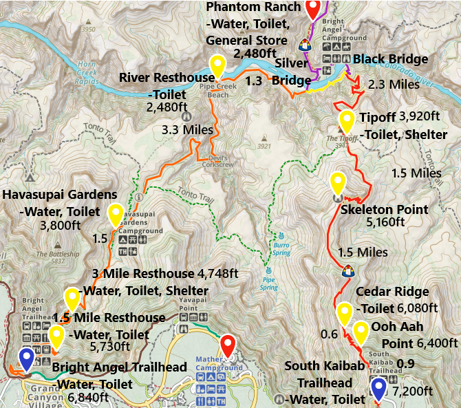
The marked spots along the Bright Angel Trail are Silver Bridge, River Rest, Havasupai Gardens Campground, 3 Mile Rest House, and 1.5 Mile Rest House. Elevation, trail distance, and services are marked. Verify the waterline is on before assuming water is available on the trail.
Silver Bridge - 2,500ft
8 Miles from South Kaibab Trailhead / 0ft elevation from Phantom Ranch
June 2026 - 8:55am / March 2018 - 11:42am (Avg Total Hike Time = 4 hours & 35 minutes)
14.1 miles North Rim-to-South Rim / 38.4 miles Rim-to-Rim-to-Rim
(9.1 miles / +4,340ft elevation from Bright Angel Trailhead)
Services - None
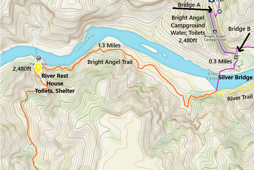
One-way distance between Phantom Ranch and the Black Bridge is 0.3 miles.
There are toilets at the bottom in a couple of places. Back at Phantom Ranch, they are back by the cabins. These are a bit out of the way. You will pass more on your way to Silver Bridge.
June 2026 (8:44am) - Bathrooms and on to the South Rim - Hike On!
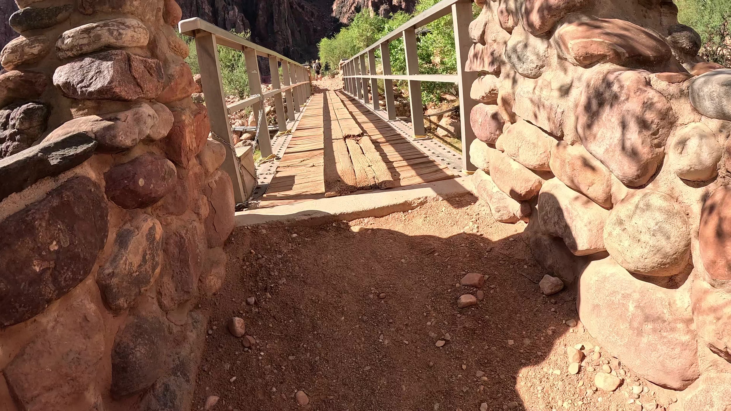
There was a footbridge over Bright Angel Creek before reaching Silver Bridge. It was also washed out in the flashflood on 29Aug2026. Even though we’ve been over this bridge 3 times, neither my husband nor I could remember it. I had to dig through our GoPro videos to find the next two pictures, verifying there was indeed a bridge. It’s so funny - what matters a lot and I didn’t even notice. This bridge absolutely has to be re-built before this trail can re-open.
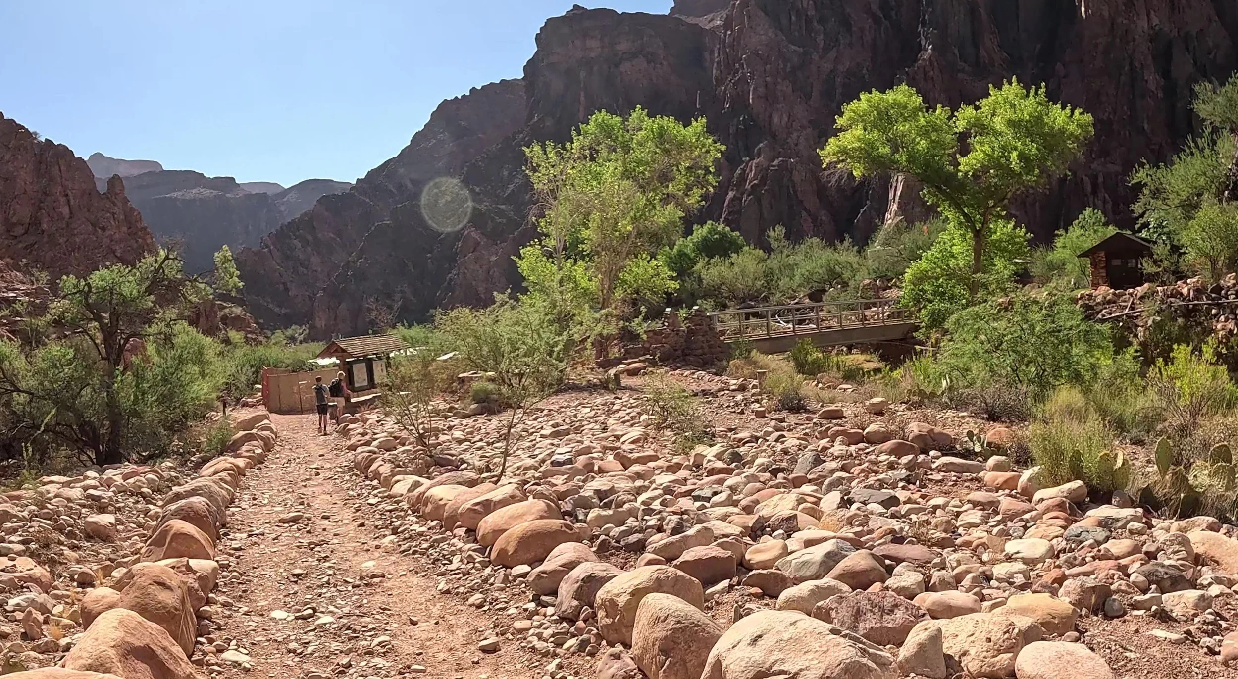
June 2026 (8:53am) - Bridge crossing Bright Angel from Phantom Ranch - this bridge is required to cross to get to Silver Bridge
All that’s left of this bridge are the stones. The absence of this bridge creates two problems. The first is that this bridge was on the main trail to Bright Angel Trail. If the park reopens Phantom Ranch before this bridge is restored, the choice will either be to hike back over to Black Bridge and hike on the south side of the river (backtracking plus a pretty large hill) or hikers would need to cross through Bright Angel Creek. I just can’t imagine the NPS choosing to do this due to the added hiking milage. I don’t think they will re-open Phantom Ranch without the repair of this bridge.
The second problem is access to Bright Angel Campground, as both foot bridges are gone. This campground has other issues than just missing bridges, but I would assume the repair crew would need at least one bridge restored before they can really begin much of the work on renovating this campground. It’s a lot of work that needs to be done at the bottom of a mile-deep hole. Be patient on the repair efforts required.
June 2026 (8:54am) - Bridge two months before it was washed away in the flashflood on 20aug2026 between Bright Angel Campground and Silver Bridge
Silver Bridge gets you back over the Colorado River to the south side. Like Black Bridge, Silver Bridge also has some impressive cables!
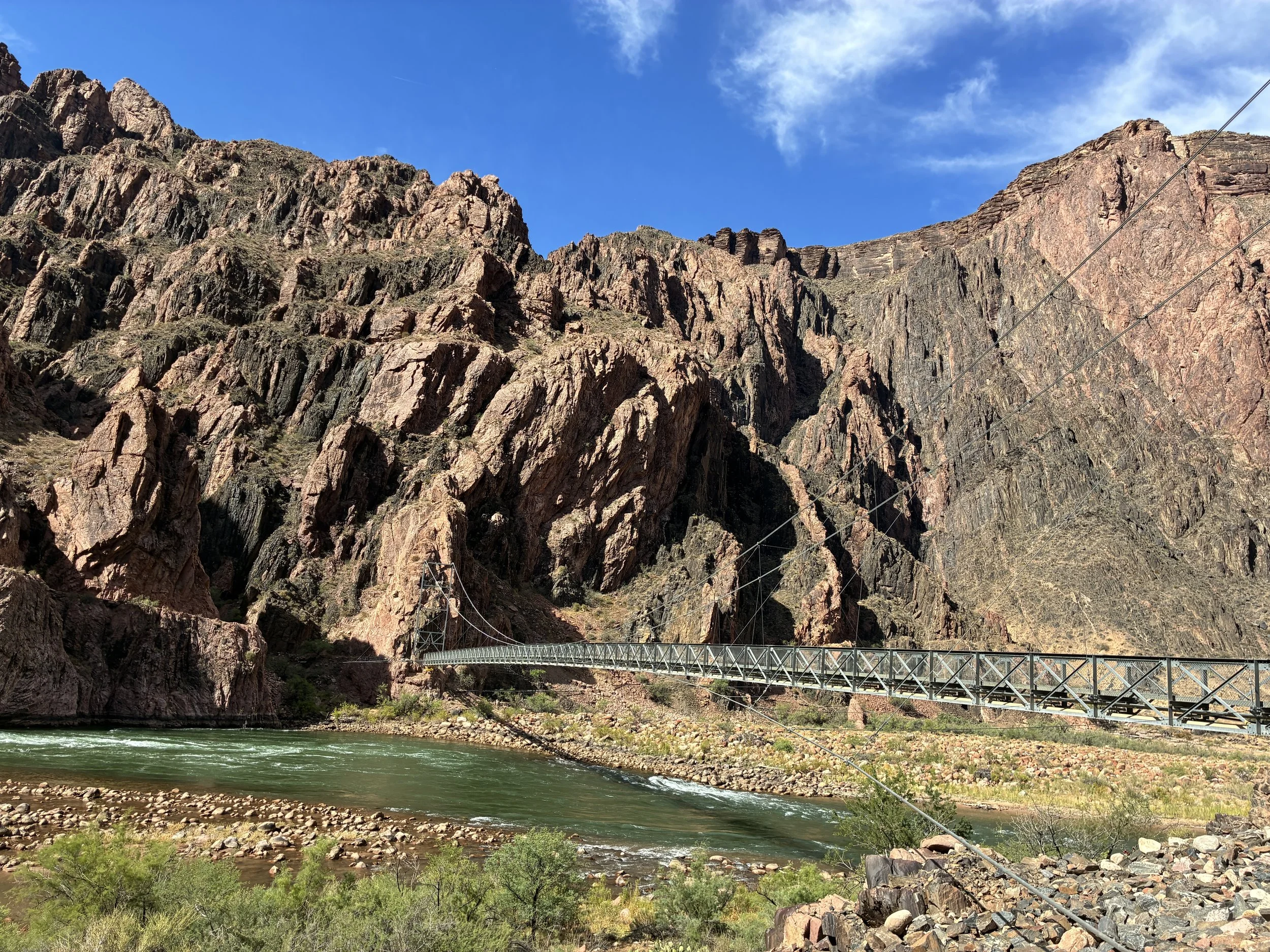
June 2026 (8:55am) - Is it silly to find joy in the simple names “black bridge” and “silver bridge”? Down at the bottom of the Grand Canyon, these names make so much sense.
Notice the flooring of this bridge. It’s the only bridge along the trails like this, because it’s the only trail that the mules do not use. All of the other bridges have wood sections for the mules to cross over.
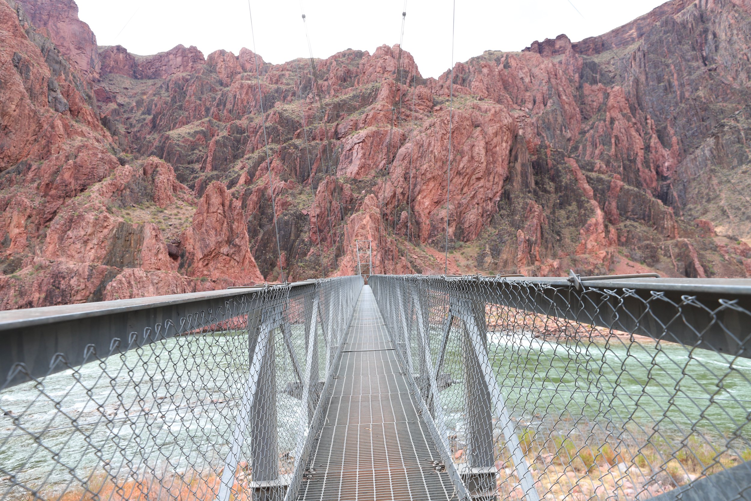
March 2018 (1:11pm) - Silver Bridge is the only non-mule friendly water crossing
The next 1.3 miles is along the river, but it’s not flat. The trail climbs up into the canyon and then comes right back down to the river. I didn’t know this on our first hike. I’m excited to start climbing up. Every step up gets us closer to the rim, and that panicky feeling can go away. And then we came right back down to the river. I didn’t cry, but this was my mental breakdown moment in 2016. I did not know how I was going to get back up to the rim and did not think I could. And I was worried about where I needed to get without paying attention to where I was at - and I slipped off a rock and ended up in the creek with a wet foot (the creek crosses over the trail a few times after River Rest). I didn’t get hurt when I landed in the water, but my socks were all wet, and hiking in wet socks is the worst. But I still had an extra pair of clean, dry socks in my backpack. I changed into these dry socks, realized I had everything I needed, when I needed it. And I didn’t panic again. We just slowly worked our way up the canyon.
And it’s funny - on the hikes in 2018 and 2026 - this section of the trail I absolutely love. Expectation setting matters though. The hike up in elevation to the South Rim does not start until after River Rest.
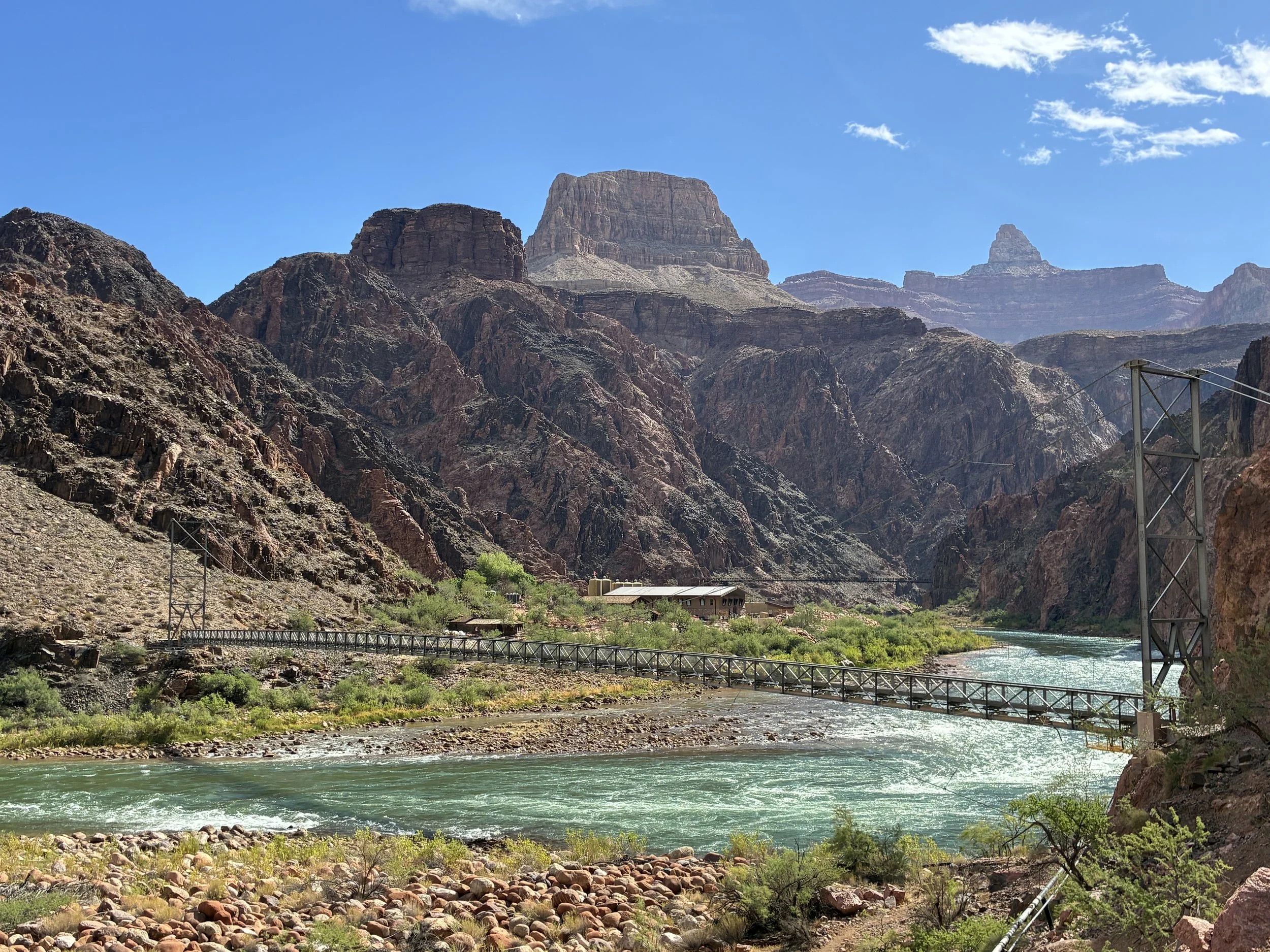
June 2026 (8:59am) - View from the River Trail along Bright Angel of both Silver Bridge (foreground) and Black Bridge (Background)
Another story - this one starts in 2025 and explains the odd picture below and why I included it. During our family 2025 summer trip, we hiked Zion’s Narrows top to bottom. Our boys loved it, were proud they hiked it, and started talking about the Grand Canyon. Did we think they could handle it? They know the Grand Canyon is a special place for us, and they wanted to hike rim-to-rim. So, for a month, we started considering this as a real possibility for 2026. But then in July 2025, the Dragon Bravo fire took out the Lodge, the cabins, water sources, etc. I know people hiked this trail in 2026 ahead of the flood, but for me, the logistics of figuring this out was just too much on a trail that was already hard enough. So, we decided we would just hike to the river and back on the South Rim, same as what we had done in 2018.
And then there was a rockfall caused by construction of the new transcanyon waterline, and it took out a portion of this trail, preventing access from Silver Bridge to Bright Angel, and leaving just the possibility of hiking down and back up along the South Kaibab Trail, something I was pretty adamant that we were not going to do. But we planned a trip to the Grand Canyon anyway, built purely on hope. We were at the Grand Canyon Jun 24-26 - and do you know what happened on June 26, 2026??? They re-opened this trail at 7am. And here we are, 2 hours later! Thank you, National Park Service, for re-pairing the trail ahead of schedule! Sometimes just train anyway… You never know.
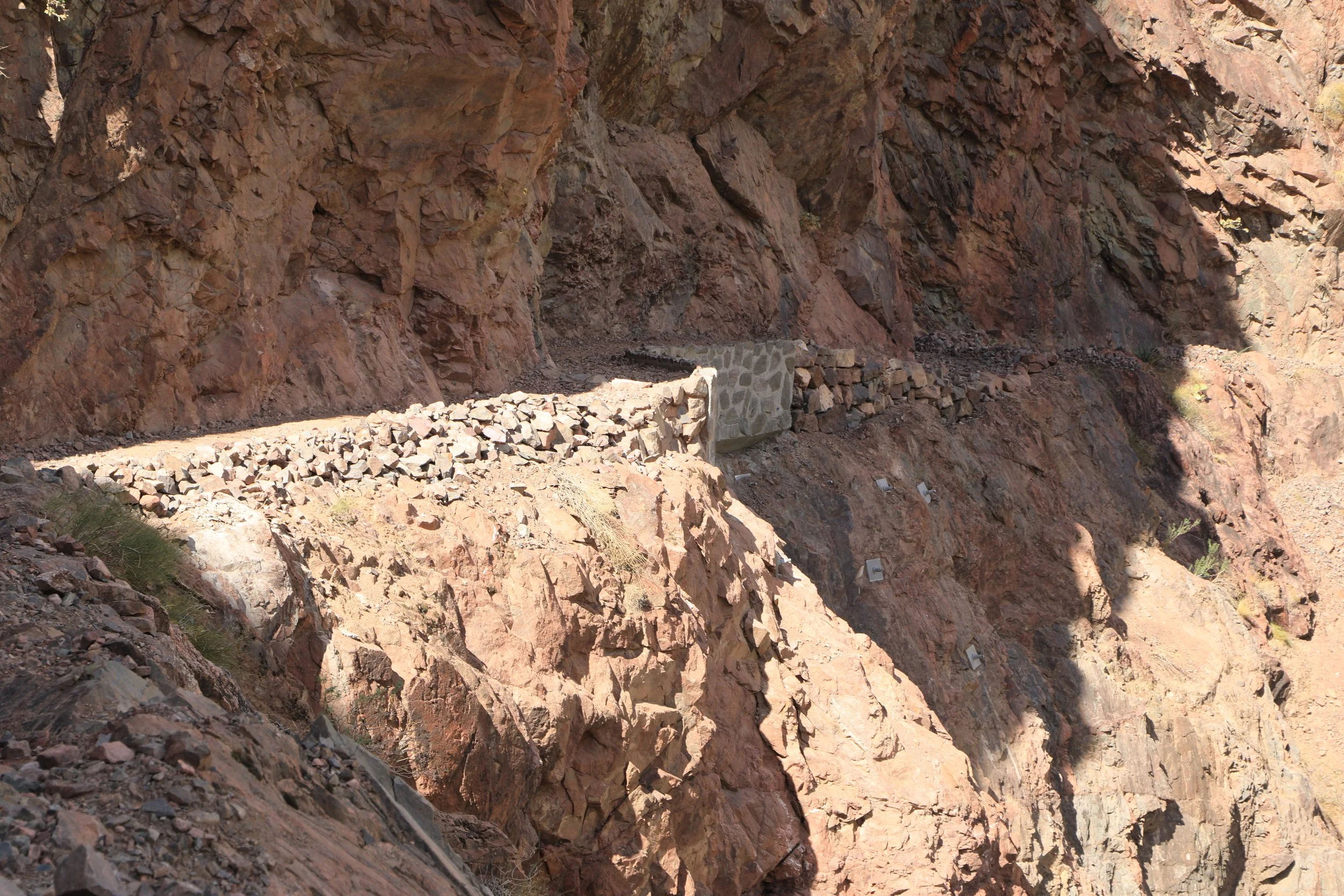
June 2026 (9:15am) - River Trail restored on 26Jun2026
This River Trail section is now my favorite section of Bright Angel. The whole point of hiking to the Colorado River is to get to enjoy the river. Don’t worry about not gaining in elevation. It’s still another mile that gets checked off on the journey back to the South Rim, and the down-section is easy.
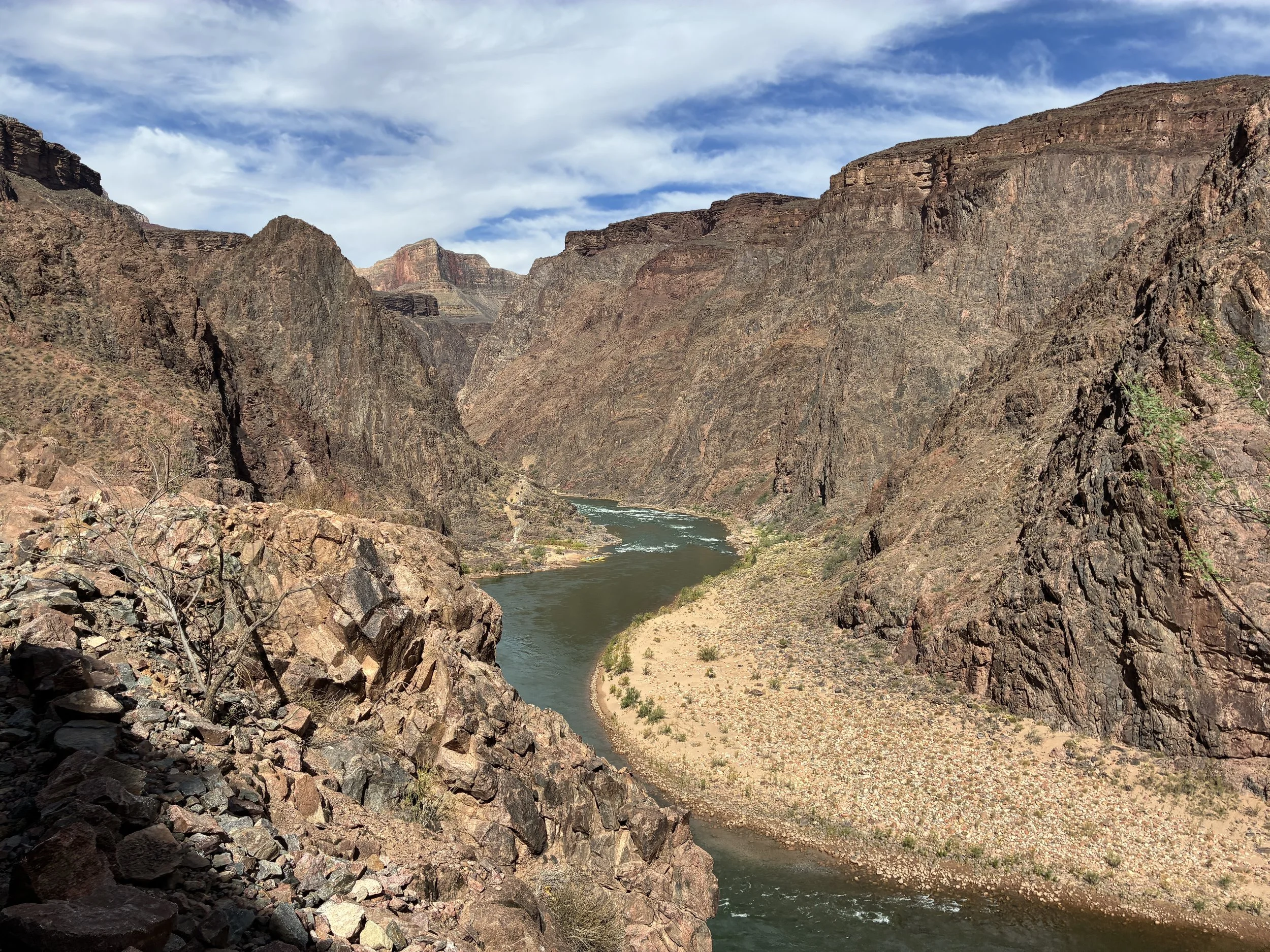
June 2026 (9:17am) - Colorado River at the Bottom of the Grand Canyon - looking downstream
Being down at the bottom, it’s not possible to look up and see the whole canyon. It’s just this little piece, with glimpses here and there of the top. The number of different perspectives of this canyon that can be had along this one hike are just incredible.
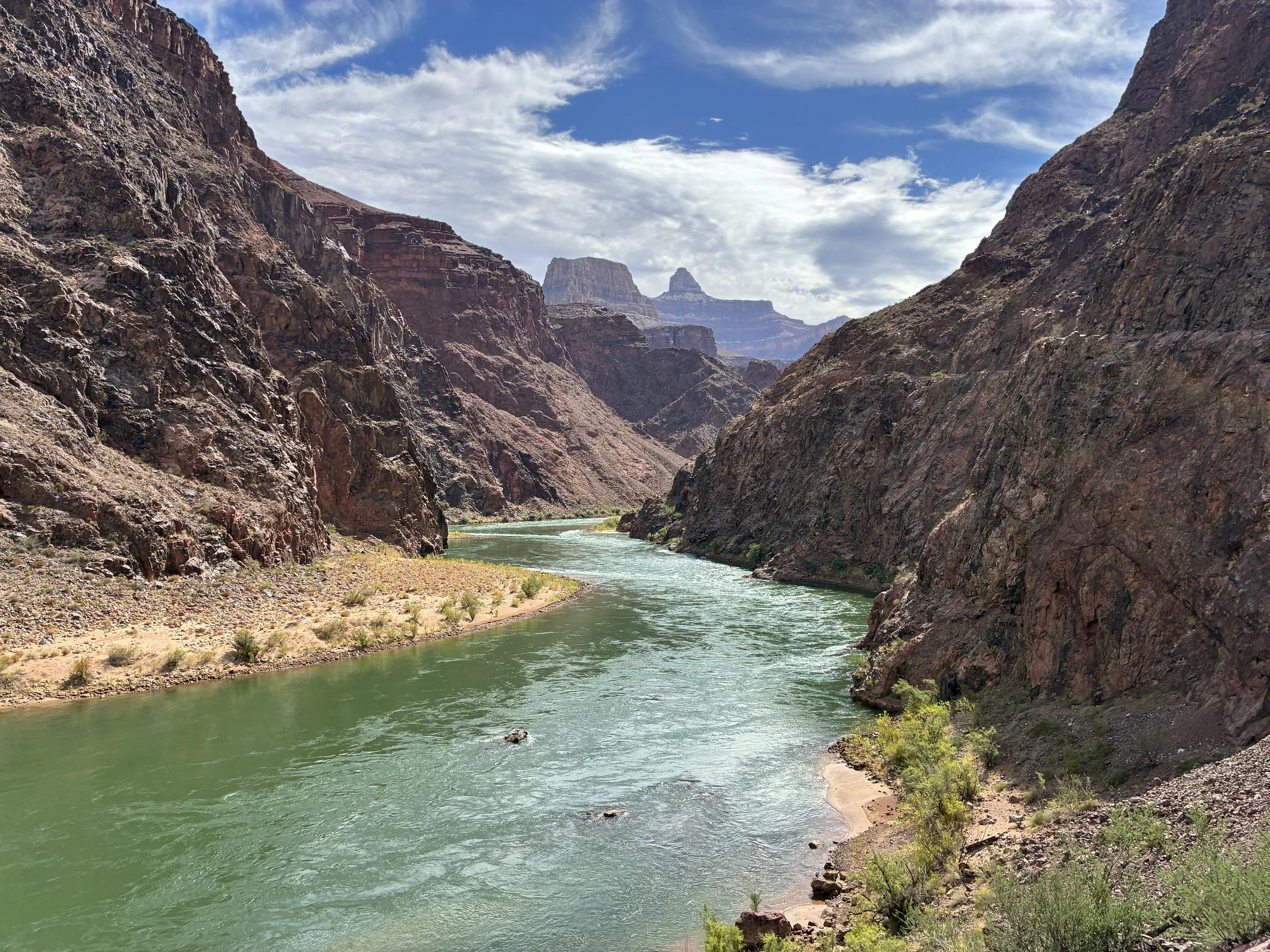
June 2026 (9:24am) - Colorado River at the Bottom of the Grand Canyon - looking upstream
River Rest House - 2,500ft
(9.3 Miles from South Kaibab Trailhead / 0 elevation from Phantom Ranch)
June 2026 - 9:36am / March 2018 - 1:00pm (Avg Total Hike Time = 5 hours & 35 minutes)
15.4 miles North Rim-to-South Rim / 39.7 miles Rim-to-Rim-to-Rim
(7.8 miles / +4,340ft elevation from Bright Angel Trailhead)
Services - Toilets, Shelter
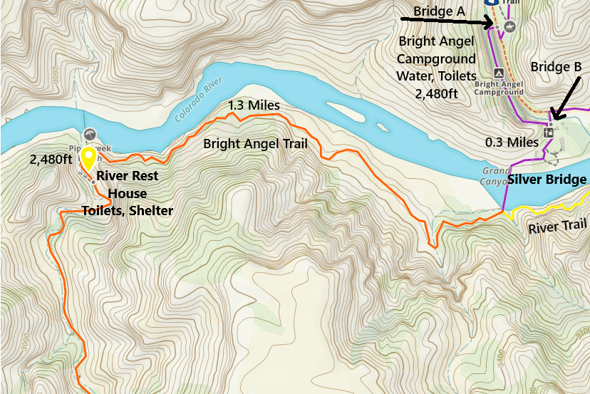
One-way distance between the Black Bridge and the River Rest House is 1.3 miles. Our average hike time for this section is an hour. It’s a pretty spot to take pictures. Note that this section starts and ends at the same elevation, but there is a substantial hill in the middle.
River Rest has a nice, shaded shelter. It’s just a short distance uphill from the toilets. Stop here and wait until evening if it has gotten too hot out. Or, consider getting out your umbrella and give yourself some shade if you need it along this section to Havasupai Gardens Campground.
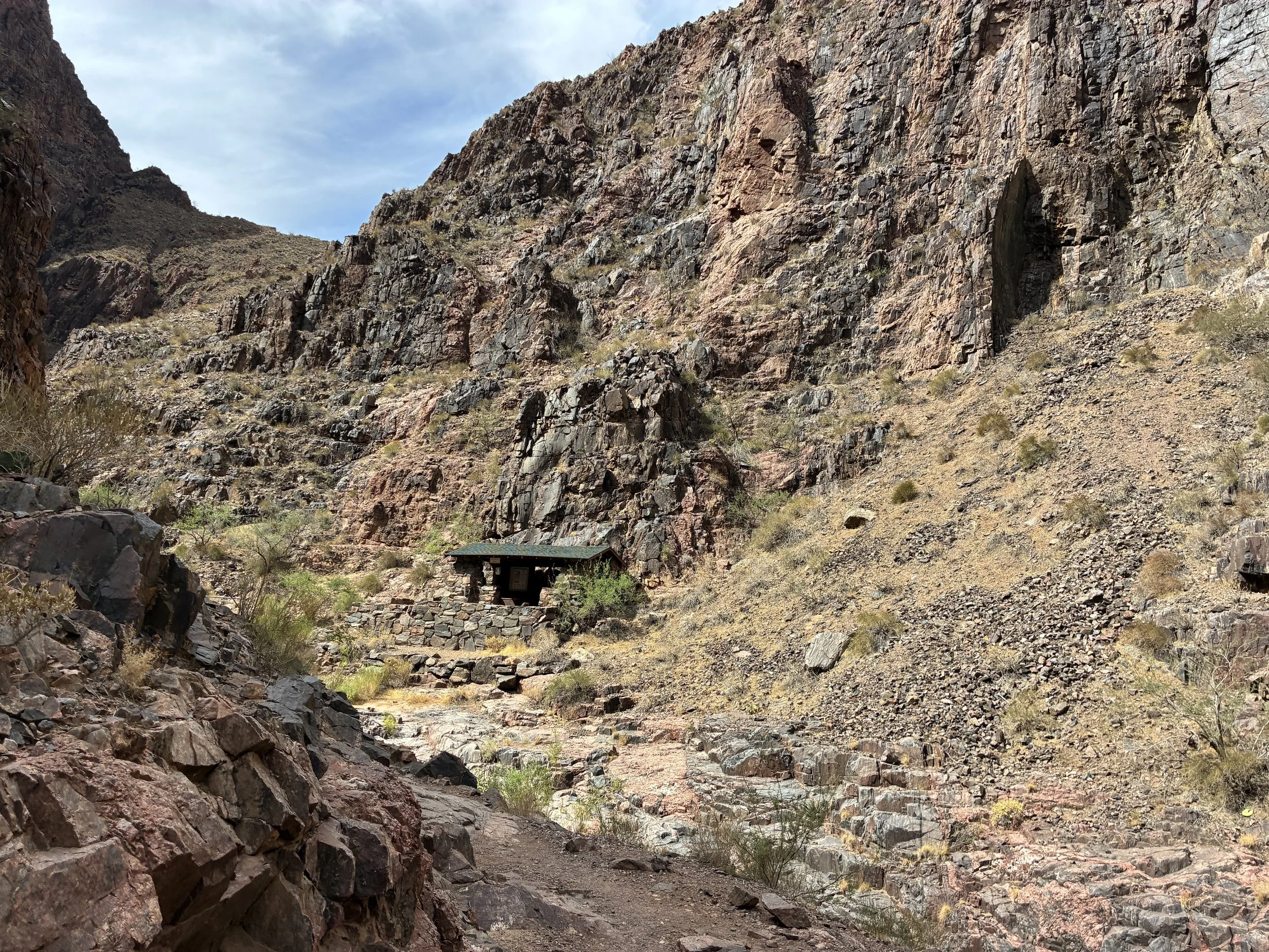
June 2026 (9:36am) - River Rest Shelter
The trail crosses over this small creek a handful of times before Havasupai Gardens Campground. This would be an option to filter and sterilize drinking water if needed, assuming water is flowing.
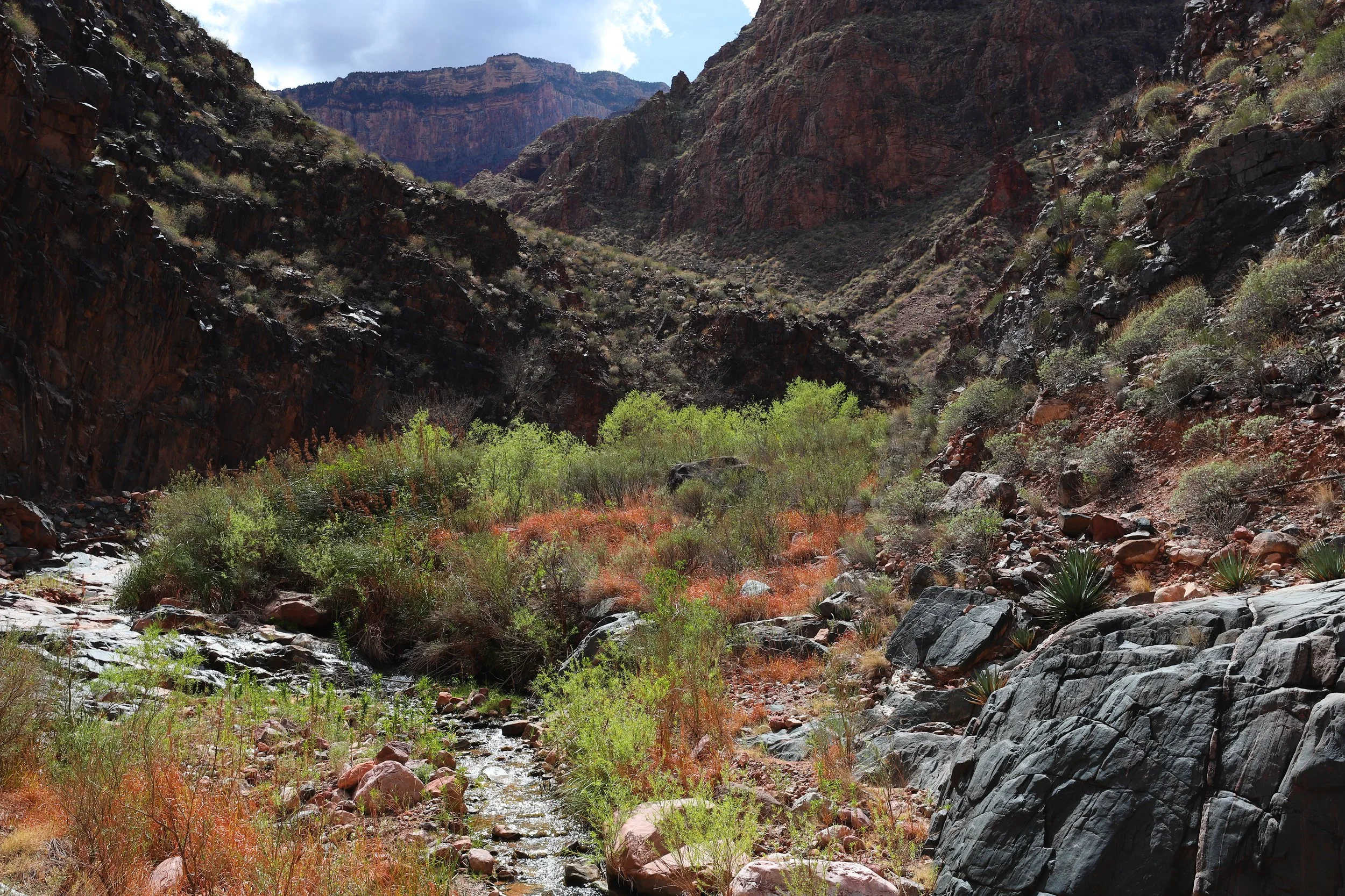
March 2018 (2:03pm) - Hiking up Bright Angel Trail - creek crossings
The next section of the Bright Angel Trail is the hardest. It’s exposed without shade. It’s still low in elevation meaning it’s going to be extremely hot in that sun. Other than the handful of small creek crossing, there is no water available, and the switchbacks here are intense and steep.
Yep, this section is hot. My goal was Havasupai Gardens by 10:00am in June 2026. It was a relatively nice day though, and it’s so hard not to stop and enjoy Phantom Ranch. As a result, it was about 11:30am when we got to the Gardens. This section of the trail was rough. I did eventually get out my umbrella. Nothing beats portable shade.
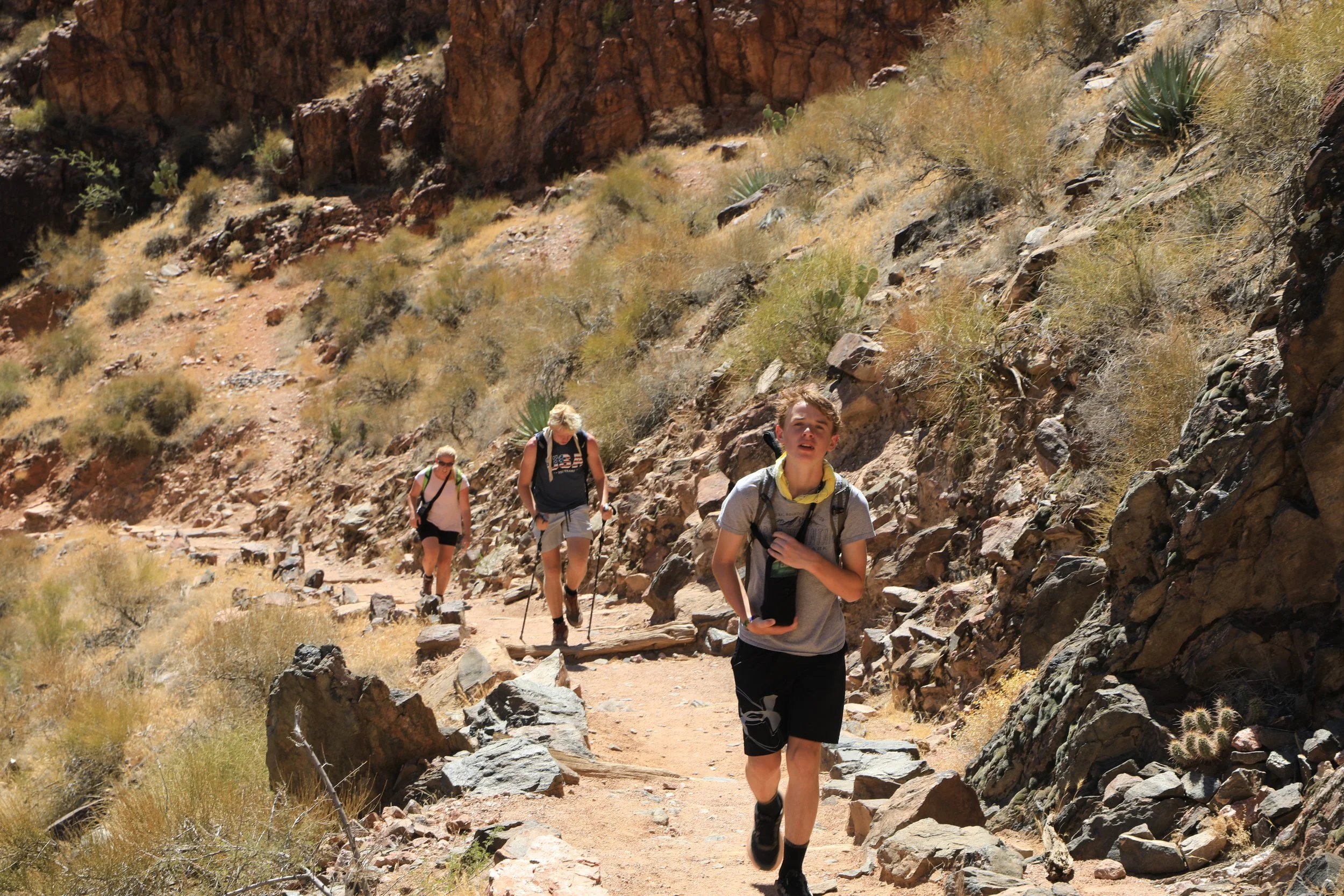
June 2026 (10:18am) - Hiking up Bright Angel Trail
I think this is the spot I slipped and fell off the rock when we hiked out in March 2016.
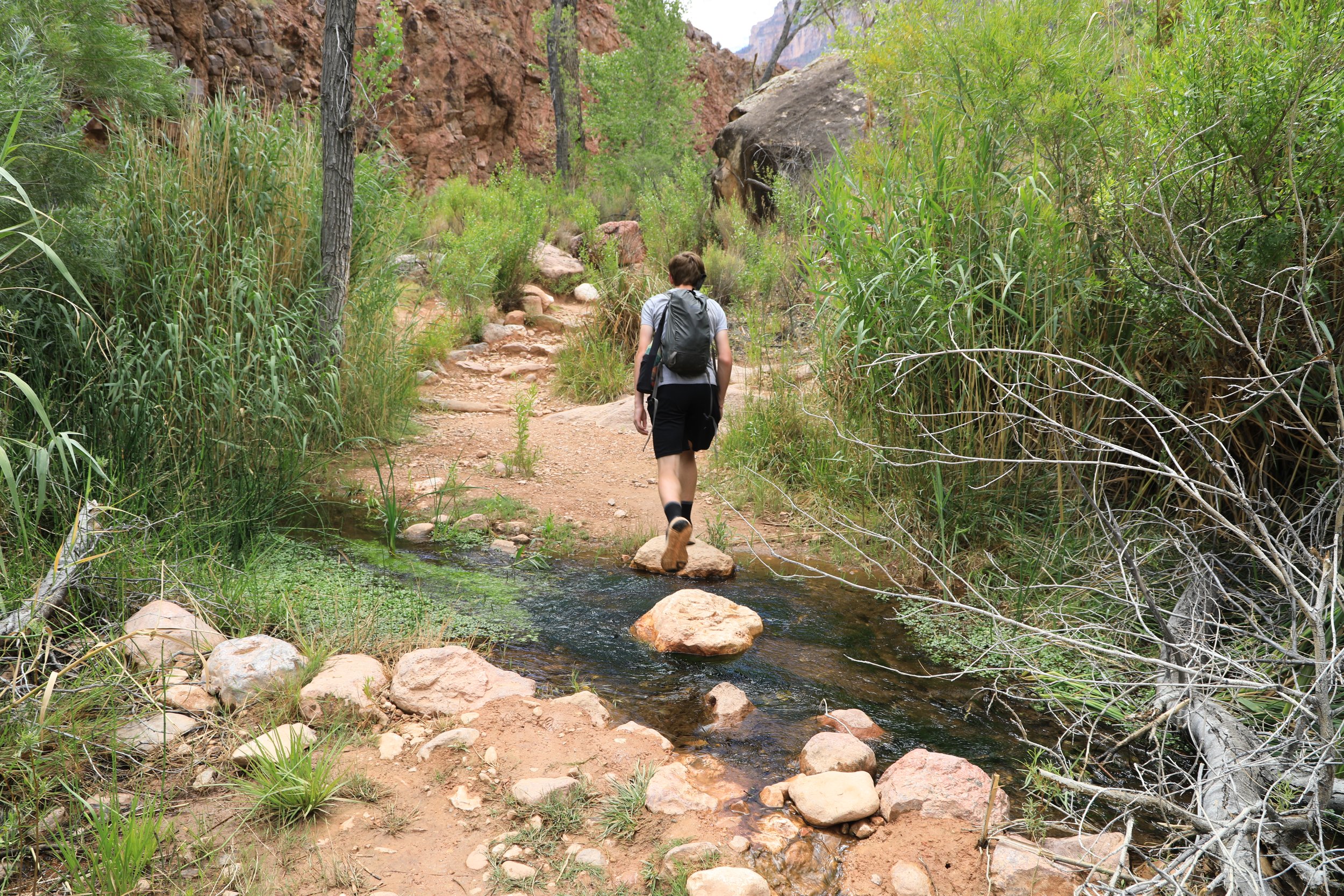
June 2026 (10:55am) - Another creek crossing
Zoom in on the picture below to see the switchbacks. This section known as “Devil’s Corkscrew” is hard! And looking up at that the rim is tough too, knowing how far is left to climb.
But also, just stop and look. This is an amazing spot to be in. Hidden from the South Rim where most people stop to take pictures of the Grand Canyon from, never knowing what it looks like from below.
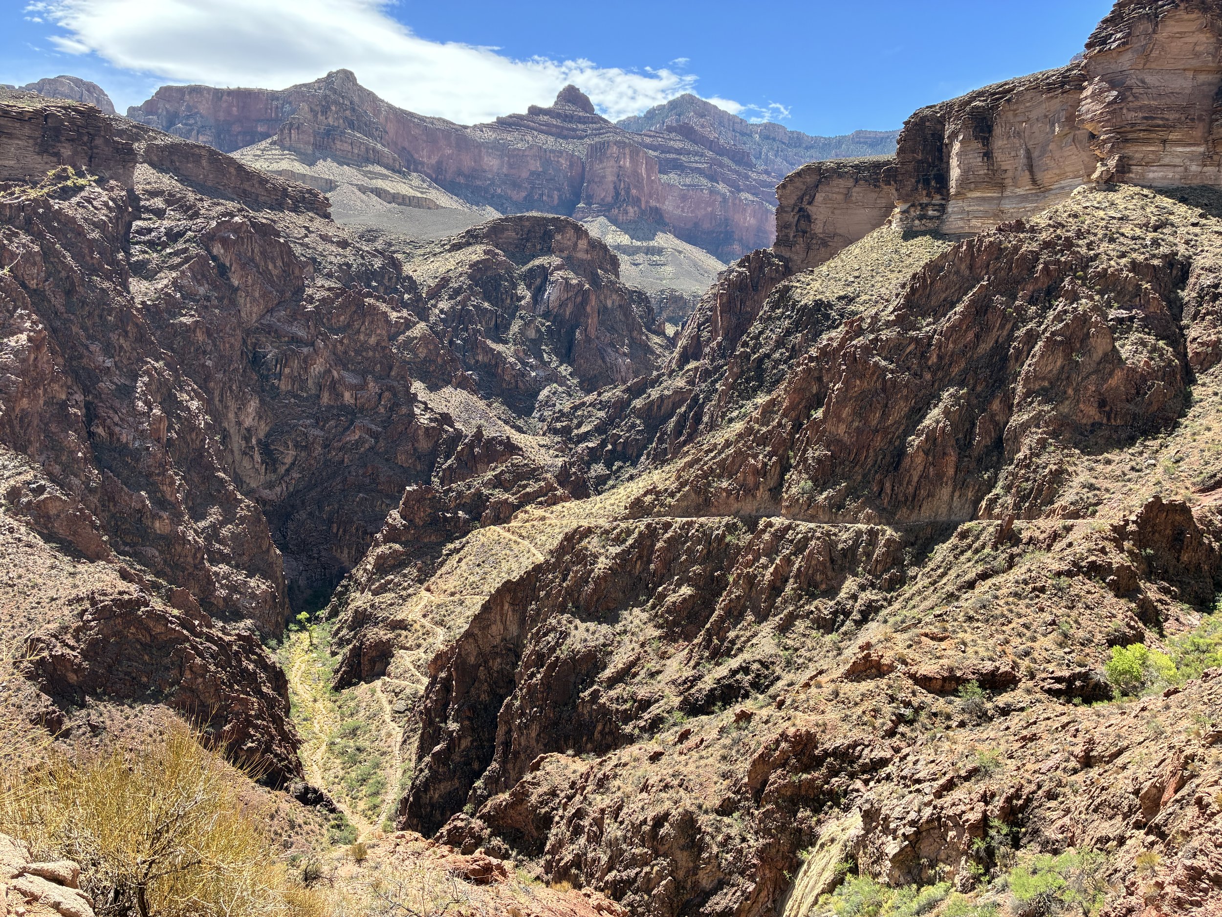
June 2026 (10:30am) - Hiking up Bright Angel - Devil’s Corkscrew
We found some shade due to a rock out-cropping and took a nice break about here. I’m not sure why, but I don’t remember much of this trail from March 2018, other than the bottom near River Rest. It was nice to go slow and appreciate where we were on the hike up in 2026.
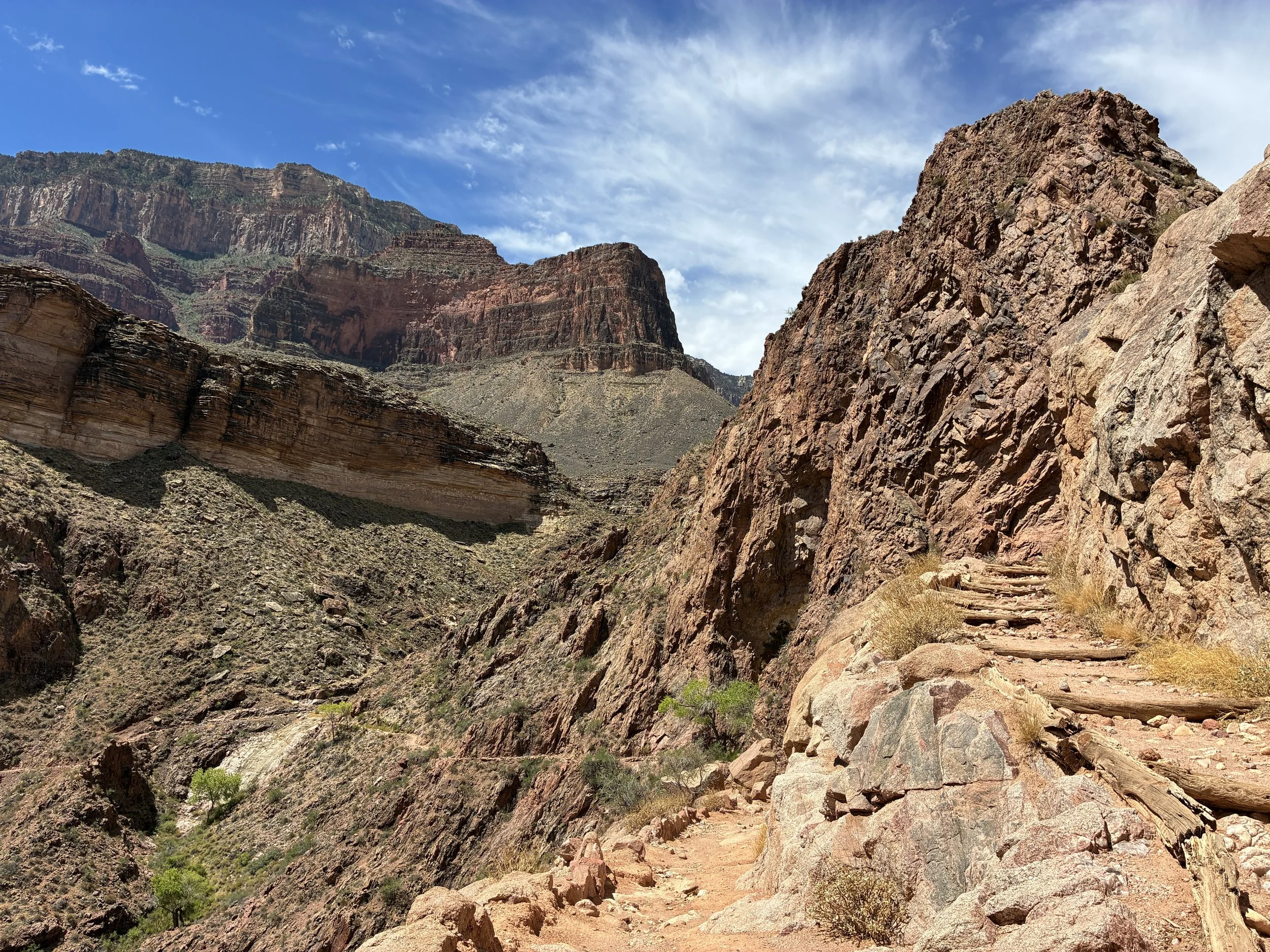
June 2026 (10:39am) - Almost out of Devil’s Corkscrew section of Bright Angel
All of a sudden there are trees near the trail, and that’s the sign Havasupai Gardens is getting close. The trail still has an incline, but the switchbacks are done for awhile.
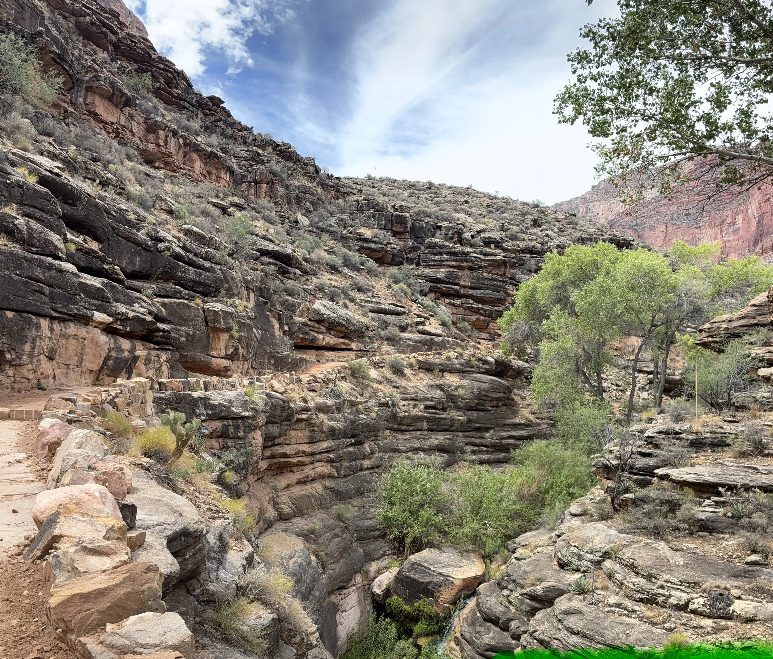
June 2026 (11:02am) - Hiking to Havasupai Gardens Campground
About 10 minutes from the picture below, the Tonto Trail (from Tipoff on the South Kaibab Trail) joins. Havasupai Gardens Campground is shortly after the intersection.
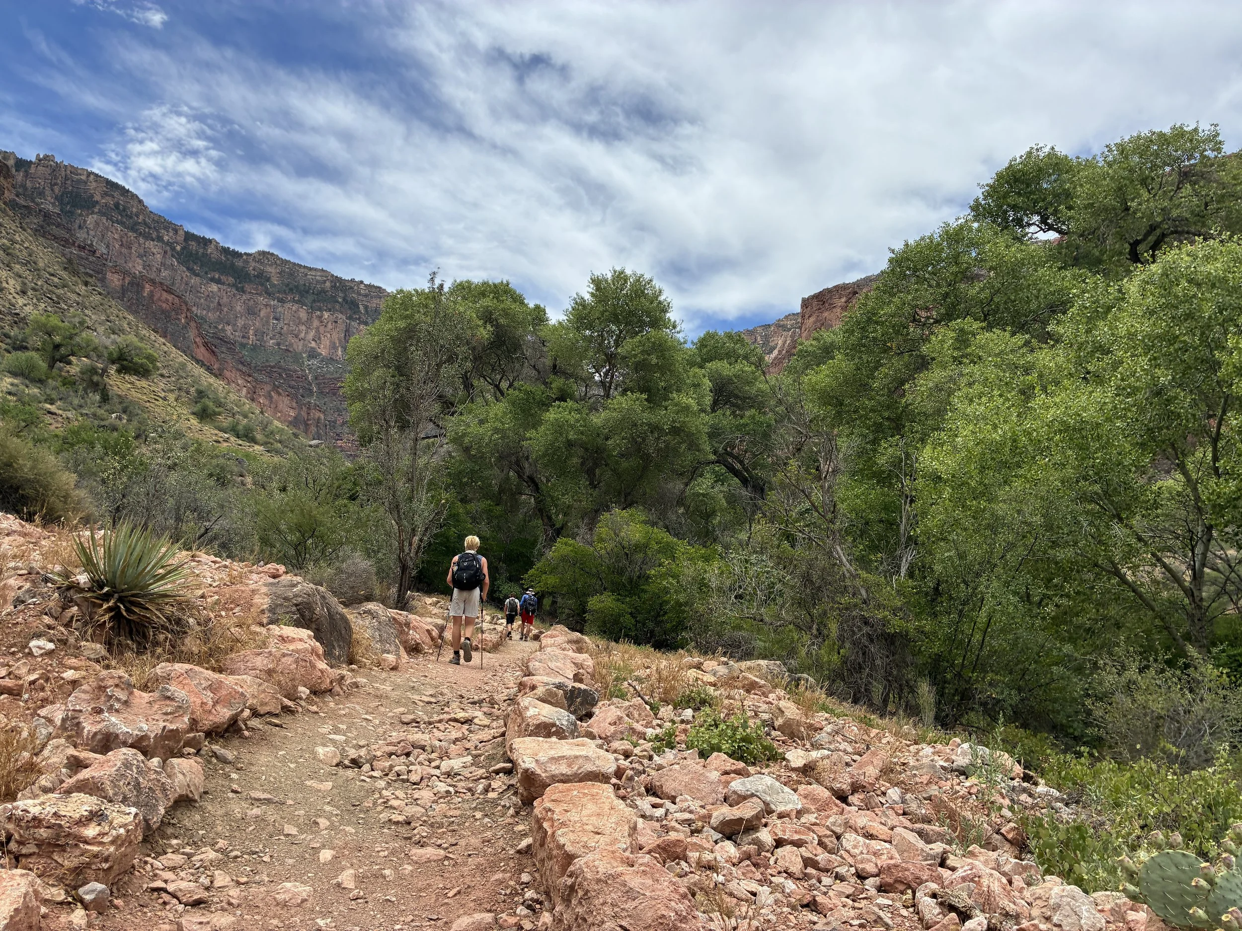
June 2026 (11:17am) - Hiking to Havasupai Gardens Campground
Havasupai Gardens Campground - 3800ft
12.6 Miles from South Kaibab Trailhead / +3,040ft elevation from Phantom Ranch
June 2026 - 11:22am / March 2018 - 2:33pm (Avg Total Hike Time = 7 hours & 14 minutes)
18.7 miles North Rim-to-South Rim / 43 miles Rim-to-Rim-to-Rim
4.5 miles / +3,040ft elevation from Bright Angel Trailhead
Services - Water, Toilets
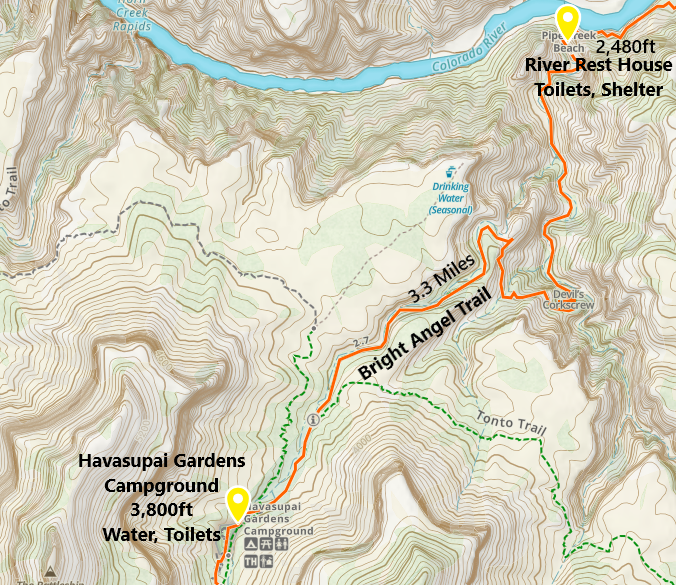
One-way distance between the River Rest House and Havasupai Gardens Campground is 3.3 miles. Our average hiking time this section is one hour and 39 minutes.
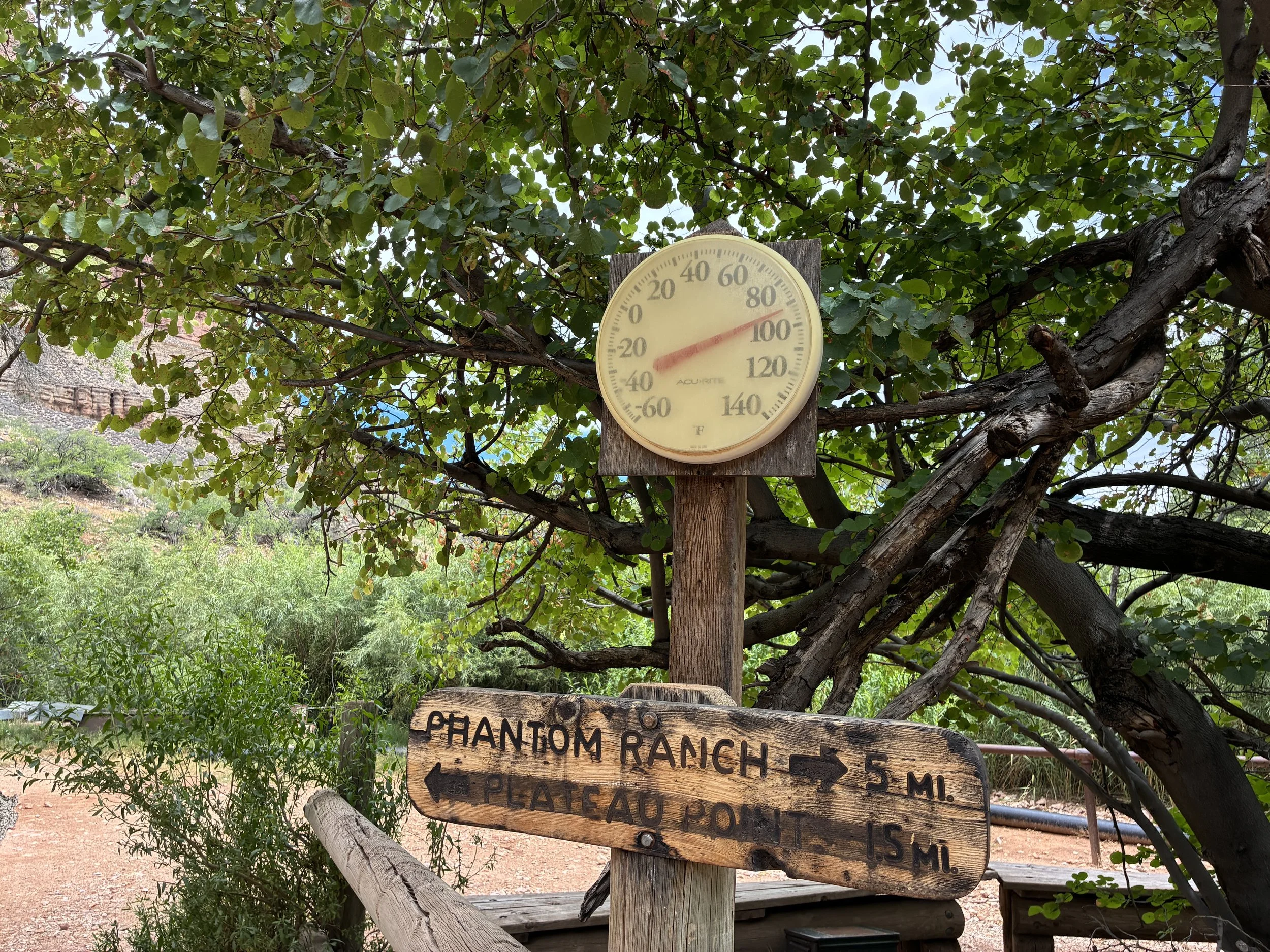
June 2026 (11:22am) - Temperature at Havasupai Gardens Campground
If the water is on, refill here, soak shirts, and enjoy a nice long break at Havasupai Gardens. There’s no rush from this point forward. The heat of the day will be counterbalanced by the climb up in elevation.
The climb out is still daunting - this is the view of the wall that will need to be hiked. But you’ve got this! Because you have to have this… There’s no option to not climb out if you hiked this far down. The choice to hike down, up is mandatory. “Just keep walking, just keep walking”
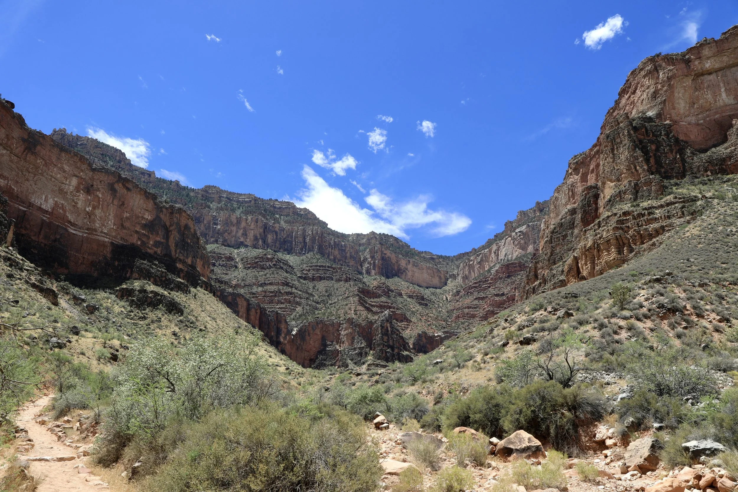
June 2026 (11:59am)- Hiking to 3 Mile Rest House
Don’t forget to turn around every once in a while. From the Gardens up, the view is relatively the same as it’s just switchbacks from here to the top. But it’s still a pretty incredible view.
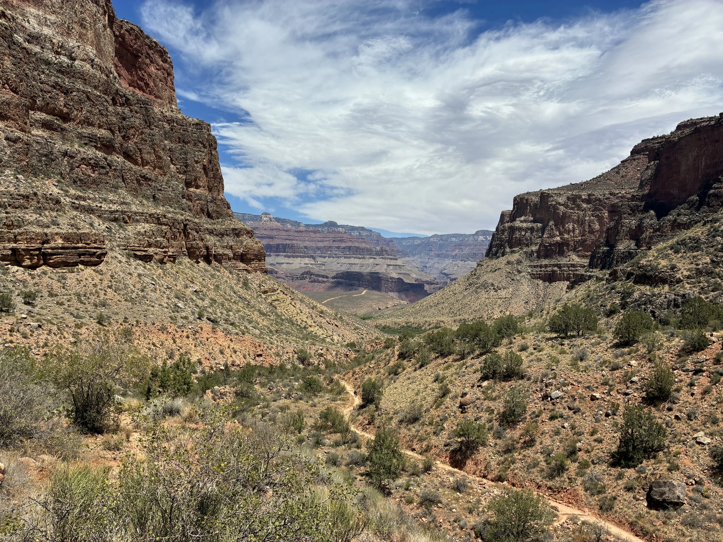
June 2026 (11:52am) - View of Bright Angel Trail on the way to 3 Mile Resthouse
3 Mile Resthouse - 4,748ft
14.1 Miles from South Kaibab Trailhead / +2,248ft elevation from Phantom Ranch
June 2026 - 12:33pm / March 2018 - 3:42 pm (Avg Total Hike Time = 8 hours & 30 minutes)
20.2 miles North Rim-to-South Rim / 44.5 miles Rim-to-Rim-to-Rim
(3 miles / +2,092 elevation from Bright Angel Trailhead)
Services - shelter, toilet, water
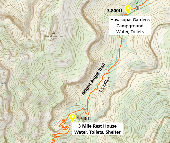
One-way distance between Havasupai Gardens Campground and the 3 Mile Rest House is 1.5 miles. Our average hiking time this section is 1 hour and 15 minutes.
3 Mile Rest House is where we start encountering the general public, who are not avid hikers, yet they have gotten themselves down here… This is where we encounter people that do not know they need electrolytes and do not know there is a spot to refill water right around the corner. Stop and talk with people at the shelter. See what they need and just help them. Park Rangers do enough in their day. We can help assist these people to make sure they make it back to the rim safely.
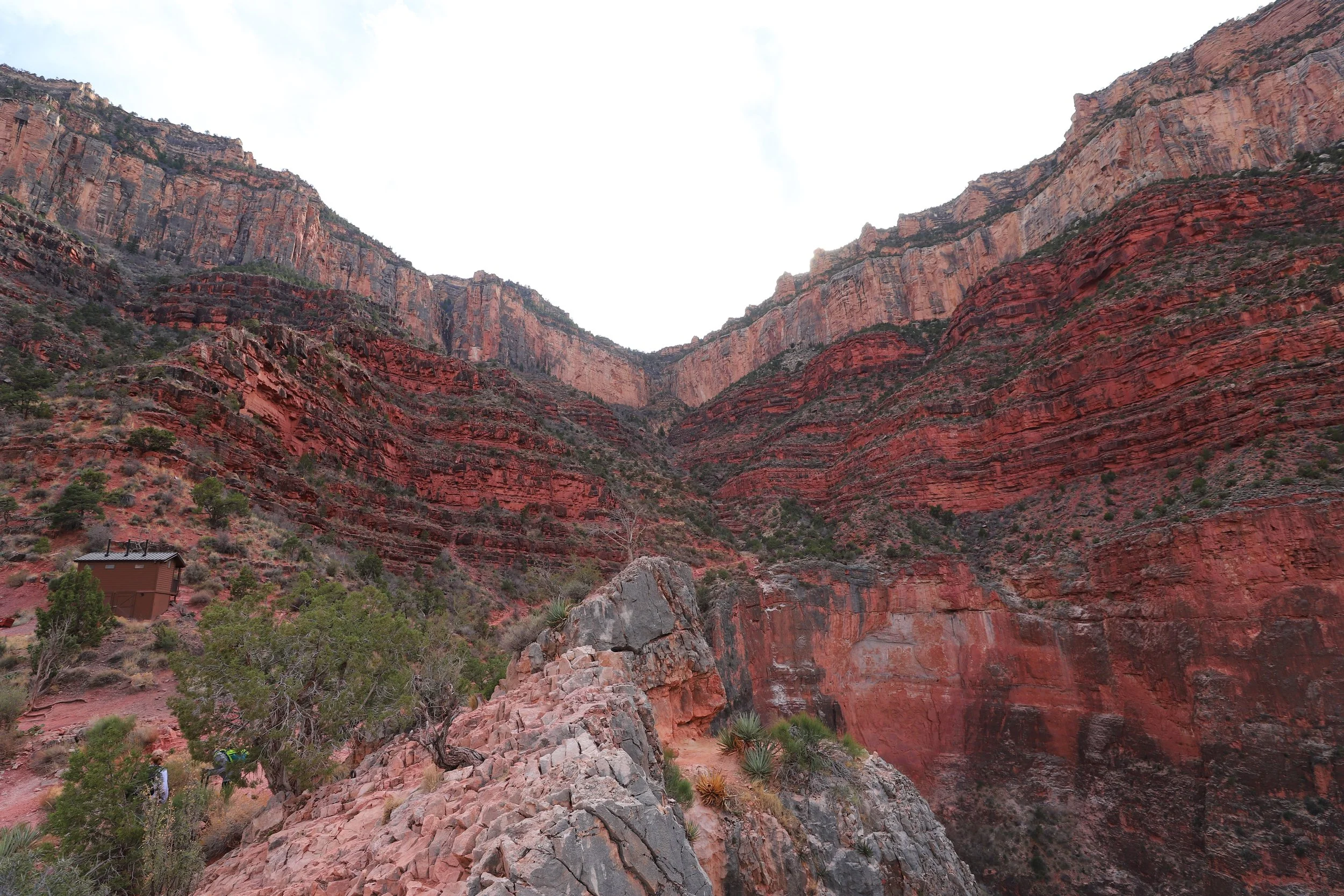
March 2018 (5:10pm) - South Rim from 3 Mile Resthouse
This section of the trail is not exciting, and it’s the point I just want to be done. We pass people who ask, “how much further?” I don’t even ask them, “how much further to what?” I just tell them to turn around; the view is the same. South Kaibab is such a better trail to hike down for a short distance compared to Bright Angel. Or take that Red Shuttle towards Hermits Rest and enjoy some easy hikes. There are better options than continuing to hike down.
See? 30 minutes later? The view is the same…
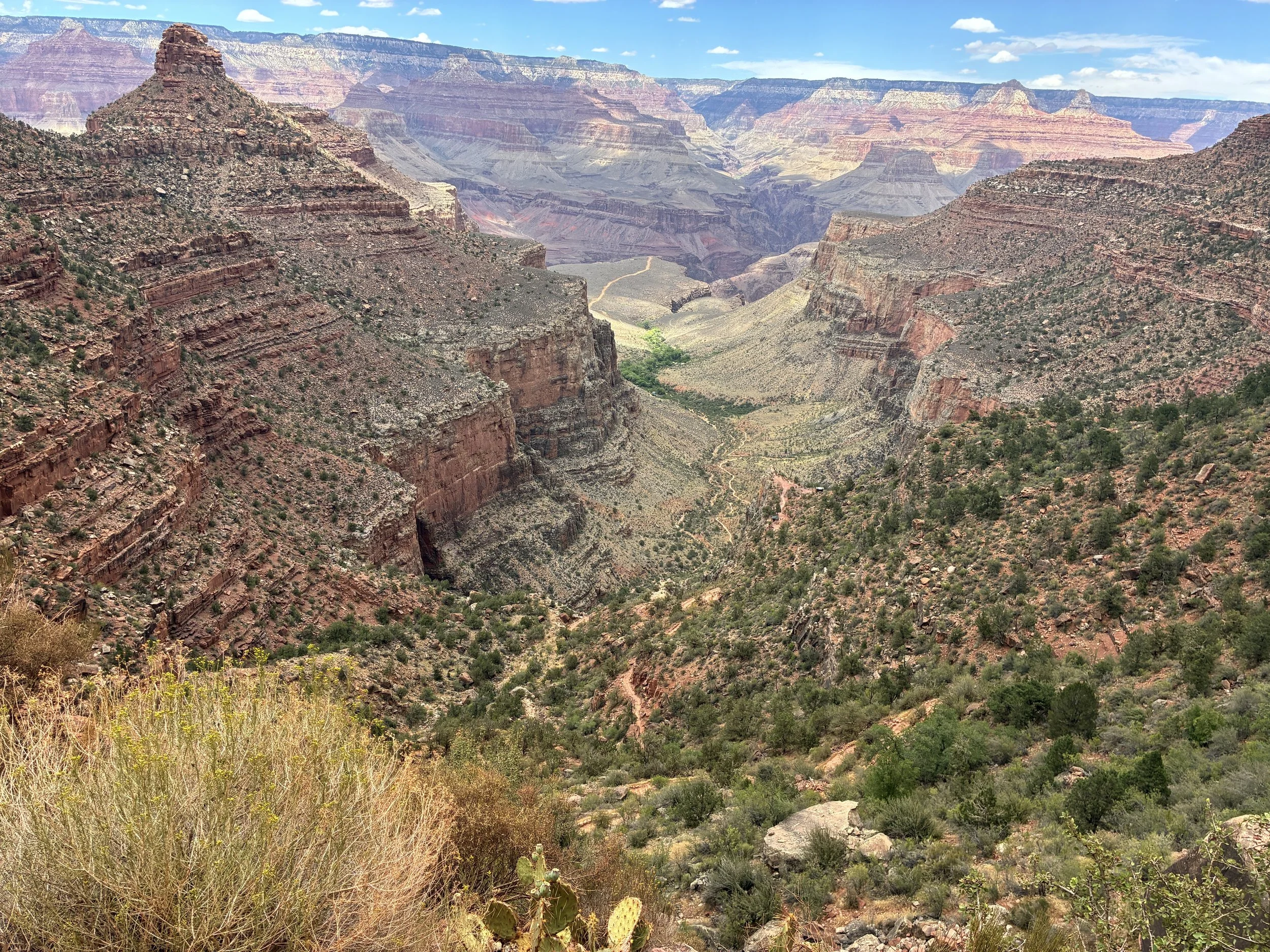
June 2026 (1:45pm) - View of Bright Angel Trail from above 3 Mile Resthouse
1.5 Mile Rest House - 5,730ft
15.6 Miles from South Kaibab Trailhead / +3,230ft elevation from Phantom Ranch
June 2026 - 1:53pm / March 2018 - 5:02pm (Avg Total Hike Time = 9 hours & 44 minutes)
21.7 miles North Rim-to-South Rim / 46 miles Rim-to-Rim-to-Rim
(1.5 miles / +1,110ft elevation from Bright Angel Trailhead)
Services - Water, Toilets
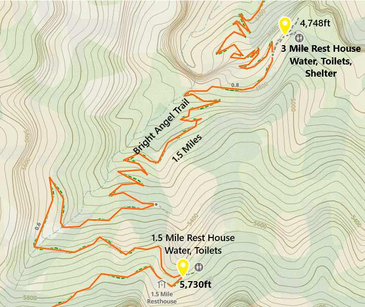
One-way distance between 3 Mile Rest House and 1.5 Mile Rest House is 1.5 miles, which makes sense. Our average hiking time this section was one hour and 15 minutes.
This is a great sign! 1.5 Mile Rest is where I actually dump water if I still have an excess. There is no need to keep 1 gallon of water in my bag. My 1L plus my extra 500mL (if I haven’t given it away yet) are plenty to get me to the top. A lighter bag feels so good at the end.
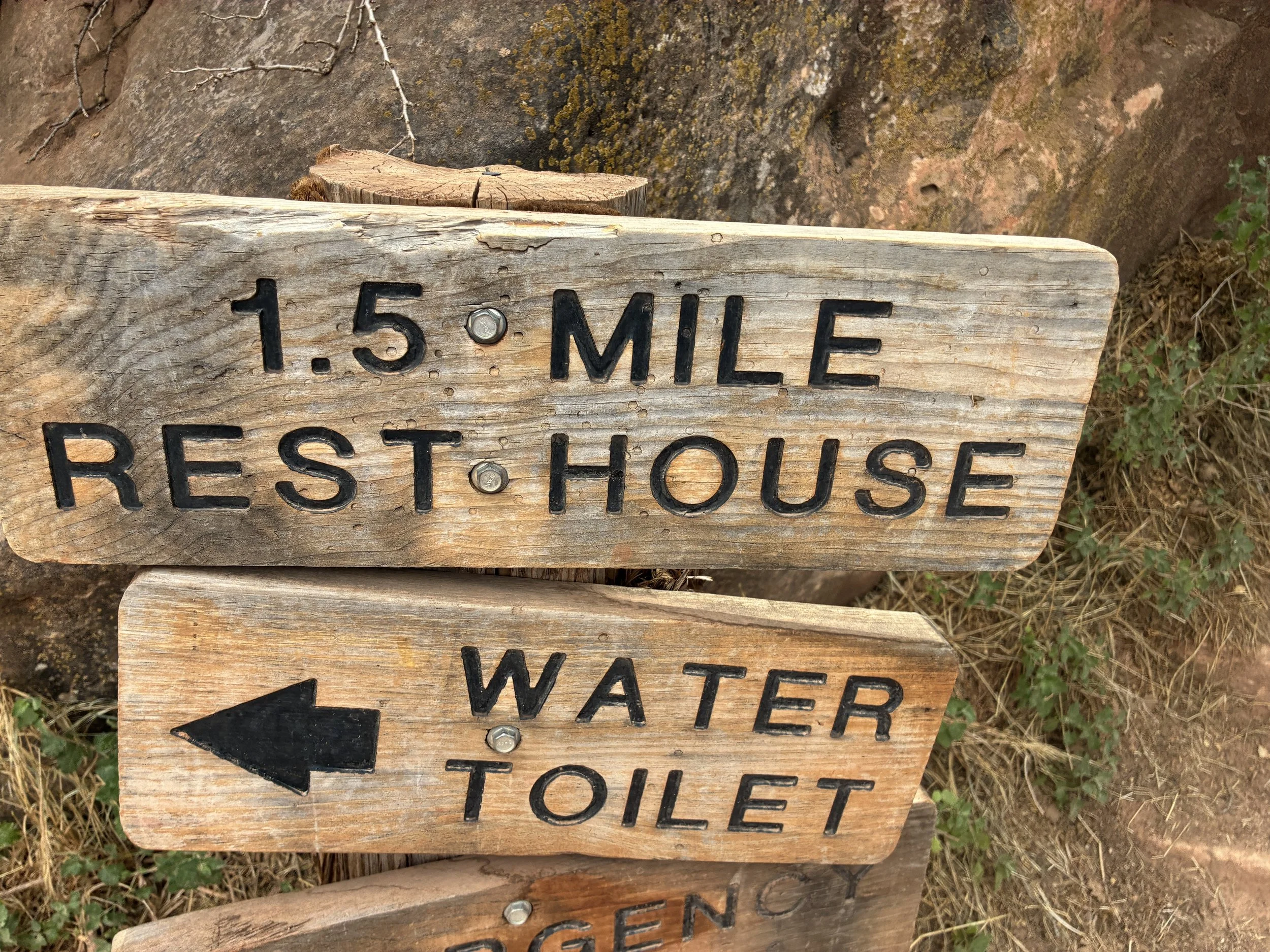
June 2026 (1:53pm) - 1.5 Mile Rest House
Those switchbacks are not nothing, but there’s no time limit on walking out of here. Just be cautious about stopping too long and letting muscles cramp up. Several short breaks at this point are better than one that is too long. And just don’t worry about it. It’s just one foot in front of the other, a lot of times…
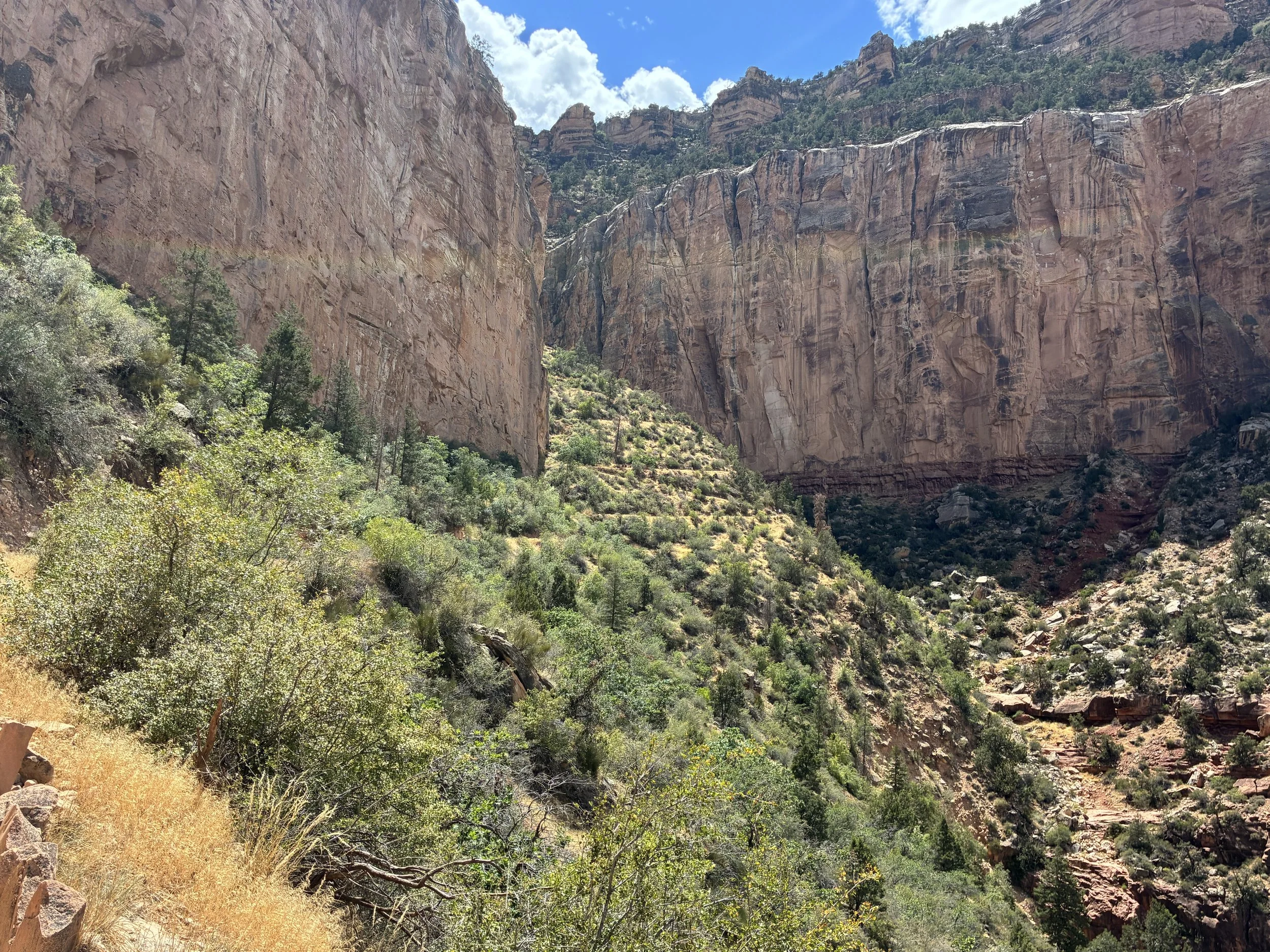
June 2026 (2:08pm) - View of South Rim from 1.5 Mile Rest House
Still the same view…
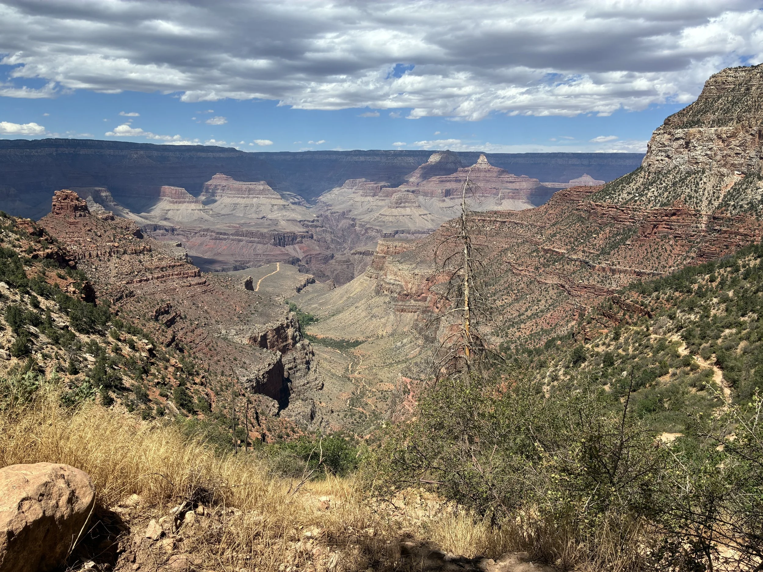
June 2026 (2:19pm) - View of Bright Angel Trail - still the same view… You can see it from the rim…
Woot! The tunnel is a very good sign!
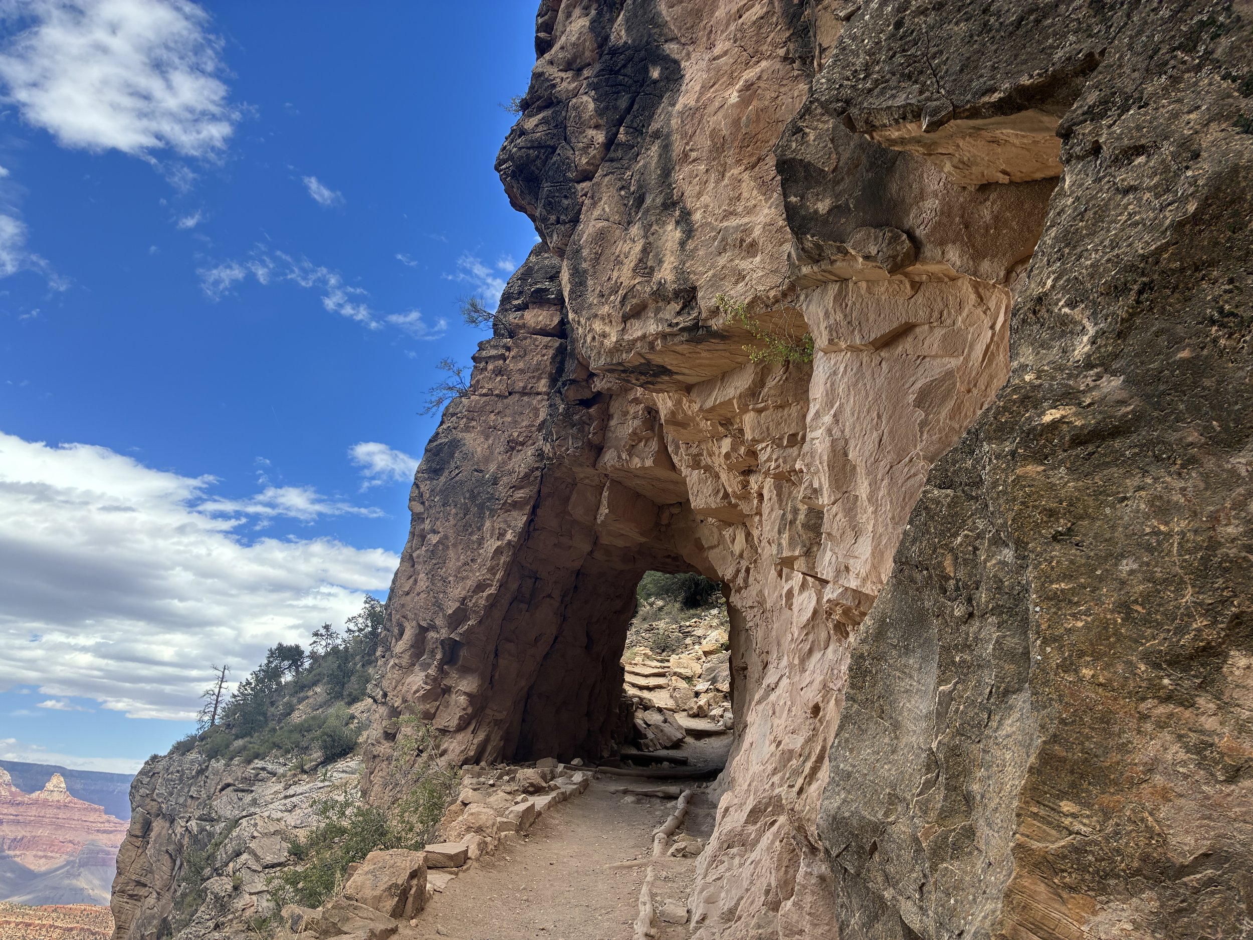
June 2026 (2:45pm) - South Rim Tunnel - Almost back to the South Rim
The picture below is from a very different trip, but it’s the only one I have from the top looking down at all of the switchbacks along Bright Angel Trail. We were here in March 2015 with two exchange students, a toddler, and an elementary school-aged son. We walked a few switchbacks in through the snow-covered path and turned right back around - my first time on this trail. We quickly realized this was not going to be worth the return hike. There are many better places to enjoy along the rim.
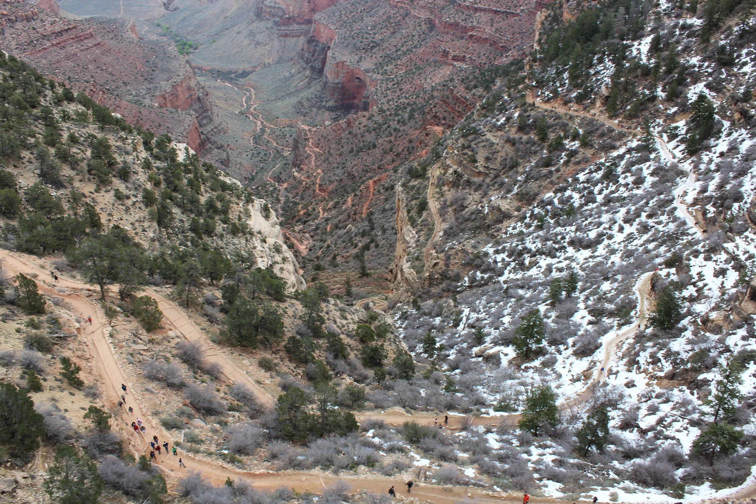
March 2015 - Bright Angel from the Trailhead
Bright Angel Trailhead - 6,840ft
17.1 Miles from South Kaibab Trailhead / +4,340ft elevation from Phantom Ranch
June 2016 & 2026 - 2:49am & 2:58pm / March 2018 - 6:01pm (Avg Total Hike Time = 10 hours & 46 minutes)
23.2 miles North Rim-to-South Rim (2016 Total Hike Time = 14 hours)
47.5 miles Rim-to-Rim-to-Rim (2016 Total Hike Time = 29 hours)
Services - Water, Toilets, Shelter, Gift Stores, Restaurants
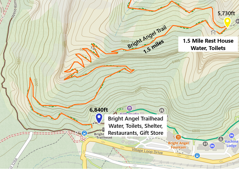
Like the name implies, one-way distance between the 1.5 Mile Rest House and the Bright Angel Trailhead is 1.5 miles. Our average hiking time this section was one hour and 2 minutes.
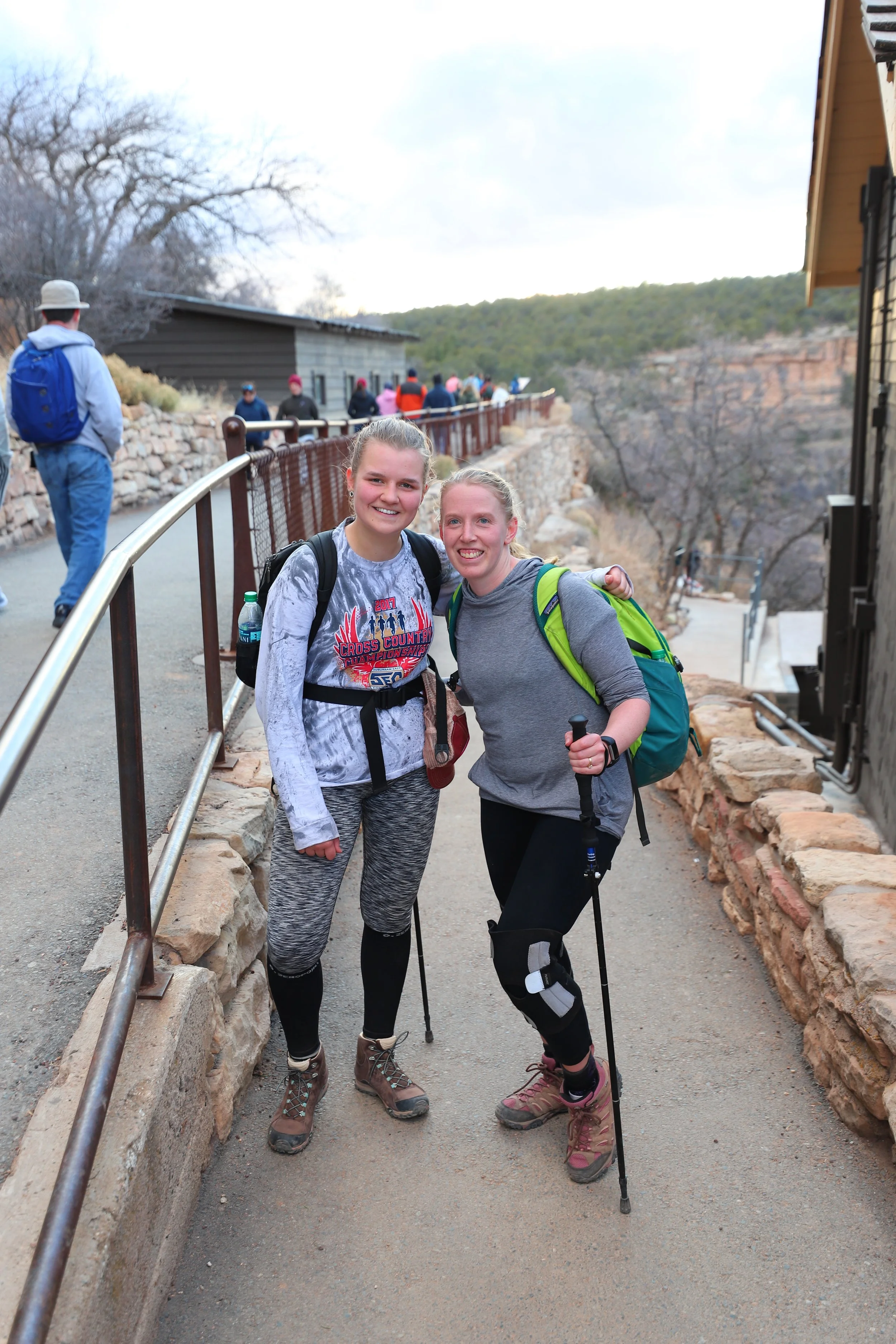
March 2018 (6:00pm) - We did it!!! Bright Angel Trailhead
Success! Hell yeah! Celebrating, but hobbling around on the South Rim. The Park Rangers stop and ask if we are ok - they notice hobbling - they will ask every time. The story of our hikes tumble out, and they are not impressed - they never are… But we were prepared, we trained, we had timetables of our hike to stay out of the heat, we had excess water, we had umbrellas and headlamps, we stopped and assisted other hikers.
Hiking in the Grand Canyon requires preparation, planning, training, known backup plans for likely emergencies, and flexibility realizing sometimes the answer is to not hike and come back again.
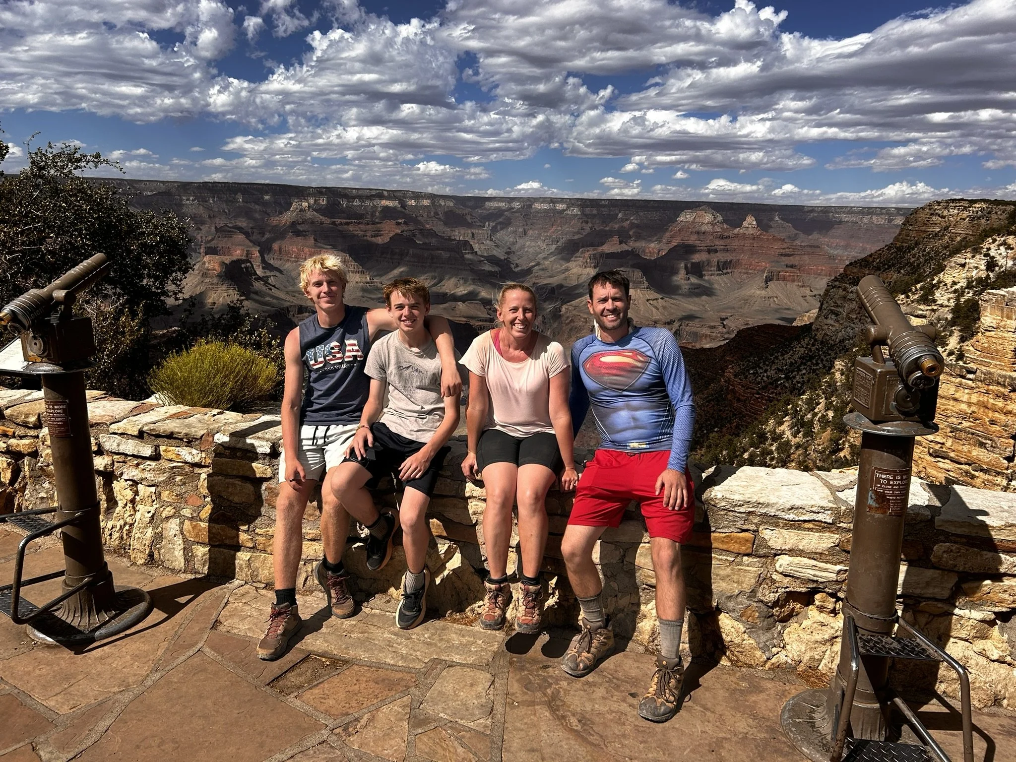
June 2026 (3:42pm) - We did it again! View from Bright Angel Trailhead after some celebratory ice cream
Love it or hate it, maybe love it and hate it? Hike the Grand Canyon and you will never be the same.