Devil’s Garden in Grand Staircase-Escalante National Monument
If you enjoy my blog, please consider signing up below for email notifications of my latest posts. I will not share your email.
A Desert Playground
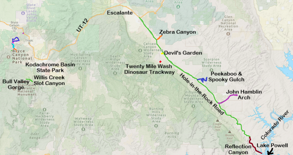
Along Hole-in-the-Rock Road, in Grand Staircase-Escalante, there are two fun, short stops that don’t involve much hiking, and both are interesting places to explore. Devil’s Garden has two beautiful arches and some impressive hoodoos. The trails crisscross throughout this park, mostly along slickrock, so it has a “choose your own adventure” sort of feel. The Dinosaur Trackway (less than 20 minutes from Devil’s Garden) includes both sauropod and therapod footprints left behind from creatures wandering this area 160-170 million years ago during the Jurassic period.
Note, I know of two “Devil’s Gardens.” Here is my link to Devil’s Garden Loop in Arches National Park, if you ended up here by mistake.
Location
Hole-in-the-Rock Road starts just outside of Escalante, Utah, as a turnoff from UT-12. Escalante is a small town but has several lodging options including campgrounds, cabins, and hotels.
Hole-in-the-Rock Road is a grated sandy road. When we traveled along it in June 2025, the road was bumpy but ok - any car would have been fine to use. In March 2019, when we were on the same road out to Peekaboo and Spooky Gulch, it was not the best - extremely rutted, and I was happy I had rented a truck. The difference was probably due to time of year. Roads can’t be repaired until winter is done (yes, it can and does snow in Escalante). The rutting happens due to cars and trucks trying to drive on the wet roads. The chance of getting stuck is high when this road is wet. If it has rained recently or if the road is wet from snow melt, don’t attempt driving along Hole-in-the-Rock Road, regardless of your vehicle type.
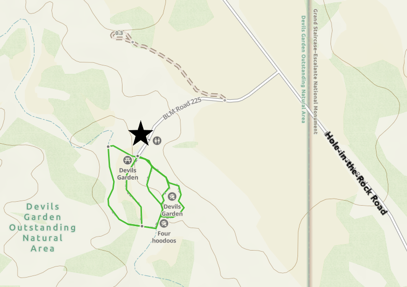
Devil’s Garden is about a 30-minute drive from Escalante. This park is about 12 miles down Hole-in-the-Rock Road. The turnoff to the park is obvious with a sign indicating “Devil’s Garden.” There are both picnic tables and vault toilets.
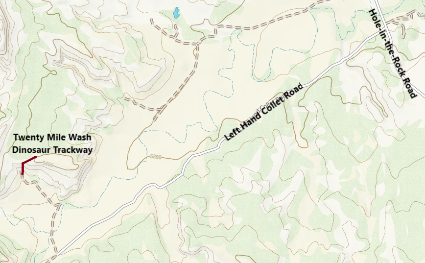
The turn to get to Twenty Mile Wash Dinosaur Trackway is not obvious. From Devil’s Garden, go back to Hole-in-the-Rock Road and turn right. Continue going down this road (away from Escalante) for about 2 more miles. Turn right onto Left Hand Collet Cyn Road. I don’t remember this road being marked. Additionally, you won’t have cell service, which makes GoogleMaps hard to follow. The best option is using a GPS app like GAIA, and pre-download the map. If you don’t have a GPS app, then simply pay attention to your odometer when leaving Devil’s Garden.
Drive down Left Hand Collet Cyn Road for about 2.5 miles. There’s another turn to the right down an unnamed road for 0.6 miles. There is an area to park at the end. Keep reading below for pictures and a more detailed map.
Map of trailheads along Hole-in-the-Rock Road
Logistics
Repeating a few things I mentioned above - Higher clearance vehicles are better along Hole-in-the-Rock Road. Additionally, this road needs to be dry to get to these areas. If the road is wet, your vehicle (regardless of its clearance) is likely to get stuck.
There are pit toilets available at Devil’s Garden but not at Twenty Mile Wash Dinosaur Trackway. Bring water with you. Although these aren’t long hikes, it’s still a desert. And consider installing a GPS map app and pre-downloading maps. GoogleMaps will get you to Devil’s Garden, but when you go to switch it to find the dinosaur tracks, you won’t have service. GPS will still work, even when you don’t have internet service, as long as you’ve pre-downloaded the maps.
Devil’s Garden
Despite the maps making it seem like there is a trail, the hike at Devi’s Garden is mostly over slick rock, so it isn’t marked, and you can wander wherever you’d like. Expect to walk about a mile here and spend maybe an hour.
Devils Garden (Escalante) Map
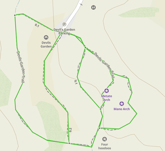
Devil’s Garden Detailed Map with the Arch, Hoodoos, and picnic tables included
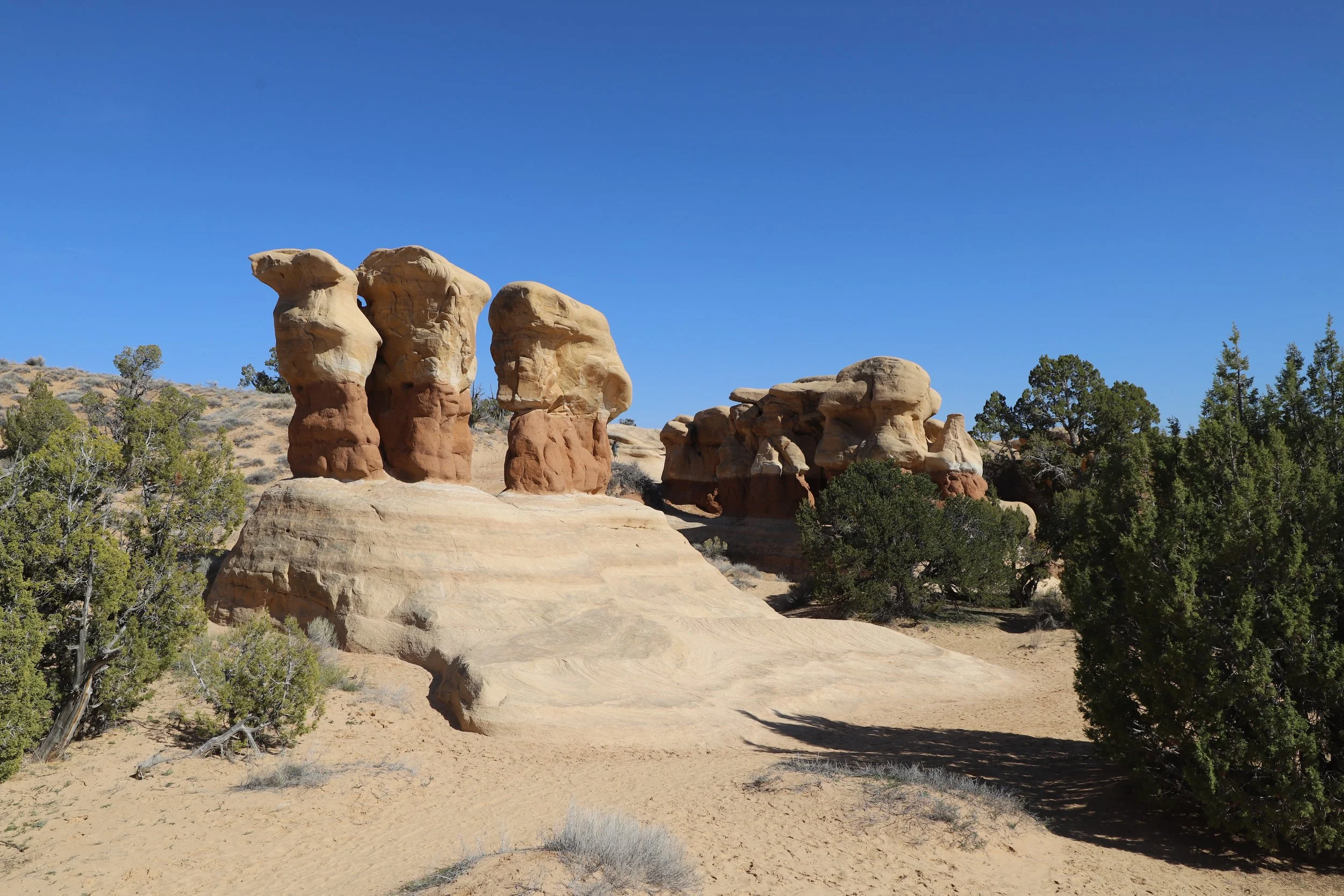
The order my boys chose to explore this park was hoodoos, then Metate Arch, and we finished with Mano Arch.
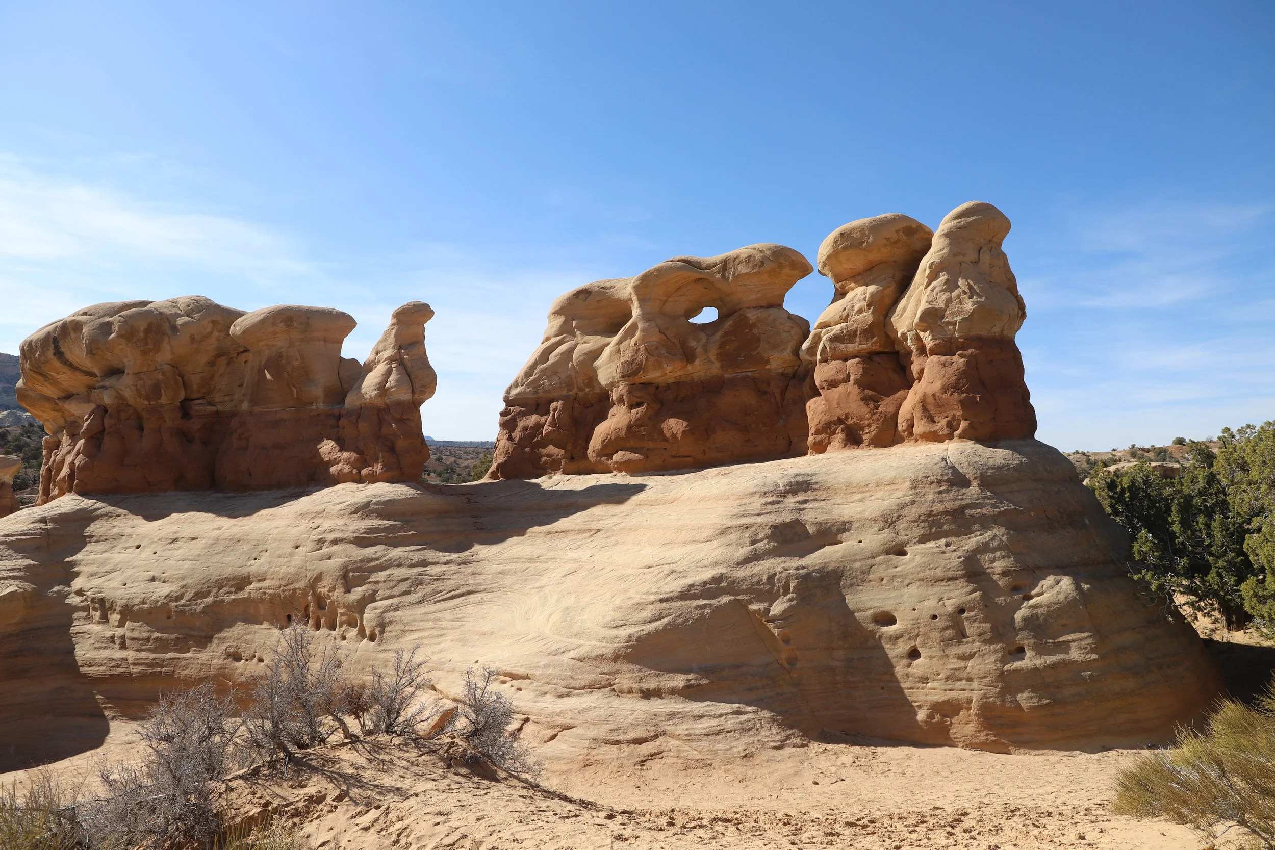
Hoodoos at Devil’s Garden in Escalante
This was such a fun, easy place to explore. We stopped here on our way back to Escalante after hiking Peekaboo and Spooky Gulch, and it was the perfect add-on to our day of hiking.
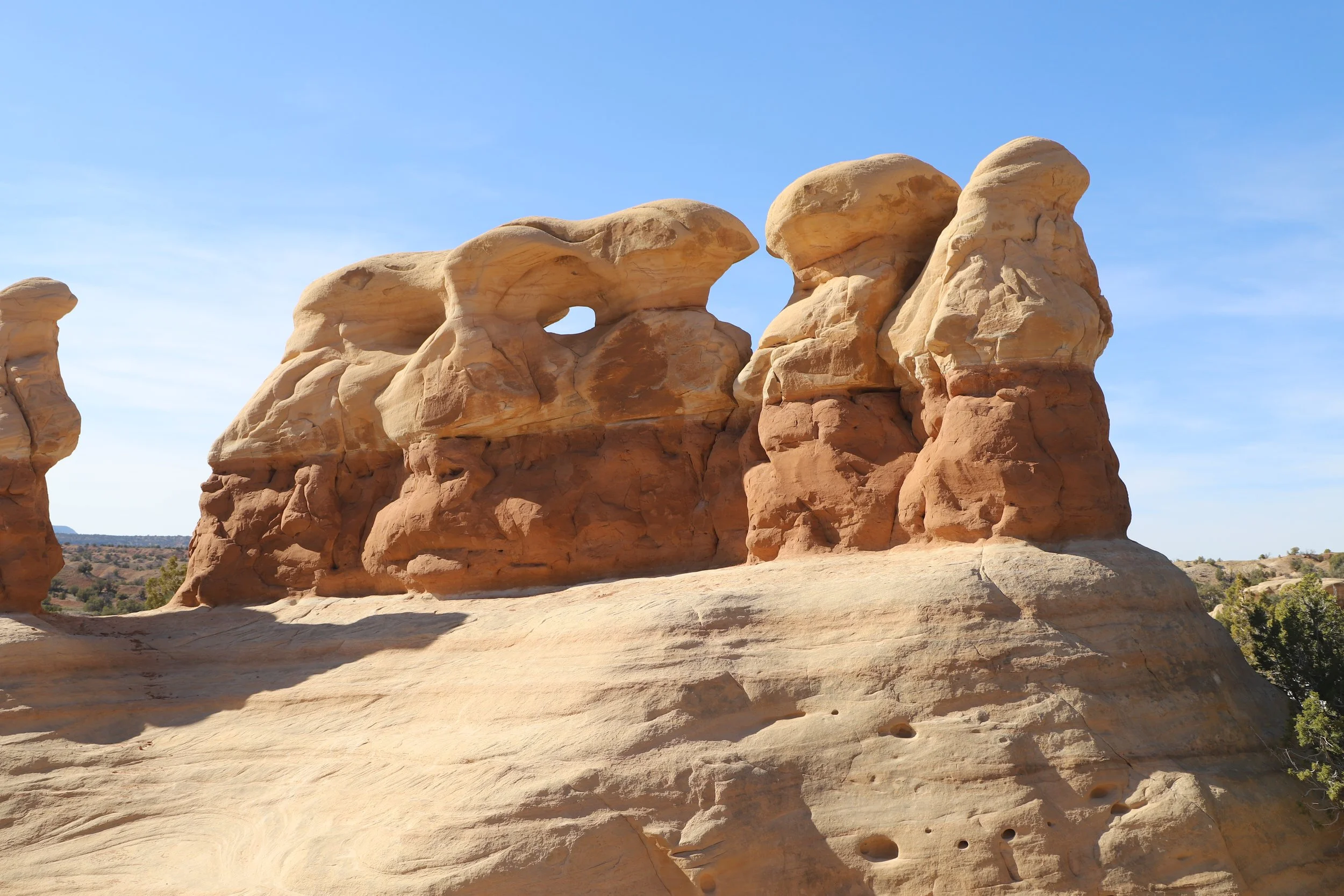
Hoodoos at Devil’s Garden along Hole-in-the-Rock Road
The slick rock is easy to climb up. You can get right next to the hoodoos and feel a part of the dramatic desert landscape.
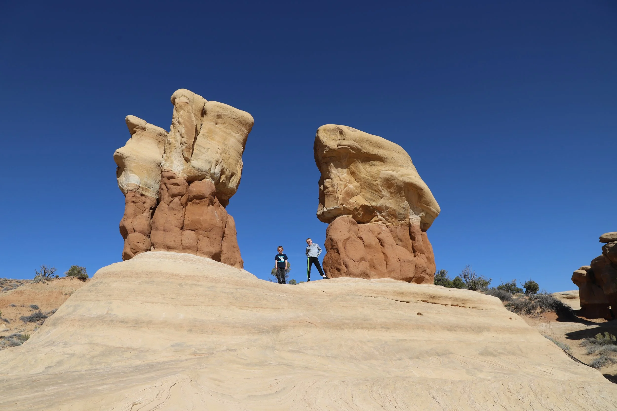
Playing next to the hoodoos at Devil’s Garden
From the hoodoos, we wandered over to Metate Arch next, and that was my favorite part of the park.
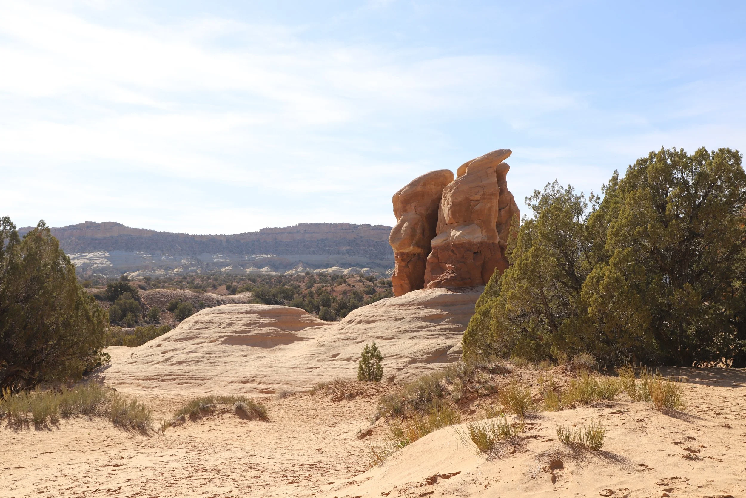
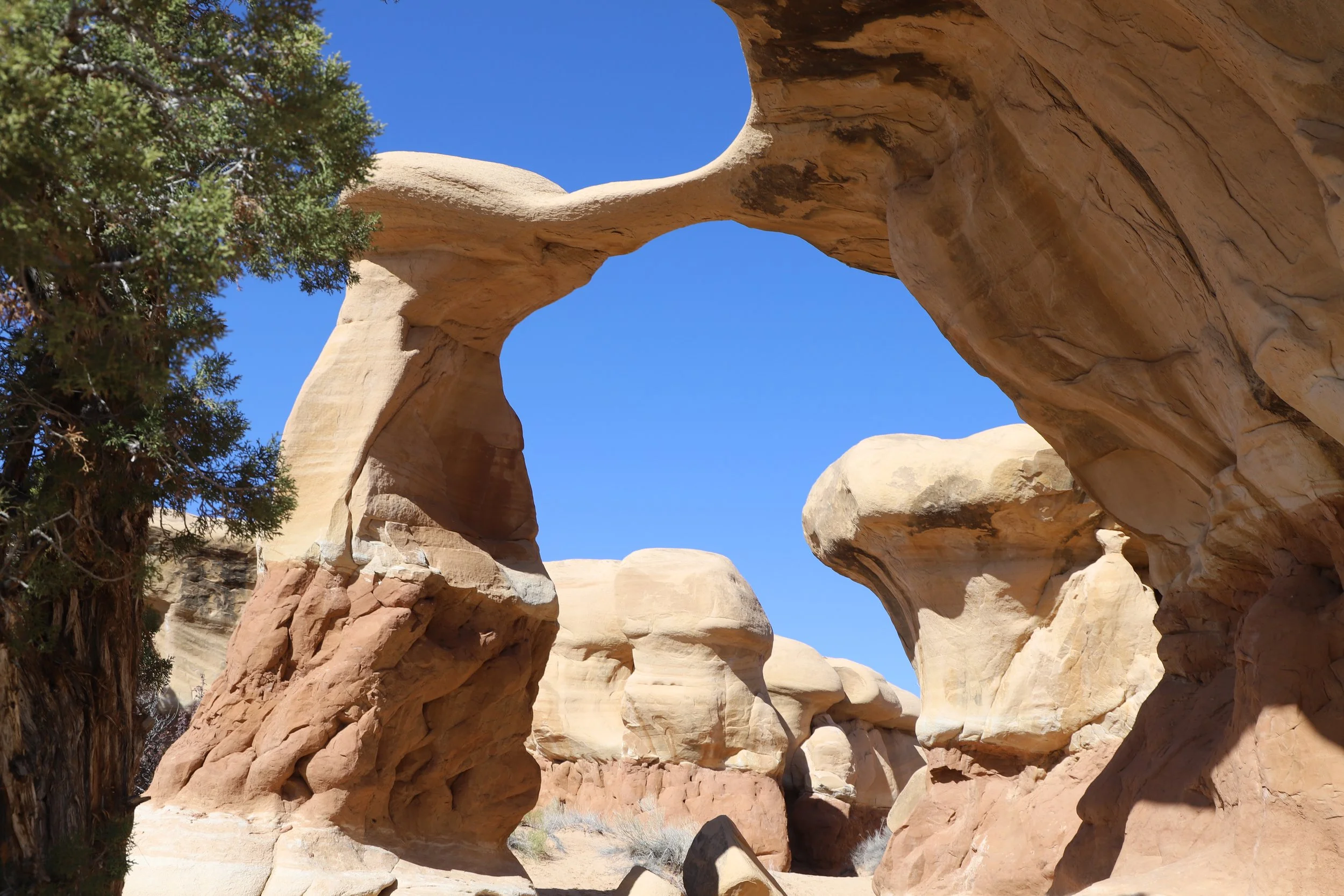
Devil’s Garden - Grand Staircase-Escalante National Monument
Metate Arch is pretty fragile. I wouldn’t recommend walking over any of the arches, but especially not this one. It would be better that nature takes it down some day, rather than a hiker prematurely destroying it.
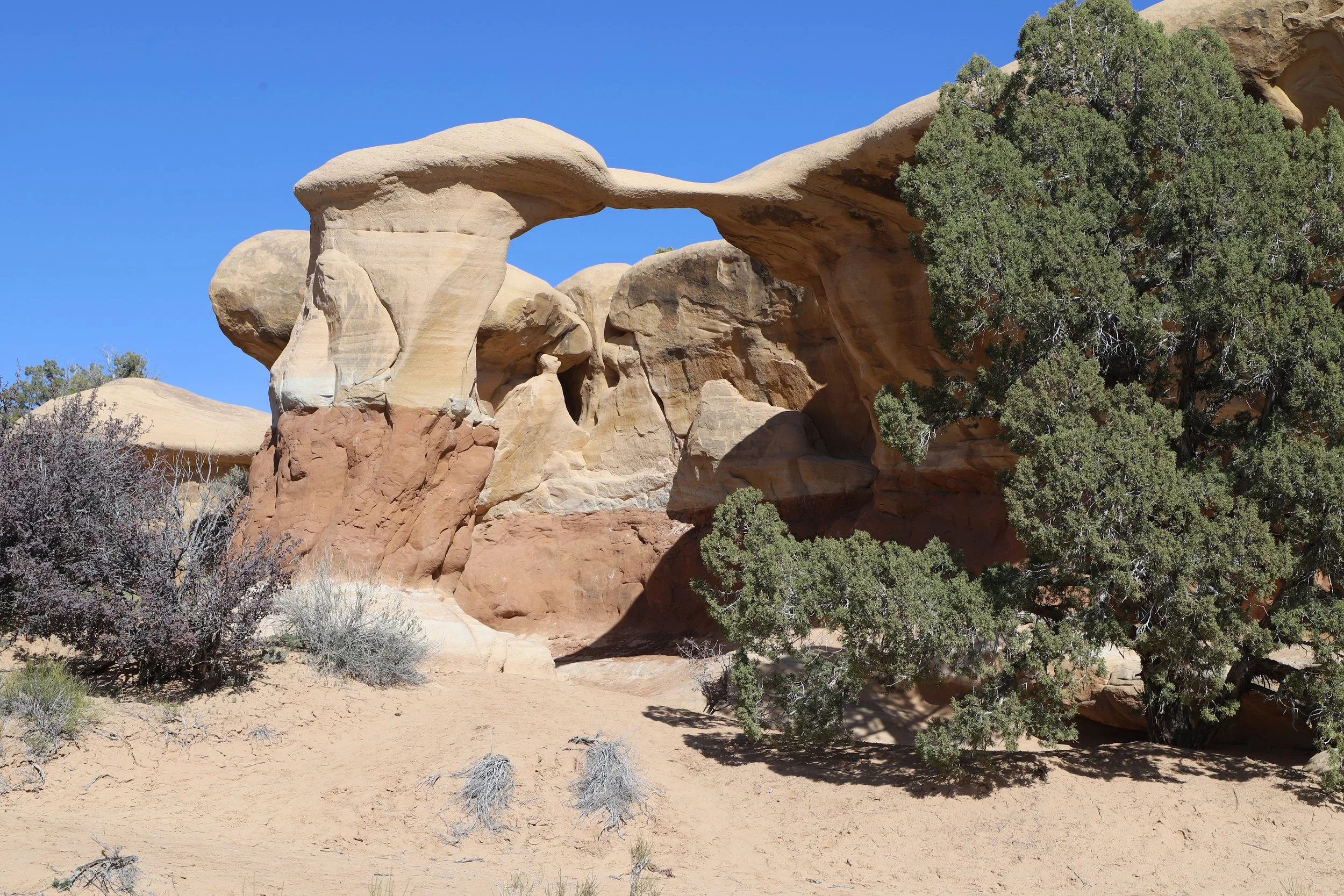
Metate Arch - Devil’s Garden, near Escalante
We didn’t walk over Metate Arch, but we had fun exploring underneath it.

Metate Arch - Devil’s Garden
The last thing we explored before leaving was Mano Arch. You can tell my boys were having fun here.
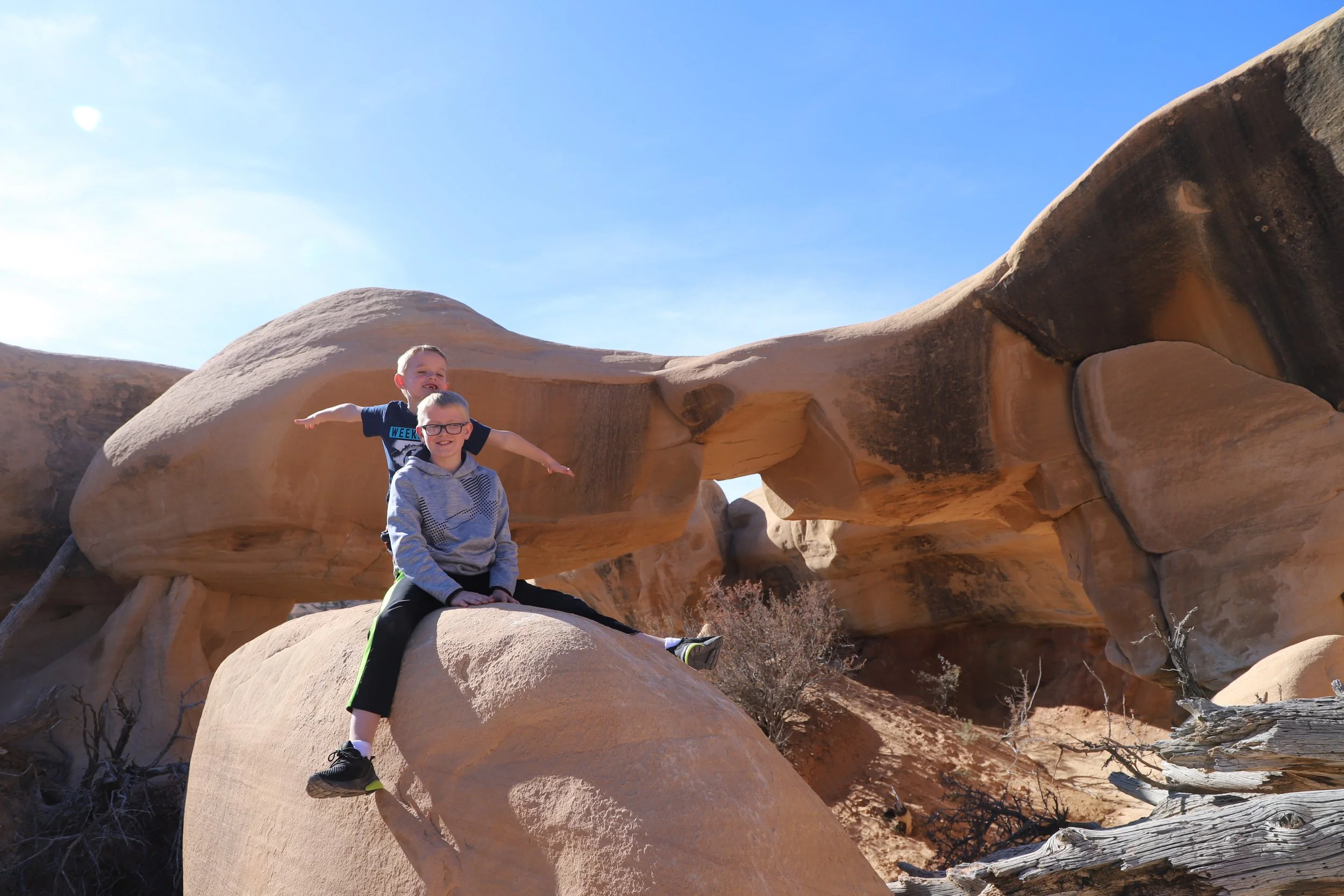
Mano Arch - Devil’s Garden, Grand Staircase-Escalante National Monument
Twenty Mile Wash Dinosaur Trackway
45 minutes from Escalante - Continue along Hole-in-the-Rock Rock for 6 miles (2 miles past Devil’s Garden) and turn right on Left Hand Collet Cyn Road. Follow this side road for 2.5 miles. For anyone interested in finding some dinosaur footprints, this is a quick place to explore. The Sauropod footprints (big round circles) are easy to spot. There are also some Therapod footprints (3-toed) but these are harder to find.
Roads out to Twenty Mile Wash Dinosaur Trackway
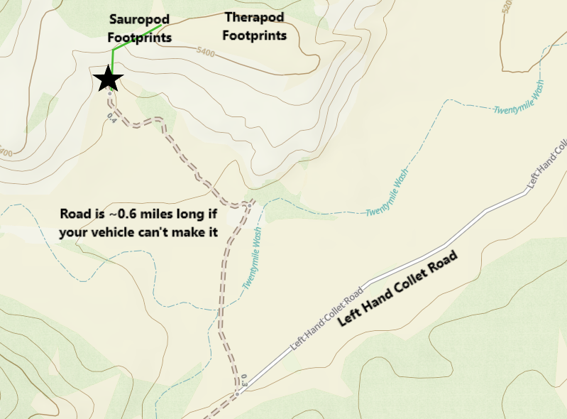
Getting to Twenty Mile Wash Dinosaur Trackway
It’s a little hard to see because I put a star over it, but the parking area is a loop. And uggh… this is a hard place for me to talk about. I rented a truck - I wanted to be able to drive out to the trailheads on rougher roads. This was my first time ever driving a truck. And it’s just me and my boys. My husband teaches and has a different week off for Spring Break than our boys. The way out to Peekaboo and Spooky Gulch, the truck easily handled each of the crazy ruts and bumps. And I’m driving down the road to the parking lot at Twenty Mile Wash. There is this huge rut along the road going counterclockwise…. Clockwise the road is pretty flat. There was one other car out here. If I was thinking, which I wasn’t, I should have drove around the loop clockwise. But I was thinking like I was in a city, and roundabouts go counterclockwise. So, I drove over that huge rut completely unnecessarily….. And the truck almost flipped. I don’t think I’m exaggerating, as we were talking with the couple from the other car, they mentioned they also thought the truck was going to flip.
Life lesson learned - you can drive anywhere on the road out in the middle of the nowhere when no one else is around. Don’t destroy your rental car and require a rescue mission…
After parking, hopefully successfully, you are going to look over to the hills. Look for the white sign that is in the below picture. To get to the dinosaur footprints, hike up the rock about at the sign once you are the top, head towards the right. At least when we visited in 2019, there wasn’t a formal trail.
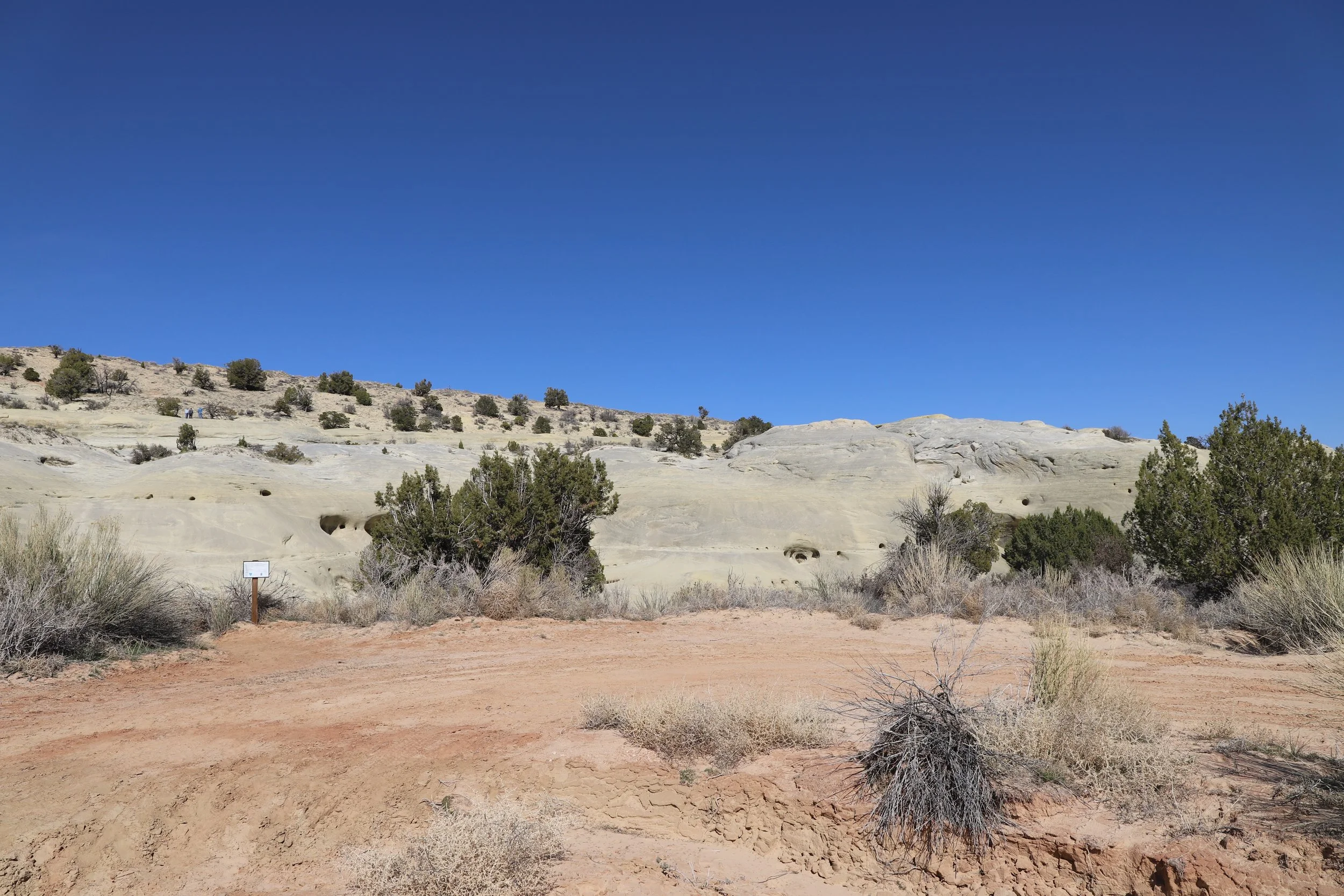
To find the footprints at Twenty Mile Wash Dinosaur Trackway, look for the white sign, and head up on the rocks. Then walk to the right.
And you are going to just have to take my word… These are the dinosaur footprints. They are more obvious in real life than in the pictures.
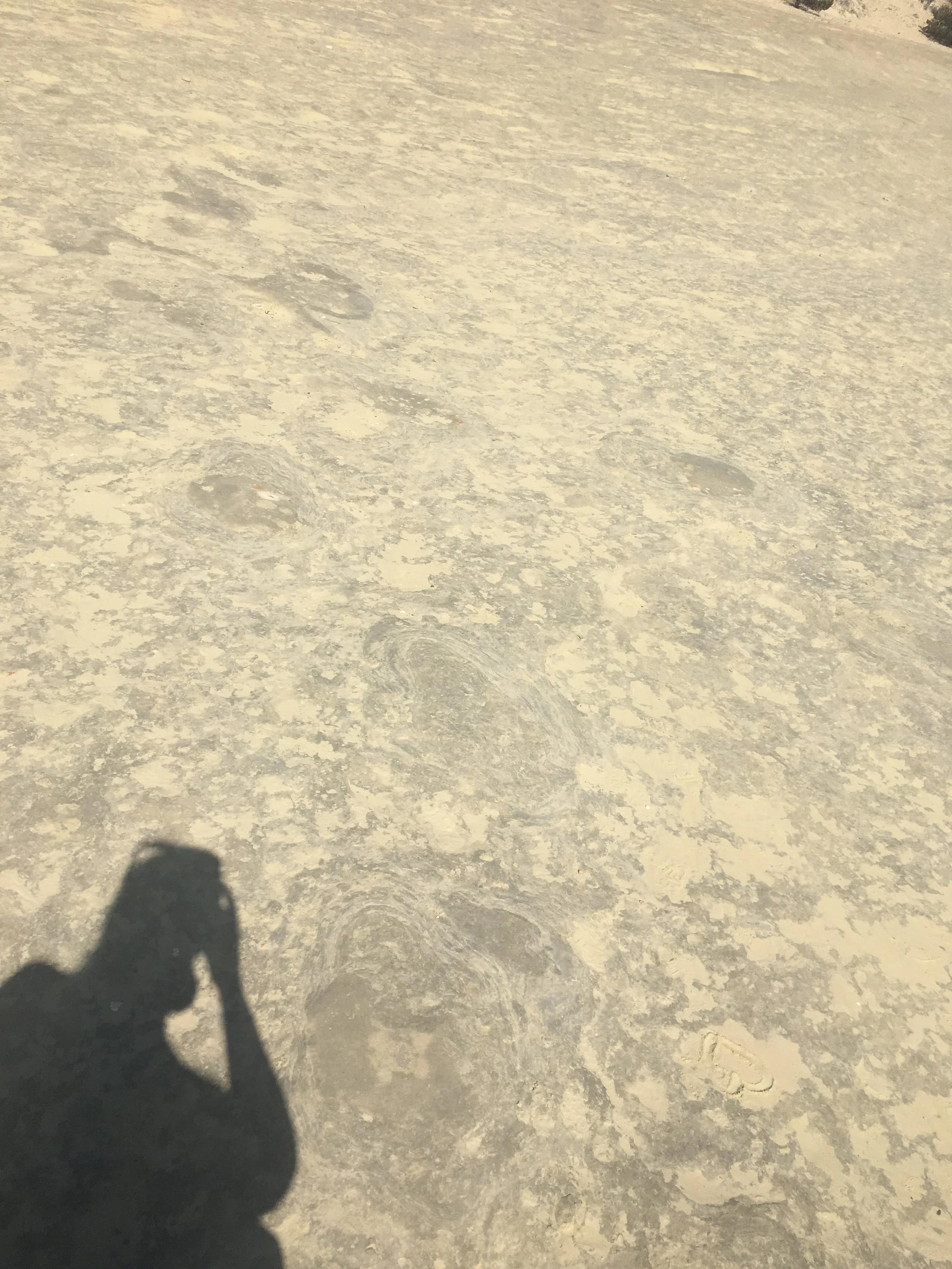
Sauropod footprints at Dinosaur Trackway
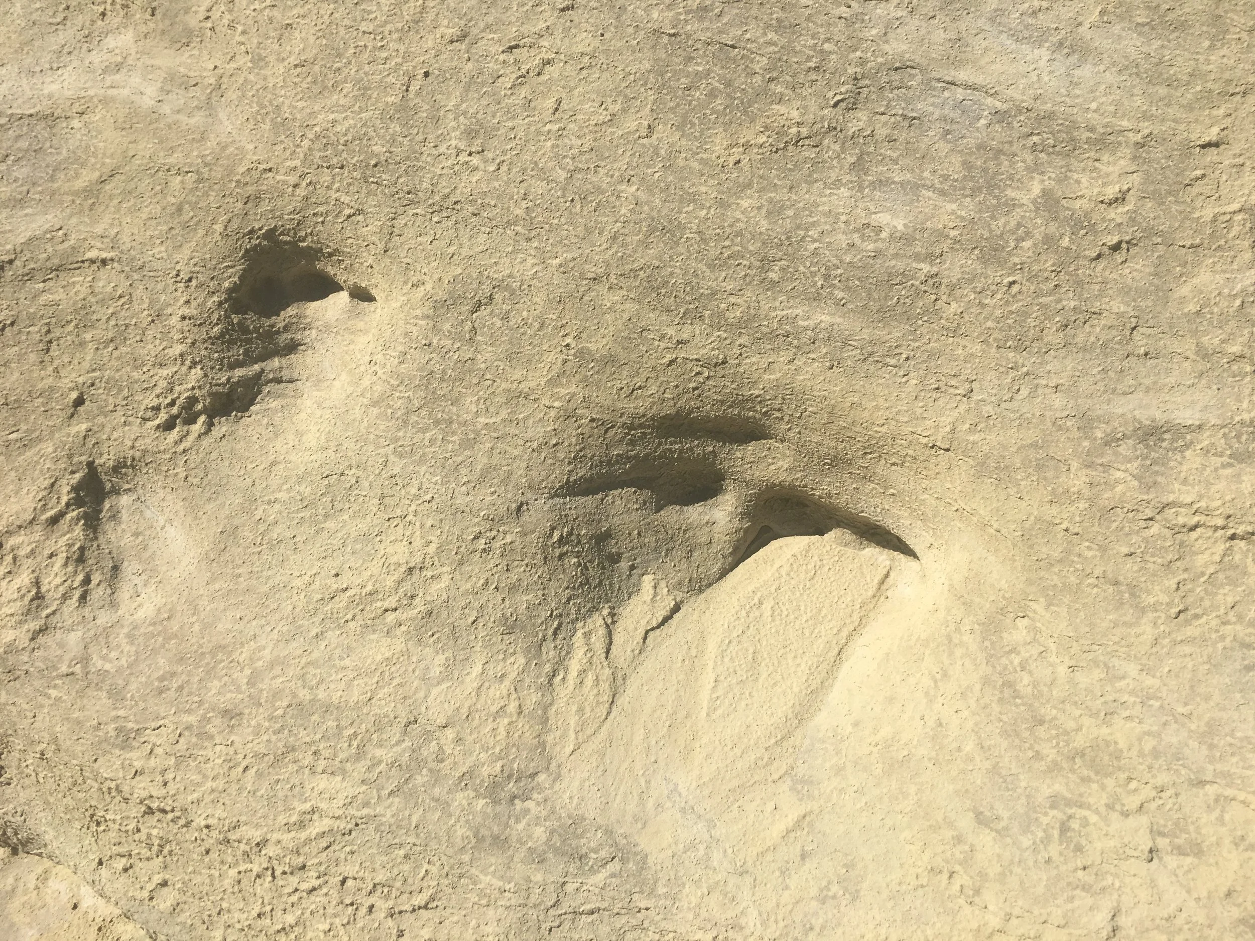
Therapod footprint at the Dinosaur Trackway
What made the trek out here fun was that the other couple that happened to be here at the dinosaur trackway at the same time we were, knew a ton about both the Escalante area as well as the dinosaurs. We talked to them for a long time and they pointed things we wouldn’t have otherwise noticed. Without them, I’m not sure that we would have gotten much out of visiting here. A more impressive place to see dinosaur footprints is the Mill Canyon Dinosaur Tracksite in Moab, Utah.
“Nearby” Things to Do
To be honest, everything is very spread out in Grand Staircase-Escalante, and the driving along Hole-in-the-Rock Road is slow to begin with. So, when I say “nearby” - it’s a bit relative… The following places to visit are within a 90-minute drive.
Peekaboo and Spooky Gulch Slot Canyons (Dry Forks Narrows and Brimstone Gulch)
35 minutes - The Upper Dry Forks Trailhead is located 14 miles along Hole-in-the-Rock Road from Devil’s Garden (continuing along Hole-in-the-Rock Road). This is a fun and challenging 4.6-mile loop hike through 3 slot canyons (Dry Forks Narrows, Peekaboo, and Spooky Gulch). Add Brimstone Gulch for an additional 3.6 miles.
Zebra Canyon
A relatively easy 5.25 mile out-and-back hike to a stunning slot canyon. This is a long and hot trail however, and the canyon itself is likely to be in the water. Expect to get wet.
This trailhead is 10 minutes from Devil’s Garden (on the way back to Escalante) along Hole-in-the-Rock Road.
Bryce Canyon National Park
1 hour - Bryce Canyon National Park is about 75 minutes from Escalante (to the west) along UT-12. I would recommend switching lodging to be able to enjoy a few days hiking through Bryce Canyon. The hikes at this park are difficult, but if you are looking at hikes in Grand Staircase-Escalante, the difficulty of this park isn’t going to be a roadblock for you.
Kodachrome Basin State Park
1 hour - Kodachrome Basin State Park sits just to the east of Bryce Canyon National Park, and is about an hour drive from Escalante. It has some of the same hoodoos, although they are not as dramatic, nor are there as many. It’s a fun park to hike through, and much quieter than its nearby National Park.
Willis Creek Slot Canyon
1 hour - Willis Creek Slot Canyon is also to the west of Escalante (and west of Kodachrome). Willis Creek Slot Canyon is an easy, shaded slot canyon with minimal change in elevation, and has stunning, tall, and colorful walls. This is an out-and-back hike for as long as you’d like. The max hike is 6 miles long. The trailhead is along Skutumpah Road, a sandy, bumpy road where a higher clearance vehicle is going to be appreciated. The canyon is located very close to the parking area.
Bull Valley Gorge
1 hour - The trailhead to Bull Valley Gorge is 6 minutes further along Skutumpah Road, past the Willis Creek Slot Canyon trailhead. Bull Valley Gorge is a short (1 mile) but difficult slot canyon. This can be a loop hike out to the start of the canyon, through it, and scrambling back up, but there are some major obstacles to navigate through within the canyon. We explored about a third of the way through the canyon and returned the way we came in. Bull Valley Gorge is also the site of where a truck can be found wedged in the canyon walls from an accident in 1954.
Lower Calf Creek Falls
30 minutes - The trailhead to Lower Calf Creek Falls is just over 30 minutes to the east of Escalante, just off of UT-12. It’s a relatively easy 6 mile out-and-back hike to an impressive waterfall, and there are petroglyphs to find along the way.
Anasazi State Park Museum
40 minutes - For anyone heading to Capitol Reef National Park, Anasazi State Park Museum is an interesting, quick stop, also off of UT-12. Just outside of the museum, there is a six-room dwelling replica constructed on the original site.
Long Canyon
1 hour - The trailhead is quite a bit off of UT-12. It’s a really easy and short hike through a slot canyon, but the slot canyon isn’t that deep, and I don’t think it was worth the drive out this far.
Capitol Reef National Park
90 minutes - Like Bryce Canyon, Capitol Reef National Park is worth switching lodging locations to be able to enjoy a few days hiking in this park. Out of all of Utah’s National Parks, this one is the quietest. That on its own made it a special place to visit.
More from www.NatureImpactsUs.com
To see more of my posts, click on any pin. There will be a hyperlink to my post on that particular hike.