Spooky Gulch - Grand Staircase-Escalante National Monument
If you enjoy my blog, please consider signing up below for email notifications of my latest posts. I will not share your email.
Epic Hiking Adventure
My boys and I conquered Peekaboo and Spooky Gulch slot canyons on a Spring Break trip to Grand Staircase-Escalante National Monument in March 2019. Seven years later, we still talk about these canyons, and this trail is definitely in our list of Top 10 Favorite Hikes Anywhere.
The trail has some challenges. Exposure to the sun, no available drinking water, 15-ish ft wall that needs to be scaled up in order to get into Peekaboo Canyon, a couple of 10-ish ft drops in Spooky Gulch, and some tight squeezes where the walls are about 10 inches apart from one another. And that’s what makes this hike fun. It’s not just walking. You will need to be prepared and work together to solve each problem along the way. And the canyons themselves - just wow!
My hiking buddies
Location
There are a couple of canyons referred to as “Peekaboo” in southern Utah (Kanab has a Peekaboo Slot Canyon, and Bryce National Park has a Peekaboo Loop Trail). The Peekaboo slot canyon referred to in this post resides in Grand Staircase-Escalante National Monument. The closest town with lodging options is Escalante, Utah (about an hour drive from the trailhead). The two closest large cities with airports are Salt Lake City and Las Vegas, both about 4.5 hours from Escalante.
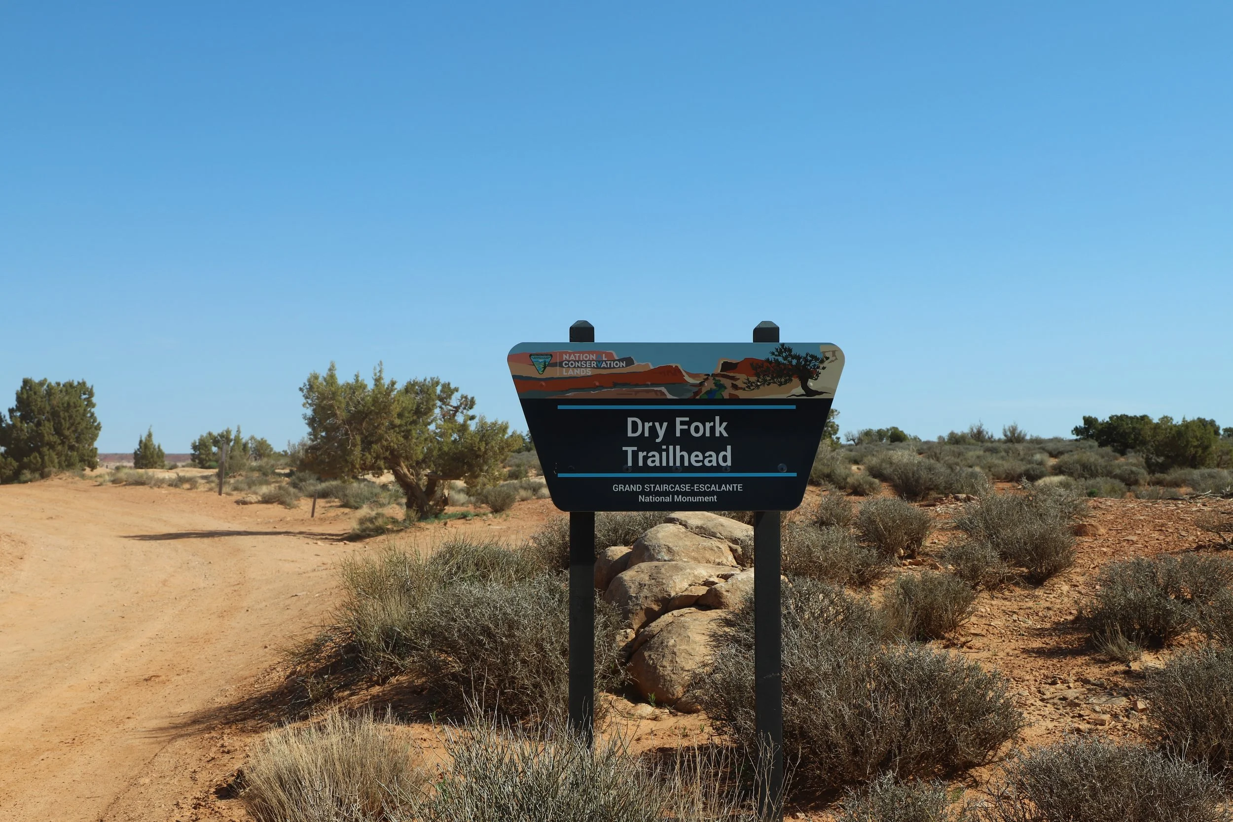
To get to the trailhead for Peekaboo and Spooky Gulch, from Escalante, take Hole-in-the-Rock Road to one of two trailheads. Upper Dry Fork Trailhead is 24.5 miles down Hole-in-the-Rock Road and Lower Dry Fork Trailhead is 26 miles (plus an additional mile along a side road).
Map of Hole-in-the-Rock Road Trailheads
Logistics
Grand Staircase-Escalante National Monument is managed by the Bureau of Land Management. It will feel very different than a typical National Monument managed by the National Park Service. The roads are not paved, and several require 4x4 or high clearance. There may or may not be bathrooms near trailheads. The trails are not well marked either. This is all intentionally by design in being managed by BLM - this park is meant to be maintained as unspoiled remote backcountry. Stepping onto a trail in this park is going to need to take more preparation than what you might be used to when visiting a National Monument, but it makes this park special as a result.
The first consideration for planning a trek to these slot canyons is what sort of car might be required. Hole-in-the-Rock Road is not paved. It’s sandy, extremely bumpy, and impassable when it’s wet, regardless of any vehicle type. If you choose to park at the Lower Dry Forks trailhead, in 2019, the side road between Hole-in-the-Rock and the trailhead was terrible. I rented a truck, and there were moments I was sure it was going to tip over. In the years since, the side road to Lower Dry Forks has been changed significantly. The trailhead has moved back about 0.8 miles (as the last section of the road was the worst part), and the road itself has been greatly improved. I’ve read that regular cars are now able to get out there. I’d still be cautious about that though, as the roads can change significantly with rain. We were back on Hole-in-the-Rock Road in June 2025 on our way to Zebra Canyon, and we had our minivan. It was bumpy and we drove quite slowly, but we didn’t have any issues driving on it.
In 2019, there were no bathrooms at either Dry Fork trailhead, but I’ve read now that there are vault toilets at both. There are also bathrooms at Devil’s Garden, about 12 miles before the Peekaboo and Spooky Gulch trailheads along Hole-in-the-Rock Road.
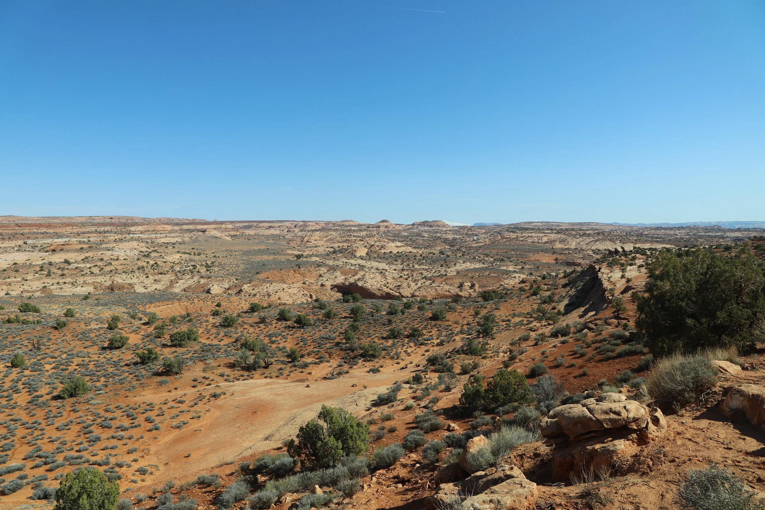
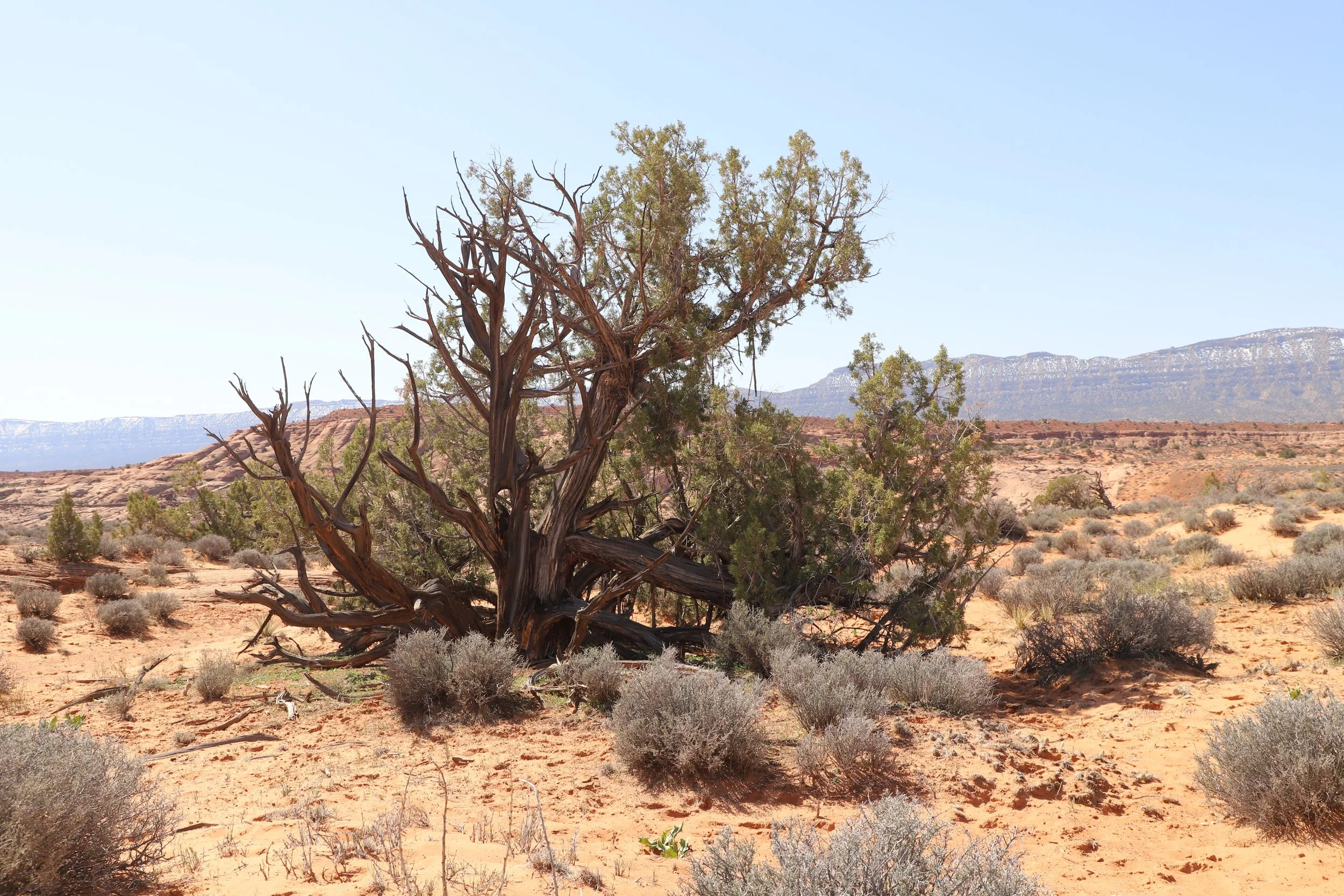
Two additional important considerations are water and sun exposure. Most blogs just show pictures of the cool slot canyons, which are in the shade. I've intentionally included several pictures of the rest of the trail, which is not in the shade, so you can see just how exposed the trail is. This is the desert. Even in March, this trail was hot. Additionally, there will not be places to fill water bottles after you leave the town of Escalante. I like to buy a couple of 2.5-gallon water jugs and leave them accessible in the trunk of the car, so we can fill up water bottles easily at the start of our hike, in addition to having more available when we are done hiking. I’d bring 2L of water per person for this hike, even though it isn’t a super long hike. Another idea might be to pack an umbrella in your bag to create portable shade, which may be needed in an emergency.
And lastly, after suggesting packing an umbrella, I’m going to seemingly state the opposite and suggest packing light. There are sections in Spooky Gulch where the canyon walls are just 10 inches from each other - this is an extremely tight squeeze. Packing small bags are going to make these sections easier. So, I guess my advice here is to just pack smart - bring the essentials and just the essentials.

Hiking between Peekaboo and Spooky Gulch slot canyons
Hiking Peekaboo and Spooky Gulch Slot Canyons
Distance / Elevation gain - 4.2 miles (from Lower Dry Forks Trailhead with slot canyon loop) / 300ft or 4.6 miles (from Upper Dry Forks Trailhead with slot canyon loop) / 200ft. Add up to 3.6 miles for hiking Brimstone Gulch (we have not hiked this slot canyon).
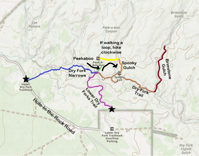
Trail map for Peekaboo, Spooky Gulch, Dry Forks Narrows, and Brimstone Gulch
There are several options you will need to pick from when hiking to the Peekaboo and Spooky Gulch slot canyons. Because so many options exist, I’ve added some different colors for different parts of the trail on my map. These colors are just unique to my map and won’t mean anything when you hike the actual trail.
First decision - Which Trailhead - Upper or Lower Dry Forks? When we hiked in March 2019, there was an option that removed 1.6 miles (0.8 miles each way) from the Lower Fork trailhead. This was a terrible road, and the option has since been removed. But at the time in 2019, the significantly shorter hiking option made sense as I was hiking with a 6-year-old.
As of 2026, the Lower Dry Forks Trail (purple trail) is now 1.3 miles long (one-way) down to Peekaboo’s entrance. By contrast, the Upper Dry Fork Trail / Dry Fork Narrows (blue trail) is 1.5 miles long (one-way). The Upper Dry Fork Trail includes its own slot canyon though (we explored this a short distance before we returned back to the Lower Dry Fork trailhead). With now similar distances, I would suggest Upper Dry Fork trailhead as it’s more interesting. Its walls are higher, wider, and straighter than Peekaboo and Spooky Gulch, but it was still fun to explore. There isn’t much spectacular to see on the way down from Lower Fork Trail. If you park at Upper Dry Fork, note that the parking lot is on the opposite side of the road - you will need to cross the road to find the trailhead.
Exploring a short distance into the Dry Fork Narrows near the entrance to Peekaboo
Second and Third decisions - Do you want to hike Peekaboo and Spooky Gulch as a loop or separately as out-and-back hikes, and if you choose the loop, which direction should you go?
We hiked these slot canyons as a loop and picked the clockwise direction, starting with Peekaboo. The main reason we chose this direction is that on Spooky Gulch, there are two big drops (if you hike clockwise). It was just me and my boys on this spring break trip (my husband teaches in a different school district and their weeks off didn’t match). I had no idea how I could lift my boys up a 10ft+ part of the canyon. But going down, we carefully figured out how to jump with some ledges on the walls. We passed a few people trying to go counterclockwise, but they were all before the second drop. I’m not sure if they made it over or not. The other reason to go clockwise is that most people are going clockwise, and the canyon walls are tight… making it really difficult to pass people. Going with the primary direction of flow meant we passed fewer hikers going the other direction.
The last decision is whether to add on Brimstone. I wasn’t aware of Brimstone when we hiked Peekaboo and Spooky Gulch, but we were pushing our limits already with a hard hike with my youngest son. However, it looks like a fun canyon (although it can add up to 3.6 additional miles). The reviews call Brimstone the “bigger and badder” slot canyon. On a cooler day, this might be a fun add-on. There is a terrible story of a hiker getting stuck in this canyon for 8 days (and somehow, he lived). This part of the trail is much less well known, and much less visited.
Original Dry Forks Trailhead - Since we hiked in 2019, the Lower Dry Fork Trailhead has been moved back almost a mile
As I mentioned, we started our hike at the Lower Dry Forks Trailhead, which has now been moved back 0.8 miles. That put us at essentially the top of the hill. We just hiked the switchbacks down.
View from the top of Lower Dry Forks
The trail is well trodden, but on top of rock, that trail can still be really hard to see. Look for the rock cairns along the way and consider using a GPS map - I use GAIA GPS.
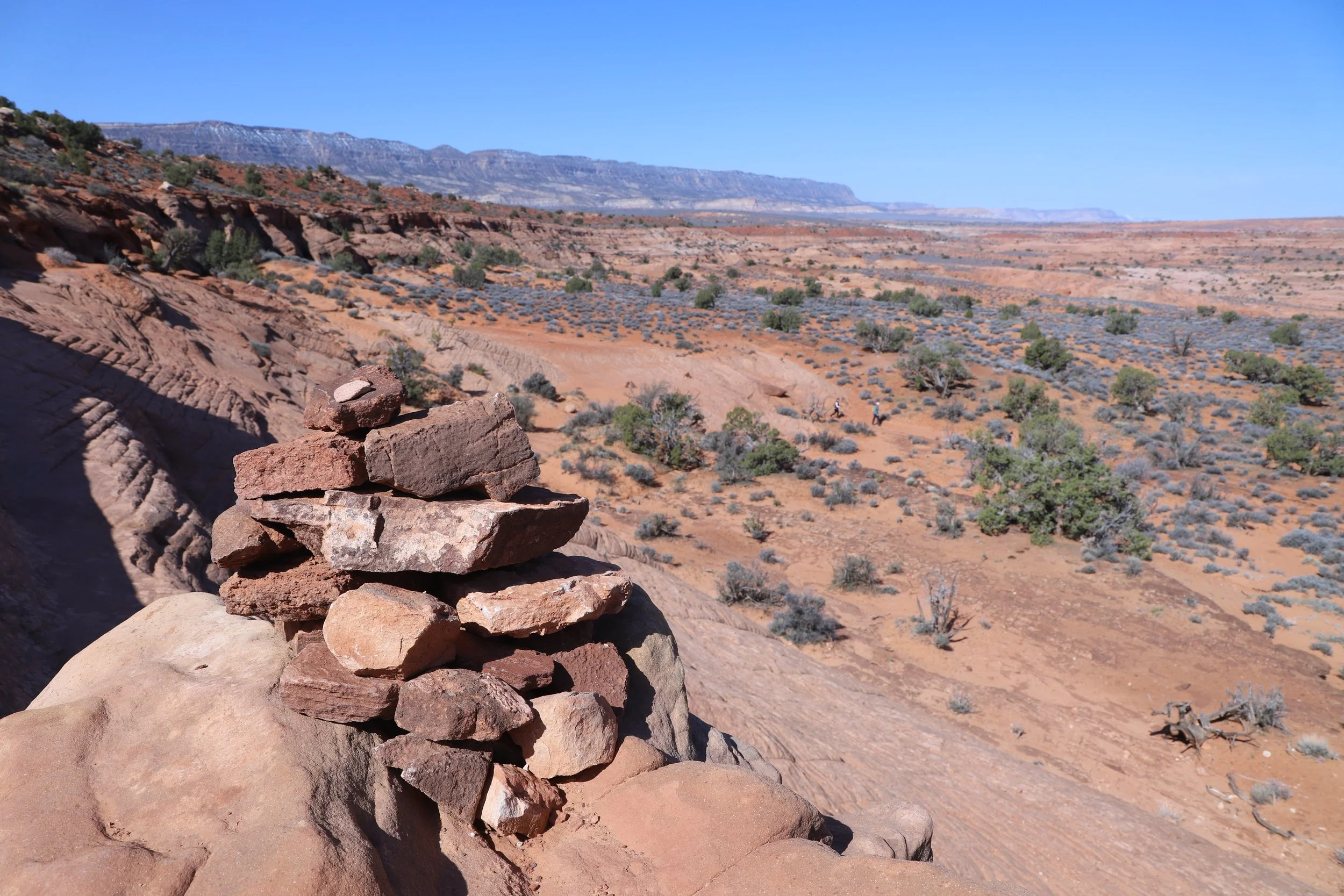
Follow the rock cairns - sometimes the trail is hard to see along the rock
We could start to see the canyons at the bottom of the hill.
Hiking down switchbacks into Dry Forks (from the Lower Dry Forks Trailhead)
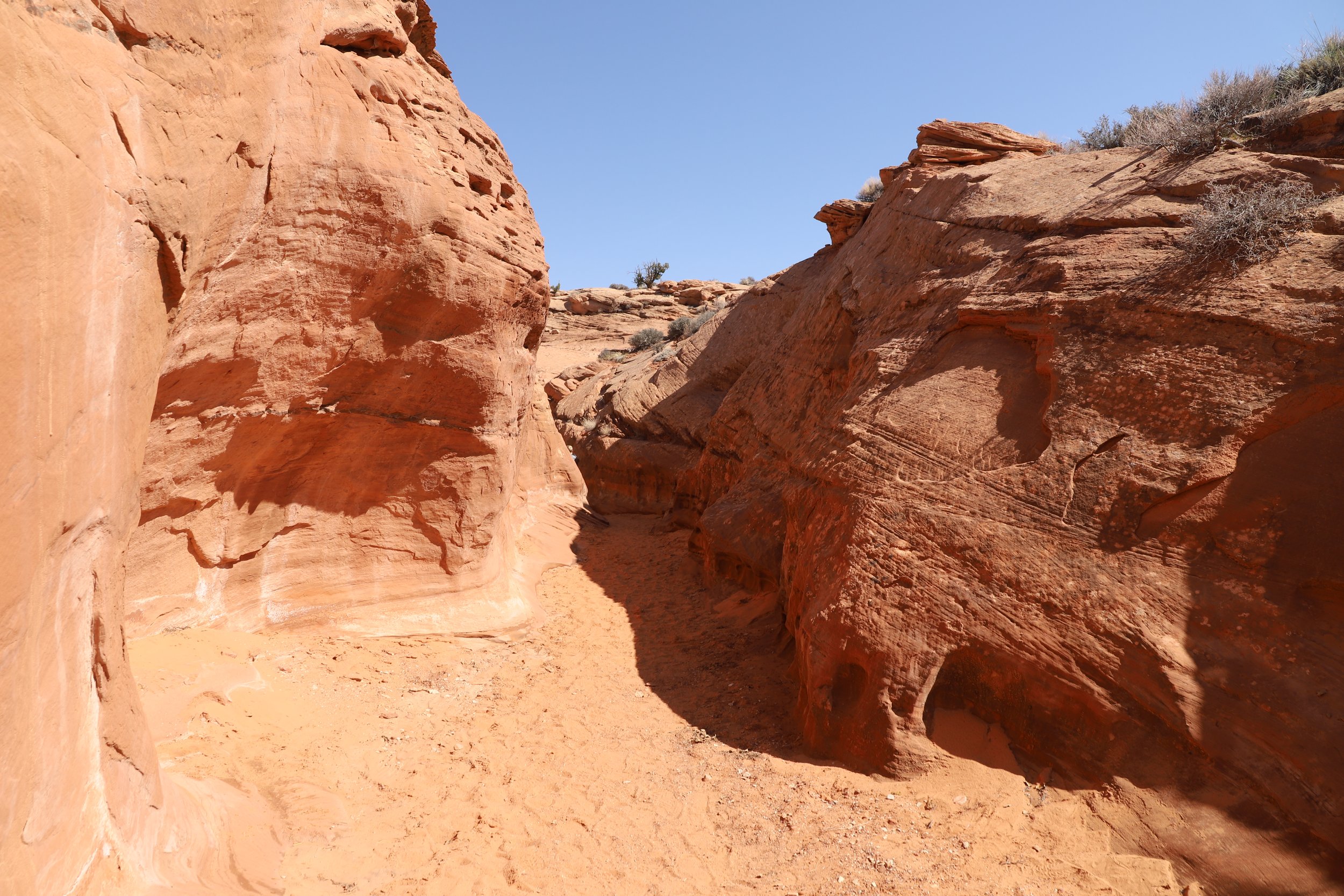
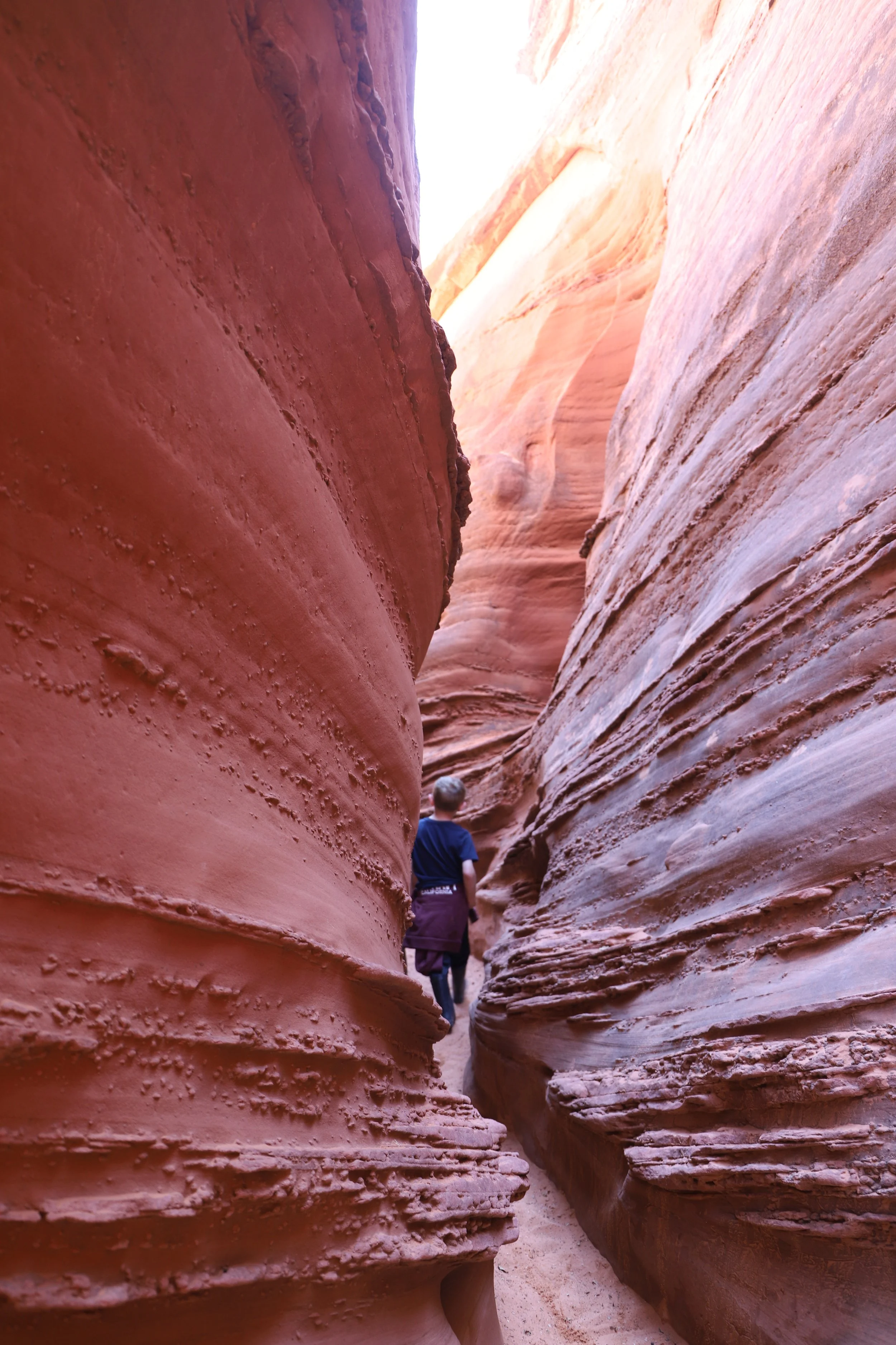
When you get to the bottom, there are three ways to go. To the left is Dry Forks Narrows (the trail to Upper Dry Forks trailhead). In the middle is Peekaboo. This slot canyon starts with a high climb up. Even with this challenging start, this if the way I would recommend going. To the right is Spooky Gulch. There were a few families trying to go this way. It might work to go this direction, but there are some extra challenges in Spooky Gulch for those hiking counter clockwise.
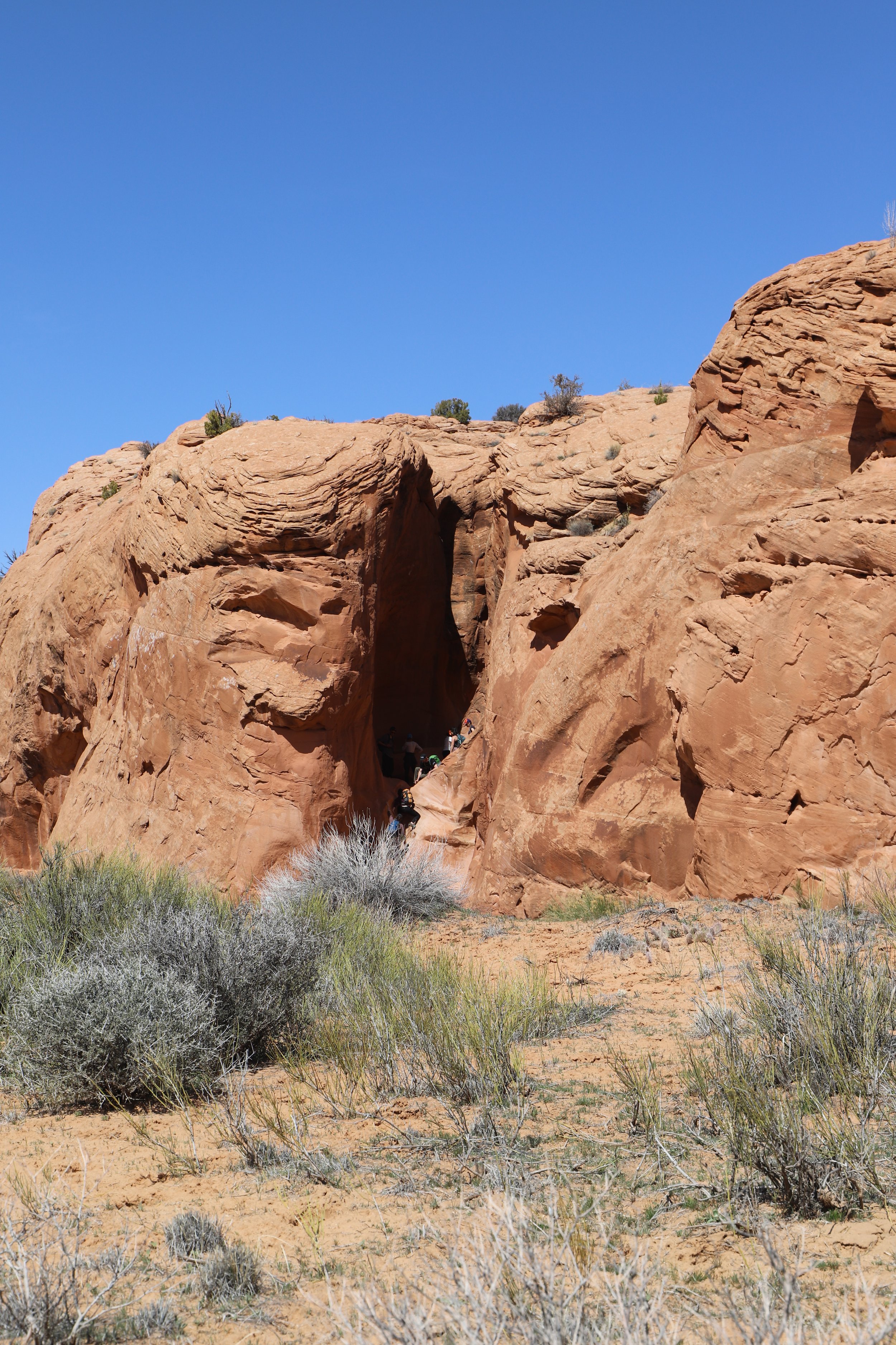
Entrance to Peekaboo
We traveled through Peekaboo first. There were only two difficult spots, and they are both at the beginning. The first challenge is the immediate climb into the canyon. It’s about 15-20ft up a slippery sandy wall. As I was the only adult with my two children, we took the help of another hiker that was present, and he helped pulls us up into the canyon. A few turns later inside the canyon there was a deep puddle. I was able to help my 6-year-old over the puddle, but my 10-year-old got pretty wet, as did I. Other hikers thought to take off their shoes and socks. That might have been a better idea… We hiked with wet feet.

Hiking up into Peekaboo Slot Canyon
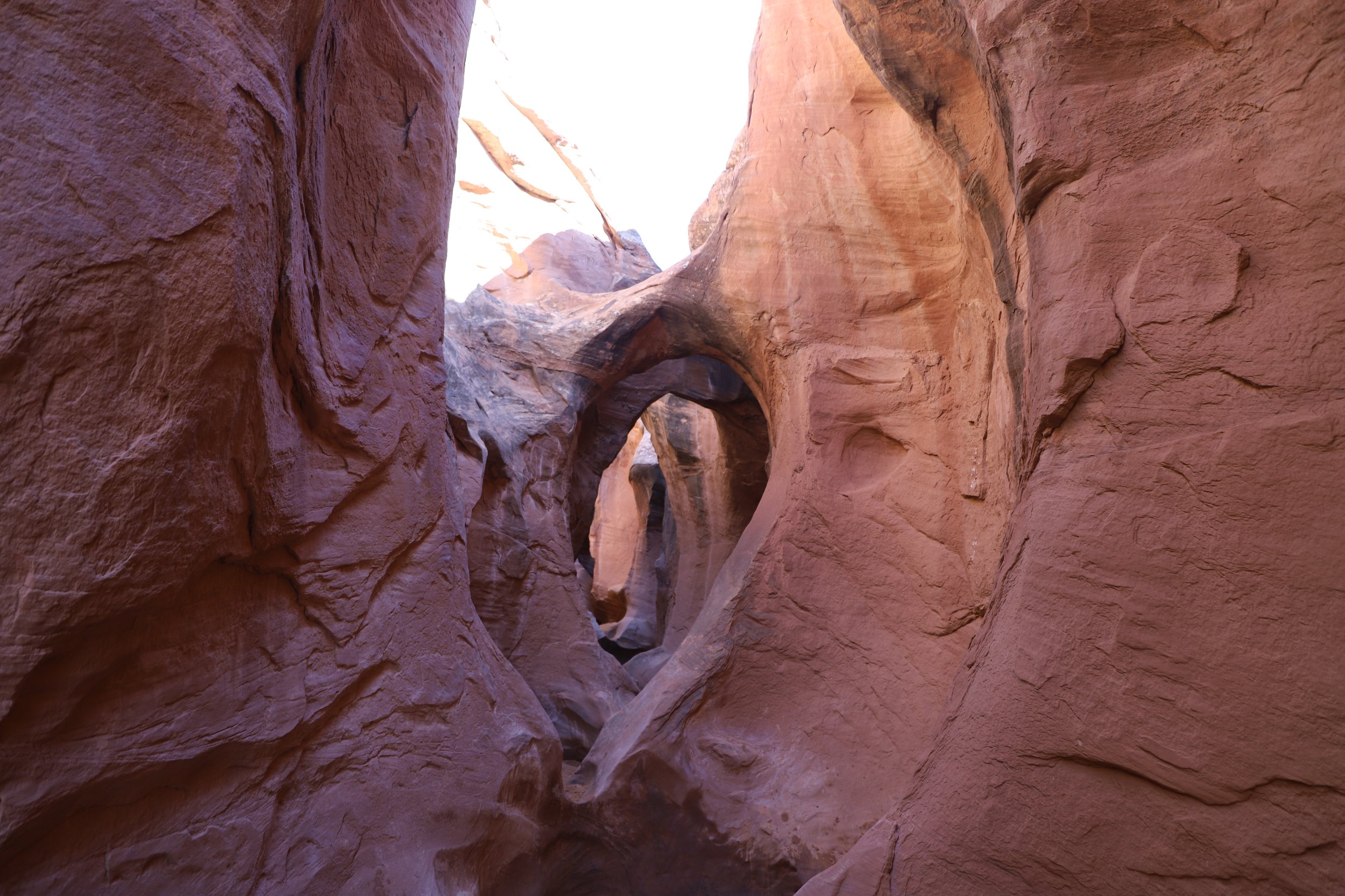
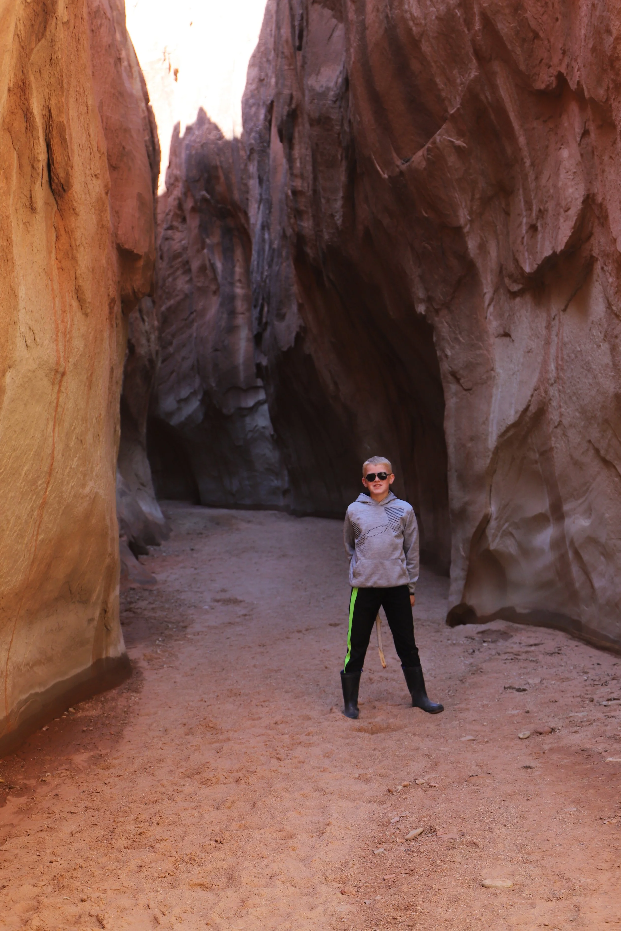
The iconic arches are right at the beginning of Peekaboo. From this point, Peekaboo isn’t very hard other than a bunch of short and tight spots that my boys fit through easily, while I had to think a bit how to squeeze through.
Peekaboo Slot Canyon - Grand Staircase-Escalante National Monument
Peekaboo Slot Canyon is marked in green on my map. It’s only about 0.3 miles long. It took us 15 or so minutes, taking pictures and playing along the way. Then we found some cool rocks to sit on and have a memorable picnic lunch.
Hiking through Peekaboo
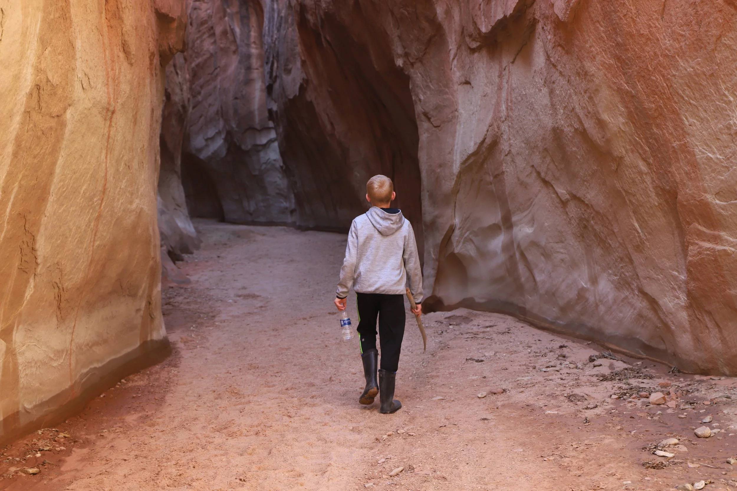
The high walls eventually shrink. The canyon continues for a bit longer, but it’s less dramatic.
Hiking with elementary-aged kids in Peekaboo Canyon - We had a blast!
Peekaboo Slot Canyon is pretty much over at this point - with a few shallower sections remaining
Shorter section of Peekaboo
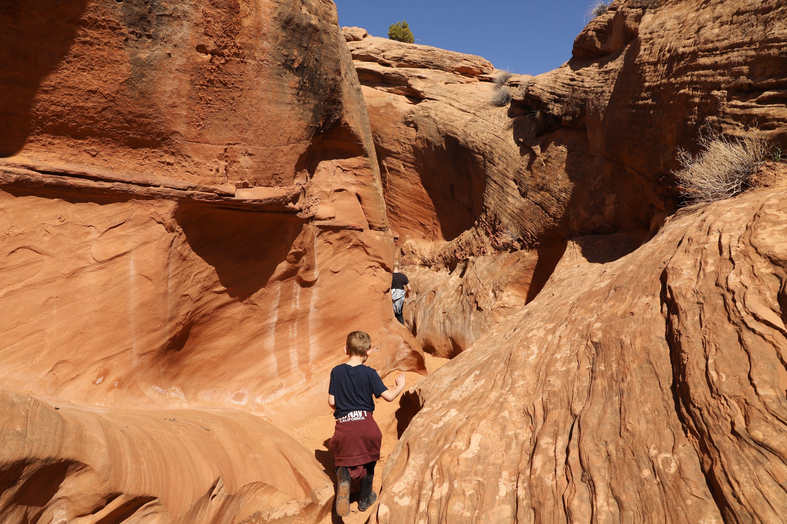
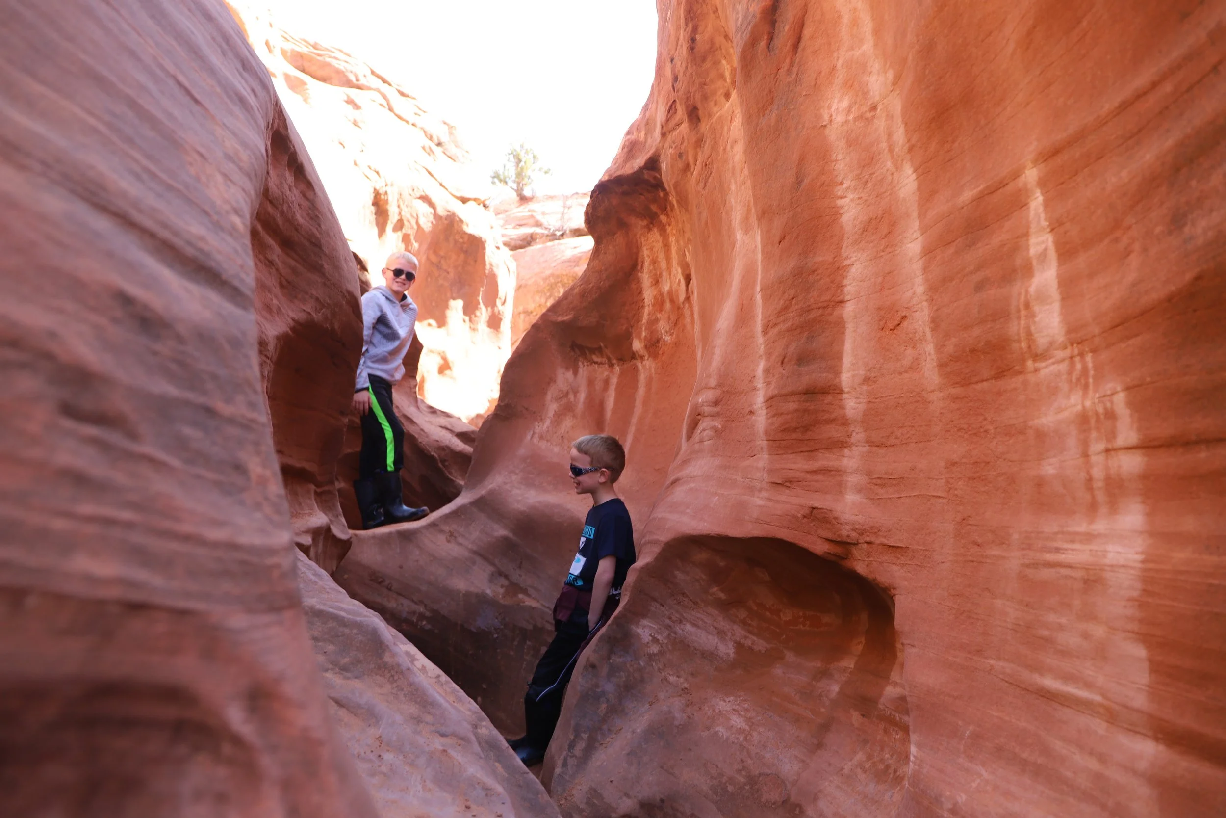
Hiking the loop between Peekaboo and Spooky Gulch Slot Canyons
Hiking out of Peekaboo Slot Canyon
If you are hiking these slot canyons in a loop, the next goal is to find Spooky Gulch, which is about 0.5 miles away (yellow trail). The trail here can be a little bit hard to follow because it primarily crosses on top of rock. Keep looking for rock cairns that mark the way. Restating - a GPS map app is a good idea.

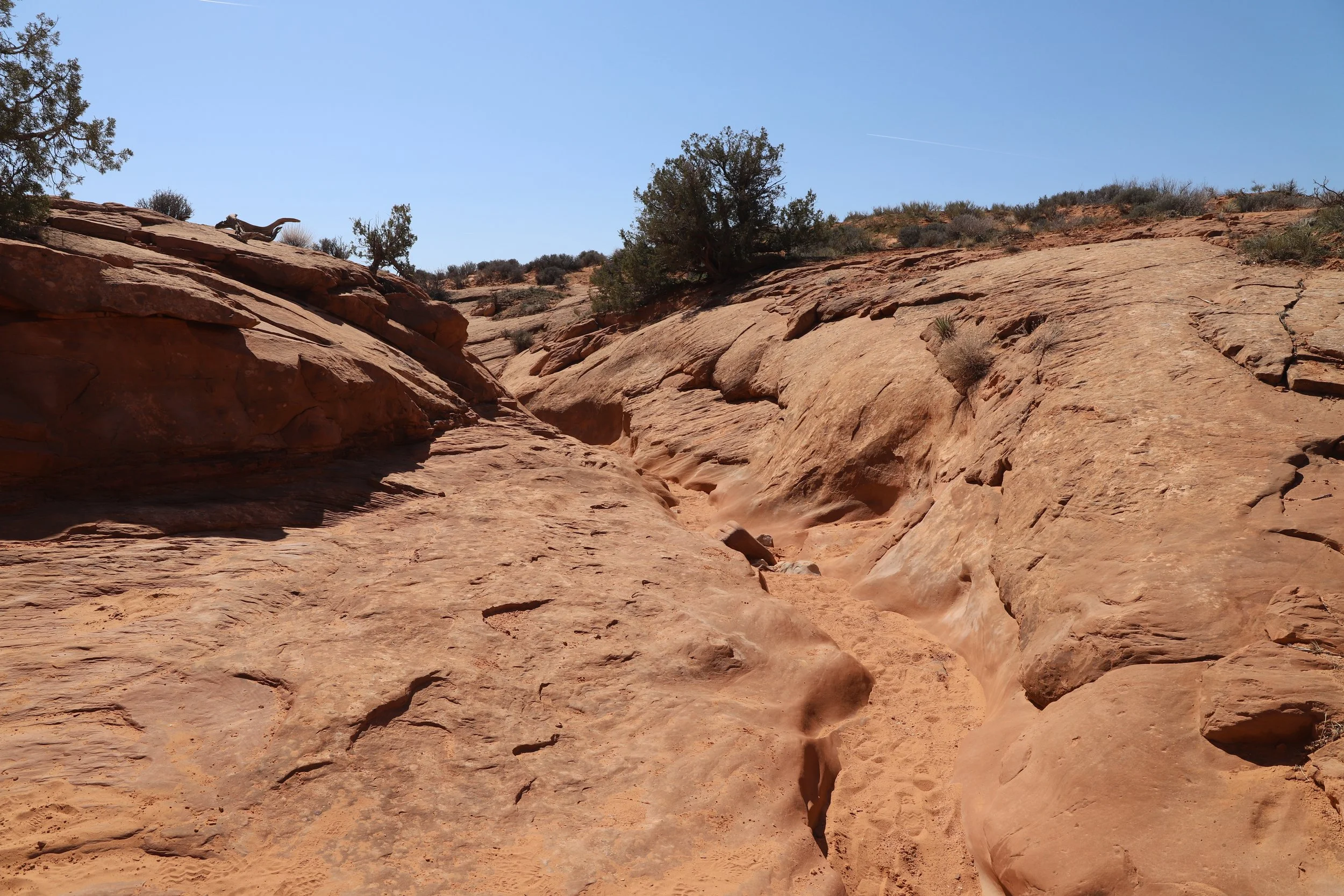
Very exposed trail between Peekaboo and Spooky Gulch
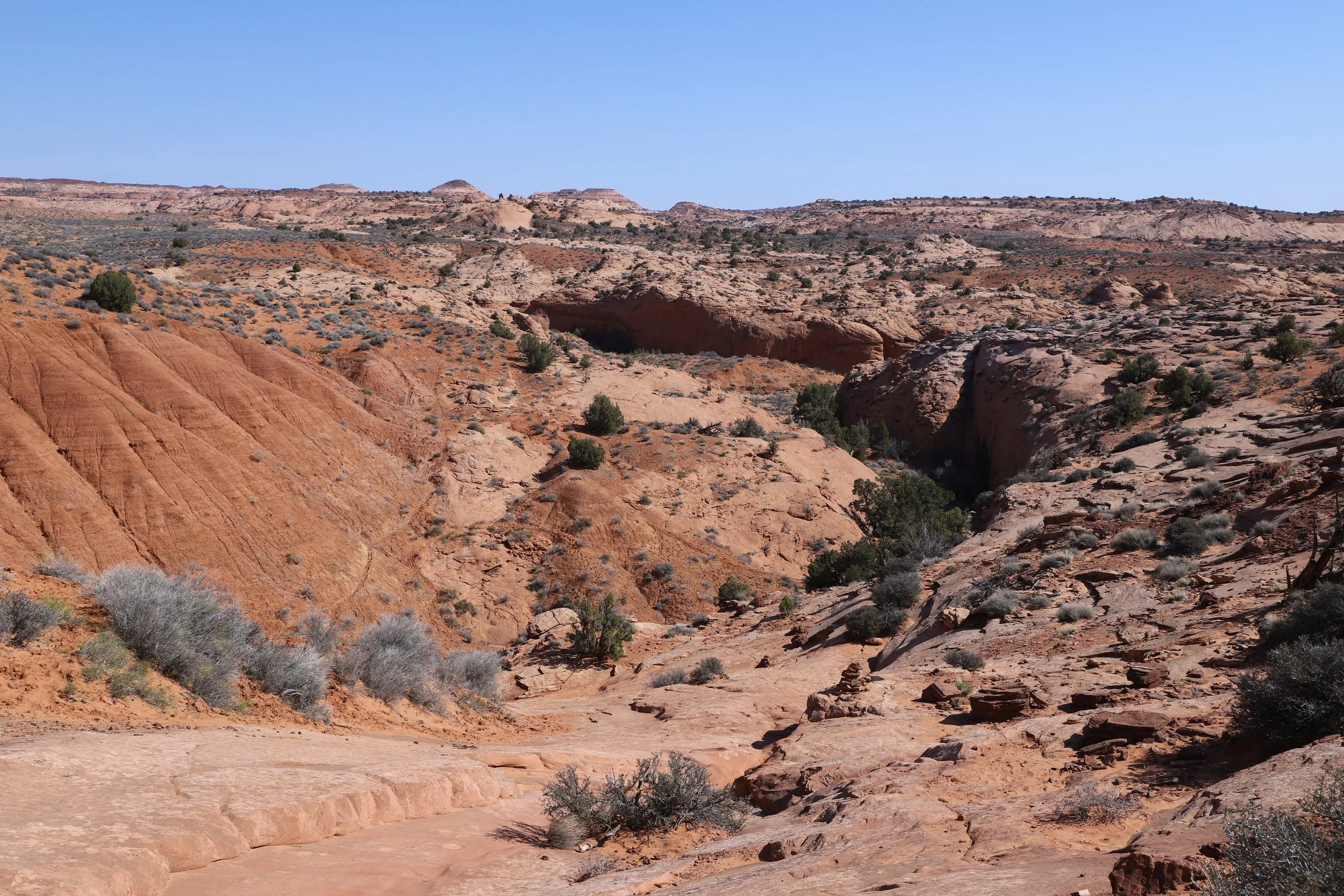
The crease down the middle of the rocks is what a slot canyon looks like from the top. The trail shows you the top of the canyons, but if you are hiking in a loop, you will leave Peekaboo to go find Spooky Gulch.
Follow the rock cairns and use a GPS map - this part of the trail can be hard to see
This section of trail and the walk back to the trailhead are the two hottest sections of trail. Every once in a while, there may be a Juniper, but even those do not provide much shade. Bring enough water to get through these sections of the trail, and don’t forget the sunscreen.
Bring extra water on this hike - there is no shade on the connecting trail between Peekaboo and Spooky Gulch
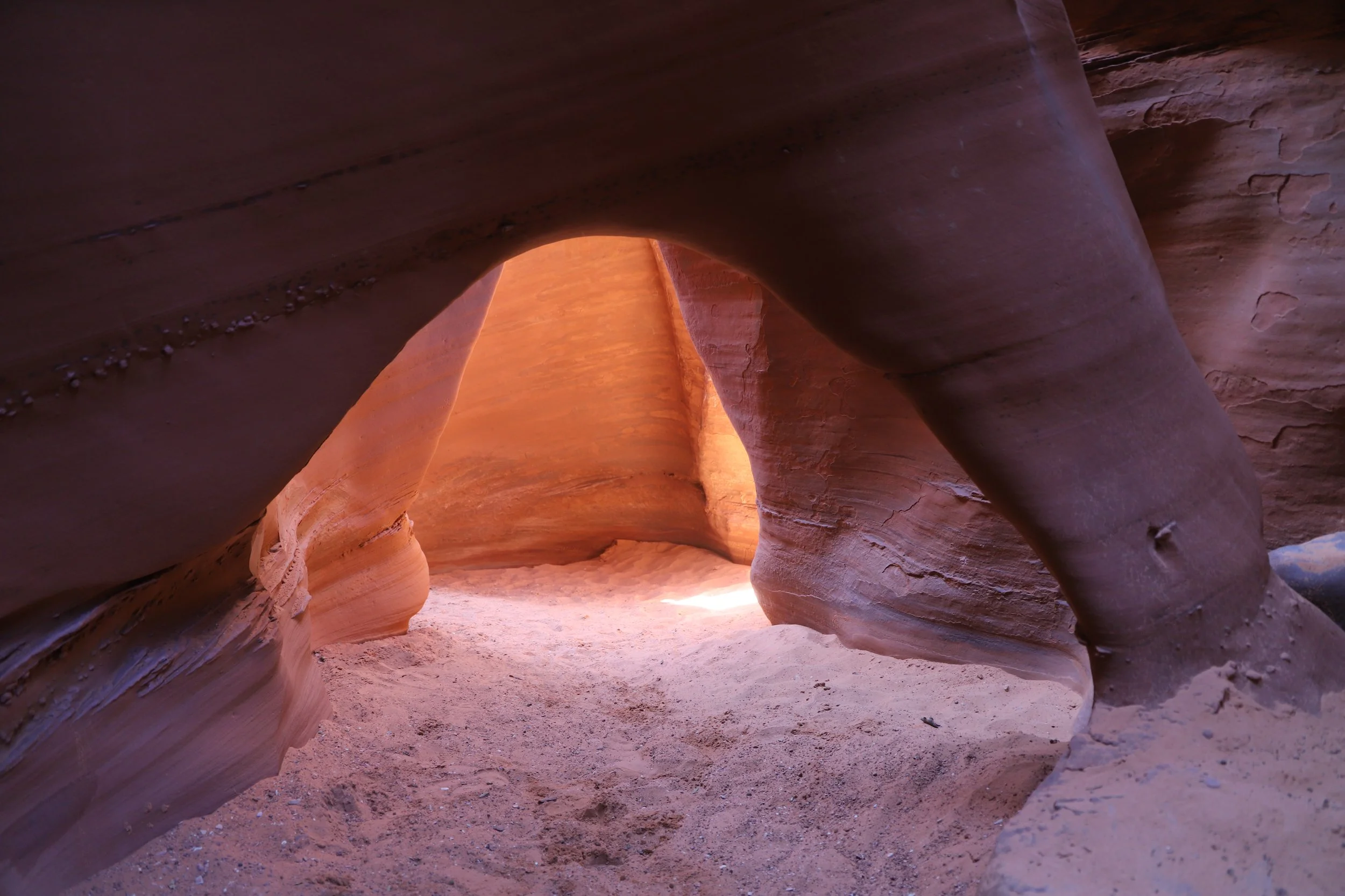
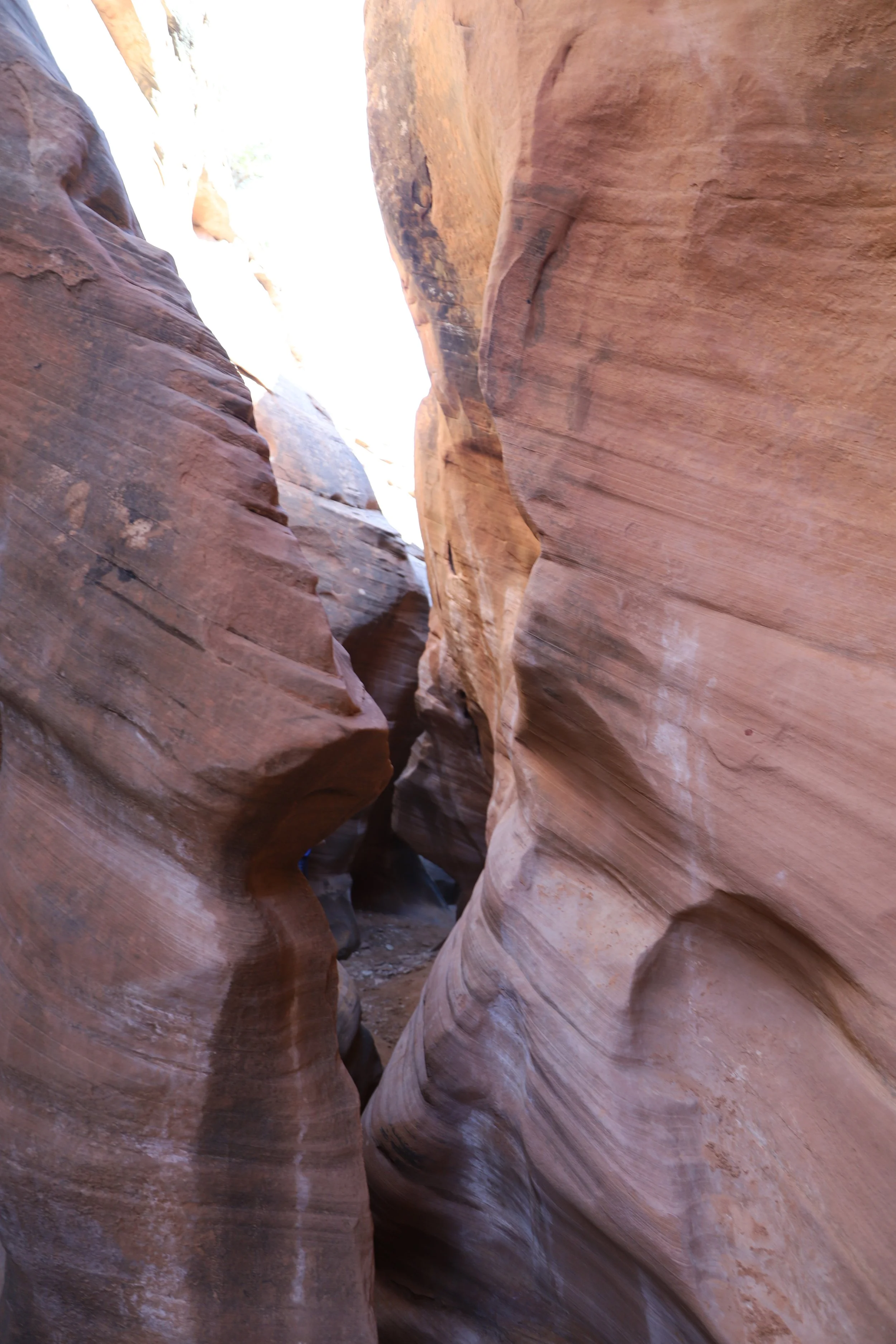
The rock cairns should bring you to entrance of Spooky Gulch. This canyon is just as pretty as Peekaboo, and it’s got a few more challenges to tackle.
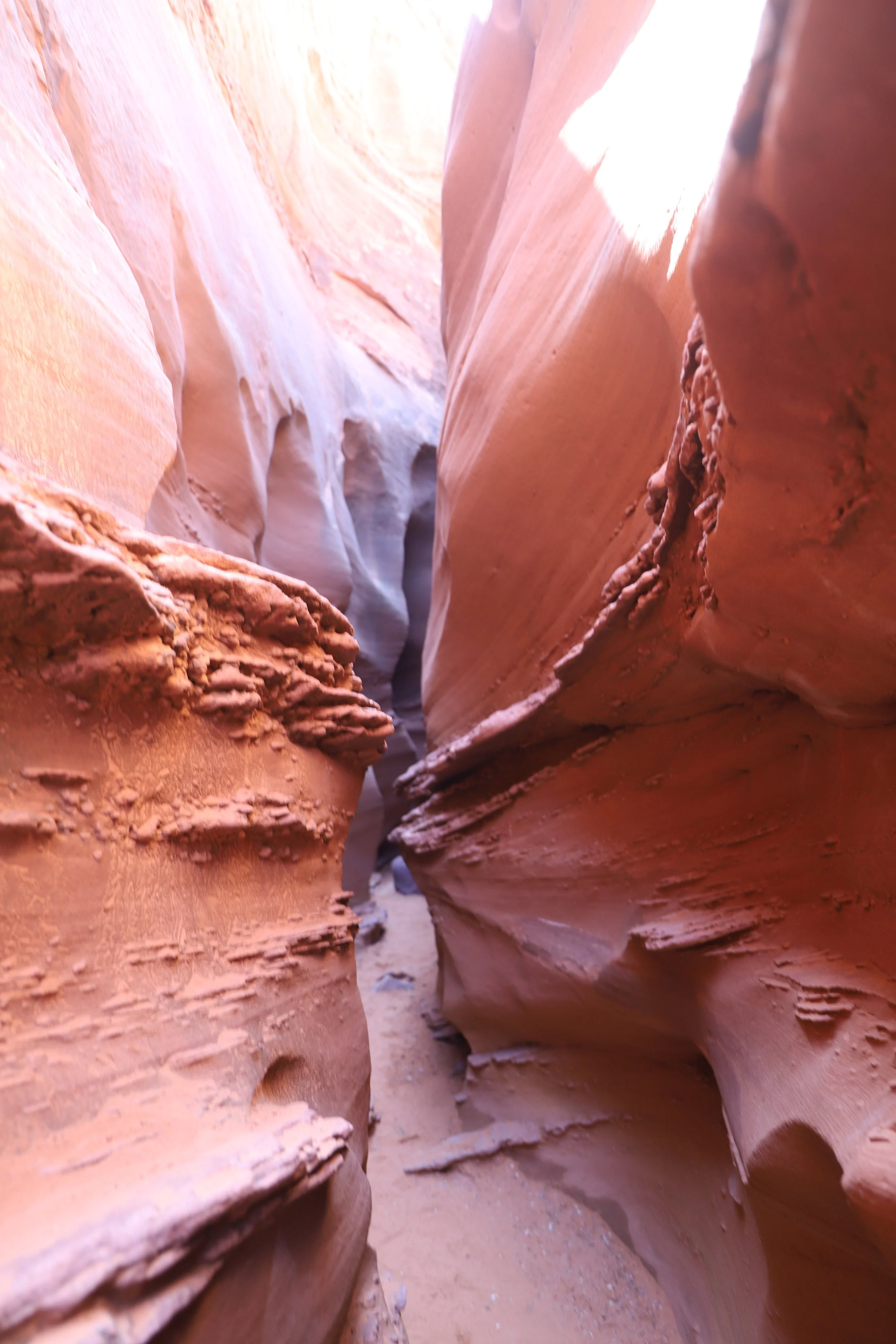
Spooky Gulch gets to just 10 inches wide - bring lots of water, but overall, pack light to squeeze through this last part of the canyon trail
The first tricky spot was about a 10-foot drop. There is a ledge to climb down first to and then it’s about a 6-foot drop. I went first. My 6-year-old went second. My older son helped him get to the first ledge, and then he had to jump into my arms. Took some courage, but no tears. My youngest really loved hiking this slot canyon. Last was my 10-year-old. He did it on his own with my hands there to catch him. No issues once we decided that this was a challenge that we could overcome.
The second challenge was another dramatic drop, this time around a twist. It wasn’t too hard in the direction we were going, we just slid around and down it, but we heard from others going the other direction that this spot took some effort to get over.
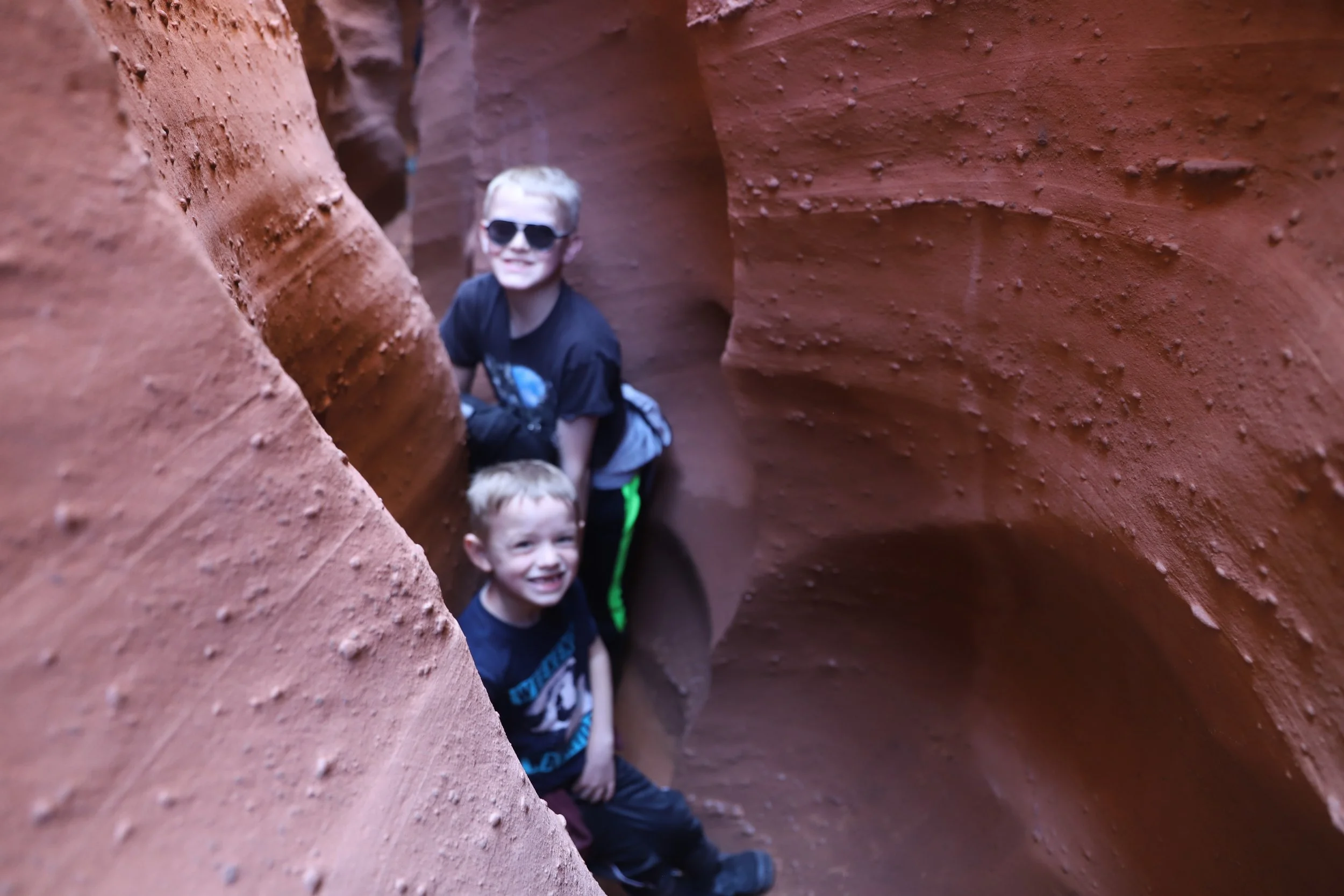
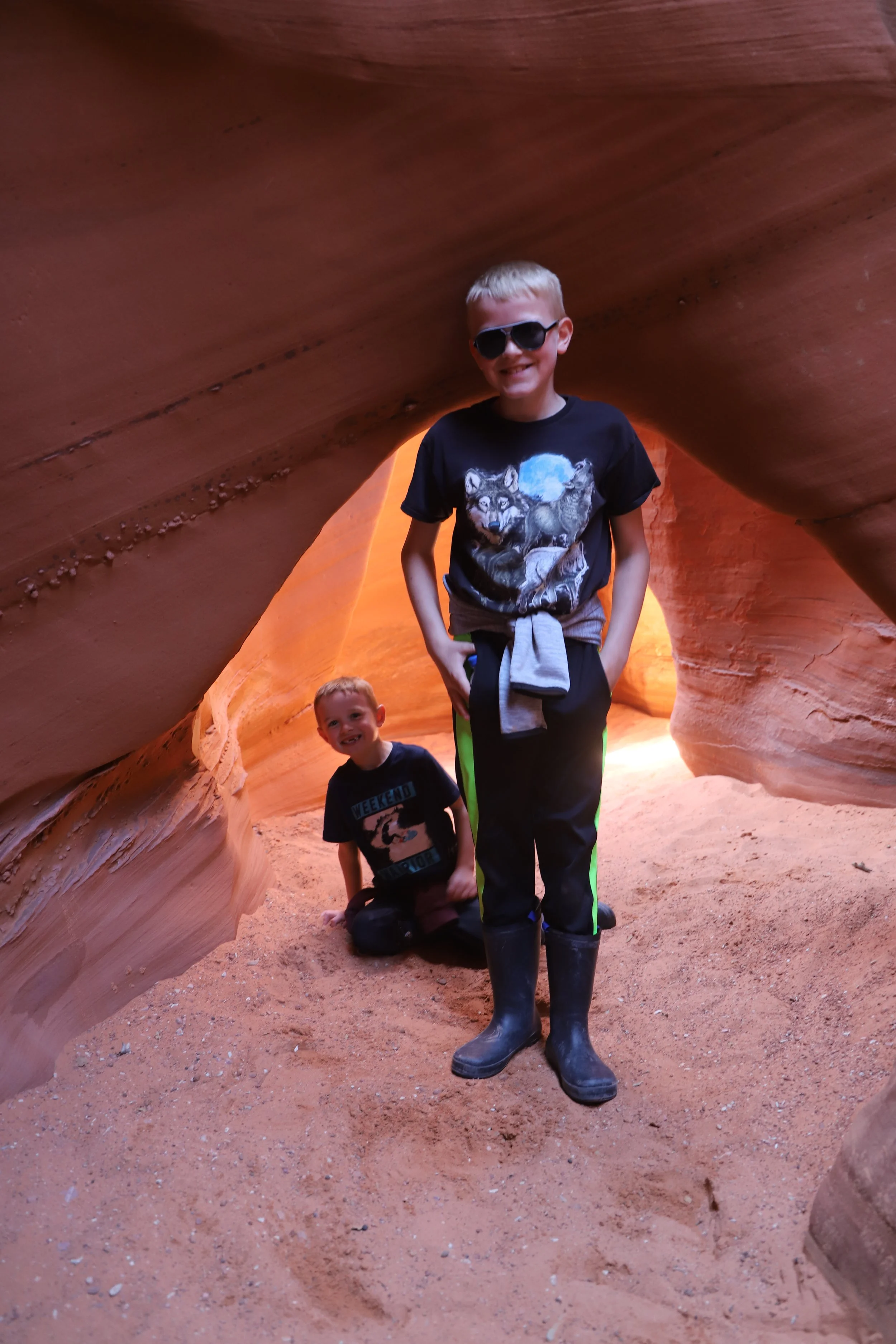
The last challenge was how tight Spooky Gulch gets (sometimes just 10 inches). I had to take off my backpack and pull it. I picked a direction for my feet and my head, and that was the way I had to stay while I hugged the rocks and squeezed through.
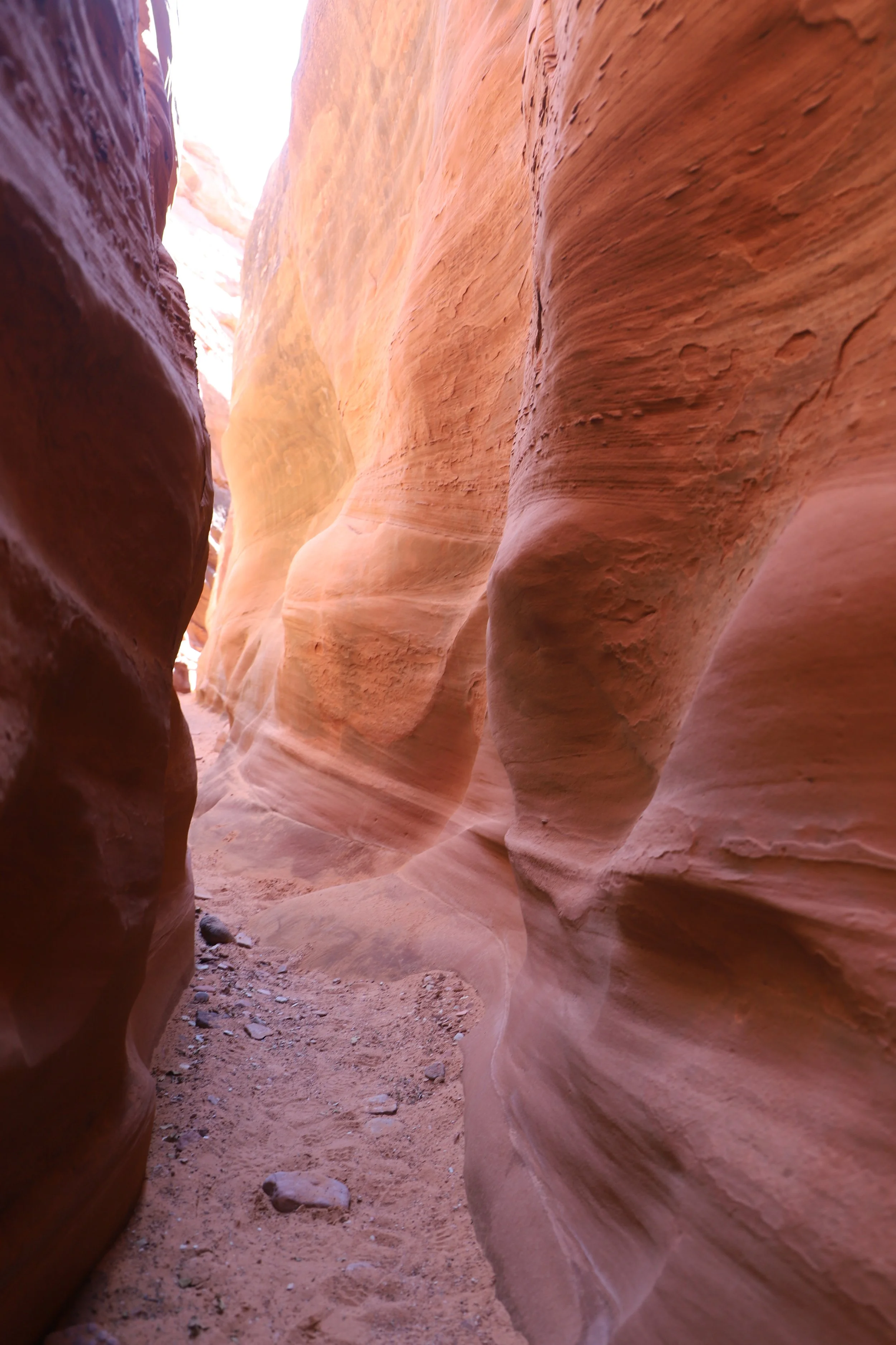
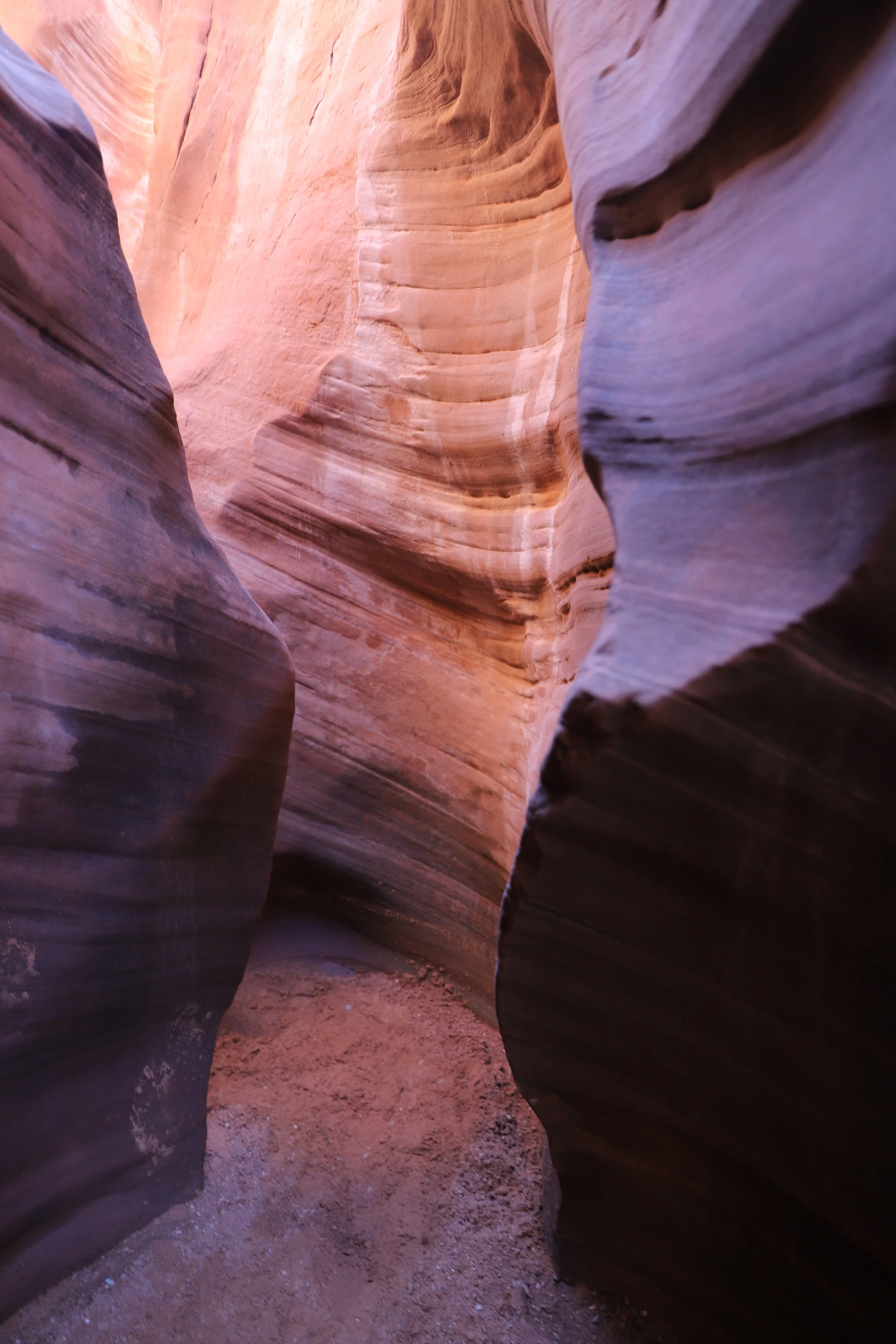
Spooky Gulch
You’ll note that I don’t have any of these tricky spots photographed - I was 100% focused on the challenge at hand and making sure my boys and I got around, over, and through the obstacles.
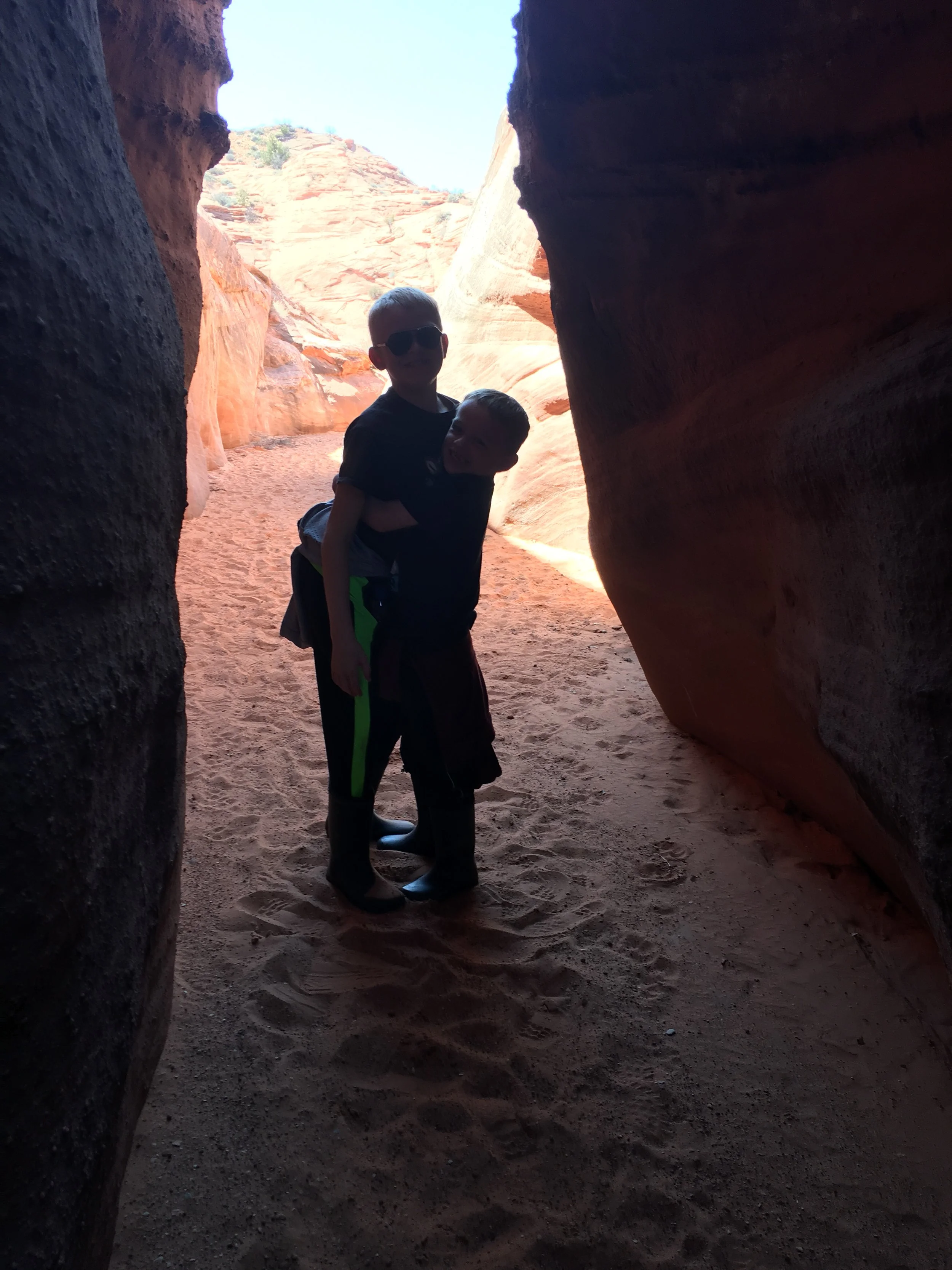
He was so proud of how small he was, knowing this was both a hard hike and that he fit through the walls much easier than his brother and mom
Spooky Gulch spits you back out near the entrance of Peekaboo, forming a nice hiking loop. This hike was hard, but it was fun because of the challenges. And my 6-year-old loved it because he was the “best” at it due to his small size.

Spooky Gulch
I did get a bit tired of the number of adults commenting on how amazing it was that I was doing this hike “on my own.” This wasn’t true. The boys and I tackled these slot canyons together and sometimes had the help of other nearby hikers.
Exiting Spooky Gulch
We did not go to Brimstone Canyon, due to the significant added milage, but for anyone interested, there is one last out-and-back slot canyon option if you turn left to stay in the wash (brown trail) and look for a canyon off on your left in about 0.8 miles (maroon trail).
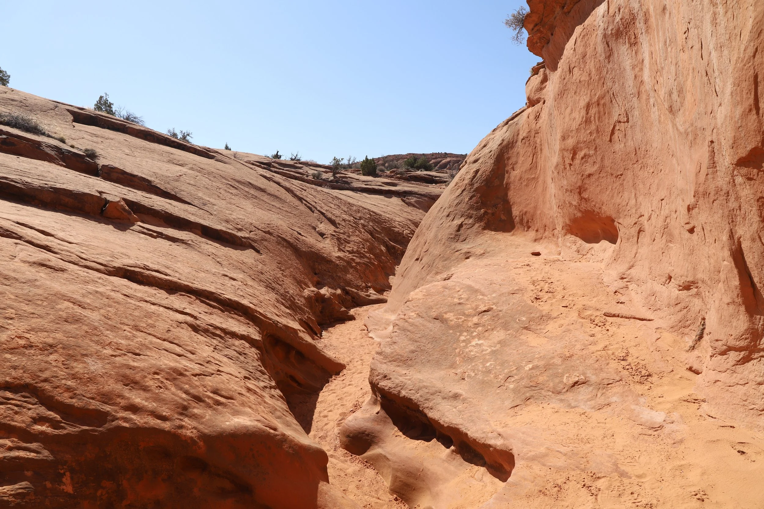
Dry Forks Narrows (blue trail) is visible from the exit of Spooky / entrance to Peekaboo - so we wandered over to check it out as well. We only wandered in a short distance because we still needed to get back up that big hill to our car. Dry Forks Narrows (for the small part we hiked in and out) had taller and straighter walls, and they were significantly further apart than Peekaboo and Spooky Gulch, but it still looked cool and would have been fun to hike the whole way to the Upper Dry Forks trailhead.
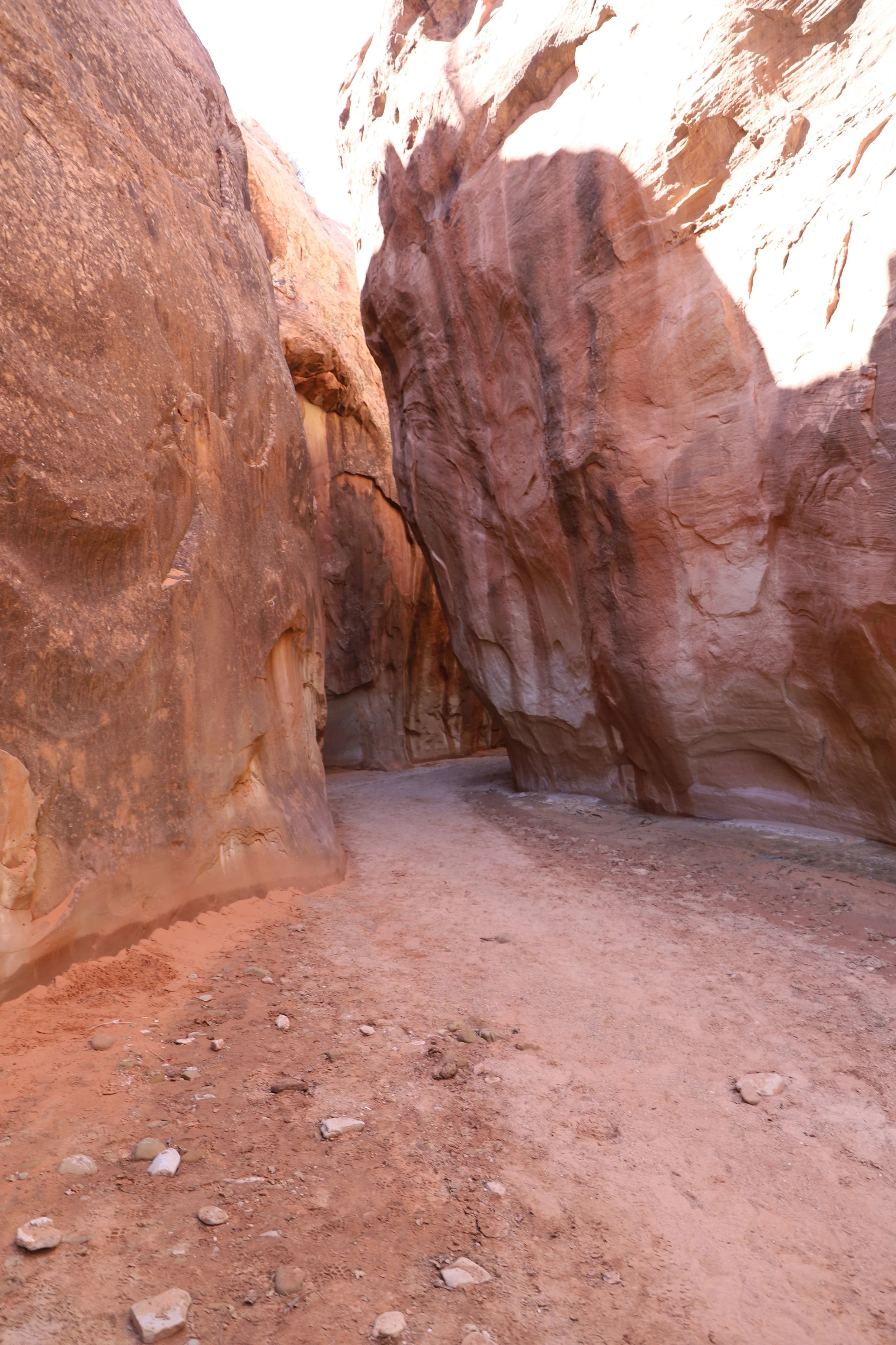
Inside Dry Forks Narrows
I’m still glad I had the truck, and that the Lower Dry Forks trailhead was where it was in 2019 - 1.6 miles is a lot when you are only 6. But knowing now that we could have hiked from a different trailhead through this canyon to get to Peekaboo and Spooky Gulch makes me a bit frustrated that I didn’t know this was an option. It seems like the better hiking choice.
Done with slot canyons - now the return hike back up the switchbacks
From here, we followed the trail (purple trail) back to the Lower Dry Forks Trailhead.
“Nearby” Things to Do
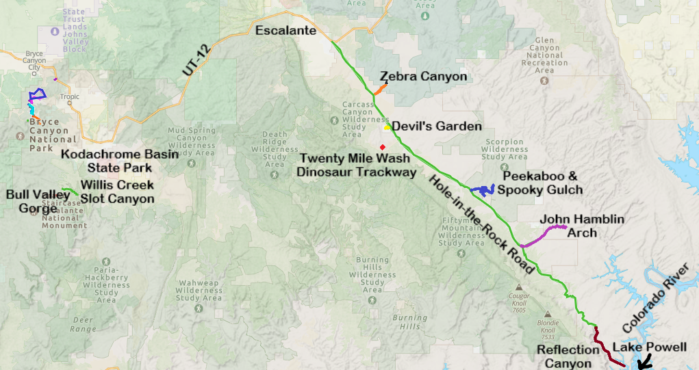
The trailhead to Peekaboo and Spooky Gulch is an hour from Escalante, so there isn’t much that is truly “nearby” other than a couple of other trailheads along Hole-in-the-Rock Road, several of which are likely going to be too much hiking for one day. But there is a lot to do if you stay in Escalante. Below are things to do, assuming your start location is in Escalante.
Zebra Canyon
A relatively easy 5.25 mile out-and-back hike to a stunning slot canyon. This is a long and hot trail however, and the canyon itself is likely to be in the water. Expect to get wet.
This trailhead is 40 minutes from Lower Dry Fork Trailhead (on the way back to Escalante) along Hole-in-the-Rock Road, and 20 minutes from Escalante.
Devil’s Garden
30 minutes from Escalante - Continue down Hole-in-the-Rock Road for another 4 miles from Zebra Canyon. Devil’s Garden isn't so much a formal hike, it's rather a place to explore with a beautiful arch. The trails crisscross throughout this park, so just enjoy. There are vault toilets to use here as well, if you are looking for nearby bathrooms.
Twenty Mile Wash Dinosaur Trackway
45 minutes from Escalante - Continue along Hole-in-the-Rock Rock for 6 miles (2 miles past Devil’s Garden) and turn right on Left Hand Collet Cyn Road. Follow this side road for 2.5 miles. For anyone interested in finding some dinosaur footprints, this is a quick place to explore. The Sauropod footprints (big round circles) are easy to spot. There are also some Therapod footprints (3-toed) but these are harder to find.
John Hamblin Arch
90 minutes from Escalante (varies - depending on which trailhead you start from) - A challenging multi-day hike through Coyote Gulch that is accessed via further down Hole-in-the-Rock Road. Still on my hiking wish list. We are trying out backpacking again in June 2026 - the boys are quite a bit older than when we went last time. That will answer if this is a viable hike with our boys or if we need to wait until they fly the nest.
Reflection Canyon
2. 5 hours from Escalante - Another challenging multi-day hike starting at the end of Hole-in-the-Rock Road and ending at the Colorado River. I’m not sure I’ll ever quite have the courage to do this hike, due to limited water supply on a multi-day trip. But I do think about the pictures of this canyon frequently - so maybe someday I’ll figure out how to make this hike feasible.
Bryce Canyon National Park
1 hour - Bryce Canyon National Park is about 75 minutes from Escalante (to the west) along UT-12. I would recommend switching lodging to be able to enjoy a few days hiking through Bryce Canyon. The hikes at this park are difficult, but if you are looking at hikes in Grand Staircase-Escalante, the difficulty of this park isn’t going to be a roadblock for you.
Kodachrome Basin State Park
1 hour - Kodachrome Basin State Park sits just to the east of Bryce Canyon National Park, and is about an hour drive from Escalante. It has some of the same hoodoos, although they are not as dramatic, nor are there as many. It’s a fun park to hike through, and much quieter than its nearby National Park.
Willis Creek Slot Canyon
1 hour - Willis Creek Slot Canyon is also to the west of Escalante (and west of Kodachrome). Willis Creek Slot Canyon is an easy, shaded slot canyon with minimal change in elevation, and has stunning, tall, and colorful walls. This is an out-and-back hike for as long as you’d like. The max hike is 6 miles long. The trailhead is along Skutumpah Road, a sandy, bumpy road where a higher clearance vehicle is going to be appreciated. The canyon is located very close to the parking area.
Bull Valley Gorge
1 hour - The trailhead to Bull Valley Gorge is 6 minutes further along Skutumpah Road, past the Willis Creek Slot Canyon trailhead. Bull Valley Gorge is a short (1 mile) but difficult slot canyon. This can be a loop hike out to the start of the canyon, through it, and scrambling back up, but there are some major obstacles to navigate through within the canyon. We explored about a third of the way through the canyon and returned the way we came in. Bull Valley Gorge is also the site of where a truck can be found wedged in the canyon walls from an accident in 1954.
Lower Calf Creek Falls
30 minutes - The trailhead to Lower Calf Creek Falls is just over 30 minutes to the east of Escalante, just off of UT-12. It’s a relatively easy 6 mile out-and-back hike to an impressive waterfall, and there are petroglyphs to find along the way.
Anasazi State Park Museum
40 minutes - For anyone heading to Capitol Reef National Park, Anasazi State Park Museum is an interesting, quick stop, also off of UT-12. Just outside of the museum, there is a six-room dwelling replica constructed on the original site.
Long Canyon
1 hour - The trailhead is quite a bit off of UT-12. It’s a really easy and short hike through a slot canyon, but the slot canyon isn’t that deep, and I don’t think it was worth the drive out this far.
Capitol Reef National Park
90 minutes - Like Bryce Canyon, Capitol Reef National Park is worth switching lodging locations to be able to enjoy a few days hiking in this park. Out of all of Utah’s National Parks, this one is the quietest. That on its own made it a special place to visit.
More from www.NatureImpactsUs.com
To see more of my posts, click on any pin. There will be a hyperlink to my post on that particular hike.