Trail to Lower Calf Creek Falls in Grand Staircase-Escalante National Monument
If you enjoy my blog, please consider signing up below for email notifications of my latest posts. I will not share your email.
Escalante’s Best Waterfall
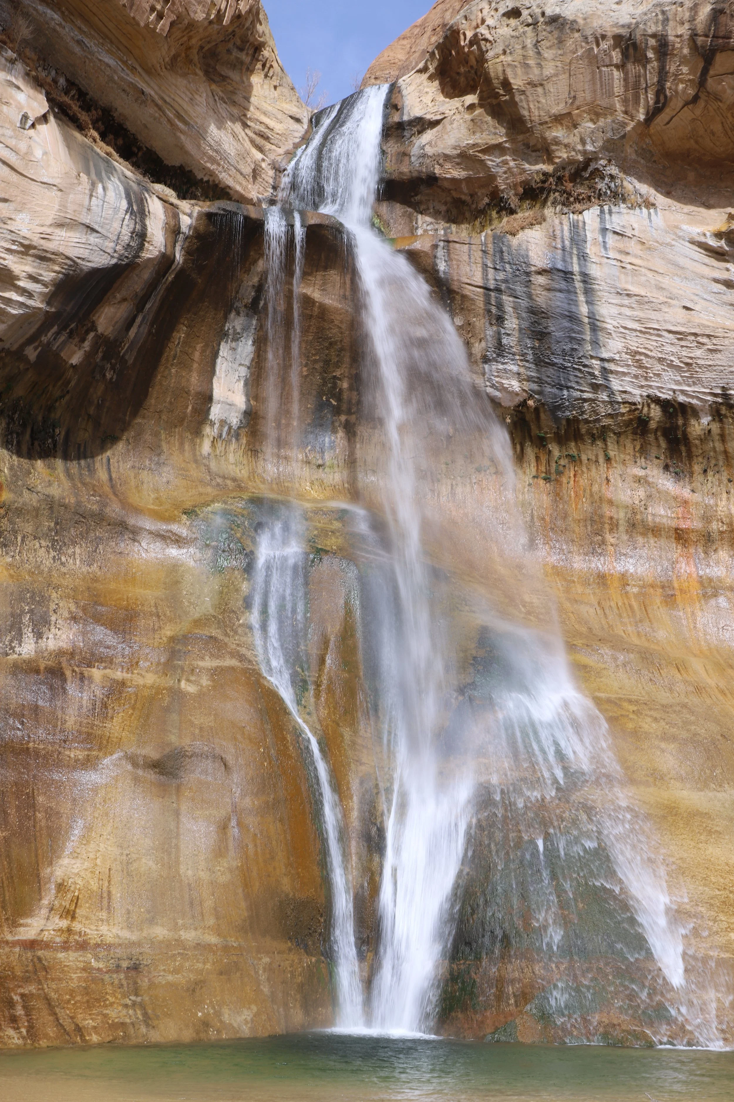
It’s not hard to be the best waterfall in Grand Staircase-Escalante National Monument when there aren’t many waterfalls, but Lower Calf Creek Falls is a fun waterfall hike, and this is one of the more popular hikes in Grand Staircase-Escalante. The trail is relatively easy, although this is a longer hike. The waterfall at the end is 126ft tall, and there is an unobstructed view, with a pool of water beside it for anyone that needs to cool off. We visited in March and had jackets on for the first half of the hike, so we weren’t brave enough to jump in. I’m not sure how deep it is.
Disclosure- I haven’t been to Upper Calf Creek Falls yet… It might be too bold of me to have a favorite waterfall without visiting the other one. For anyone looking for nearby waterfalls, there is also a third one, Mossy Falls, but this is in Bryce Canyon National Park, and it’s pretty small.
Location
The trailhead to Lower Calf Creek Falls is less than 30 minutes from the town of Escalante, Utah. Escalante is small, but has campgrounds, cabins, and hotels, and this is a great lodging option for anyone planning to hike to this waterfall.
The trailhead to Lower Calf Creek Falls is along a short, paved road directly off of UT-12. The trailhead is well-marked, and any car will be able to access it.
UT-12 is one of the most beautiful highways I’ve ever been on, and it essentially connects Bryce Canyon National Park with Capitol Reef National Park. Escalante is approximately in the middle of this drive. Stopping at Lower Calf Creek Falls would make a great day excursion for anyone driving between these two National Parks.
Lower Calf Creek Falls Trailhead Location
Logistics
The trail to Lower Calf Creek Falls resides within Grand Staircase-Escalante National Monument. There is a $5 fee to park in the lot (as of 2026), or if you display your America the Beautiful Pass, parking is free.
There are bathrooms at the trailhead but no running water. This a desert and it’s going to be hot and dry. Bring twice as much water as you think you can drink. For us, that’s 2L/person in the cooler months, and 4L/person in the summer months.
The trail is easy but longer. Plan for a 4-hour hike, maybe a little longer if you plan to splash around by the waterfall or in the creek along the way.
Hiking to Lower Calf Creek Falls
Distance / Elevation Gain - 6.2 miles / 520ft
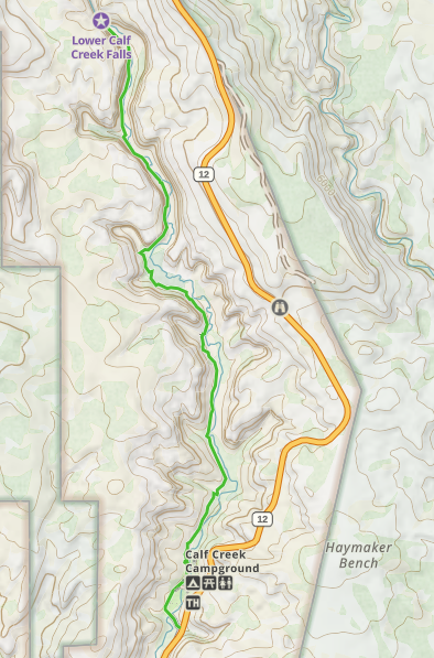
Lower Calf Creek Falls Trail Map
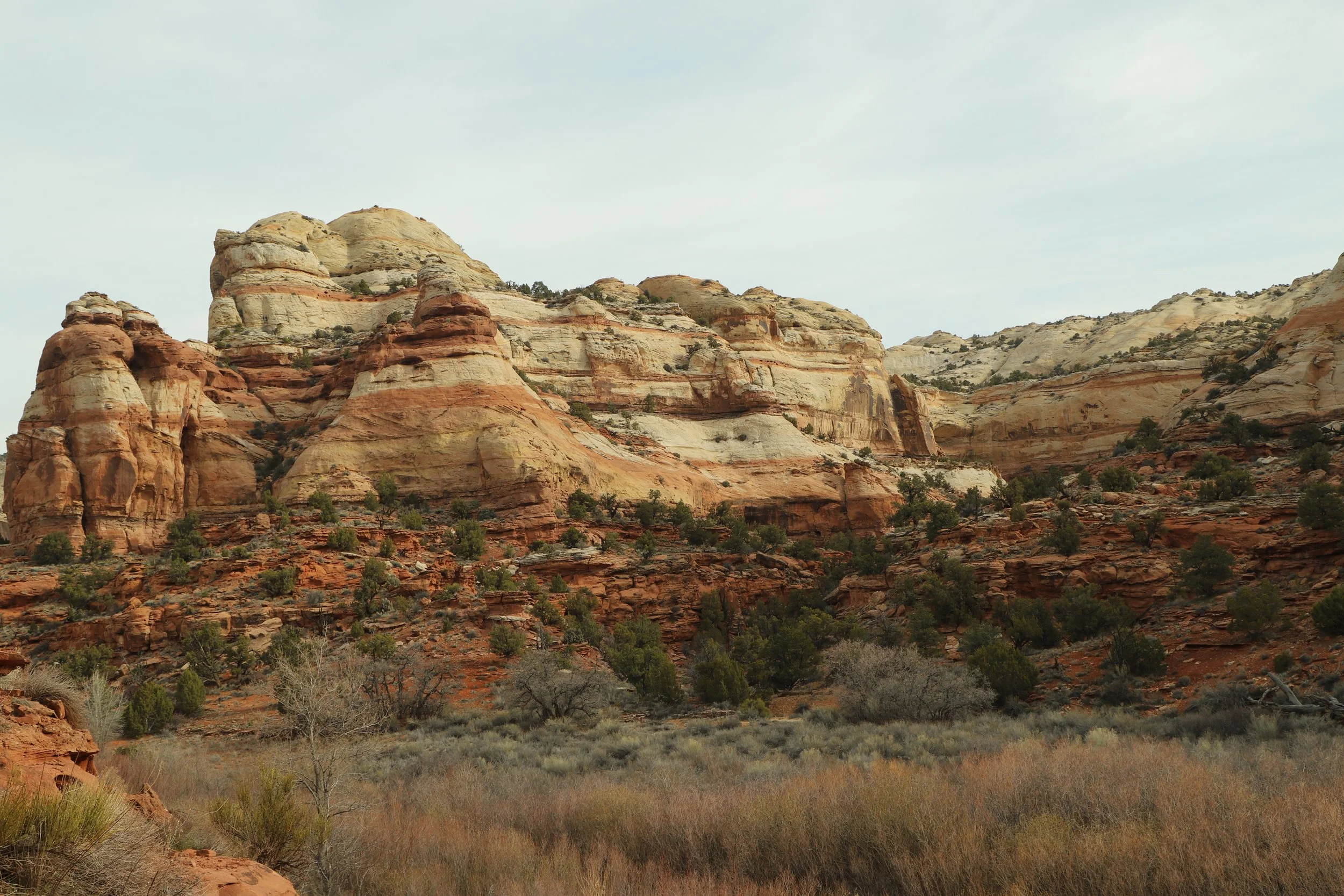
Hiking out at Lower Calf Creek Falls is one of the easier trails in Grand Staircase-Escalante. The trail is clearly marked. It follows Calf Creek the entire way, although it often isn’t visible. The trail has a gentle incline out to the waterfall, with a few steeper hills.
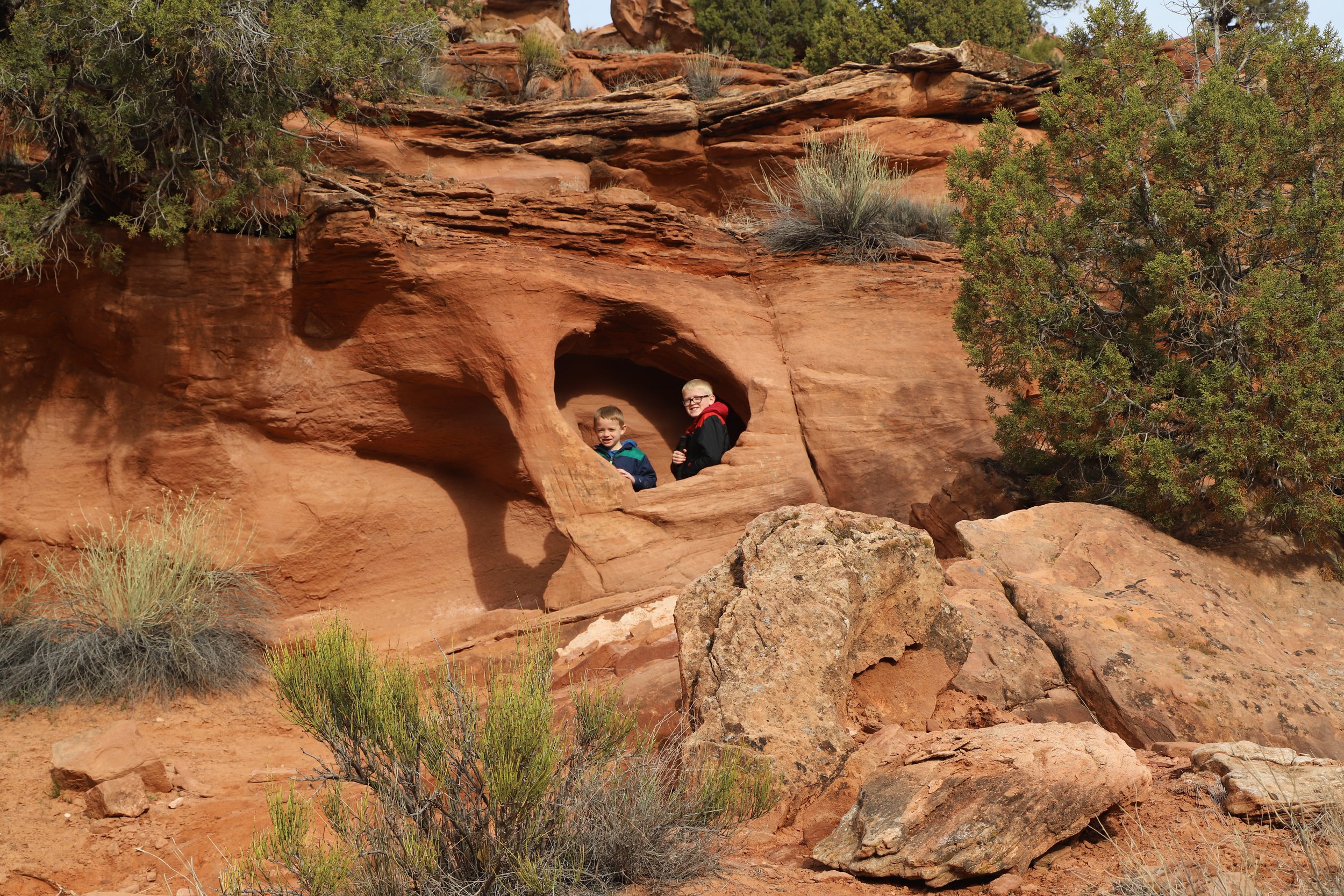
Playing in the hills along the trail
Close to the trailhead, up on the left, there are some rocks with holes in them - a magnet for young hikers.
Heading out on the trail to Lower Calf Creek Falls
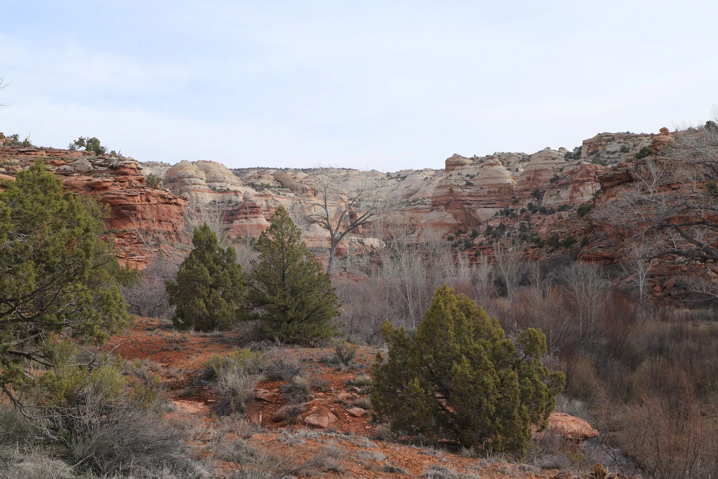
The trail to Lower Calf Creek Falls stays within this amazing canyon of colorful, striped walls. The trail is not shaded, so the best time of day to hike in the hotter summer months would be the early morning. Or plan to jump in the water at the end to cool off, bring an umbrella to create your own shade, and pack 4L of water per person. There are also a few places along the way where the trail dips down to the creek where you could get wet as well.
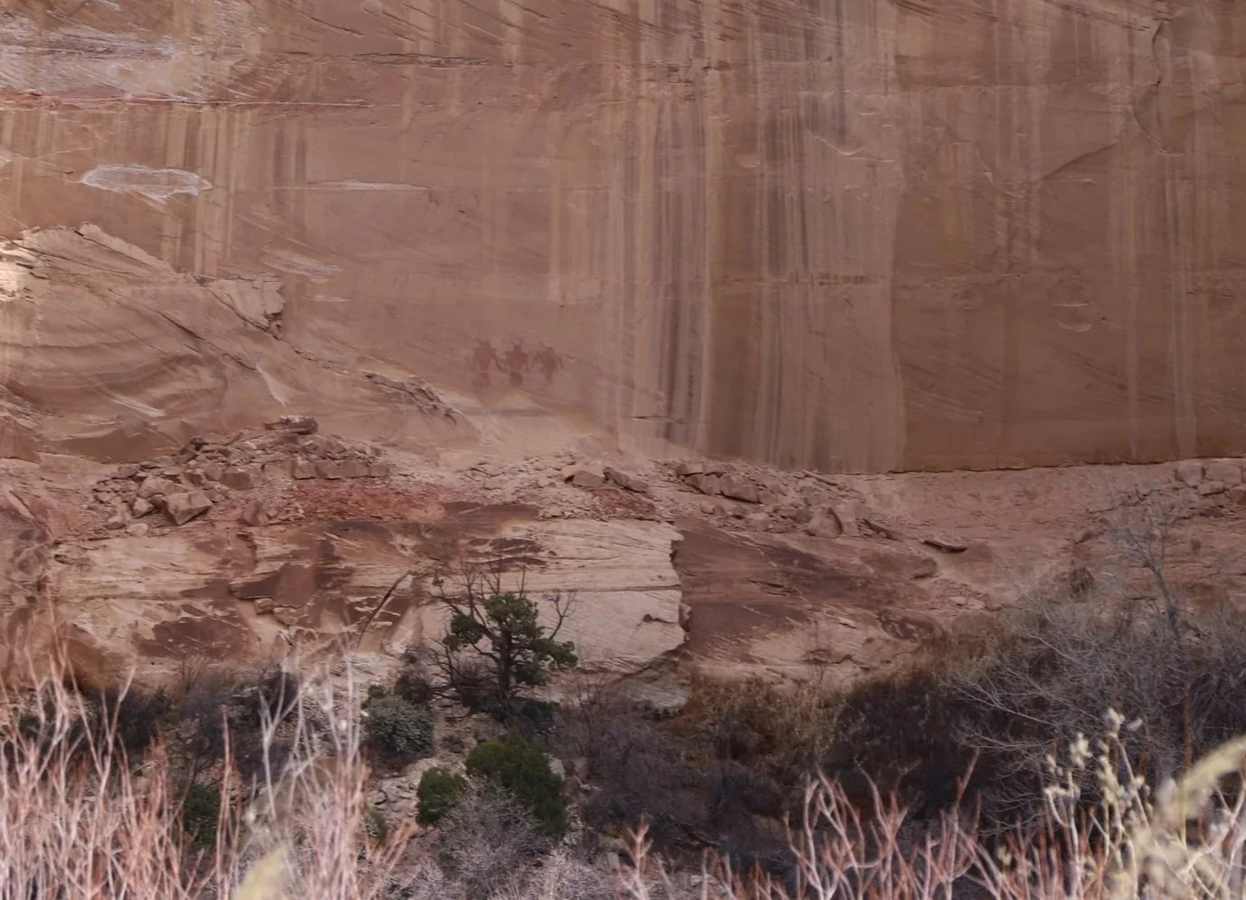
Pictographs (painted) along the trail
We found some pictographs along the base of the canyon walls as we hiked. These are pictographs (not petroglyphs) because they are painted on the walls. Petroglyphs are carved into the rock.
The hike out to Lower Calf Creek Falls is an interpretive hike. If the trailhead is out of the trail maps which explain the numbered signs, here is the online version from the Bureau of Land Management: Official Lower Calf Creek Falls Trail Map. You can find these pictographs by looking for sign #9 along the trail.
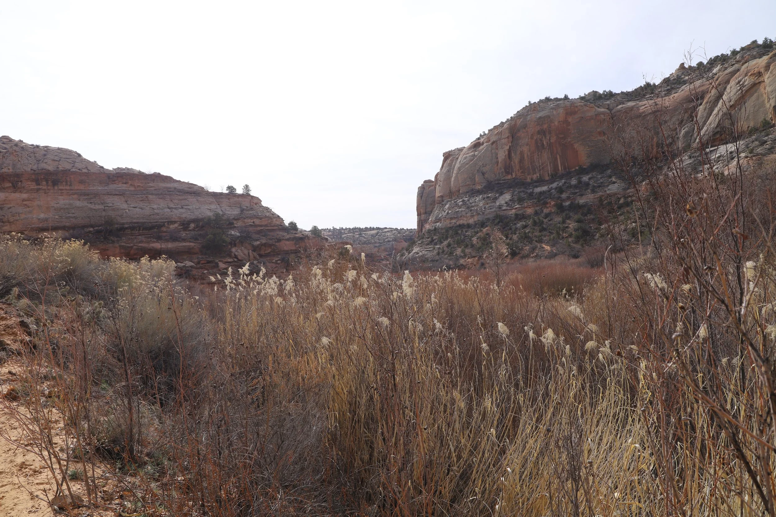
Walking through the canyon - The tall grass is close to the water in the creek
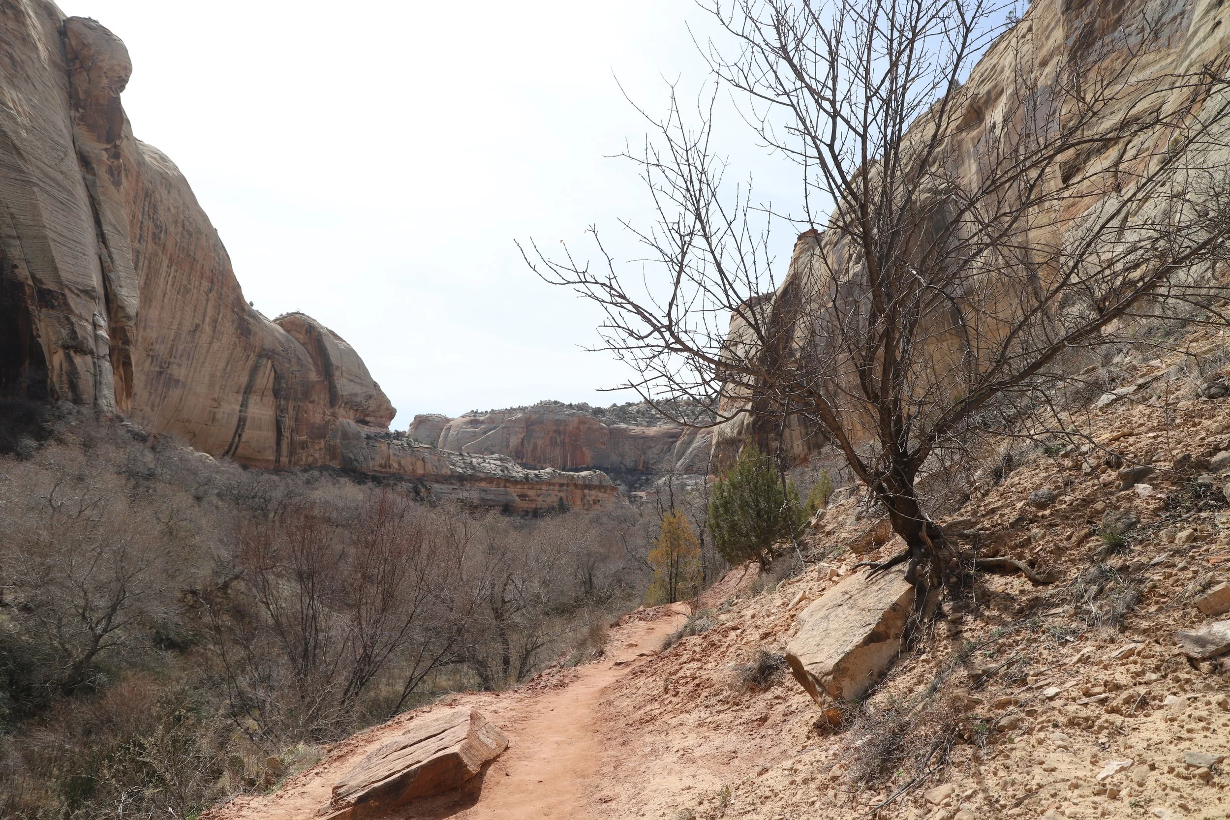
Trail to Lower Calf Creek Falls near Escalante
I did mention at the beginning that this is a pretty easy hike, but there are a few steeper hills. One is pictured below. My boys did fine. We took our time and enjoyed snacks along the way.
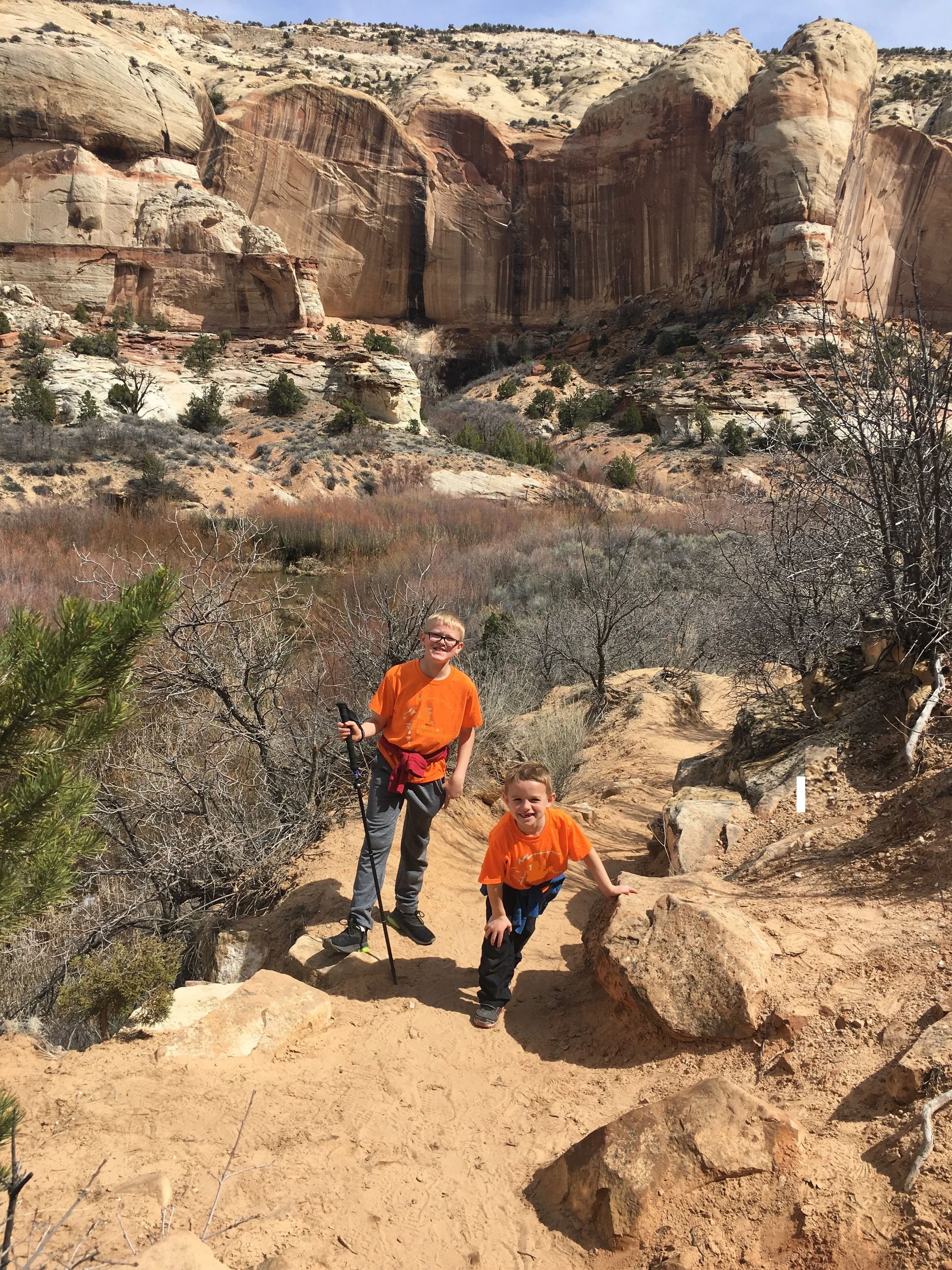
My hiking buddies - on their way to the waterfall
This waterfall is very much worth the effort to get out here. There are some nice shady spots to enjoy a picnic lunch while looking at the waterfall. We didn’t go swimming. You can see that we had put our jackets back on. It was cold sitting in the shade on a day in late March. I can imagine though that swimming would be fun in the summer.
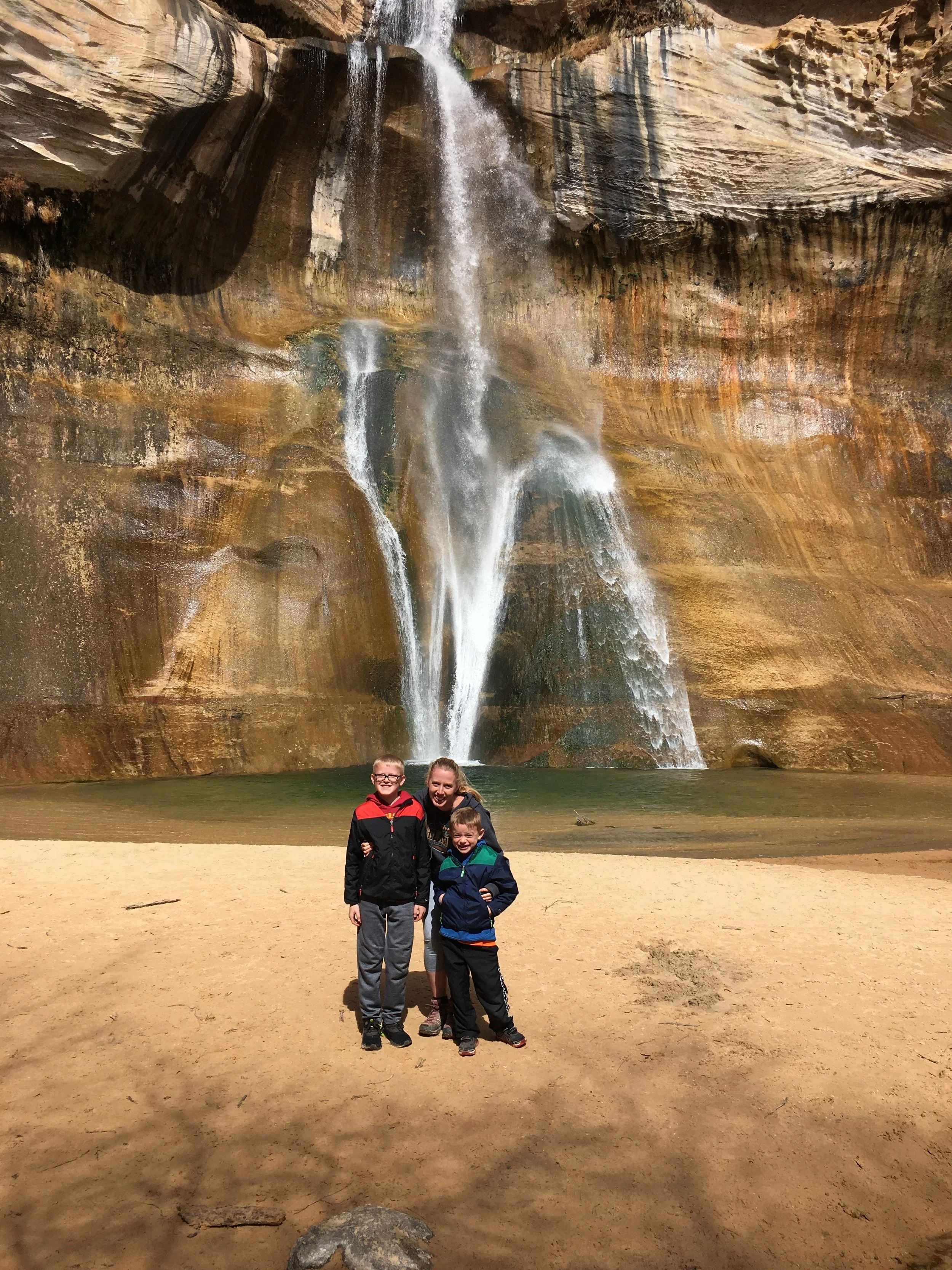
We made it to Lower Calf Creek Falls!

Lower Calf Creek Falls - March 2019
“Nearby” Things to Do
To be honest, everything is very spread out in Grand Staircase-Escalante. So, when I say “nearby” - it’s a bit relative… The following places to visit are within a two-hour drive of the Lower Calf Creek Falls Tailhead.
Because this trail is 6 miles already, this works well on a day that you need to drive someplace else - like Capitol Reef or Bryce Canyon. Several of the suggestions below are also longer trails, and it might too much to combine them on the same day.
Anasazi State Park Museum
20 minutes north along UT-12 (on the way to Capitol Reef) - This is a great stop for anyone that just hiked Lower Calf Creek Falls and wants to find something to do that doesn’t involve more walking. In addition to a museum, there is a six-room dwelling replica constructed on the original site.
Long Canyon
40 minutes northeast along UT-12 and then a side road. For anyone traveling to Capitol Reef, this stop will add 30 minutes to the drive. Despite its name, Long Canyon is a very short hike into a slot canyon. Not the most impressive hike we’ve done out here, but a way to fill up a day with easy hikes. There are better easy hikes though at Capitol Reef National Park.
Capitol Reef National Park
1 hour 20 minutes north - Out of all of Utah’s National Parks, Capitol Reef one is the quietest. That on its own made it a special place to visit. Switch lodging and stay in or near Fruita, Utah, to be able to enjoy this park for a couple of days.
Hole-in-the-Rock Road
There are several trailheads located along Hole-in-the-Rock Road. Escalante would be the best place to stay for anyone planning on hiking Lower Calf Creek Falls and any of the below trails. Hole-in-the-Rock Road starts 20 minutes south of the Lower Calf Creek Falls trailhead. Note that this is an extremely bumpy, grated sandy road that will be impassable in any vehicle if it’s wet.
Zebra Canyon
A relatively easy 5.25 mile out-and-back hike to a stunning slot canyon. This is a long and hot trail however, and the canyon itself is likely to be in the water. Expect to get wet.
This trailhead is 15 minutes down Hole-in-the-Rock Road.
Devil’s Garden
Devil’s Garden isn't so much a formal hike, it's rather a place to explore with a beautiful arch. The trails crisscross throughout this park, so just enjoy. There are vault toilets to use here as well, if you are looking for nearby bathrooms.
This trail is about 25 minutes down Hole-in-the-Rock Road.
Twenty Mile Wash Dinosaur Trackway
For anyone interested in finding some dinosaur footprints, this is a quick place to explore. The Sauropod footprints (big round circles) are easy to spot. There are also some Therapod footprints (3-toed) but these are harder to find.
The trackway is about 35 minutes from the start of Hole-in-the-Rock Road and includes a bypass down Left Hand Collet Cyn Road.
Peekaboo and Spooky Gulch Slot Canyons (Dry Forks Narrows and Brimstone Gulch)
The Upper Dry Forks Trailhead is about an hour drive down Hole-in-the-Rock Road. This is a fun and challenging 4.6-mile loop hike through 3 slot canyons (Dry Forks Narrows, Peekaboo, and Spooky Gulch). Add Brimstone Gulch for an additional 3.6 miles.
Bryce Canyon National Park
90 minutes west, mostly along UT-12 - Bryce Canyon has incredible scenic overlooks and a lot of difficult hikes. For anyone wanting to hike, switch lodging and stay in Bryce Canyon City to split the harder hikes out over a couple of days.
Kodachrome Basin State Park
75 minutes southwest - Kodachrome Basin State Park sits just to the east of Bryce Canyon National Park. It has some of the same hoodoos, although they are not as dramatic, nor are there as many. It’s a fun park to hike through, and much quieter than its nearby neighboring National Park.
Willis Creek Slot Canyon
90 minutes southwest (near Kodachrome Basin) - Willis Creek Slot Canyon is an easy, shaded slot canyon with stunning, tall, and colorful walls. This is an out-and-back hike for as long as you’d like. The max hike is 6 miles long. The trailhead is along Skutumpah Road, a sandy, bumpy road where a higher clearance vehicle is going to be appreciated. This road will be impassable in any vehicle if it’s wet.
Bull Valley Gorge
90 minutes southwest (near Kodachrome Basin) - The trailhead to Bull Valley Gorge is 6 minutes further along Skutumpah Road, past the Willis Creek Slot Canyon trailhead. Bull Valley Gorge is a short (1 mile) but difficult slot canyon. This can be a loop hike out to the start of the canyon, through it, and scrambling back up, but there are some major obstacles to navigate through within the canyon. We explored about a third of the way through the canyon and returned the way we came in. Bull Valley Gorge is also the site of where a truck can be found wedged in the canyon walls from an accident in 1954.
More from www.NatureImpactsUs.com
To see more of my posts, click on any pin. There will be a hyperlink to my posts on that particular hike.