Capitol Reef National Park - Sulphur Creek
My husband teaches in a different school district than the one our boys attend. Some years our Spring Break vacation matches and other years, like this one, we have different weeks off. As my boys are only 6 and 10, I was faced with taking the week off either way, so my choices were stay home with them and try to find something to do in the snow or find a fun vacation for the three of us. As I love to hike, this was a pretty easy decision. I travel for work frequently enough to be comfortable renting a car and finding my way by myself. Traveling with two kids is different only in that you need to make sure you have enough snacks in the car. So I booked flights for us in and out of Salt Lake City, UT, where we picked up a Dodge Ram and headed out on a mother-sons adventure to Zion National Park, Coral Pink Sand Dunes State Park, Lake Powell, Grand Staircase-Escalante National Monument, Kodachrome State Park, Capitol Reef National Park, and Goblin Valley State Park. Across our adventure, we hiked 47 miles in 7 days. See my previous posts for Zion, Lake Powell (Page, AZ), and Grand Staircase-Escalante. This post will focus on trek to Capitol Reef National Park and nearby Goblin Valley State Park


Getting Here
We traveled to Capitol Reef from Escalante, taking Utah highway 12, and wow, just wow! Maybe not a highway if you are afraid of heights, but the views were incredible the entire way. We stopped for a hike in Lower Calf Creek Falls and to look around at the Anasazi State Park museum along the way. Our hotel was in Torrey, UT, just outside of Capitol Reef, and for supper we stumbled upon Slackers Burger Joint. The boys fell in love with their Oreo shakes. So much so, that it turned into bribery the next day to eek out one more hike from them, and we went back there for supper a second day in a row.

View along Utah Highway 12
Day 1:
We began our day at the Visitor Center to listen to a Park Ranger program and to watch a video about the park. This part of our country was first an ocean, and then turned into a swamp which is visible in the gray rock layers due to little oxygen. A river then flowed past, which turned the rock layer red because of the presence of oxygen. Next the area became a desert – 400ft sand dunes made from remnants of the Appalachian Mountains (which were once higher than the Himalayas of today). Water mixed with the sand and pressure turned the sand dunes into sandstone. As this sand erodes away today, it is forming new sand dunes at Coral Pink Sand Dunes State Park – a worthy place to stop and explore as well.

Capitol Dome - Namesake of the park
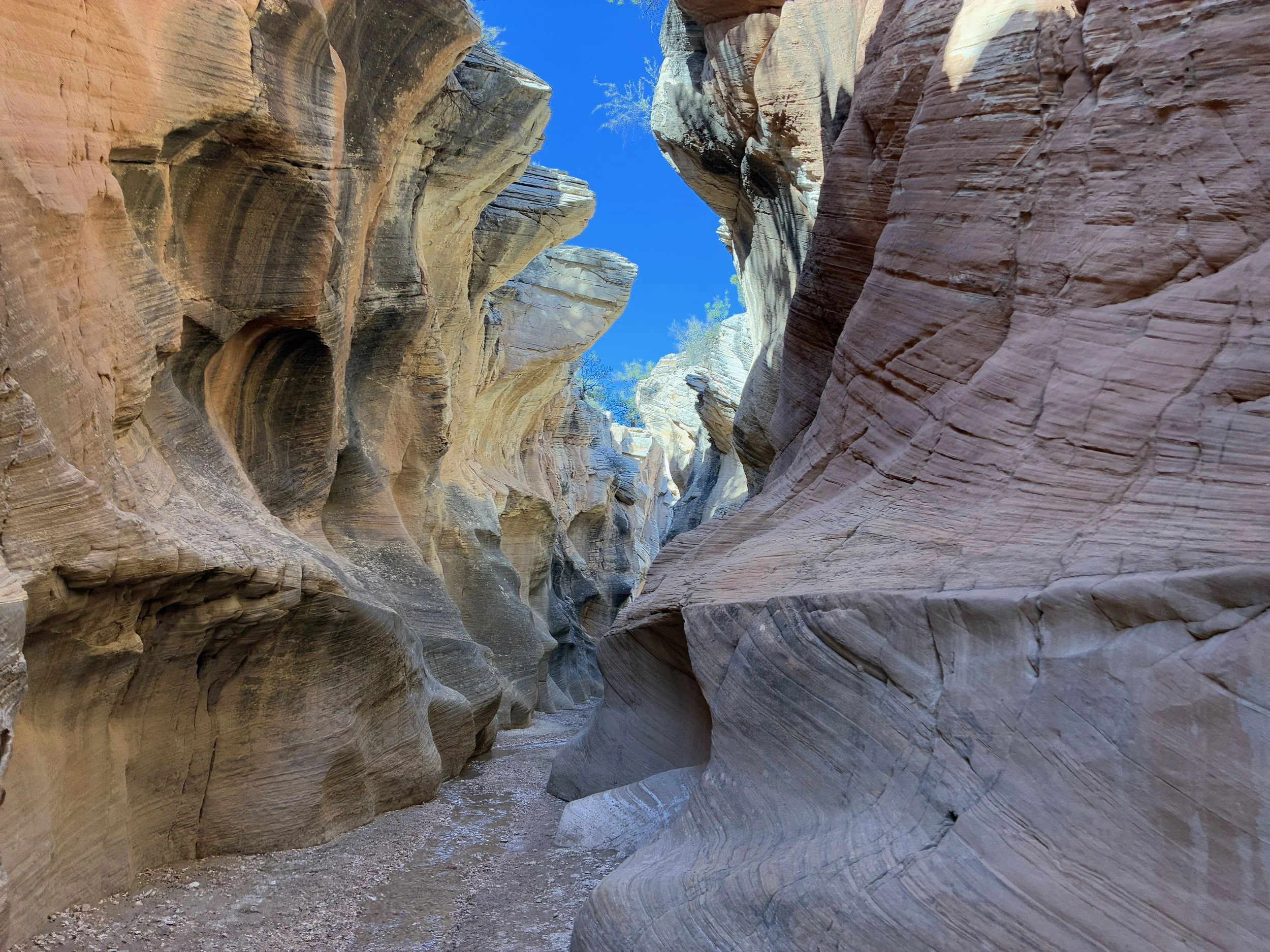
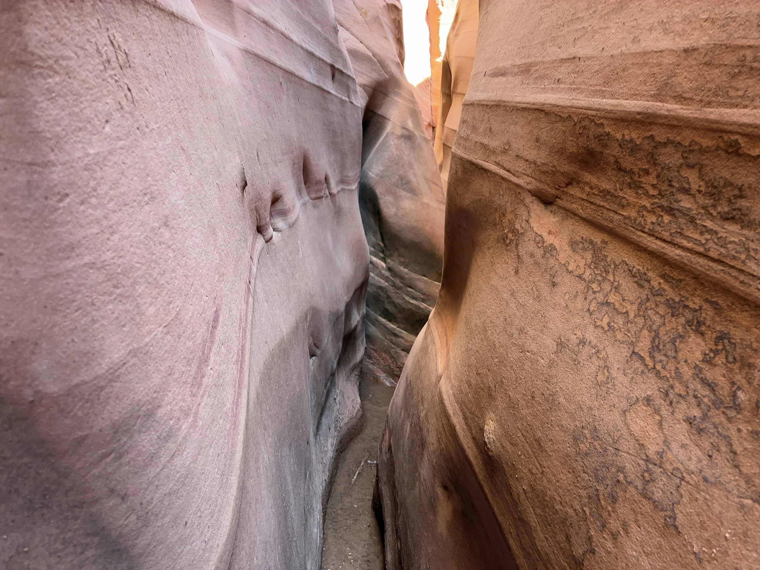
Capitol Gorge (2.0 Miles)
Our first hike of the day was Capitol Gorge. This is towards the back of the park. There is a long windy and narrow dirt road to get to the trailhead with a relatively small parking lot at the end. I would recommend this hike either earlier in the morning or towards the end of the day when the small parking lot is less full. It was crowded when we left with several more cars entering than leaving.

Capitol Gorge Hike
The trail starts at the bottom of a canyon with towering walls on both sides of you. Our destination within the gorge was the “tanks”. Before reaching the turnoff though, look up and to your right and you will see the names of four early settlers carved in a very strange location in the middle of a very tall wall. The rumor is this was a pioneer prank of sorts. Then men arrived before their wives. They lowered themselves down the cliff in buckets to carve their names. When their wives arrived, they claimed that the walls had eroded the rest of the way down in that short time. Whether or not they believed them or were upset at them for precariously hanging off the side of a cliff for a joke, isn’t known. It’s an interesting story at least.

Pioneer Names etched into the canyon wall
You will see people at the tanks on your left as you walk along before you see the trailhead and wonder how they got up there. Keep going a little further and you will see a well-marked trail branch. It’s a small climb up to the top. The tanks hold water from the last time it rained and the views with the water in the desert are very pretty. It’s also a great picnic spot to sit and enjoy the rocks.

Clearly marked trail branch up to the Tanks

Capitol Gorge Tanks
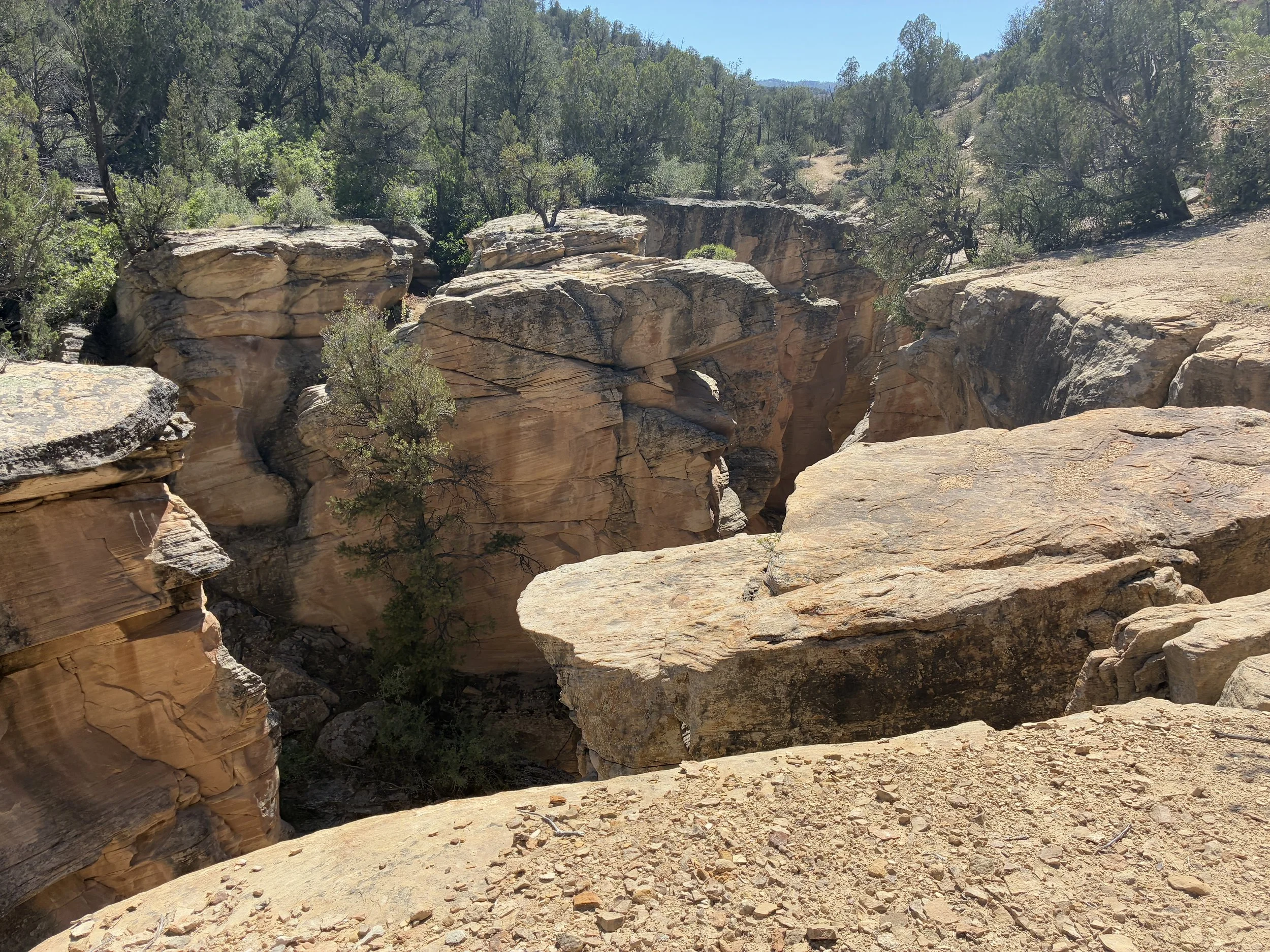
Cohab Canyon (4.6 Miles)
Our second hike of the day was Cohab Canyon. The first mile or so is continuous switchbacks up 1,100ft. We travelled in March and it was in the lower 60s. As we were still living through an epic winter back home, we were all happy to just be outside in the sun even if the hike up was a bit brutal. At the top is Hidden Canyon, which the boys had fun exploring before we continued our hike.

Cohab Canyon Trailhead and Switchbacks

Hidden Canyon at the top of Cohab Canyon trail
We then walked up to the Rim Overlook, a little higher in elevation, but nothing compared to the switchbacks at the beginning. This is a beautiful overlook of Fruita and the park.

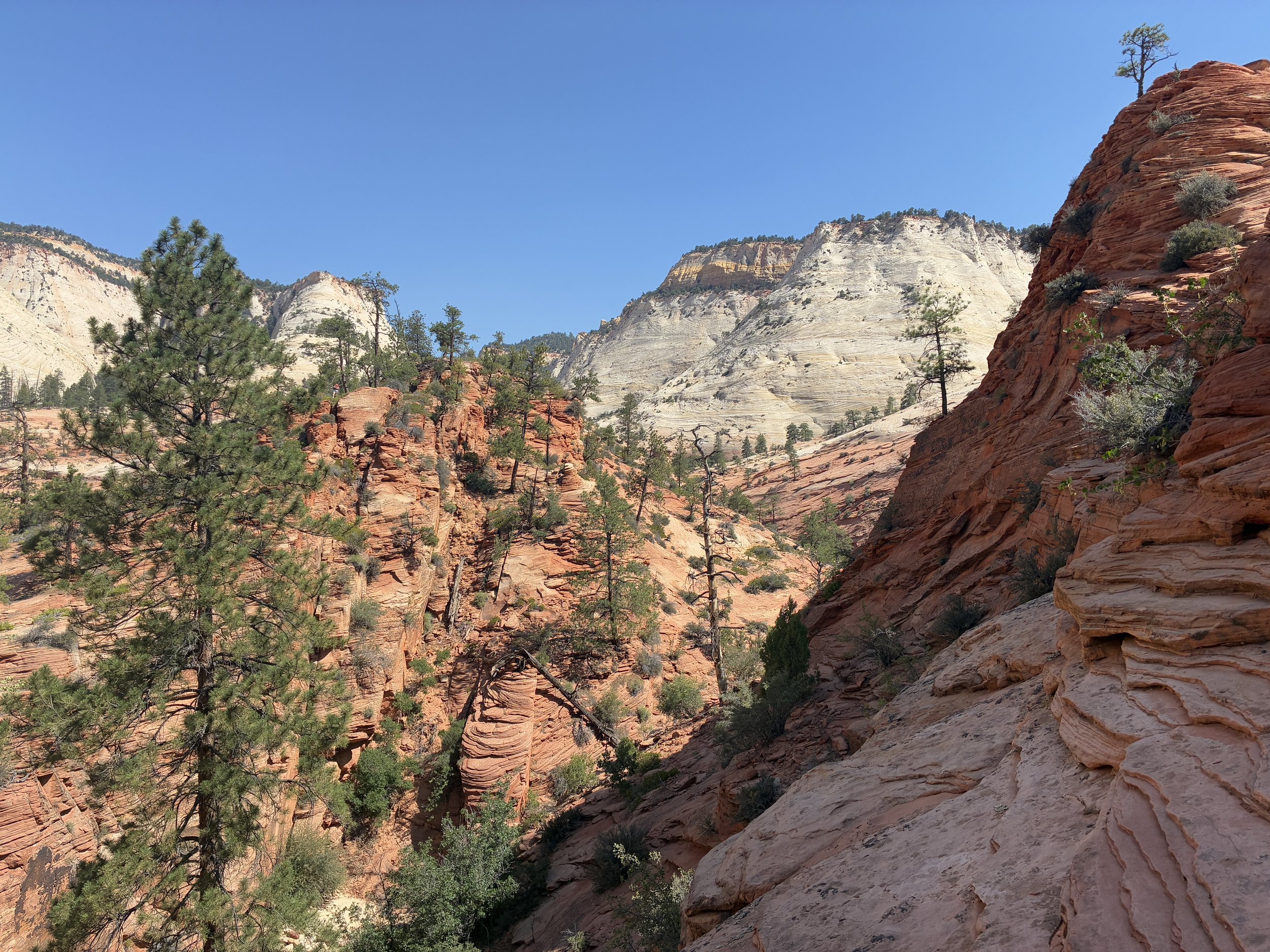
The trails back here are all interconnected. You can keep hiking to the northeast, cross the highway, and you’ll be at the trailhead for Hickman Bridge. Or you could hike to the south down Frying Pan trail and see Cassidy Arch and then connect with Grand Wash. The logistical problem with these great hiking options though is that there is no national park bus or shuttle between trailheads along the highway. So unless you have two cars that you could keep at different locations, you’re stuck then along the highway with no way back to your car. So we chose to hike back to the car after seeing the overlook, and we saved the Hickman Bridge hike for another day.

Cohab Canyon
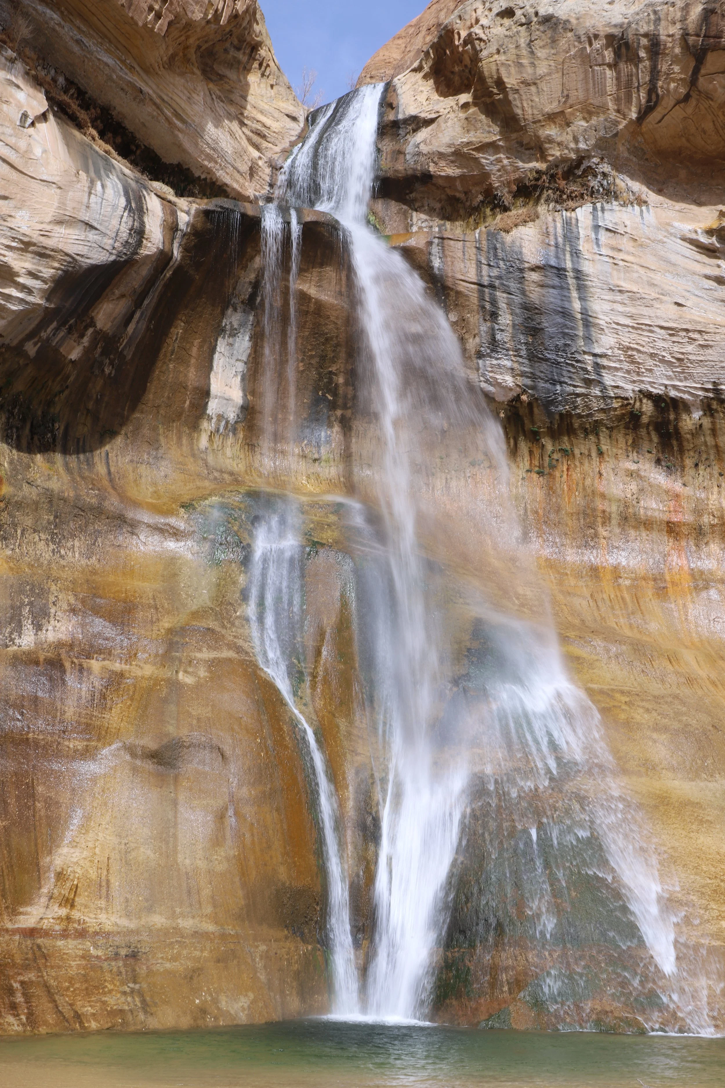
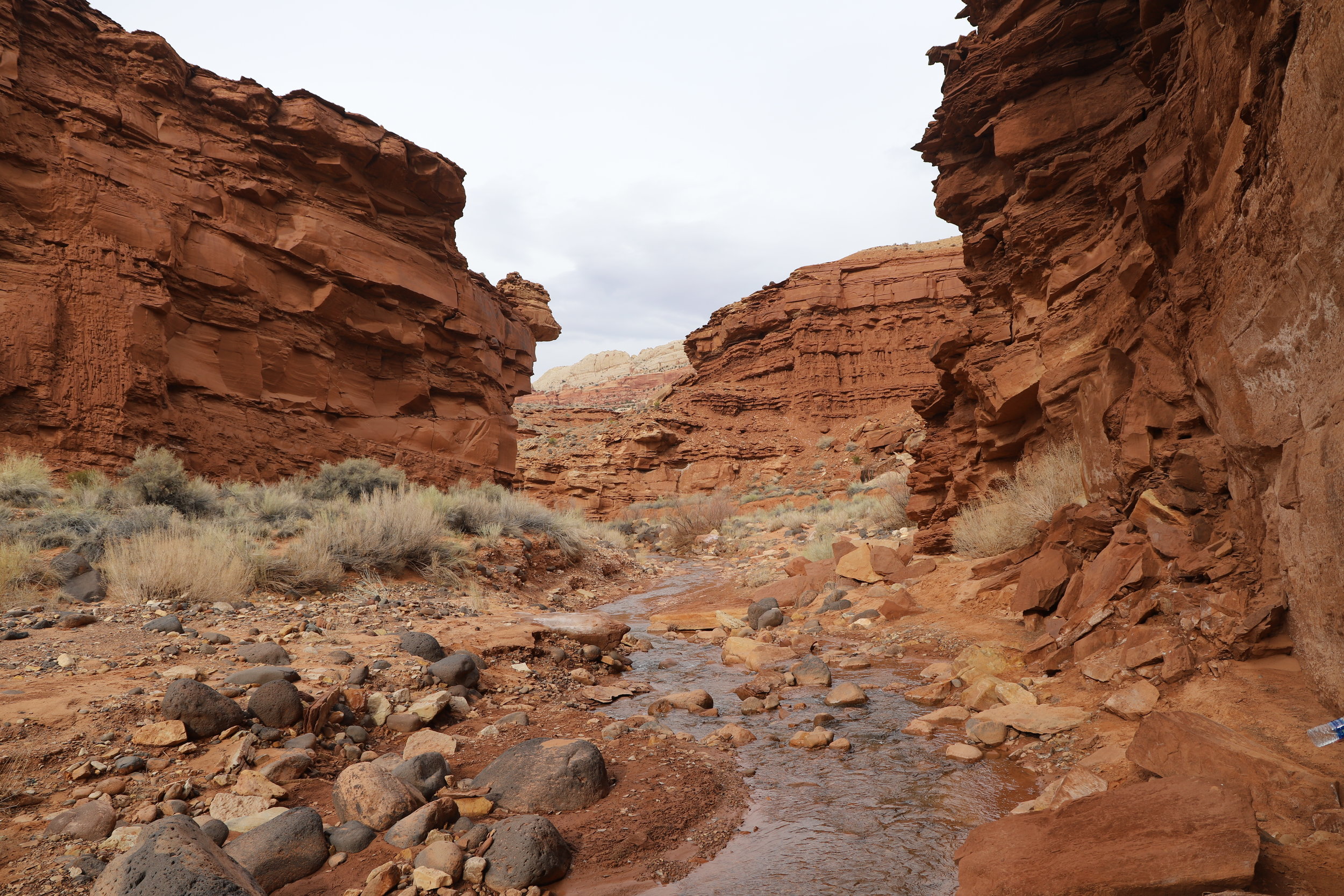
Sulphur Creek (1.4 Miles)
That previous reference to Oreo shake bribery was needed at this point in the afternoon. The pool at our hotel was out of service and there isn’t anything else to do in Torrey, so I wasn’t excited to turn in early. It’s hard to keep two boys quiet in a hotel room with nothing to do. So we went back to the visitor center and found one last hike.

Hiking in Sulphur Creek
When I planned for a hiking trip in March, I wasn’t sure how muddy the trails would be, and I bought all three of us rubber waterproof boots. We decided to use them in a different way than I’d originally intended, and we went for a hike in Sulphur Creek to the first waterfall as we watched the sunset.

Sulphur Creek
From the visitor center parking lot, first walk towards the highway, but don’t cross it. There will be several trails down to the creek. Take any of them. There were a few families walking along the trails, but we had more fun walking in the water. After about 0.7 miles, you will come up to a small but pretty waterfall. There are more waterfalls, but I’d promised the boys those shakes as a reward since they’d done such an awesome job hiking, and we pretty much ran back to make sure we made it there before it closed.

Sulphur Creek Waterfall
Day 2
We were looking for a sunrise, but Torrey is on the west side of the park. A ranger told us to watch the Cathedral light up in the sunlight. We tried, but I didn’t see quite what he had been talking about. I would recommend going to the east side of the park.

Pretty, but a bit of a failed attempt at a sunrise
Petroglyphs (0.25 Miles)
Our first hike of the morning was a brief boardwalk, just past the school house on your way through the park on Hwy 24. This is easily accessible from the main road and there is a parking lot close by. The trail keeps you on a wooden boardwalk, far enough away from the wall to keep visitors from being tempted to scratch their own names in the wall, but still plenty close enough to see the drawings.
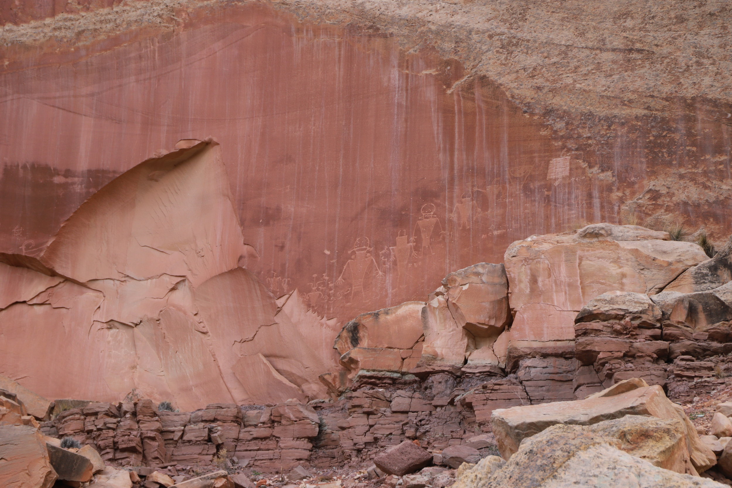
Petroglyphs
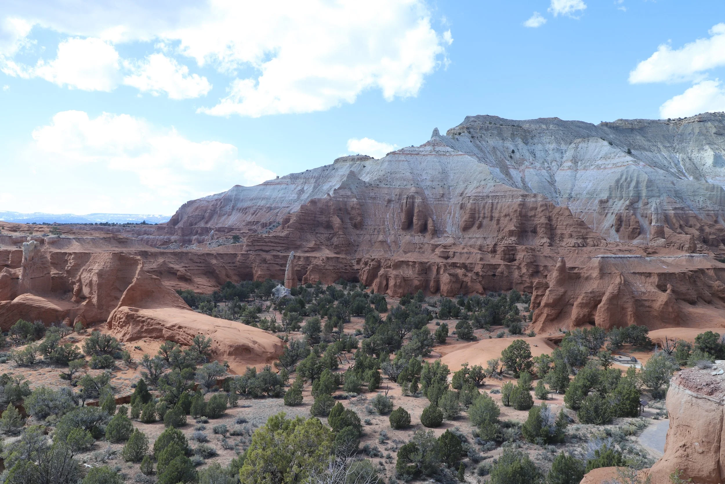
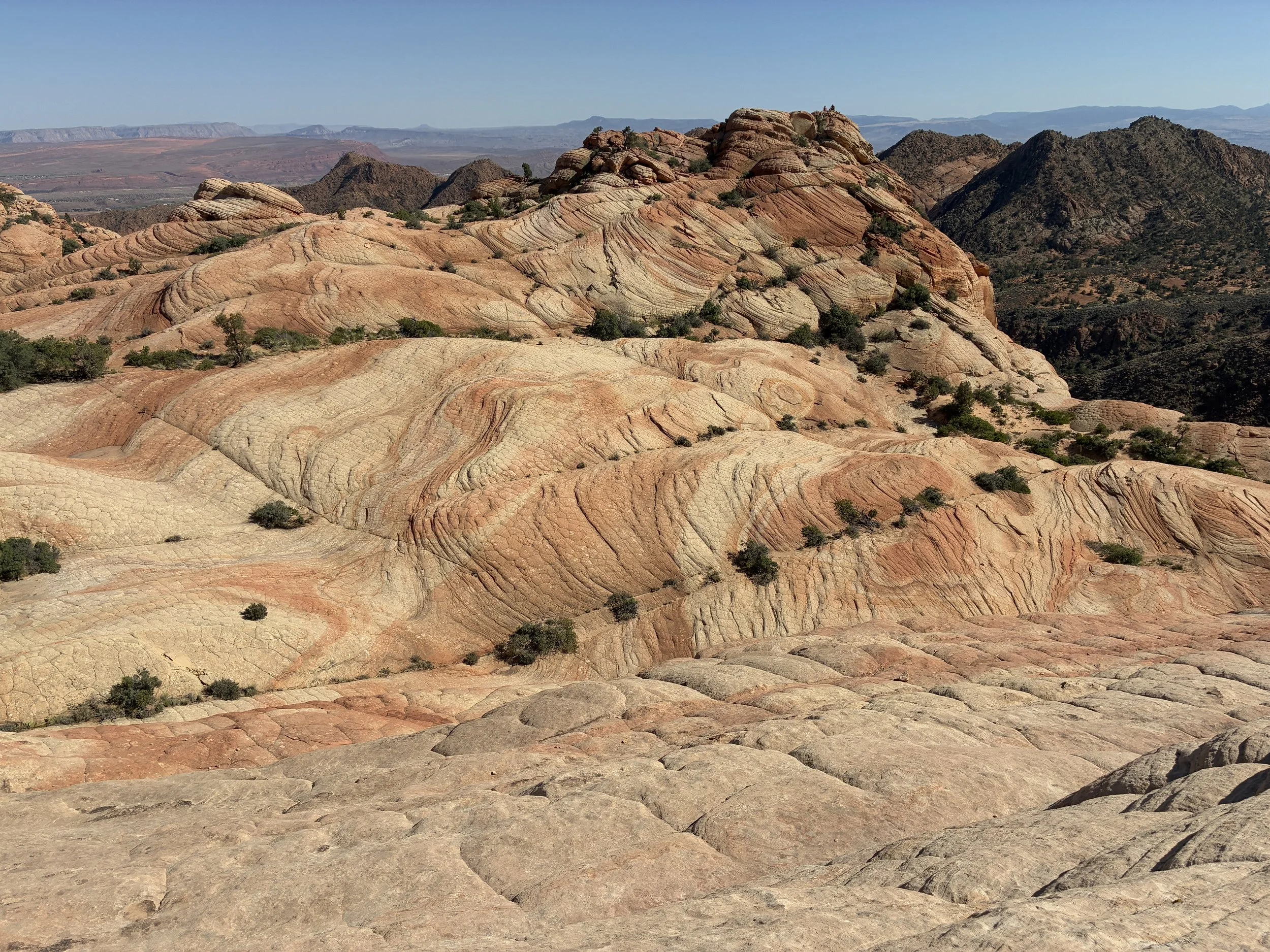
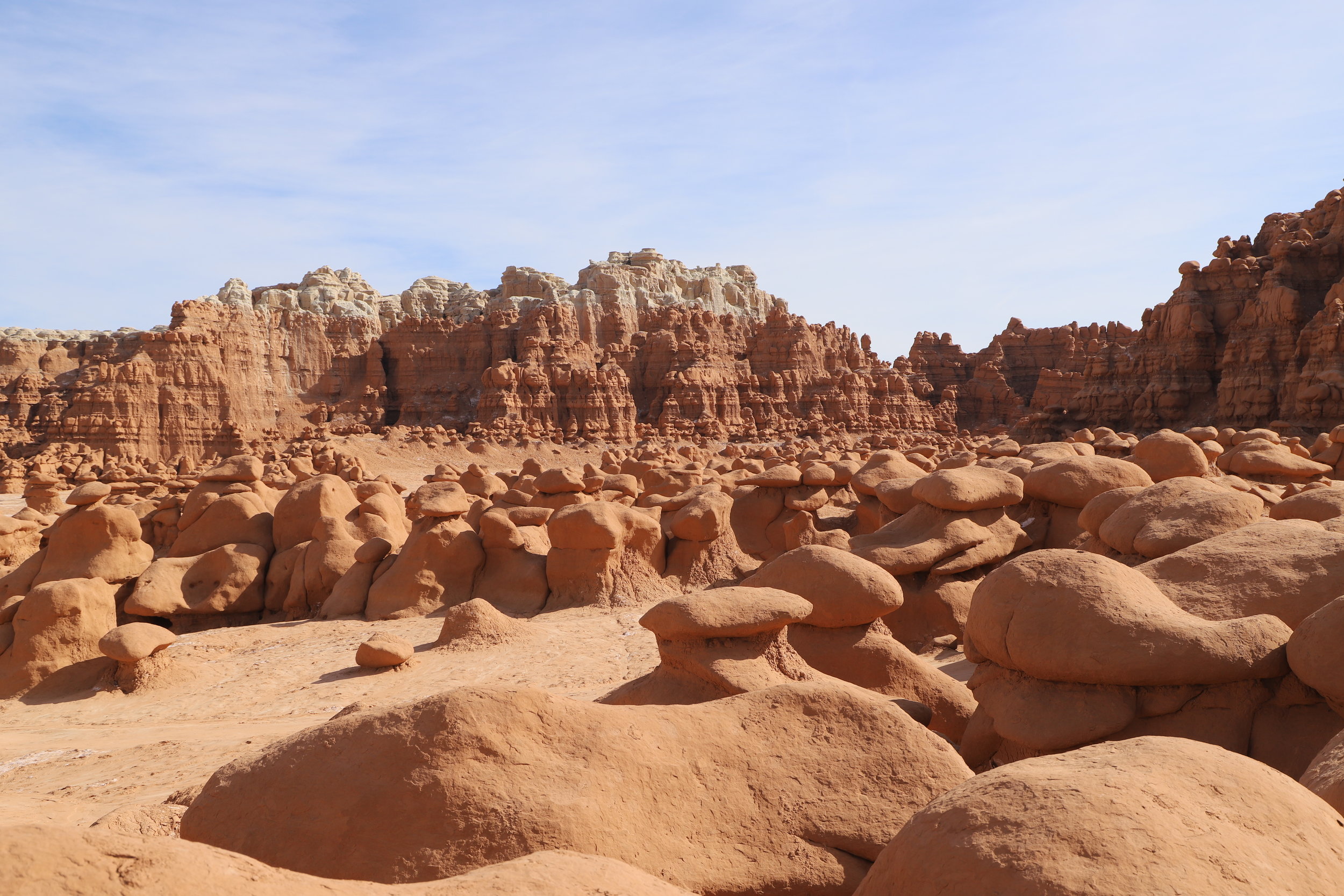
Goblin Valley State Park
It’s about a 90-minute drive from Capitol Reef to Goblin Valley State Park. This park is truly in the middle of nowhere, and there isn’t much closer than Capitol Reef to start from. Since we were here anyway, I thought it looked like an interesting place to explore. If you have kids with you, I would recommend the drive.

Me and my boys at Goblin Valley State Park
There is little to no vegetation, and dry cracked mud cakes the ground that you walk on. In the valley, you are surrounded by these crazy little hoodoos everywhere. Several times I caught myself holding my breath. I kept forgetting that I was still on Earth and could actually breathe the air. It really felt like we were on Mars.
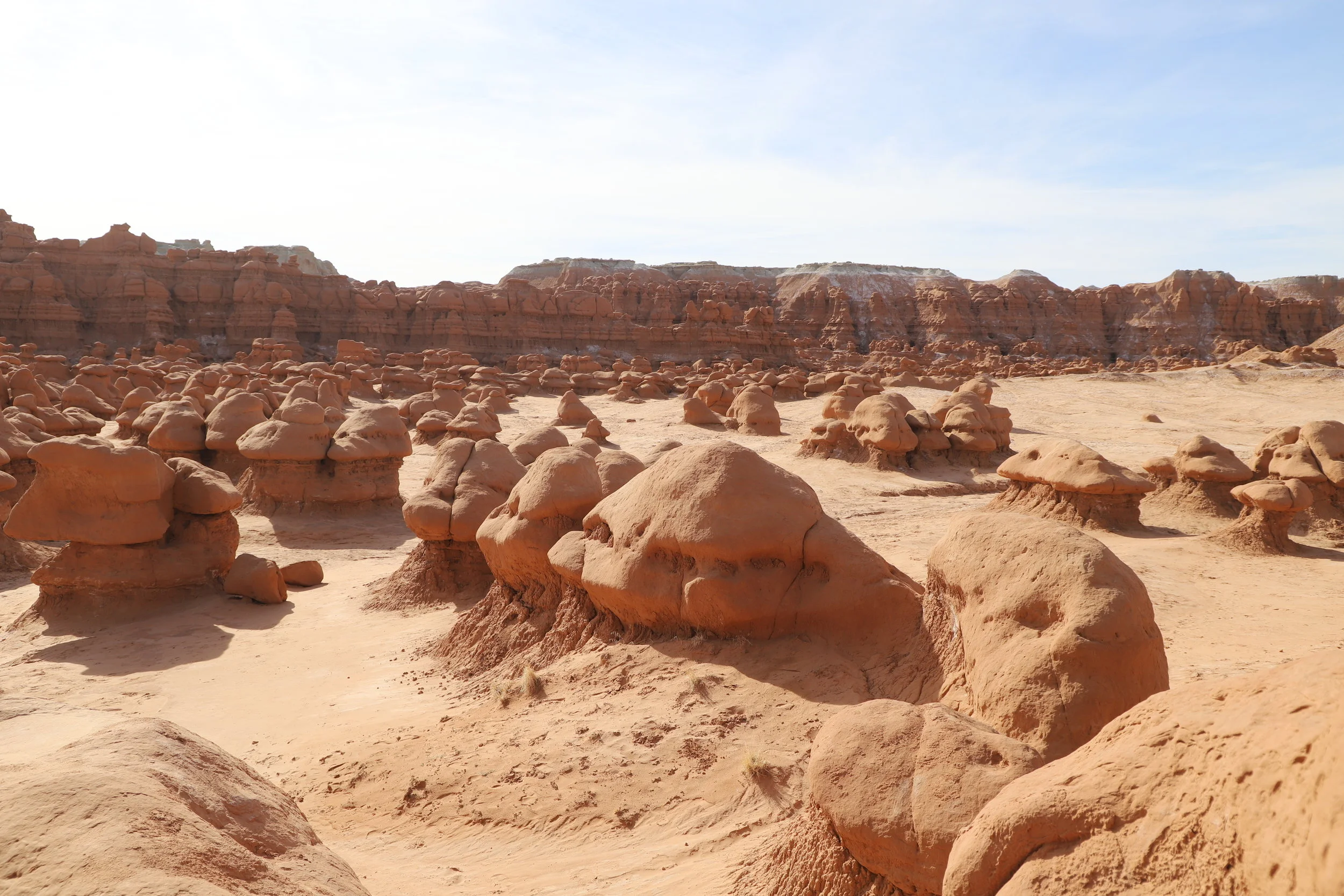
Goblin Valley
First, we wandered through Goblin Valley. The boys played hide and seek with each other, while I kept an eye on both of them. So many great hiding spots! I was a little nervous one would of them would get lost, but we stayed close together through the game. The boys loved this park because you could get right up next to the hoodoos and they were similar in size. It was a place they could really interact with the environment. We covered about 2 miles as we wandered. The park goes on and on though and we could have walked much further.
Goblin Valley
Goblin’s Lair (3.0 Miles)
If you have young kids, I’m going to strongly discourage you from this hike. It is rated strenuous, and I felt like that was probably understated. We passed several young families on this hike, all with upset moms and dads. This hike is not possible with young children or dogs, and you won’t realize it until the very end. Instead, turn left at the first branch of this trail, and go on Carmel Canyon Loop, a 1.5 mile loop through the only pretty part of the Goblin’s Lair hike.

Goblin Valley State Park - Carmel Canyon
After the branch to Carmel Canyon, Goblin’s Lair hike becomes very exposed in the sun. There is no shade. We were there in March, and it was already in the 80s, even though it was still early in the morning. At the end of the 1.5-mile hike out to Goblin’s Lair, the trail ascends a very steep climb. I say “climb” because this is one of the hikes you need to use your arms to pull yourself up.

End of Goblin’s Lair - to get into the slot canyon, you’ll need to climb up these boulders
Assuming you get to the top, to get into the slot canyon, you now need to descent onto steep boulders with some narrow squeeze spots. While the boys and I were able to get up and down these obstacles, note that we hike a lot as a family and my boys weren’t scared to try this. For perspective, a young man in his 20s peered down at us while we were inside. He asked if we’d hiked down inside. I said “yes” and he replied “Impressive….” Turned around and hiked back down without trying to climb down the boulders.

To get inside Goblin’s Lair, now you need to climb down these boulders, and back up again to leave
We had a picnic inside while we enjoyed the shade, and a group of canyoneers came to the top of the canyon and descended into the slot on ropes. It felt a little bit like we were in an Indiana Jones movie!
Capitol Reef National Monument
Back in the car for a 90-minute drive back to Torrey, we were refreshed and recharged and looking for one more hike before calling our vacation over, as we were heading back to the airport the next morning. We picked Hickman’s bridge, and this ended up being my my favorite hike that we did at Capitol Reef.
Hickman Bridge (2.0 Miles)

Hickman’s Bridge Trail
This trail was an easy hike with a little bit of elevation gain, but nothing compared to previous hikes. The views were incredible. My 10-year old defines great hikes based on the excitement level though, so this one scored on the lower side for him. Something to keep in mind while you are planning hikes with children – any trail that just involves walking and has no obstacles that need to be navigated through, over, or around aren’t that much fun.

This is the first bridge you will see on the hike. Keep going, this isn’t Hickman’s Bridge

Hickman’s Bridge

Walk through Hickman’s Bridge and keep going. It’s a loop at the end of the hike. There is a small branch trail to an amazing view of the park.
Junior Ranger Badge
Before heading back to the hotel for the night, we stopped at the National Park headquarters to turn in the completed Junior Ranger books and do the pledge in order to get the badge. Each National Park has a unique badge that can be earned by kids or adults of any age. Just approach the ranger station inside the visitor center and ask for the book. I’ve found them to be free at all parks so far except Yellowstone. They will tell you how many of the activities need to be completed and then you and your kids can pick the activities that make sense for you. Often there are scavenger hunts while you are out hiking, or places to draw pictures of something you see along your hike, picking up trash while you hike, or learning about the park inside the visitor center. When you are done, just bring the books back to the visitor center. The kids will do the Junior Ranger Pledge, which is also different at each park, and then get a badge. If you don’t have time to complete the activities while you are at the park, have the kids do them in the car – a great alternative to iPads and movies, and then mail the books in. The Rangers will mail back both the book and a badge.

Panorama Point - Viewpoint accessible from Highway 24
Hike I Still Want to Do
If we would have had one more morning, we would have hiked Cassidy Arch. As we’d already hiked 47 miles though in the 7 days we’d been on Spring Break, I’m not sure that it would have even been possible to convince my 6-year-old that he had another 3 miles left in his feet with a 700ft+ elevation gain. Next time though.
Why We Skipped Grand Wash
I would have also loved to see the Grand Wash, but we skipped this due to the less exciting aspect.
Grand wash connects the Cassidy Arch Trailhead and the Scenic Drive. Flat hike, 80 ft walls, and 2 miles each way. Kind of boring… But the walls are similar to that what we saw on the Tanks hike.
Slackers!!!
Our unexpected best find – Slackers! Anything I can use to bribe the kids into one more hike in the late afternoon or evening is a great find. I used Slackers Oreo milkshakes two days in a row!
Other Posts from NatureImpactsUs: