
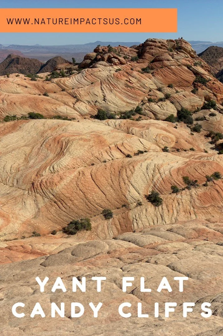
Candy Cliffs at Yant Flat
If you enjoy my blog, please consider signing up below for email notifications of my latest posts. I will not share your email.
Secret Hike Near St. George
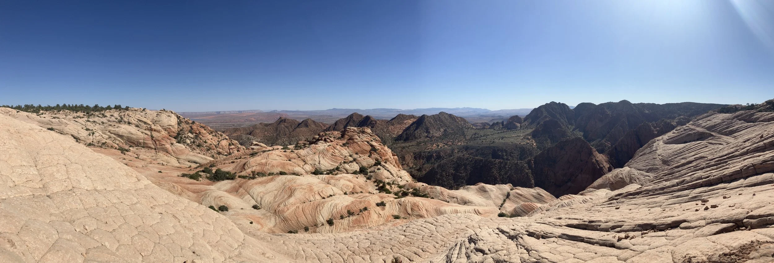
For anyone with an extra half day near St. George, Utah, the Yant Flat Candy Cliffs could be a fun, free, and relatively easy place to explore within the Mojave Desert. The out-and-back trail is 2-3 miles (depending on how far one wants to venture within the Candy Cliffs). It leads to a strangely beautiful display of geometric patterns cut into red and white striped Navajo Sandstone surrounded by green brush-covered mountains. Most visitors in the nearby city head to internationally-known Zion National Park, which can leave similarly incredible rock formations, like the Candy Cliffs, secluded. Due to the small size of the parking lot, I don’t think these rock formations are frequently visited. During our June 2025 trip to southern Utah, this was one of our favorite hikes. A hike with two votes from teenage boys? This is a place worth stopping!
Candy Cliffs
Driving Directions
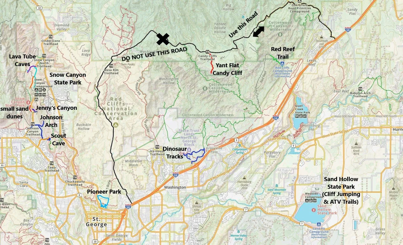
The map below shows both how to get to the Yant Flat Candy Cliffs, as well as several other hiking locations just outside of St. George, UT. The Yant Flat Candy Cliffs are free and no permits are required (as of August 2025).
Beyond the Candy Cliffs, St. George is a fun city to spend a few days in due to the number of nearby places to hike. In addition to the main Zion National Park entrance (approximately 1 hour away), the following are cool places to check out (note that some of these places have hyperlinks to additional blogposts I’ve written, and some places I’ve visited but haven’t yet had a chance to write about).
Yant Flat Candy Cliffs - Approximately 50 minutes from St. George - go first to Leeds and take the road in from the east
Snow Canyon State Park - There are three cool things to check out here: Lava Tube Caves, Jenny’s Slot Canyon, and Scout Cave. There’s no water here - this park is best in late fall to early spring - avoid the summer months.
Pioneer Park would be perfect for any age, including young children. There’s a slot canyon, an arch, a small place for easy “rock climbing” (no ropes required), and lots of large rock holes to hide in.
Red Reef Trail - This is a shorter hike that does require use of a rope in one spot with some foot holds. I did this with a 9 and 13 year old, so not impossible with kids, but there were moments I thought we were going to slip into the water. Ideally, this is probably an early summer to late fall hike.
Sand Hollow State Park - We had fun cliff jumping here and summer is best for that. I’m not an ATV sort of person due to the noise of the vehicles, but there are several trails at this park for anyone interested.
Dinosaur Tracks - This is flagged for a future trip - I haven’t had a chance to visit yet.
There are two ways to get to the Yant Flat Candy Cliff Trailhead. The western road starts in St. George, and the eastern road starts in Leeds, UT. The absolute best advice I can give about hiking to the Candy Cliffs is to use the eastern road from Leeds. Even if you are staying in St. George, drive the extra 10 minutes up I-15 to Leeds, and come in from the east. In March 2023, I tried taking the western road from St. George, and even though I had rented a truck, I almost got stuck in the mud before making it to the trailhead, and ended up turning around. In June 2025, we successfully made it to the trailhead in our minivan, using the road from the east in Leeds. This eastern road to the trailhead was pretty easy. But we were spending the night in St. George, so we thought we were taking a shortcut by using the road going west after our hike. Although not muddy in June, this side of the road was rocky, rutted, and had some steep climbs I was almost sure we wouldn’t make. We didn’t pop a tire, but I think it would have been pretty easy to do that as well. Two bad experiences on the western road, while the eastern road was fantastic - Use the road from Leeds, UT.
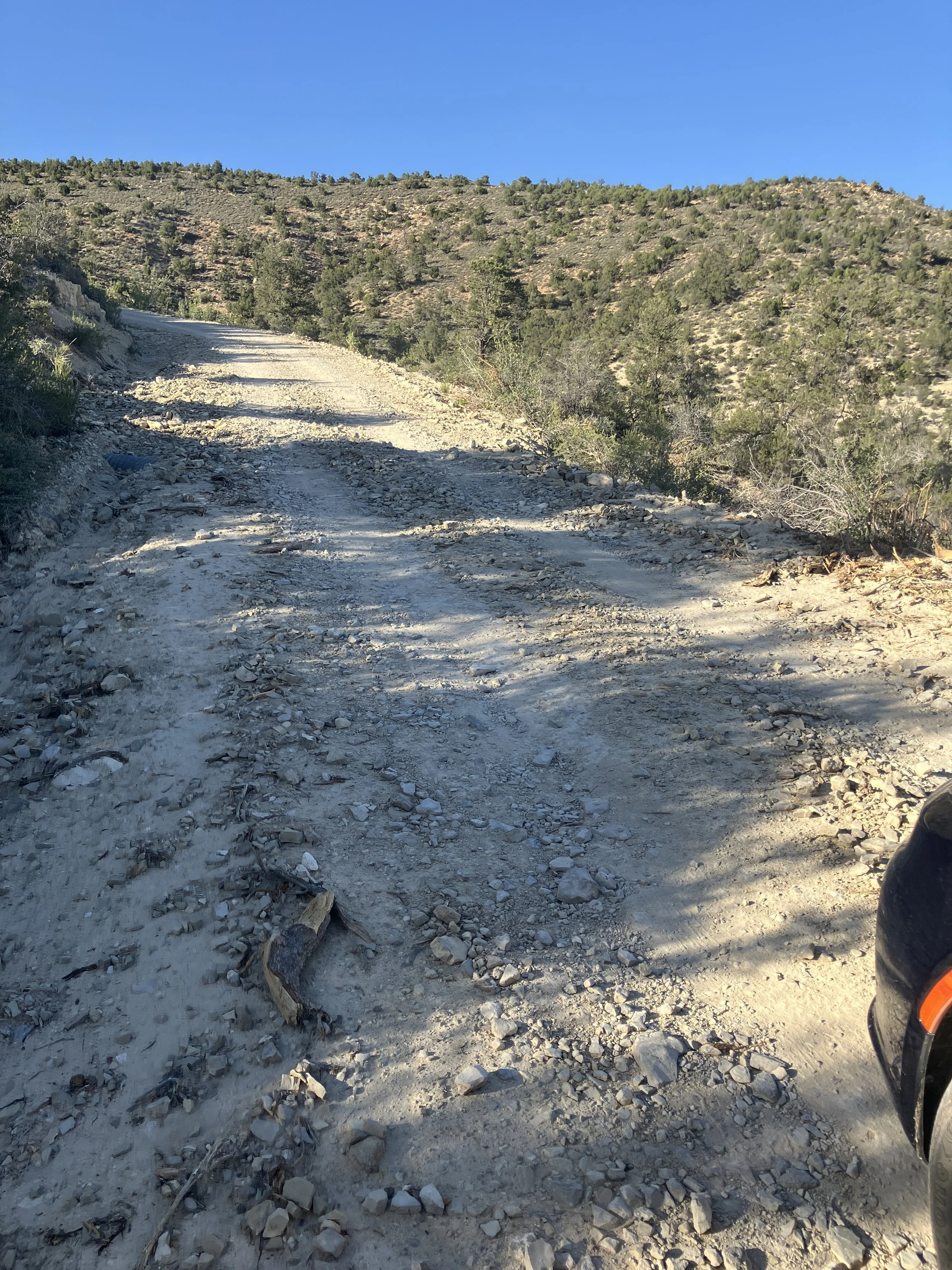
Taking the “short-cut” to St. George and driving west from Yant Flat - This road is terrible! Go east and drop down to St. George on I-15. This picture is from a “good” section along this road…
Be Prepared - Hiking in the Desert
St. George, Utah, is in the Mojave Desert - keyword being desert. I know lots of people travel to Zion National Park during summer vacation (I would highly suggest visiting Zion during winter or spring breaks, when it is less hot instead). It is still possible to venture out to the Yant Flat Candy Cliffs during the summer months, but plan to go in the early morning hours before it is hot. We were here in June, and it was the later afternoon when we visited just due to drive time to get here. It was 100F. We knew what this was going to be like, and we were prepared. We each carried 4L of water, and we had an extensive first aid kit and enough food that if we needed to hunker down due to the heat and stay until sundown of several hours that we would have been able to withstand the desert until it got cooler at night. I have a picture later in the post that shows us carrying heavy backpacks laden with supplies. If you venture here in the summer, please heed this warning and take care of yourself and anyone else you may meet on the trail. Desert heat is not something to mess with.
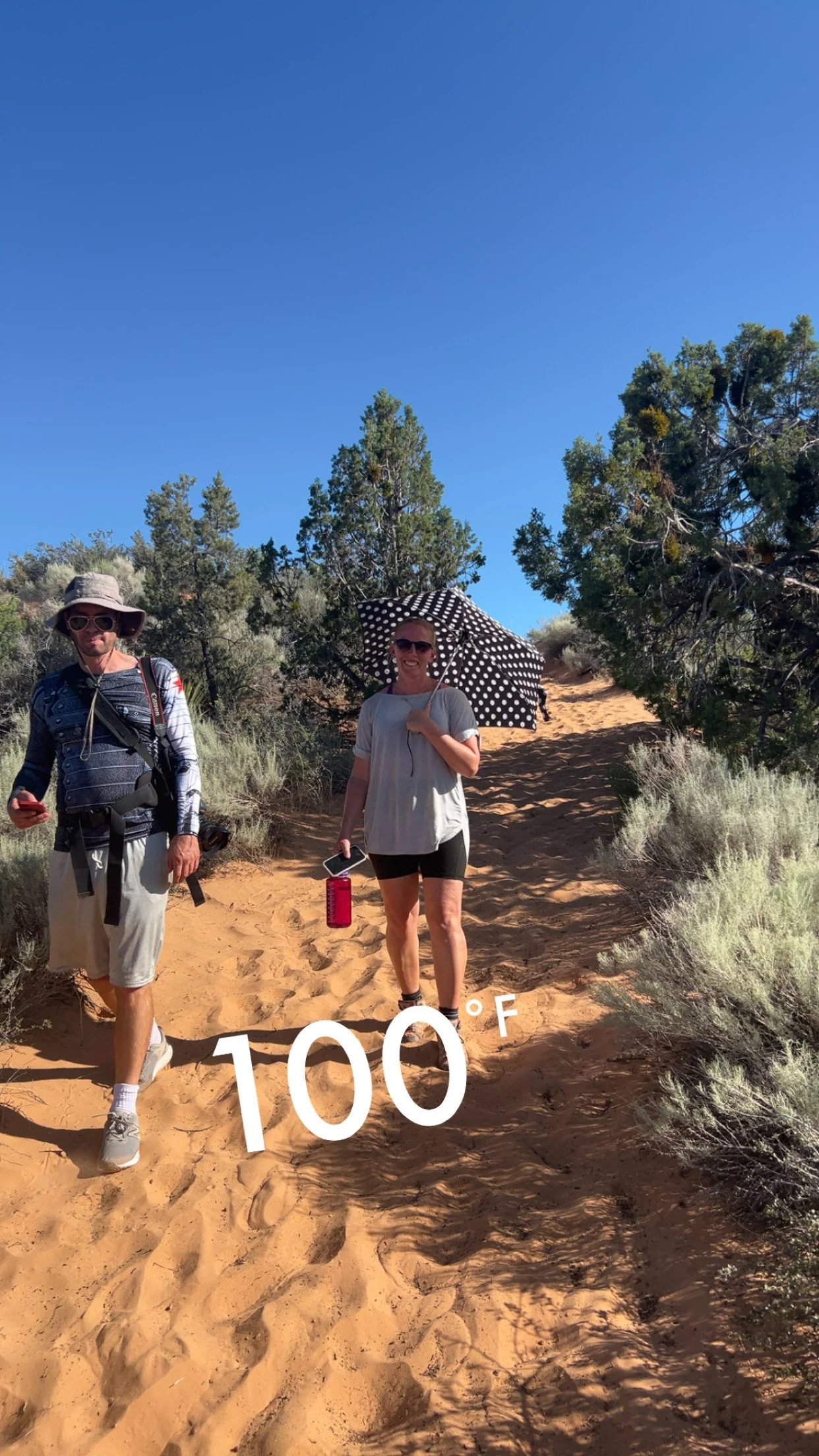
On the way back to the car, my older son offered to carry my bag in addition to his. When we took it, he asked why it was so heavy (as most of my water weight was already in his bag). I described items I had in the bag in case of emergency, and when I got “umbrella” he stopped walking, took off the bag, and started searching for it. Then he gave it to me. I wasn’t sure who was smarter… Me for thinking to pack it as portable shade, or him for taking it out of the bag so I could use it.
Hiking to the Candy Cliffs
There is an obvious place to park at the trailhead, but there are no signs. The trail takes off along the same side of the road as the parking lot. The hike from the trailhead to the main viewing area and back is little over 2 miles, with an approximate gain in elevation of 100ft which is I would say unnoticeable due to the gradual incline. From the viewpoint, the rocks can be imaginatively explored in any direction. We ended up hiking 3 miles total, with an elevation gain of 350ft. We explored the area for about 2 hours.
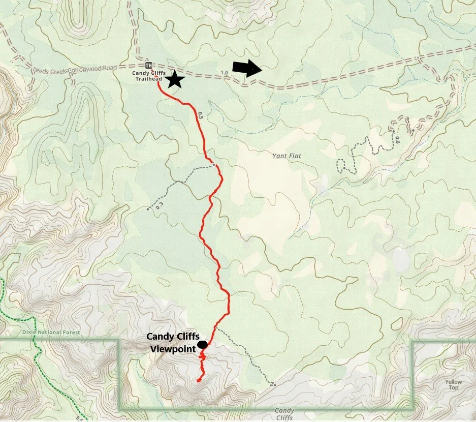
Hiking Map from Yant Flat Trailhead to the Candy Cliffs
The above map shows a spur trail to the west, not quite halfway to the viewpoint. We did not observe this trail, so I’m not sure where that goes to, and I don’t think it would be easy to find without a GPS map indicating that there is a spur to follow.
A short distance from the trailhead there should be a wilderness check-in to add your name. If you haven’t done this before, just add your name. It’s free, it can’t be tracked online, and it’s only there for people that might be looking for you in an emergency - this is common in backcountry wilderness. Check-in on that form, and then check-out when you return.
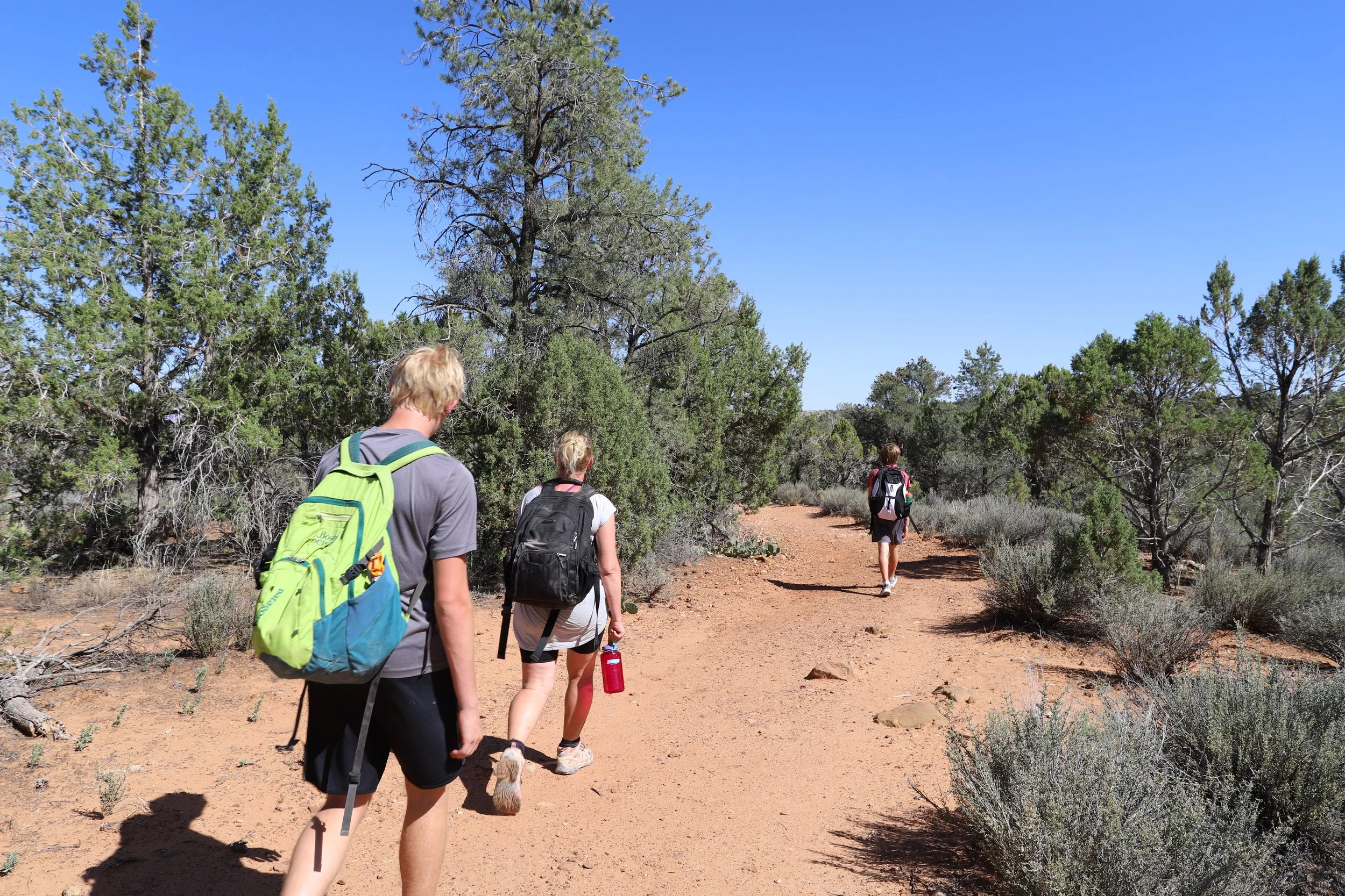
This was a short hike, but I’m showing this picture as evidence that we each carried a bag because we brought 4L of water per person, just in case, as we were hiking into the desert in the summer. Assume worst case could happen and be prepared for it. This is the middle of nowhere - people may not be here to help you.
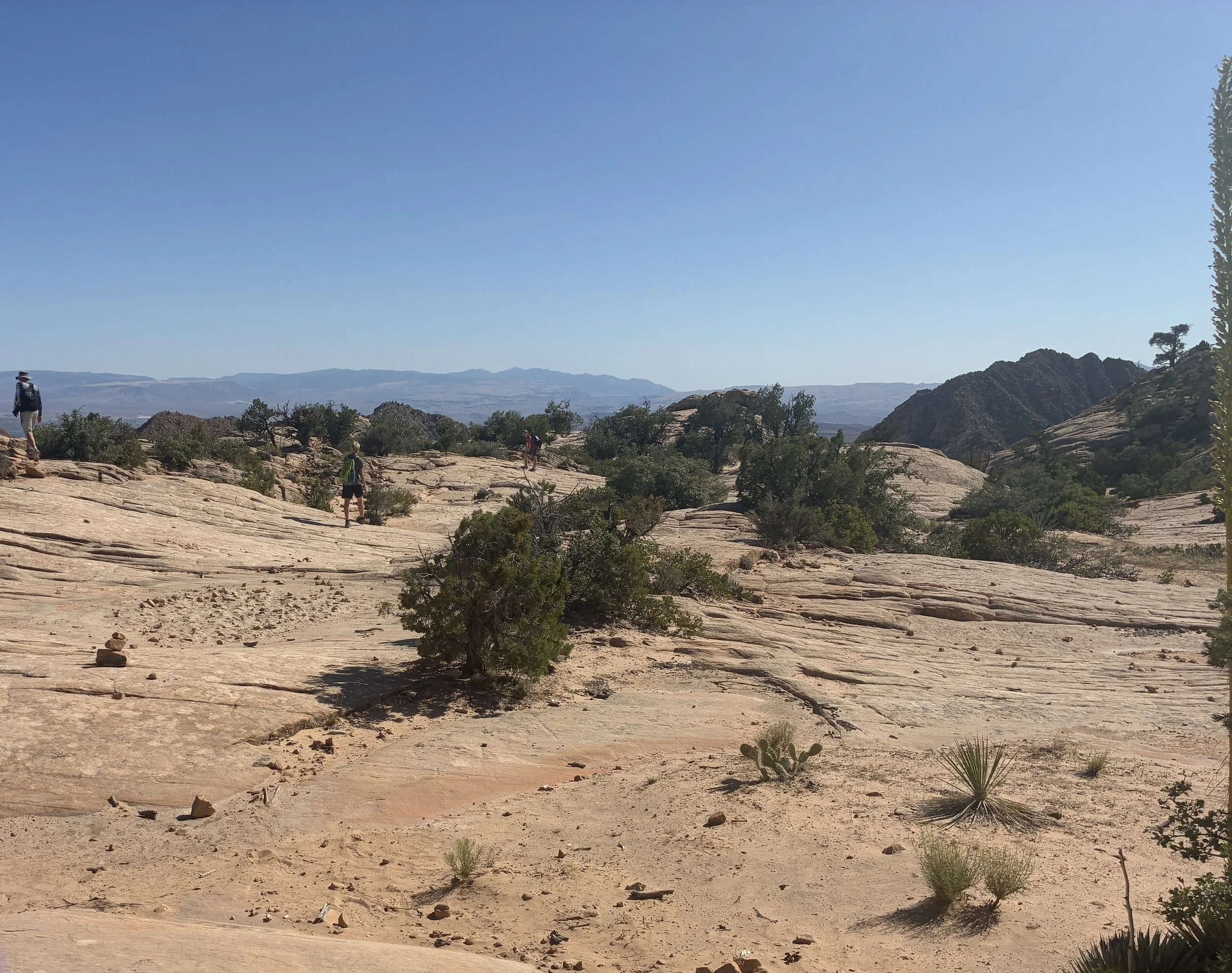
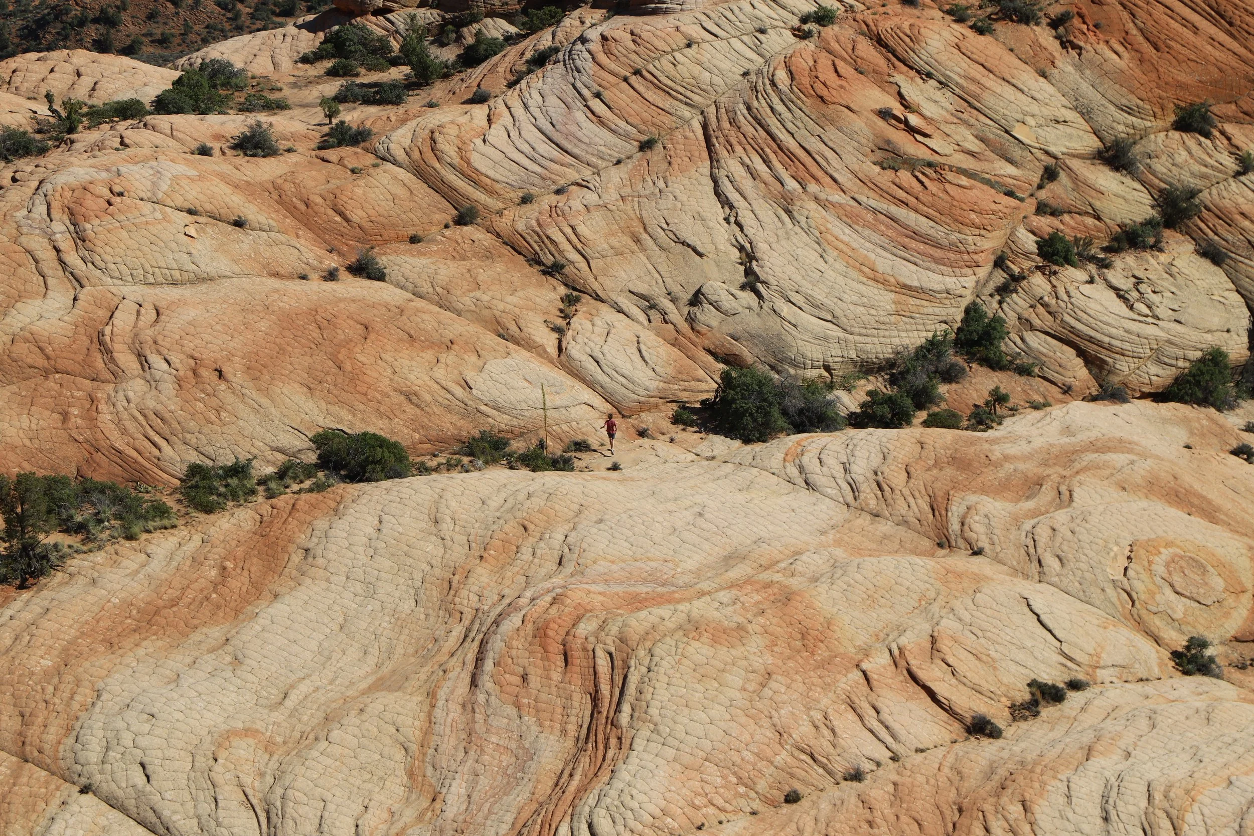
It’s about a mile from the trailhead to the main viewpoint. The majority of the trail is sand, which is tiring to walk through, and there is nothing indicating that there is something amazing is on this trail beyond the wilderness check-in near the parking lot. There were several moments of doubt in my head as I was dragging my family through some level of misery to get here. There are no clues of getting closer to the Candy Cliffs. It looks like this until the end.
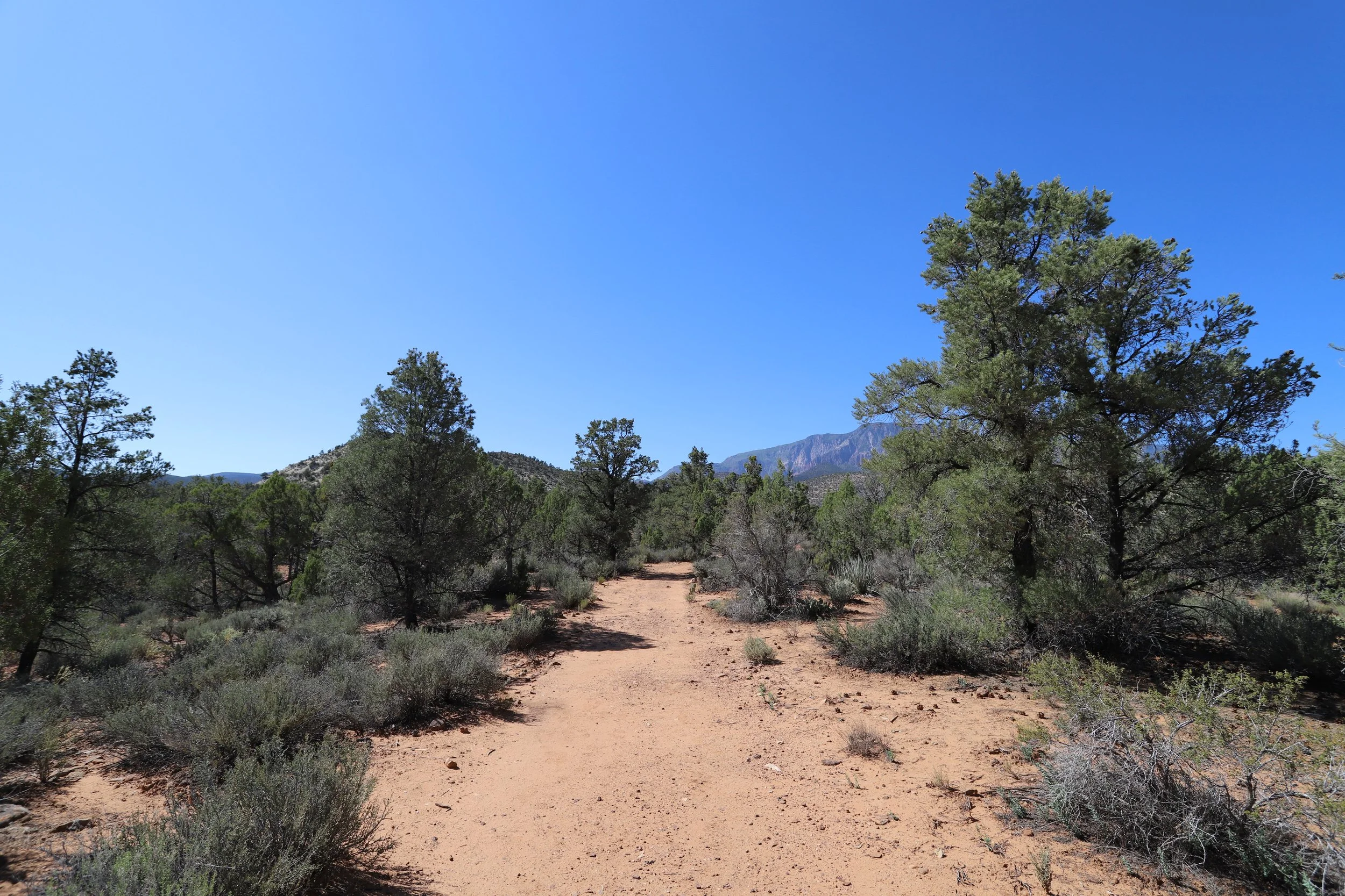
There is about a mile of sandy trail between the trailhead and the main viewpoint - be prepared, especially in the summer.
There are some tall Cedar Trees that provide brief amounts of shade. In an overheating emergency, hunker down under a tree and cool off. Umbrellas are a great “portable shade” option as well.
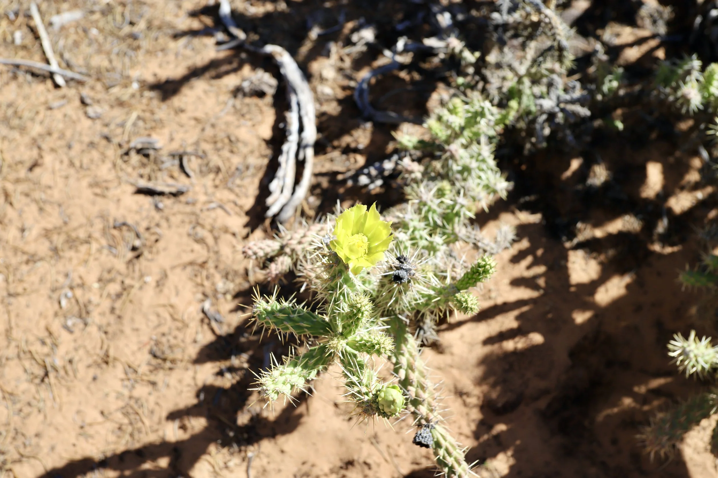
Blooming Snow Leopard Cholla Cactus
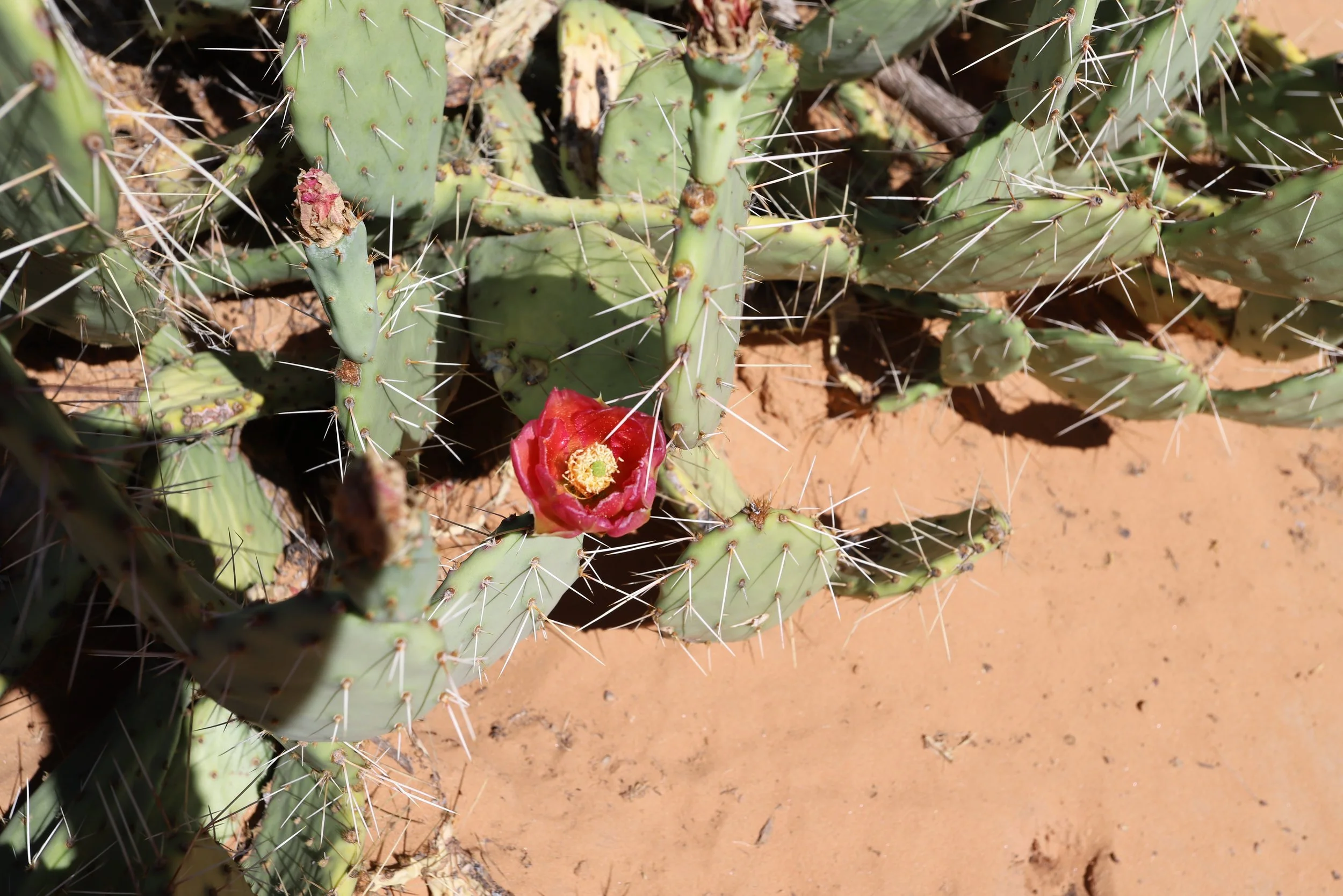
Blooming Prickly Pear Cactus
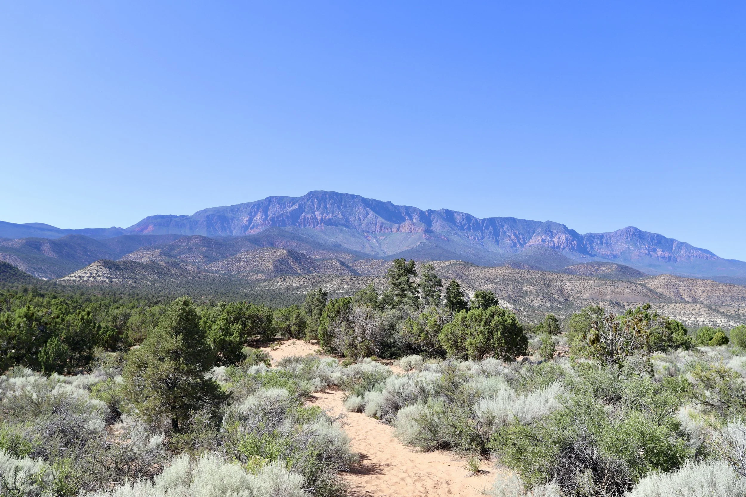
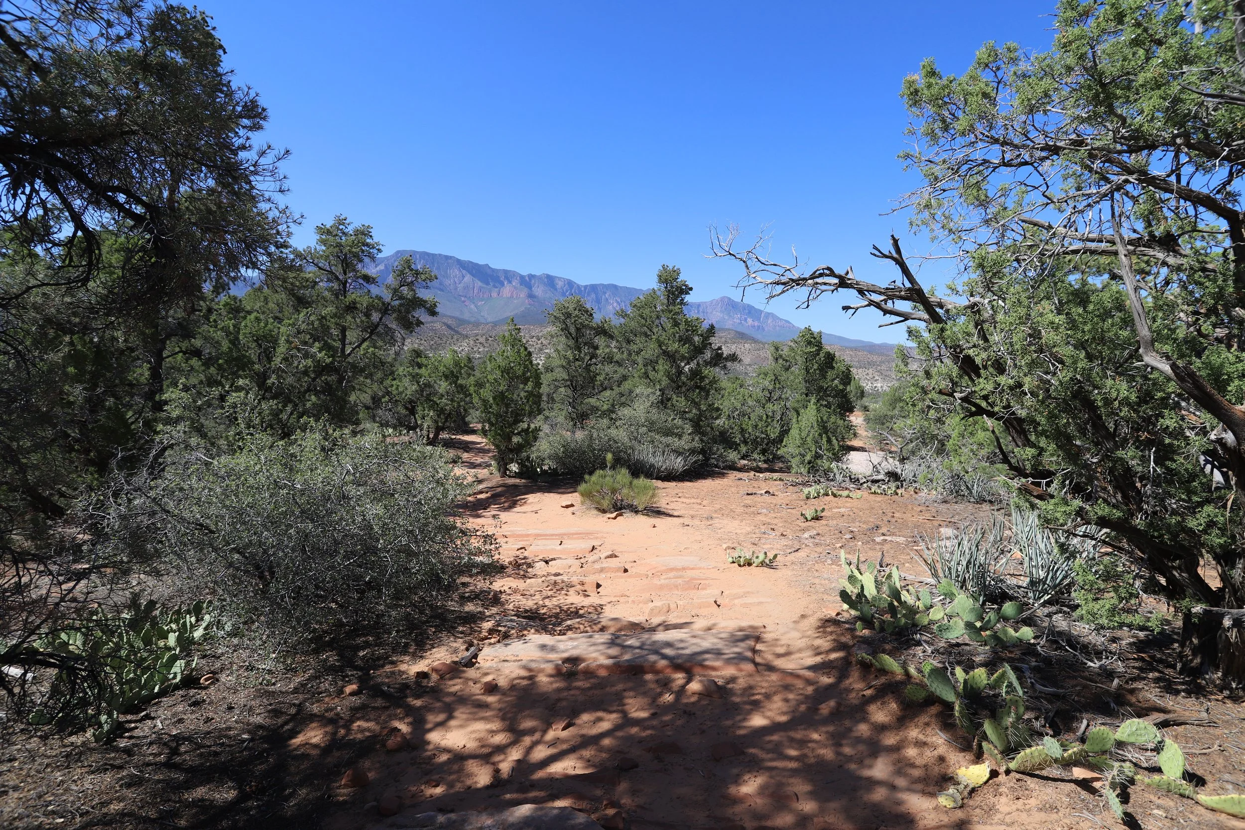
I actually appreciated this view more on the way out to the Candy Cliffs by turning around than I did facing it on the way back when I was ridiculously hot and tired. The Mojave Desert is amazing - but do this hike in the morning in the summer, or pick a cooler month to explore.
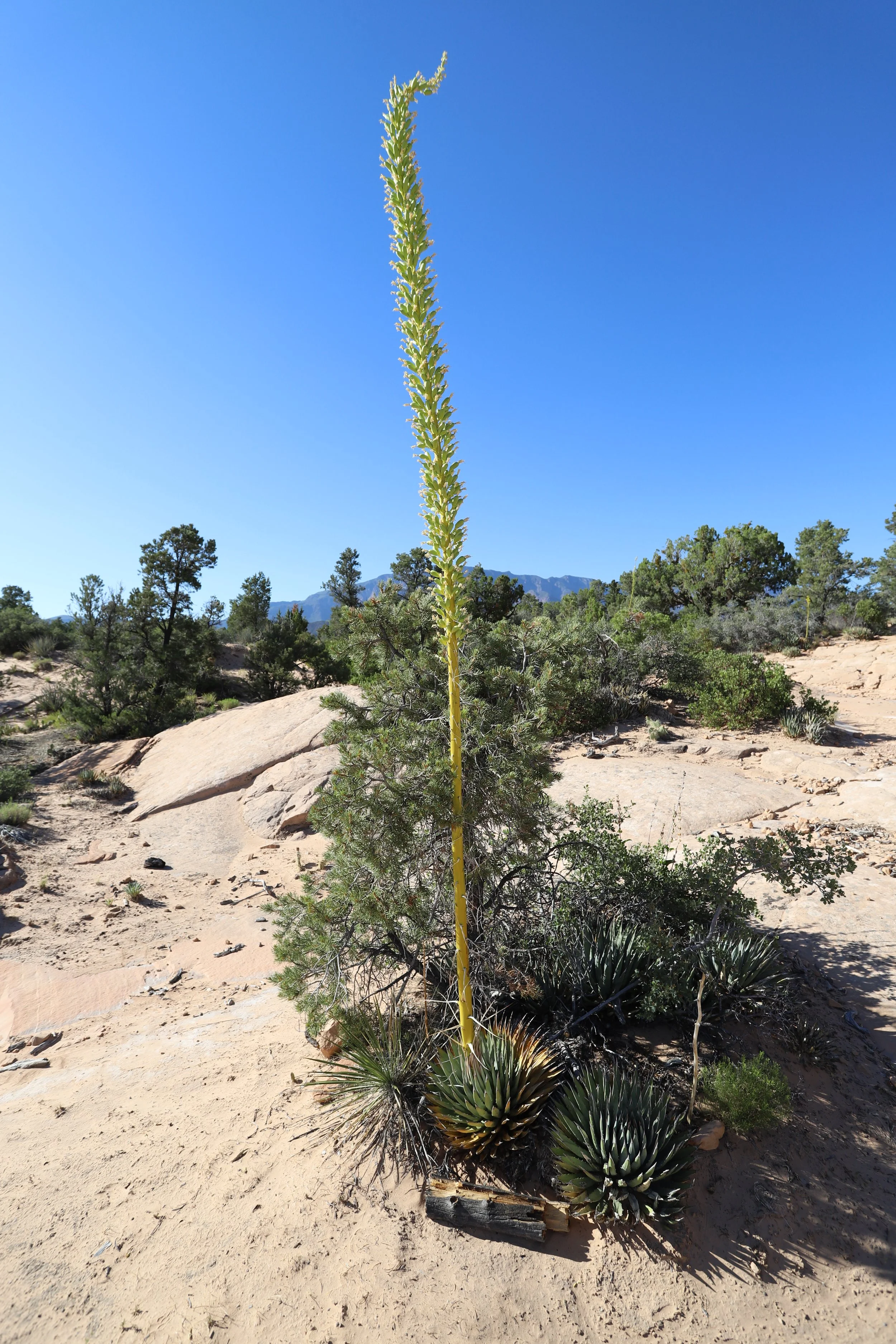
Yucca plants have extremely tall flower/seed stalks in the event they are covered by a sand dune.
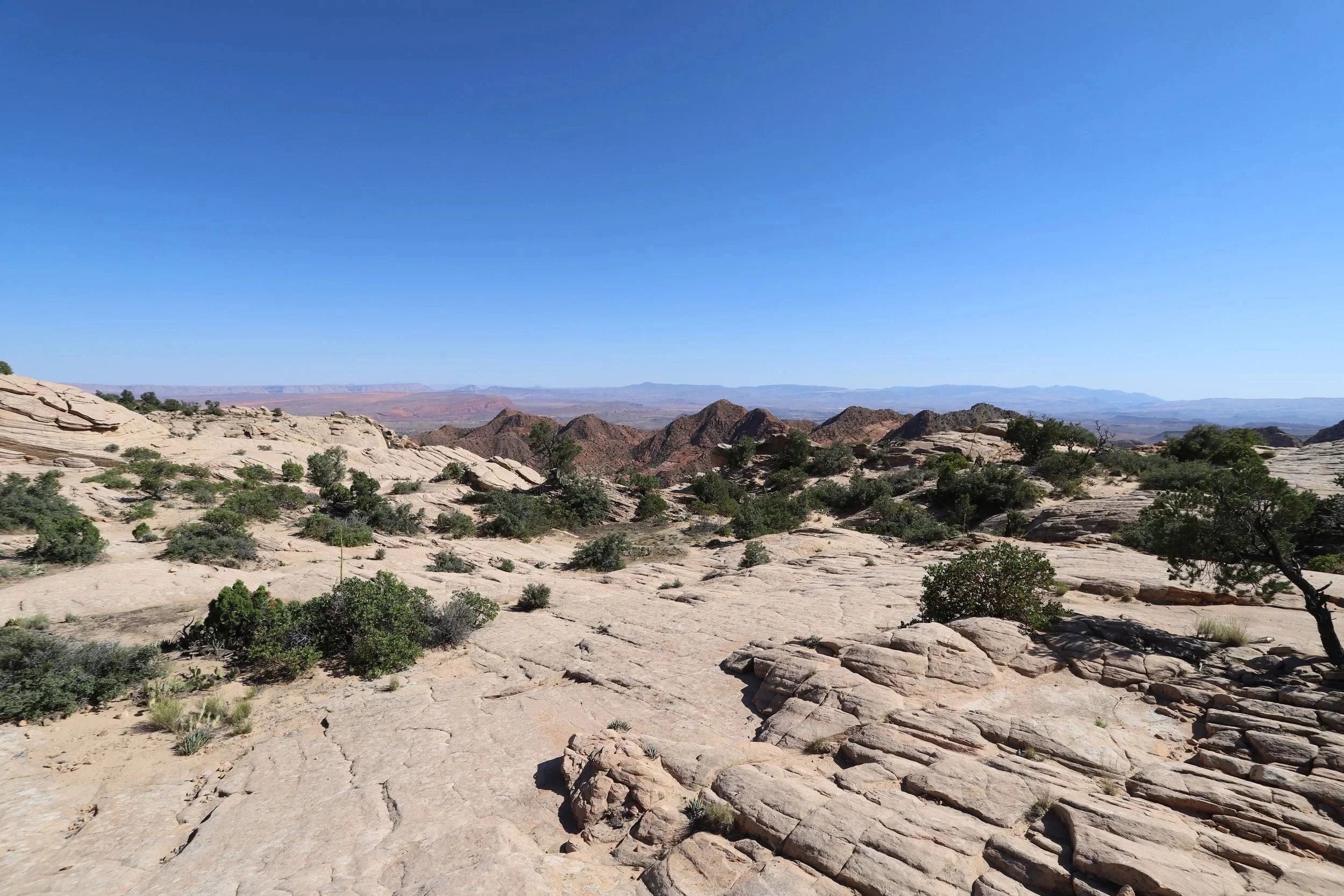
The trail to the Candy Cliffs abruptly ends when the sand turns into hard stone. This section is short and wandering about any direction should still head to the main viewpoint. We did have the trail pre-downloaded on our GAIA app, which I would always recommend when wandering into backcountry (or use the AllTrails app).
Moment the sandy trail ends along the way to Candy Cliffs. Keep going - it should be pretty obvious at this point, and you are super close!
Candy Cliffs aren’t visible quite yet, but just keep walking out to the edge
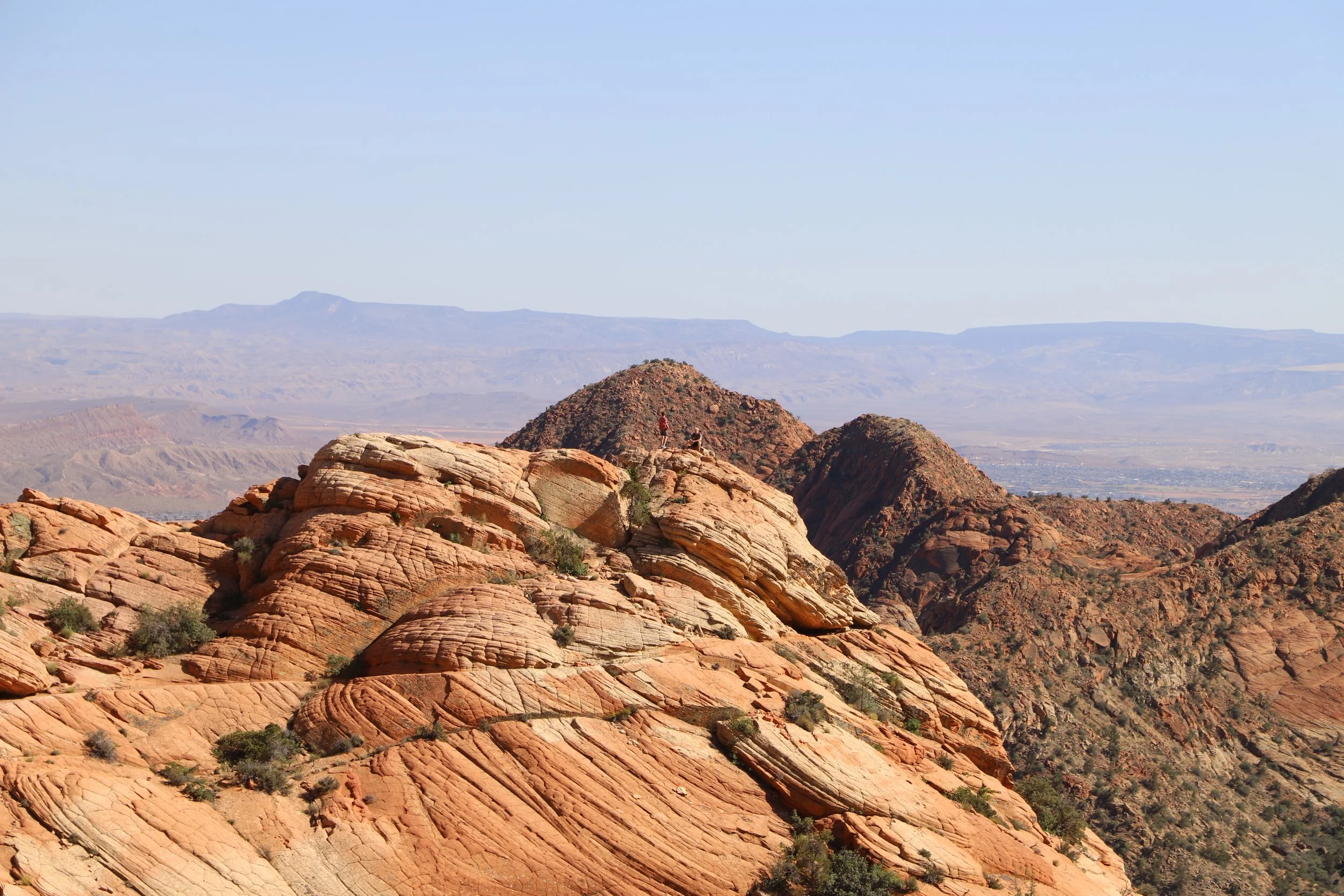
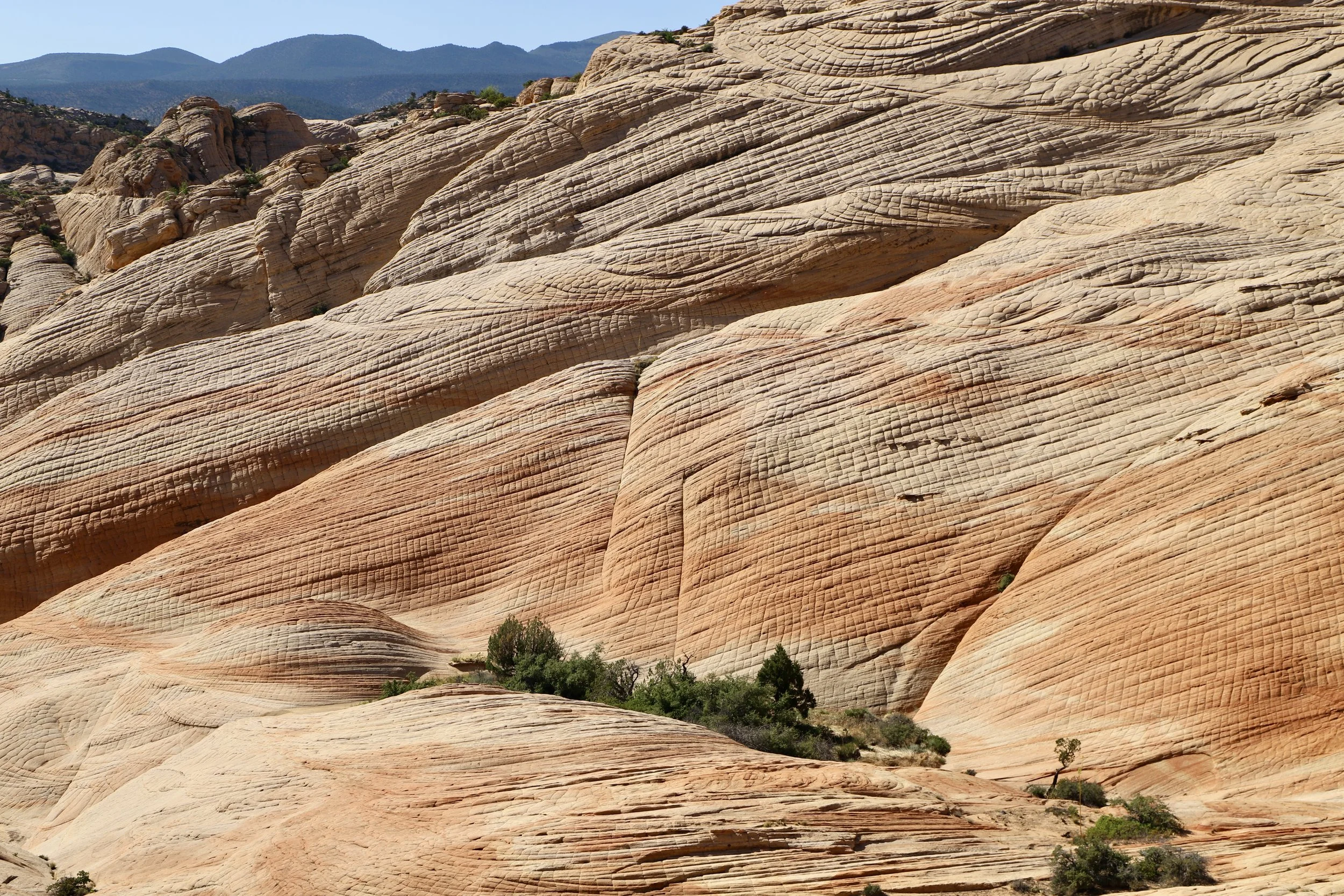
The Candy Cliffs are a pretty stunning reveal at the end of a mostly sandy desert trail.
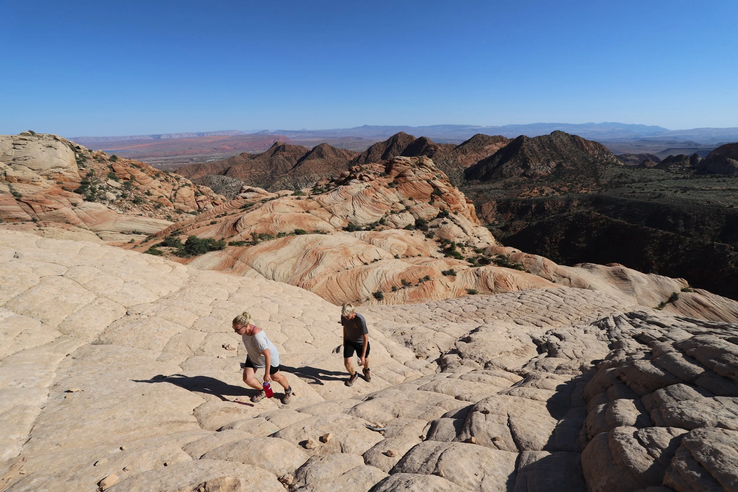
This is the main viewpoint. From here, the rocks can be explored in any direction. Our boys took off straight in front of us, with the goal of conquering the main center rock..
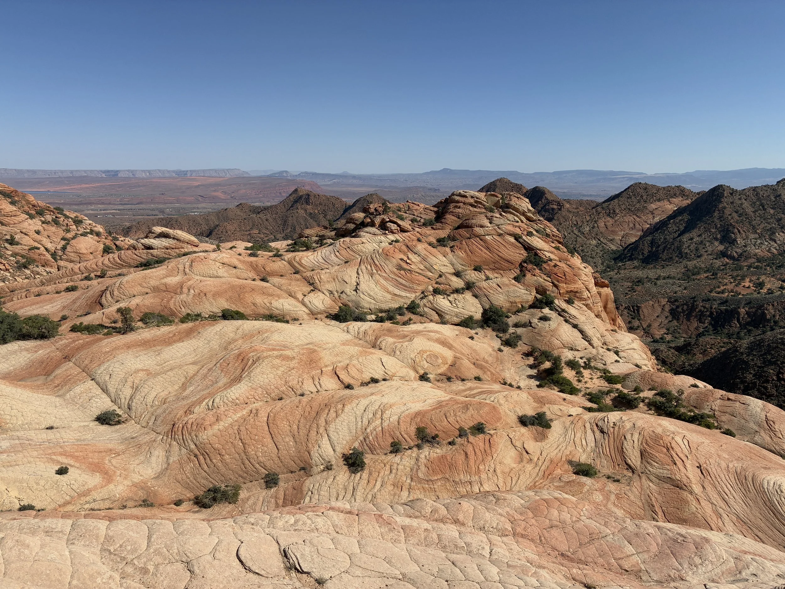
Yant Flat Candy Cliffs
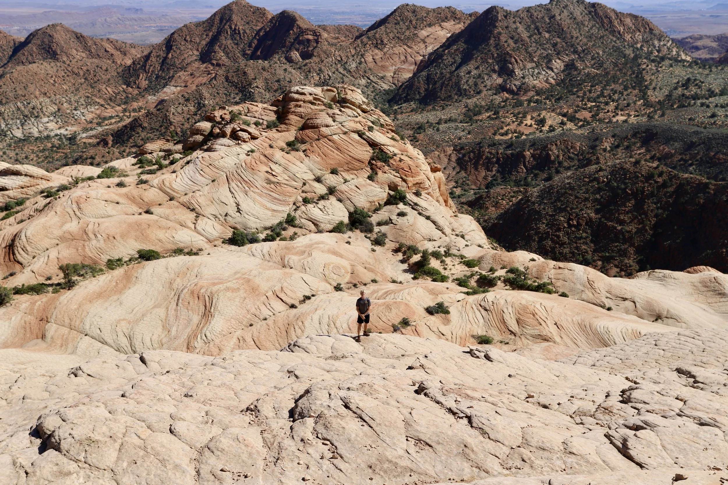
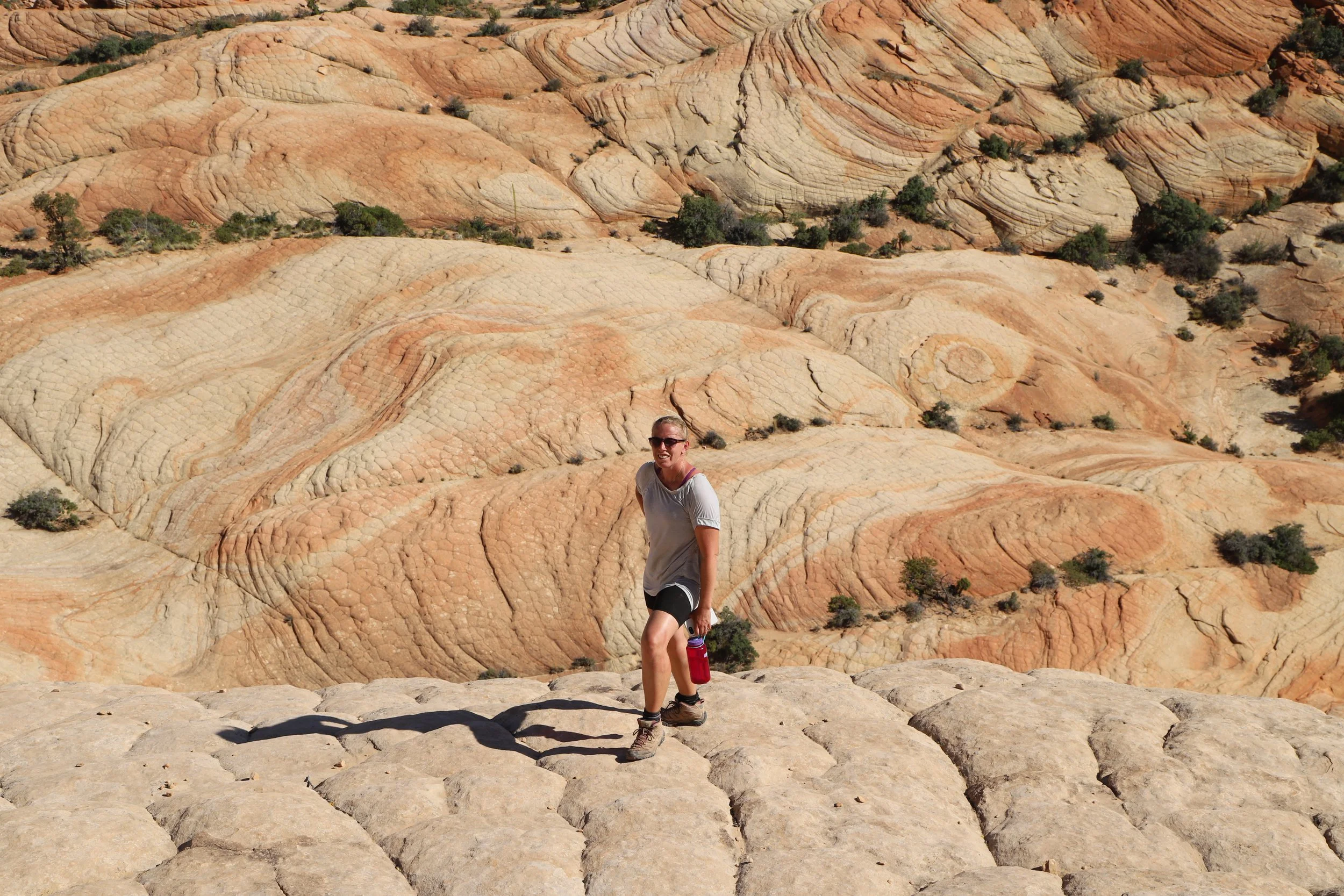
Having people in the picture helps with a bit of perspective for how big these rocks are. It looks like there is a drop-off, but as long as the rock isn’t wet, it’s possible to just make impromptu switchbacks behind where our son is standing, and it’s easy to walk down from this viewpoint.
Posing in front of the Candy Cliffs
Having scaled down the cliffs, this is our younger son excitedly running across the easy part to scale up the largest rock
Both boys scaled the rock in front of us, leaving my husband and I to somewhat grudgingling agree we would meet them on top of the rock.
Here I go, slower than both of my boys
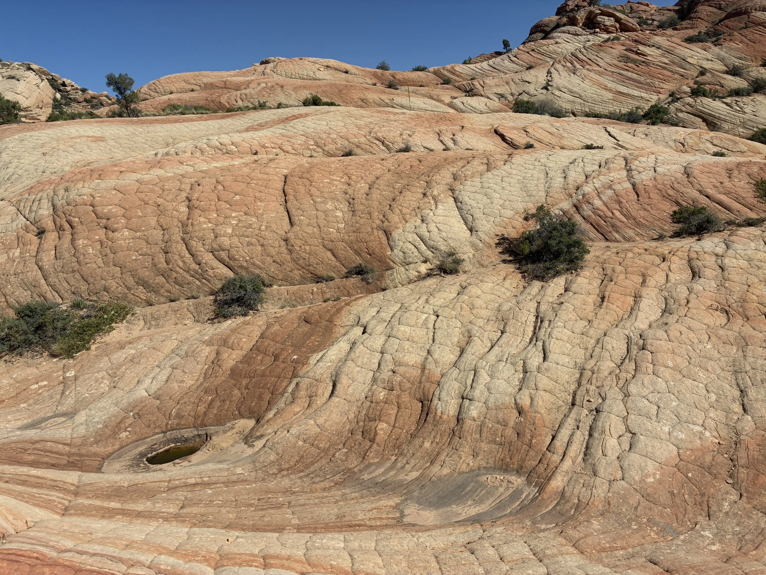
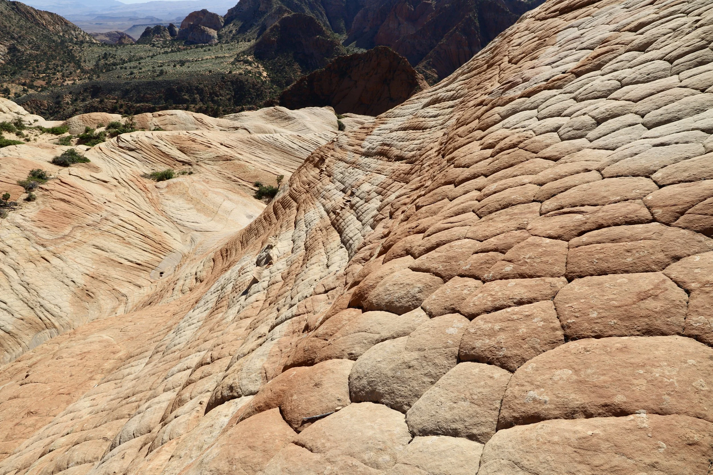
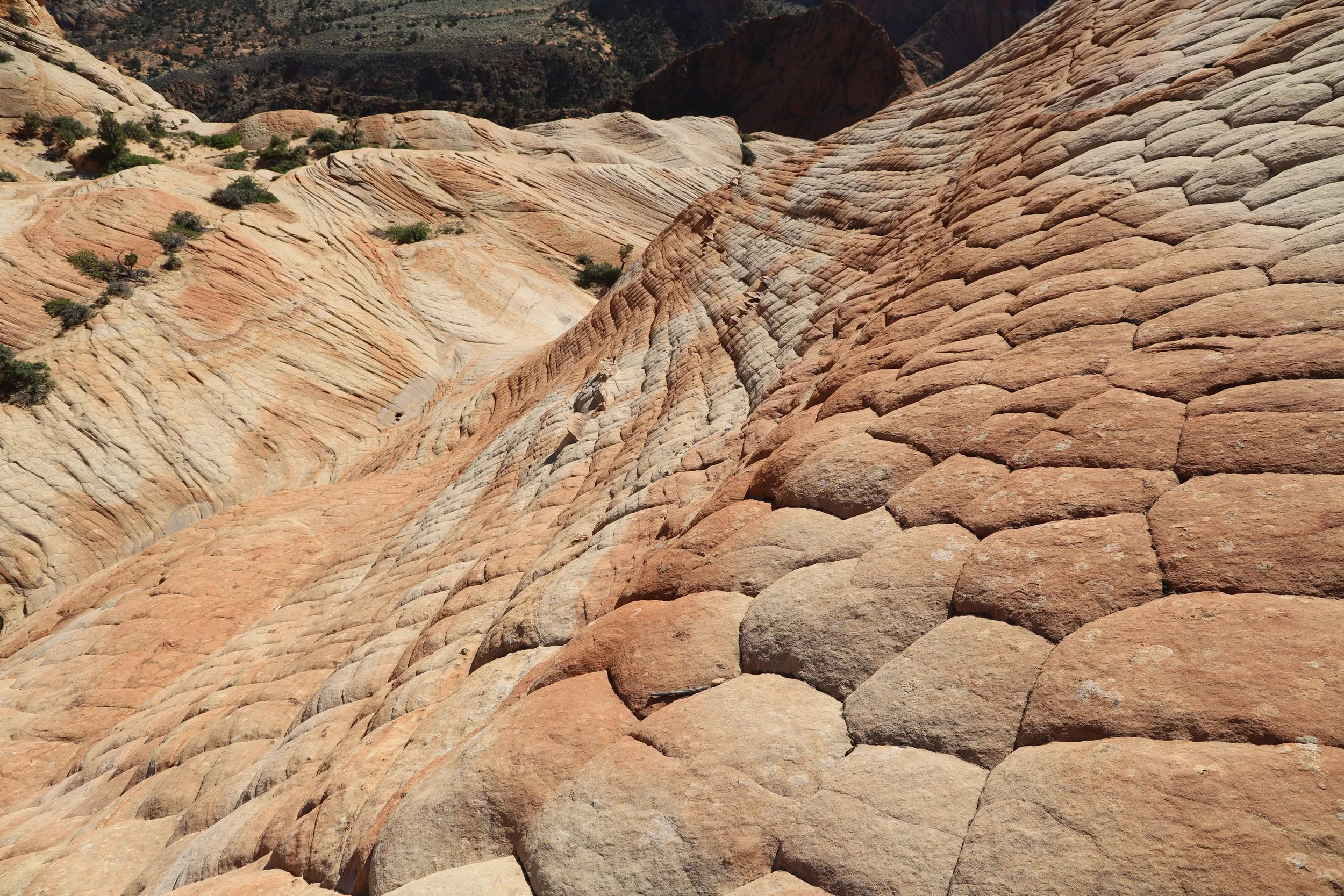
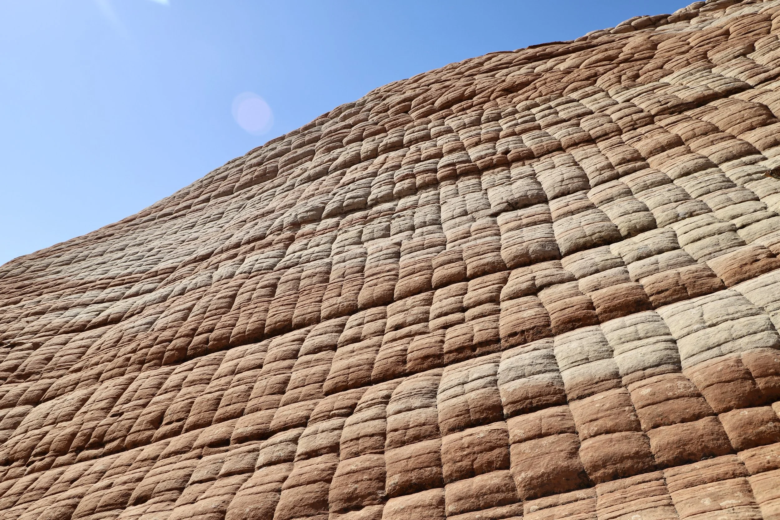
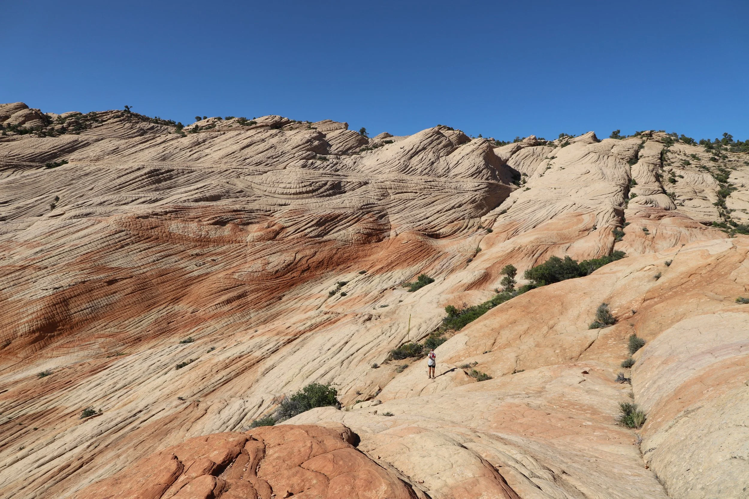
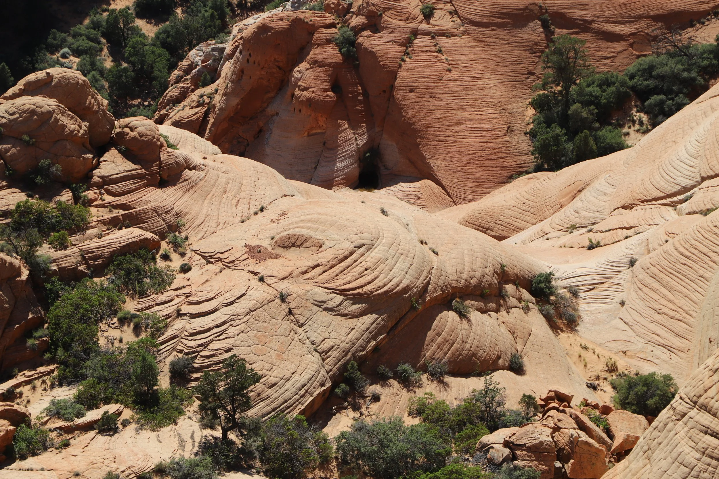
At this point in the hike - the geometric square patterns in the Navajo Sandstone are undeniably amazing. The only other rock that we’ve seen with a similar pattern is the Checkboard Mesa, inside Zion National Park. The horizontal lines formed as the ancient sand dunes formed (like waves). The vertical lines are formed from water expanding as ice during winter freezing.
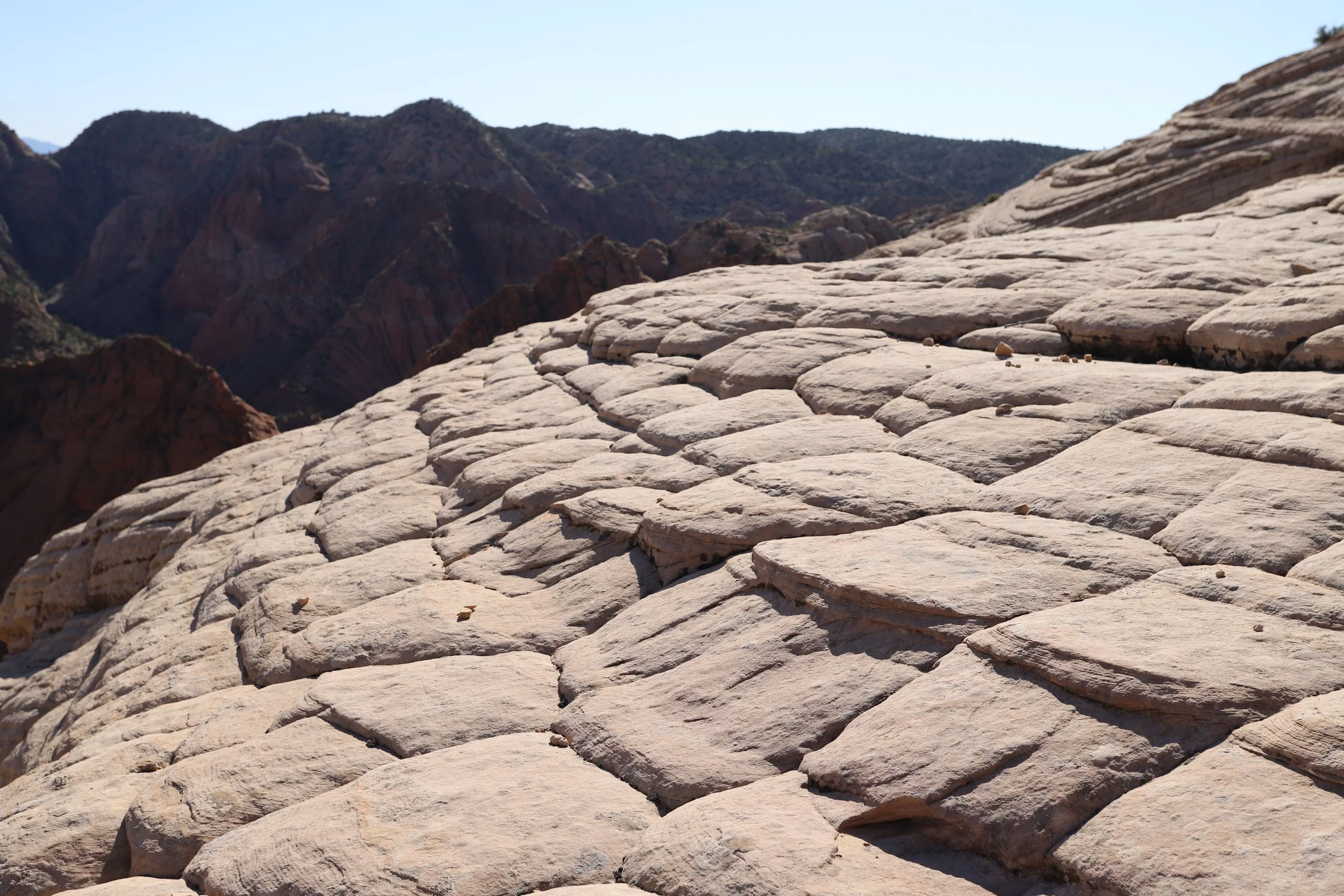
Checkerboard pattern at Candy Cliffs
There’s not a need for a trail. The easiest way to traverse this rock is to make switchbacks on the dry rock.
Sorry for all of the pictures - this was such an unexpectedly beautiful hike
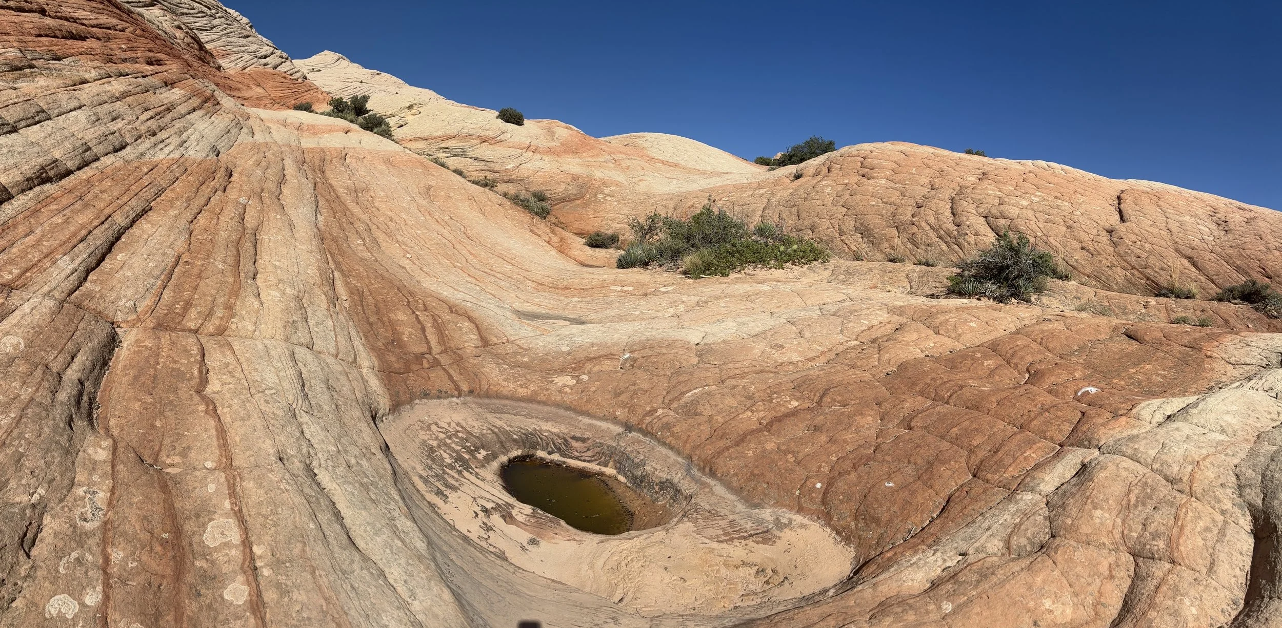
There was one random hole filled with water
Gazing up at this incredibly symmetric pattern formed randomly by nature
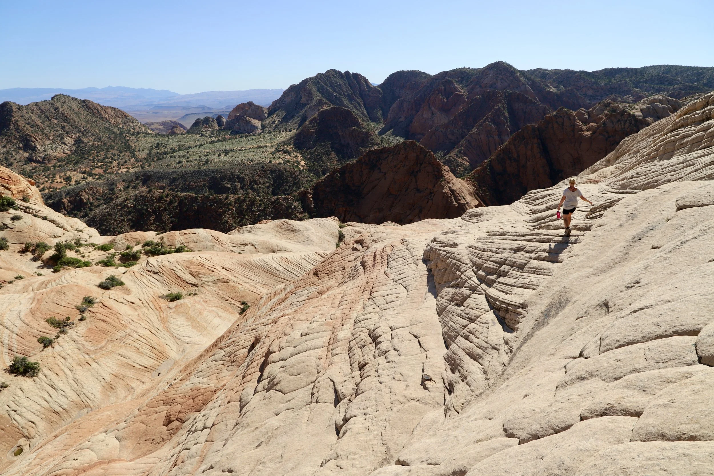
Looking backwards from where we had been as we climbed up the rock
One more picture looking back towards where we had started from
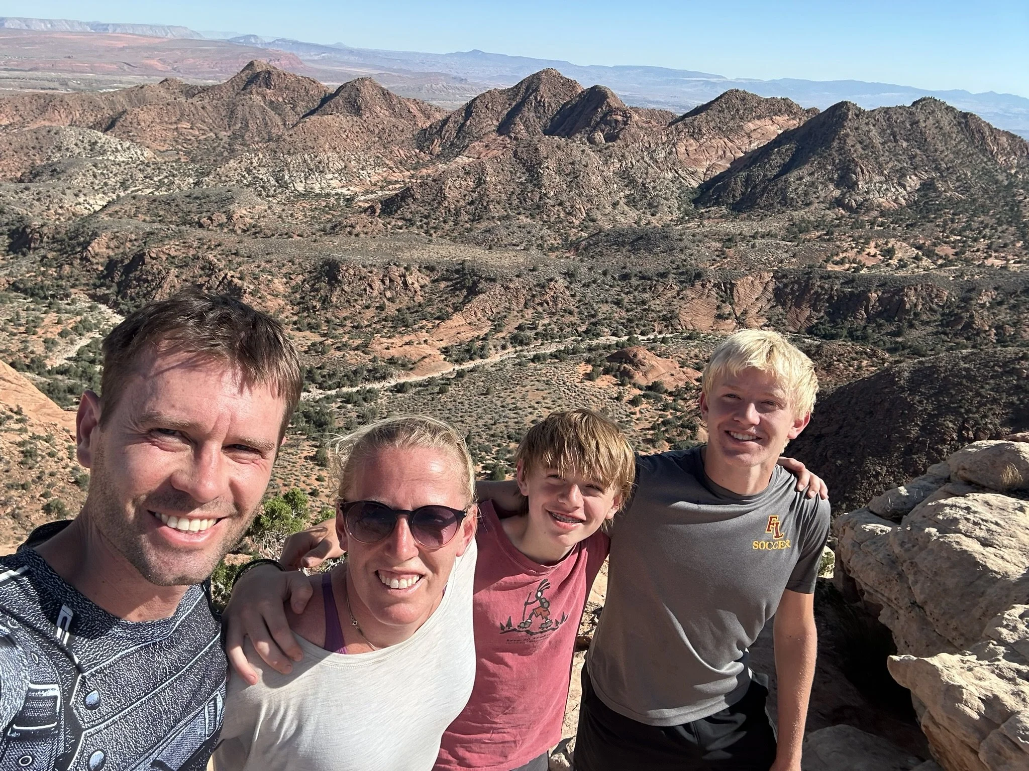
Made it to the top!
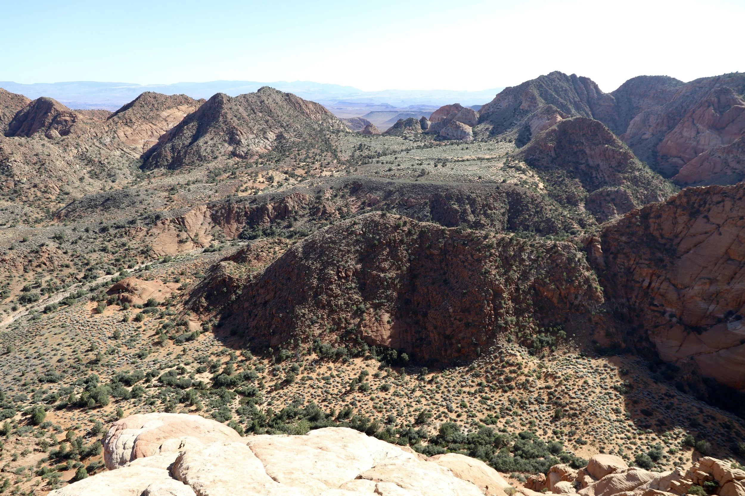
Mountains on one side of us from the peak
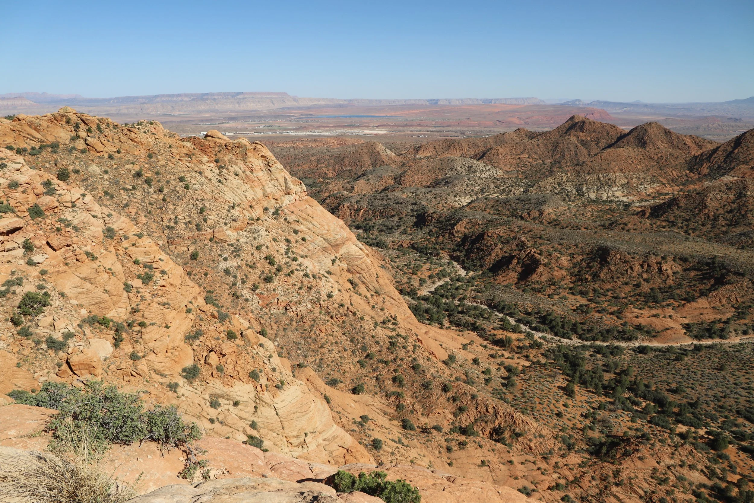
Looking at the opposite side from the peak
Looking down the way we’d climbed up. The ancient sand dunes have been turned into a mountain.
Climbing back was particularly tragic in the afternoon heat. This is why you need to pack extra water! Note that we had water bottles in our hands - we left our bags back at the viewpoint while we played on the rocks.
This was such a fun place to explore. It would have been better had the weather been a lot cooler though. Try this hike in a non-summer month or plan to hike in the cooler early morning hours.
Other Things to Do Nearby (within an hour drive)
Below are hyperlinks to other posts I’ve written about things to do that are located within an hour’s drive from the Yant Flat Candy Cliffs. All estimated drive times assume taking the road to Leeds (not St. George as this road is not as well maintained).
Zion National Park
Zion National Park is probably the reason for traveling to this part of Utah. There are so many fantastic hikes for all types of hikers. There are multiple park entrances. Kolob Canyons Visitor Center is 45 minutes northeast from Yant Flat, and the main Zion Visitor Center (near Springdale) is an hour and 15 minutes east.
Kanarra Falls
Kanarra Falls is a moderately difficult hike that travels through a slot canyon with four waterfalls. This trail goes through the water and feet and ankles will get wet. Permits are needed for this hike. Consider pre-purchasing as only 200 hikers are allowed in per day. Walking sticks will be helpful on this hike. Neoprene booties under hiking boots will keep your feet warmer. Kanarra Falls is an hour drive northeast from Yant Flat.
Red Reef Trail
Red Reef Trail is a relatively easy 1.7-ish mile out-and-back hike along Quail Creek within a stunning canyon. The first obstacle involves some Moki steps that require a bit of courage to cross. The trail continues upstream but will likely be underwater in the winter and spring months. The trailhead is 45 minutes east of Yant Flat.
Pioneer Park
Pioneer Park is a free city park in St. George, UT. There are no playgrounds or swings, but there are arches, slot canyons, caverns, Moki steps, and tons of rocks to scramble over, under, through, around, up, and down. Pioneer Park is a 55-minute drive south of Yant Flat. Take the road through Leads - the road to St. George is not well maintained.
Snow Canyon State Park
Snow Canyon State Park is a unique place to hike which includes both a short slot canyon and lava tube caves that can be explored, in addition to some beautiful hikes. Bring a flashlight or headlamp for the lava tubes. Snow Canyon is an hour drive west of Yant Flat. Take the road through Leads. It’s going to feel weird going east to go west…. My directions are worth the extra 7 minutes in drive time.
Sand Hollow State Park
Enjoy swimming, cliff jumping, or riding ATVs through sand dunes at Sand Hollow State Park. Jumping Rock is a short 0.3-mile relatively easy walk from the parking lot. This state park is going to be better suited for older kids. Sand Hollow is an hour southeast of Yant Flat.
More from www.NatureImpactsUs.com
In the map below, there are additional posts I’ve written attached to each pin. Use two fingers to move around within the map.