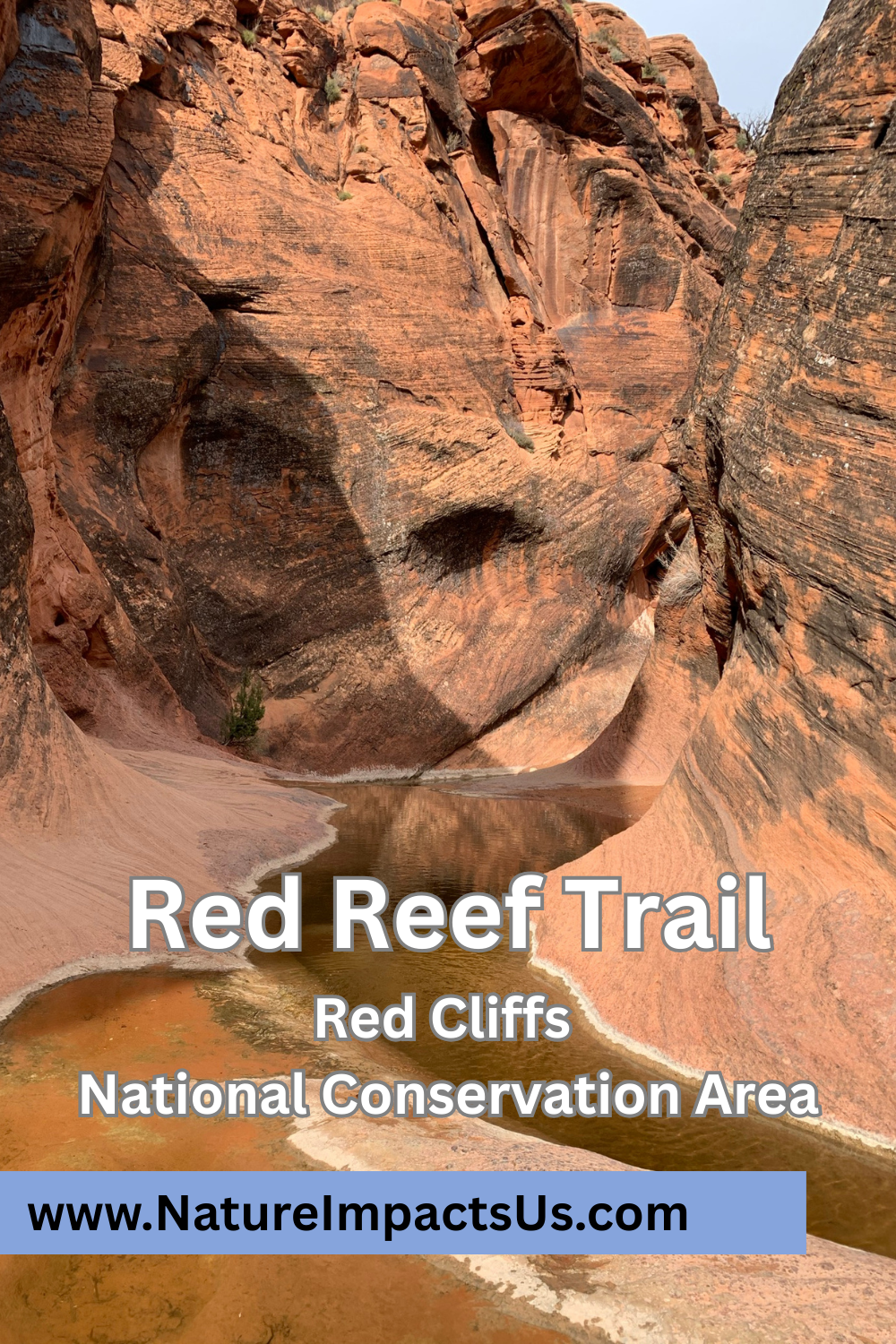
Red Reef Trail - Red Cliffs National Conservation Area
If you enjoy my blog, please consider signing up below for email notifications of my latest posts. I will not share your email.
A Desert Oasis
Obviously, water in any desert is a special place. This is especially true on the Red Reef Trail within the Red Cliffs National Conservation Area, near St. George, UT. The Red Reef Trail follows along the base of a canyon and Quail Creek, which has deep enough pools to maintain water through much of the year. In the spring, snow melt run-off creates small waterfalls and deeper pools that kids can splash in. During dry summer months, the water will disappear. There are also preserved three-toed dinosaur tracks near the Red Reef trailhead, although I’ve learned about these tracks long after hiking here, therefore do not have any pictures to share, and I need to go back… It’s so hard to find everything worth seeing on just one visit anywhere.

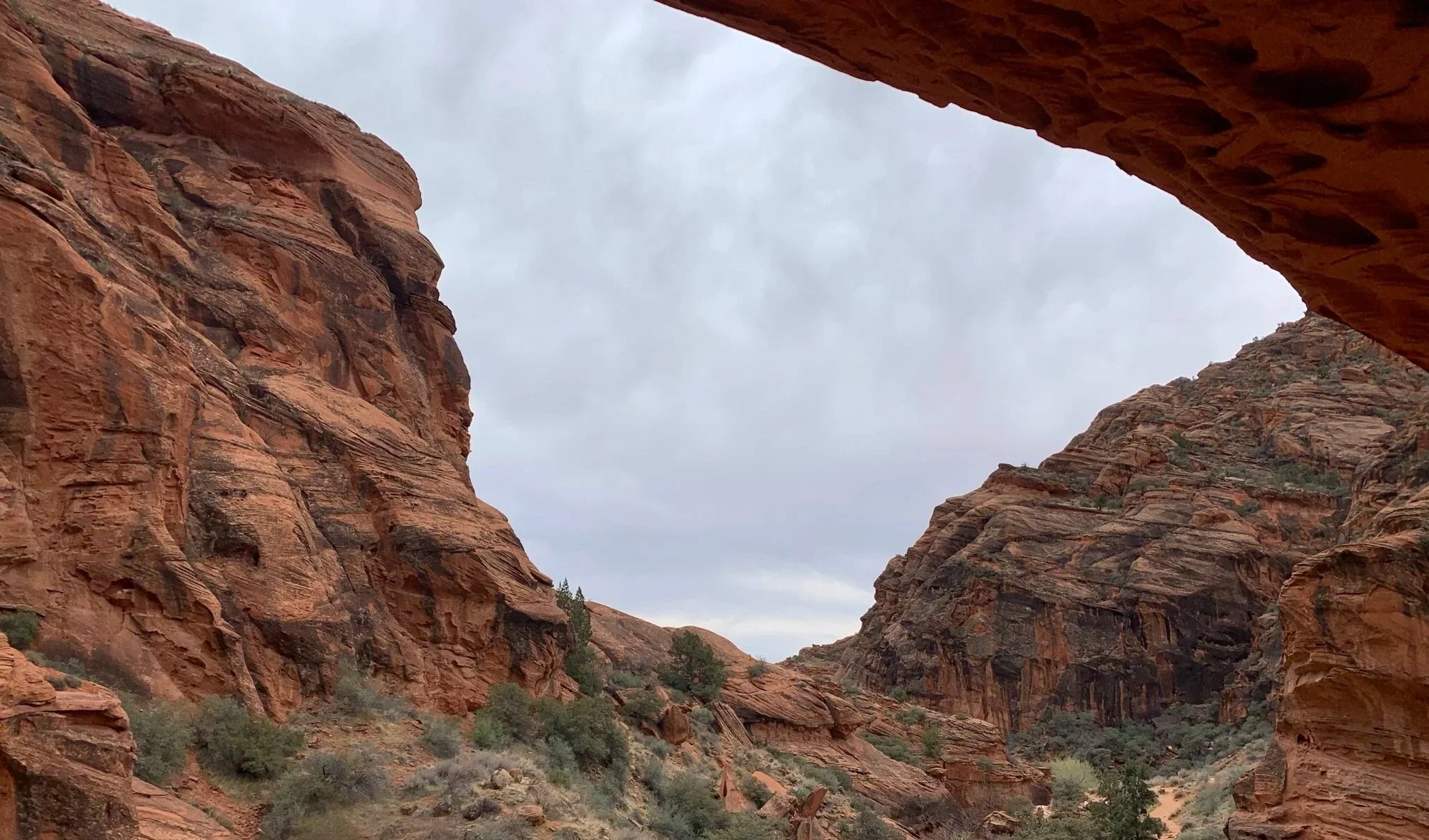
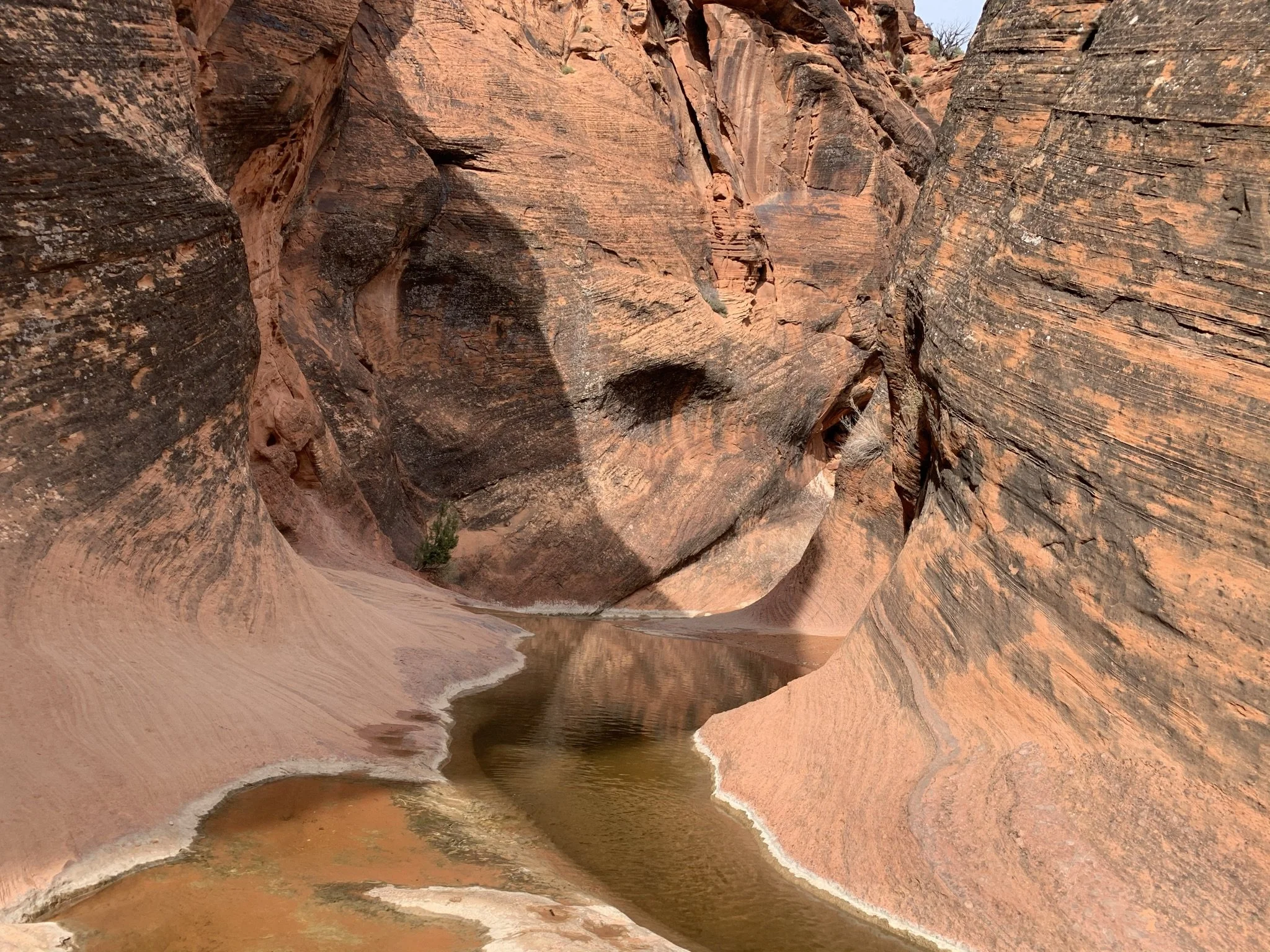
Under the alcove, near the pictographs along Red Reef Trail
Location and Logistics
The Red Reef Trail is located in the Red Cliffs National Conservation Area, about a half hour northeast of St. George. The road to get to Red Reef Trail is paved, so any car will be able to get to the trailhead. Because this trailhead is in a National Conservation Area, a fee for parking is required. The America the Beautiful pass is accepted here.
We visited during March 2021, in the middle of the pandemic, and enjoyed the trail to ourselves. I think that was a unique experience based on other more recent reviews of the trail that describe it as so busy that it might not be worth it to explore. The hardest part of a trip to Red Reef may be in finding parking. There are a handful of small parking lots, but these lots do fill up. My best suggestions for dealing with crowds would be to go on a week day during a non-summer month, arrive early, or try in the early evening when others have stopped hiking for the day and are eating supper.
Hiking the Red Reef Trail
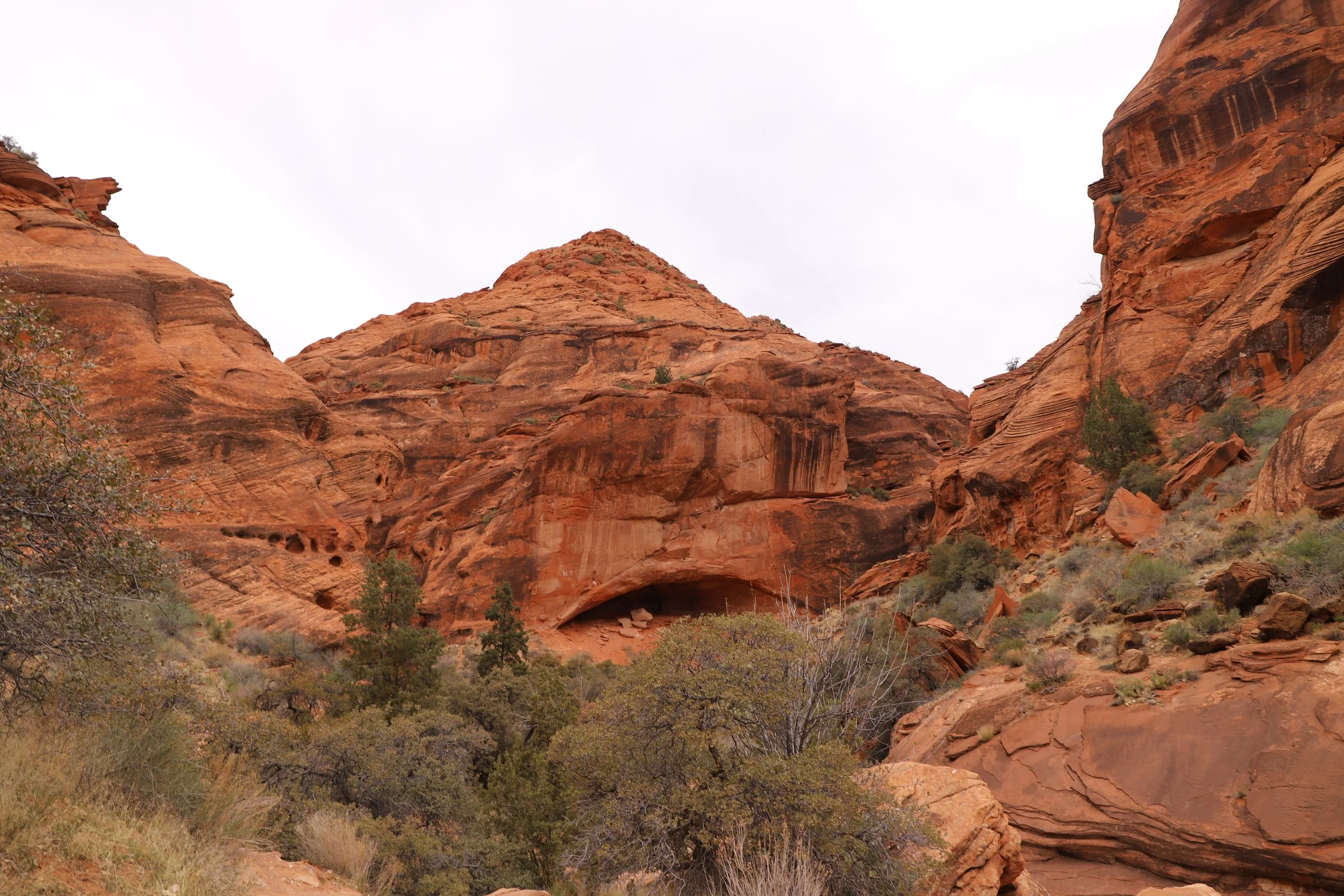
We hiked 1.7 miles (out-and-back) along the Red Reef Trail, and the incline was only 150ft. Most of the incline occurred when we wandered off the main trail to find the pictographs .
Apparently the trail continues and forms a much longer hike loop, but we stopped when the trail was no longer obvious for us on how to continue (about 0.1 miles above the Moki steps). According to other hikers, the loop trail requires getting wet, and there rappelling may be required. I haven’t been able to find any details on the technical route, however.
On the map below, I also have the site marked for preserved three-toed dinosaur tracks. This is easily accessible from the same trailhead, but I unfortunately learned about these tracks after visiting.

Map of the Red Reef Trail and the surrounding Red Cliffs National Conservation Area. Parking lots are designated with black stars.
The trail doesn’t immediately join up with Quail Creek from the parking lot. The first cool thing we found along the Red Reef Trail was this old stump, which made us think of an old elephant.
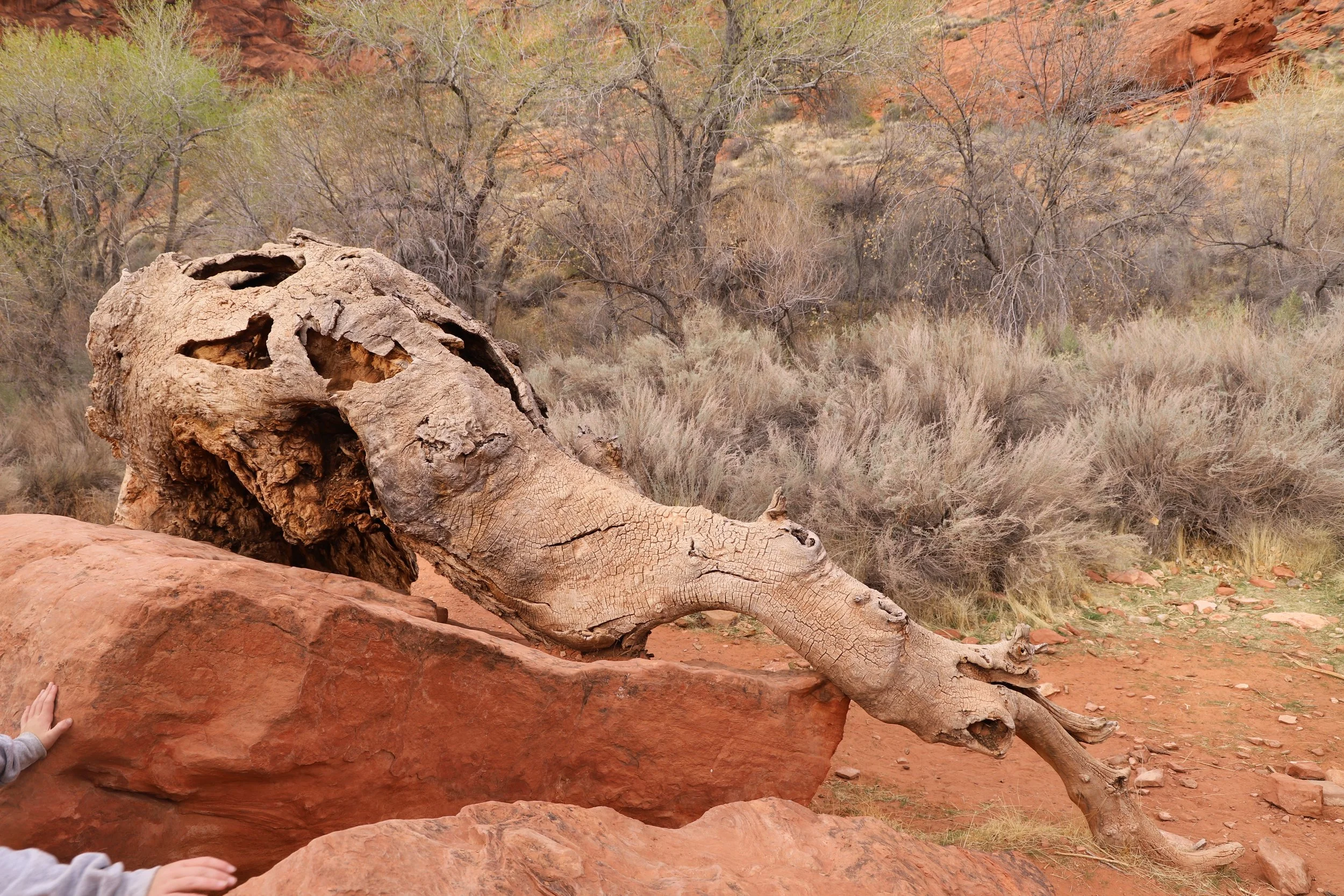
Elephant Tree Stump along the Red Reef Trail
The stump is cool from the backside as well.
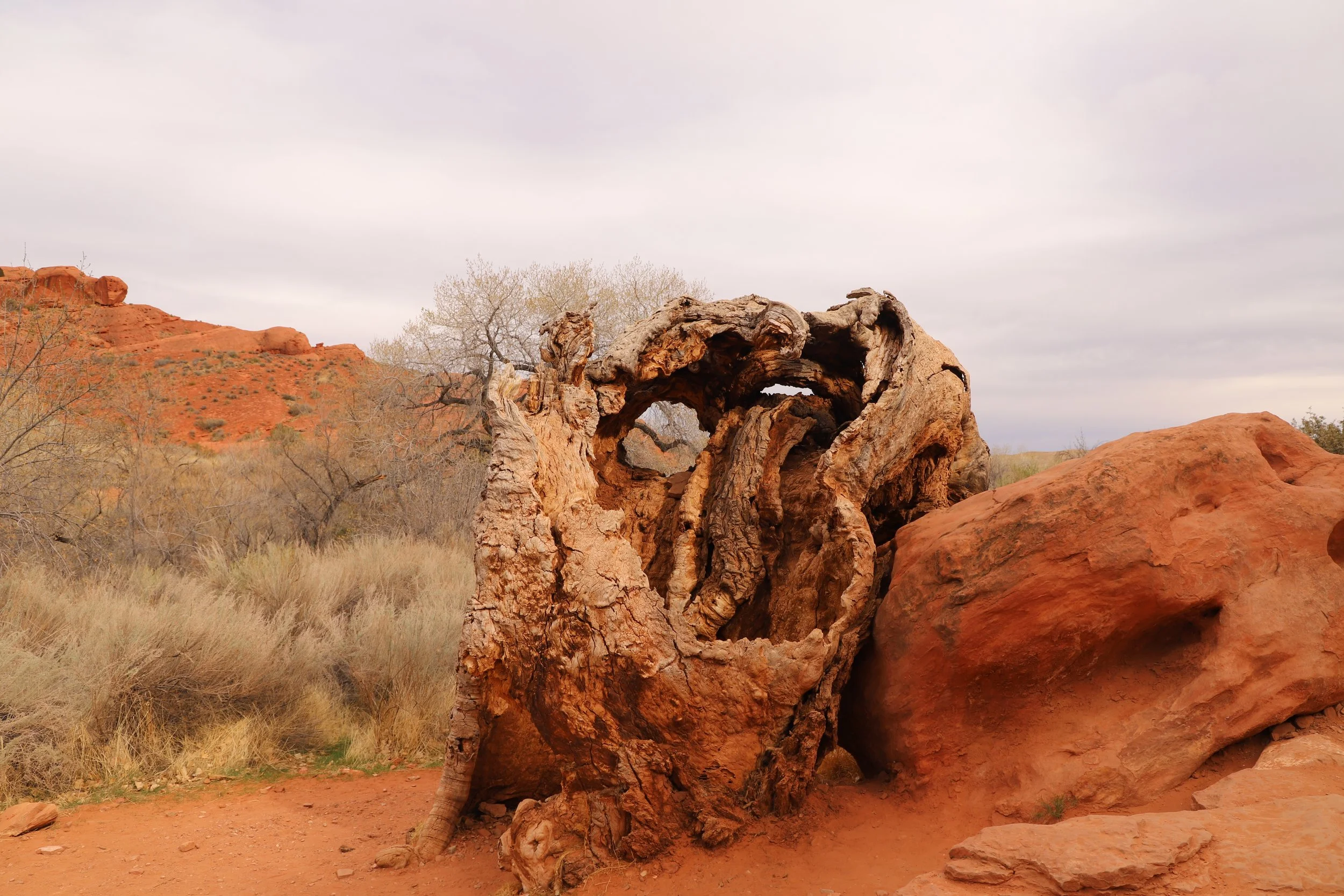
Old gnarly tree stump along Red Reef Trail
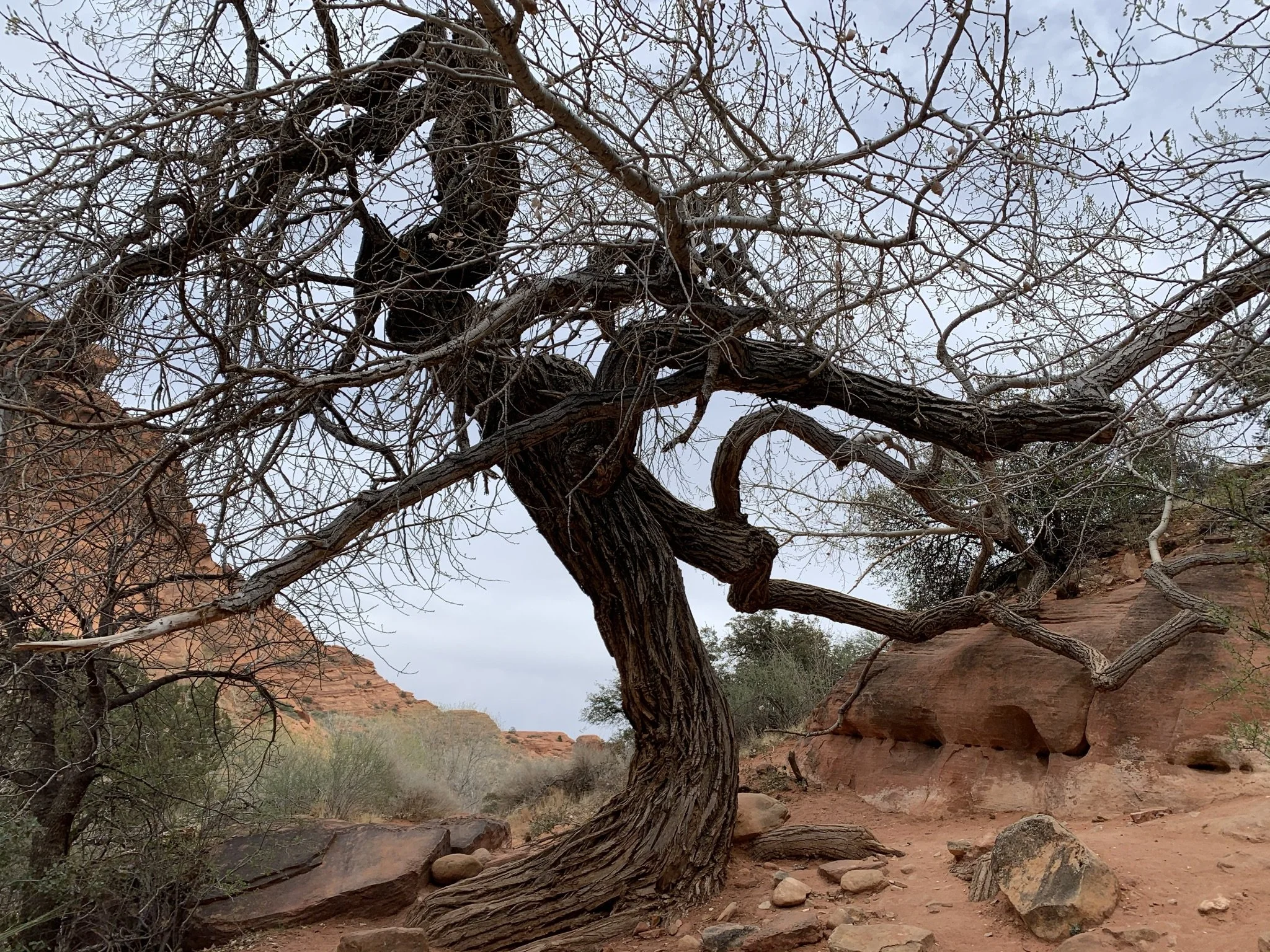
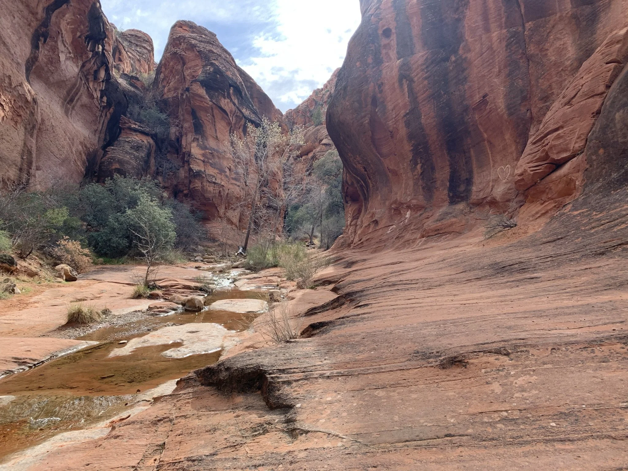
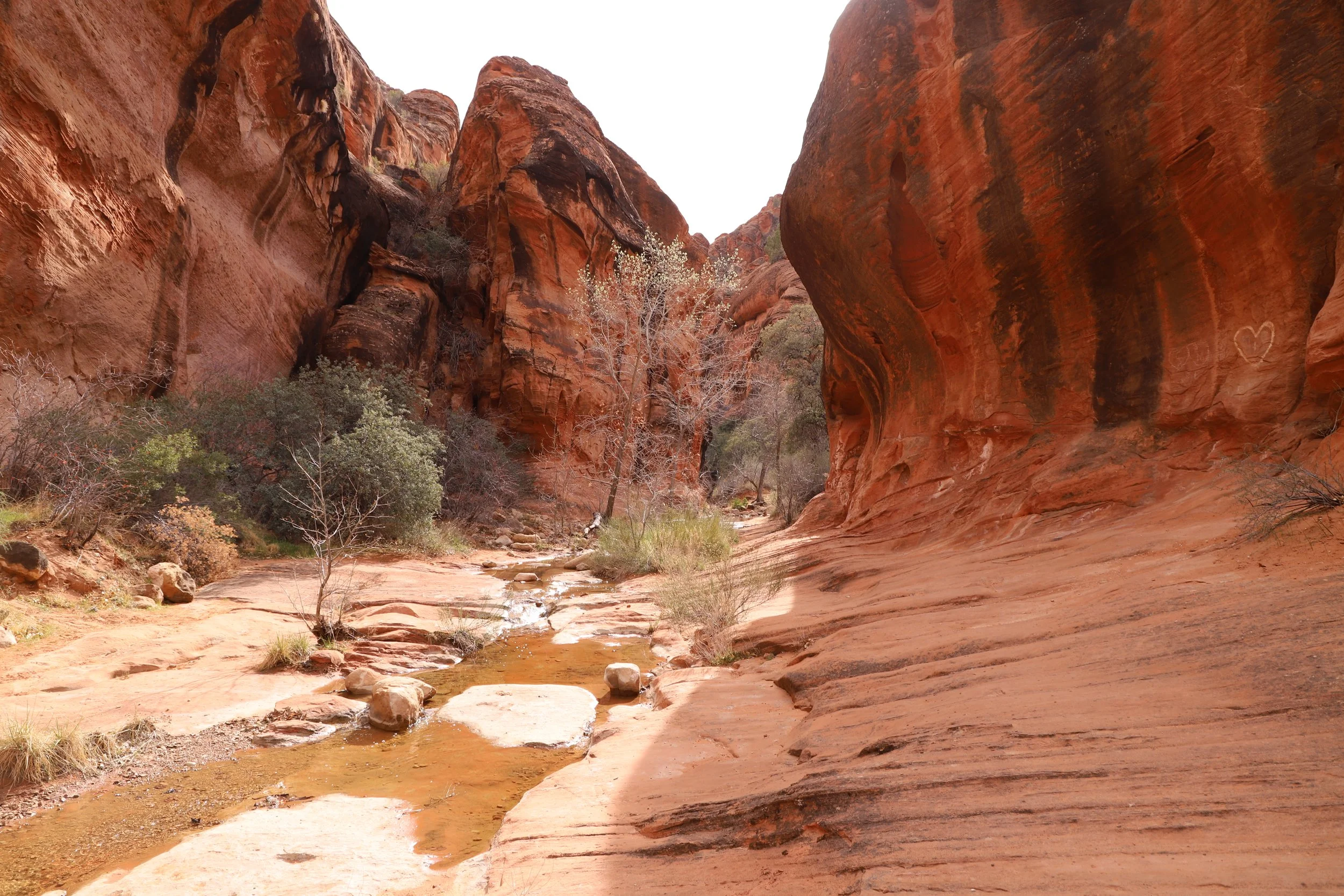
The desert trail continues 0.3 miles before reaching Quail Creek. It’s a pretty hike, but this section of the trail will be hot in the summer months.
Hiking along the Red Reef Trail
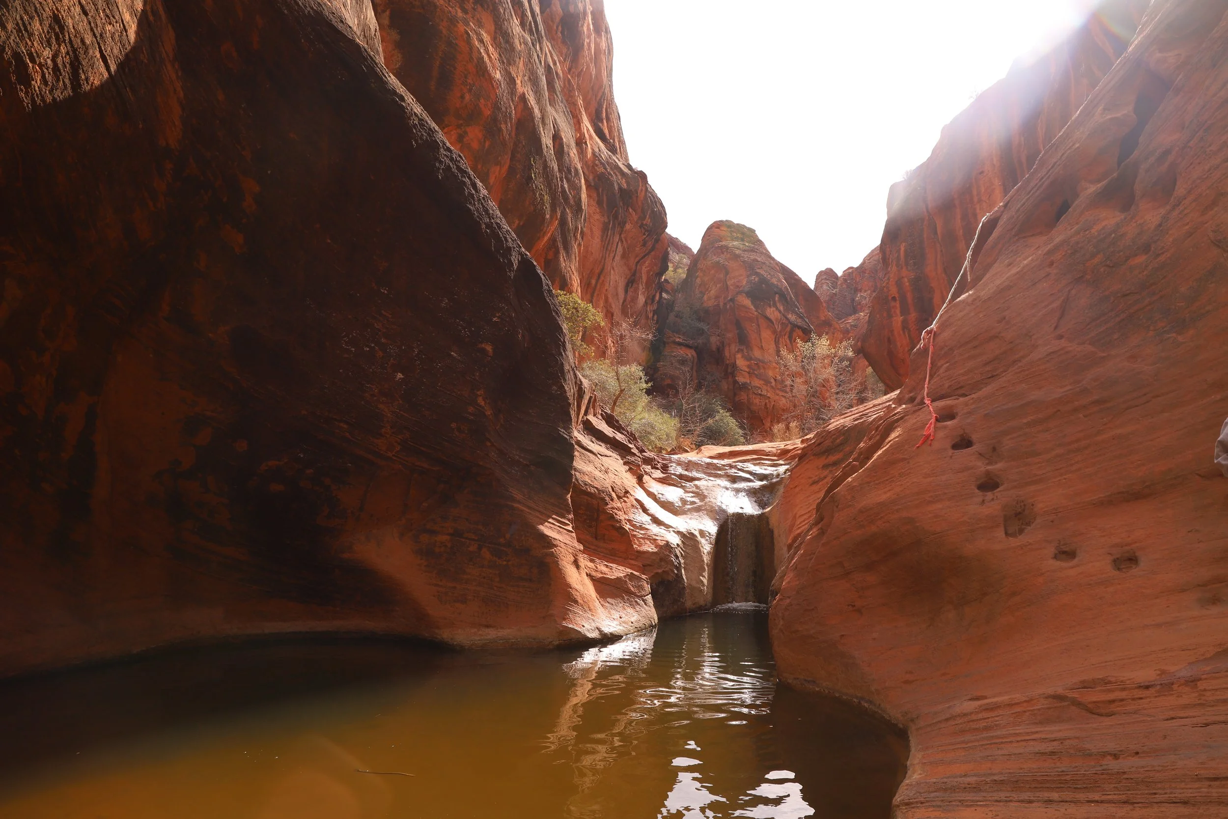
The trail then continues along side Quail Creek for another 0.1 miles before there is a small waterfall. The rest of this trail is extremely pretty. Again, we were here in March, which explains the trees in the photos which are slowly starting to leaf out.
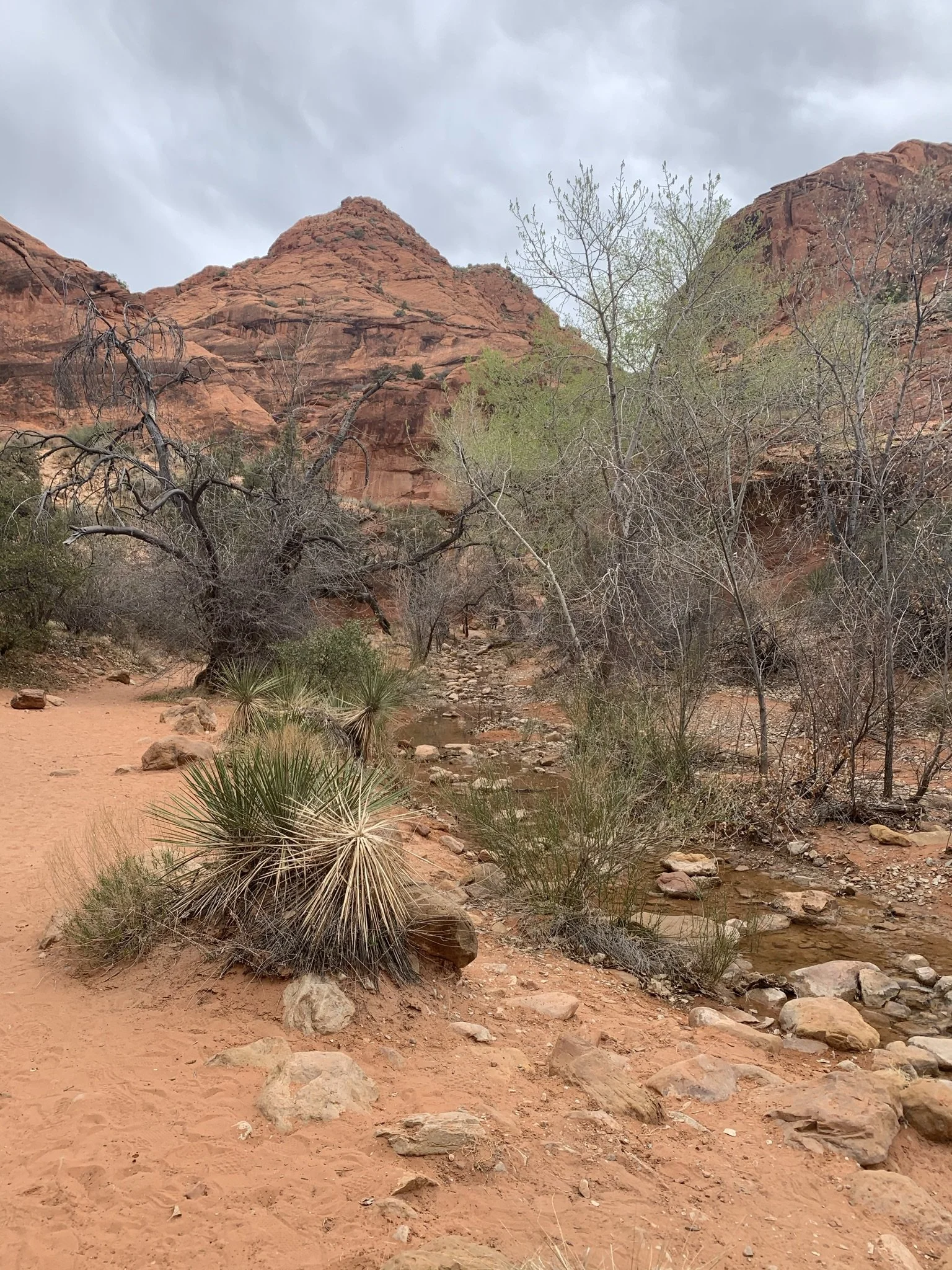
Following the Red Reef Trail along Quail Creek
Another pretty view of Quail Creek nestled between the canyon walls
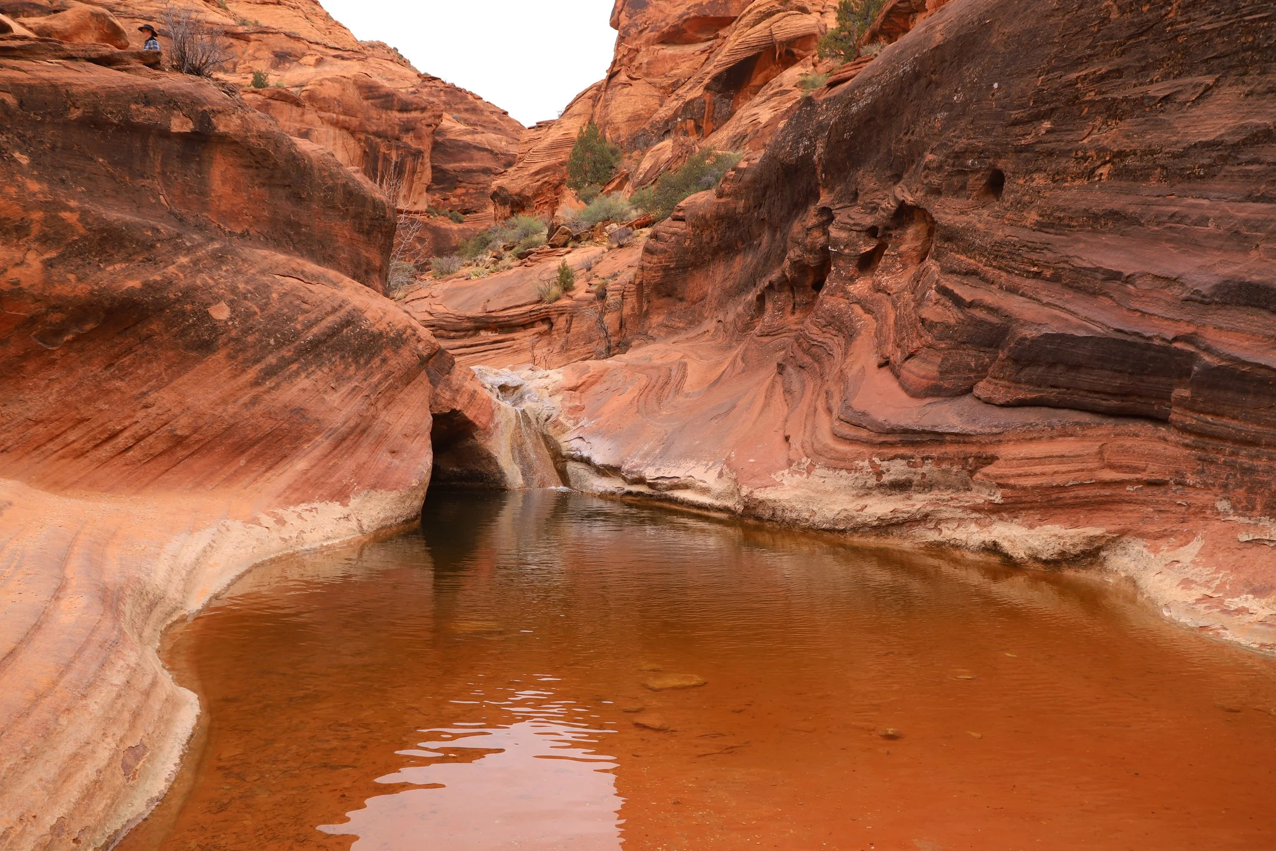
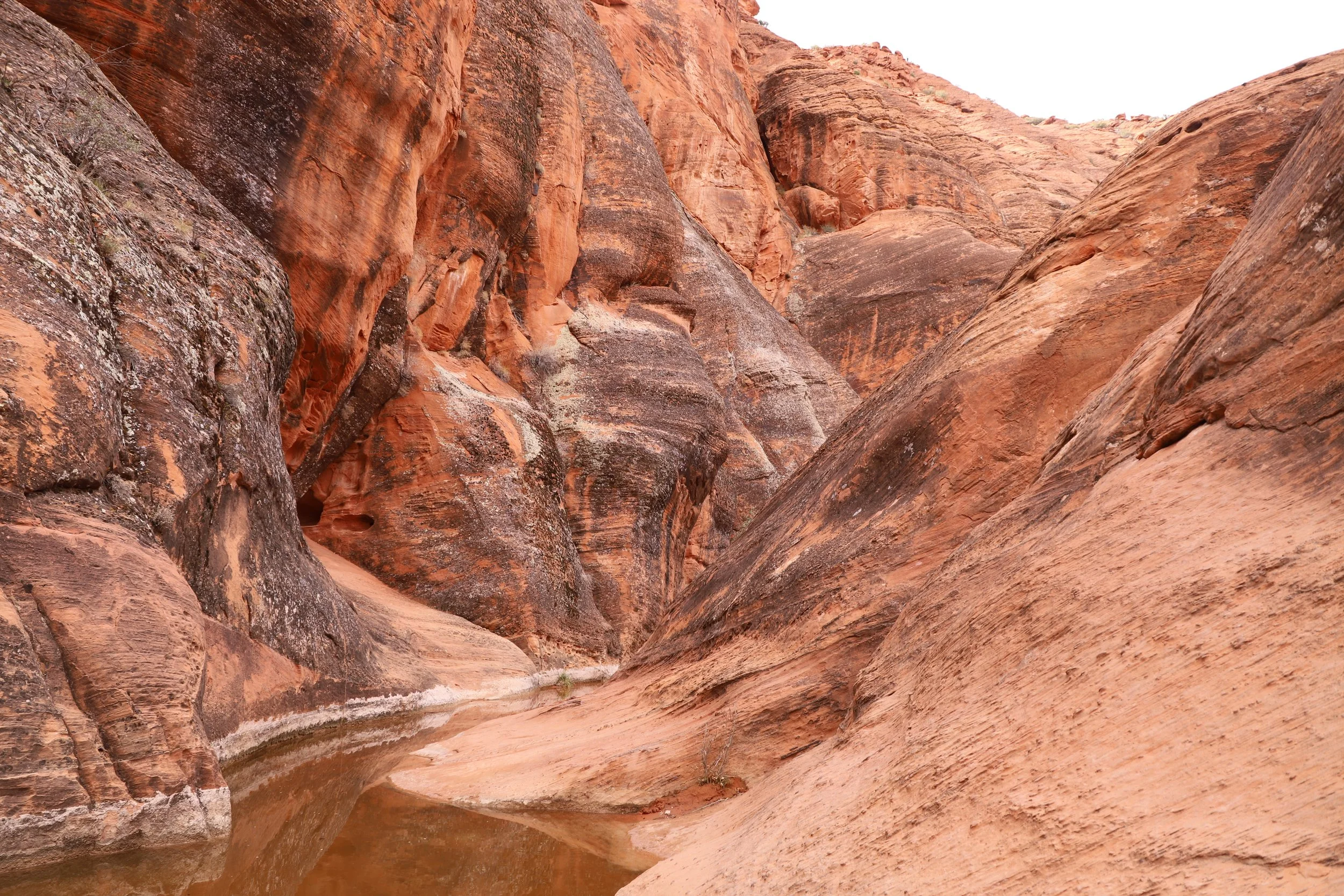
There was no water at the first waterfall. It must have been a dry winter. There was a small pool of water to play in. It was a bit chilly even though we were hiking in the late part of the afternoon, so we chose to keep our feet dry.
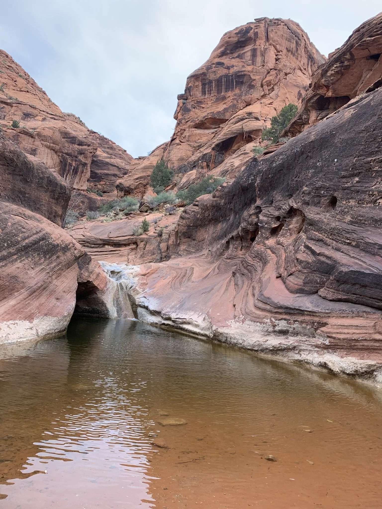
Dry waterfall along Red Reef Trail
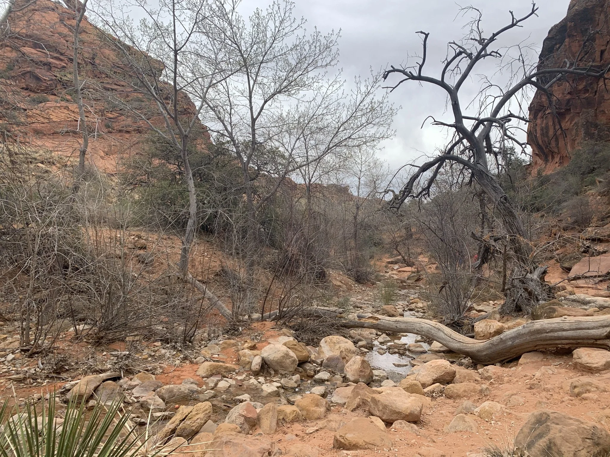
For anyone looking for the Pictographs, it’s another 0.1 miles from the waterfall to the point to exit the trail. This section of the trail had some phenomenal rock formations along the way.
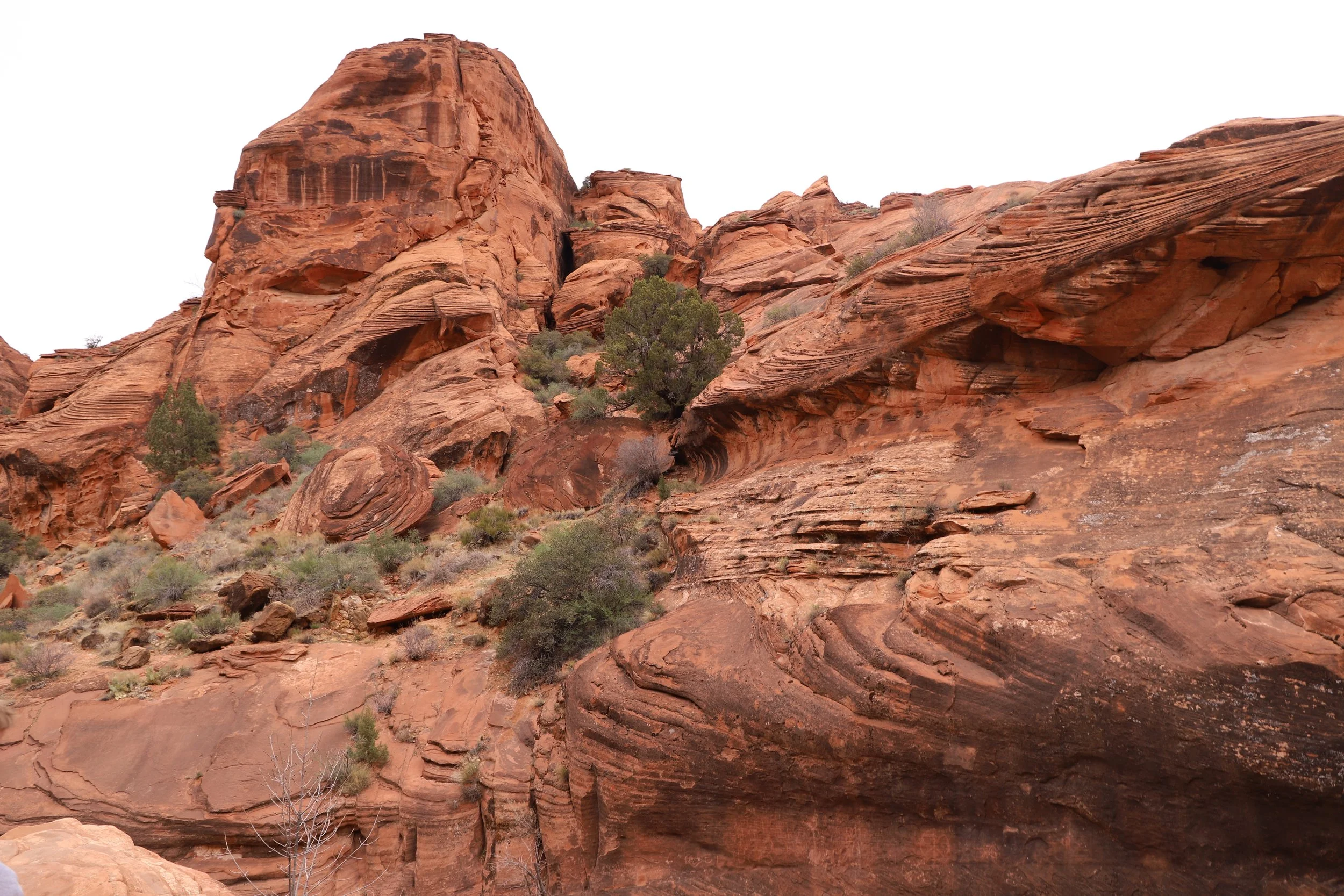
Following Red Reef Trail, shortly after the first waterfall
Same rock formations as above with some perspective of the trai
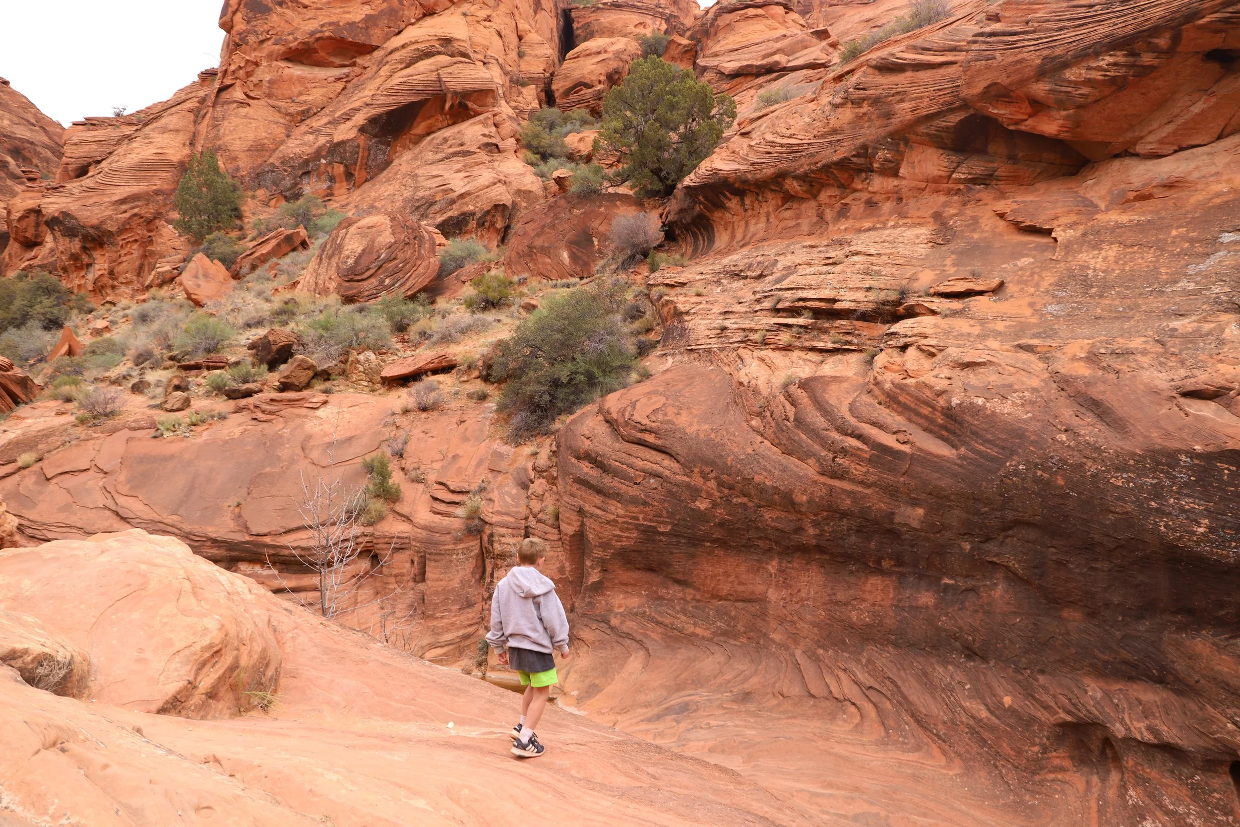
About 0.1 miles from the first waterfall, look up on the right side of the trail. There will be an alcove that is very apparent in the canyon walls. The pictographs are in the walls of this alcove. Walking out and back is another 0.1 miles.
Alcove along the Red Reef Trail that has petroglyphs
We followed an unofficial trail towards the alcove. That pretty much means it was lightly marked, but it’s easy to see the alcove, so just walk over the sand and rocks to get there. Follow your steps back to the main trail after admiring the pictographs .
Under the alcove near the Red Reef Trail, where the pictographs can be found.
Confused about the difference between “petroglyphs” and “pictographs”? Petroglyphs are carved into the rock. Pictographs are painted.
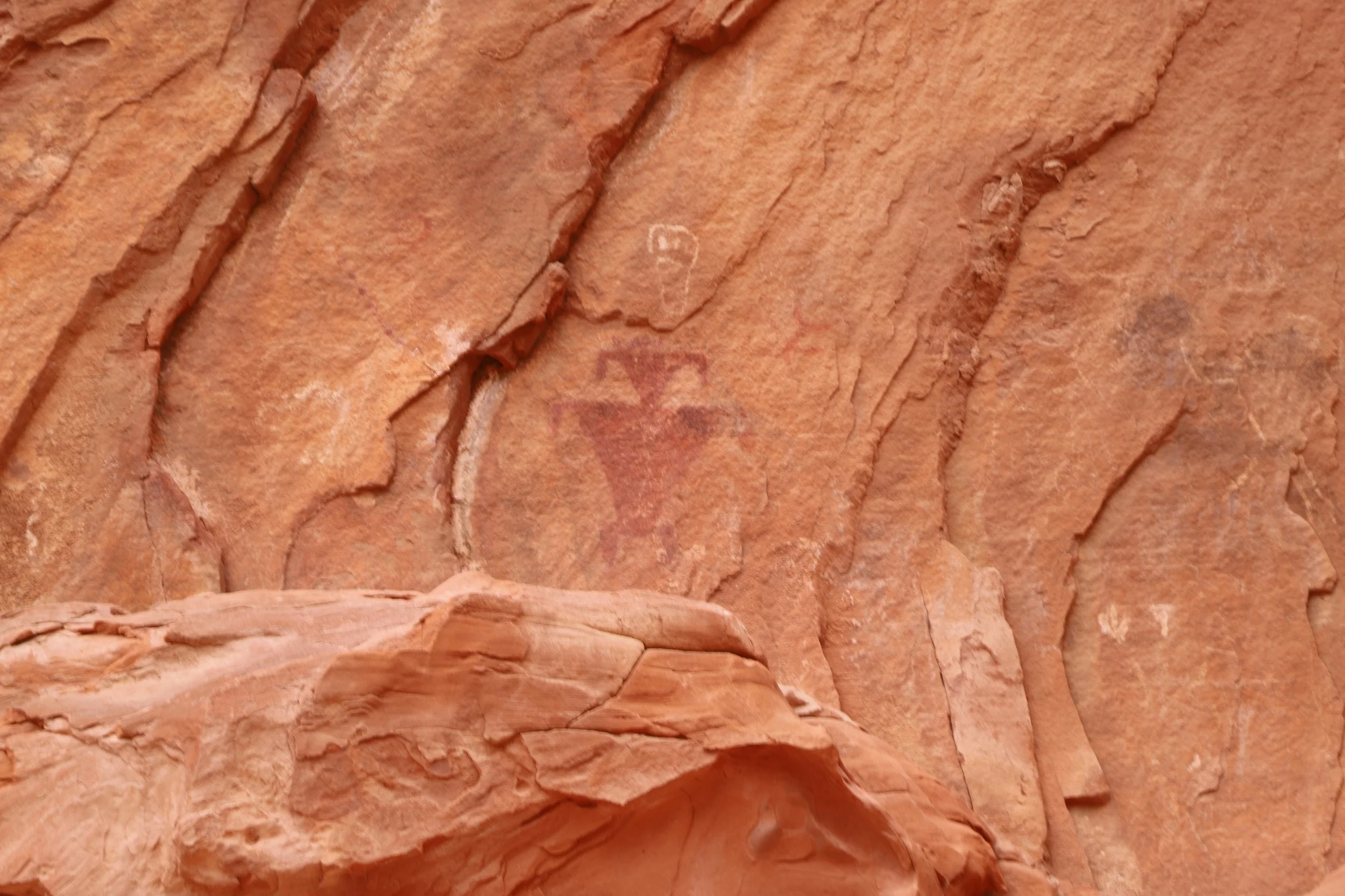
Pictographs with some graffiti carved into the walls. Don’t touch the walls.
Join back up with the main trail. It’s another 0.1 miles to the second waterfall which has the infamous Moki steps. I’m not sure why the majority of the pictures I see of Red Reef Trail are of just the Moki steps. Much of this trail is stunning.
Walking back to the main Red Reef Trail
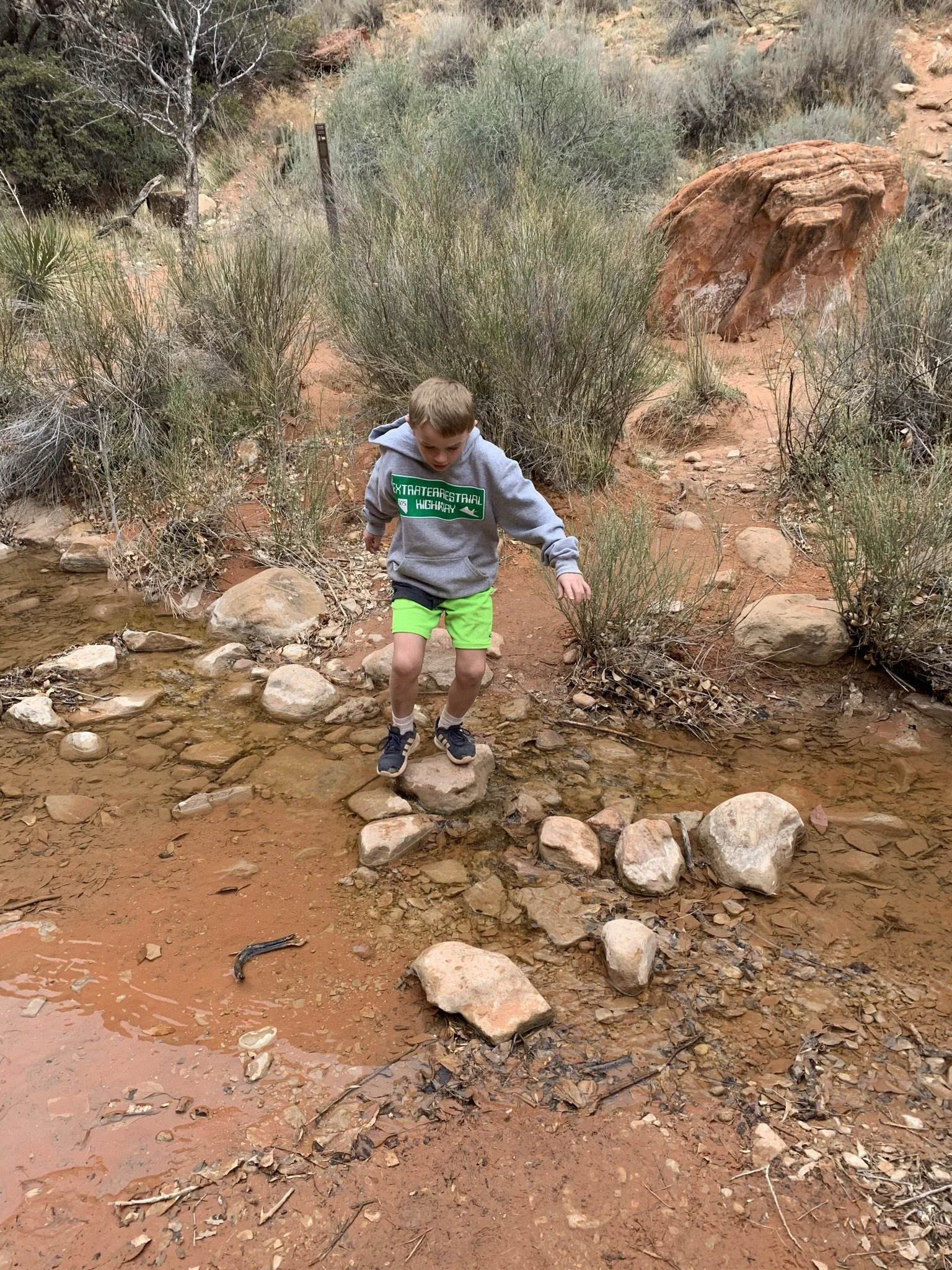
Hoping across the rocks - staying dry
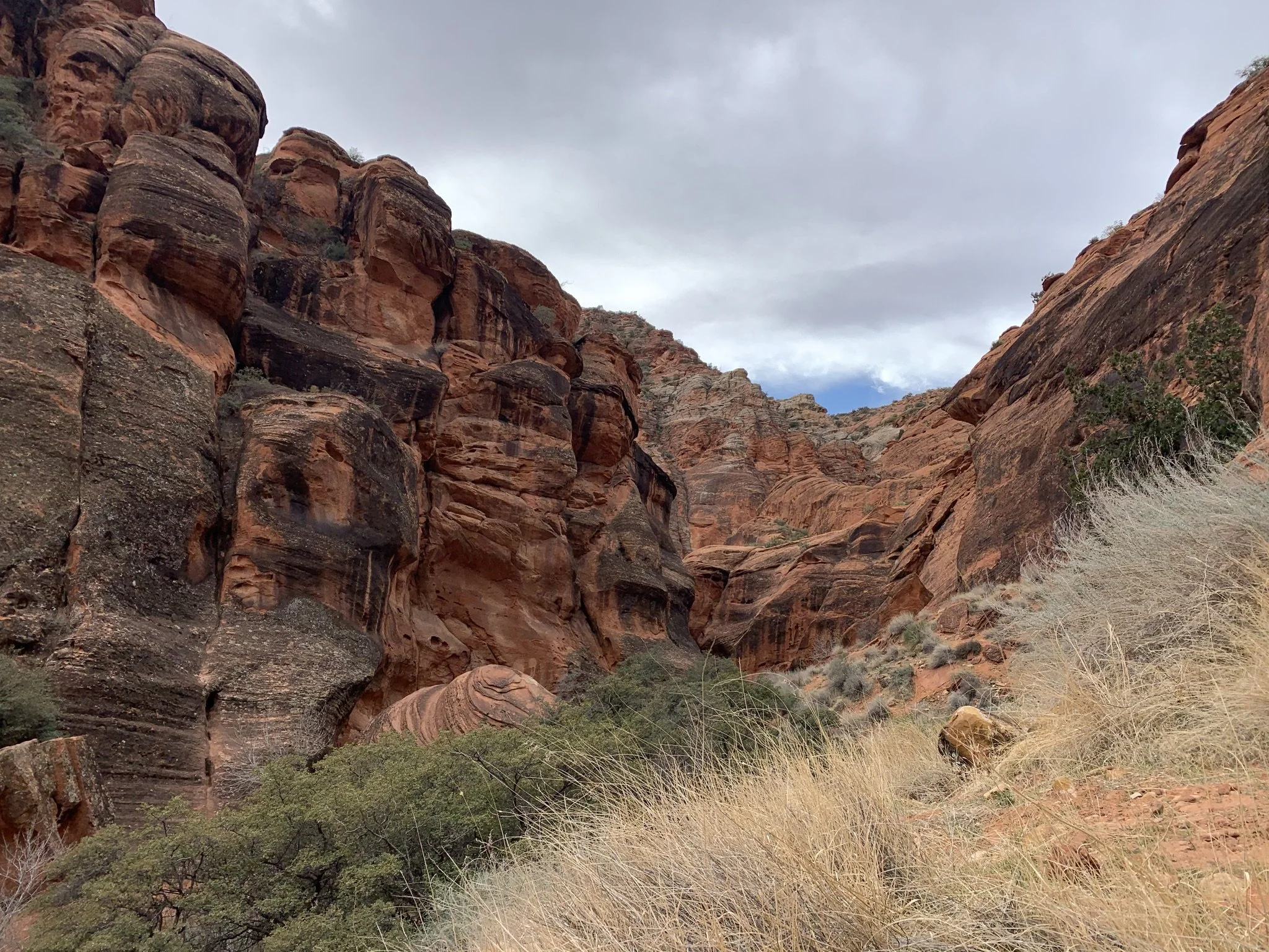
The canyon gets tighter and the views are incredible. Feet can stay dry along the trail.

The Moki steps are unique, but there is so much more to the Red Reef Trail
This is an easy trail up to this point, and it’s so stunning. Definitely worth an hour of anyone’s time as long as parking is available.
Red Reef Trail - Red Cliffs National Conservation Area
Walking upstream, the Moki steps are going to be on the right side of Quail Creek. There was slightly more than a trickle of water coming down this waterfall.
I hiked this trail with my then 8 and 12 year-old sons. We made it over the steps with the help of the rope and by working together. There was a part of me that was terrified one of us was going to slip into the water. There was another part of me that was ready to deal with getting wet if we needed to, as it wasn’t so big of a fall. I wasn’t too worried about getting hurt if we fell. All three of us made it over the steps going both directions without slipping.
For anyone curious, Moki steps are hand and foot holes that were hand-carved into rocks by Native Americans. I’ve heard that different tribes had different Moki step patterns, such that someone from the tribe that carved them would be able to quickly ascend if needed, but an invading tribe might need a bit more time to memorize the pattern, giving the tribe that lived in the canyon an extra moment to prepare an attack. I think these steps were there though to simply help navigate around the waterfall in the canyon.

Moki steps and the second waterfall along the Red Reef Trail
We made it another 0.1 miles before we turned around due to there being no remaining dry rock to continue hiking along. As I mentioned at the beginning, there is a long loop trail in this canyon. It would either involve a wet hike in the spring, or a hot dry hike in the summer. Some trail reviews state that rappelling gear is required and others don’t mention it, so I’m not sure which is true. Regardless, we didn’t want to get wet on this trip, so we stopped soon past the steps.
Quail Creek just above the Moki steps on the Red Reef Trail
We made it just around this bend and had to stop
Quail Creek along the Red Reef Trail
This is where we turned around. We’ve since hiked many trails through water in canyons, and if we were hiking this year, we would have kept going. I’ve learned hiking boots mostly dry out in a night in Utah if they are left outside. For anyone thinking of hiking through the water, I would recommend bringing a hiking pole to avoid an ankle rolling unexpectedly. Another option would be to hike in a drier month to make it a bit further.
As I’ve mentioned, I haven’t found a hiking review yet that goes further than this point. But I am incredibly curious about the technical route options. In June 2025, after taking some classes, we have tackled some canyons that required easier rappels. This canyon is beautiful and I would love to go back… I mean, I have to come back some day, anyway, to find those dinosaur tracks…
There are just so many amazing experiences to have in southern Utah. As many times as I’ve traveled here, I keep coming up with more reasons to return.
Other Things to Do Nearby (within an hour drive)
Below are hyperlinks to other posts I’ve written about things to do that are located within an hour’s drive from Red Reef Trail.
Zion National Park
Zion National Park is probably the reason for traveling to this part of Utah. There are so many fantastic hikes for all types of hikers. There are multiple park entrances. Kolob Canyons Visitor Center is 30 minutes north of Red Reef Trail, and the main Zion Visitor Center (near Springdale) is an hour east.
Kanarra Falls
Kanarra Falls is a moderately difficult hike that travels through a slot canyon with four waterfalls. This trail goes through the water and feet and ankles will get wet. Permits are needed for this hike. Consider pre-purchasing as only 200 hikers are allowed in per day. Walking sticks will be helpful on this hike. Neoprene booties under hiking boots will keep your feet warmer. Kanarra Falls is a 35-minute drive north from Red Reef Trail.
Yant Flat Candy Cliffs
The Yant Flat Trail is a relatively easy 2-3 mile hike through the desert to the Candy Cliffs, a hidden and strangely beautiful display of geometric patterns cut into red-and-white striped Navajo Sandston surrounded by green brush-covered mountains. Use the road from Leeds - the road from St. George is not well maintained. The trailhead to Yant Flat is 45 minutes west of Red Reef Trail.
Pioneer Park
Pioneer Park is a free city park in St. George, UT. There are no playgrounds or swings, but there are arches, slot canyons, caverns, Moki steps, and tons of rocks to scramble over, under, through, around, up, and down. Pioneer Park is a 30-minute drive southwest of Red Reef Trail.
Snow Canyon State Park
Snow Canyon State Park is a unique place to hike which includes both a short slot canyon and lava tube caves that can be explored, in addition to some beautiful hikes. Bring a flashlight or headlamp for the lava tubes. Snow Canyon is a 40-minute drive west of Red Reef Trail.
Sand Hollow State Park
Enjoy swimming, cliff jumping, or riding ATVs through sand dunes at Sand Hollow State Park. Jumping Rock is a short 0.3-mile relatively easy walk from the parking lot. This state park is going to be better suited for older kids. Sand Hollow State Park is 25 minutes west of Red Reef Trail
Water Canyon
Water Canyon, managed the Bureau of Land Management, is a rugged, wild canyon about an hour southeast of Red Reef that has something for all adventurous souls. Enjoy a 2 mile out-and-back hike to the waterfall, a 6 mile out-and-back hike to White Dome or hike up into Water Canyon and rappel out.
More from www.NatureImpactsUs.com
In the map below, there are additional posts I’ve written attached to each pin. Use two fingers to move around within the map.