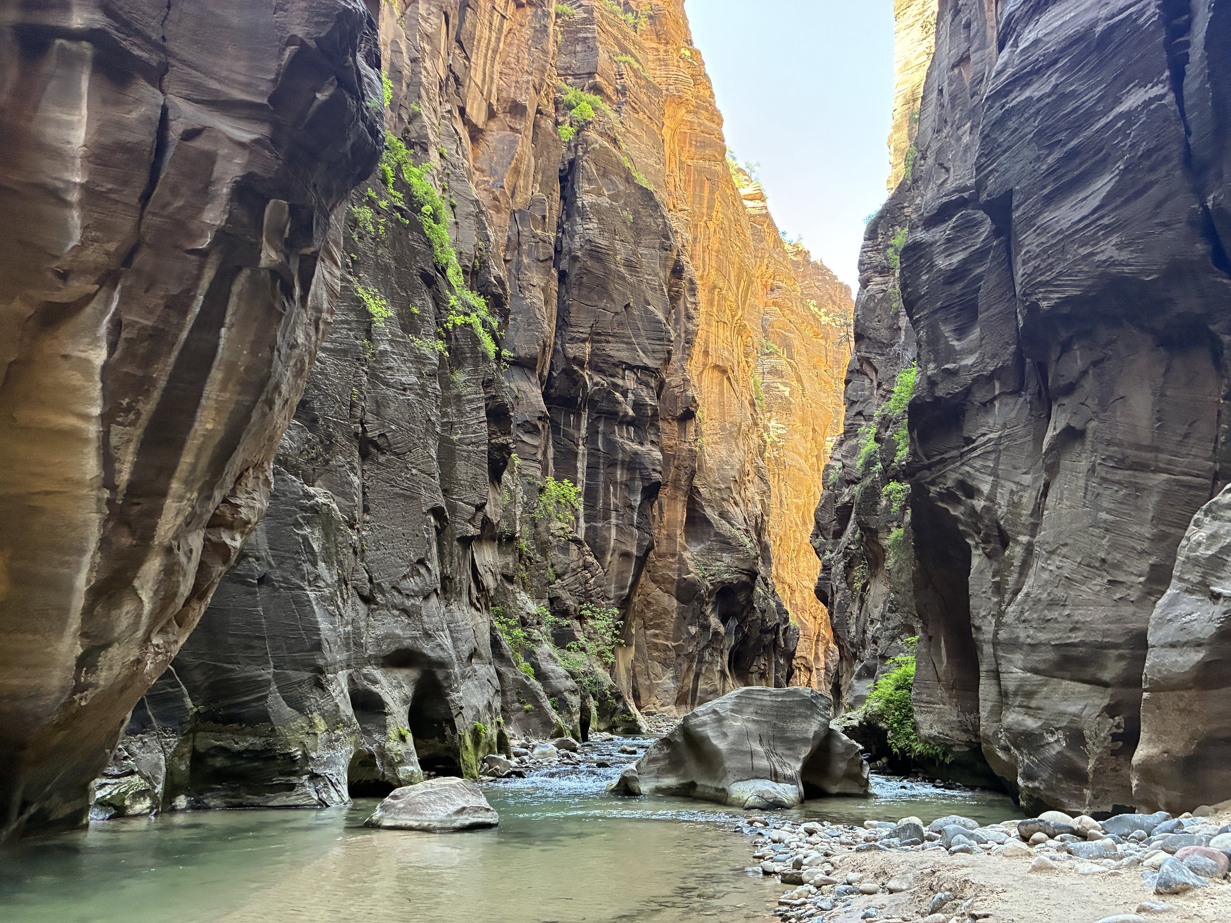

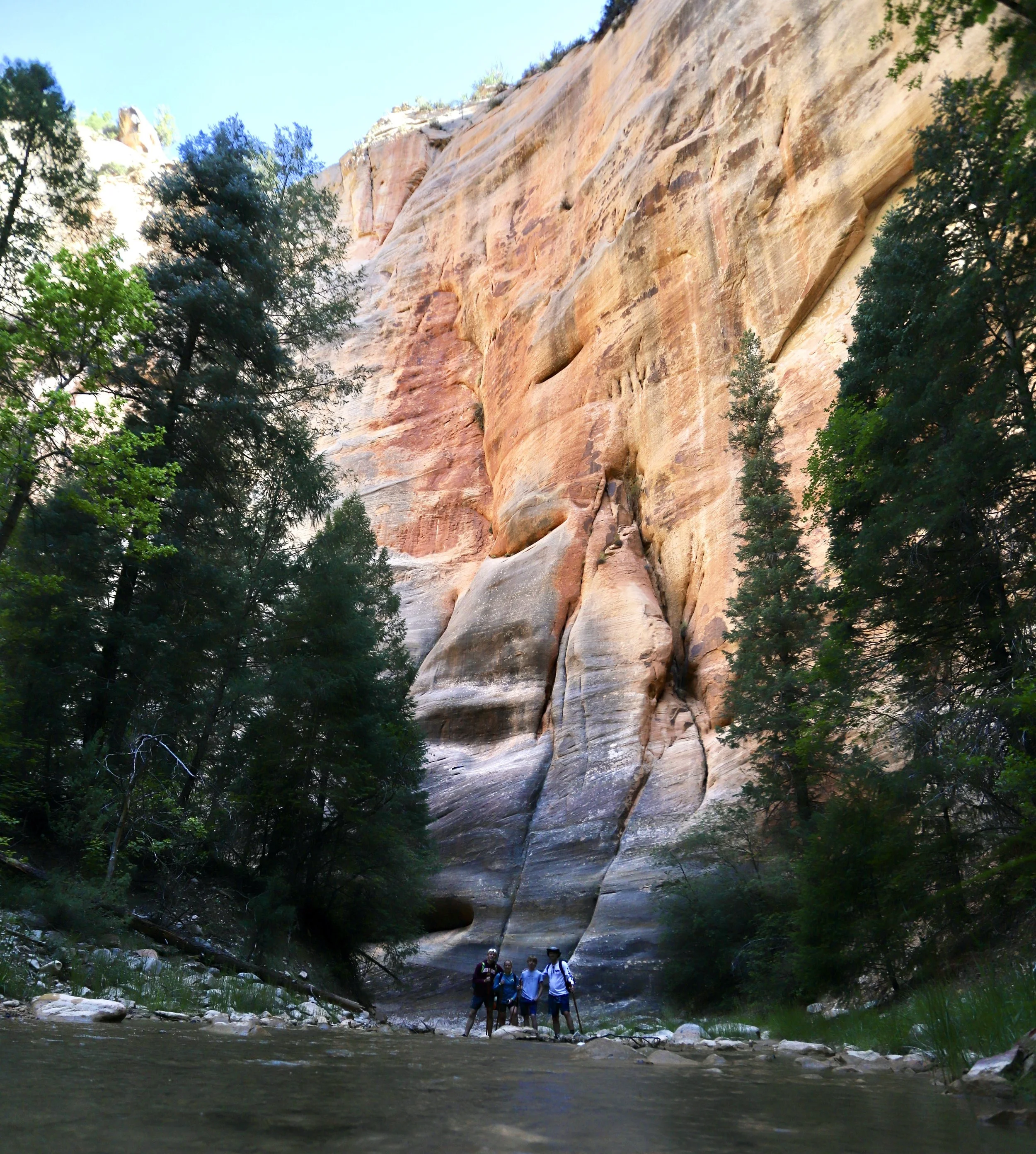
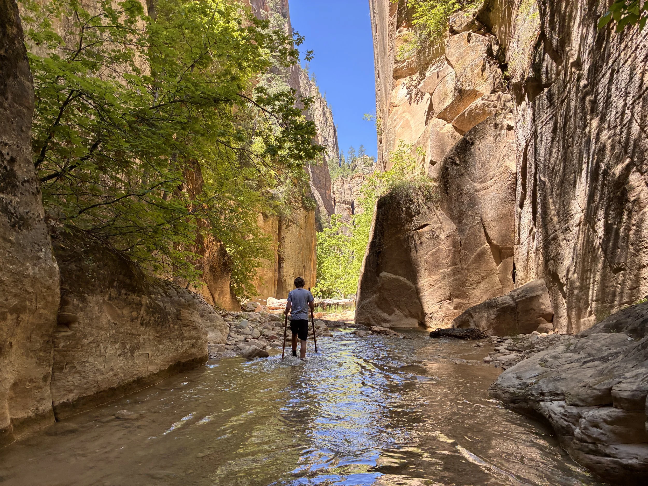
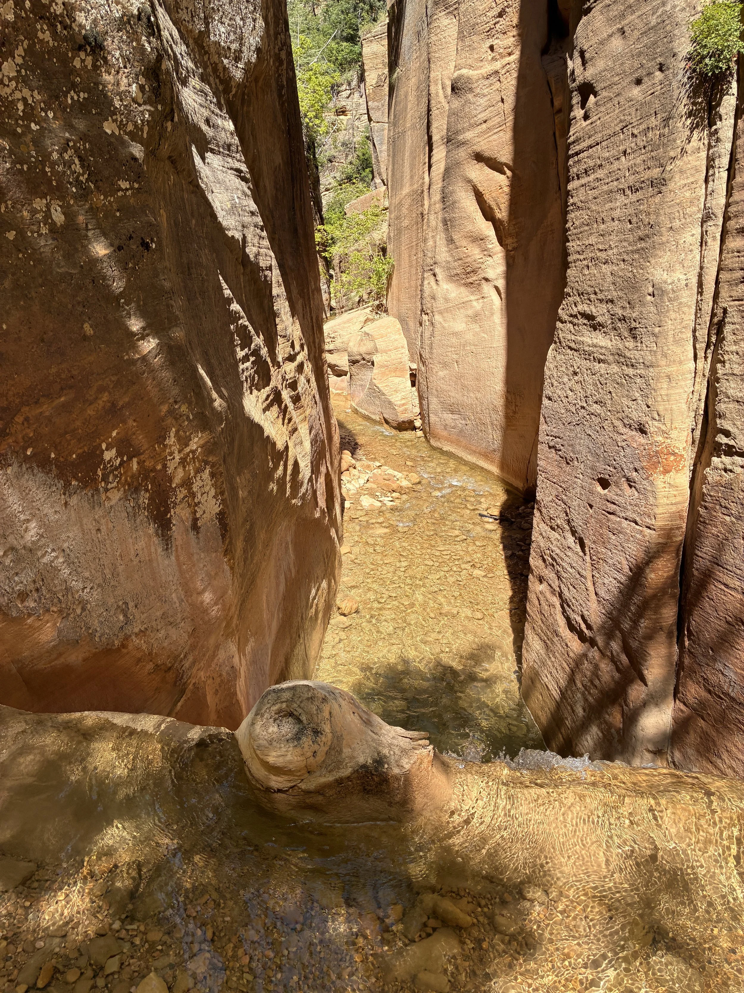
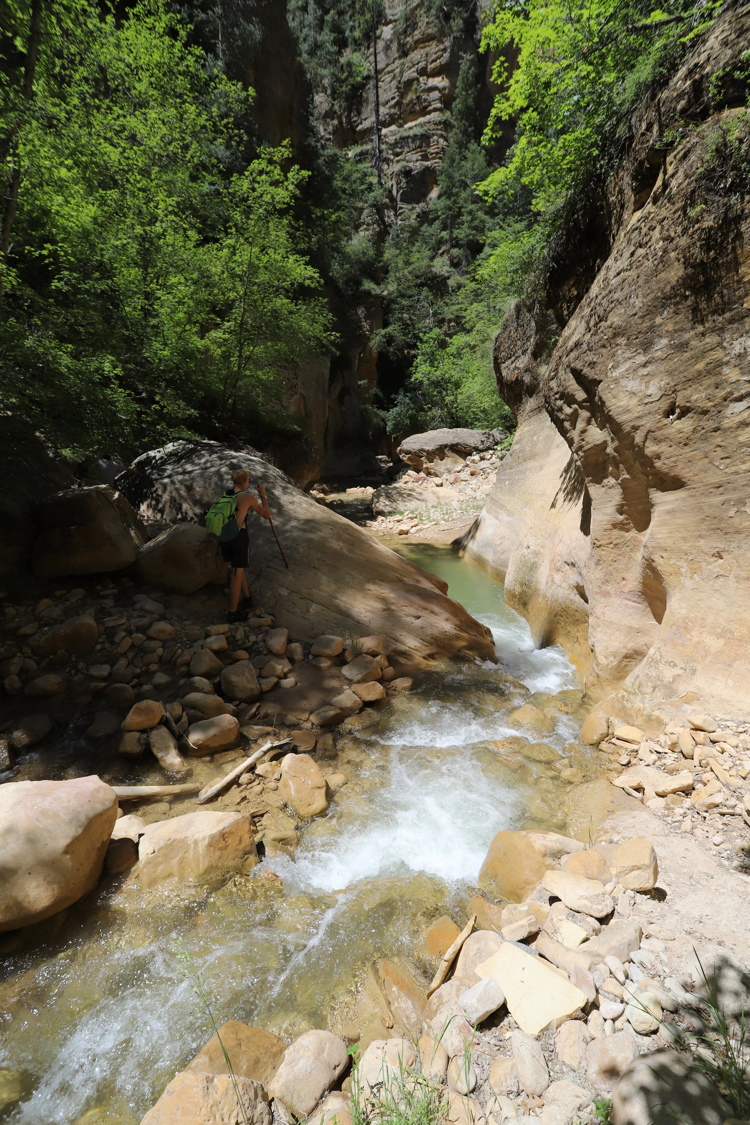
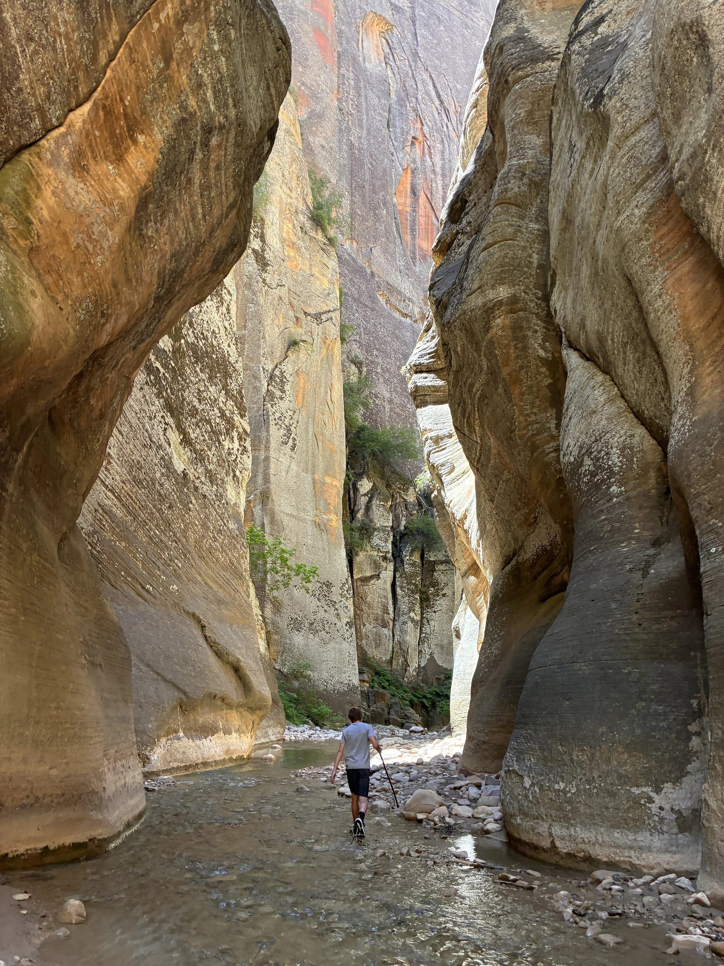
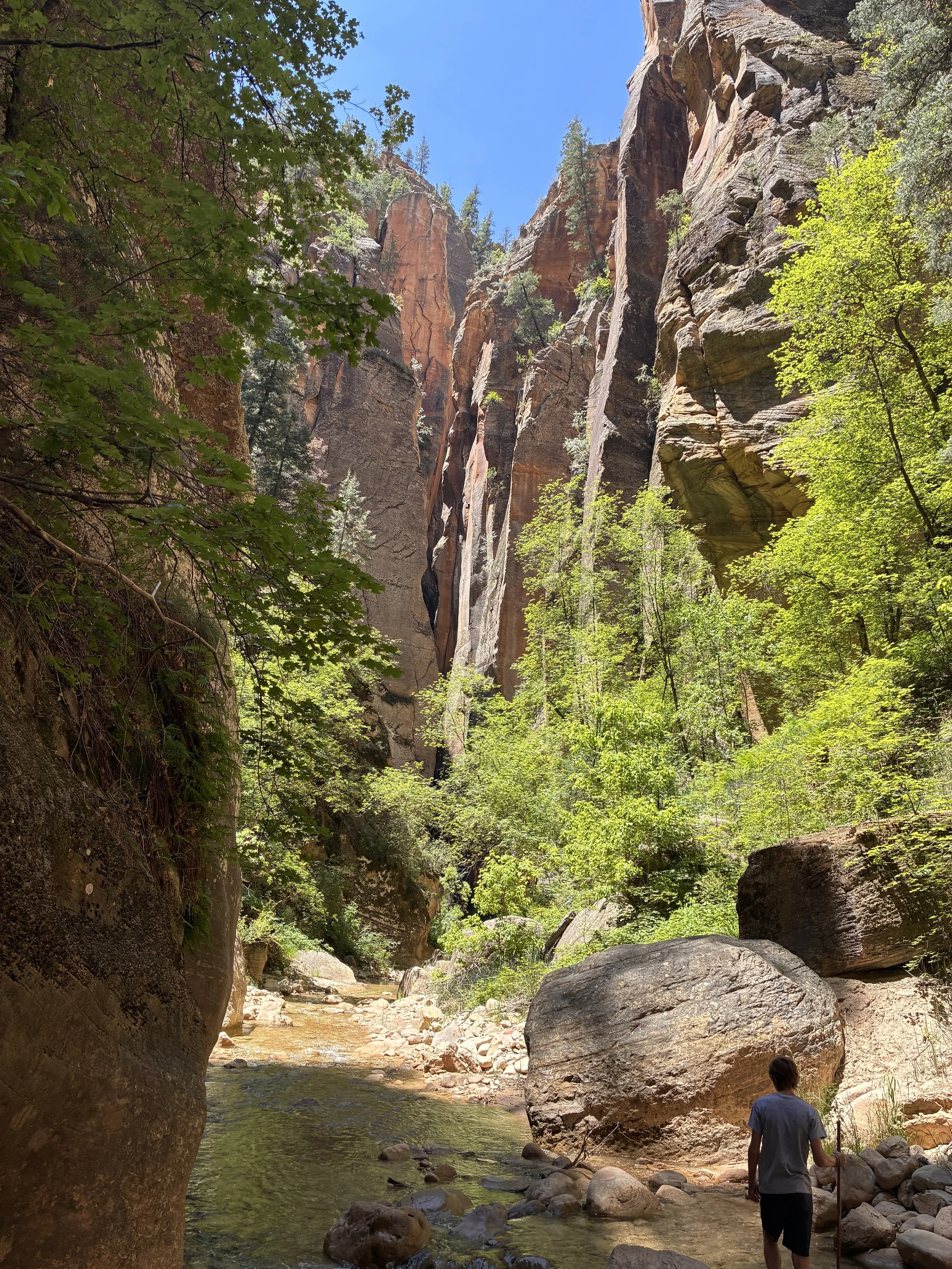
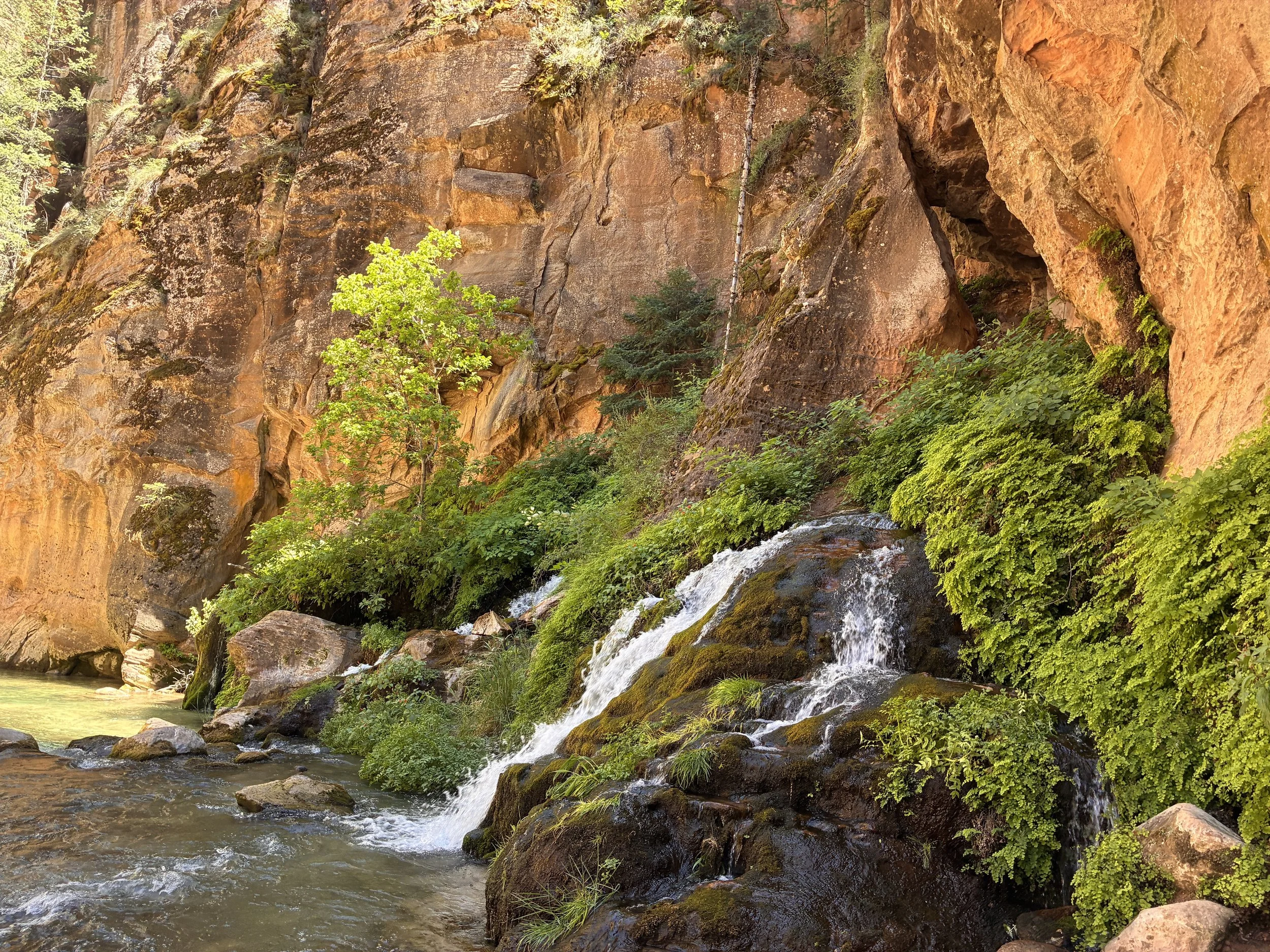
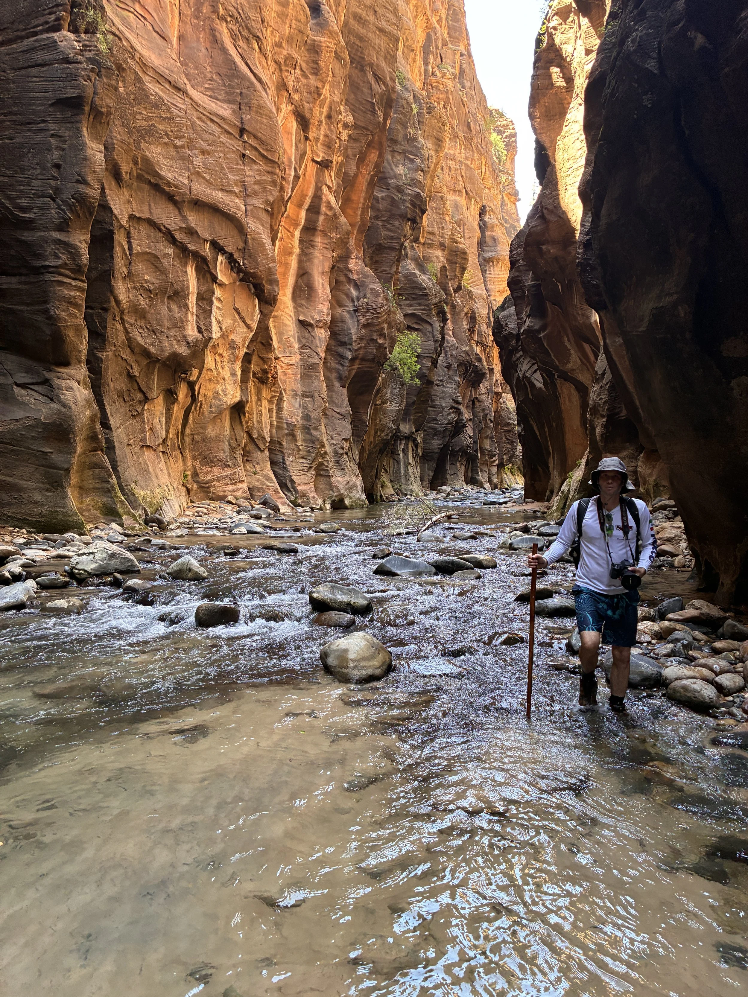
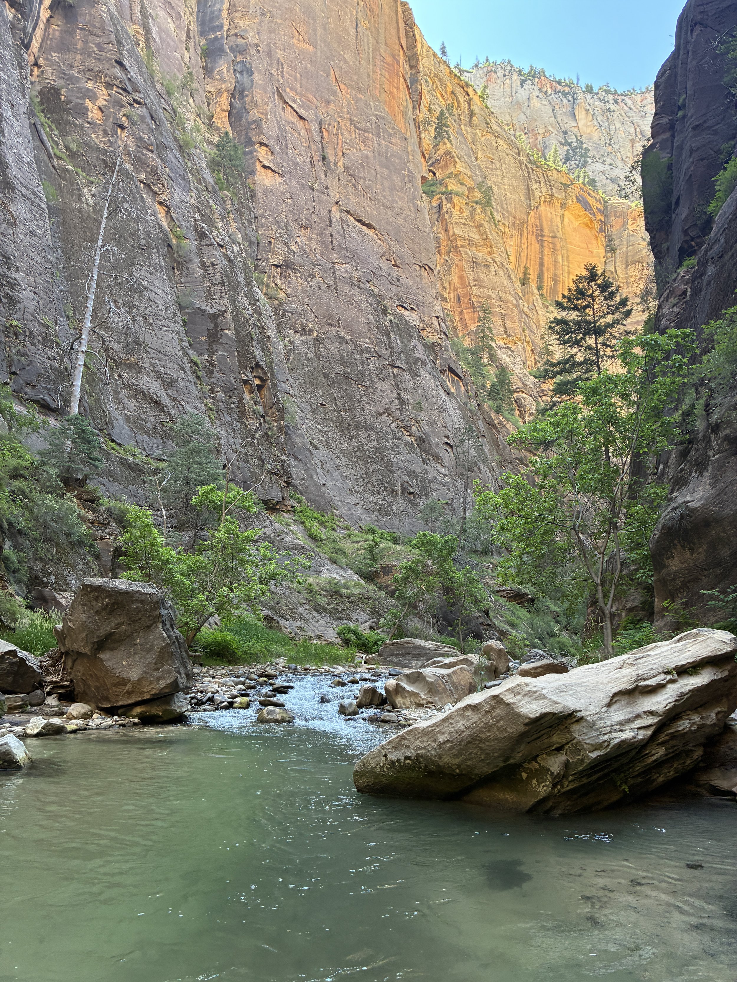
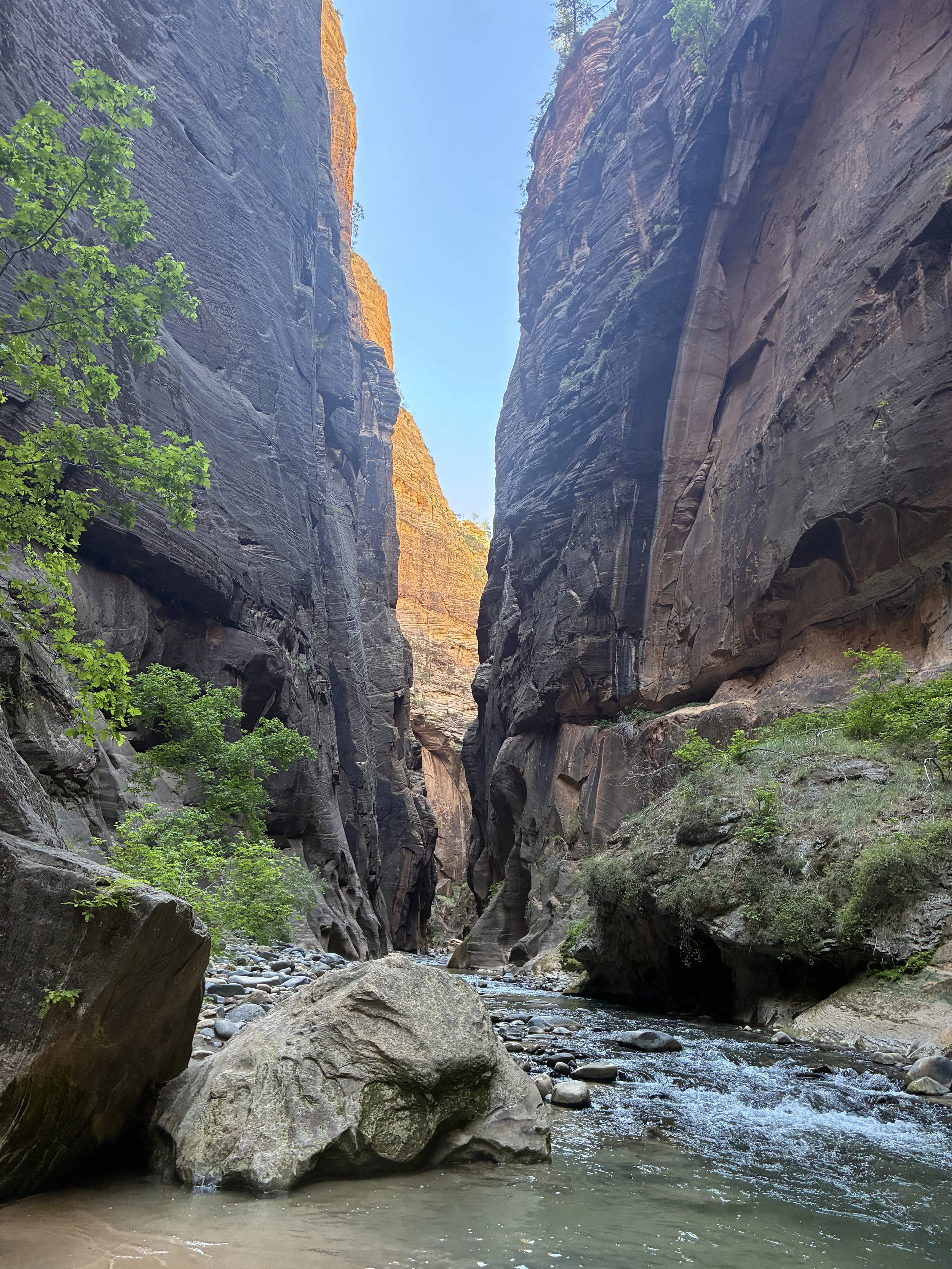
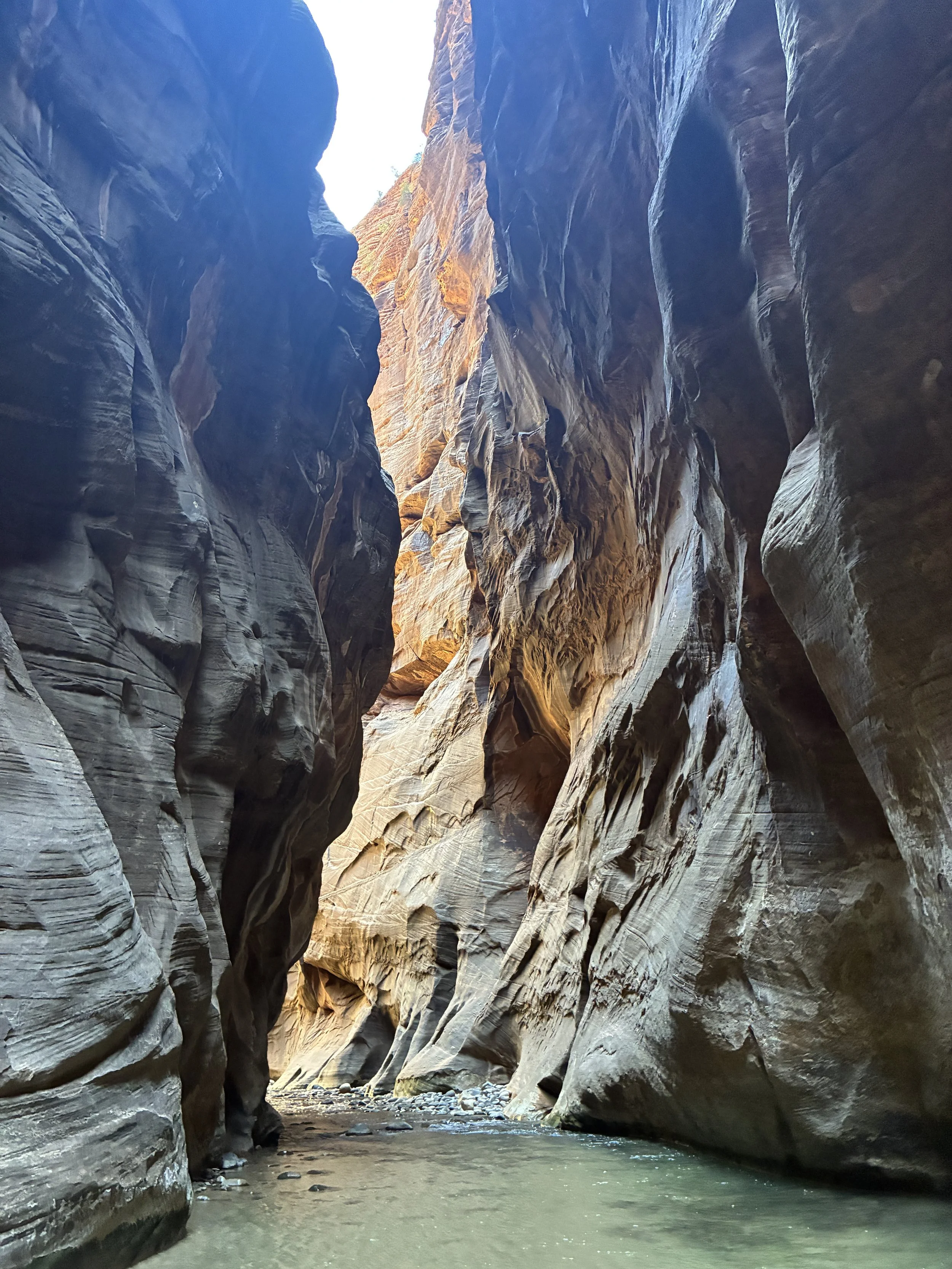
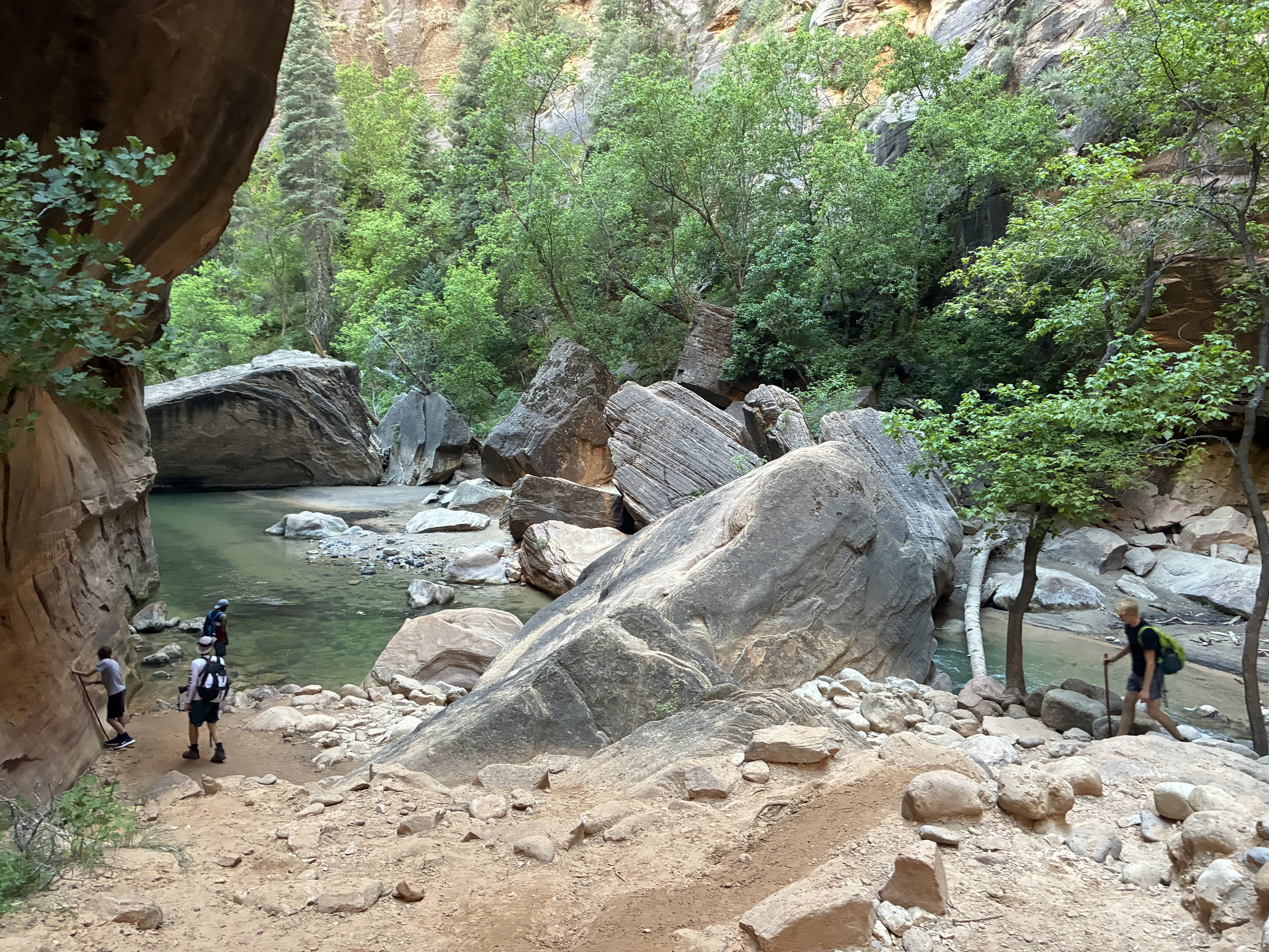
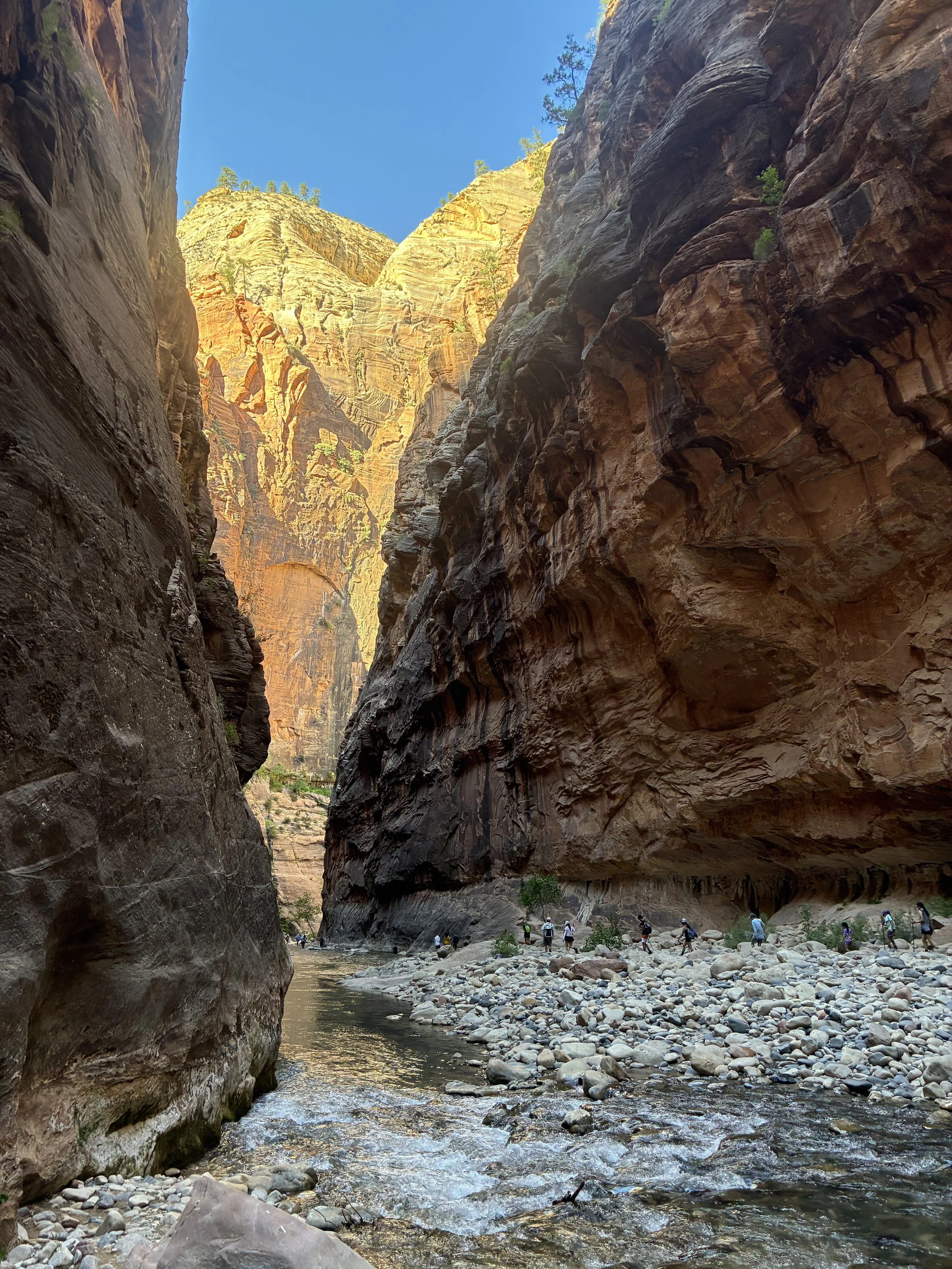
Zion Narrows (3:26pm)
If you enjoy my blog, please consider signing up below for email notifications of my latest posts. I will not share your email.
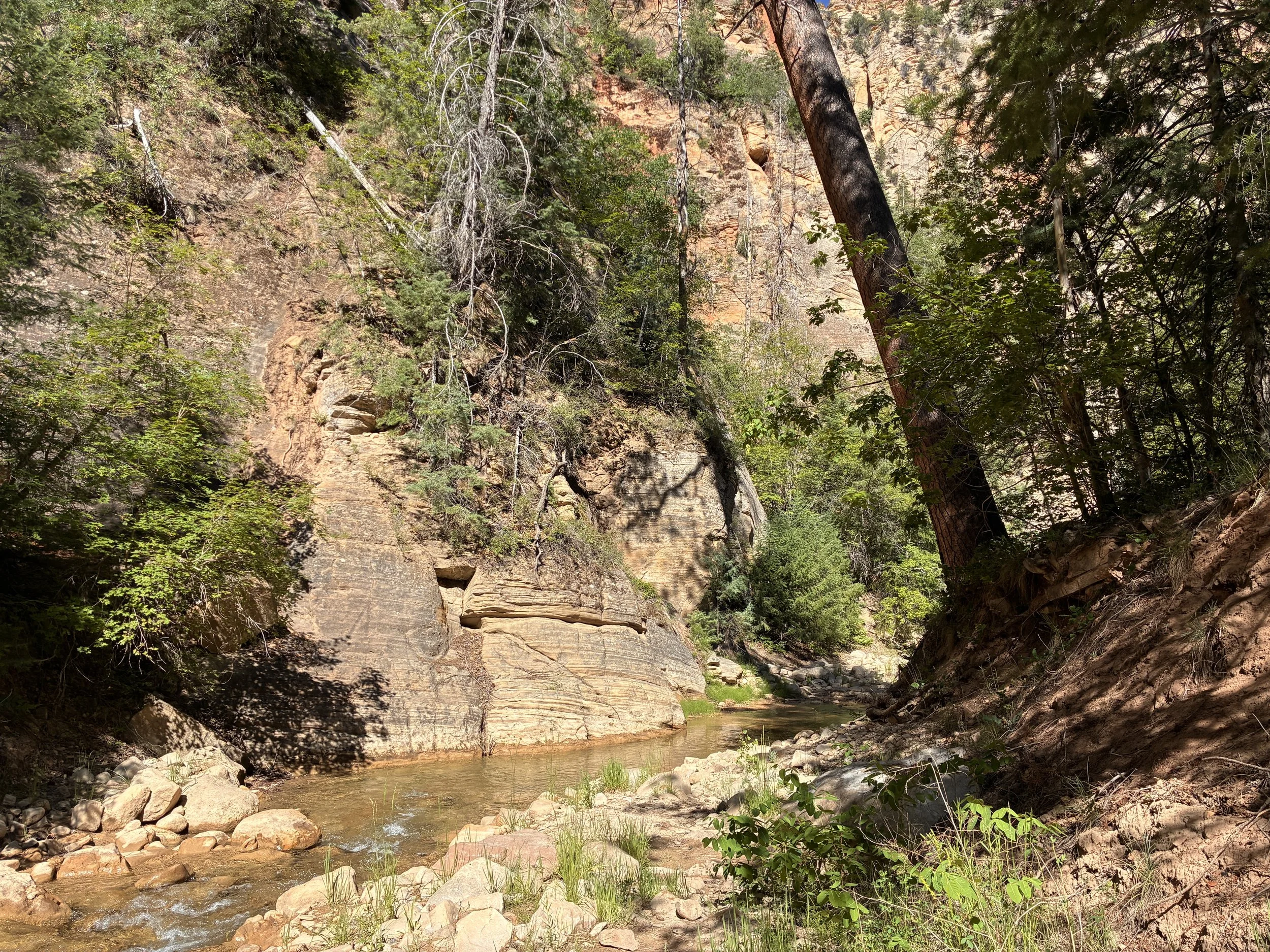
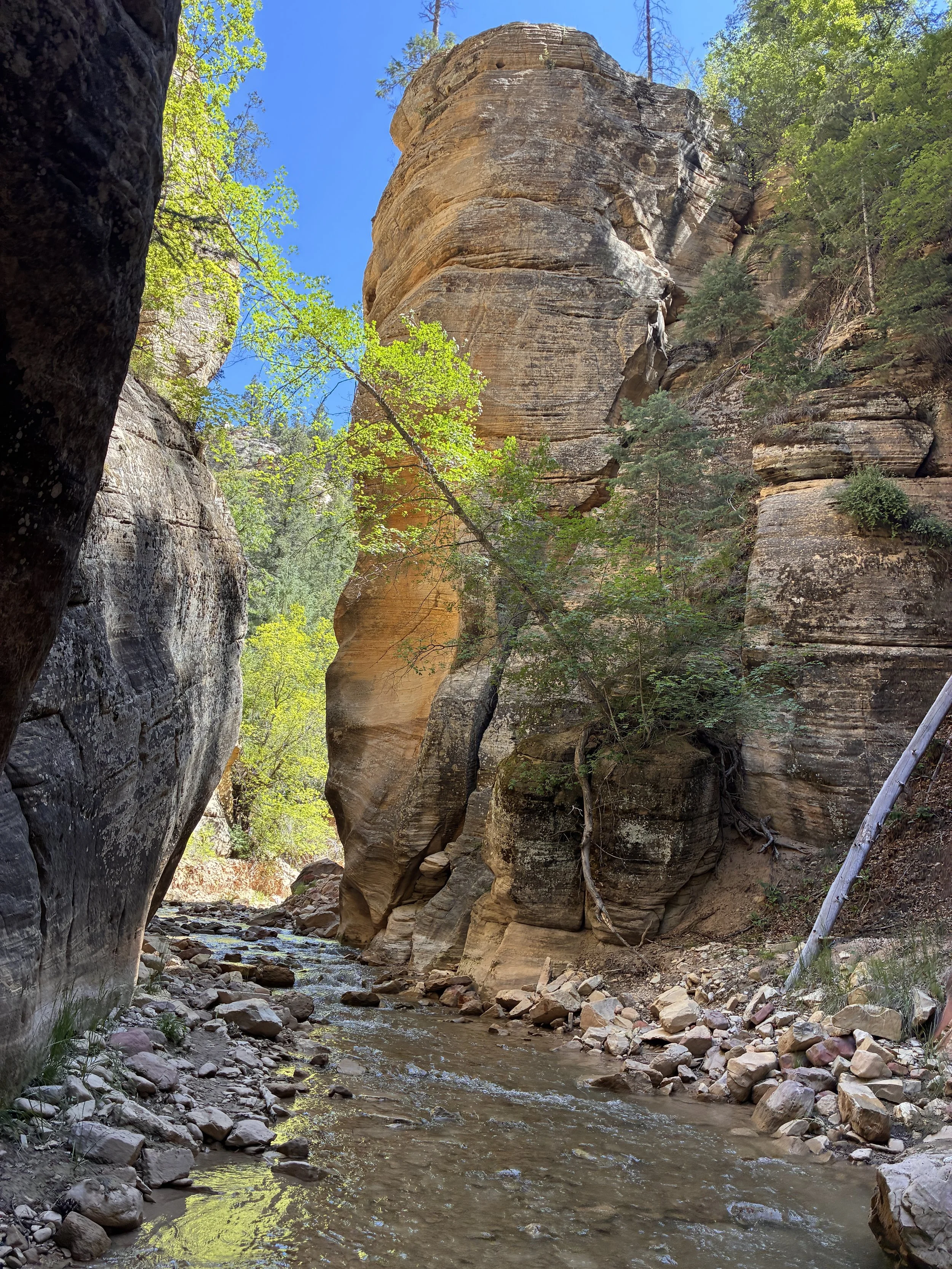
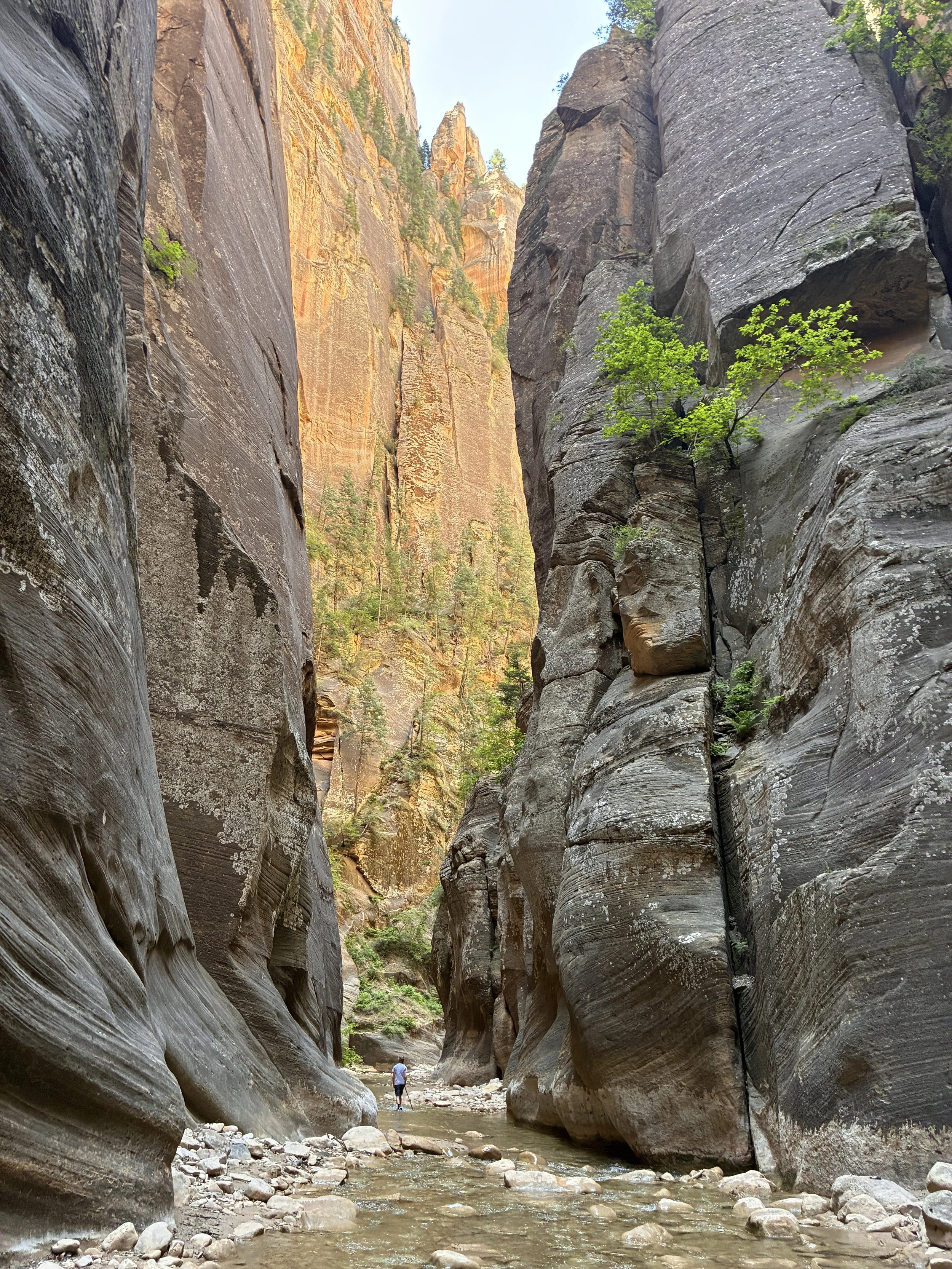
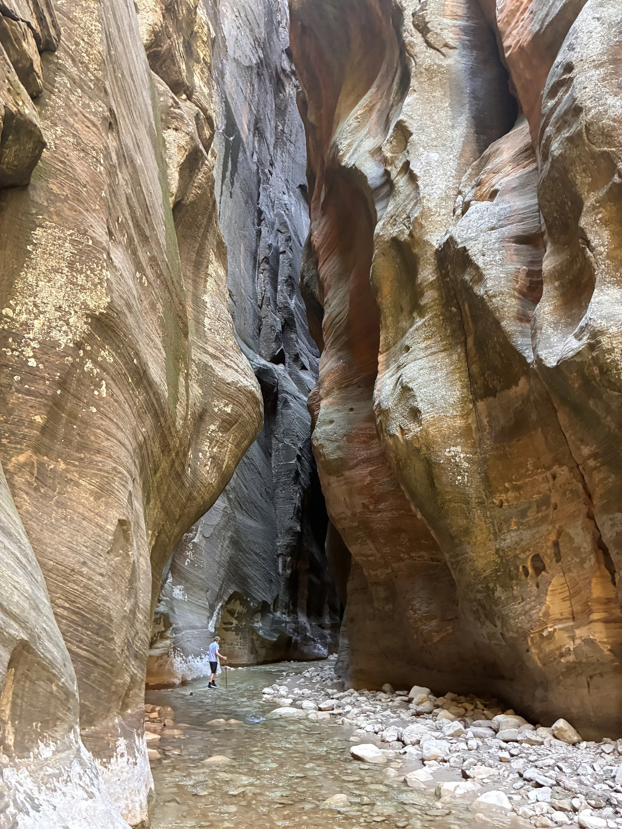
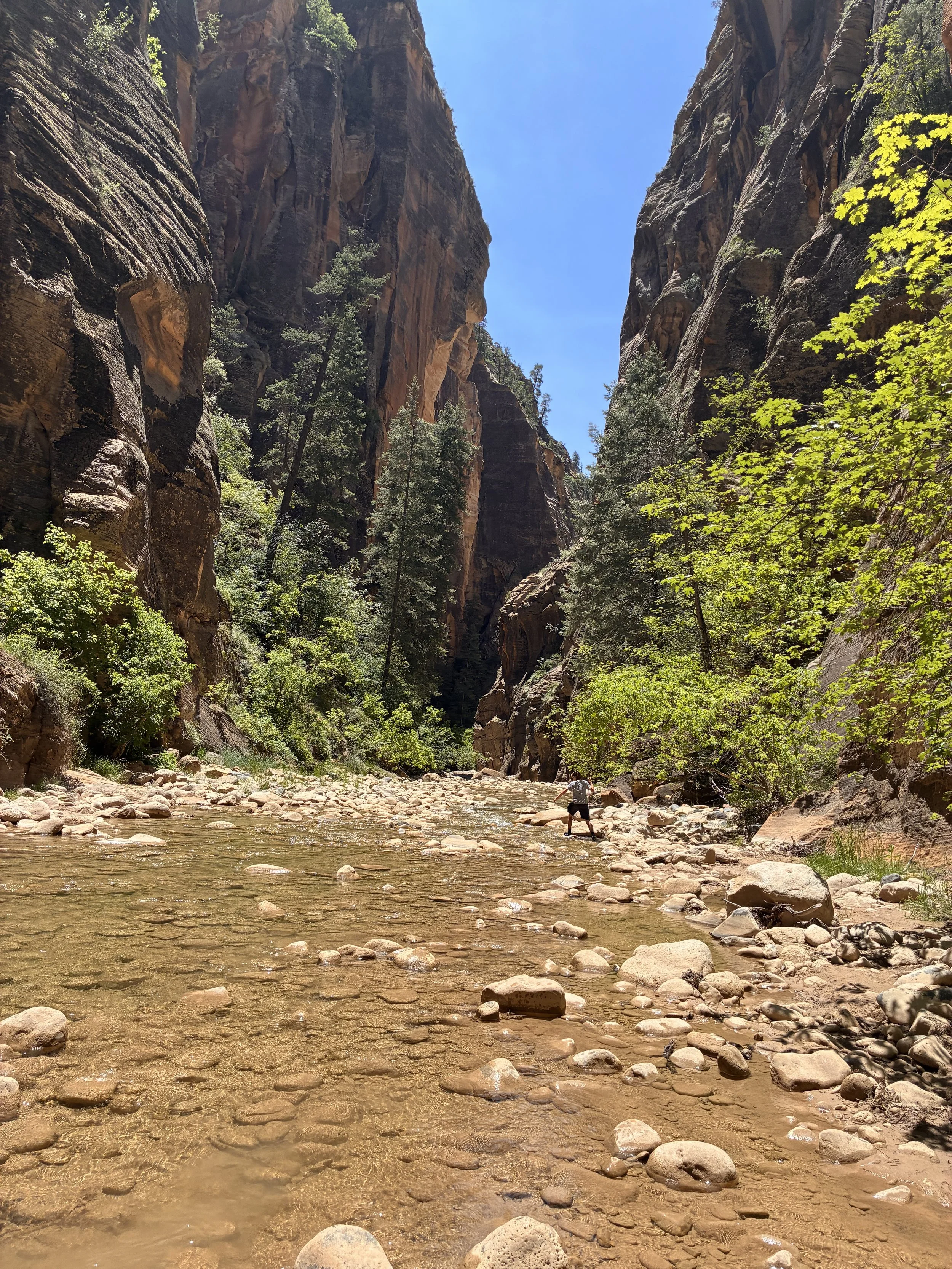
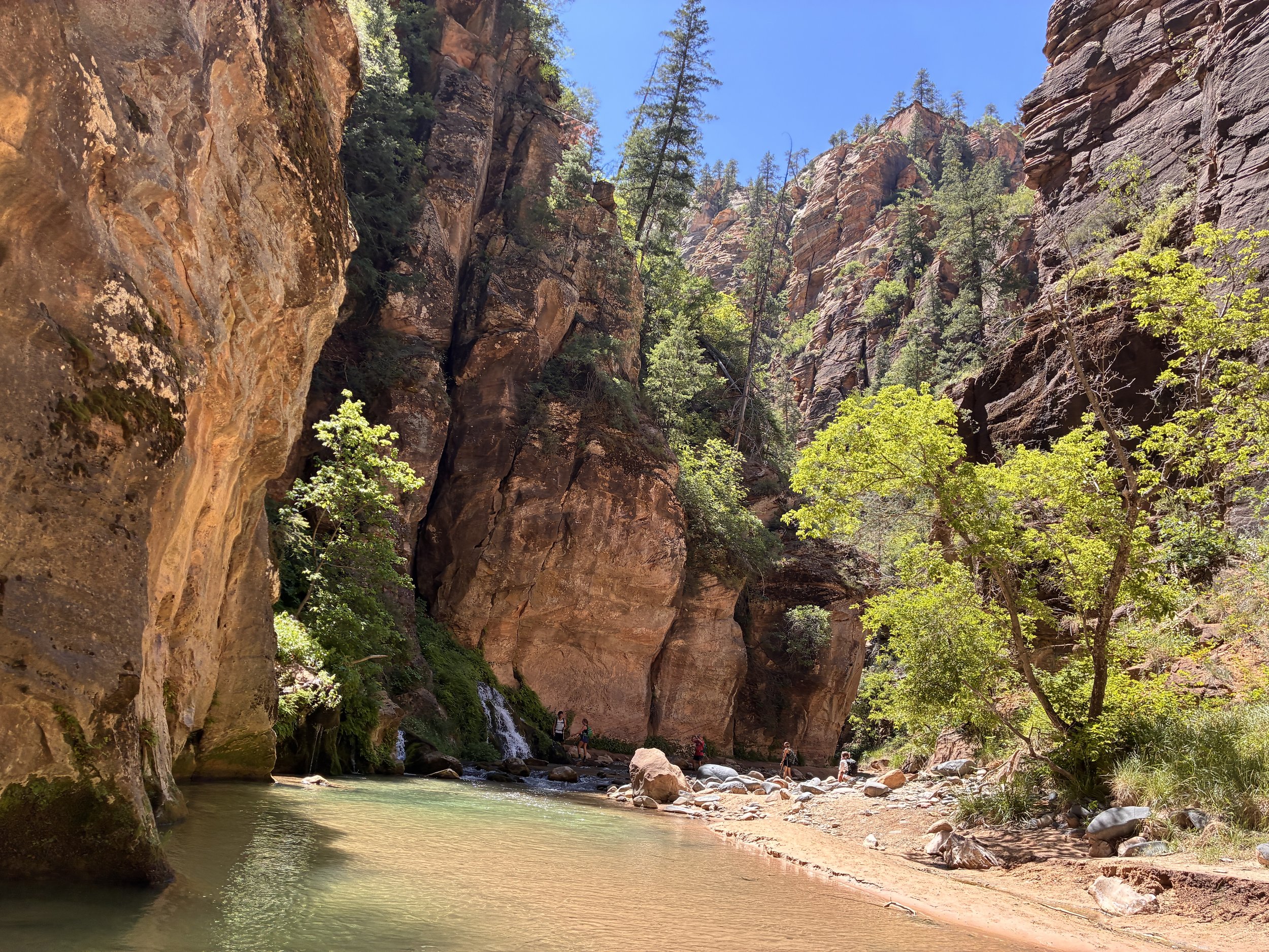
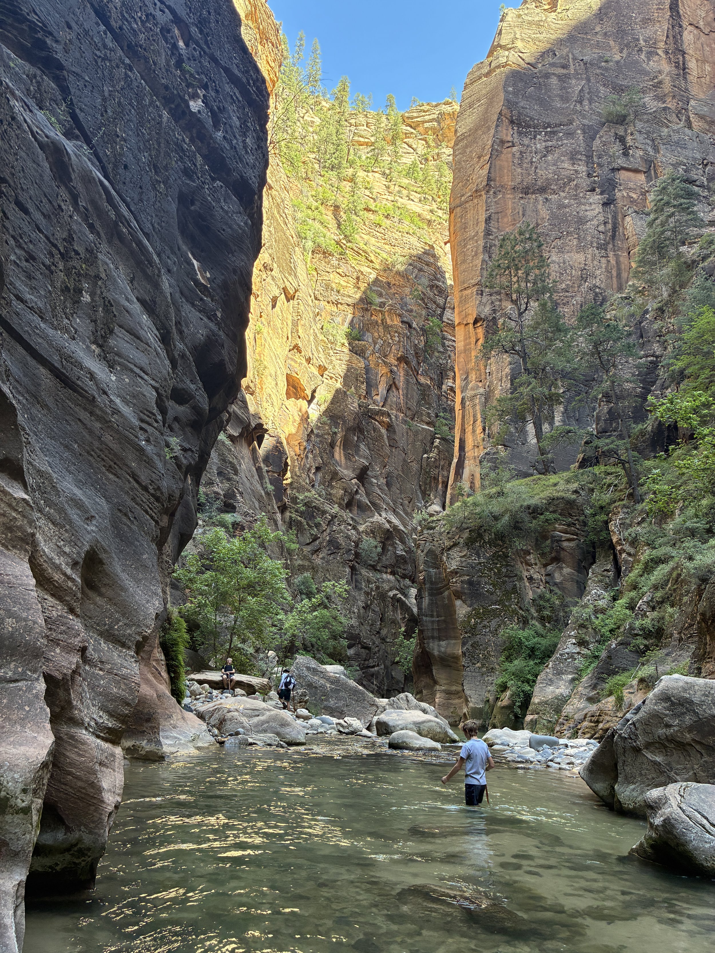
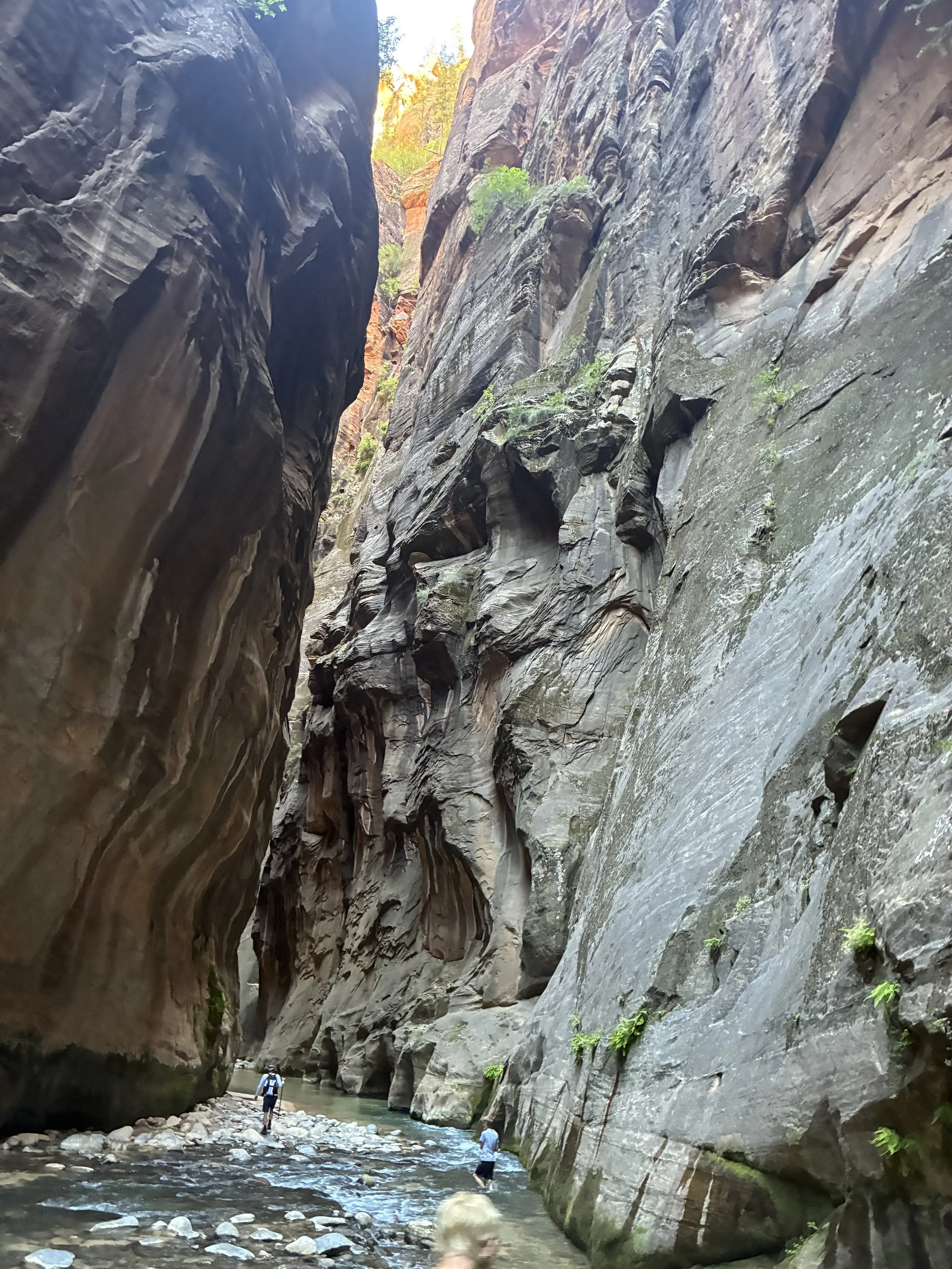
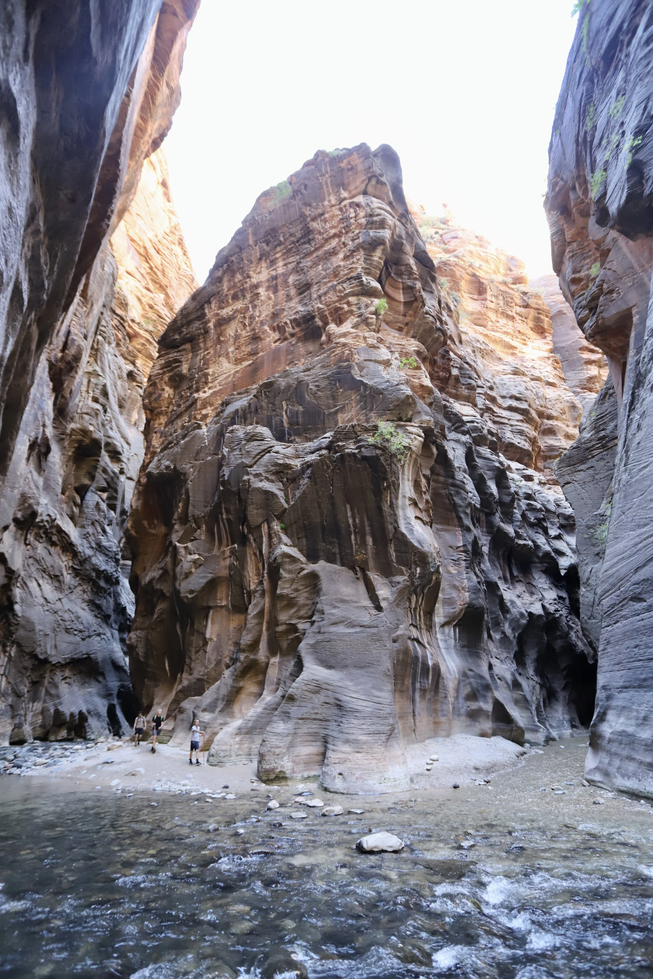
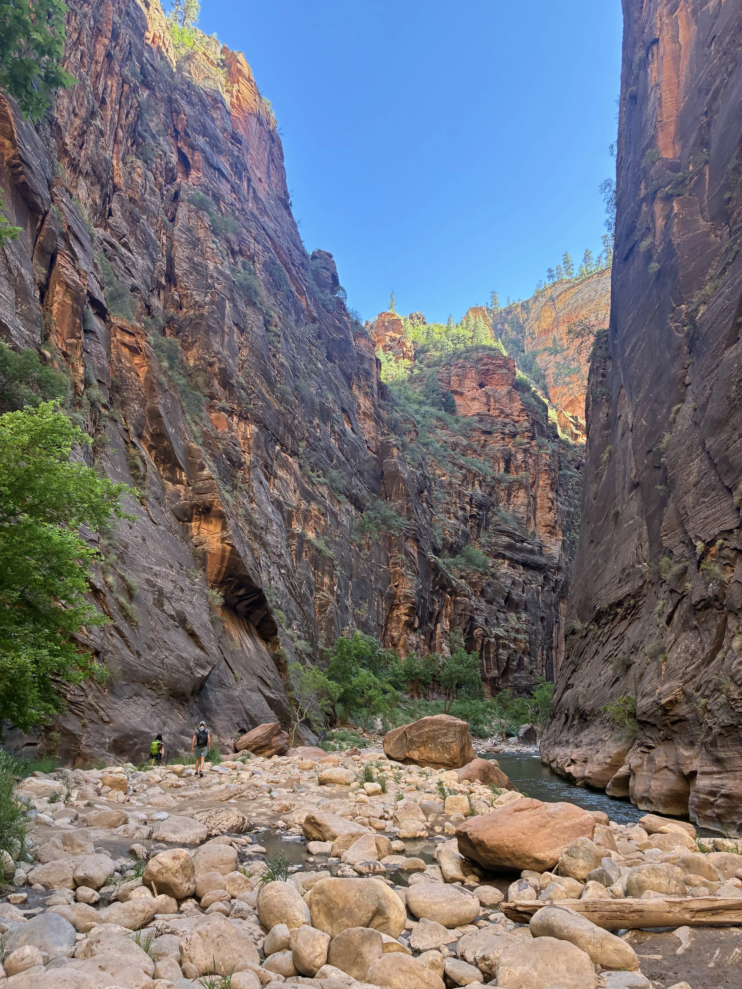
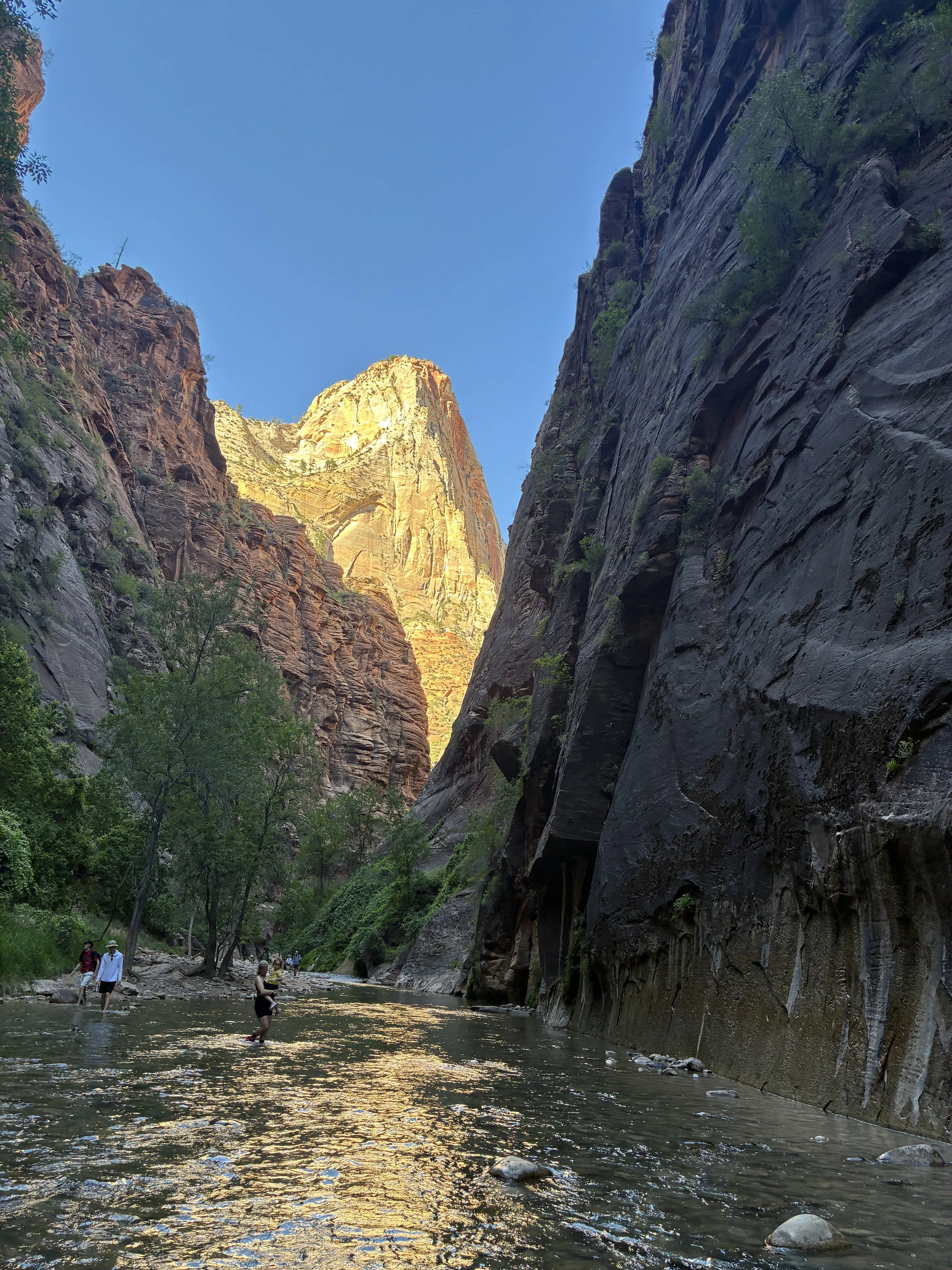
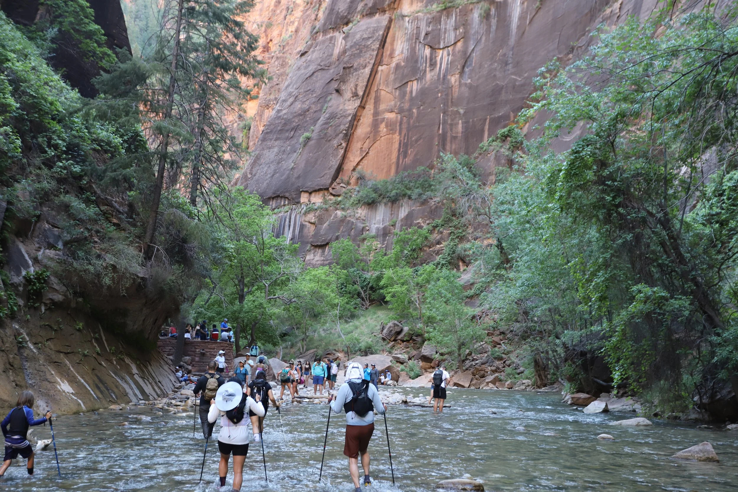
Zion Narrows (11:28am)
Yep, You are Going to Get Wet
Thinking of hiking the Narrows? Hiking top-down or bottom-up - it doesn’t matter, you will get wet. The deepest section, unfortunately, is at the bottom, close to the Riverside Walk entrance into the Narrows. It was chest-deep when we visited in June. So even those that just want to walk a short distance up and back are going to hit that deep section in a matter of minutes.
Getting wet is ok though, and sometimes it’s the perfect way to spend a hot day. When we hiked in June, it was over 100 deg F, and the Narrows was the absolute best hike to do in the heat. We never once talked about the weather or temperature because we were comfortable the whole day. For those that hike in a cooler month, there are nearby places to rent gear to stay warm (Zion Outfitters).
Hiking boots dry out pretty fast in Utah if they are left outside over night. But I get it, lots of people prefer to keep their feet dry and can find better ways to spend a day than walking through water for 12+ hours. Feel free to click the link below, and it will take you past the “how to” section of this post and straight to the pictures. Most people that visit Zion do not step foot into the Virgin River.
Just take me to the pictures of Zion’s Narrows
Top-Down or Bottom-Up
I’m going to state miles in this post, but this assumes someone walks straight in the middle of the river, which does not happen. We crossed back and forth across the river hundreds of times to find the easiest way to walk (trying to avoid rocks, slippery spots, deeper sections, etc.). We walked at least two additional miles beyond the quoted mileage due to our constant crossing back and forth across the river. Something to keep in mind when planning for this hike.
There are two choices to hike the Narrows. The more common way is to hike bottom-up, starting from the Riverside Walk and walking upstream as far as Big Springs, then returning back. From the bus stop to the end of the Riverside Walk is 1 mile. Big Springs is 3.5 miles from where the Narrows begins and Riverside Walk ends. An out-and-back hike bottom up could be up to 9 miles long (+ extra mileage due to crossing back and forth across the river).
The advantages to hiking bottom-up are: 1) You can turn around at any point, 2) You can start the hike at any time of the day, 3) One of the prettiest part of the hike is between Orderville Canyon and Big Springs. The disadvantages are: 1) The busiest part of the canyon is at the bottom as there are no limits to how many people can hike bottom-up, 2) The hardest part of the hike is between Orderville Canyon and Big Springs, and hiking bottom-up means you have to hike this section twice to return back to the trailhead.
Top-down requires pre-planning to purchase a permit to access the Narrows upstream of Big Springs, and a shuttle ride is needed to get to the trailhead at Chamberlain Ranch. This hike at a minimum is 16 miles (assuming no mistakes, no backtracks, and walking straight through the middle of the river). We clocked this with a few additional miles due to not traveling in a straight line, a few mistakes that required retracing our steps, and a little bit of exploration.
The advantages to hiking top-down are 1) This is a one-way hike, so each view is unique along the way, 2) There are essentially no people upstream of Big Springs due to the constraints of both limited permits and shuttle drop-off times, and this canyon is pretty incredible to feel like your hiking group has it all by yourselves. The disadvantages are: 1) Significant pre-planning is required, 2) Hiking it in one day is tough to do, and there is a time limit because to return to your car you need to make the last Zion shuttle bus to avoid walking an additional 7 miles in the dark to get back to the Visitor Center, 3) Hiking bags are going to be quite a bit heavier when planning a full day hike in backcountry.
Top-Down Shuttle and Permit Requirements
To reserve a permit, go to the National Park website: https://www.nps.gov/zion/planyourvisit/narrowspermits.htm. Because permits are limited, checkout this website several months in advance to learn when permits can be purchased for the dates you are interested in. Then set up a reminder on your phone to check back on the right date and buy the permits. As of 2025, day permits were $16 / person, and overnight permits were $27 / person. There are 12 backpacking campsites available in the Narrows. Choose day-use or over-night when reserving your permit. Backpackers are only permitted to spend one night in the Narrows.
Permits need to be picked up the day before or the morning of at the main Zion Visitor Center, near Springdale, UT. For anyone day hiking the Narrows top-down, you will want to take the 6:00am shuttle, which means you need to plan to be at the Visitor Center when it’s open the day before to get your permits.
We used Red Rock Shuttle to get to the Chamberlain trailhead: https://redrockshuttle.com/. As of 2025, the shuttle cost was $60 / person. Park at the main Zion Visitor Center and walk across the parking lot to Zion Outfitter (in Springdale) to meet the Red Rock Shuttle. Pick a parking spot in the west section of the lot to minimize walking. It takes less than 10 minutes to walk there. First, fill up water bottles at the Visitor Centernear the bathrooms. There won’t be another place to fill them again until reaching Big Springs, where water can be filtered safely.
The Narrows hike ends at the Temple of Sinawava. From here, there is a free shuttle bus back to the main Zion Visitor Center (where you parked your car). The only logistical hurdle is that the shuttle stops running at 8:15pm (summer months), 7:15pm (fall months), 6:15pm (winter months). For anyone day hiking, this means you need to be at the shuttle stop prior to the last bus leaving to avoid a 7-mile walk back to the Visitor Center. I’ll be honest, we made it with 90 minutes to spare, but it was a tough hike knowing we had a hard stop that we had to be done by. We didn’t take too many breaks along the way.
What to Pack
How do you pack for a 12+ hour hike through a river? Here’s my hiking bag list. We also packed several peanut butter and jelly sandwiches, salty crackers, and jolly ranchers, as well as 4L of water per person. We brought a water filtration system (which can only be safely used at Big Springs), but we didn’t end up needing to use it.
There were three additional special items that we purchased for this hike:
Neoprene socks - to keep our wet feet warm. Below is what we purchased from Amazon. They were comfortable, fit fine in our hiking boots (which are a half-size larger than our normal shoes), and didn’t result in any blisters.

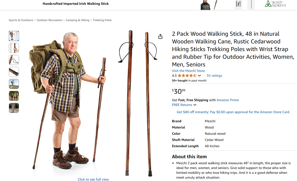
Wooden Hiking Sticks - We each used one stick. That kept one hand free for the remainder of the hike to hold cameras, phones, water bottles, sandwiches, etc. The stick was necessary through the section between Orderville Canyon and Big Springs. This section of the Virgin River is full of boulders, which feels like walking over a field of slippery bowling balls while trying not to fall over due to the moving water. We appreciated having the sticks in other parts of the hike as well, but in this section it was a must. We have folding poles but were worried they might break. We were all happy with wooden ones we purchased. As we drove to Zion, these poles fit in our minivan fine. I’m not sure if it’s possible to bring non-folding poles on an airplane. They can be rented though at Zion Outfitter, right next to the Visitor Center in Springdale.
Wag Bags - This is a carry-out-everything sort of place to hike, if you get what I mean….sorry. It’s not a reason not to do the hike. Double bag it, don’t overthink it, you can do it if you need to. Pack a roll of toilet paper too. I may have forgotten this, causing an extra problem for someone in my family….

For anyone hiking in cooler months, dry gear can be rented out of the same parking lot as the shuttle at Zion Outfitter. It won’t be open yet when you take the morning 6:00am shuttle - plan to pick up rentals the day before.
Backcountry Risks
One last bit of advice - pay attention and be prepared. Don’t go into the Narrows if there is a threat of rain. The rock has been formed into a canyon due to flash floods. Water is powerful. There is a 2-mile section between Orderville Canyon and Big Springs with no high ground, just thousand foot cliffs on both sides. If this part of the canyon floods, there’s no where to go, and people have died as a result. There isn’t a way to prepare for flash floods other than to not enter the canyon.
Second, there aren’t a lot of people around to help you if you need it upstream of Big Springs. When entering backcountry, you need to be able to handle all emergencies. There was a moment in the middle of the hike that my older son slipped on a dry boulder section and fell. Somehow he was not harmed when he fell, but had he, we would have had be able to stop the bleeding until we could walk out of the canyon several miles later to get stitches, if needed. Be mindful of potential injuries when packing a first aid kit. Anything can happen in the wilderness.
Hiking the Narrows
Below is a map of the Narrows top-down, starting at Chamberlain Ranch, where the Red Rock Shuttle drops off hikers, and ending at the Temple of Sinawava with a pick-up from the Zion National Park shuttle bus. Your car will be parked at the main Visitor Center.
I will give mileage throughout this post based on walking straight through the middle of the river. As I’ve stated earlier, add in a handful of extra miles when planning out this hike due to potential mistakes that might need to be backtracked, interesting side canyons that you may want to explore, and the need to cross back and forth through the Virgin River to find the safest place to walk. Over the course of 16 miles, these extra steps will turn into extra miles.
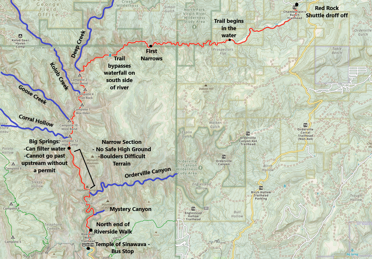
Zion’s Narrows - Hiking Trail Map
4:00am - Alarm Clock - The closest place to stay would be in Springdale, UT. We picked an air conditioned cabin at a KOA in Hurricane, UT, due to wanting to spend some time in Kolob Canyon. It was a good choice for us based on the other things we chose to do, but it did make for an early morning on our summer vacation.
5:35am - Arrived at Zion National Park Visitor Center - We used bathrooms and re-filled our water bottles / jugs and walked over to the parking lot of Zion Outfitters. The Red Rock Shuttle met us in that parking lot, even though their actual business is located elsewhere.
6:00am - Red Rock Shuttle takes off towards Chamberlain Ranch - It’s a long (and bumpy) van ride. There were 12 hikers in the shuttle from four different groups. We walked with one group of three hikers most of the day (we kept passing each other, and for some longer stretches we walked and talked together). I have no idea what happened to the other five hikers - we never saw them after the drop off.
7:18am - Chamberlain’s Ranch (0 miles) - There is a vault toilet to use (the last one) and warnings on the trailhead signs that won’t do you much good as the shuttle will have left you long before you’ve had a chance to read it. Make sure to grab all of your stuff when you get off. Those shuttles are in a hurry to get back and pick up the next set of hikers.
The trail is well-marked at the trailhead and follows an old road. Almost immediately there will be a water crossing. This one is easy to hop across.
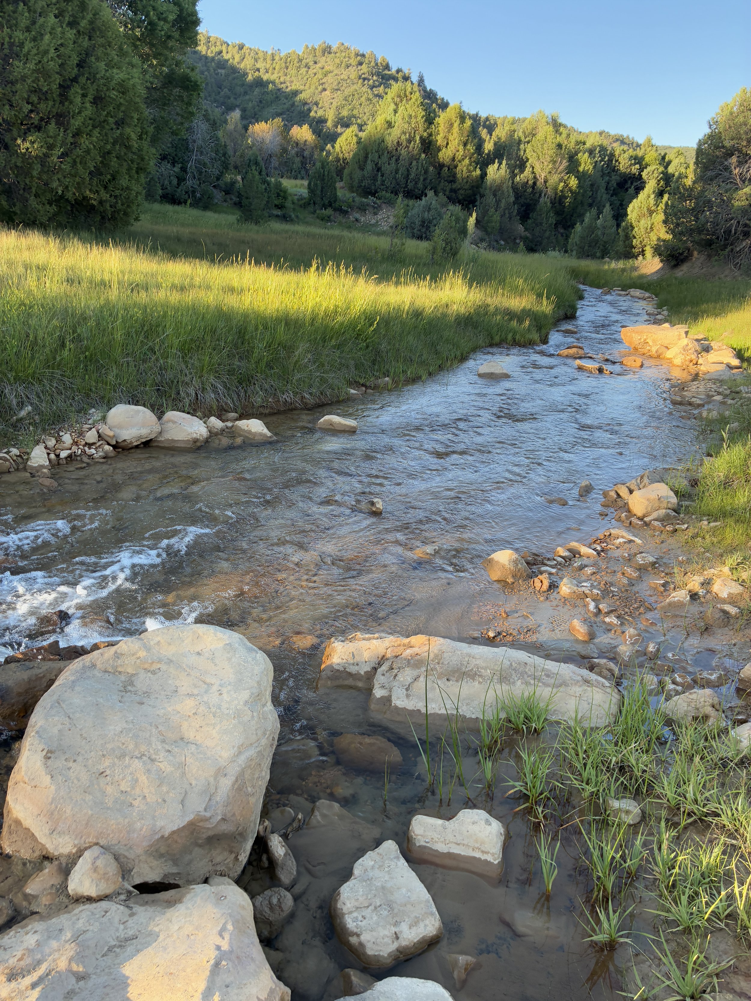
First water crossing is steps into the Narrows hike (7:20am)
Shortly after the water crossing the trail comes to a T and this isn’t marked. Go to the right. I use the GAIA app and pre-download maps. That would be my advice to anyone hiking an all-day trail. No one needs to take extra steps by getting too far down the wrong path.
Walking across private rancher’s land (7:23am)
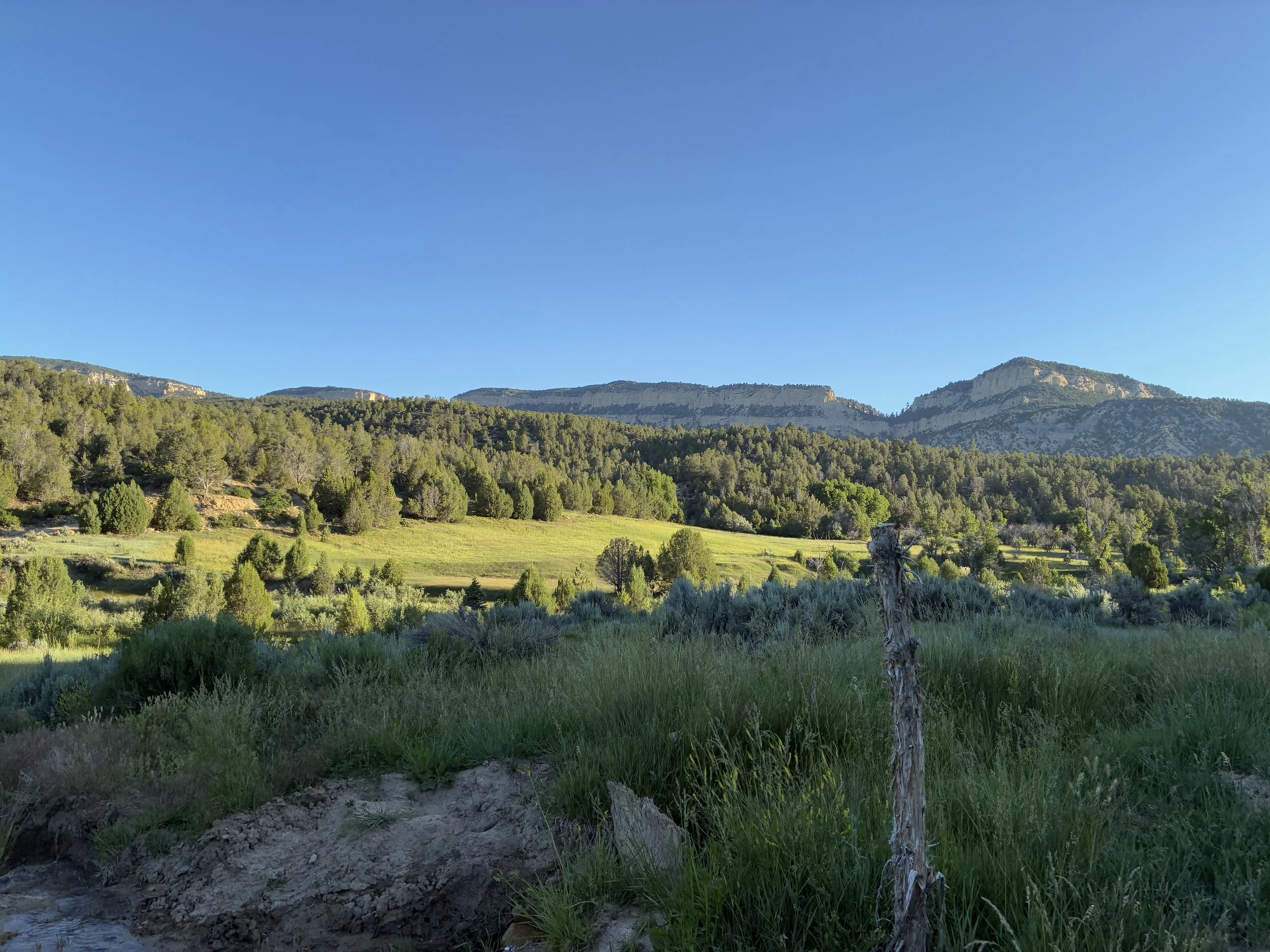
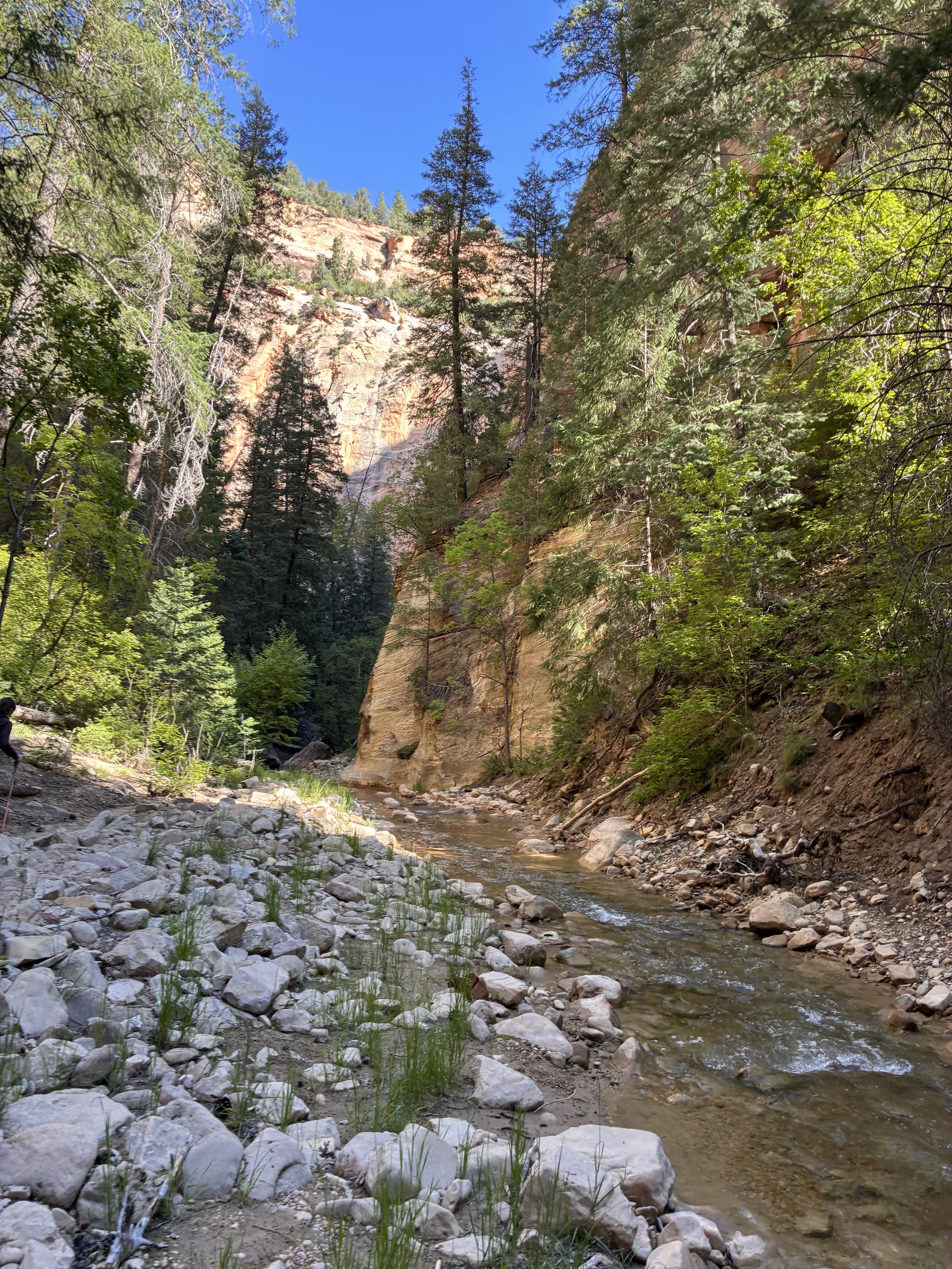
From the trailhead to where the hike joins with the Virgin River is 3 miles. This is the easiest 3 miles in the entire hike. Don’t dawdle here. It’s pretty, but the views will get so much better! Push to do this section in an hour.
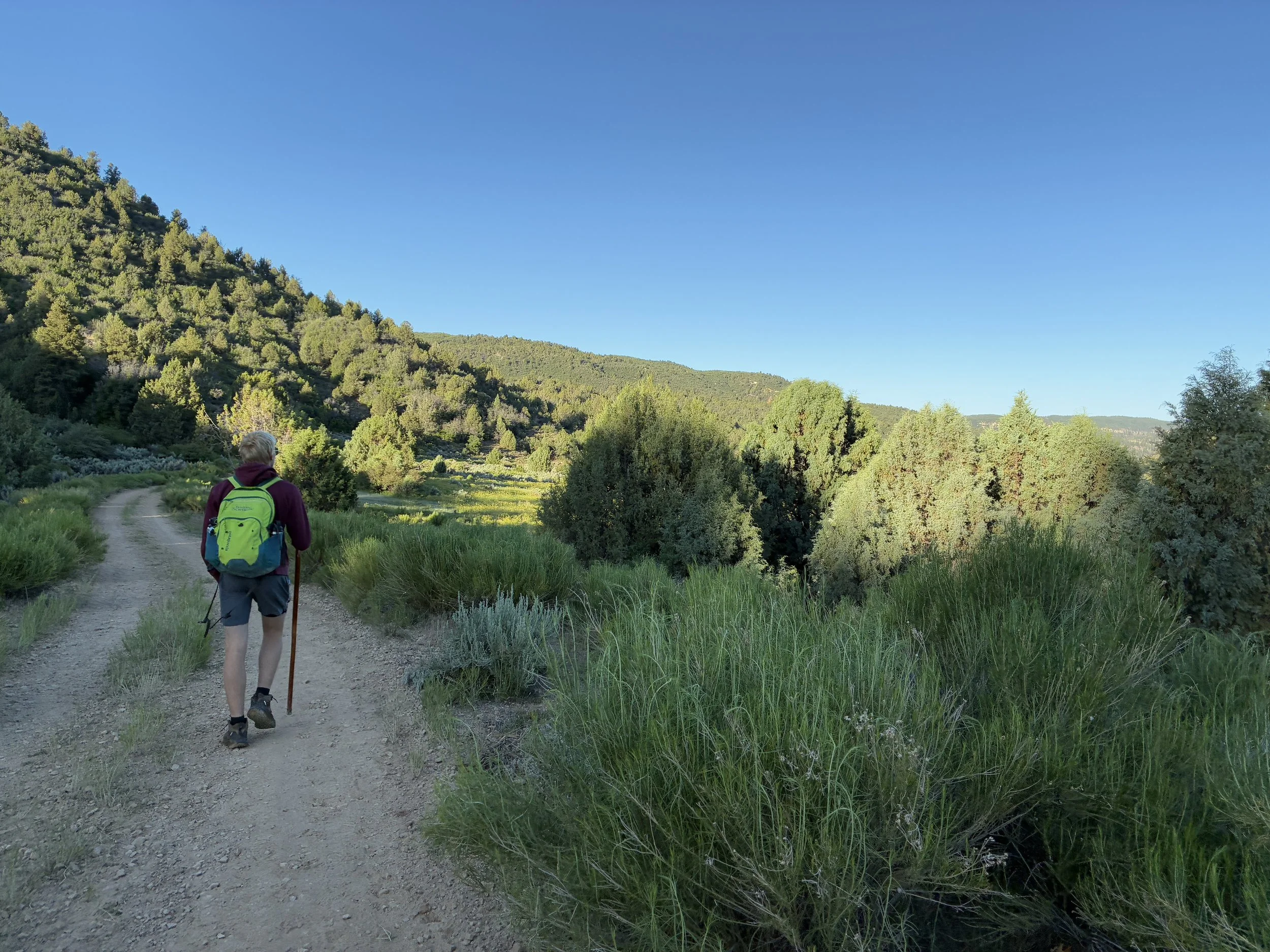
The first 3 miles are along a road that looks like this. (7:26am)
There will be a second fork in the road. Again, stay to the right.
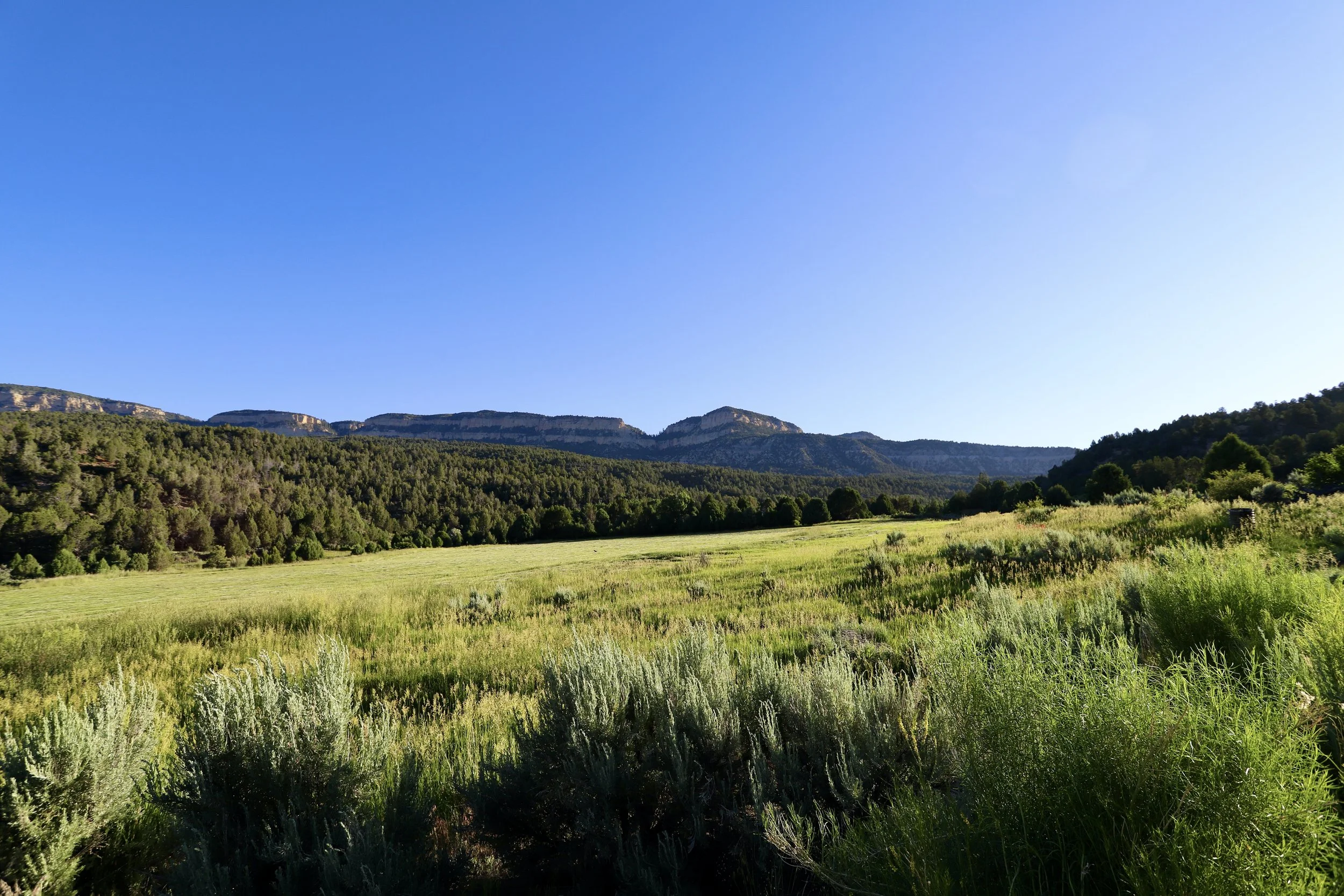
Private Ranch land (7:29am)
I didn’t know what to expect at the beginning, but this was an incredible start to our morning.
Hiking the first section of ranchland to get to the Virgin River (7:40am)
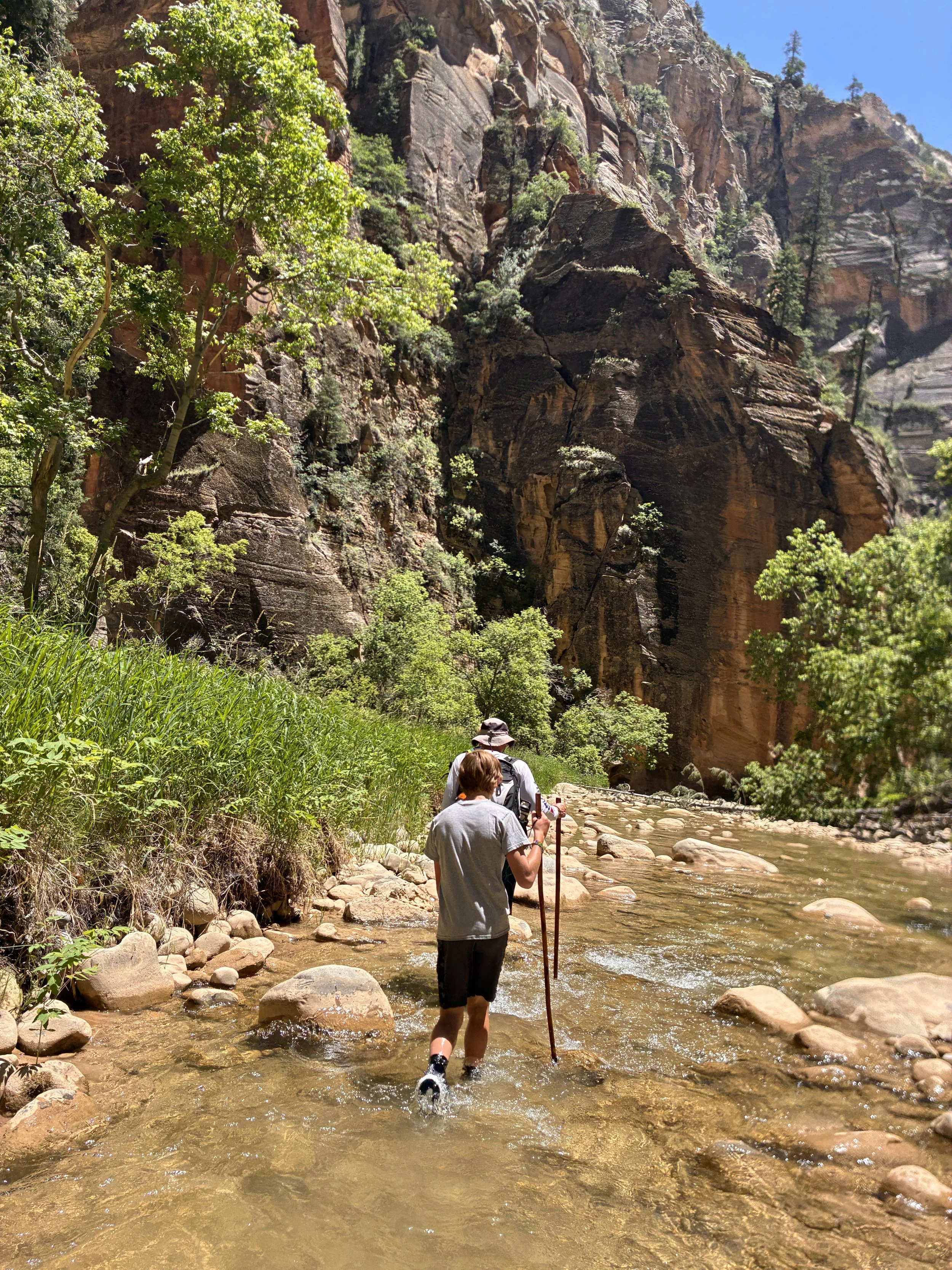
We were confused when we got to the next river crossing. It looked like there was a trail on both banks of the Virgin River. We walked along the left side for a bit, but the trail rose quite a ways up hill, and there didn’t appear to be a way to get back down to the river, so we backtracked and followed on the right bank instead. Honestly, at this point, the trail is the river. Hop across and stay dry or just start walking in it.
Second river crossing - from here either walk in the Virgin River, or just stay nearby on the river bank (8:19am)
Third river crossing - we almost understood at this point the river was the trail… almost. We wasted a few steps trying to find the “trail”. There isn’t a trail - it’s just the river (8:23am)
8:26am - Virgin River (3 miles) - At this point, we understood what was going on. We could walk in the water or we could walk on the dry riverbank. There are sections of trail here and there, but this is a “choose your own adventure” sort of day-long walk.
Canyon walls slowly start to rise along sections of the Virgin River (8:30am)
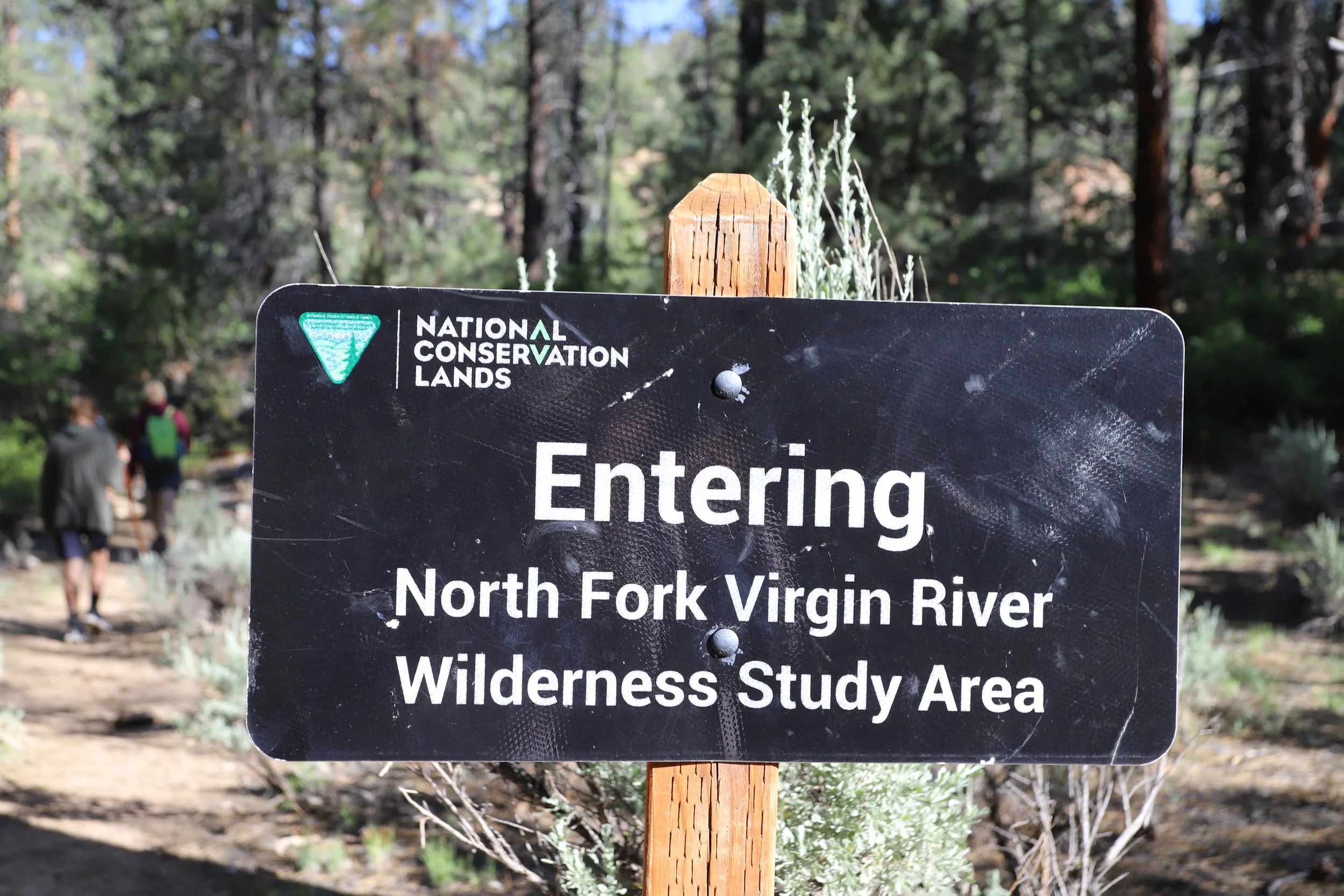
Officially walking off of private land and entering the North Fork Virgin River Wilderness Study Area (8:40am)
By this point in the trail, my feet are wet. I’m walking on the banks as much as I can because it’s faster, but I’m no longer trying to stay dry. The water was cold, but the neoprene socks worked really well. My feet are always cold in the winter, but I was never uncomfortable along this hike.
Walking through the Virgin River (8:52am)
The canyon walls are still pretty short where we are, but we can see them getting dramatically taller off in the distance.
Still walking - (8:53am)
You will get wet, eventually… His feet are still dry so far (8:57am)
My older son did not want to get his feet wet - and he lasted the longest with dry feet up until 4.25 miles into the hike.
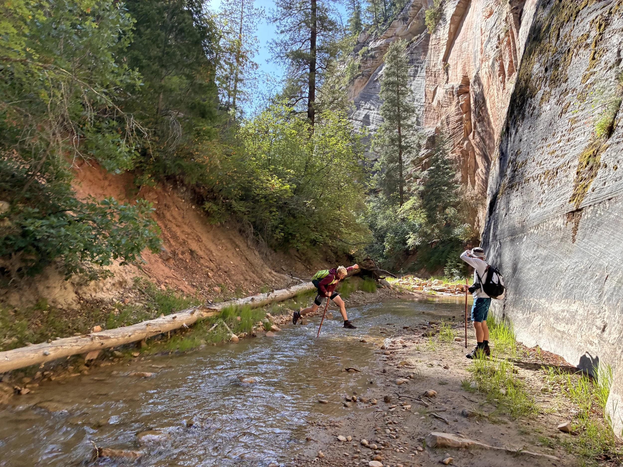
He made the jump and kept his feet dry for a few more minutes (9:11am)
By this point in the trail, my younger son is enjoying walking in the river (intentionally being his brother’s opposite). He sees the added challenge of staying in the water, while my older son sees the challenge in staying out of the water.
Enjoying the walk through the Virgin River (9:17am)
The canyon walls aren’t dramatic yet, but the striped patterns and cut-outs are beautiful.
Getting comfortable in the Virgin River (9:20am)
Just around the riverbend (9:30)
The coolest part of this trail is how just a bend in the river changes the entire landscape. At this point, we can now start to see Zion’s deep oranges and reds in the canyon walls.
We swapped cameras with the other group of hikers to take some family shots. And yep, my older son is finally in the water.
(9:37am) - Family Picture
The canyon walls are starting to grow higher by this point, but the Virgin River is still pretty small. There are lots of trees still in this section. When we can walk along the dry bank, we chose to do that, as walking on dry ground is quite a bit faster and easier than walking through the river.
Hiking alongside the Virgin River (9:59am)
This hike is so peaceful. For 8 hours, It was just the four of us and occasionally we ran into the other group of 3 hikers. Zion is such a busy National Park, and we had it all to ourselves.
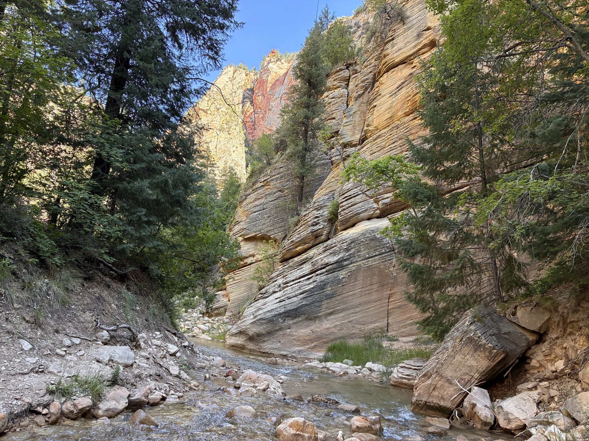
Looking Upstream (10:14am)
Looking Downstream (10:!4am)
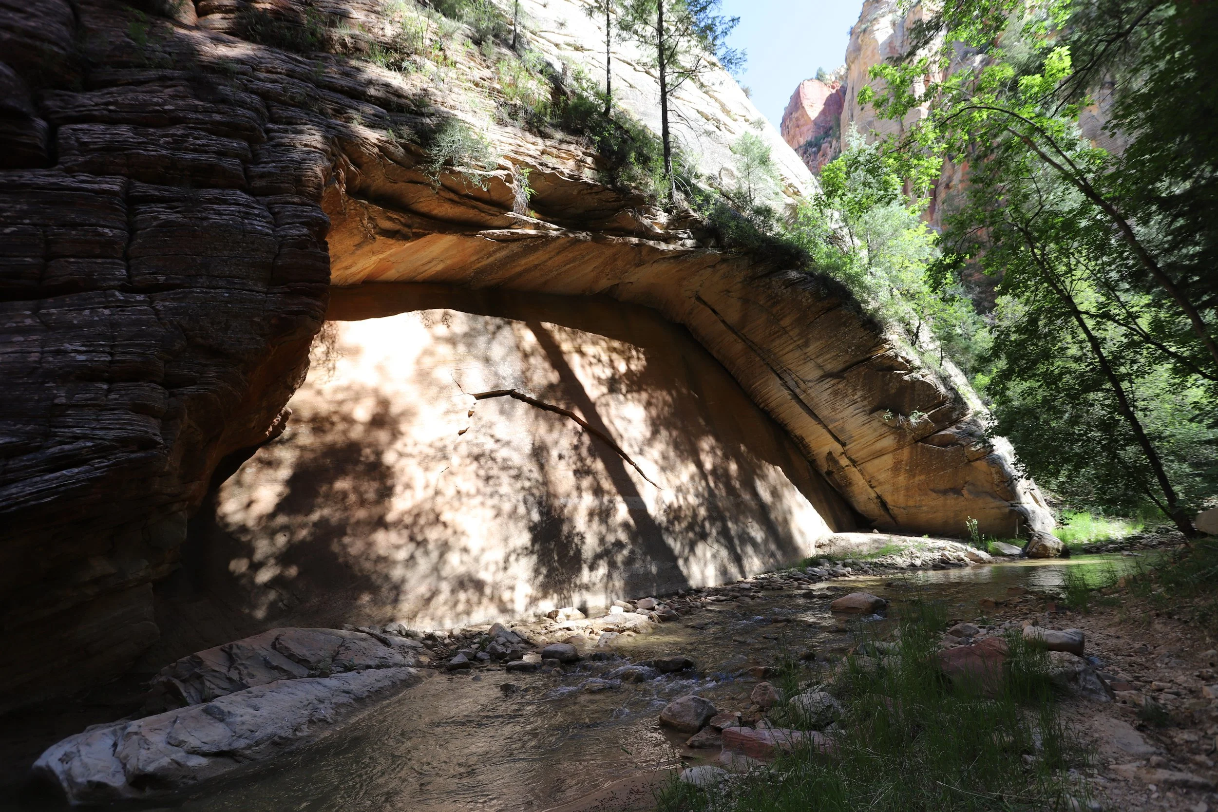
Cool alcove in the wall (10:15am)
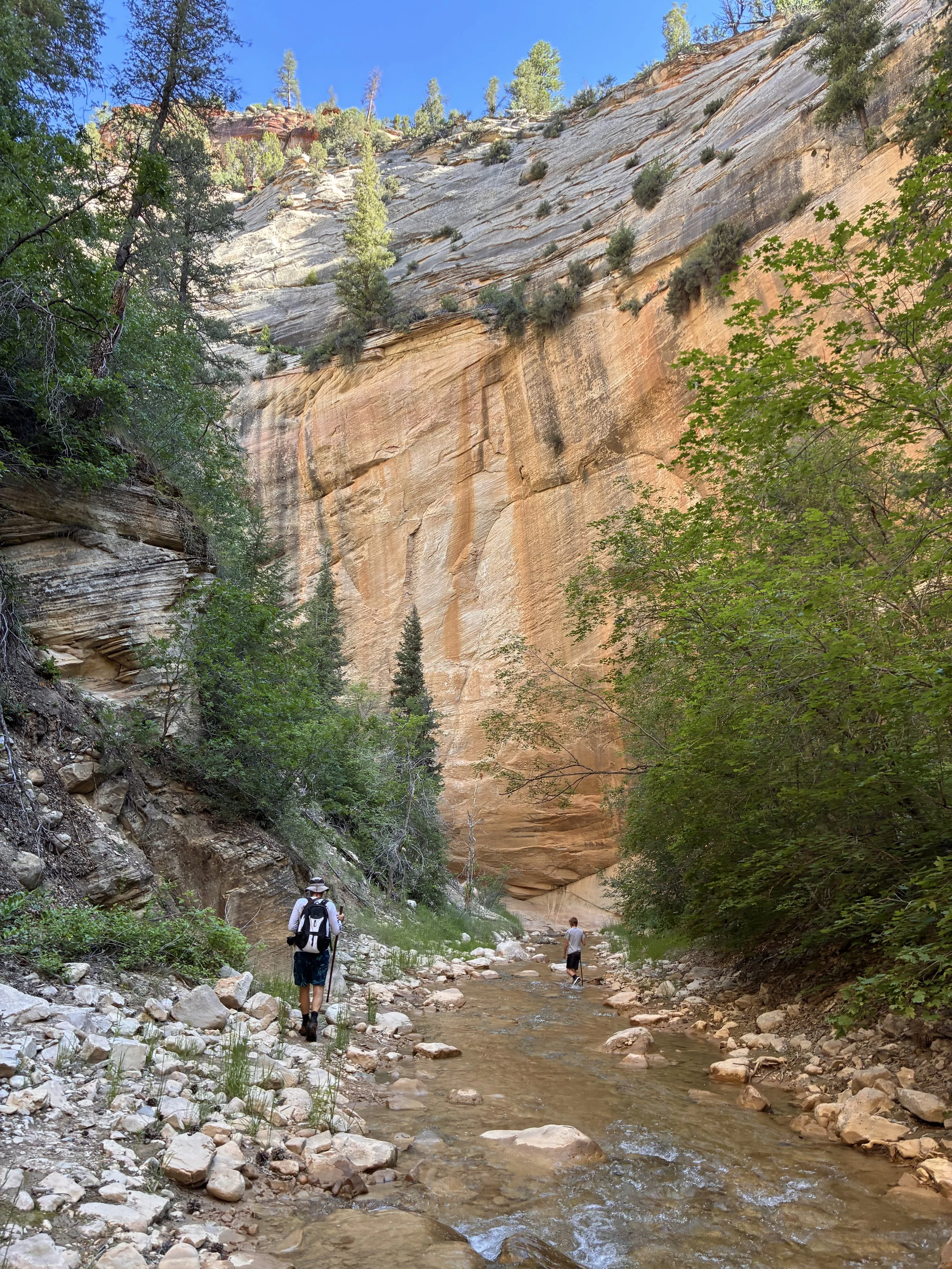
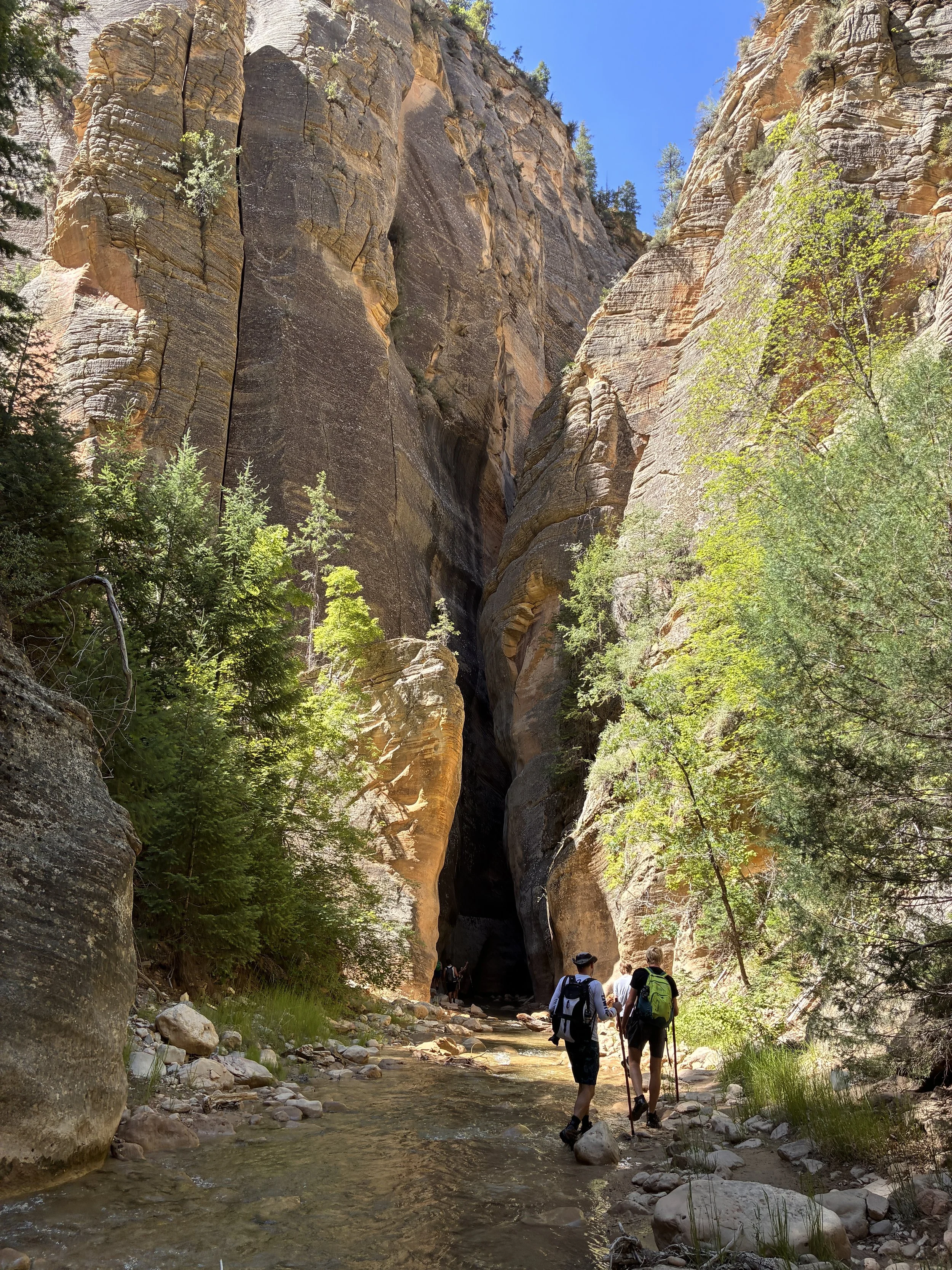
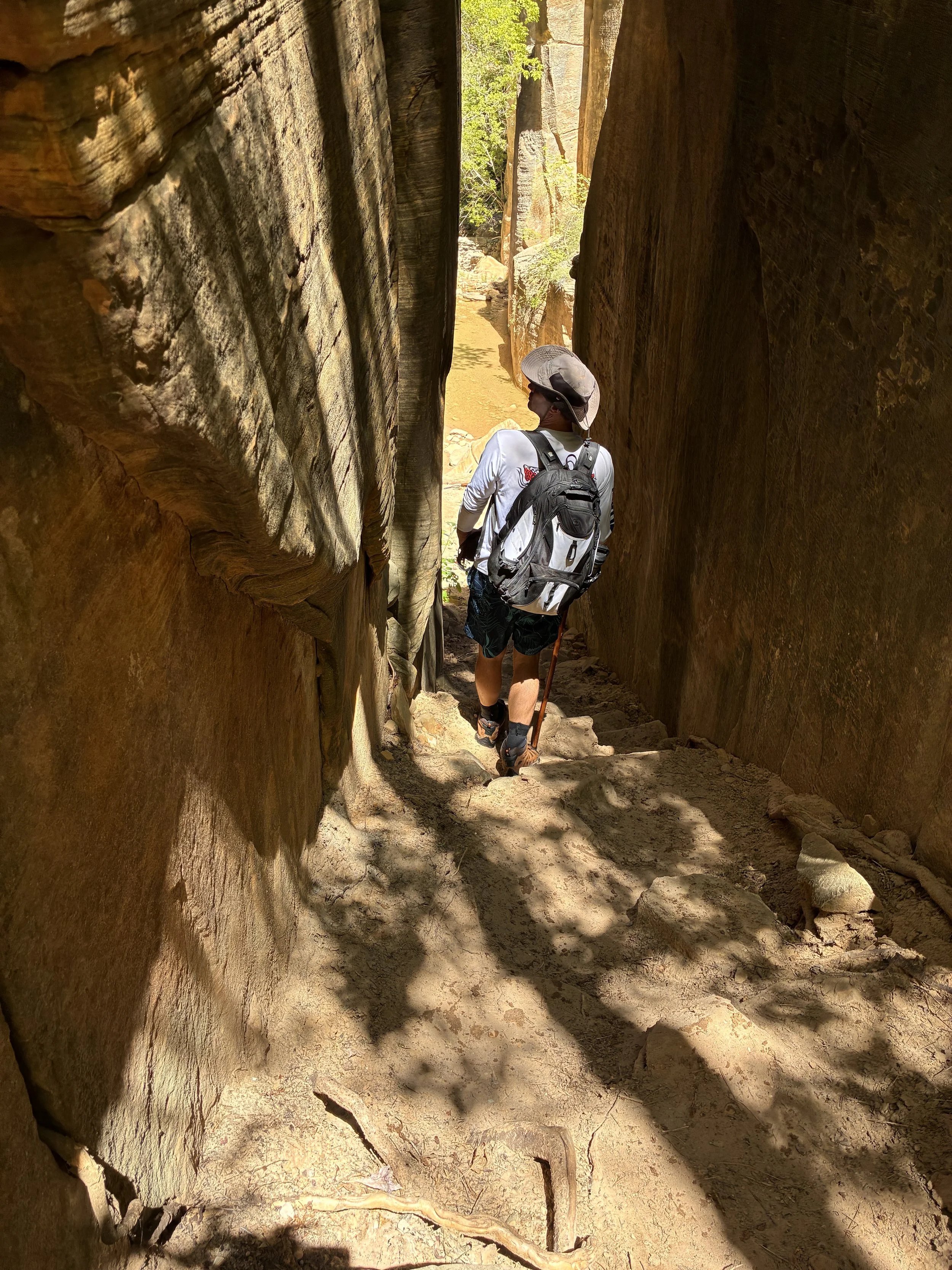
Entering the first part of the “Narrows” (10:18am)
10:19am - First Narrows (6 miles) - This is the first section of the Narrows. It’s not contiguous canyon wall yet, but just wow!
Entering the first Narrows (10:19am)
Because the walls are so tight, the view changes dramatically every couple minutes of walking.
Hiking through the first Narrows (10:24am)
This is a nice picture that shows what the path looks like when there is dry river bank. Again, we picked dryland when it was an option because it’s faster and easier.
Wider canyon walls again, but still stunning (10:26am)
Hiking through the Virgin River (10:28am)
We stopped to put sunscreen on and get snacks out of our bags, but other than that we were moving consistently up to this point. We enjoyed pausing for a few moments to watch a frog swimming through the river.
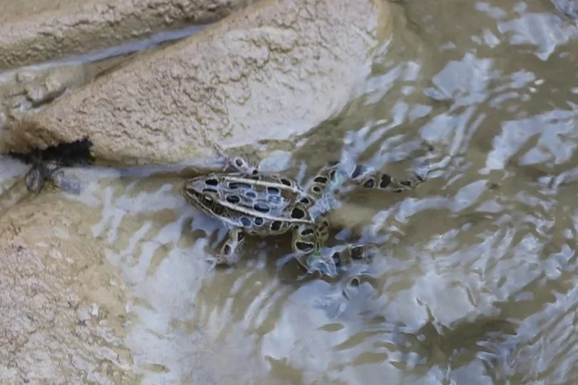
Some interesting wildlife (10:33am)
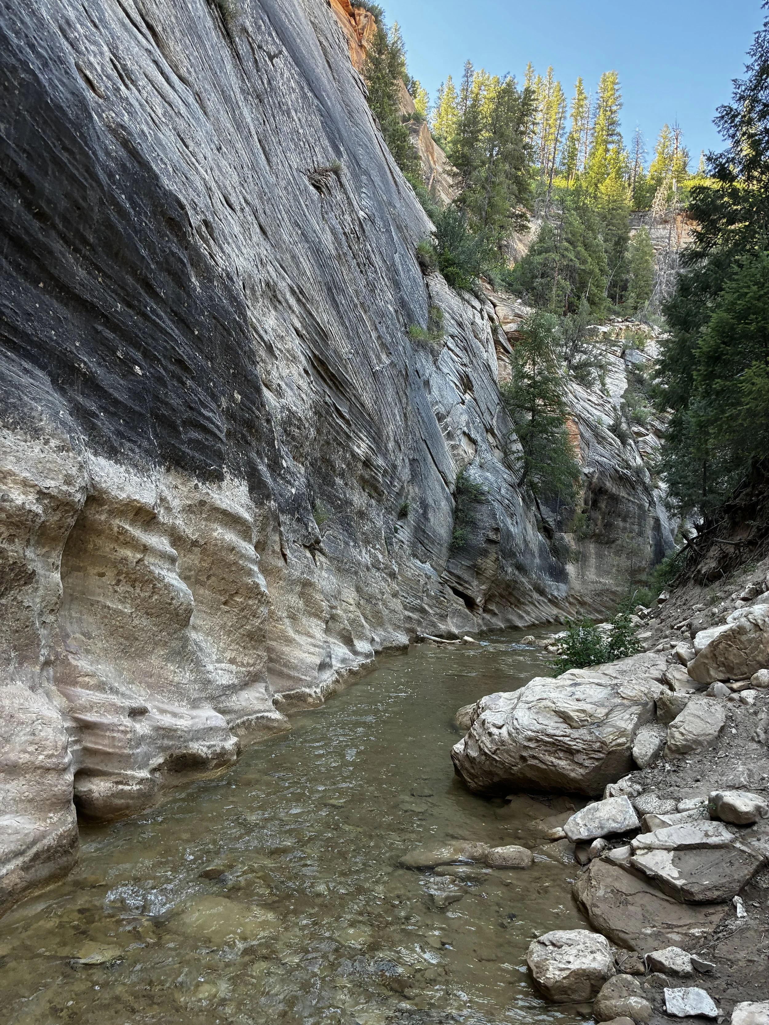
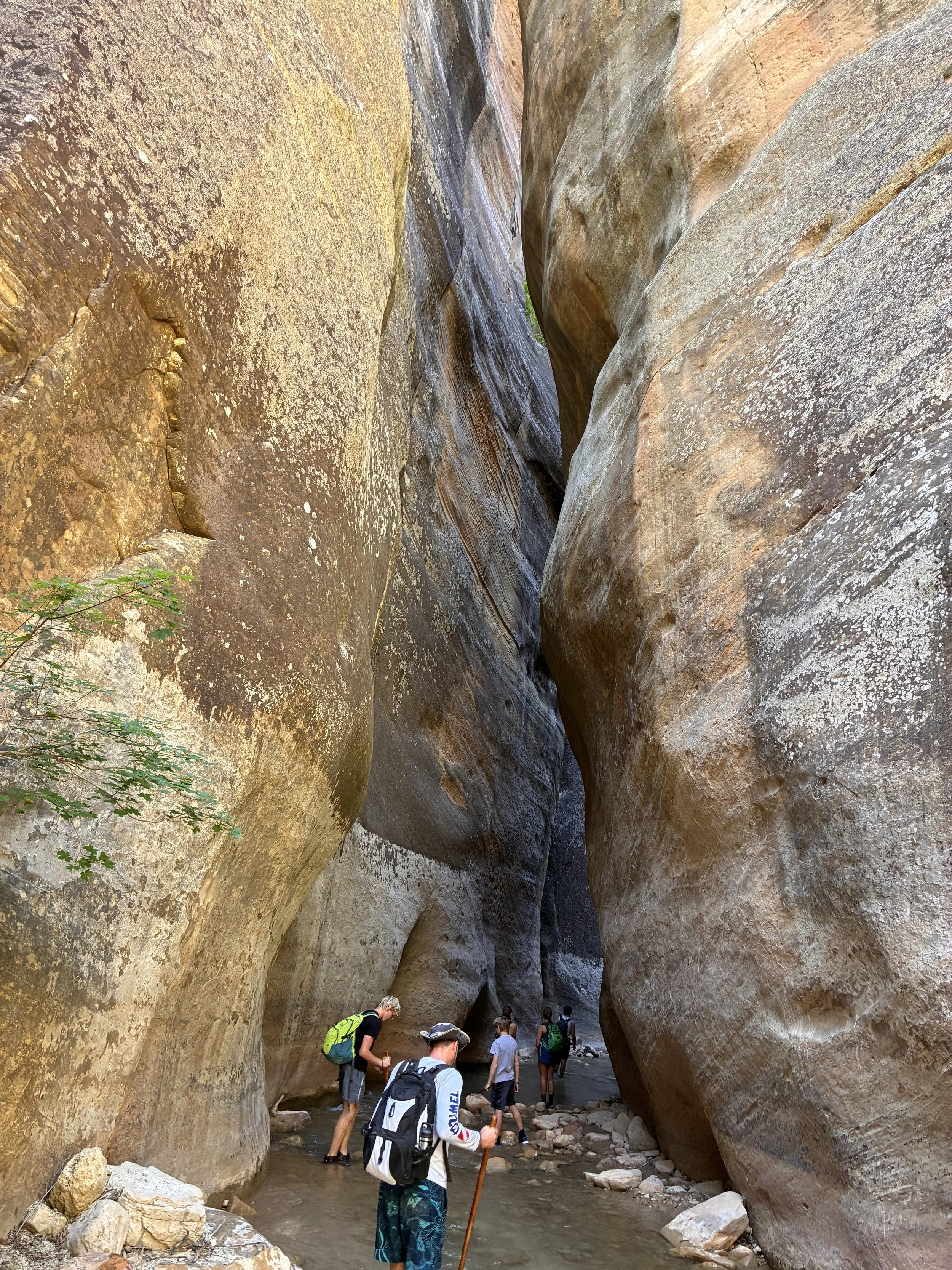
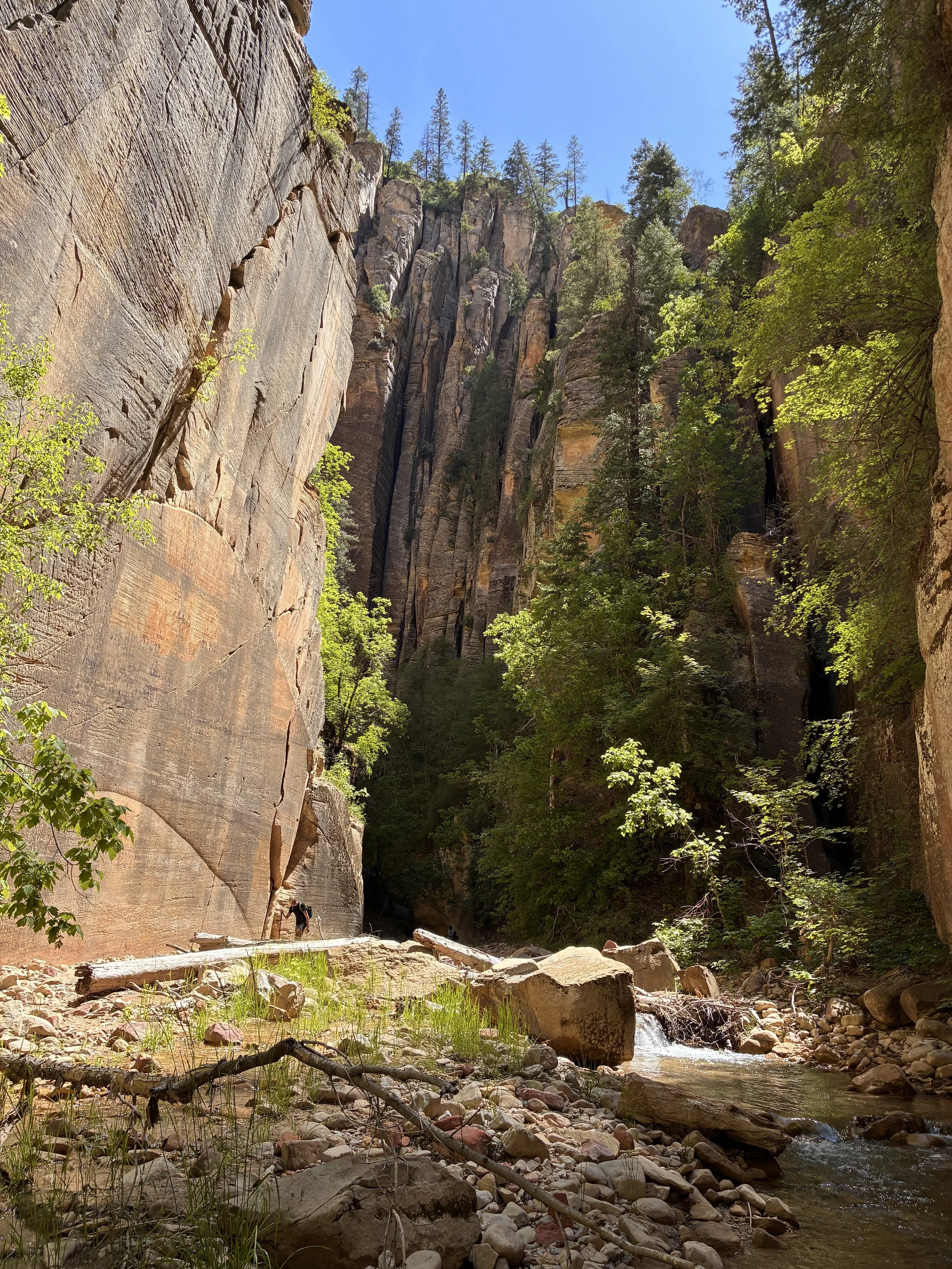
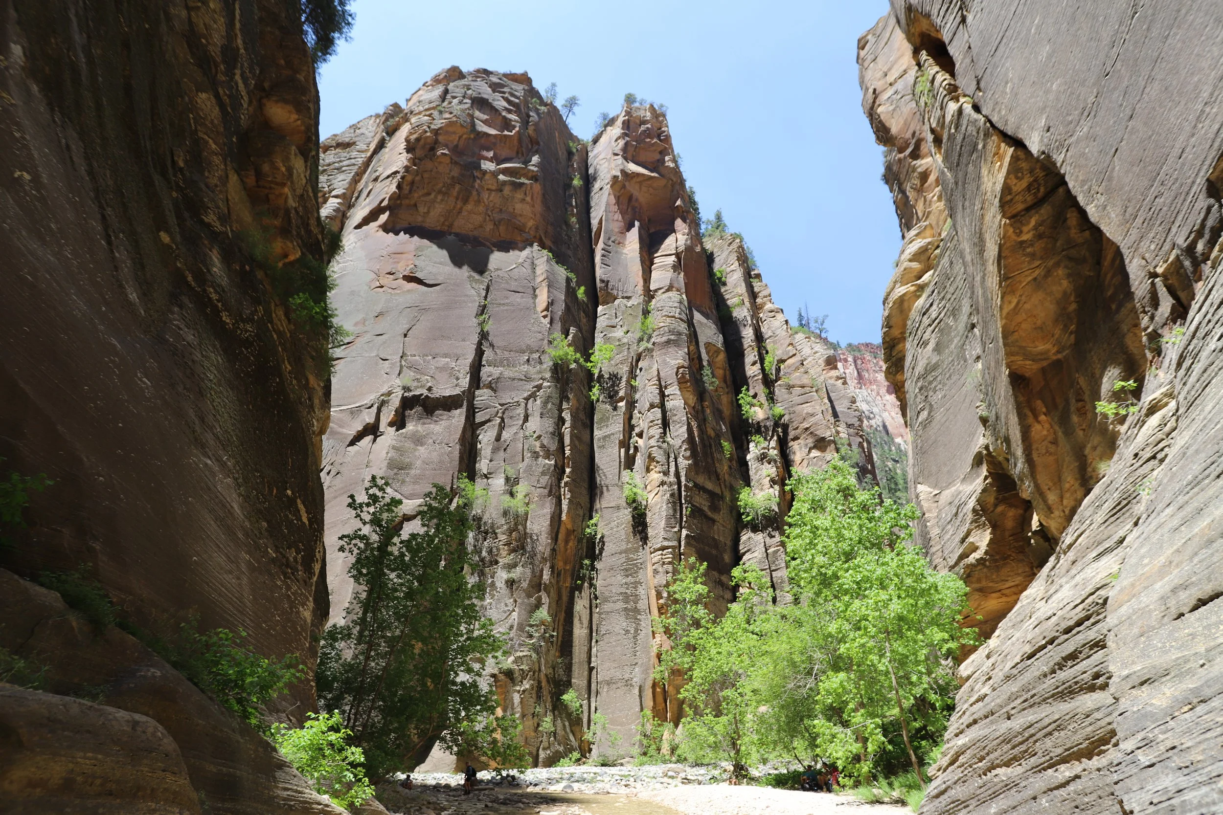
The pictures of the Narrows between Big Springs and Orderville Canyon may be the most popular on the internet, but this next section of the canyon up to the Deep Creek split was my favorite spot.
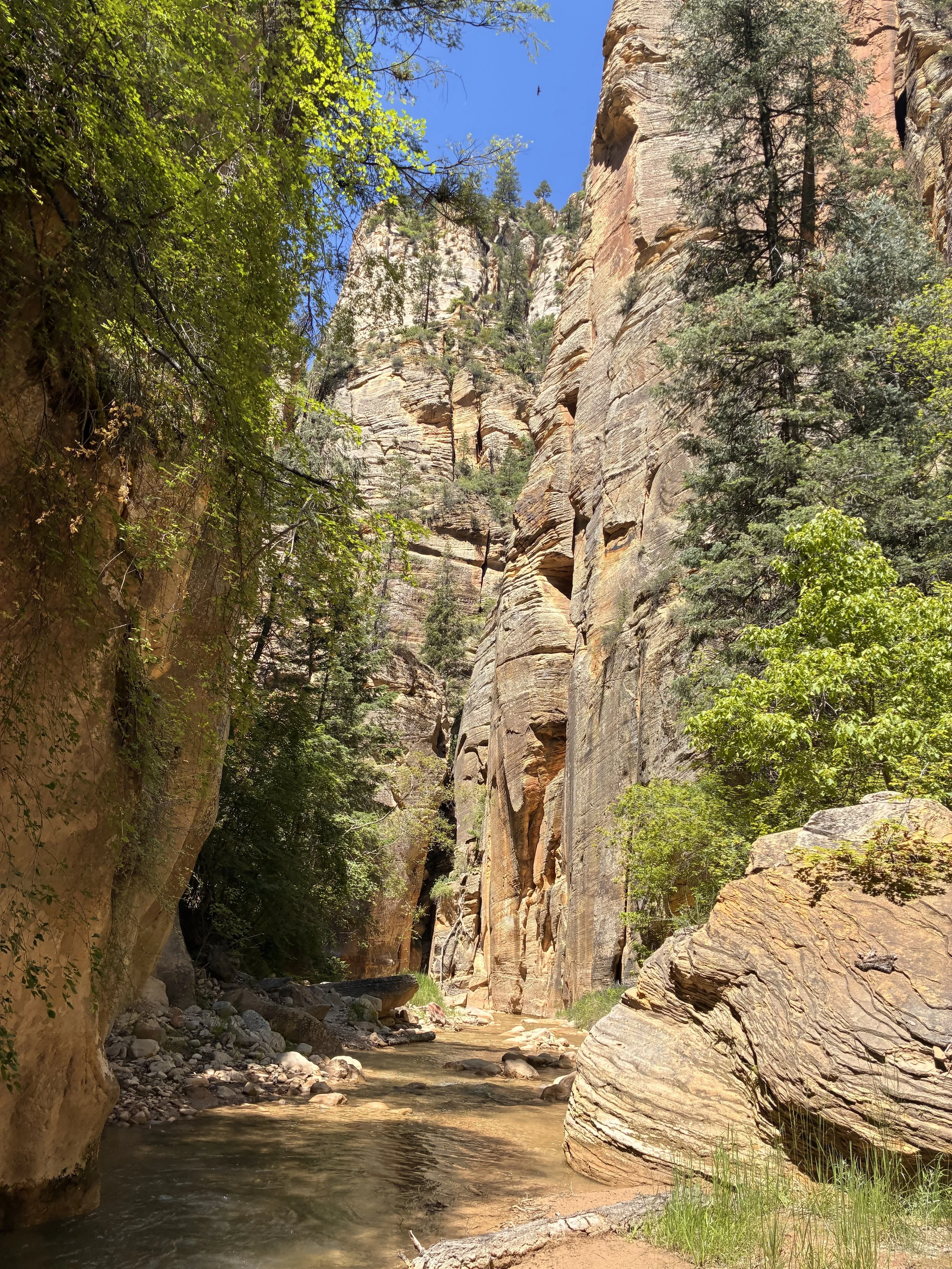
Particularly narrow section of the Narrows (10:57am)
This is the first part of the hike that made us feel small. The walls are just so big. I love these moments - it normalizes everything else going on in my life. If I’m small, everything else I’m dealing with is small too. We kept this feeling through the remainder of the hike.
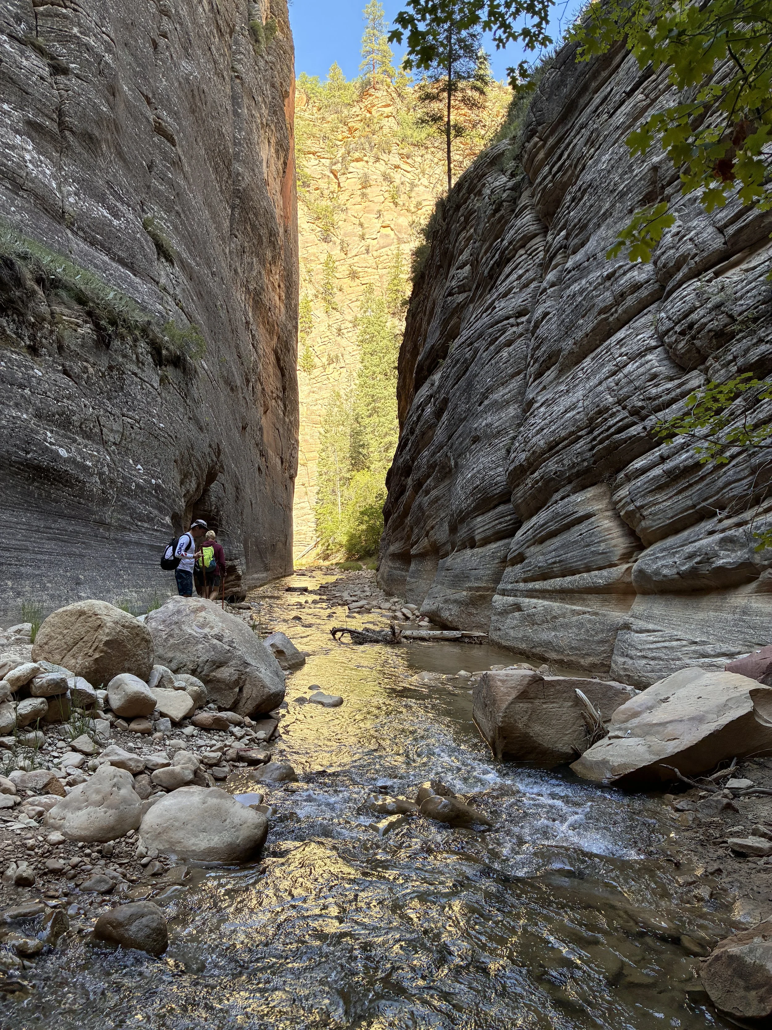
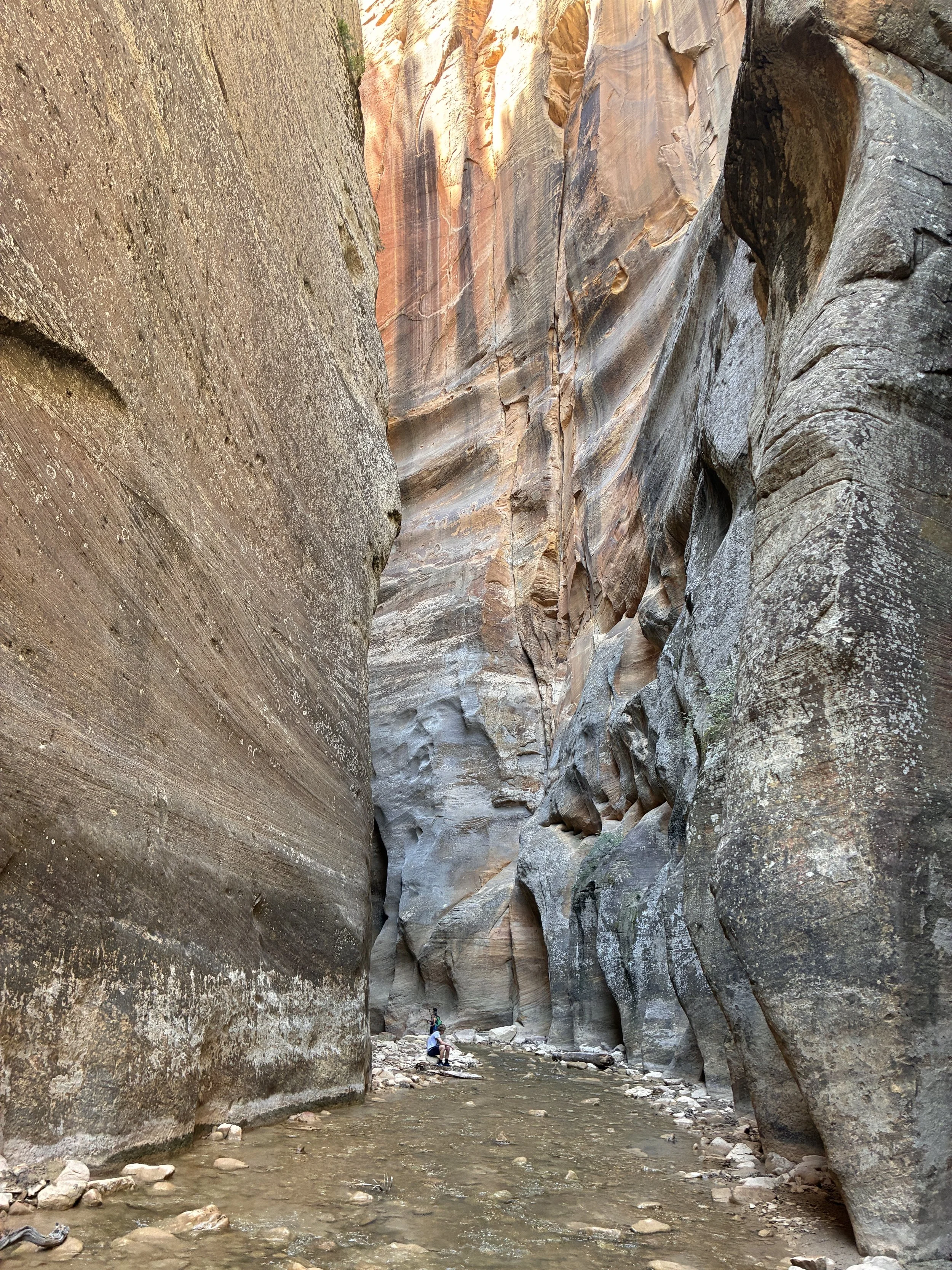
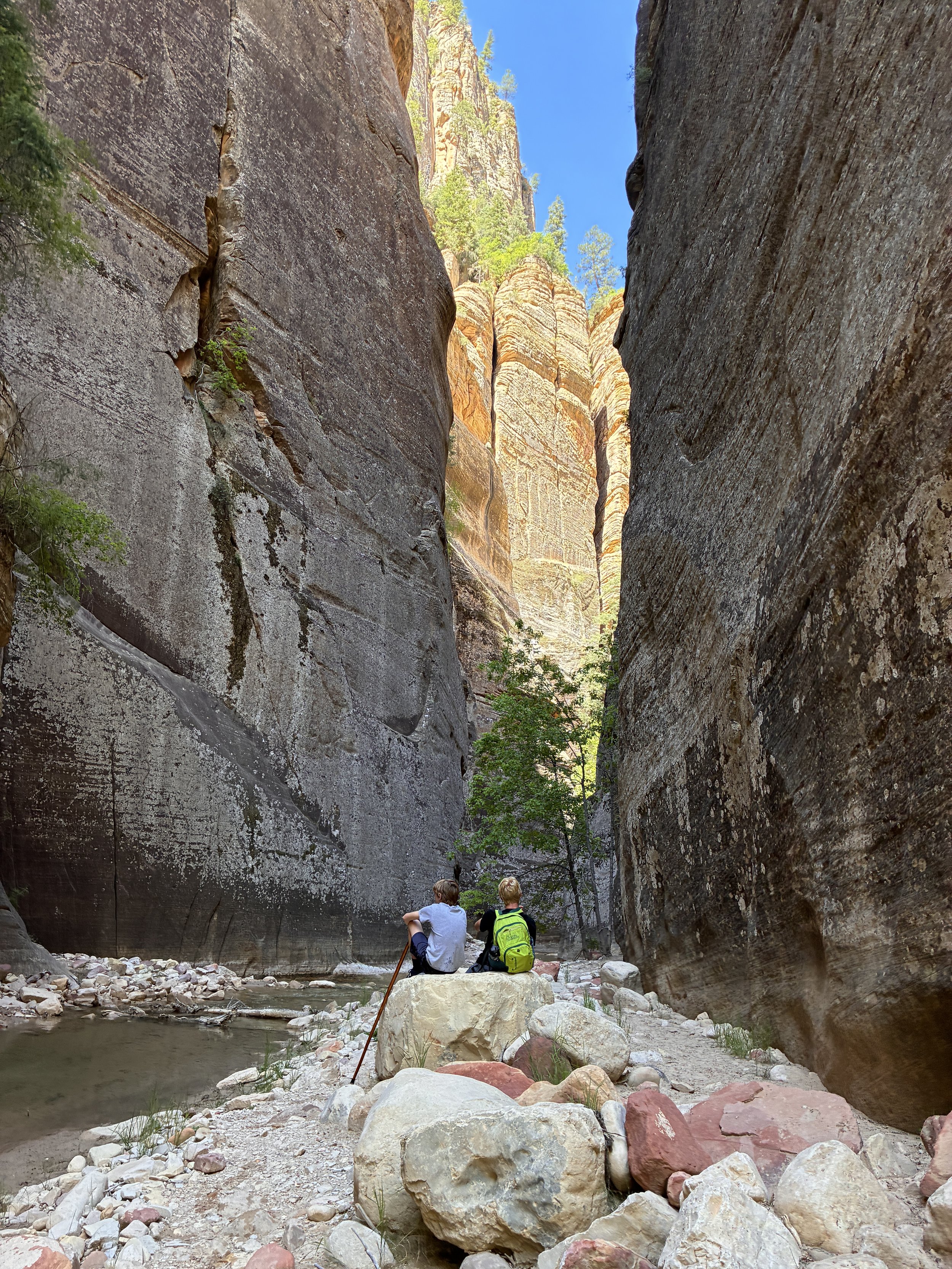
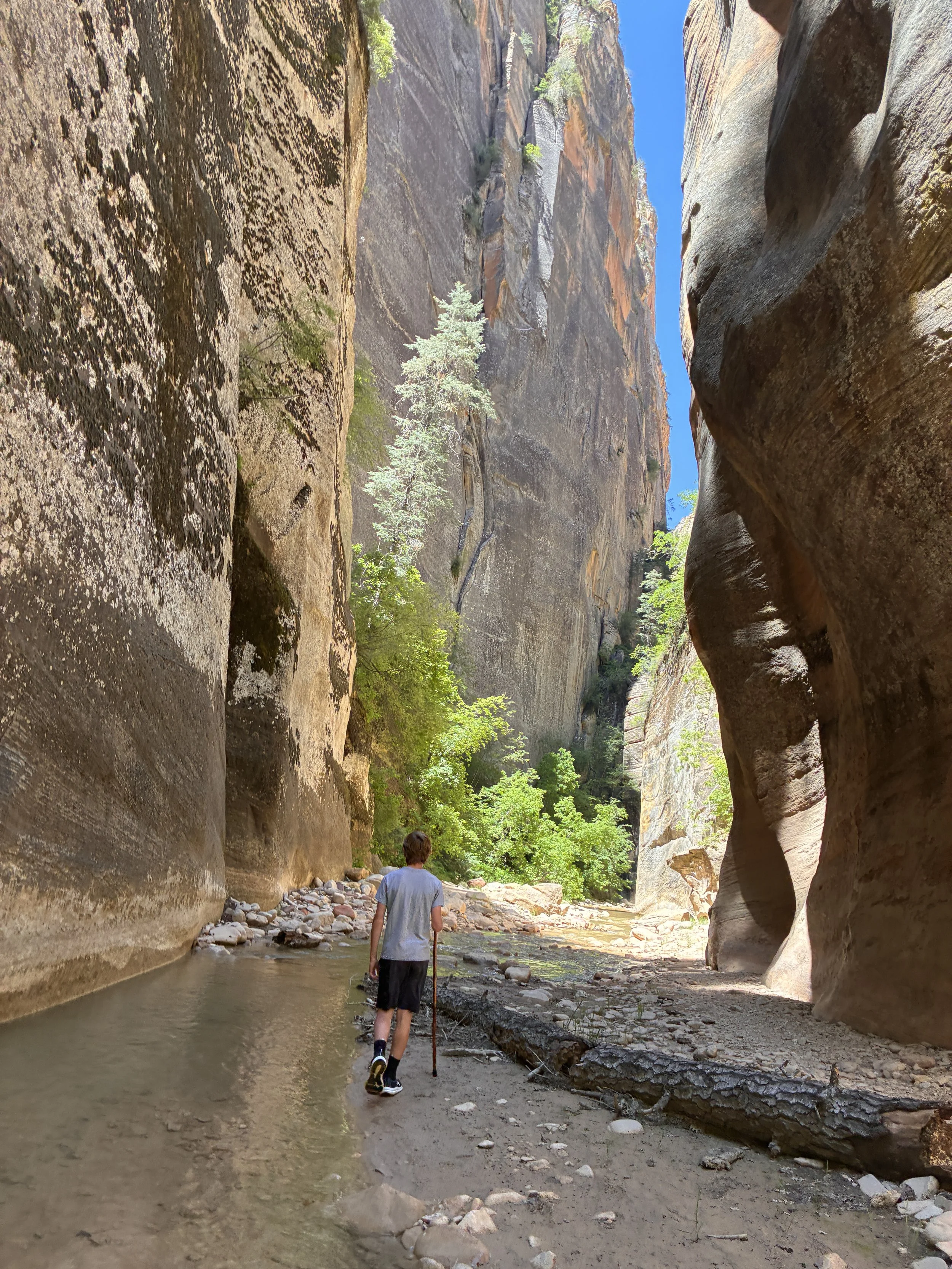
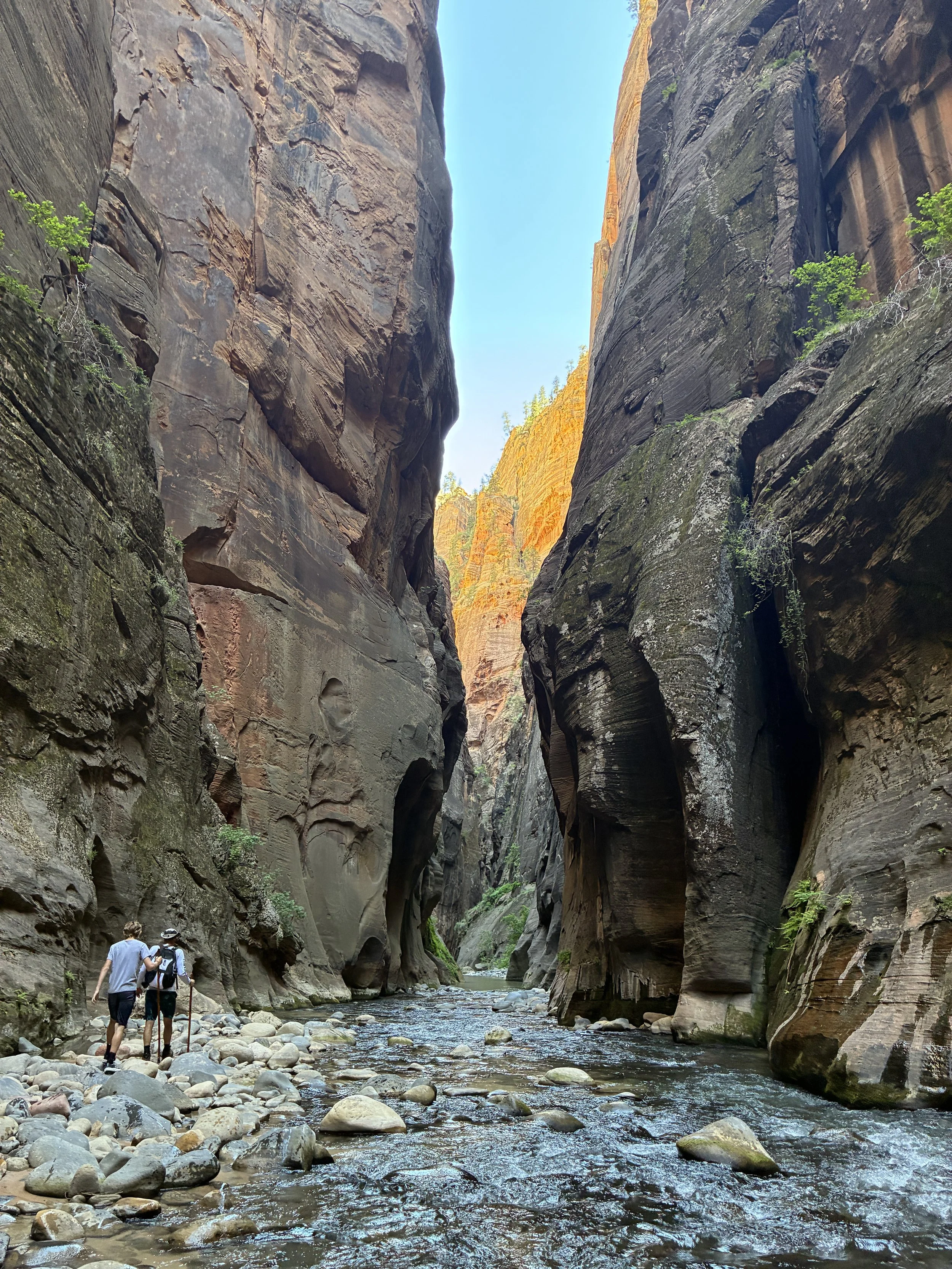
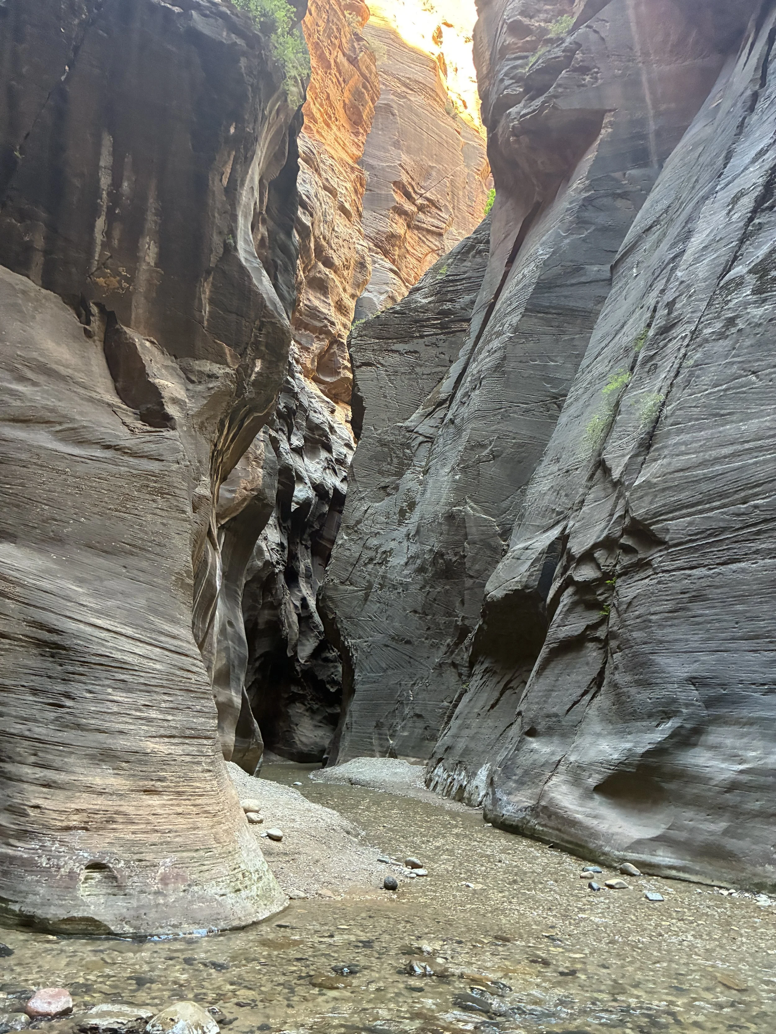
Entering the tightest section of the Narrows hike (11:06am)
This section of the canyon is still limited to just those that have permits. The people in the picture below are my family and that other hiking party of 3 that I’ve mentioned before. I have lots of pictures of this canyon section without people in it - it was just us. I picked the pictures with people in it to give perspective of just how tall these rock walls are.
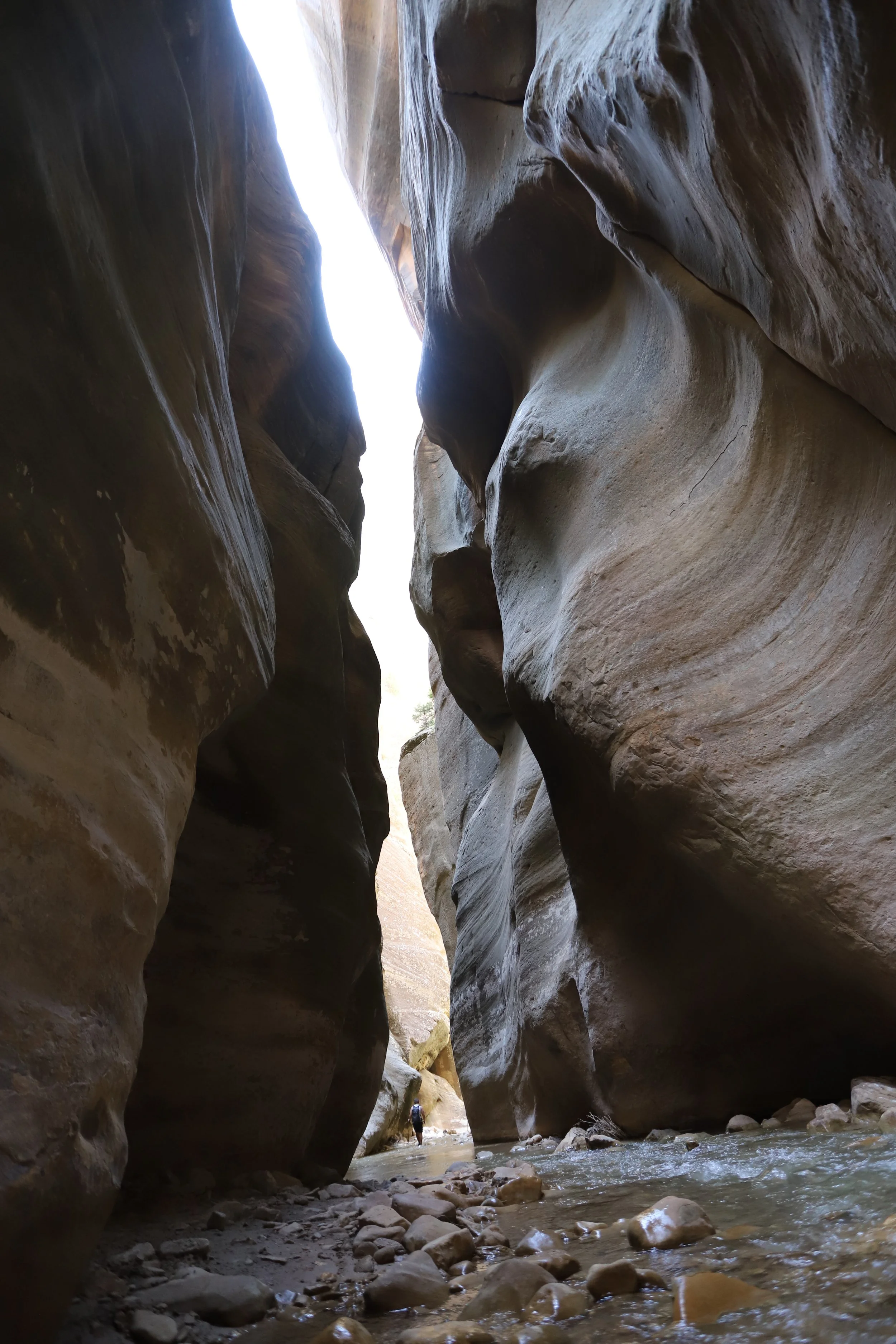
One of those “just wow!” moments (11:07am)
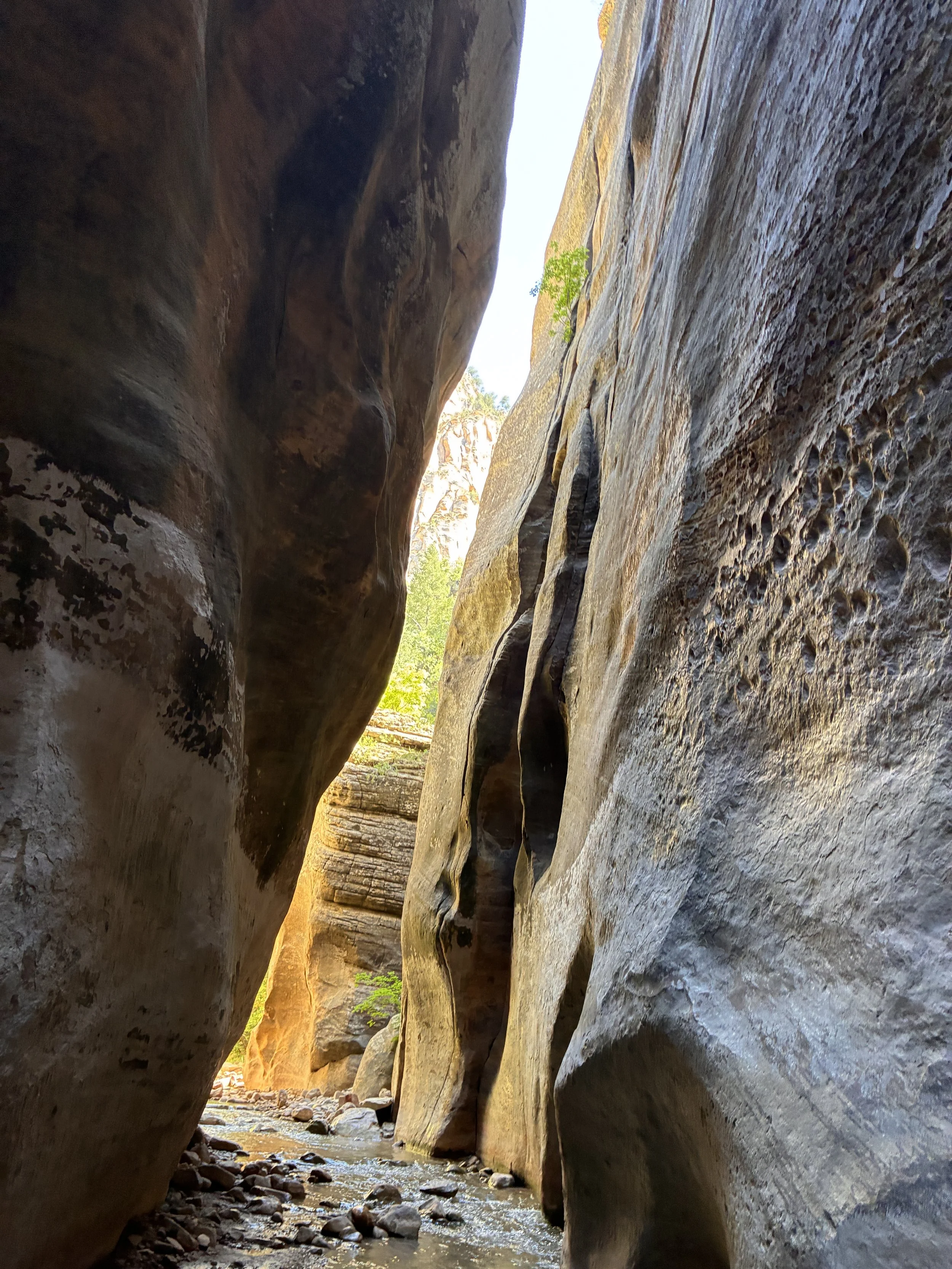
In the canyon walls just a little bit, looking back upstream (11:08am)
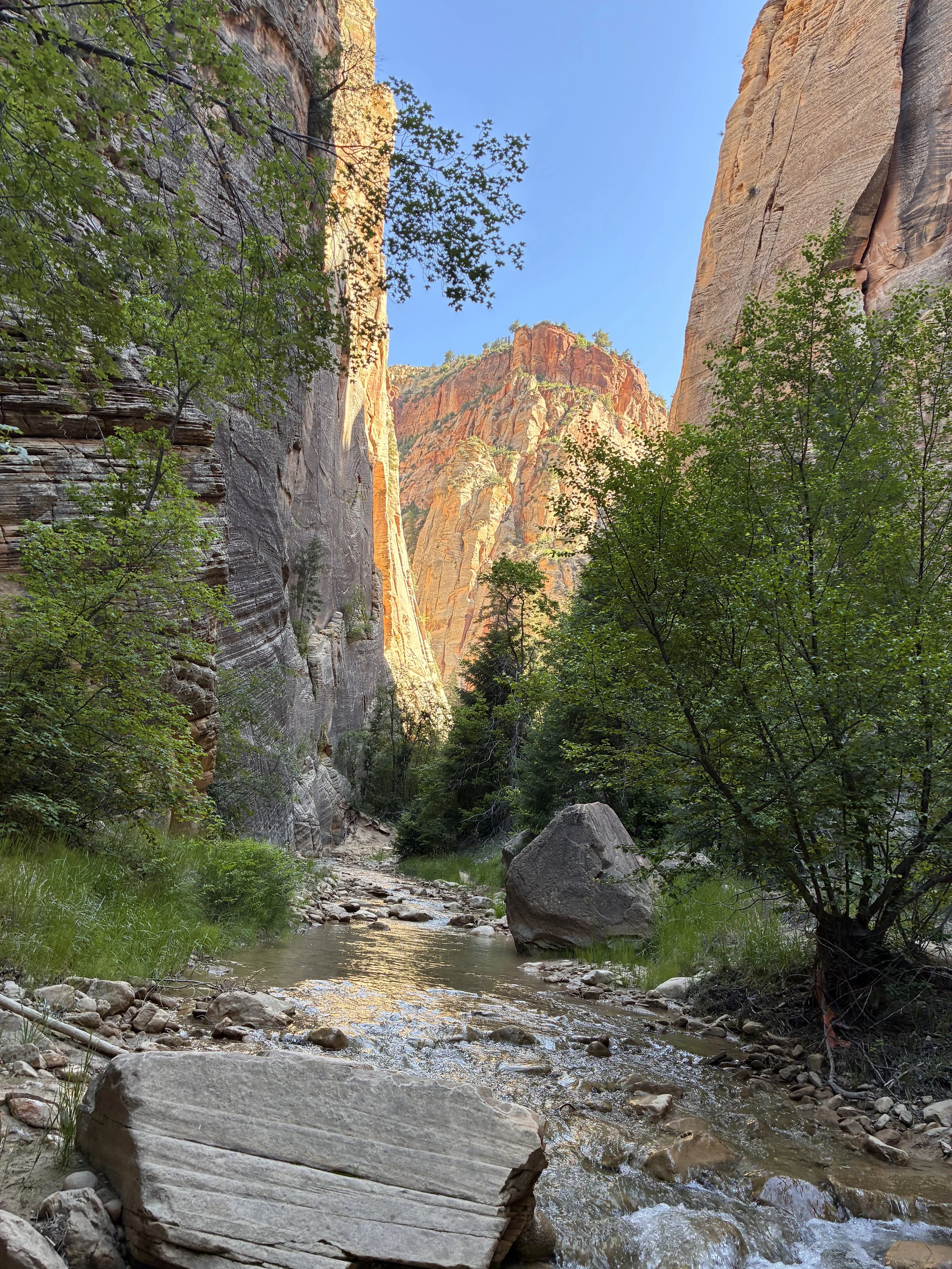
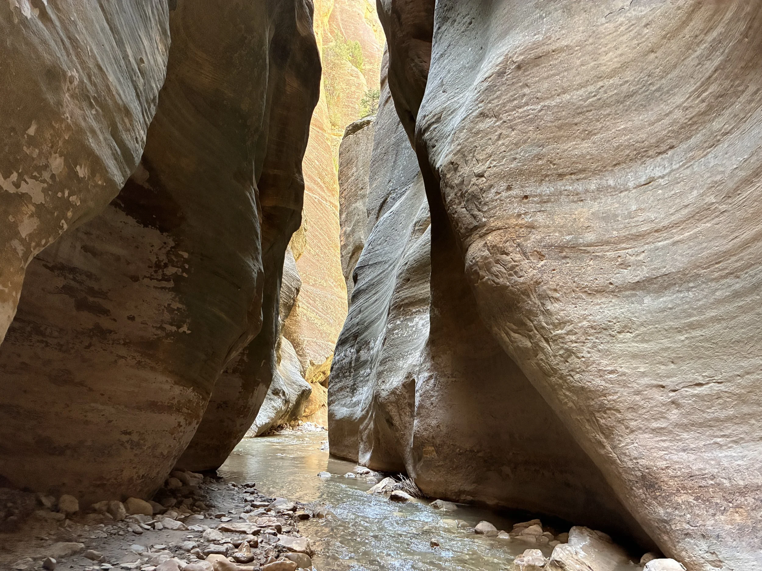
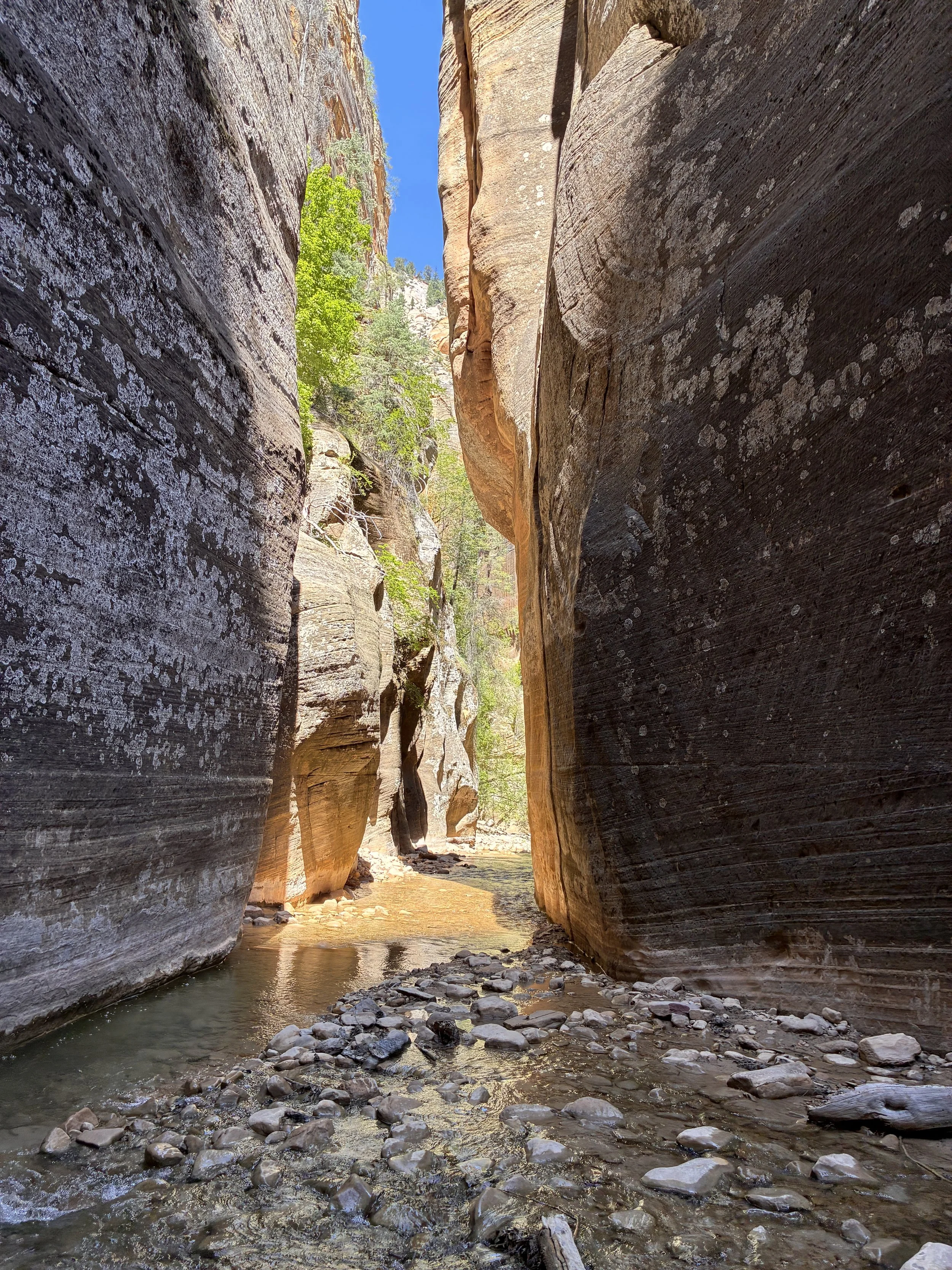
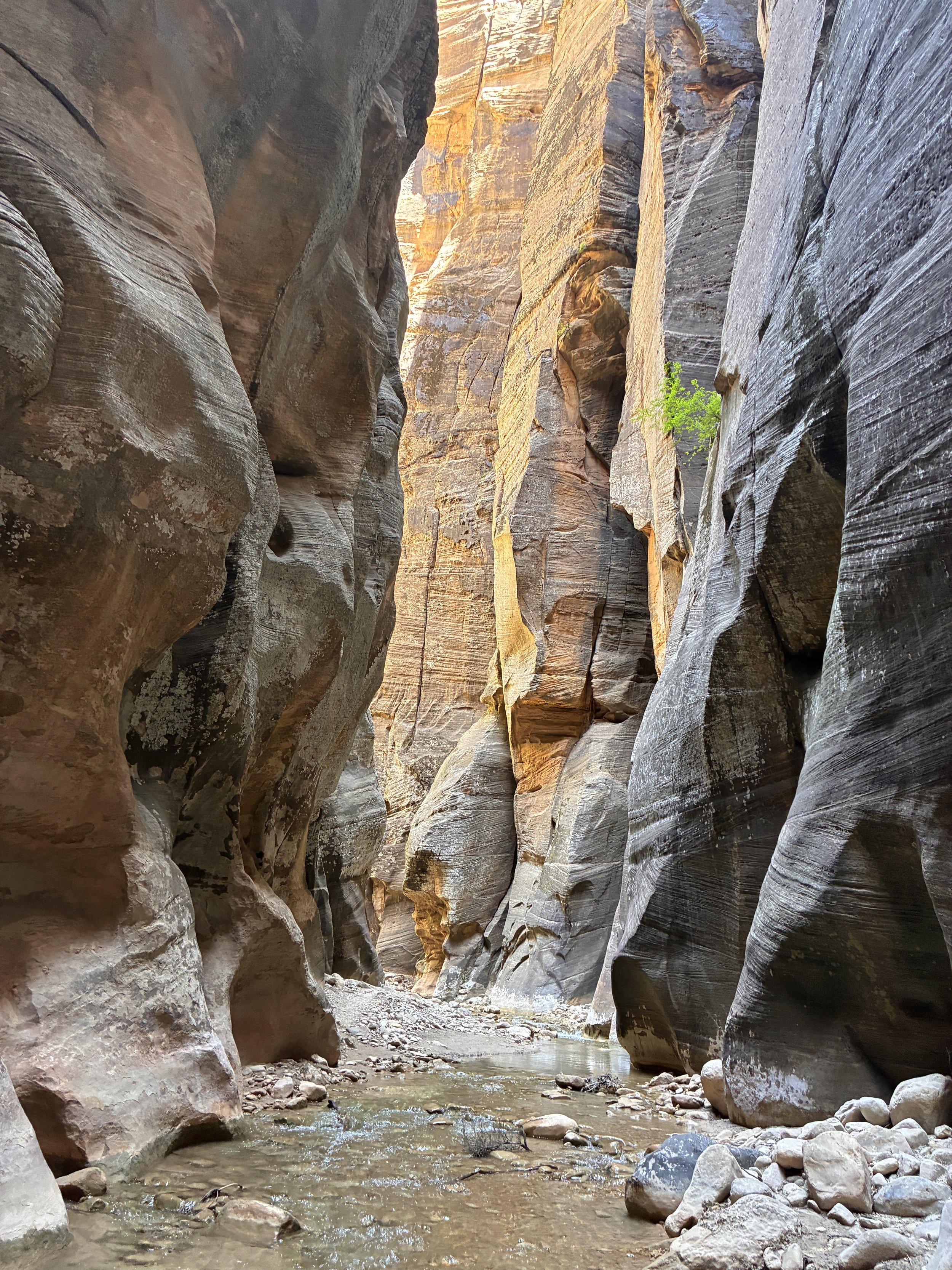
The walls widen out again for just a short section, but it’s still spectacular. Again, this is my favorite section of the hike.
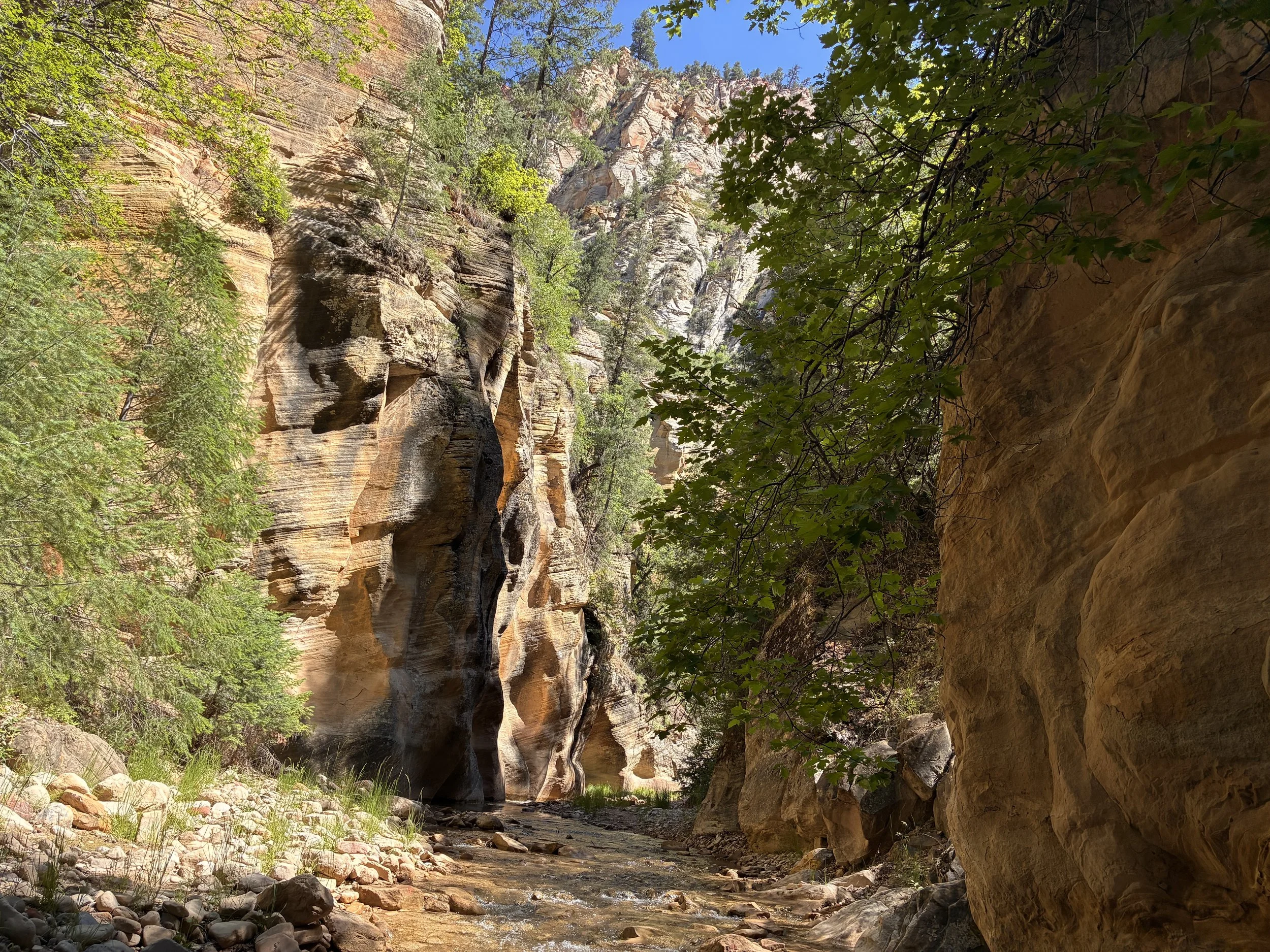
Another river bend, another incredible view (11:14am)
Not much high ground here. This would be another section I would worry about flash floods.
Are you ready to try this hike yet? It’s just one day of wet feet (11:20am)
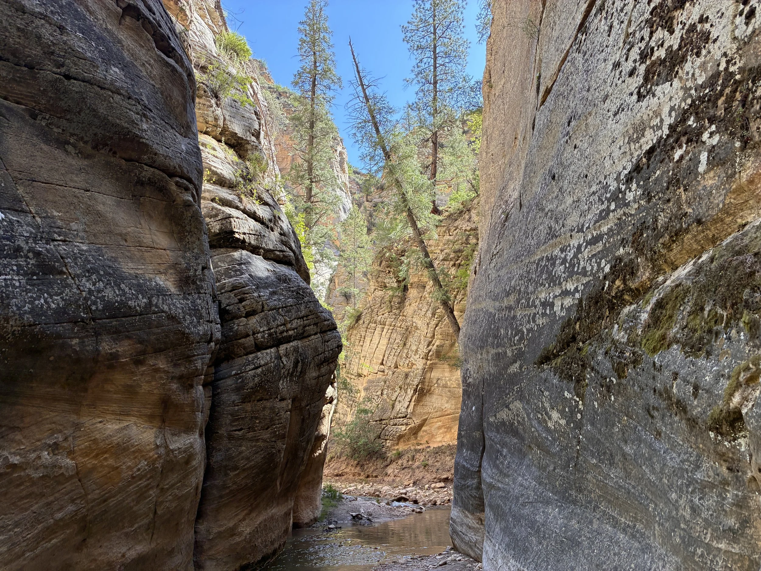
And we are back to huge canyon walls.
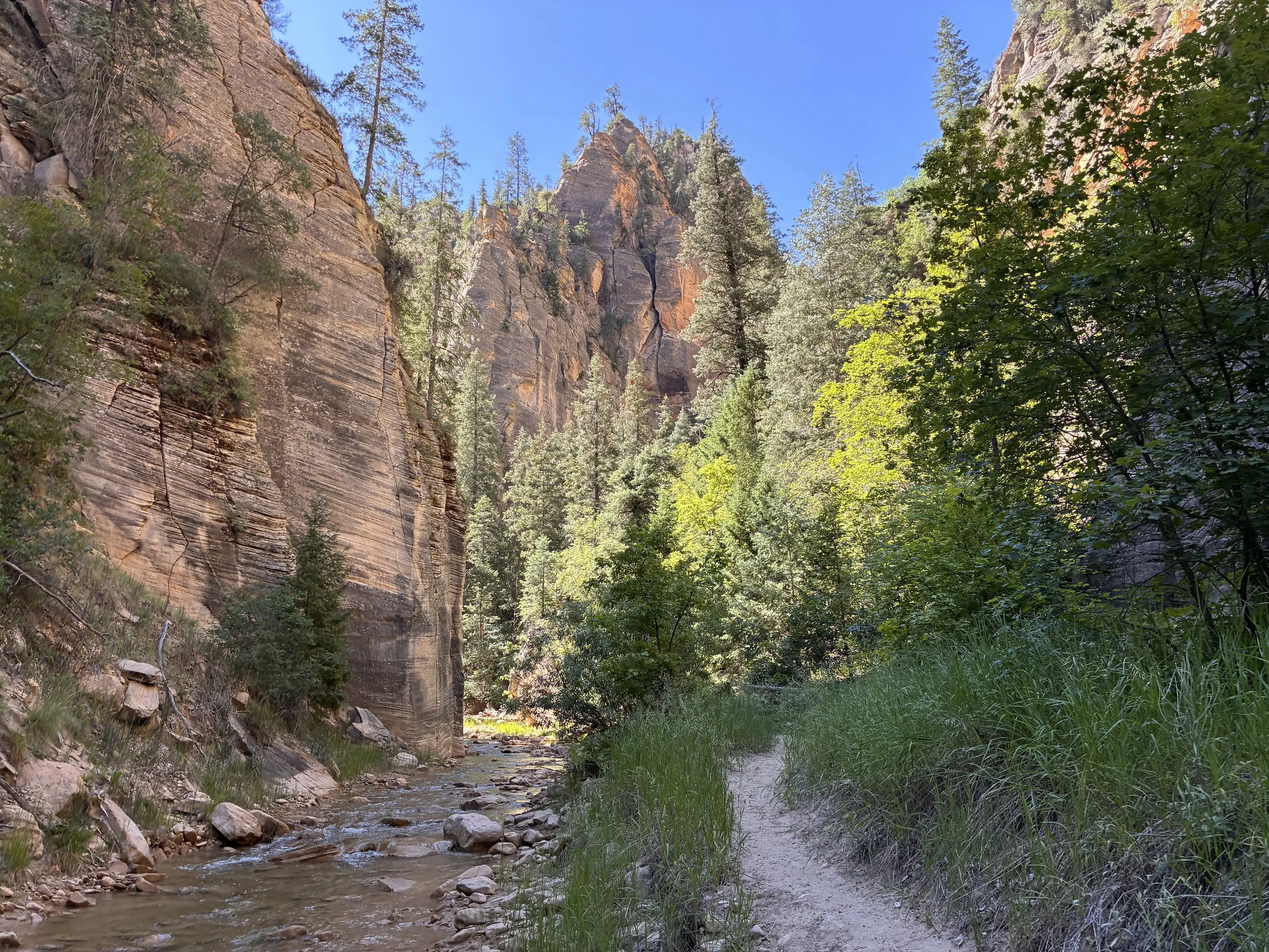
Hiking the Narrows (11:25am)
The bottom-up hike is easier… This section of the canyon is the reason to do the tougher hike.
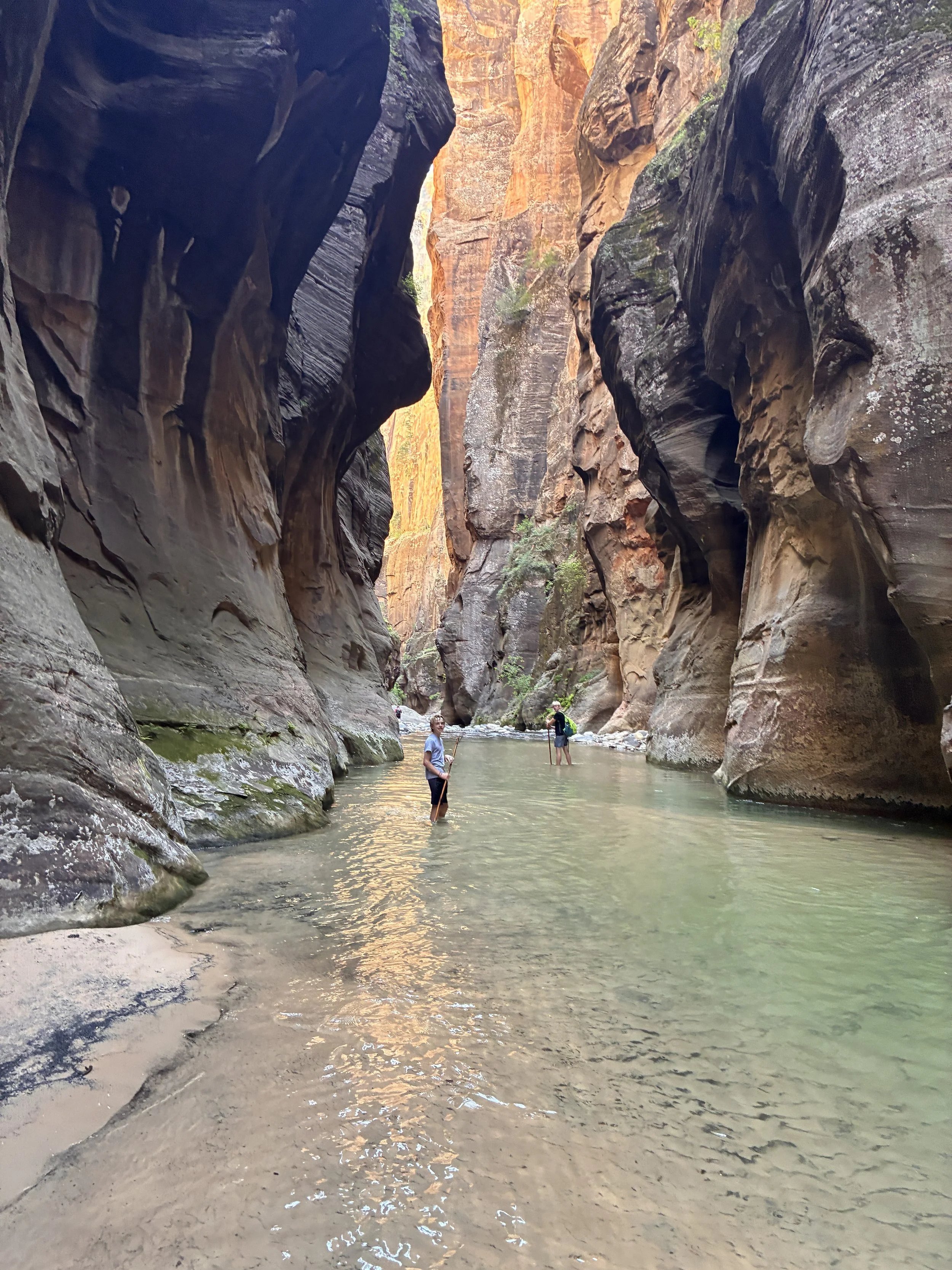
Hiking the Narrows (11:29am)
Hiking the Narrows (11:30am)
Although we were walking in cold water a lot of the day, I never once thought about the temperature of my feet. I really liked the neoprene socks. It’s the same material that a wetsuit is made out of. Feet still get wet, but they stay warm.
Hiking the Narrows (11:34am)
There’s a small little rapid in the picture below. There is always an easy way to navigate around rapids on dry ground.
Small rapids in the Virgin River, looking upstream (11:36am)
This is my favorite picture of my boys on this hike, waiting for their slower hiking parents.
Short breaks, followed by more walking. Anyone doing this hike in a day - don’t plan on much resting 11:41am)
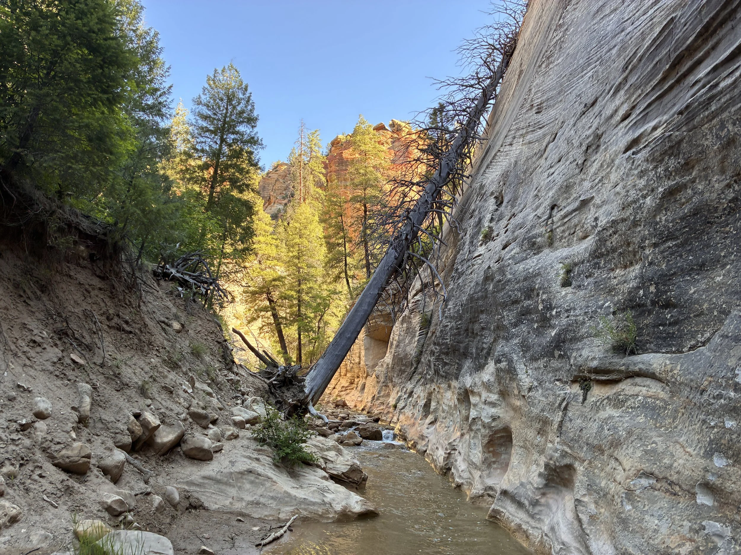
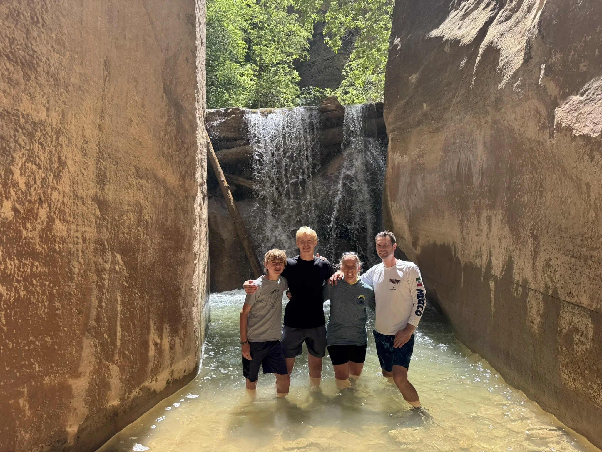
At this point in the hike, we can hear the waterfall. The map says we can walk around the waterfall, but I’ll admit that I’m starting to get nervous.
Just upstream of the waterfall (11:43am)
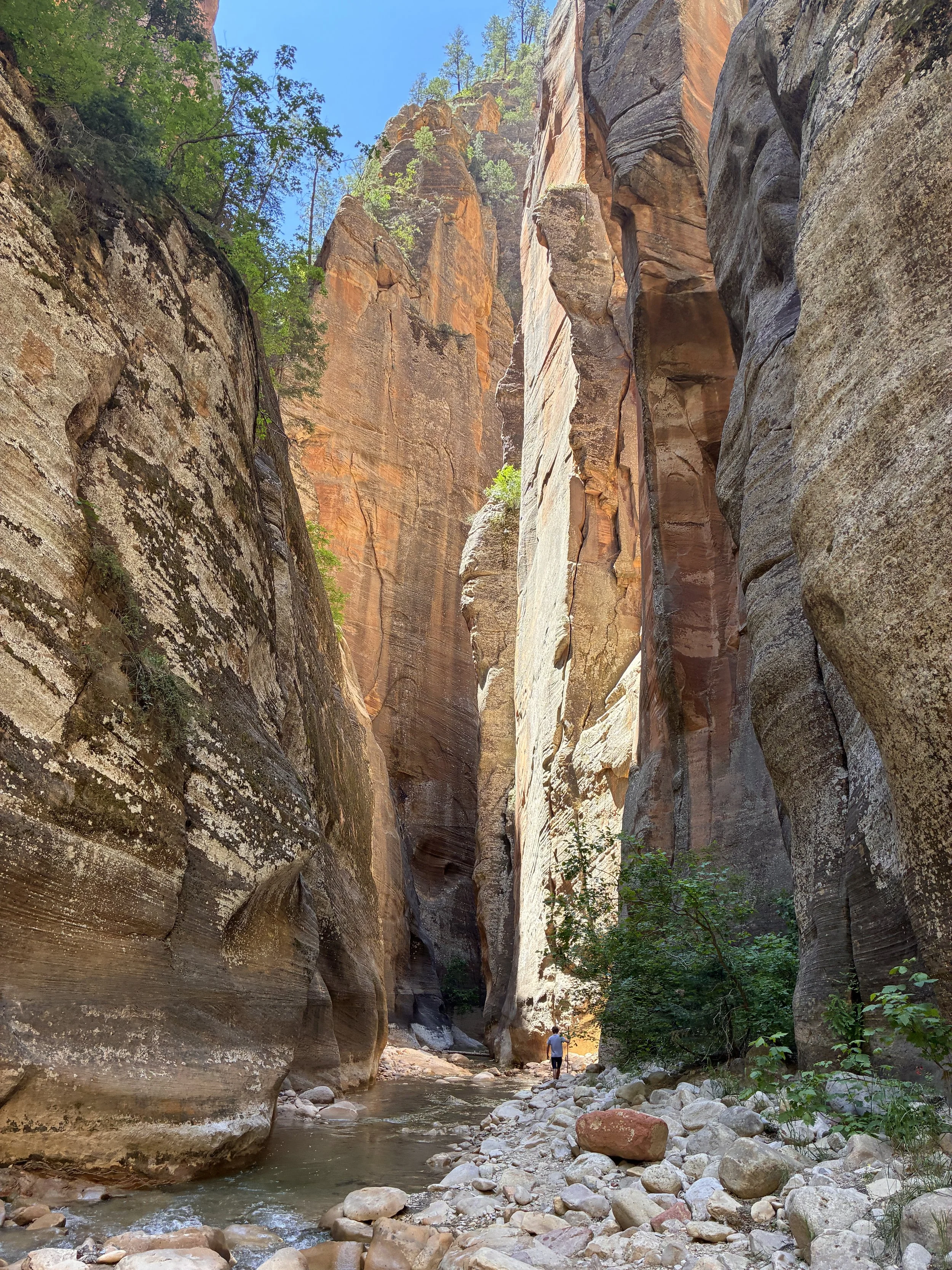
11:46am - Waterfall (8 miles) - There is one instance where the Virgin River tumbles over a waterfall. Fortuitously, there is no technical gear required to get around the waterfall. On the river’s south side (hiker’s left) there is an obvious trail that is very easy to walk down.
When we hiked in June, the water was maybe ankle deep here. This maybe looks like an adventurous picture to take, but this was not a scary place to stand.
Just upstream of the waterfall, looking down (11:46am)
This waterfall was fun to photograph easily from all angles.
Virgin River tumbling over a waterfall (11:47am)
There is zero reason to stress over this waterfall. The trail is easy to find, and extremely easy to walk down. It didn’t seem like this section of the canyon had been cut out to make a trail. I think it really was happy circumstance that the waterfall is easy to bypass on foot.
Bypass trail around the waterfall (11:49am)
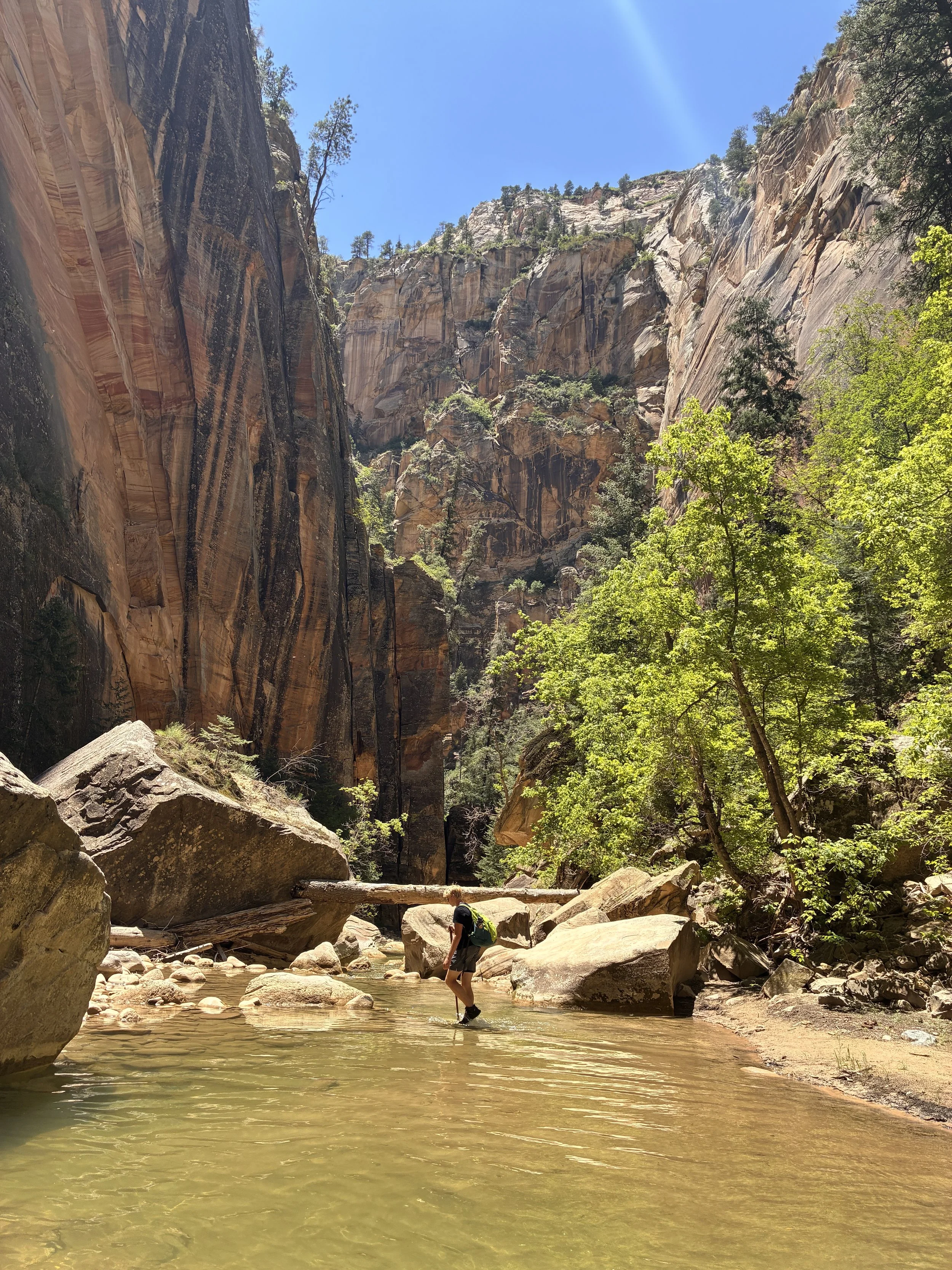
This was the one spot in the hike that we took a nice long break. We had lunch (PB&J sandwiches), put on more sunscreen, enjoyed talking with that other group of hikers, and took family photos.
There was a great spot for a picnic just downstream of the waterfall. Before we took off, we sent our older son upstream a few steps and realized it wasn’t actually that deep below the waterfall. This was a hot day, and at this point we were in the sun. I wouldn’t say we were hot hiking, but it felt good getting a little bit wetter to take pictures.
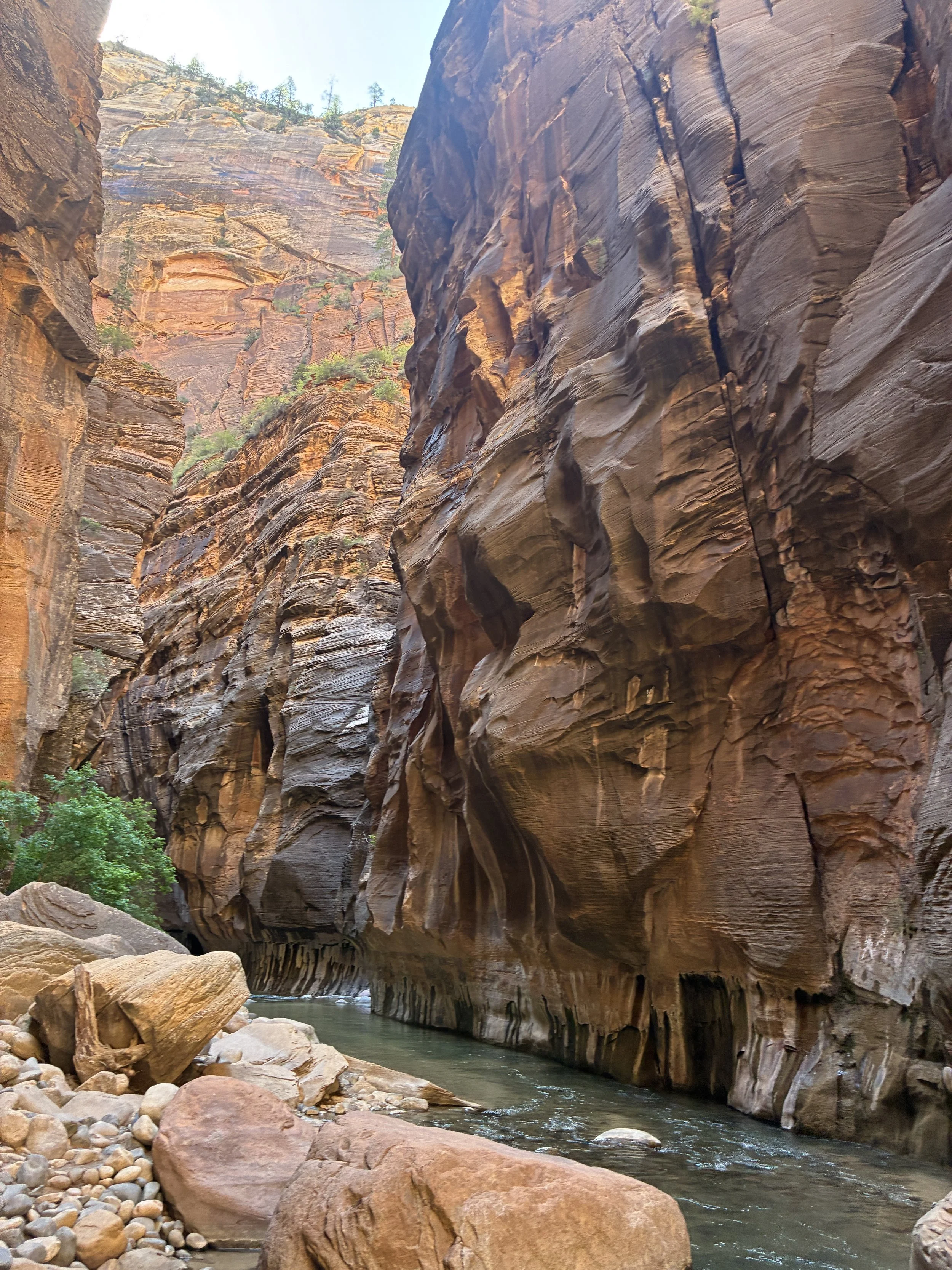
The Virgin River Waterfall along the Narrows (11:56am)
The river tumbles slightly following the waterfall. We continued to bypass this more turbulent section on dry ground.
Just downstream of the Virgin River waterfall (12:!4pm)
This section of the canyon I’m still claiming as my favorite part - up until we get to the first backpacking campsite.
Hiking the Narrows downstream of the waterfall (12:16pm)
Still hiking, still happy we are hiking, still enjoying feeling small in this incredible canyon
Hiking the Narrows below the waterfall (12:19pm)
At this point in the hike, we were often in the sun, but surrounded by cold water, we never talked about being too warm. It was a beautiful day to hike this trail. We did put sunscreen on frequently though.
Hiking the Narrows below the waterfall (12:23pm)
This next section of the canyon was one of the prettiest spots we walked through.
Hiking the Narrows below the waterfall (12:24pm)
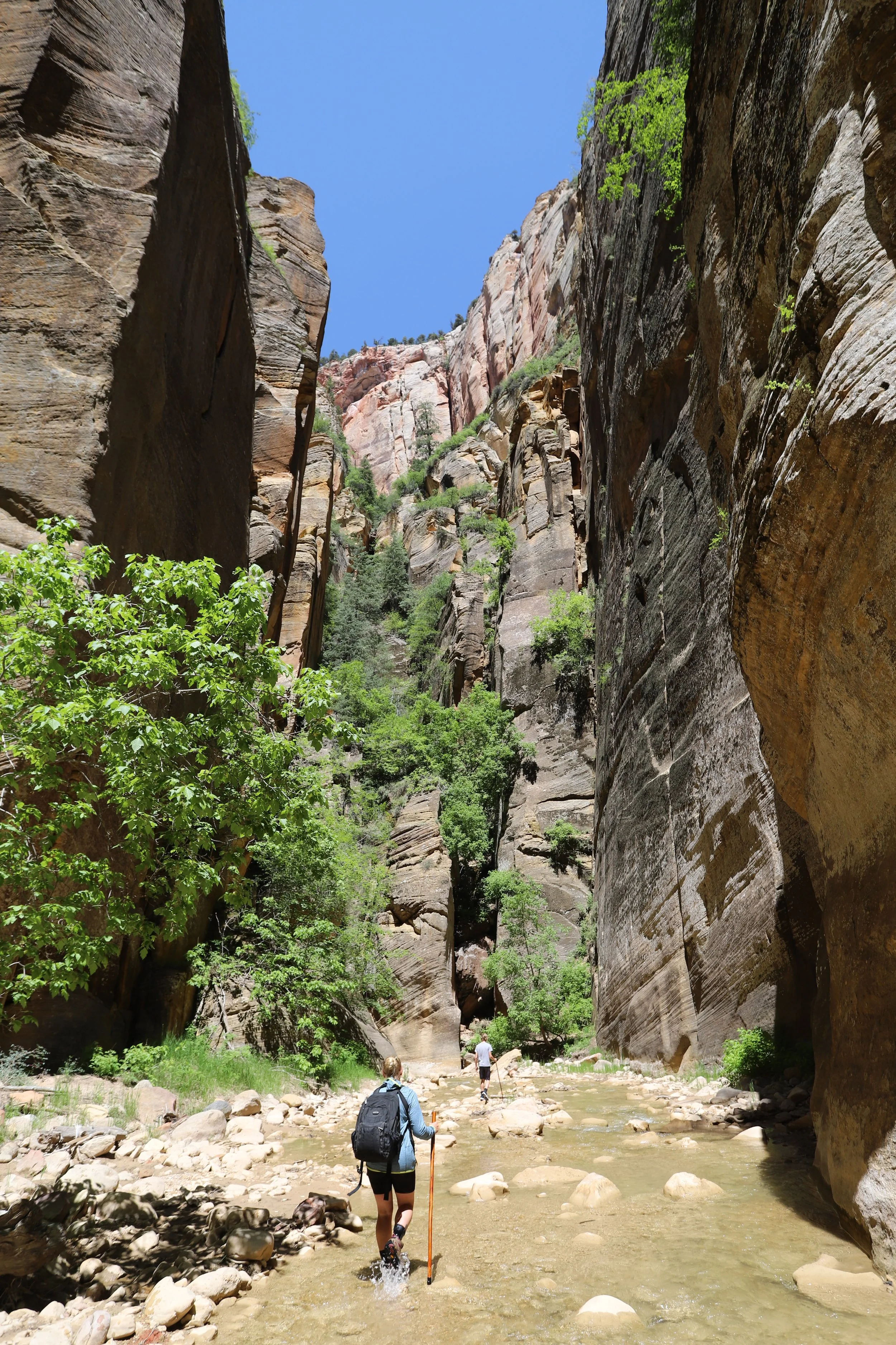
The trail continues to the left in this beautiful canyon split.

Hiking top-down through Zion’s Narrows (12:26pm)
One really long day-hike through the Narrows (12:30pm)
Just keep hiking, just keep hiking, just keep hiking
Every bend in the Virgin River brought another gorgeous view (12:35pm)
Zion National Park - The Narrows (12:36pm)
Hiking down the Narrows (12:41pm)
Although this was a long, hard day of hiking, it was our favorite hike on our June 2025 summer trip, and my favorite hike in Zion National Park.
Hiking the Narrows - about 30 minutes downstream of the waterfall (12:43pm)
One last picture of my favorite stretch of this canyon.
Hiking the Narrows, just upstream of the backpacking campsites (12:50pm)
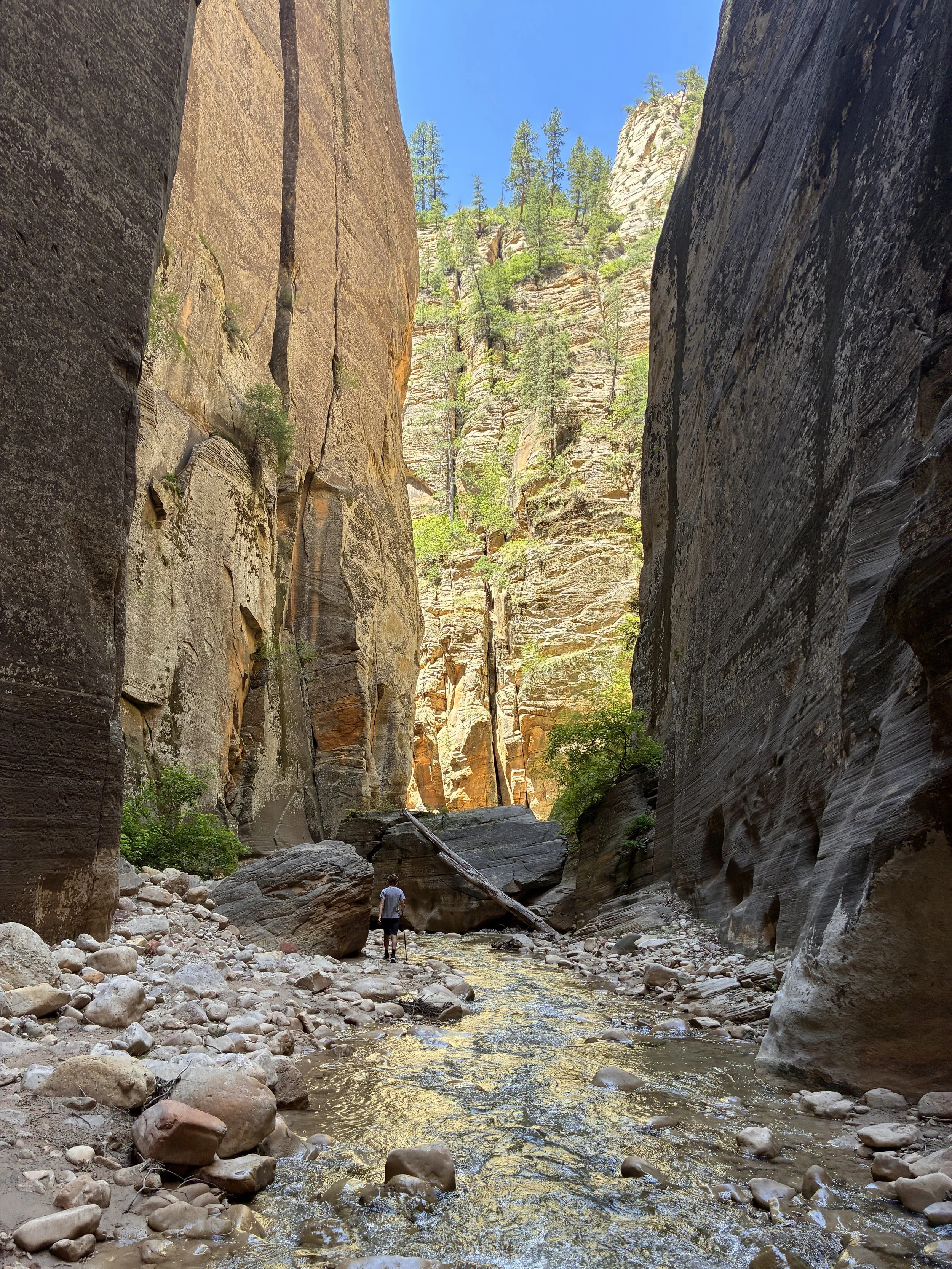
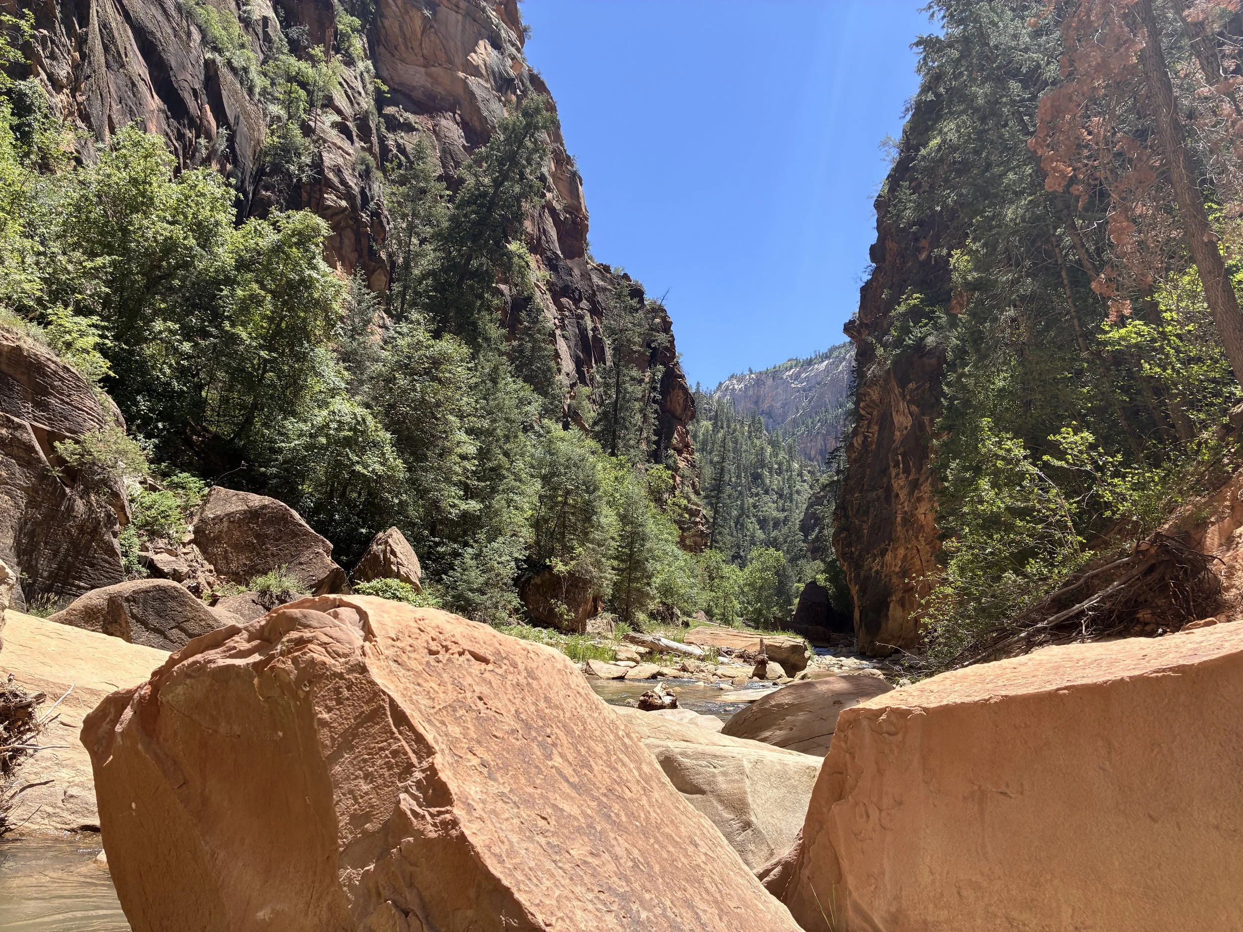
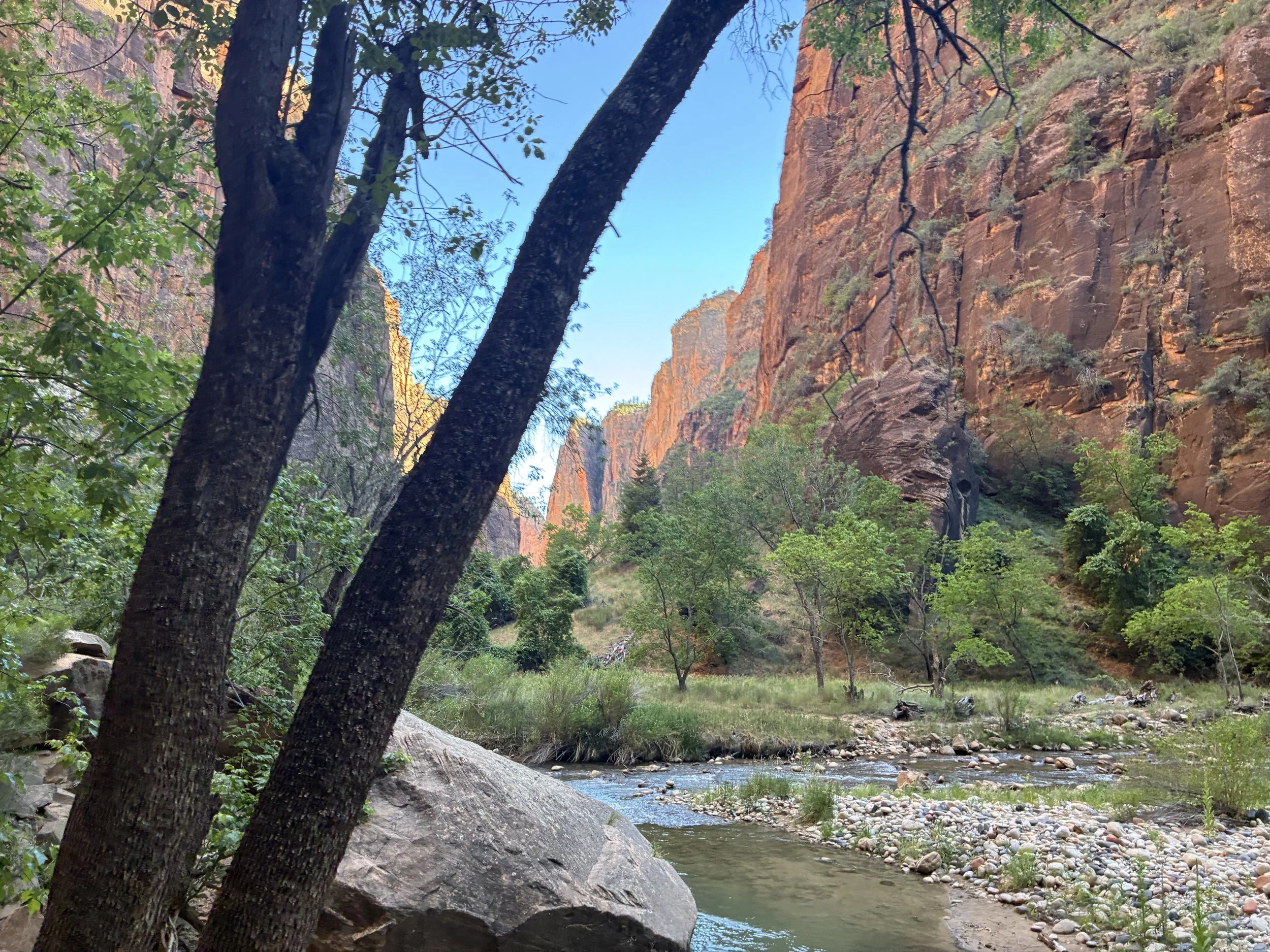
12:54pm - Campsite 1 / Deep Creek (9 miles) - Now the Narrows Canyon opens up in spots wide enough to include some backpacking campsites. Each site is marked with a small sign, some hard to see. There are 12 campsites between 4 branches in the canyon. Each side canyon was dry, however there was still water gushing through Big Springs (where water can be filtered to drink) near campsite 12.
Deep Creek joins with the Virgin River (12:54pm)
In several places, the canyon walls though still high, are much further apart. From here to Big Springs was the most difficult part of the hike from a mental resiliency standpoint. It’s past the halfway point by river miles, but not yet halfway by step count (due to many more river crossings ahead). Added to that, we were all paying attention to the time, and wondering if we could possibly make it out ahead of the last shuttle back to the Visitor Center.
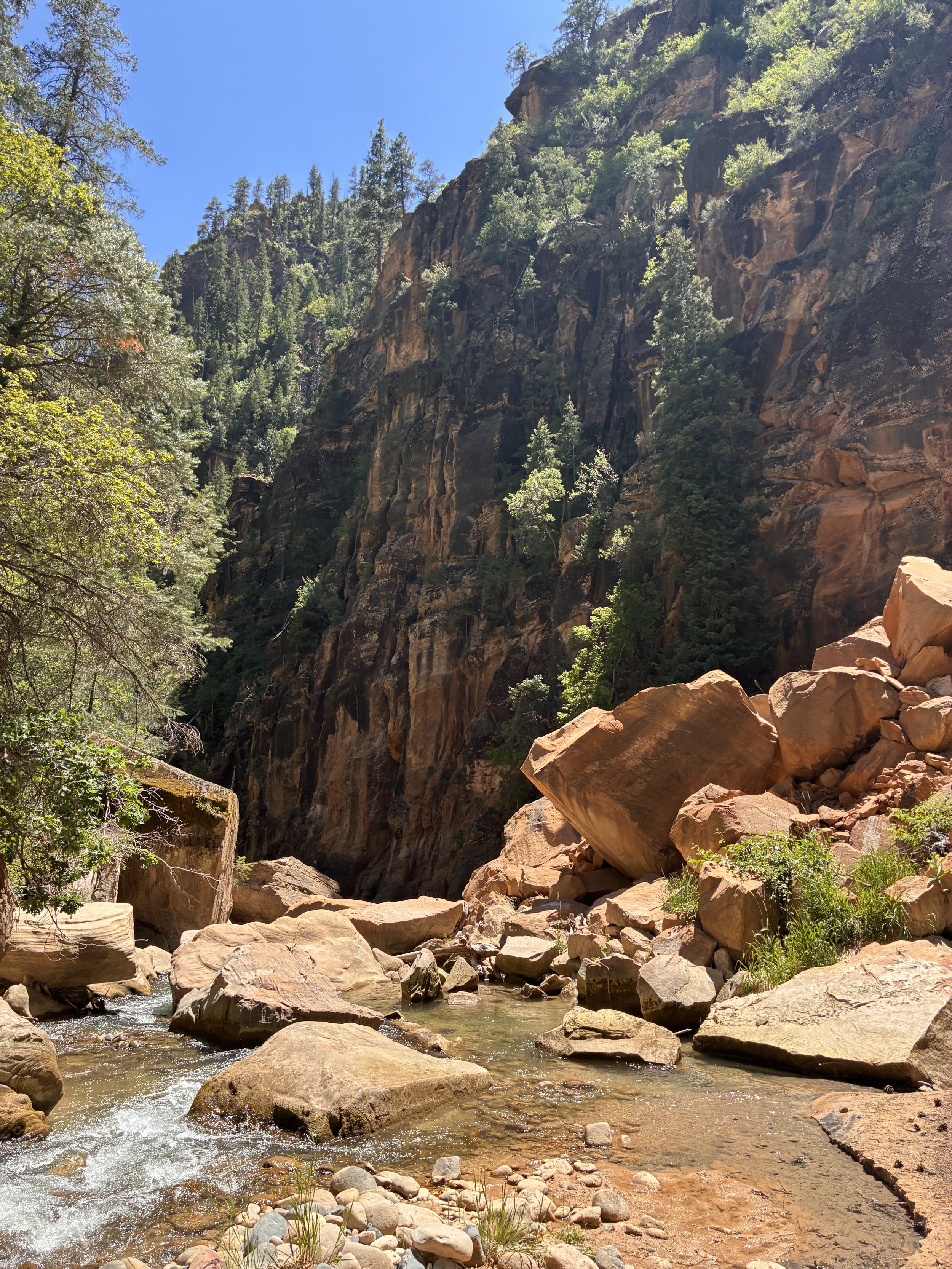
Hiking the Narrows downstream of Deep Creek (1:00pm)
We did take one more long break in an unoccupied campsite to enjoy some shade, refill on snacks, and just sit for a bit. This was the place my older son slipped on a rock - not doing something stupid, just walking. Luckily he was not hurt, not even one scrape. But it was a reminder of how isolating backcountry is. This part of the canyon is still in the permit-only section. The only other people we had seen in the past 6 hours were the three people in the other hiking group that started with us.
Hiking the Narrows downstream of Deep Creek (1:41pm)
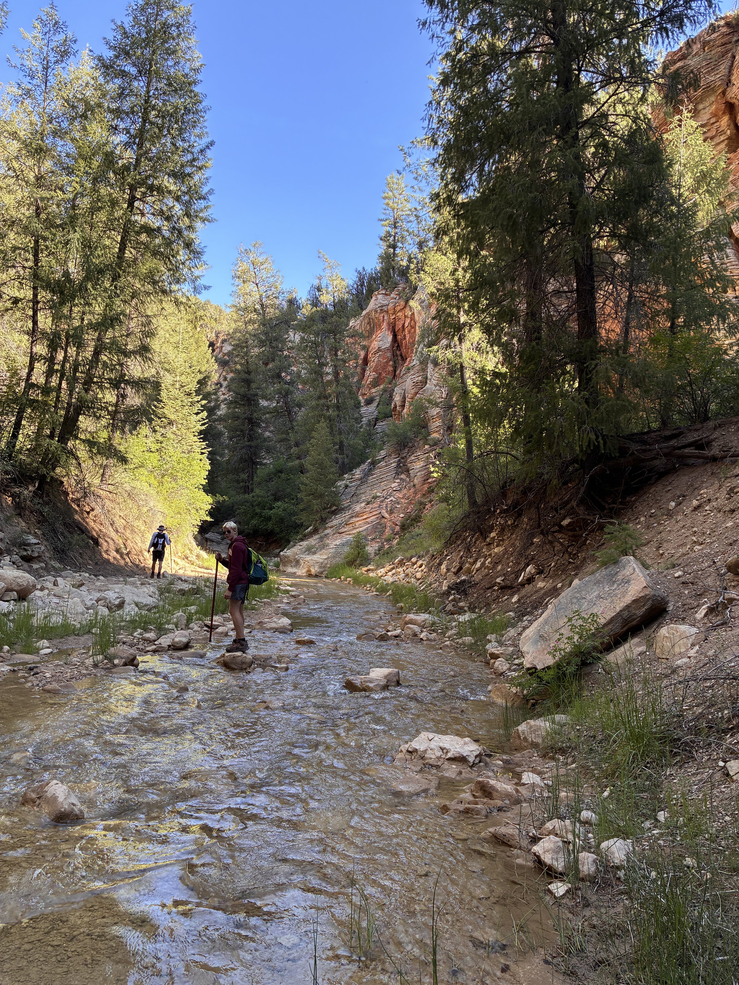
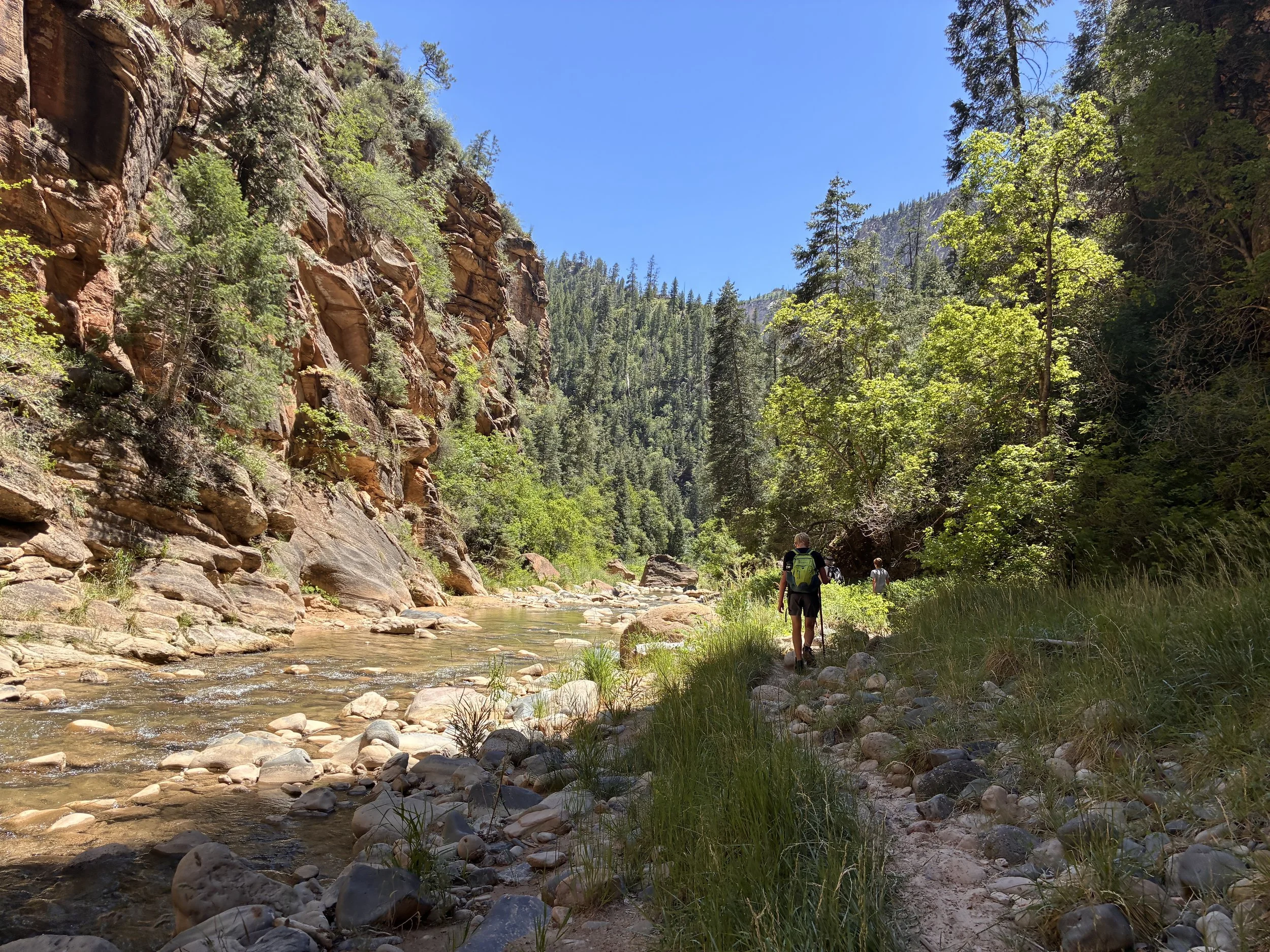
Hiking the Narrows, just upstream of Kolob Creek (1:49pm)
1:51pm - Campsite 6 / Kolob Creek (10 miles) - Still enjoying the hike, but still dealing with metal fatigue. The break felt good, but again, we are all paying attention to the time.
Hiking the Narrows downstream of Kolob Creek (2:01pm)
Hiking the Narrows downstream of Kolob Creek (2:04pm)
2:33pm - Campsite 10 / Goose Creek (11 miles) - We were feeling better about our hiking time when we reached Goose Creek. When you pick up the top-down permit, you receive a hiking time-table, to help make sure you budget the day correctly to make the last shuttle to the Visitor Center. We were 7 hours and 15 minutes into our hike. Per the suggested time table, we were about 45 minutes slower. However, if we could keep their suggested pace, and complete the remainder of the hike in 6 hours, we should still catch that last shuttle. We calmed down quite a bit after reaching this milestone.
Hiking the Narrows downstream of Goose Creek (2:37pm)
Due to the time of day, there was shade again in much of the trail (2:41pm)
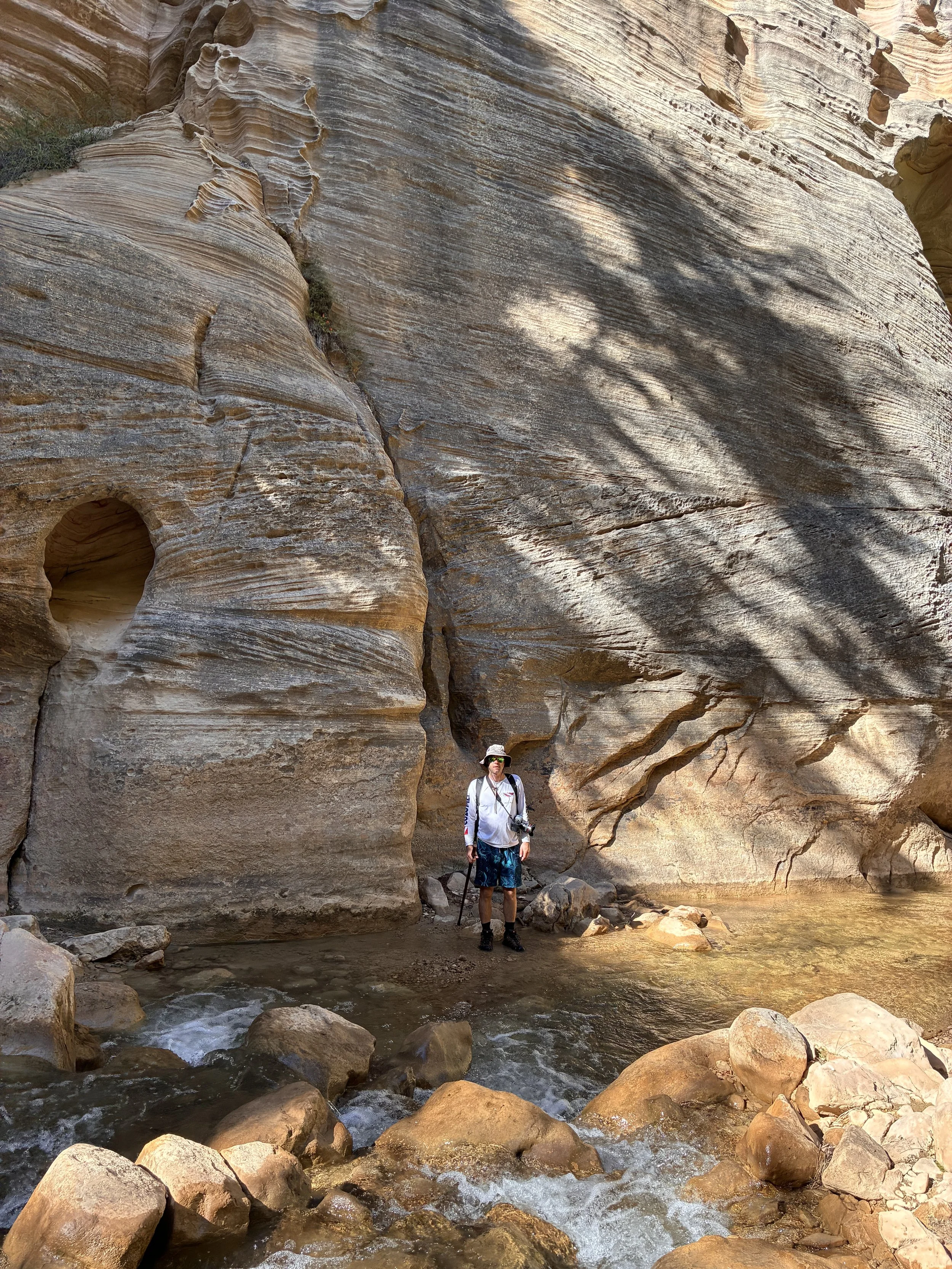
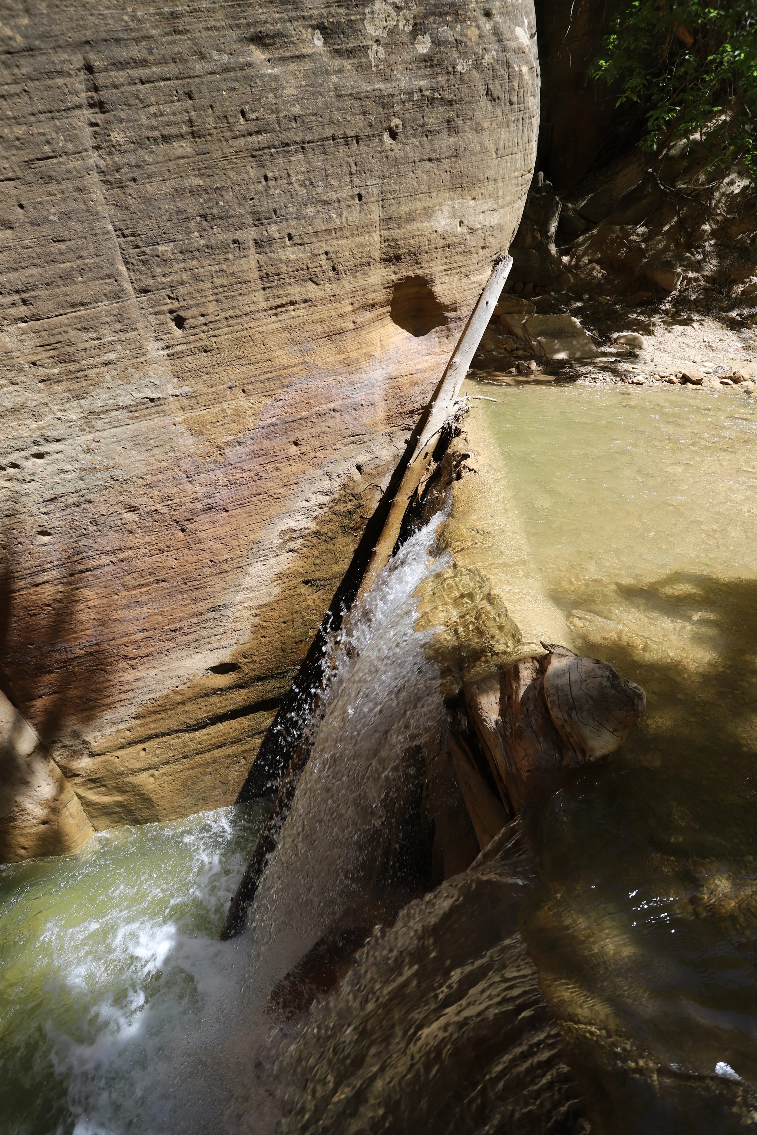
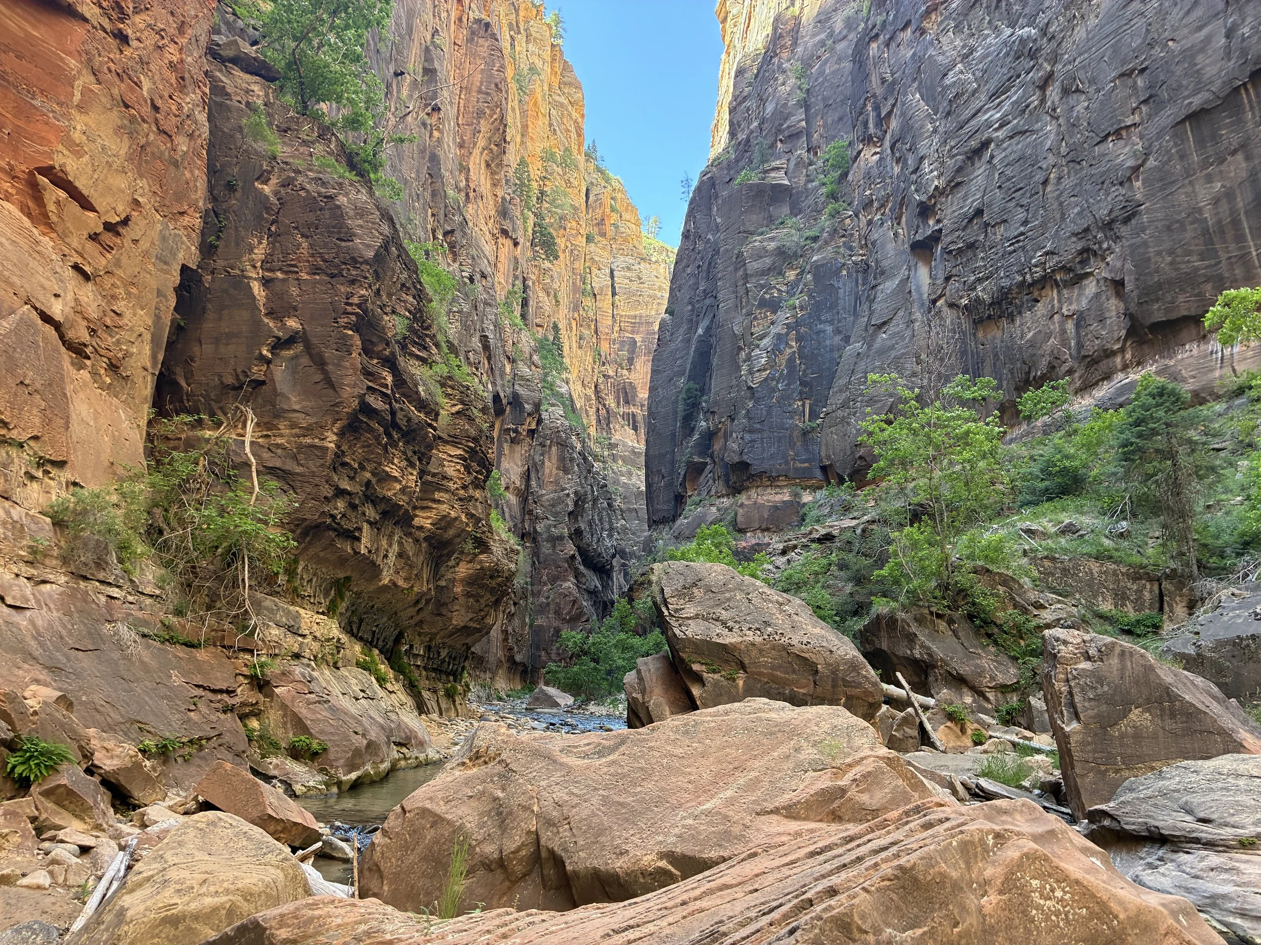
We found the 12th campsite, so the next milestone we were looking for was Big Springs. Just upstream of Big Springs is a huge rockfall. Mountains and canyons seem so steady - but water and gravity have the power to knock them down given enough time.
This would be the place to do your thing if you need to, or as our family says “see a man about a horse.” From this point onward, the canyon walls get pretty tight and there’s going to be a lot of people around, severely restricting comfortable options.
Rockfall just upstream from Big Springs (2:58pm)
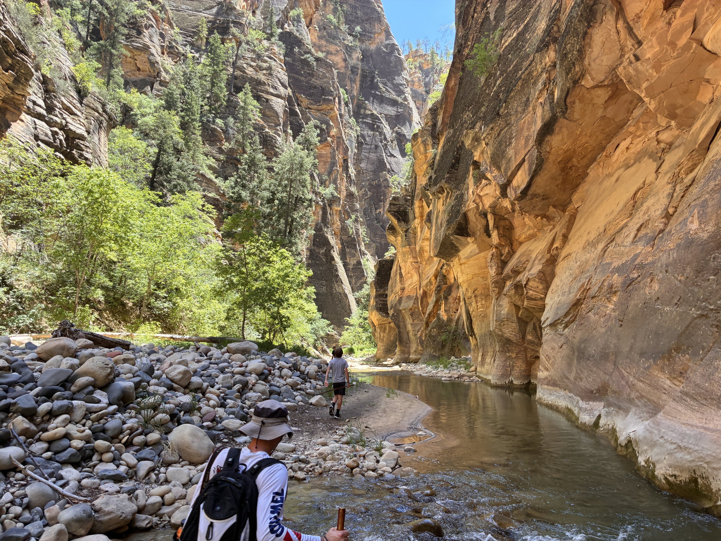
3:06pm - Big Springs / Corral Hollow (11.5 miles) - This waterfall can be filtered for drinking water, if needed. Up until this point, a permit was needed to be in the canyon. Downstream of Big Springs, no permit is required, and an unlimited amount of hikers can be present. For the past 8 hours, it’s just been the four of us, and we occasionally would see the other group of 3 hikers. It was a little disorienting to see other people again. This section of the canyon isn’t super busy. Most hikers have turned around before reaching this point. From this point on though, there are other people we can see at all times.
Big Springs - The Narrows - Turn-around point for bottom-up hikers without a permit (3:06pm)
View of Big Springs from downstream (3:08pm)
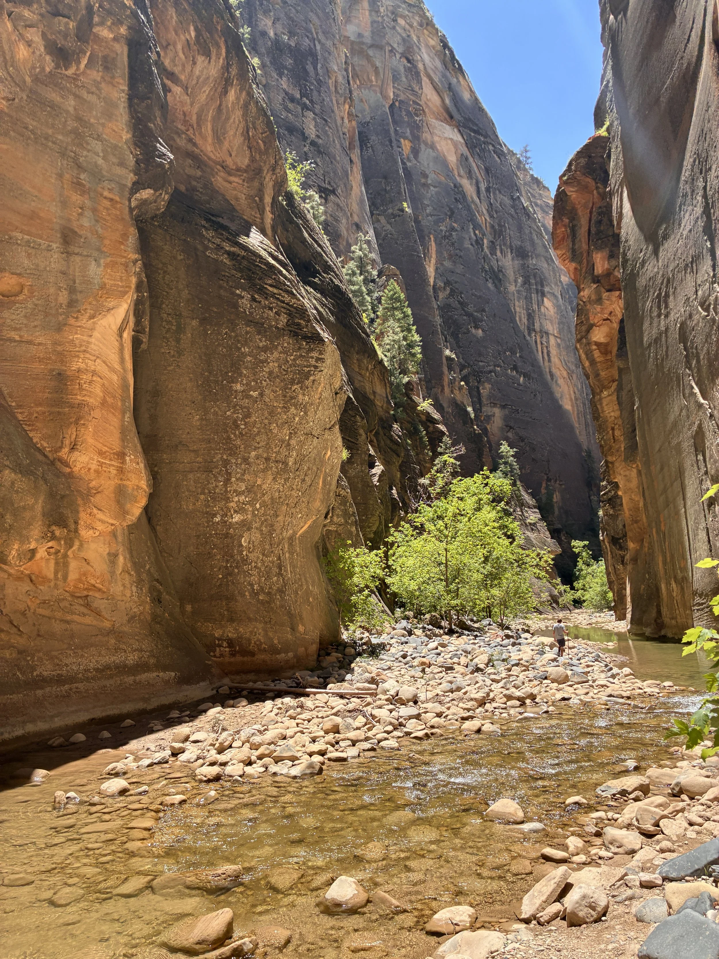
Despite more people, resulting in needing to be a bit more patient to wait for people to get out of the picture and the canyon being quite a bit nosier, this is the second best part of the hike. This is also the most dangerous part of the trail. After Big Springs, there is a 2-mile stretch with no high ground. This means there is no safe place to be in a flash flood.
Additionally, this section of the hike is the hardest and slowest. There isn’t much dry ground to walk along, and in the river, the bottom is covered with boulders, which are covered in algae. This is like walking over greased bowling balls for two miles. Having a strong hiking pole in this section is a must.
Hiking the Narrows downstream of Big Springs (3:11pm)
Incredible stretch of canyon, but there are slippery boulders everywhere (3:16pm)
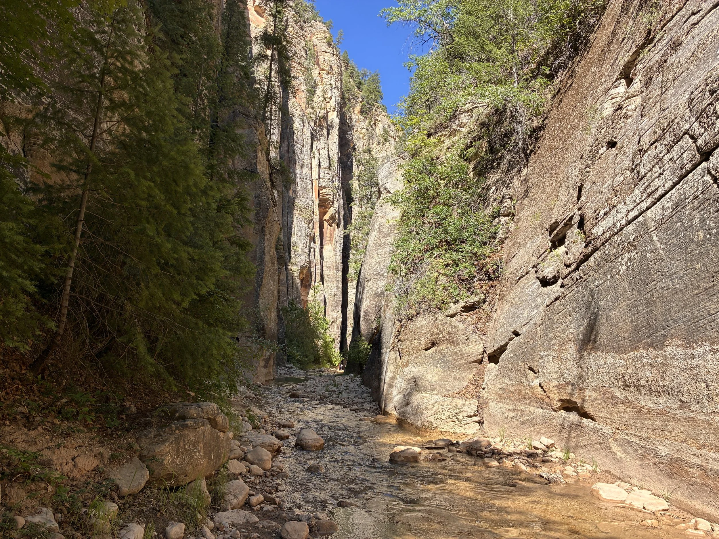
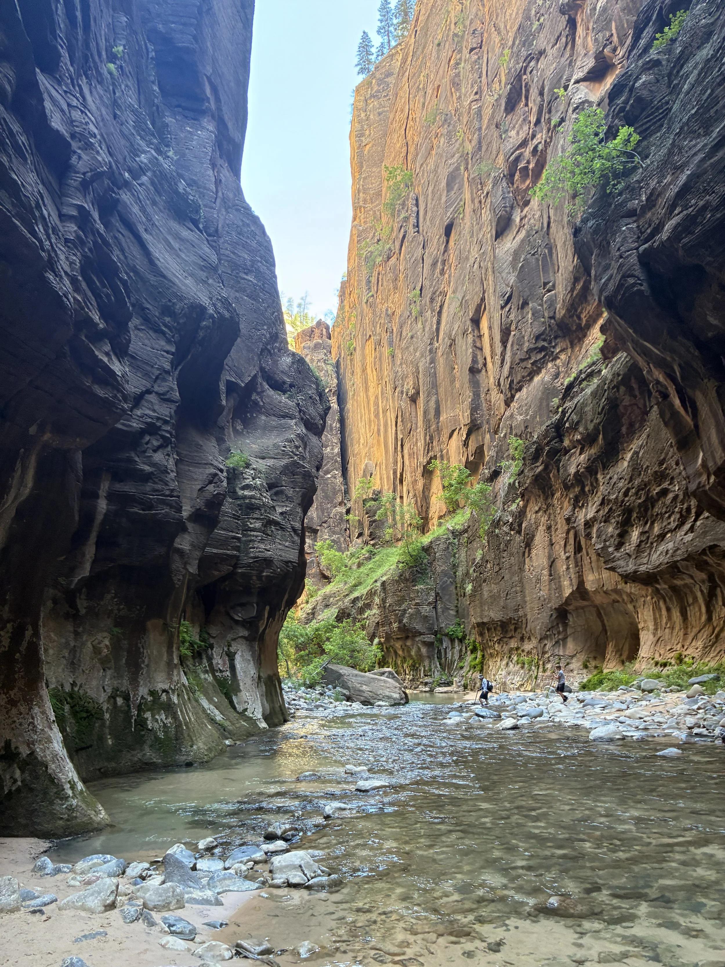
Hiking the Narrows between Orderville and Big Springs (3:21pm)
The water was deeper in this part of the canyon, but not much past our knees. The deeper water, in addition to the boulders makes this section of the hike harder and slower. But, this section of the canyon is why people hike the Narrows.
Hiking the Narrows between Orderville and Big Springs (3:31pm)
The pictures show little sections of dry ground. This is the part of the canyon that we walked back-and-forth, back-and-forth across the Virgin River to reach those easier sections to walk over. This significantly increased how many steps we took along the hike, but it also allowed us to hike this section of the canyon quite a bit faster than the time table provided to us by the National Park.
Crossing back-and-forth through the Virgin River to get to those easier sections of dry ground (3:35pm)
There are lots of rock falls along this section of the hike. Not much one could do in the event of a rockfall… We were glad one didn’t happen while we were hiking.
Hiking the Narrows between Orderville and Big Springs (3:41pm)
Hiking the Narrows between Orderville and Big Springs (4:01pm)
There are some deeper spots in the Virgin River. We continued to cross back and forth across the river to get to dry spots. Walking through the middle of the river in these spots reached thigh level.
Hiking the Narrows between Orderville and Big Springs (4:01pm)
Hiking the Narrows between Orderville and Big Springs (4:04pm)
Hiking the Narrows between Orderville and Big Springs (4:15pm)
Hiking the Narrows between Orderville and Big Springs (4:22pm)
Hiking the Narrows between Orderville and Big Springs (4:25pm)
By this point in the hike, we’ve been walking for more than 9 hours. We are surrounded by stunning views each step of the way. We are being passed by people walking up stream who are asking if it’s worth it to continue further. It’s humorous to think back on our responses - is it possible to be de-sensitized to beautiful things? Our answer was “well, it kind of looks like this for a long ways.” You could sit still and enjoy the canyon, or keep walking and see different sections, but you don’t need to walk all the way up to Big Springs to feel the beauty of the Narrows. If you can handle the grind of a super long day hike, I’d 100% recommend the top-down hike. But for bottom-up hikers - if you’ve reached the point of asking other hikers if it’s worth it to continue? Just stop where you are, enjoy it for a bit, and then walk back.
Hiking the Narrows between Orderville and Big Springs (4:30pm)
Hiking the Narrows between Orderville and Big Springs (4:35pm)
Hiking the Narrows between Orderville and Big Springs (4:47pm)
4:50pm - Orderville Canyon (13.5 miles) - Woot! We’ve made it to Orderville Canyon in 9.5 hours. We are now 30 minutes ahead of the National Park timetable that we’ve been chasing all day. At this point, expect the river to be crawling with people.
Orderville Canyon anlong the Narrows (4:50pm)
If we had more time, and if we hadn’t already been hiking 9.5 hours, I would have loved to explore Orderville Canyon a bit further.
Orderville Canyon (4:51pm)
We continued to trek back-and-forth across the Virgin River to again get to the easier dry ground. However, some of that “easier” dry ground was full of boulders too. Look for the sandy narrow trails.
The Narrows downstream from Orderville Canyon (4:57pm)
Hiking the Narrows downstream from Orderville Canyon (5:02pm)
Hiking the Narrows downstream from Orderville Canyon (5:18pm)
The hollowed out section of the canyon wall is known as the Grotto. I think this is a common destination for several day hikers. This section of canyon didn’t impress me though. I would recommend that day hikers plan enough time to hike up to at least Orderville Canyon and enjoy a moment upstream of it to fully appreciate the Narrows.
The Narrow’s Grotto (5:25pm)
The Grotto (5:30pm)
Up until the Grotto, I’d been wondering if my advice would be the crazy hard long hike top-down or bottom-up. My favorite spot was near the waterfall, only accessible doing the top-down hike, but this was a really hard hike, and the section between Orderville and Big Springs was a close second favorite section of the canyon. But when I got to the Grotto and the crazy amount of people, I remembered how for almost 8 hours that we had the canyon to ourselves. That was such a special experience compared to the zoo of people I was now encountering. 100% my recommendation is the top-down hike, for those that can handle 12+ hours of hiking in a day.
The Narrows downstream of the Grotto (5:36pm)
This extremely curious turkey made me laugh, and gets a spot in my post.
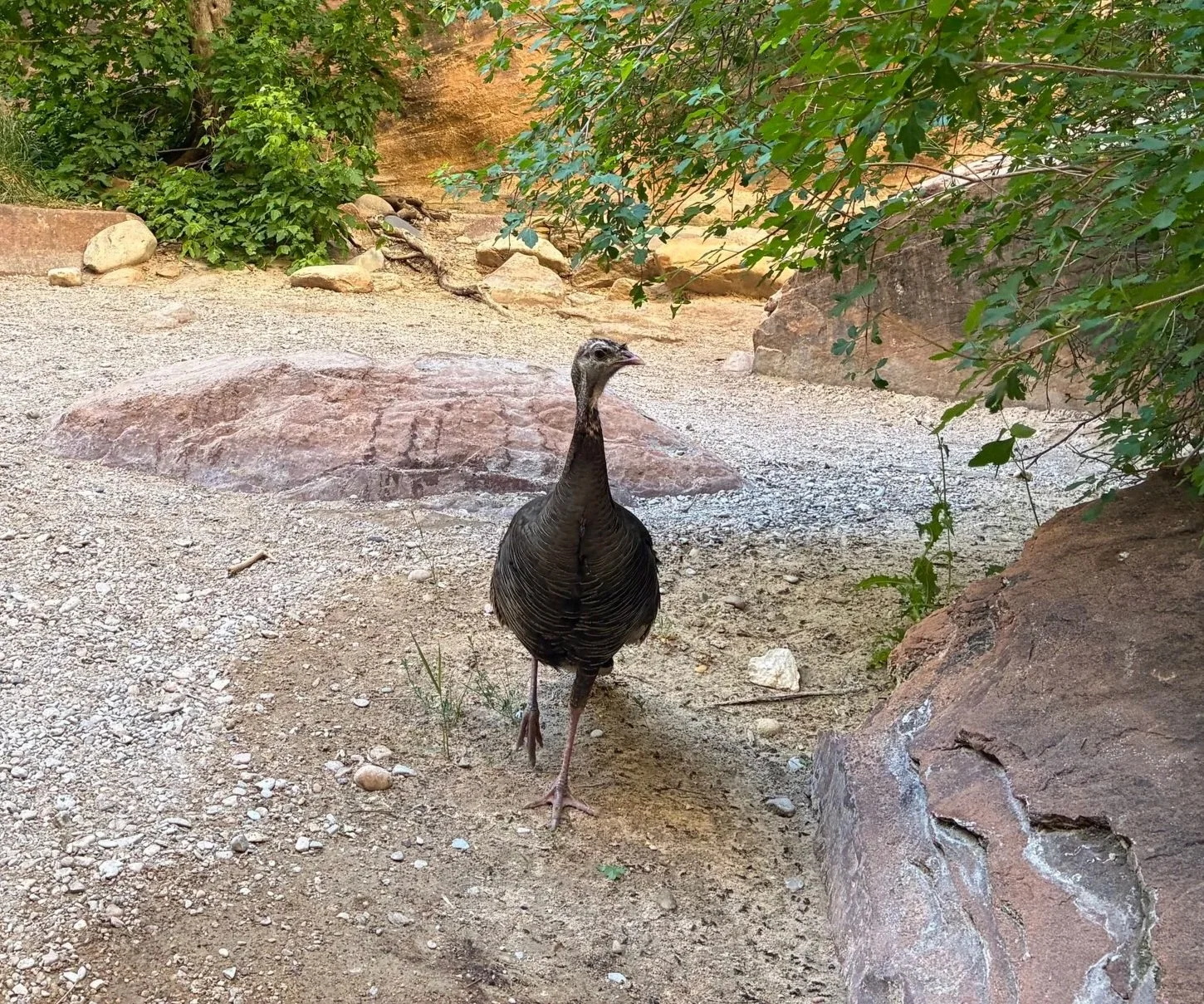
I made a friend in the Narrows (5:48pm)
After Orderville, I was ready to be done with this hike. I was tired, there was still quite a bit of trail left, navigating around people was getting annoying. And then we get to this section - waist deep water. I’d stayed relatively dry other than my feet up to this point. I was less than thrilled we had to walk through this extra deep section of the Virgin River towards the end of the trek. I did dry off though before we got on the bus - a feature of hiking in a desert.
For anyone thinking of hiking the Narrows with little kids, this section of the river isn’t very far into the hike. You could hold them, but I would worry about dropping them. My suggestion for the littlest hikers would be to skip the Narrows until they are a bit older, and hike Kanarra Falls instead (about an hour outside of Zion’s Springdale entrance). This hike does require a permit though, and they do sell out, so it takes some pre-planning. Here is my post on Kanarra Falls for anyone interested.
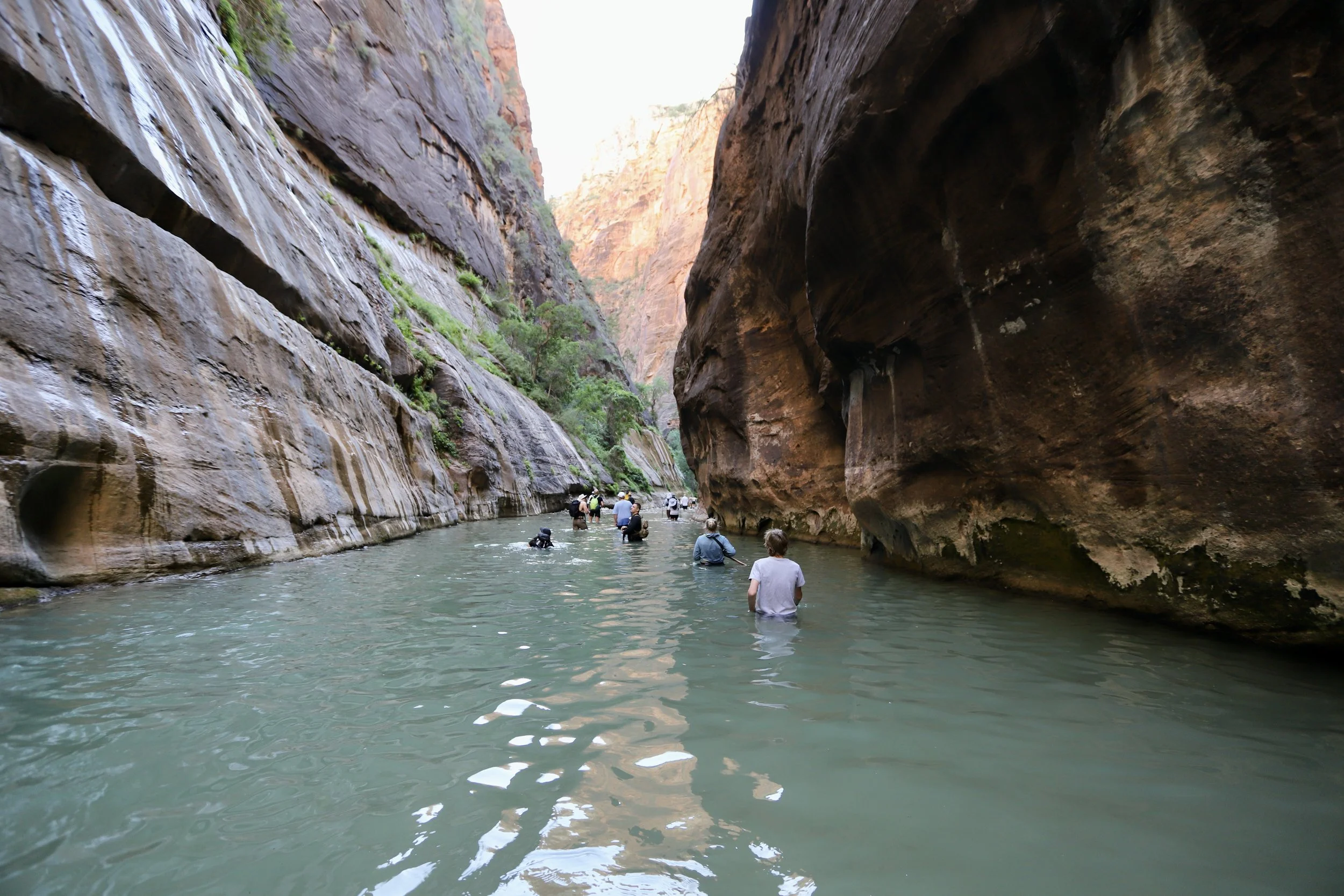
The deepest section of the Virgin River is about 10 minutes into the hike from the Riverside Walk entrance (6:00pm)
Almost there - we can just barely see where people are getting out of the Virgin River.
The end of the Narrows trail (6:08pm)
We made it! Well, almost. There is still another mile to hike along the Riverside Walk until reaching the shuttle stop where the bus will take us back to where our car is parked at the Visitor Center.
Exiting the Narrows onto the Riverside Walk( 6:08pm)
6:10pm - Riverside Walk (15 miles) - One more mile to go, and this is actually going to be just one mile. By this point, we had clocked about 19 miles between the constant crossing back and forth across the river, we’d explored into some of the other canyons short distances, and a few missteps that we had to back track.
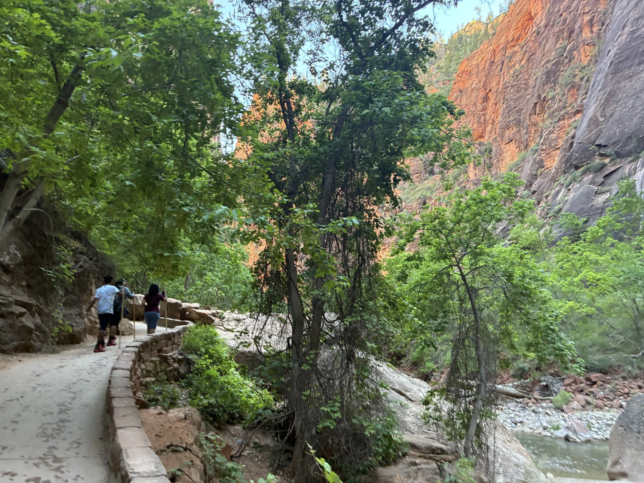
Riverside Walk (6:11pm)
Riverside Walk (6:16pm)
6:37 - End of hike (16 miles officially) - We clocked about 20 miles, as I mentioned due to extra steps that we’d taken throughout the day. The National Park timetable suggested the hike would be 12.5 hours, but we proudly finished it in 11.5 hours.
There are bathrooms at the bus stop. The shuttle runs every few minutes, so the wait shouldn’t be too long. We stopped to get Hungry Howie’s Pizza in St. George (a favorite pizza place from our days at Arizona State and something we don’t have in Minnesota) on the way back to our cabin and enjoyed a quick swim and an amazing shower at then end of our day.
Other Places to Hike in Zion National Park
Here is my full post on other hikes within Zion National Park.
Other Places to Hike within an Hour Drive of Zion
Below are hyperlinks to other posts I’ve written about things to do that are located within an hour’s drive from Zion National Park.
Kanarra Falls
The trailhead to Kanarra Falls is less than 15 minutes north of Zion’s Kolob Canyon Visitor Center, or an hour drive north of Zion’s main Springdale entrance. Kanarra Falls is a moderately difficult hike that travels through a slot canyon with four waterfalls. This trail goes through the water and feet and ankles will get wet. Permits are needed for this hike. Consider pre-purchasing as only 200 hikers are allowed in per day.
Red Reef Trail
The trailhead to Red Reef Trail is 30 minutes south of Zion’s Kolob Canyon Visitor Center, or an hour west of Zion’s main Springdale entrance. Red Reef Trail is a relatively easy 1.7-ish mile out-and-back hike along Quail Creek and a stunning canyon just outside of St. George. The Moqui steps require a bit of courage to cross. The trail continues upstream but will likely be underwater in the winter and spring months.
Yant Flat Candy Cliffs
The trailhead to the Yant Flat Candy Cliffs is about 45 minutes southwest of Zion’s Kolob Canyon Visitor Center, or 75 minutes west of Zion’s main Springdale entrance. The Yant Flat Candy Cliffs is a relatively short desert hike to a hidden and strangely beautiful display of geometric patterns cut into red-and-white-striped Navajo Sandstone surrounded by green brush-covered mountains. Use the road from Leeds - the road from St. George is not well maintained.
Sand Hollow State Park
Sand Hollow State Park is 40 minutes south of Zion’s Kolob Canyon Visitor Center, or 50 minutes west of Zion’s main Springdale entrance. Sand Hollow State Park includes a crystal clear reservoir, great for swimming and cliff jumping, and a fun place for families with older kids to cool off on a hot day. This park also has ATV trails that cross over sand dunes.
Pioneer Park
Pioneer Park is 30 minutes southwest of Zion’s Kolob Canyon Visitor Center, or an hour west of Zion’s main Springdale entrance. Pioneer Park is a free city park in St. George, UT. There are no playgrounds or swings, but there are arches, slot canyons, caverns, and Moki steps, and tons of rocks to scramble over, under, through, around, up, and down.
Snow Canyon State Park
Snow Canyon State Park is 50 minutes southwest of Zion’s Kolob Canyon Visitor Center, or 75 minutes west of Zion’s main Springdale entrance. Snow Canyon is a unique place to hike that has a short slot canyon and lava tube caves that can be explored, in addition to some beautiful hikes.
Belly of the Dragon
Belly of the Dragon is 20 minutes east of Zion’s east entrance. This is a cool place to stop for hikers of all ages. There’s a little cave that has been formed through the rock under US-89.
Moqui Caverns (Kanab Sand Caves)
The trailhead to Moqui Caverns (also known as Kanab Sand caves) is 30 minutes southeast of Zion’s east entrance. Moqui Caverns is a small man-made cave that can be explored with a short hike. Note that there is a steep scramble that’s needed to get up to the caverns.
Peekaboo Canyon (Kanab)
The off-road vehicle entrance to get to Peekaboo Slot Canyon is 30 minutes southeast of Zion’s east entrance. Peekaboo is a short beautiful slot canyon near Kanab (not to be confused with the Peekaboo Slot Canyon in Escalante). This canyon requires an off-road vehicle to get to the trailhead.
Coral Pink Sand Dunes
Coral Pink Sand Dunes State Park is located 40 minutes south of Zion’s east entrance. Coral Pink Sand Dunes State Park is a fun place to explore a sand dune habitat and play in the sand. Walk up a dune and have fun running down, sledding down, or rolling down. Repeat over and over.
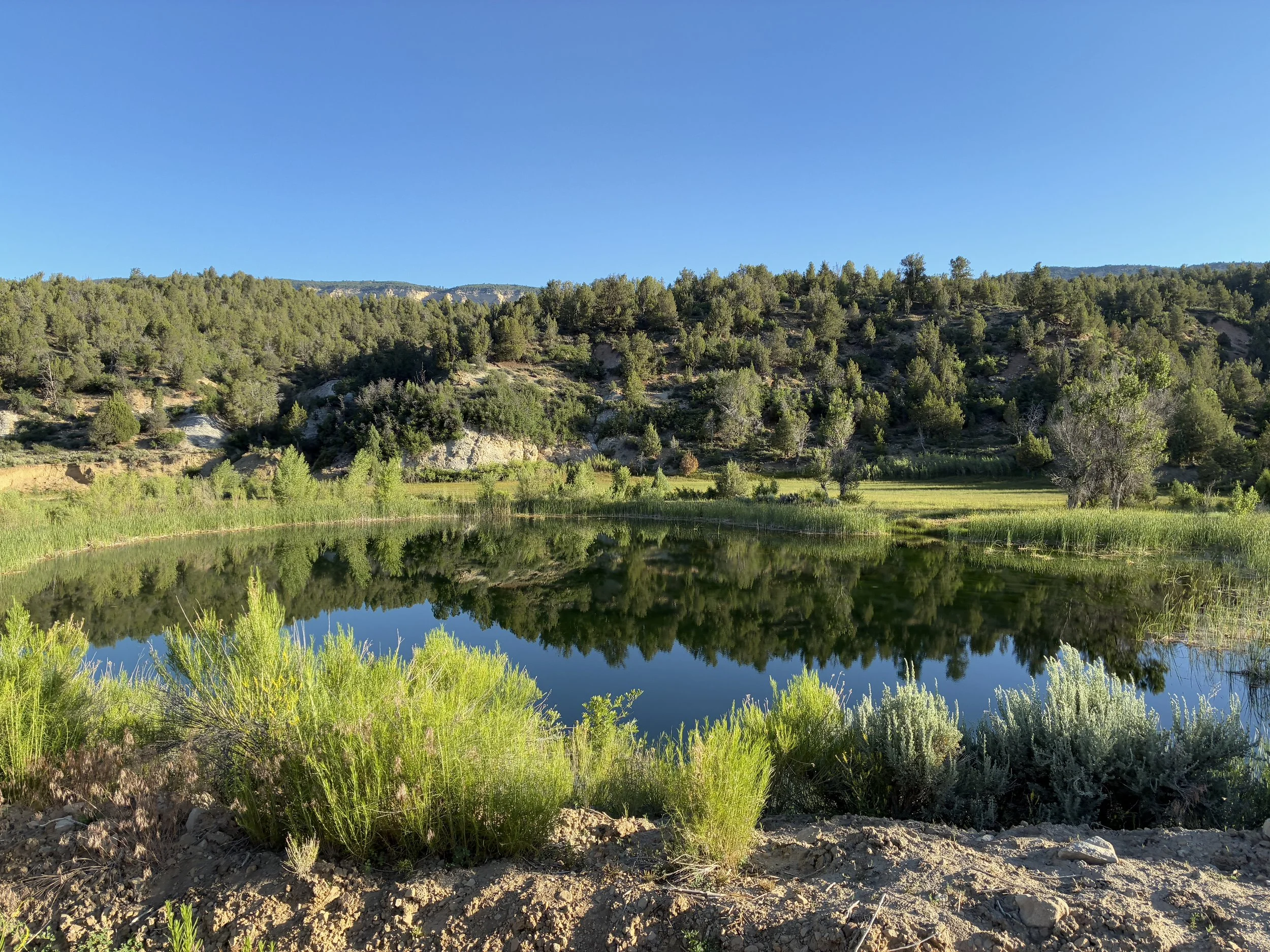
Water Canyon
Water Canyon, managed the Bureau of Land Management, is a rugged, wild canyon about an hour south of Zion that has something for all adventurous souls. Enjoy a 2 mile out-and-back hike to the waterfall, a 6 mile out-and-back hike to White Dome or hike up into Water Canyon and rappel out.
More from www.NatureImpactsUs.com
In the map below, there are additional posts I’ve written attached to each pin. Use two fingers to move around within the map.