
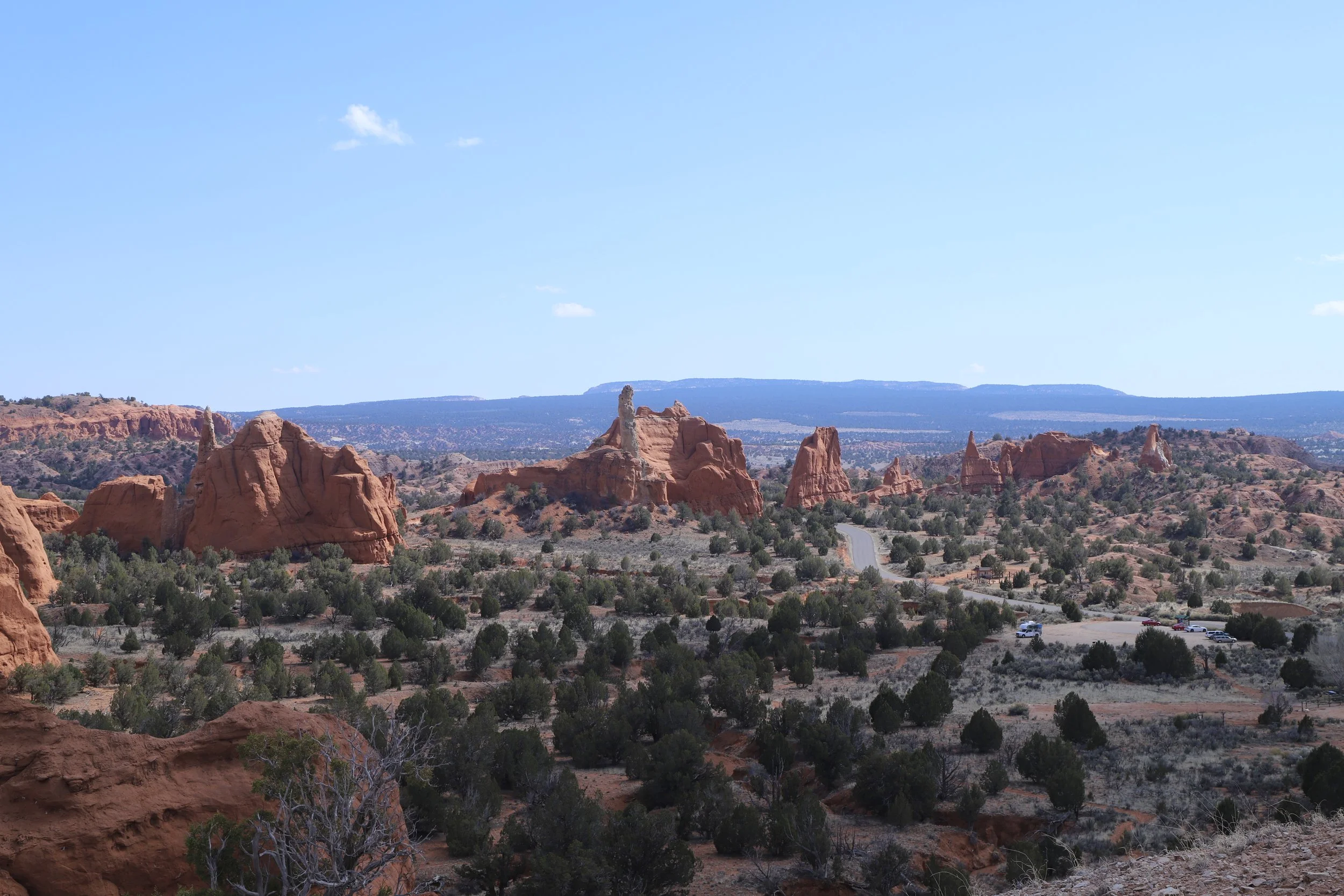
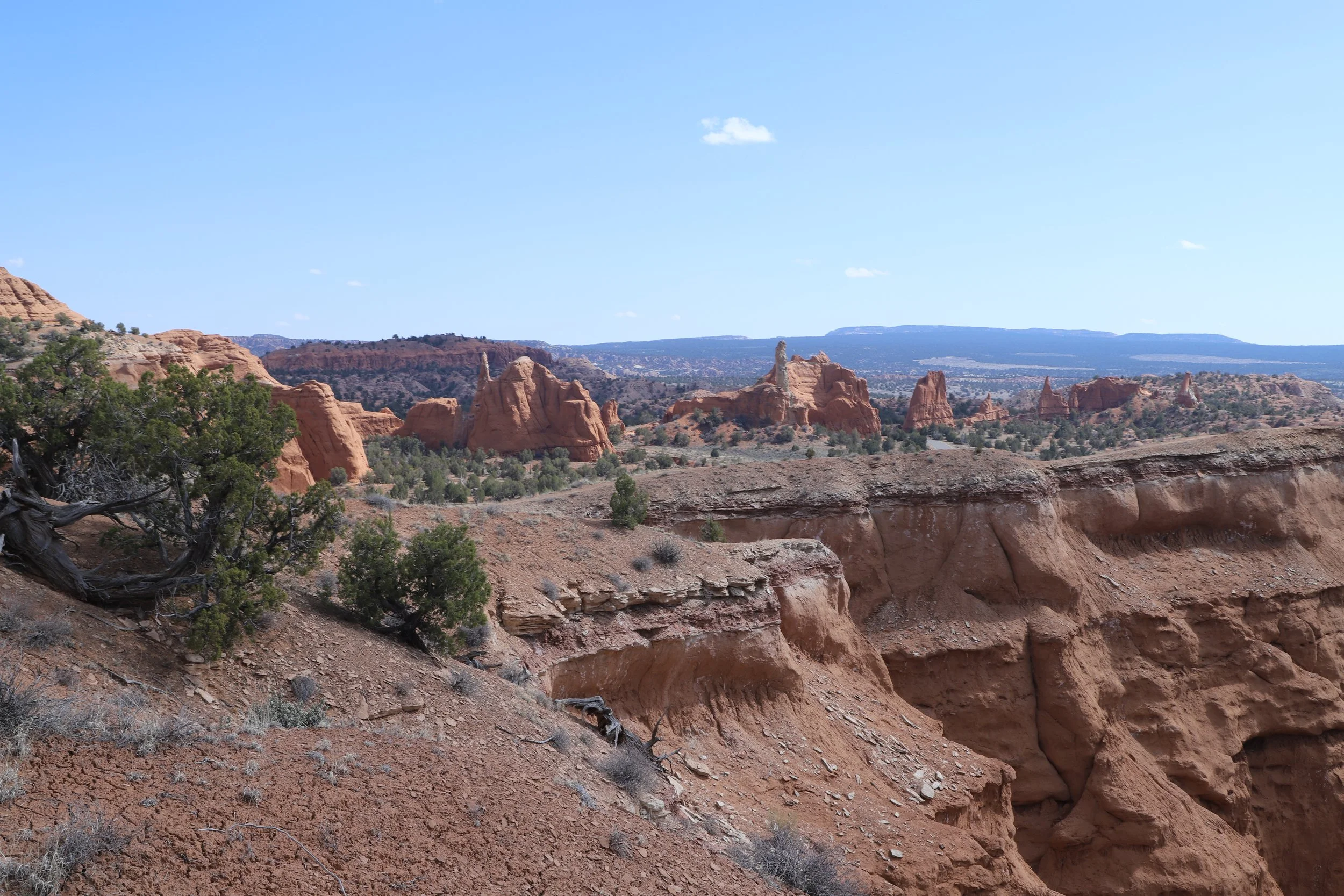
Kodachrome Basin State Park - View from Angel’s Palace
If you enjoy my blog, please consider signing up below for email notifications of my latest posts. I will not share your email.
Bryce Canyon’s Sister State Park
Kodachrome Basin isn’t really a “sister” park to Bryce Canyon National Park - that’s not a thing. But it feels like it. There are places within Kodachrome Basin State Park where you can actually see over into Bryce Canyon. Because of the close proximity of the parks, the geology is all part of the same story.
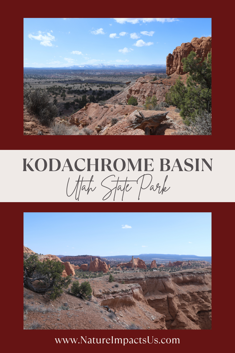
Kodachrome Basin is a beautiful State Park in Utah, and definitely worth visiting. The problem with it though is that it’s near so many other amazing and better-known places (Bryce Canyon National Park, Grand Staircase Escalante National Monument, Zion National Park, and Capitol Reef National Park). As a result, it’s unlikely Kodachrome Basin will make it on an itinerary for your first handful of vacations to Utah. Fortunately, or unfortunately, it’s going to take several trips to Utah to fully appreciate all of this state’s unique beauty. It’s useful to know about Kodachrome Basin though, in case you need to make a change to your vacation plans.
I ended up in Kodachrome Basin State Park with my boys in March 2019. We were staying in Page, Arizona, for a couple of days and then traveling to Escalante, Utah. Plan A had been to take Cottonwood Canyon Road and enjoy some hikes along the way. Cottonwood Canyon Road was closed however, due to being wet from melting snow. I had a plan B prepared - hiking Willis Creek Slot Canyon. But the last 1.5 miles of Sutumpah Road (the road needed to get to the Willis Creek Slot Canyon) was also closed, due to being wet. And adding 3 miles just to get to the trailhead seemed like a lot when hiking with a 6-year-old. I’ve already tried visiting Bryce Canyon in March… It was full of snow, and the trails were super slippery. I didn’t have a desire to repeat that experience. So, we used our day and came up with a plan C - hiking at the Toadstool Hoodoos (closer to Page) and Kodachrome Basin State Park as we drove to Escalante the long way.
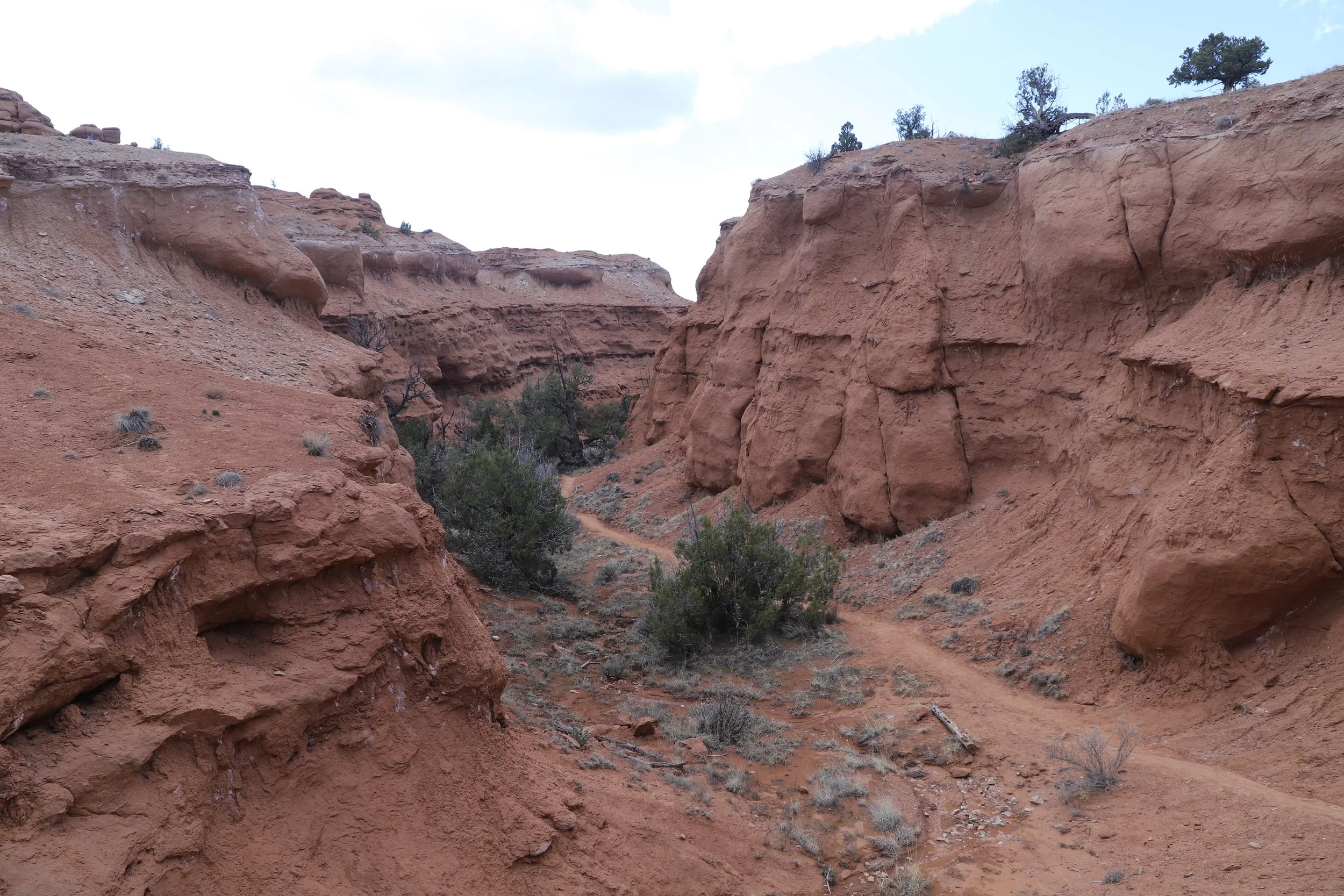
Hiking to Shakespeare Arch
Plan C was great! We found some fun hikes and stunning views. Kodachrome Basin is an awesome park to hike with kids. There was no one around on any of the trails and there were many spaces to explore.
In June 2025, we returned to this area, and we were able to finally hike Willis Creek Slot Canyon - the best easy slot canyon that I’ve found so far. And, fingers crossed, we are returning to this area again in 2026 (yep, I kind of have a thing with this part of the country...). We hope to have a chance to finally drive along Cottonwood Canyon Road.
It’s impossible to get to do everything all in one trip, especially when things don’t according to plan - and they won’t. That’s part of going on an adventurous road trip. Being able to smoothly pivot to other options when something doesn’t work out is the secret sauce to fun vacations. Knowing ahead of time what options exist can be really helpful in a pinch. Kodachrome Basin State Park was a hugely successful plan C!
Location
Kodachrome Basin State Park is located in Utah, not quite halfway between Bryce Canyon National Park and Escalante, Utah. The State Park is near Utah Highway 12. Take Kodachrome Road, which is paved until the State Park entrance. After the park, Kodachrome Road becomes a dirt road, known as Cottonwood Canyon Road (mentioned above), which runs through Grand Staircase-Escalante, connecting Utah Highway 12 with US-89.
There is a campground within Kodachrome Basin State Park. Other lodging options include camping at Bryce Canyon National Park (40 minutes) or hotel options in Bryce Canyon City (30 minutes away) or Escalante (50 minutes).
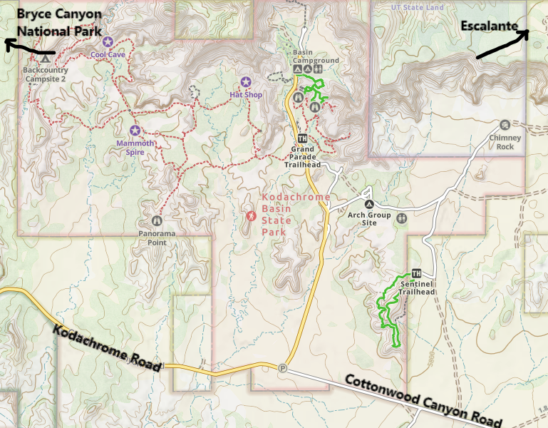
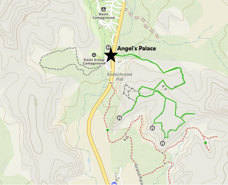
Kodachrome State Park Map
Logistics
Kodachrome Basin is a State Park, so it will require a small Utah State Park fee ($10/car as of 2026). The America the Beautiful Pass is for National Parks and Monuments, so that won’t work here. There are bathrooms onsite, and there is water available in the campground. There are multiple places to park close to each trailhead. Expect to hike a half day here.
Hiking at Kodachrome Basin State Park
We had a chance to hike two trails on our day at Kodachrome Basin (Shakespeare Arch on the Sentinel Trail and Angel’s Palace). They were both recommendations from the park rangers. Since this was plan C, I didn’t have an itinerary already planned ahead. We enjoyed both hikes and thought they were great recommendations. We haven’t had a chance yet to hike Grand Parade, Eagle’s View or the Panorama Trails. Someday, I’m sure we will be back.
Shakespeare Arch / Sentinel Trail
Distance / Elevation Gain - 1.7-mile loop hike / 200ft
Sentinel and Shakespeare Arch Trail Map
We started with the Sentinel Trail. I hadn’t quite realized where I was at until we started hiking - again, this was Plan C. But as I look off in the distance, I’m seeing the cliffs lined with orange/red hoodoos. They look a lot like Bryce Canyon! And later I confirmed that yes, that is Bryce. I didn’t know these parks were that close to each other.
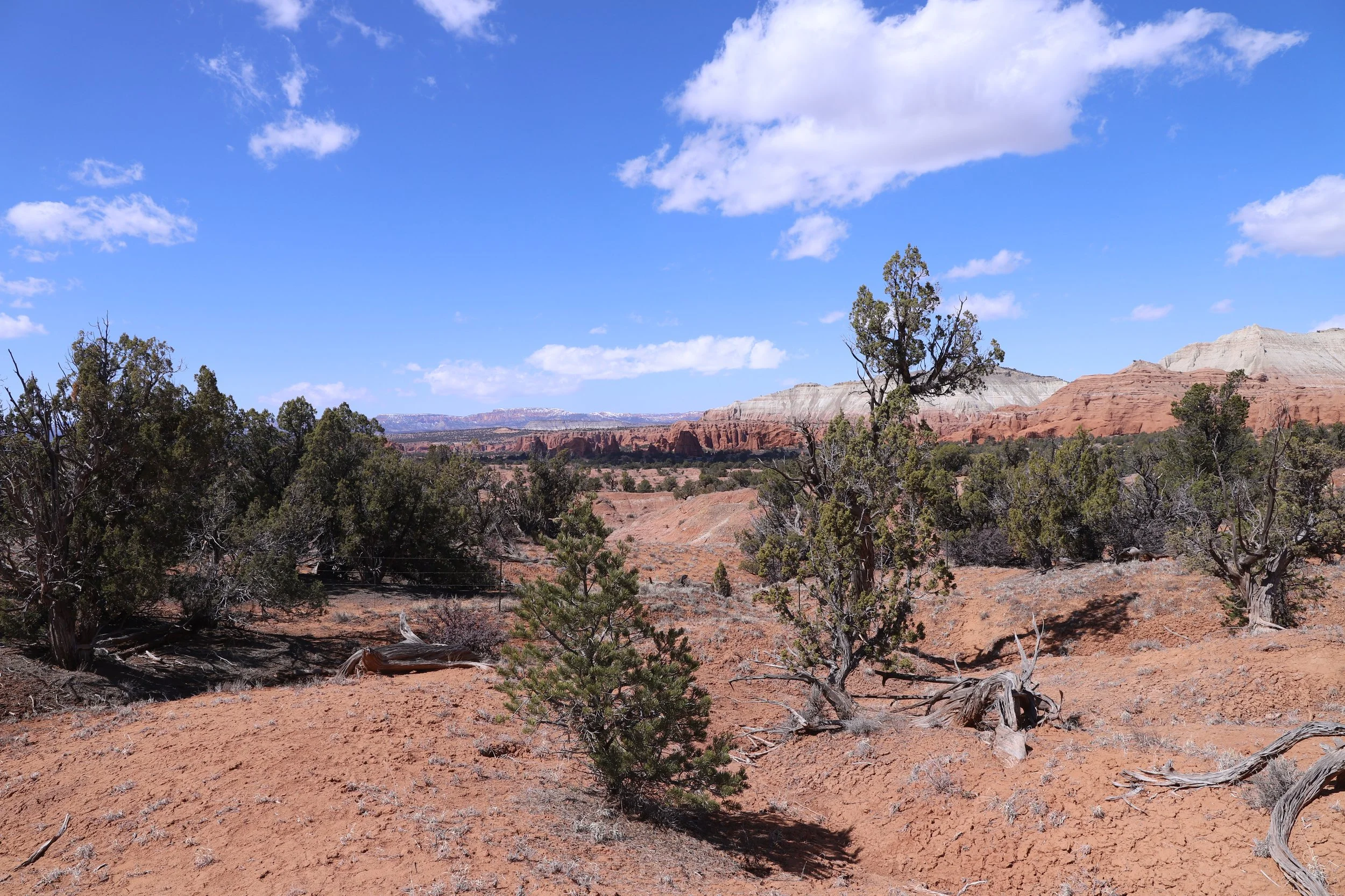
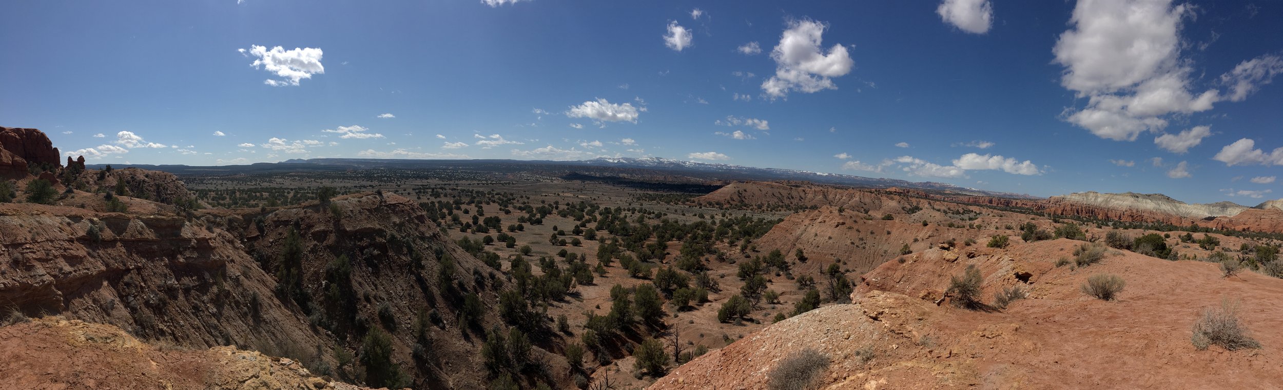
Views on the hike to Shakespeare Arch
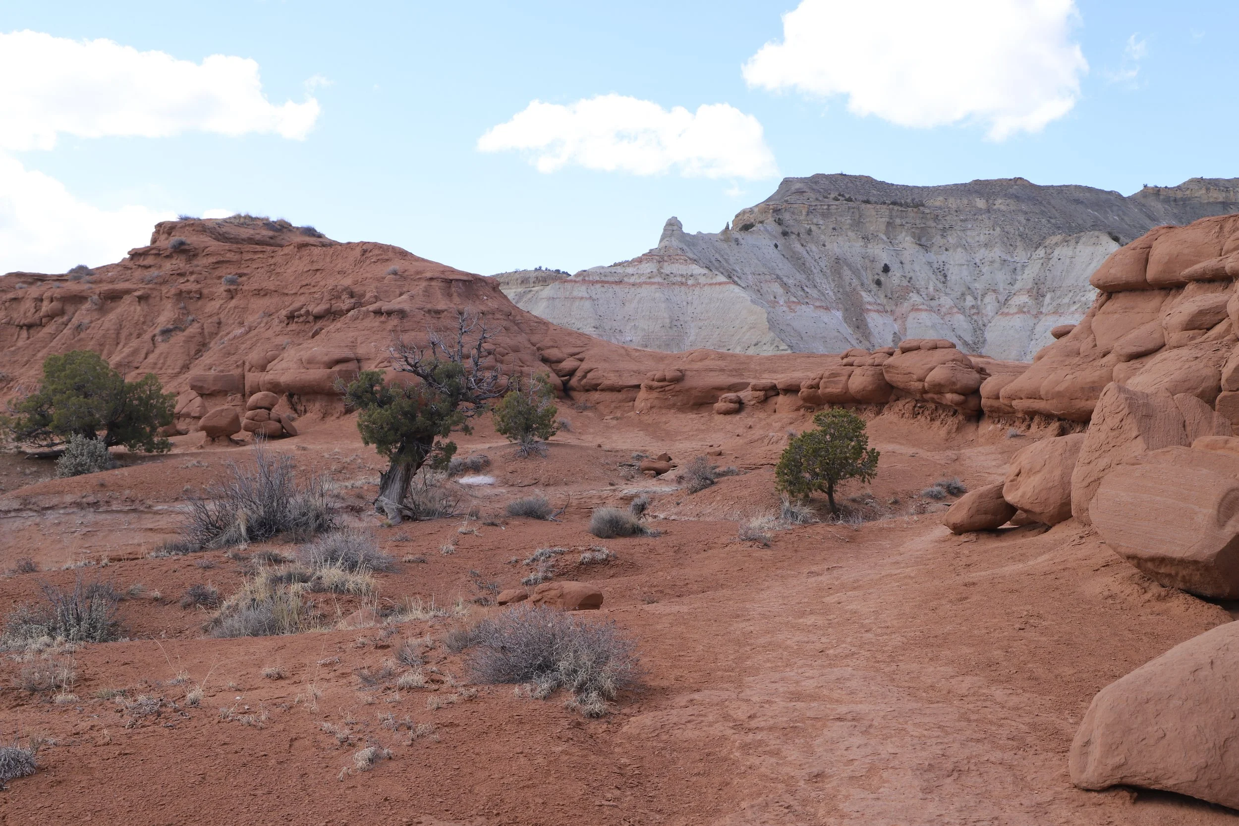
I know this post is about Kodachrome Basin, but looking at Bryce from this spot explains why Grand Staircase-Escalante National Monument is called the “staircase.” It’s a big staircase… The top of Bryce Canyon is the top of the first step. That’s the Pink Cliffs. And the next “step” is the Gray Cliffs, and then the White Cliffs, and then the red is the Vermillion Cliffs. The “staircase” ends at Cottonwood Canyon Road (mentioned previously). Cottonwood Canyon Road runs parallel to a fault line. You can see these geological steps as you explore Kodachrome Basin State Park.
Viewing Bryce Canyon from Kodachrome Basin State Park
The rock here feels like hard mud or clay, and some of it is crumbly. That’s why the dirt roads are impassable when they get wet. It’s sort of similar to Badlands National Park (South Dakota) and Cathedral Gorge State Park (Nevada).
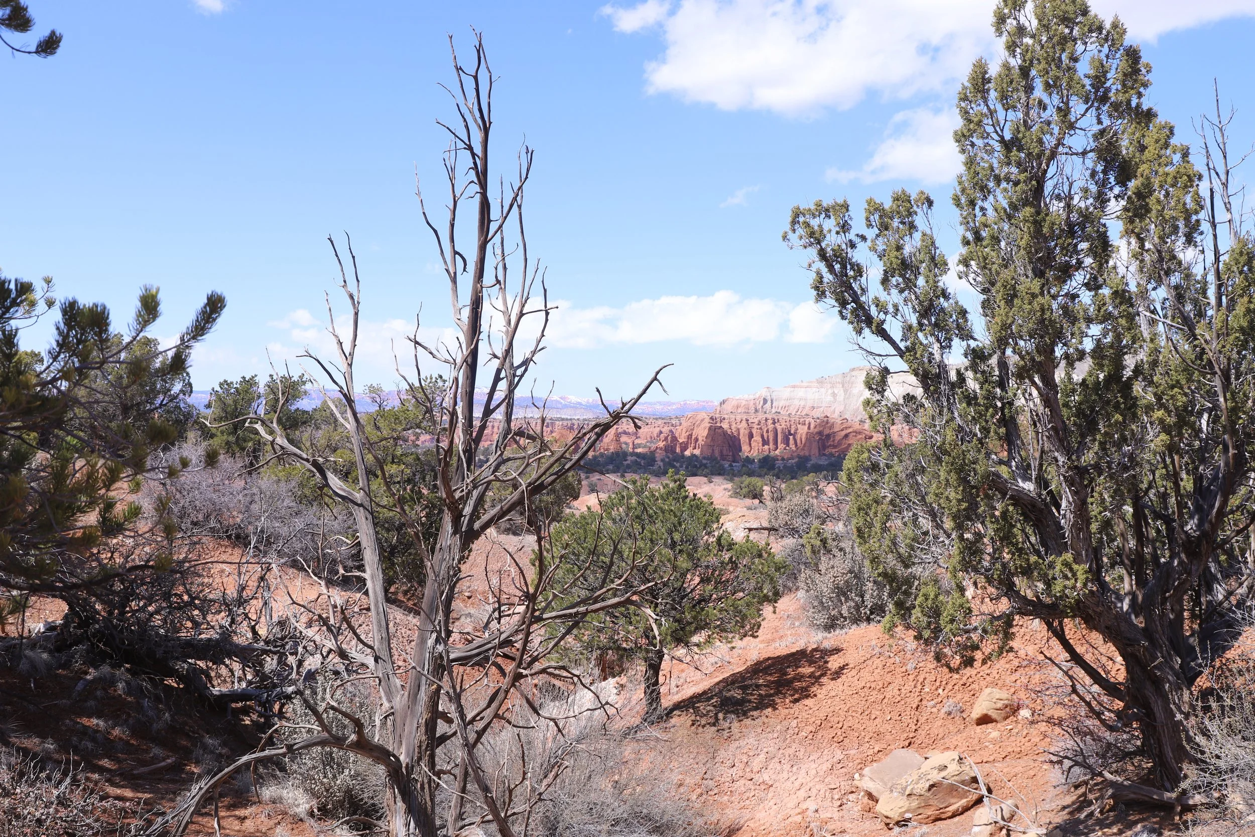
Hiking to Shakespeare Arch
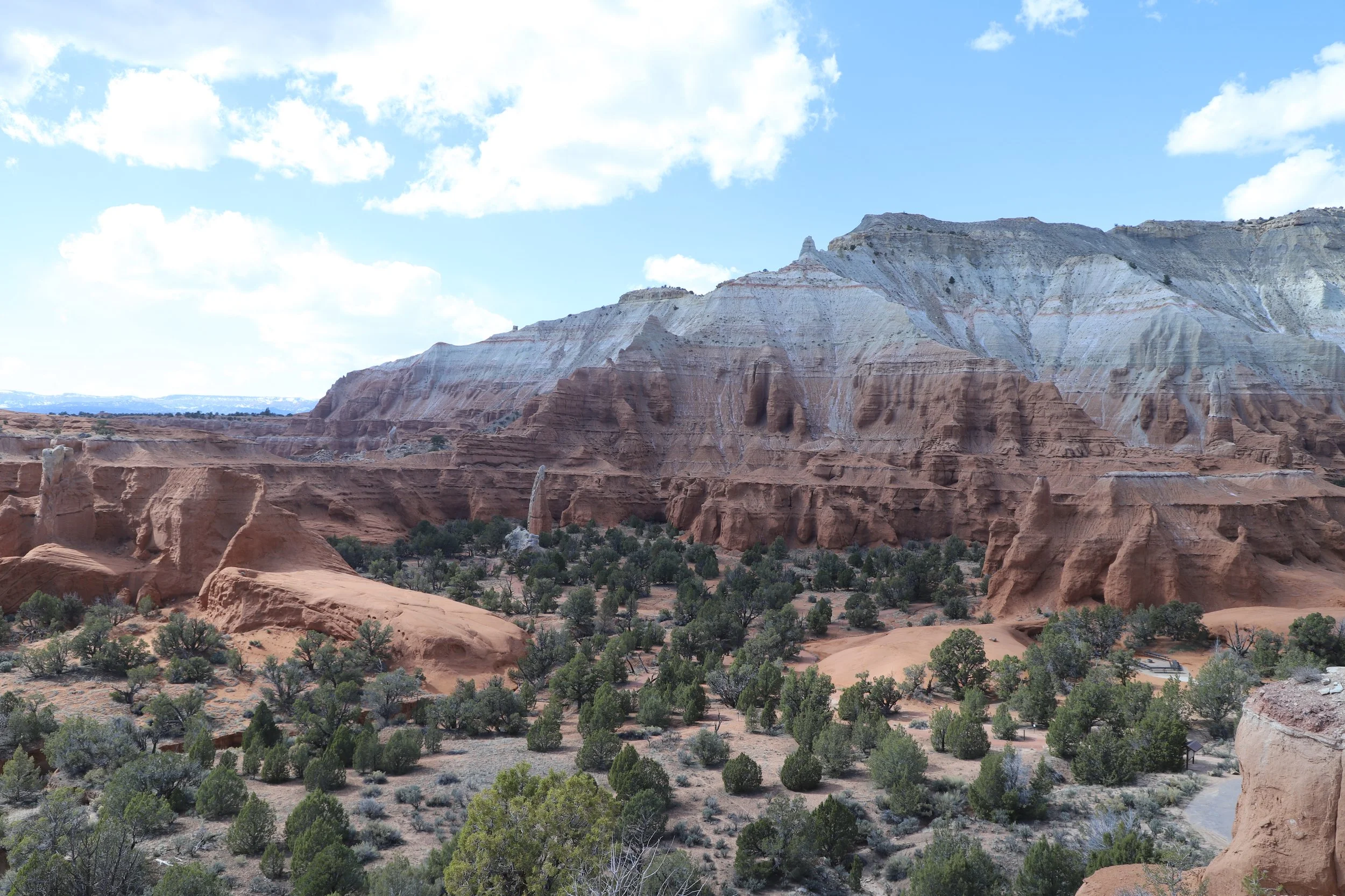
Shakespeare Arch is the only arch in the State Park. It’s neat to look at, but this is as close as the trail goes. For anyone excited about arches, I would recommend checking out Arches National Park, where you can get much closer to several of the arches. This park is also in Utah, but it’s 4.5 hours away. Bryce Canyon, Grand Staircase-Escalante, Zion, and Capitol Reef are all quite a bit closer to Kodachrome Basin. Arches might need its own, separate trip. Enjoy what’s nearby - there’s plenty!
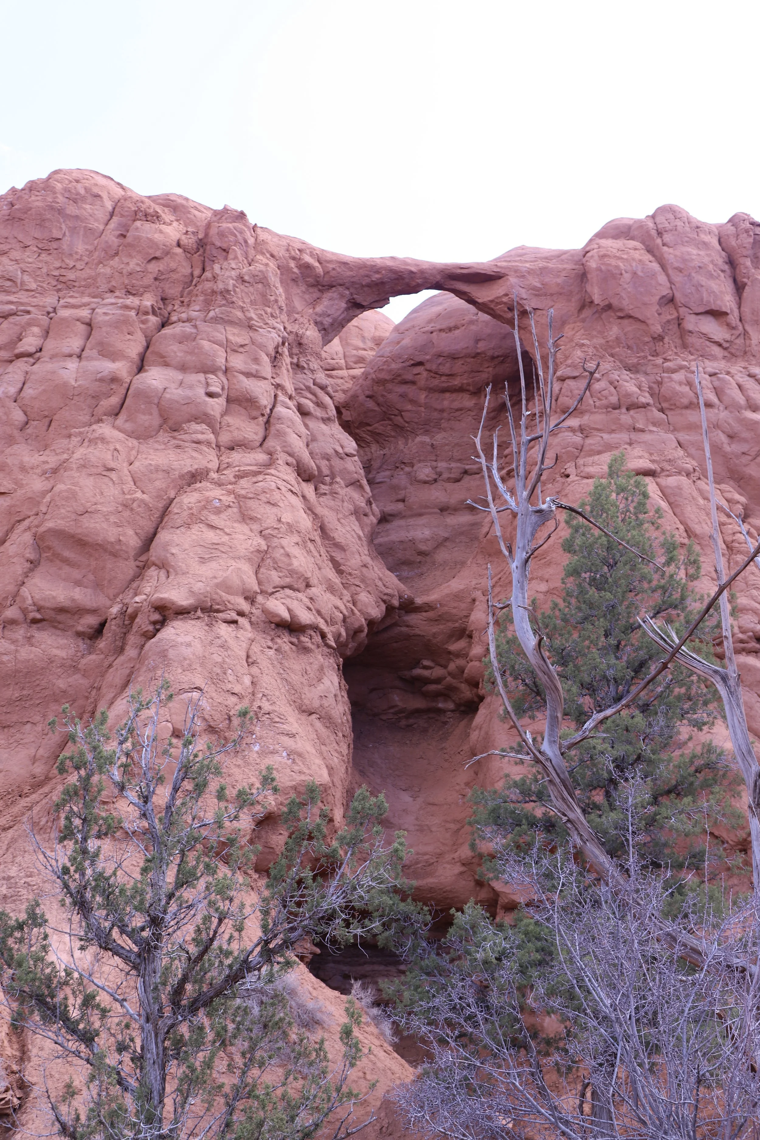
Shakespeare Arch - Kodachrome Basin State Park
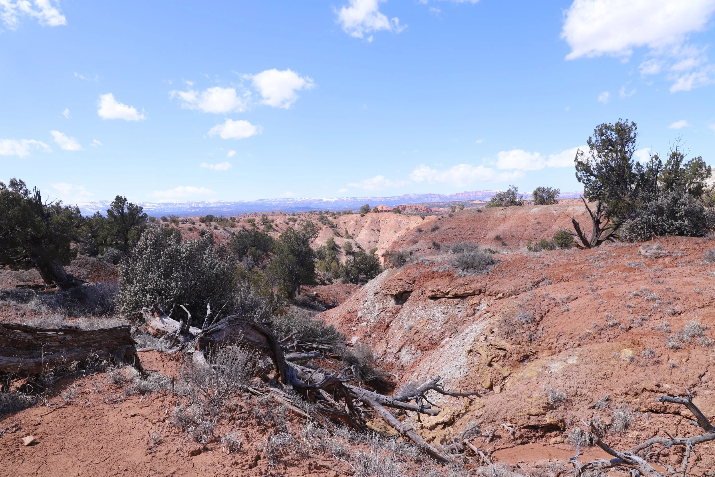
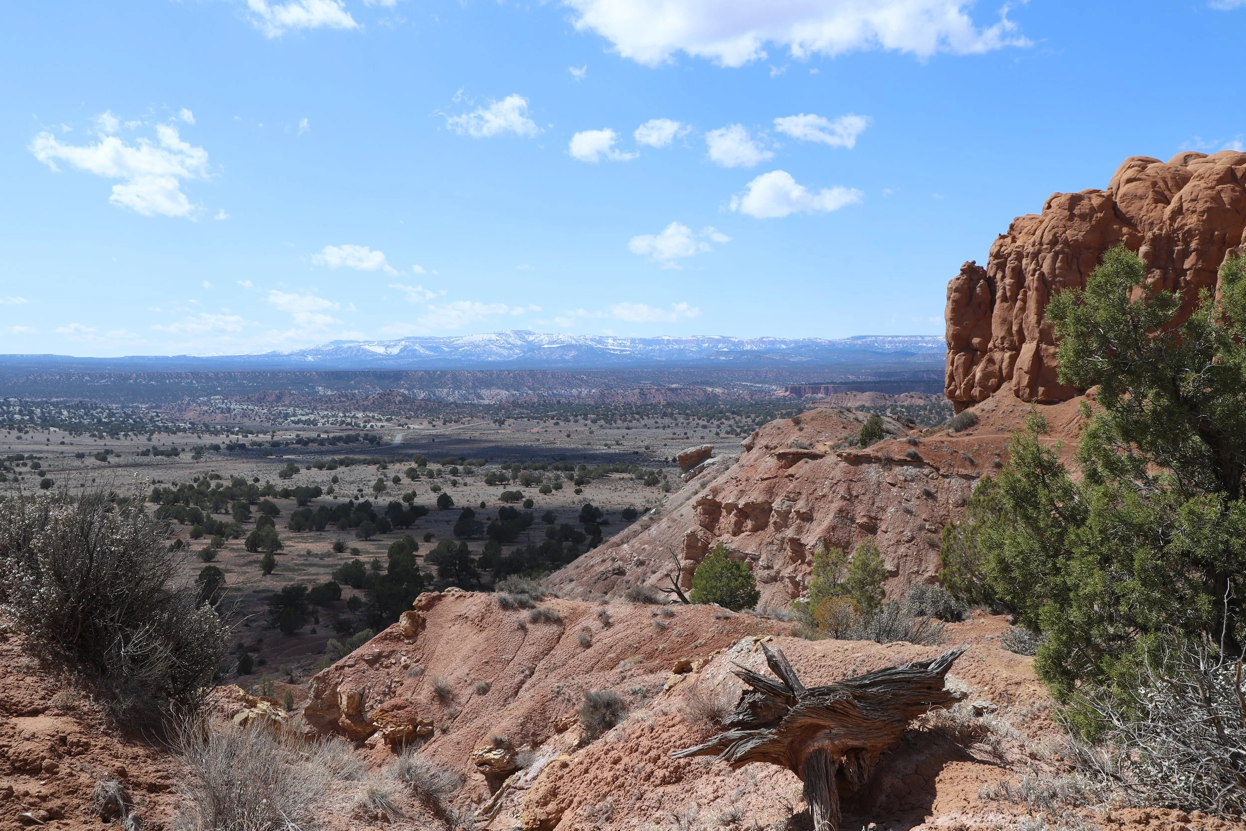
Don’t turn around after the arch. Keep going around the entire Sentinel loop trail. The panoramic views from up above are worth the trek.
View from the Sentinel Trail
It felt like we had this whole park to ourselves. We all spread out a bit and just soaked in the warm sun. Sometimes it’s nice to just stop on a trail and simply enjoy being where you are.

Hiking to the Sentinel
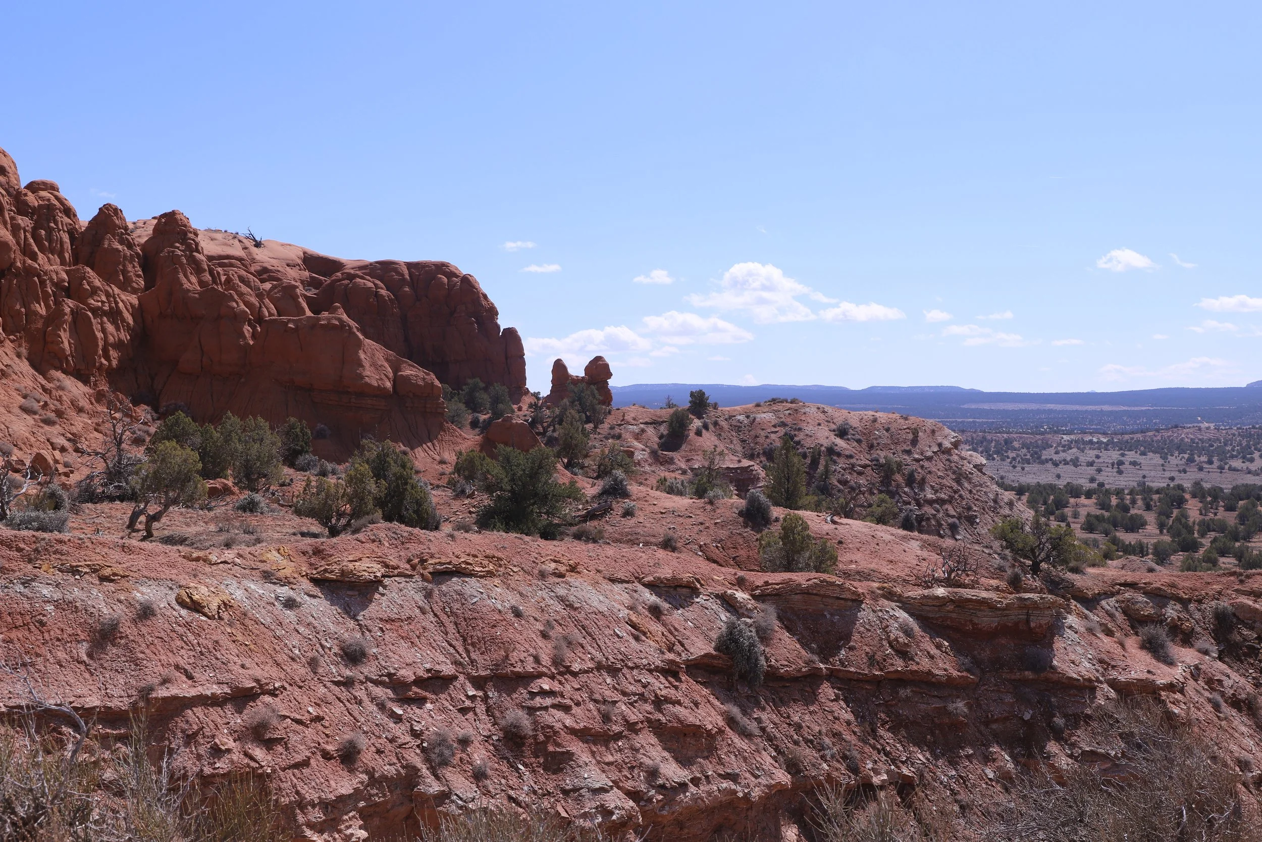
A bit past Shakespeare Arch, you will find this huge rock. This is known as the Sentinel.
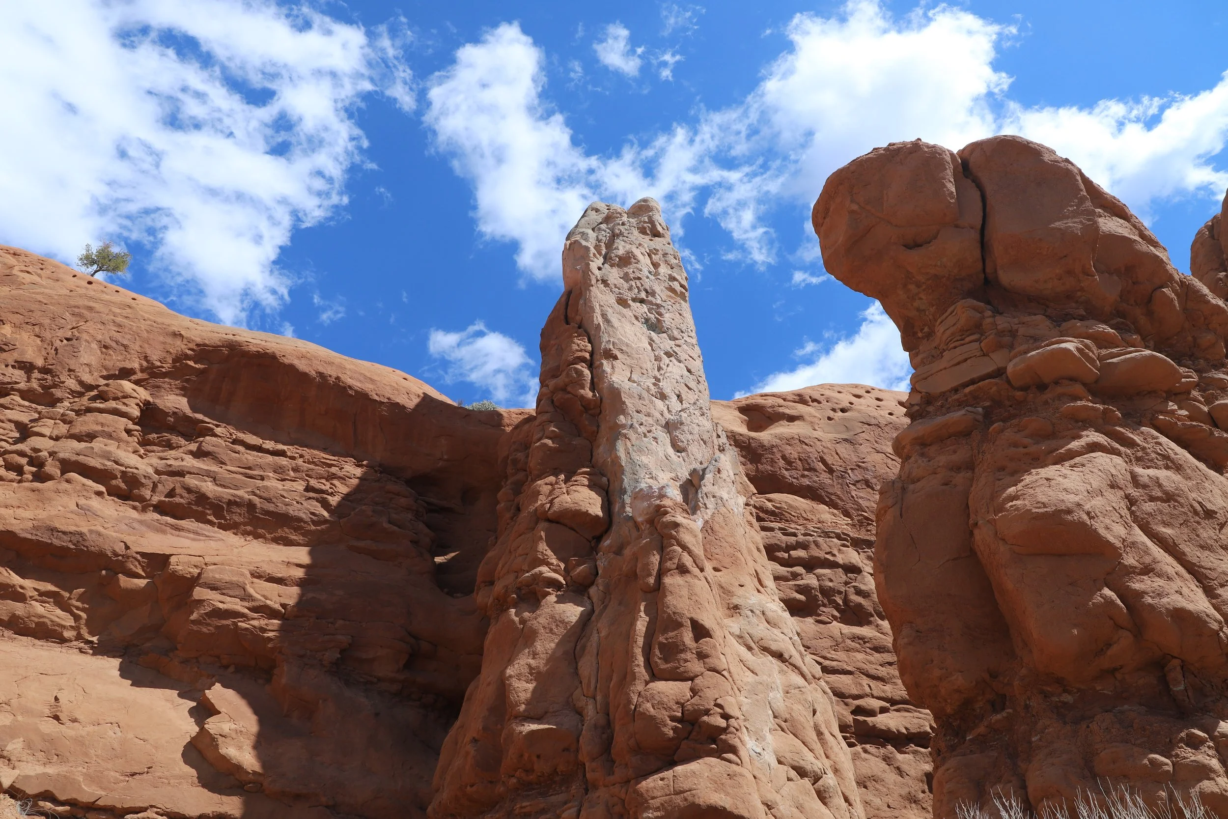
The Sentinel - Kodachrome Basin State Park
There are two options to loop back. We stayed higher in elevation to enjoy more of the basin views.
Hiking the Sentinel Loop
Angel’s Palace
Distance / Elevation - 1.5 mile out-and-back with a loop in the middle / 250ft
Angel’s Palace Trail Map
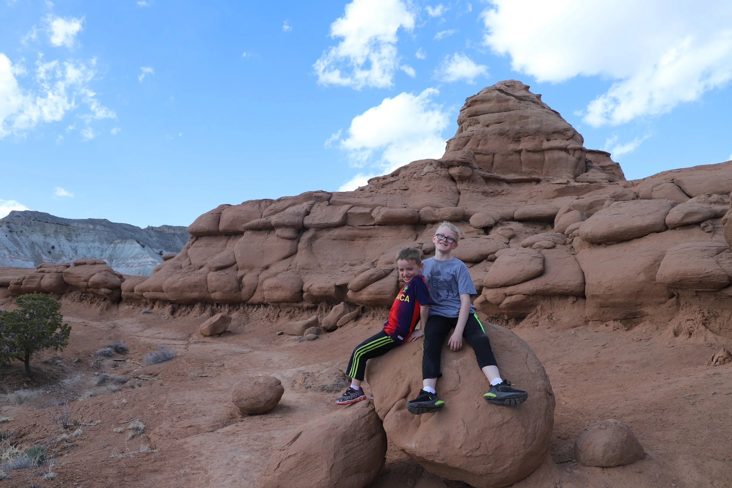
Of the two hikes, my boys preferred Angel’s Palace. This trail starts off through a small canyon, and then gently climbs up through the canyon to the top, where there is a loop with several overlooks. My boys loved this trail because there were so many spaces within the rocks to play, hide, and explore.
Angel’s Palace - Climbing up the canyon
The trail is less defined at the top, but it’s easy to figure out where to go.
Hiking around Angel’s Palace
As I’m looking at these pictures again, and remembering what a fun we had, I can guarantee you will enjoy this park. But I really understand that there are a lot of other places you are more likely to go on your vacation, and I’d probably agree with your itinerary. Utah is worthy of several return trips!
Views along Angel’s Palace
Hiking Angel’s Palace
Exploring Angel’s Palace
“Nearby” Things to Do
The following places to visit are within a two-hour drive.
Willis Creek Slot Canyon
30 minutes west - Willis Creek Slot Canyon is an easy, shaded slot canyon with minimal change in elevation, and has stunning, tall, and colorful walls. This is an out-and-back hike for as long as you’d like. The max hike is 6 miles long.
Bull Valley Gorge
35 minutes west - Bull Valley Gorge is a short (1 mile) but difficult slot canyon. This can be a loop hike out to the start of the canyon, through it, and scrambling back up, but there are some major obstacles to navigate through within the canyon. We explored about a third of the way through the canyon and returned the way we came in. Bull Valley Gorge is also the site of where a truck can be found wedged in the canyon walls from an accident in 1954.
Bryce Canyon National Park
30 minutes northwest - Bryce Canyon has some amazing viewpoints, but the best parts of this park involve some difficult hikes. Plan to stay a few days in the area if you plan to also explore Bryce Canyon.
Kanarra Falls
2 hours west - Kanarra Falls is a moderately difficult hike that travels through a slot canyon with four waterfalls. This trail goes through the water and feet and ankles will get wet. Permits are needed for this hike. Consider pre-purchasing as only 200 hikers are allowed in per day. Walking sticks will be helpful on this hike. Neoprene booties under hiking boots will keep your feet warmer.
Zion National Park
East Entrance is 1 hour 45 minutes southwest, and Kolob Canyon Entrance is 2 hours west. Note that the roads from these two entrances do not intersect. These are separate parts of the National Park. Zion is one of my favorite National Parks. There are so many fantastic hikes for all types of hikers - beginners through advanced.
Kanab, Utah
1 hour 45 minutes southwest - Switch lodging to visit Kanab and plan to spend a few days. Kanab is a smart place to set up basecamp for a trip to Zion National Park, just 35 minutes away from Zion’s east entrance. There are several other fun and less crowded places to hike nearby, as well.
Lower Calf Creek Falls
1 hour 15 minutes northeast - The trailhead to Lower Calf Creek Falls is along UT-12. This is a 6 mile out-and-back hike to an impressive waterfall. The best way to combine Lower Calf Creek Falls with Kodachrome would be on a day switching lodging between Bryce Canyon and Capitol Reef National Parks, or find lodging in Escalante.
Anasazi State Park Museum
1 hour 30 minutes northeast - For anyone heading to Capitol Reef National Park, Anasazi State Park Museum is an interesting, quick stop, also off of UT-12. Just outside of the museum, there is a six-room dwelling replica constructed on the original site.
Hole-in-the-Rock Road
The following trailheads are located along Hole-in-the-Rock Road. Escalante is the best place to stay if you want to visit both Kodachrome and any of the following trails. Escalante is a little under an hour northeast from Kodachrome Basin State Park.
Zebra Canyon
20 minutes from Escalante (Hole-in-the-Rock Road)- The trail to Zebra Slot Canyon is a relatively easy 5.25 mile out-and-back hike through gorgeous desert backcountry. Most of this trail is entirely exposed to the sun. Hiking to Tunnel Slot Canyon adds 1.8 miles. Hike early in the morning to avoid the afternoon heat, bring 4L of water per person, pre-download a GPS map, and be prepared to get wet inside Zebra. Water shoes are helpful inside the canyon.
Devil’s Garden
30 minutes from Escalante (Hole-in-the-Rock Road) - Devil’s Garden is located 4 miles down Hole-in-the-Rock Road from the Zebra Canyon Trailhead. Devil’s Garden isn't so much a formal hike, it's rather a place to explore with a beautiful arch. The trails crisscross throughout this park, so just enjoy. There are vault toilets to use here as well, if you are looking for nearby bathrooms.
Twenty Mile Wash Dinosaur Trackway
45 minutes from Escalante (Hole-in-the-Rock Road) - The turnoff for Twenty Mile Wash Dinosaur Trackway is 2 miles further along Hole-in-the-Rock Road, past Devil’s Garden. Turn right onto Left Hand Collet Cyn Road and follow for 2.5 miles. For anyone interested in finding some dinosaur footprints, this is a quick place to explore. The Sauropod footprints (big round circles) are easy to spot. There are also some Therapod footprints (3-toed), but these are harder to find.
Peekaboo and Spooky Gulch Slot Canyons (Dry Forks Narrows and Brimstone Gulch)
1 hour from Escalante (Hole-in-the-Rock-Road) - The Upper Dry Forks Trailhead is located 10 miles further along Hole-in-the-Rock Road from the turnoff for Left Hand Collet Cynn Road. This is a fun and challenging 4.6-mile loop hike through 3 slot canyons (Dry Forks Narrows, Peekaboo, and Spooky Gulch). Add Brimstone Gulch for an additional 3.6 miles.
More from www.NatureImpactsUs.com
To see more of my posts, click on any pin. There will be a hyperlink to my posts on that particular hike.