
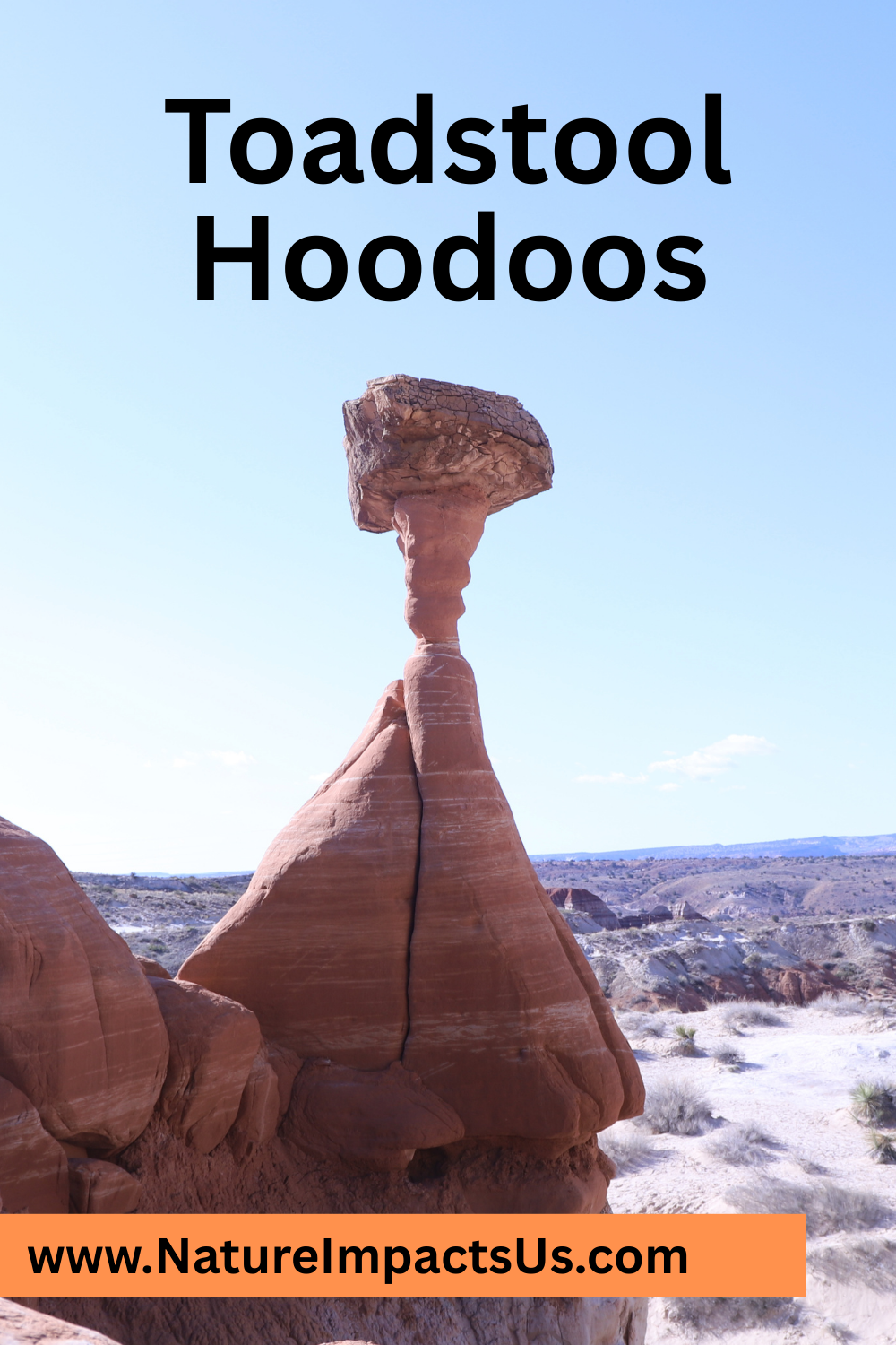
Toadstool Hoodoos - Grand Staircase-Escalante National Monument
If you enjoy my blog, please consider signing up below for email notifications of my latest posts. I will not share your email.
Mystical Rocks
The Toadstool Hoodoos is an easy hike in Grand Staircase-Escalante National Monument and features rock formations that don’t seem possible. The trailhead is extremely accessible, right off of US-89. Before getting to the hoodoos, the surrounding mountains are incredible on their own with dramatic color bands. This is a fun, easy hike for people of all ages.
So, what’s the catch? Why aren’t your friends talking about the Toadstool Hoodoos? That expression, “in the middle of nowhere”? This trailhead is not someplace you are likely to find yourself nearby without some intentional planning…
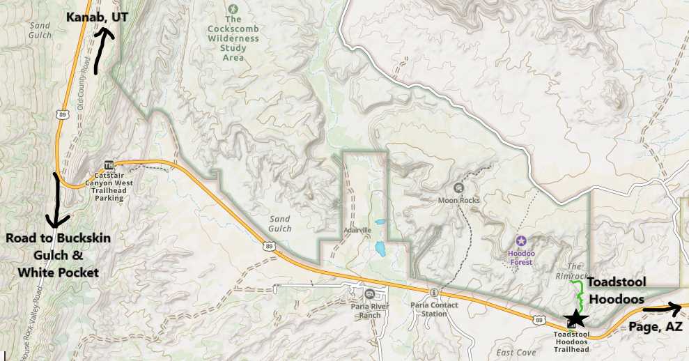
For anyone driving between Kanab, Utah and Page, Arizona along US-89, or if you are on your way to Buckskin Gulch and / or White Pocket, the Toadstool Hoodoos is worth an extra hour of your time! For anyone else, Toadstool Hoodoos is remote enough, it might not make the cut for your vacation itinerary. There are tons of fun things to do in both Kanab and Page for hikers though, so it’s not implausible to plan a trek out to these hoodoos. If you aren’t sure why you might want to visit Page or Kanab, see my linked blogs.
Location
How to get to the Toadstool Hoodoos
The trailhead to the Toadstool Hoodoos is right off of US-89, not quite midway between Kanab, Utah, and Page, Arizona. The closest small town is Big Water, Utah, which at 12 miles away has a gas station and a few places to spend the night, but no restaurants. Kanab is 45 miles away. It’s still a pretty small town, but it’s more likely to be on your vacation itinerary due to its close proximity to the east entrance of Zion National Park. I’ve stayed in Kanab a couple of times. There are no chain restaurants, but the local food is great and well-priced. Page is about twice as big as Kanab and is only 30 miles away. There are more hotels in Page, and there are a handful of chain fast food restaurants. Page is near Lake Powell, and there are several interesting things to do there, but none as high profile as Zion. I’ve stayed in Page on a couple of vacations as well. Page feels surprisingly modern and shouldn’t be discounted as a potential vacation idea (in a non-summer month).
Logistics
Other than having a pre-downloaded GPS app (from AllTrails or GAIA), plenty of water to drink (not just for the hike but in the car afterwards as well), and food for the next hour or so after the hike (this isn’t a spot in the country with a nearby McDonalds…), there isn’t a lot of pre-planning needed to visit the Toadstool Hoodoos. The trailhead is a pullout right off of US-89. The pullout is apparent but not well marked. No payment or permits are needed. This is a likely a trail that you will have to yourself.
If hiking in the summer, bring extra water, and if possible, hike in the morning. Or pack an umbrella for portable shade. Hiking poles may be helpful for those who are a bit unsteady, but in general this is an easy hike.
If you are looking for bathrooms, there may be port-a-potties at the trailhead. Otherwise, there is a visitor center in Big Water (about 12 miles away - east of the trailhead). There are souvenirs at the visitor center as well.
Hiking to the Toadstool Hoodoos
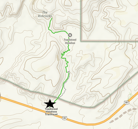
Toadstool Hoodoos Hiking Map
The trail out-and-back to the Toadstool Hoodoos is about 1.8 miles, with an elevation gain of around 100ft. The trail is made of hard packed dirt. This trail requires minimal rock scrambling and is pretty accessible for hikers of all ages, although hiking poles might be helpful in the uneven areas.
March 2019 - On our way out to see the Toadstool Hoodoos
There is a decent sized parking lot. We did not run into anyone else while we were here.
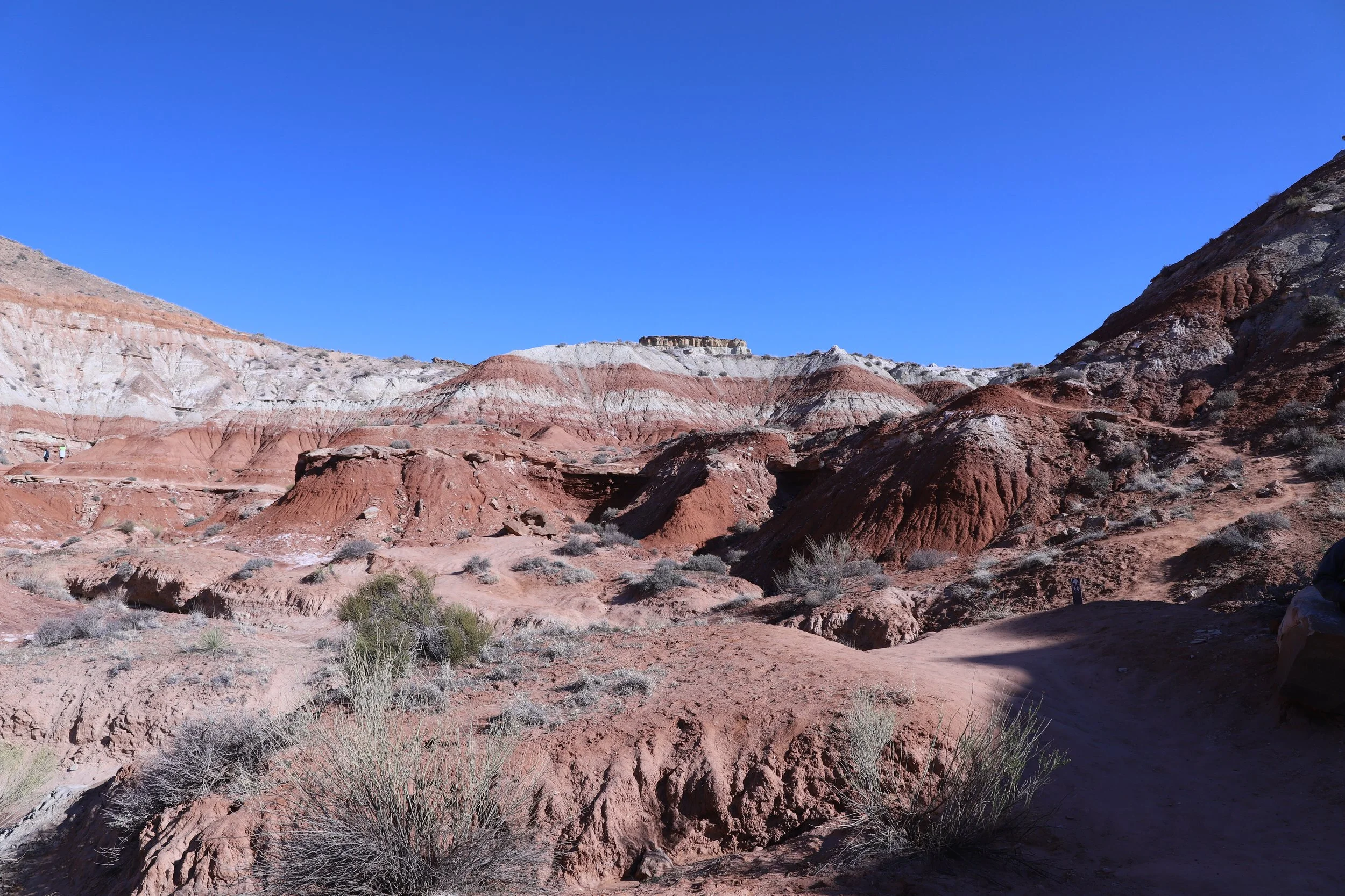
Paria Rimrocks on the way to the Toadstool Hoodoos
The trail is very obvious to follow. We hiked in March 2019. In June 2019, I learned about the GAIA app and I started pre-downloading maps before hiking. I never felt lost on this trail, but we didn’t wander as far as we feasibly could have in the region with hoodoos. If I had a map tracking our location, we may have gone a bit further. Now that I have GAIA, I always have it turned on while hiking, and multiple times it has caught us going in the wrong direction. Even though the trail was easy to follow, I would still recommend downloading a GPS map. Although the apps aren’t the cheapest, it’s much better than getting lost in a desert…
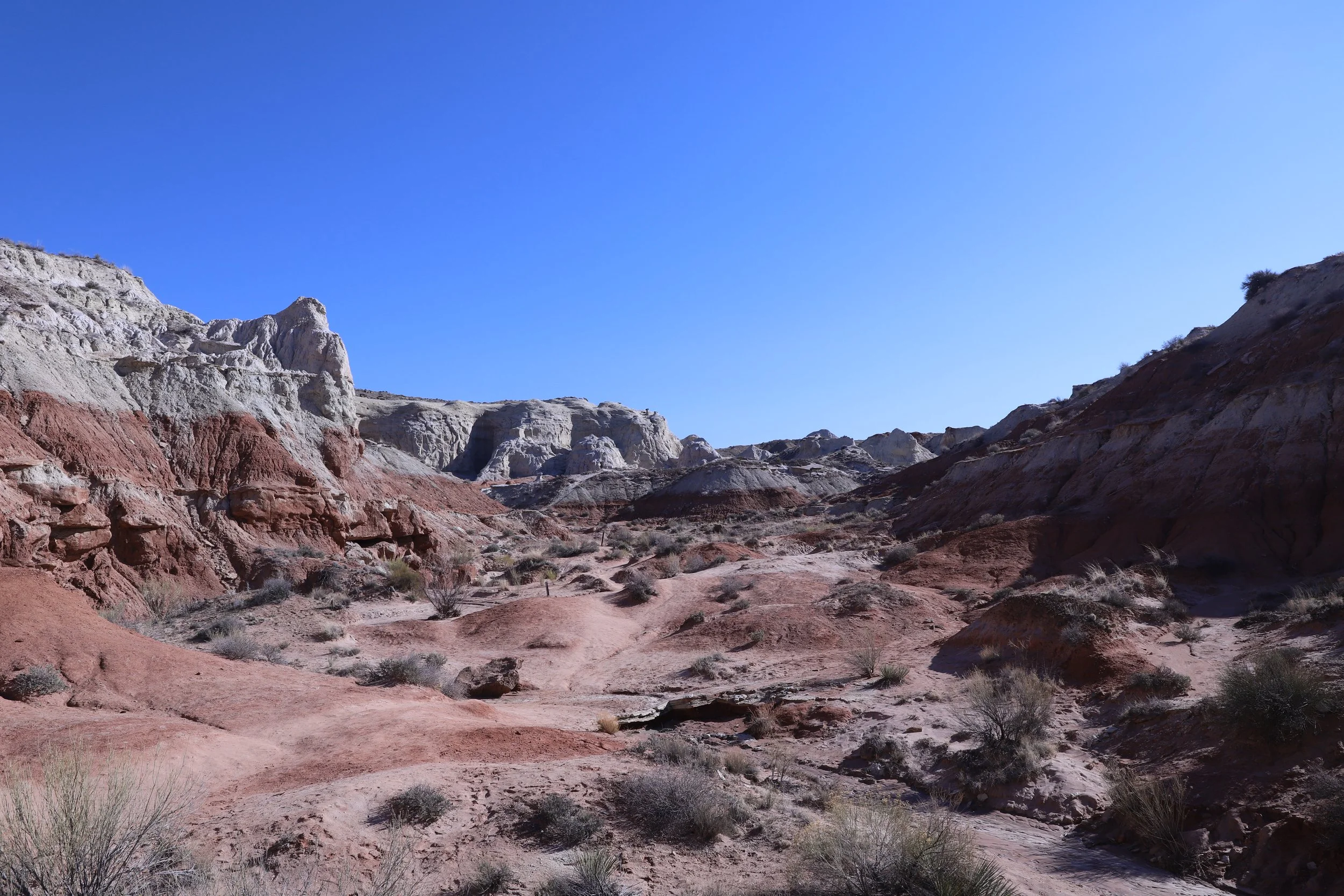
Hiking through the Paria Rimrocks on the way out to the Toadstool Hoodoos
The trail goes up and down a handful of times as it follows above a waterway. There aren’t any steep sections along this trail. The hike out to the hoodoos is almost as stunning as the hoodoos themselves. These Paria Rimrocks have amazing color bands. The hike to get to the hoodoos is incredible!
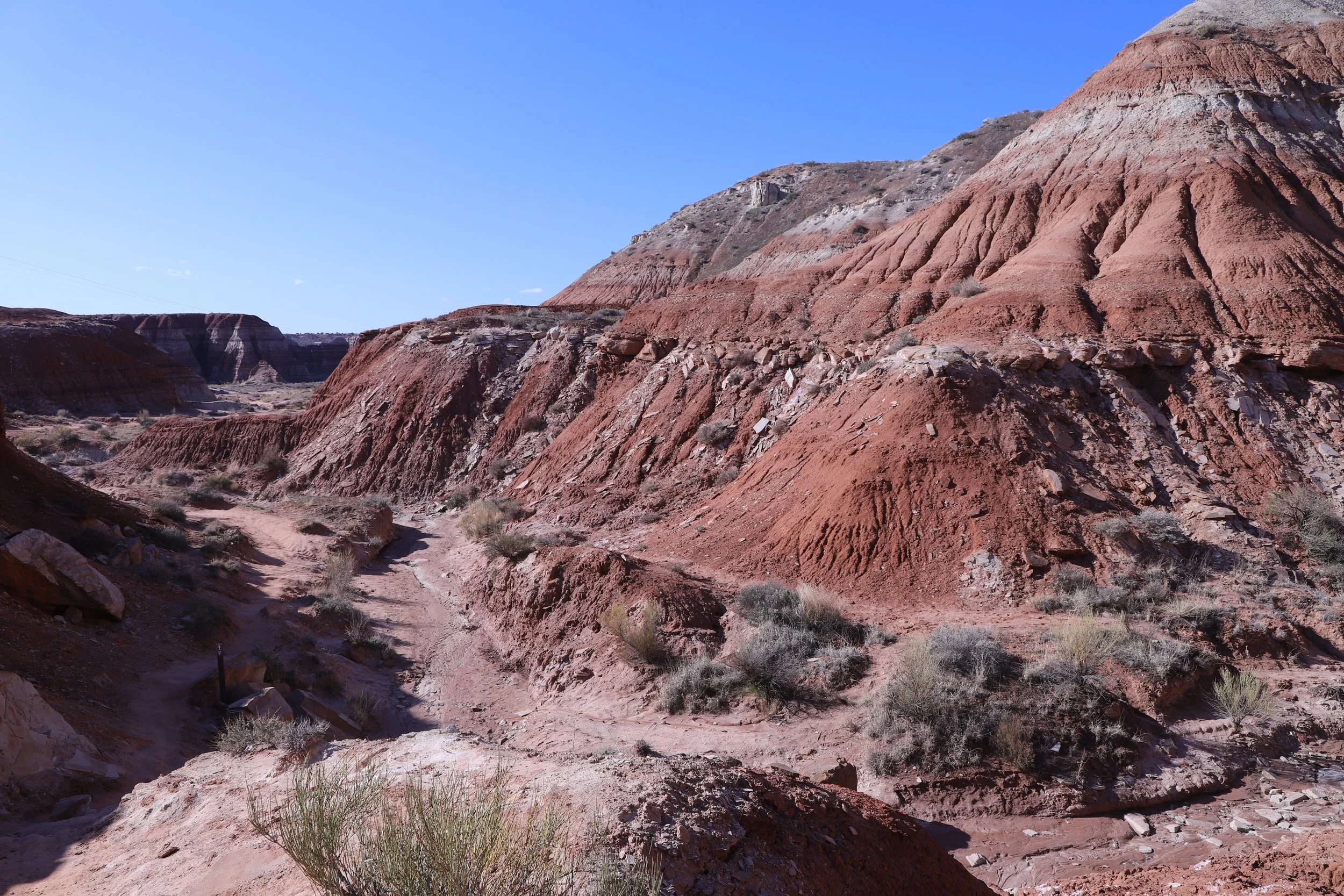
Hiking out to the Toadstool Hoodoos
The Paria Rimrocks are beautiful, but I’m also including several pictures of the trail out to the hoodoos so it’s apparent that there is no shade along this trail. The summer months are the most common months for a road trip. A 1.8-mile hike in the summer in the desert is possible, but bring some portable shade (ex. umbrellas) if you can’t hike in the early morning hours, and of course, pack extra water.
There isn’t a place to refill water bottles at the trailhead, and there are no nearby towns. I like to stop at a gas station or grocery store and buy 3-4 of the 2.5-gallon water jugs at the start of my road trip, or when I fly into a city. I keep them near the trunk and accessible for a cheap and easy way to refill water bottles before (and after) a hike.
There is not a nearby place to get food either. When planning a hike out to Toadstools, think about what food might be needed for the hike, as well as what people might want to eat in the car afterwards.
Hiking out to the Toadstool Hoodoos
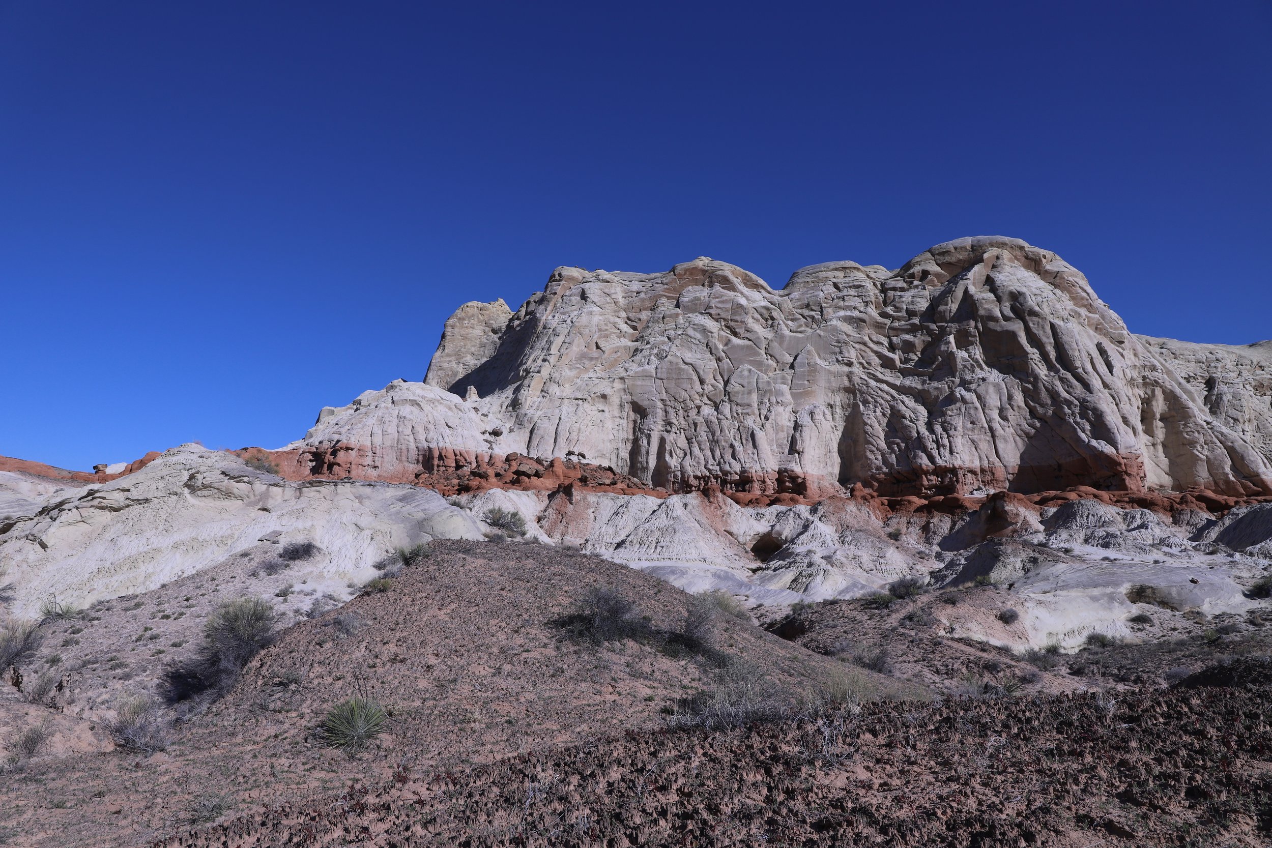
These mountains are incredible. I loved this trail, even before we reached the hoodoos!
Paria Rimrocks (on the hike out to Toadstool Hoodoos)
Coming around on corner, on your left, the canyon opens up the hoodoos will appear. The trail will keep going up and into the hoodoos.
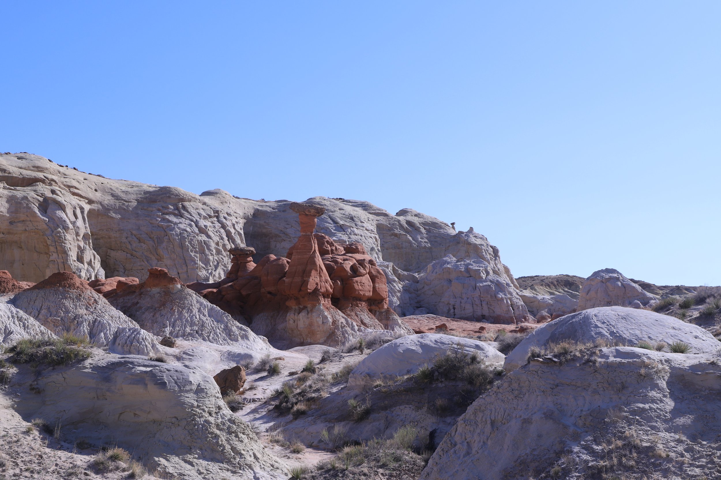
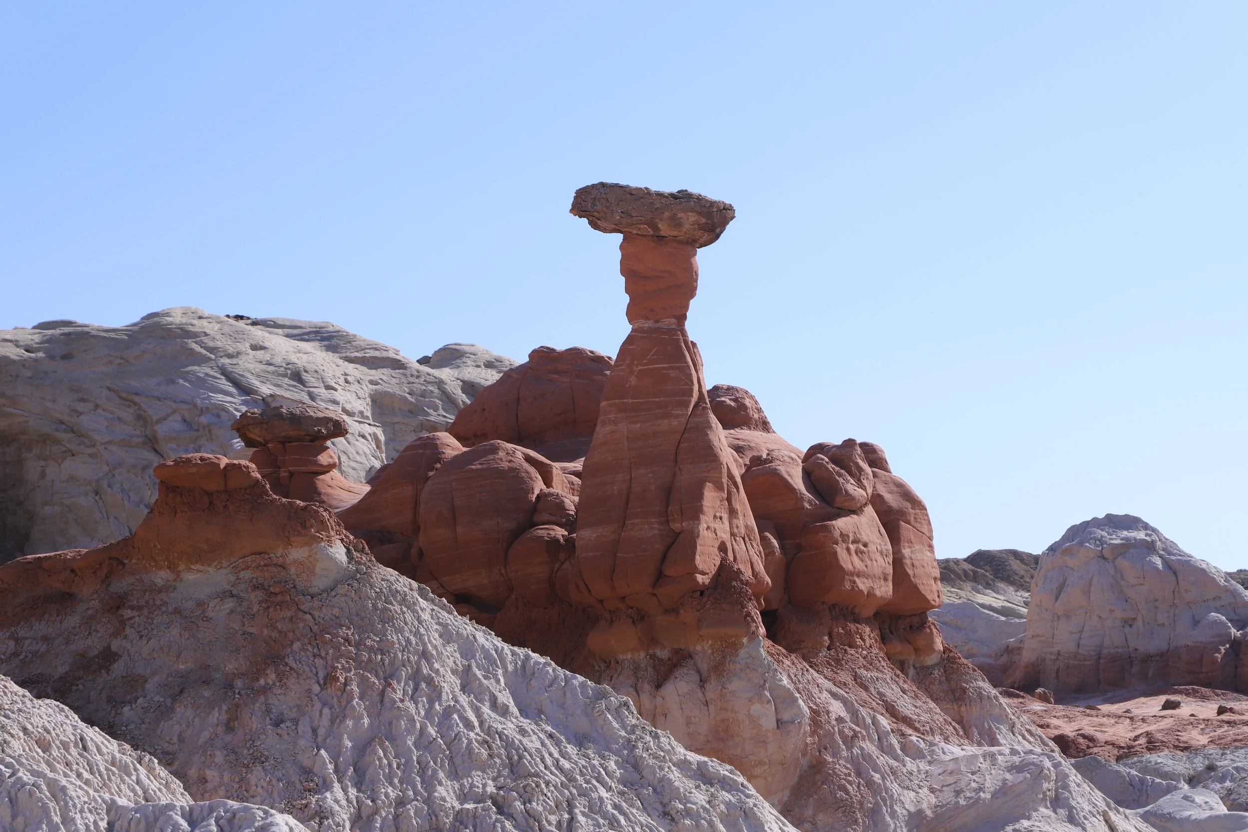
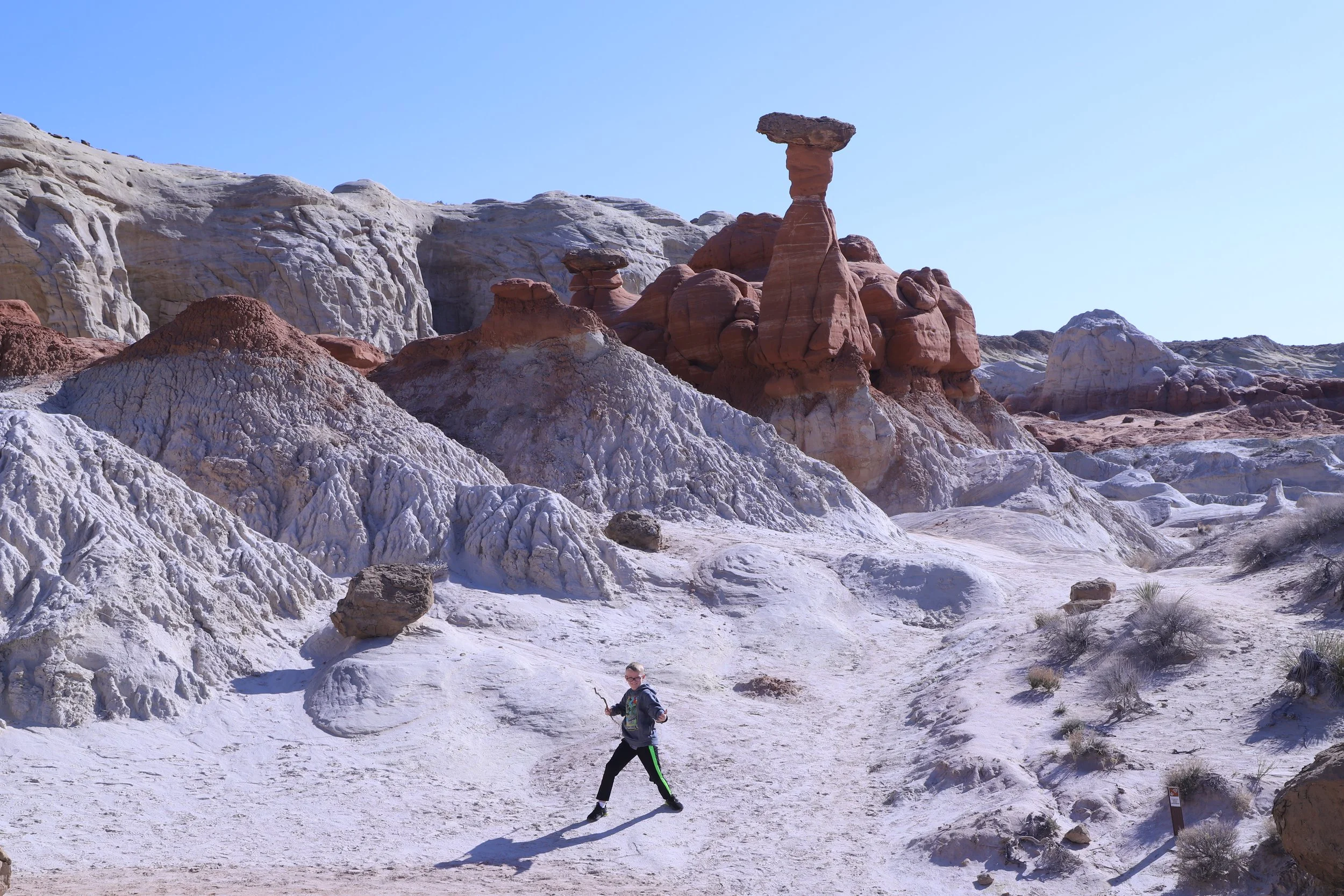
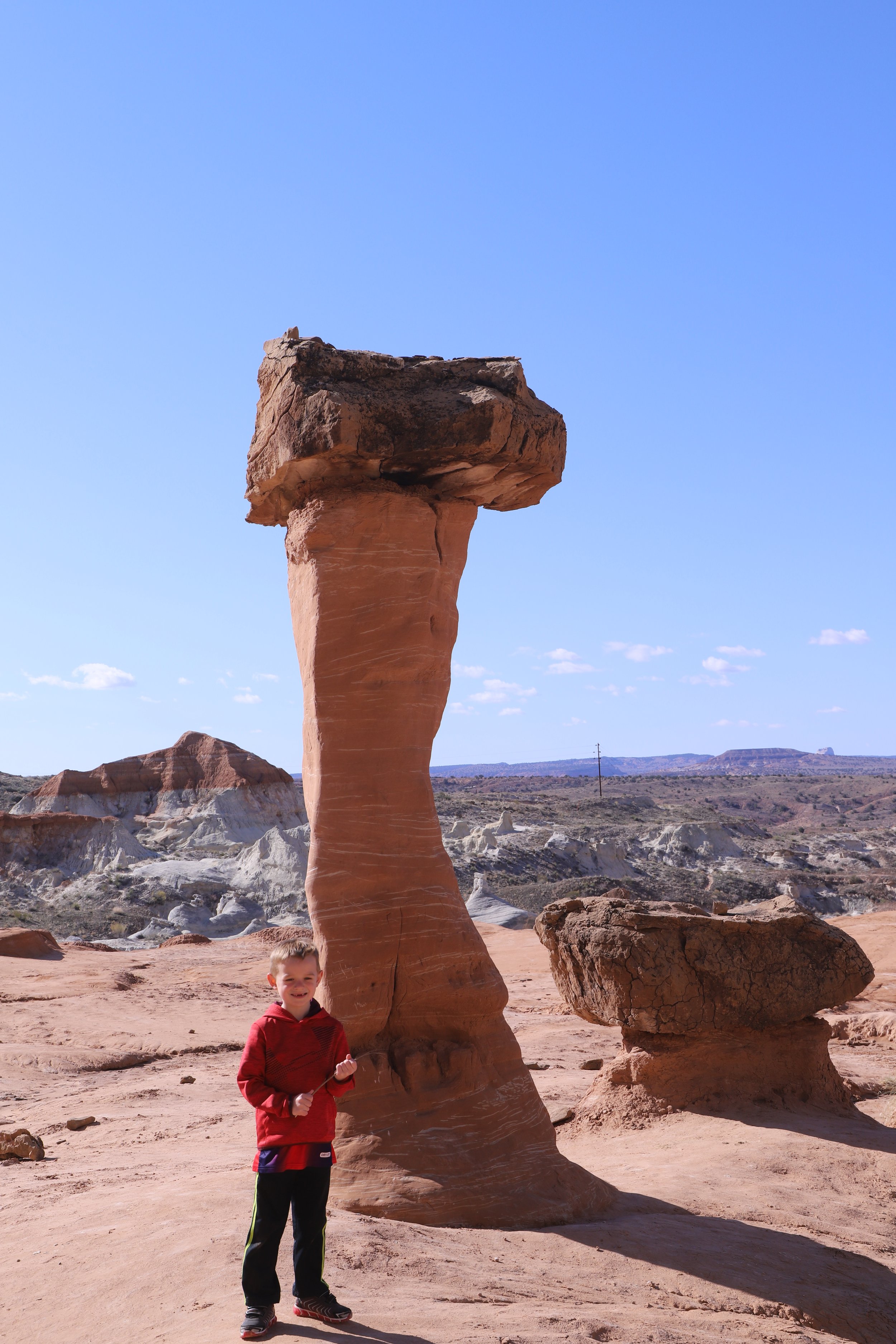
Toadstool Hoodoos
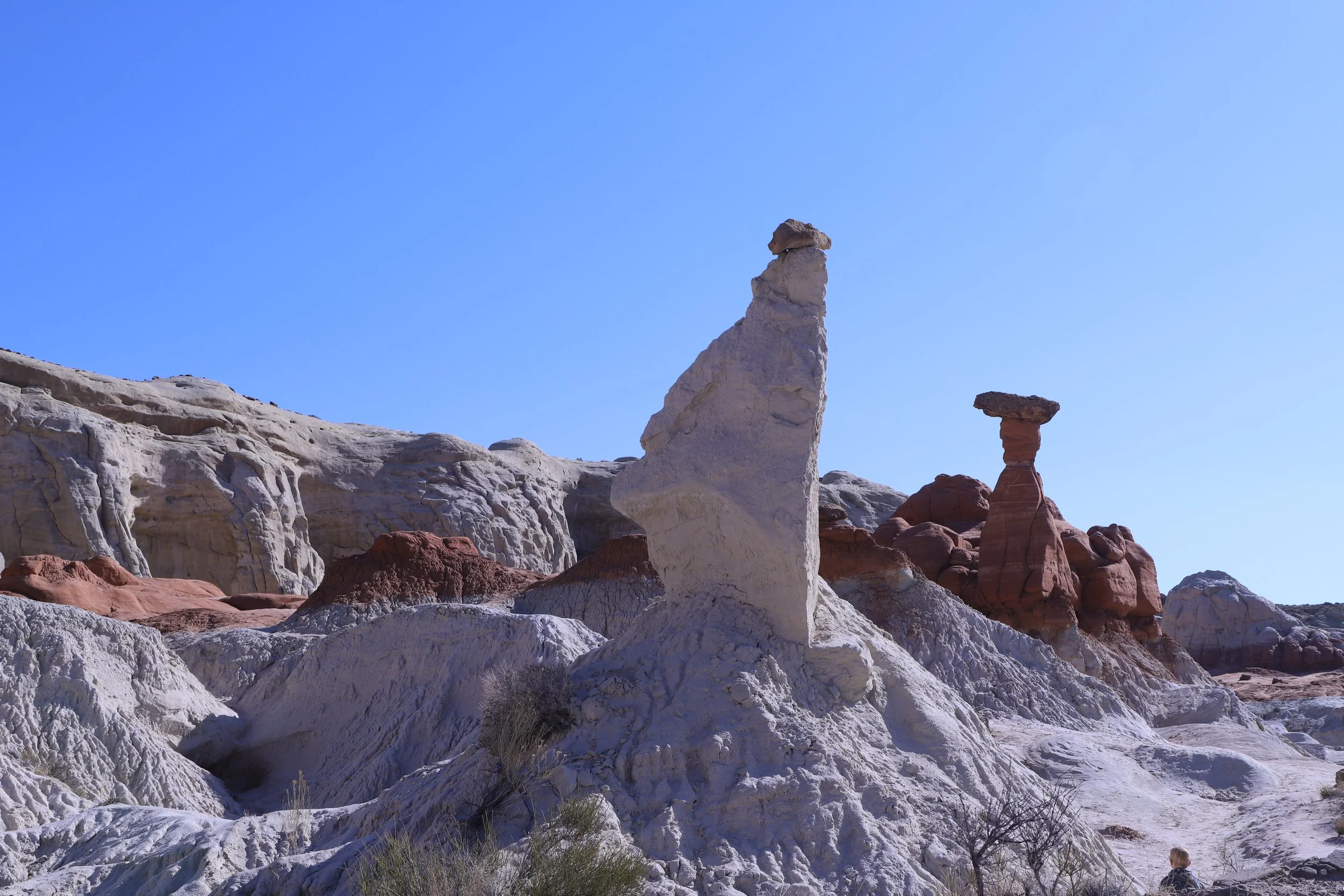
These rocks don’t all look real. Some seemed like they were placed somehow on top of other rocks. I absolutely love hoodoos! They are so mystical.
Toadstool hoodoos
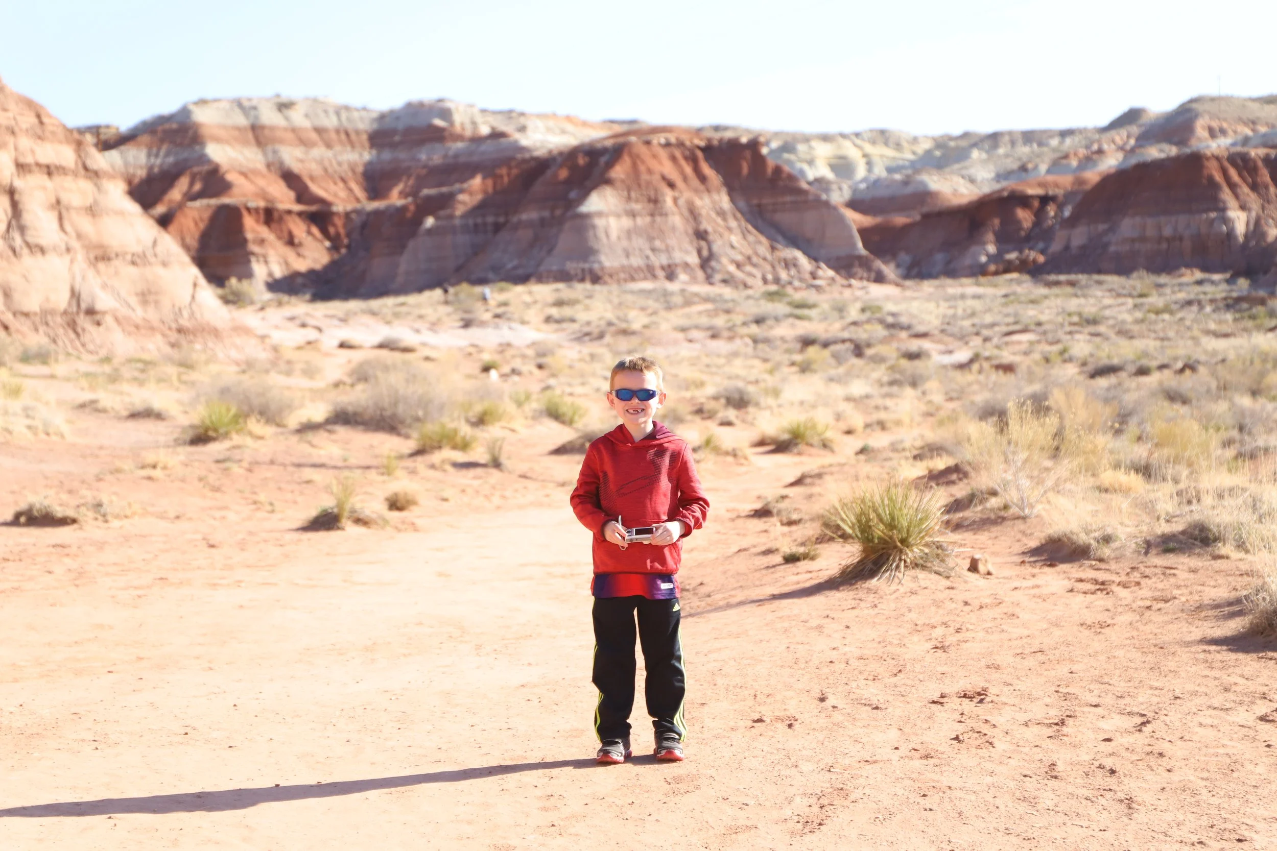
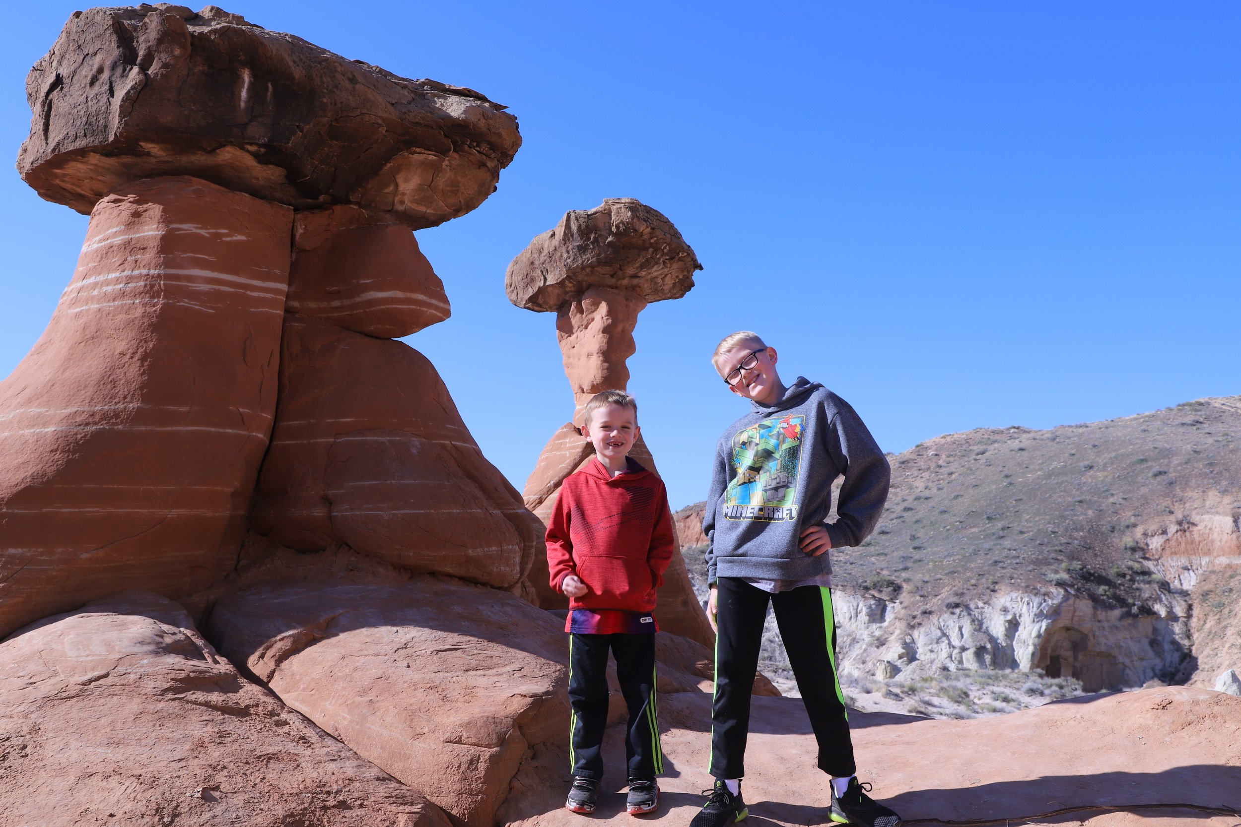
I’ll be honest, sometimes I include pictures and stories in my blogs for me, so I remember them. This was my first trip alone with my boys. My husband had a different spring break, so my choices were taking a week off and spending it at home with my boys or taking the week off and traveling as the solo adult. I had so much fun (on this trip and others in future years). They made me laugh constantly. The stories, the silliness, the games - traveling alone with your kids isn’t as hard as you think it might be.
Braving a hike to conquer the Toadstool Hoodoos
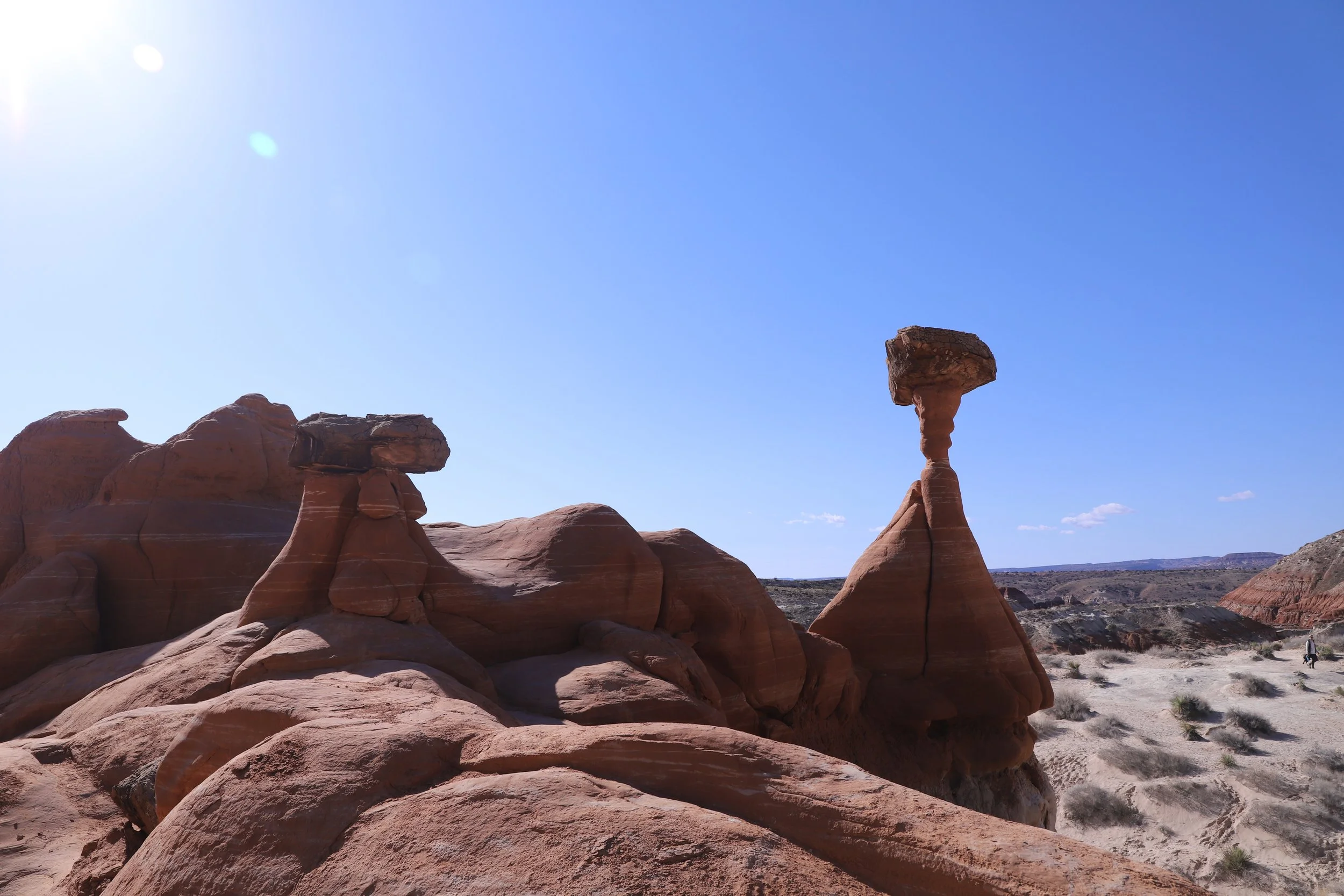
I do not understand how this hoodoo formed…. In theory I do, but looking at it, I really don’t get why this rock hasn’t fallen over. Incredible?
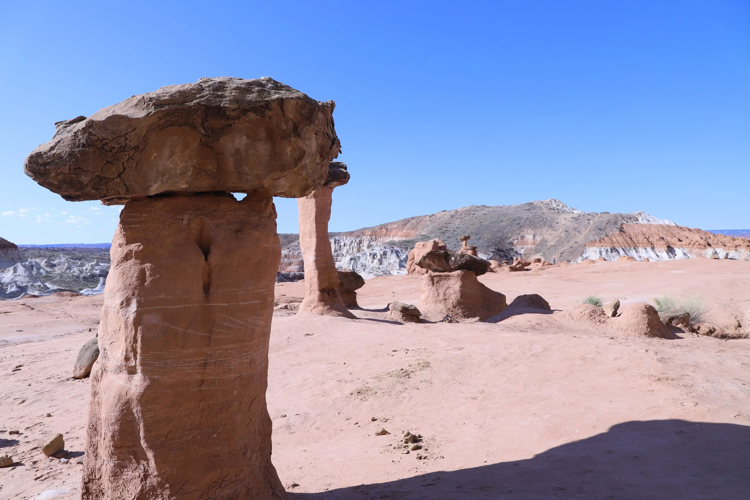
Toadstool Hoodoos
These are the rocks that kind of looked like they were placed on top of other rocks. This place was so weird…
Standing in front of the Toadstool Hoodoos
Mini-hoodoos
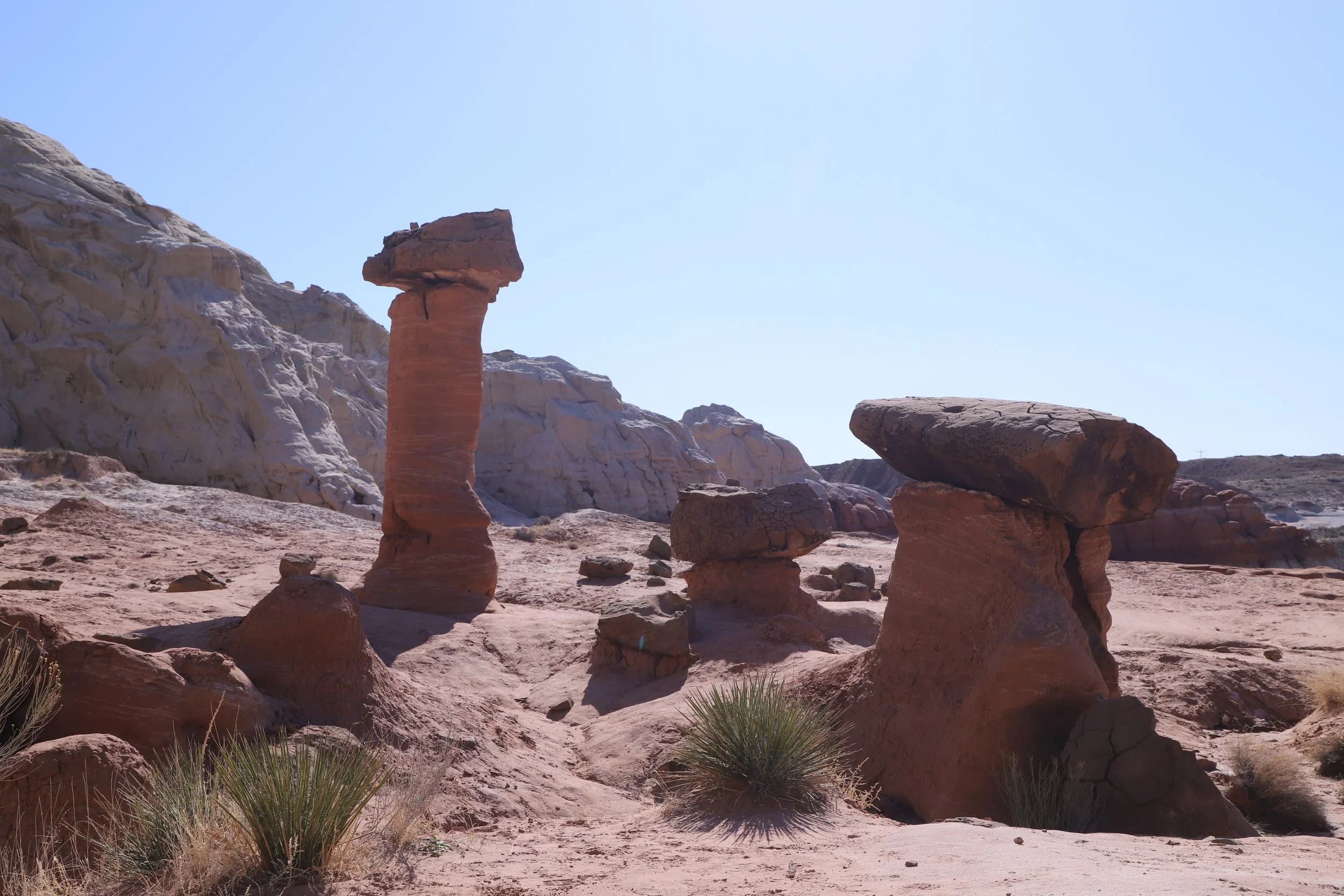
It’s not just one rock formation. Googling “Toadstool Hoodoos” only shows a handful of formations. There are so many though. Where the trail ends, you can (and should) explore in two directions. There are several rock formations to explore.
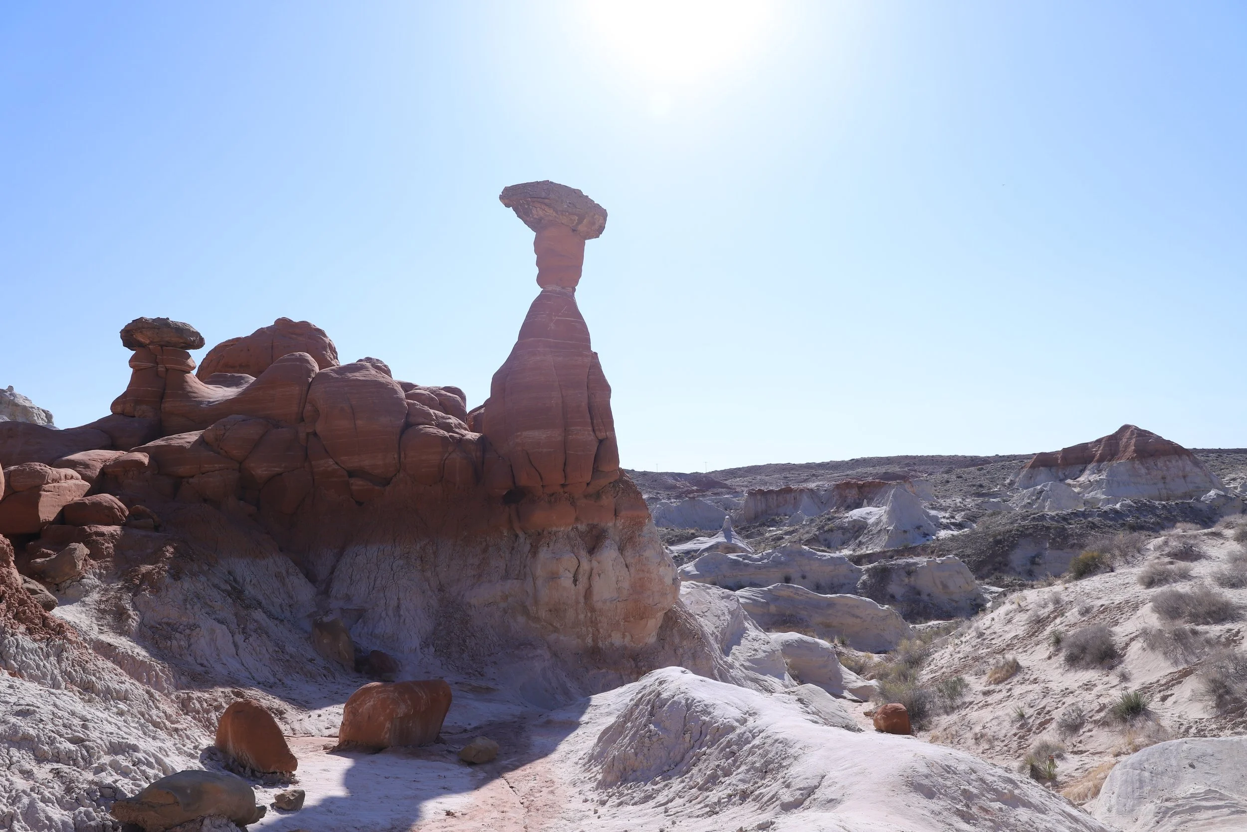
This hoodoo below is huge, and I love the colored bands on it, in addition to its weird shape.
Exploring the Toadstool Hoodoos of Grand Staircase-Escalante National Monument
For anyone planning a trip to “Grand Staircase-Escalante National Monument” - this National Monument is almost 1.9 million acres (twice the size of Rhode Island). If you are searching for easy hikes within this National Monument, the Toadstool Hoodoos will show up on a list. There aren’t roads through this protected wilderness. Willis Creek, Devil’s Garden, and Lower Calf Creek Falls, will also show up in this list. It’s a 2-hour drive to Willis Creek, 3-and-a-half hours to Devils Garden, and 3-hours-and-15-minutes to Lower Calf Creek Falls. Willis Creek is closer to Bryce National Park, and both Devil’s Garden and Lower Calf Creek Falls are closer to Escalante, Utah. If you are inspired by the photos in this blog, spend some time with a map to understand where everything is at. The Toadstool Hoodoos are close to Page, AZ.
Toadstool Hoodoos
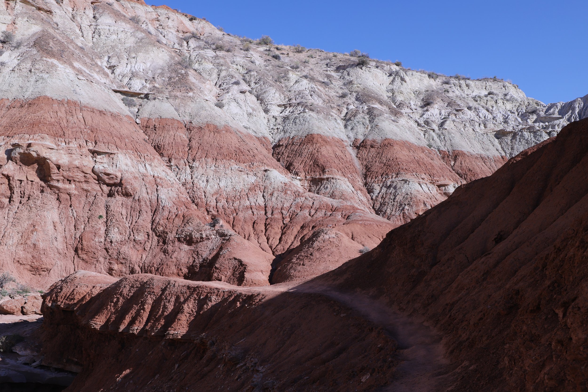
The mountains in the background are just as cool as the hoodoo… Look how the rock shifts from almost white to deep red.
Toadstool Hoodoos
Below are a couple of landscape shots to give more of a feeling to the section of land surrounding the hoodoos - desolate, but incredible…. How many times have I used the word “incredible”?
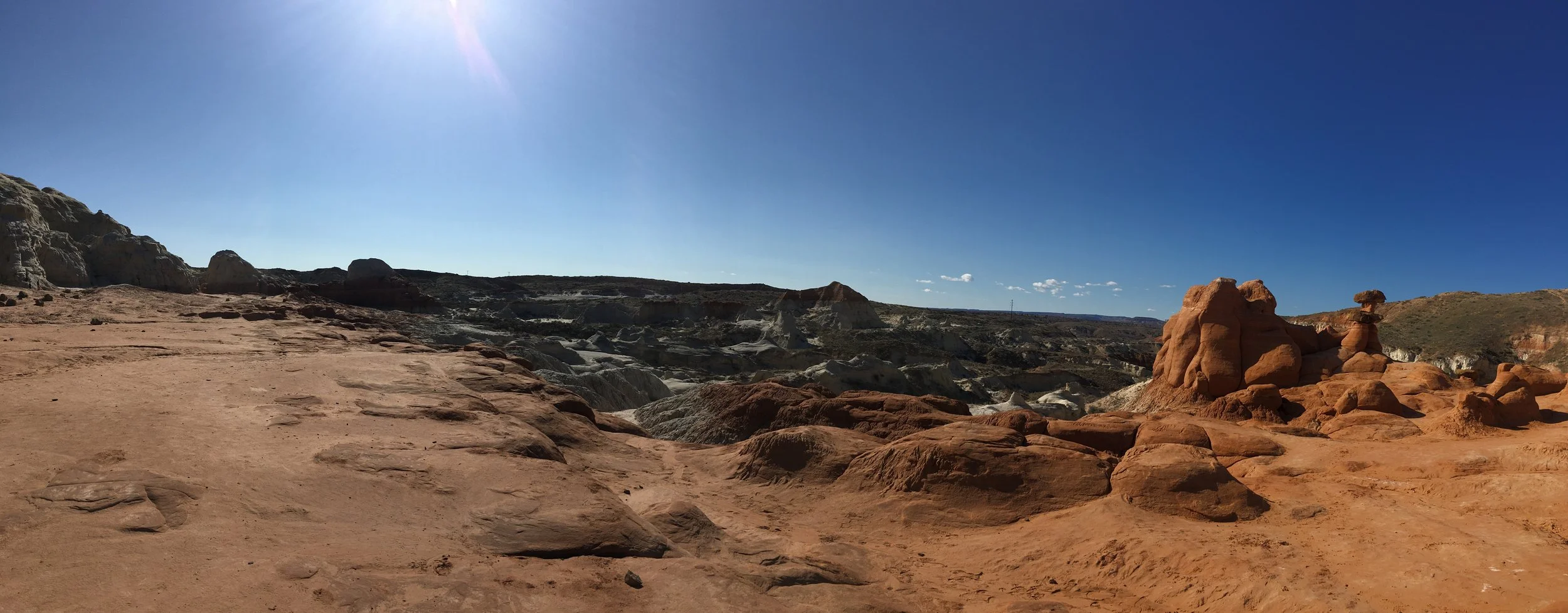
Toadstool Hoodoos - looking back towards the trailhead
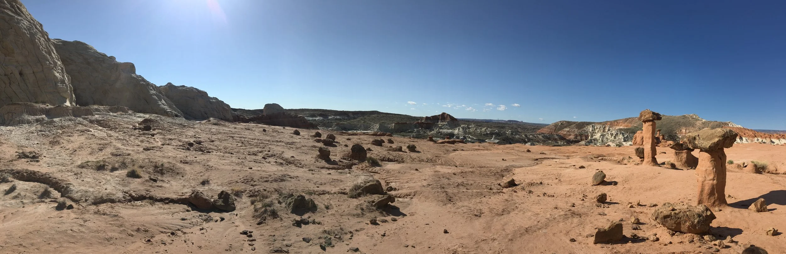
Another landscape photo from the Toadstool Hoodoos - Looking back towards the trailhead.
Nearby Things to Do
Other things to do within an hour from the Toadstool Hoodoos Trailhead:
Buckskin Gulch Slot Canyon
(30 minutes) Buckskin Gulch can be accessed via a 1.7 mile hike along Wire Pass (one-way). Enjoy an out-and-back hike, a long thru-hike between Wire Pass and White House, or a multi-day backpacking trip. Permits should be pre-purchased for day hikes (the day of) and several months in advance for overnight reservations.
White Pocket
(almost 2 hours) I know I said within an hour… But White Pocket is accessed via the same road as Buckskin Gulch, it just also requires a further 4x4 road, which adds more time to get there. In addition to needing a 4x4 vehicle, it requires knowing how to drive through deep sand. We just hired a tour guide instead and used Paria Outpost & Outfitters. They are located 3 minutes from the Toadstool Hoodoo trailhead.
Horseshoe Bend
(35 minutes east) This is a short (1.5 mile) hike to an amazing view of the Colorado River.
Antelope Canyon
(40 minutes east) Antelope Canyon is still the best slot canyon I’ve ever entered. Although it can only be accessed through a tour (fee required), I would highly recommend stopping here.
Moqui Caverns (Kanab Sand Caves)
(45 minutes west) Moqui Caverns is a small man-made cave that can be explored with a short hike. Note that there is a steep scramble that’s needed to get up to the caverns.
Peekaboo Canyon (Kanab)
(45 minutes west to the off-road vehicle entrance) Peekaboo is a short beautiful slot canyon near Kanab (not to be confused with the Peekaboo Slot Canyon in Escalante). This canyon requires an off-road vehicle to get to the trailhead.
Belly of the Dragon
(60 minutes west) This is a cool place to stop for hikers of all ages. There’s a little cave that has been formed through the rock under US-89.
Coral Pink Sand Dunes
(60 minutes west) Coral Pink Sand Dunes State Park is a fun place to explore a sand dune habitat and play in the sand. Walk up a dune and have fun running down, sledding down, or rolling down. Repeat over and over.
Zion National Park
(75 minutes west to the east park entrance) Zion has something for all hiker abilities and adventure-levels.