

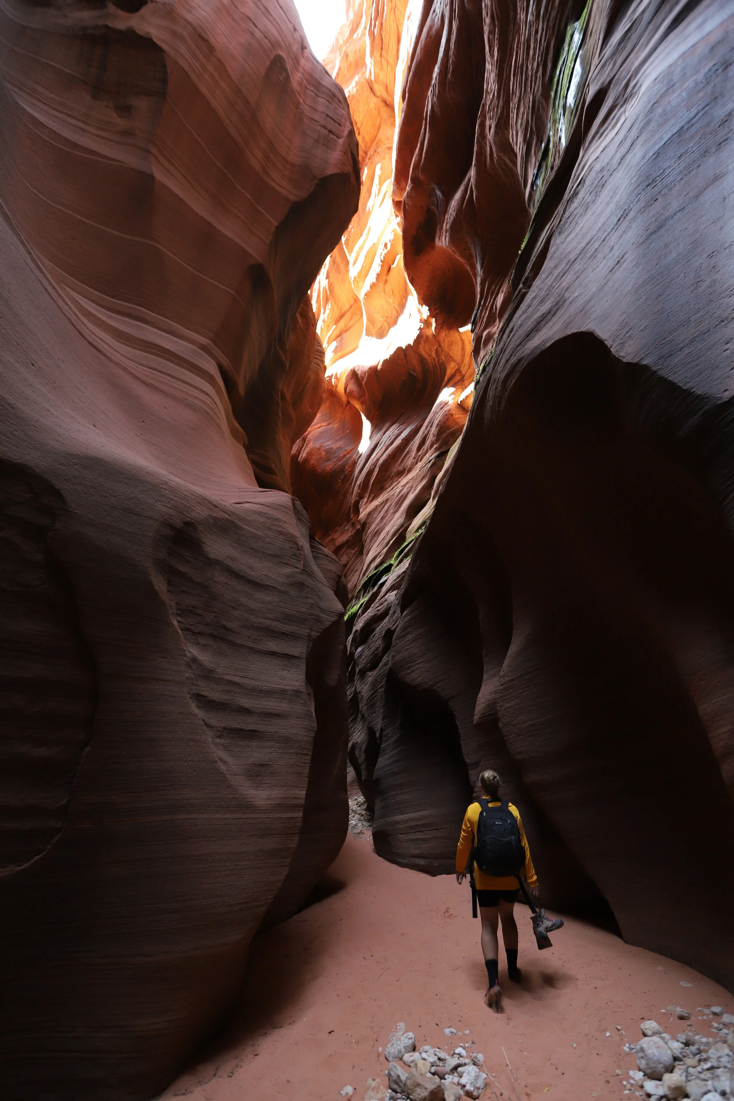
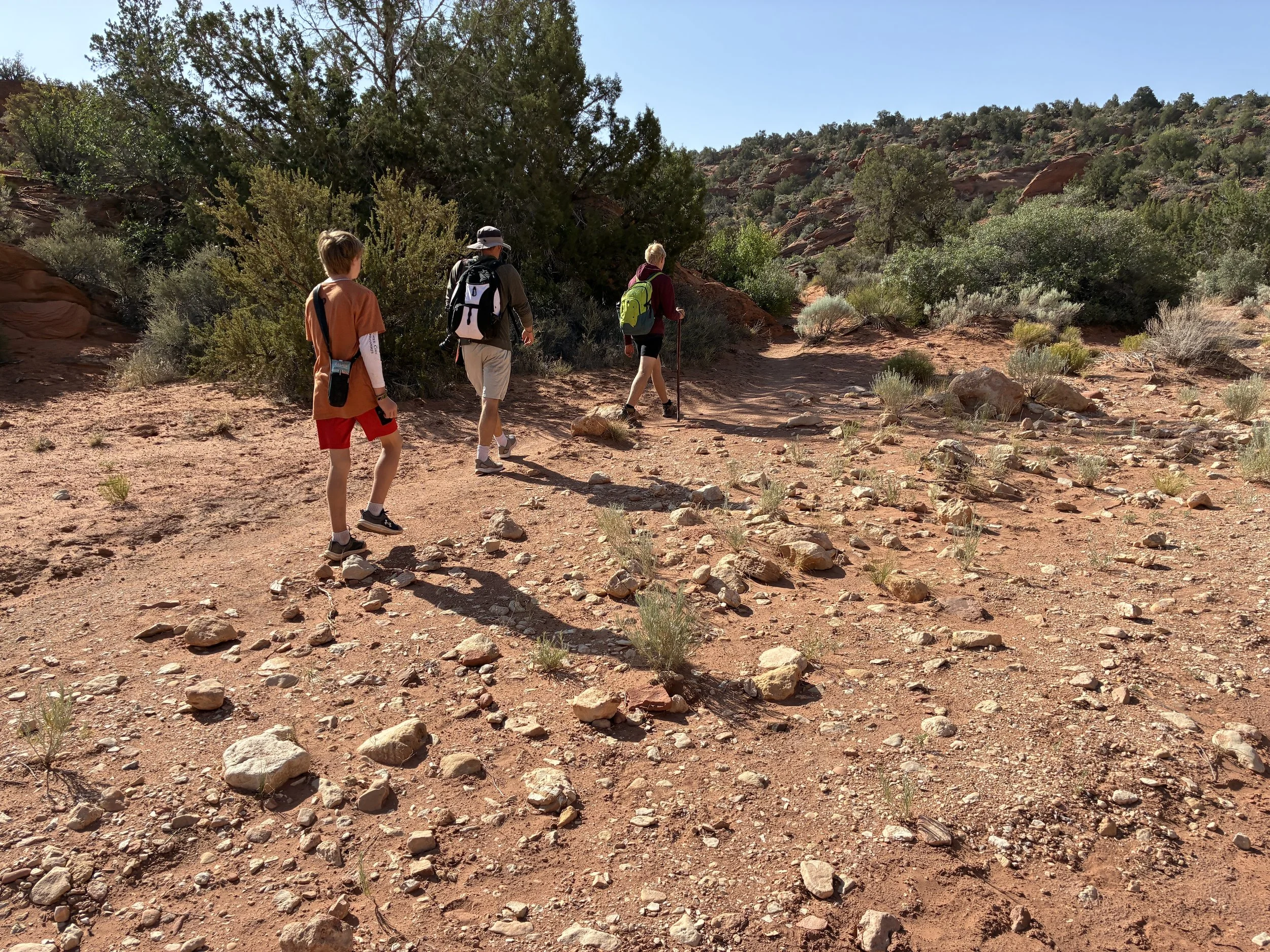
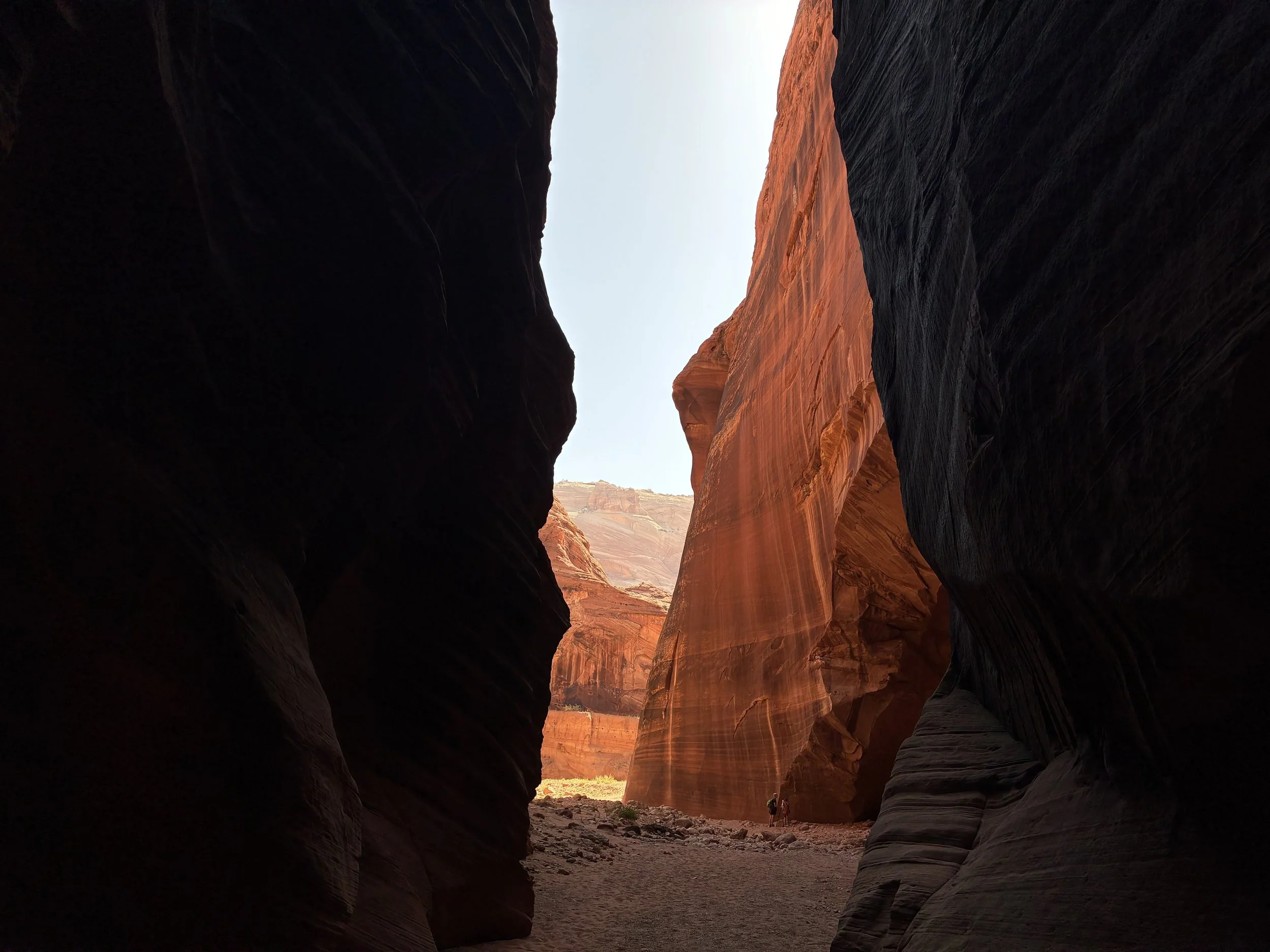
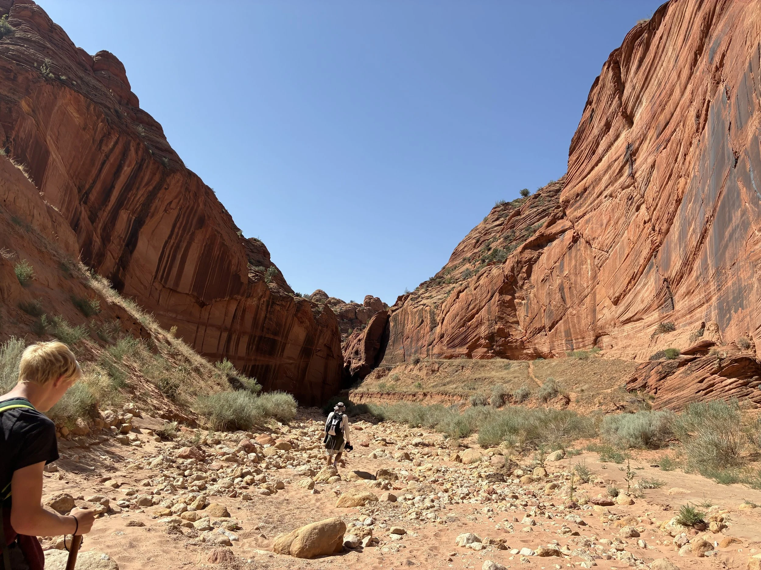
Hiking through Buckskin Gulch Slot Canyon
If you enjoy my blog, please consider signing up below for email notifications of my latest posts. I will not share your email.

Longest Known Slot Canyon in the World
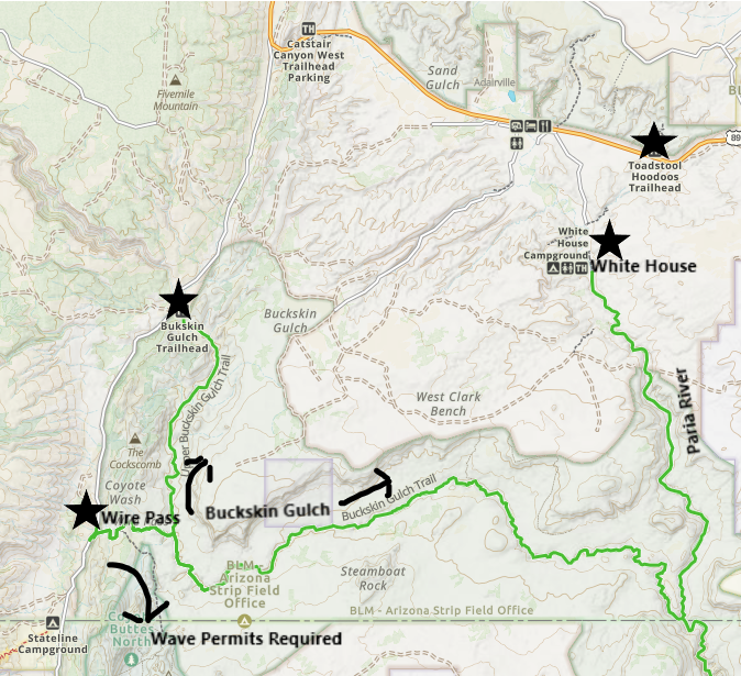
Approximately 16 miles long, Buckskin Gulch is currently the longest known, hikeable slot canyon in the world. There are two primary entry points - Buckskin Gulch Trailhead and Wire Pass. For anyone backpacking, there are two additional exit points at White House and Lee’s Ferry.
The trailheads are located about an hour away from both Kanab, Utah and Page, Arizona. The slot canyon crosses the border between the two states. Buckskin Gulch can be a shorter out-and-back day hike, a long 20-mile thru hike from Wire Pass to White House with the use of two cars or a shuttle service, or a multi-day 46-mile backpacking adventure from Buckskin Gulch Trailhead to Lee’s Ferry. (Note that I’ve linked vacation guides that I’ve written for both Kanab and Page.)
Exploring Buckskin Gulch
Buckskin Gulch Trailhead Locations
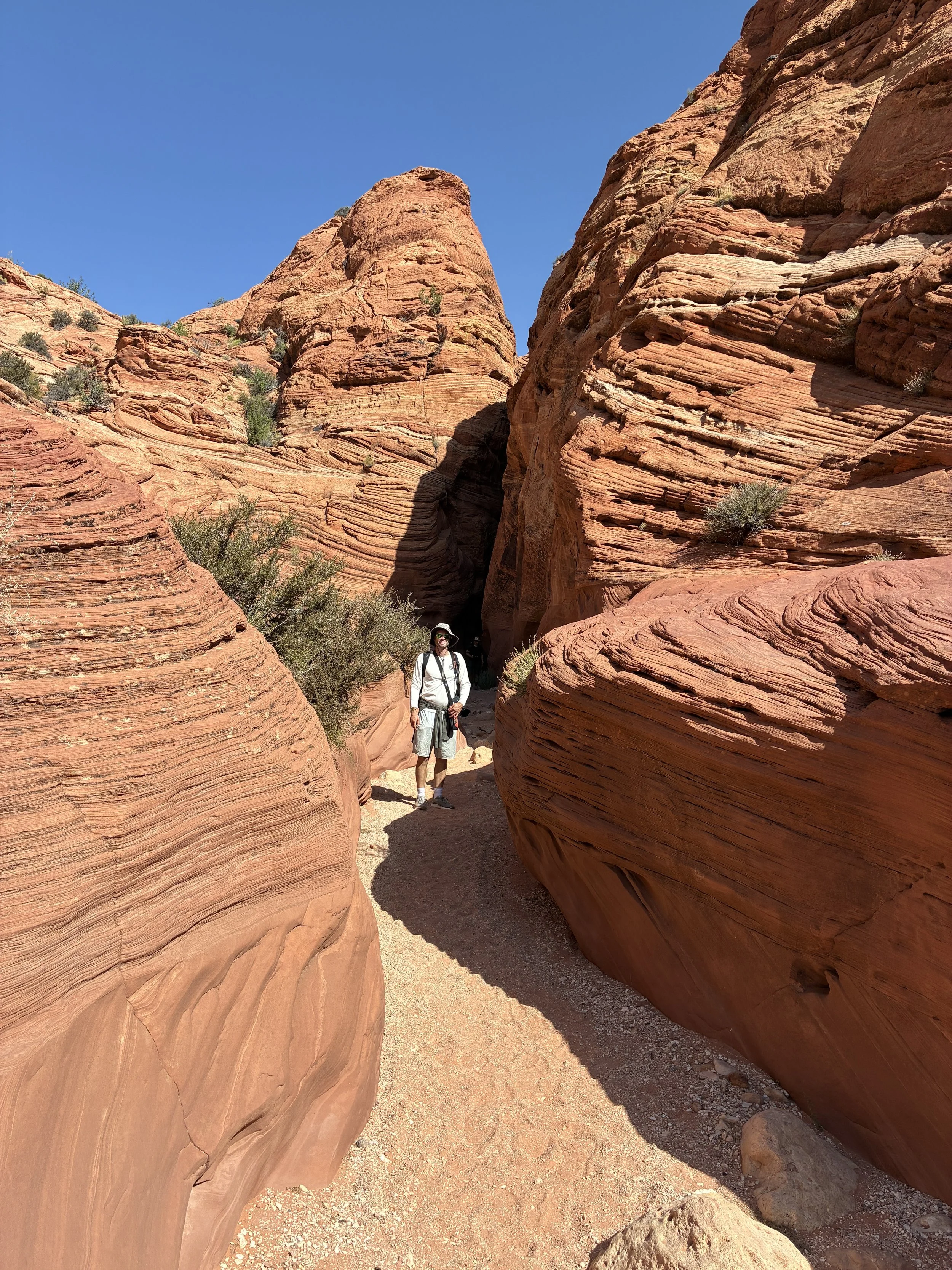
Wire Pass is the most popular trailhead. A 1.7-mile hike (mostly through an open desert landscape until the last few minutes which enter a series short slot canyons) leads to a T-intersection within Buckskin Gulch. At the intersection, there are petroglyphs. We went to the right (towards Paria) as we entered Buckskin Gulch. There’s likely going to be water in this part of the canyon pretty quickly. We explored a short distance down the left as well on our way back. It seemed to be drier in that section.
The Buckskin Gulch Trailhead is the other entry option. It’s a 4.8 mile-hike from this trailhead to the intersection where Wire Pass joins Buckskin. We haven’t hiked this section of the canyon yet, so I’m not exactly sure why the Wire Pass Trailhead is more popular. My guess is that the dramatic slot canyon section of the trail is a longer walk than the 1.7-mile hike from Wire Pass.
A note on the road to the trailheads - To get to Buckskin Gulch (either trailhead), you will exit US-89 onto The Cockscomb (which later turns into House Rock Valley Road). I’ve been on this road twice. In June 2025, it had been dry for quite some time, and we were easily able to drive to the Wire Pass Trailhead in our minivan without even thinking about the dirt road. But in March 2023, the same road was washed out, muddy, sometimes it didn’t feel like there was a road present. Cars couldn’t even get to the Buckskin Gulch Trailhead. The short road to the parking lot was so bad, they were just parked off on the side in the desert. In March 2023, I had hired a driver (from Paria Outpost & Outfitters) to take us out to White Pocket. This was such a smart idea - there was zero way I would have known how to drive along this road without getting stuck. The driver told us each year the road has to be re-graded after winter. We were there before the BLM had a chance to service the road.

The main trailheads are Buckskin Gulch Trailhead and Wire Pass. White House is the exit point for the shortest thru hike. Use two cars or a shuttle. Lee’s Ferry is the exit point for the longest option through the canyon.
Other things to do nearby are: Toadstool Hoodoos, White Pocket (consider hiring a driver), the Wave (if you are lucky enough to win a permit), Antelope Canyon (requires a purchased tour), and Horseshoe Bend. Kanab is a similar distance away to the west, and has several other places to explore (see my vacation planning guide to Zion National Park, which includes places to hike beyond the National Park).
Logistics
When planning a trip to Buckskin Gulch, the first thing to decide is: day hike or multi-day hike. All hikers need a permit to hike in the Buckskin Gulch canyon. Even though the canyon is in the Grand Staircase Escalante National Monument, this park is managed by the Bureau of Land Management (BLM), which operates through permits outside of the America the Beautiful pass. As of 2025, the day-use pass is $6 per person and per dog. The money goes right back to take care of re-grading the road that you need to get to the trailheads, which is worth the small fee. The day use passes are unlimited, so you don’t need to worry about pre-purchasing them days in advance. You likely won’t have internet service though out at the trailhead, so just make sure to purchase them before you leave your hotel in the morning. Day use permits can be purchased from Recreation.gov.
Overnight permits, for multi-day hikes, are limited, and sell out months in advance. Pre-purchase the overnight permits from Recreation.gov. These permits need to be picked up in person within 10 days of your trip. If you are hiring a shuttle / driver to complete a thru-hike, check to see if they can pick the permits up for you. Some places offer this as an option.
Separate permits (extremely difficult to win) are needed to enter Coyote Buttes North (the Wave). If you hike in from Wire Pass, you will pass the trail intersection for the Wave. There is a large fine if you are found on this trail without a permit, and there will be rangers out there looking for you. This intersection is clearly marked. Just stay on the trail to Buckskin.
There are several options for shuttles for thru hikes. Google “Buckskin Gulch shuttle.” They will meet you early in the morning at your planned exit location and drive you and your hiking group and gear to your entry location. We were exploring a thru hike as an option for a day hike between Wire Pass and White House and talked with a couple of people regarding shuttles. We ended up deciding to do an out-and-back instead, worried a bit about getting stuck in the sun on a hot summer day, as the last 7 miles to White House are extremely exposed.
Trails are minimally marked on BLM land, so pre-downloading a GPS map beforehand is really helpful. Don’t expect to have an internet signal at the trailhead. Kanab and Page are the closest cities, each are an hour away, and both have less than 10,000 people. This canyon is literally in the middle of nowhere. Plus, inside a deep canyon, you wouldn’t get reception even if it were closer to a large city. I use GAIA for my map service. It’s a little pricy, but I hike a lot, making it more than worth it. AllTrails is another option.
Not sure what to pack? This is a slot canyon, so rescue operations are extremely difficult. Assume that any emergency situation that might occur is going to need to be dealt with by you or the other hikers in your group. Bring more water than you think you could possibly drink. You won’t want to filter any of the stagnant water in the main part of the canyon. You will need to make it all the way to Paria River before filtering water is an option. I’m going to let you look that up what a wag bag is on your own. These are going to be required. Nothing gets left behind in the canyon. Lastly, it’s likely you will encounter water within the canyon. This could be the point you turn around. But for thru hikers, have a plan to get wet - and the water is cold! We used water shoes and neoprene socks and frequently switched between these and our hiking boots. Our clothes dried out in-between each water crossing.
Buckskin Gulch Map for day-hikers. A thru-hike between Wire Pass and White House is > 20 miles, and the last 7 miles are exposed to the sun, which could pose health risks for hikes in the summer.
The last and most important logistic for hiking into the longest slot canyon in the world is the weather. A 16-mile-long slot canyon has a huge watershed. Any rain, in any part of that watershed, is going to run into the slot canyon, with the potential to create flash floods unexpectedly in moments. In this super long slot canyon, there aren’t many exit points to out-run a flashflood. Do not go into Buckskin Gulch if it has recently rained, or if there is a chance of rain while you are hiking.
Tree lodged up inside Buckskin Gulch due to a flashflood
My first attempt at hiking Buckskin Gulch was in March 2023, when I was on a Spring Break trip with my boys. If I have a slot canyon hike planned, I start watching the weather in the area weeks in advance to get an idea of what level of water might be present. What I was seeing in February 2023 was high amounts of snow, all month long. At some point that snow is going to melt, and I was teetering on iffy even before our flight to Las Vegas. The day before our planned hike, I was reading recent reviews from AllTrails, and hikers were saying it was an incredibly muddy drive to the trailhead, with cold, deep water inside the canyon. Those reviews, combined with what I knew for how much snow the area had recently received, were enough for me to change my mind and find another way to spend our day. I don’t think I quite understood how dangerous of a situation that canyon was in though - I more was thinking that I didn’t want us to be cold, miserable, and wet inside the canyon. We spent our extra day hiking instead on the east side of Zion National Park. I was disappointed that Buckskin Gulch remained on my wish list, but we had a fantastic day instead at Zion. Later that same week, two men died in a flash flood inside of Buckskin Gulch and a third was successfully rescued.
In June 2025, we returned to the area, this time after weeks without rain in the area, and despite it being June, the day wasn’t terribly hot either. We had a safe and fabulous time exploring Buckskin Gulch. Plan A often doesn’t work out as planned, at least for me it seems anyway. That’s one of the reasons we keep returning to similar places - to finish a hike we weren’t able to try for whatever reason. Successful trips result from our ability to quickly pivot to other options. The best thing about southern Utah, is that there are lots of great options. Please only enter this canyon when it’s safe to do so. A return trip to Utah isn’t a bad thing.
Wire Pass Trailhead
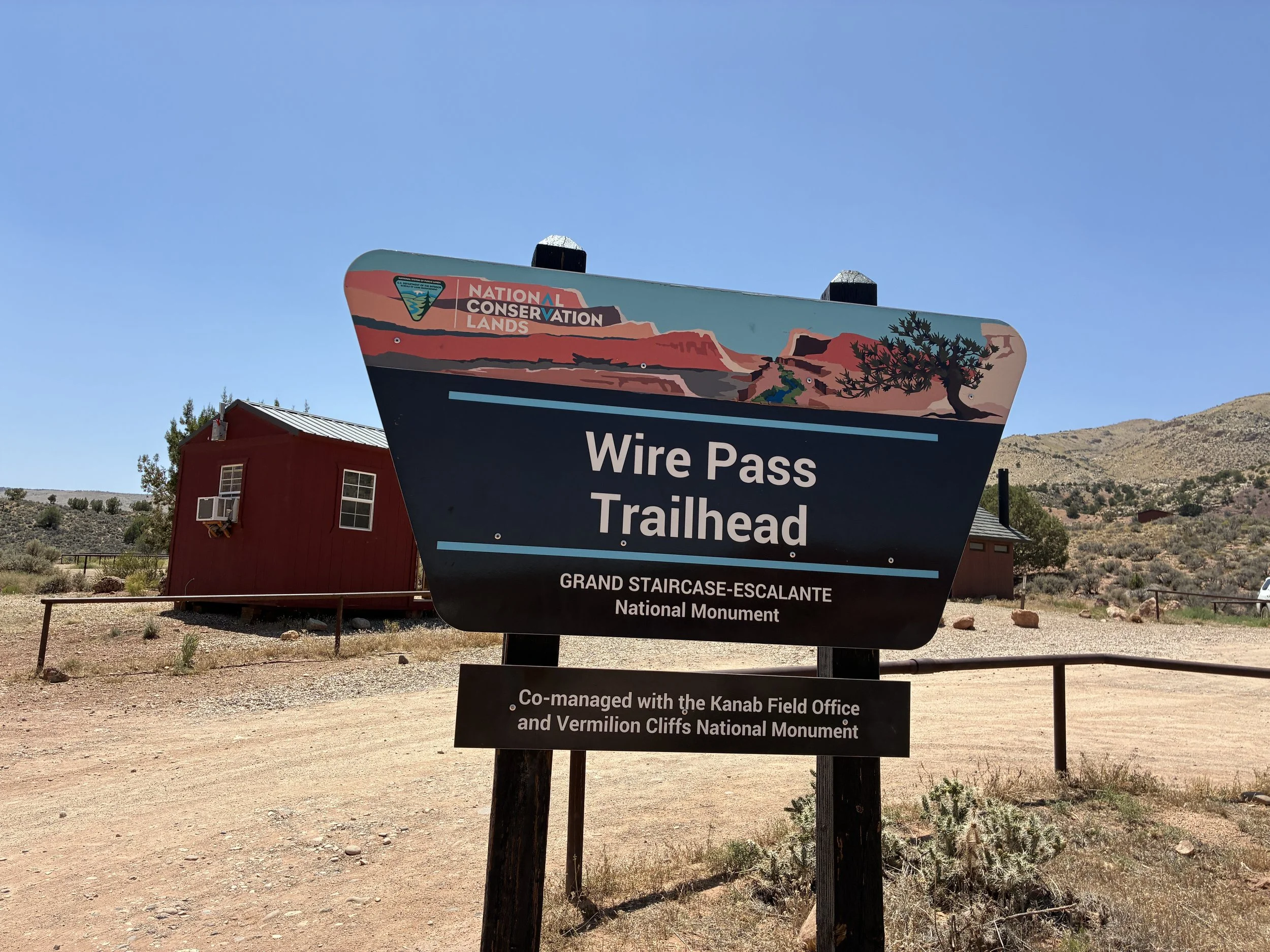
Wire Pass Trailhead sign near the parking lot and vault toilets
Unsure of how hot a day hike would be in June, we arrived at the Wire Pass Trailhead early, knowing that the most of the 1.7-mile hike from the trailhead to Buckskin Gulch would be exposed in the sun. We hiked a little over 5 miles into the canyon and then turned back. When we got back to the Wire Pass intersection, we explored a short distance down the other side of Buckskin before returning to our car. Our hike was a little over 10 miles as a result, and we were in the canyon for just over 5 hours.

June 2025 - our trek into Buckskin Gulch - I’m not sure what “Buckskin Overlook” refers to. This confused other hikers looking for an “overlook.” This hike is inside of the slot canyon, so there isn’t an overlook. The trail stays at the bottom and there isn’t an option to climb out.
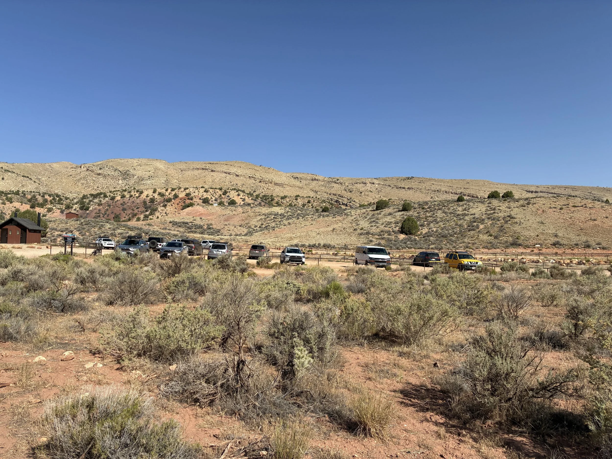
Wire Pass Trailhead parking lot and vault toilets
There was plenty of parking available at the Wire Pass Trailhead. There are also vault toilets. There is no running water. Water bottles need to be pre-filled prior to arriving at the trailhead. There were a couple of park rangers in the parking lot, checking permits and making sure hikers seemed prepared to enter the canyon.
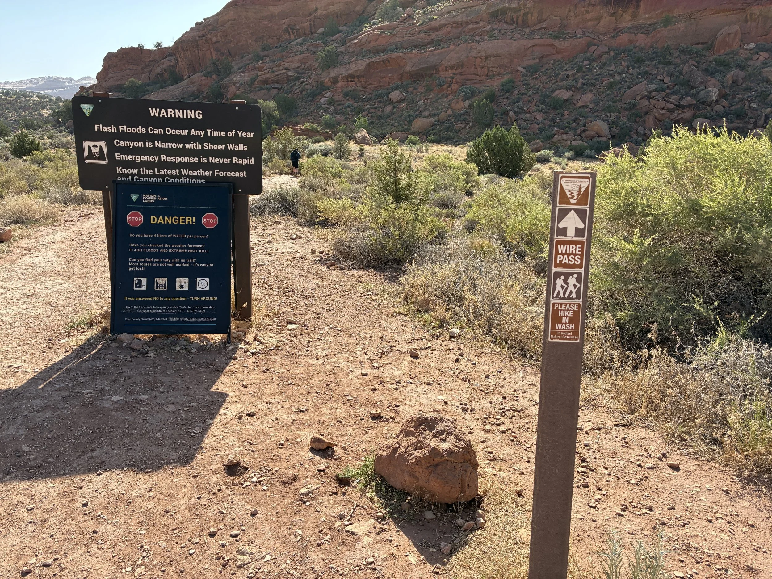
One last sign marking the path and reminding hikers to know the weather before entering.
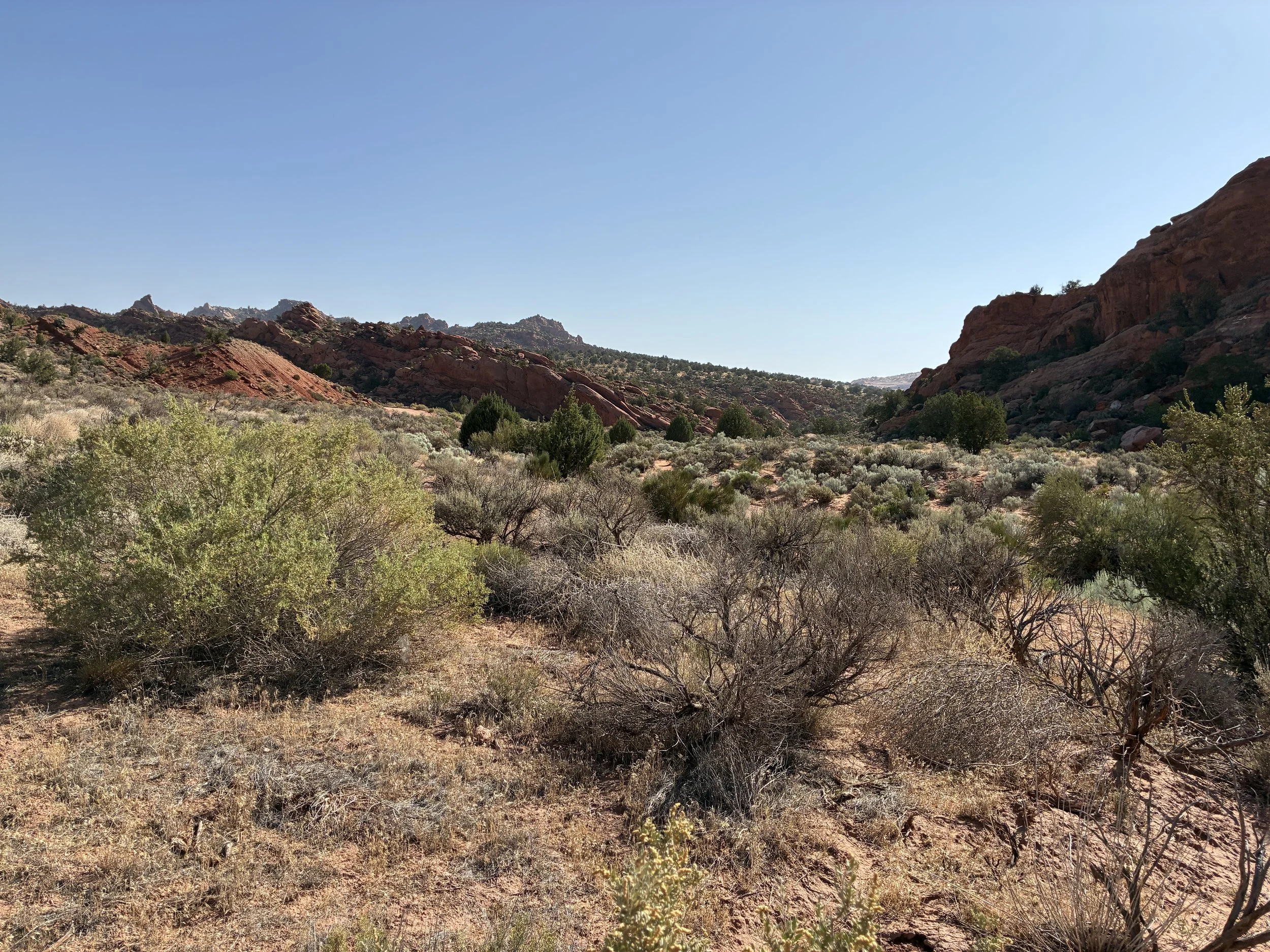
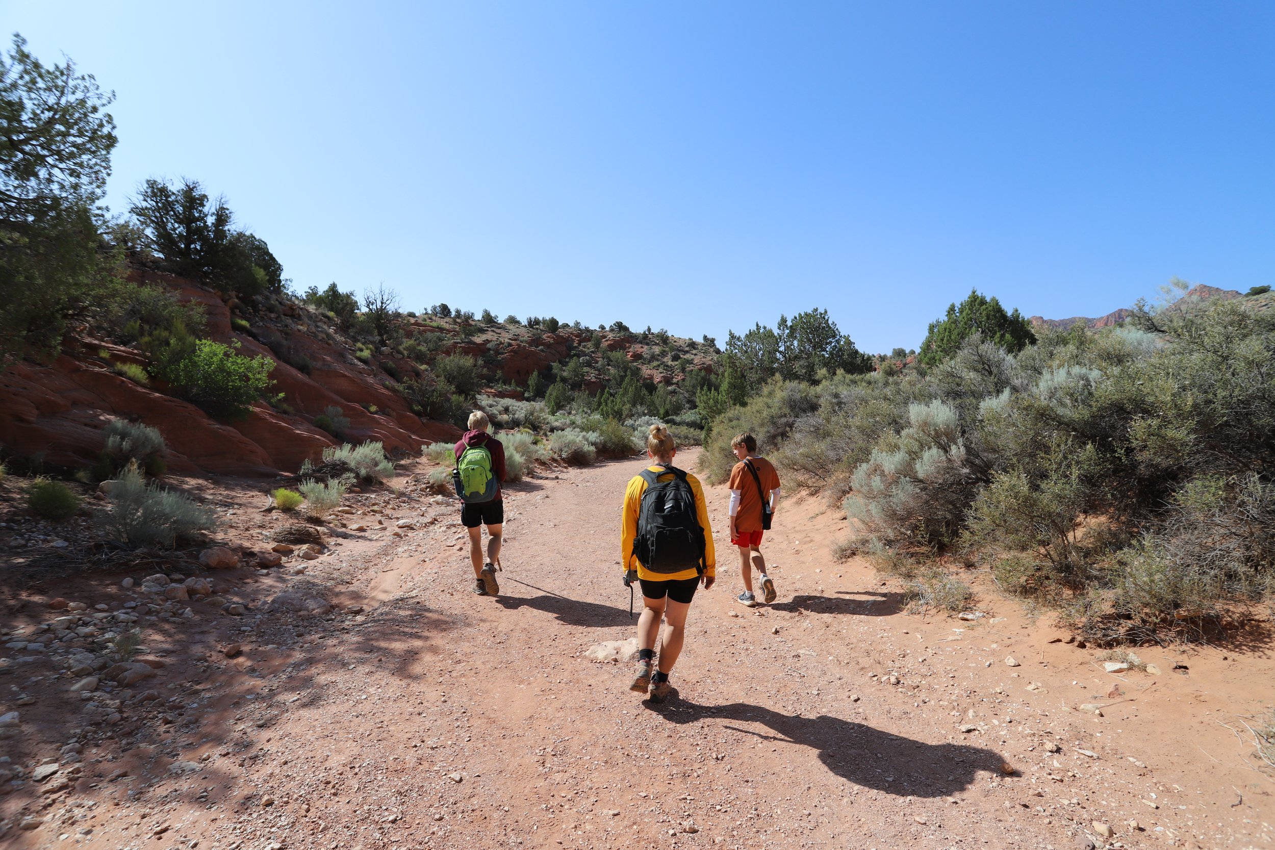
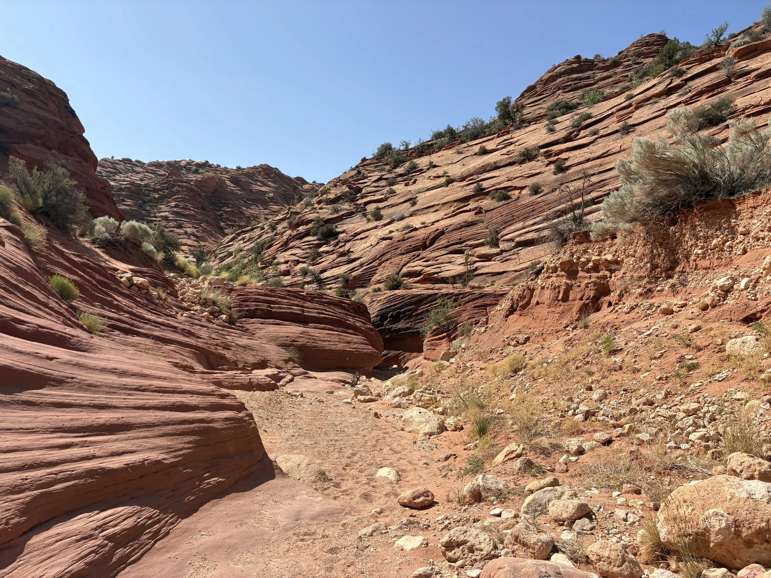
The first 1.4 miles of the trail are exposed to the sun. It’s a pretty walk, but on a hot summer day, this could present danger of overheating without enough water. On BLM land, trails are minimally marked. These trails are meant to be more adventurous, and route finding is part of that. Again, I’d suggest pre-downloading a GPS map. Washes can look very similar to trails. For the most part, this trail was pretty obvious. Much of it follows an old road most of the way to the canyon. There are some smaller trails that go the same way a short distance from the road. The trail gently slopes downward to the start of the canyon.
Hiking Wire Pass to Buckskin Gulch
Beginning part of Wire Pass follows an old road
There is one more trail sign that will be encountered, and that’s at the split to Coyote Butte North (the Wave). Continue to follow the road down to Buckskin Gulch (which won’t be labeled with a sign). You need a special Wave permit to take that trail to Coyote Butte North. Keep following the unmarked path.
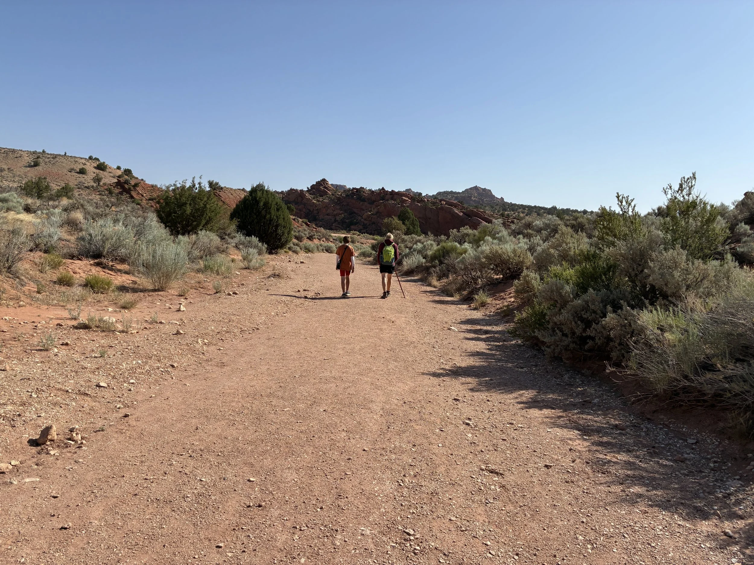
Hiking down Wire Pass to Buckskin Gulch
This is a long section of the trail, there is no shade, and stating the obvious, it gets hot in the desert in the summer. The best time to hike is early in the morning. Bring enough water to be able to hike this section back to your car in the afternoon sun.
Hiking down Wire Pass to Buckskin Gulch
Because the trail isn’t marked, and I had no idea how long the hike would be before reaching the canyon. There were several moments I re-checked my GPS map. It was not obvious looking at the landscape where Buckskin Gulch was. As I mentioned, the route is pretty apparent, but the canyon entrance is pretty hidden. At about this point in the trail, it officially starts to feel like entering a canyon.
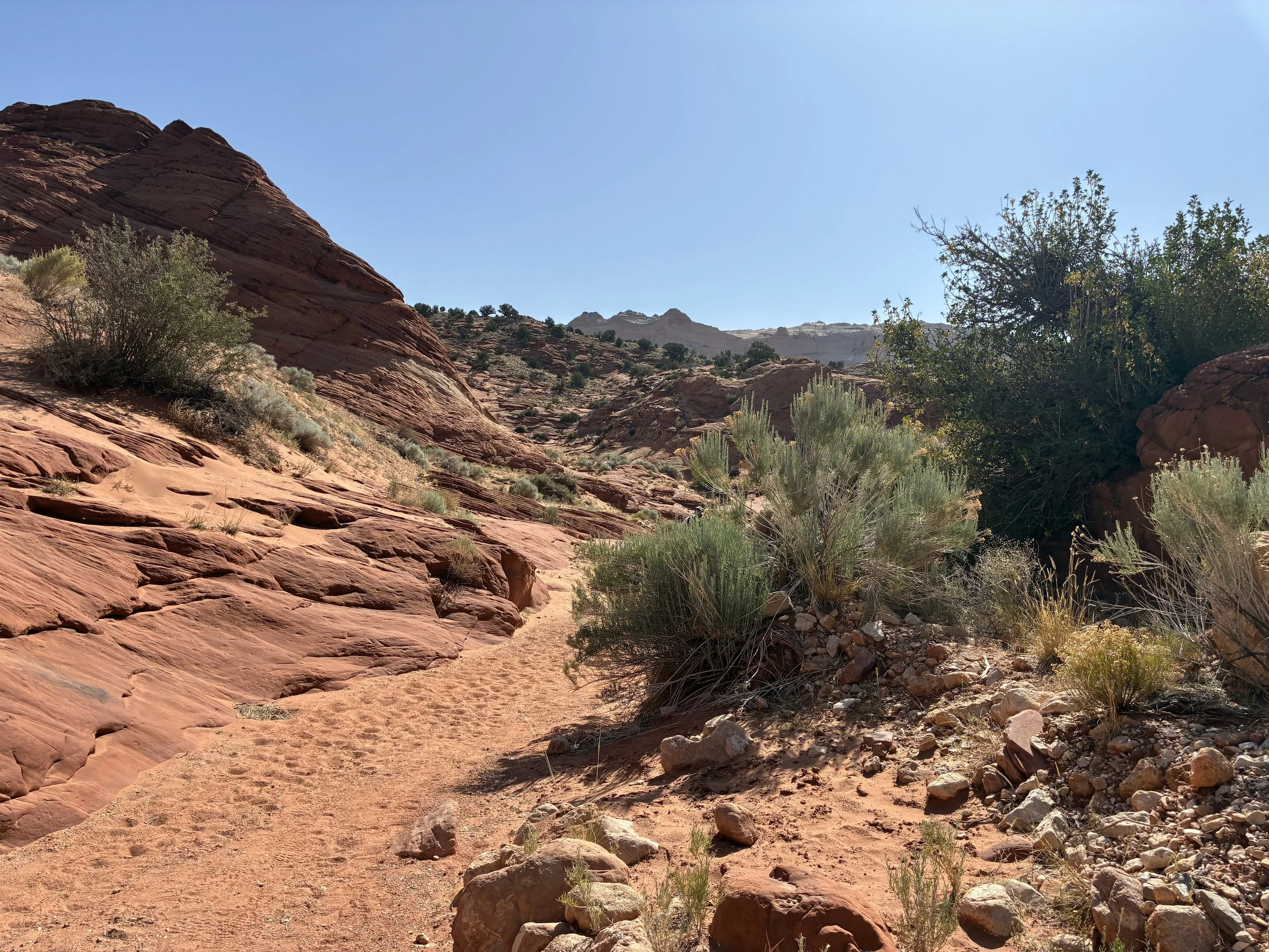
Near the Buckskin Gulch entry point from Wire Pass
The picture below is the entrance into the Wire Pass slot canyon.
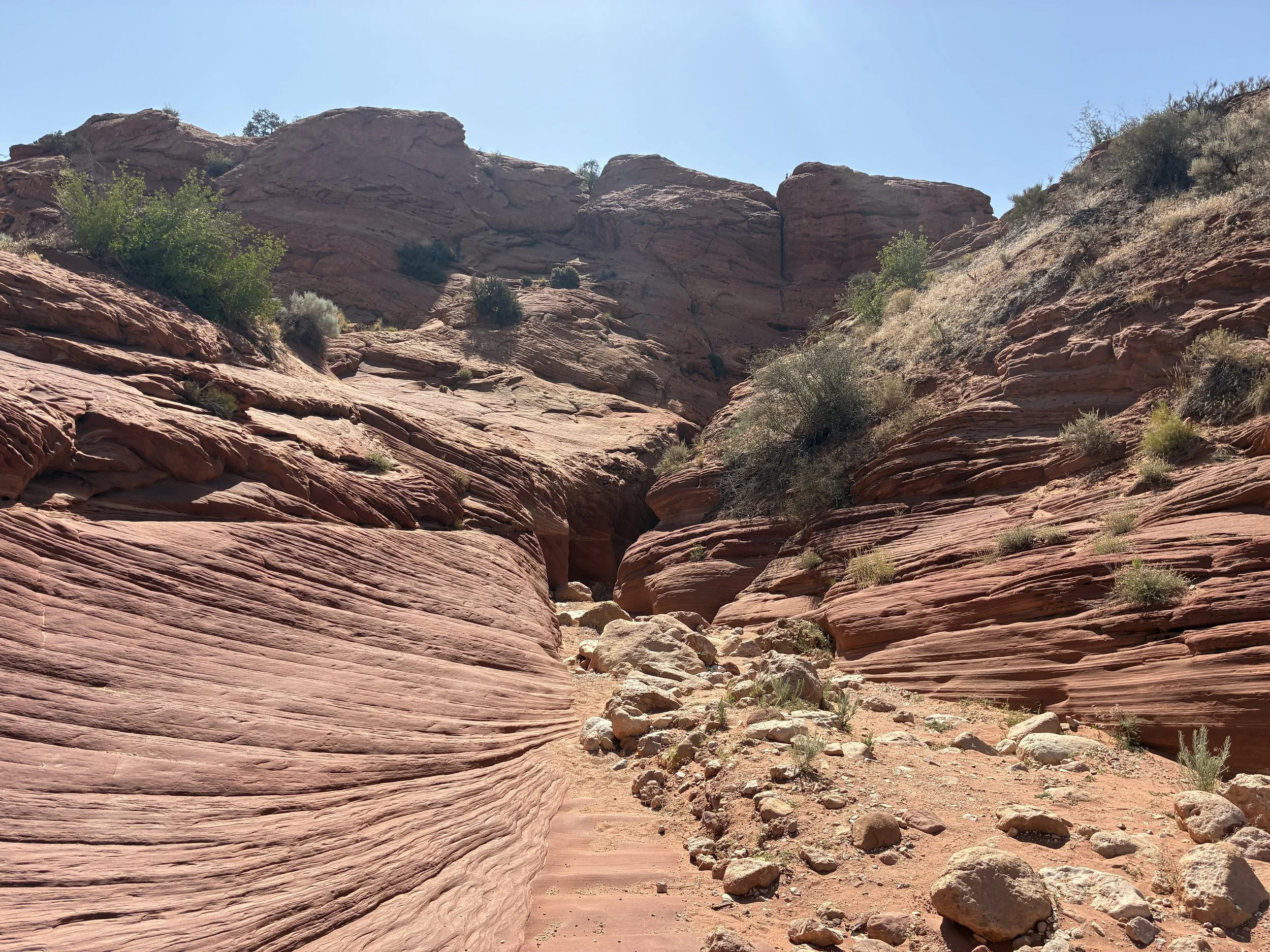
Abruptly, the trail enters into a slot canyon on the Wire Pass trail
It took us about 35 minutes to hike from the trailhead until we reached the beginning of the Wire Pass slot canyon. Our milage at this point was approximately 1.4 miles.
Entering the Wire Pass slot canyon
Slot canyons are so much fun. You never know what the water might have swept into the canyon. And those objects are going to be stuck there forever.
Large tree logs knocked into the canyon during a flashflood
Within the Wire Pass slot canyon, there is one steep drop off. In June 2025, there was a ladder present which made it easy to get down and back up. This hike has been on my wish list for a long time though, and I know from reading trail reviews over the years that time to time this ladder needs to be repaired, and sometimes it has been washed away. When the ladder is not present, you will need to bring rope with you to get over this section. Check AllTrails for recent hiking reviews which will likely comment on if rope is necessary.
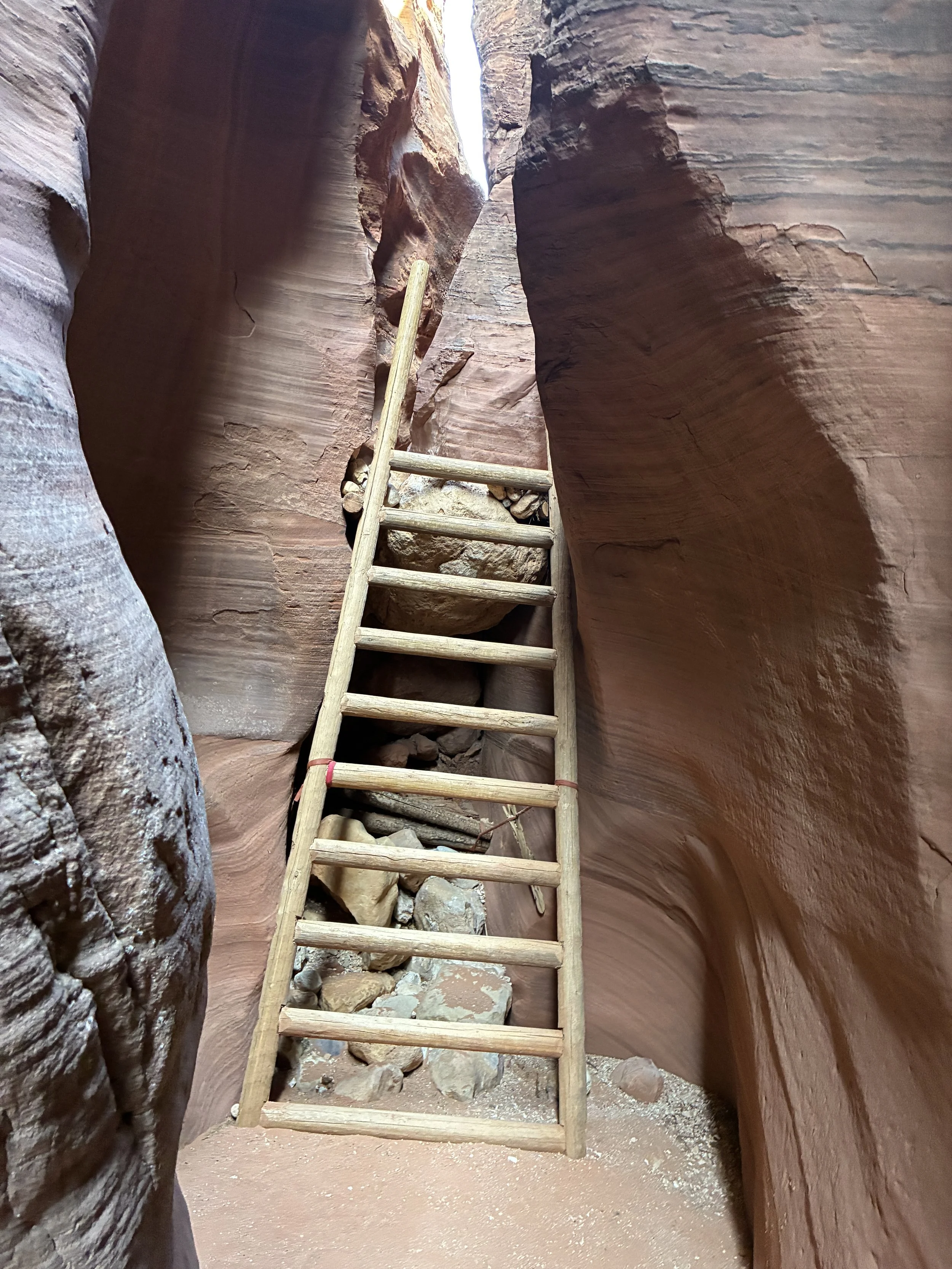
Ladder inside of Wire Pass slot canyon
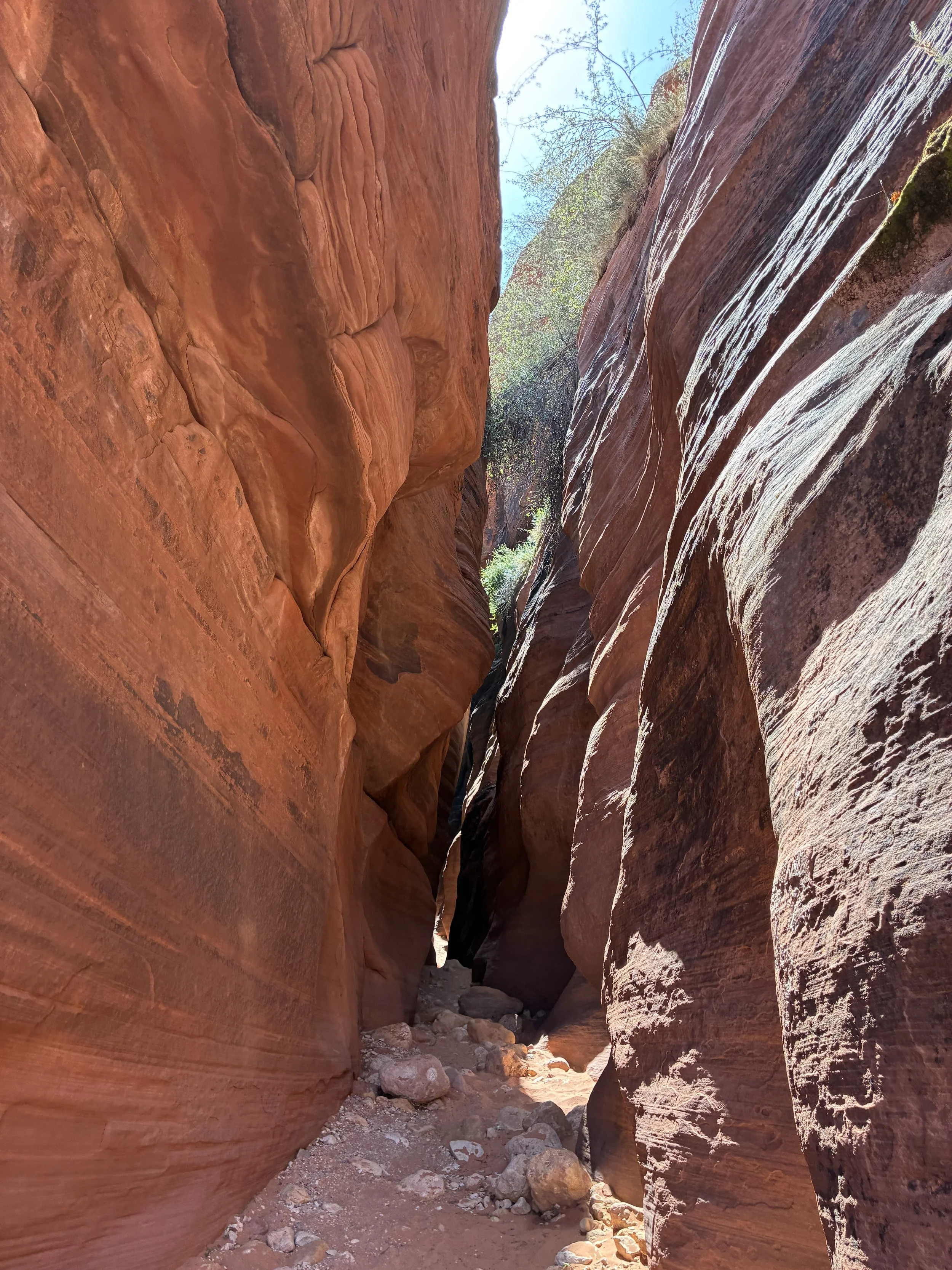
The slot canyon on the Wire Pass trail is really short. In about 3-4 minutes, the canyon will end, and the trail opens back up again.
Walking out of Wire Pass slot canyon
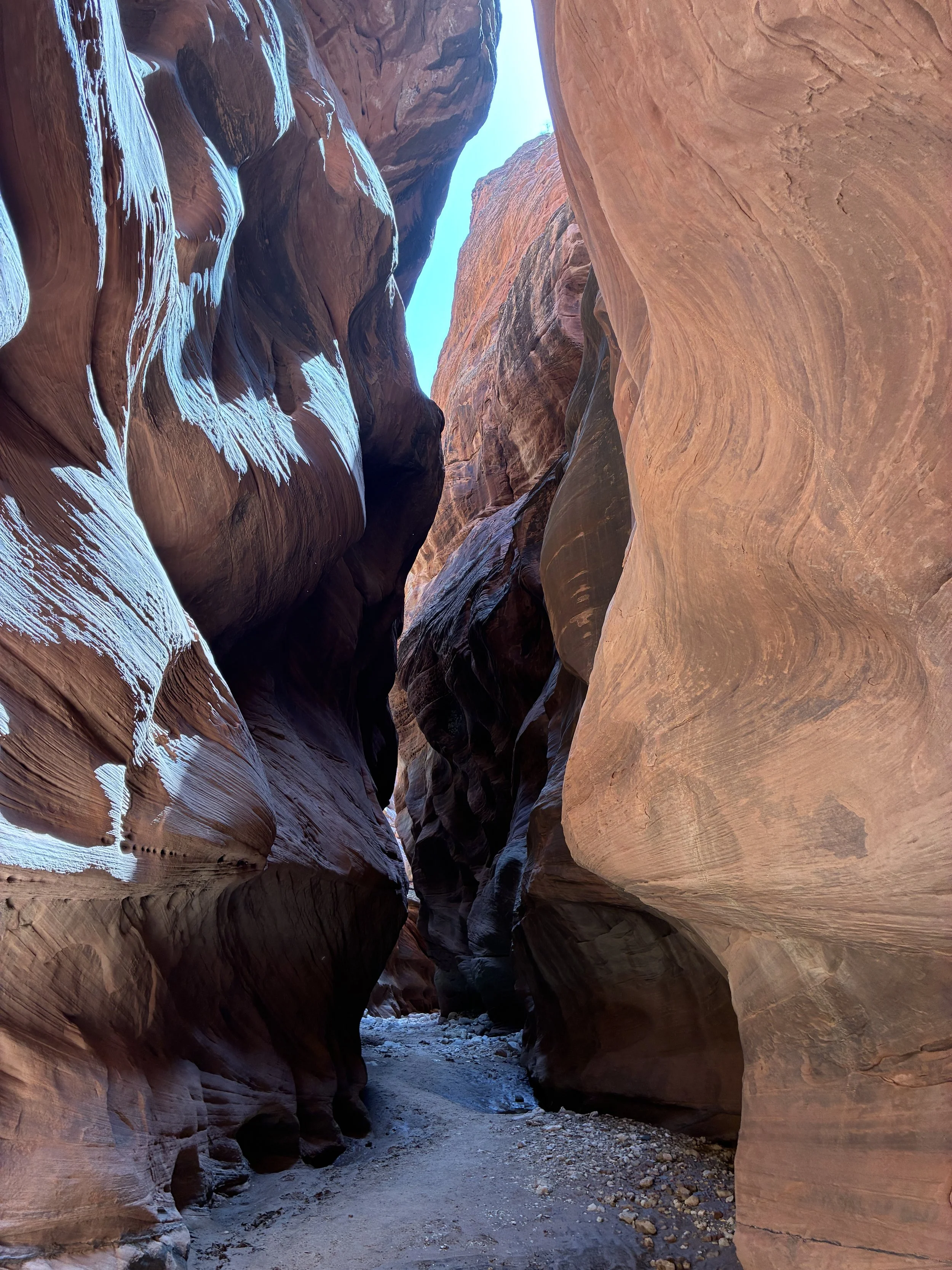
It’s obvious when you make it Buckskin Gulch. Until then, there are a series of short slot canyons along the Wire Pass trail.
Wire Pass Trail
The trail widens out for a short distance before entering another slot section.
A short walk to another slot section along the Wire Pass Trail
This next section of the trail was the tightest part of the slot canyon (that we hiked anyway).
Wire Pass Trail
The canyon narrows enough to touch me on both sides, but this isn’t so tight that you have to pick a direction for your head to face. Pretty manageable.
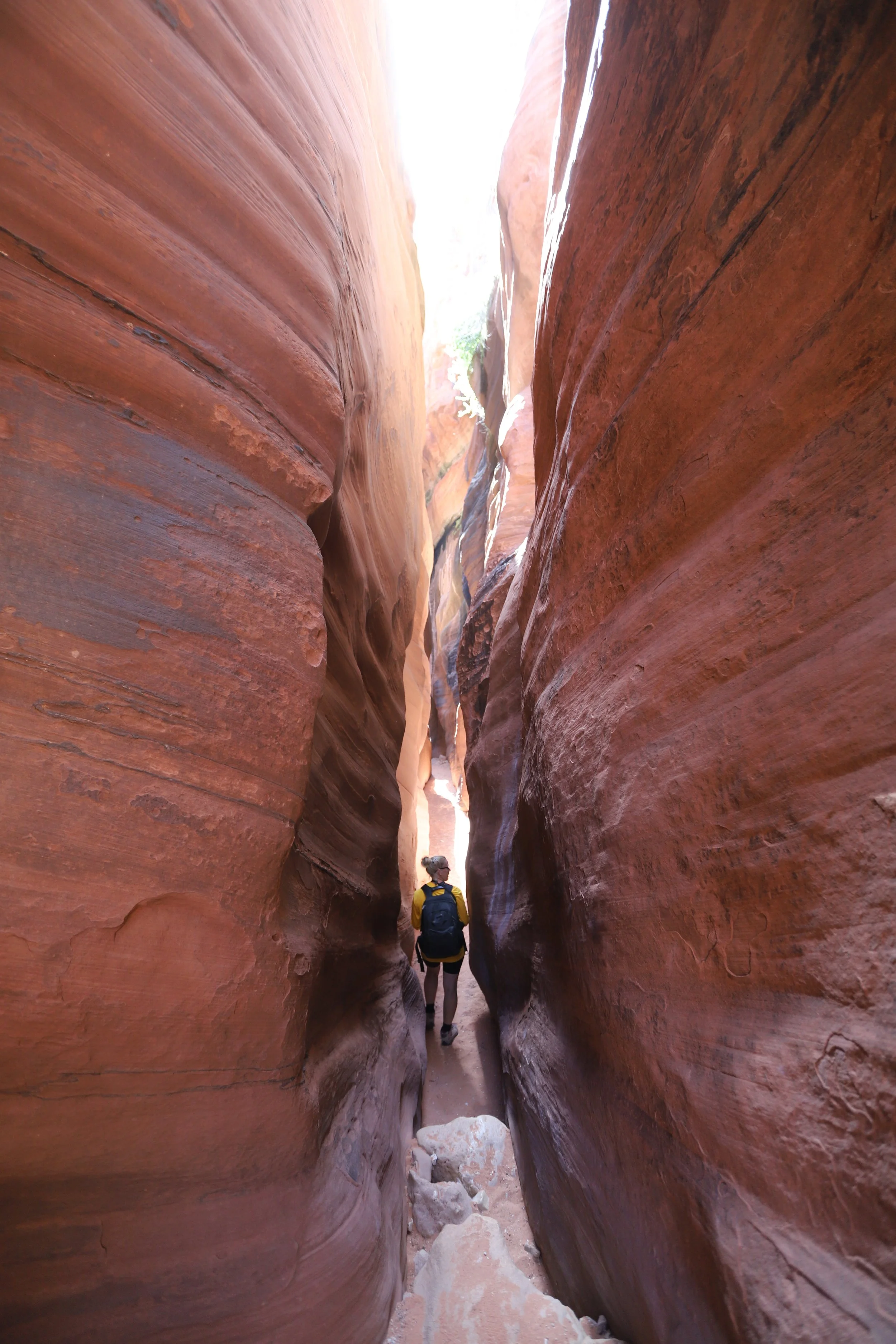
Tight slot canyon section along the Wire Pass Trail
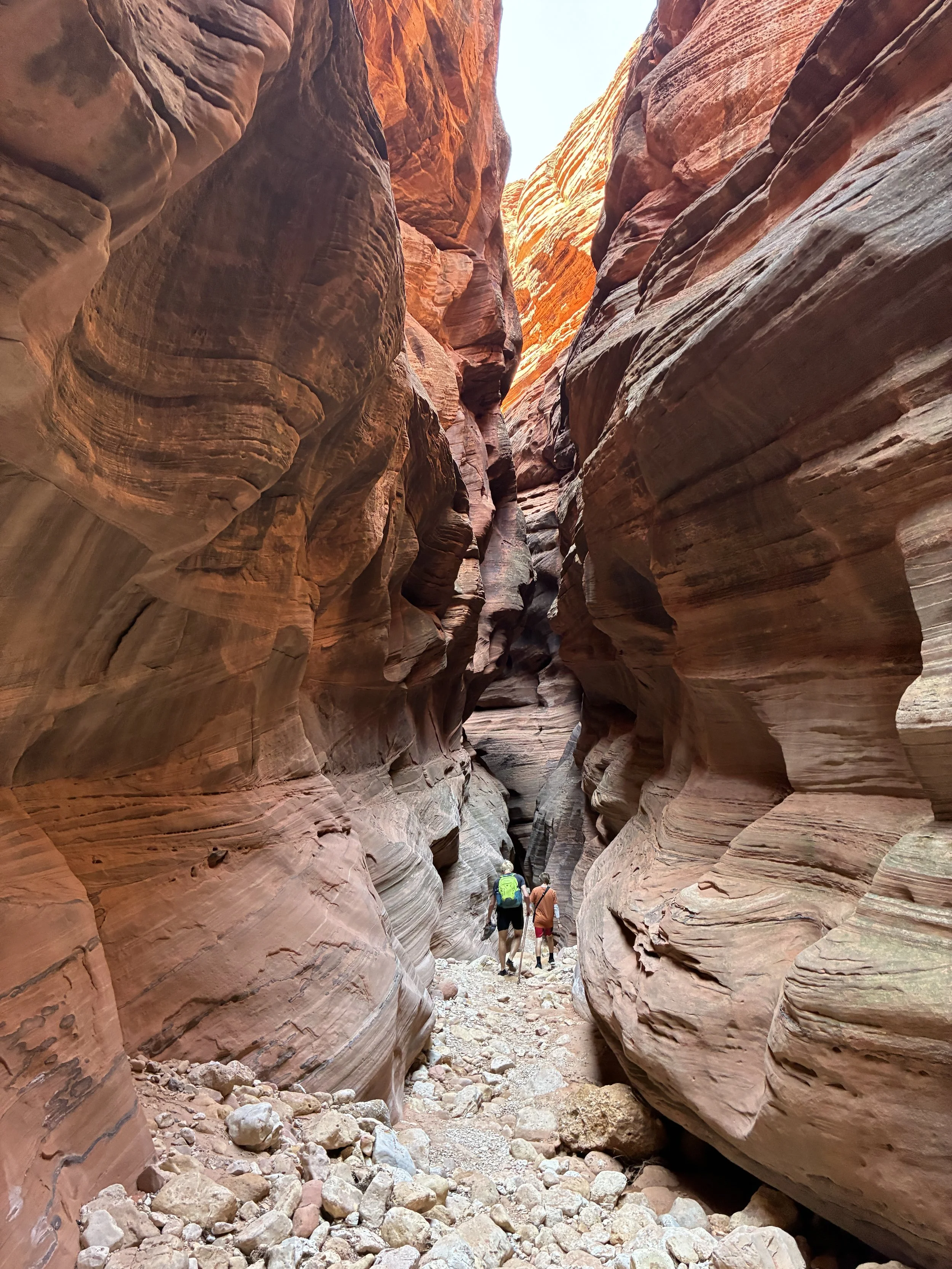
From here, it’s about a 5-minute walk to the intersection with Buckskin Gulch Canyon.
Wire Pass Trail ends at an intersection with Buckskin Gulch Canyon
Stop and explore the walls of the canyon before heading into Buckskin Gulch. There are several petroglyphs. Check the walls on the right side of Wire Pass.
The canyon widens as it enters the intersection with Buckskin Gulch. Look for petroglyphs along the walls on the right. Don’t touch the canyon walls here and risk damaging the drawings.
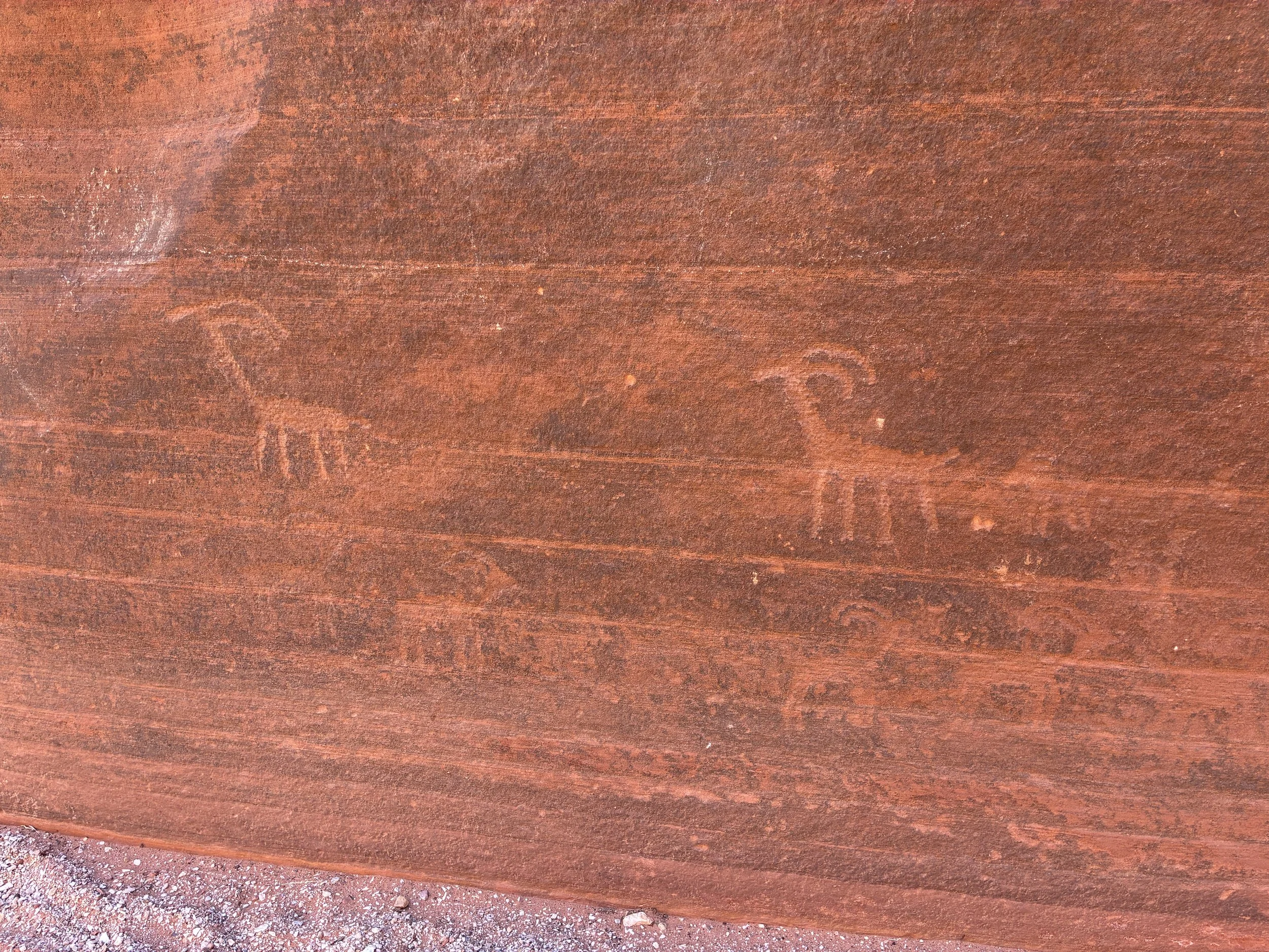
A handful of petroglyphs at the intersection of Wire Pass and Buckskin Gulch
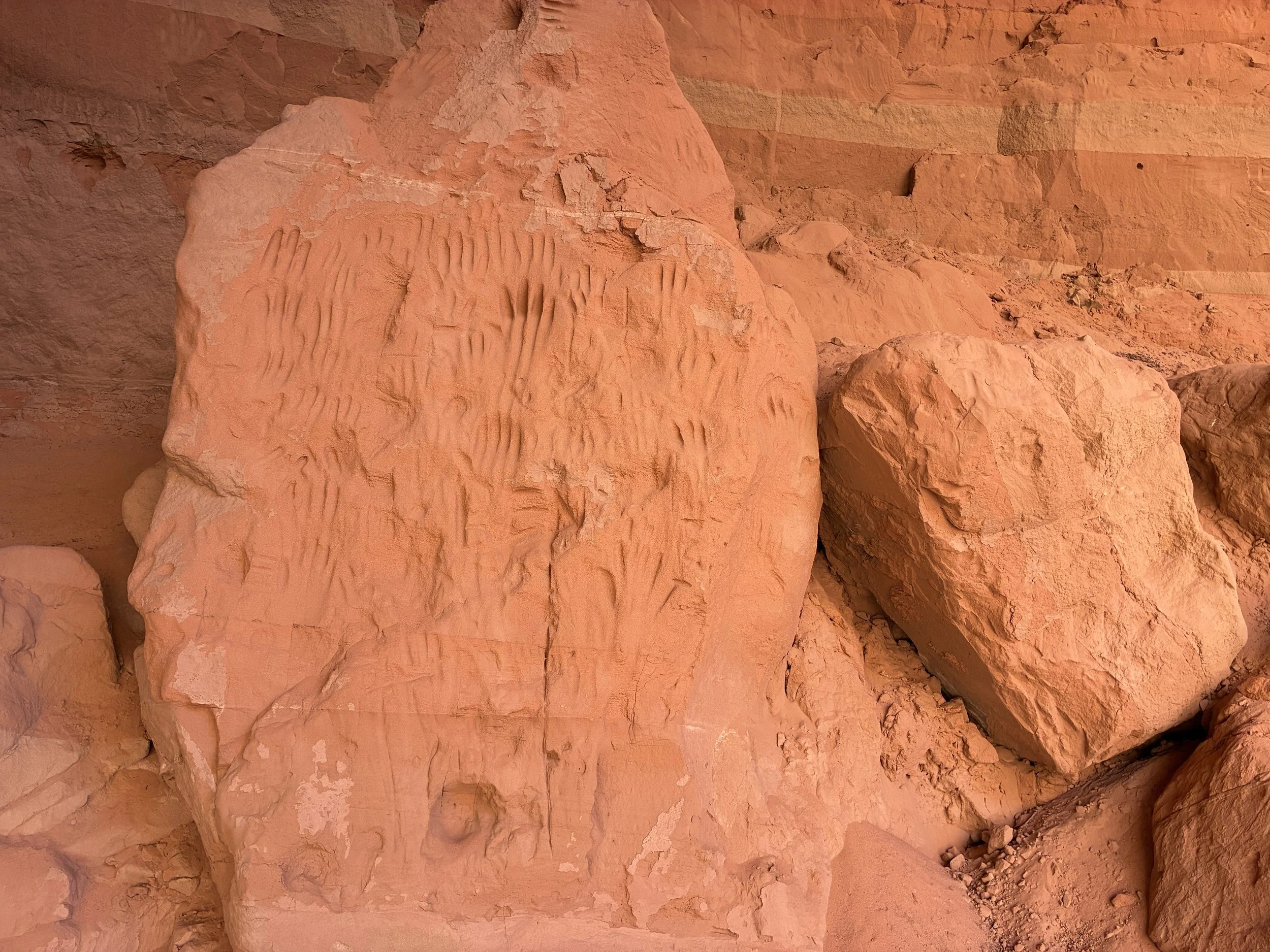
I’m not sure if these handprints were made by Native Americans or more recent tourists. It looks cool, but again, our job as hikers is to leave nothing behind. A reminder to not touch the walls, especially in this area marked by Native Americans who lived here.
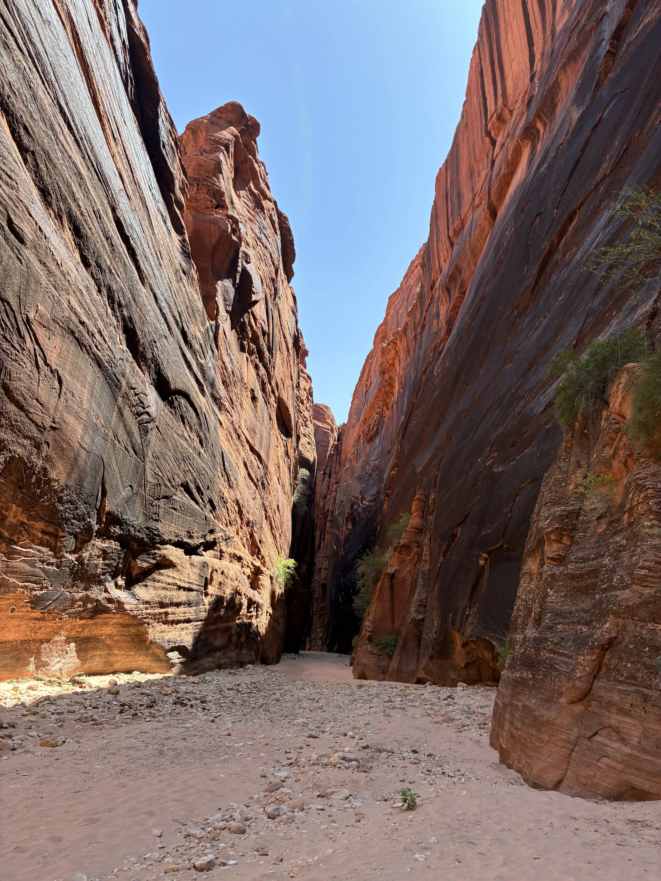
Buckskin Gulch
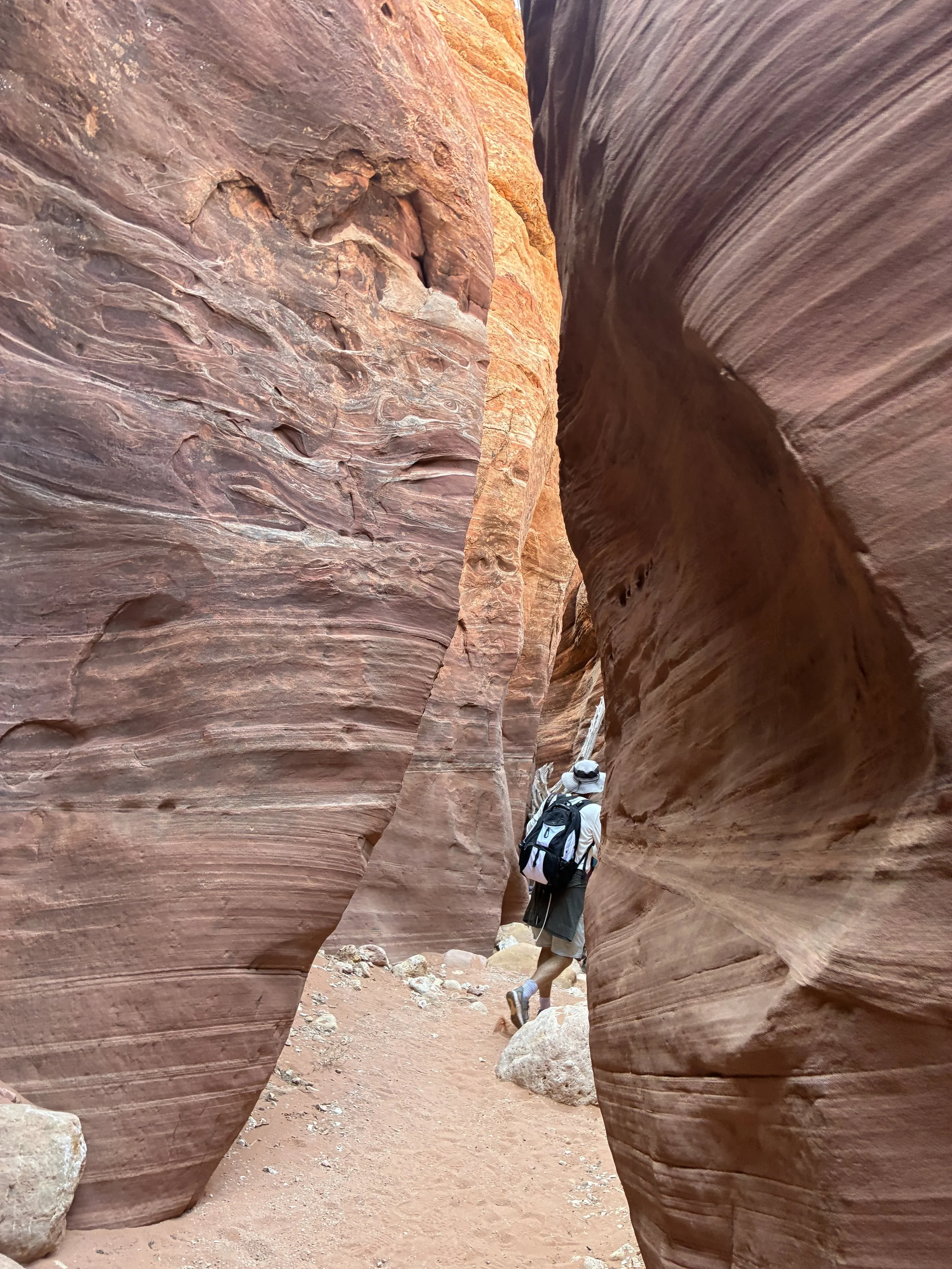
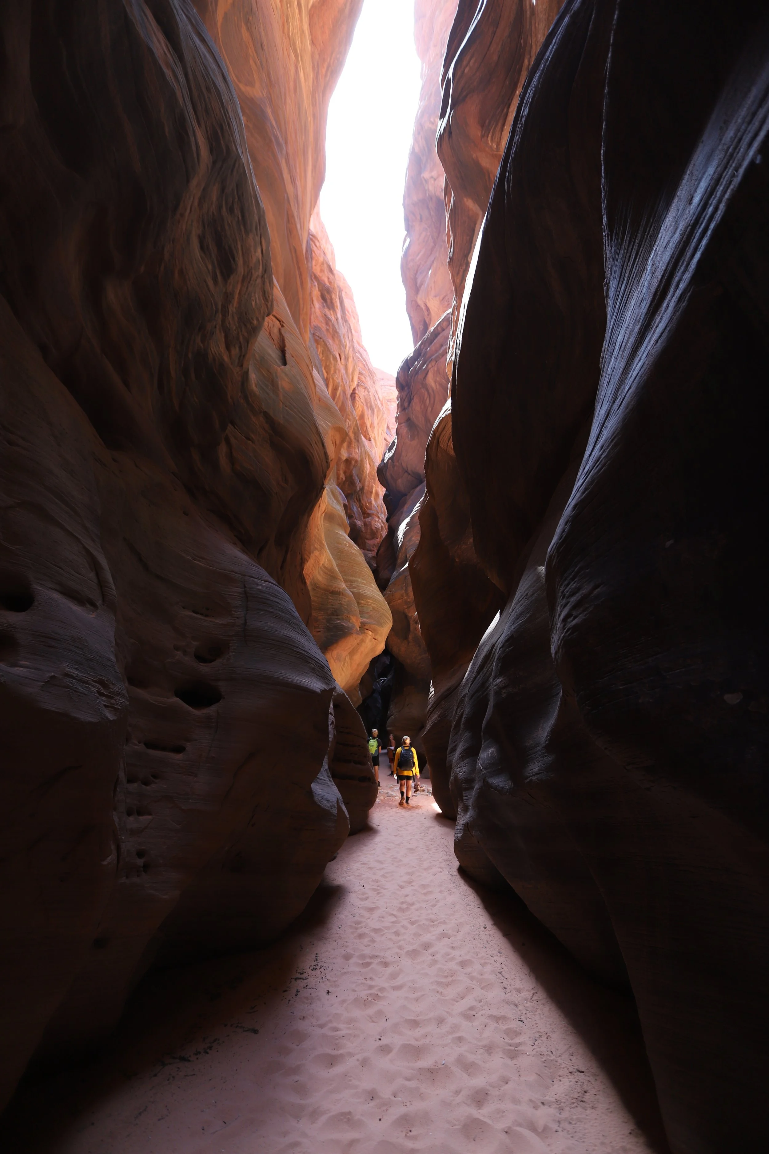
At the T-intersection, pick a direction into Buckskin Gulch. We went to the right, towards the Paria River. On the return we walked a short distance in the opposite direction. It looked similar, but we were able to walk a little further without getting wet.
Walking into Buckskin Gulch Canyon
The trail doesn’t end at Wire Pass, although it looks a little bit like it’s done, and this is a common turnaround spot for day hikers. Just walk down into the wash and pick either direction. A dramatic slot canyon will begin shortly.
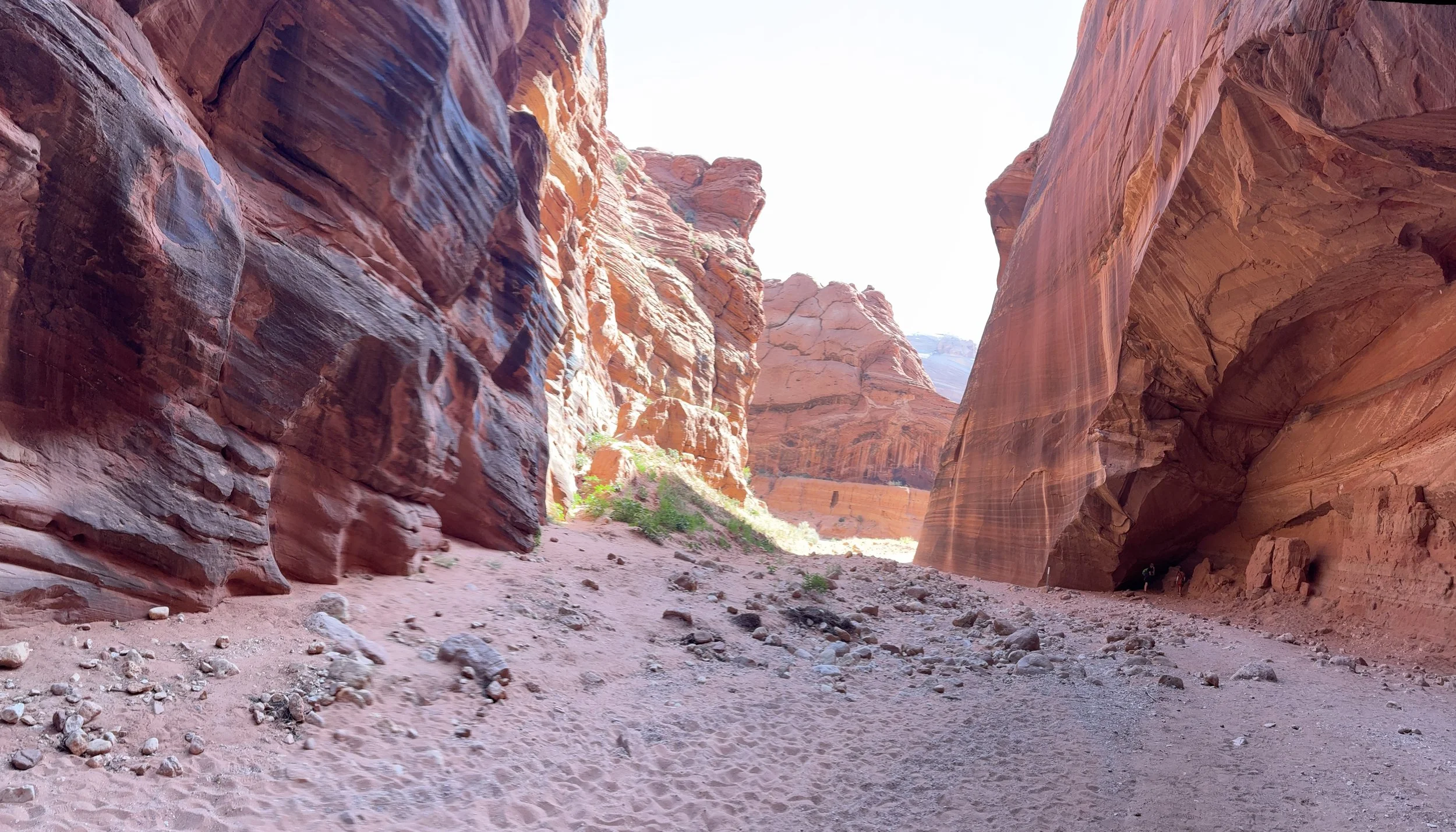
Hiking into Buckskin Gulch
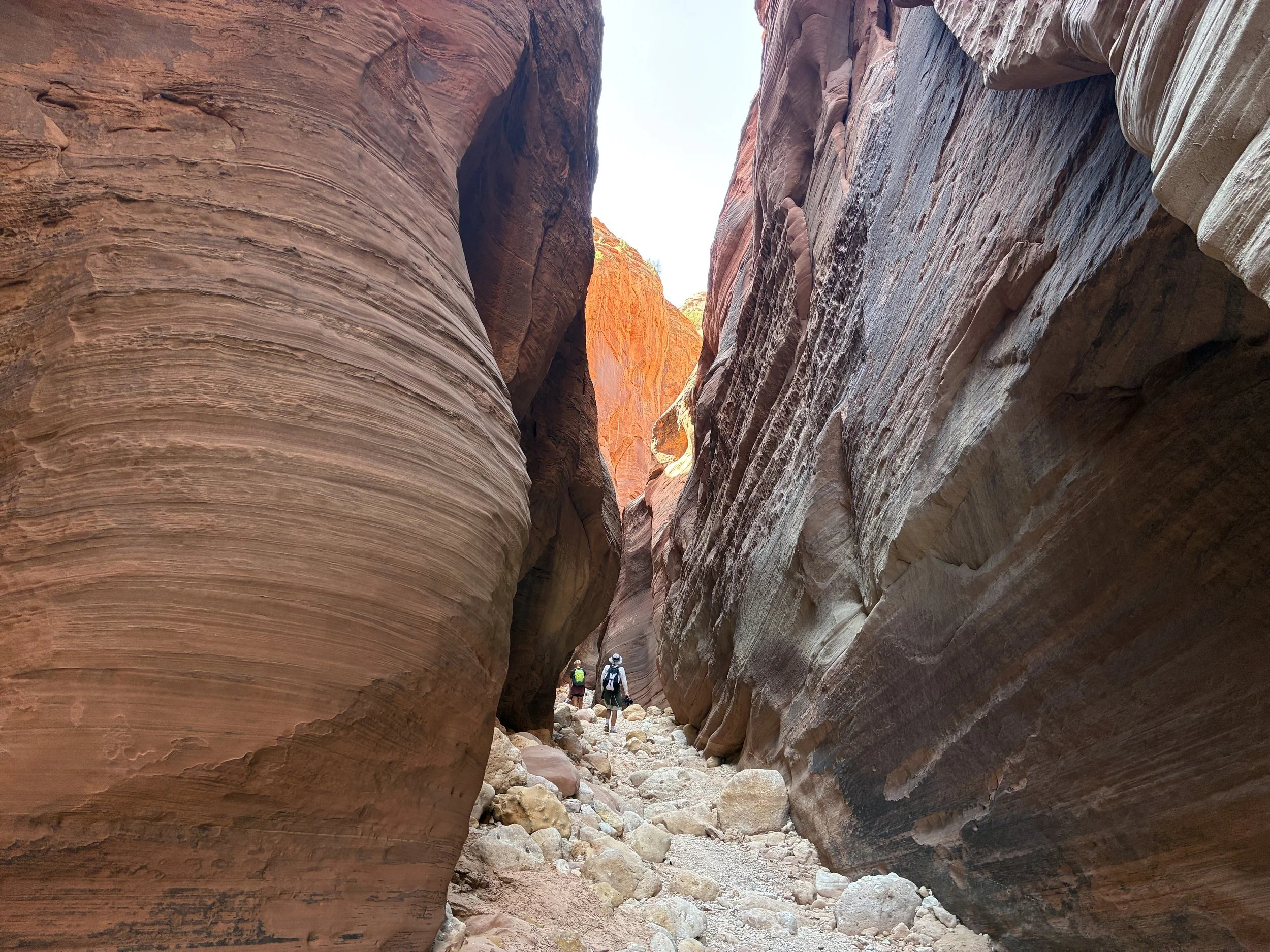
One interesting thing we noticed as we hiked into Buckskin Gulch was how the floor of the canyon changes. In this first section, the surface is full of small boulders and large rocks. It was nice to have ankle support here with our hiking boots.
After about 10 minutes of hiking, we hit our first water obstacle. It was about a foot or so deep. We switched out of our boots and into water shoes with neoprene socks. The water was pretty cold. A couple of other hikers were nearby us at this point. They all turned around here. I think we only passed three other small groups of hikers after this point. A water obstacle is a perfect way to thin out the hiking crowd (not that the rest of the trail was very busy though… This trailhead really is in the middle of nowhere.)
First water crossing in Buckskin Gulch, about a foot or so deep
On the other side - more large rocks. We all chose to switch back to hiking boots.

Buckskin Gulch, near the Wire Pass Trail entrance
Buckskin Gulch - this water obstacle we were able to get around without getting wet
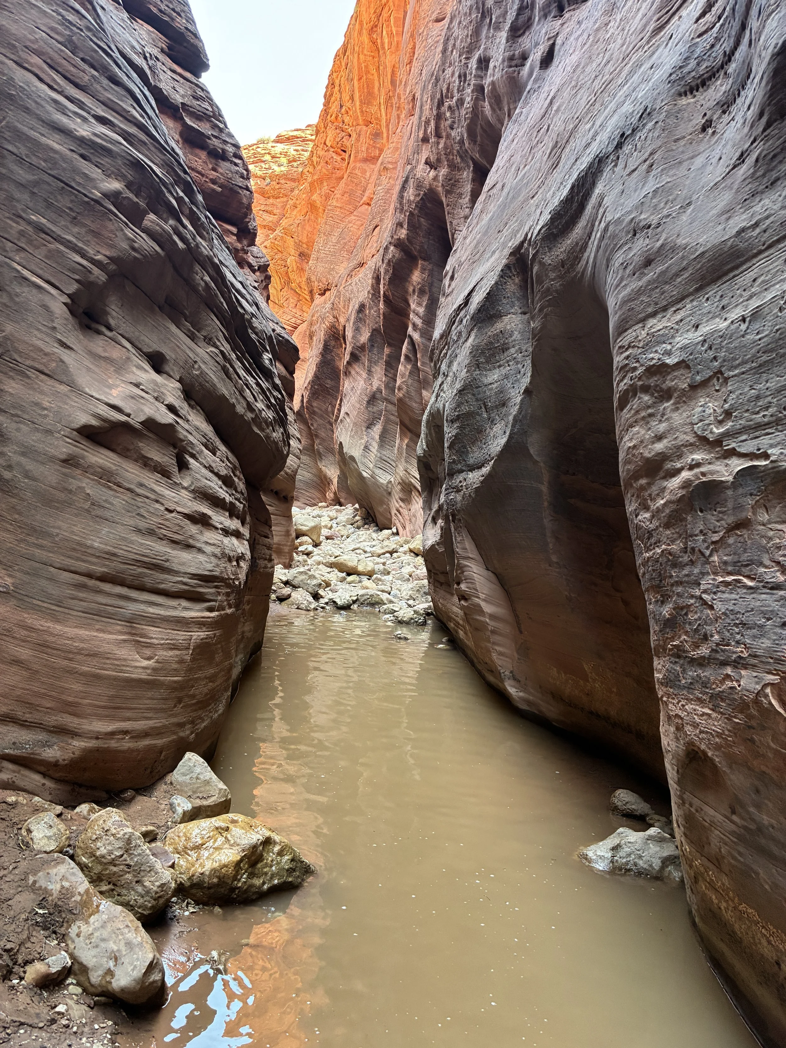
At 2.3 miles from the Wire Pass trailhead (about 30 minutes into our hike within Buckskin Gulch) we hit our first big water obstacle - waist deep. Again, we switched into our water shoes and neoprene socks. Our bags were able to stay dry. As for our clothes that got wet - it’s a desert - you dry out faster than you’d think. And clothes can be washed. The silt came out fine, and nothing was stained.
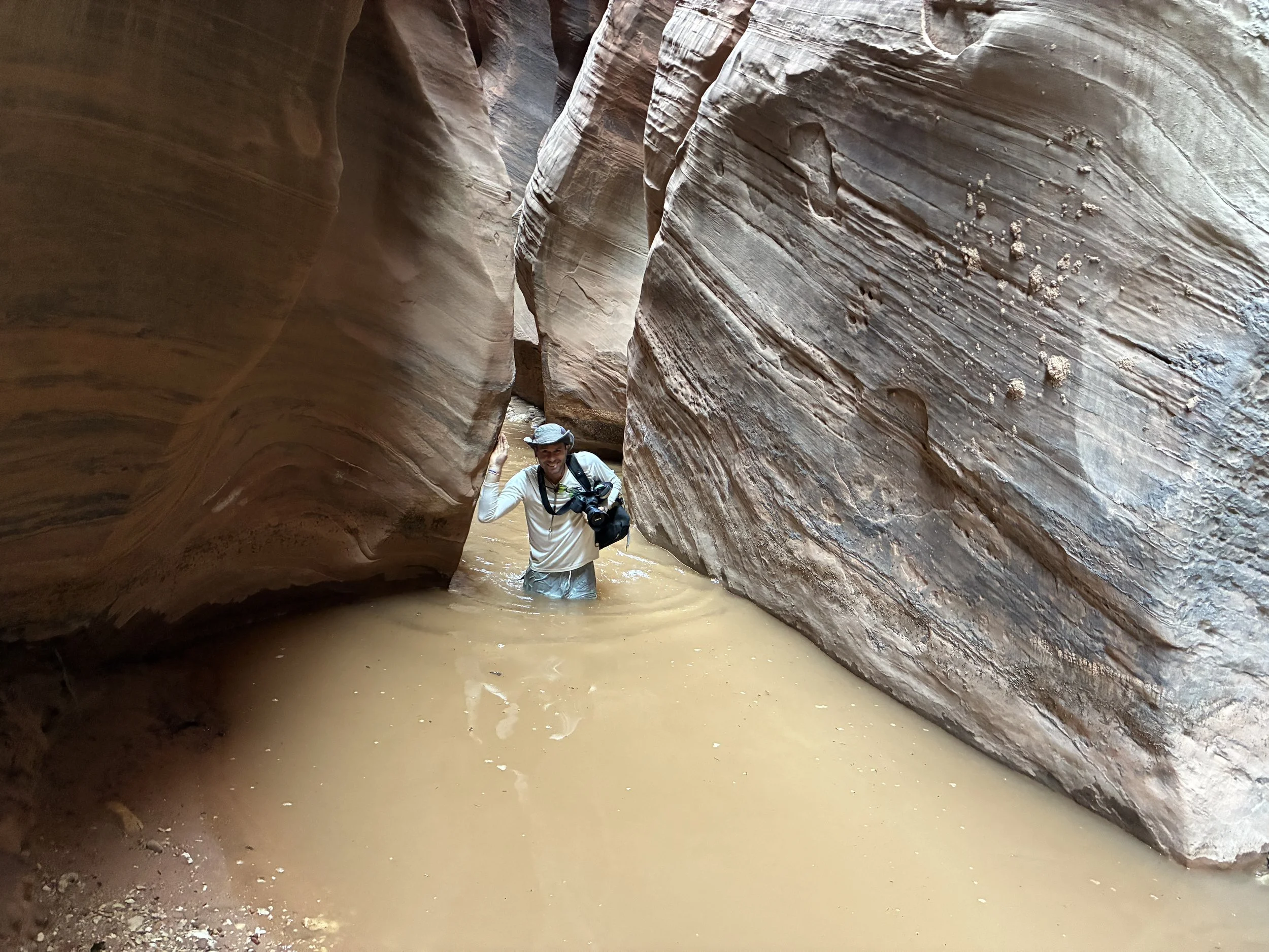
Hiking through the water in Buckskin Gulch - yep, pretty cold
You’re going to get wet on this hike through Buckskin Gulch
I had so many questions from friends when I told them we were going to southern Utah in the summer - what were we doing going into the desert in the summer? Most days though, we have a picture like this of us swimming through canyons. Canyon water is extremely cold. I was worried as much about hypothermia as I was worried about running out of water due to the summer heat. Extremely weird hikes to plan for… Luckily in Buckskin Gulch, there was plenty of distance to dry off between water sections. And a little bit of sun appeared in the slot canyon on the way back to the car. Overall, temperature-wise, we were pretty comfortable through most of the hike, although a little warm on the way back through Wire Pass in the afternoon back to the car.
More large rocks continue to line the bottom of Buckskin Gulch. Hiking over these takes a bit of care and extra time. We didn’t need to use hiking poles though.
After the third time switching into my water shoes, I chose to just keep those on until I returned through the last water obstacle on the way back.
Hiking through Buckskin Gulch in water shoes
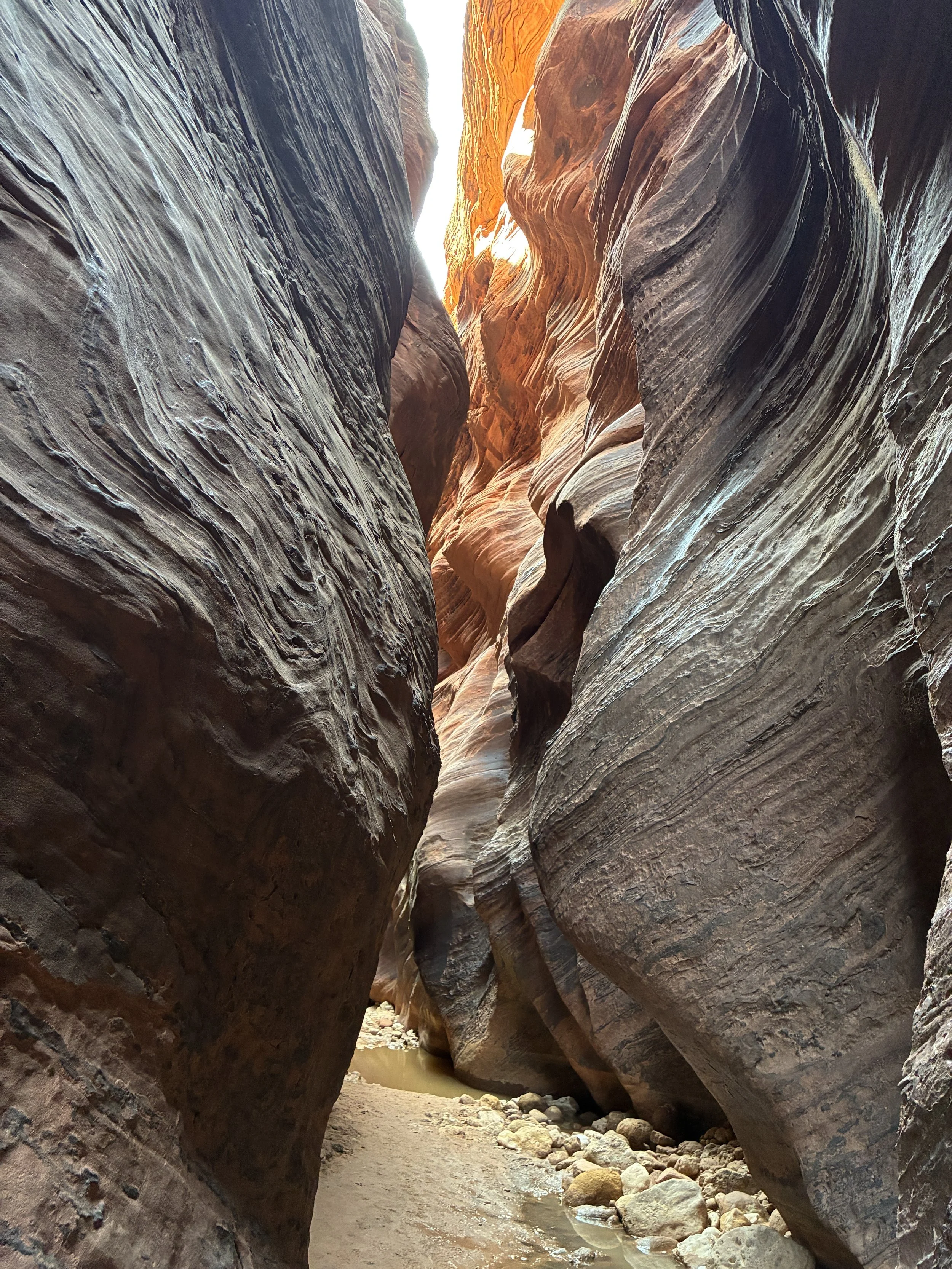
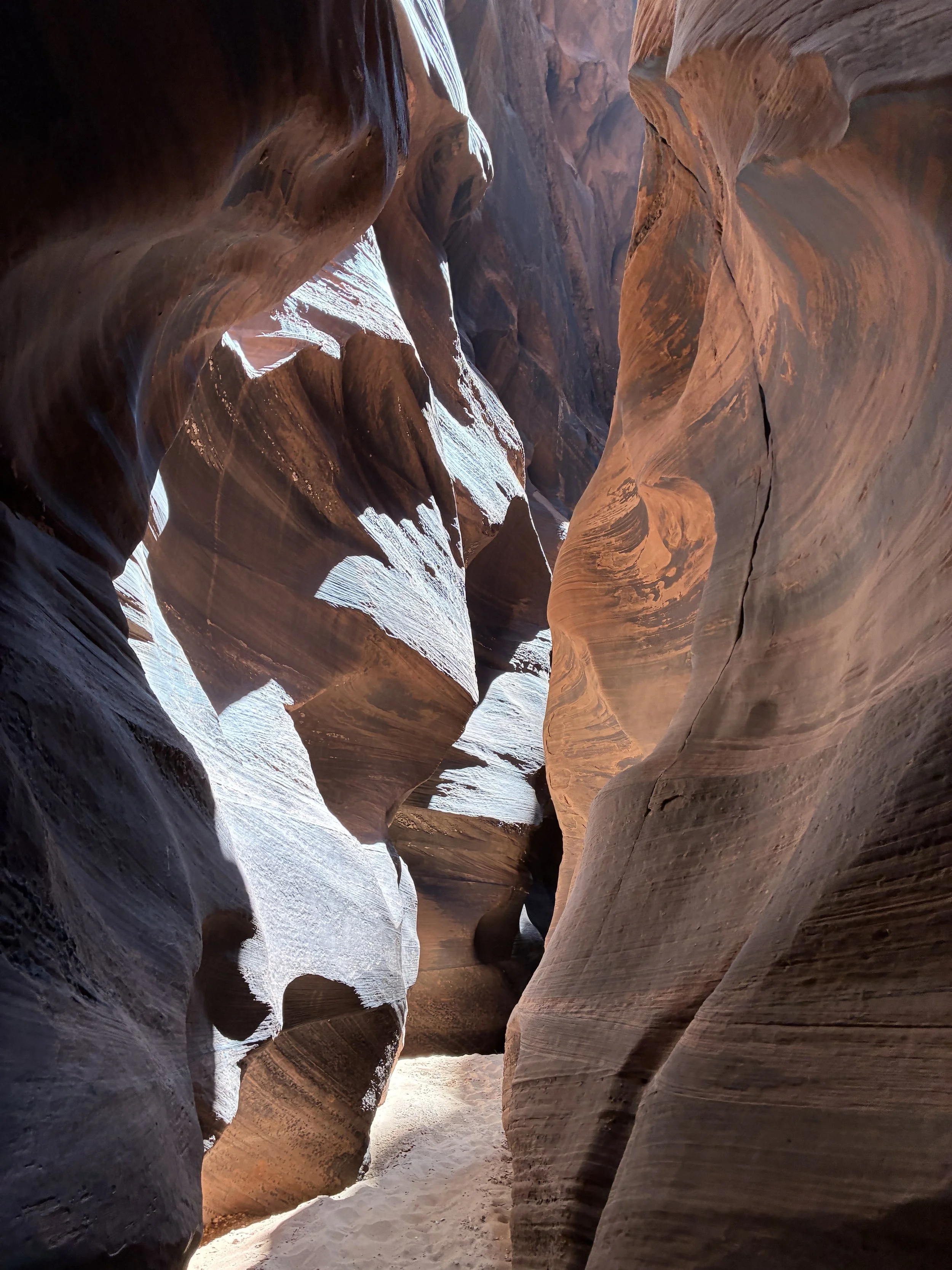
This part of the canyon was worth getting wet to be able to see. The walls are so high, so colorful, so beautiful. It’s humbling to feel so small inside this canyon.
Buckskin Gulch
Buckskin Gulch
I don’t know why the water was black here. I’ll admit, this was my least favorite section of water to walk through. None of us got sick. All of our clothes were fine to continue wearing after we washed them. It was a bit gross to hike through though.

Not a fan of walking through the black water, but this is one of my favorite pictures inside of Buckskin Gulch
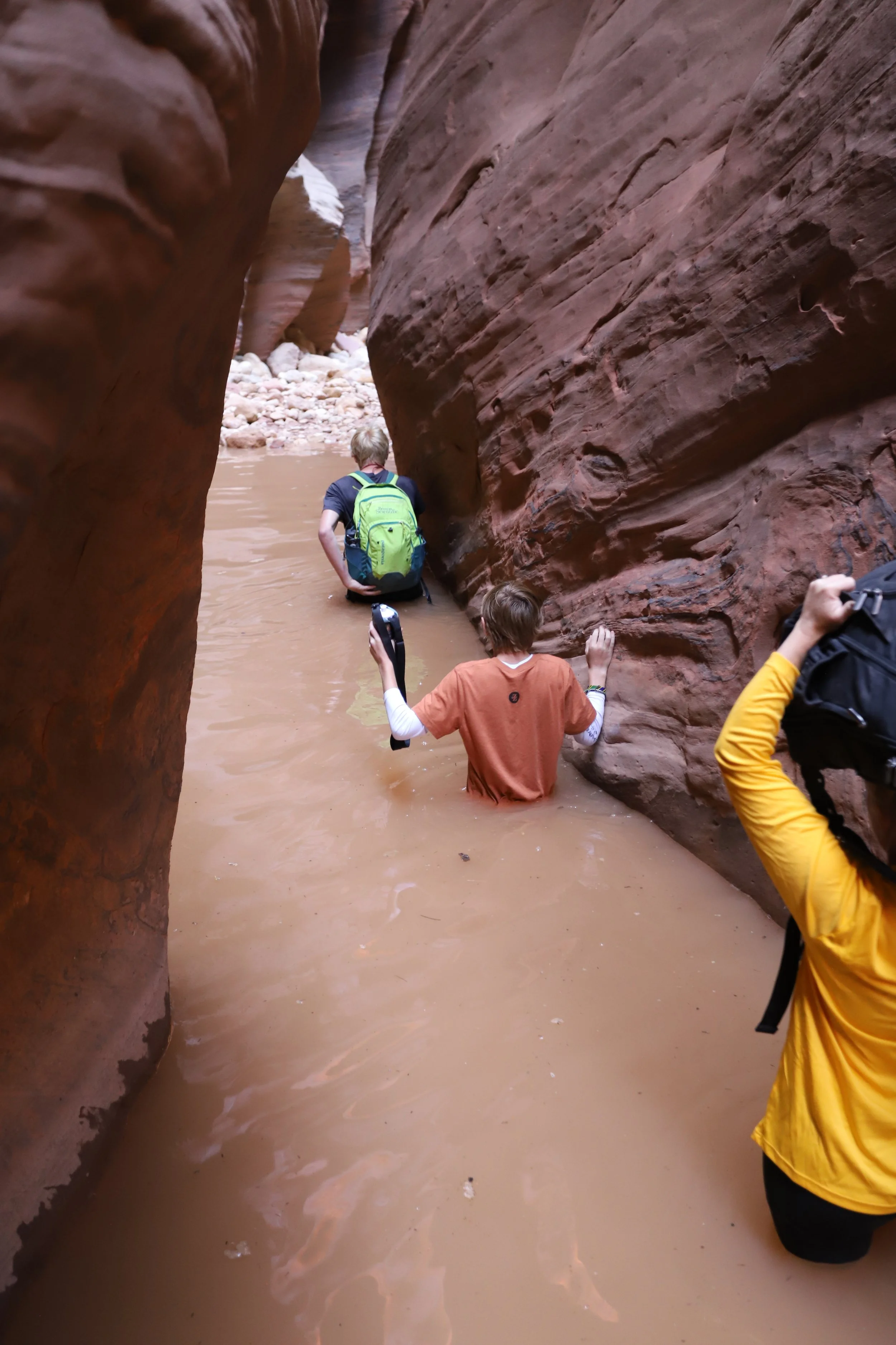
My boys hiking together through Buckskin Gulch Slot Canyon
A little more than 3 miles from the Wire Pass trailhead, the canyon floor shifts to soft sand.
A sandy section of Buckskin Gulch
It was such a change from large rocks to soft, small sand grains. We wondered out loud for a while why it was so different. Without knowing what the ground above us looked like, we weren’t sure why it changed so suddenly.
Hiking through Buckskin Gulch
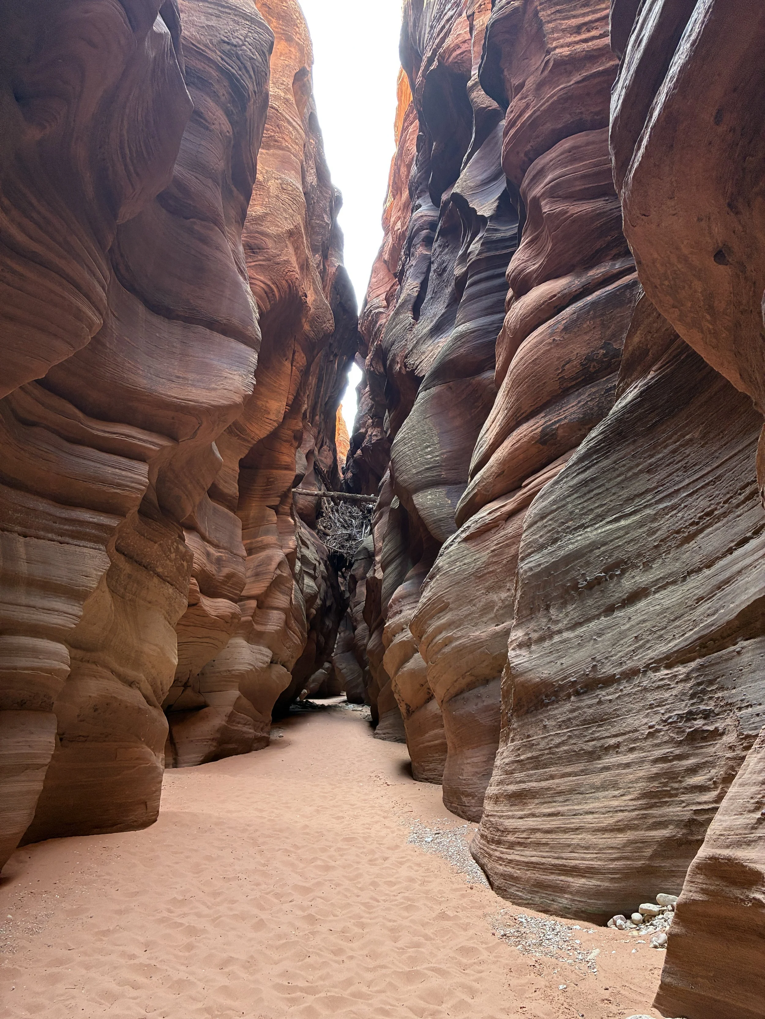
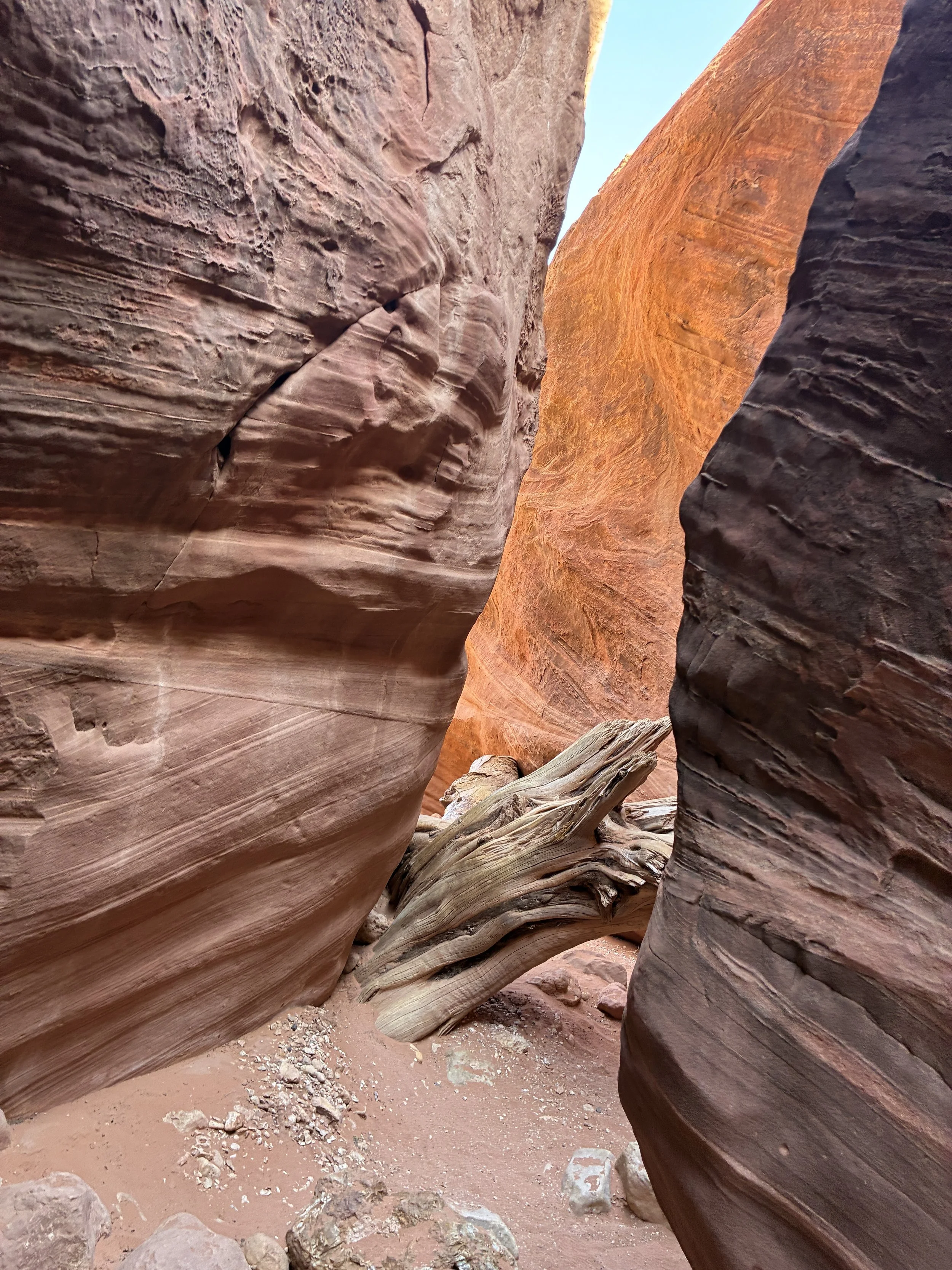
There is a spot in Buckskin Gulch that has a huge log and tree branches lodged inside. This debris enters slot canyons during flash floods. And there’s nowhere for it go, so it gets lodged in the tight walls. What surprised us though was how big the tree log was. This part of the desert doesn’t typically have tall trees. There isn’t enough water to support something this big.
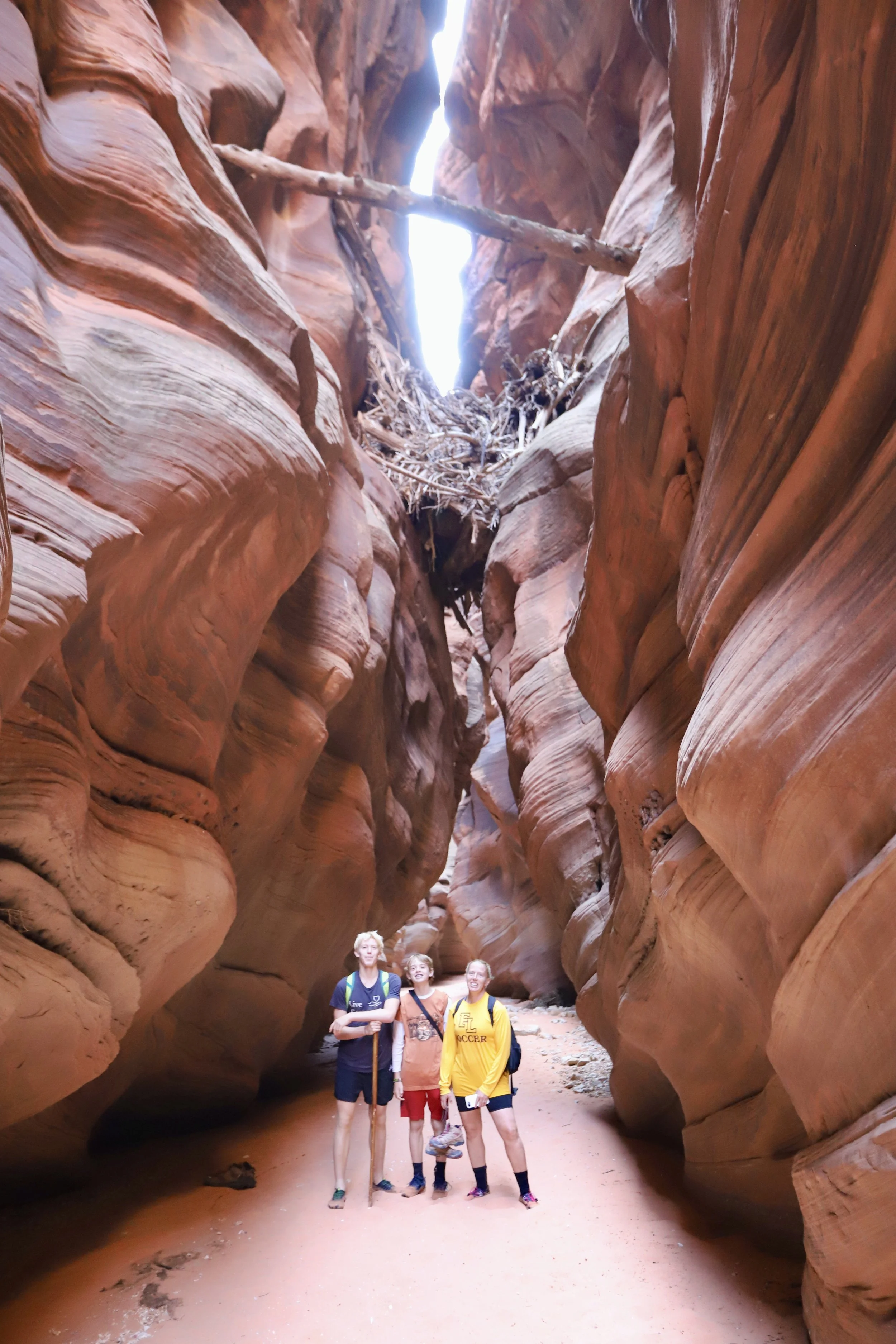
Posing below the largest tree log we found in the section of Buckskin Gulch that we were able to hike. You can see that by this point in the hike my boys had also stopped switching back and forth between boots and water shoes.
Around this section of the trail we passed a couple of groups of hikers that were both visibly confused, looking for some type of “overlook” that was marked on the trail in both GAIA and AllTrails. I don’t know why there is something labeled as an overlook. The trail is at the bottom of a very big slot canyon. There isn’t a way to climb up and out. Ignore that on your map if you see it.
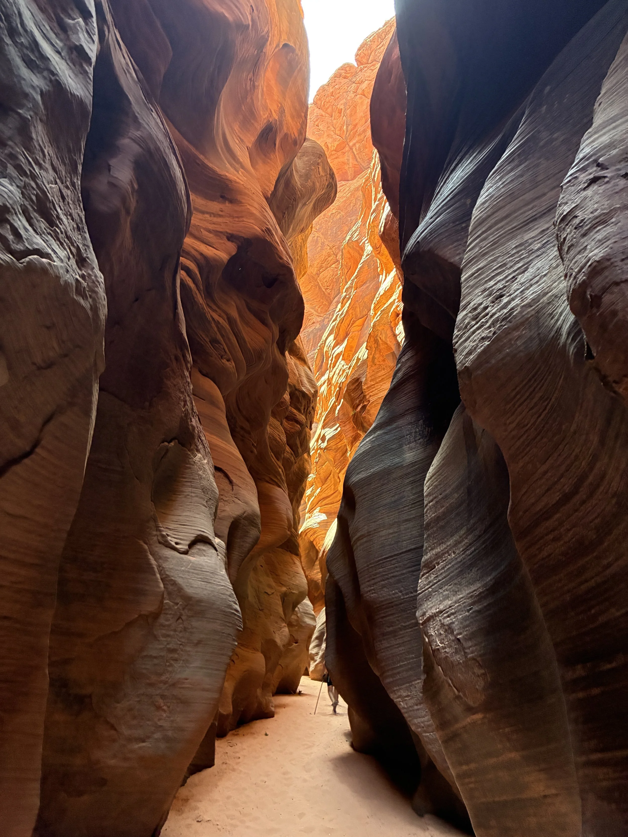
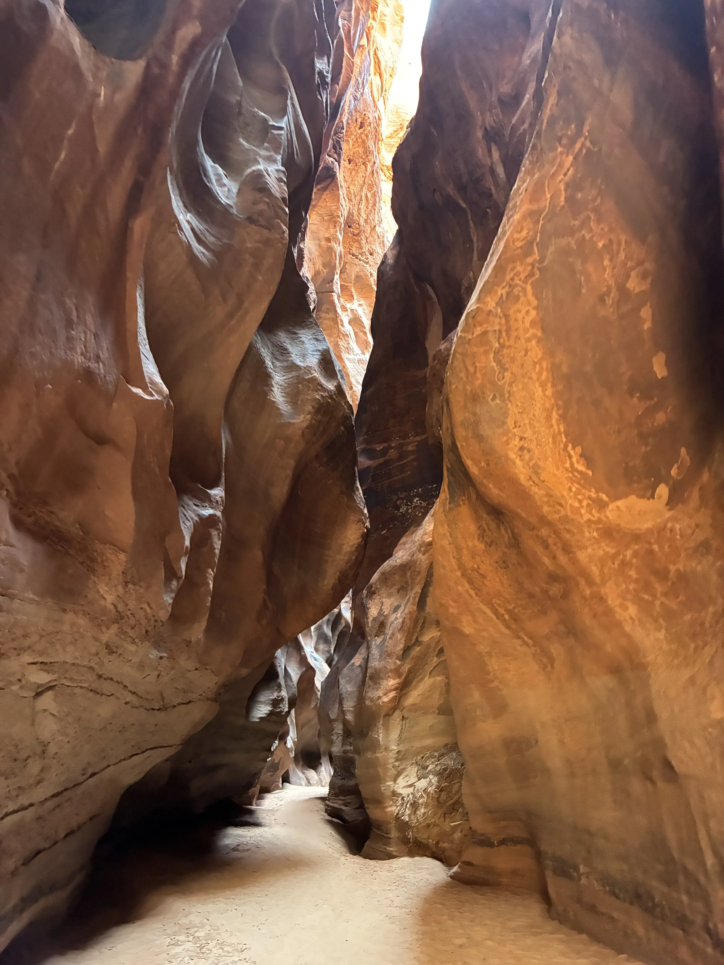
Hiking through Buckskin Gulch
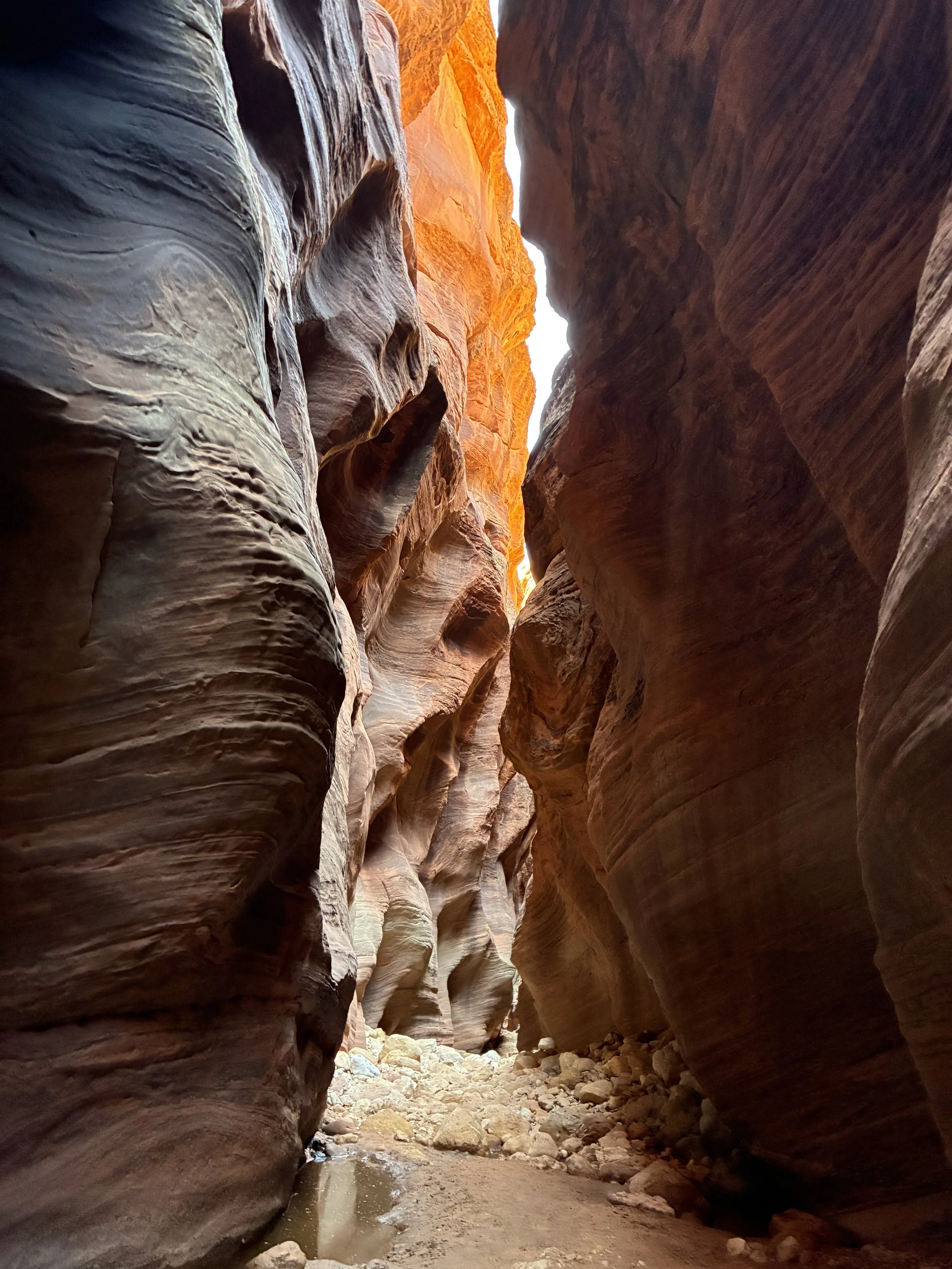
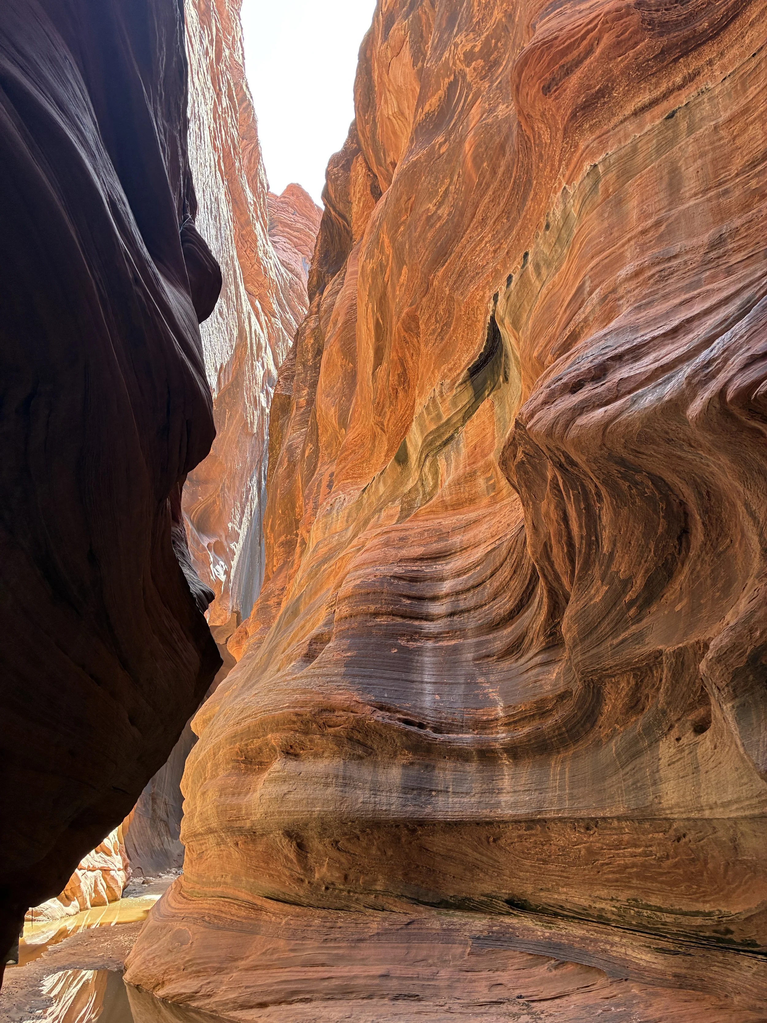
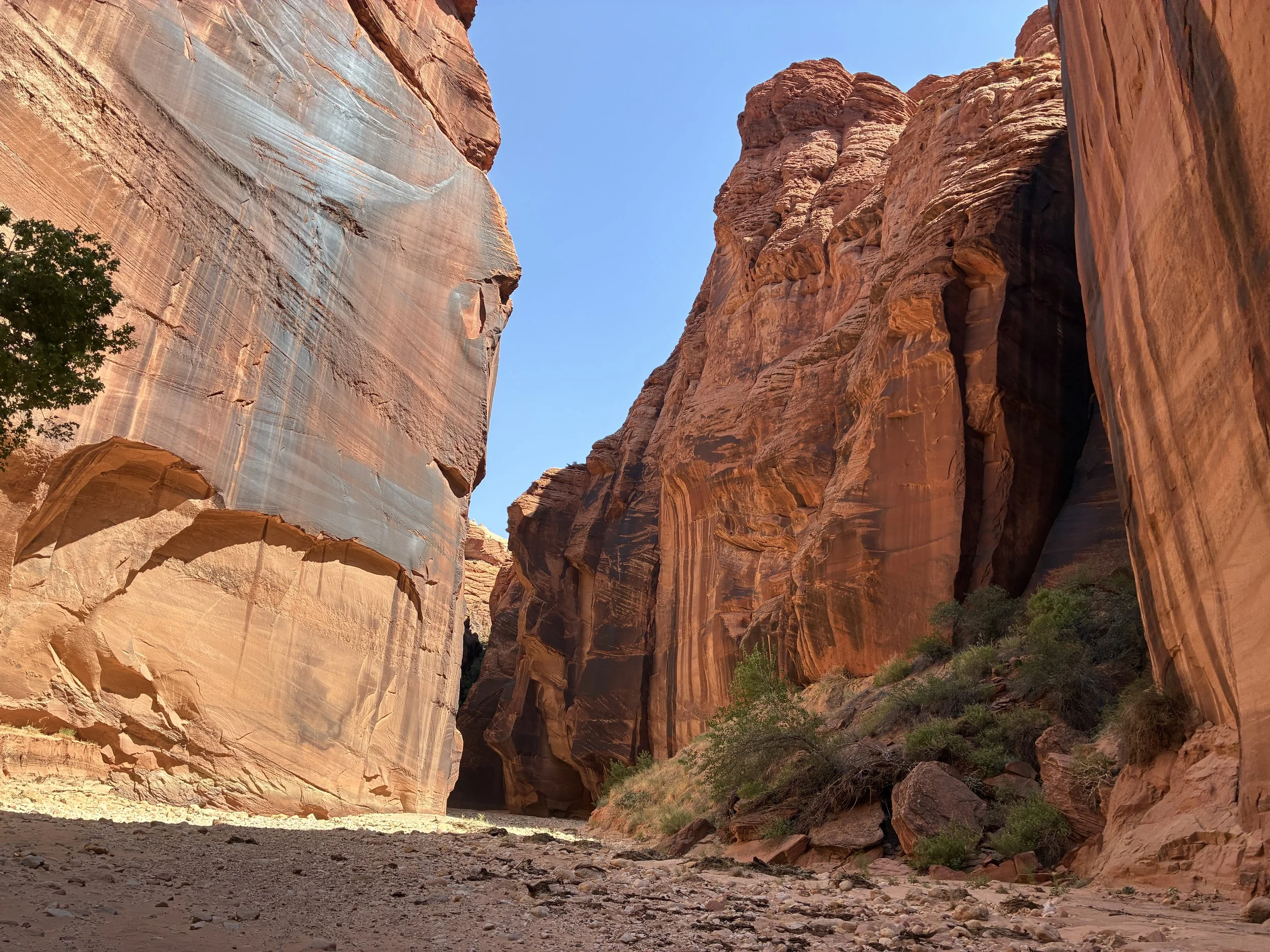
This next section of the canyon was significantly wider, and the walls were much flatter and straight.
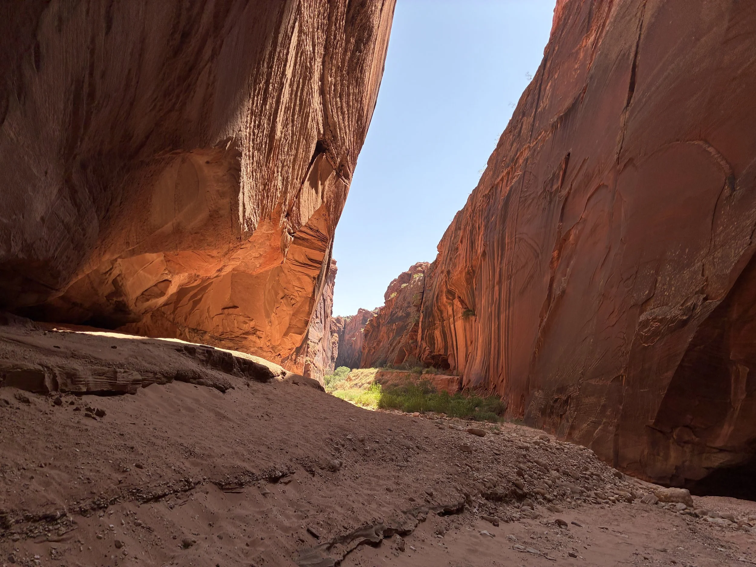
Buckskin Gulch
The straight walls are so impressive looking. This wasn’t the prettiest section of the canyon, but it’s one of the more imposing parts.
Buckskin Gulch
At this point in the canyon, we encounter a snake. Where we live in Minnesota, our snakes are all non-venomous. But looking at this guy’s head, it is triangle shaped. Although this snake does not make a sound, it’s pretty clear to all of us that it’s a rattlesnake. During COVID, we played a lot of games to fill the empty spaces in the evening. A family favorite was a card-game version of the 1990s Oregon Trail game that my husband and I had grown up playing on computer lab days in elementary school. The card game, just like the computer game, was full of different ways to die, and included two calamity cards stating, “Rattlesnake Bite - You died.” It was such a sudden card to get, with no way to plan for it, and the boys would get so upset they died, that we had a family rule when the first snake bite card was drawn that we had a stash of “anti-snake venom” in the wagon. No one died the first time the card was drawn, but the second time it was drawn, you definitely died.
In July 2020, we went on a backpacking trip out to the Wind River Range in Wyoming, and on the way, we stopped at Chimney Rock. The museum of course was closed, but we were able to walk around outside on the grounds. There was a trail that goes out closer to Chimney Rock, but there was a sign that stated “Rattlesnakes have been observed. Please stay on the sidewalk.” And we humbly realized that anti-venom was a made-up family rule for a card game version of Oregon Trail, and that the hospitals full of COVID patients at this time didn’t need to deal with one of us being bit by a rattlesnake. As a family, we decided we should get back in the car and skip the walk through the tall grasses out to Chimney Rock.
So fast-forward five years, and this is our first actual encounter with a rattlesnake. And that little snake just didn’t care that we were in the canyon with it. It would have been so much more satisfying of a story if it rattled and frightened, we ran away. Instead, it was me shouting at my boys- “DON’T ANTAGONIZE THE RATTLESNAKE.” Even though I really wanted to hear it rattle too… We were hours from the trailhead, there was no way to contact emergency services, and even if we could, there’s no place that we’ve hiked yet wide enough for a helicopter to help us, and even if we could make it the trailhead, it’s an hour drive to Kanab or Page, and I’m not sure what kind of emergency services either small city has. We took pictures, and pulled the boys away from the snake, continuing further into the canyon. It had moved on, and we weren’t able to find it again on our way back. That was probably a good thing.
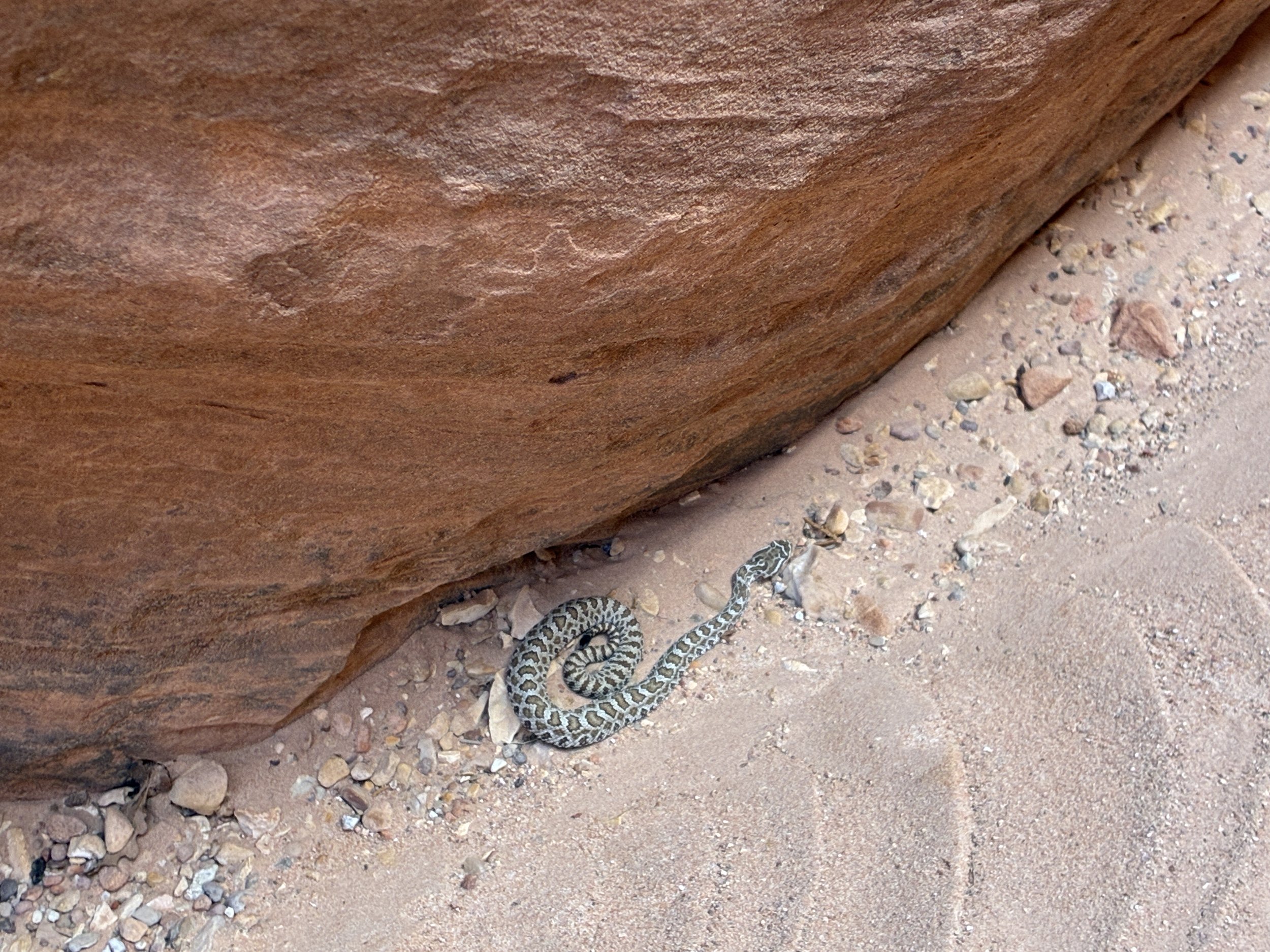
Non-exciting rattlesnake enounter inside of Buckskin Gulch
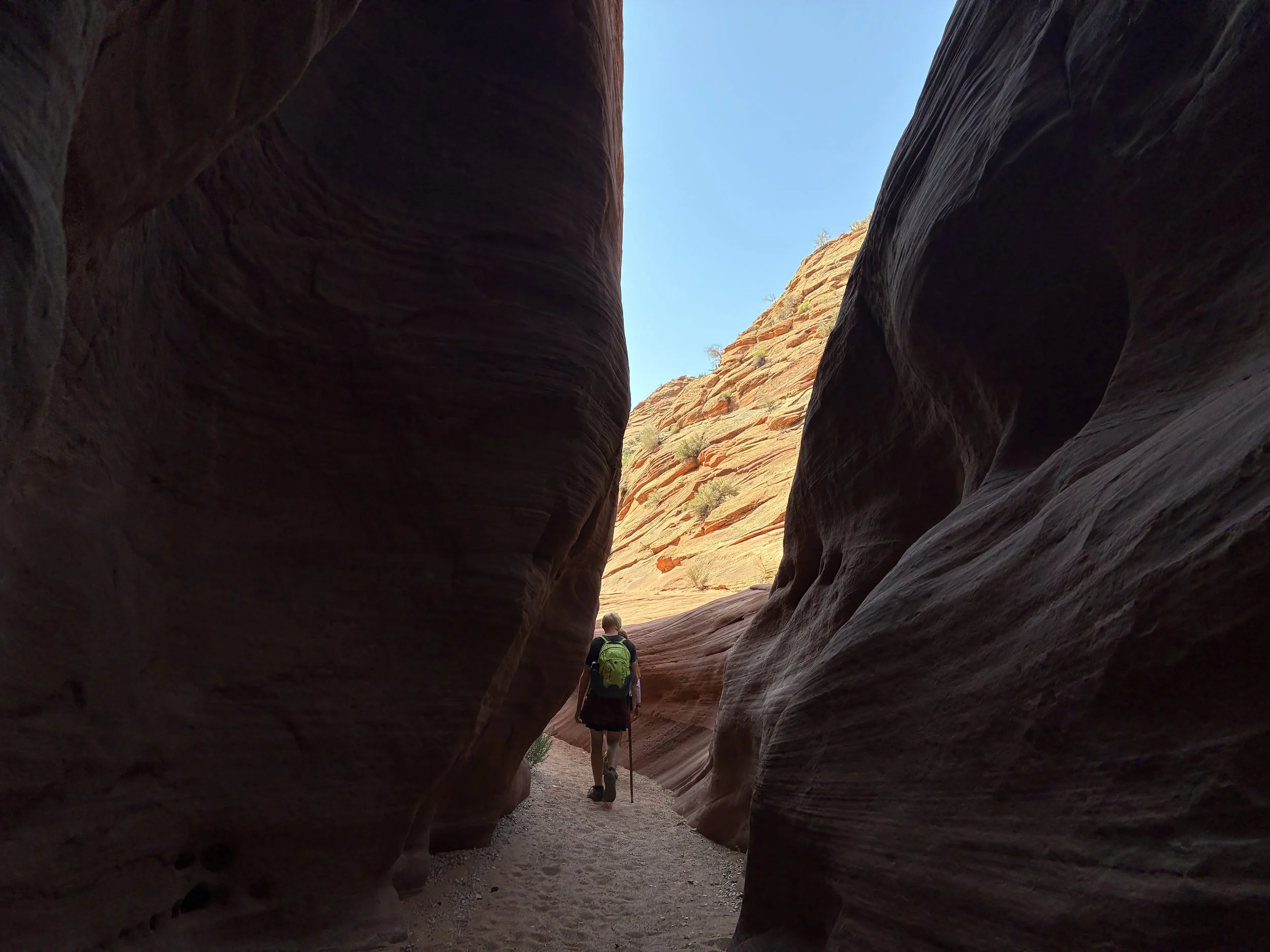
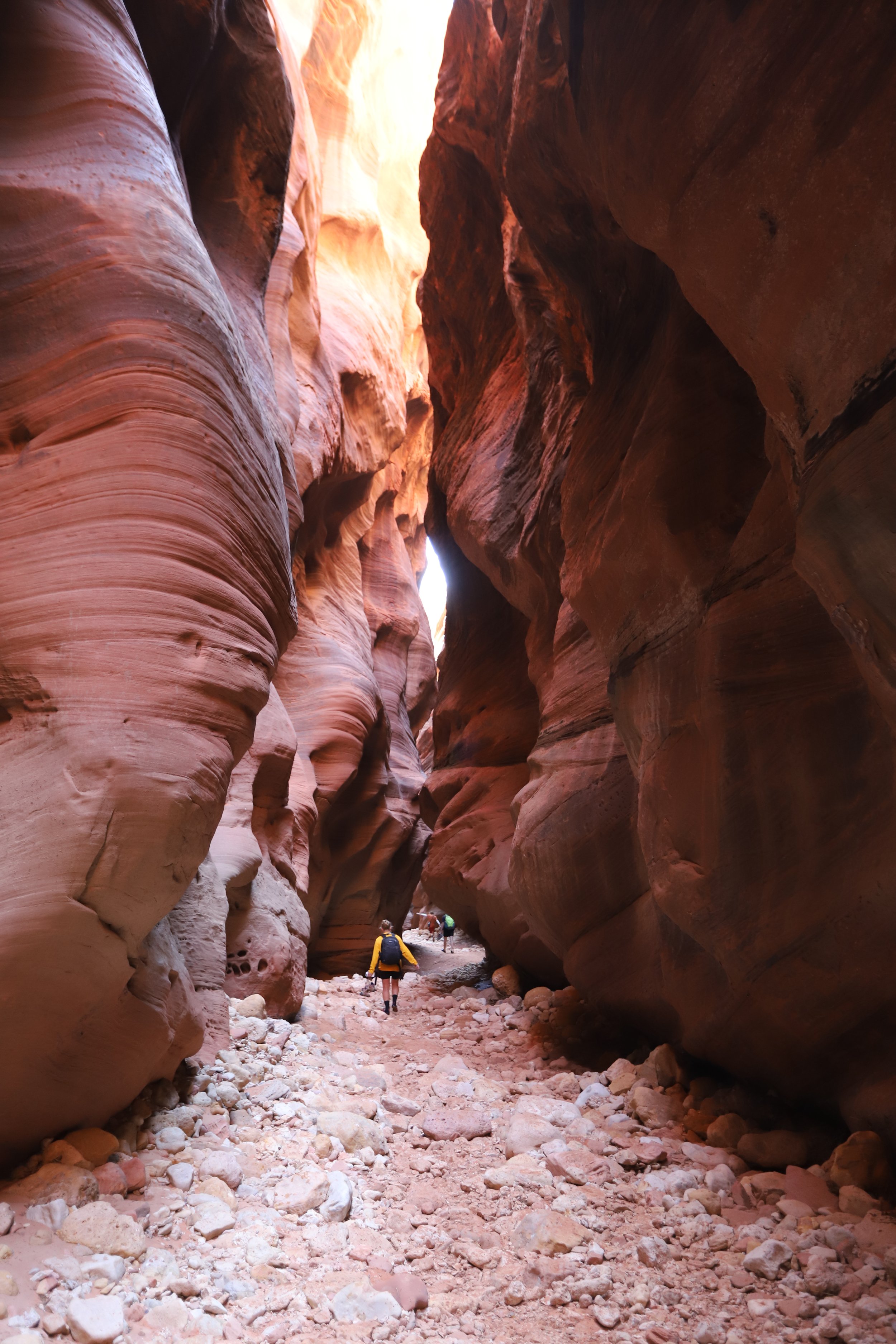
We continued a bit further into Buckskin Gulch Canyon.
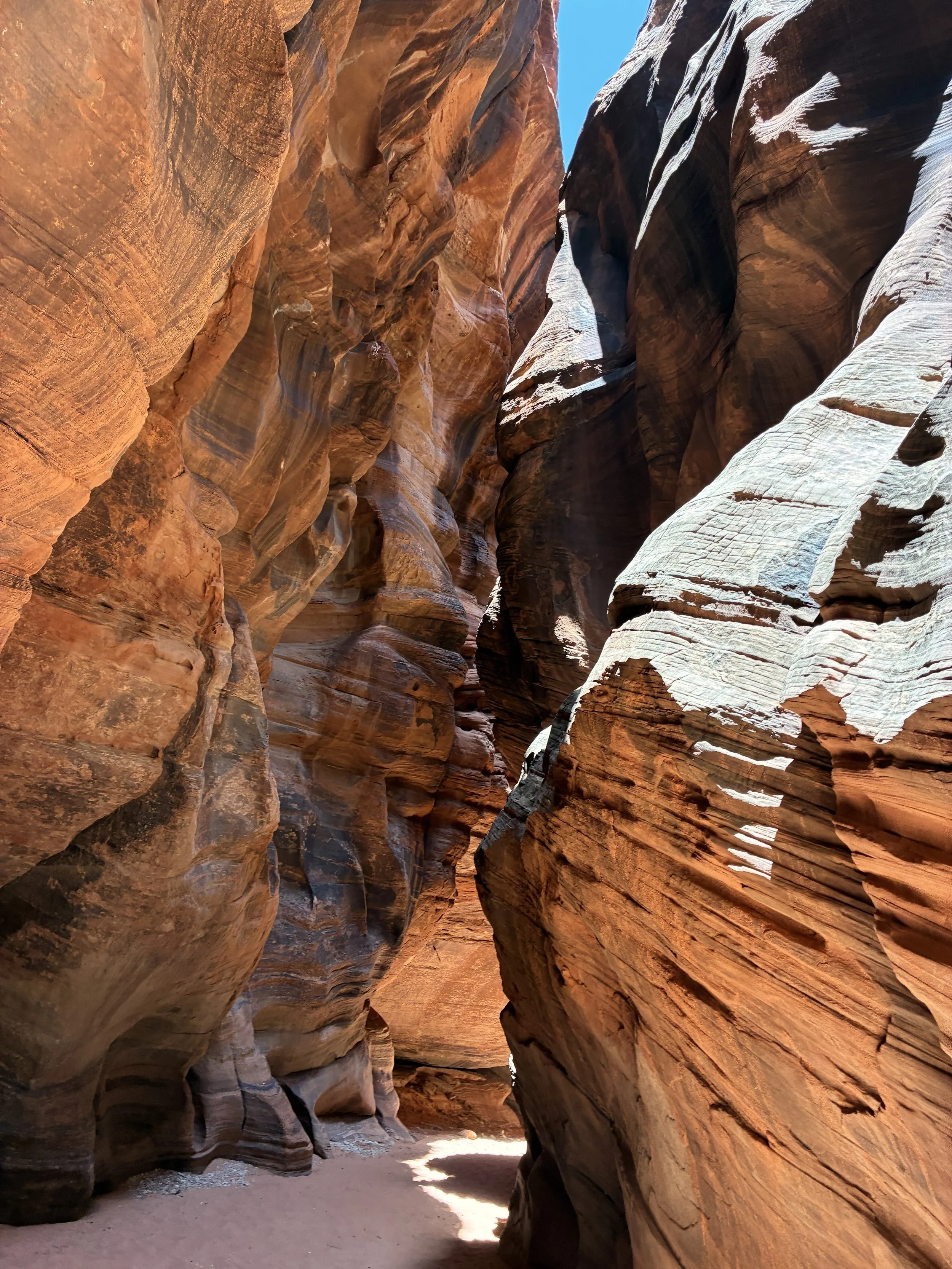
Hiking through Buckskin Gulch Canyon
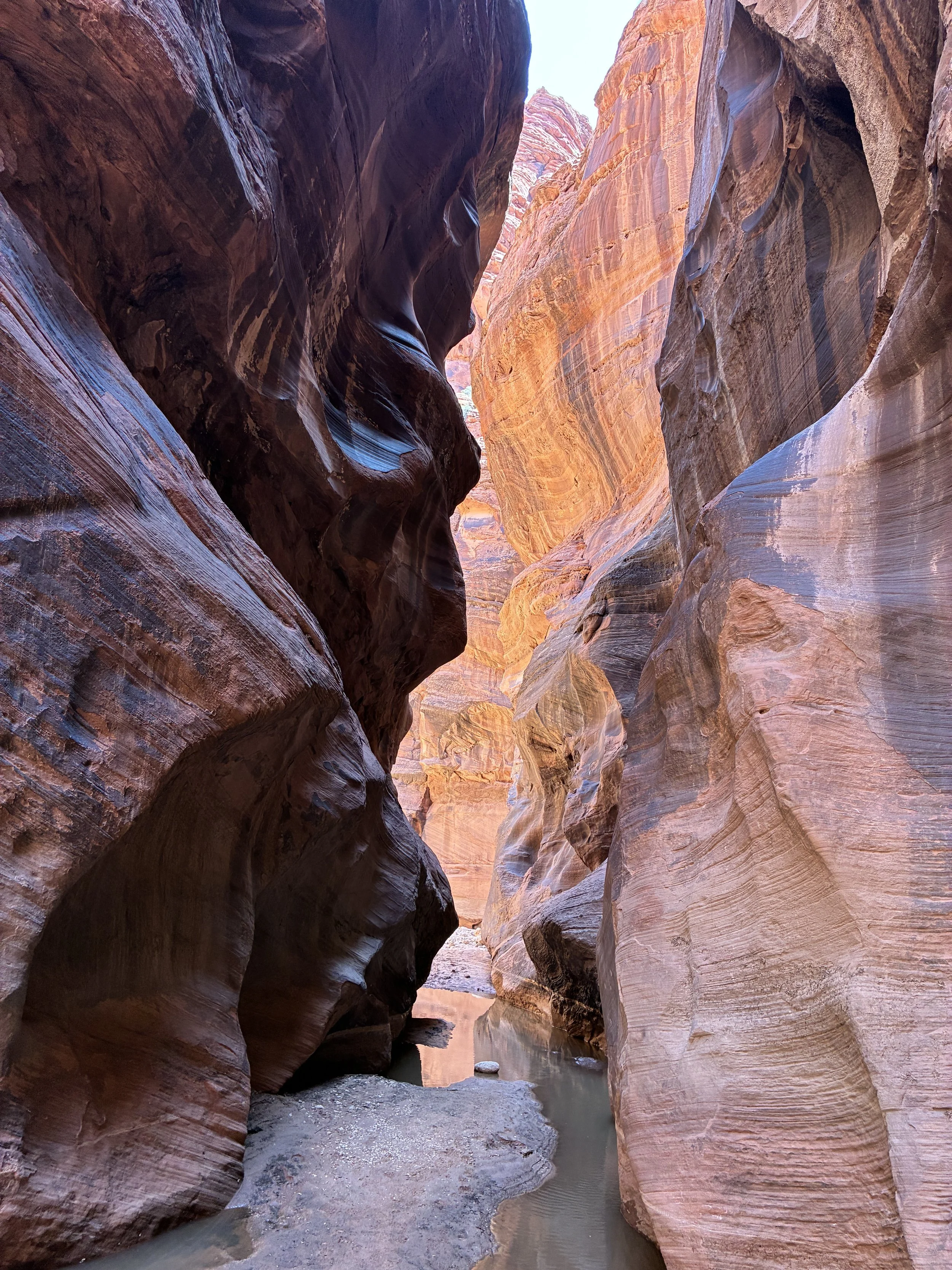
This is one of my other favorite pictures inside Buckskin Gulch Canyon
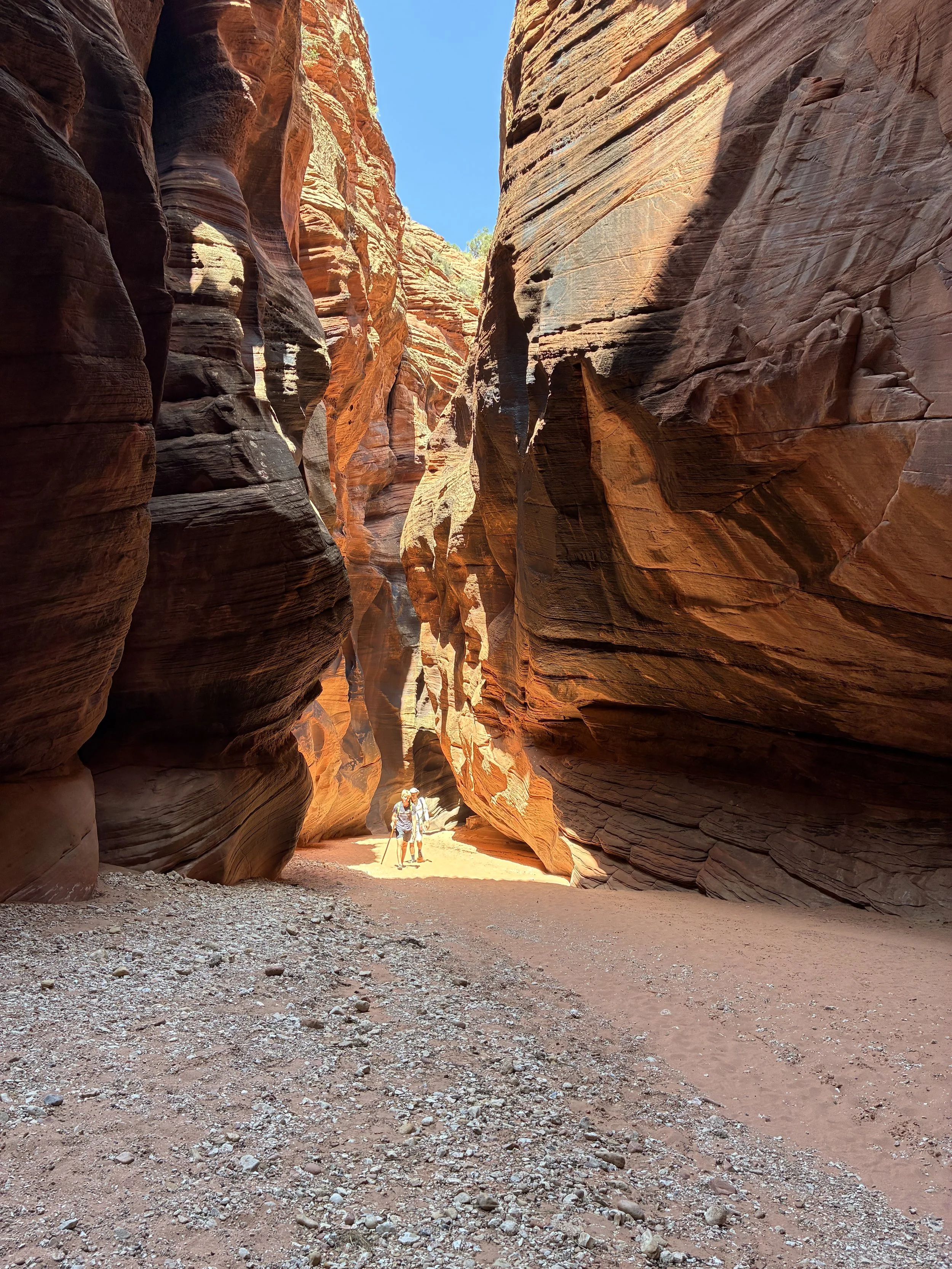
The tall, straight walls reverted back to the intricate, curvy walls manufactured by time and water.
Buckskin Gulch
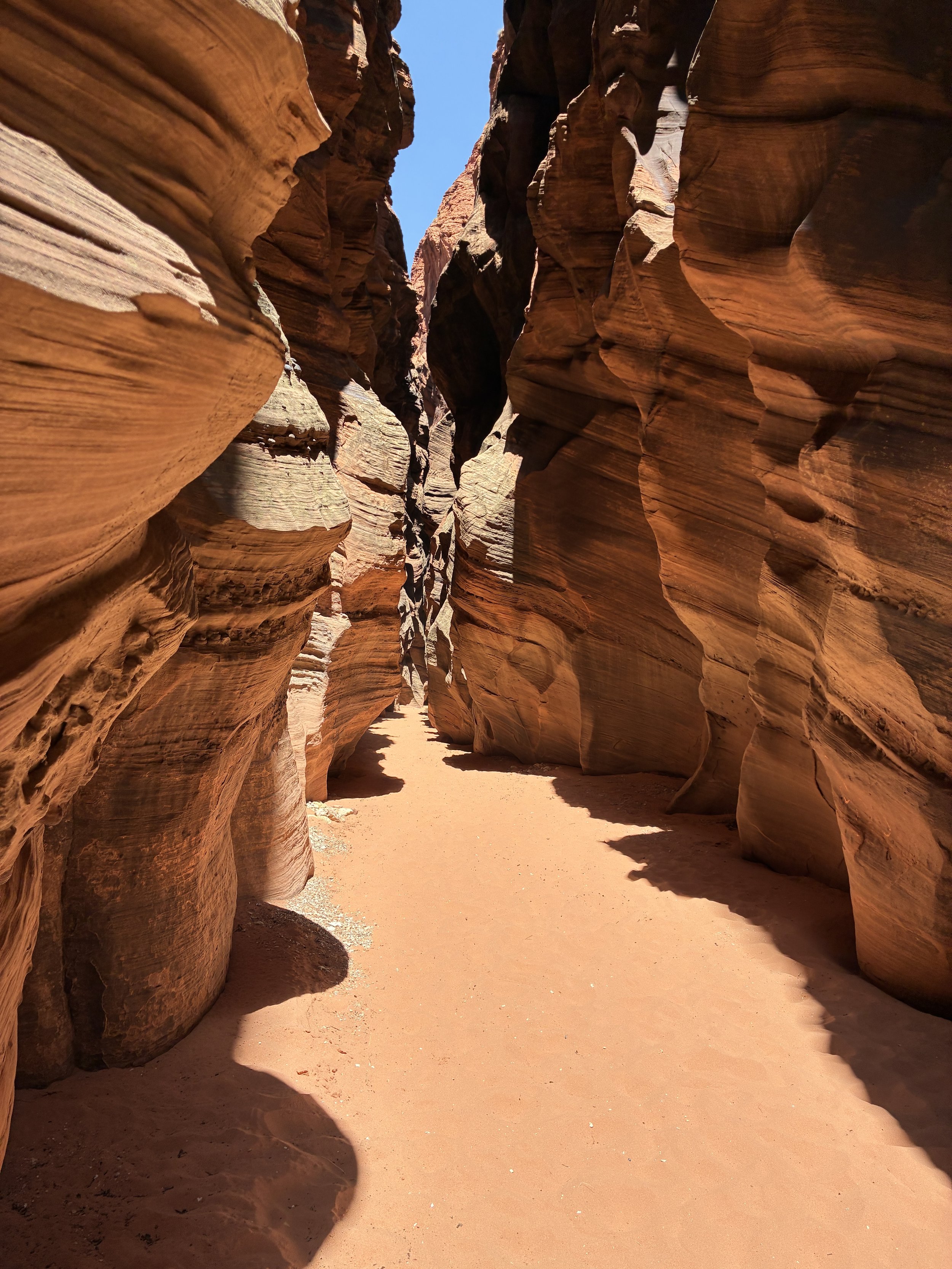
This was were we turned around after a little more than 5 miles from the trailhead. The light was very different on the way out, so here are a few more pictures from our hike back. I’ve really struggled to narrow down the pictures from this hike. Buckskin Gulch is such a phenomenally beautiful canyon.
Hiking back out through Buckskin Gulch Canyon in the late afternoon sun
Where we had been in the shade almost the entire hike since entering the canyon, we now found ourselves primarily in the sun. That was ok. We had a lot of water crossings, and that sun kept us warm.
Hiking back through Buckskin Gulch
One last picture
Other Nearby Places to Explore
Toadstool Hoodoos
The Toadstool Hoodoos are accessed from US-89, about 30 minutes from the Wire Pass Trailhead. This is an easy 1.5-mile hike.
White Pocket
To access White Pocket, keep going along House Rock Valley Road. There are a handful of unmarked roads along a road of mostly deep sand. I have an idea of how to drive on snow from living in Minnesota most of my life, but I do not know how to drive on sand. I hired a driver (Paria Outpost & Outfitters). It was worth the cost! Note that it is over an hour drive to White Pocket from Wire Pass due to the sandy roads.
Horseshoe Bend
This is a short (1.5 mile) hike to an amazing view of the Colorado River. The trailhead is just under an hour from Wire Pass.
Antelope Canyon
Antelope Canyon is still the best slot canyon I’ve ever entered. Although it can only be accessed through a tour (fee required), I would highly recommend stopping here.
Lake Powell
Swim, rent a motorboat or kayak, take a boat tour, or hike - there are so many ideas to choose from. All activities are accessible from Page, Arizona.
Kanab, Utah
Kanab, Utah is an hour away from the Wire Pass Trailhead. Most of the places to explore from Kanab are an added distance, but Kanab is a great small town to pick for a hotel location. The link I have is to Zion National Park. At the end of the post is a link to other nearby places to explore, which include those within an hour drive from Kanab, as well as St. George, and Kolob Canyon. There are so many places to explore that this has been a frequent vacation destination for us.
More from www.NatureImpactsUs.com
In the map below, there are additional posts I’ve written attached to each pin. Use two fingers to move around within the map.