
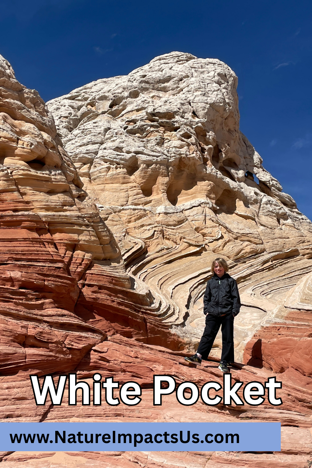
White Pocket - Vermilion Cliffs National Monument
If you enjoy my blog, please consider signing up below for email notifications of my latest posts. I will not share your email.
A Desert Treasure
Probably the furthest off-the-beaten-trail I’ve ever been, White Pocket is in a category all of its own. The huge, layered and colorful rocks, the desolateness, and how hard it is to get to (all three are such extremes) make White Pocket hard for me to compare it to anything else, even other places nearby.
On our Spring Break trip in March 2023, it was just my boys and me. I had rented a truck, but I had no idea how to drive on sand, and I didn’t really want to get stuck some place without another adult to help me figure out what to do. I did want a chance to visit White Pocket though, so I booked a tour with Paria Outpost & Outfitters. I think that was the best way for us to visit this place. For someone with a 4x4 vehicle and knowledge of how to drive in sand, it’s possible to do this without a tour, but I would download a GPS map. These roads are not marked, and I wouldn’t recommend getting lost in the desert.
White Pocket - Vermilion Cliffs National Monument (near the AZ-UT border)
White Pocket Logistics
The good news about planning a trip to White Pocket - this is a free place to visit with no permits required. The bad news - White Pocket is really hard to get to. The closest cities with lodging are Kanab, Utah and Page, Arizona. Both cities are along US-89, each about 40 minutes from the turnoff. From US-89, first there is a 20.5-mile drive along a dirt road. This dirt road may be in various states. If it’s wet, it’s going to be impassable. If you are traveling too early in the spring and the BLM (Bureau of Land Management) hasn’t had a chance to re-grade it yet, good luck. It’s going to be filled with treacherous potholes. This is the same road you need to take to Buckskin Gulch. When we travelled it in June 2025, it was fine with our minivan. I wouldn’t have thought anything of it. Except in March 2023, this road was so hard to drive on that cars were parked on the edge in the desert landscape, and hikers were walking extra distances to get to the slot canyon trailhead. I give this dirt road a “wild-card” rating without a 4x4.
Following the adventurous dirt road, there are several 4x4 (required) roads that need to be successfully navigated through to get to White Pocket. None of the intersections are marked, and the roads in some places are just deep sand. There were spots our driver sped up to get through the sand and other times he slowed down. I have no idea how to navigate a vehicle over such terrain. If attempting this on your own, in addition to having a 4x4 vehicle and knowledge of how not to get stuck in the sand, download a map of the 4x4 roads to help navigate these intersections.
For anyone like me, that feels overwhelmed by these pretty high barriers, just find a tour guide. It’s expensive, but how else are you going to see this amazing part of our planet? Paria Outpost & Outfitters was fantastic! We had a great trip. The boys’ one relevant complaint was the drive time to and from White Pocket. It was about a 2-hour drive (each way) between Paria Output & Outfitters and the trailhead. They thought White Pocket was pretty cool, but that it was a long time to invest during a vacation to drive somewhere. Now having had a chance to explore Buckskin Gulch (on our June 2025 trip), my advice would be - combine this trek out to White Pocket with a half day hike out-and-back into Buckskin Gulch slot canyon. I’m not sure if it’s even an option with any tour guides to have them pick you up / drop you off at the Wire Pass trailhead, but if it is, this would 100% be my recommendation for an incredible day well spent on a vacation.
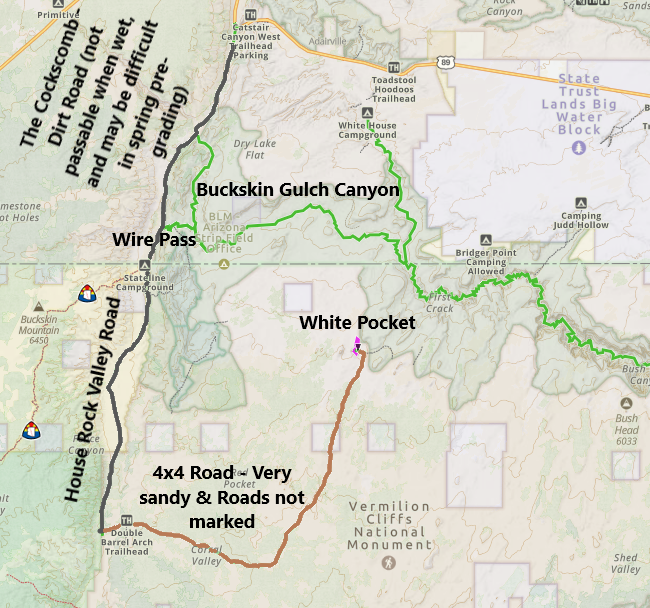
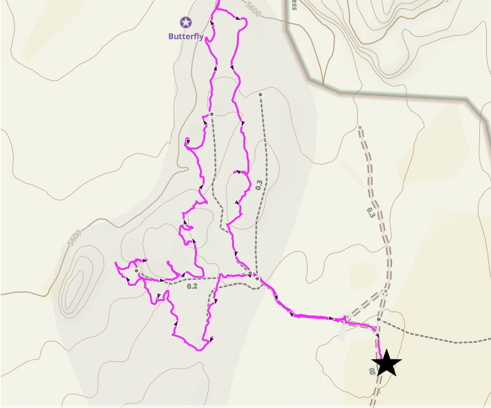
Map for how to get to White Pocket (and the Wire Pass Trailhead to Buckskin Gulch)
White Pocket
Exploring White Pocket
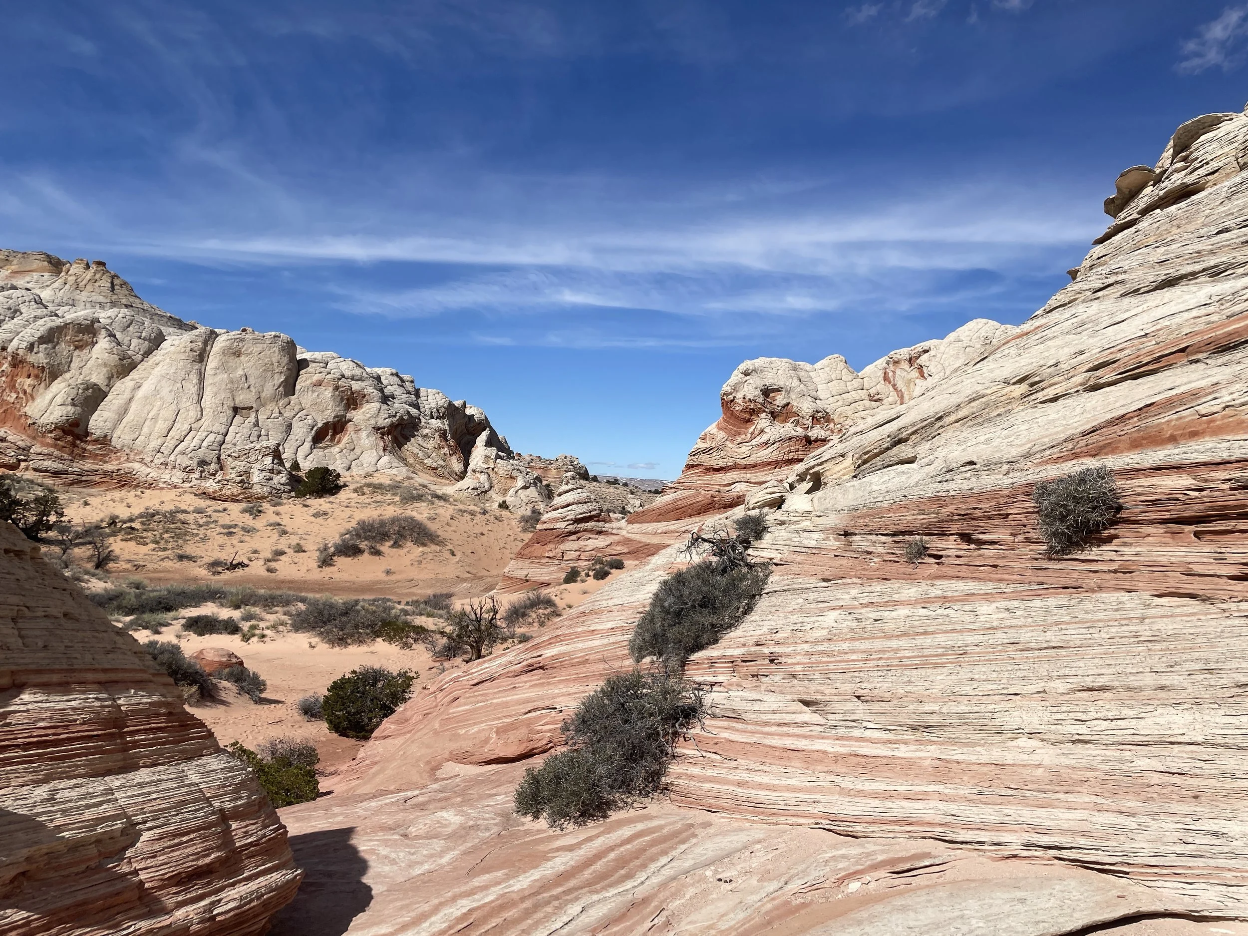
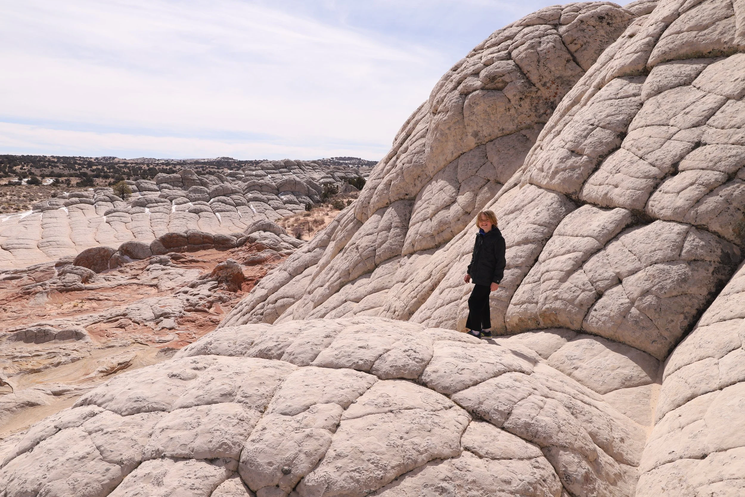
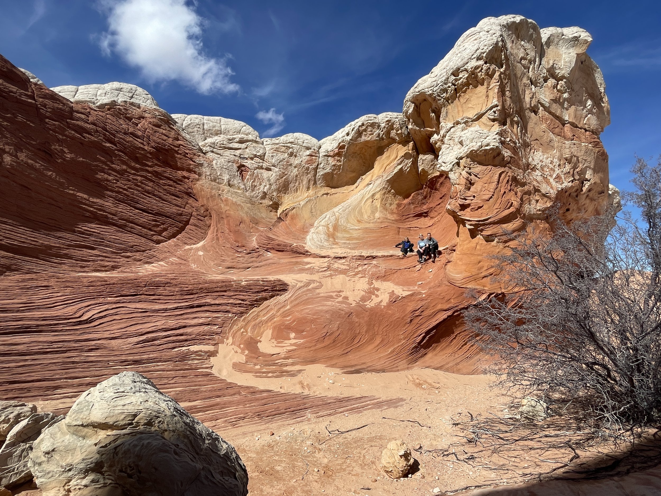
As I mentioned, it was about a 2-hour drive (each way) to get to White Pocket from Paria Outpost & Outfitters. Once we were at White Pocket, we hiked about 2.25 miles over a 3.5-hour period. This was a slow hike, but it was fun to explore every crevice, take a thousand pictures, and just sit in a few places and be a part of this incredible landscape. For the most part this was a flat hike, but due to it being on rocks, and there were a couple of places we needed to scramble up and down, bring hiking poles if mobility might be a slight challenge. For those people that are naturally part mountain goat, there are plenty of places to scale up and down these beautiful rocks and view the sites from multiple angles.
Hiking through White Pocket in the Vermilion Cliffs National Monument
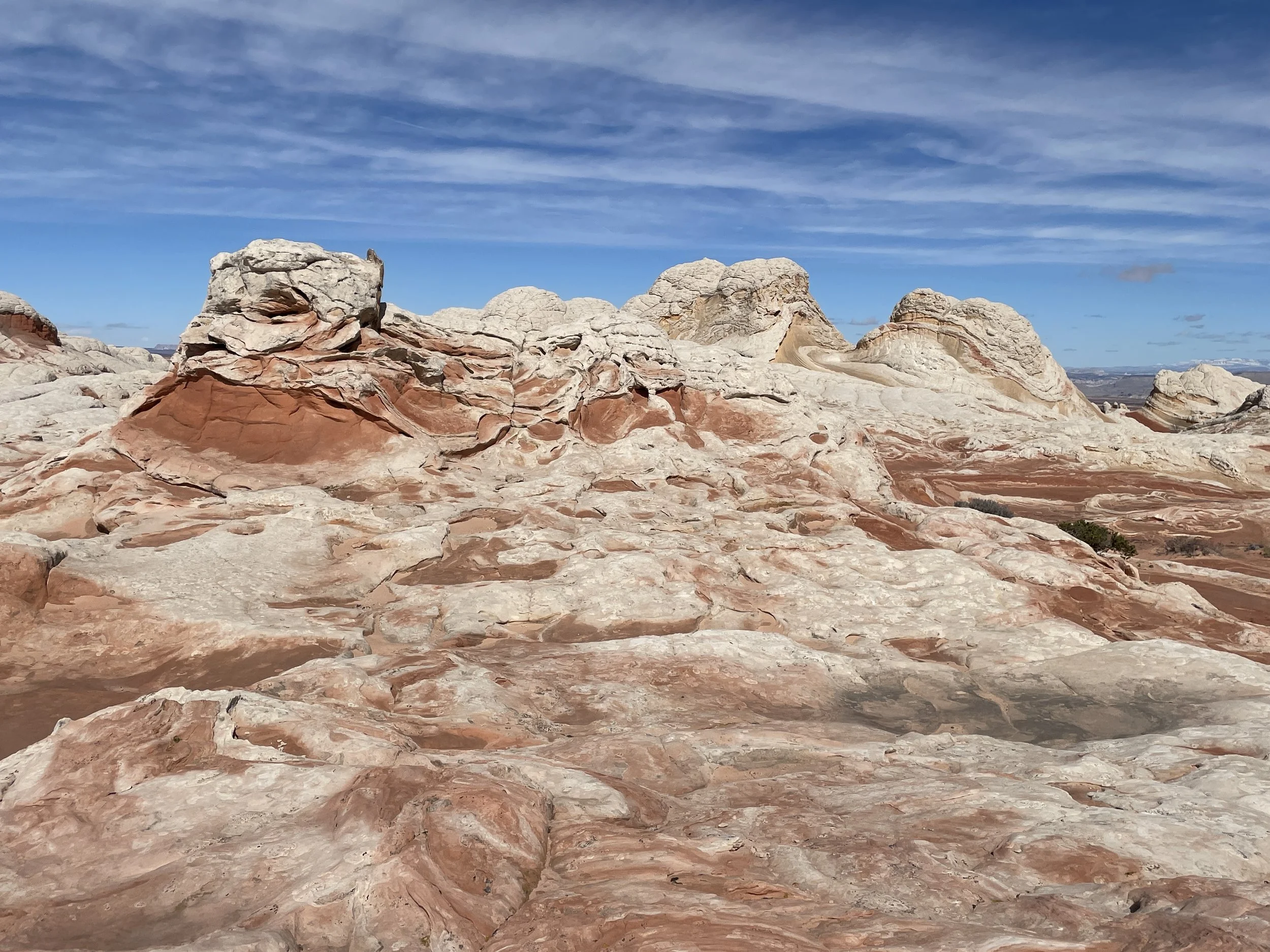
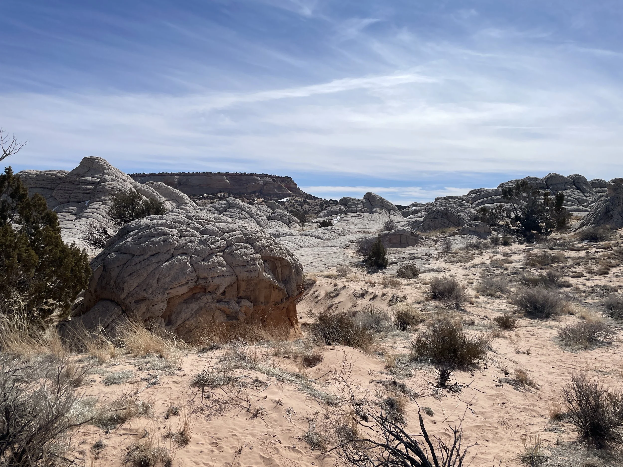
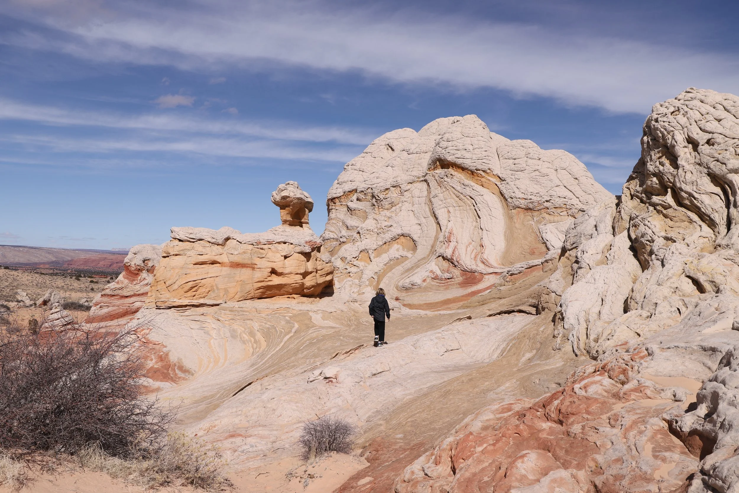
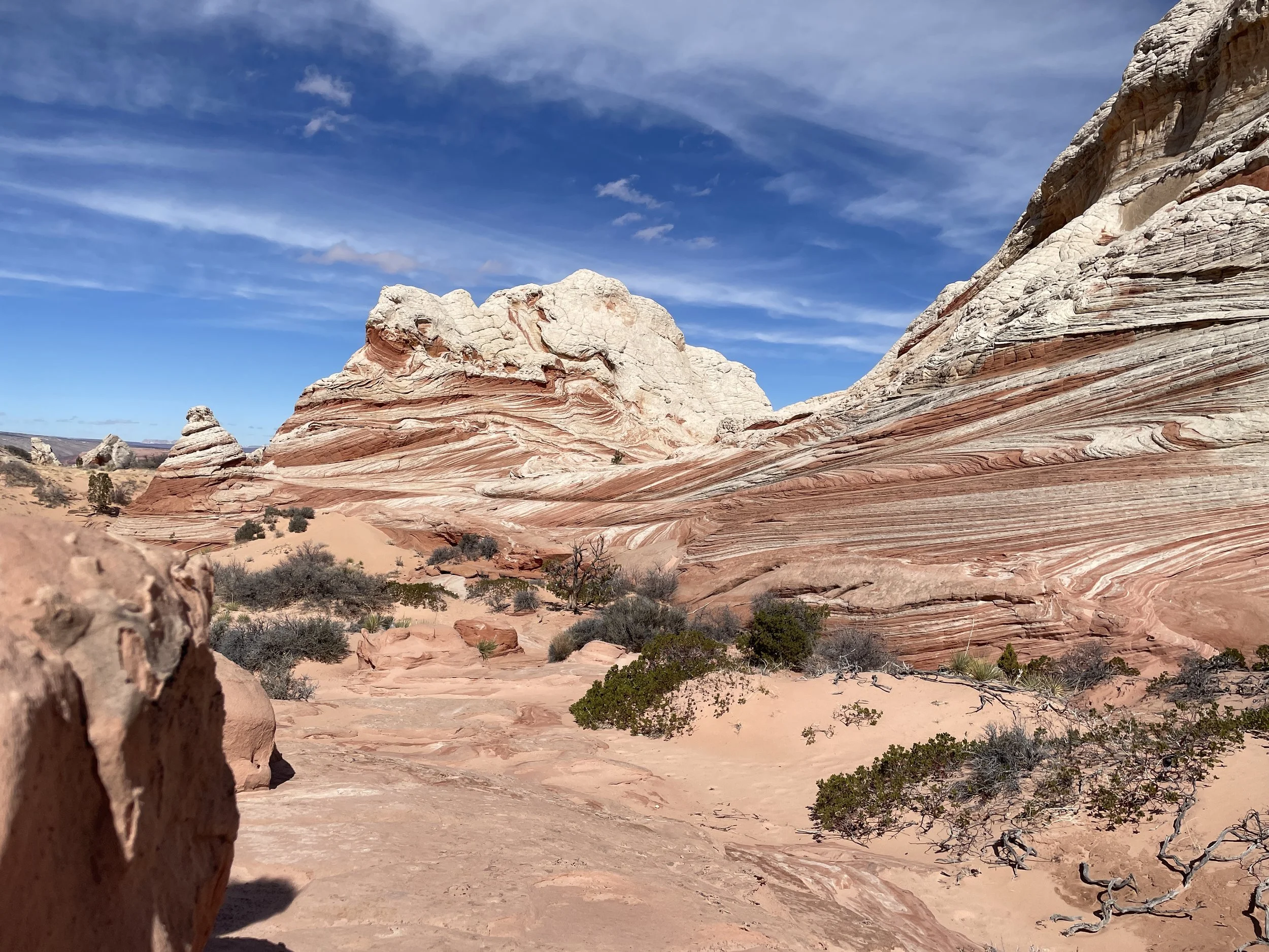
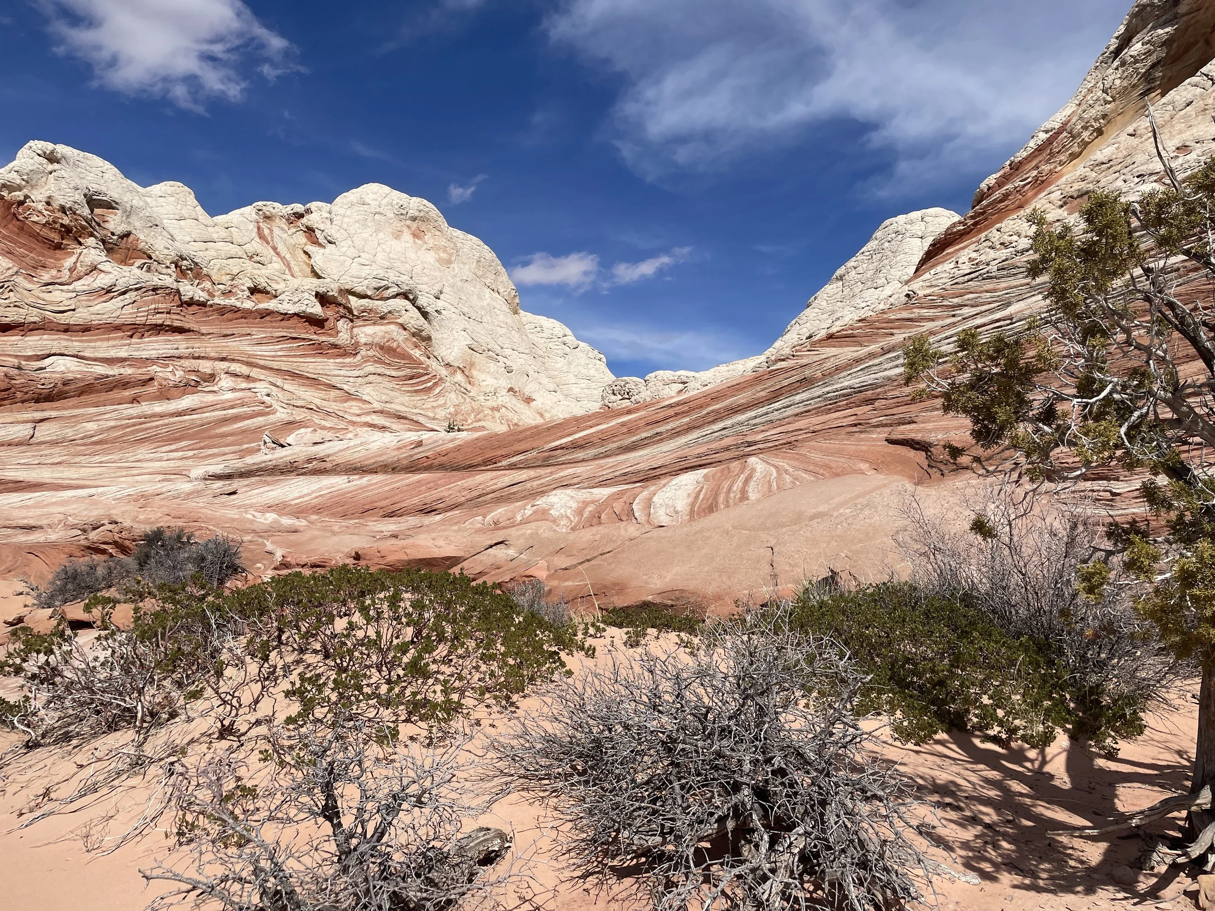
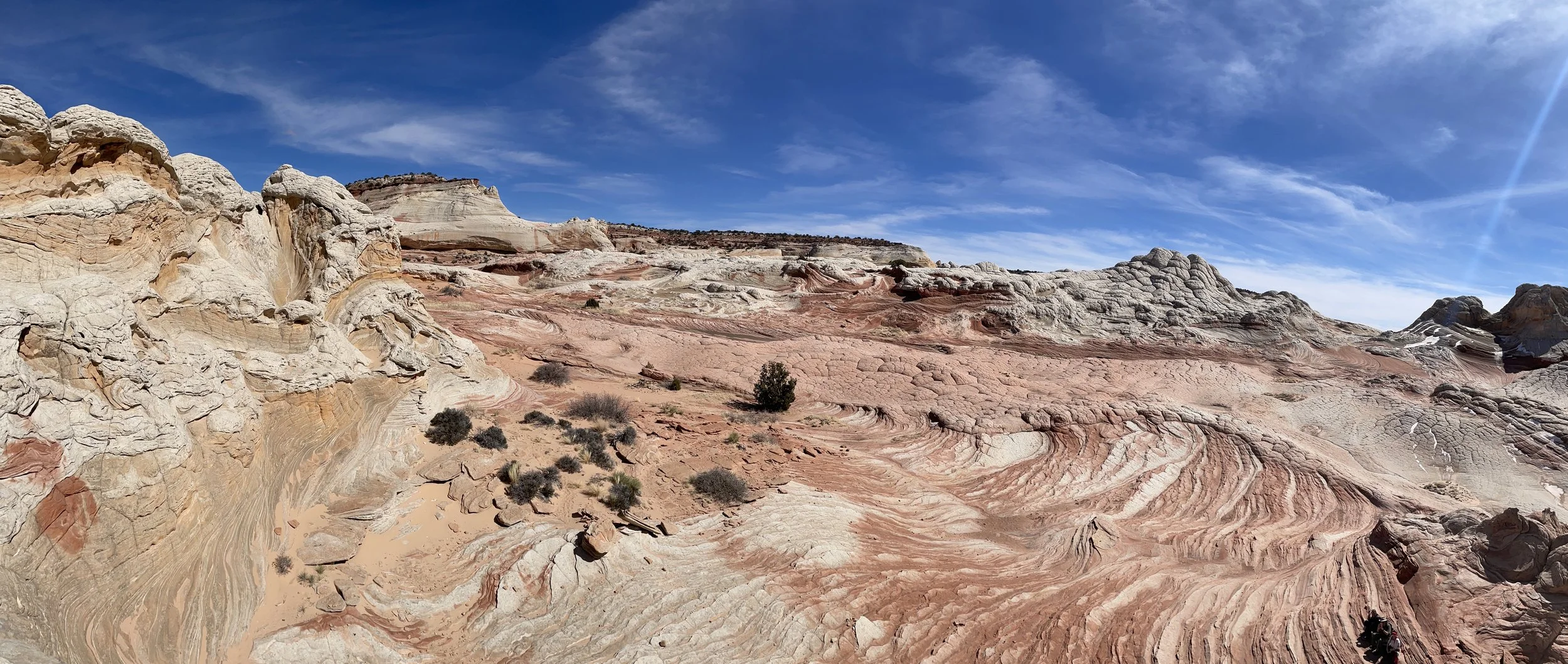
White Pocket is a place where you get of your vehicle, stare, and think to yourself “Wow! Where am I?” This is about the view from our starting spot. We walked towards the left of these cliffs.
Exploring White Pocket
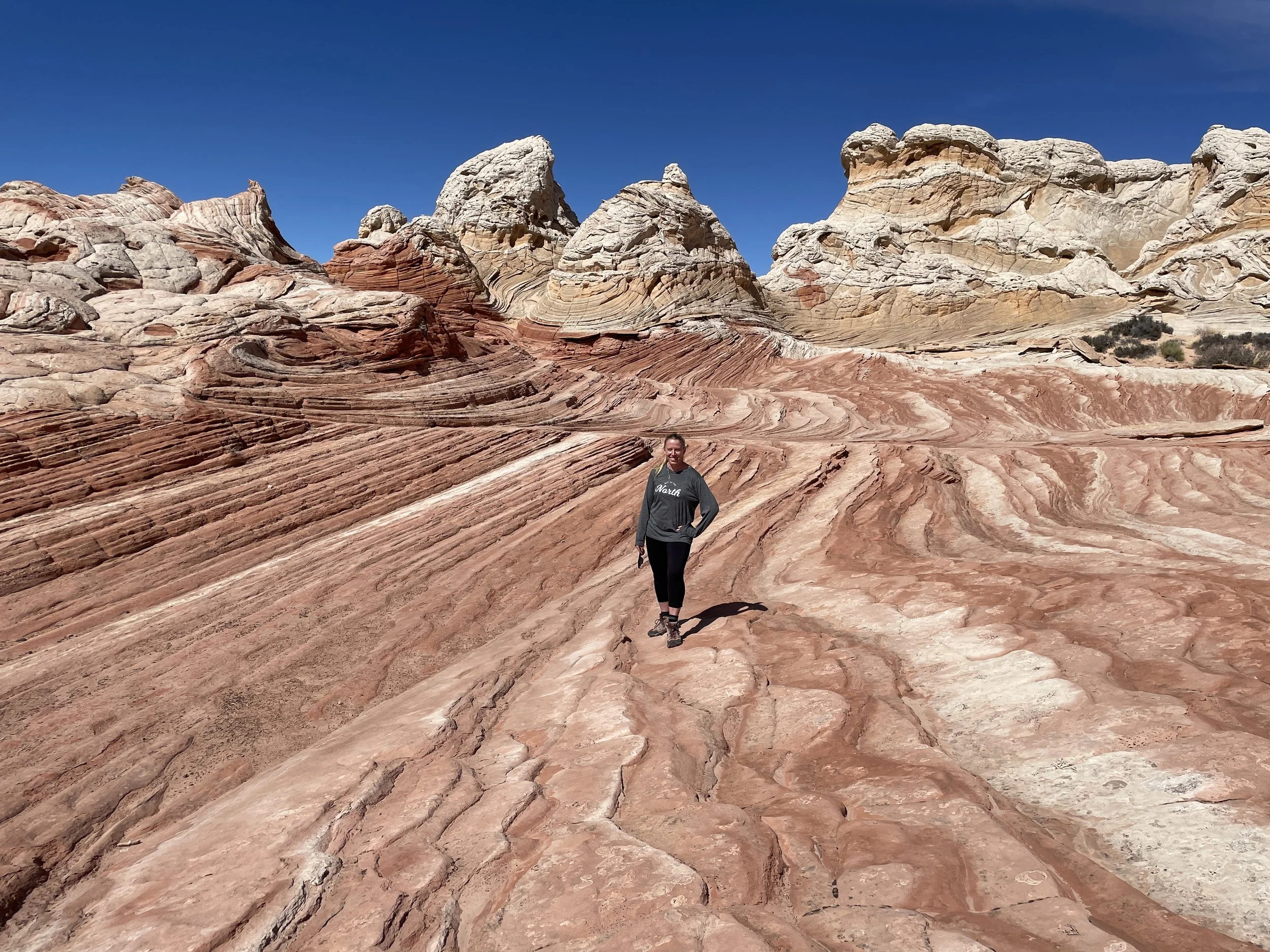
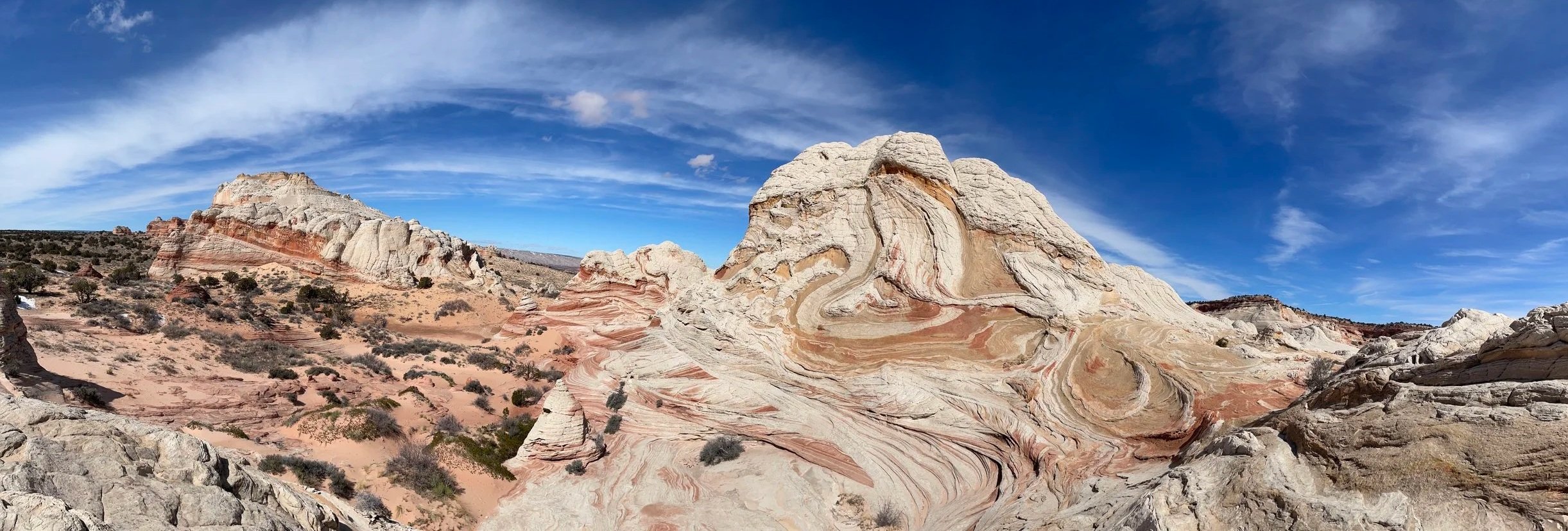
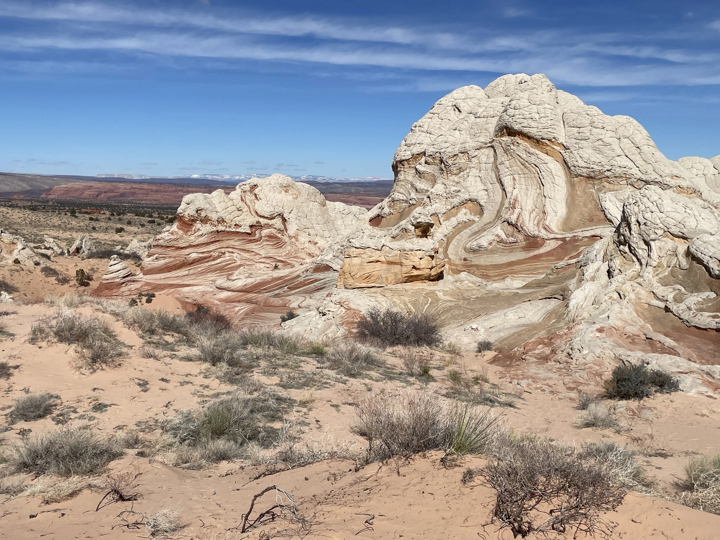
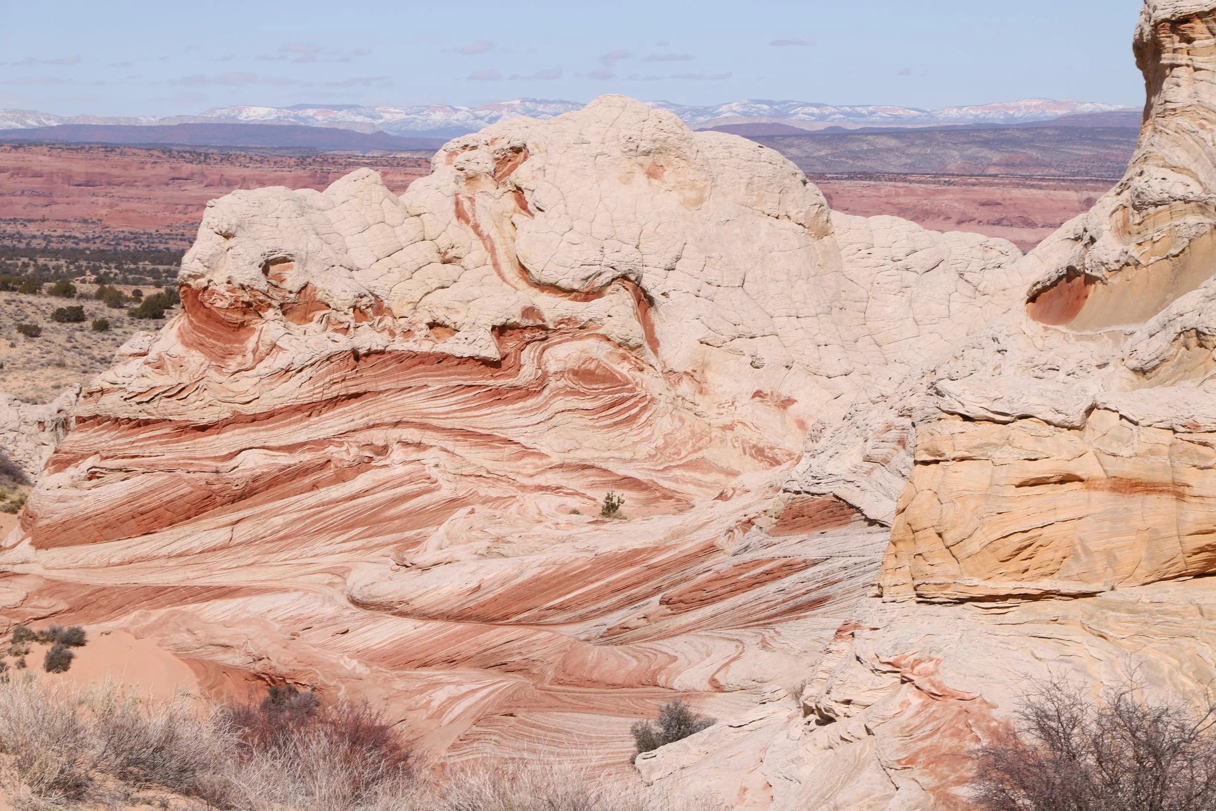
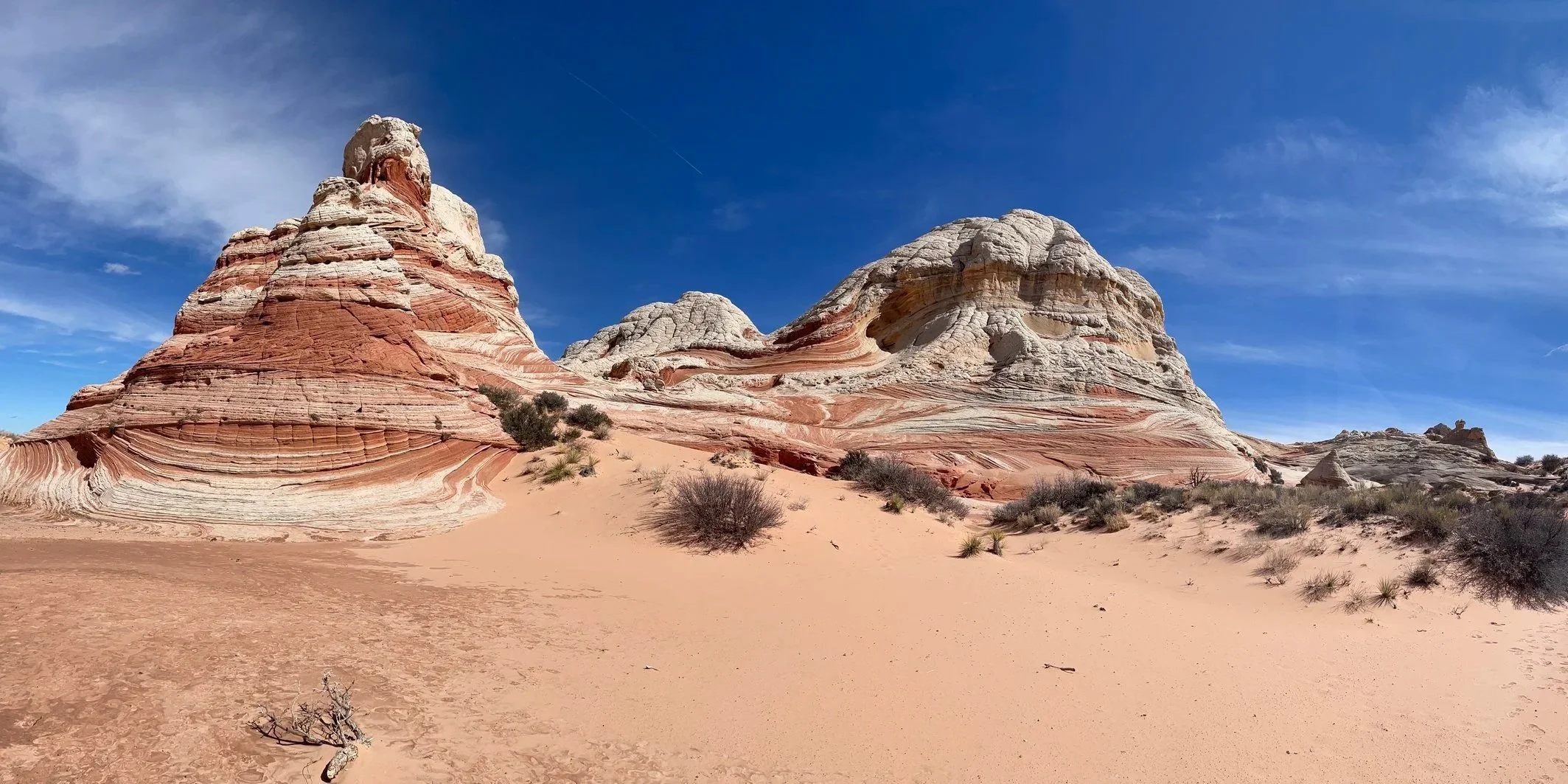
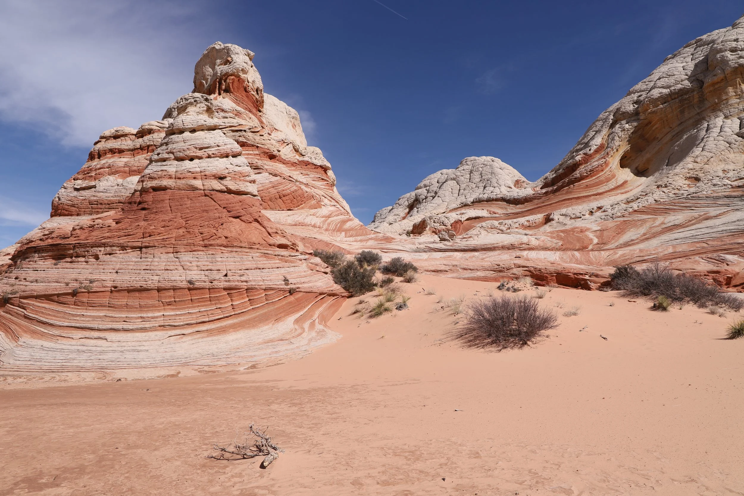
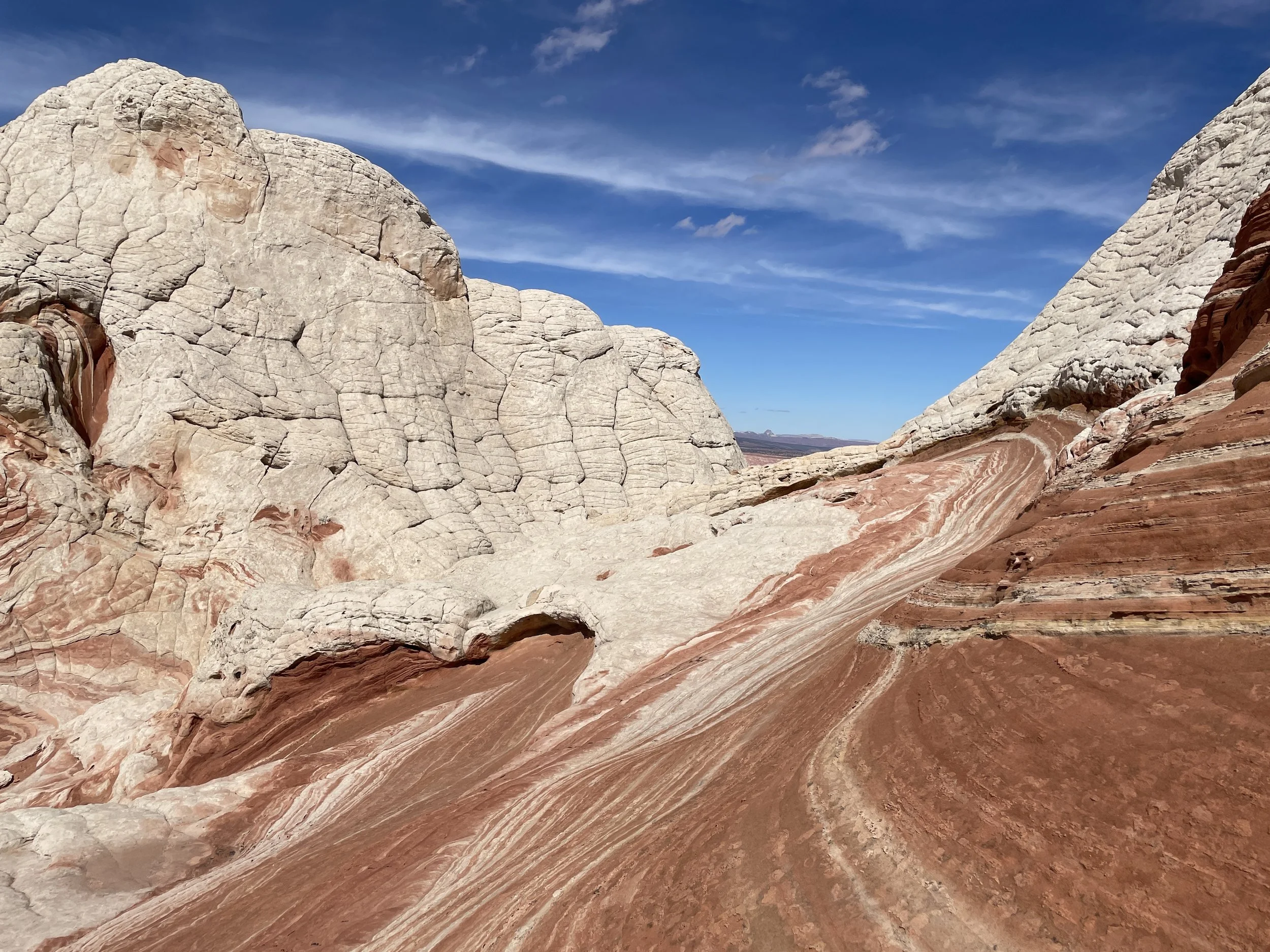
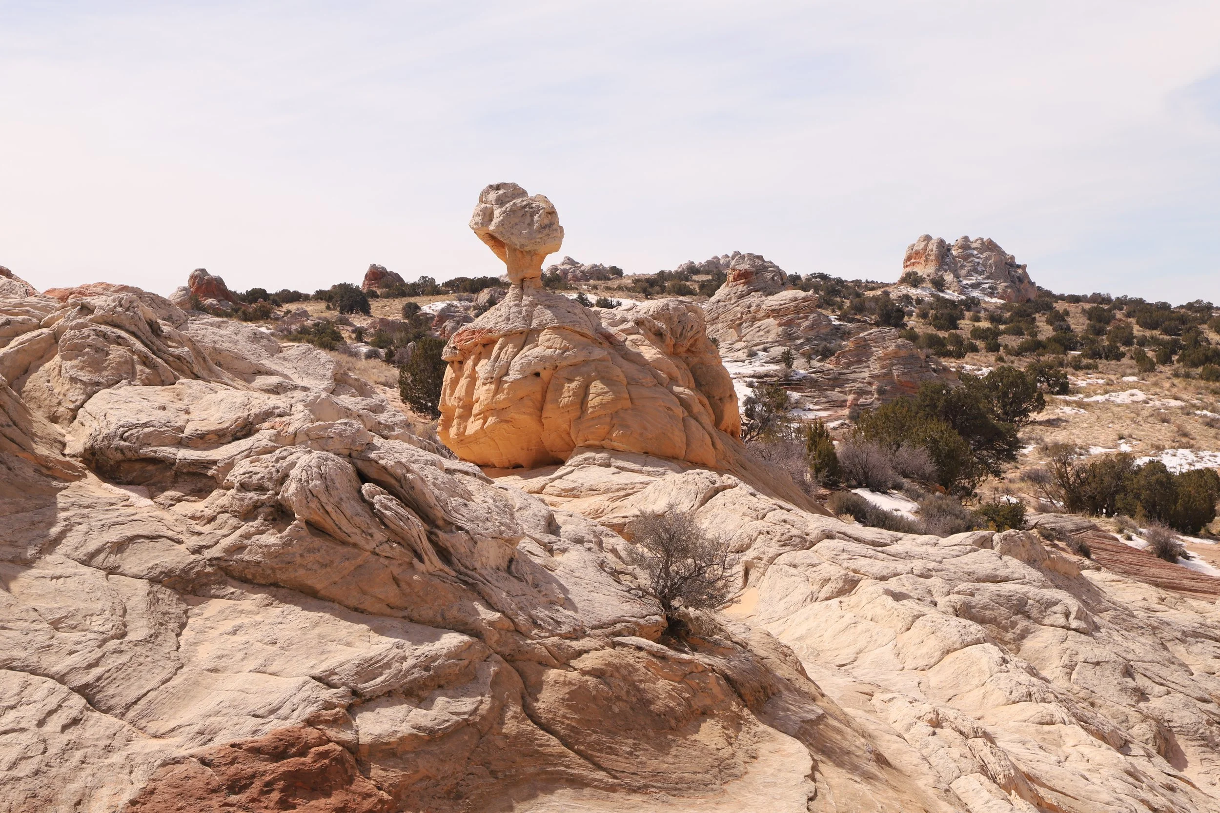
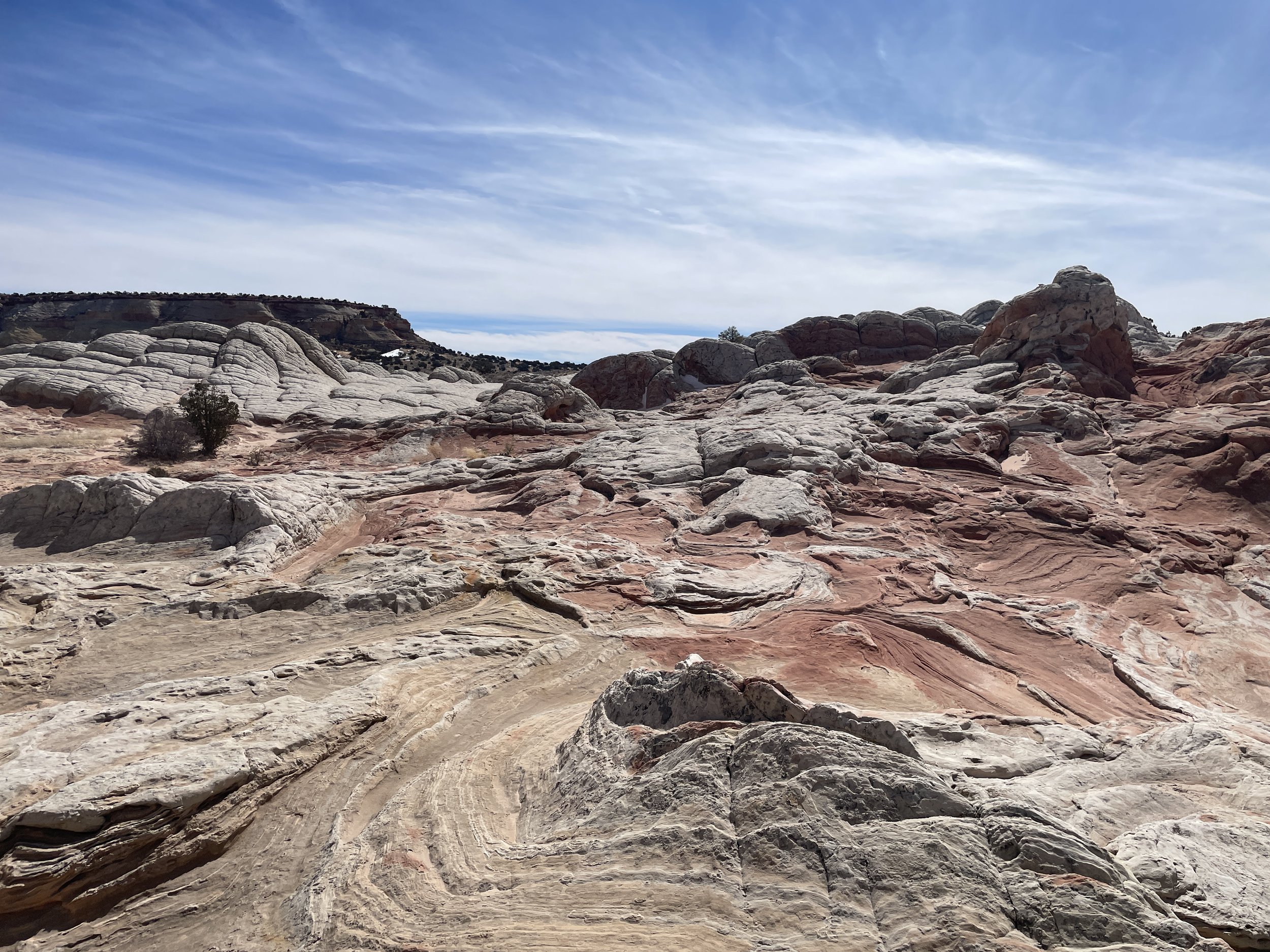
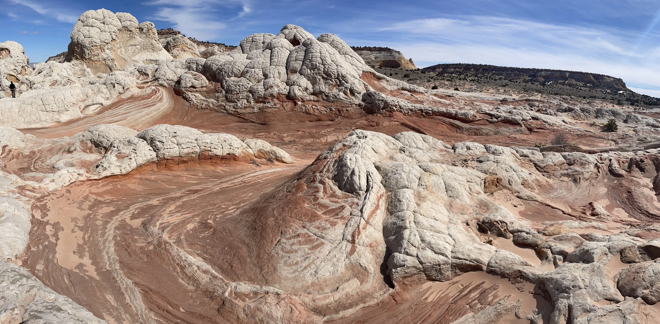
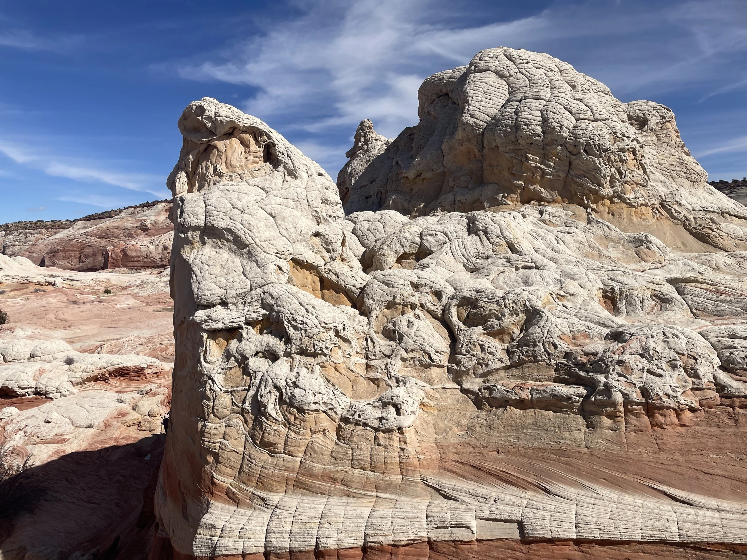
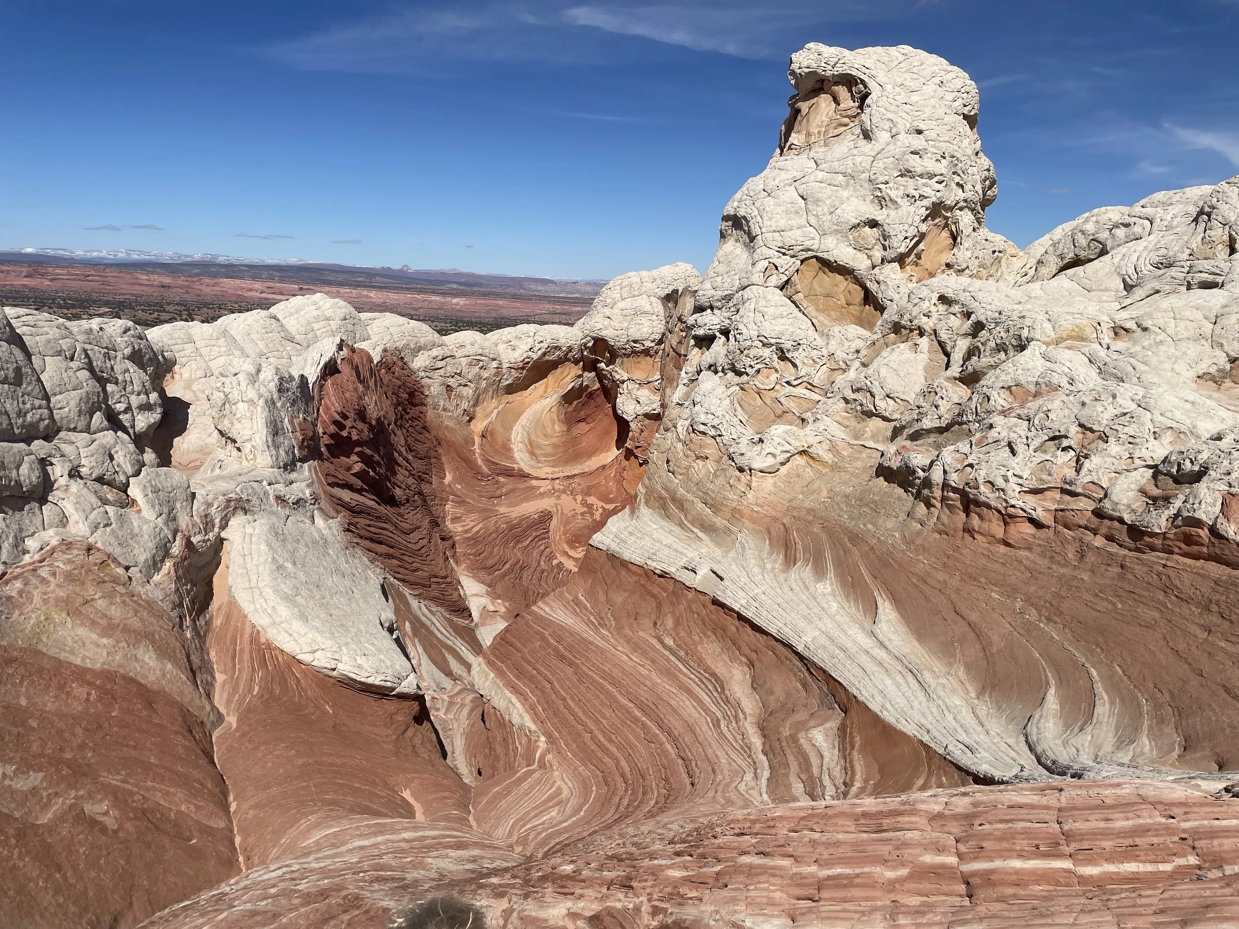
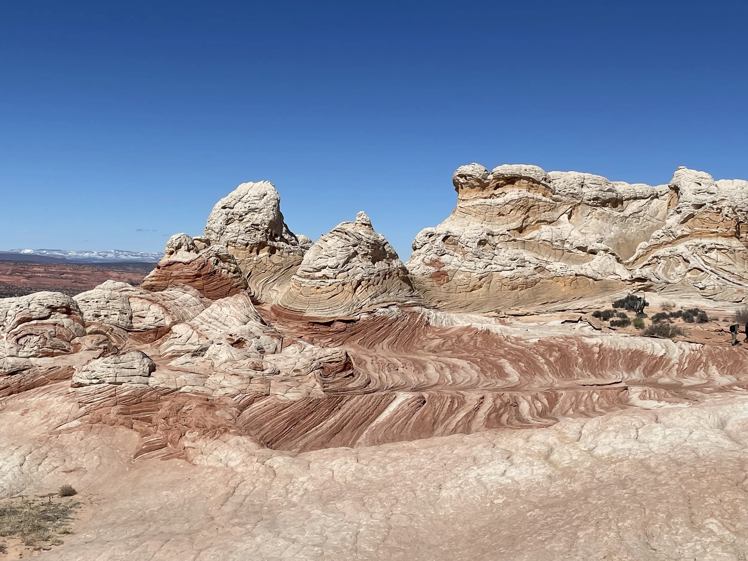
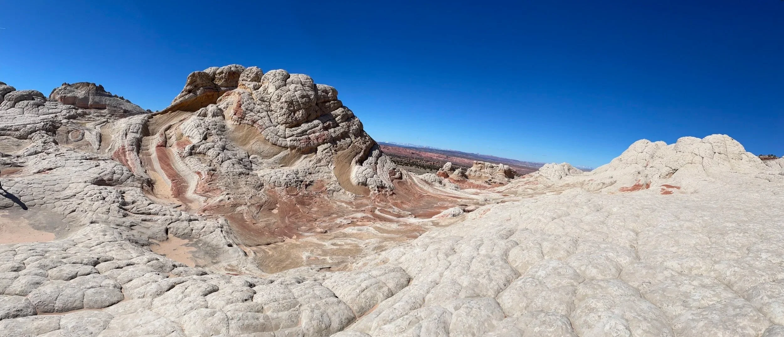
There are two pretty incredible things to focus on from a geology standpoint at the very beginning. The first is the striking color bands. The dazzling red colors are due to iron deposits. The second amazing feature is the geometric boxes cut into the rocks. I’ve found similar patterns in two other places - Zion National Park (Checkerboard Mesa) and at Yant Flats. The horizontal lines formed as ancient sand dunes formed (like waves). The vertical lines are formed from water expanding as ice freezes during winter within the sandstone.
Exploring the outer edges of White Pocket
Just to the left of the image above is a famous tree. It’s just a tree, but it’s in the middle of a rock, with no obvious soil. This tree is a true testament to “life finds a way.” There is a closer shot of the tree in the photos below, but this one truly shows how the tree is somehow growing out of the rock.

White Pocket Ponderosa Pine Tree
This is a prettier picture of White Pocket’s Ponderosa Pine. There must be some level of nutrients within the upper layers of the rock in White Pocket, but how it can support a tree this large, I’m not sure. It was stunning to see in person.
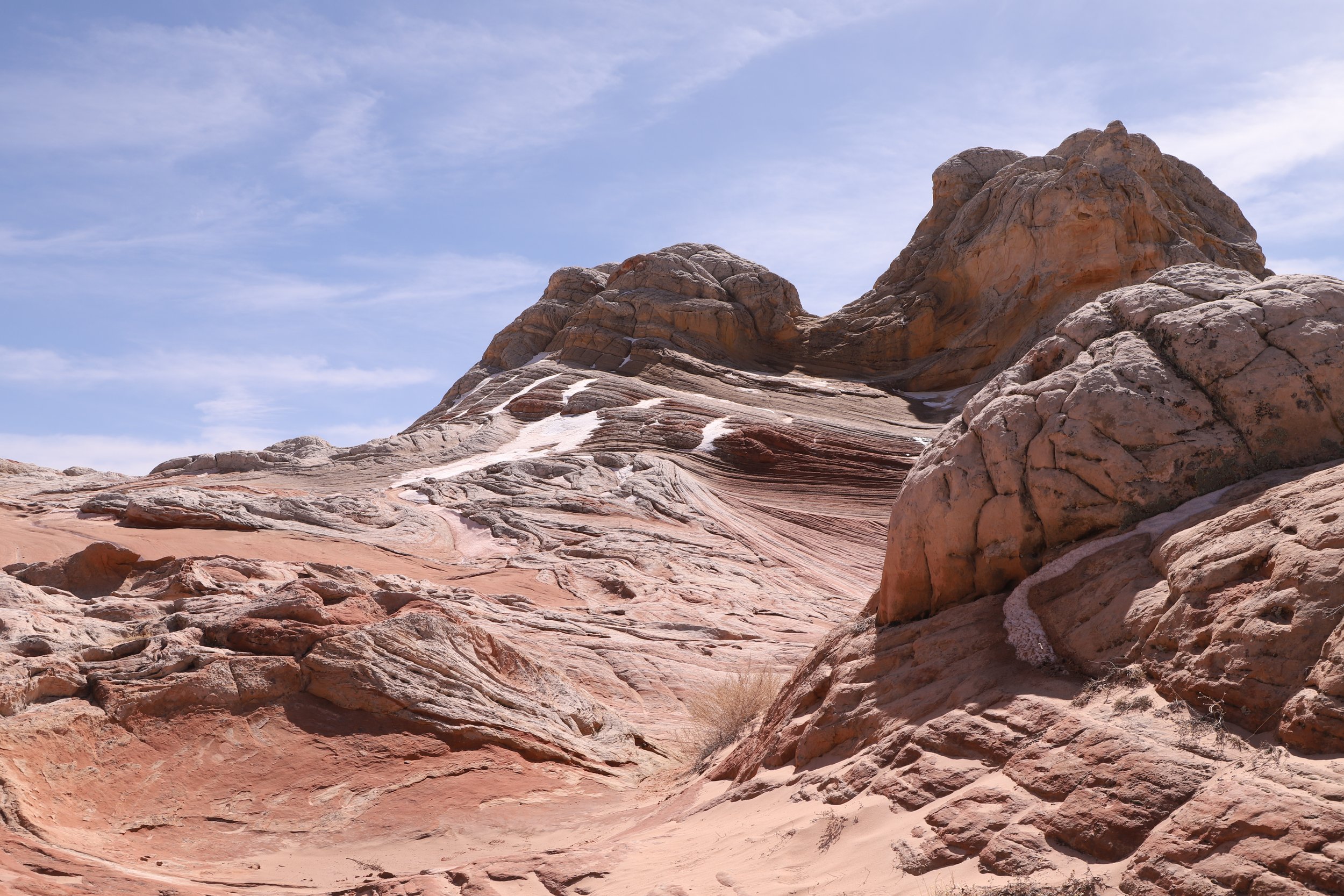
Yes, the white stuff in the picture is snow. It’s a desert and gets quite hot in the summer, but yes, it can snow here as well (and did often in February 2023).
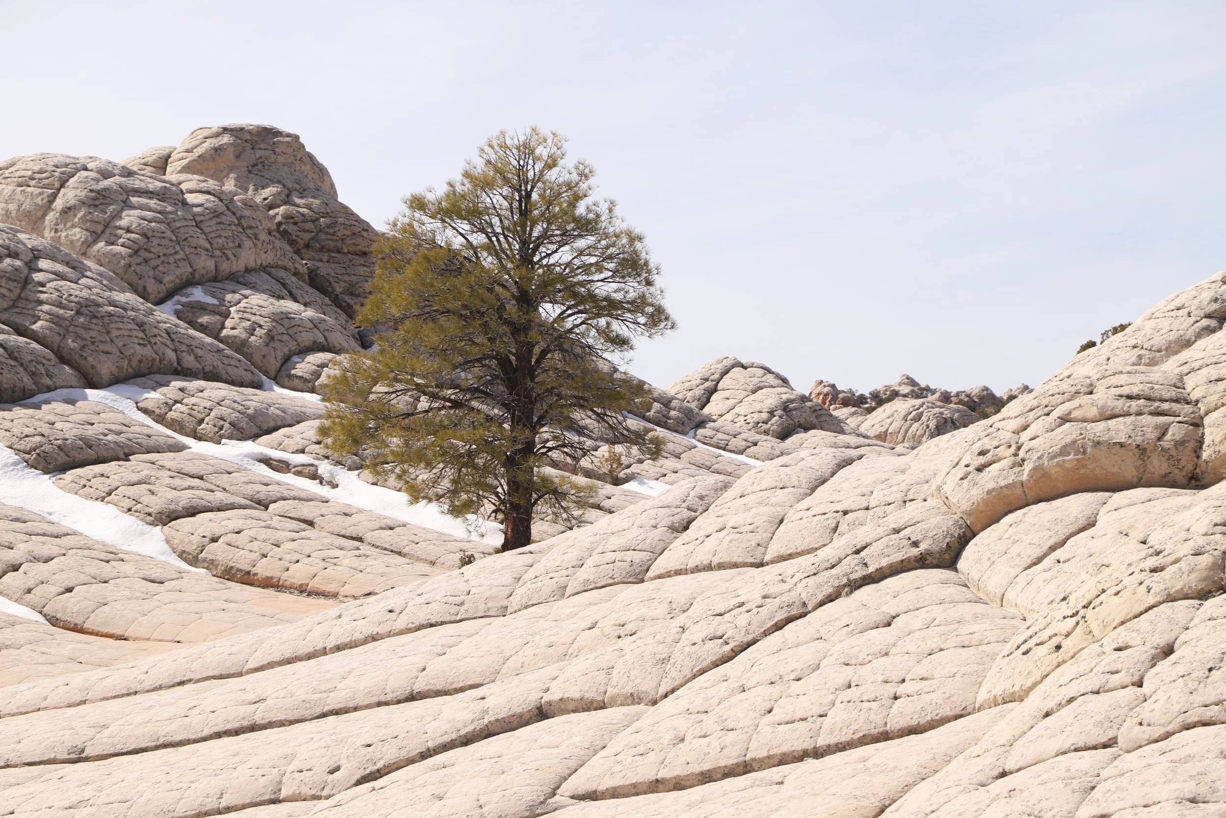
White Pocket’s Lone Ponderosa Pine Tree
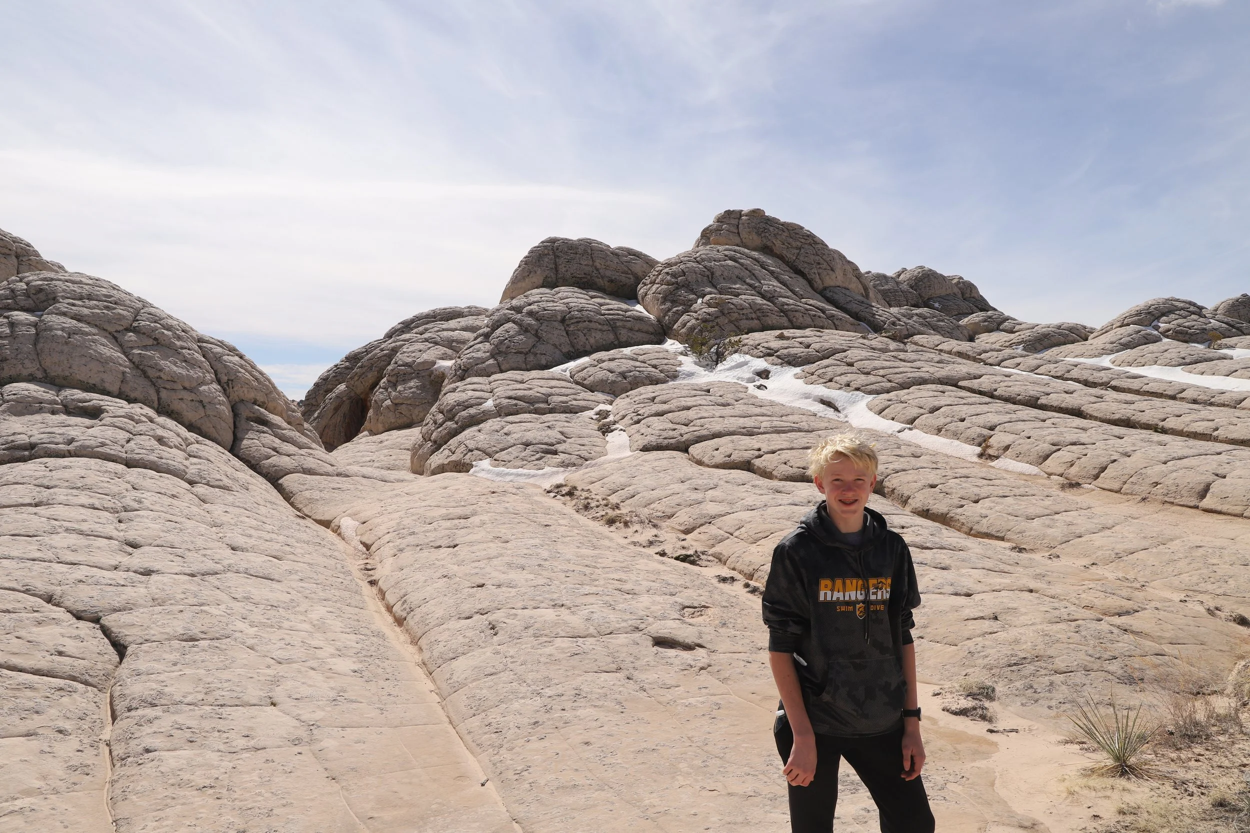
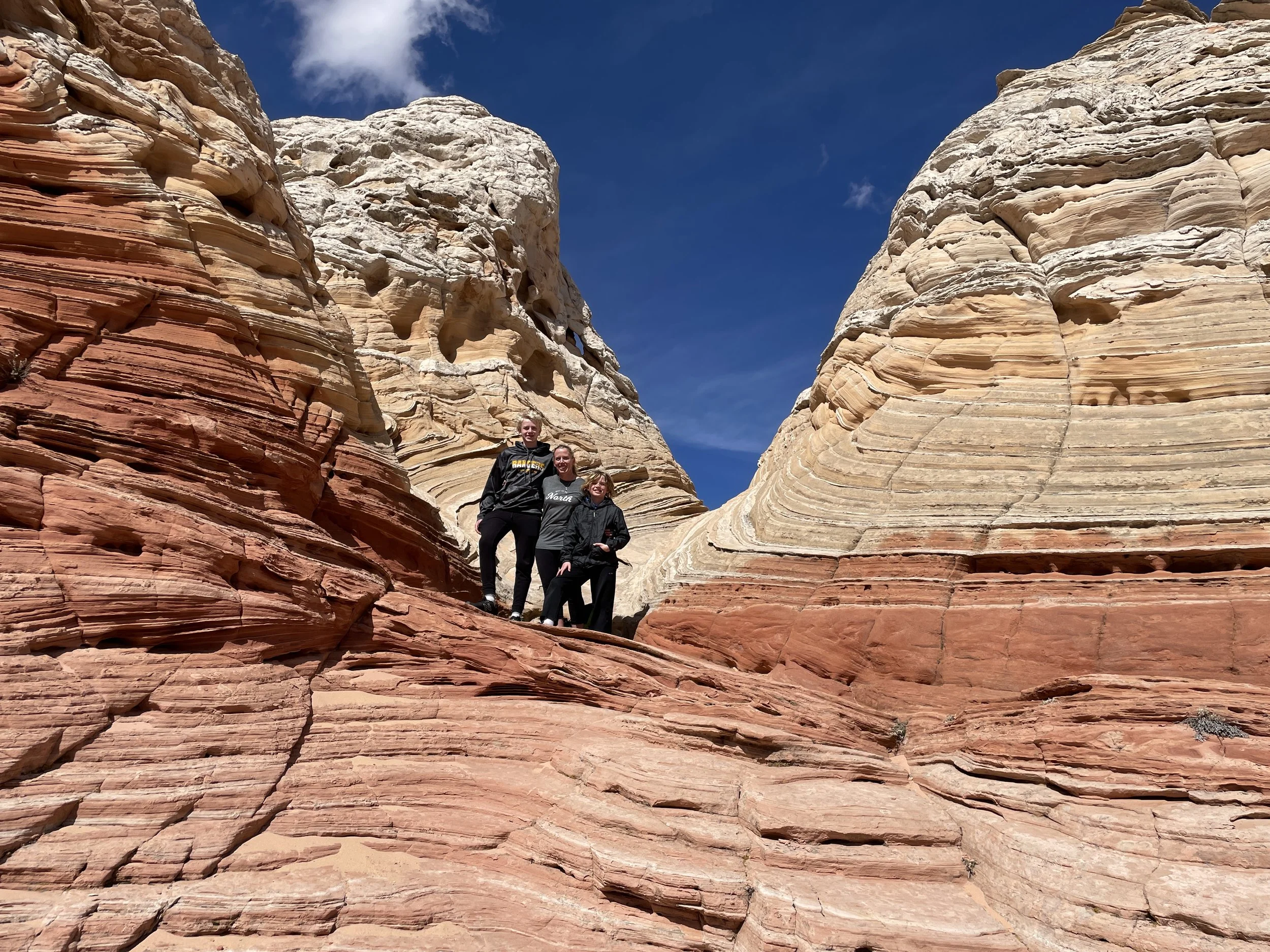
My boys had a lot of fun climbing up and running down these rocks while we waited for the small number of other people in our tour group to finish taking pictures. This is definitely a moment when I can say the pictures are impressive, but don’t contain the power of the ages that is felt while walking over this imposing section of rock.
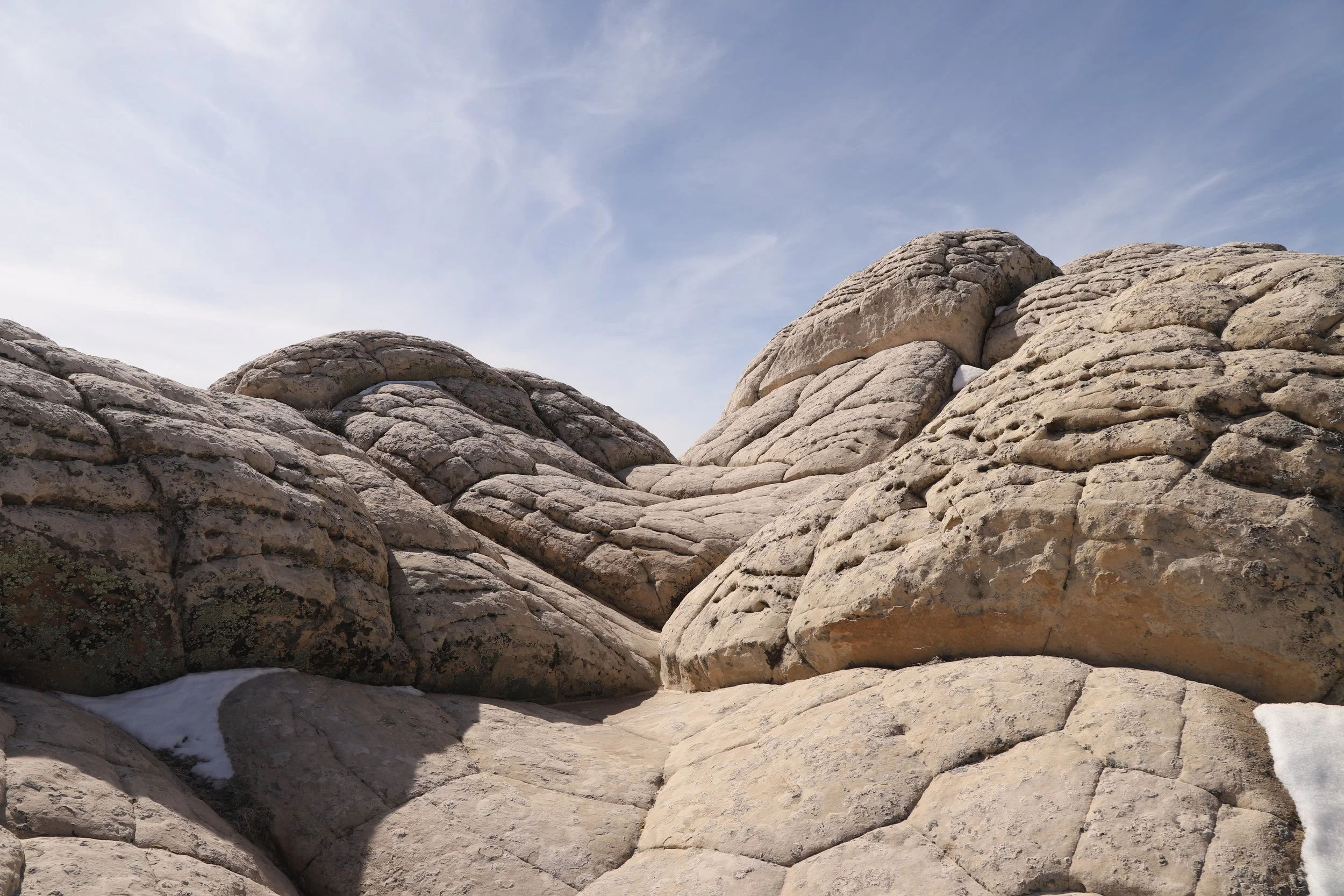
Geometric patterns in the rocks at White Pocket are similar to Zion’s Checkerboard Mesa and the Yant Flat Candy Cliffs
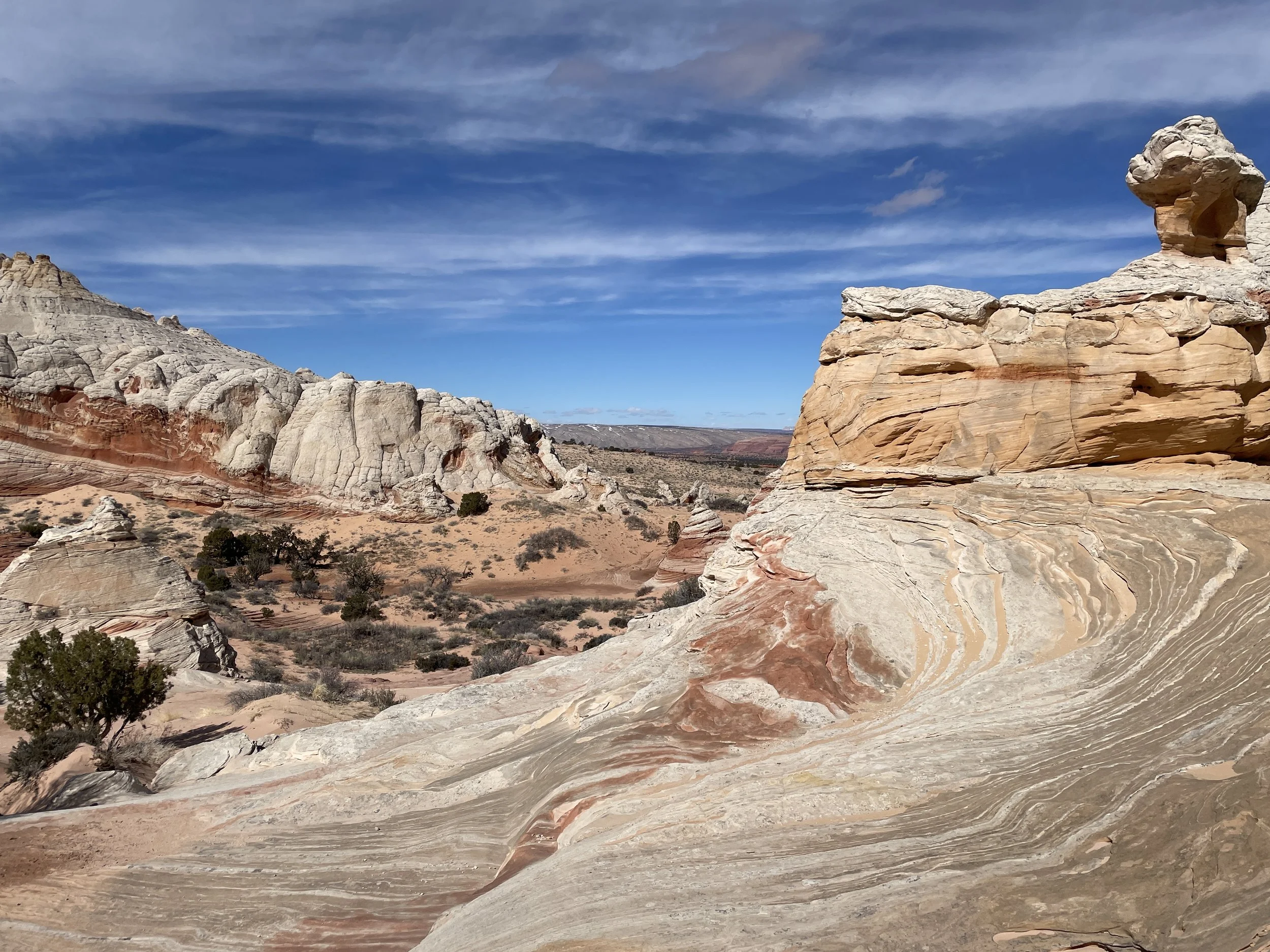
This rock pattern stretches on an impressive distance.
Hiking up and down the rocks at White Pocket
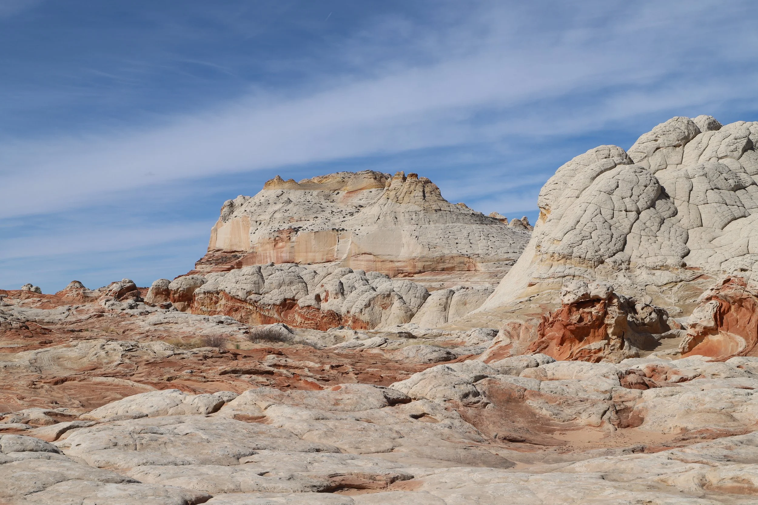
From here, we walked towards this mountain and cliffs behind it.
This part of White Pocket reminds me a little bit of Badlands National Park
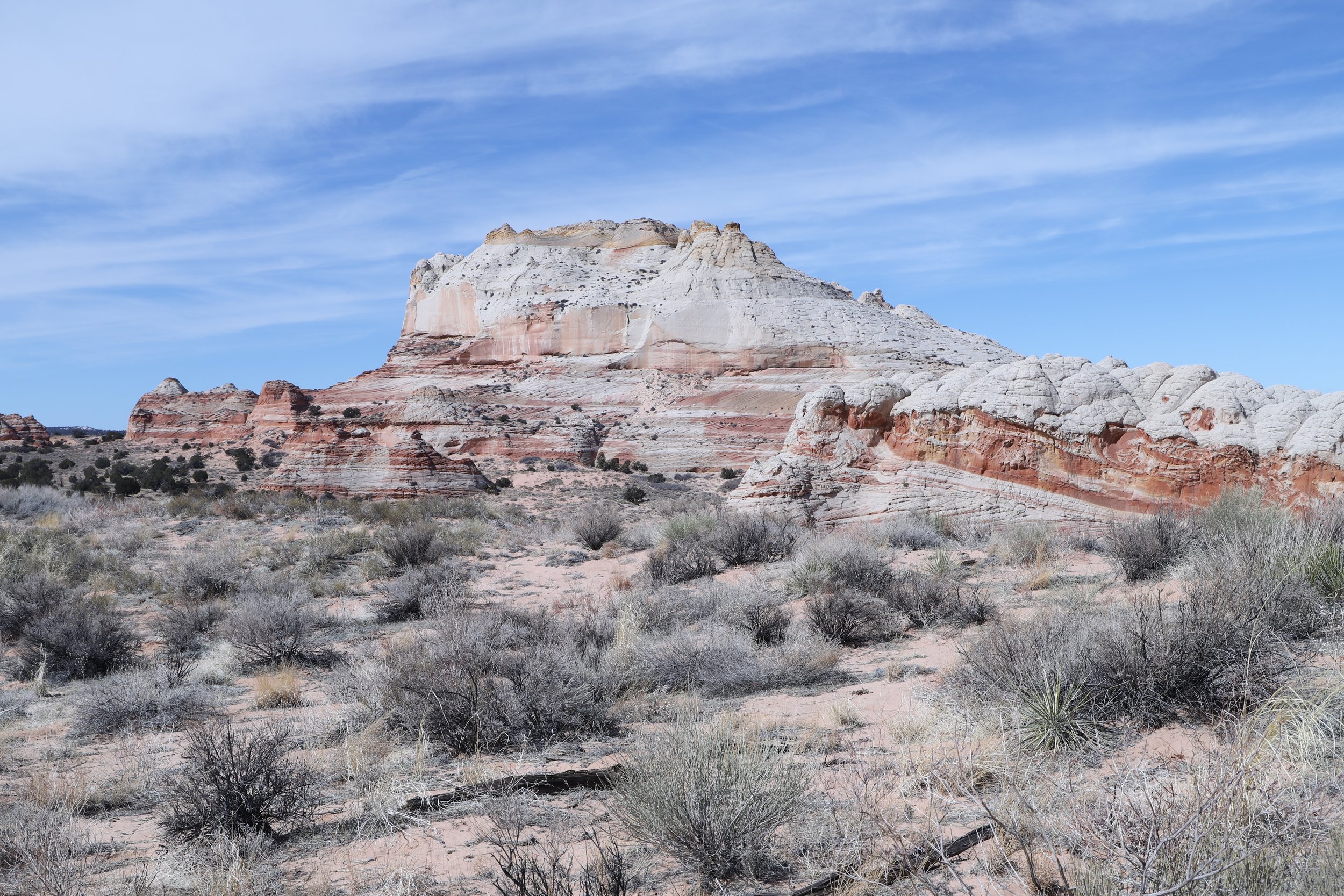
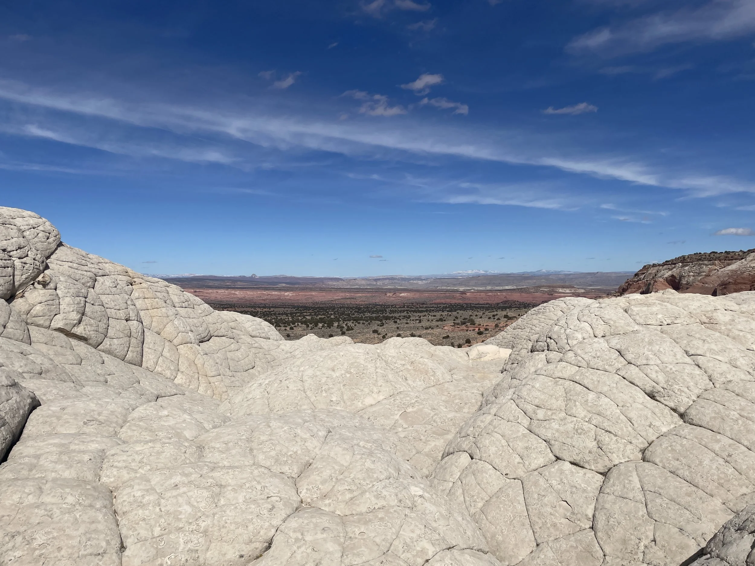
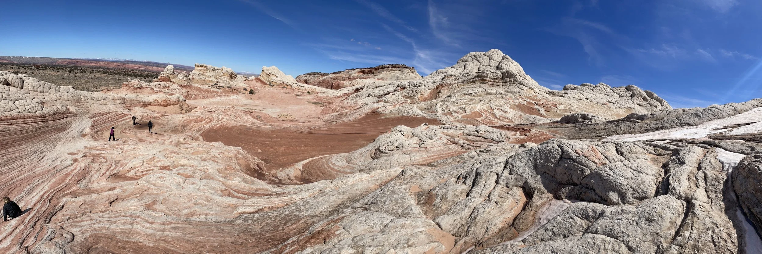
It’s not just the impressive rock structures within White Pocket that make it worth visiting. The vastness of desolation is humbling. Look at this stretch of land. Does it look like planet Earth? The shrubs were a grounding reminder - yes, we are actually still in Arizona.
Vastness of White Pocket
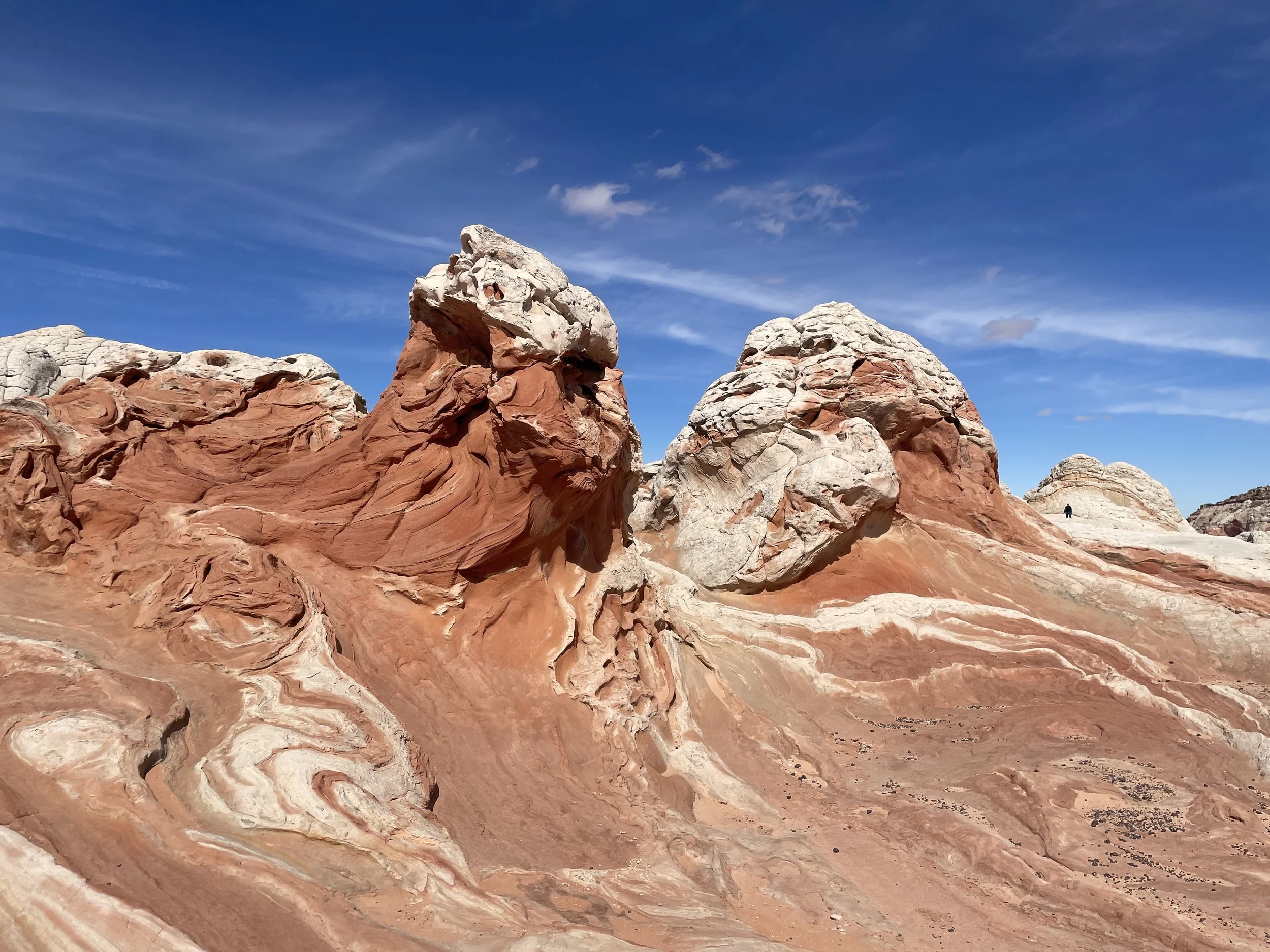
I don’t remember the names of the structures, but this one was one of my favorites. We hiked through it to see it from all sides.
White Pocket
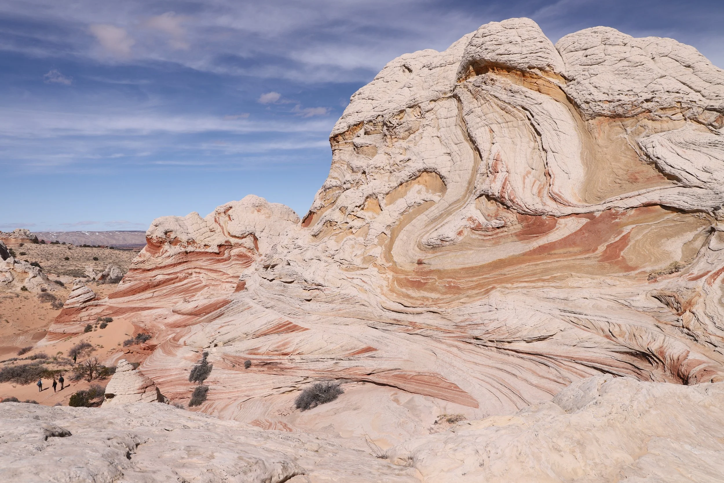
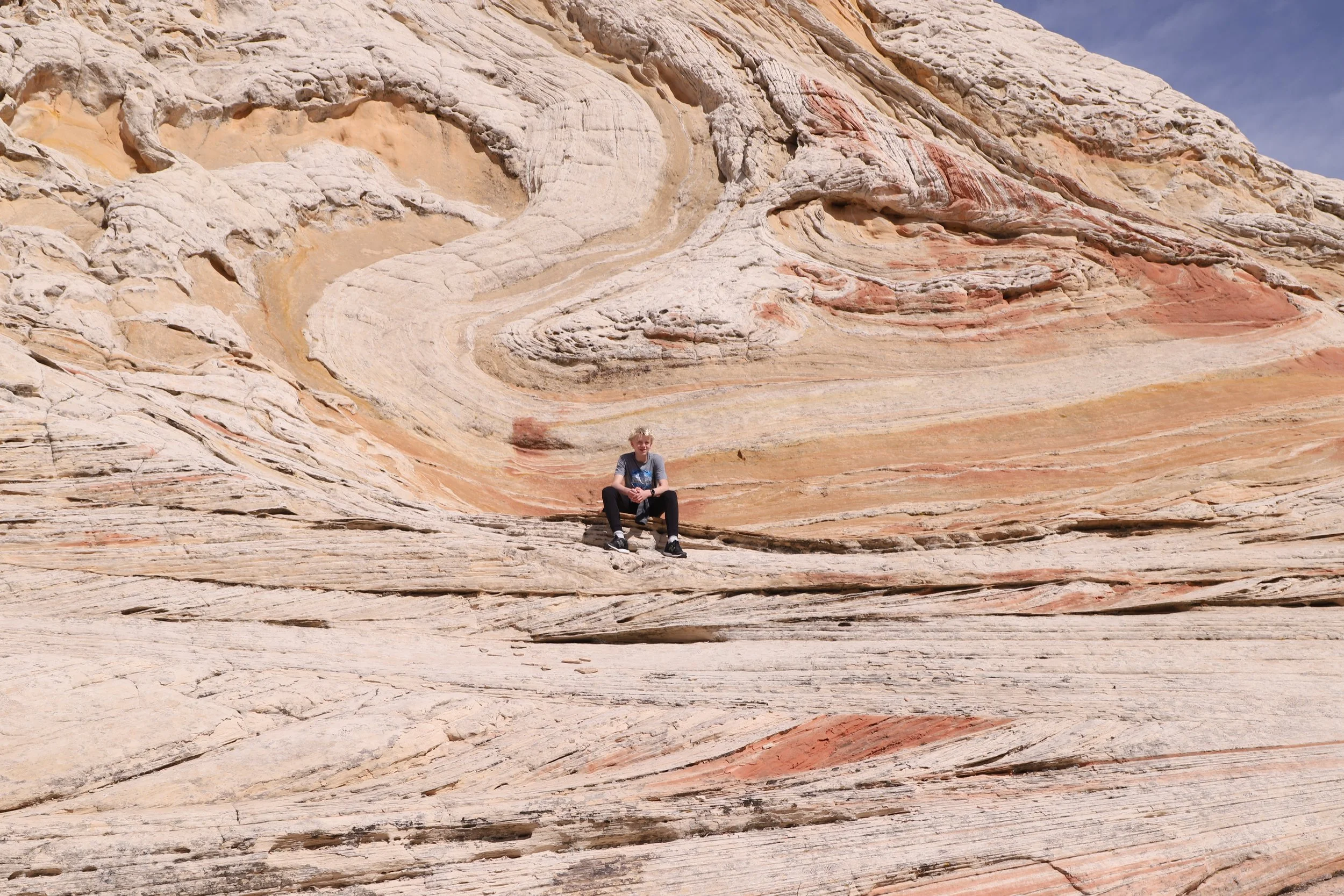
It’s not just the color of the rock layers that is incredible, but also how the lines aren’t straight. You can feel the swirl of the sand over time.
White Pocket
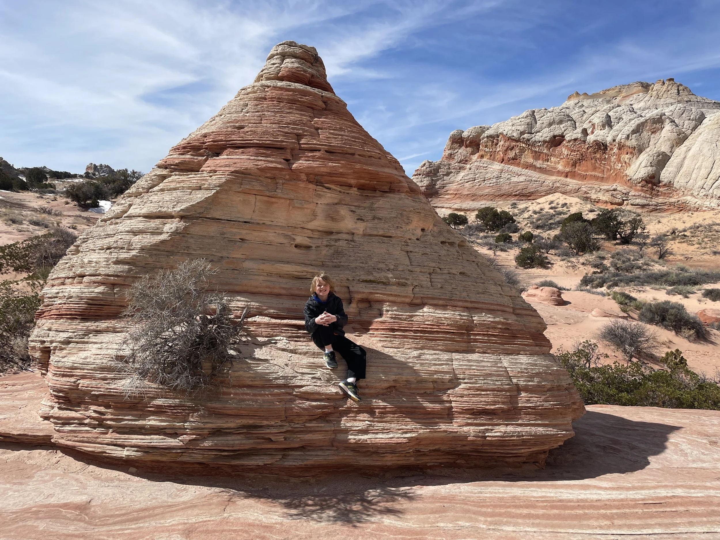
Hiking up to a hoodoo in White Pocket
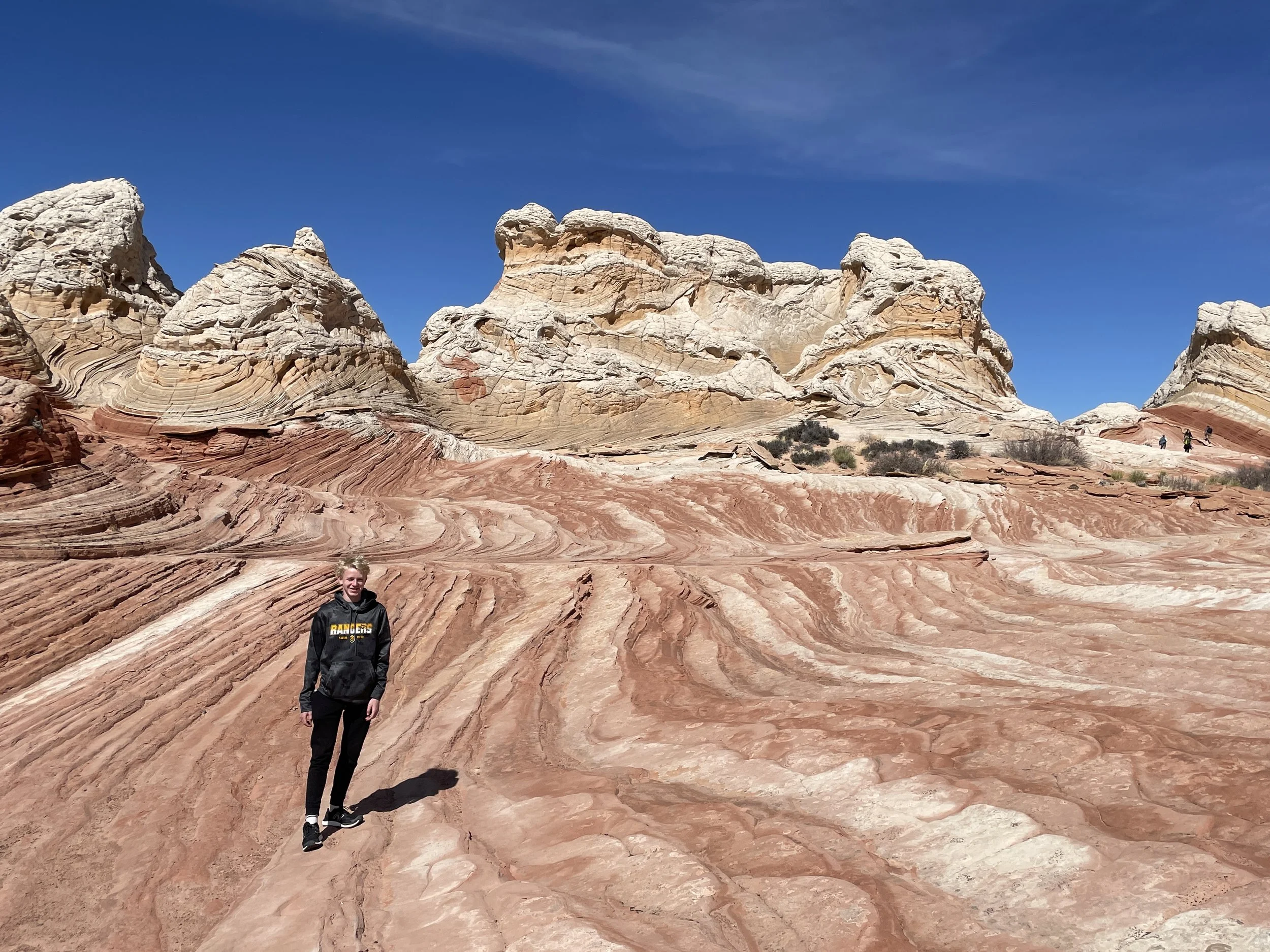
For perspective, here is my son walking towards the hoodoo. These are large rocks!
Hiking to the White Pocket Hoodoo
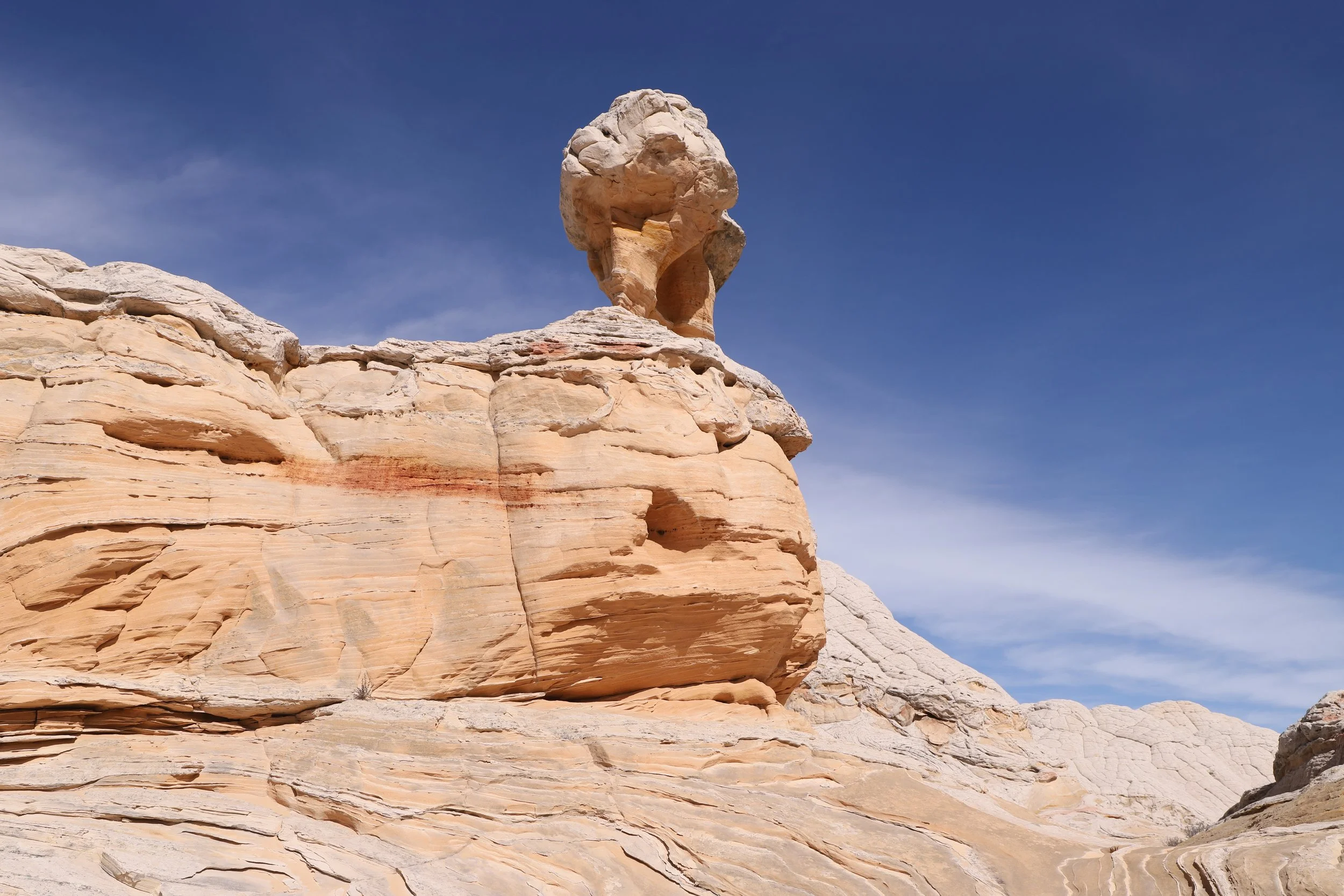
Hoodoo at White Pocket
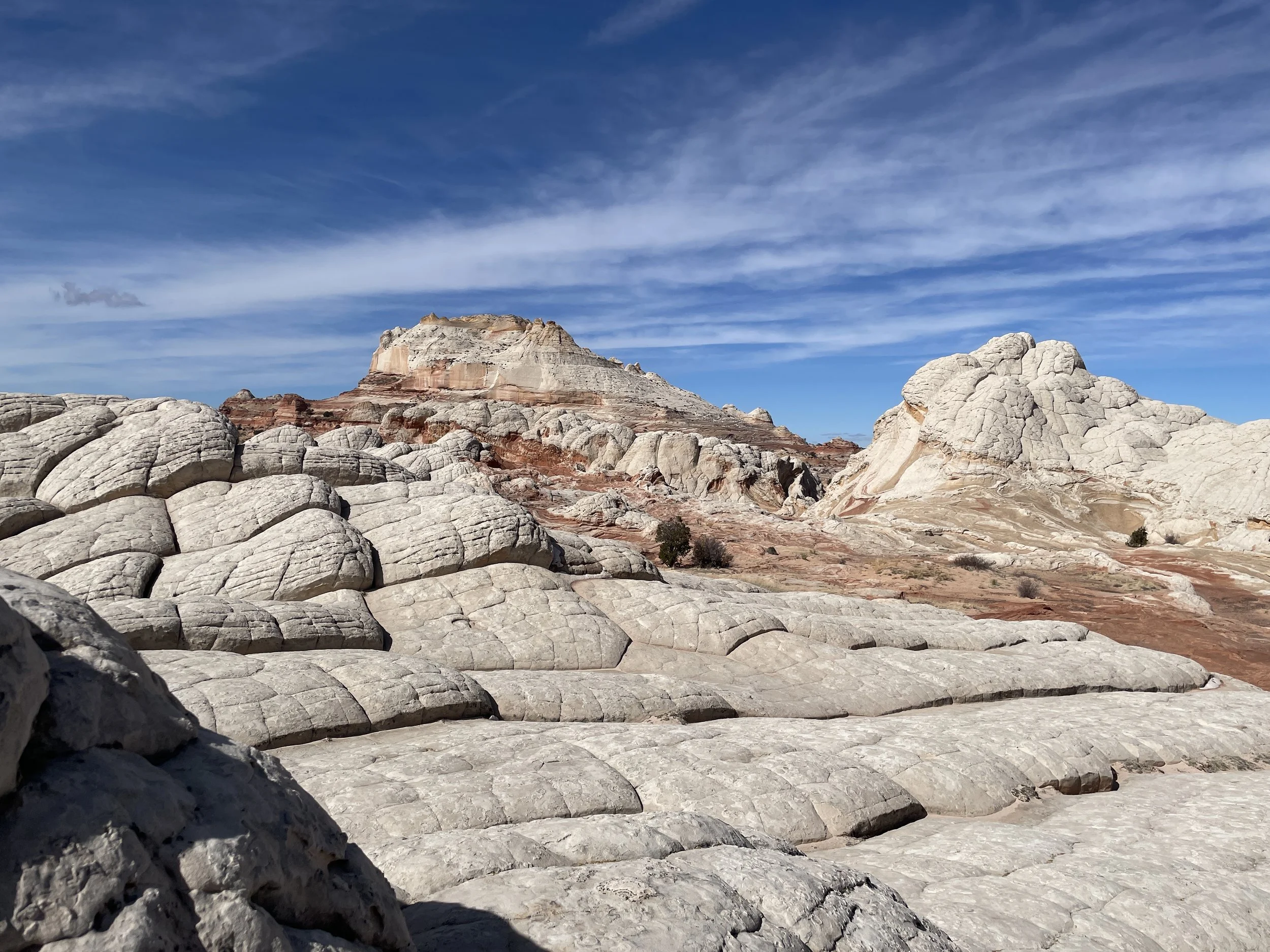
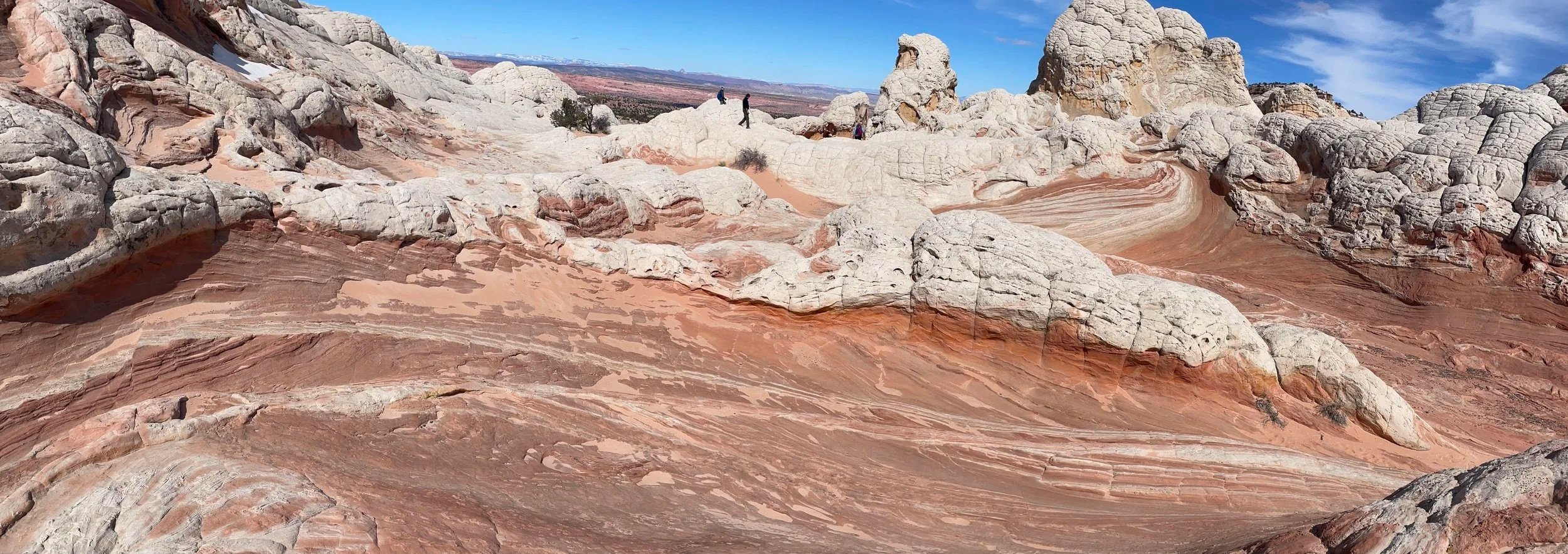
From here, we started to walk around the rocks, clockwise.
White Pocket
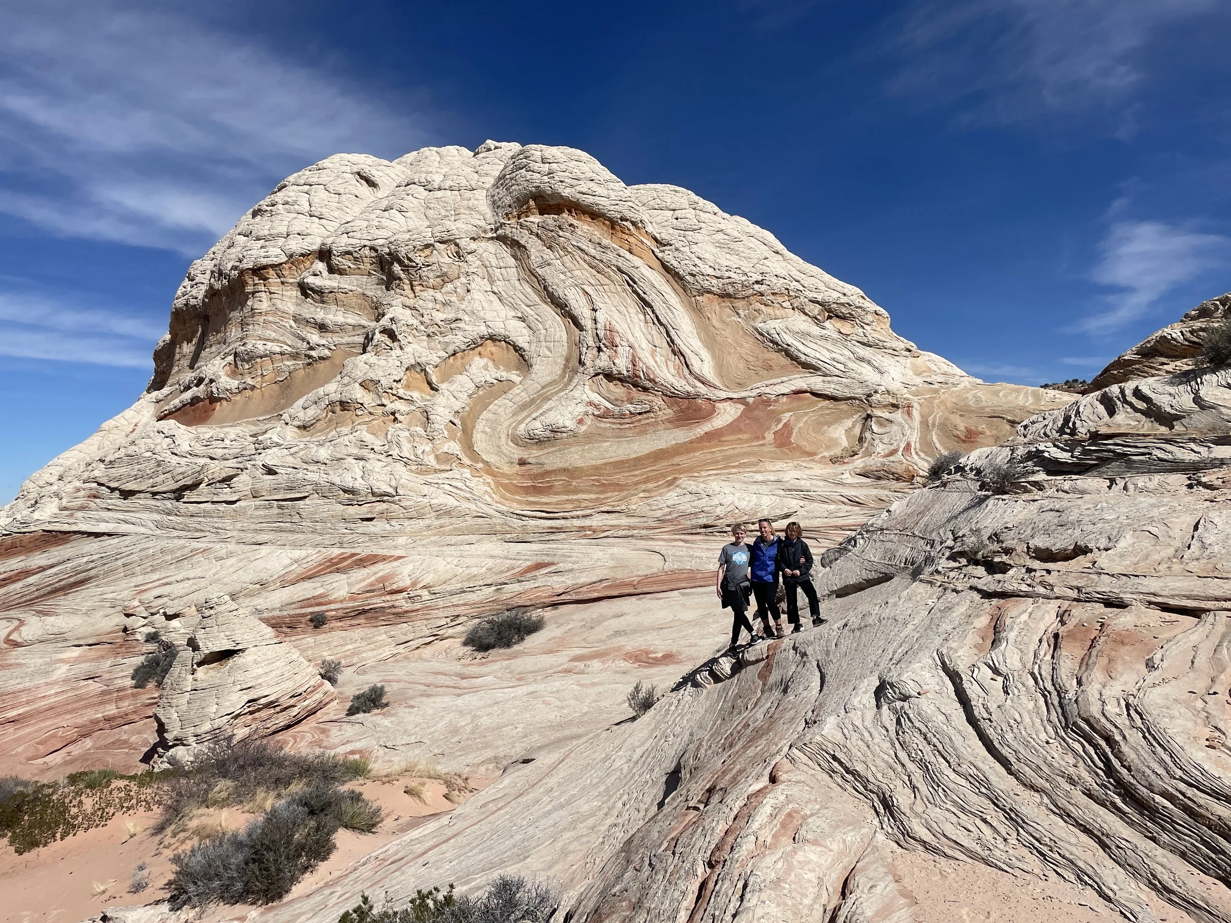
March 2023 - My boys and I at White Pocket
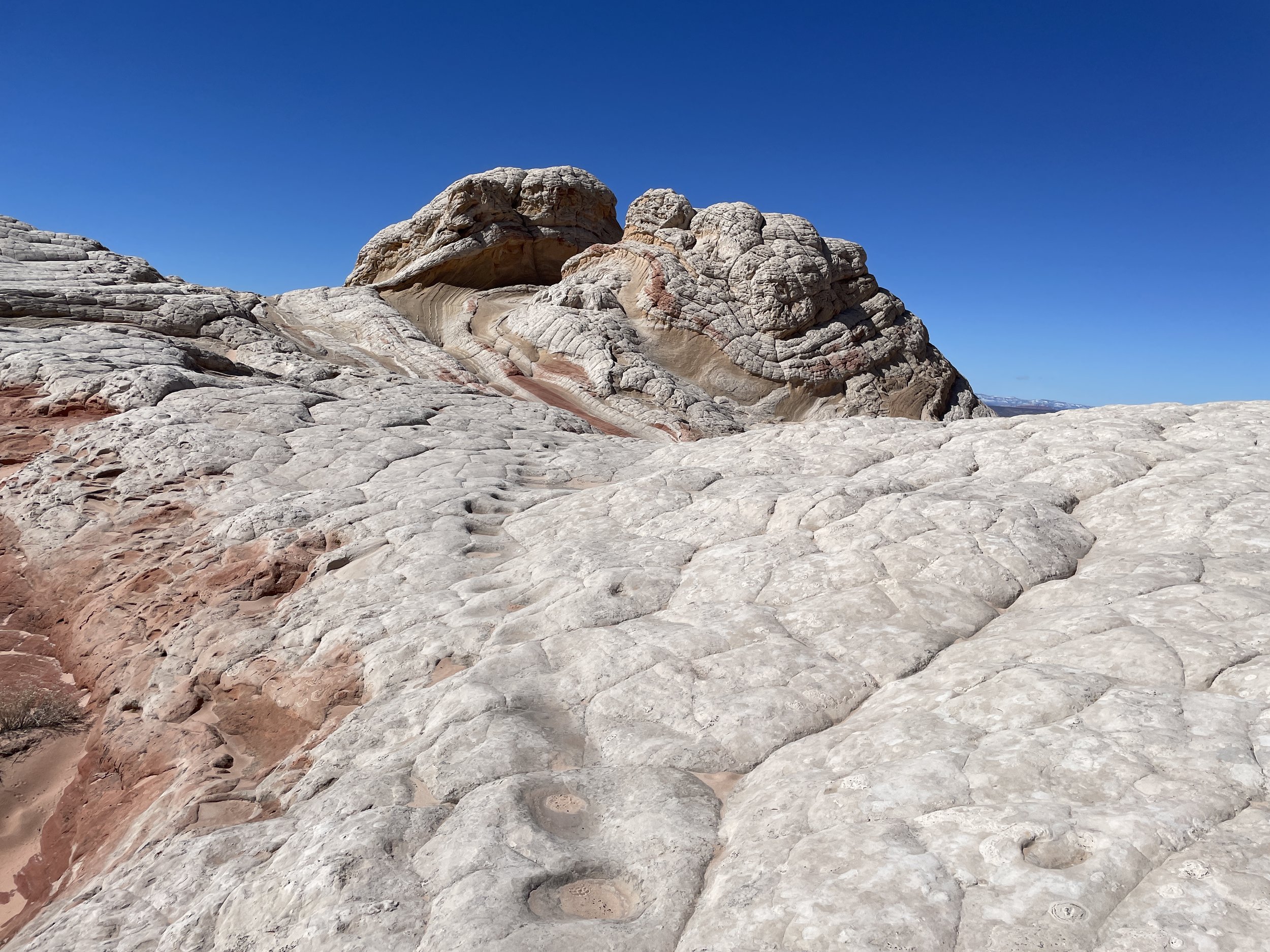
It might be a bit repetitive, but it’s hard to pick only a couple of pictures of these rocks.
White Pocket
From here, we started walking up in-between these rocks.
White Pocket
White Pocket

white Pocket
Hiking through White Pocket
Minimal rock scrambling is needed, but choosing to climb up gets you to more interesting views at White Pocket
White Pocket
More hoodoos at White Pocket
This was such a fun place to slowly explore. At times, we just sat for a bit and stared at our surroundings.
Colorful rock bands at White Pocket
Another random hoodoo at White Pocket
Vastness of the rock landscape at White Pocket
These rock structures drop off into a cliff on the west side. We stayed on top.
White Pocket
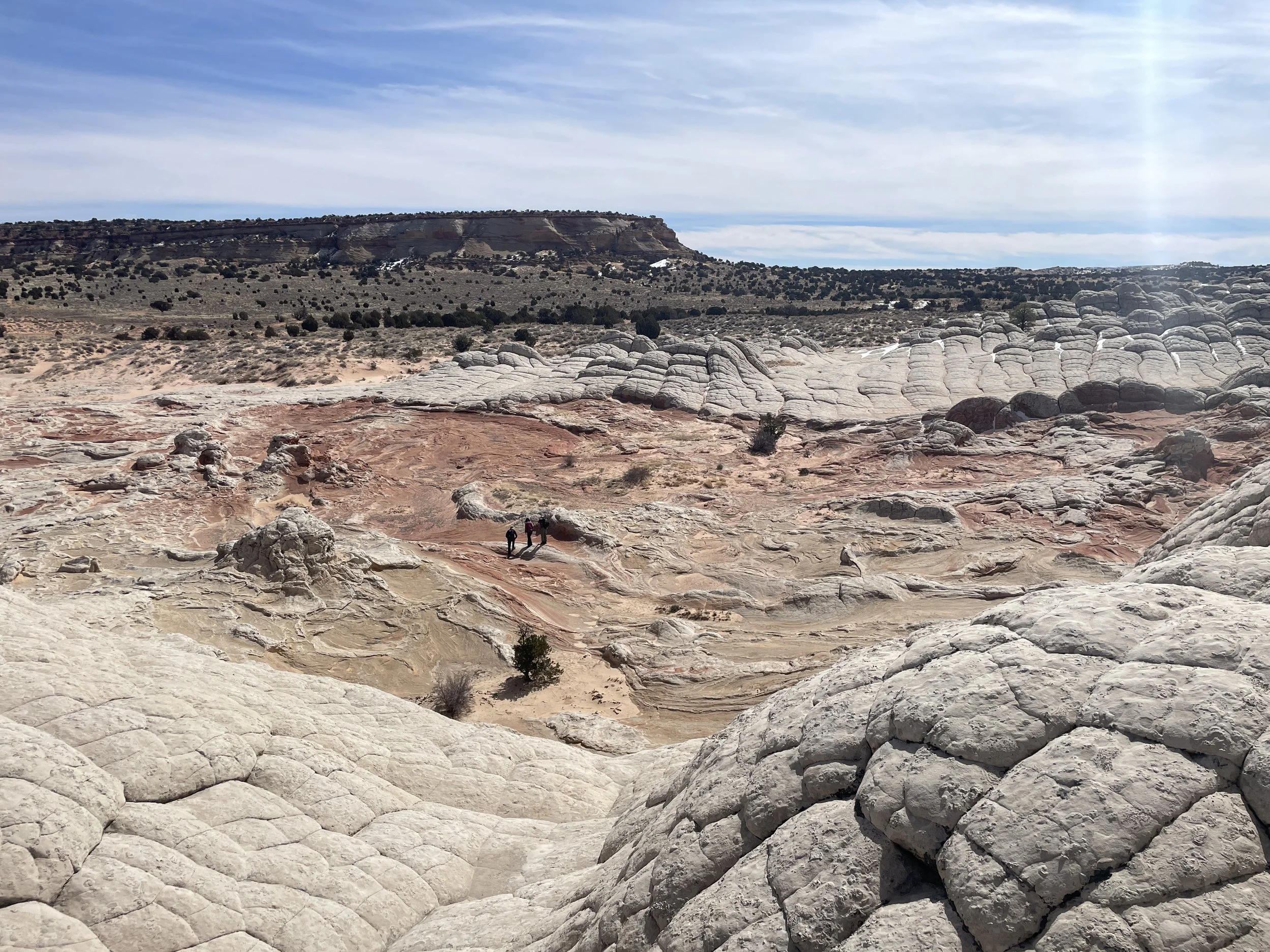
Hiking over, around, and throughout White Pocket
March 2023 - White Pocket
This was another really interesting rock structure. Again, we hiked clockwise around and through it.
White Pocket
These are such odd shaped and colored rocks.
White Pocket
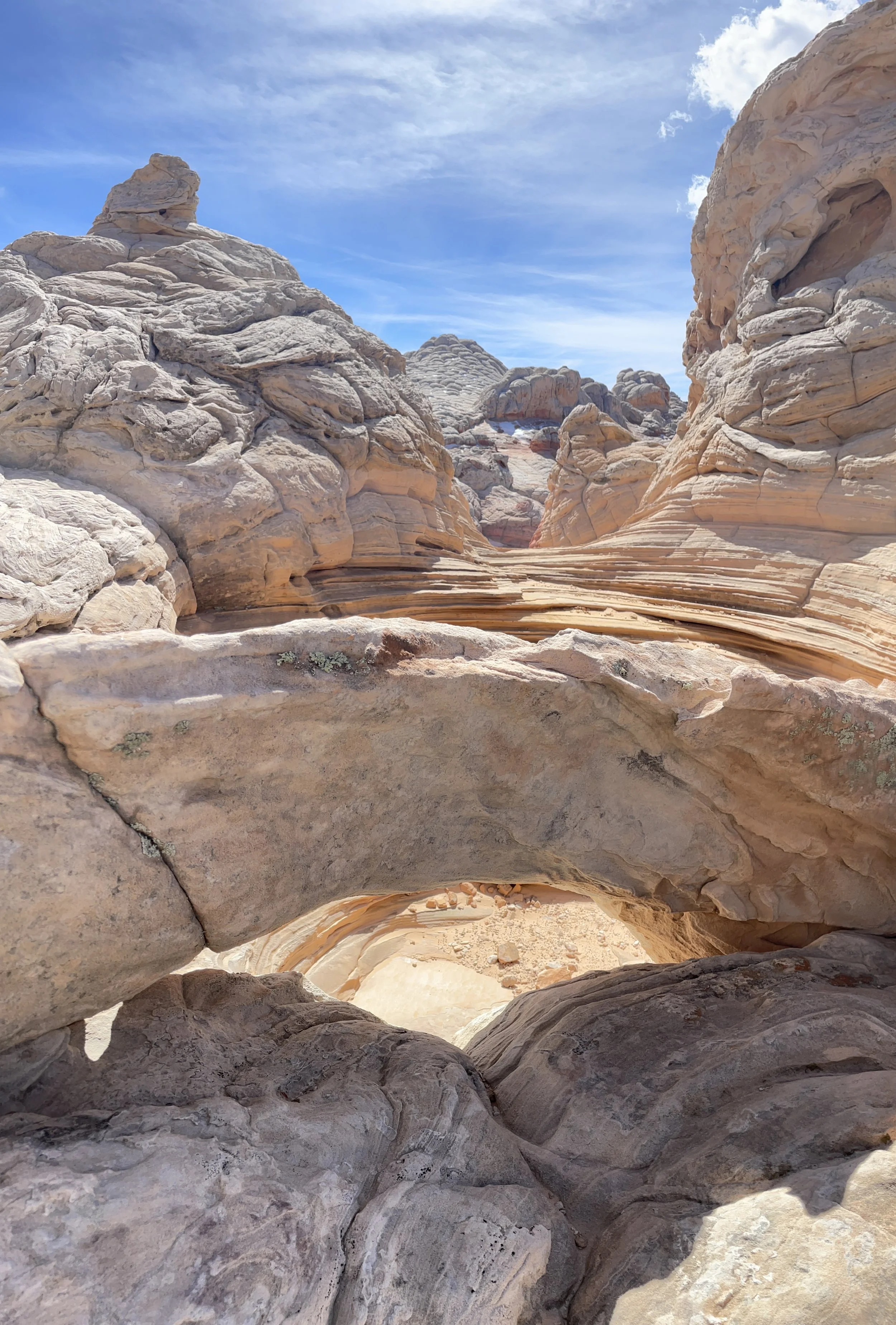
Where you see the people in the picture, there is a drop in the rocks to get through this structure.
White Pocket
This picture is at the top as we start to descend through the rocks.
White Pocket
It’s hard to tell, but this is where we were able to walk down into the rocks, it curls to the right.
White Pocket
We ate lunch in the shade at the bottom of this rock. While we were waiting for everyone else to finish, my boys and I scampered up the other side of the rock for a picture.
White Pocket
From here, we continued walking north, with the cliff on our right side. There was one other fantastic place to explore on the way back.
White Pocket
White Pocket
Again, for perspective on the size, here is my son pictured in front of them.
March 2023 - White Pocket
We climbed up into these rocks as well. The views were incredible. In general, if you are able, climb up everything you can.
White Pocket
White Pocket
White Pocket
March 2023 - White Pocket
There was a small arch we found in one of the rocks in the back.
White Pocket
Why is it called White “Pocket”? The Pocket refers to the holes in the rock that can hold water. We spent awhile trying to take reflection pictures. A couple of them turned out pretty well.
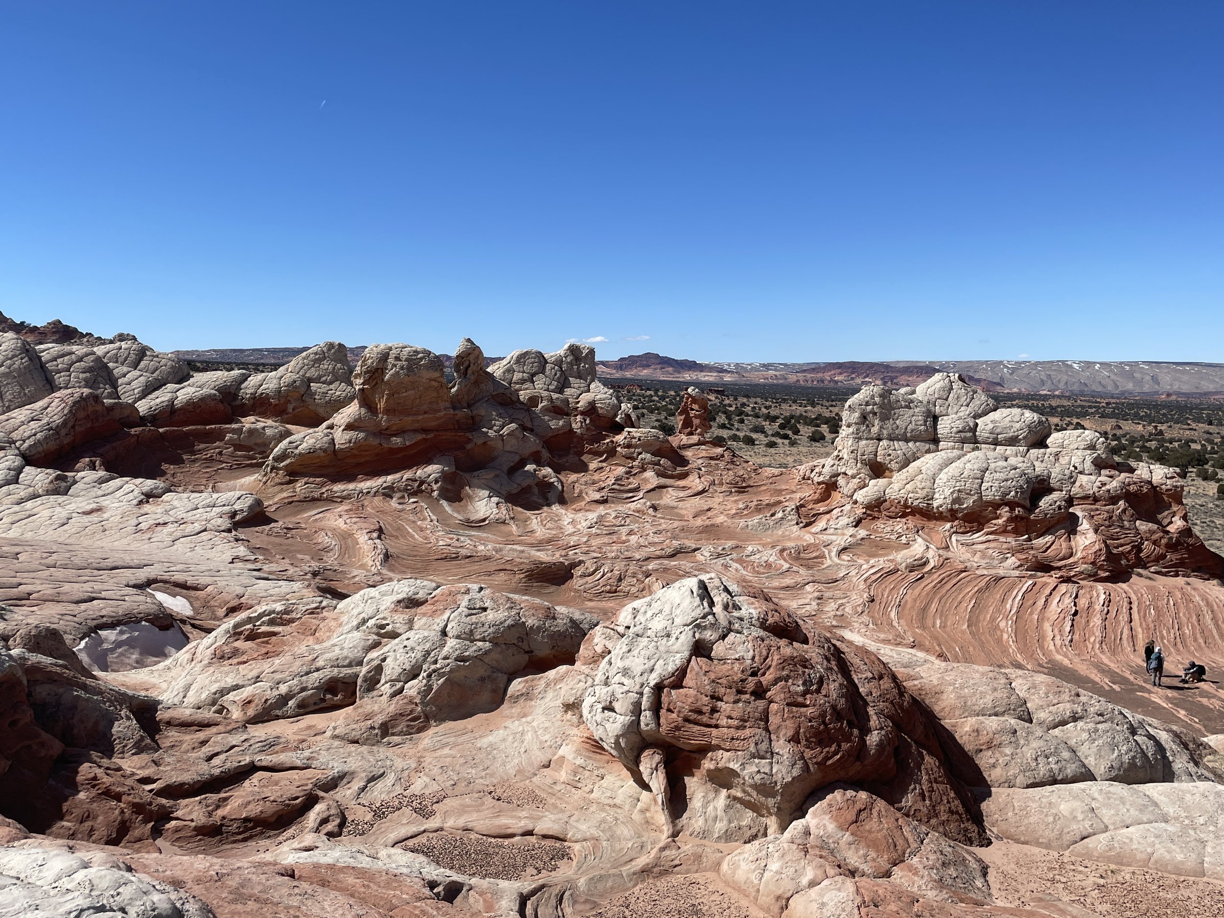
White Pocket
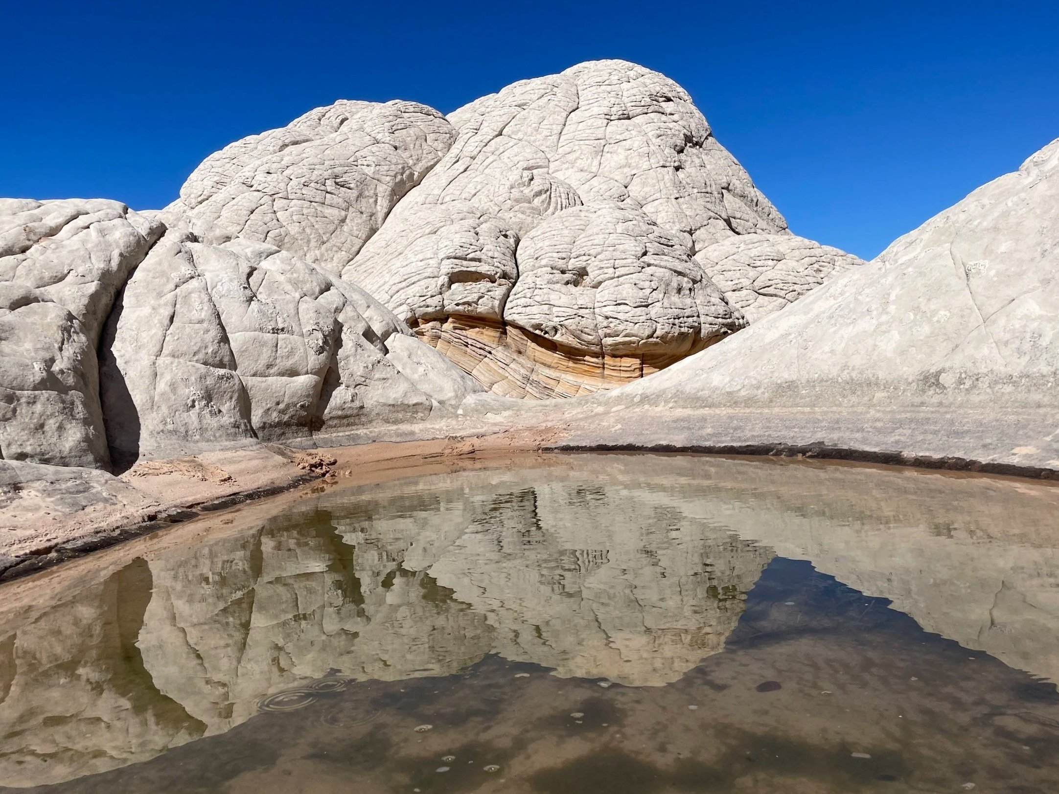
White Pocket
White Pocket
It’s hard for me to image, because there just isn’t much plant life to eat, but apparently this area was previously used as ranchland. In the picture below, the “steps” were formed by cows that essentially picked the same “trail” over the rocks as they moved back and forth to presumably find water to drink in the pockets.
Cattle steps in the rocks at White Pocket
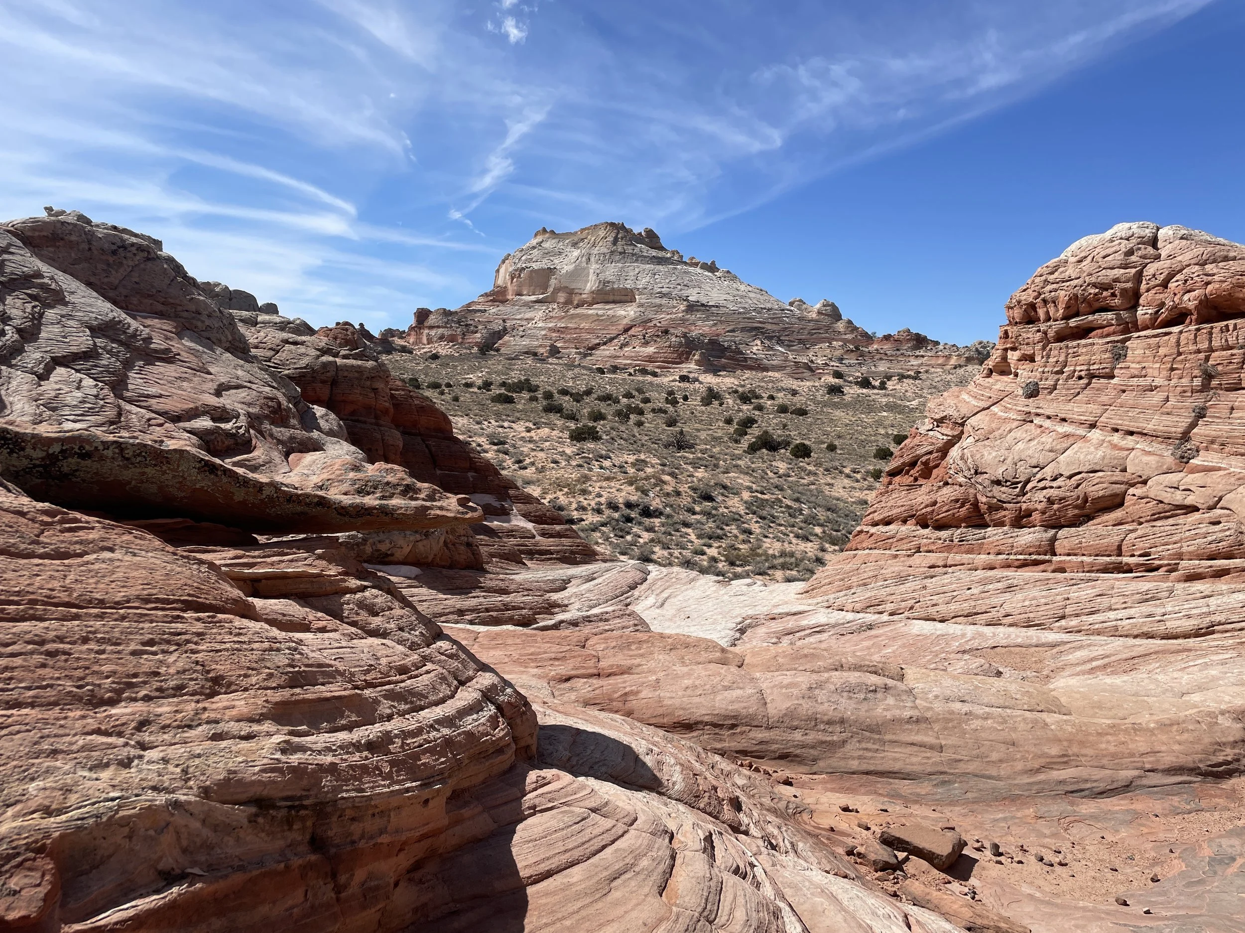
And then a two-hour drive back. Below is a picture of the surrounding cliffs closer to the Buckskin Gulch area. It was a long drive, but White Pocket was a phenomenal place to get to visit.
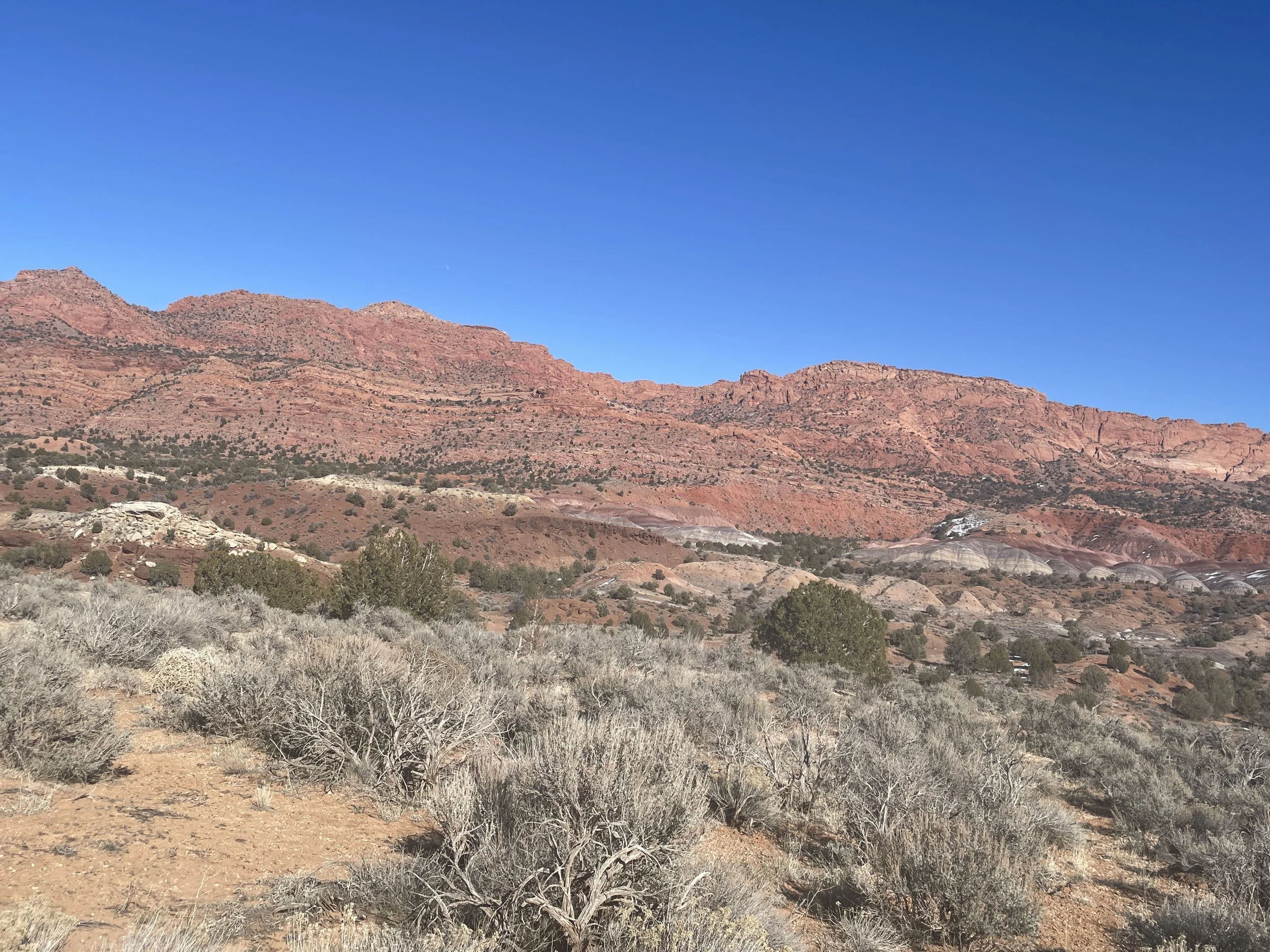
Driving back along the 4×4 and dirt road to return to US-89
Other Nearby Places to Explore
Keep in mind that it’s more than an hour-drive from White Pocket to the Wire Pass trailhead to Buckskin Gulch, so nothing is exactly “nearby.” But the Wire Pass trailhead is on your way back to US-89 along the same dirt road (and there is a vault toilet at this trailhead if you need one). The Toadstool Hoodoos are just a short drive away when you get to US-89.
Buckskin Gulch Slot Canyon
Buckskin Gulch can be accessed via a 1.7 mile hike along Wire Pass (one-way). Enjoy an out-and-back hike, a long thru-hike between Wire Pass and White House, or a multi-day backpacking trip. Permits should be pre-purchased for day hikes (the day of) and several months in advance for overnight reservations
Toadstool Hoodoos
The Toadstool Hoodoos are accessed from US-89, about 30 minutes from the Wire Pass Trailhead. This is an easy 1.8-mile hike.
Horseshoe Bend
This is a short (1.5 mile) hike to an amazing view of the Colorado River. The trailhead is just under an hour from Wire Pass (east), near Page, Arizona.
Antelope Canyon
Antelope Canyon, also near Page, Arizona, is still the best slot canyon I’ve ever entered. Although it can only be accessed through a tour (fee required), I would highly recommend stopping here.
Kanab, Utah
Kanab, Utah is also an hour away from the Wire Pass Trailhead (west). Most of the places to explore from Kanab are an added distance, but Kanab is a great small town to pick for a hotel location. The link I have is to Zion National Park. At the end of the post is a link to other nearby places to explore, which include those within an hour drive from Kanab, as well as St. George, and Kolob Canyon. There are so many places to explore that Southern Utah / Northern Arizona has been a frequent vacation destination for us.
More from www.NatureImpactsUs.com
In the map below, there are additional posts I’ve written attached to each pin. Use two fingers to move around within the map.