Trail to Zebra Slot Canyon in Grand Staircase-Escalante National Monument
If you enjoy my blog, please consider signing up below for email notifications of my latest posts. I will not share your email.
Be Prepared to Get Wet
Zebra Slot Canyon had been on my hiking wish list since March 2019 when my boys and I first travelled to Grand Staircase-Escalante National Monument. We checked in with the Visitor Center in Escalante to understand current trail conditions, and learned this trail was closed, due to the canyon being full of water. Moments in March can still be chilly in Escalante, so this seemed like wise advice to avoid - canyon water is extremely cold, and we were only prepared to get wet up to our mid-calves with our rubber boots.
I hadn’t crossed off returning to Escalante, but it wasn’t really on my radar again until planning for a summer trip to southern Utah in June 2025. Southern Utah is extremely hot in the summer, so I was thinking about trails high in elevation, trails that had high canyon walls (to stay in the shade), and places where we could get wet. We were on our way from Minnesota to Bryce Canyon National Park. As I was planning our route, I recalled Escalante was on the way, and I immediately remembered how Zebra Canyon had been full of water.
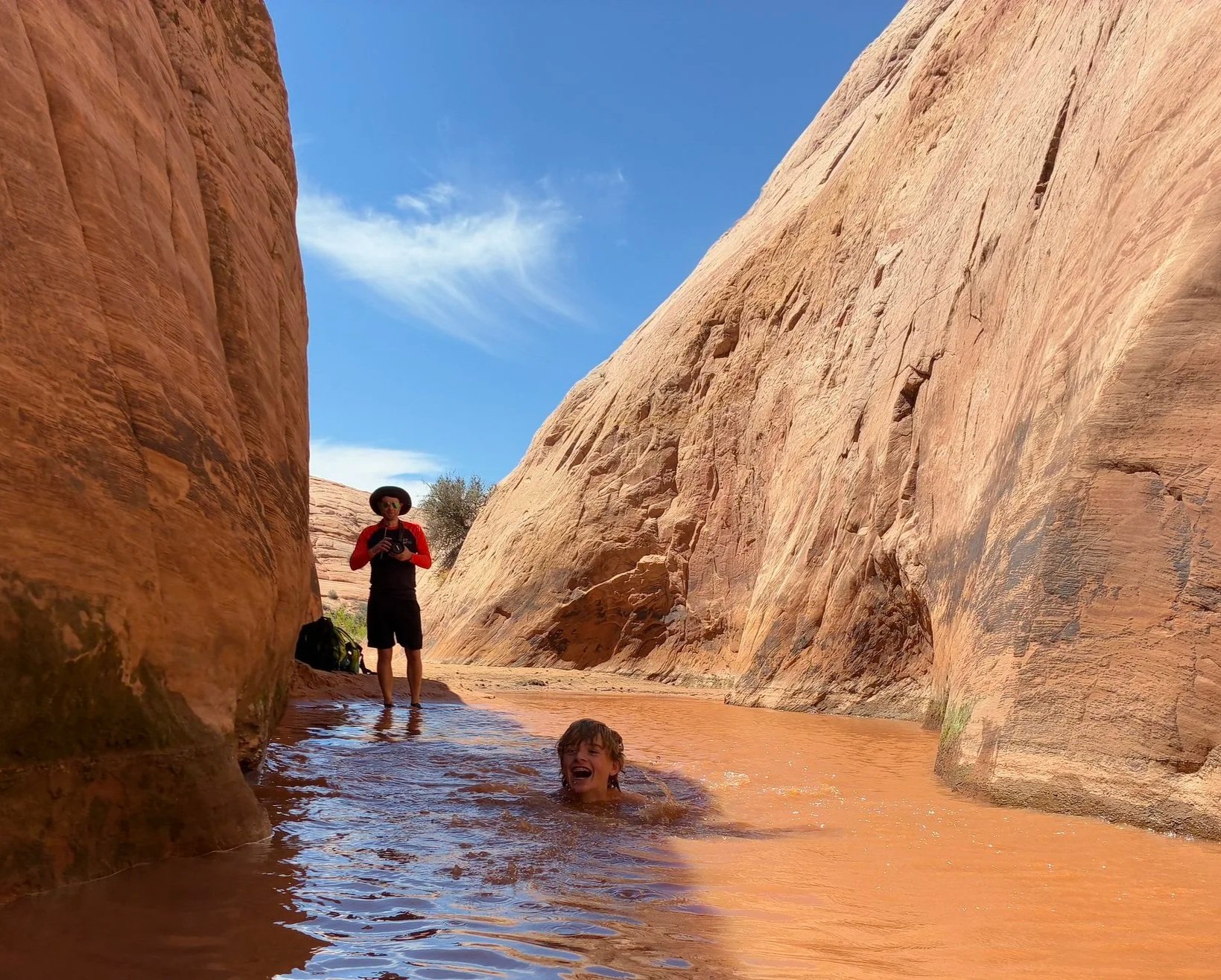
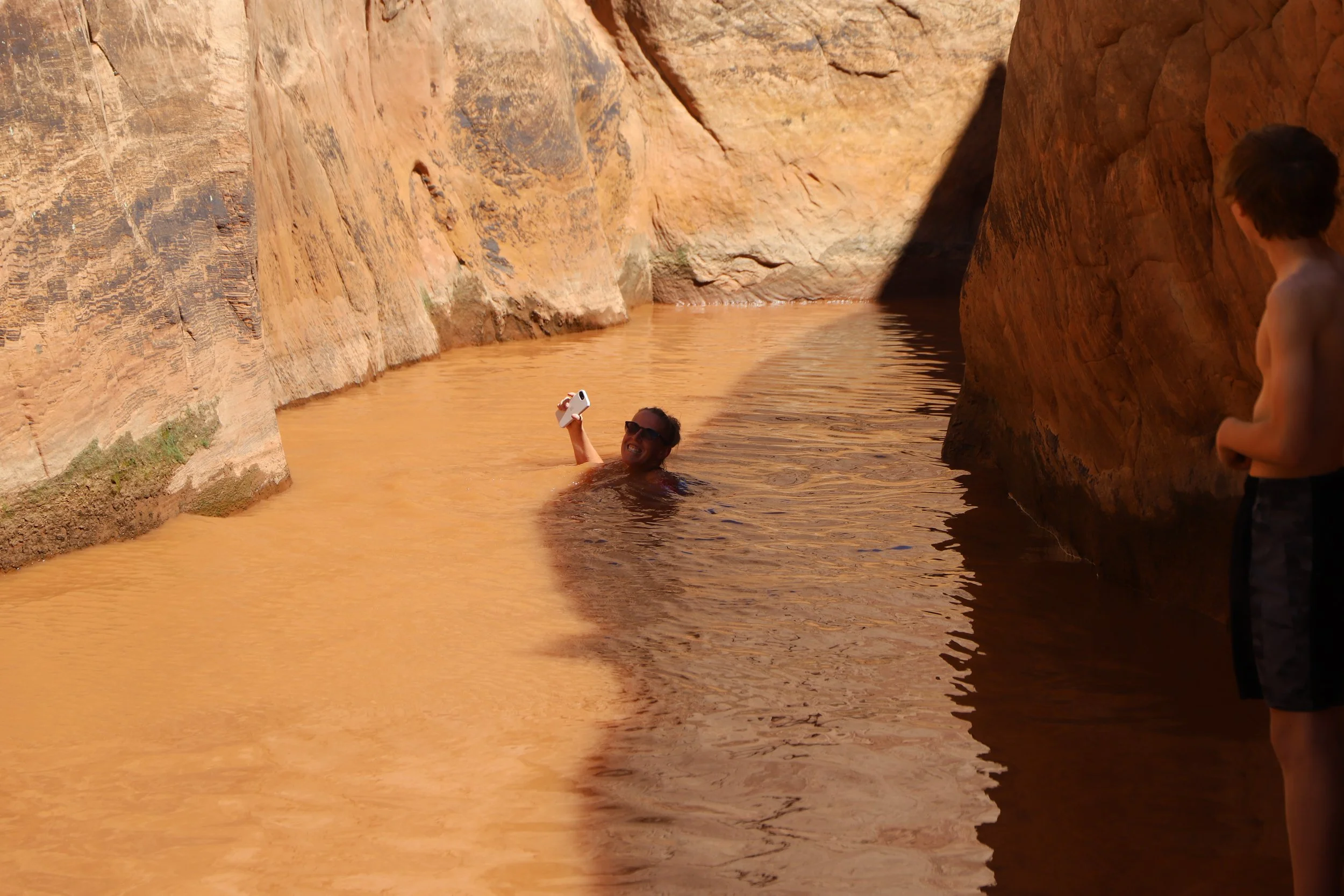
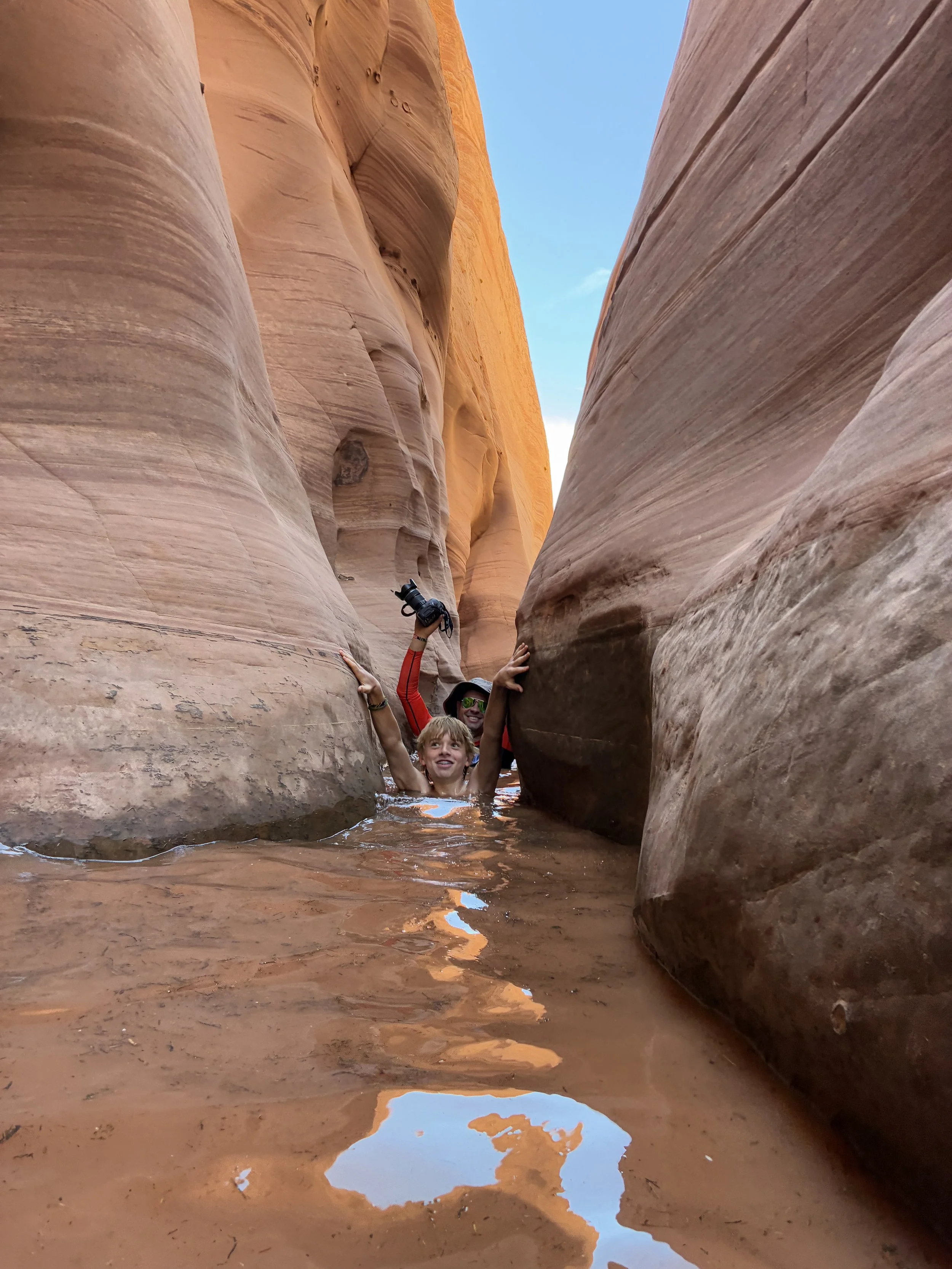
Even in the heat of June, with no recent rainfall, the water in Zebra Canyon was so deep at the beginning we all had to swim a few strokes before we could even touch the floor. Super cold, but this hike was the best way to start off our summer family vacation!
If there’s that much water at the end of June, I’m going to assume there is almost always water in Zebra Canyon. Bring water shoes and clothes that can get wet on this hike and embrace the opportunity to cool off in the middle of a hot summer hike!
The water was so deep we all had to swim - and yep - super cold!
Location
Zebra Slot Canyon resides within Grand Staircase-Escalante National Monument. The closest town with lodging options is Escalante, Utah, which is less than a half hour from the trailhead. The closest cities with airports are Salt Lake City and Las Vegas; both are about 4.5 hours from Escalante.
The trailhead for Zebra Slot Canyon is located along Hole-in-the-Rock Road (about 8 miles in). The parking area is large, but it is not marked. The trailhead is not marked either.
Hole-in-the-Rock Road is a grated sandy road. When we traveled in June 2025, the road was bumpy but ok - any car would have been fine to get to the trailhead. In March 2019, when we were on the same road out to Peekaboo and Spooky Gulch, it was not the best - extremely rutted, and I was happy I had rented a truck. The difference was probably due to time of year. Roads can’t be repaired until winter is done (yes, it can and does snow in Escalante). The rutting happens due to cars and trucks trying to drive on the wet roads. The chance of getting stuck on a wet road is high - don’t attempt this trailhead if Hole-in-the-Rock Road is wet.
There are no bathrooms at the trailhead. The closest one is going to be another 4 miles down Hole-in-the-Rock Road at Devil’s Garden.
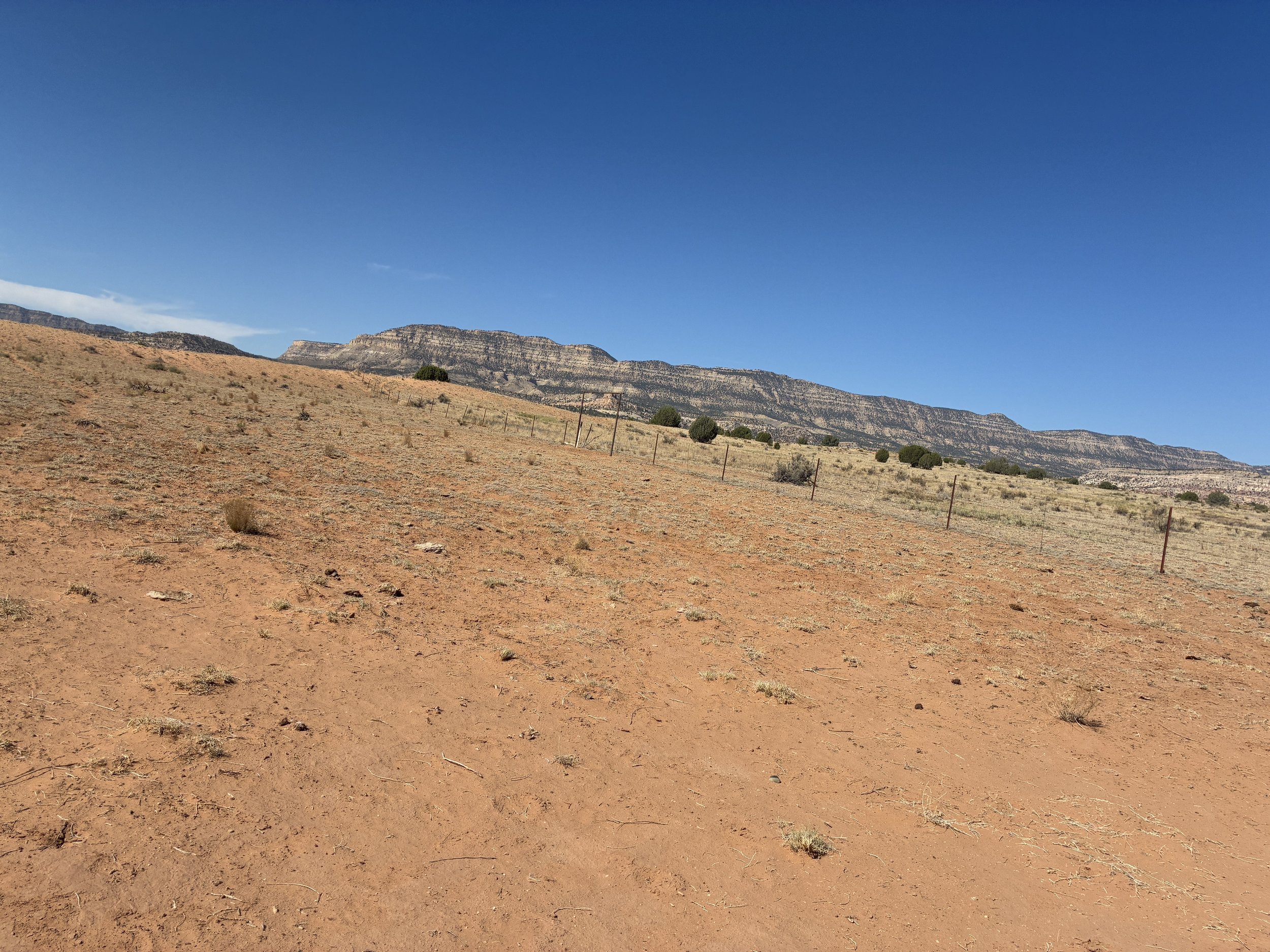
Trailhead locations along Hole-in-the-Rock Road
Logistics
If you haven’t hiked in Grand Staircase-Escalante before, it’s going to feel a lot different than a typical National Park or National Monument. That difference is intentional and part of its magic. This park is managed by the Bureau of Land Management (BLM), and its purpose is to maintain the land as unspoiled remote backcountry. This is such a fun park to explore as a result, but it does mean more preparation is required than what may be typical when visiting a National Park / Monument.
I mentioned a bit about the conditions along Hole-in-the-Rock Road already, as that might have an impact on which type of vehicle you rent. My second bit of advice is to use a GPS map and pre-download the trail on your phone. I use GAIA GPS. This trail is minimally marked. For the most part, it’s pretty easy to follow, until it starts intersecting with washes. At the last wash (Harris Wash), it’s not obvious how to find Zebra Slot Canyon. The trail follows along rock surfaces. It’s marked with cairns, but even with the cairns and our GPS map, it took us a bit to be confident in the direction we were heading.
The last two things to consider are opposite things - be prepared to deal with the heat and cold water. When I was looking up information about this trail, I didn’t see much on the actual trail itself, and one of the things that surprised me was how long the trail was to get to Zebra and how short the canyon itself is. Most of this trail is hot and unshaded. Hike in the morning, wear sunscreen, and carry 4L of water per person.
The best part of this hike, after being so hot though, is jumping in the cold canyon water. On our hike, we saw three different groups of hikers. All walked out to Zebra Slot Canyon, and all turned around without getting in. I had packed lightweight water shoes for us each to change into, and we were all wearing lightweight clothes that would dry easily. My intention on this hike was to get wet. All three groups of hikers that we saw, turned around at the mouth of the canyon, without choosing to get wet. Even though we were hiking in the morning, it was still crazy hot. I could not imagine turning around and staying in the sun to walk back to the car without being completely soaked. I’m guessing each of those hikers were miserable. We tried to convince them to get in the water with us, but they were not having it.
If you do not want to get wet, then check trail status at the Visitor Center in Escalante, before heading out to the trailhead. I think each of the hiking groups was surprised to find so much water in the canyon. There are plenty of other trails in the area without water, but in the summer months, they are all going to be hot trails. I actually thought this was a perfect way to spend a hot summer morning.
Bring a GPS map - the trail is hard to route find towards the end, especially in spots over the rock
Hiking to Zebra Slot Canyon
Distance / Elevation - Out-and-Back to Zebra Slot Canyon is 5.25 miles / 235ft in elevation gain. Tunnel Slot Canyon can be added for another 1.8 miles.
It was hot, even with our time in the water. We spent 3 hours along this trail and needed to get out of the sun, so we skipped Tunnel Slot Canyon. The map for is provided below for anyone interested in it.
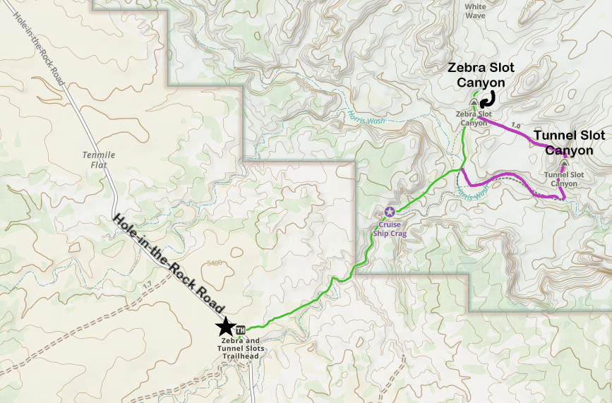
Hiking Trail Map of Zebra and Tunnel Slot Canyons
The parking area is located just off of Hole-in-the-Rock Road, and it’s huge. There is plenty of parking space available. The turn off will not be marked, but the space is obvious. Either use GPS to find the trailhead or just watch the odometer. It’s about 8 miles down Hole-in-the-Rock Road.
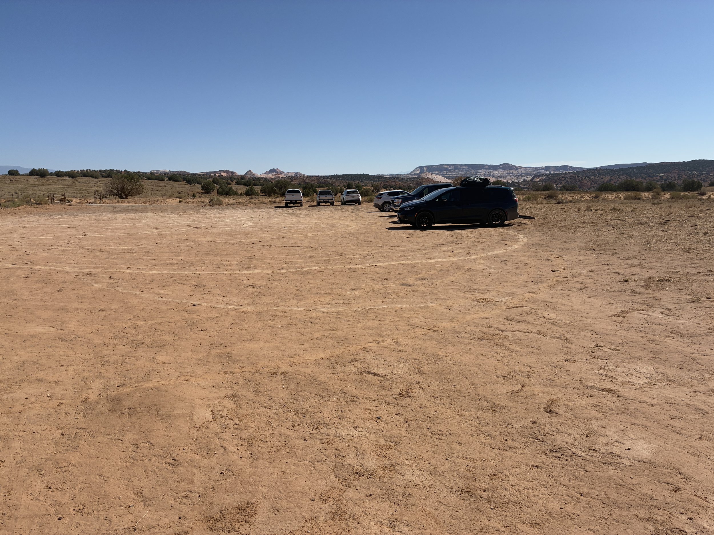
Large parking area at the Zebra Slot Canyon Trailhead. Note, neither the parking lot nor the trailhead are officially marked
We get out of the car, I’m a bit turned around, and the trailhead is not marked. There’s an old dirt road that leaves from the parking area along a fence that looks a bit like a trail. This is NOT THE WAY. I take a few steps in this direction, but quickly realize with GAIA GPS that we need to first cross over Hole-in-the-Rock Road.
Don’t go this way - cross back over Hole-in-the Rock Road
Walk across Hole-in-the-Rock Road to find the trail. It’s directly on the other side from the turn into the parking area. It should be easy to see.
Crossing Hole-in-the-Rock Road
There isn’t a trailhead sign or anything that states this is the way to Zebra Slot Canyon. Again, that’s intentional due to this park being managed by BLM. Route finding is part of the fun of hiking in backcountry. There is a warning sign though, a short distance along the trail. Heed the warnings. Search and Rescue would rather not be called to come find you because you were unprepared.
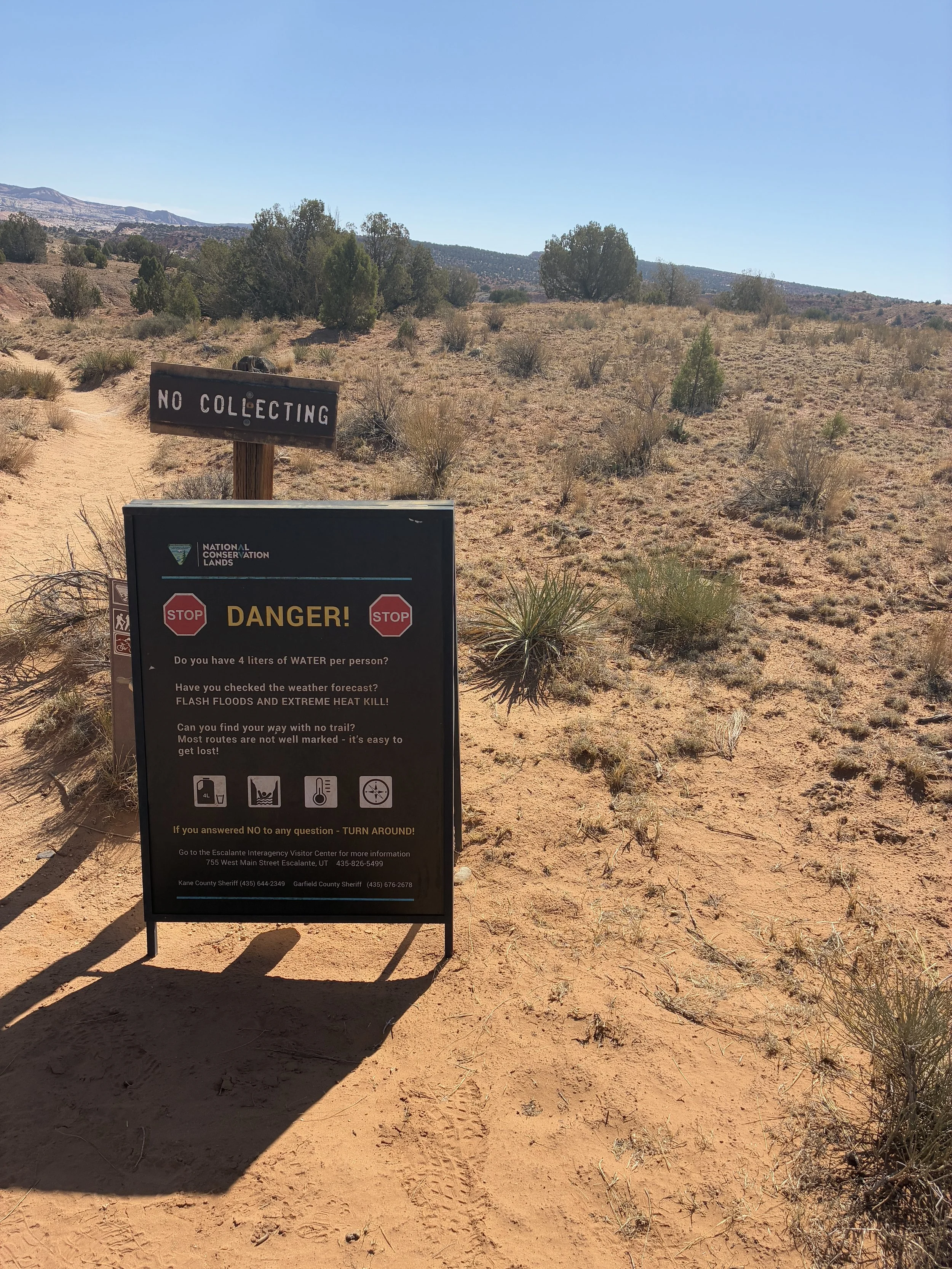
This warning sign is the only indication of a trailhead
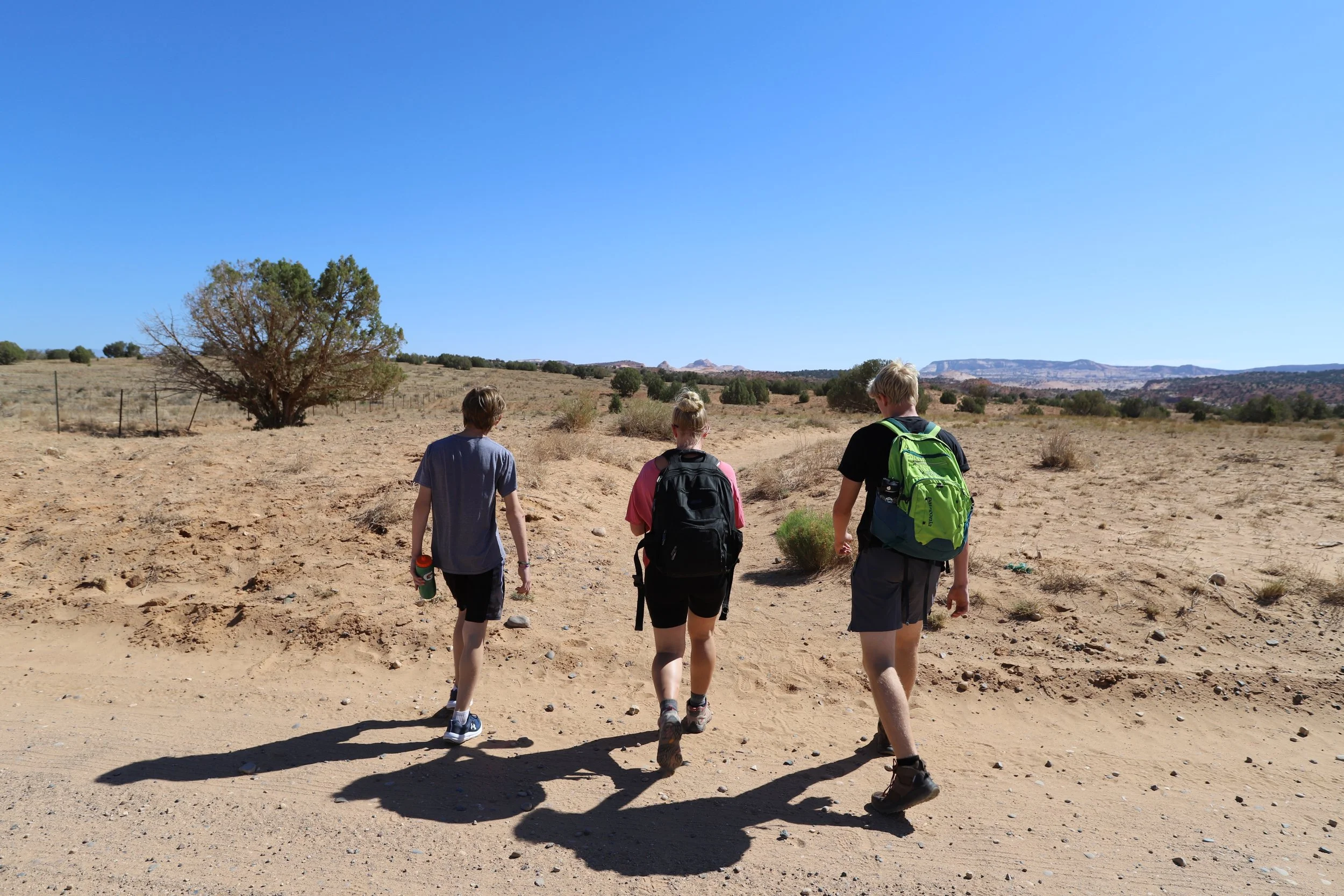
I mentioned previously that I wasn’t able to find out much information about the actual trail - most of what I could find was just pictures of Zebra Slot Canyon. I’m going to include several pictures of the trail, to share how beautiful it is, as well as to show just how long it is, that it is almost 100% exposed to the sun, and the trail surface is mostly sand and rock, with some sections a little harder to route find than others.
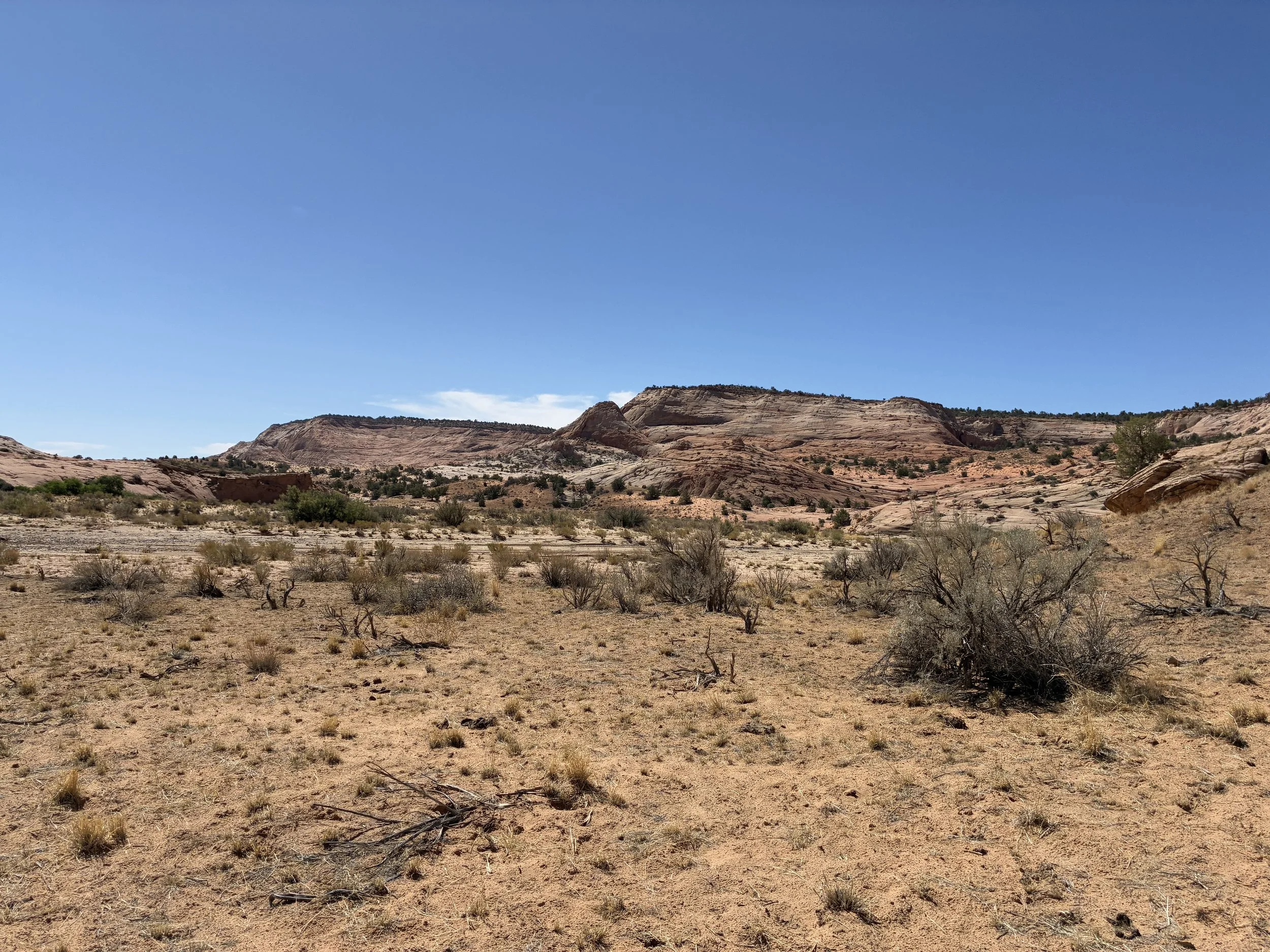
Prepare for a long and hot hike to Zebra Slot Canyon
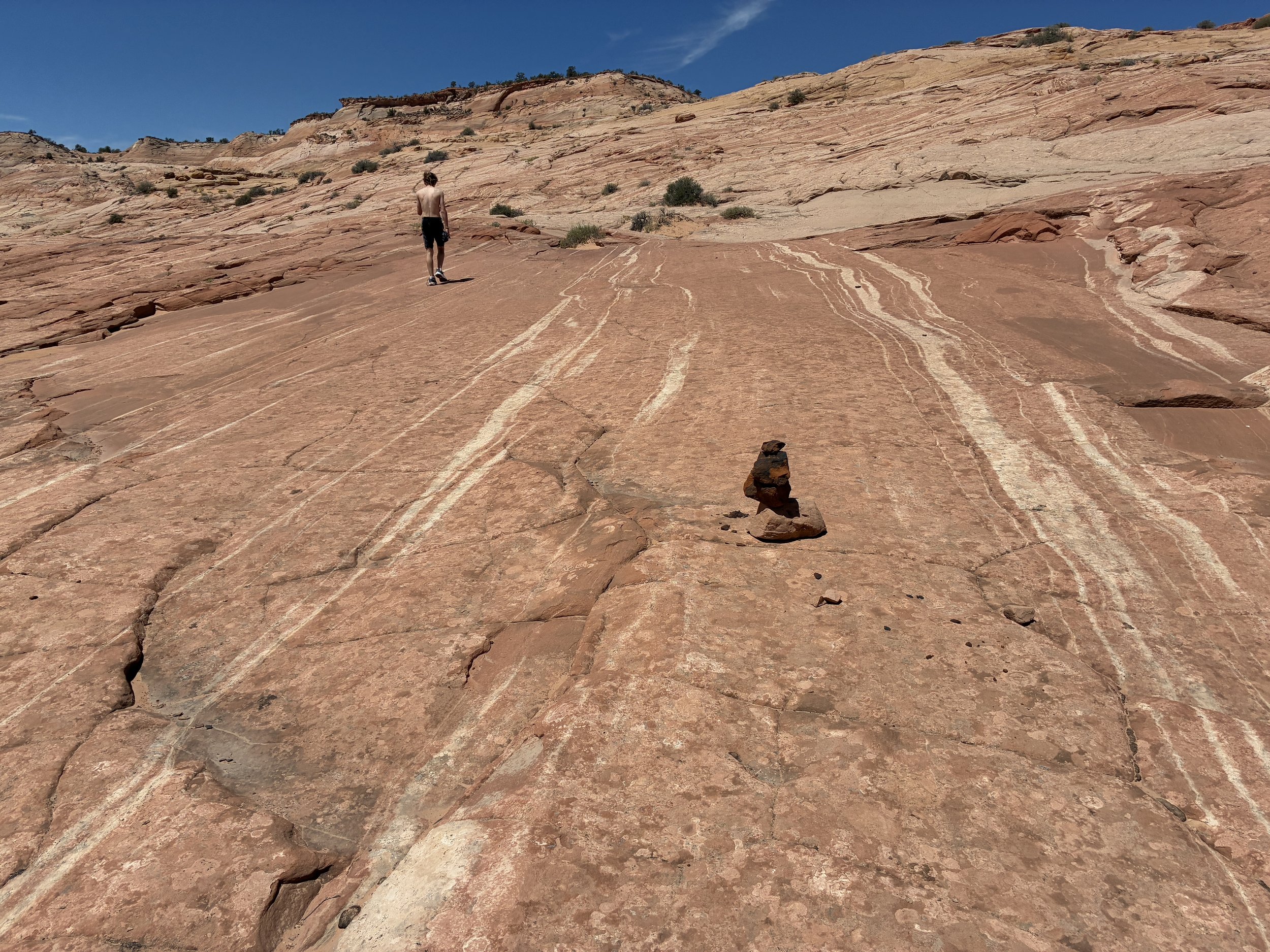
In general, other than heat, this trail is pretty easy. Not too long, and the elevation changes are just gradual short hills.
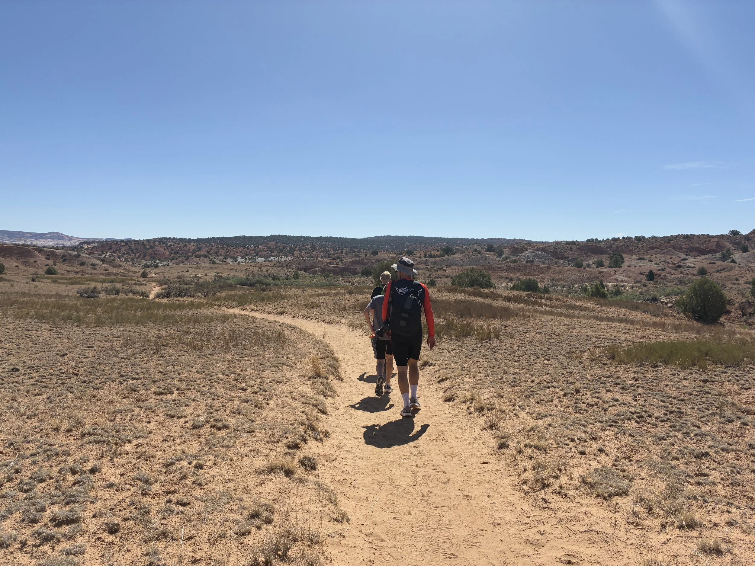
Shade is extremely limited on this trail
If something can bloom in this heat, it’s worthy of a spot in this blog! This is a beautiful prickly pear cactus. We call them “ankle biters” in my family - you do need to watch your feet to avoid hitting them along the trail, and cactus encounters (I’ve had a few in my life), are not fun…
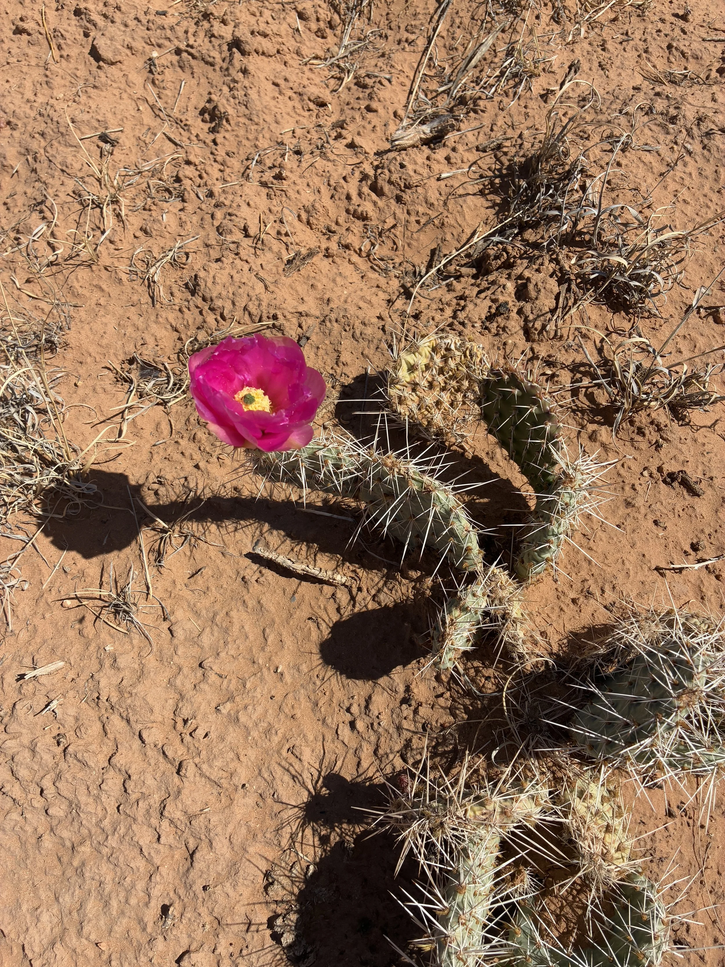
Prickly Pear Cactus blooming in the summer heat
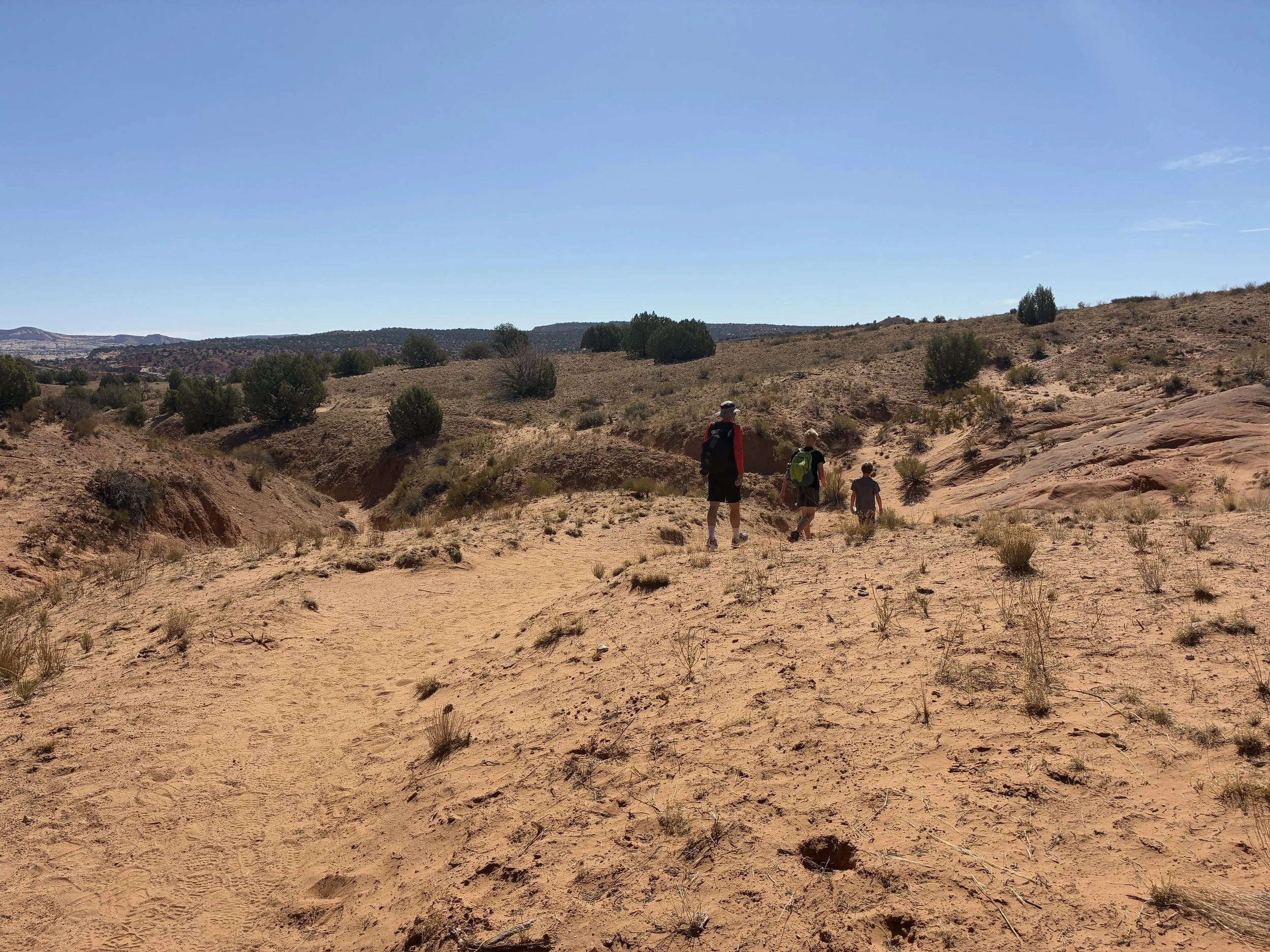
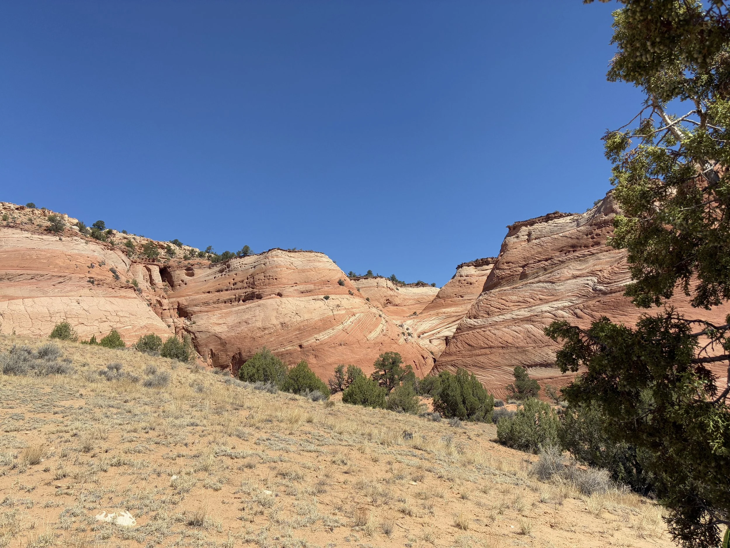
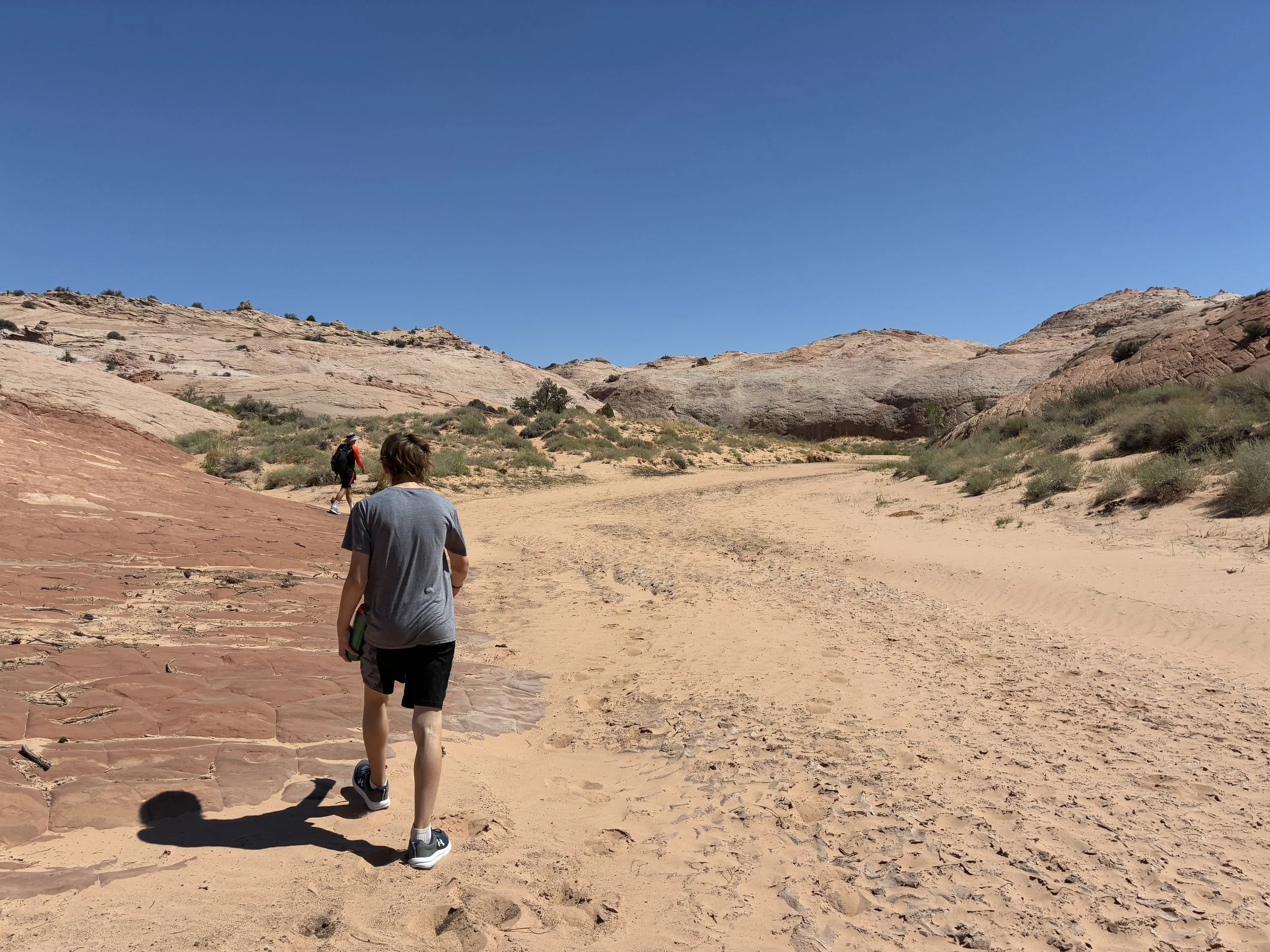
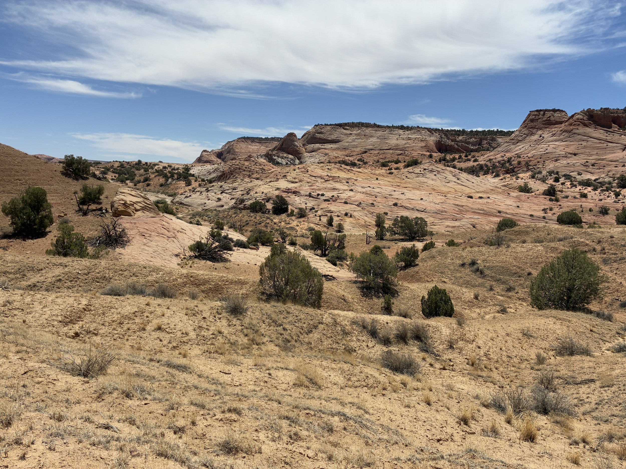
The trail starts heading down into a wash. There are cliffs on the right and canyons on the left. Some of the canyons looked like they would have been fun to explore on a cooler day. We stayed on the trail. It was hot. Pretty and interesting canyons are not a good enough reason to get stuck or lost and run out of water…

The trail is pretty easy to follow at the beginning, but don’t get confused by the wash - Use a GPS map
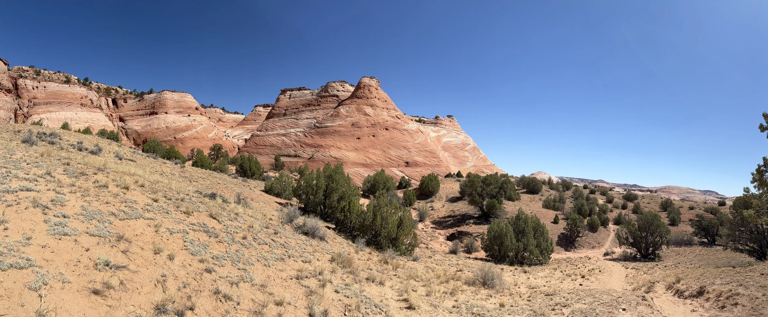
Zebra Slot Canyon is the destination, but about here, these canyons are just as amazing
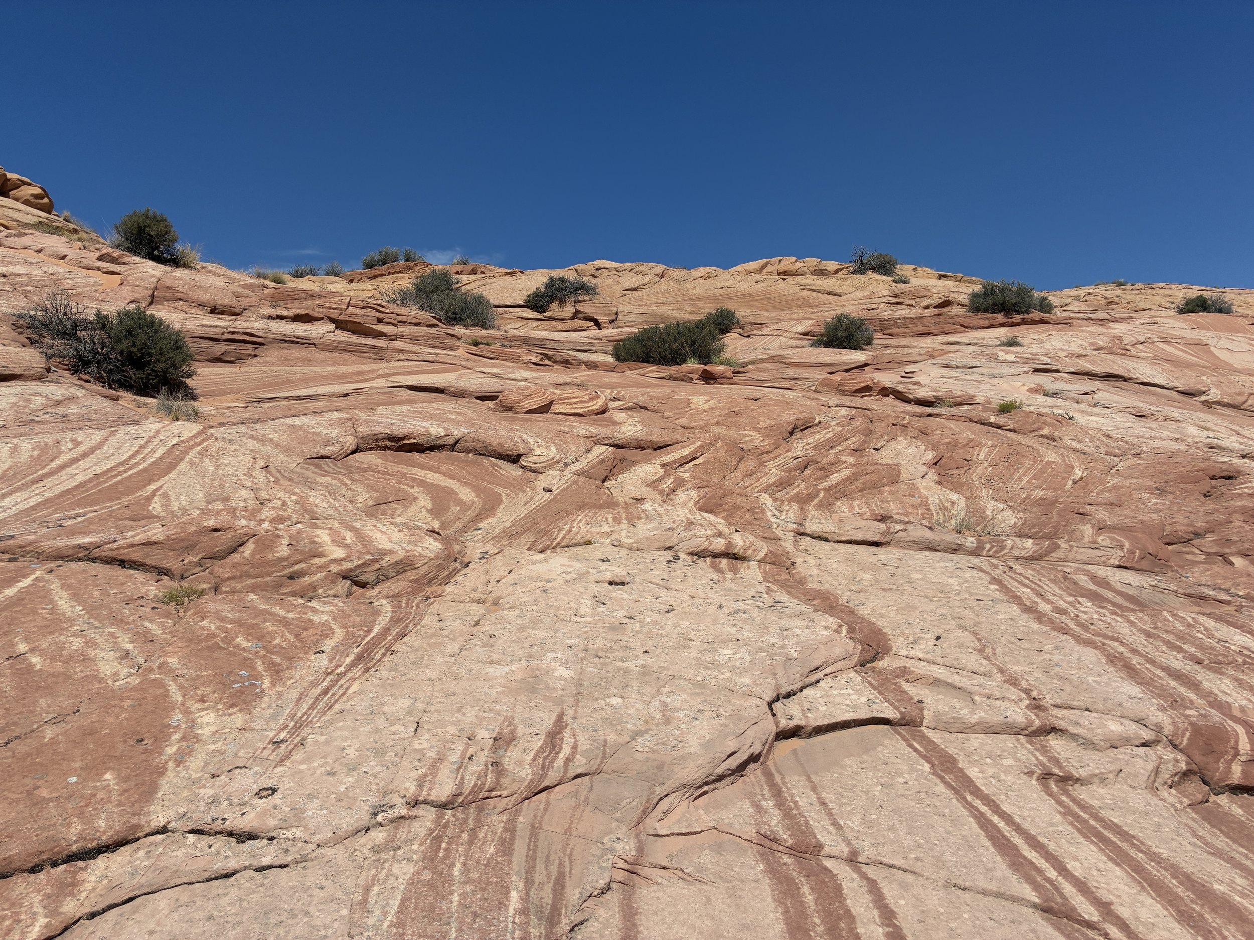
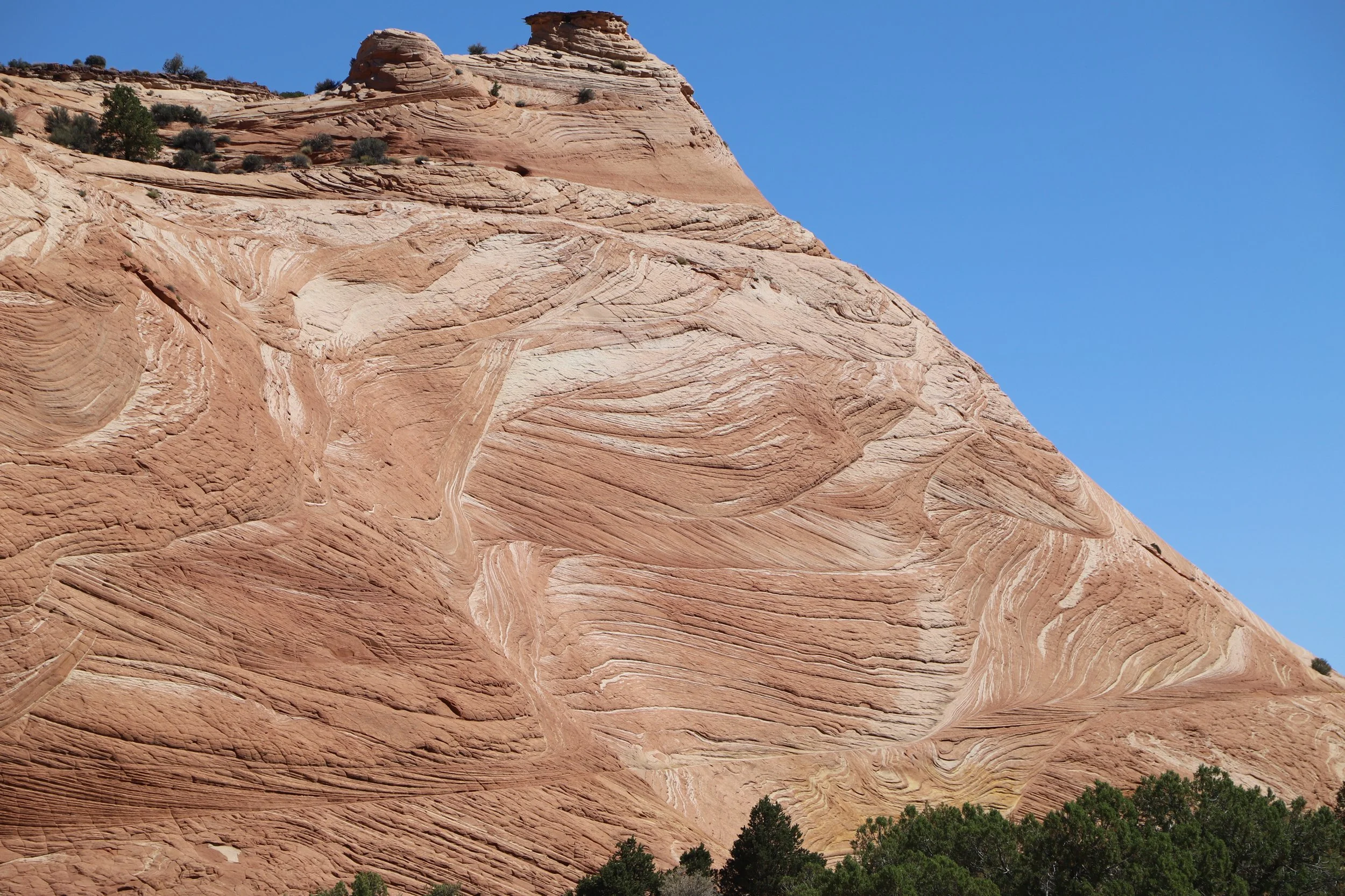
This canyon is incredible with its multi-colored bands of rock. We did have to stop in the Visitor Center after the hike, though, to ask about the holes. The holes are caused by iron-oxide rich rock formations, known as Moqui Marbles. These rocks harden over time, and as the main rock erodes, these “marbles” fall out.
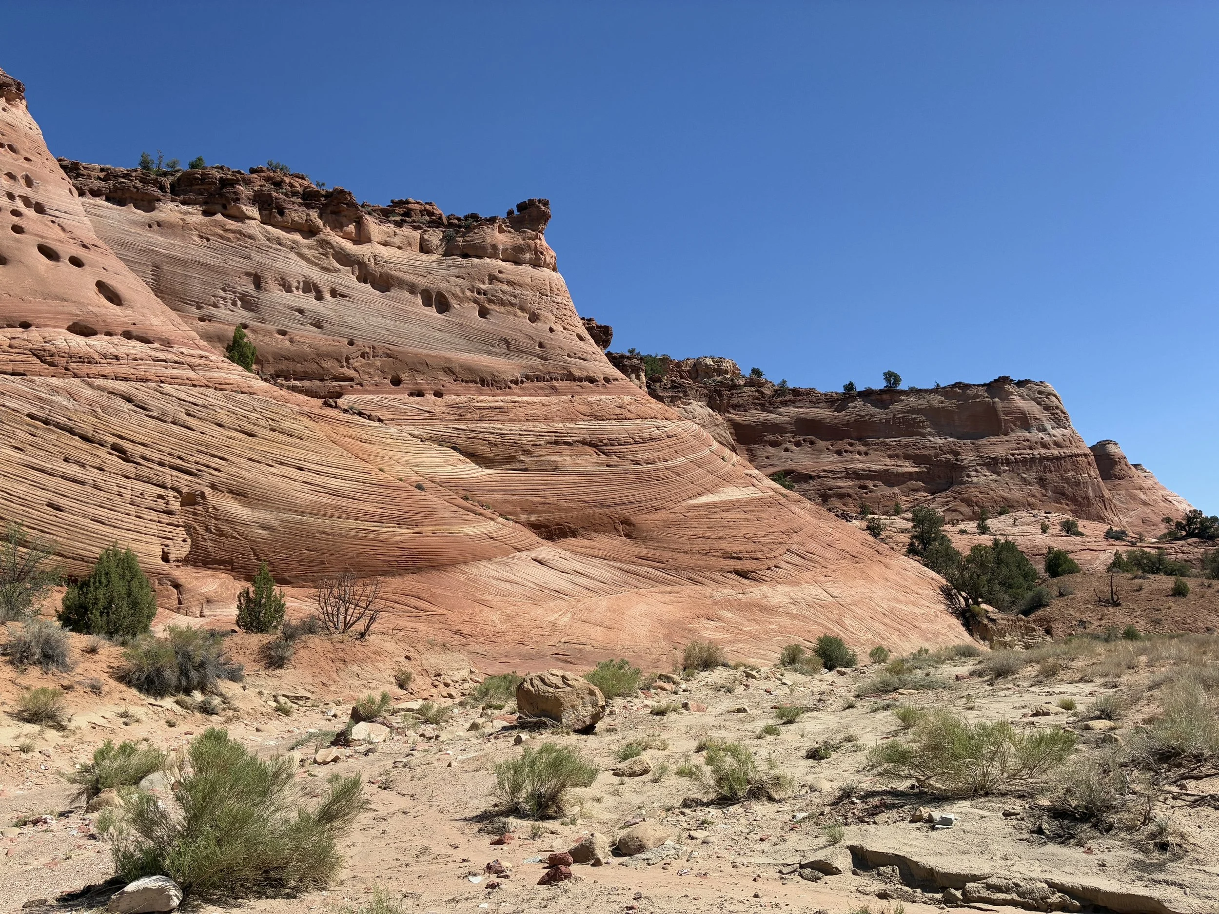
The holes in the rock are spaces where Moqui Marbles (iron-oxide-rich rocks) have fallen out during the process of erosion
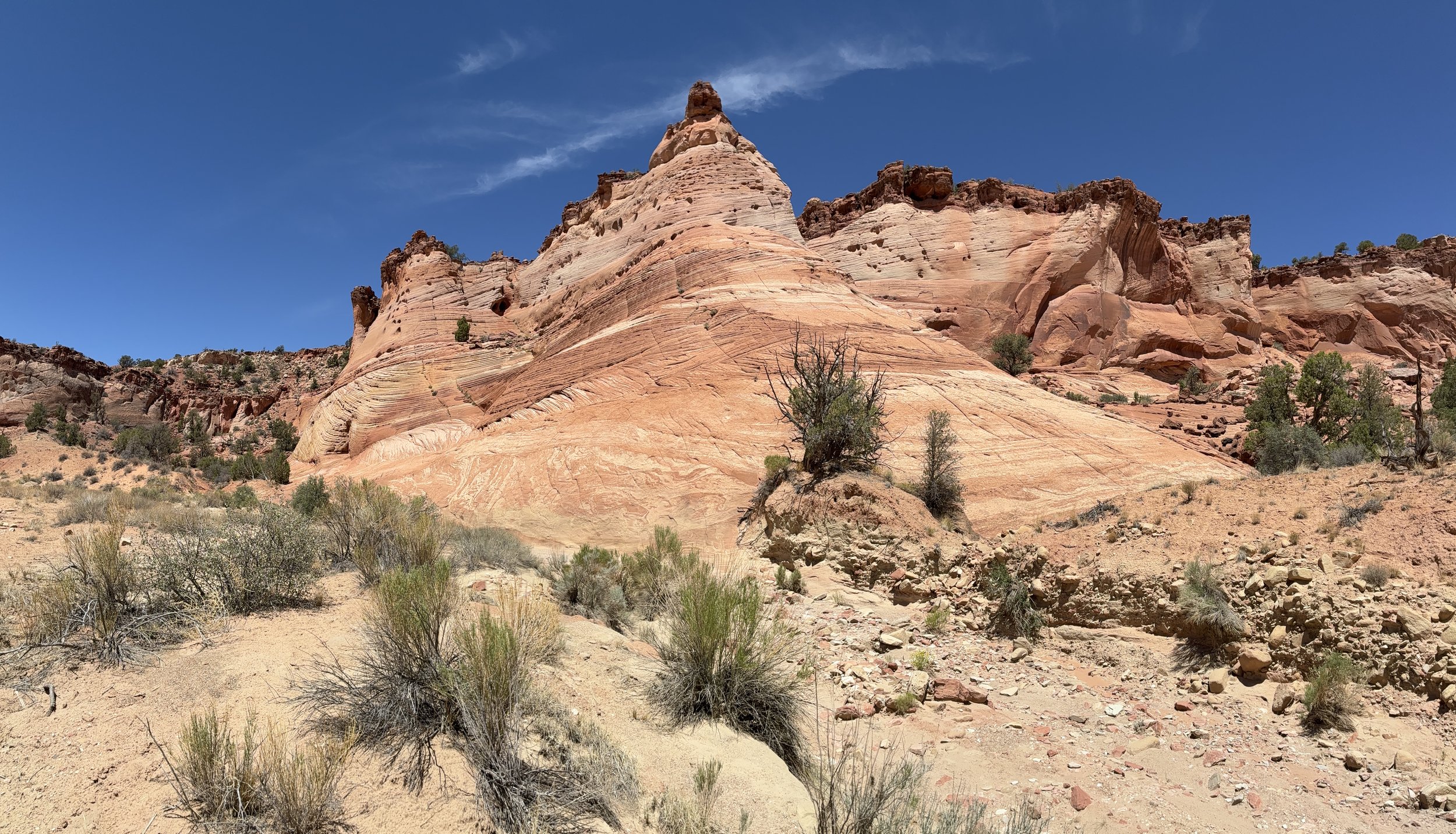
There were many “jaw-dropping” views along this hike. The goal of this hike might be the slot canyon, but the scenery along the way is worth the hike itself.
This is a gorgeous hike!
Staring at the rock layers, I can feel the wind swirling the sand dune as it formed and hardened.
There are small bits of shade here and there. We stopped for some water and a snack under a Juniper.
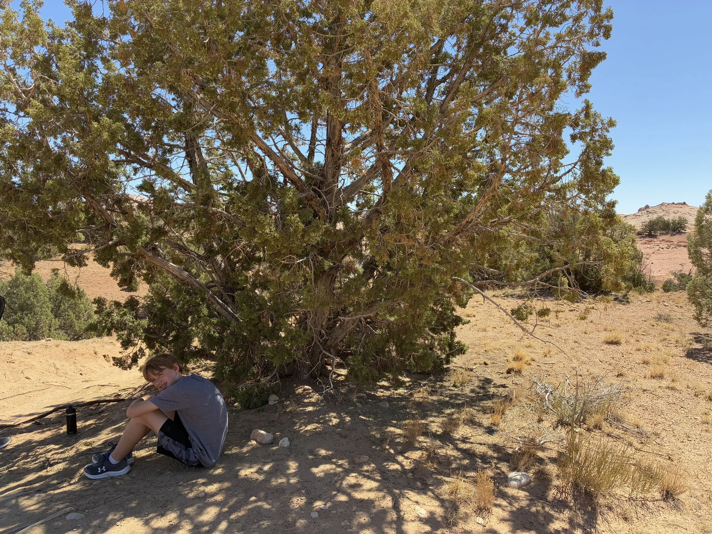
Yep, it’s hot! Stopping for a short break in the shade of a Juniper.
One more picture of these beautiful rocks
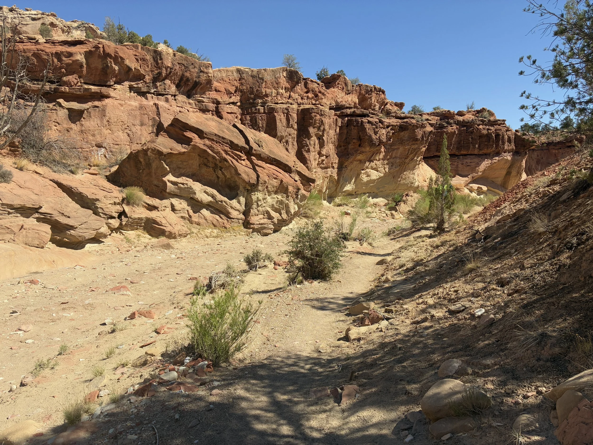
This is Harris Wash. This is the hardest spot to stay on the trail. Aim for the rocks towards the left of the picture, past the wash for Zebra’s entrance. Tunnel Slot Canyon is on the right.
This is the final wash. Zebra Slot Canyon is on the left of the picture, in the shadows.
We lost the cairn path on the way to Zebra Slot Canyon and ended up hiking in the wash. We still figured out where it was, but it did take a bit of exploration. The way back, it was much easier to follow the cairns (plus I had been tracking our route on GAIA GPS, so that helped as well) Looking at pictures, like the one below, ahead of time, will help you get your bearings and know what to be aiming towards when you hike.
The trail may be hard to follow here. Just aim for the corner and walk toward the front of the cliffs. You can walk on the rocks or stay in the wash.
This is the beginning of a beautiful canyon. It’s so unassuming that we were second guessing ourselves if we’d found the right place.
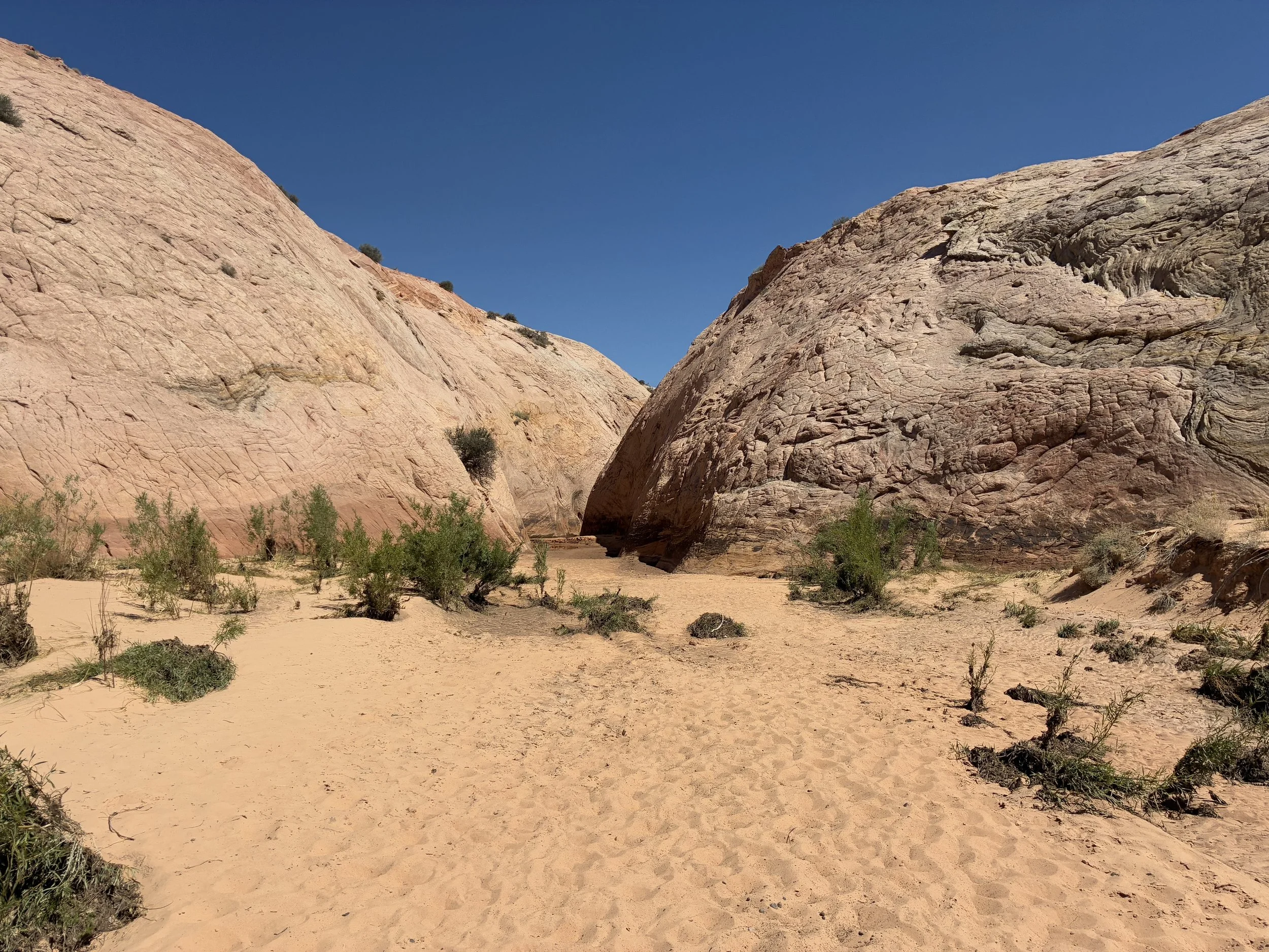
Entrance of Zebra Slot Canyon - pretty unassuming
I was ready for the water at the entrance of the canyon. We changed into our water shoes and left our hiking boots and backpacks at the mouth of the canyon in the dry sand.
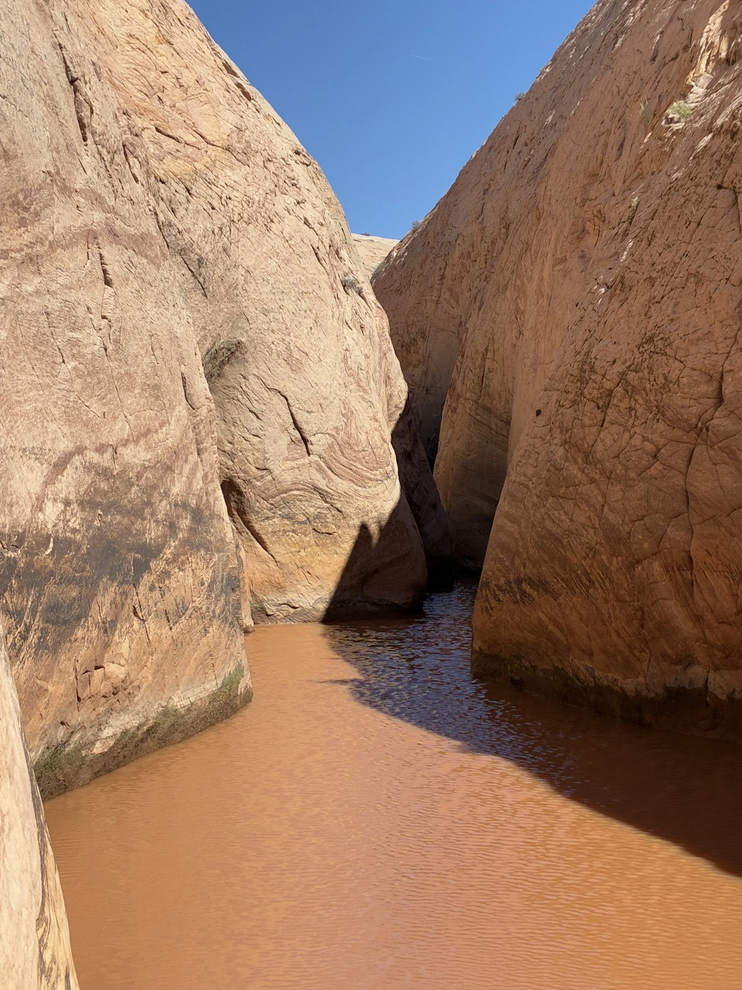
Zebra Slot Canyon - how deep could that water be?
Step, step, step into the cold water, and then drop off and I’m swimming, laughing, trying not to drop my phone, and I can’t feel the floor of the canyon. It didn’t really matter how deep the water was - we were so hot by this point, it felt amazing even if the water was incredibly cold.
I was surprised we needed to swim through Zebra Canyon
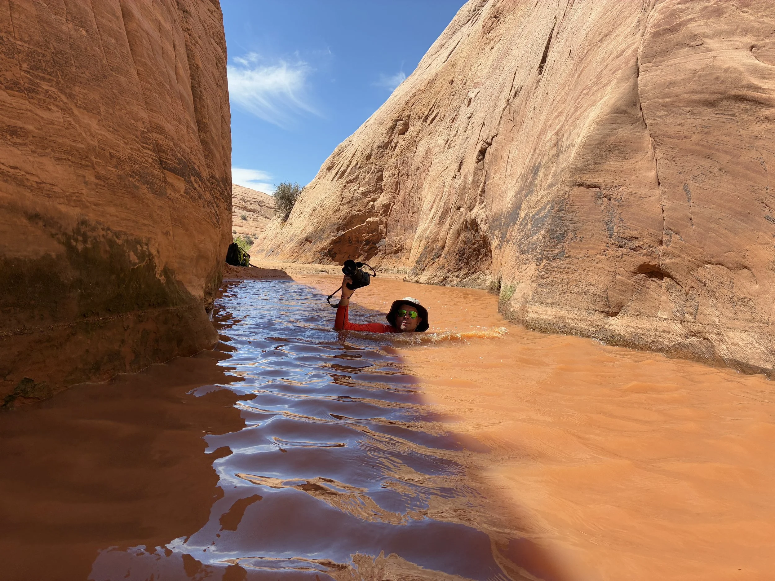
We all swam through the first part. The rest was within touching depth.
The deep section didn’t last more than just a few strokes, and we could touch the ground again.
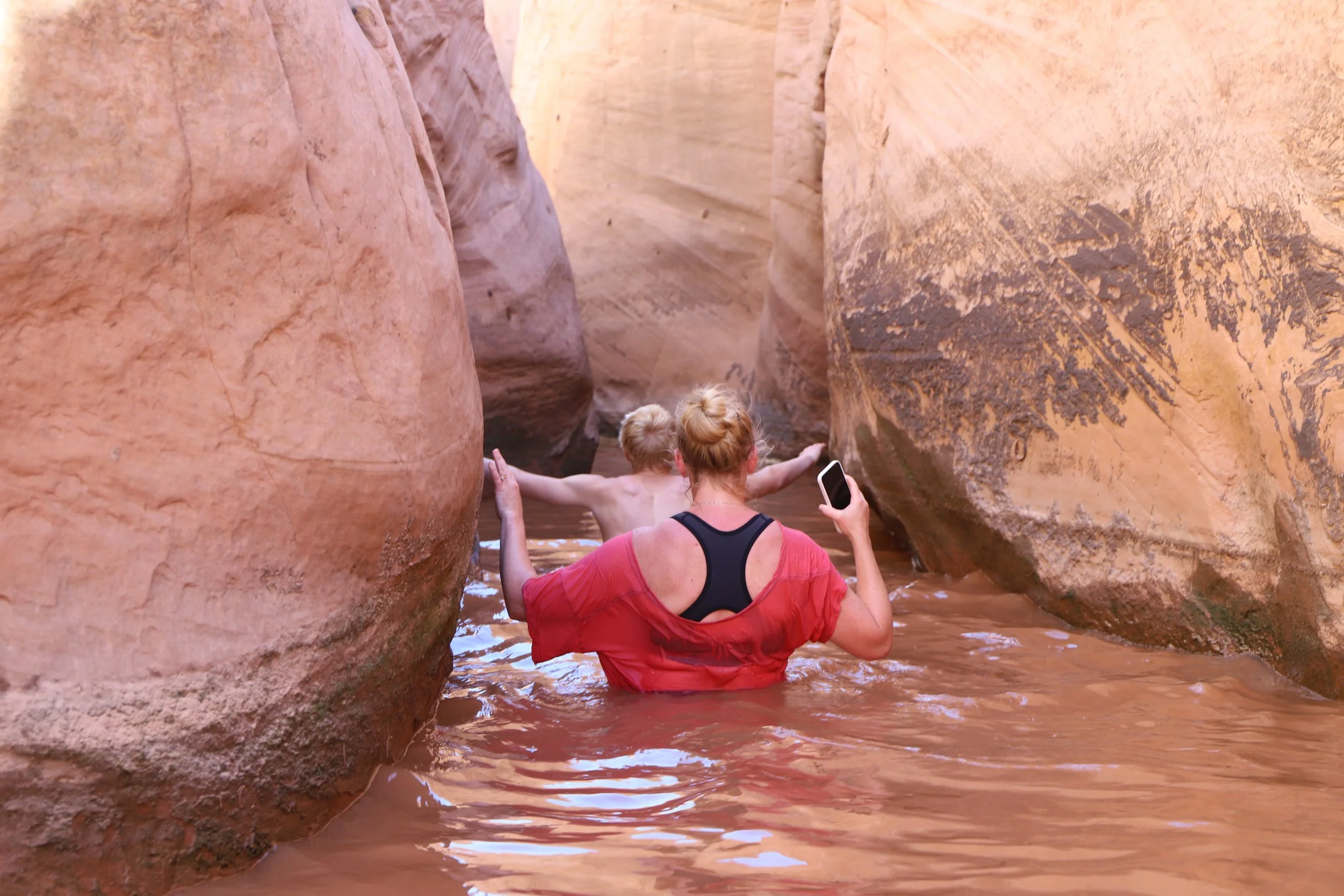
Wading into Zebra Slot Canyon
The water is cold, but we were so hot by this point, it still felt great!
It is weird to not be able to see the bottom while hiking through a canyon
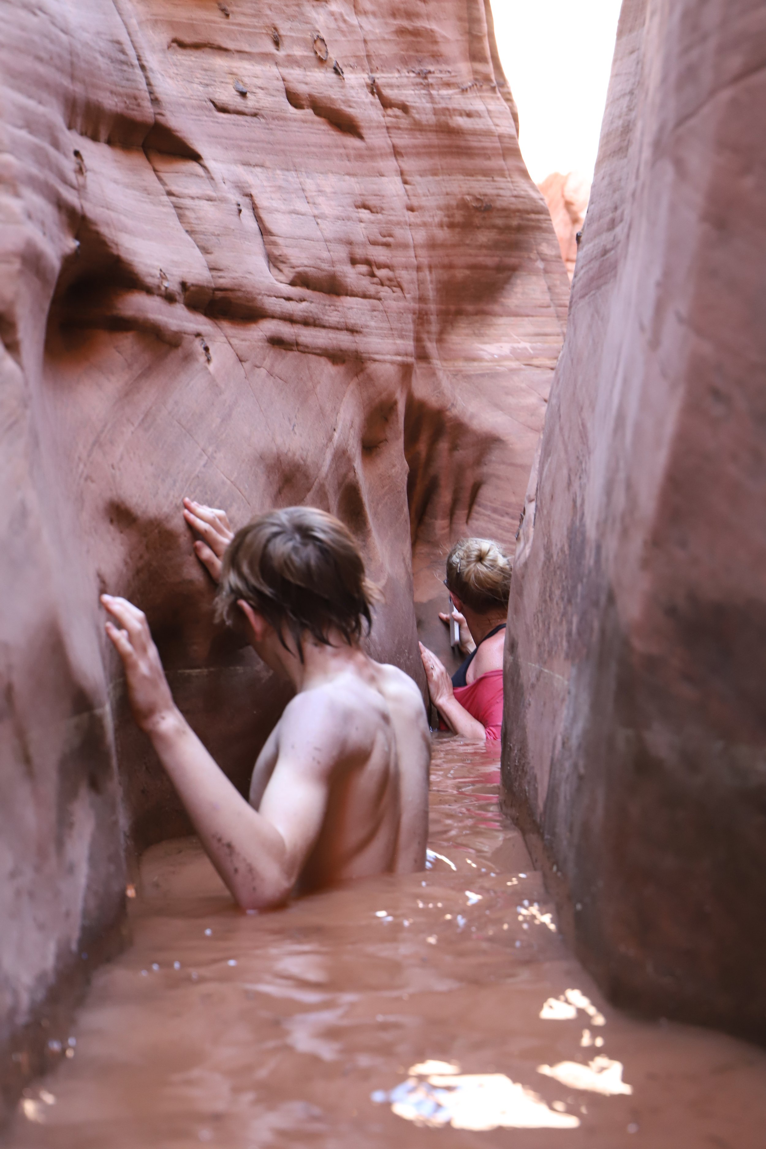
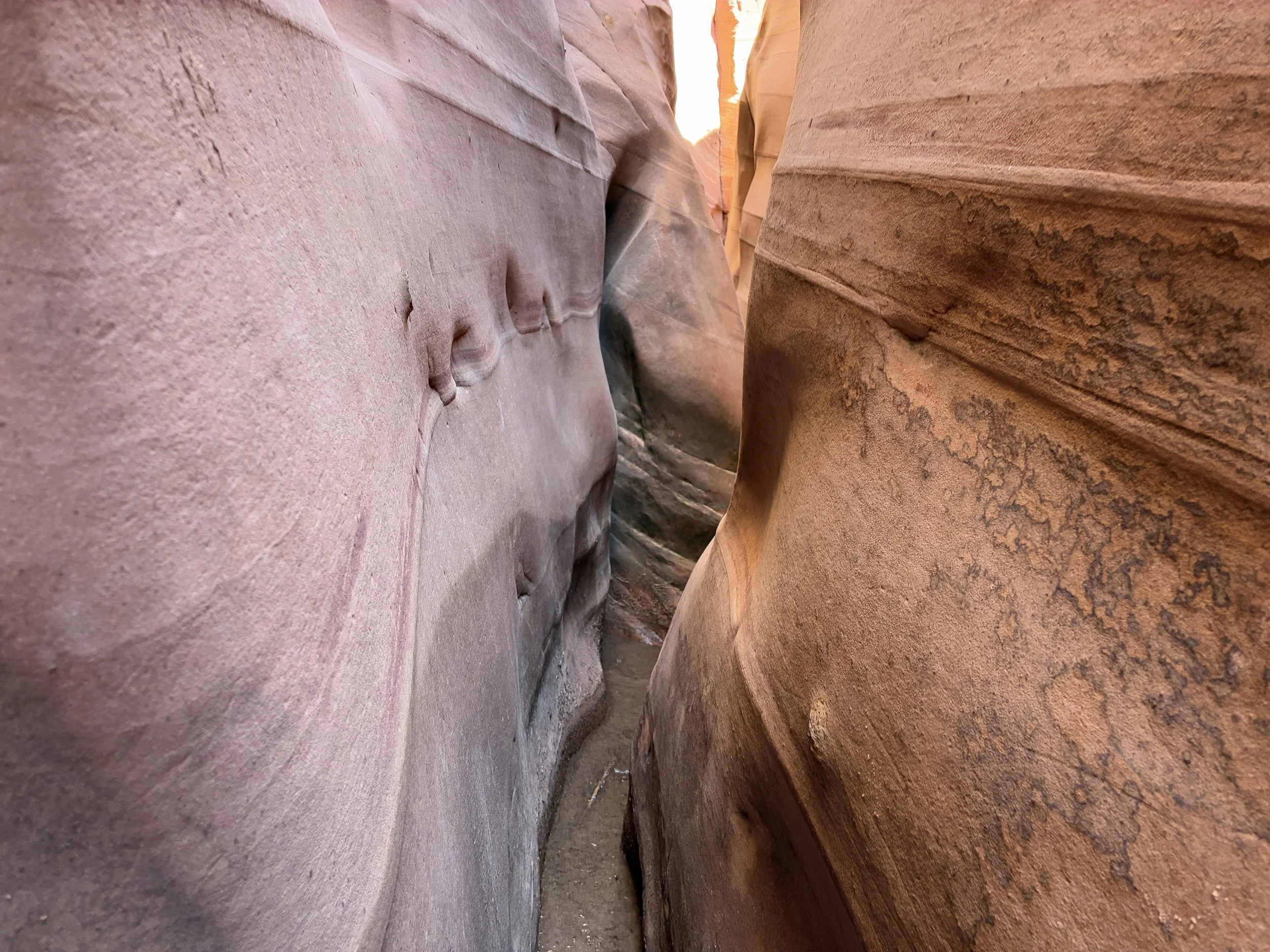
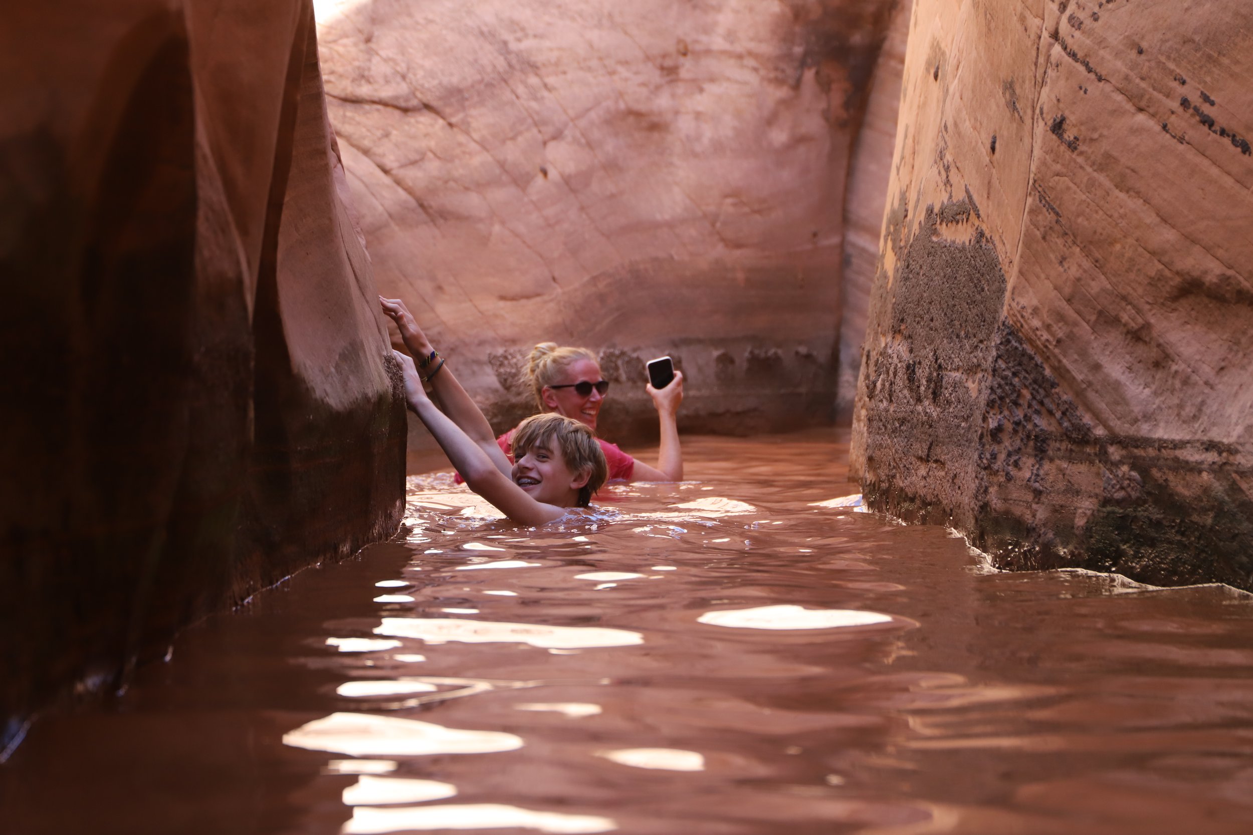
Squeezing through Zebra
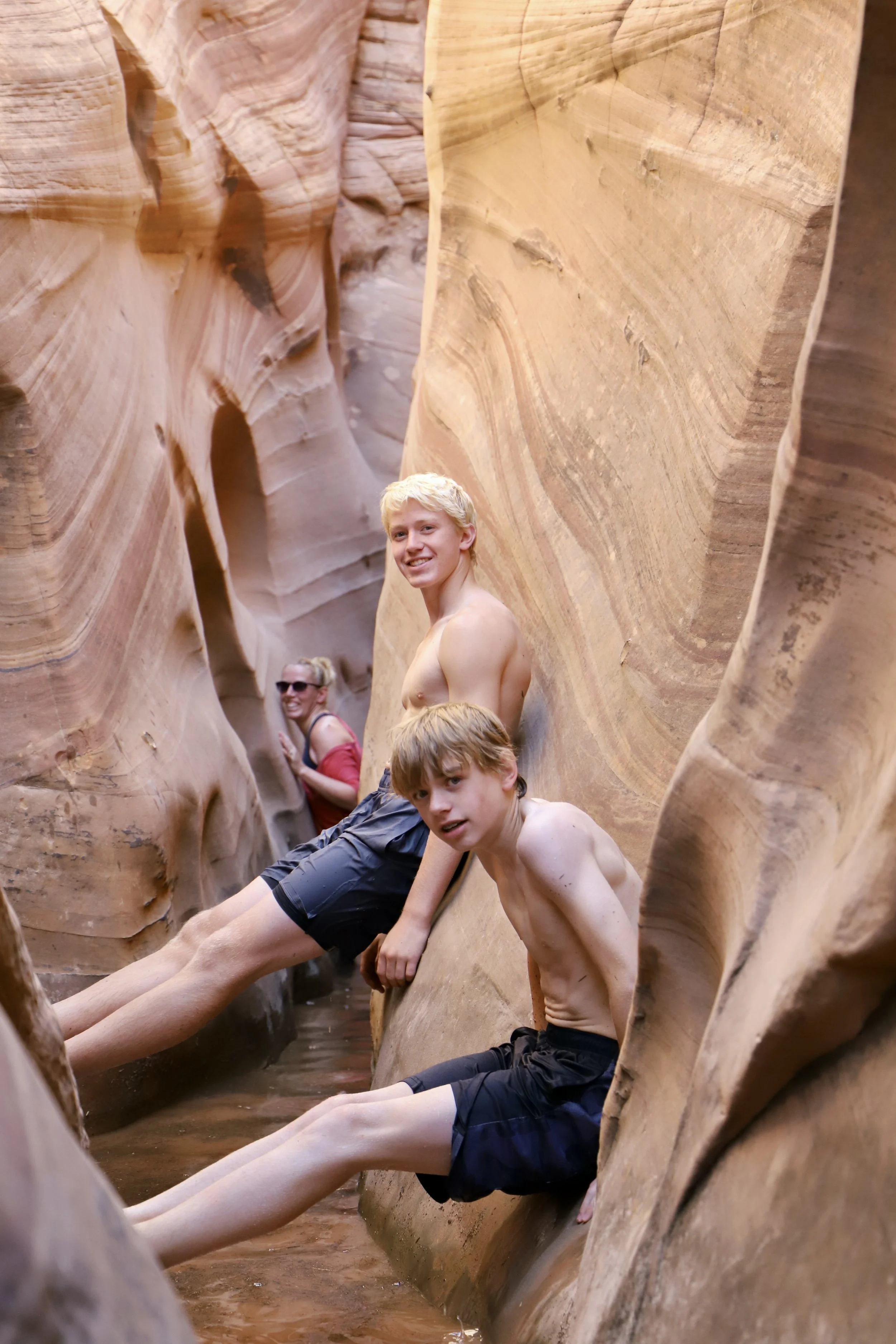
Best familly summer vacation?
Getting really tight!
This is where we stopped, and I realize now that we should have climbed up a bit higher on the walls and squeezed through a bit further to find the multi-colored rock walls. There weren’t any other hikers though that we’d passed who had actually entered the canyon, so we didn’t really have much information on how far we should go.
We stopped here as we couldn’t walk any further. The canyon walls come to a V, there was still a lot of water, so we couldn’t see the floor, we were getting cold, and this was our first hike of our summer trip. No one wanted to get hurt at the beginning, so we turned around. Apparently, the walls do widen back out again, so I’d recommend going further. I guess we chickened out a bit early.
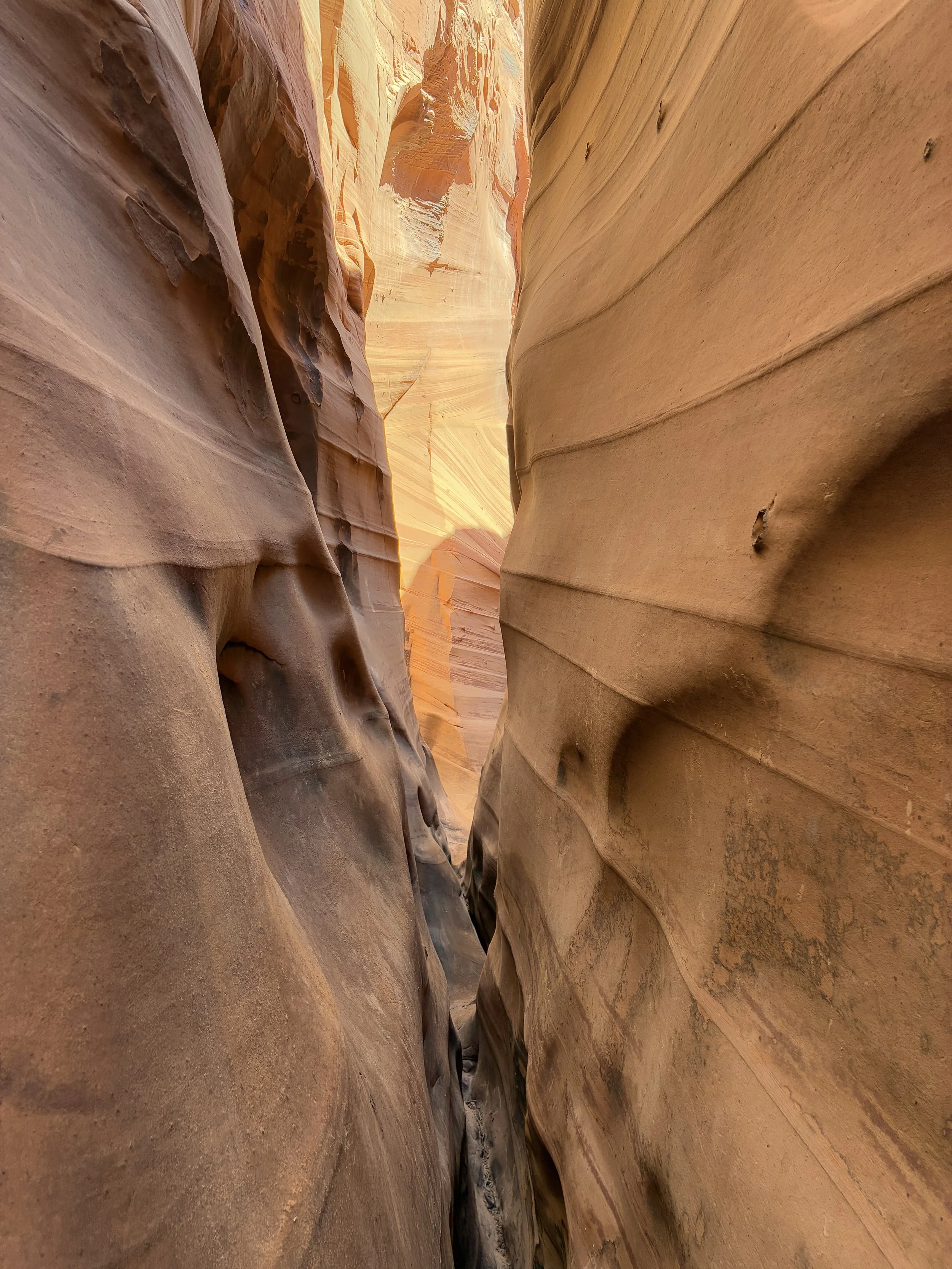
This is where we stopped, because we couldn’t easily get any further, and I wasn’t aware there was more. I’ve since read, it’s worth making it past this section to see more of the multi-colored rocks.
There was a frog we saw swimming with us on our way back through the canyon.
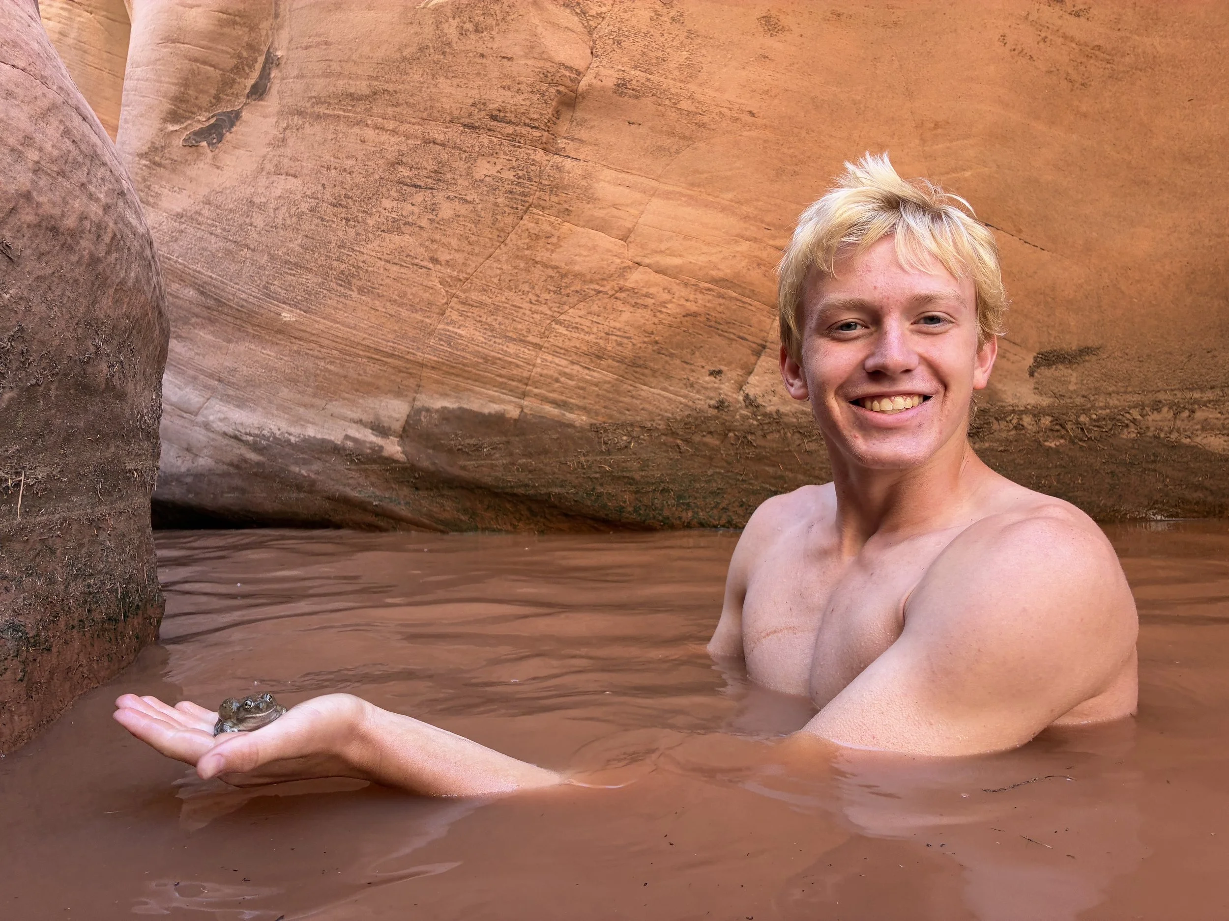
Found a frog swimming with us back towards the entrance
Family picture! Our first “swimming” hike - of many more to come on this trip in June 2025 (see my other posts on Kanarra Falls, Keyhole Canyon, Zion Narrows, Buckskin Gulch, and Water Canyon).
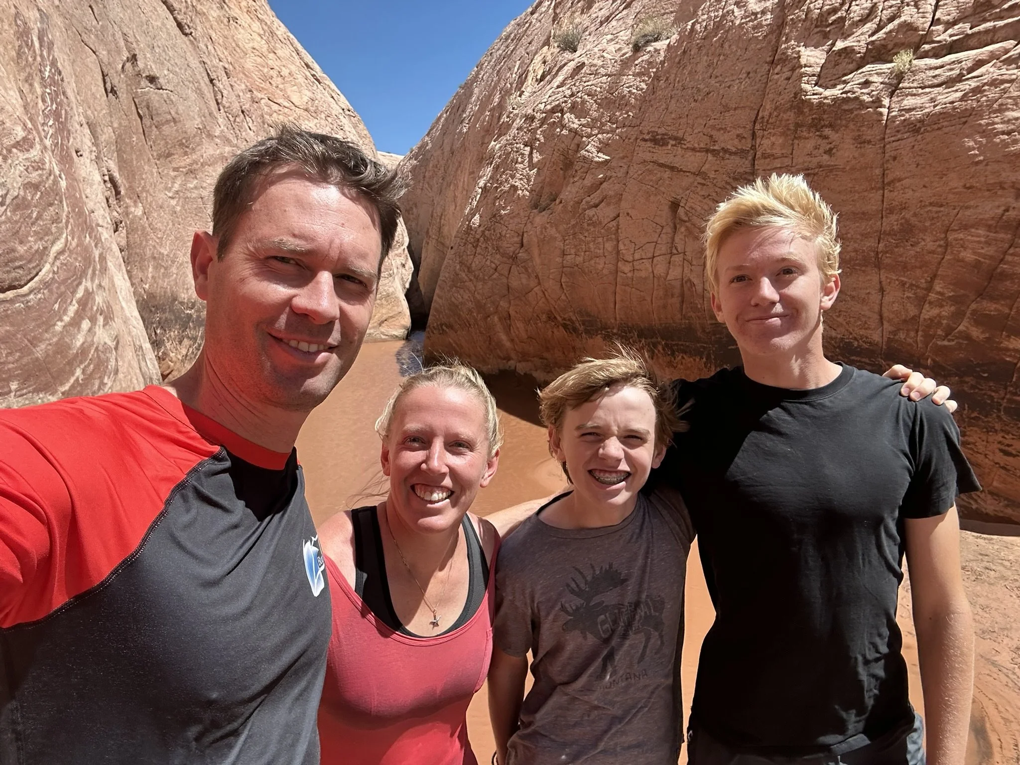
Fun start to our summer vacation!
I had towels set out for us in the car for when we returned. We didn’t need them. We were fully dried back off by the time we got back to the trailhead. The cold water was so refreshing! It took an hour or so before we were hot again along the trail.
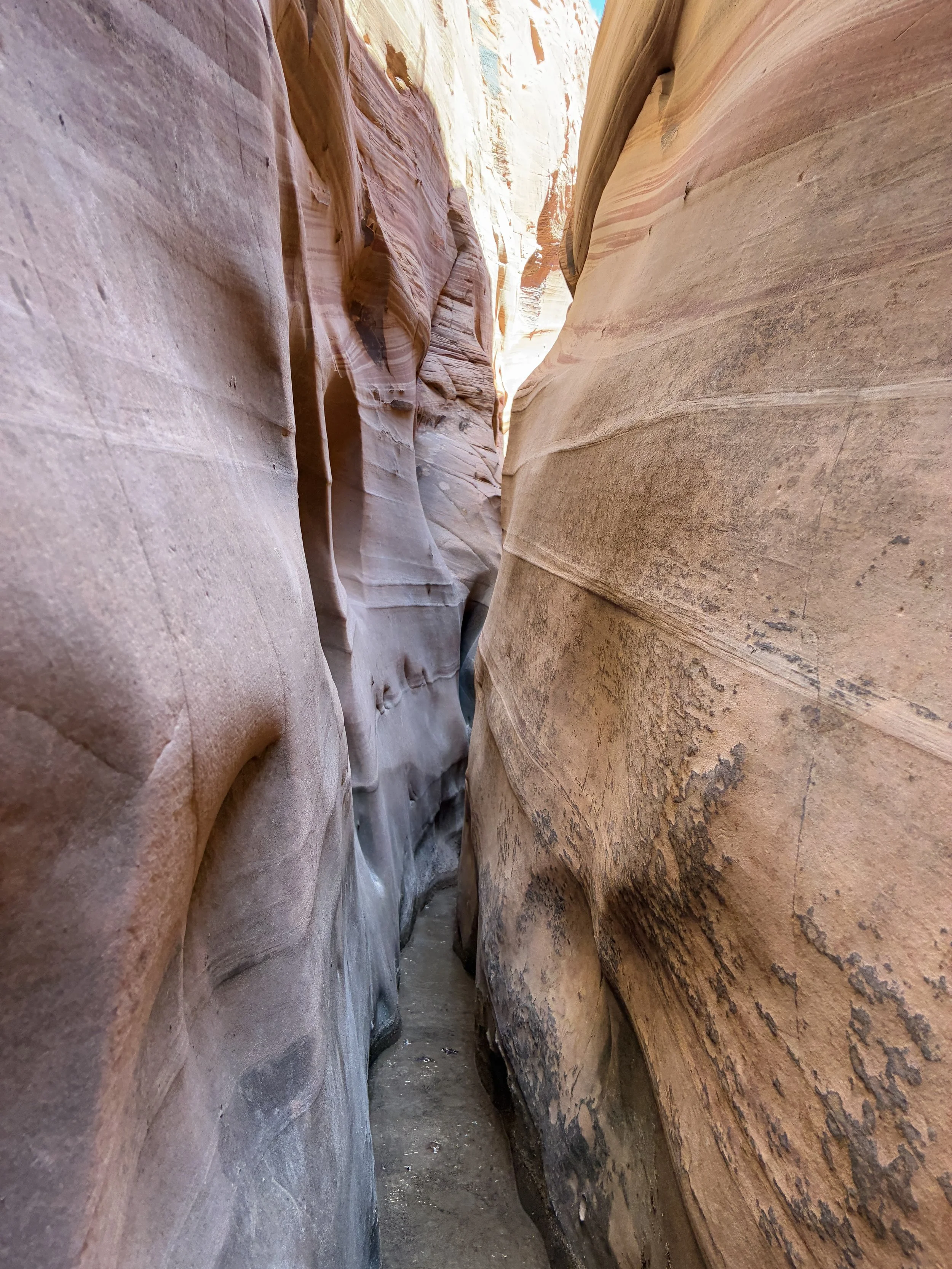
It’s easier to follow the trail on the way back - the rock cairns were more obvious
One last picture - again, Zebra Slot Canyon was cool, but the whole hike was beautfiul!
“Nearby” Things to Do
To be honest, everything is very spread out in Grand Staircase-Escalante, and the driving along Hole-in-the-Rock Road is slow to begin with. So, when I say “nearby” - it’s a bit relative… The following places to visit are within a two-hour drive.
Devil’s Garden
10 minutes - Continue down Hole-in-the-Rock Road for another 4 miles. Devil’s Garden isn't so much a formal hike, it's rather a place to explore with a beautiful arch. The trails crisscross throughout this park, so just enjoy. There are vault toilets to use here as well, if you are looking for nearby bathrooms.
Twenty Mile Wash Dinosaur Trackway
20 minutes - Continue along Hole-in-the-Rock Rock for 6 miles (2 miles past Devil’s Garden) and turn right on Left Hand Collet Cyn Road. Follow this side road for 2.5 miles. For anyone interested in finding some dinosaur footprints, this is a quick place to explore. The Sauropod footprints (big round circles) are easy to spot. There are also some Therapod footprints (3-toed) but these are harder to find.
Peekaboo and Spooky Gulch Slot Canyons (Dry Forks Narrows and Brimstone Gulch)
30 minutes - The Upper Dry Forks Trailhead is located 17 miles along Hole-in-the-Rock Road from Zebra Slot Canyon (10 miles past the turnoff for Left Hand Collet Cyn Road). This is a fun and challenging 4.6-mile loop hike through 3 slot canyons (Dry Forks Narrows, Peekaboo, and Spooky Gulch). Add Brimstone Gulch for an additional 3.6 miles.
John Hamblin Arch
50 minutes (varies - depending on which trailhead you start from) - A challenging multi-day hike through Coyote Gulch that is accessed via further down Hole-in-the-Rock Road. Still on my hiking wish list. We are trying out backpacking again in June 2026 - the boys are quite a bit older than when we went last time. That will answer if this is a viable hike with our boys or if we need to wait until they fly the nest.
Reflection Canyon
2 hours - Another challenging multi-day hike starting at the end of Hole-in-the-Rock Road and ending at the Colorado River. I’m not sure I’ll ever quite have the courage to do this hike, due to limited water supply on a multi-day trip. But I do think about the pictures of this canyon frequently - so maybe someday I’ll figure out how to make this hike feasible.
Bryce Canyon National Park
75 minutes - Bryce Canyon National Park is about 75 minutes from the Zebra Slot Canyon Trailhead (to the west) along UT-12. I would recommend switching lodging to be able to enjoy a few days hiking through Bryce Canyon. The hikes at this park are difficult, but if you are looking at hikes in Grand Staircase-Escalante, the difficulty of this park isn’t going to be a roadblock for you.
Kodachrome Basin State Park
75 minutes - Kodachrome Basin State Park sits just to the east of Bryce Canyon National Park. It has some of the same hoodoos, although they are not as dramatic, nor are there as many. It’s a fun park to hike through, and much quieter than its nearby National Park.
Willis Creek Slot Canyon
90 minutes - Willis Creek Slot Canyon is also to the west of Zebra Canyon (and west of Kodachrome). Willis Creek Slot Canyon is an easy, shaded slot canyon with minimal change in elevation, and has stunning, tall, and colorful walls. This is an out-and-back hike for as long as you’d like. The max hike is 6 miles long. The trailhead is along Skutumpah Road, a sandy, bumpy road where a higher clearance vehicle is going to be appreciated. The canyon is located very close to the parking area.
Bull Valley Gorge
90 minutes - The trailhead to Bull Valley Gorge is 6 minutes further along Skutumpah Road, past the Willis Creek Slot Canyon trailhead. Bull Valley Gorge is a short (1 mile) but difficult slot canyon. This can be a loop hike out to the start of the canyon, through it, and scrambling back up, but there are some major obstacles to navigate through within the canyon. We explored about a third of the way through the canyon and returned the way we came in. Bull Valley Gorge is also the site of where a truck can be found wedged in the canyon walls from an accident in 1954.
Lower Calf Creek Falls
30 minutes - The trailhead to Lower Calf Creek Falls is just over 30 minutes to the east of Zebra Slot Canyon, just off of UT-12. It’s a relatively easy 6 mile out-and-back hike to an impressive waterfall, and there are petroglyphs to find along the way.
Anasazi State Park Museum
50 minutes - For anyone heading to Capitol Reef National Park, Anasazi State Park Museum is an interesting, quick stop, also off of UT-12. Just outside of the museum, there is a six-room dwelling replica constructed on the original site.
Long Canyon
75 minutes - The trailhead is quite a bit off of UT-12. It’s a really easy and short hike through a slot canyon, but the slot canyon isn’t that deep, and I don’t think it was worth the drive out this far.
Capitol Reef National Park
1 hour 45 minutes - Like Bryce Canyon, Capitol Reef National Park is worth switching lodging locations to be able to enjoy a few days hiking in this park. Out of all of Utah’s National Parks, this one is the quietest. That on its own made it a special place to visit.
More from www.NatureImpactsUs.com
To see more of my posts, click on any pin. There will be a hyperlink to my posts on that particular hike.