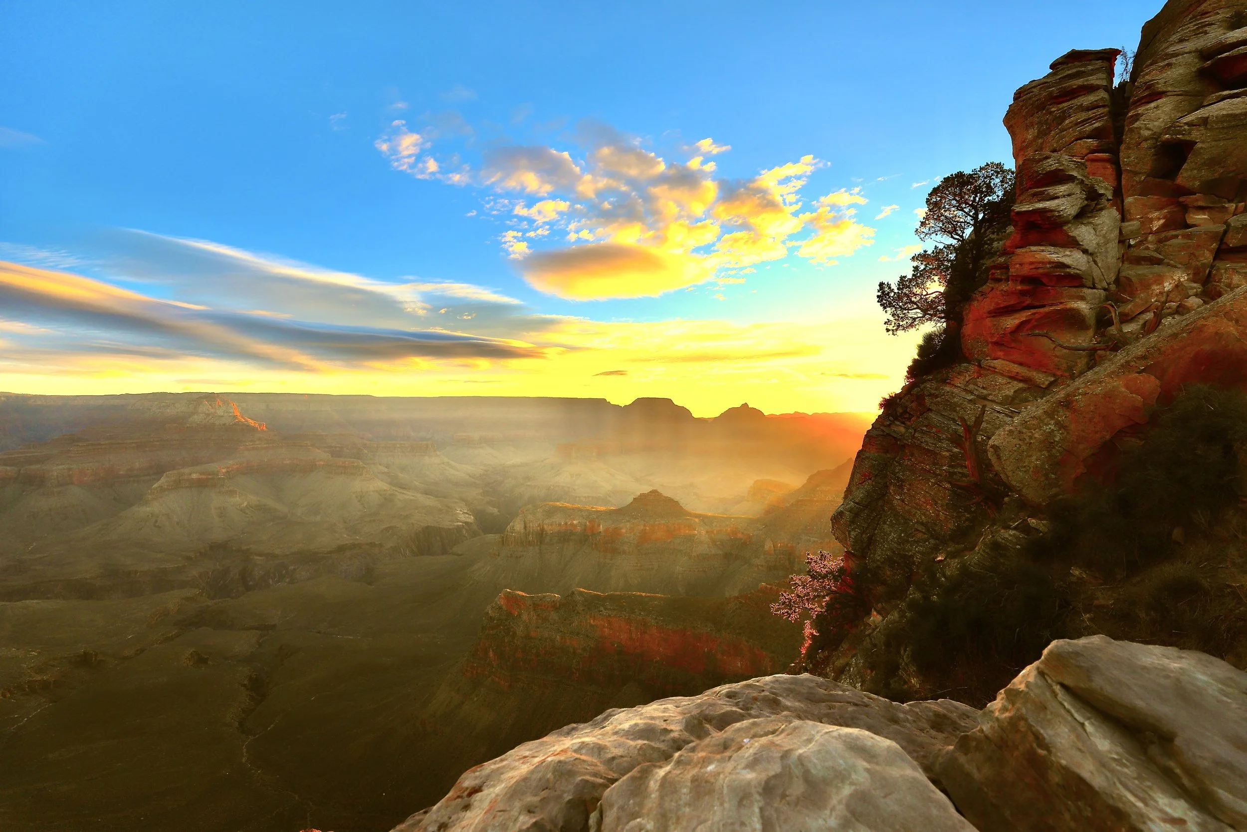
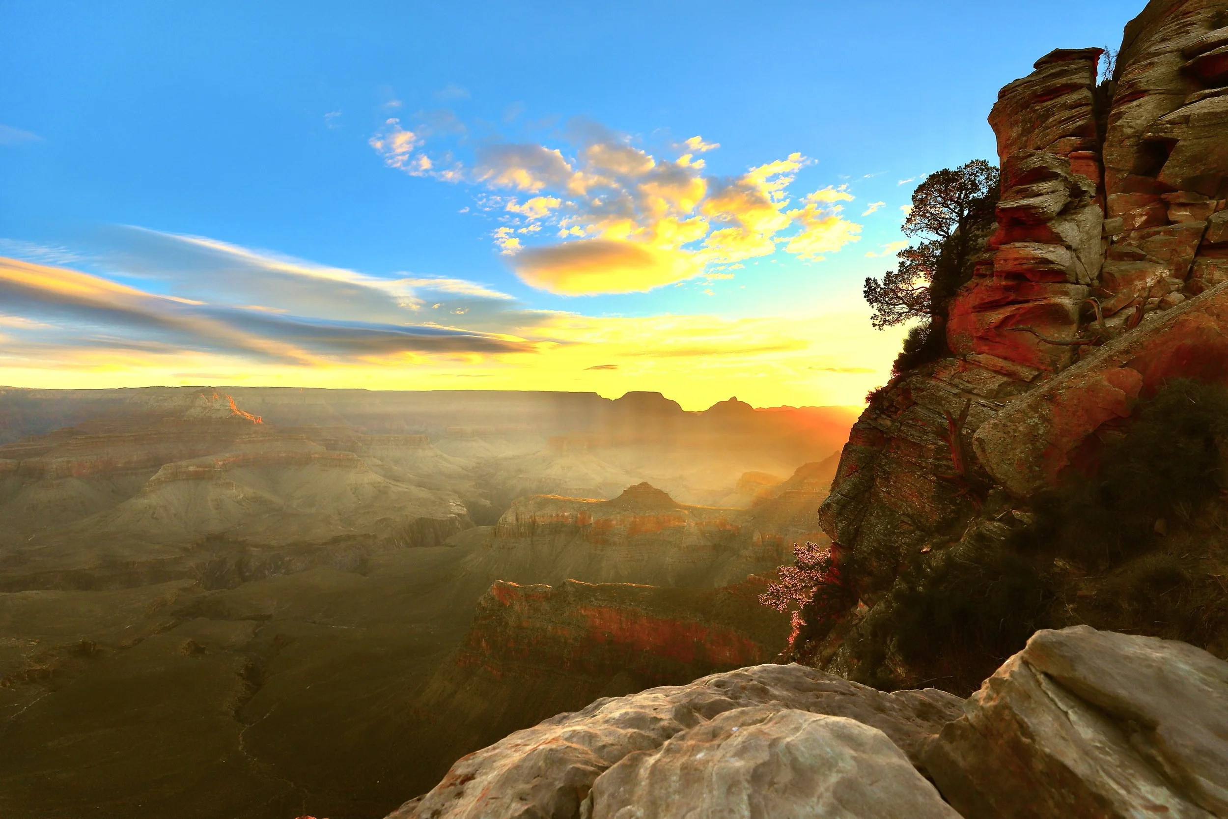
(March 2018) South Kaibab Trail - Sunrise at Ooh Aah Point
If you enjoy my blog, please consider signing up below for email notifications of my latest posts. I will not share your email.
Skip logistics and go straight to hikes and photos
Grand Canyon National Park
I don’t think anyone will dispute when standing on the rim, looking out at the Grand Canyon that the view is epic, but some people might leave the park with a feeling of “meh.” As this is one of my favorite National Parks, I’ve visited 6 times so far, with glimmers of a potential next trip in ideation phase (although likely several years in the future). Even though I love this park, I get where the “meh” vibes could come from - a ton of people conglomerated at a handful of key viewpoints, limited everything (dining options, parking spaces, hotel rooms, etc.), and if you don’t want to hike into the canyon, what are you supposed to do while visiting? Without a plan, it would be really easy to walk away from this park without ever feeling a connection with the canyon. That’s truly unfortunate when there are so many different kinds of experiences to be had within the Grand Canyon.
In addition to the obvious awe-inspiring views, what captures my imagination the most at the Grand Canyon are the extreme opposites. It might be cold on the rim in the evening but dangerously hot at the bottom in the afternoon sun. There’s hardly any tree shade on the South Rim trails, but at a higher elevation, the North Rim has forests of huge pine trees. The South Rim is optimized for millions of visitors each year while the North Rim is designed for secluded experiences of just the thousands. A huge river cuts through the middle of an impressive desert landscape, and flashfloods can occur in just moments. There are options for short, easy, and accessible walks along the rim or the hardest treks I’ve ever hiked in my life. Each visit for me has been different, even if I’ve been on the same trails. I think there’s an option for the perfect vacation for everyone here at the Grand Canyon, with a bit of knowledge before arriving.
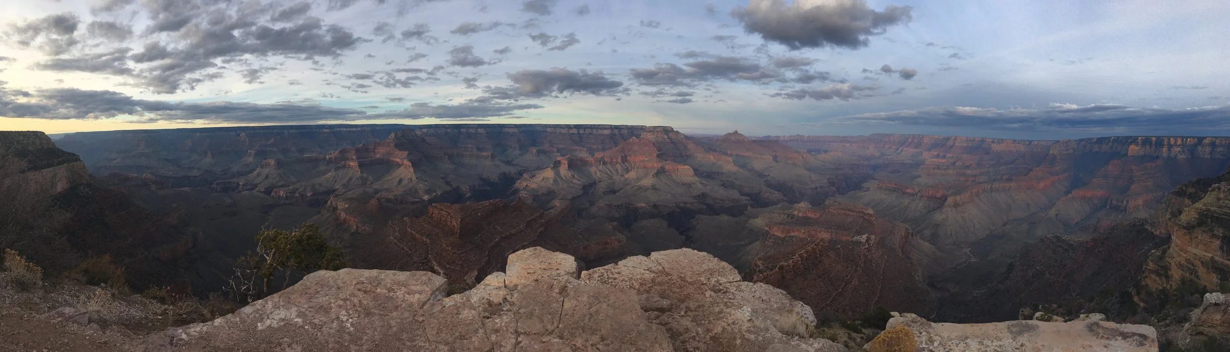
(March 2018) Last glimpse of an amazing sunset at Shoshone Point
Planning Your Trip
For a “check-the-box” type of experience, you could see the Grand Canyon in a couple of hours (stop at Mather Point, walk the Rim Trail to Yavapai Point, stop at the gift store to buy a shirt, head over to Grand Canyon Village to have some lunch, and be on your way). The pictures will turn out great because how could they not? And that’s really all the time you need to say you’ve been here.
For someone looking to connect with the canyon, I would recommend 2-3 nights on the South Rim to fully enjoy the park (depending on what time of day you arrive). That gives you plenty of time to catch at least one sunset, one sunrise (if I can convince you that it’s worth getting up super early), wander around the rim, and maybe hike into the canyon a short distance.
For anyone interested in planning a trek either all the way down to the Colorado River and back up, or hiking from the South Rim to the North Rim, I have a more detailed guide, as this hike requires significant planning and training: Hiking Rim-to-Rim-to-Rim.
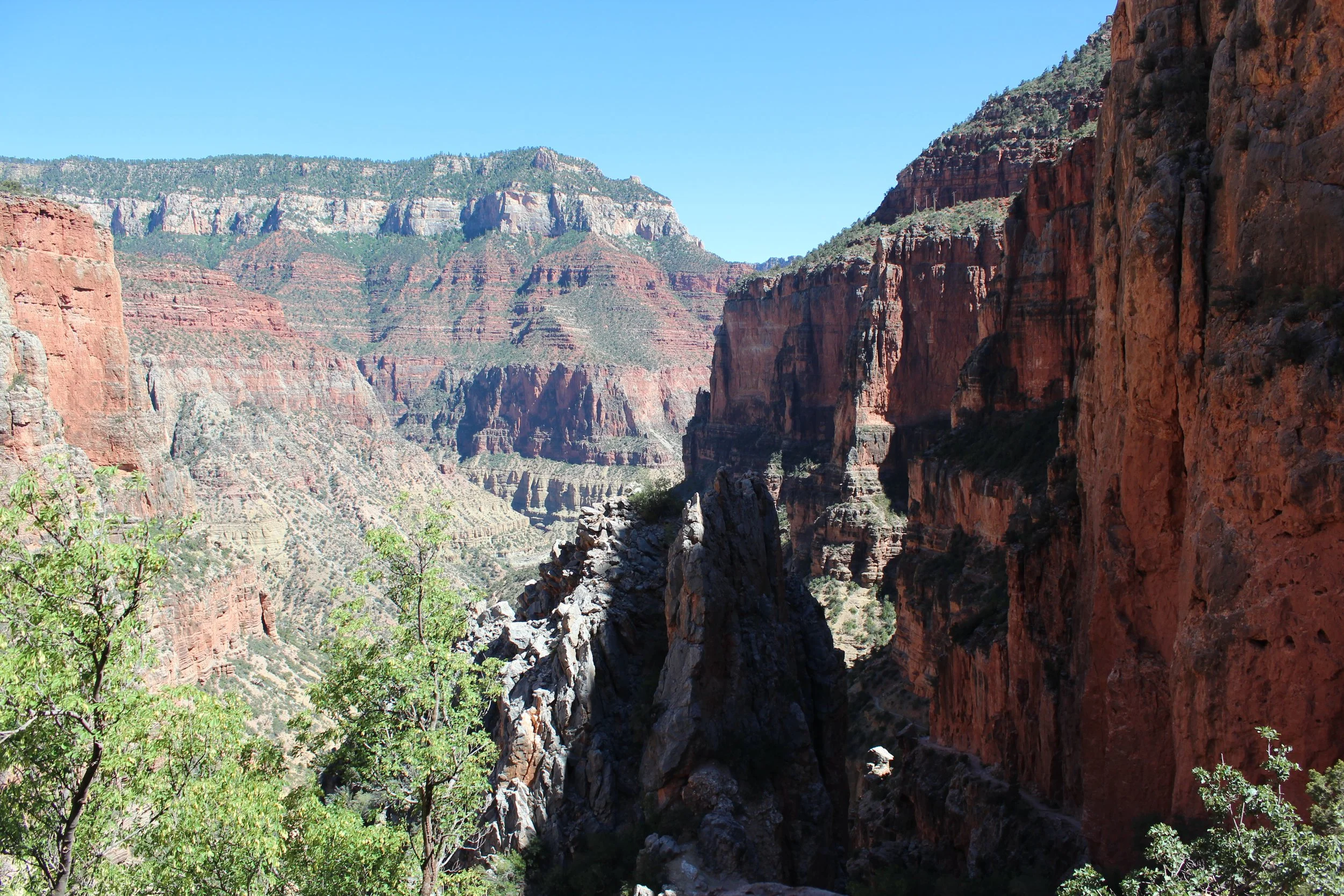
(June 2026) North Kaibab Trail between Redwall Bridge and Roaring Springs (trail is on the right-side along the wall)
What to do
My high-levels suggestions for a vacation at Grand Canyon’s South Rim would be:
Day 1:
1) Park at the Visitor Center and walk to Mather Point and Yavapai Point. There are going to be crowds here, these won’t be your favorite views of the park, but these are the most famous views in the park, and you’re here so you have to visit.
2) Save some steps and take the Orange Shuttle back to the Visitor Center.
3) From the Visitor Center, hop on the Blue Shuttle and take it all the way to the end to Bright Angel Lodge.
4) Shuttle hop one more time onto the Red Shuttle.
5) Get out at Hopi Point and walk along the easy Rim Trail to Mohave Point.
6) Jump back on the Red Shuttle and take it all the way to the end at Hermits Rest. Enjoy an ice cream treat and sit on the park benches for a bit. It is much less crowded out here.
7) Take the Red / Blue shuttles back to the Visitor Center.
8) Enjoy supper in Tusayan.
9) After supper, drive out to the Shoshone Point trailhead and plan a hike at sunset. Bring headlamps as it will be dark on the way back to the car.
Day 2:
1) Get up early and head out to the Visitor Center before sunrise. The Hiker’s Express Shuttle runs out to South Kaibab once per hour. The schedule changes throughout the year based on the sunrise times, so check the National Park website or ask a Park Ranger.
2) Get off the shuttle at the South Kaibab Trailhead. The canyon will still be dark, but it’s dawn. You shouldn’t need a headlamp. Enjoy the view as the sun comes up closer to the horizon. Try to get to Ooh Aah Point by sunrise. Find a rock to sit on and just enjoy. Not many people get up this early. I promise it won’t be crowded.
3) Either continue down for a longer hike or head back up to the rim.
4) Take the Orange Shuttle back to the Visitor Center and jump back on the Blue Shuttle.
5) Ride the Blue Shuttle all the way to Maswik lodge, and enjoy a late lunch at the Maswik Pizza Pub.
6) There’s not a great shuttle option to get back to the rim from Maswik Lodge. I’d recommend walking.
7) Aim towards Bright Angel Lodge. The Bright Angel Trail will be just on your left. Walk along the rim in either direction.
8) Catch a ranger talk or just find a place to sit, enjoy the canyon, do some people-watching, or even better, talk with a couple other visitors - aim to chat with avid hikers (they’ll have the bigger backpacks, hiking poles, and probably look more tired than everyone else, but have bigger smiles) - hikers have amazing stories, even just from that day.
North Rim?
There are two sides to the Grand Canyon (South Rim and North Rim). There is no direct way between the rims unless you hike down to the Colorado River where there are two foot bridges. The drive between the South and North Rims is 4-5 hours depending on where you are specifically headed. The vast majority of visitors just see the South Rim.
Why visit the North Rim? Is it worth the 5-hour ride? The North Rim is going to be the place for someone that is looking for a secluded, quiet, and reflective experience while looking out over the Grand Canyon. That seclusion comes with more effort in planning - It’s harder to get to, it’s only open certain months (due to receiving 12ft of snow annually), and both lodging and food options are limited.
My husband and I got to the North Rim in 2016 by walking. This was the hardest hike of my life, still. And that night, having supper at the Lodge, and realizing we knew a lot of the people eating at the same time as us because we had talked to them out on the trails throughout the day - this was one of our favorite nights ever of both telling our own hiking story and listening to everyone else’s. In the ten years that have passed, we haven’t found a spot as special for hiker stories as the Grand Canyon Lodge. Can you imagine striking up conversations with strangers all around a restaurant that you just met earlier that day? At the South Rim, I can’t stand people - they are everywhere. We have to wait in lines, wait for people to get of the way of our pictures, and squeeze uncomfortably close together on the shuttle buses. Do we talk to any of them? Not many… North Rim? So few people that you actually recognize people that you met and talked with earlier in the day. It still hurts to think that this Lodge burned to the ground in the Dragon Bravo fires of 2025. Is the North Rim worth it? To me personally, absolutely. To just take get pictures of the same canyon from the other side? I could probably recommend some better hiking options that are closer if that’s all you are interested in doing.
If you plan to drive to the North Rim, the cheat way to do it isn’t from the South Rim. Pair a trip to the North Rim instead with a visit to Zion National Park. The closest cities to Zion are Kanab and St. George. Kanab is 2 hours from the North Rim, and St. George is 2.75 hours away.
If you do end up driving from the South Rim to the North Rim, Page is a nice city to stop at for a day or two, and it’s about the halfway point. Page is near Antelope Canyon, Horseshoe Bend, Lake Powell, and the Glen Canyon Dam. I have links added to additional posts that I’ve written, in case that might be helpful.
Note that Kanab, St. George, and Zion National Park are all in Utah. Page and the Grand Canyon are in Arizona. Arizona does not observe Daylight Saving Time, so the time between Arizona and Utah is going to be different between March and November, and the same from November to March. If you have tours or reservations, realizing there is a time zone difference during have the year can be important.
Conditions and status of the North Rim have been changing due to both the Drago Bravo fire of 2025 and the more recent flashflood along Bright Angel Creek in 2026. Check the National Park website for a more current list of closures on the North Rim before planning a trip.
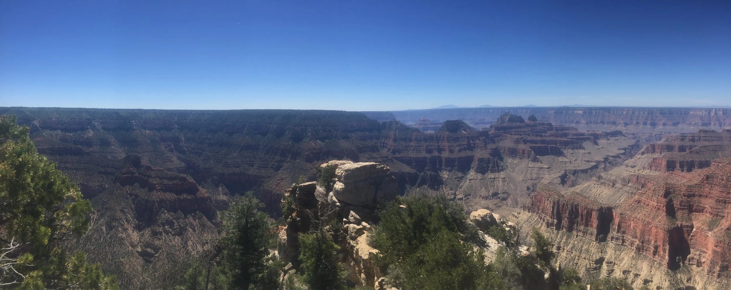
(June 2016) North Rim - Look to the right half of the picture and see that tight canyon section? Follow that line up to the top of the picture. That’s the South Rim. The tight canyon section is the T-intersection visible from the South Rim in most pictures.
When to Visit
The Grand Canyon is wonderful to visit any time of the year. But remember what I said about extremes? The South Rim is at almost 7,000ft in elevation and the North Rim is more than 8,000ft. It can snow in the winter on the South Rim, and the North Rim services (including lodging, food, and roads) are typically shut down between November and May-ish (depending on snowstorm timing).
The opposite extreme is visiting in the summer months. If you descend into the canyon, pay attention to where the trail gets to 4,000-ish ft elevation. The trails can become dangerously hot between 10am and 4pm with little to no shade below this elevation.
Our trips to the Grand Canyon have been in March (4 times) and June (twice). Both months are great. June is much hotter. We’ve had snow on the trail in March. The future trip my husband and I are dreaming about? Some day, when we are empty nesters and not dependent on a school calendar, we’d love to visit in October.
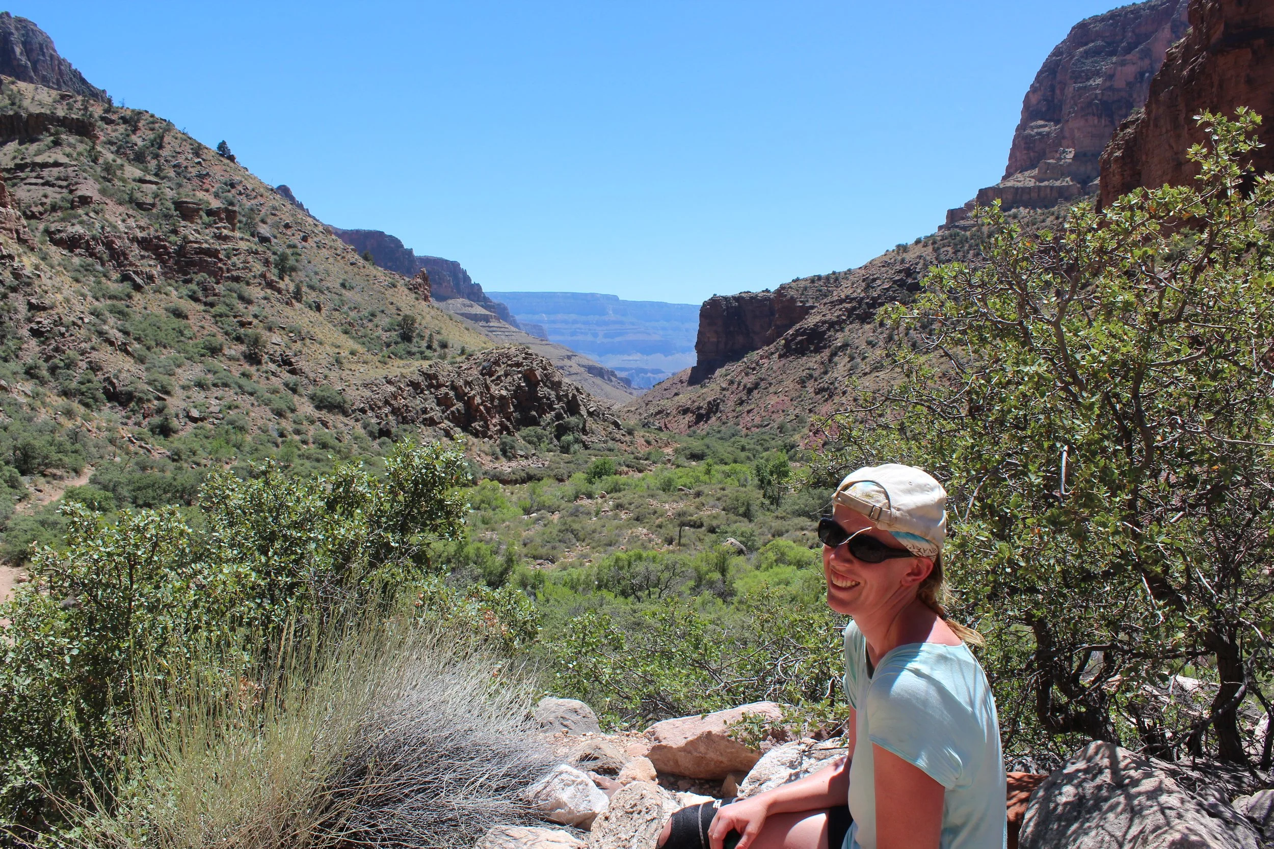
(June 2016) North Kaibab Trail past “the Box” section towards Cottonwood - There is a reason the park website states not to hike at lower elevations between 10am and 4pm. Do you see shade???? We made it, but this was stupid. When we hiked back, we hiked in the evening hours, when the canyon walls shaded us.
Where to Park
There are five places to park on the South Rim. The easiest place to navigate to and from is the Visitor Center (lots 1, 2, and 3). The other parking lots are at Shrine of the Ages (lot A), Market Plaza near Yavapai Lodge (lot B), Center Road (lot C), and Backcountry Info (lot D). Once you park, take the shuttles to navigate throughout the park. There are three main shuttles.
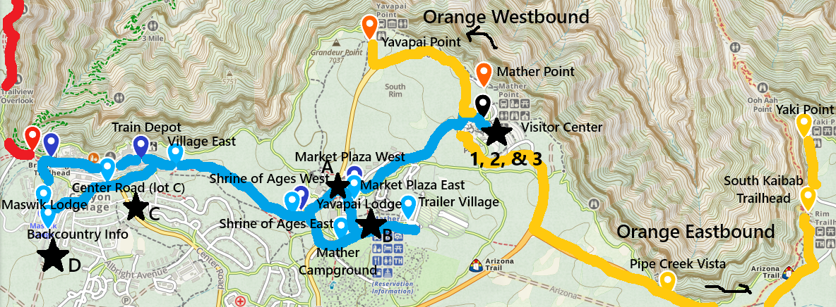
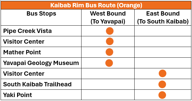
Parking lots are marked with black stars. The bus stops are marked with pins.
Orange (westbound) heads to South Kaibab, Yaki Point, Mather Point and Yavapai Point. Orange (eastbound) goes out to South Kaibab Trailhead. The easiest place to get on the Orange Shuttle is the Visitor Center.
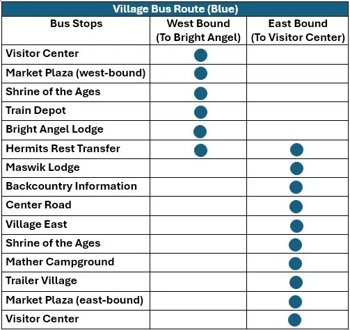
Blue Shuttle connects Grand Canyon Village with the Visitor Center. Pay attention to the shuttle stop (going eastbound or westbound) if you are getting on someplace in Grand Canyon Village. Going eastbound will send you all the way back to the Visitor Center (we’ve made this mistake more than once…) You’ll eventually get back to where you want to be in Grand Canyon Village, but you are going to be on the shuttle for several extra minutes. Maybe a few extra minutes to sit isn’t a bad thing? Kind of depends on how busy the shuttle is.
The Red Shuttle goes out to Hermits Rest. There are places to hop off and either enjoy a viewpoint and hop back on, or hike along the Rim Trail to the next viewpoint and then get back on the Red Shuttle. The Rim Trail that connects each viewpoint is flat the entire way. This trail is both easy and uncrowded - I’m really not sure why it isn’t busy... I’d consider the Red Shuttle one of the “secrets” of the South Rim.
There are no free shuttle buses on the North Rim. Parking is not hard to find, and the North Rim is easy to navigate with a car.
Lodging Options
On the South Rim, there are three main lodging options. 1) There are a handful of campgrounds directly inside of Grand Canyon National Park - Mather Campground, Trailer Village RV Park, and Desert View Campground. 2) There are also hotels directly inside the park - Bright Angel Lodge, Maswik Lodge, Kachina Lodge, Thunderbird Lodge, Yavapai Lodge, and Grand Canyon Lodge. Yavapai and Maswik require a shuttle bus (or driving) to get to the rim of the Grand Canyon. The other lodges are directly on the rim. 3) There are several hotels and campgrounds within the city of Tusayan, a 15-20-minute drive to Grand Canyon Village. We’ve stayed at Yavapai Lodge and a couple of hotels within Tusayan. Tusayan is a nice city, and the benefit is that there are more restaurant choices for supper, and the food is a little cheaper. My preference is to stay directly in Grand Canyon Village. It’s nice to use the shuttles rather than driving.
On the North Rim, there is a campground still open near the North Kaibab Trailhead and the Kaibab Lodge is about 18 miles from the North Rim trails. Hopefully some day they will rebuild the Lodge and cabins.
Food Options
The easiest food option on the South Rim is to pack your own lunch and avoid waiting in long lines. There is a General Store with some groceries next to the Yavapai Lodge. Yavapai Lodge also has two options for dining - the Dining Hall and Yavapai Tavern. There are also a handful of restaurants along the South Rim. The Fountains has snacks and Ice Cream, and it’s right next to the Bright Angel Trailhead. The others are marked on the map but are a bit more expensive. Also, a bit out of the way, but worth mentioning, is the Pizza Pub at Maswik Lodge. A 15-20-minute drive to Tusayan will provide several more options.
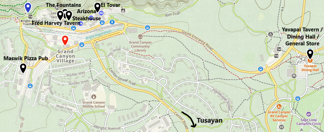
Food / Dining Options along the Grand Canyon South Rim
Food Options on the North Rim are currently going to be limited to what the General Store has, in addition to the Kaibab Lodge. Plan ahead. I actually have a foldable cloth cooler that I pack with me when I fly. It won’t keep food cold for very long, but it works great to keep sodas chilled, or things like salami or cheese blocks for fast lunches. The first place we stop after we pick up a rental car is a grocery store.
Airport Options
The closest airports to the South Rim are Phoenix (3.5 hours) and Las Vegas (4.5 hours). I’d recommend flying in and out of Las Vegas for anyone renting a car. Arizona has a “tourist tax” that they add on the car rental. Typically renting a car from Las Vegas is quite a bit cheaper.
Other Places to Visit on a Grand Canyon Trip
Nearby destinations include Sedona (just 2.5 hours away and one of my favorite cities) and Zion National Park (4 hours from the South Rim / 2 hours from the North Rim). The other National Parks in Utah could be added to the same trip, but they are further out of the way. Bryce Canyon is 5 hours from South Rim / 3 hours from North Rim. Capitol Reef is 6.5 hours from South Rim / 4.75 hours from North Rim. Arches and Canyonlands are both near Moab, 5.5 hours from South Rim / 6.5 hours from North Rim. Escalante might be one other place to consider on a trip to see Grand Staircase-Escalante National Monument, which is 5.75 hours from South Rim / 3.75 hours from North Rim.
Hiking at the Grand Canyon
Use hyperlinks below map to jump to a particular section of the park. I would break this park up into 3 different things to do. The first option is non-hiking stuff to do - Visitor Centers, gift stores, restaurants, and museums (clustered together and represented by red pins). The second option is enjoying viewpoints and the easy rim trail hikes in-between, if desired. The viewpoints are represented by purple pins. Lastly, there are the difficult hikes that go down into the canyon. The trailheads are marked by blue pins.
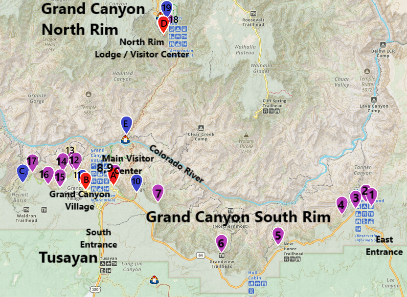
1 - Desert View - Short 0.5 mile out-and-back easy hike, 2- Desert View Watch Tower - Short 0.5 mile out-and-back hike, 3 - Navajo Point - Viewpoint, 4 - Lipan Point - Viewpoint, 5 - Moran Point - Viewpoint, 6 - Grandview Point - Viewpoint, 7 - Shoshone Point - Easy 2 mile out-and-back hike
Visitor Center Area / Kaibab Rim
A - Visitor Center - Largest Visitor Center and gift shop, 8 - Mather Point - Easy and accessible 0.3-mile hike (one-way), 9 - Yavapai Point - Easy and accessible 0.5-mile hike (one-way) between Mather Point and Yavapai Point, 10 - South Kaibab Trailhead - Trail ranges from moderate to extremely hard based on how far you descend
B - Grand Canyon Village - Museums, restaurants, and viewpoints, 11 - Bright Angel Trailhead - Trail ranges from moderate to extremely hard based on how far you descend
Hermits Rest - Easy Rim Trail between Viewpoints
12 - Powell Point - Viewpoint and 0.3 miles to Hopi Point. 13- Hopi Point - Viewpoint and 1 mile to Mohave Point, 14 - Mohave Point - Viewpoint and 1.2 miles to The Abyss, 15 - The Abyss - Viewpoint and 1 mile to Monument Creek Vista, 16 - Monument Creek Vista - 1.5 miles to Pima Point, 17 - Pima Point - Viewpoint and 1.2 miles to Hermits Rest, C- Hermit’s Rest Trailhead - Gift Store and extremely difficult trails
D - Visitor Center / Lodge, 18 - Bright Angel Point to Bridle Trail - easy 2-mile hike, 19 - North Kaibab Trailhead - Trail ranges from moderate to extremely hard based on how far you descend
Descending into the Grand Canyon
Creating a hiking map of the Grand Canyon trails is difficult due to the scale needed. This image below might be more helpful. There are three options to get down into the canyon along maintained trails. Two are on the South Rim: South Kaibab and Bright Angel. My best advice in this post - don’t walk down Bright Angel Trail. The view 3 miles down is the same as it is on the top, and you have to hike back up 2,100ft. It’s not worth it. Bright Angel is a great option though to hike up, if you have hiked down to the Colorado River. The rest areas include water refill stations, although, check the National Park website for water status before hiking. The waterpipe has frequently broken in the past and it was heavily damaged in the flashflood in Aug 2026. A new waterline is currently under construction.
South Kaibab is an amazing trail, and very much worth the effort of the return trip. Stop before getting to Tip-Off. If you plan to go to as far as Skeleton Point, consider training before your trip. Note that water is only available at the trailhead. My honest recommendation - pack 4L of water per person. Better to be able to share a bottle you don’t need with a hiker than has run out of water than to find yourself in need. Your pack will get lighter as you hike and drink it.
Along the North Rim, the only trail that goes down is North Kaibab. The trek out to Coconino Overlook is great. It’s not worth it to go to Supai Tunnel - this is a boring place to turn around as the view is pretty much the same as Coconino and it’s just a bathroom and a hole in the rock. Continuing down to the Redwall Bridge is cool, but it’s 2,200ft back to the rim. Additionally, the North Rim is at an elevation of 8,000ft, and you are going to feel that high of an elevation on your lungs. Be careful on this trail.
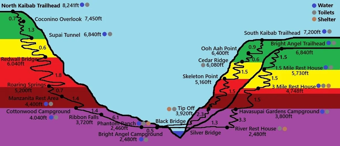
Green - Spontaneous Hiking Decisions are OK
Yellow - Have a Plan, Be Prepared
Red - Caution - Train 6+ months and carry enough water for yourself, your party, and any hiker you pass that might need help
Maroon - There’s No Reason to Hike Here and Back in a day - Turn Around Before, or Plan to Hike to the Bottom and Rest until the heat of the day has past
Purple - Below 4,000ft in Elevation - DANGER - Extreme Heat in Summer Months between 10am and 4pm (Avoid hiking during these times)
Now let’s get into the park details.
East Entrance
For anyone arriving or departing the Grand Canyon through the East Entrance, typically those coming from one of the other nearby National Parks, Page, or anywhere from I40 east of Flagstaff, there are some nice viewpoints and short rim trails along AZ-64. If you come in from the south, I’m not sure it’s worth it to drive out here for “hop out / hop back in the car” sort of experience.
I prefer to get out and walk at the stops rather than just take pictures from a viewpoint. That said, there are short hikes at Desert View and the hike out to Shoshone Point is 100% worth the 2-mile easy hike - it’s my favorite place to watch a sunset.
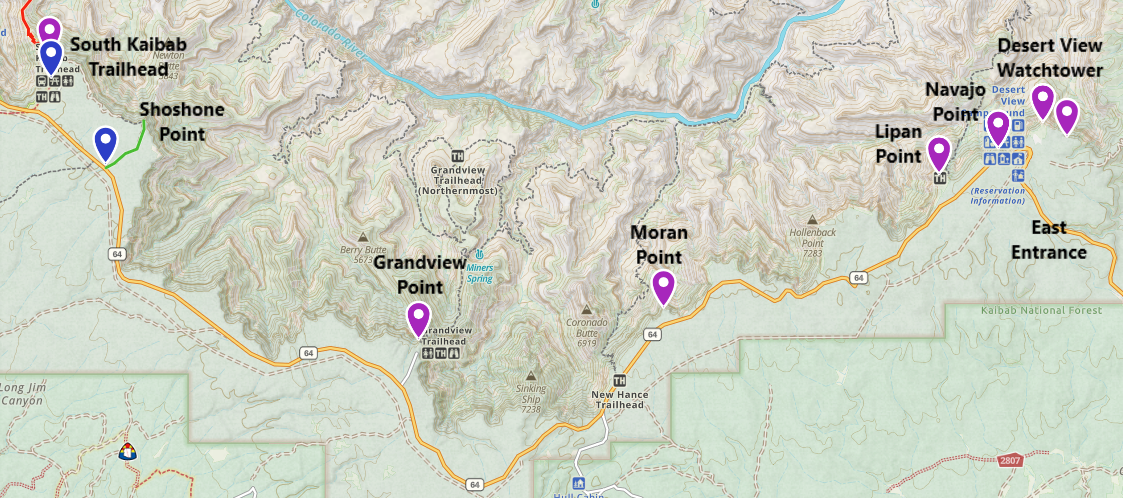
Viewpoints and short hikes along AZ-64 from the East Entrance
Just past the East Entrance there are two short hikes with amazing views at Desert View. There is also a small Visitor Center. Black stars on my map indicate parking.
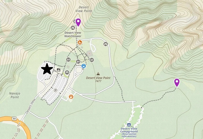
Map of Desert View Hikes, Viewpoints, and Visitor Center
1 - Desert View
From AZ-64, the first pullout results in two viewpoints, but each requires a short (half mile out-and-back easy hike). The trail to Desert View takes off from the campground.
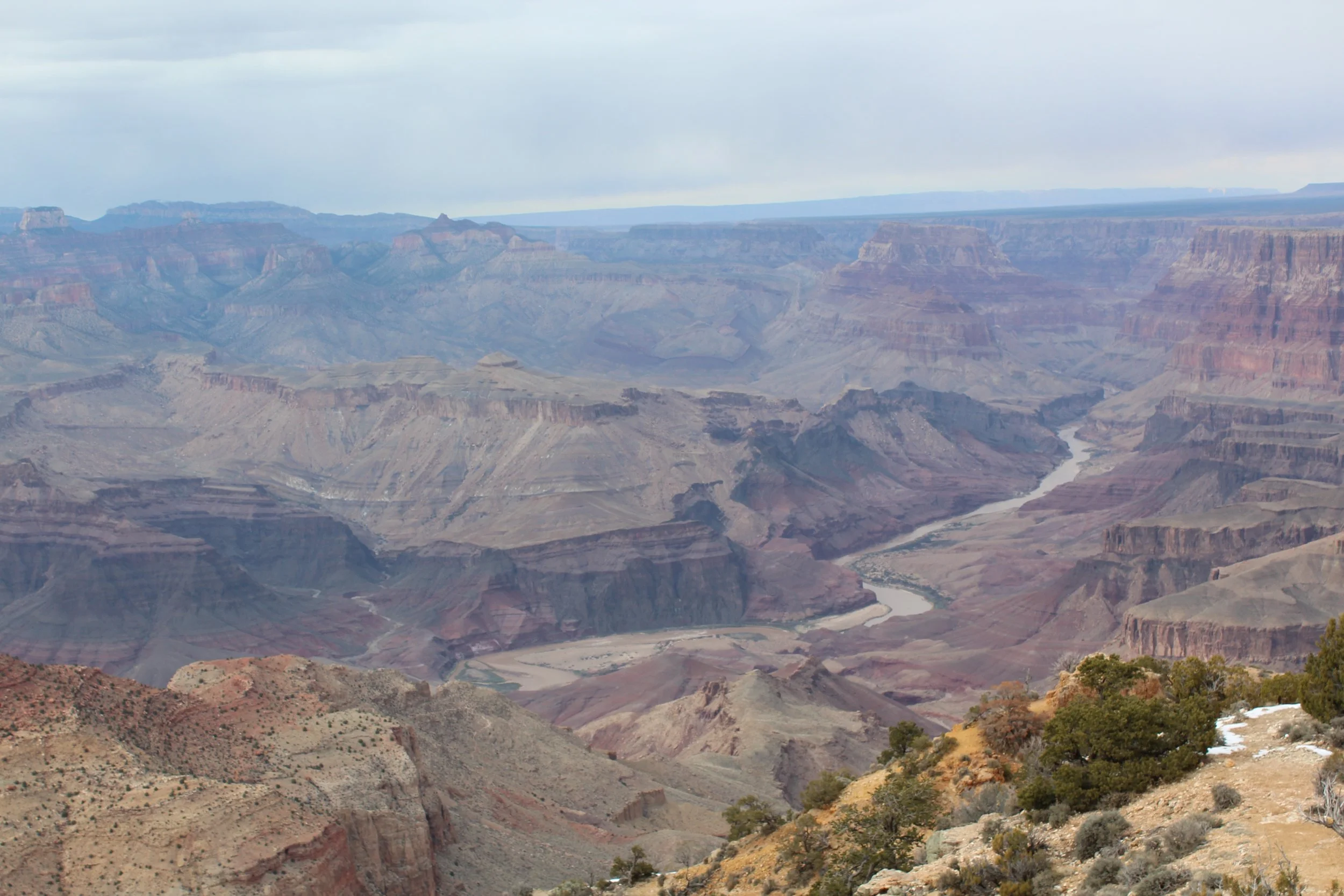
(March 2015) Desert View
2- Desert View Watchtower
For the second stop, park at the Visitor Center. There is a short 0.5 mile out-and-back hike to a watchtower. We’ve been here twice, although we don’t seem to have any pictures of the actual watchtower. It is possible to go inside, and its free, but getting to the upper floors requires a ticket. Only 25 people are allowed in every 20 minutes.
If there is only one place you want to stop along the East Entrance, this would be my recommendation.
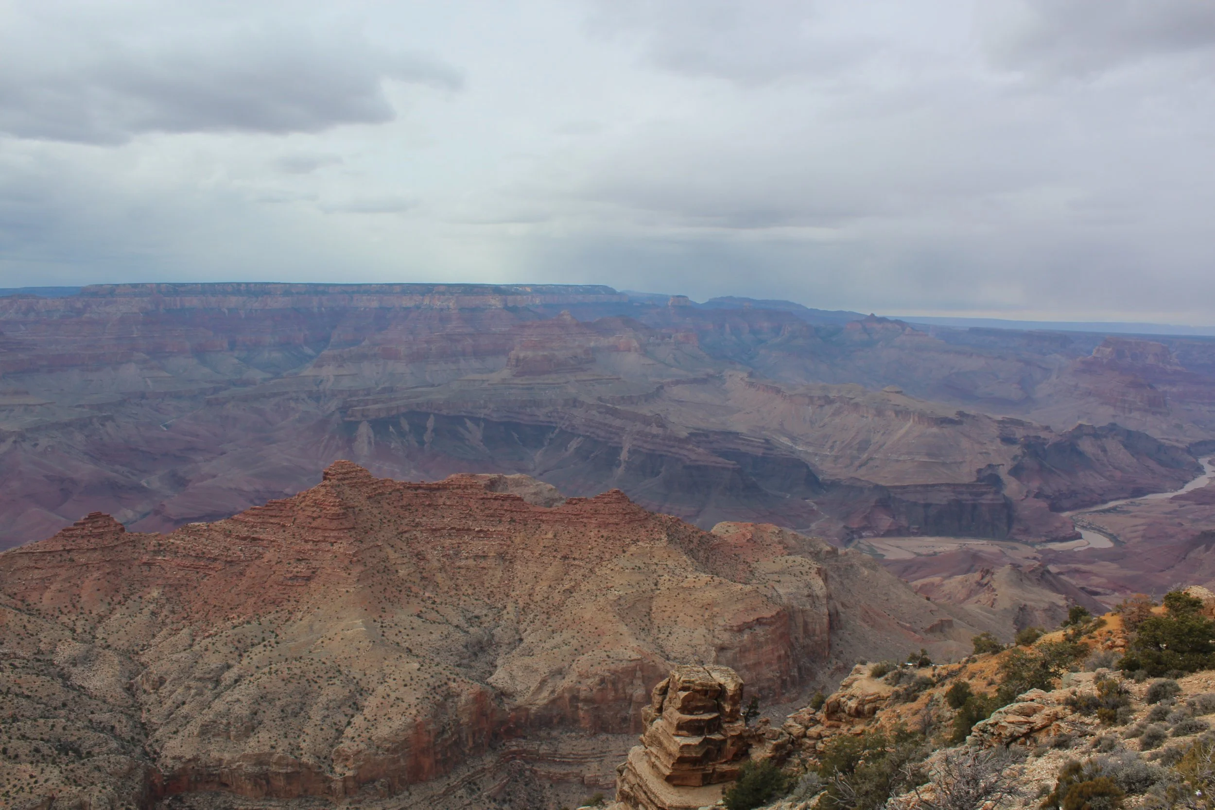
(March 2015) View from Desert View Watch Tower
3 - Navajo Point
Navajo Point is just a quick stop to take pictures - no hiking required.
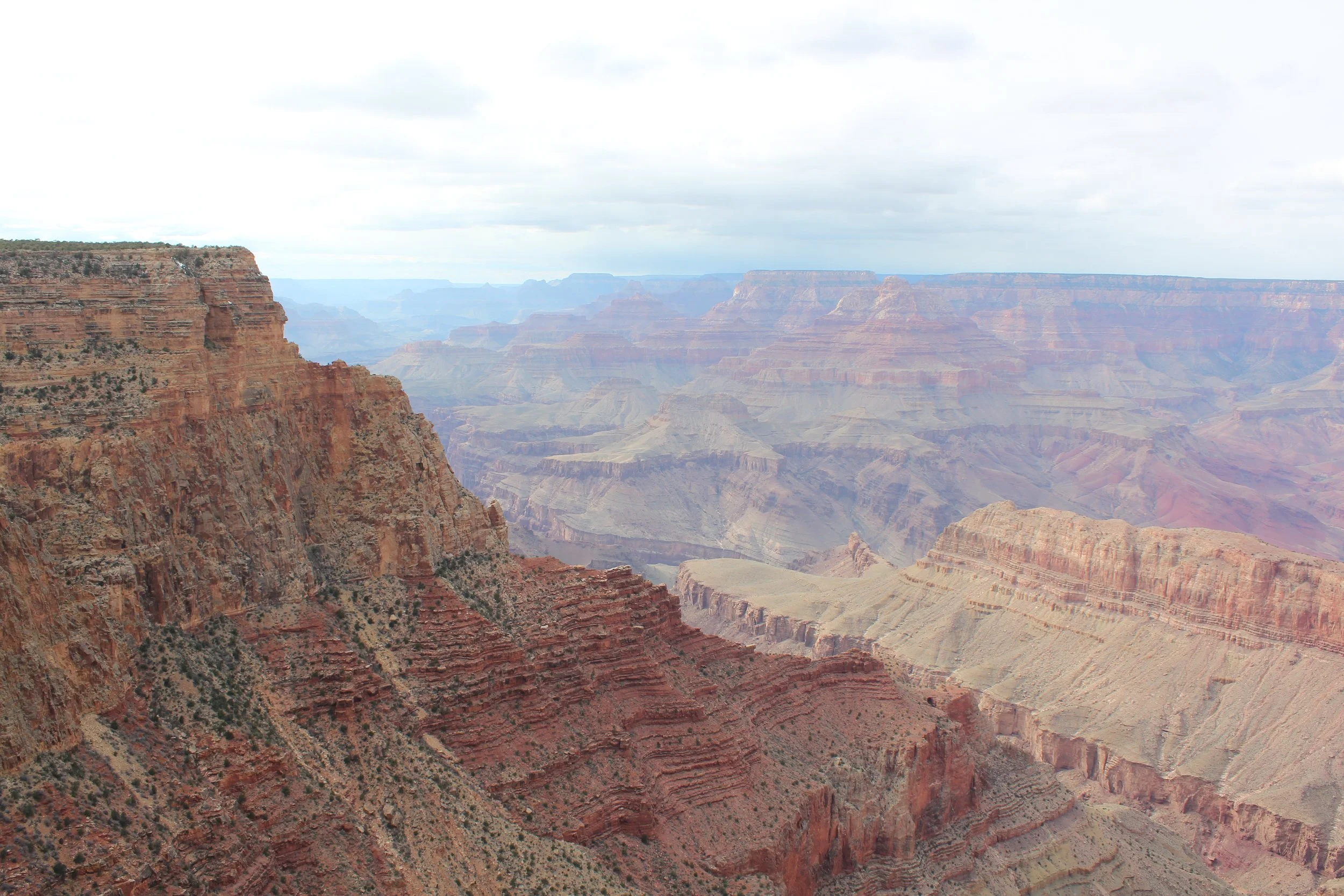
(March 2015) Navajo Point
4 - Lipan Point
The next stop heading into Grand Canyon National Park is Lipan Point, which is similarly just a viewpoint without hiking required. Note that this is also the trailhead to Tanner Trail, a backcountry route. This trail is harder than South Kaibab and Bright Angel as it is not maintained in the same manner, and there is no access to water. This is a 14-mile out-and-back hike to the Colorado River.
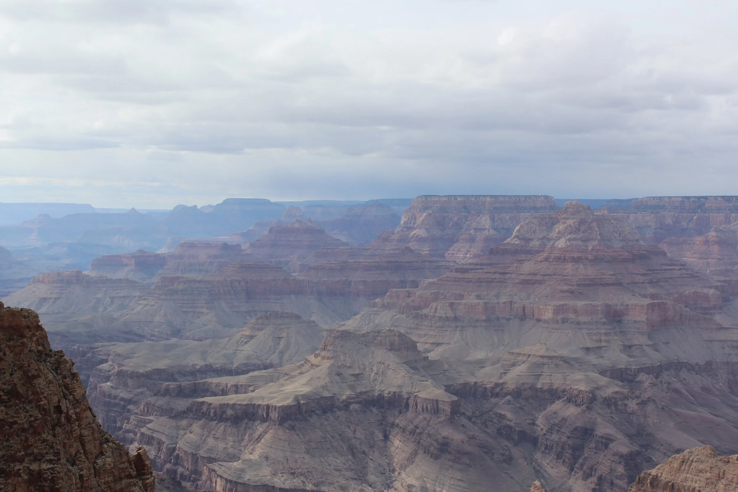
(March 2015) - Lipan View
5 - Moran Point
Moran Point is another option that just involves a viewpoint without hiking. I don’t think I’ve stopped here? After a while, the viewpoints all start looking a bit alike, and it’s a bit difficult to sort through the pictures…
6 - Grandview Point
Similar to Lipan Point, Grandview Point can be just enjoyed as a viewpoint without hiking. This is also the trailhead to the Grandview Trail, a backcountry route that eventually joins the Tonto East Trail.
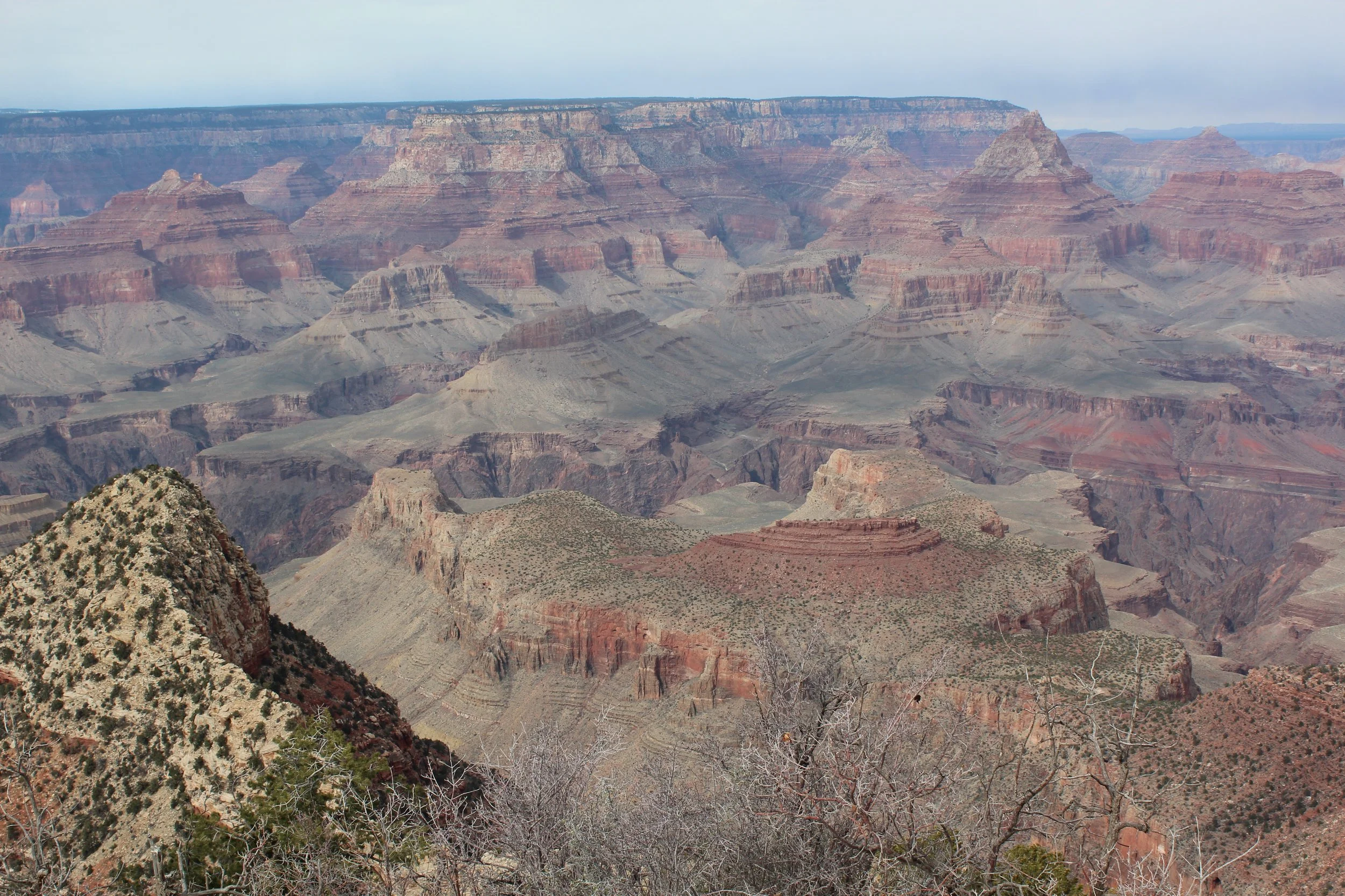
(March 2015) Grandview Point
7 - Shoshone Point
The last place to stop along AZ-64 is Shoshone Point, and this is going to be the least obvious place to stop. This is my favorite place to watch the sunset because it’s hidden, and therefore there won’t be crowds of people.
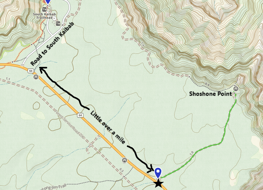
Shoshone Point - Trailhead parking and trail
If you are heading to Shoshone for sunset, most likely you will have spent some time at the main part of the park, so you would be driving from the other direction. My directions are going to be assuming you are coming from Grand Canyon Village or the Visitor Center, not the east entrance.
Along AZ-64, pay attention to when you pass the road that goes to the South Kaibab Trailhead. From this point, continue along AZ-64 just a little bit over a mile. There is going to be a small, unmarked pullout on your left. Because it isn’t marked, it will have you questioning if you are trespassing. There aren’t signs that prohibit parking though. Park here and follow a small trail / dirt road. You will not yet be able to see the canyon. The majority of the hike is through a forest. It’s decently flat along the trail. If you use a GPS map app (like GAIAGPS or AllTrails) that might be helpful to verify the trailhead location.
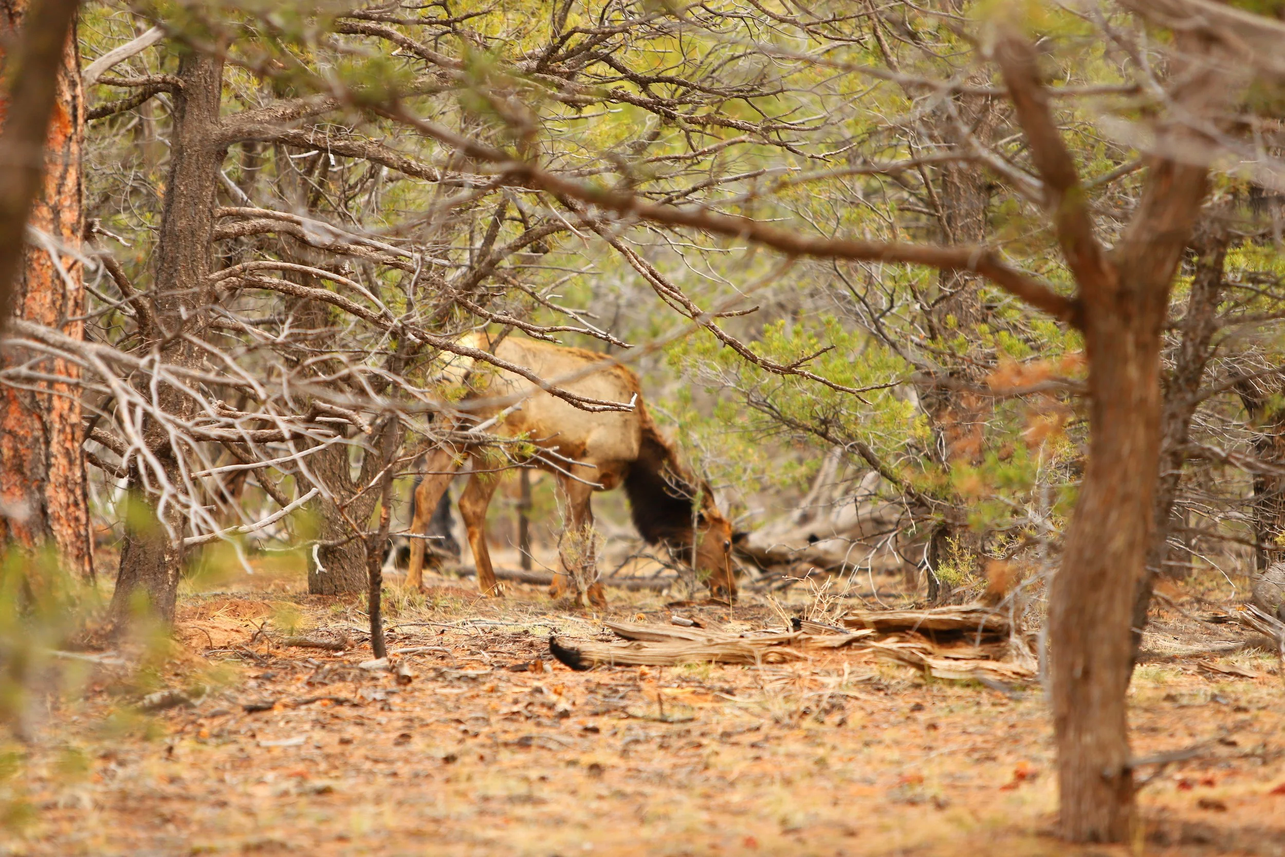
(March 2018) Elk along the way to Shoshone Point
On a Spring Break weekend, watching the sunset at Shoshone Point, it was myself, my husband, our exchange student, and an off-duty Park Ranger with two friends. That was it. It felt like we had the whole Grand Canyon to ourselves.
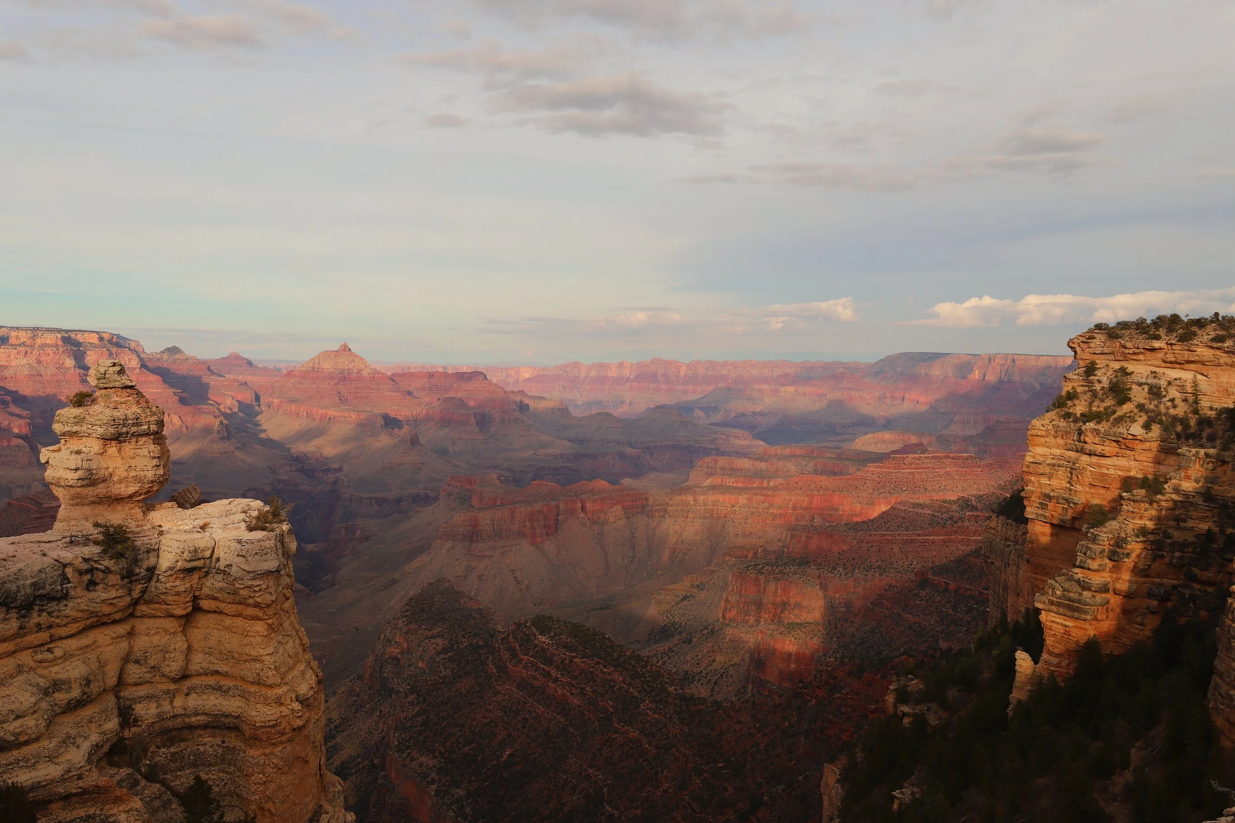
(March 2018) Hiking out to Shoshone Point
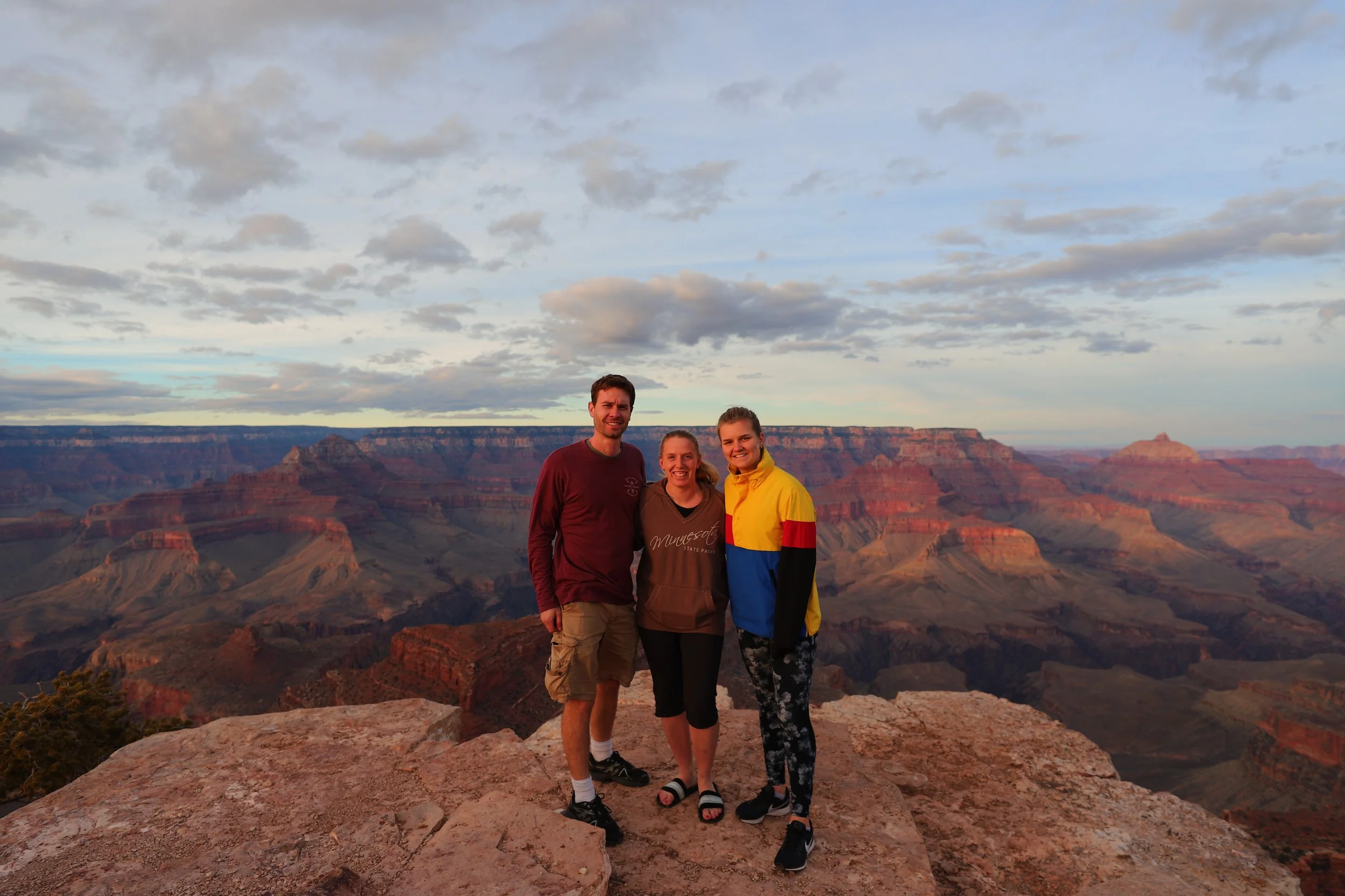
(March 2018) Ready to watch an epic sunset
It’s a mile back to the car. That’s a 15-20-minute walk. If you stay until the sun has set, it’s going to be dark walking back through the forest. Bring a flashlight or headlamp.
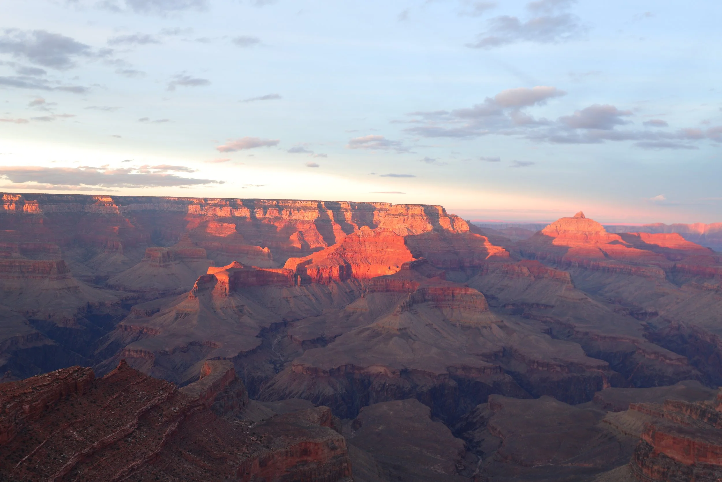
(March 2018) Grand Canyon Sunset at Shoshone Point
Visitor Center Area / Kaibab Rim
If you aren’t staying at one of the campgrounds or a lodge / hotel within Grand Canyon National Park, then the easiest place to park your car for the day is at the Visitor Center, where there are 3 large lots. From here, you can take shuttles around the rest of the park and not have to deal with crowds, finding your way, or searching for another parking spot. If you are staying within the property, the shuttles will stop nearby, and you won’t need to worry about driving anywhere.
From the Visitor Center you can walk out to Mather Point and Yavapai Point, take the Orange Shuttle to the South Kaibab Trailhead, or take the Blue Shuttle to Grand Canyon Village. Below is a high-level map of the Visitor Center Area and Grand Canyon Village.
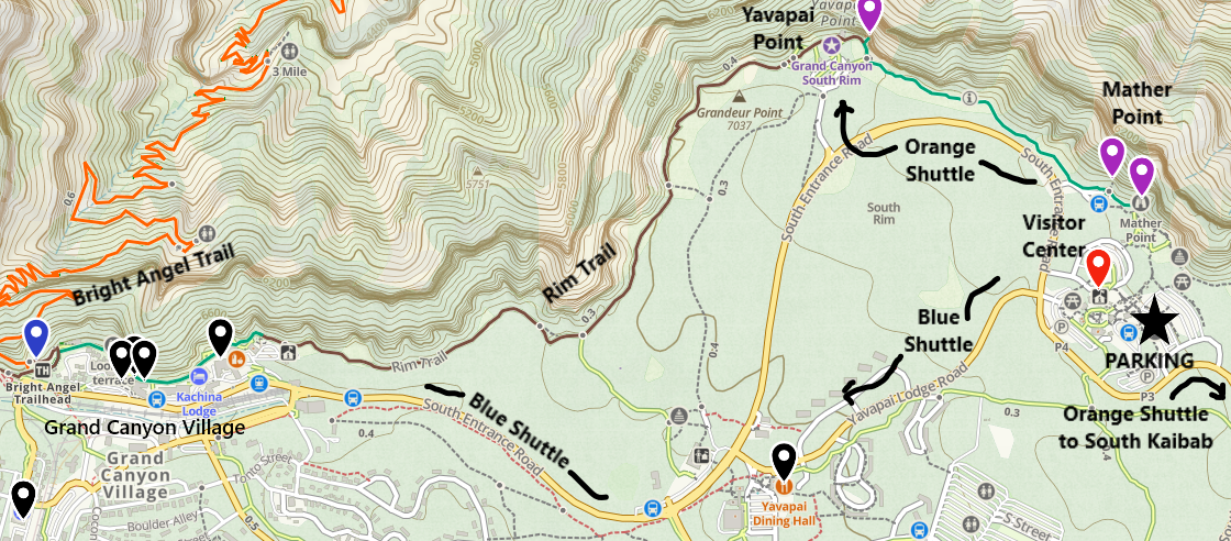
Simple map of the Visitor Center Area, nearby trails, and shuttle stops
A - Visitor Center
This is the largest Visitor Center in the park, and it includes a movie theater with a short film on how the Grand Canyon was formed. There are also exhibits to explore, and this is a great place to talk with Park Rangers, ask questions, and pick up a map. There is also a large gift store in a nearby, separate building.
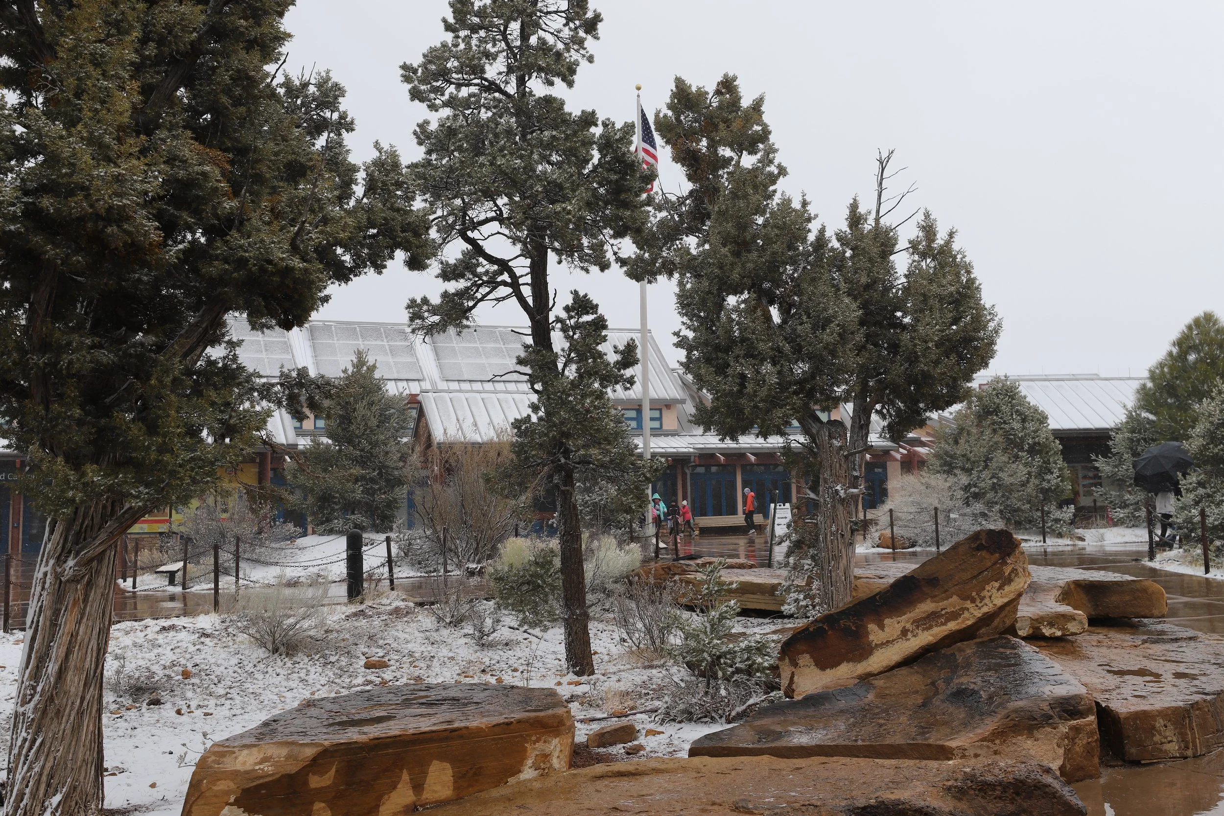
(March 2015) Snow at the Visitor Center
From the visitor center, take the paved path out to Mather Point. There are two viewpoints near each other. Then walk over to Yavapai Point, where there are a couple of more viewpoints. This one-way hike is 0.8 miles. From Yavapai Point, take the Orange Shuttle back to the Visitor Center, or enjoy the 1.5-mile Rim Trail to Grand Canyon Village. If you walk to Grand Canyon Village, you can take the Blue Shuttle to get back to the Visitor Center.
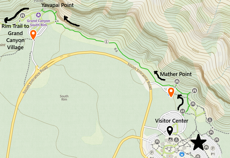
Map of the Visitor Center, Mather Point, Yavapai Point, and the Orange Shuttle
8 - Mather Point
Historically, Mather Point and Yavapai Point have been my least favorite spots in the Grand Canyon, due to the large crowds. However, when we were visiting in June 2026, it had stormed on and off throughout the day, chasing a lot of people away. We found a rock to sit on along the Rim Trail between the points, and we just enjoying watching the storm clouds moving over the canyon. And a family of mountain goats surprised us! They were looking for water to drink from the puddles that had formed on the rocks. Yes, we moved back and gave up our rock. And yes, those goats might have changed my perception of this part of the park… It’s still not my favorite spot in the park, but this was my favorite moment of this day.
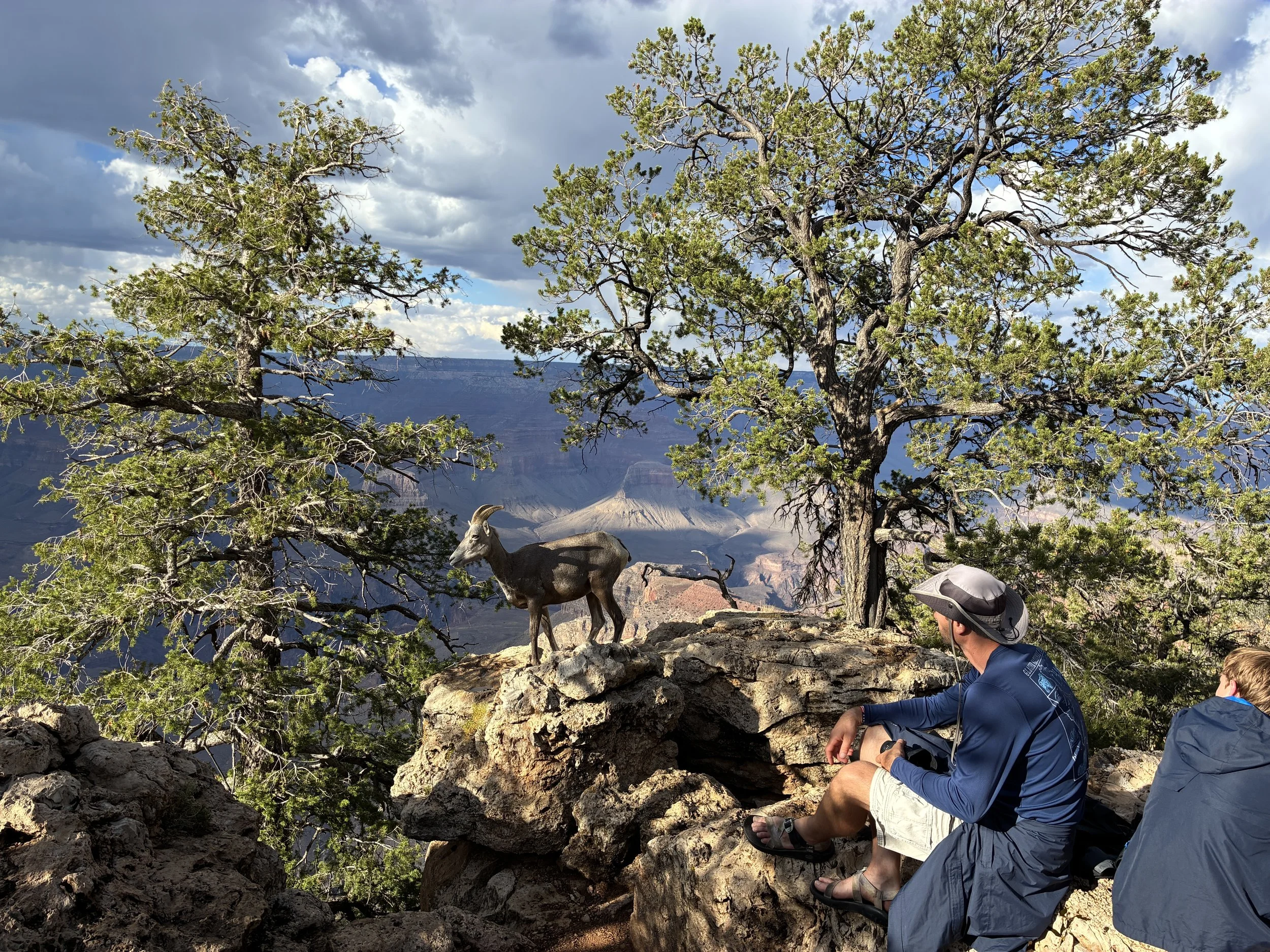
(June 2026) We stopped and sat for a bit on the rim between Mather Point and Yavapai Point to watch the storm rolling through, and look who surprised us?
The walk out to Mather Point from the Visitor Center is a short (~0.3-mile hike) along a paved flat path.
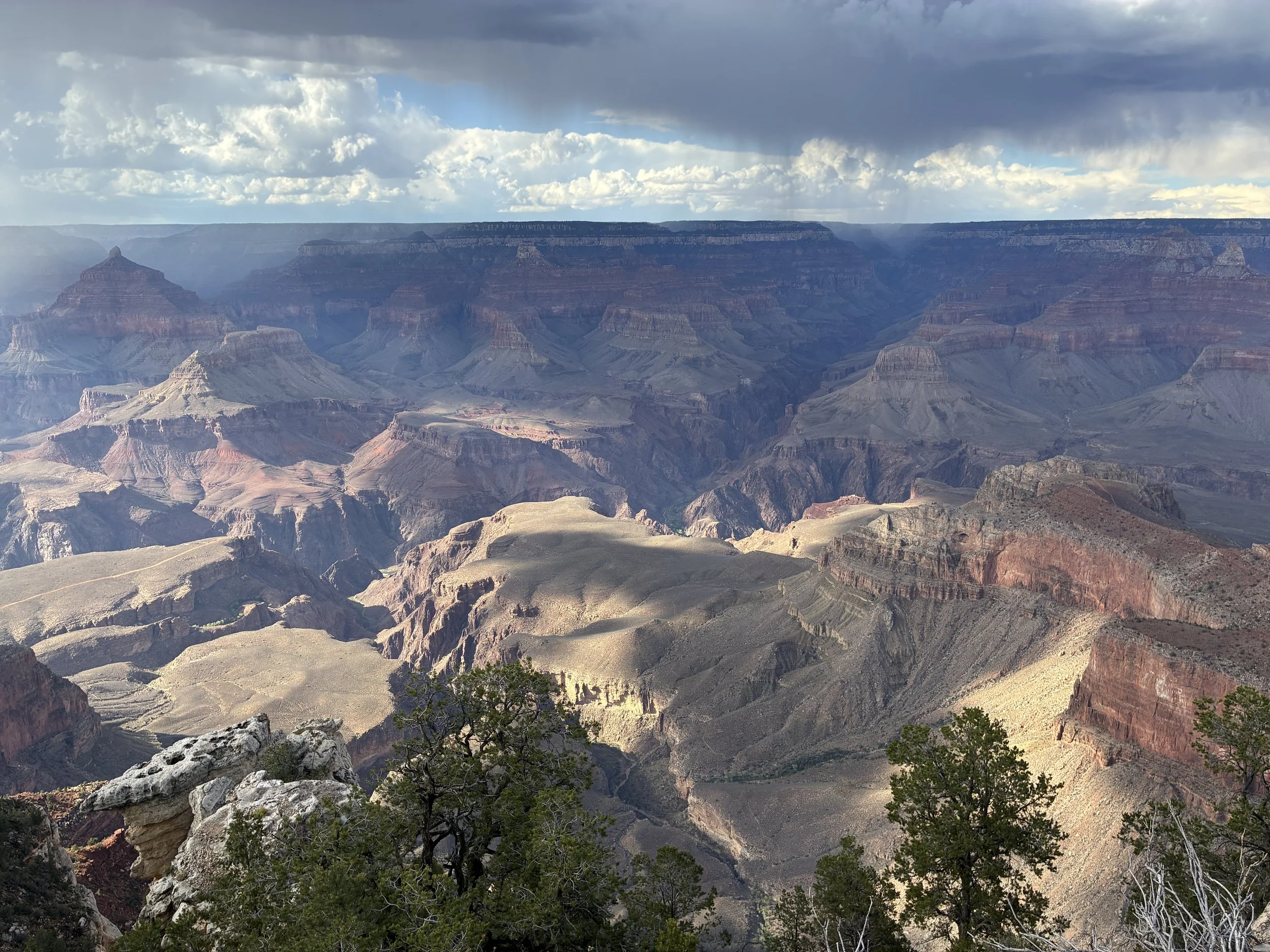
(June 2026) Mather Point
This is one of the best views in the park, and because it’s so accessible, it’s probably going to be crazy busy. But going to Mather Point is part of visiting the Grand Canyon. My advice though - do more than just this viewpoint. If this is your only stop, you will ultimately be underwhelmed, even though your pictures will look amazing. The view is incredible, but it’s hard to connect with the canyon with so many other people.
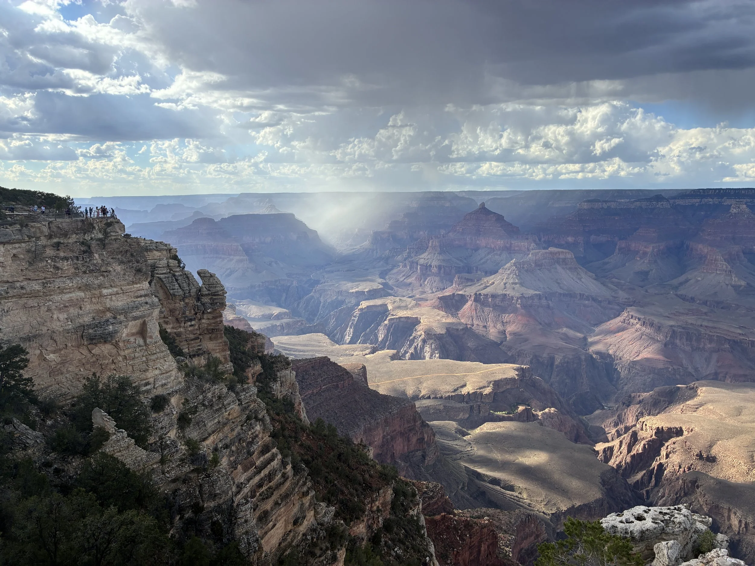
(June 2026) Mather Point
I think we’ve stopped at Mather Point on each of our trips. It’s just too easy to get to. In March 2018, we spent our first full day hiking down South Kaibab to the Colorado River and back up Bright Angel Trail. It was a fantastic day - weather was cool but not cold, and so much easier than hiking in the heat of June. But you never know what you’ll get at the Grand Canyon during the winter months. The next day, we stopped at the Visitor Center before leaving and walked out to Mather Point. There was a small dusting of snow from the night before and there was a cloud so thick that this was the view… I would have been so upset if this were the day we did our big hike and we missed seeing the canyon. But we’d had a gorgeous day before and this was actually a really cool thing to experience. It was like looking into an incredibly huge abyss or finding where the sidewalk ends.
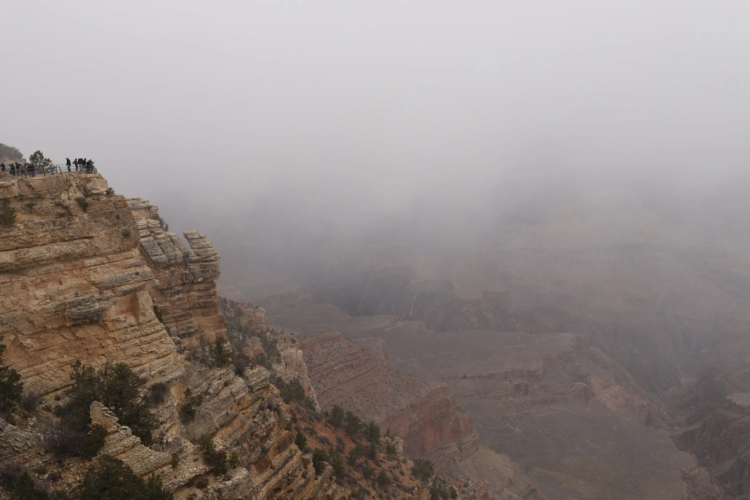
(March 2018) Mather Point
9 - Yavapai Point
It’s just a half mile (one-way) between Mather Point and Yavapai Point. This is a flat, accessible, easy trail to another crowded viewpoint. But keep walking, because why not? It’s another incredible view. The Orange Shuttle technically stops at both Mather Point and Yavapai Point, but you will walk further to get between the viewpoints and the shuttle stops than you would just by walking along the Rim Trail between the viewpoints. Enjoy the canyon. The walk between won’t be as busy as the viewpoints themselves.
Take the Orange Shuttle on your return to the Visitor Center.
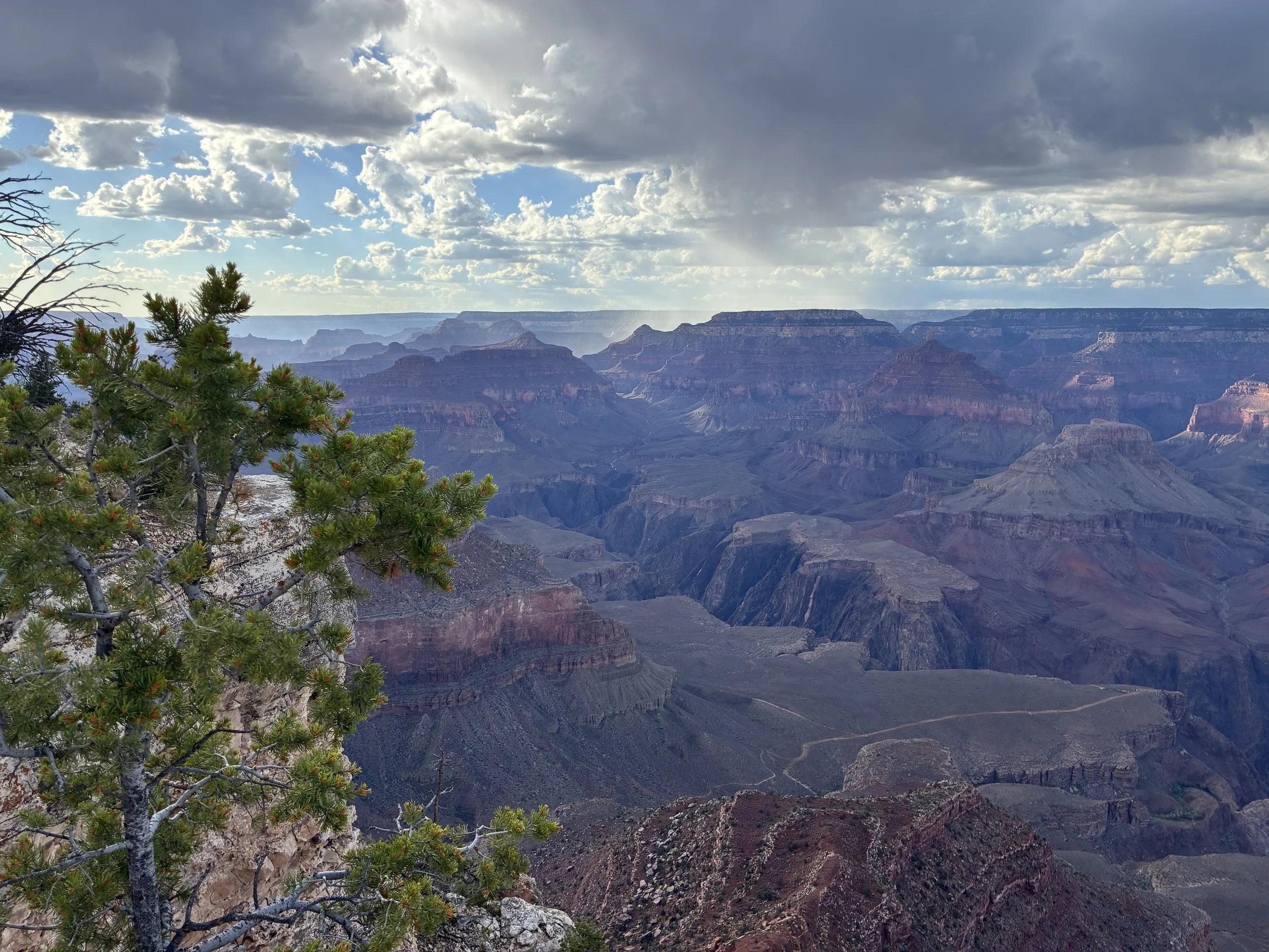
(June 2026) Yavapai Point
10 - South Kaibab Trailhead
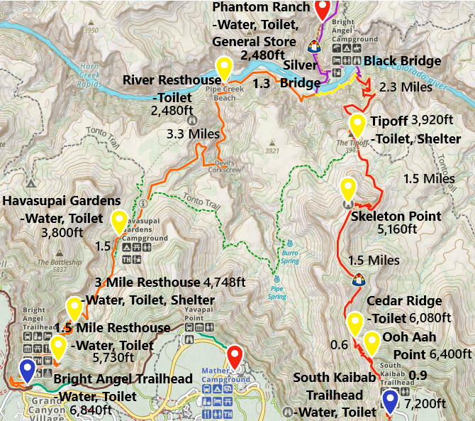
South Kaibab and Bright Angel Trail Map down to Phantom Ranch and Bright Angel Campground
There’s no parking at the South Kaibab Trailhead. To get there, you will need to either take the Hiker’s Express Shuttle (early in the morning, leaving once per hour) or the Orange Shuttle (runs throughout the normal daylight hours). The easiest place to catch either the Orange Shuttle or the Hiker’s Express Shuttle is at the Visitor Center.
Ooh Aah - 0.9 Miles / -790ft elevation from trailhead
Ooh Aah Point is the destination for anyone looking to descend just a short distance into the Grand Canyon. This is going to be a quick hike down but will require a lot of effort to climb back up. It is worth every step. It will feel like you are in the middle of just about a full 360-degree view. And hiking back out will be its own accomplishment of the day!
Sunrise is my favorite time of day at Ooh Aah. To make that happen, you need the Hiker’s Express Shuttle that takes off from the Visitor Center and goes straight to the South Kaibab Trailhead. It only leaves once per hour, and the schedule changes throughout the year to match the sunrise times. Check the NPS website or stop in and talk with Park Rangers at the Visitor Center the day before to understand where you need to be by when if you think you want to try the Hiker’s Express Shuttle.
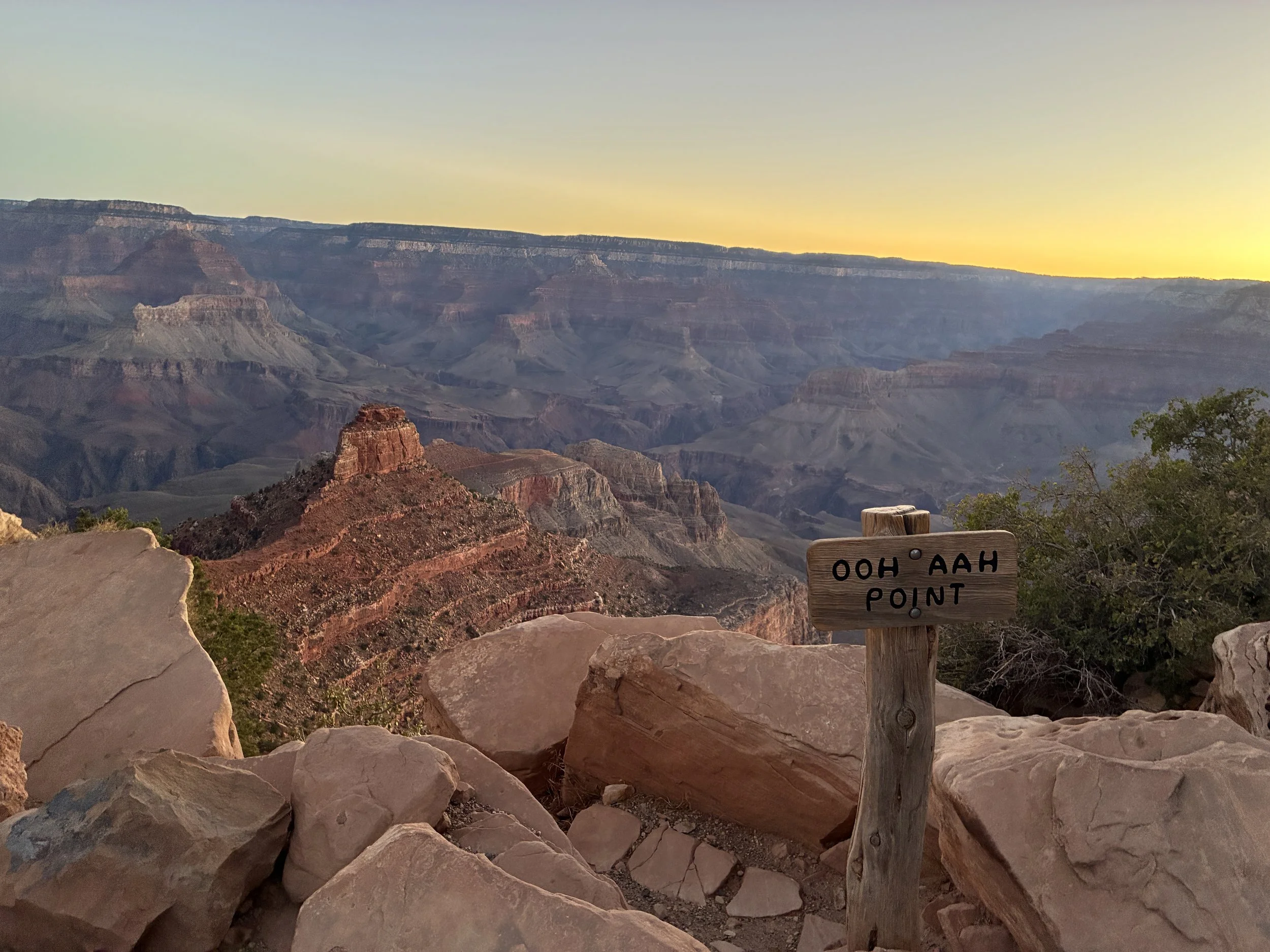
(June 2026) Sunrise at Ooh Aah Point
Cedar Ridge - 1.5 Miles / -1,120ft elevation from trailhead
For a longer hike, trek down another 0.6 miles down to Cedar Ridge. There is a pit toilet at Cedar Ridge and that’s about it. I’m not saying don’t do this hike… It’s the opposite. This is a really hard point to stop at and turn around. You will have been aimed towards O’Neill Butte for the majority of the hike out to Cedar Ridge. You’ll be thinking it’s your destination, but it’s not. You won’t be close to it yet. Speaking from experience, I spent 21 years wondering what happened to this trail after Cedar Ridge, and that question ultimately led me and my husband on our first rim-to-rim-to-rim hike. That’s a bit extreme... Instead, my advice is if you have plenty of water with you and you are physically fit, have a pre-plan to go a little bit further. The funny thing about this trail is that it never actually goes to O’Neill Butte. The trail switchbacks below it and wraps around to the other side, and the scenery changes so much you completely forget that it’s been your goal for the past hour or so.
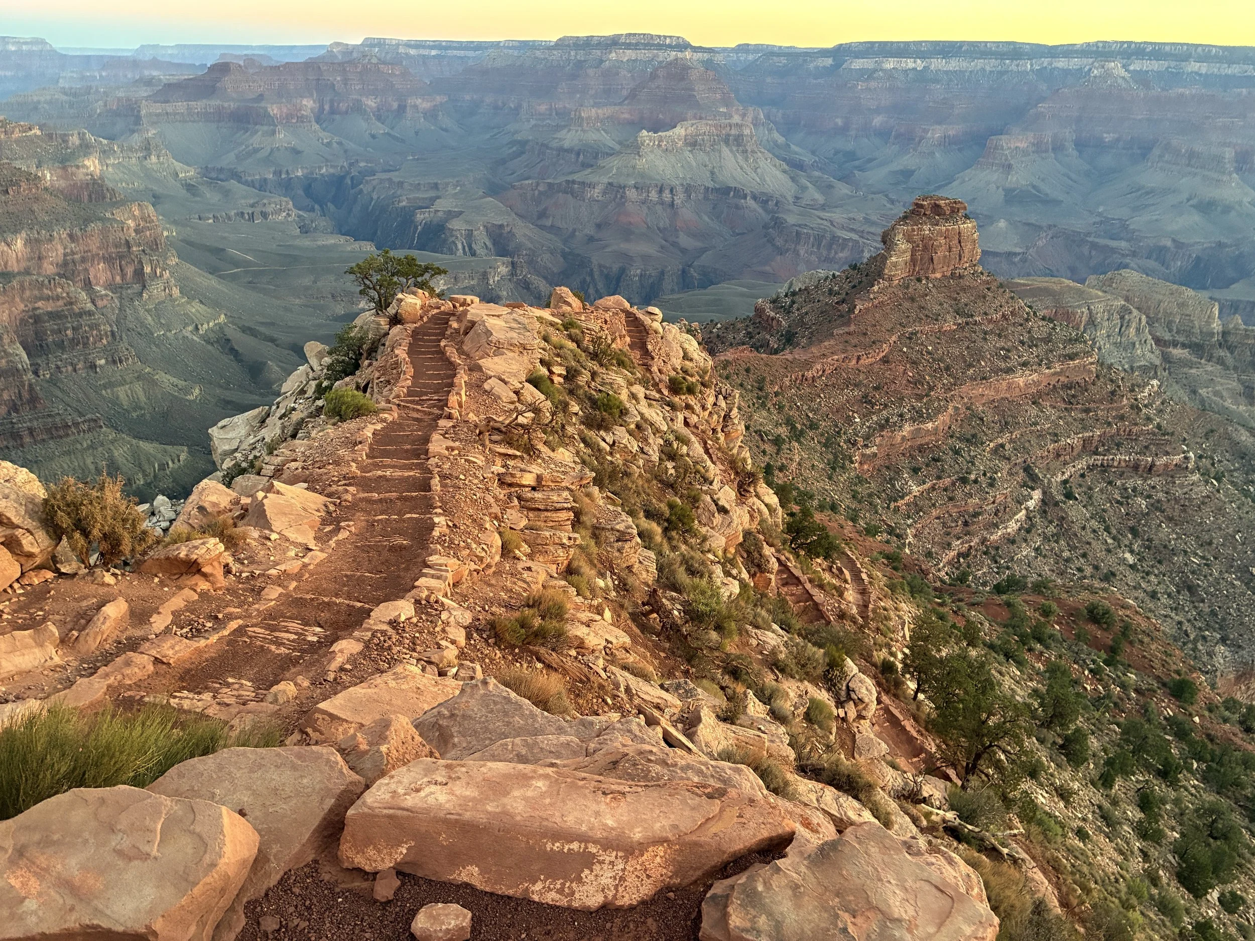
(June 2026) Walking past Ooh Aah Point down to Cedar Ridge. O’Neill Butte is the obvious rock in the picture.
Skeleton Point - 3 Miles / -2,040ft elevation from trailhead
Walking another 1.5 miles to Skeleton Point isn’t a bad idea, but it’s past the point of making spontaneous choices. You need to have 4L of water to be able to hike back up. You need to have paid attention to the day’s weather report to understand how hot it might be both at Skeleton Point and how hot you are going to be walking back up the rest of the trail as there is no shade, anywhere. You should also have basic first aid with you, just in case, and some salty snacks packed. Super easy going down - but this is going to be a tough and long hike back up.
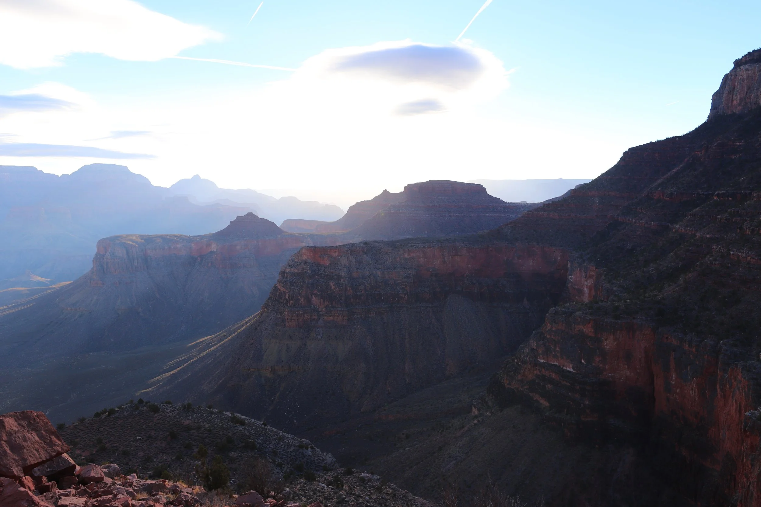
(March 2018) Hiking towards Skeleton Point
The further below the rim you hike, the deeper your relationship with this canyon is going to grow. Just remember that relationship only goes one-way. The Grand Canyon does not care if you make it out, but you will. Be prepared and be smart.
If you look at the picture below, zoom in a little below the rocks in the middle. There is another series of switchbacks. These switchbacks are just past Skeleton Point. My favorite view along South Kaibab is from the middle of these switchbacks.
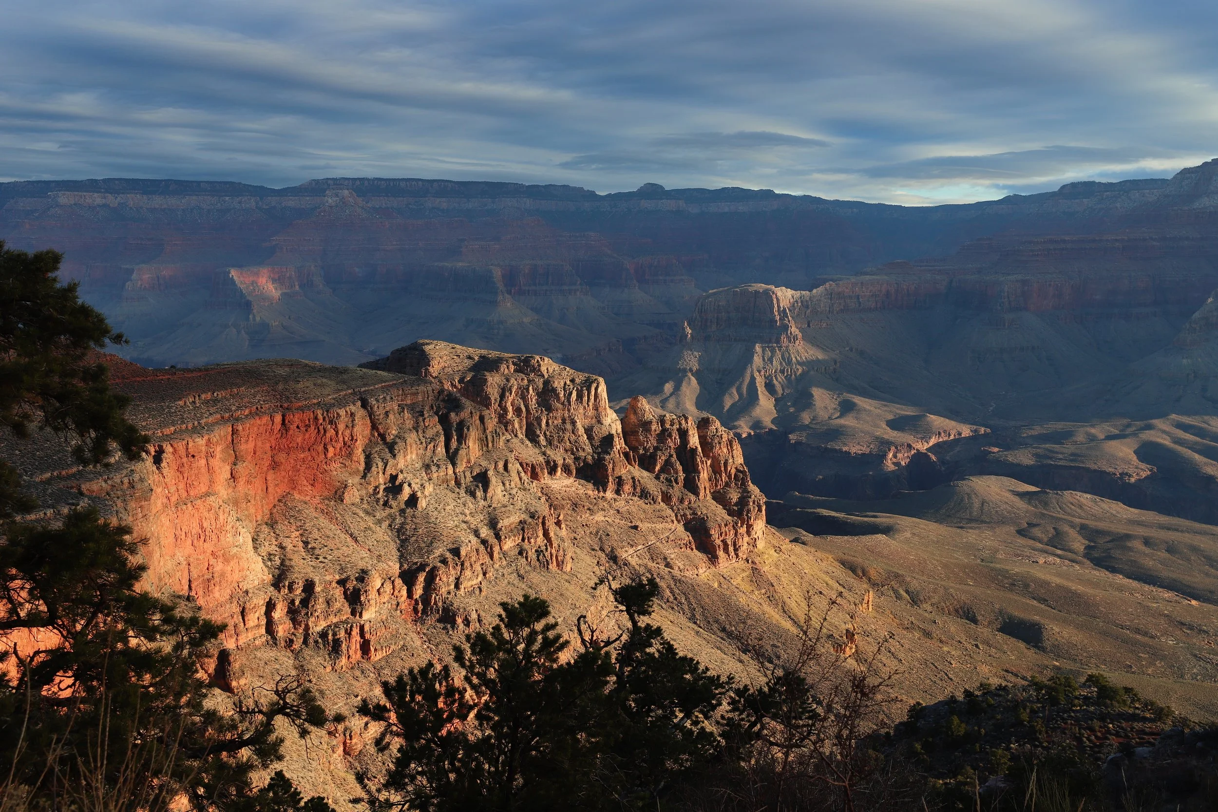
(March 2018) Hiking down South Kaibab to Skeleton Point
Skeleton Point is another smart place to turn around, but the problem is going to be that the trail is just starting to get incredibly interesting. At the same time, this is going to be a really hard hike back to the rim. Make smart choices. That might mean starting a 6-month training plan. (I’ve been to the bottom of the Grand Canyon 4 times and have spent 1.5 years of my life training to climb back out of this hole…)
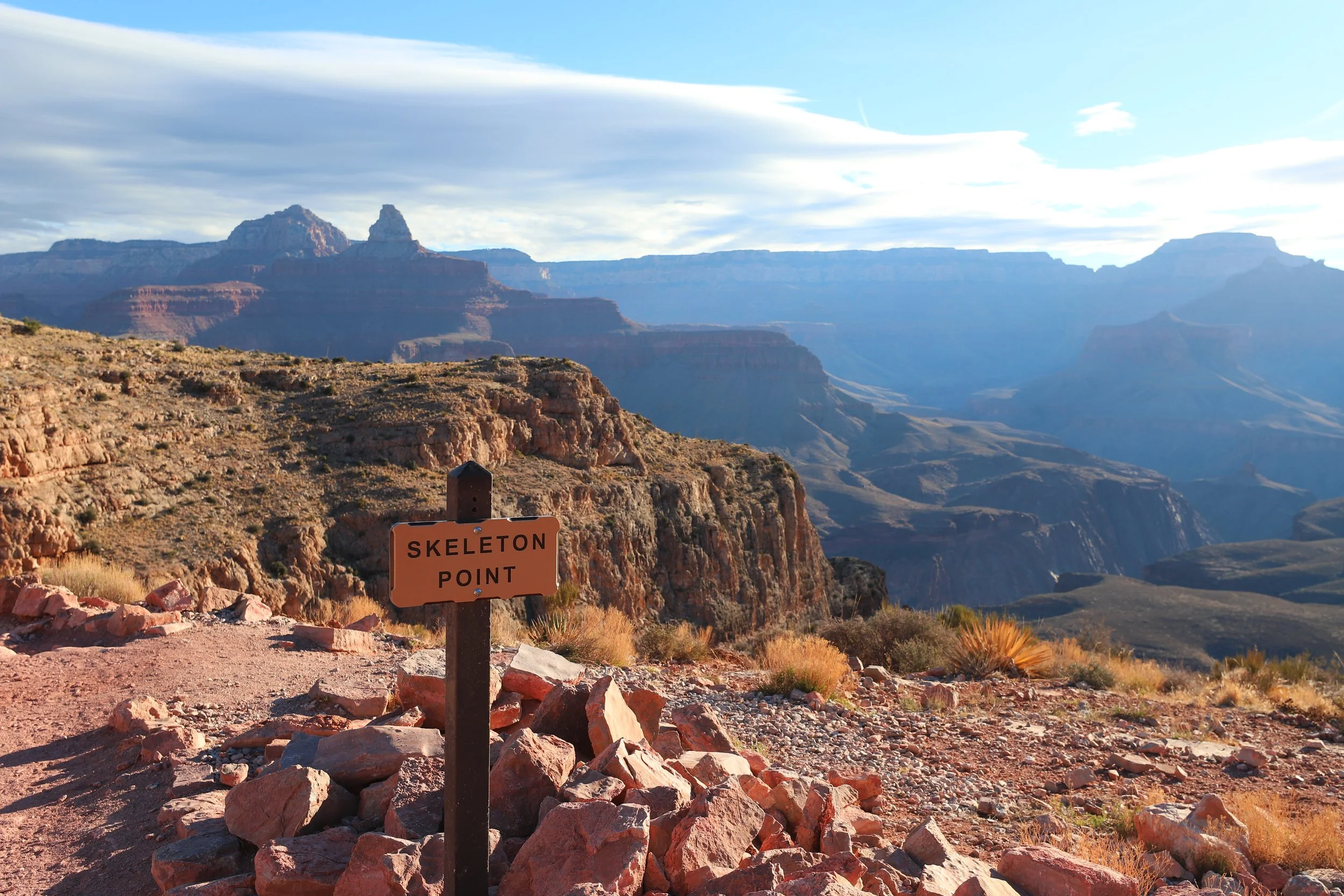
(March 2018) Skeleton Point along the South Kaibab Trail
On an out-and-back day hike, stop before you get to Tip-Off. If you walk a couple of minutes past Skeleton Point, you will be able to see the Colorado River and the Black and Silver Bridges that cross it along the way to Phantom Ranch. You could walk a little bit further to where the next set of switchbacks occur. The only reason I suggest this, as I mentioned, is my favorite part of this canyon.
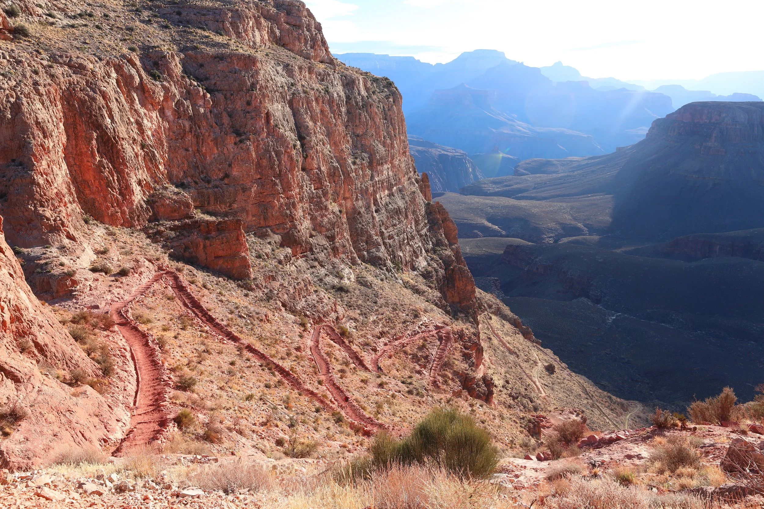
(March 2018) Switchbacks between Skeleton Point and Tip-Off
About halfway down the switchbacks will be a sign that I think of as the “Point of No Return.” It’s essentially the halfway point between the South Kaibab Trailhead (3.5 miles) and Phantom Ranch (3.8 miles).
The major problem with hiking down the South Kaibab Trail is that there are no water sources along the trail on your way back up, as well as no shade, and several months out of the year it’s quite hot in the Grand Canyon, especially as you start to reach the lower elevations (below 4,000ft). You can hike all day and take your time to get back up, but you are going to need water that you packed. How far you descend depends both on how much water you packed and being physically able to get yourself back out. No one is going to do this for you. There is no “easy button” to push in this canyon. It’s part of the Grand Canyon’s charm…
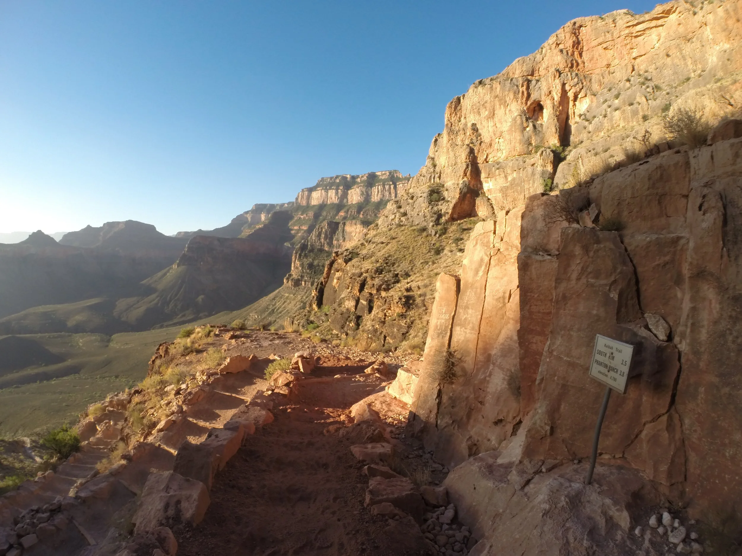
(June 2026) Halfway between Skeleton Point and Tip-Off
For anyone considering to go further, whether on a one-day trip or a multi-day trip, this is going to require immense planning, training, first aid knowledge, and the ability to consistently make smart decisions (which might include bailing on the hike and returning early). Hiking to the Colorado River would never be my suggestion, but I have also felt the pull of the Grand Canyon. If you are thinking of doing this, please do it smartly. Here is a link where I share how we have hiked to the Colorado River. Please read other blogs too. Each person will be able to give you a different perspective, and each perspective is going to be important as your journey could end up being completely different due to an injury or an unexpected shift in the weather. You might need to make quick decisions and it’s important to have thought through options for every scenario.
B - Grand Canyon Village
Grand Canyon Village is busy in a different way than Mather Point, Yavapai Point and the Visitor Center. There are probably more people, due to the lodges directly on the rim, but everyone is more spread out, as there aren’t just one or two viewpoints.
There are parking areas near Bright Angel Lodge, but the easiest way to explore is to take the Blue Shuttle from the Visitor Center all the way to Bright Angel Lodge. The Grand Canyon is on the other side of the buildings, and you can go right through the Lodge, even if you don’t have reservations, to get to the rim views. Nearby are the Kolb Studio and the Lookout Studio. The Fountains is a great place to get ice cream on a hot day. The line might be long, but it moves fast. There are a handful of restaurants as well, but most are on the pricier end. Maswik Lodge has a restaurant that sells whole pizzas - split 4 ways this is pretty reasonably priced. The Blue Shuttle will go to Maswik Lodge, but if you want to return to the rim you will need to walk as the Blue Shuttle first heads back to the Visitor Center, and that is going to add a lot of time.
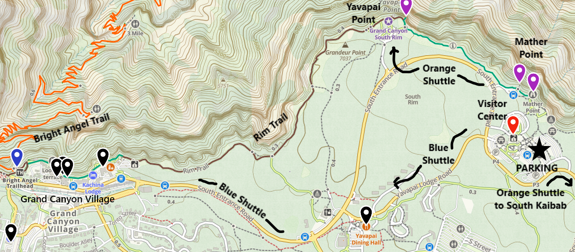
Simple map of Grand Canyon Village, Visitor Center Area, nearby trails, and shuttle stops
First priorities- stroll along the rim, stop in one of the studios, enjoy a ranger talk. There will be people everywhere, so take advantage of them and ask someone to take your picture.
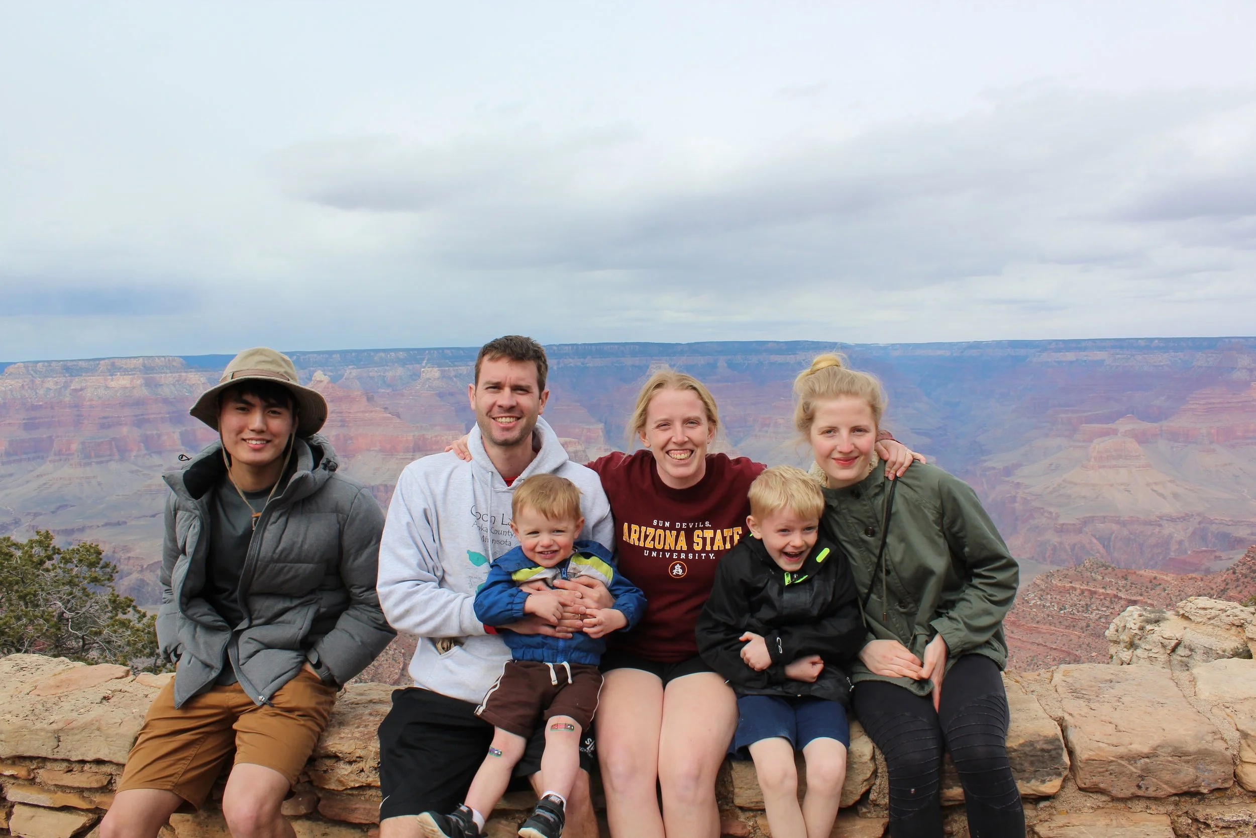
(March 2015) Epic Spring Break Road Trip from Minnesota down to the Grand Canyon with two exchange students and our boys. Every part of this trip was crazy, I would never recommend it, but it was one of my favorite trips ever. Do the crazy ideas anyway!
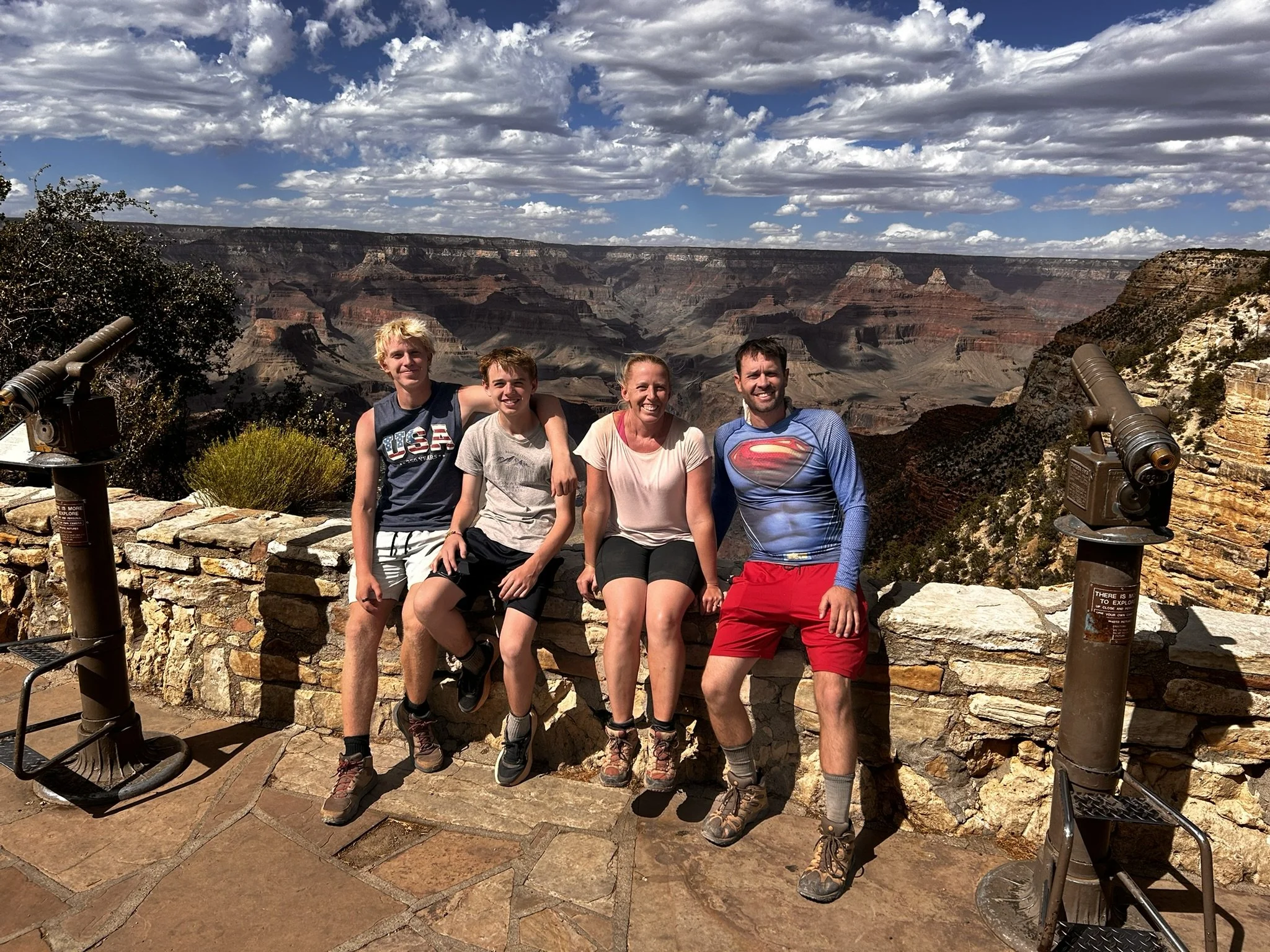
(June 2026) Family picture after hiking down to the river and back
11 - Bright Angel Trailhead
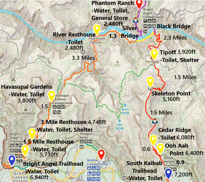
South Kaibab and Bright Angel Trail Map down to Phantom Ranch and Bright Angel Campground
The Bright Angel Trailhead is right across from Bright Angel Lodge, so it’s very easy to get to. The first 4 miles is pretty much just switchbacks within the same canyon. Eventually the trail does get interesting with different views at Havasupai Gardens Campground, but that distance alone will require returning up 3,040ft. The Bright Angel Trail has water along it at the campground and resthouses, which makes it the best option to hike up if you made it all the way down to the river. It’s a really boring trail to walk down and a hard trail to walk up for someone that just wants to walk a bit into the canyon. My best advice is to go back to the Visitor Center and take the orange shuttle to the South Kaibab trailhead.
Don’t go down those switchbacks…
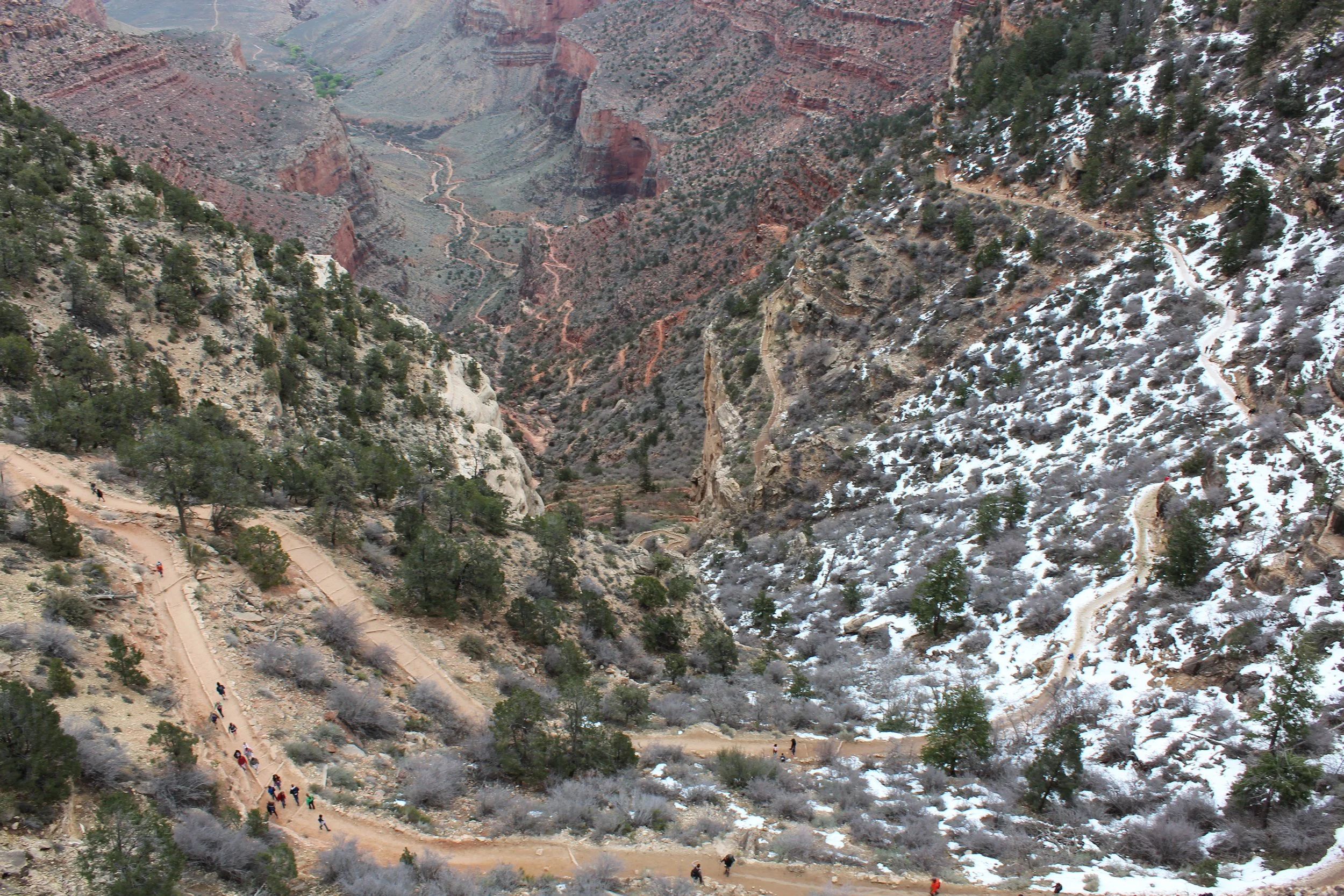
(March 2015) Looking at the switchbacks of Bright Angel from the trailhead - the view is the same from the top for the next 4 miles…. don’t go down there
When you look over the rim down from the Bright Angel Trail, there’s this trail that goes all the way out to the edge. That’s Plateau Point, and it’s a 1.5-mile spur trail (each way). It intersects with Bright Angel just past Havasupai Gardens Campground. It is incredibly tempting when you look out at it, but remember it’s 4.5 miles just to the campground, and then another 1.5 miles to get out to the point, so that’s 6 miles (one-way), and you have to return back that distance while hiking up 3,040ft.
When we hiked up Bright Angel in the evening in March 2018, at the trailhead there was a family of 4 that had teenagers. The mom was looking out at that point and trying to convince her family they could make it. They looked like a pretty athletic family, but the sun was setting in an hour or so, and they didn’t have a backpack, so we assumed that meant they didn’t have a flashlight. And they each had one 20oz bottle of water. We stopped them when they started walking down the trail, reminded them what time of day it was, and aimed them instead towards Shoshone Point. You’re welcome, Park Rangers! We prevented an unnecessary search and rescue endeavor.
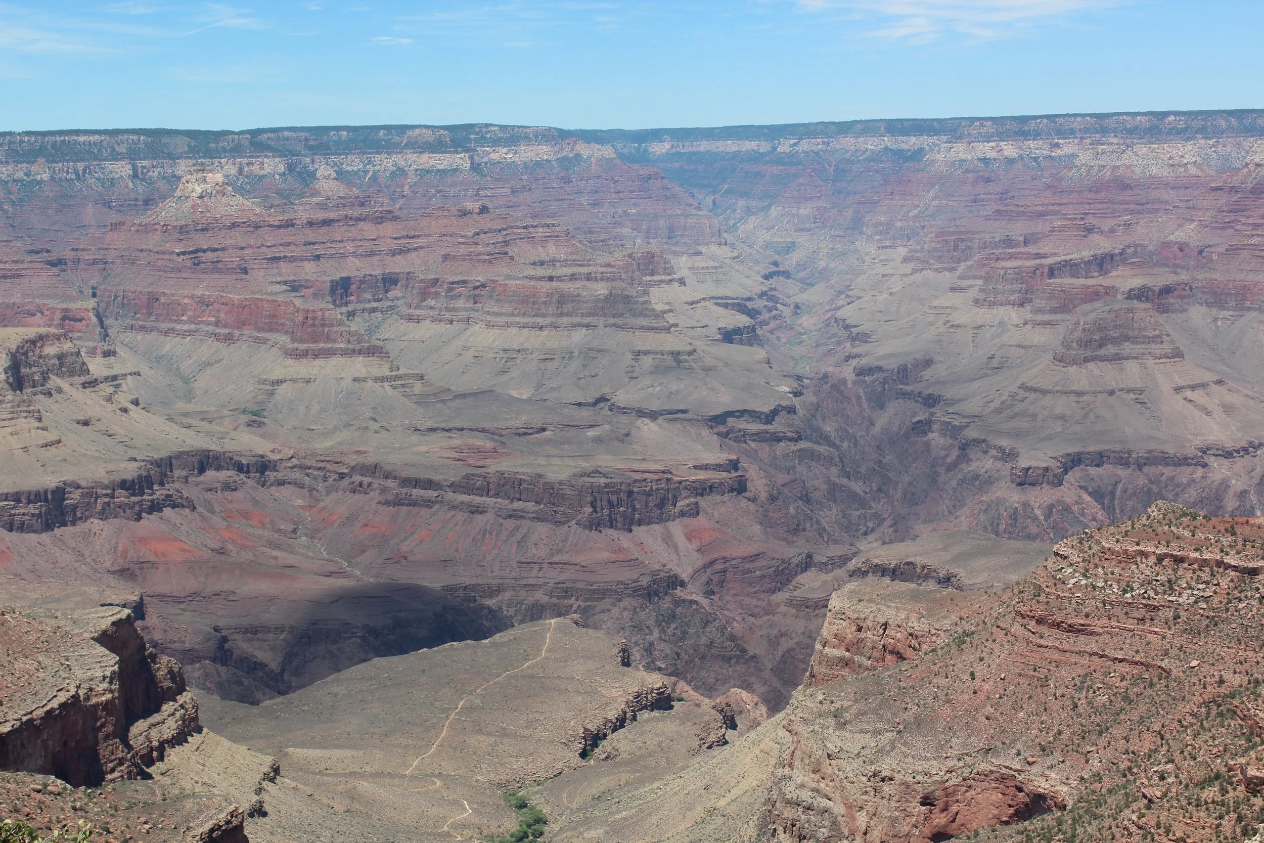
(June 2016) View from the Bright Angel Trailhead - the trail that goes all the way to the edge is Plateau Point
1.5 Mile Resthouse - 1.5 Miles / -1,110ft elevation from trailhead
The “resthouse” isn’t exciting. It’s a pit toilet and a place to refill water bottles. The view is the same. This is not your trail.
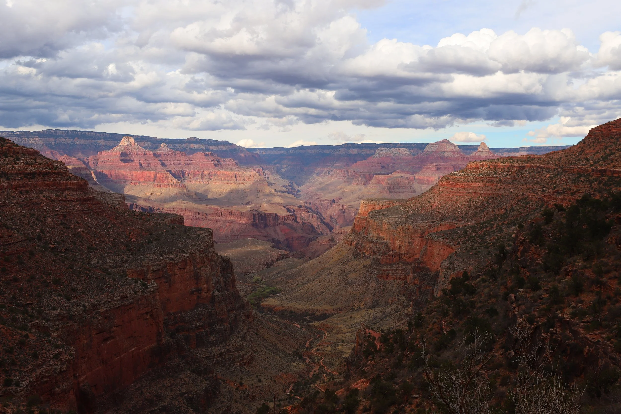
(March 2018) Sun setting as we hiked up from the Colorado River. This view is from near 1.5 Mile Resthouse
3 Mile Resthouse - 3 Miles / -2,092ft elevation from trailhead
3 Mile Resthouse is just a bit more interesting. In addition to water and a pit toilet, there are a couple of benches to sit at under a shelter. Those benches are not worth it. It’s still the same view.
In June 2026, while we were climbing out, there was a family with a few exhausted hikers and a couple of enthusiastic hikers. They asked if they were “almost there.” Well, realistically where is “there”? I pointed down at the 3-Mile Resthouse structure, convinced them the view was the same, and made sure they had enough water to make it back to the 1.5-Mile Resthouse. We suggested if they still wanted to hike more when they made it back to the rim to head out on the Red Shuttle and enjoy the Rim Trail.
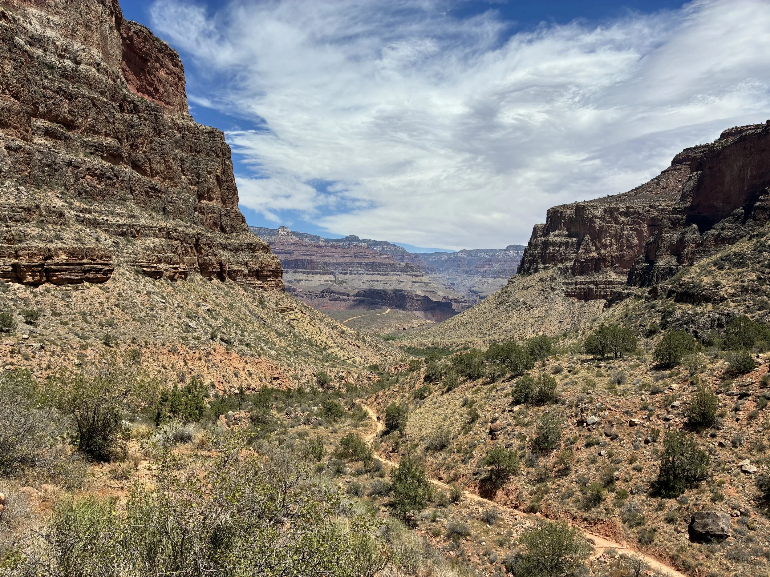
(June 2026) View from 3-Mile Resthouse - Still in the same section of the canyon and the view has not changed
Havasupai Gardens Campground - 4.5 Miles / -3,040ft elevation from trailhead
Once you get past Havasupai Gardens, Bright Angel Trail is incredible. There are two logistical problems though with hiking this far, though. First is the obvious elevation that you will need to climb back up. The second is less obvious but very important to consider, especially in the summer. While the temperature on the rim might be comfortable, maybe even a little cool, the rim is at 6,840ft. Havasupai Gardens Campground is at 3,800ft. The Colorado River is at 2,480ft. The further down you go, the hotter it gets, and there’s not much shade, especially in the early afternoon. Due to extreme heat, it’s not recommended to hike at elevations below 4,000ft in the summer months between 10am-4pm. Don’t go down there! This is not your hike!
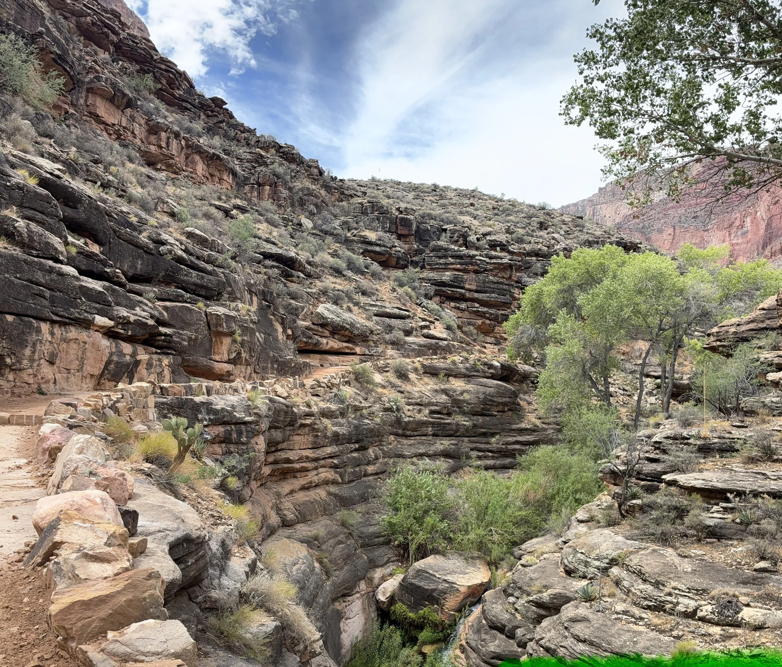
(June 2026) A short distance past Havasupai Gardens Campground
Hermits Rest
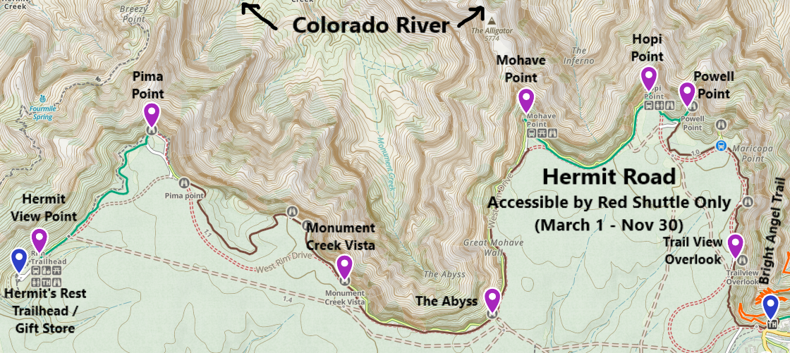
Hermit Road and Red Shuttle stops - It’s possible to hike the entire Rim Trail or use the Red Shuttle to hop on and hop off at different points without hiking at all
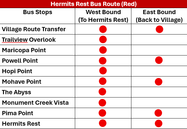
I was looking for something to do at the Grand Canyon during our June 2026 trip that we hadn’t done before. And I realized that we’d never been further west of Grand Canyon Village than Trail View Overlook. So, I plotted out a path to see each of the official viewpoints along Hermit Road, and we hiked the Rim Trail between several points.
The Red Shuttle runs between March and November. During the less busy winter months, the road is open to personal vehicles and there are small parking areas at each viewpoint.
I cannot say this enough - this is the hidden part of the park! Hidden in plain sight since there’s a shuttle bus that runs here. There was no one here on an afternoon in June. We didn’t have to rush to get anywhere. We enjoyed sleeping in. We parked at the Visitor Center, took the blue shuttle to the end, just past Bright Angel Lodge and transferred to the red shuttle. The bus was empty. We’d previously walked over the Trail View Overlook, and we already know the Bright Angel Trail pretty well, so we skipped Maricopa Point as well. Our first stop was Powell Point. We hiked along the rim to Hopi and Mohave Points and then got back onto the red shuttle. We got back off at The Abyss and hiked the rim to Monument Creek Vista. We took the red shuttle to Pima Point and walked the rest of the way to Hermits Rest.
There were a handful of people on the bus and a couple of people at a few of the viewpoints. I think we passed two groups of hikers along the rim trail between shuttle stops. There were people at Hermits Rest, but it was pouring and storming and we were all crowded into the store and under the shelter. Even with us all in one spot, there was still plenty of space for everyone.
This is your trail! It’s easy - the Rim Trail is flat. It’s paved in some spots and others it’s just a natural surface or crushed rock. You can hike as long as you want, and the shuttle will take you back. This is an easy way to see a lot of the canyon from different angles. There are several spots where you can actually see the Colorado River running through the canyon. There’s no people. And there are ice cream treats at the gift store at Hermits Rest. We spent 4 hours out in this part of the park and absolutely loved it.
12 - Powell Point
0.3 miles from Powell Point to Hopi Point
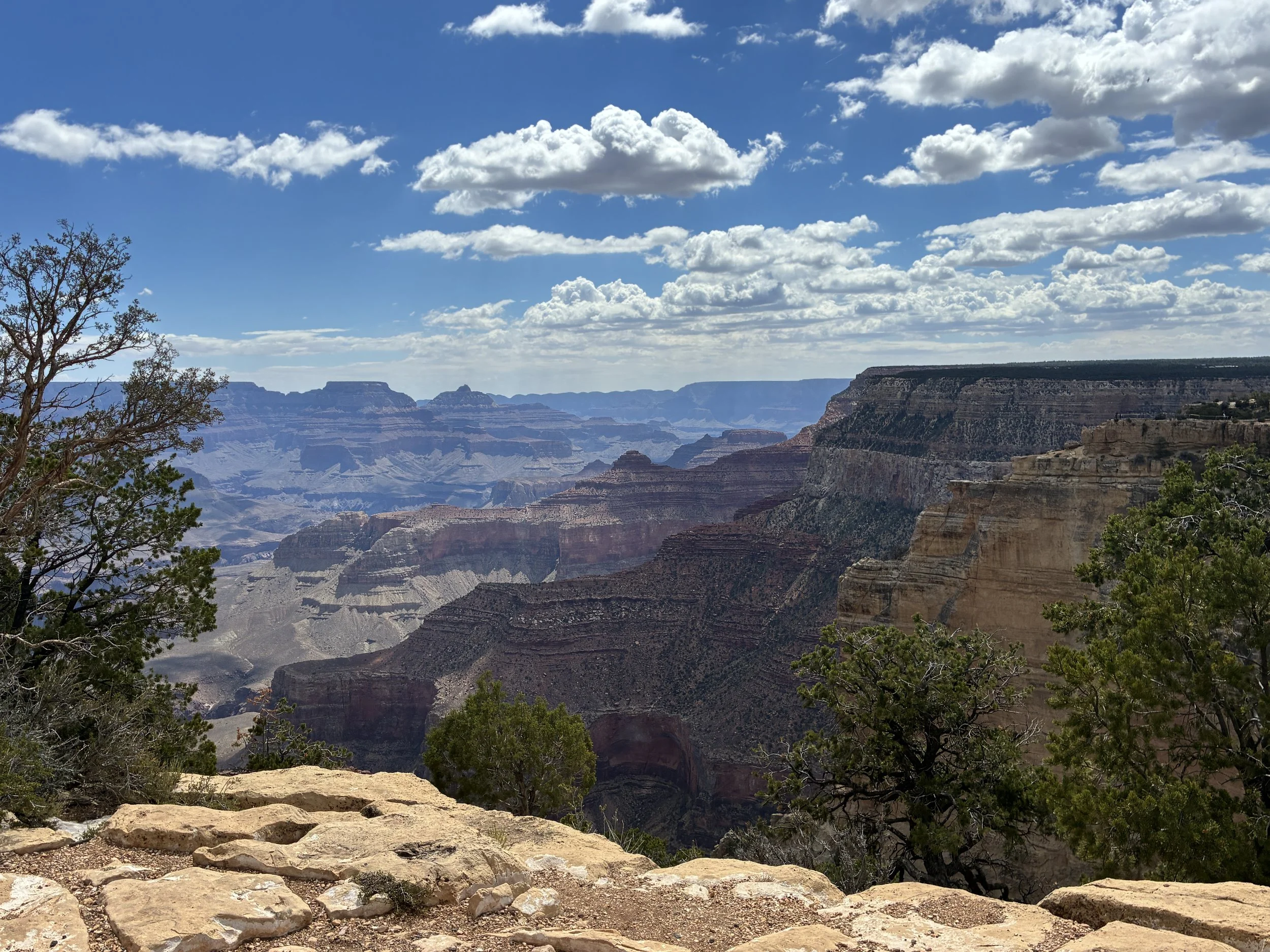
(June 2026 - Powell Point)
Powell Point is quite a bit west of the Bright Angel Trail and this is a completely different spot to view the canyon from. In the picture below, there’s a deep section of the canyon (north / south) in the right third. That’s Bright Angel Creek (that’s what you look out at from both Mather Point and the top of Bright Angel Trail). Phantom Ranch is at that the T-intersection at the bottom of the canyon. Everything to the left of that is a new part of the canyon to look at.
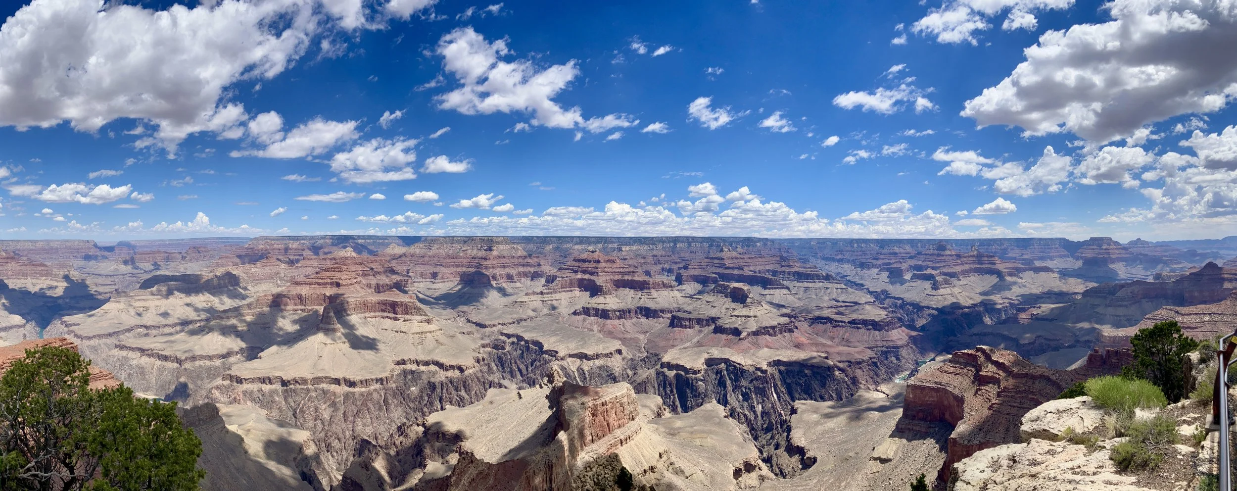
(June 2026) Powell Point
Some of these pictures are a little bit repetitive, but it was hard to pick a favorite.
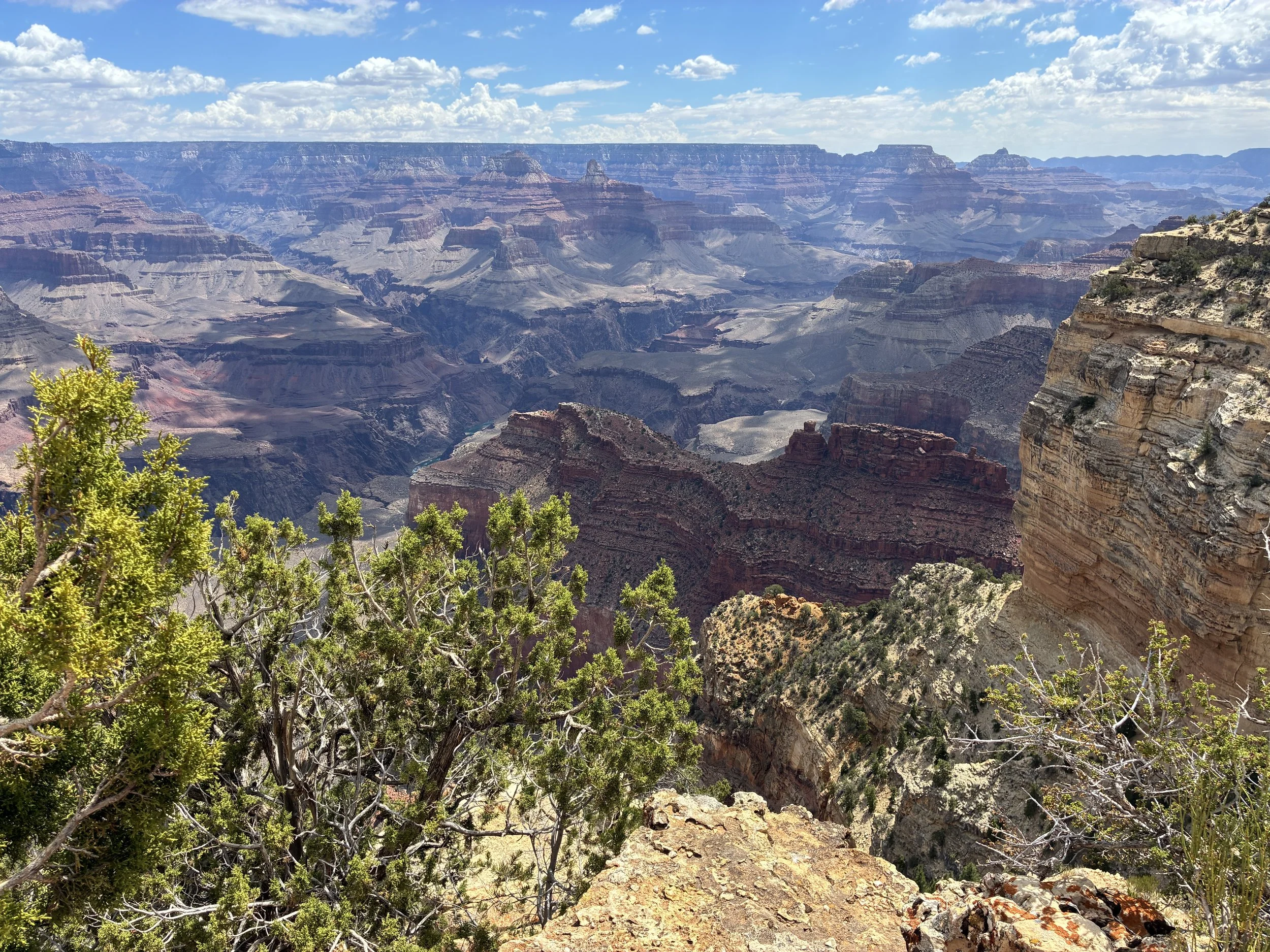
(June 2026) Leaving Powell Point and hiking to Hopi Point
Anyone can walk this easy Rim Trail section between Powell Point and Hopi Point. It’s flat and short, amazing, and again, we were the only ones walking it, in June… when the park should be the busiest.
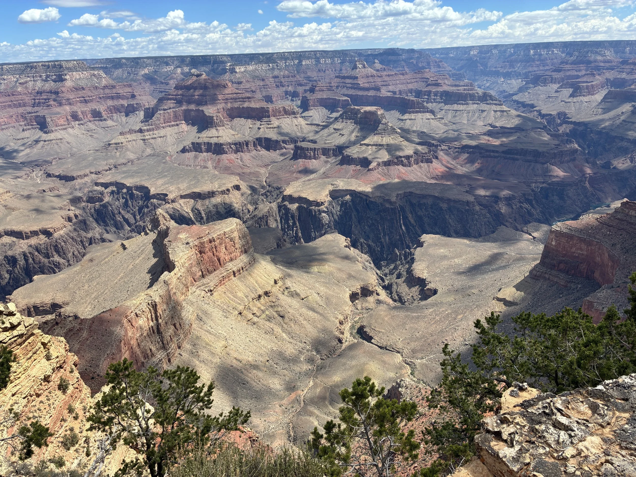
(June 2026) Walking between Powell Point and Hopi Point
As we are walking, I realize that I can actually see the Colorado River at the bottom. There are not many places in the park where you can see the river from the rim. It’s a mile-deep hole. It’s incredible to look at the rim from the river and vice versa the river from the top. If you can’t see the river in this picture below, it’s small at the bottom, just a bit of it showing just left of middle.
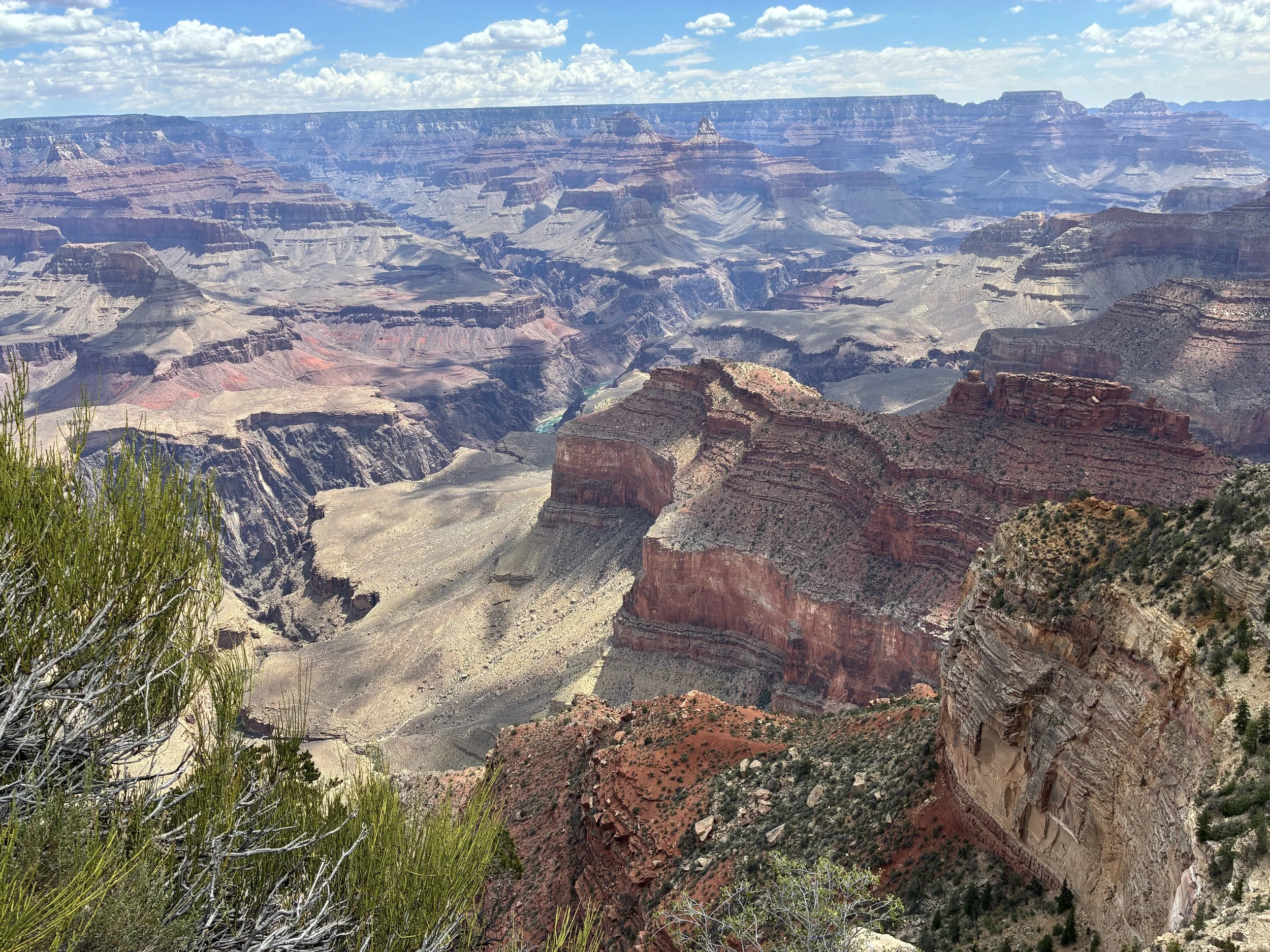
(June 2026) Colorado River becomes visible while walking the Rim Trail between Powell Point and Hopi Point
A little further, looking to the west, and a huge section of the Colorado River comes into view. I think that river is so special to see at the Grand Canyon, because the whole canyon was formed due to the incredibly wild force of water.
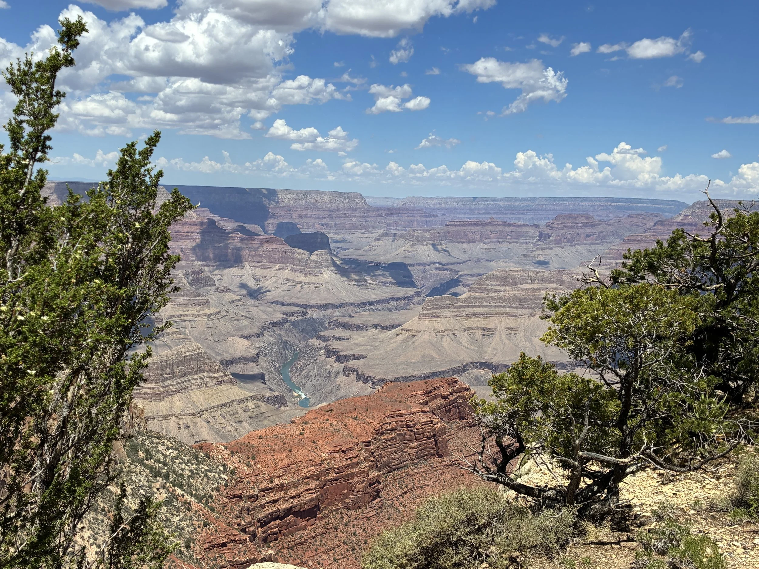
(June 2026) Colorado River visible while walking out to Hopi Point
13 - Hopi Point
1 mile from Hopi Point to Mohave Point
I loved the hike between Powell Point and Mohave Point. This would be my recommended hike for everyone. There is also a pit toilet at Hopi Point, and it’s the only one along the road before Hermits Rest.
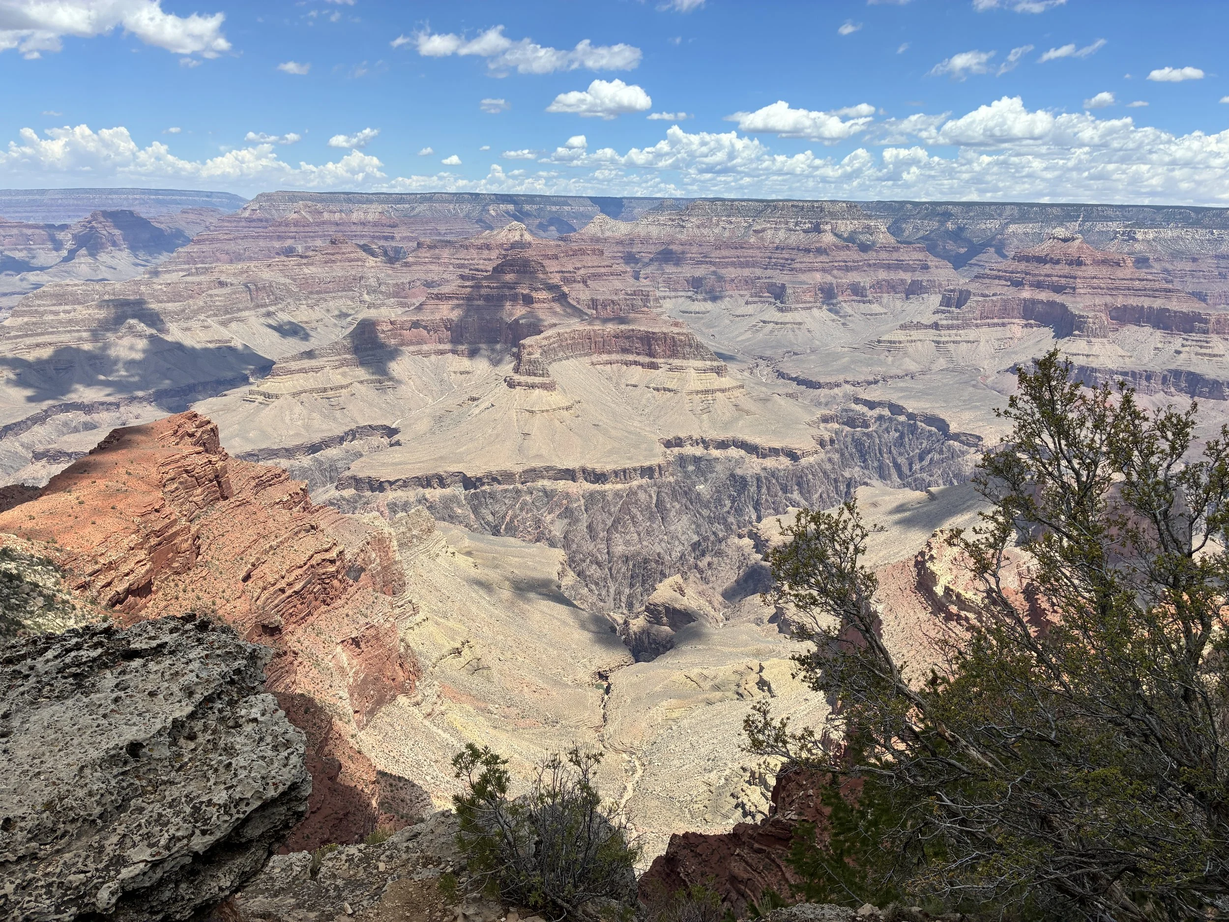
(June 2026) Hopi Point
It was such a beautiful and easy hike between Hopi Point and Mohave Point. I don’t think we passed anyone between the shuttle stops.
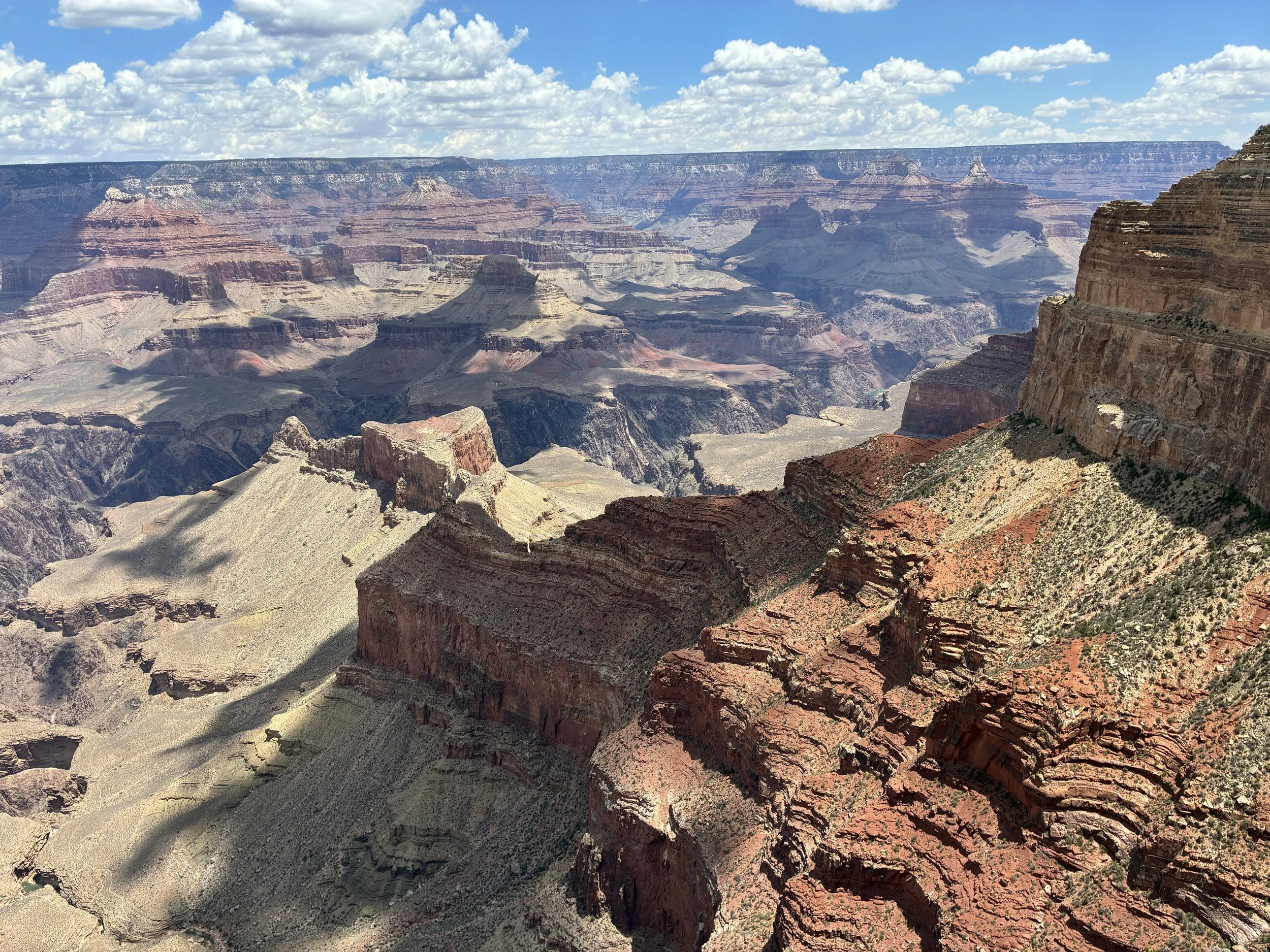
(June 2026) Walking between Hopi Point and Mohave Point
The trail is a flat crushed rock / dirt. It follows right along the rim. It’s plenty wide. I wasn’t nervous hiking along it.
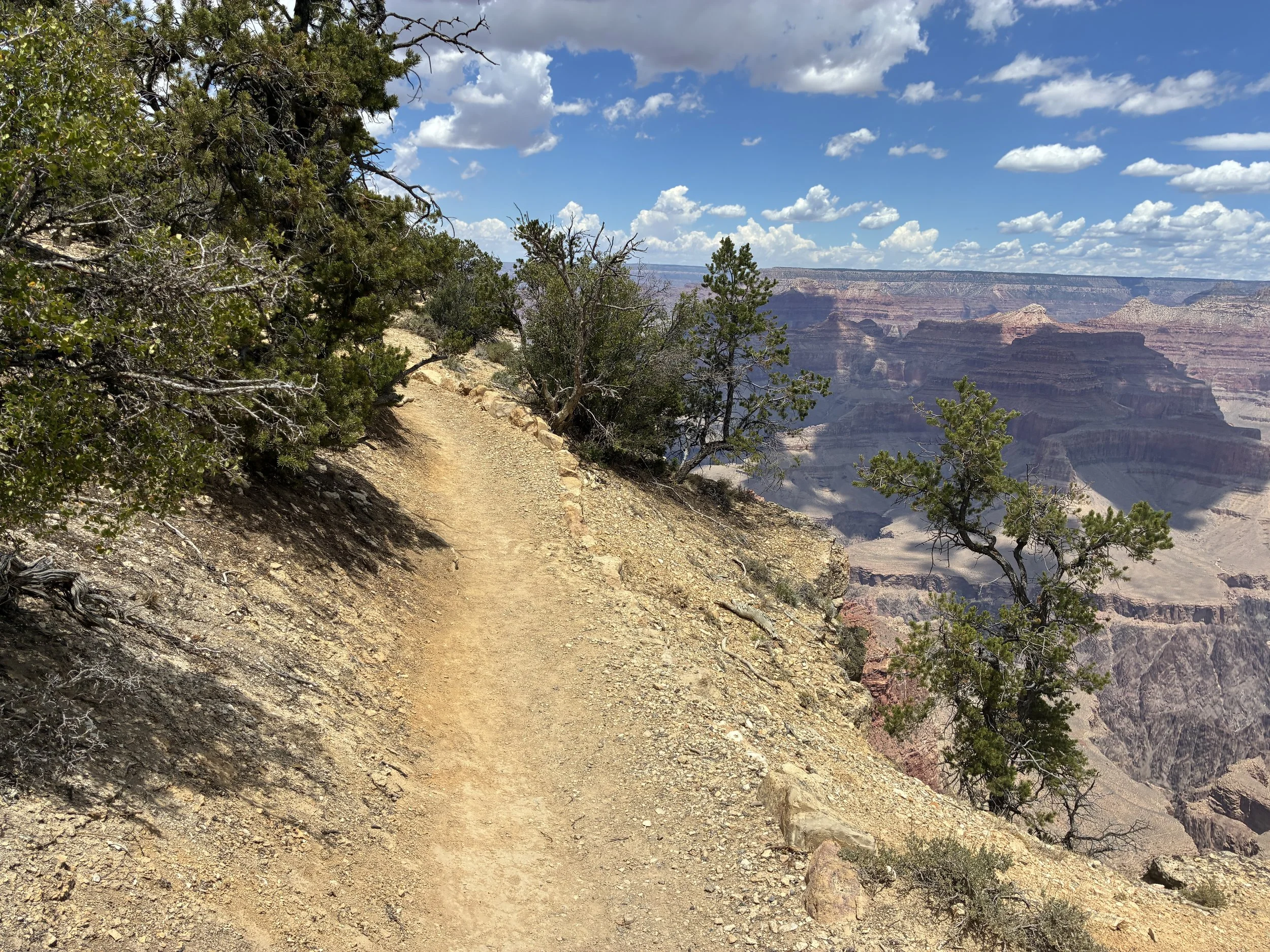
(June 2026) Rim Trail between Hopi and Mohave Points
There are a handful of benches along the Rim Trail as well. They were all open as we didn’t happen to pass anyone on this section of the trail. This would be a perfect spot for a picnic or to just sit and watch the clouds move over the canyon.
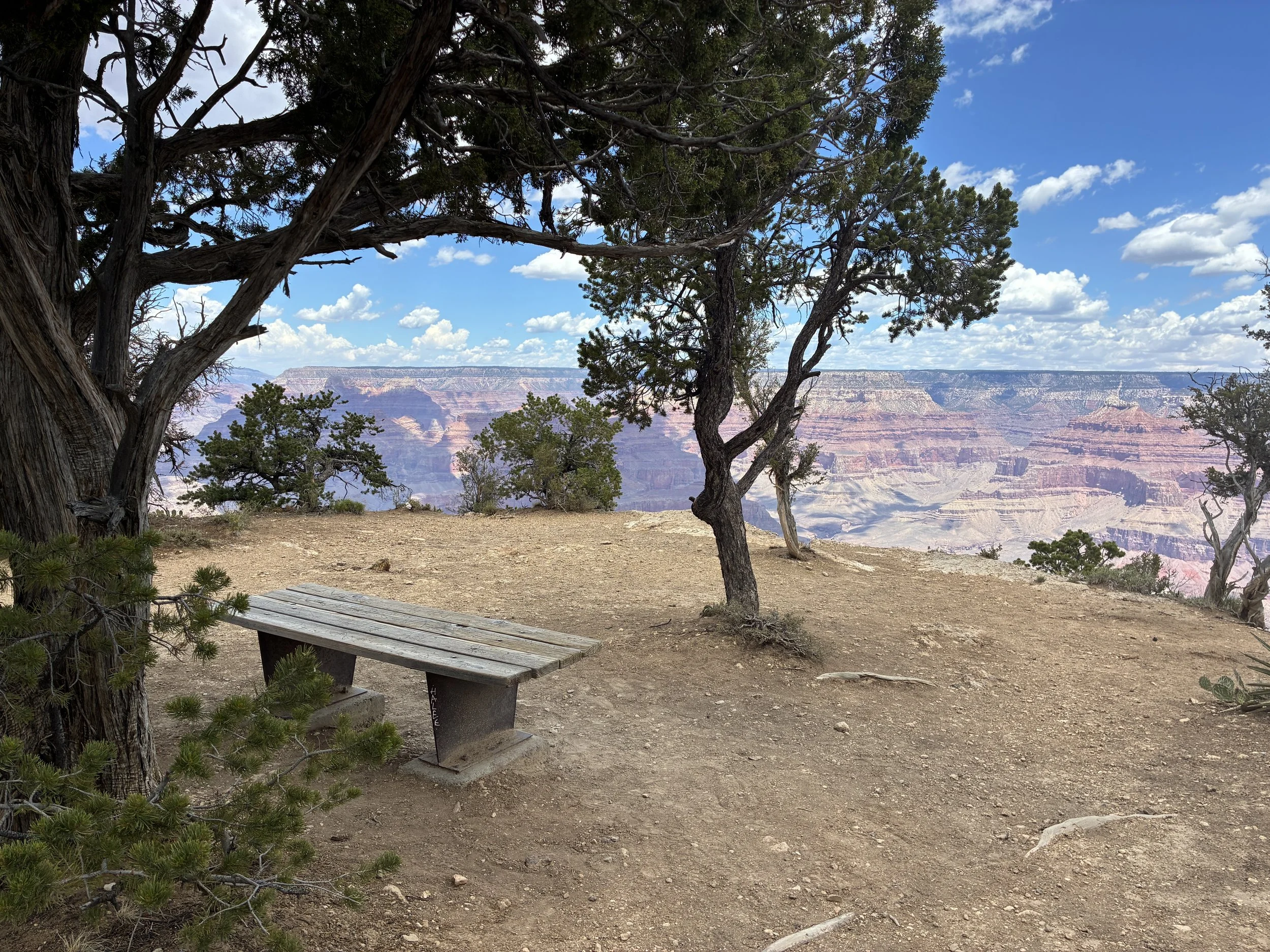
(June 2026) Bench along the Rim Trail between Hopi Point and Mohave Point
Because the trail follows the rim which isn’t straight, the views do change a little bit between Hopi and Mohave Points.
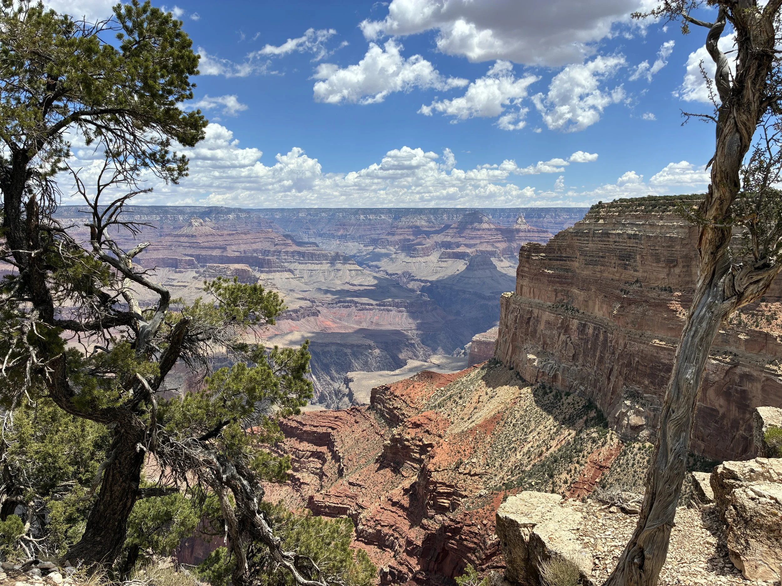
(June 2026) Hiking the Rim Trail to Mohave Point
14 - Mohave Point
1.2 miles from Mohave Point to The Abyss - We got back onto the Red Shuttle at Mohave Point and took the shuttle instead of walking.
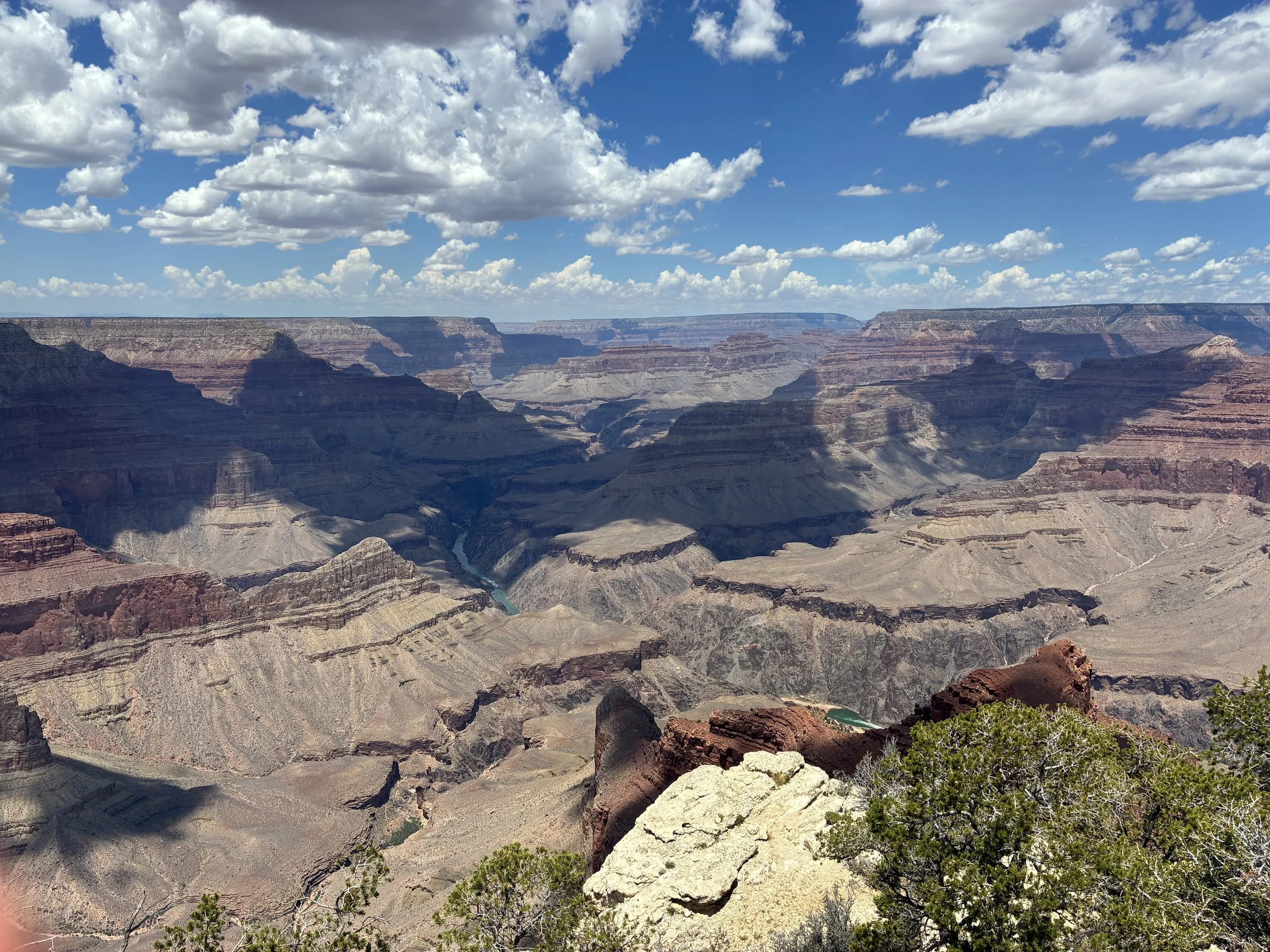
(June 2026) Mohave Point
I really enjoyed Mohave Point. Because it’s on a point, there are multiple angles to view the Grand Canyon from. Looking out to the west, there’s a large section of the Colorado River that is visible.
15 - The Abyss
1 mile from The Abyss to Monument Creek Vista
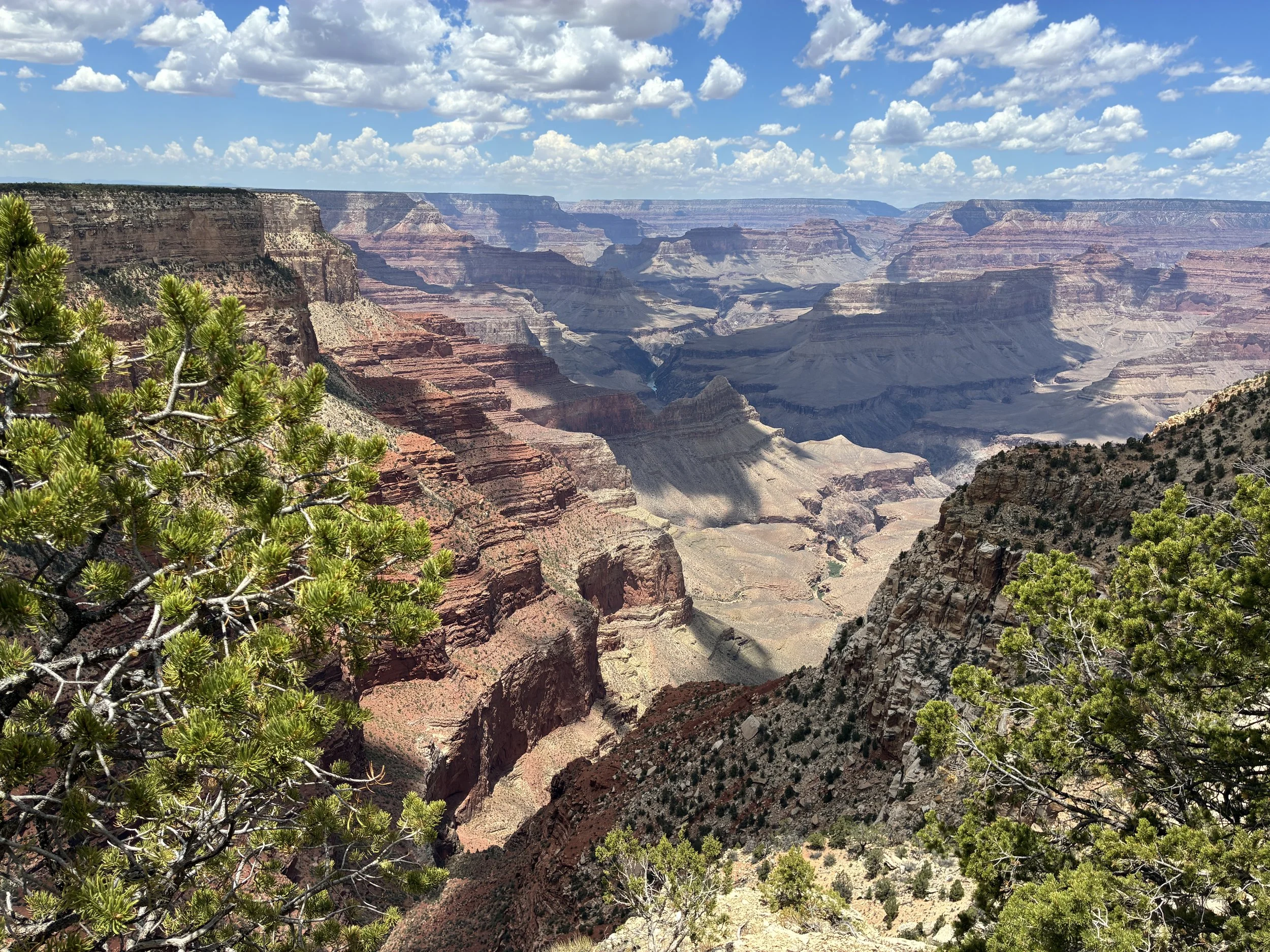
(June 2026) View from the Abyss
I’ll admit that we got off the shuttle at The Abyss because of the name… I think it’s named The Abyss because you can’t see the bottom, but there are lots of places in the Grand Canyon that you can’t actually see the bottom. This section of the trail is tucked into a wall, kind of like the Bright Angel Trail, so we were just looking at one part of the Grand Canyon. It’s still a nice and easy trail, but I preferred Powell Point to Mohave Point over this section.
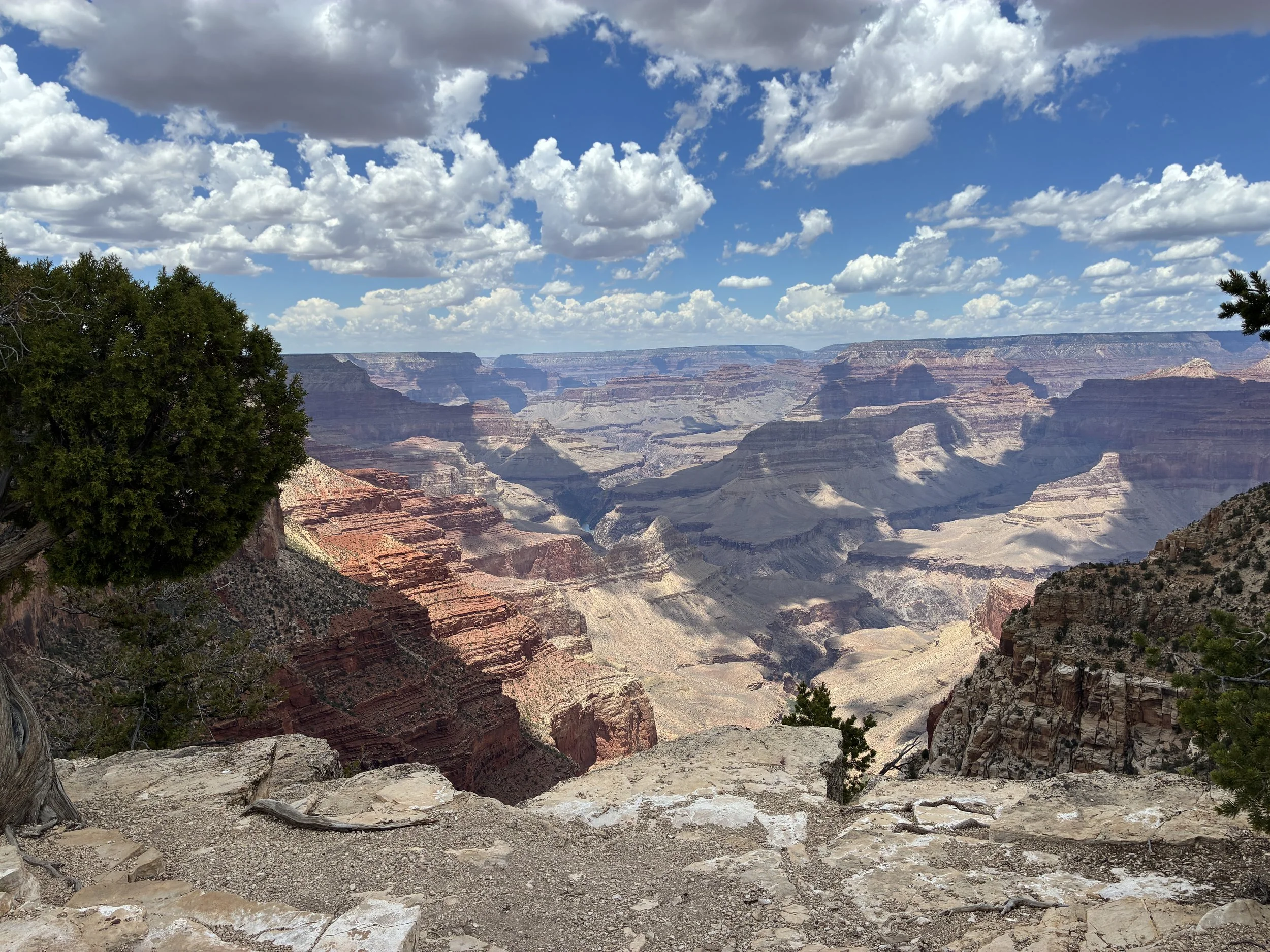
(June 2026) Walking between The Abyss and Monument Creek Vista
While we were hiking, there were a couple of helicopters that were working, although we weren’t sure what they were doing. They would fly down into the canyon, turn right and drop closer to the river. Then they’d return over us a handful of minutes later. And back and forth. They were carrying something, but we weren’t sure exactly what they were doing. It was fun to watch though.
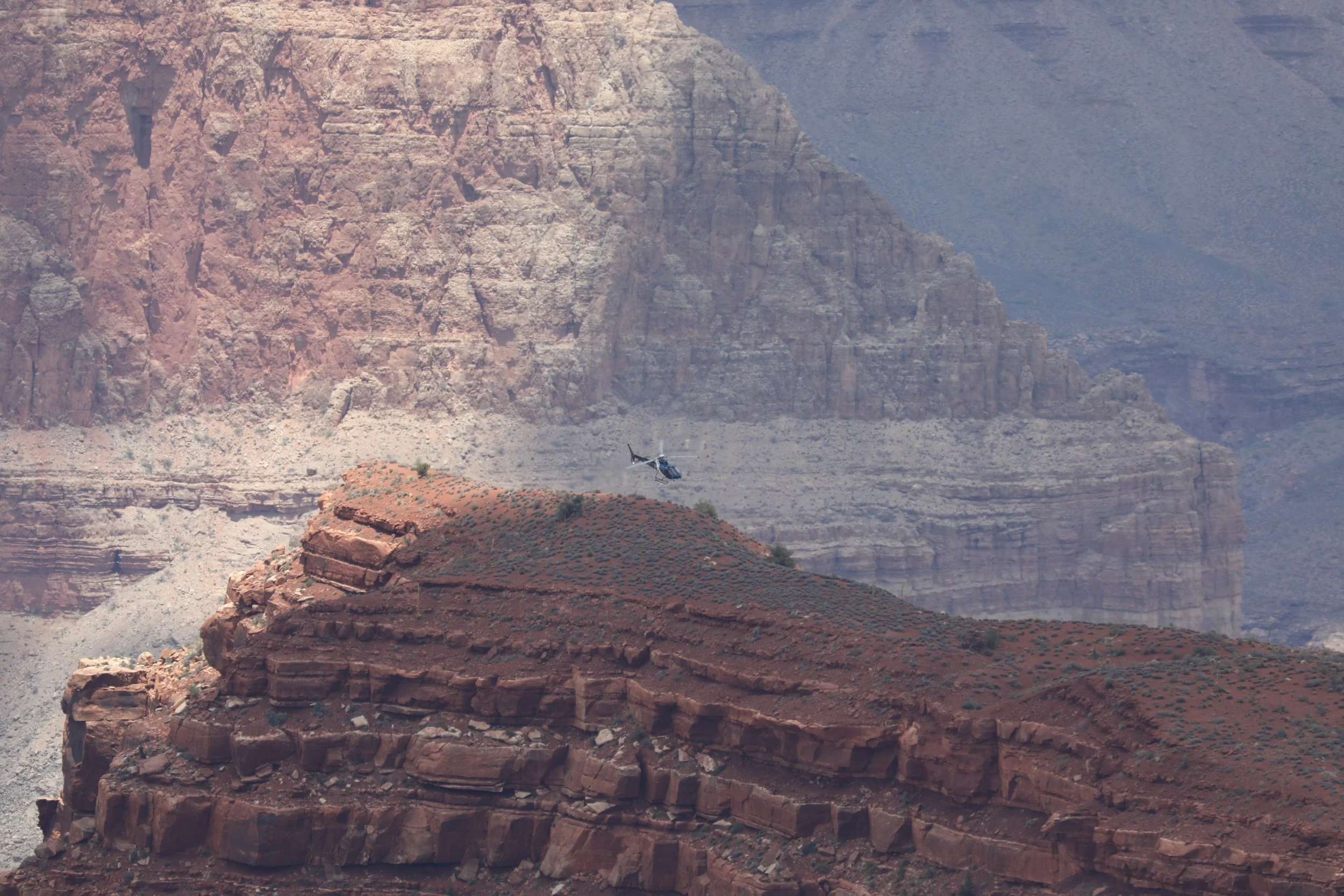
(June 2026) Watching the helicopters working near The Abyss
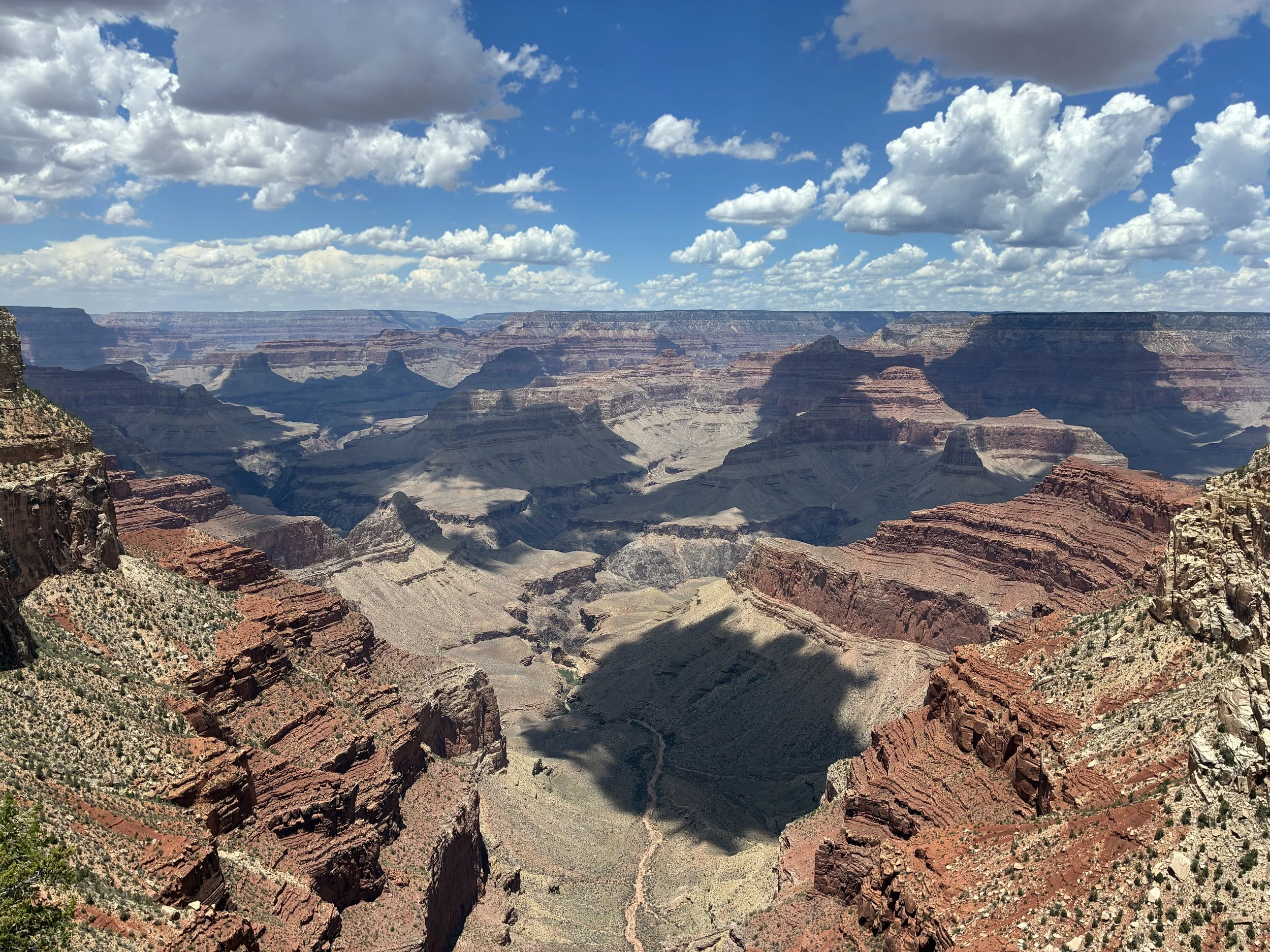
(June 2026) Walking to Monument Creek Vista
16 - Monument Creek Vista
1.5 miles from Monument Creek Vista to Pima Point
We hopped back on the Red Shuttle after Monument Creek Vista.
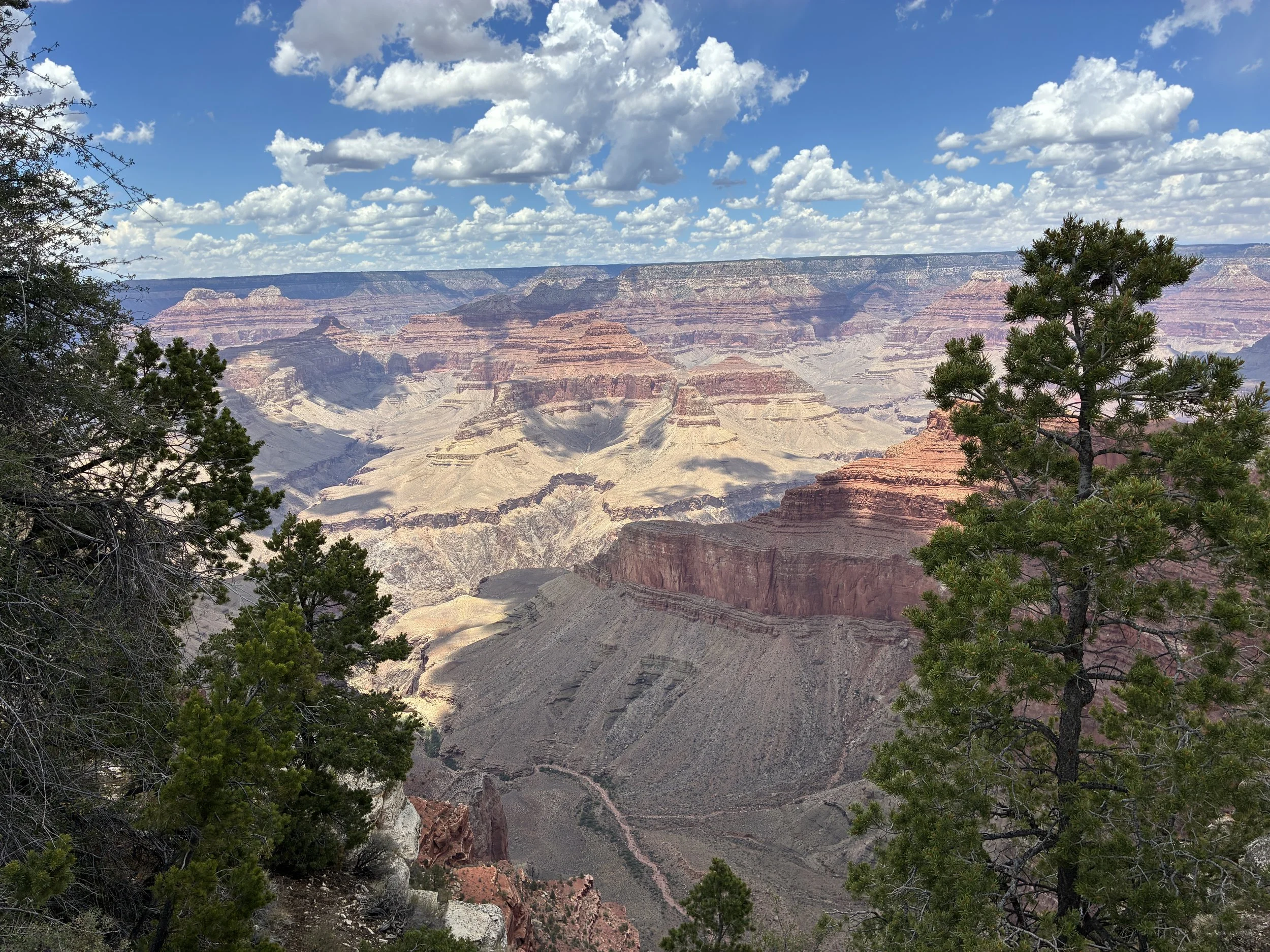
(June 2026) View from Monument Creek Vista
The views were better walking towards Monument Creek Vista than at the official viewpoint. I’m guessing the trail to Pima Point is also pretty, but there’s only so much time in a day, so we jumped back on the Red Shuttle.
17 - Pima Point
1.2 miles from Pima Point to Hermits Rest
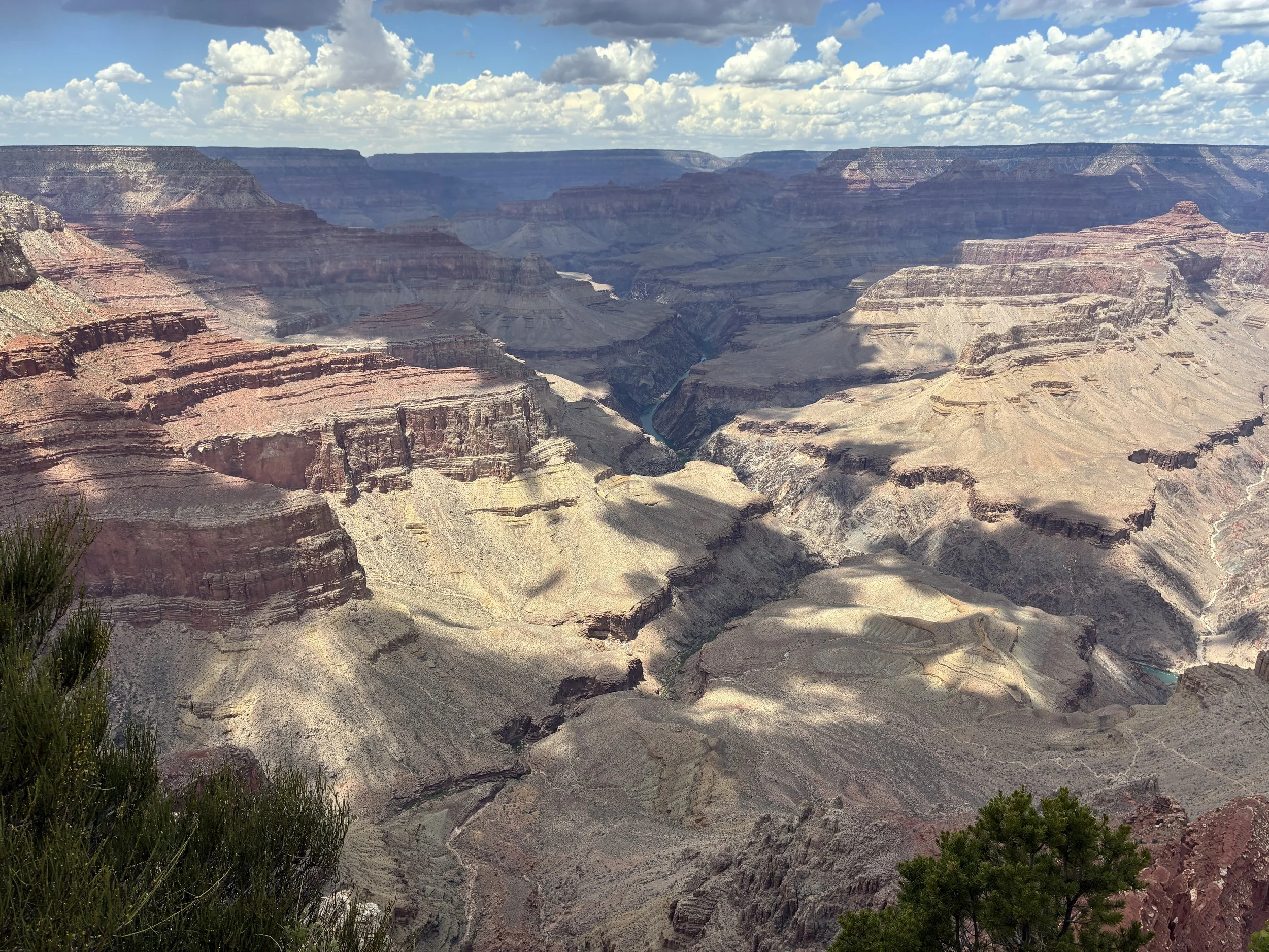
(June 2026) Pima Point
We got back off of the shuttle at Pima Point and finished hiking the rest of the Rim Trail. The Colorado River is visible at the bottom of the canyon from Pima Point as well. Considering that the river is not visible at all from Grand Canyon Village or near Mather / Yavapai Points, I was surprised at how many places we could see it from along the Rim Trail on Hermits Road.
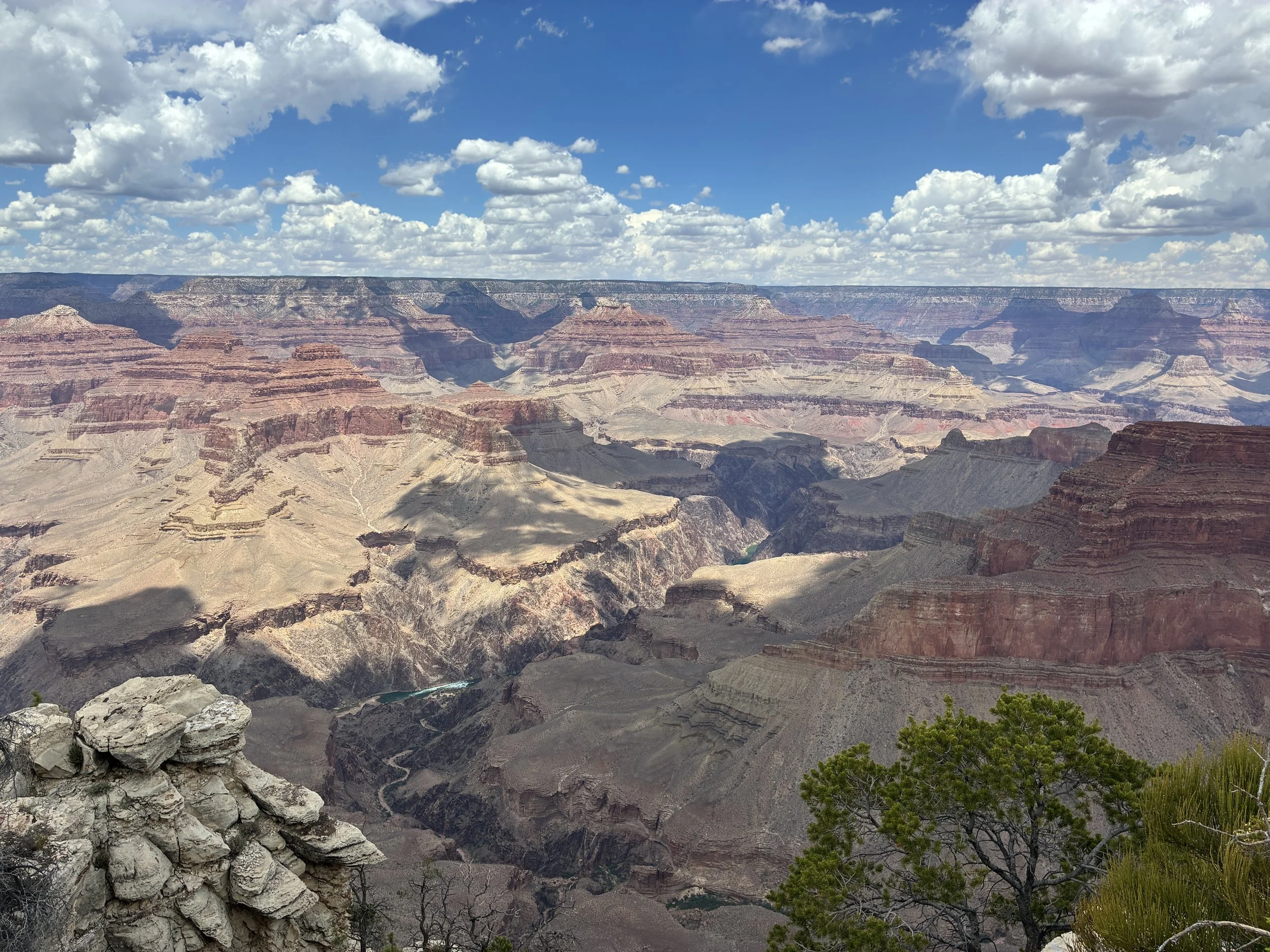
(June 2026) Walking to Hermits Rest from Pima Point
The Rim Trail is paved between Pima Point and Hermits Rest. This was probably the easiest section of the Rim Trail to walk, although none of it is difficult. There were people out here walking though, which is why I liked that section between Powell Point and Mohave Point better.
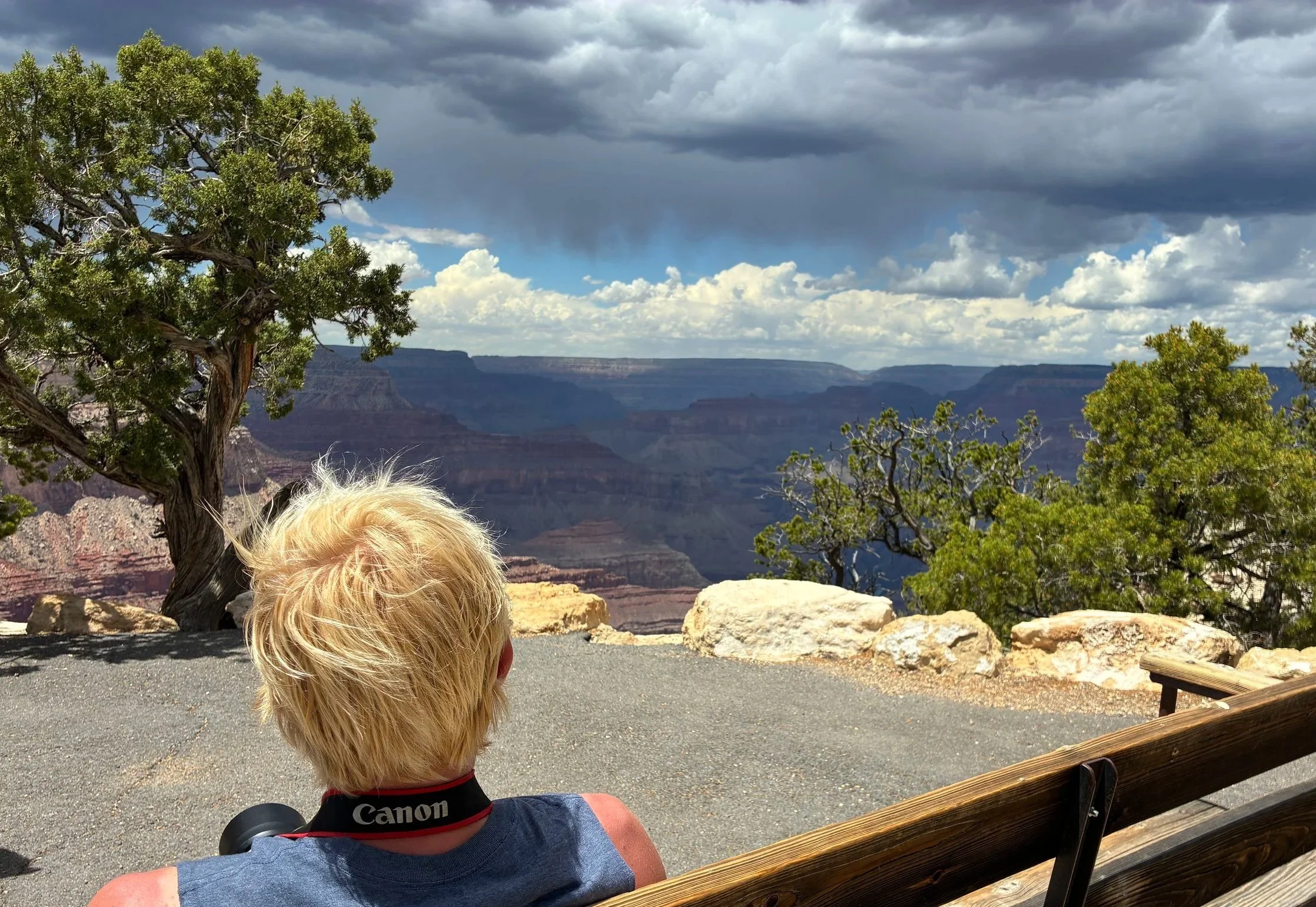
(June 2026) Watching the storm clouds roll in near Pima Point
C - Hermits Rest Trailhead
There are several trail options that take off from Hermits Rest. The trails are not near as well maintained as Bright Angel and South Kaibab, there is no access to water beyond the trailhead, and we have not had a chance yet to hike any of them.
The view from Hermits Rest isn’t that great due to trees. The best viewpoints are at Powell, Hopi, Mohave, and Pima Points.
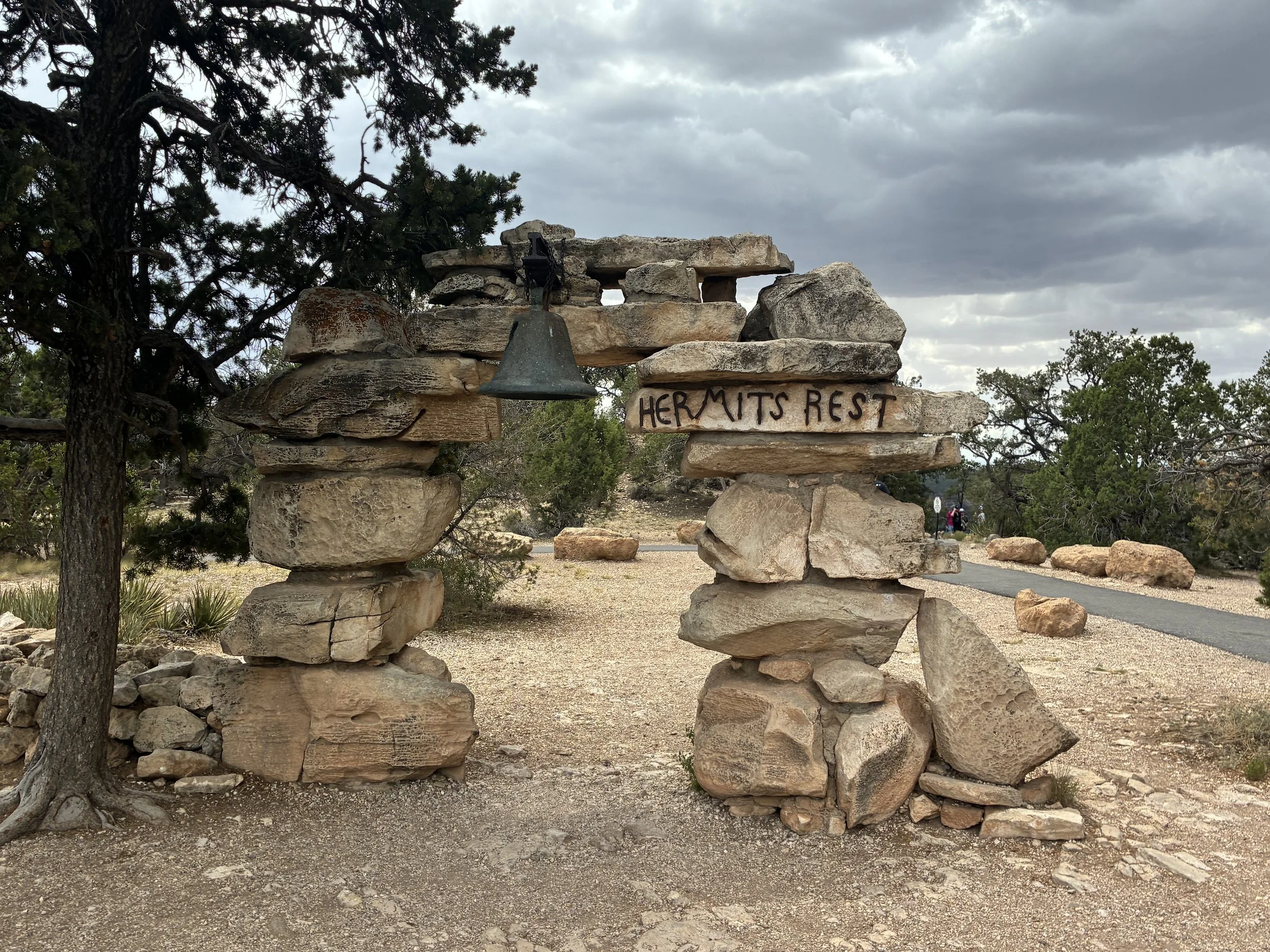
(June 2026) Hermits Rest
The storm clouds that we had been watching all day finally rolled through when we arrived at Hermits Rest, which was the perfect place for us to be. There is a gift store that sells snacks, so we walked inside to get out of the rain and bought some ice cream treats. Just outside of the store, there is a shelter overhang, so we could watch the storm without getting wet while enjoying snacks. Going through pictures that night, I was shocked to realize that we had actually captured two different lightning strikes.
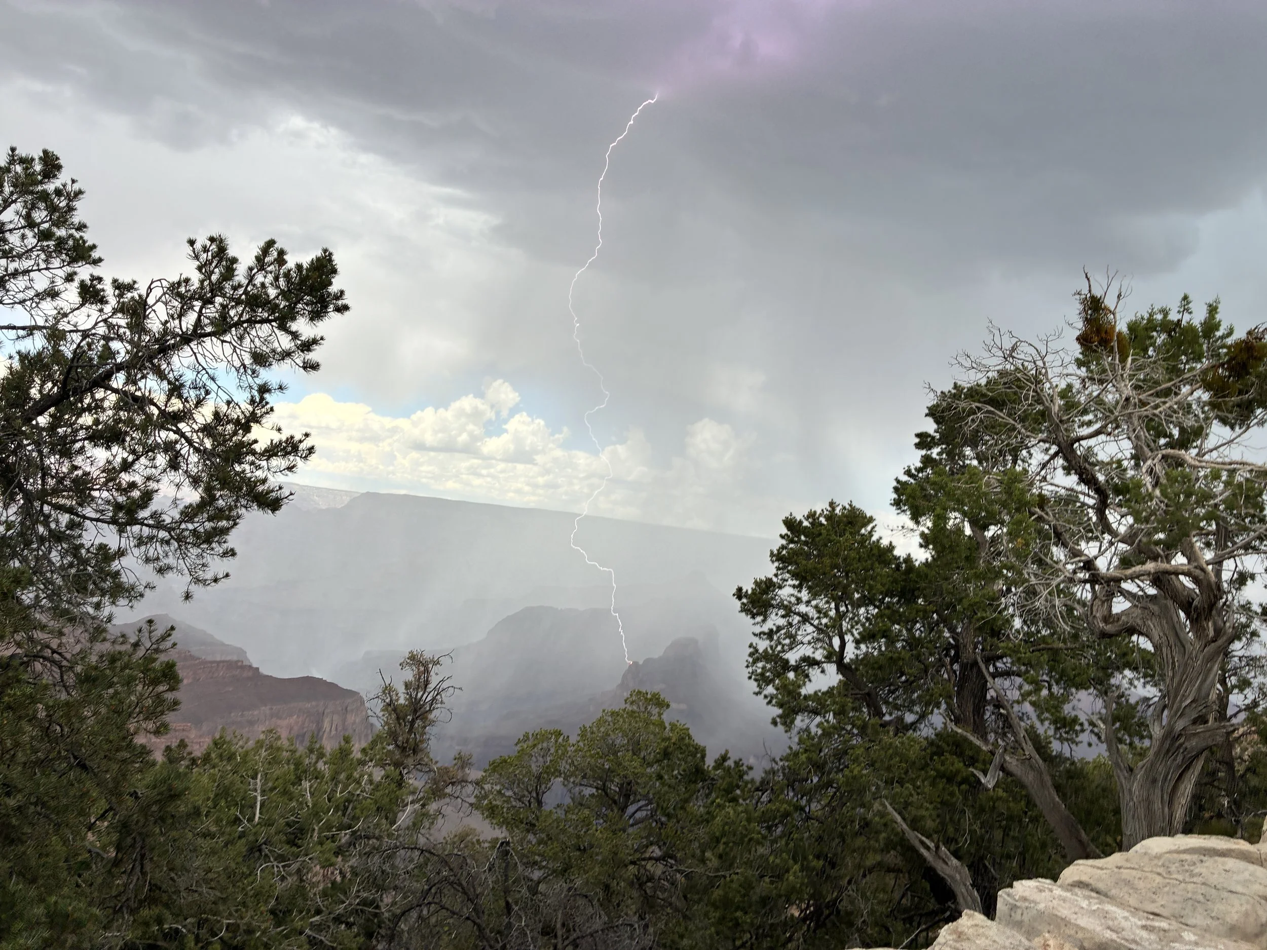
(June 2026) Watching a storm roll over the Grand Canyon at Hermits Rest
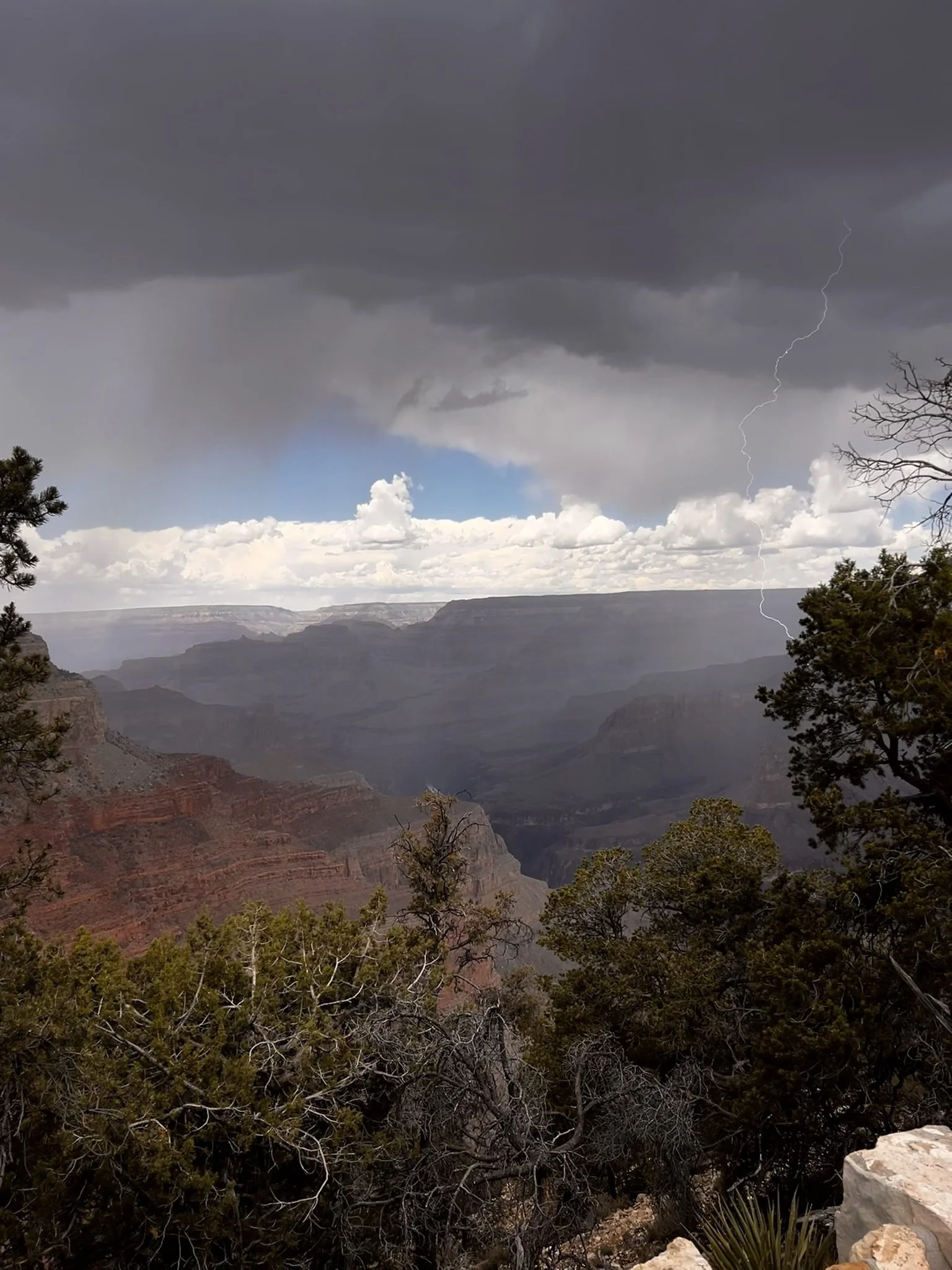
(June 2026) Hermits Rest
North Rim
If you are looking for a quiet and secluded Grand Canyon vacation, then the North Rim is what you want. While the South Rim typically receives 4.5 - 5 million visitors annually, the North Rim receives about a tenth of the people (400,000 - 500,000). The 2025 fire and 2026 flashflood have made travel to the North Rim even more difficult than normal. Keep watching the National Park website for current status if you are considering planning a trip.
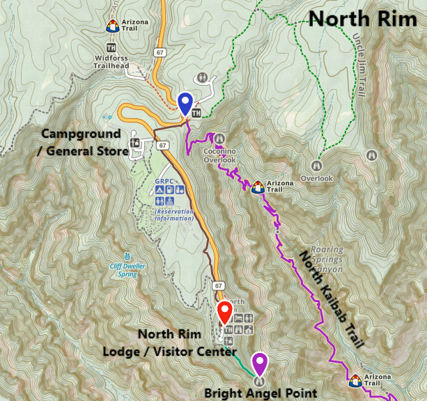
Map of Grand Canyon North Rim
Because there are not near as many visitors on the North Rim, there are no park shuttle services. Most visitors are going to arrive by car or with a tour group, and the North Rim is easy to navigate. If you end up on the North Rim because you hiked from the South Rim, it’s going add another 1.5 miles to the 21.7-mile Rim-to-Rim hike to actually get to where the North Rim views are. You can’t actually see the Grand Canyon from the start of the North Kaibab Trail.
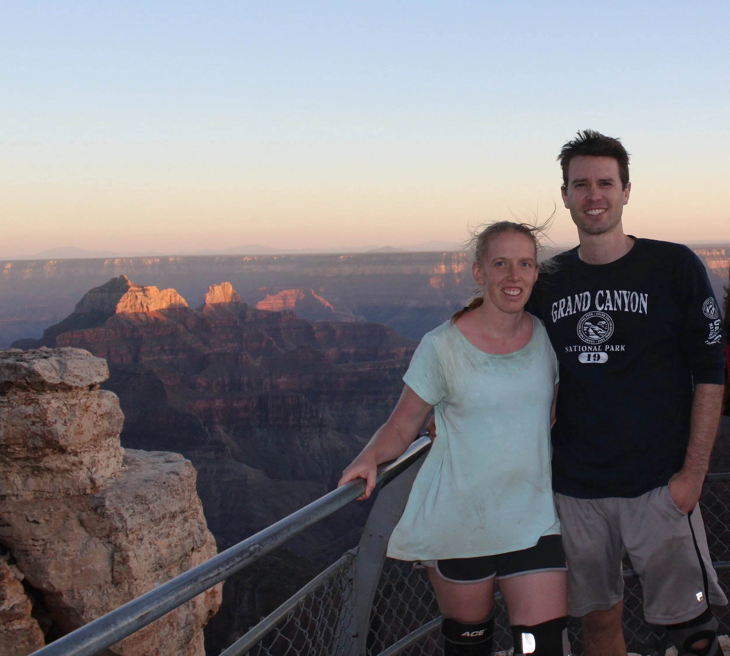
(June 2016) Checking out the view from the North Rim before taking showers and enjoying our night at the Lodge.
18 - Bright Angel Point / Bridle Trail
Our favorite viewpoint on the North Rim is Bright Angel Point, a short and flat 1-mile out-and-back hike. The other fantastic trail is Bridle Trail, which starts from the trail out to Bright Angel Point. It follows rim 0.4 miles (one-way) along the rim. This is an easy and flat trail as well. You can walk back along the road / sidewalks or take the trail back.
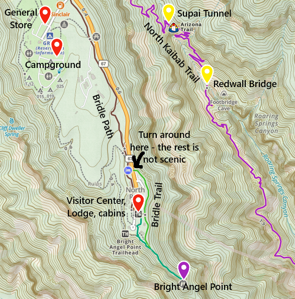
North Rim Hiking Trails to easy viewpoints - Bright Angel Point & Bridle Trail
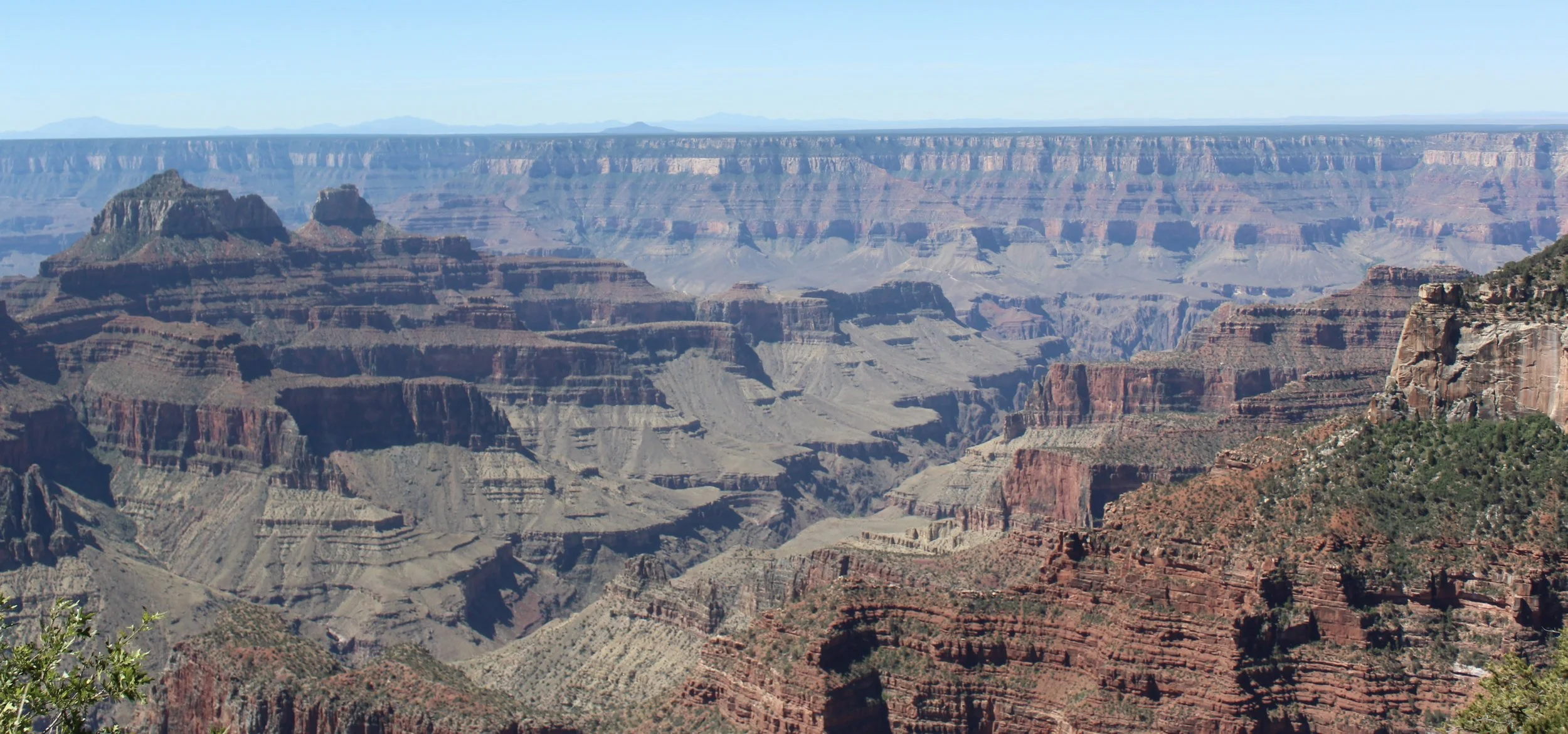
(June 2026) View from Bright Angel Point
I would compare the North Rim to the Rim Trail along Hermits Rest on the South Rim. Both are so quiet. The benefit to the North Rim though is that it remains quiet. Versus on the South Rim, after enjoying a quiet hike, you typically return to Grand Canyon Village and its sea of people.
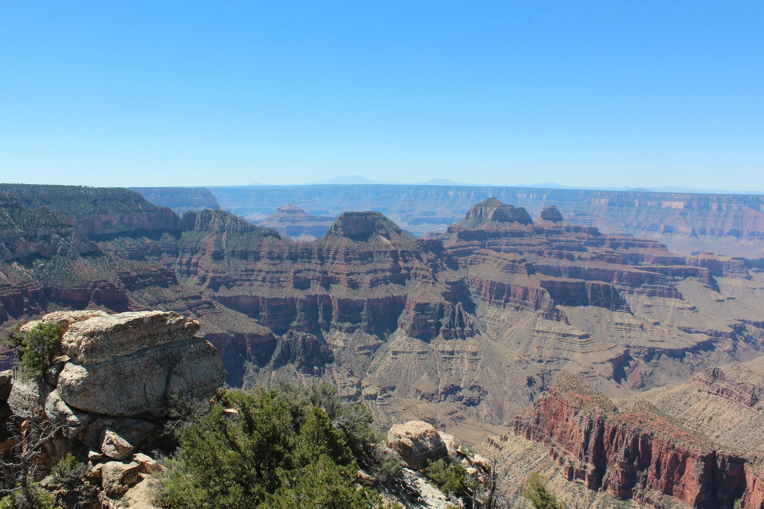
(June 2016) View from Bridle Trail
D - North Rim Visitor Center / Lodge
As I mentioned, there was a Visitor Center and a Lodge, but both burned down in 2025. I’m assuming the National Park Service will rebuild both in approximately the same location.
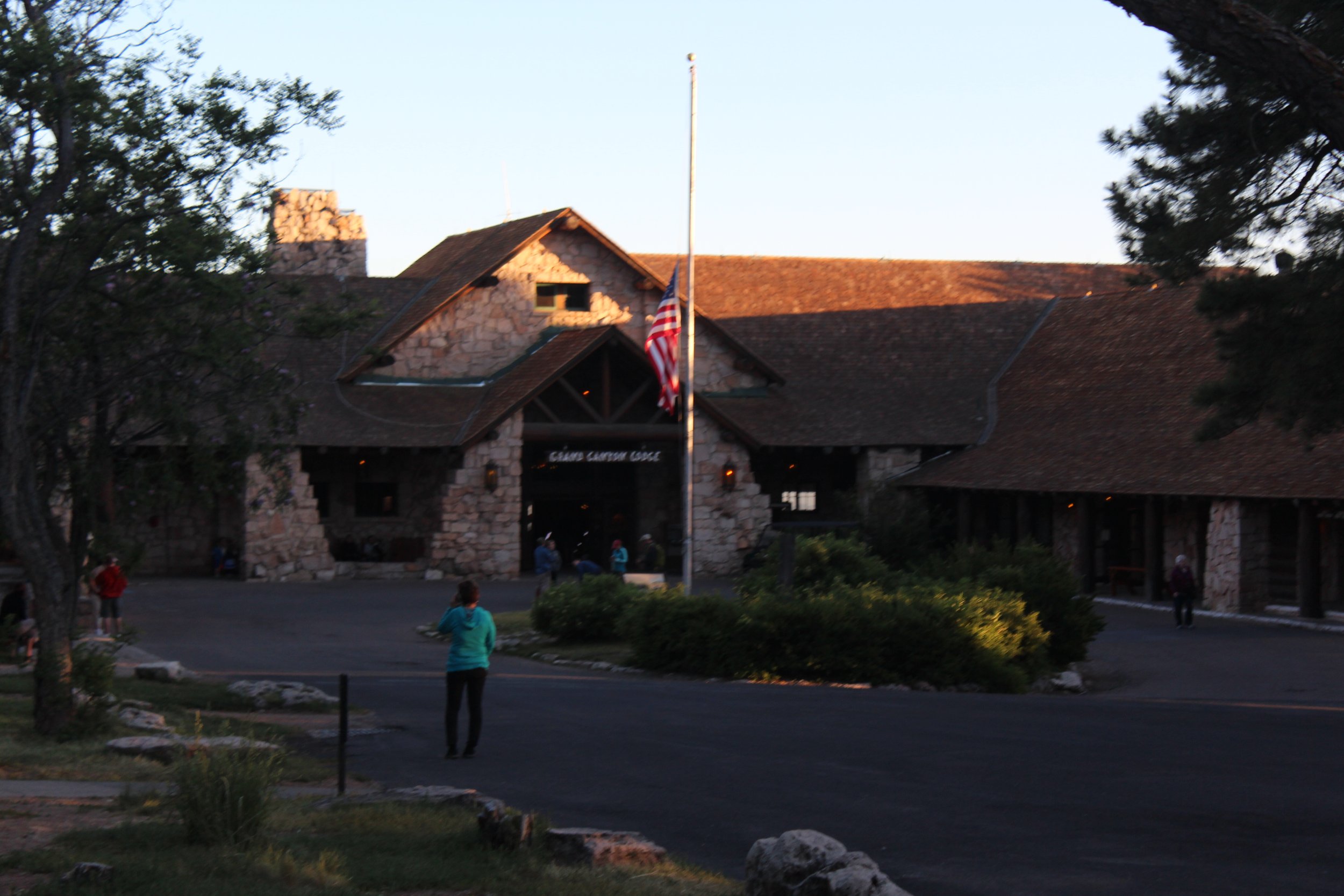
(June 2016) - Grand Canyon Lodge on the North Rim
We stayed in a cabin, but it was a fair walk between our cabin and the Lodge where we ate supper. Our legs hurt so much by this point in the evening (after hiking more than 23 miles), my husband asked the staff at the Lodge if they would be willing to give us a ride back to our cabin after we ate, which they were happy to help us out. This memory still makes me laugh. Something like this just wouldn’t happen on the South Rim. There would be too many people that might want rides…
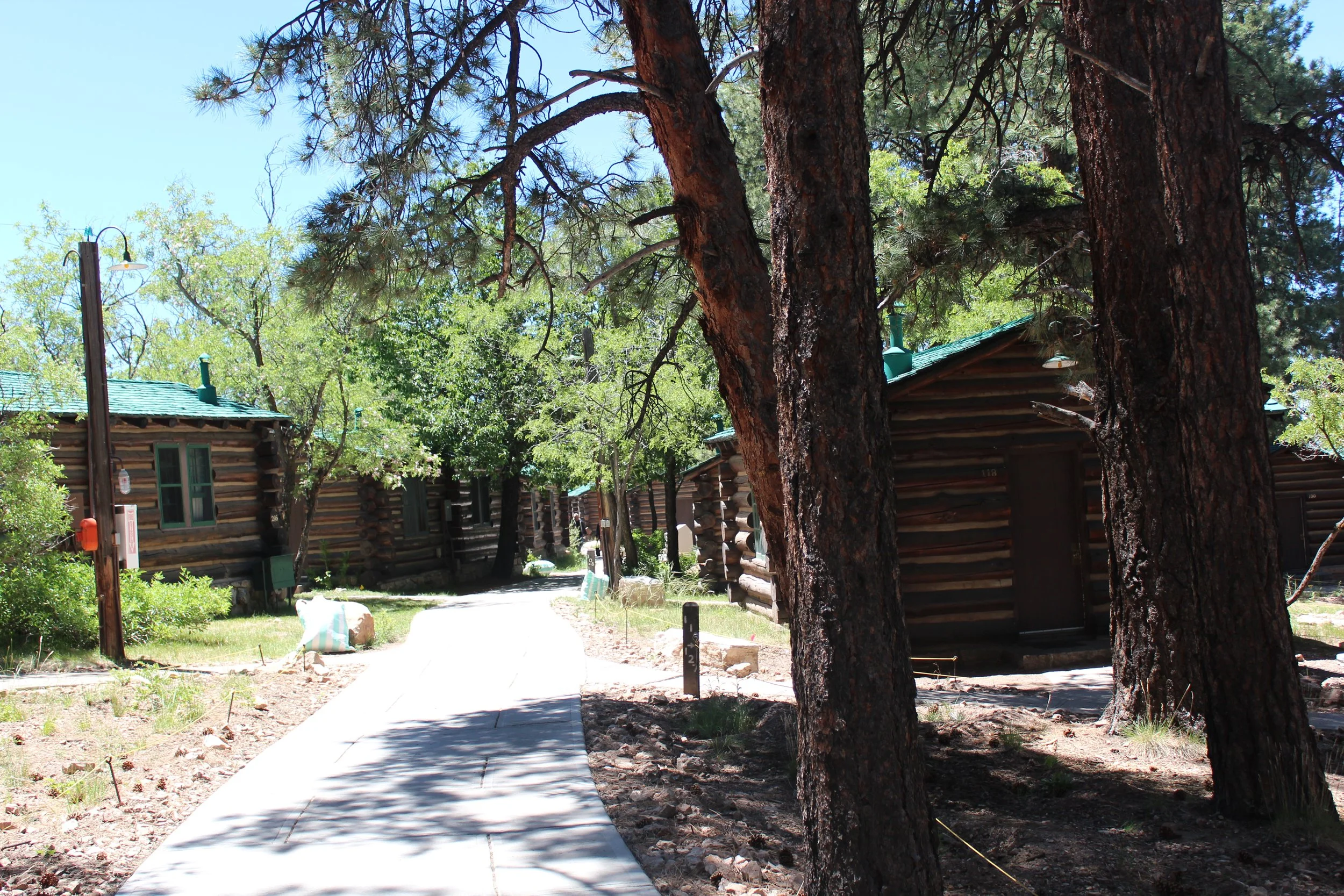
(June 2016) Cabins on the North Rim that were reservable through the Grand Canyon Lodge
19 - North Kaibab Trailhead
The main hiking trail on the North Rim is the North Kaibab Trail. This trail connects at the bottom of the canyon with Bright Angel and Sout Kaibab Trails.
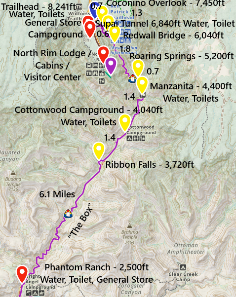
North Kaibab Trail
Because the North Rim starts at over 8,000ft in elevation in a place that gets 12 feet of snow annually, the North Kaibab Trail feels significantly different than the South Kaibab Trail. It starts in a forest of huge pine trees, and it takes a bit of a hike before even being able to see the Grand Canyon. There is a large parking lot at the trailhead.
Just like the South Rim, when hiking the South Kaibab and Bright Angel trails, you need to have a plan hiking down North Kaibab. It will be cool at the top and hiking down is going to be easy. Pay attention to how much elevation you drop (and have to climb back up), the distance that you hike, the time of day you are hiking, and the elevation of your destination. You don’t want to be past 4,000ft between 10am and 4pm, when it can become dangerously hot.
Coconino Overlook - 0.7 Miles / -790ft elevation from trailhead
Coconino Overlook is a great place to turn around. It looks over a beautiful section of the canyon, it’s not too long of a hike, and most of the trail is in the shade due to large pine trees. Getting back to the trailhead is going to take some effort to re-hike the 790ft up, and this section of the trail is steep. And, you’ll likely feel the upper elevation being a little bit harder to breather.
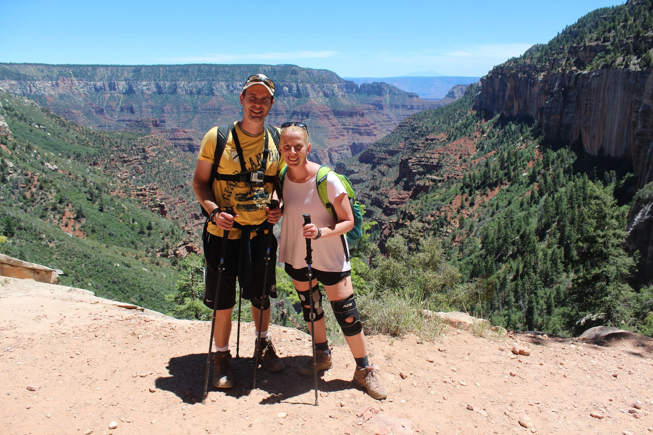
(June 2016) Coconino Overlook on our way back to the South Rim
Supai Tunnel - 2 Miles / -1400ft elevation from trailhead
The Supai Tunnel would be a silly destination for a day hike. It’s a hole in the rock with pit toilets and a place to refill water bottles. The view from Supai Tunnel is essentially the same as Coconino since the trail mainly zigzags in switchbacks overlooking the same section of the canyon. This is very similar to hiking Bright Angel Trail. Now you are 2-miles from the trailhead, and you have to hike up 1400ft. Either plan to keep going or stop and turn around at Coconino Overlook.
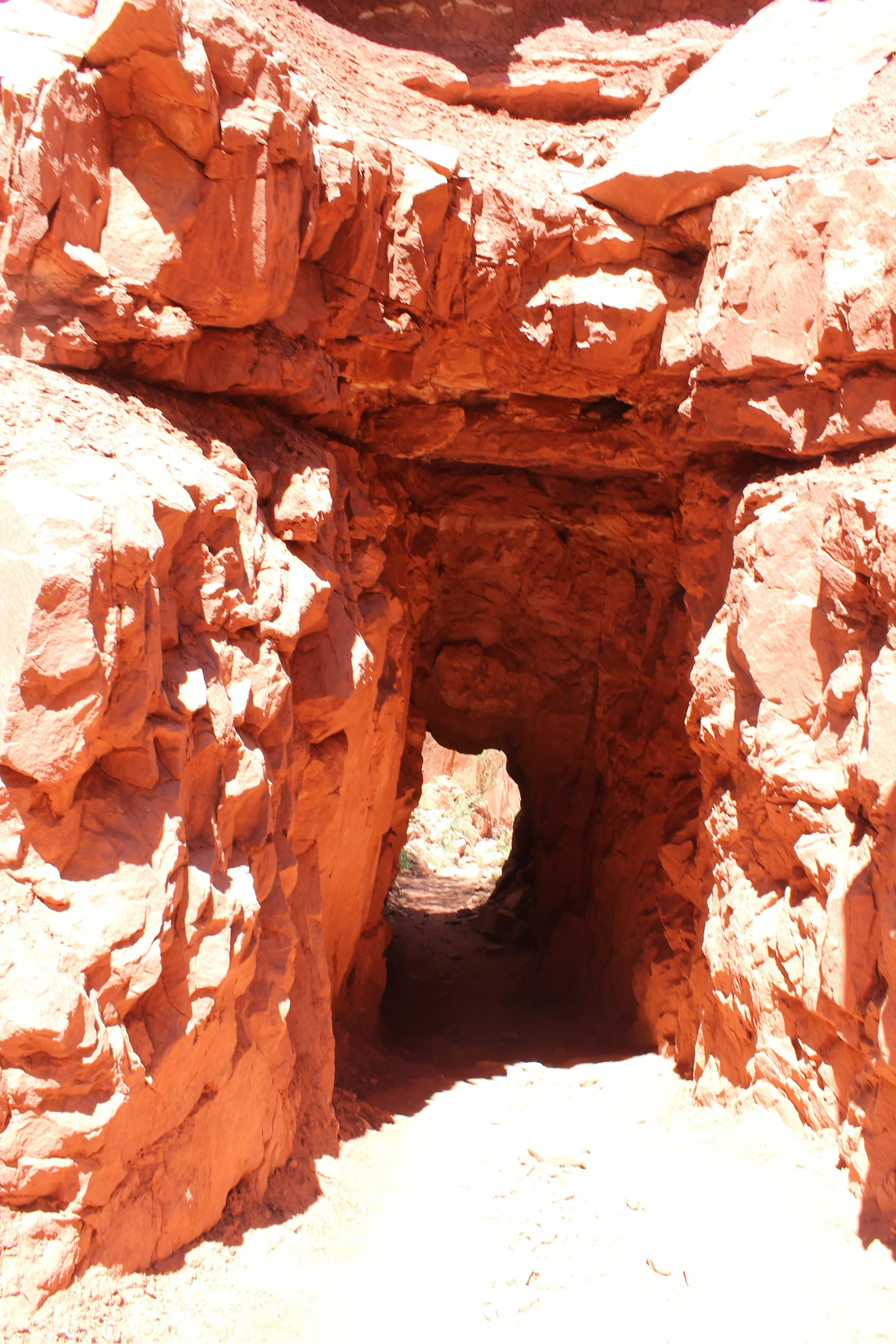
(June 2016) Supai Tunnel
Redwall Bridge - 2.6 Miles / -2200ft elevation from trailhead
Redwall Bridge is pretty cool, if you can handle the 2,200ft in elevation that you need to hike back up. It’s still the same view of the same section of the canyon as Coconino Overlook, but as soon as you cross the bridge the trail changes significantly. This is a great turnaround point. Or hike a little bit further. There are some impressive steep dropoffs between Redwall Bridge and Roaring Springs.
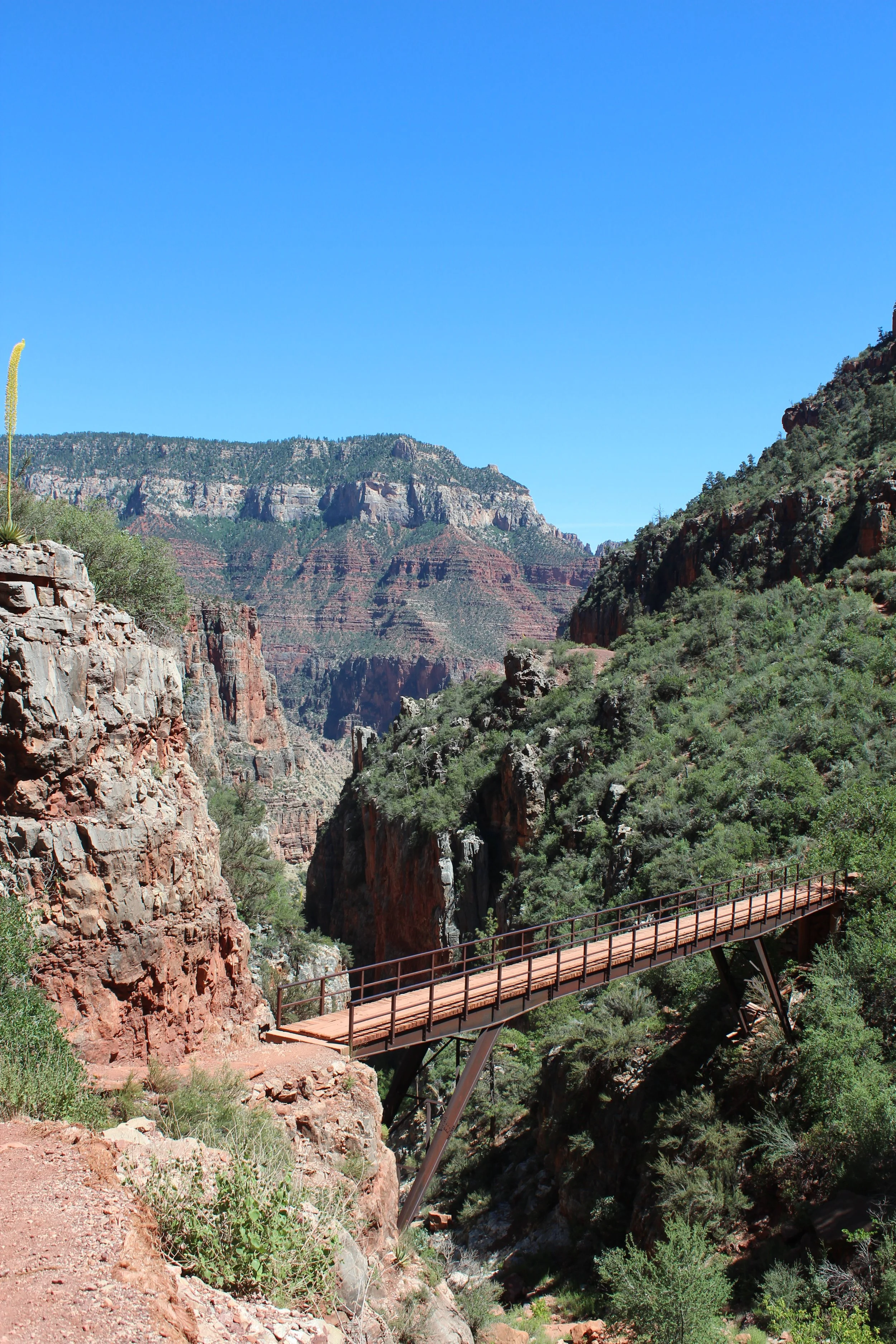
(June 2016) Redwall Bridge
Roaring Springs - 4.4 Miles / -3040ft elevation from trailhead
Roaring Springs is the last place I’d recommend for a day hike. This is going to be an incredibly difficult hike to get back to the trailhead. Roaring Springs is a waterfall that comes out of the canyon wall. It’s quite odd to stare at and realize there must be tunnels through the sandstone walls that the water flows through. The trail doesn’t go next to the waterfall though; you view it from the opposite side of the canyon wall.
The trail between Redwall Bridge and Roaring Springs is quite incredible. I would suggest training for a hike this hard, and have a plan for salty snacks, plenty of water, and first aid, and venture past Redwall Bridge for a bit. Turn around before Roaring Springs.
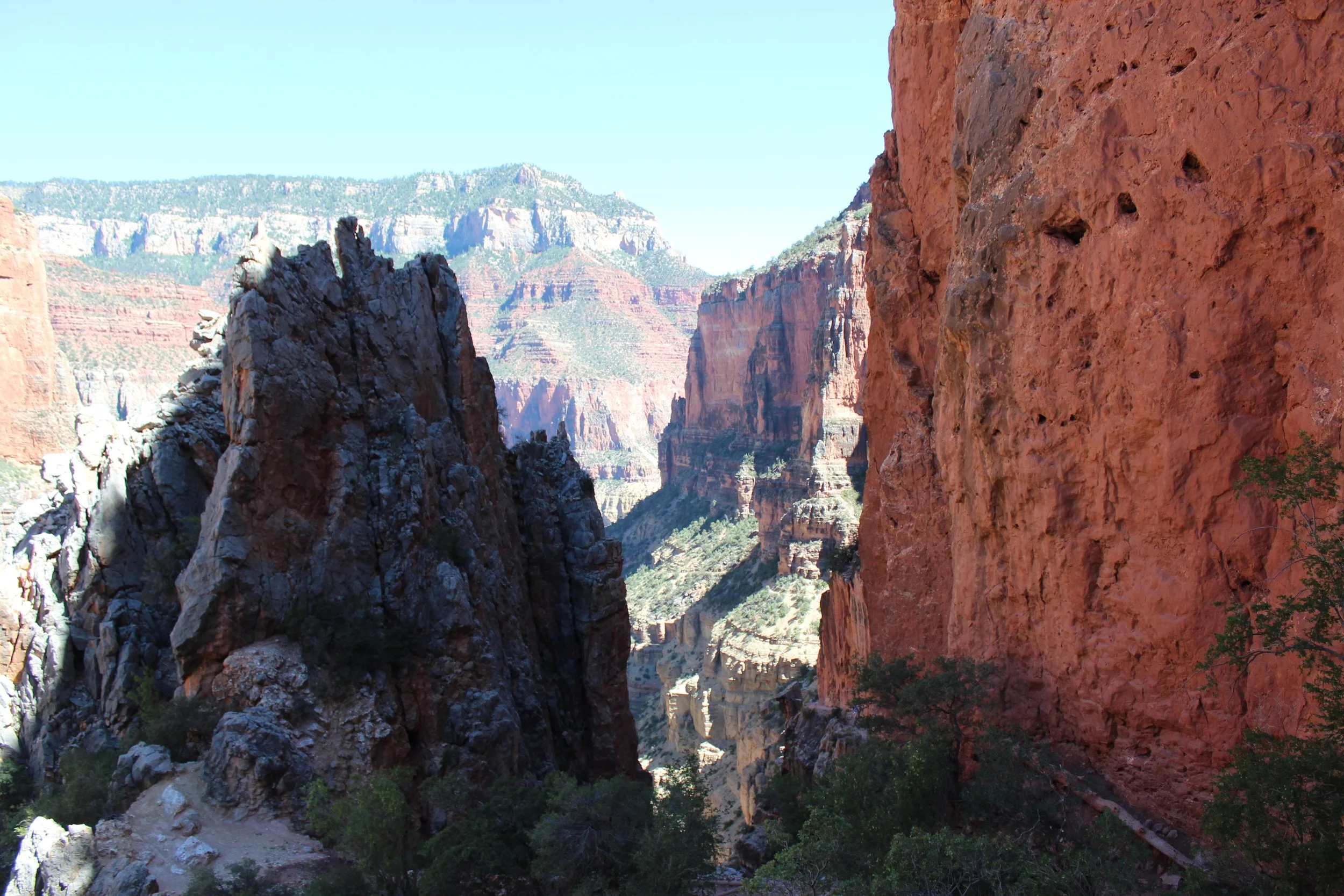
(June 2016) North Kaibab Trail between Redwall Bridge and Roaring Springs
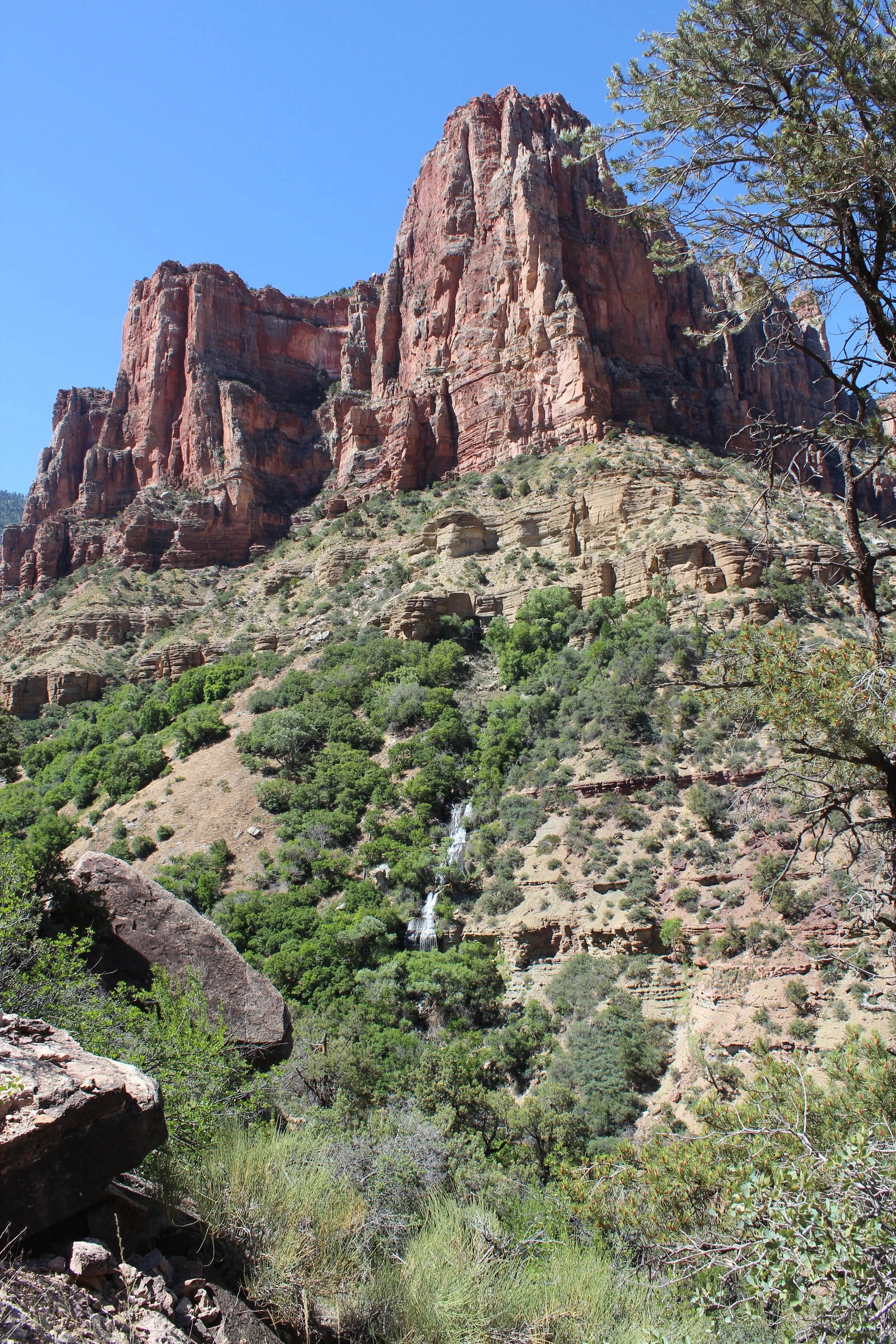
(June 2016) Roaring Springs
Bottom of the Grand Canyon
The hardest place in the Grand Canyon to get to is the bottom, which includes Phantom Ranch. You can’t see Phantom Ranch from either the South or the North Rim. The canyon walls are just to steep in that section. When you are on the South Rim though, really from any location, you’ll look out and see a T-shape in the canyon. The Colorado River flows along the bigger section. Bright Angel Creek flows through the T-intersection. Phantom Ranch is just a little bit upstream Bright Angel Creek from the intersection.
Note that Phantom Ranch is still closed (as of 01Nov2026 at least) due to the destructive flash flood this past August. Check the National Park website for current status.
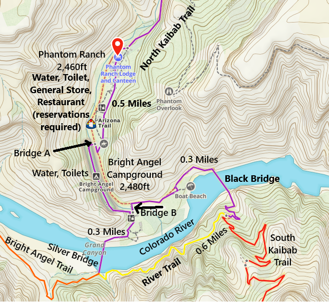
Map of Phantom Ranch and Bright Angel Campground
There are two ways to get to Phantom Ranch - hiking or by riding a mule. My personal opinion - the hike is worth it. Put in the effort to train and prepare. Mule trains are smelly, the mules walk fast, and they walk incredibly close to the edge of the trail - none of which makes for a great day… There are three hiking options - South Kaibab (7.25 miles one-way), Bright Angel (9.5 miles), and North Kaibab (14.3 miles one-way). The hike down won’t be the problem, although knee braces and hiking poles might be helpful on joints when hiking the steep trails. Most likely, your bigger challenge is climbing back up to the top of a mile-deep hole. There are no elevators or hidden roads, and a helicopter rescue isn’t going to be an option simply because you don’t want to hike back up.
We haven’t had a chance yet to spend a night at the bottom. That’s what we’d like to do on our next trip back.
E - Phantom Ranch / Bright Angel Campground
The Bright Angel Creek changes the whole atmosphere of the Grand Canyon. A short distance along the creek, there will be large trees. Turn around and look back up at the walls. This is the bottom. It is so different than either the North or South Rims.
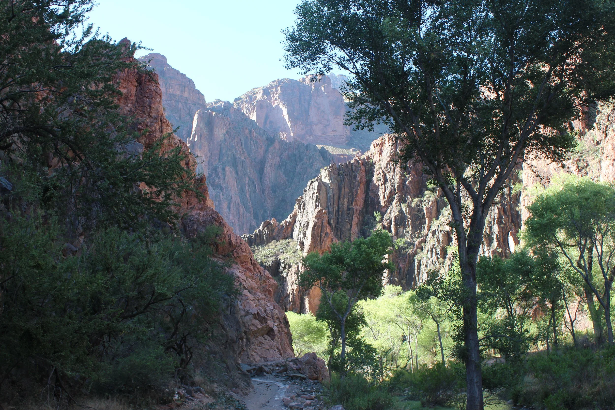
(March 2018) - Along the North Kaibab Trail a short distance from the Black and Silver Bridges.
Phantom Ranch includes a small store that sells lemonade - worthy of a stop. There are cabins to stay in, and the Bright Angel Campground is just across the creek. Phantom Ranch also serves meals, but you have to get a reservation ahead of time.
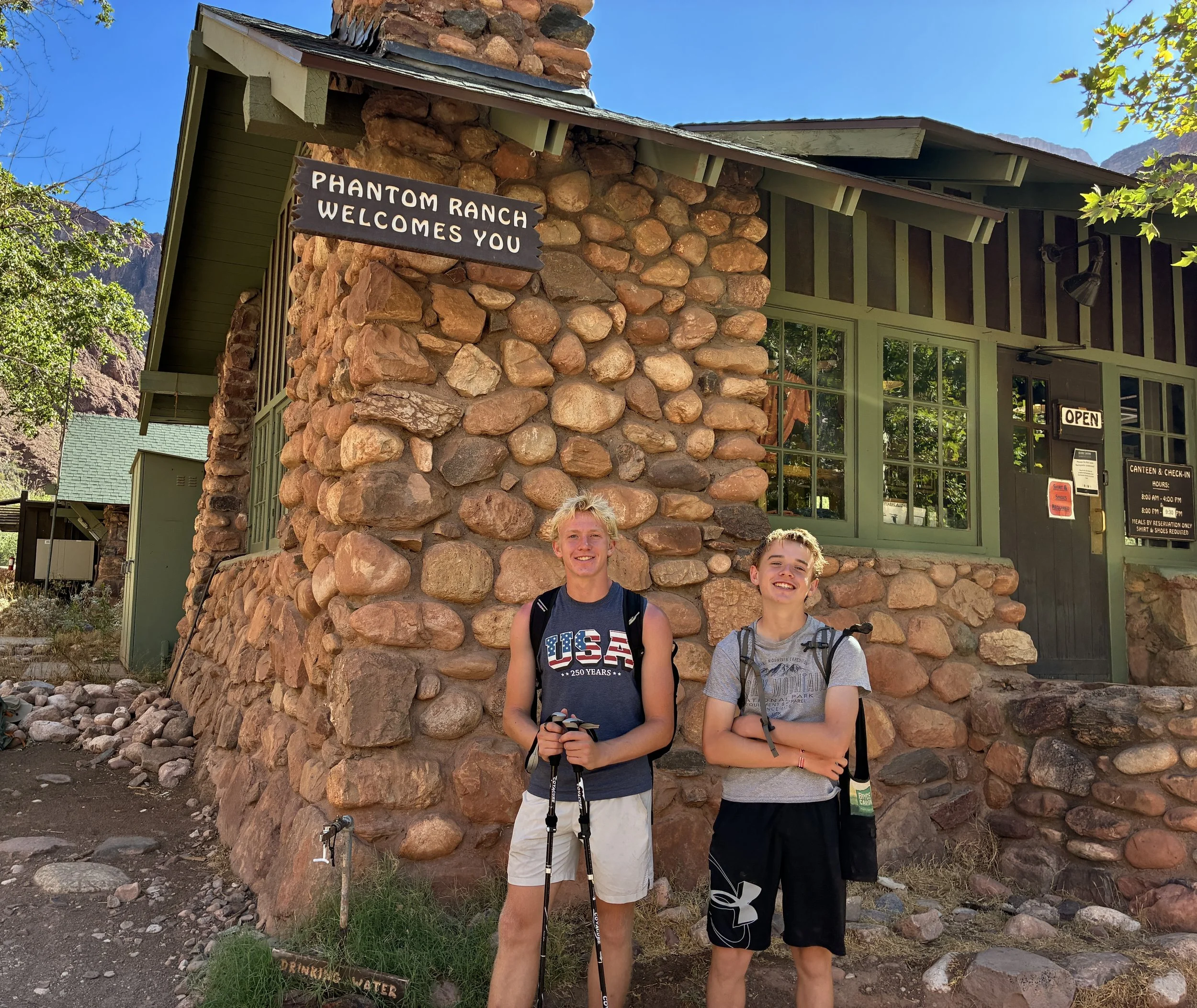
(June 2026) Hiking to Phantom Ranch with our boys.