
Antelope Canyon
If you enjoy my blog, please consider signing up below for email notifications of my latest posts. I will not share your email
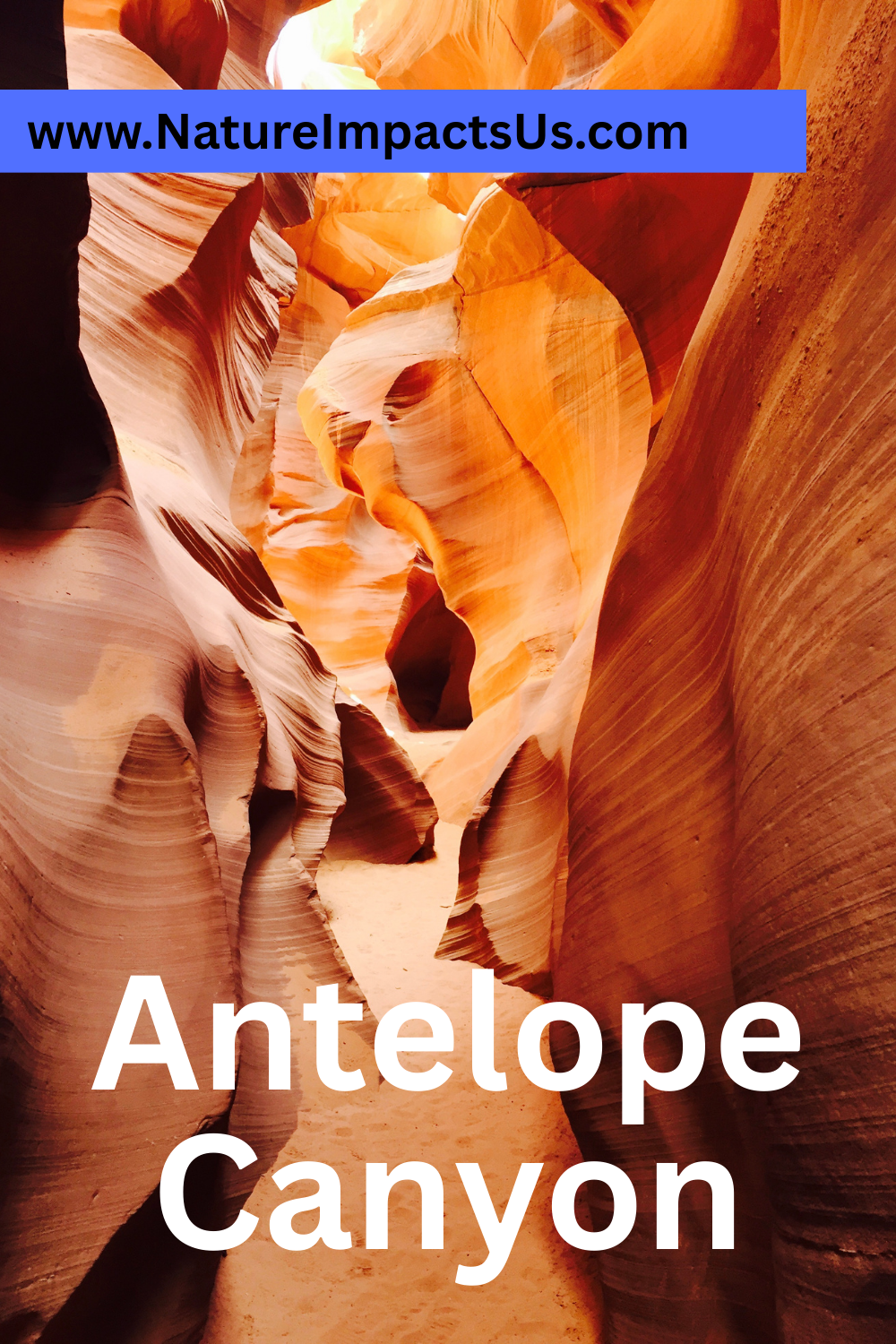
Spectacular, Photogenic Slot Canyon
My love of slot canyons started with Antelope Canyon, which I toured in March 2016. I was on a Spring Break trip with my 7-year-old, a high school exchange student from Sweden, and my parents. We were visiting Sedona, Monument Valley, Arches, Canyonlands, and the Grand Canyon, and I stumbled upon pictures of Antelope Canyon while googling things to do along the way as I researched different driving route options. I honestly hadn’t heard of the term “slot canyon” before. I think I thought Antelope Canyon was the only one. It’s funny to remember this moment, as we’ve hiked so many slot canyons since. Scroll to the bottom of the post for a list of other slot canyons that we’ve explored, most of which are free or just cost the price of park admission.
Antelope Canyon is on Navajo Tribal Lands and therefore requires a ticket for a guided tour, in addition to the park fee. This is not a canyon you can enter on your own. Although there are several other free slot canyons to hike in, Antelope Canyon is still one of the prettiest I’ve been in so far, so I’m going to recommend spending the money. The colors and incredible rock shapes within the canyon will play with your imagination both while you are in the canyon, and when you look at the photos afterwards. The tour guides will help set up your camera settings, so every picture you take will be amazing, and they will take your phone or camera and take pictures of your group for you. There is no extra cost for photos at the end.
Location
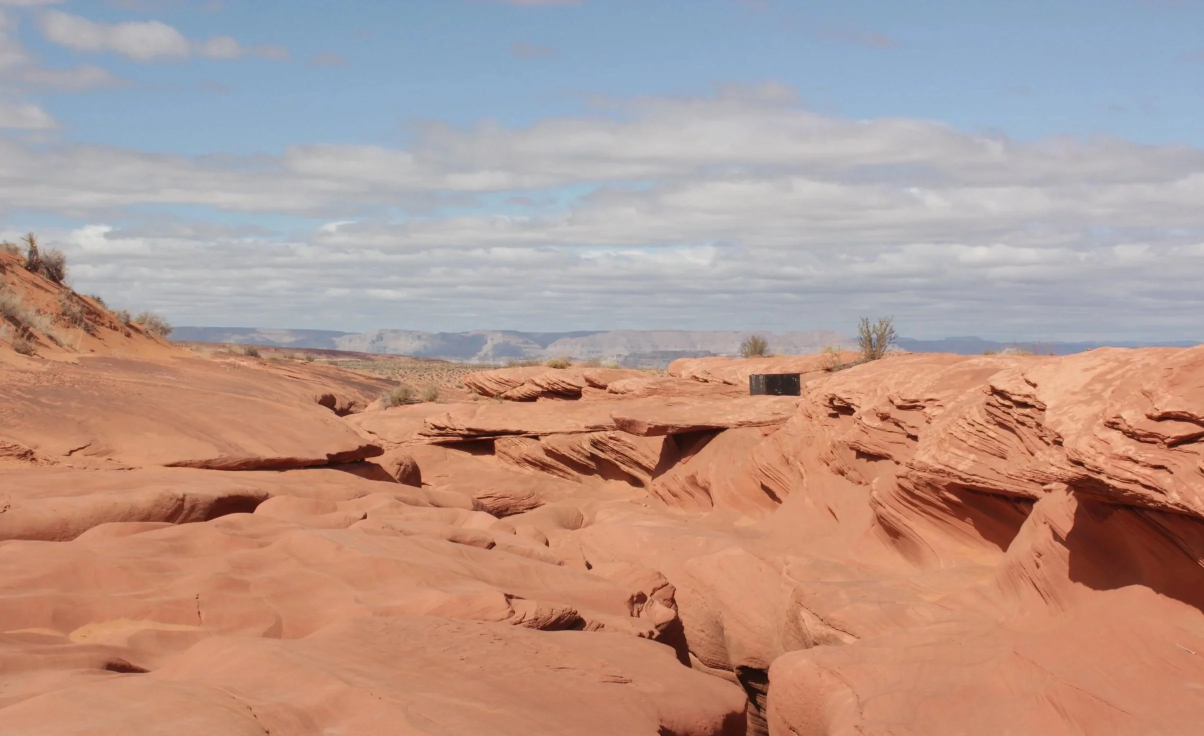
Antelope Canyon is located just to the east of Page, Arizona. There are different starting locations based off of which tour you pick, so pay attention to the information on your ticket. Lower Antelope Canyon tours start within walking distance to the canyon. Upper Antelope Canyon tours start within the city of Page and include a van ride out to the trailhead. There is a third section of Antelope Canyon referred to as “Rattlesnake Canyon”. These tours have a start location off of AZ-98, and also involve a van ride to the trailhead.
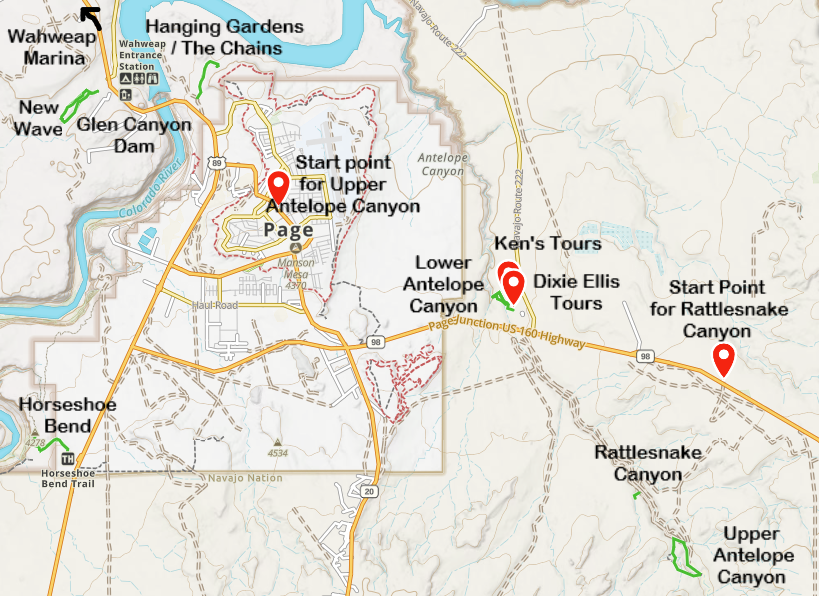
Map of things to do in Page, Arizona, including the tour locations for Antelope Canyon
Tour Options
There are two tour options for Lower Antelope Canyon. Ken’s Tours can be purchased at: https://lowerantelope.com/. Dixie Ellis Tours can be purchased at: https://www.antelope-canyon-tours.com/. The buildings are close to each other, and to get to the canyon from either, it is just a short walk. The tours seem comparable. Both last 45-60 minutes with about a mile of walking. To get in and out of Lower Antelope Canyon, use of steps with railings is required. We booked through Ken’s Tours. Our guide was great!
Tickets for Upper Antelope Canyon can be purchased at: https://www.antelopecanyon.com/. This tour is operated from a building in the main city of Page. This is where you park, and a van takes tourists out to the trailhead. Because of the added van ride, tours last 90 minutes. The walking distance is similar to Lower Antelope Canyon, but the entry in and out of the canyon is from the ground (no stairs required). The walk outside of the canyon after the tour is longer though and involves walking up a hill.
Tickets for Rattlesnake Canyon can be purchased at: Rattlesnake Canyon Tour - Adventurous Antelope Canyon Tours. This tour is operated from a building just east of the Lower Antelope Canyon entrance, along AZ-98. This tour also involves the use of a van to get to the trailhead. There are ladders required along this tour. I can’t find any information on their website indicating how long the hike through Rattlesnake Canyon is.
Helpful Logistics
1) Ticket cost may or may not include the $8 / person park fee. Tipping for tour guides is also expected.
2) Reserve your tour ahead of time. This is an extremely popular canyon, and the tour sizes are small.
3) Pay attention to the time. Page is in Arizona, and Arizona does not have Daylight Saving Time. This practically means that March-ish through Nov-ish (dates depending on the year), the time is going to be different between Utah and Arizona, even though they are both in the Mountain Time Zone. Page is on the northern edge of Arizona, so it’s possible you might be arriving from Utah. Note the potential time change so you don’t miss your scheduled tour.
4) As mentioned above, the tours may involve steps, ladders, and/or hiking uphill after exiting the canyon. Doublecheck the websites or call to ensure the tour you pick meets your needs. The hike proceeds in one direction through the canyon, as multiple tours operate at once. This involves a different route to return to the building or van location. If you are visiting in a summer month, remember that you are in a desert and it’s going to be hot and dry. Bring water with you to drink.
5) The most dangerous aspect of hiking through a slot canyon is a flash flood. Rainwater from the watershed is going to end up in the slot canyon, so it multiplies in volume rather quickly. The tours should be monitoring the weather to prevent hiking in the slot canyon when there is a threat of a flashflood. If your tour is cancelled due to the potential of a flash flood, plan another trip. There are so many fun things to do in the southwestern part of the United States, it’s worth that return trip. Try not to be too frustrated. Your safety is more important than a photo.
In 1997, eleven tourists died in a flash flood in Antelope Canyon. In response to these deaths, Antelope Canyon was turned into a Tribal Park, which established the tour guide requirement.
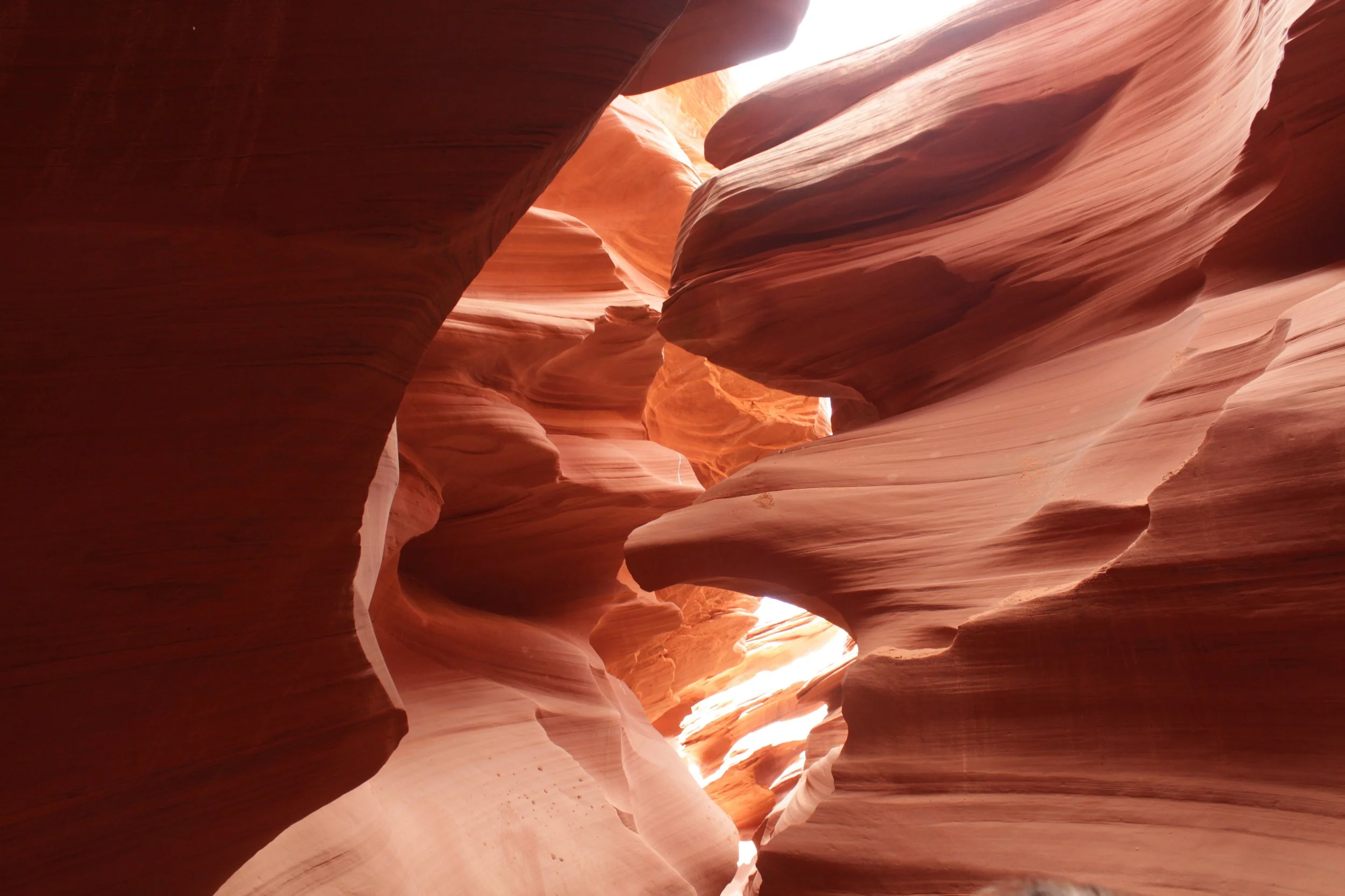
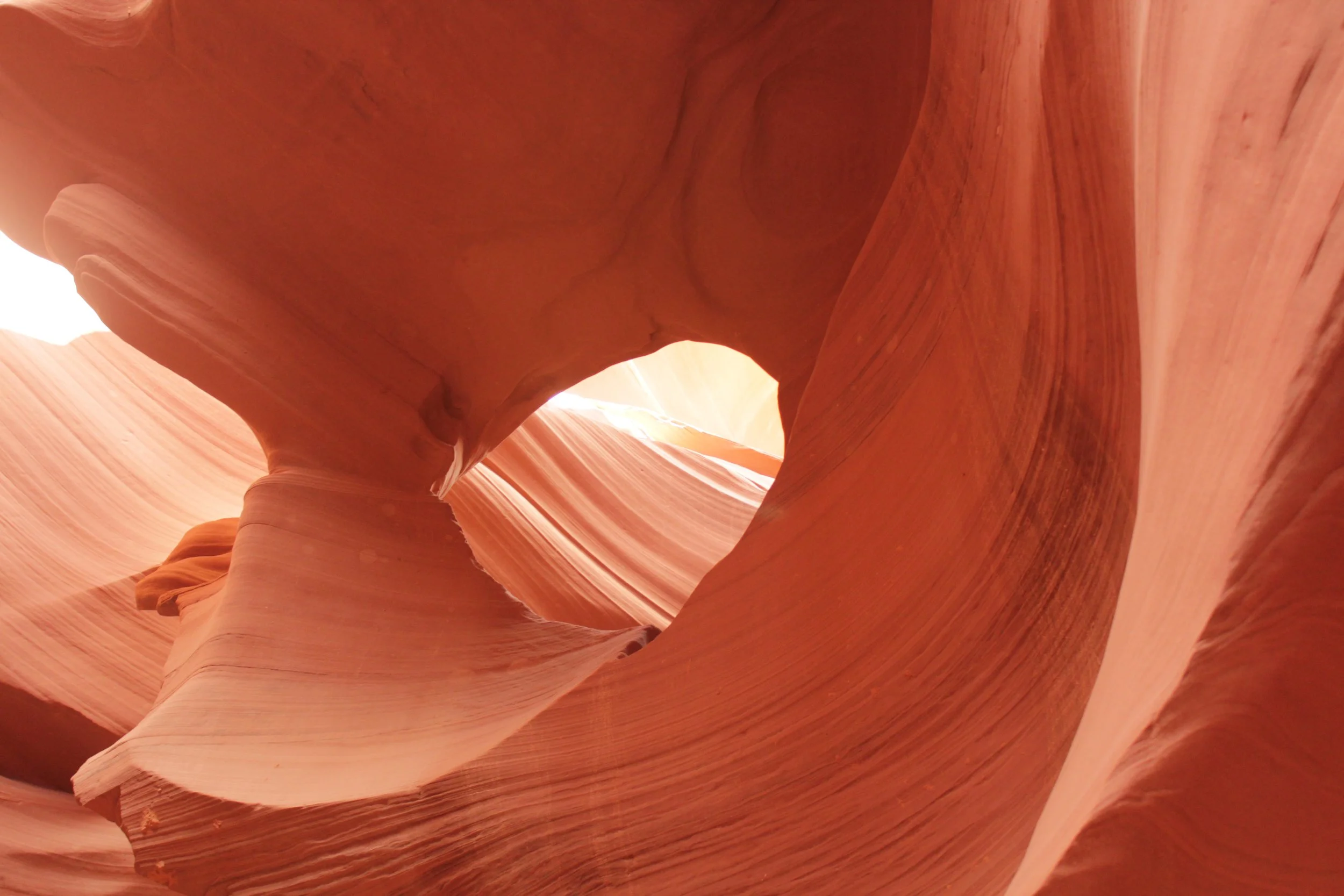
Inside Antelope Canyon
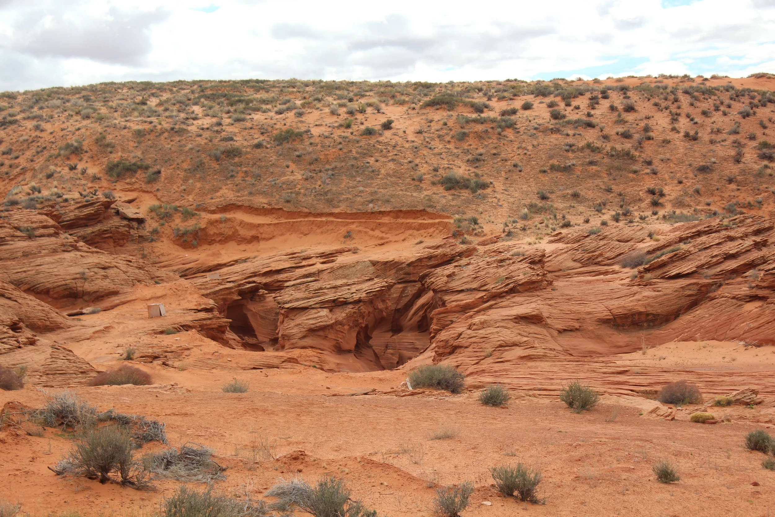
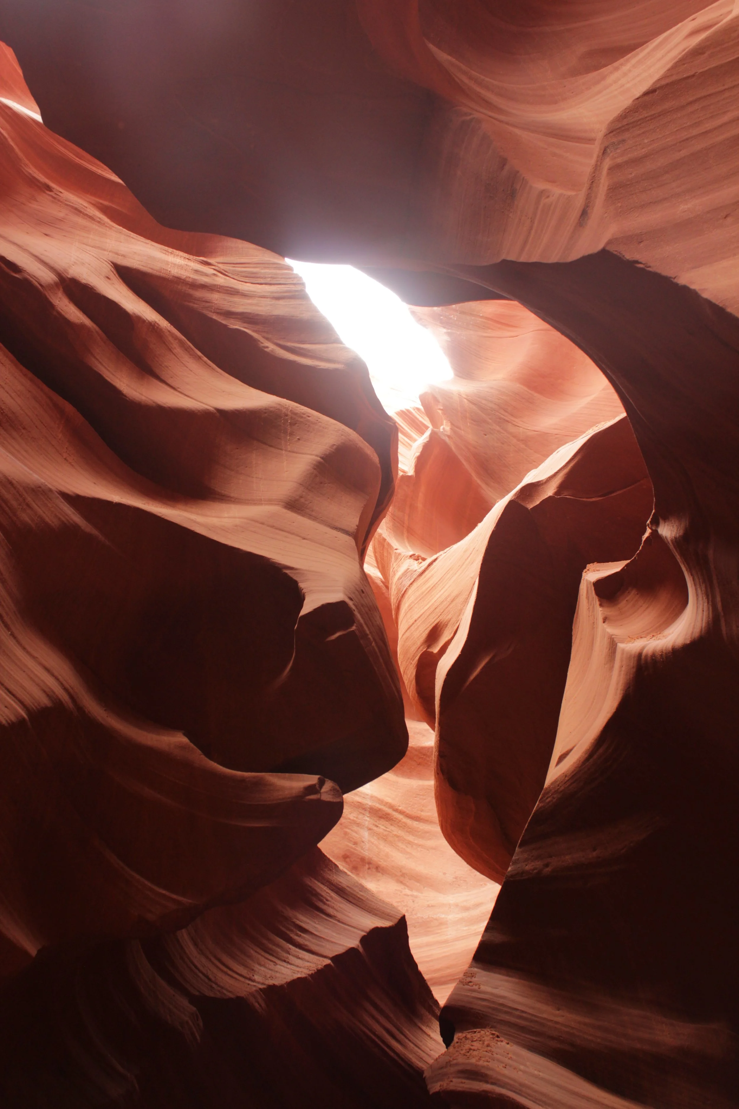
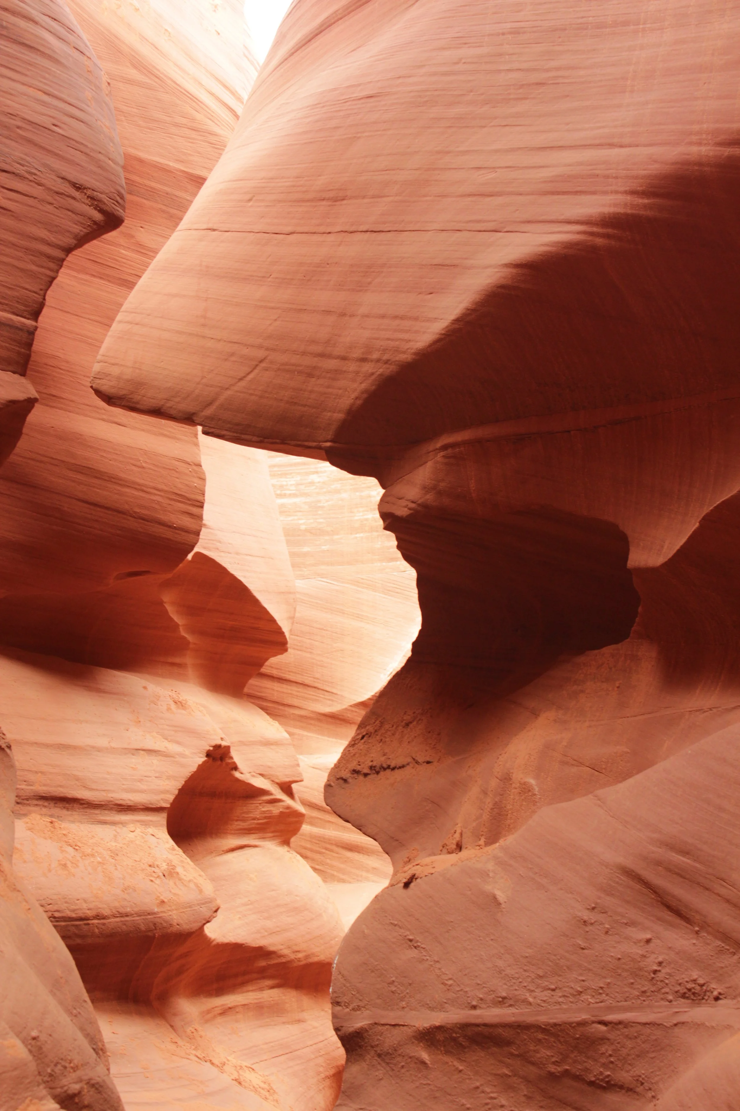
Looking at these photos again as I build this post - I remember just how excited I was to enter my first slot canyon. Can you see the canyon yet in the photo below? It’s there.
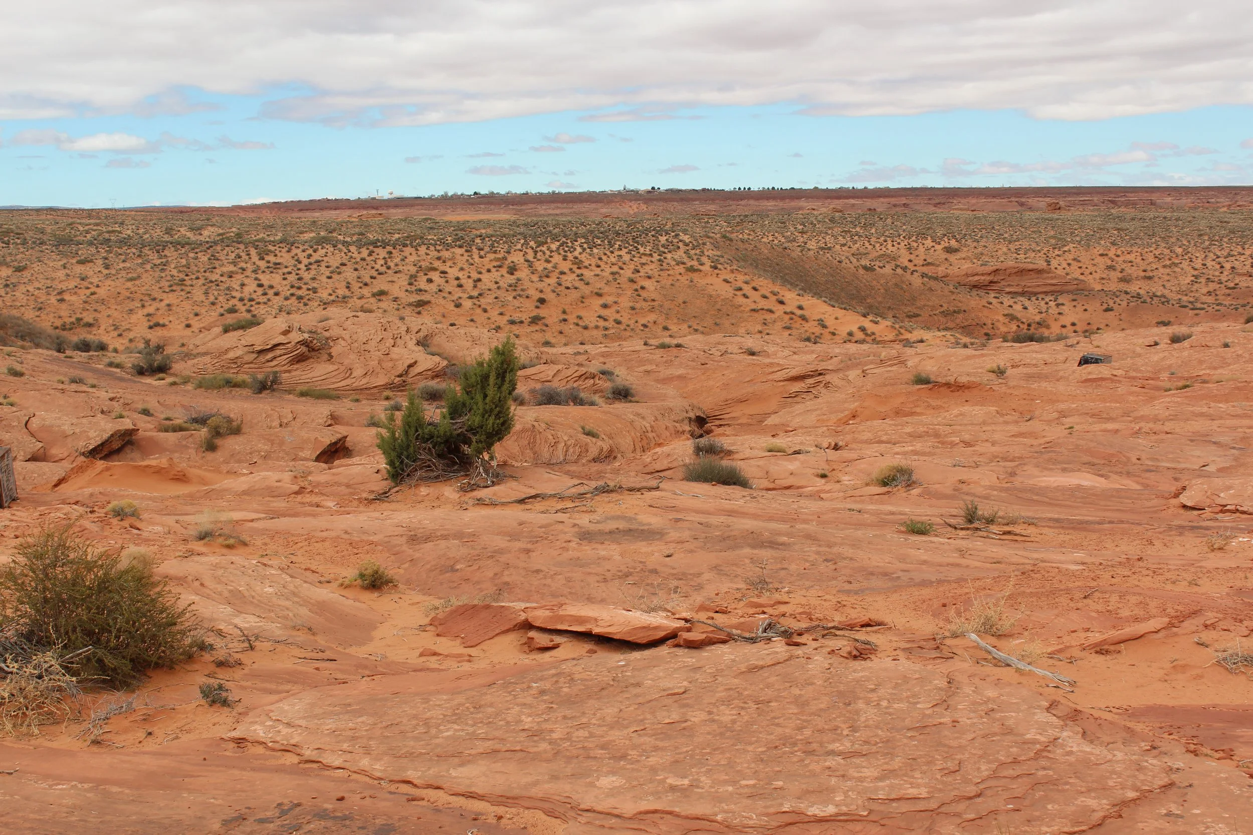
First view of Antelope Canyon - It doesn’t even look like there is a canyon…
The slot canyon walls are so tight together that the cracks in the rock are tough to pick out, even though the canyon itself is quite deep (120ft at points).
Hiking out to the entry point of Lower Antelope Canyon
There are sturdy steps with railings to use while descending into Lower Antelope Canyon. By this point in the journey, the slot canyon is apparent, but underwhelming. Give it about 30 more seconds into the hike.
Descending into the entrance to Lower Antelope Canyon
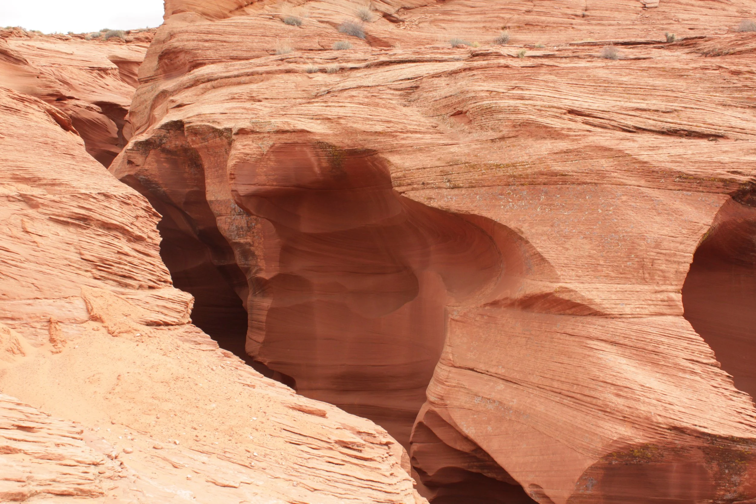
The picture below is from the bottom of the canyon we just walked into, looking up. The staircase we just walked down is just slightly visible.
Entrance into Lower Antelope Canyon is by way of a sturdy staircase with railings
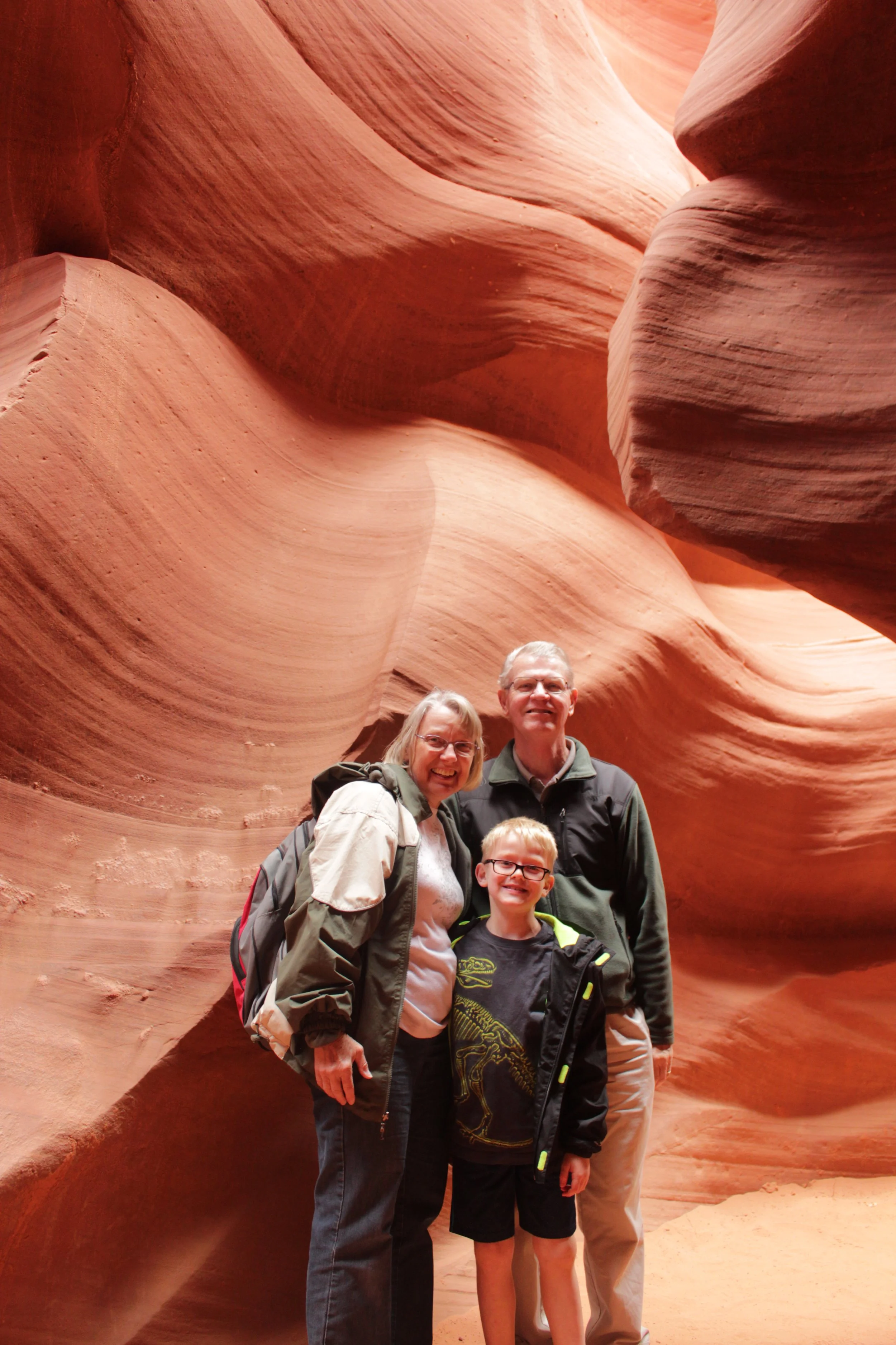
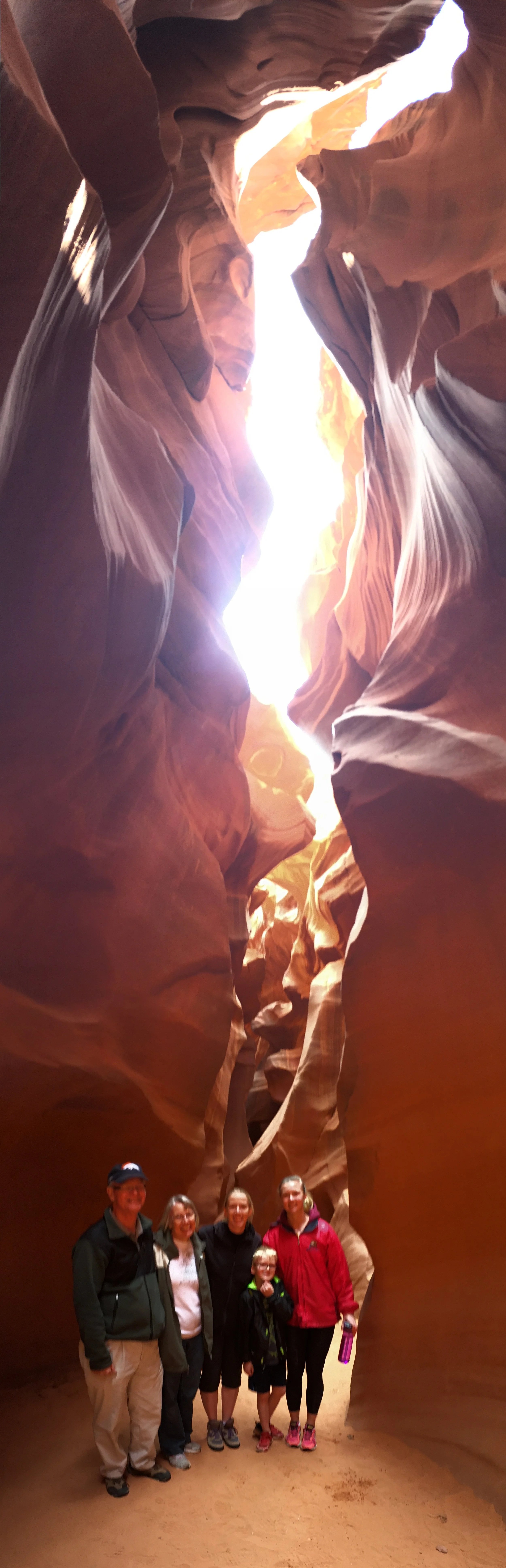
Every one of our group pictures was taken by our tour guide. The first thing he did as we entered into the canyon was take our cameras / phones and adjust the settings for us. Then he took group shots. We could explore a few steps into the canyon while we waited for everyone else. Every angle you stare at this canyon from is incredible. A few steps at a time are all you need.
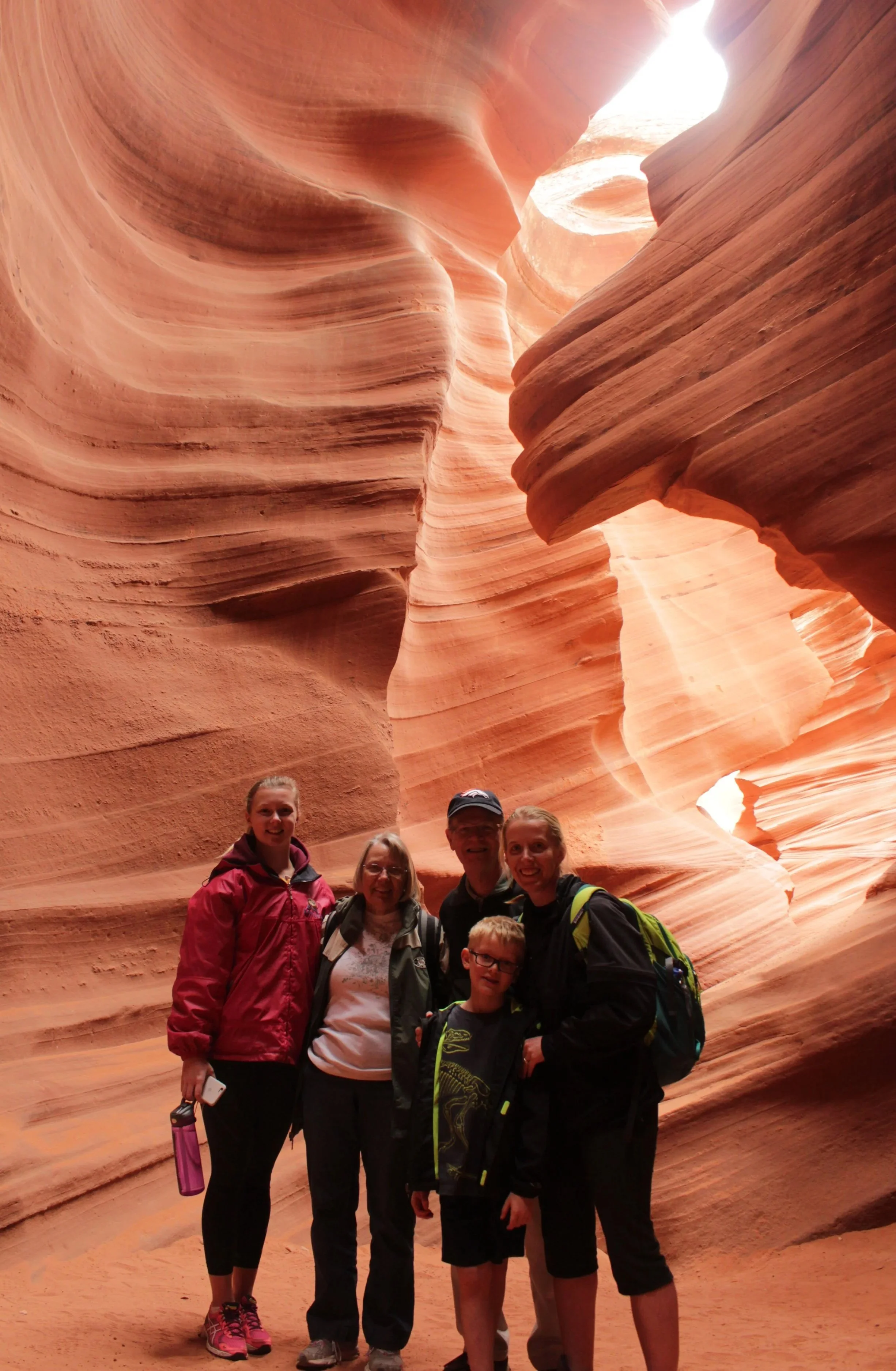
March 2016 - Family photo after we all got to the bottom of Antelope Canyon
Even though the website says 45 - 60 minutes, by my camera time stamps, we were in Antelope Canyon for almost 80 minutes. We walked slow and took tons of pictures. Our tour guide spent time talking about the local tribe history as well as the geology of the canyon. The tickets are pricey, but I felt it was well worth the money.
Lower Antelope Canyon on Ken’s Tours
Exploring Lower Antelope Canyon
With the exception of needing to enter / exit the canyon using steps, this is an extremely easy slot canyon. It’s narrow, but there are no real places where you need to squeeze or angle your body in a weird way to fit through. There are no places you need to duck. No places you need to scale up or scamper down. It’s just flat and sandy. This is a great place to try a first hike through a slot canyon.
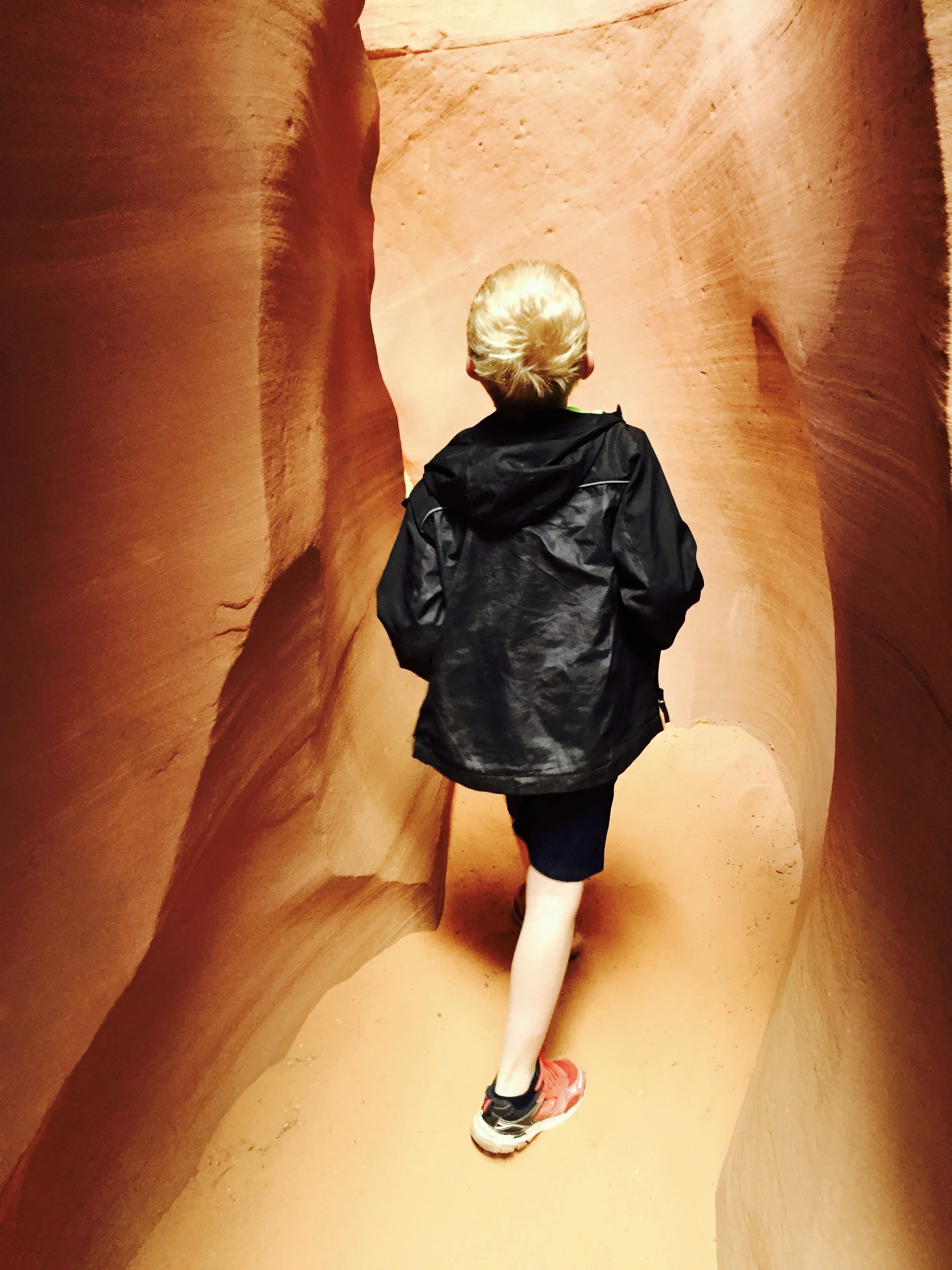
Proudly hiking through his first slot canyon - being small makes this even easier!
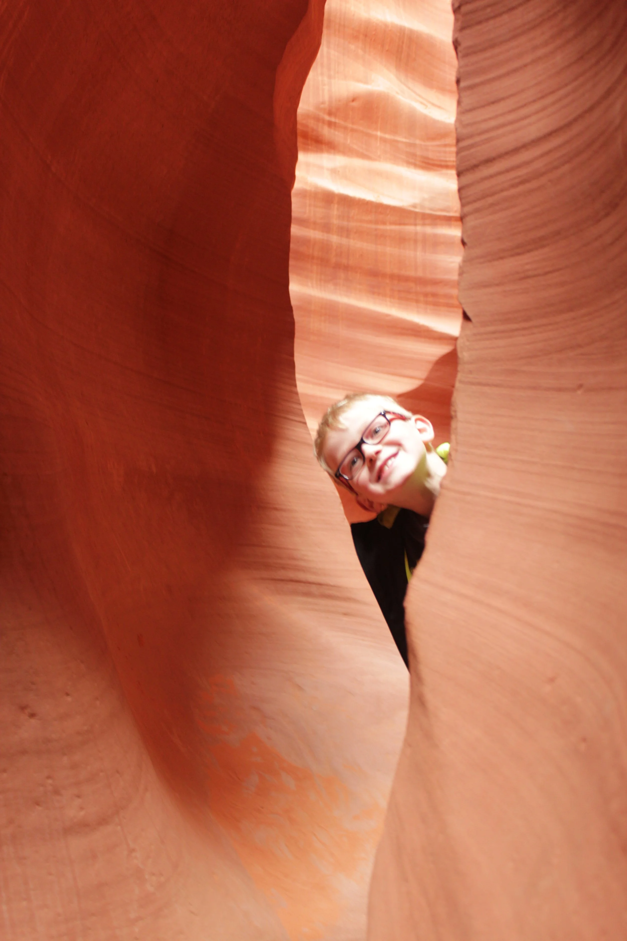
Antelope Canyon - there are lots of spaces in the canyon to play “Peek-a-boo”
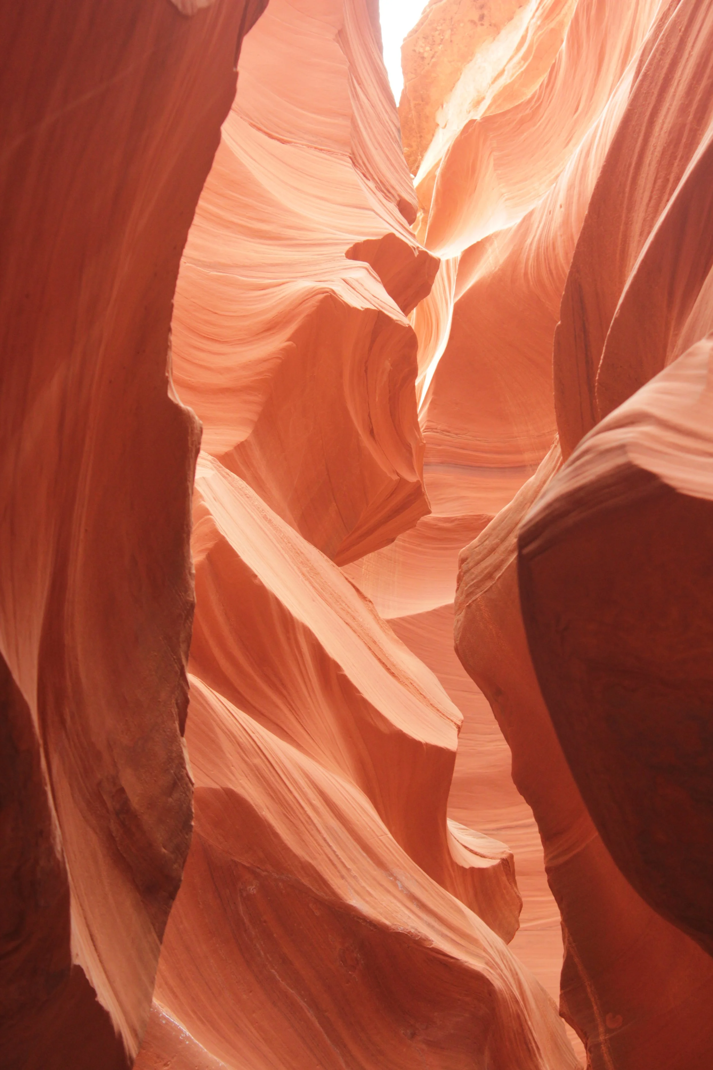
Each slot canyon is different - different colors, different shapes, different depths, different difficulties. But there are some similarities as well. There may be straight walls for short sections, but it doesn’t seem like slot canyons often form with water that flows straight. This curvy pathway is pretty common. The walls are typically made of Navajo Sandstone, so they feel similar, and have the layered-rock appearance due to how the rock was formed prior to being carved out into a canyon. And the floors are often made of sand (or mud if there is water in the canyon).
Lower Antelope Canyon
Touring Antelope Canyon was probably the highlight of this Spring Break trip, for all of us, regardless of age. It’s an easy hike to one of the most beautiful spaces I’ve ever been. A perfect multi-generation activity.
March 2016 - Hiking through Antelope Canyon with his grandparents
Hiking through one little arch section in Lower Antelope Canyon
The walls of this canyon are high, so I don’t have too many with the ground and the sky together in the same image. This shows the super sandy floor of Antelope Canyon.
Hiking into Antelope Canyon
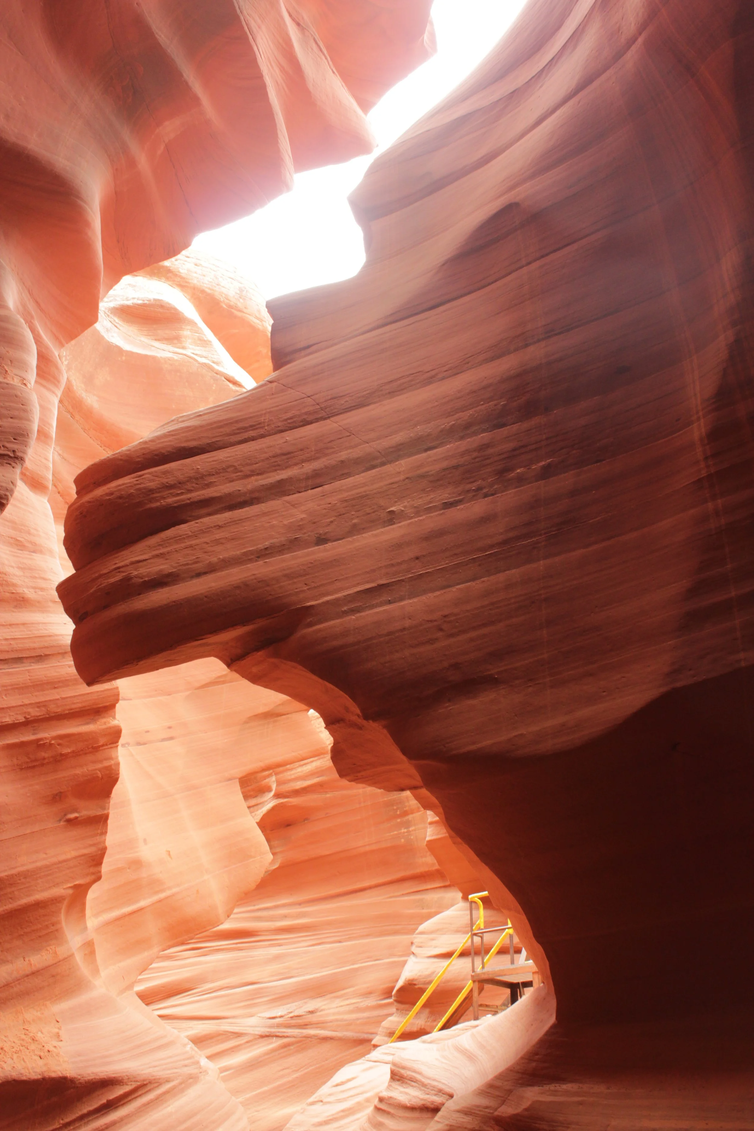
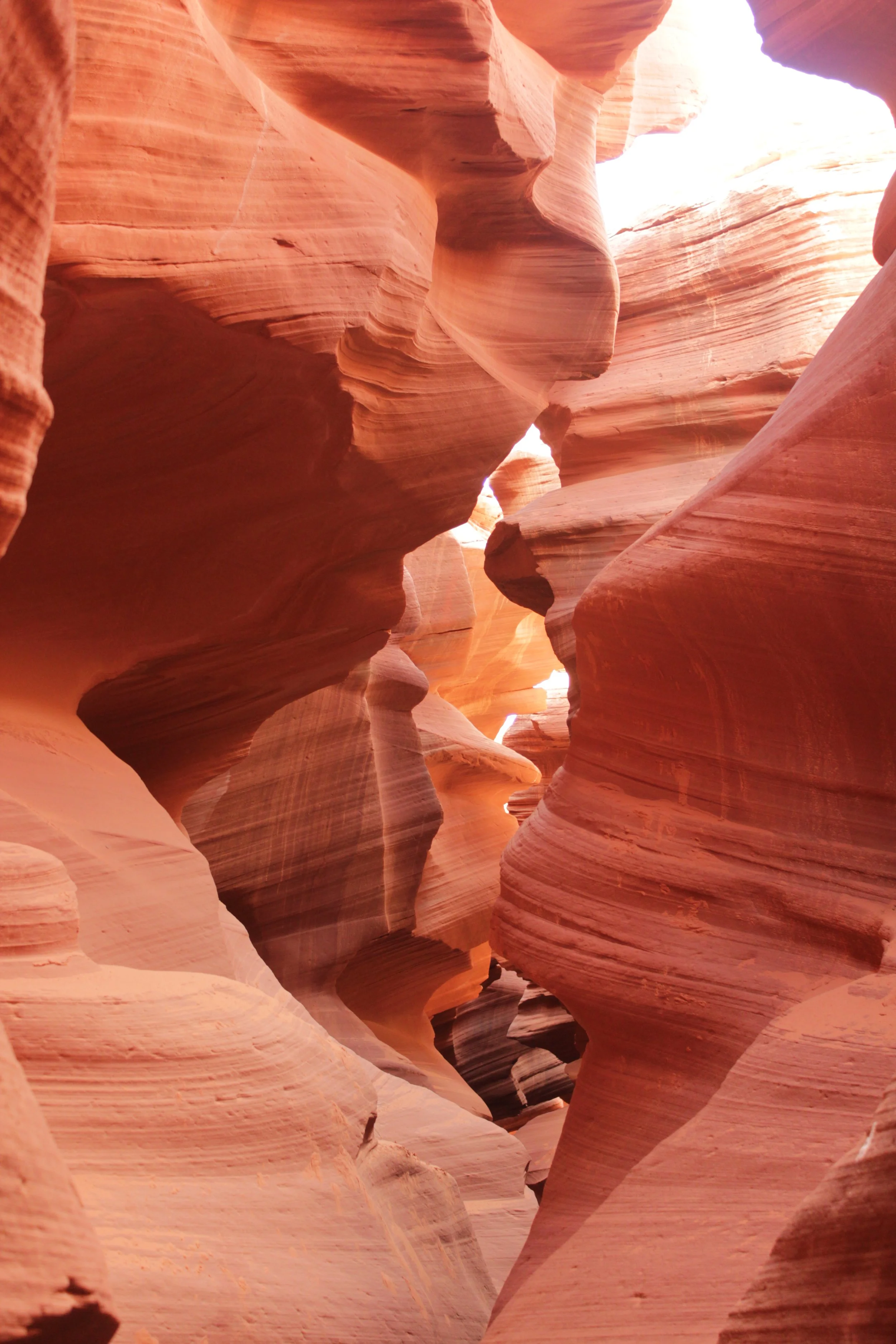
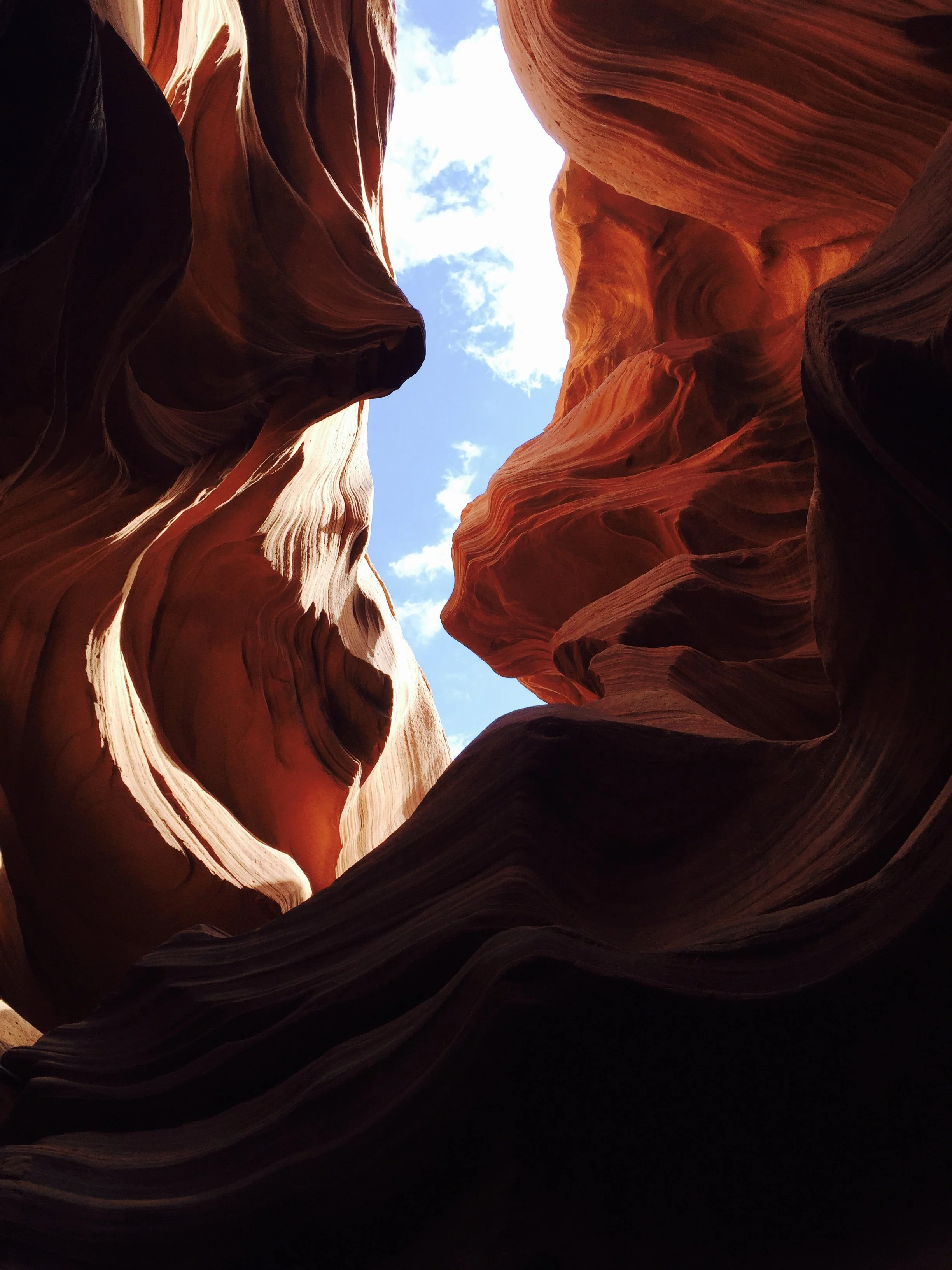
It was wonderful that we had so much time on our tour of Antelope Canyon. Looking up was just as cool as looking down. There are holes and arches in the wall throughout the canyon.
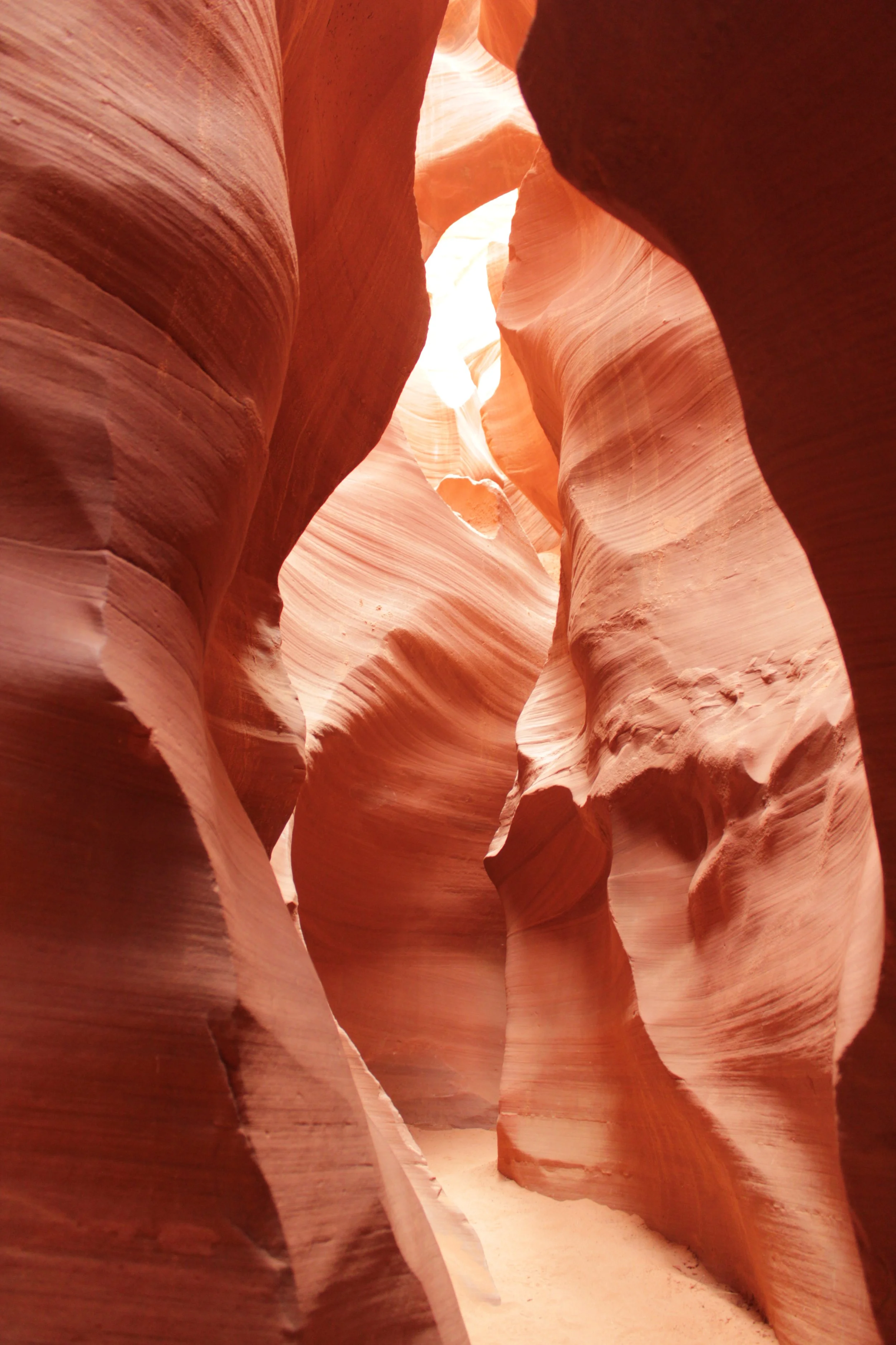
Lower Antelope Canyon
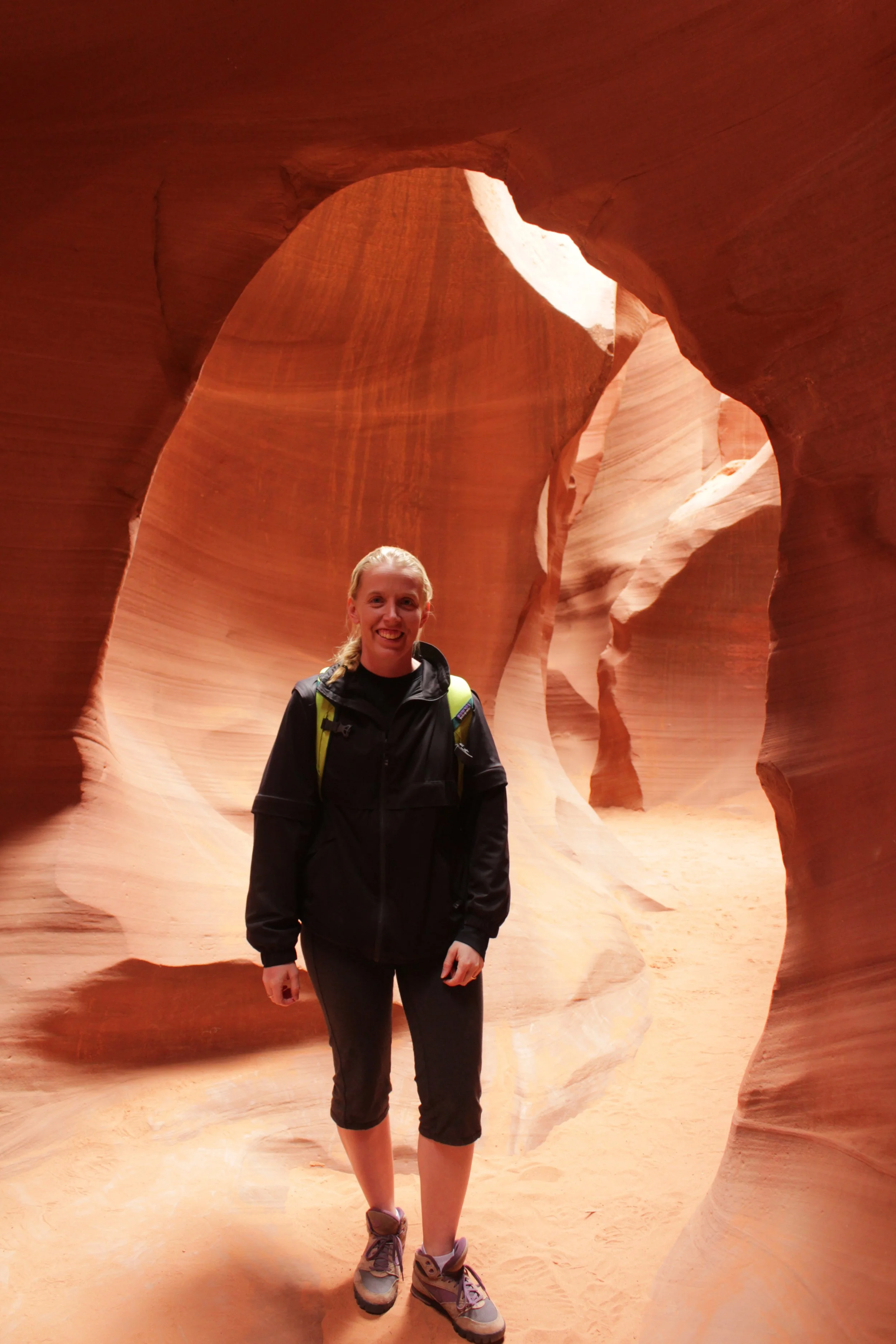
Exploring Antelope Canyon
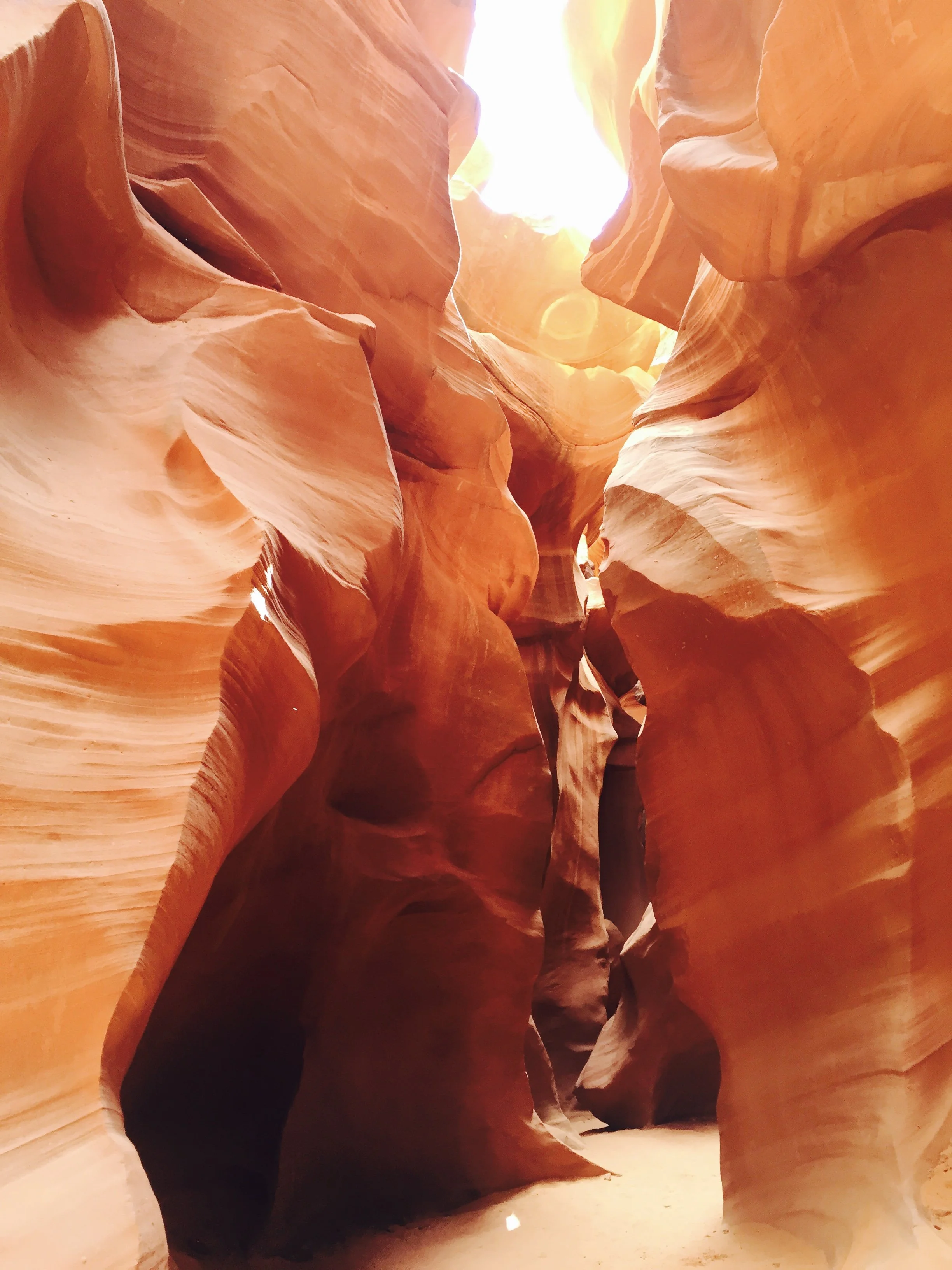
Lower Antelope Canyon
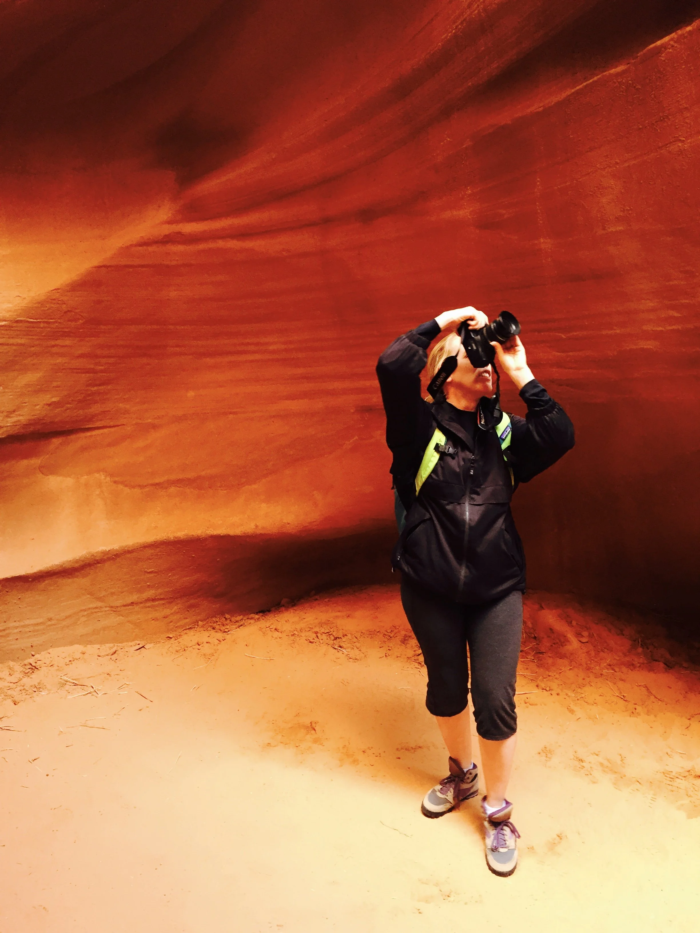
Taking some close-up shots inside Antelope Canyon
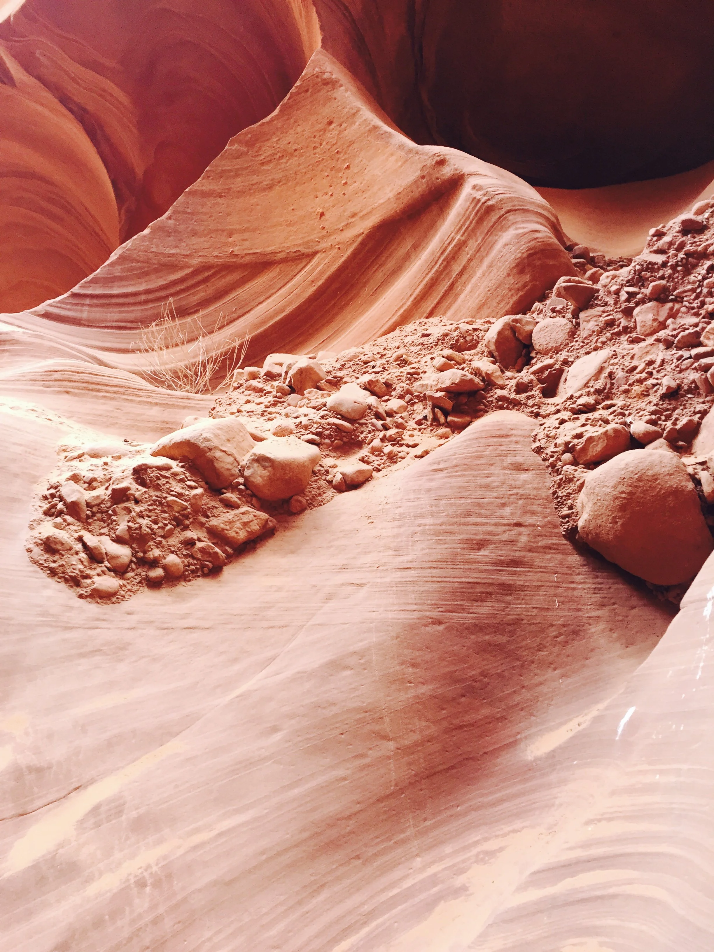
Antelope Canyon is made of sandstone, so the walls crumble easily - that’s how the canyon has formed over time

Lower Antelope Canyon - close-up of the rock layers
There are times in the canyon where the guide will point to a part of the wall and say it looks like a bird or some other type of creature. Sometimes I saw it, sometimes I just took a picture, even though I couldn’t see anything. The picture below is a little fuzzy, but do you see the “alien” face on the wall on the left, about mid-way down? I don’t remember seeing this while in the canyon, but it looks so obvious in the photo - almost a bit creepy.
March 2016 - Touring Antelope Canyon
This is my last picture inside of Antelope Canyon, staring up at the beautiful blue sky, before we ascended the staircase (just behind the last curve in the canyon wall).
Climbing out of Lower Antelope Canyon
This staircase was so much fun to use to climb slowly out of Antelope Canyon. Send your first hiker up the steps with a camera, and have them take pictures of everyone as they climb out.
Climbing out of Antelope Canyon
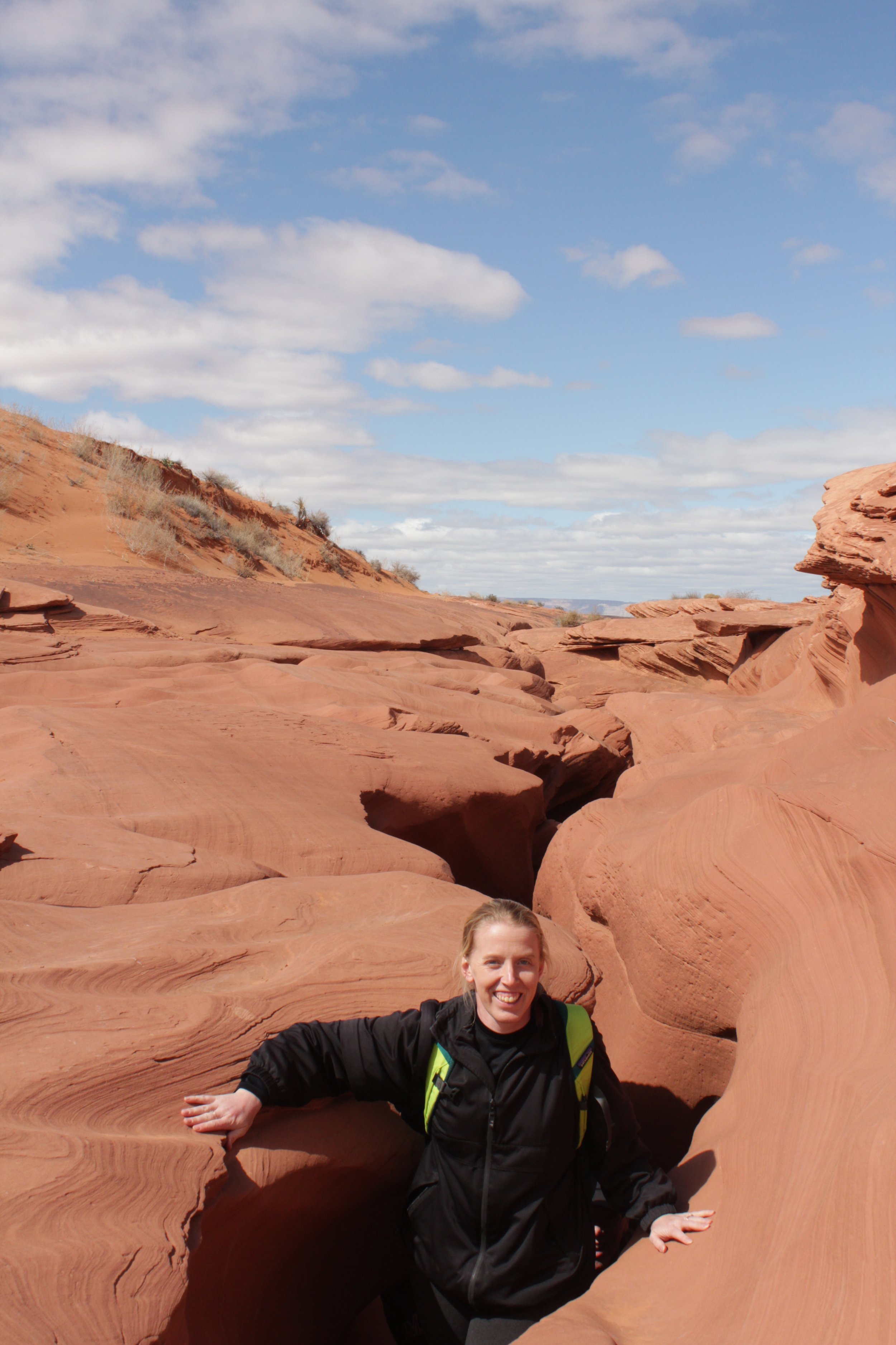
Looking backwards into Antelope Canyon - can you see the slot canyon? It’s a little more obvious what to look for after leaving than when we entered.
Looking back towards Lower Antelope Canyon exit point.
It’s a short 5 or so minute walk back to the building / parking lot for Ken’s Tours.
Other Nearby Things to Do
Horseshoe Bend
Horseshoe Bend is just south of Page, and is a quick 15-minute drive from Antelope Canyon. This is a relatively easy 1.5 mile out-and-back hike to a beautiful bend in the Colorado River. Note that like everything else in the area, this trail is completely exposed to the sun. Bring water even though it’s a short hike. This a free trail to hike, but parking does have a fee.
Hanging Gardens
Hanging Gardens is also a quick 15-minute drive from Antelope Canyon, on the north end of Page. This is an easy 1-mile out-and-back hike. There are also several rocks to scale up to see Lake Powell from some beautiful views. This trail is both free to hike and park.
The Chains
In GoogleMaps, search for “the Chains”. It’s a two-minute drive from the Hanging Gardens trailhead. There is no official trail here, just so amazing striped rocks to scale up. Not as impressive as the Wave in North Coyote Buttes, but still beautiful, as well as free, and no permit required.
Glen Canyon Dam
There is a visitor center where you can park for free in Page. At the Visitor Center, there is a movie to watch to learn about how the dam was built. There is also a pedestrian bridge that goes over the dam. Although it’s a National Recreation Area and not a National Park, there are still Junior Ranger books available if you ask for them at the desk.
New Wave / Beehive Trail
The trail for New Wave is on the west side of the Colorado River. It’s about a 2-minute drive from the Glen Canyon Dam. This is a 1.2-mile loop. The best way to experience this hike is to scramble up into the rock formations rather than hike around them.
Swimming, Kayaking, or taking a Boat Tour of Lake Powell
The best spot to access Lake Powell is the Wahweap Marina, just north of Page, on the west side of the Colorado River. There is a swimming spot, place to rent kayaks, and there are boat tours. Note that there are other locations for kayak rental and swimming beaches along Lake Powell. We picked a boat tour through Lake Powell Resorts & Marina.
Wahweap Hoodoos
The Wahweap Hoodoos are still flagged on my “wishlist” of future hikes. The trail head is about 30 minutes west of the Wahweap Marina (past Big Water). According to AllTrails, this is an 8-mile out-and-back hike, with minimal elevation gain.
Toadstool Hoodoos
The Toadstool Hoodoos are further west of the Wahweap Hoodoos (about 40 minutes from Antelope Canyon). This is an easy 1.8-mile out-and-back hike to other-worldly rock structures.
Buckskin Gulch
The turn-off road for Buckskin Gulch (the longest known hikeable slot canyon in the world) is just a couple of minutes past the Toadstool Hoodoos. I’d recommend the Wire Pass Trailhead (which takes about 30 minutes to get to from Toadstool Hoodoos). One-way, it’s 1.7 miles to get to Buckskin Gulch from Wire Pass. Then hike into Buckskin as far as you’d like. Note that there will likely be water you need to walk through in this canyon. You can go left or right once you get to the canyon.
White Pocket
White Pocket is free, does not require a permit, and is a relatively easy 2-ish mile hike (poles may help as the hiking surface is mainly rock). To get to White Pocket, you'll need a 4x4 vehicle, knowledge of how to drive in the sand, and pre-downloaded GPS maps to navigate the 4x4 intersections. Or skip that and hire a tour guide. We used Paria Outpost and Outfitters. To get to White Pocket, you will keep driving on the same road as the trailheads to Buckskin Gulch. The 4x4 roads add quite a bit of time to get to the trailhead. A little over 2 hours to the trailhead from Page (if you have a 4x4 vehicle).
Kanab, Utah
Kanab, Utah, is another fun town to visit and stay in. It’s about 75 minutes west of Page, but quite a bit smaller. Kanab is much closer to Zion National Park. If you want to hike more than a day in Zion, I recommend switching hotels to either Kanab, Springdale, or St. George.
All Ways Adventures
My first shout-out for things to do in Kanab goes to All Ways Adventures. We booked a day excursion with them in March 2023 and tried out canyoneering for the first time - ropes, harnesses, helmets (the whole shabang) - and so much easier than rock climbing since gravity does all of the work. My boys loved it! Our tour guide, Brett, made it fun, not scary, and it didn’t seem overly complicated. Two years later, we hired a guide in Minnesota to teach us how to canyoneer, and we ventured out on our own in June 2025. Here’s our story. I couldn’t recommend this tour group enough for anyone looking to try something new that will be a day you’ll remember forever!
Kanab Sand Caves (Moqui Caverns)
The Kanab Sand Caves (also known as the Moqui Caverns) is a short hike (little less than a mile out-and-back) with a very steep and somewhat sketchy sandstone hill to climb to get to a manmade cave. The best time for pictures is late in the afternoon. The trailhead is about 90 minutes from Page. Probably not worth it on its own, but a nice add on for a day of hiking on the eastern side of Zion. This is a free place to hike and park
Belly of the Dragon
Just a bit west of Kanab Sand Caves (on the way to Zion’s East Entrance), Belly of the Dragon is a fun place to stop. Pictures on the internet are a bit confusing though. I just want to set expectations appropriately… This is an amazing manmade water culvert under US-89 that is being carved slowly into a slot canyon by the water moving through the sandstone. The water culvert is under US-89 and parking is free. Roundtrip trail is 0.25 miles. It’s not a natural cave or canyon - it’s a water culvert, but a pretty cool water culvert.
Red Canyon (Peekaboo Kanab)
The 4x4 trailhead to Red Canyon (also known as “Peekaboo” but not to be mistaken by the more impressive Peekaboo Cayon in Esclante, Utah) is between the Kanab Sand Caves and the Belly of the Dragon. This slot canyon requires a 4x4 to visit. Another shout-out to All Ways Adventure - we had a bit of time left over after canyoneering, so we had a chance to explore this canyon.
Coral Pink Sand Dunes
Coral Pink Sand Dunes State Park is about an hour 40 minutes from Page. The turn-off to the park is between Kanab Sand Caves and Belly of the Dragon. If you haven’t ever seen a sand dune, this is worth the drive (although the sand is going to be extremely hot in the summer… Pick a cooler season to explore the sand dunes). The state park has an entrance fee, and sleds can be rented at the visitor center. Yep, I said sleds… It’s kind of like snow sledding, but not cold… however sand will get everywhere. Bring quarters to wash out clothes at the hotel afterwards to keep sand out of everything else you’ve packed with you on your vacation.
Water Canyon
Water Canyon is a two-hour drive from Page (not on the way to Zion National Park), although it is also west of Page. There is a two mile out-and-back hike to the waterfall, a 6 mile out-and-back hike to White Dome, or an option to hike up into Water Canyon and rappel out. This wild, rugged canyon has something for all adventurous souls. If “adventurous soul” doesn’t describe you, that’s ok. Skip this park. Stick to Zion National Park - there are lots of amazing trails with various difficulty.
Zion National Park
Zion National Park is incredible and one of my favorite National Parks. There are so many fantastic hikes for all types of hikers - beginners through advanced. The east entrance is not quite 2 hours west from Page. If you want to hike in Zion for more than a day, I recommend switching hotels to something closer in Kanab, Springdale, or St. George.
Monument Valley Navajo Tribal Park
Switching directions - Monument Valley is 2 hours east of Page. This is also an incredible place to explore. Visiting Monument Valley Tribal Park involves a 17-mile loop drive that requires a higher clearance vehicle. If you don't have the right kind of car, you can book a guided tour. There is also a 4-mile loop hike trail - Wildcat Trail, which is not well marked, but fun to explore.
Grand Canyon
It’s a bit funny to me that I don’t have a blogpost yet for visiting the Grand Canyon, when hiking the Grand Canyon rim-to-rim-to-rim is what started my blog. It’s coming… But there are several posts in Utah still ahead of it. The Grand Canyon Village (best place to get a hotel on the south rim…. which is the only current option as much of the north rim burned down in the summer of 2025) is about 2.5 hours southwest of Page. It wouldn’t be worth it for a day trip back and forth from Page, but it’s a great destination on the same vacation as a trip to Page.
If you’d like to read out my rim-to-rim-to-rim hike and see pictures of the Grand Canyon, this was my first blogpost. Not a hike I would recommend for most people due to the immense amount of training required, but it was a hike that changed my life.
Other Slot Canyons to Visit
If you are looking for other slot canyons, several are much cheaper to visit. The thing Antelope Canyon has though over these other slot canyons is that it is both gorgeous and incredibly easy to hike. There are short slot canyons, pretty slot canyons that are challenging to scramble through, and easy slot canyons that aren’t as pretty as Antelope Canyon. I haven’t yet found another slot canyon both as easy to walk through and as stunning as Antelope Canyon - it is worth the money to visit.
More from www.NatureImpactsUs.com
In the map below, there are additional posts I’ve written attached to each pin. Use two fingers to move around within the map.