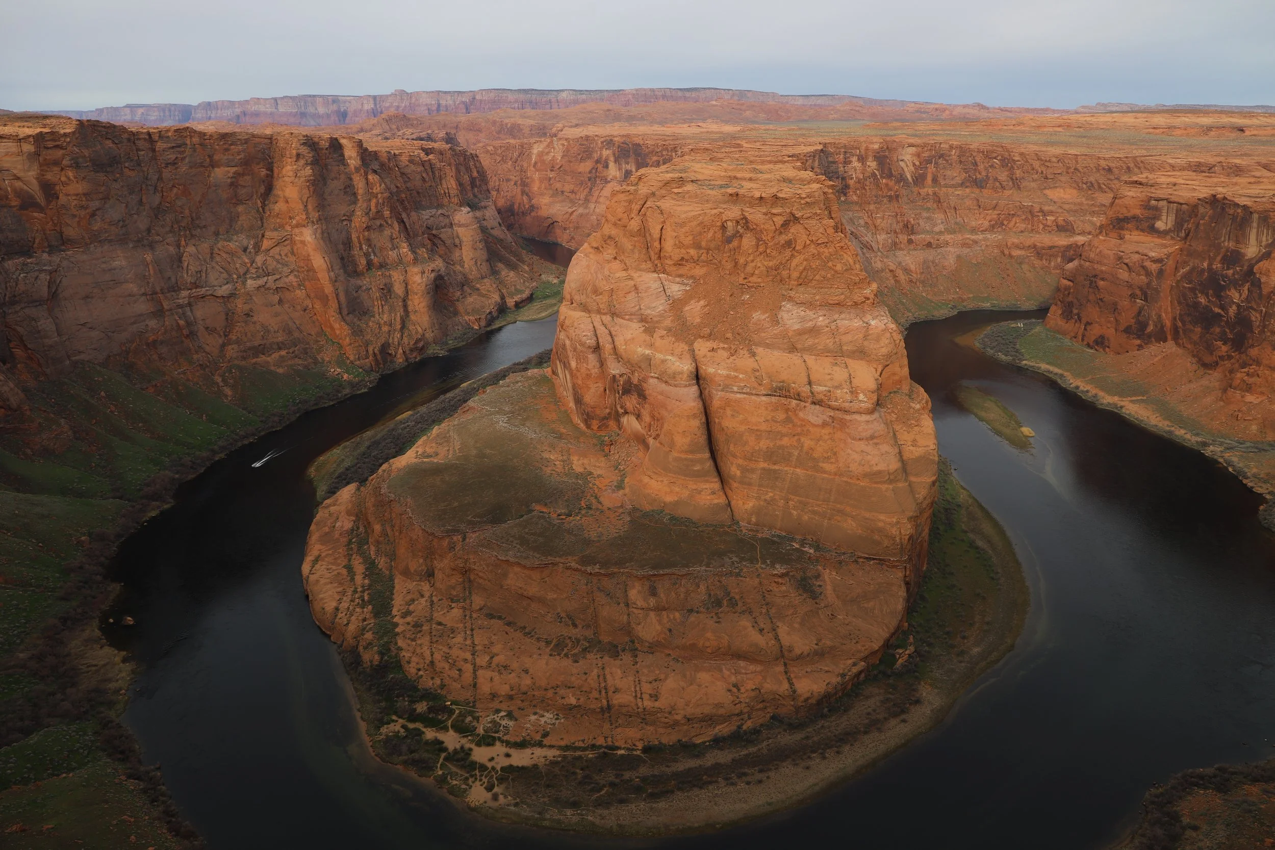
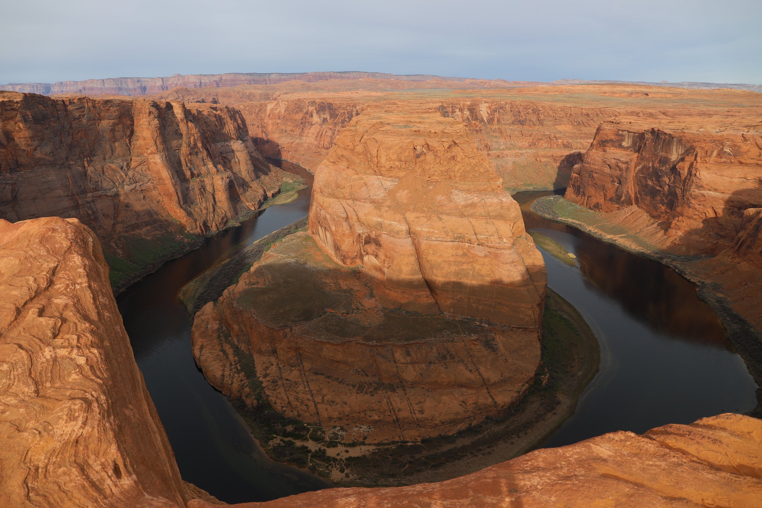
Horseshoe Bend - Glen Canyon National Recreation Area
If you enjoy my blog, please consider signing up below for email notifications of my latest posts. I will not share your email.
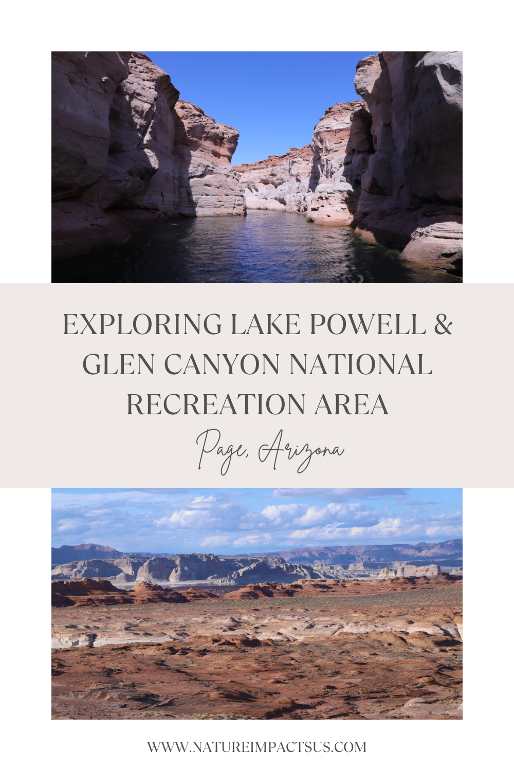
A Desert Retreat
Lake Powell was formed in the Colorado River by the Glen Canyon Dam in 1966, just upstream of the Grand Canyon, which formally starts in Lee’s Ferry (as designated by the National Park Service). Lake Powell offers opportunities for swimming, kayaking, and boating - a rarity in the desert.
The land surrounding Lake Powell is filled with canyons, striped rocks, arches, and hoodoos, making the Glen Canyon National Recreation Place a great place to hike in non-summer months. Lastly, Horseshoe Bend might be the most famous place within the park - an amazing bend in the Colorado River. This viewpoint requires a short, but relatively easy hike.
Location
The Glen Canyon National Recreation Area includes 1.25 million acres - another huge park in the United States. The parts of Glen Canyon National Recreation Area that I’ve explored so far are all near Page, Arizona.
Page has a population of over 7,000 and there are several modern hotels and restaurants, making it an easy and fun city to explore and spend a few days in. Page is near the Arizona-Utah border, and there is not much nearby… The nearest airports are Las Vegas, Nevada, which is a little over 4 hours away, and Phoenix, Arizona, which is 4.5 hours. If you aren’t sure which city to pick for flights, I’m going to suggest Las Vegas. Arizona has a steep “tourist” tax on car rentals, making them significantly more expensive than rentals from Nevada.
On the map, Escalante looks close to Page (north) but due to there being no direct roads to get there, it’s a 3.5-hour drive. Bryce National Park is actually closer by time even though it’s further by distance as the crow flies. Monument Valley is 2 hours east, and Grand Canyon Village is 2.5 hours south. Those are all going to be separate destinations that could be combined in a larger road trip type vacation.
Below is a map of things to do near the Lake Powell and Glen Canyon National Recreation Area. Note that there are other hikes on the north side of Lake Powell, such as Reflection Canyon, but these are difficult areas to access trailheads due to long routes with high clearance vehicles or 4x4 roads.
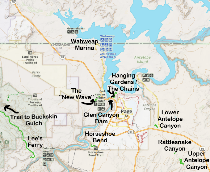
Map of things to do near Page, Arizona, and the Lake Powell and Glen Canyon National Recreation Area. Click the hyperlinks to move quickly around this page.
Horseshoe Bend- Easy 1.5 mile out-and-back hike
Glen Canyon Dam - Watch a video on the construction at the visitor center, complete a Junior Ranger Badge, and walk across the bridge
Hanging Gardens - 0.6 - 1 mile out-and-back trek to see the upside-down ferns and beautiful views of Lake Powell
The Chains - Trailhead to explore off-trail or swim in Lake Powell
New Wave (Beehive Trail) - 1.2 mile loop trail to fun rock formations
Lake Powell - Swim, rent a kayak, house boat, or take a boat tour along Lake Powell
Rainbow Bridge - 2 mile out-and-back hike combined with a long boat tour (with high enough water levels in Lake Powell)
Logistics
There isn’t too much from a pre-planning standpoint needed for a trip out to Glen Canyon National Recreation Area other than reserving boat rentals or tours. If you are interested in visiting Antelope Canyon, click the attached link for more information.
Things to Do
Horseshoe Bend
Distance / Elevation Gain - 1.5 miles out-and-back / 100ft
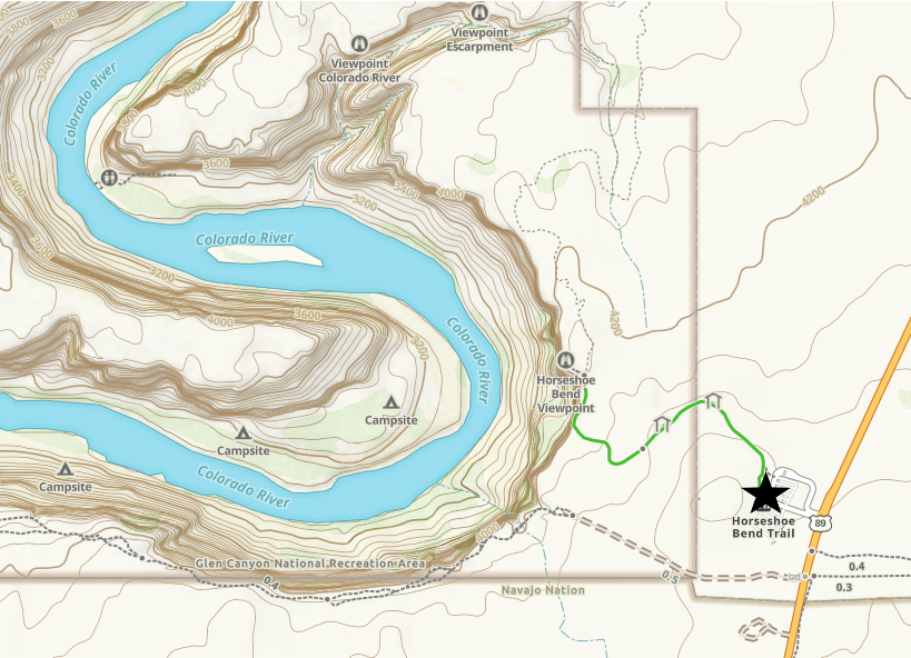
Hiking Trail Map to Horseshoe Bend Viewpoint
Use of the trail to Horseshoe Bend is free, however, there is now a small parking fee required that is not included by the America the Beautiful pass. The parking lot is managed by the city of Page rather than the National Park Service.
The trail to the Horseshoe Bend viewpoint is relatively easy, but it’s a constant slight decline to get to the view, meaning the way back to the parking lot will be more challenging. The second challenge is that there is no shade at any point on this desert adventure. Bring water and plan to hike at an appropriate time of day based on the temperature and sun position.
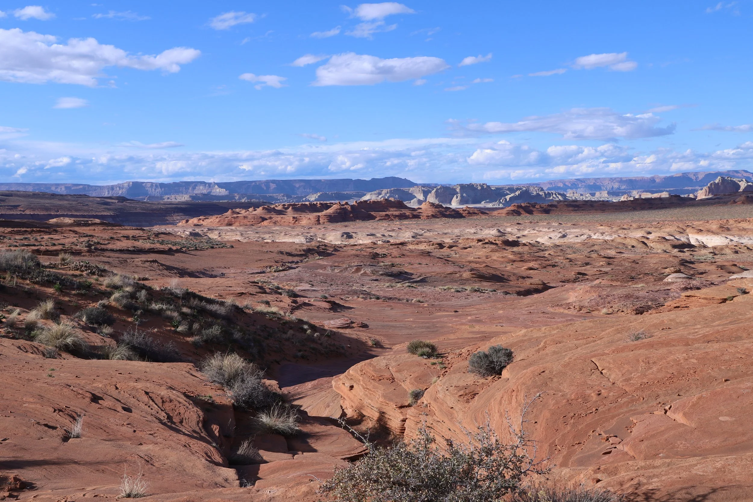
There’s not much to see in-between the parking lot and the viewpoint, so I’ll jump straight to the iconic view of the Colorado River.

March 2019 - Horseshoe Bend
There is a nice large spot to view the canyon from but note that there are no guardrails.
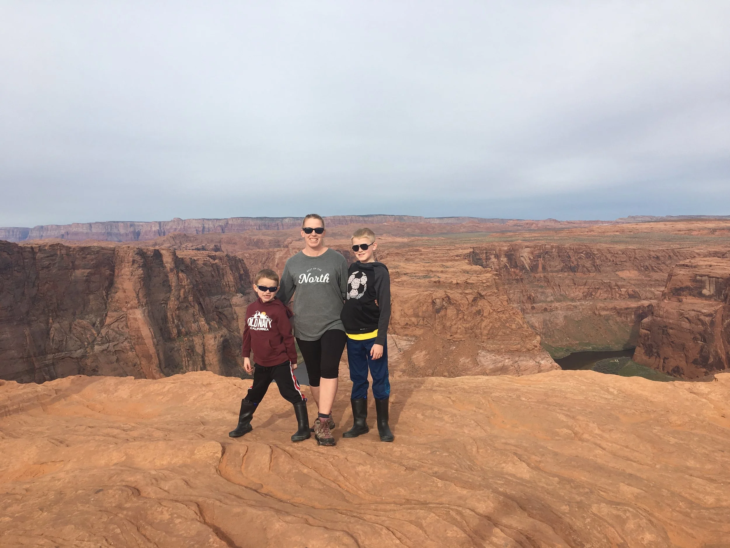
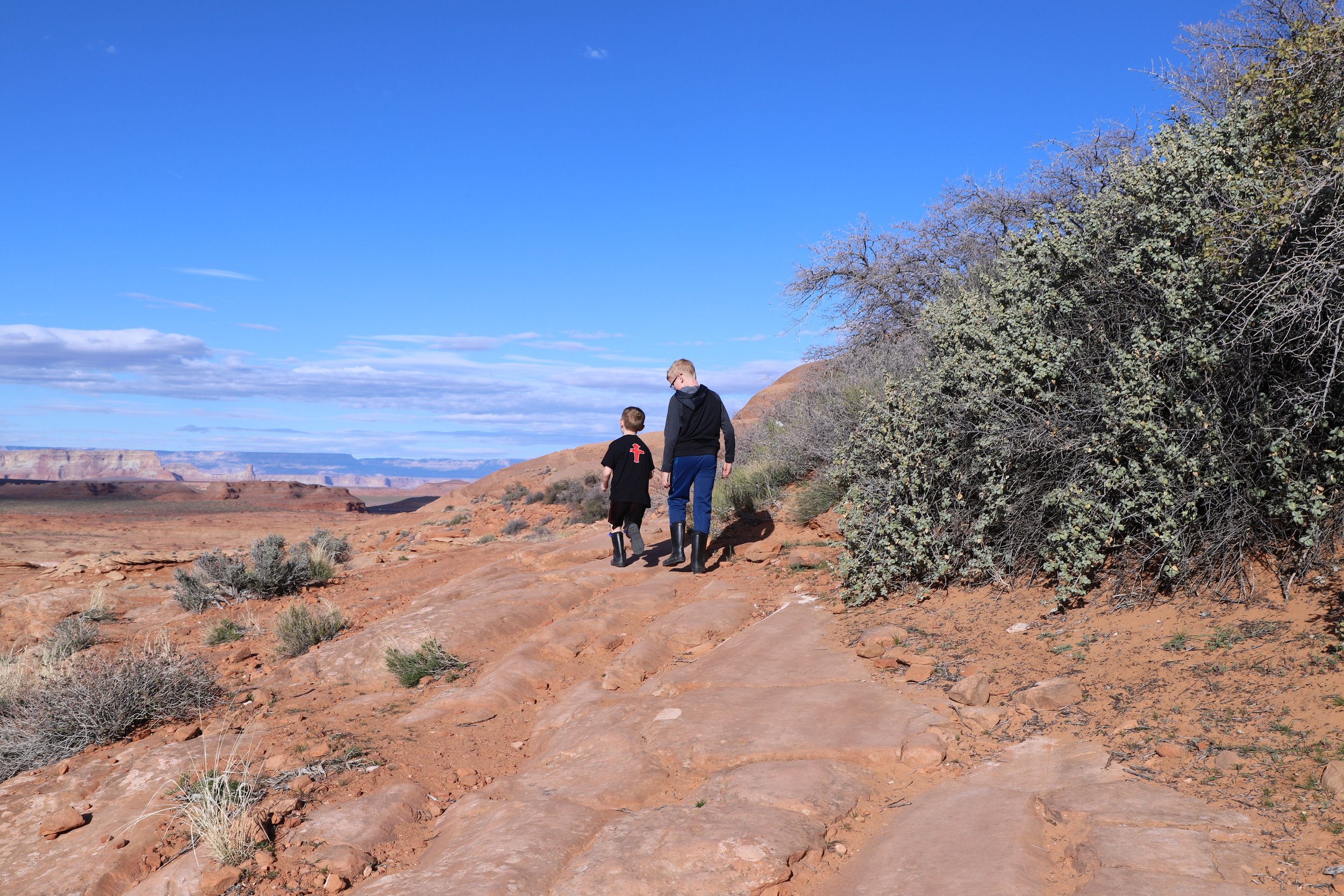
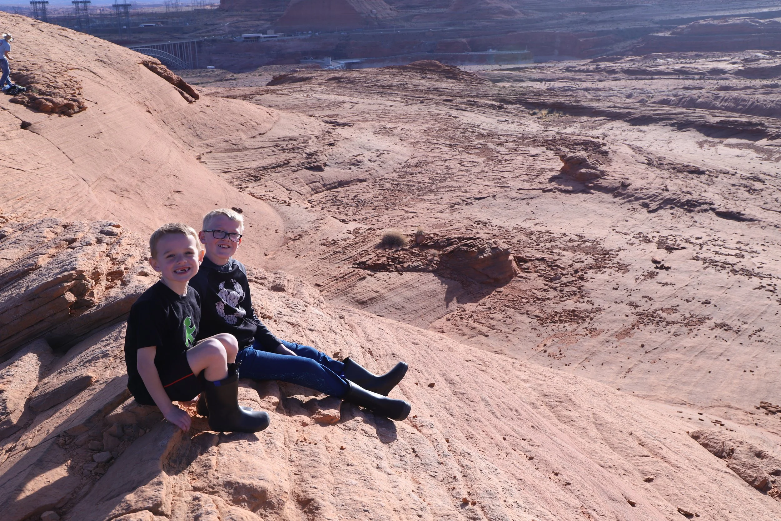
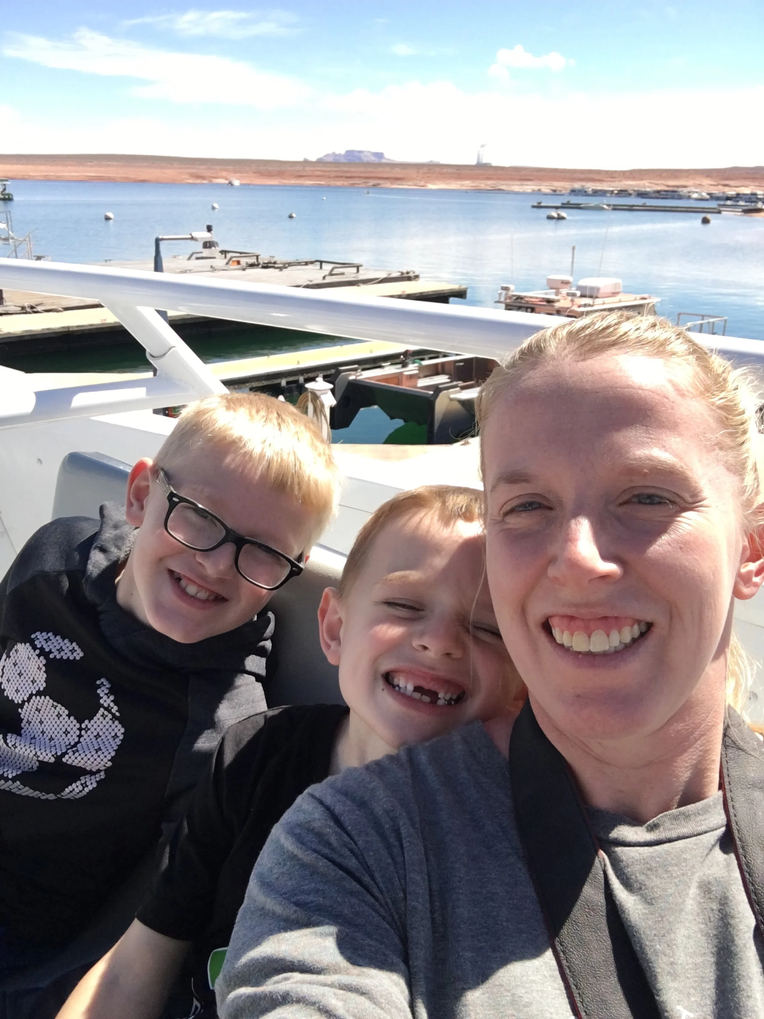
Hiking with my boys in March 2019 out to Horseshoe Canyon. I’m laughing at their boots - we had these for some hikes through water “in” the canyons. I have no idea why they chose to wear these on this particular hike. The Colorado River is not even remotely accessible from this viewpoint.
There are beautiful pictures on the internet of Horseshoe Bend at sunset. I picked the opposite - we visited in the early morning before any crowds arrived. If you find yourself in or driving through Page, this should be on your list for a quick stop. This is quite an inspiring viewpoint.
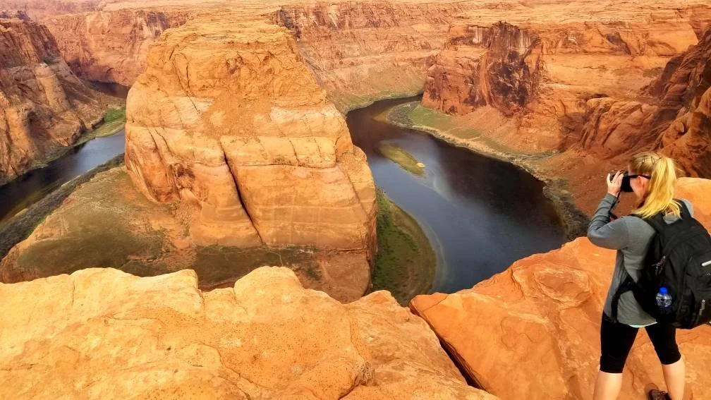
Horseshoe Bend - Colorado River just upstream from Grand Canyon National Park
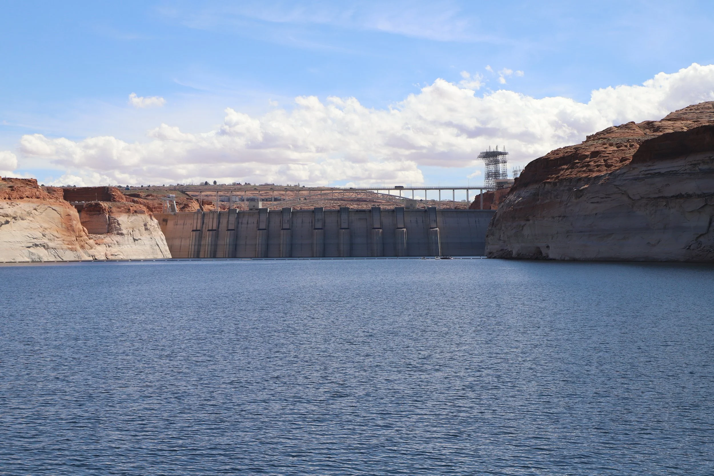
Glen Canyon Dam
Visiting the Glen Canyon Dam and the Carl Hayden Visitor Center is free. There is parking next to the visitor center, which is on the west side of the Colorado River.

Map of things to do in Page, Arizona
Inside the visitor center, there are some exhibits and a short movie about the construction of the dam. For anyone working on Junior Ranger badges, they have free booklets you can ask for at the desk for both the Glen Canyon National Recreation Area and Rainbow Bridge. Both are easy badges - we did them in about 30 minutes.
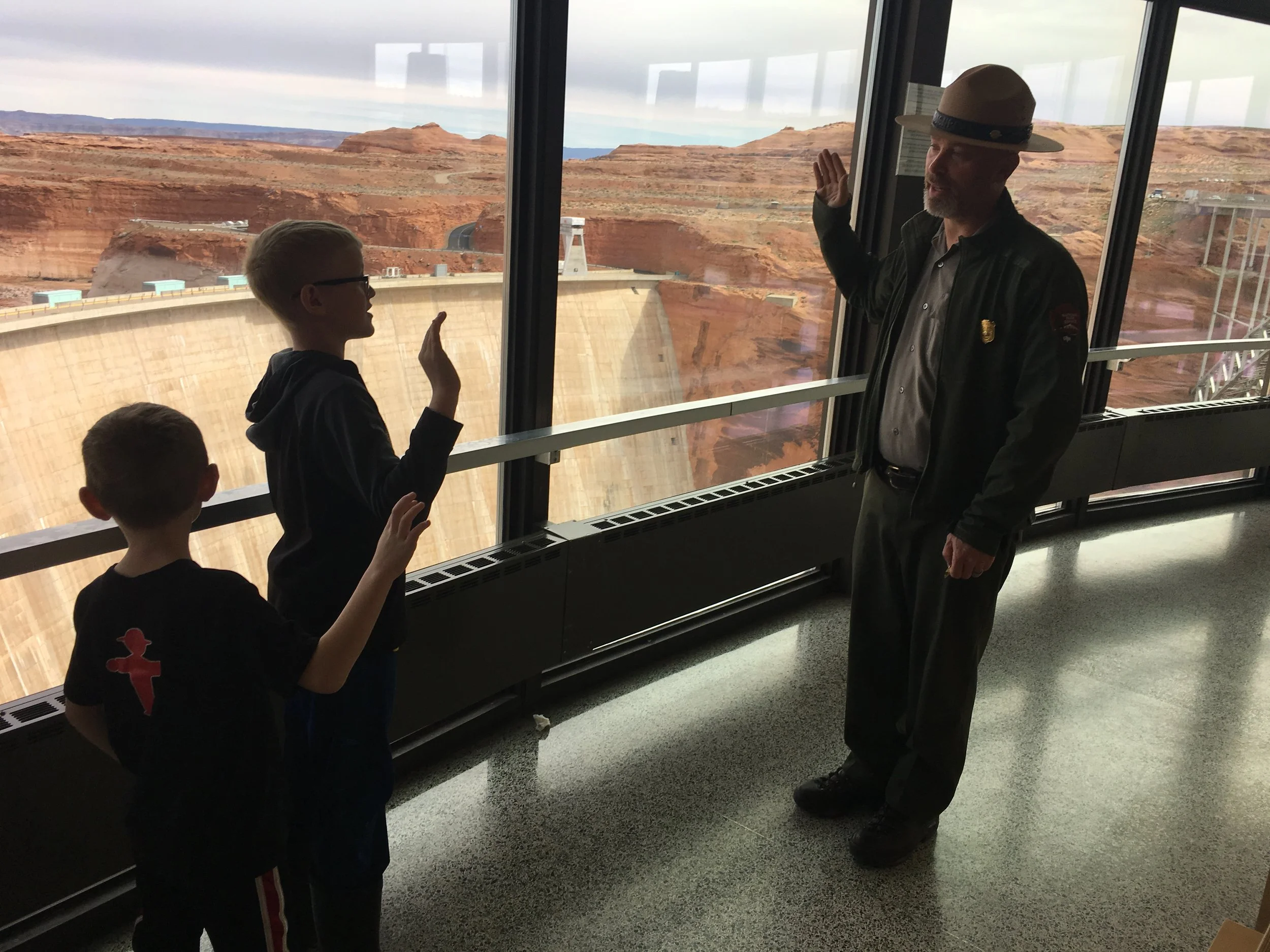
Earning Junior Ranger Badges for the Glen Canyon National Recreation Area
Outside of the visitor center, it’s just a short walk to the bridge over the Colorado River. In the picture below, you can see the dam on the left and the car / pedestrian bridge on the right. We walked about halfway across the bridge to get a better view of the dam.
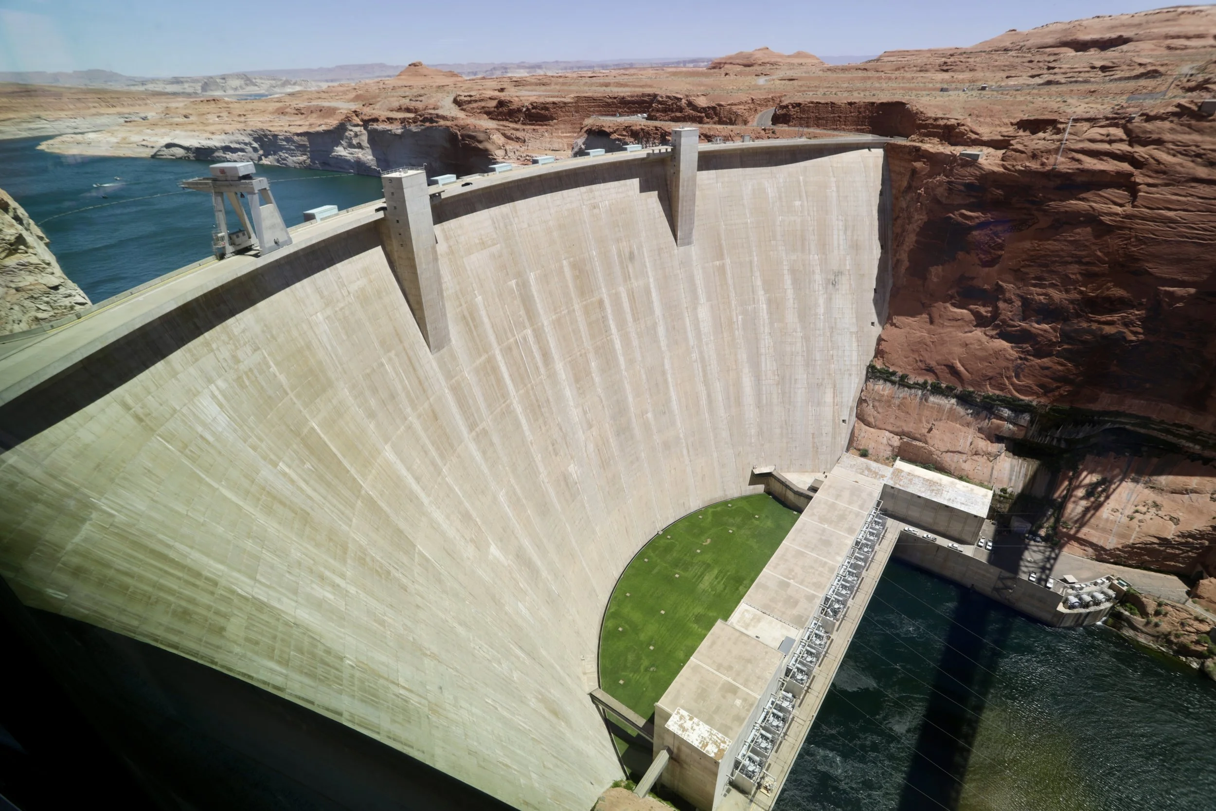
Glen Canyon Dam (June 2026)
The visitor center also has information about nearby hiking trails.
Hanging Gardens
Distance / Elevation Gain - 0.6 miles out-and-back with negligible elevation gain, unless you scale up some of the larger rocks to get a better view of Lake Powell. We explored out to the “viewpoint” as well, which resulted in total mileage of about a mile.

Hiking Map to Hanging Gardens
The Hanging Gardens wasn’t a destination we ended up in intentionally. I read about it in the visitor center, it was nearby, and my boys were a bit squirrely after a long boat ride in Lake Powell. Needing a place we could burn off some energy, we found ourselves at the Hanging Garden trailhead. Parking at the trailhead is free.
March 2019 - Hiking out to the Hanging Gardens
The sandstone has holes in it, and when it rains, water slowly moves through the sandstone and drips out of the wall. This creates the perfect place for fern-like plants to grow, due to the almost constant availability of water.
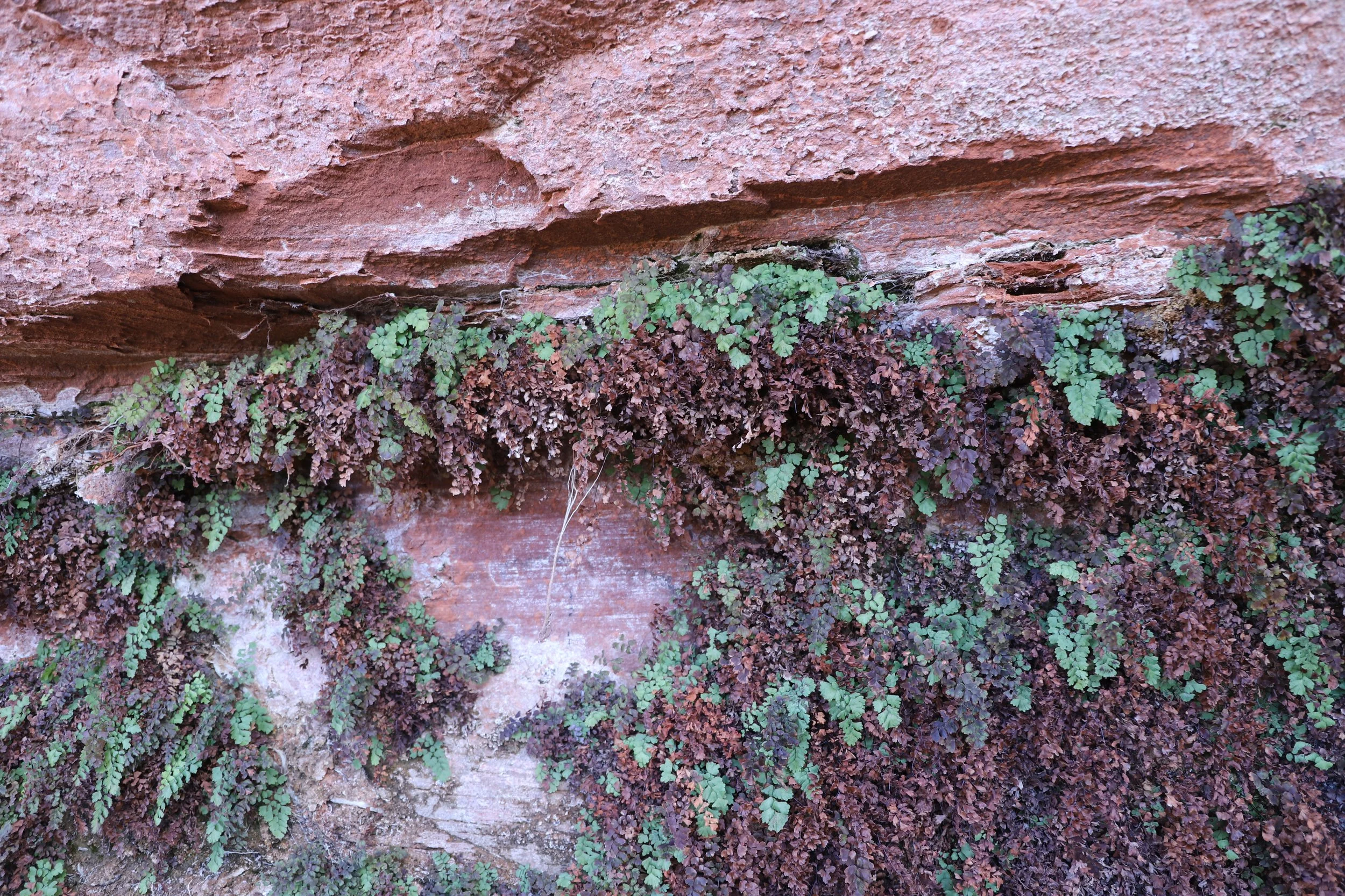
Hanging Gardens - Glen Canyon National Recreation Area in Page, Arizona
This “hanging garden” was interesting. By itself, I’m not sure it would be worth the hike. But if you take the spur out to the viewpoint and scale up the larger rock, there are amazing views of Lake Powell. And this is why I would recommend a quick stop out here if you have some extra time while you are in or near Page.
Climbing up to the viewpoint. Lake Powell is off in the distance, within the canyon
I’m not exactly sure how to describe the hike up to the viewpoint. There’s not really a trail, and it’s just slick rock. I wouldn’t call it a “mountain.” It’s not that big and won’t take many minutes to climb up to the top of. But it’s bigger than just a rock or boulder. Maybe it’s a “hill”? Or really short mountain. Regardless, it takes a few minutes to get to the top of, and it’s not very hard to get up there.
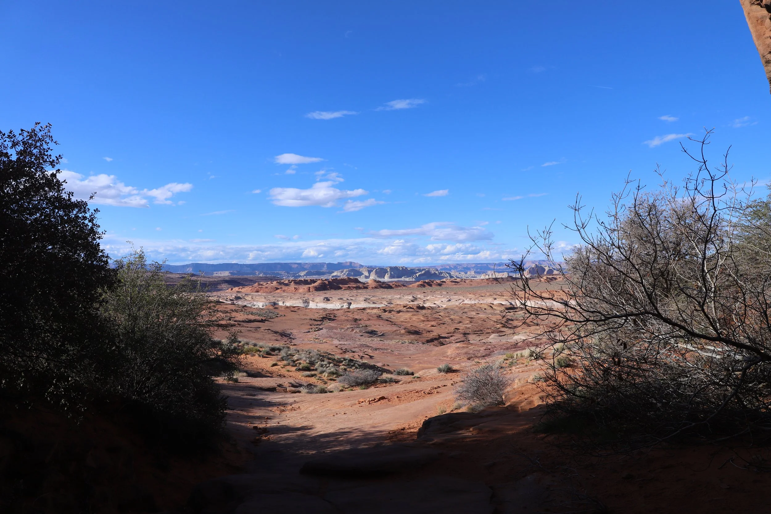
Looking out towards Lake Powell on our way up to the viewpoint
It was so pretty up at the top. The Colorado River (Lake Powell) wraps around this part of the canyon, so in three directions, when you look out you see water.
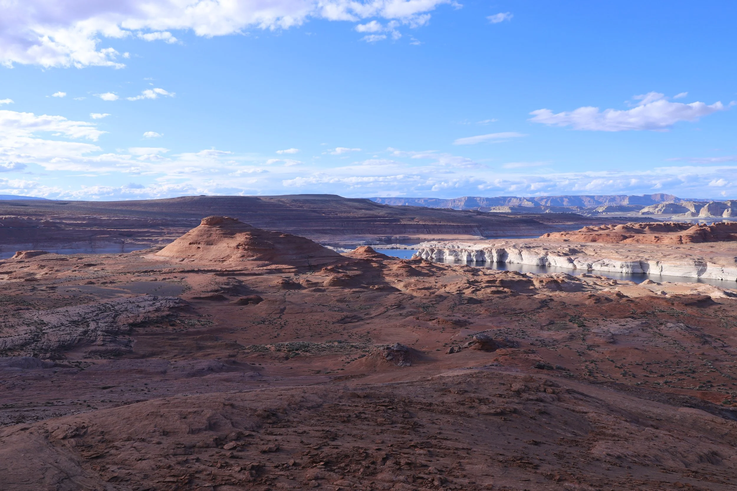
Looking out towards the main part of Lake Powell
Looking more upriver (off to the right)
Looking downstream, the bridge over the Colorado River is obvious, the dam is just barely visible in front of the bridge
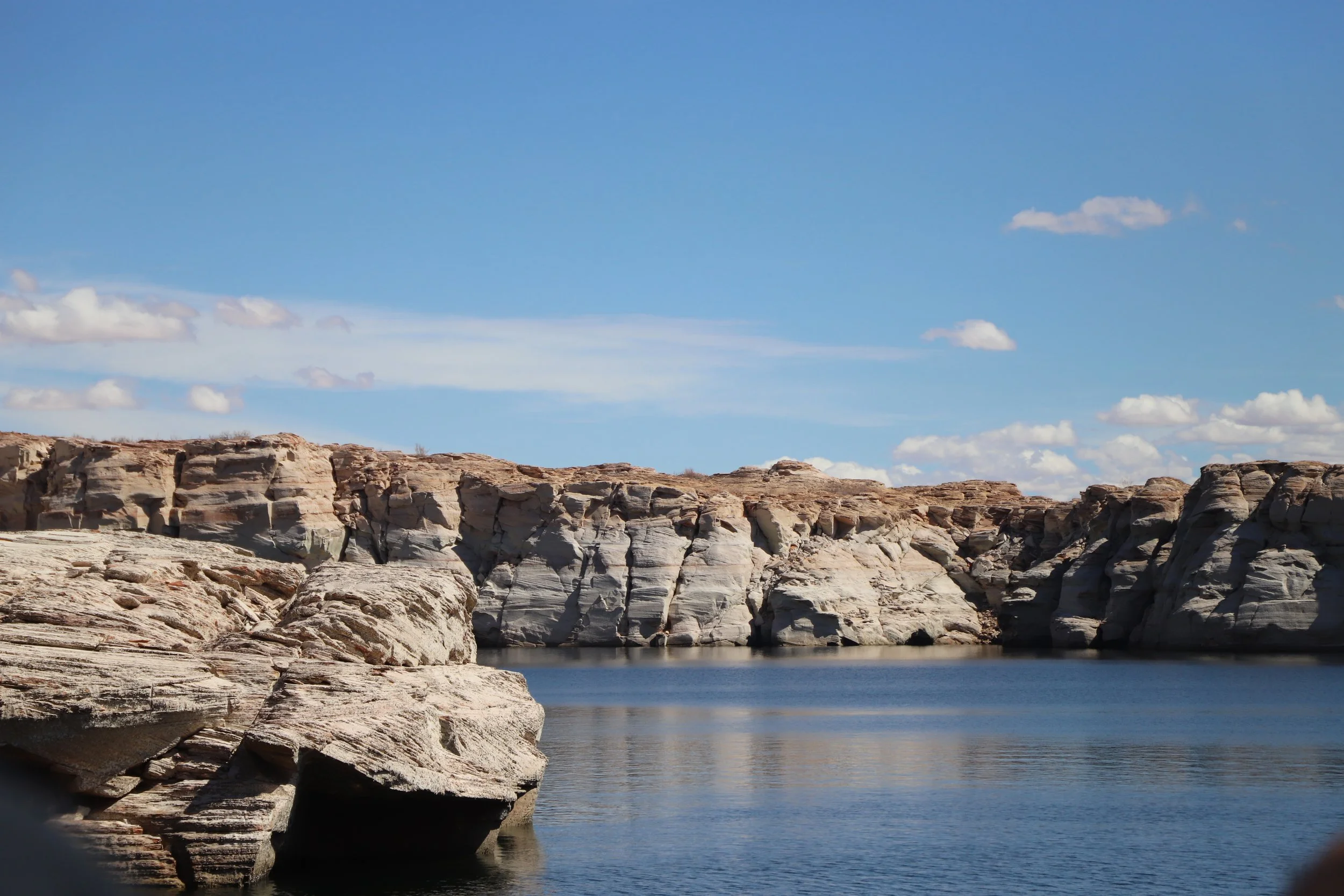
The Chains
Distance / Elevation - There’s no formal trail here, but to scamper up both “hills” and back is not quite a mile, and the elevation gain is about 100ft.
The Chains Area - Swimming and hiking/exploring
For anyone looking for a place to swim, the Chains is a potential spot. This would be a place to swim for older kids who are strong swimmers. Dammed canyons have sharp drop-offs, different from gently sloping shores of lakes.
Hiking at the Chains in Page, Arizona
I’ll admit that when we found the Chains, I was lost. I was actually looking for the New Wave area, which we did not find on this trip. By March 2019, I had learned to look up hiking information ahead of traveling to a park (before I was just asking Park Rangers for advice when we got there). But I hadn’t yet discovered GAIA or AllTrails, so I didn’t have GPS maps pre-marked (This was a tool I learned of a couple months later while purchasing backpacking supplies at an REI store for our first trek into backcountry in Yosemite).
Although we didn’t find the New Wave, we really enjoyed watching the sun set at the Chains. We were the only ones here, and I just the let the boys run up and down the slick rock hills. The boys told me this was the favorite part of their day. Well, at least until we went back to the hotel and went swimming.
Playing at the Chains area in Page, Arizon
These are the hills the boys ran up and down. Slick rock is pretty easy to go up and down, as long as it isn’t wet.
Hiking in the Chains - Page, Arizona
There is a view of Lake Powell here as well, but this is more just on the side in front of the dam. The viewpoint from Hanging Gardens is much better, due to being able to see more sides of the lake.
View of Lake Powell from the Chains
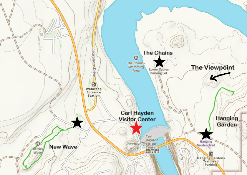
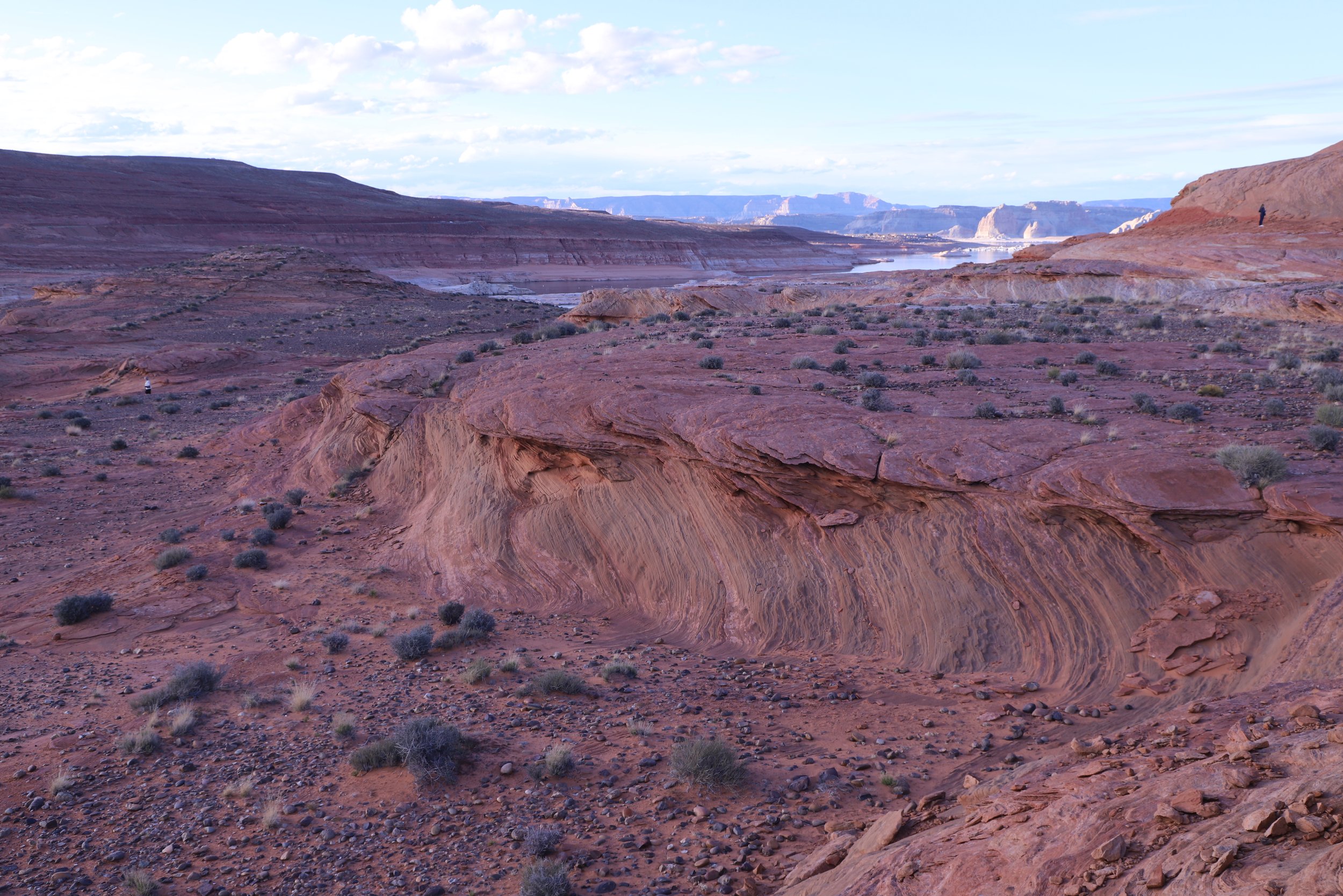
The New Wave / Beehive Loop
Distance / Elevation - 1.2-mile loop / 175ft in elevation
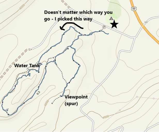
Map of The New Wave (better known as Beehive Loop) near Page, Arizona
As I mentioned above, I tried finding this trailhead in March 2019 and ended up at the Chains. Knowing where to look, I was easily able to understand where the trailhead was when I returned in June 2026. Coming from Page, the turnoff will be on your left, pretty quickly after passing over the bridge, and right before the turnoff to the Wahweap entrance. Today, searching for both “Beehive Trail” and “New Wave” will get you to the right trailhead.
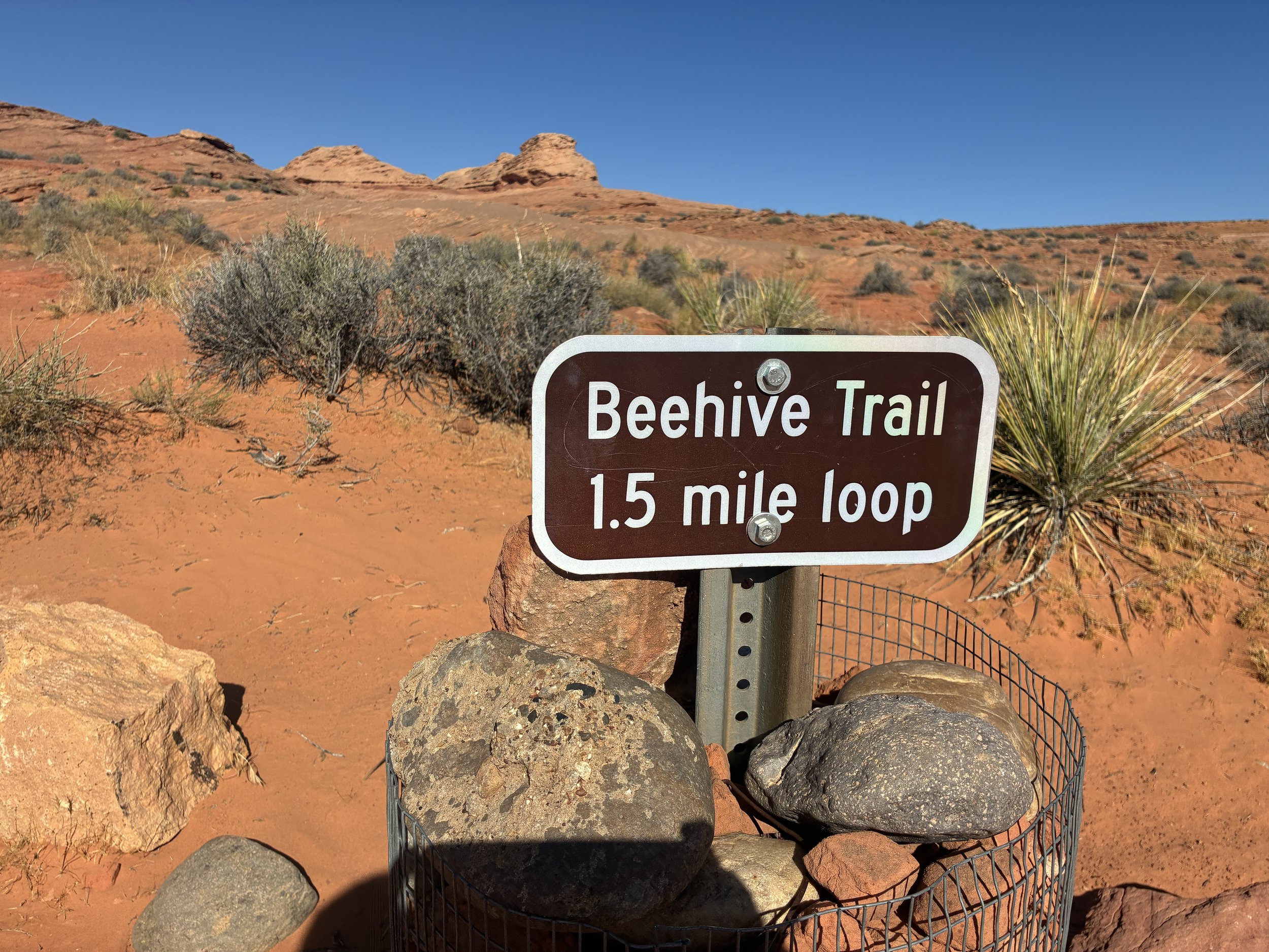
Beehive Loop Trailhead (also known as New Wave)
There are two spots to park, and the more obvious spot isn’t really actually the parking lot. When I left, there were three cars, and we were all parked in this weird spot on a flat rock. The parking lot is actually the camping area. And there’s a vault toilet there. Either spot works, but I laughed as I could see the actual parking area on my way back to the car. None of us found the actual parking lot.
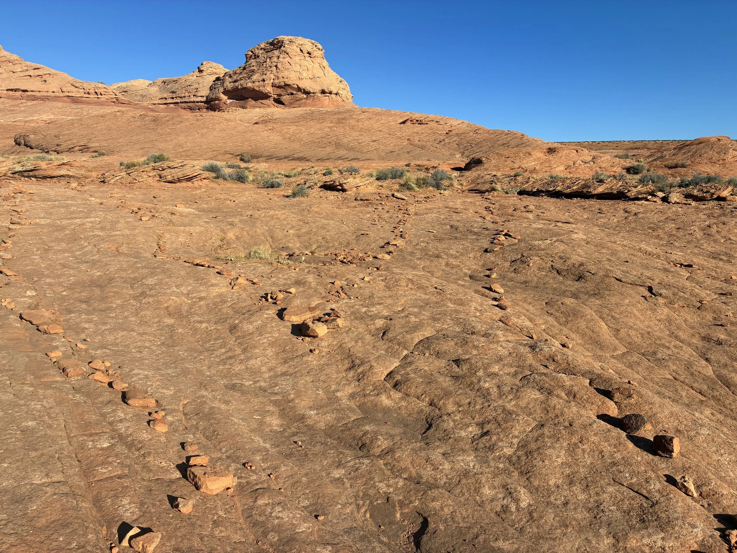
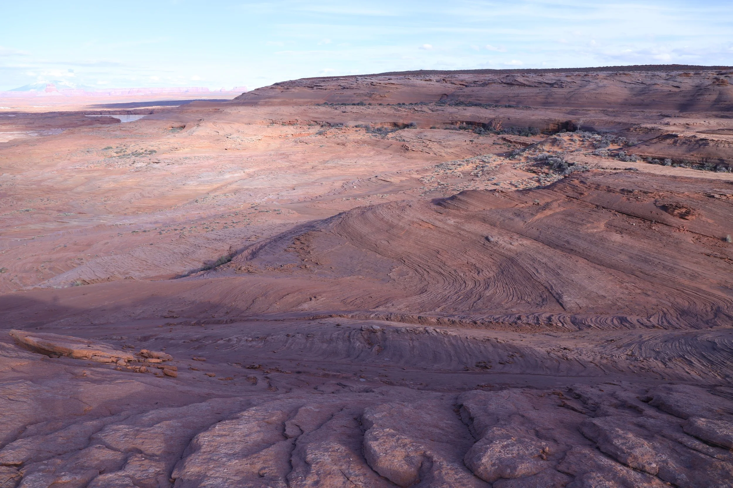
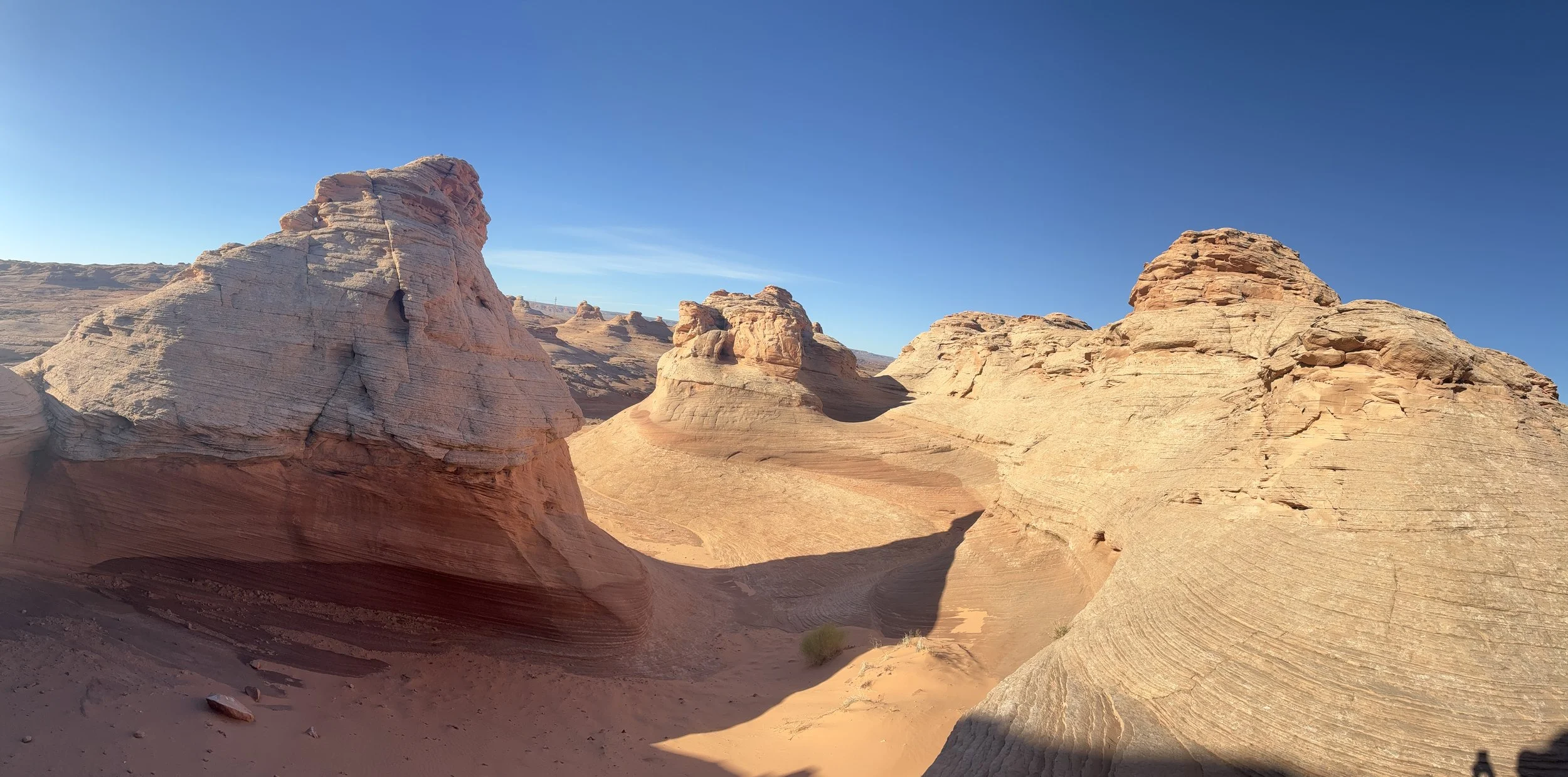
The trail is marked on two sides by a lot of small rocks. The more interesting stuff I found by scampering up into the rock formations.
At the fork in the trail, I went the right and walked counterclockwise around the loop.
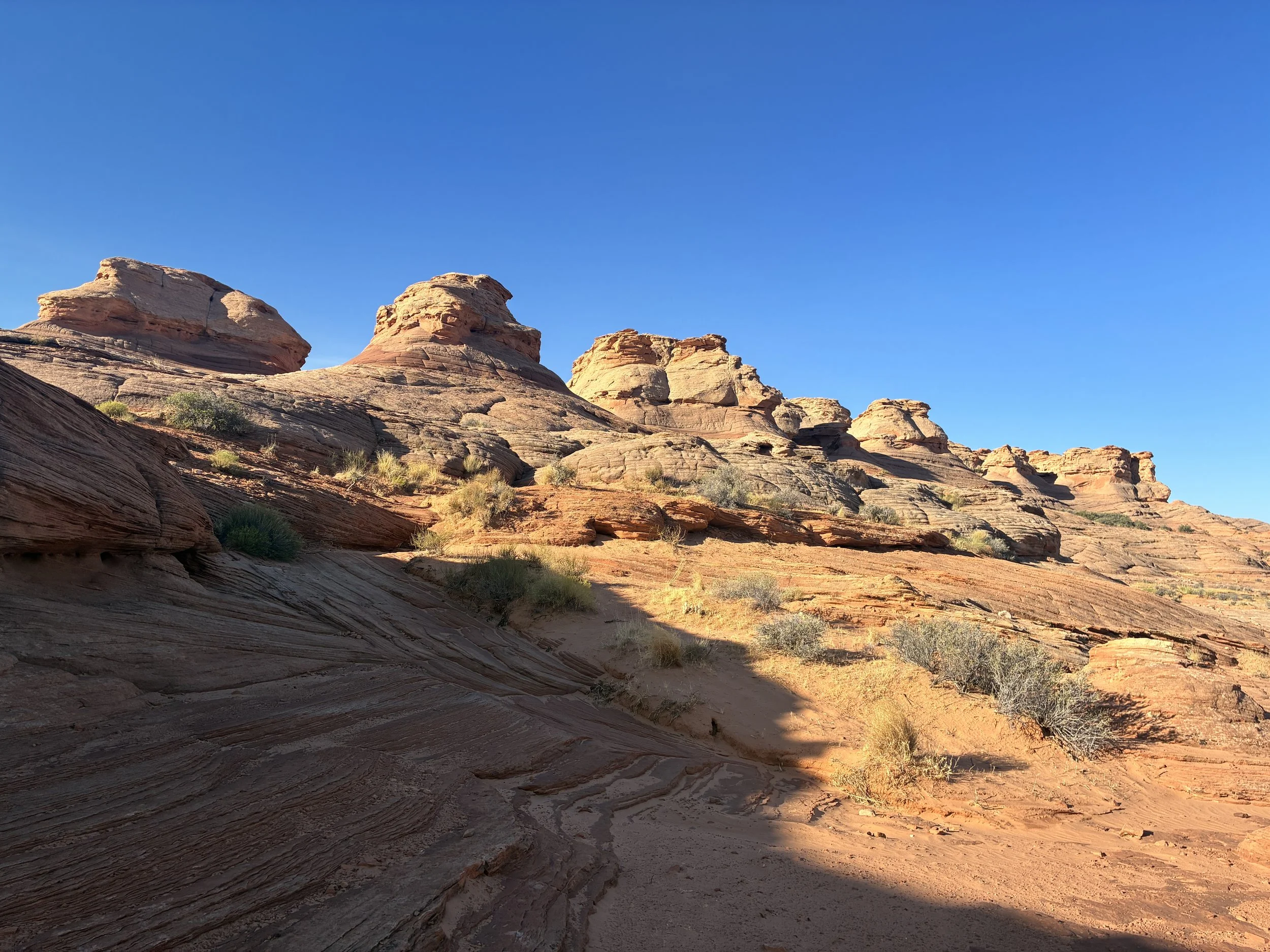
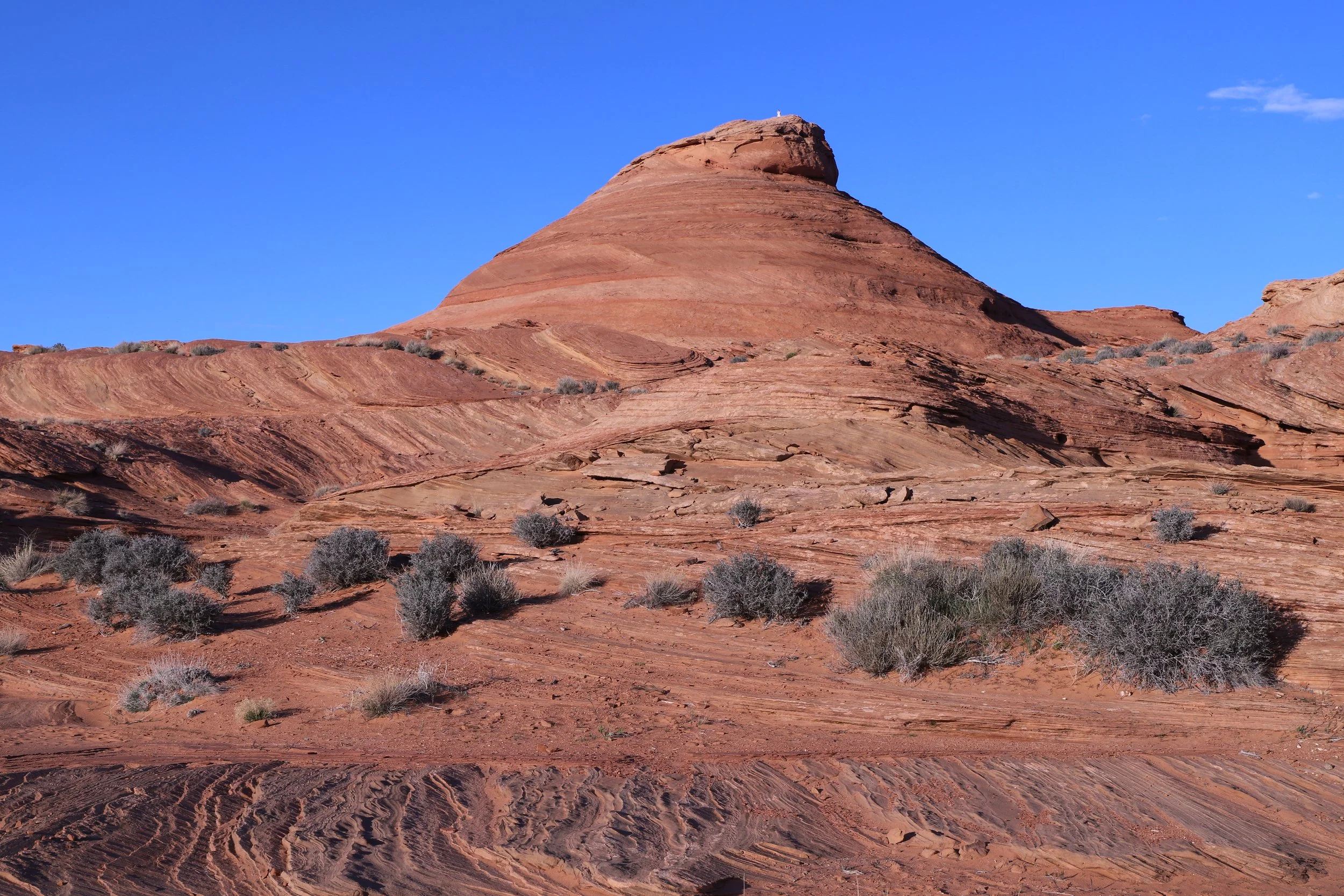
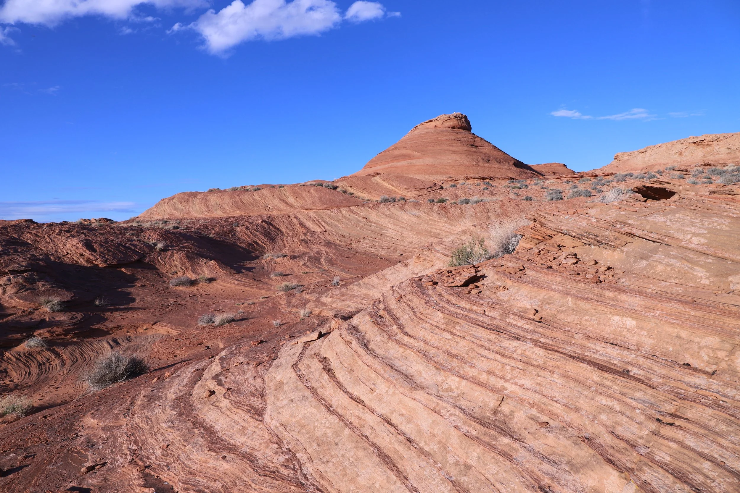
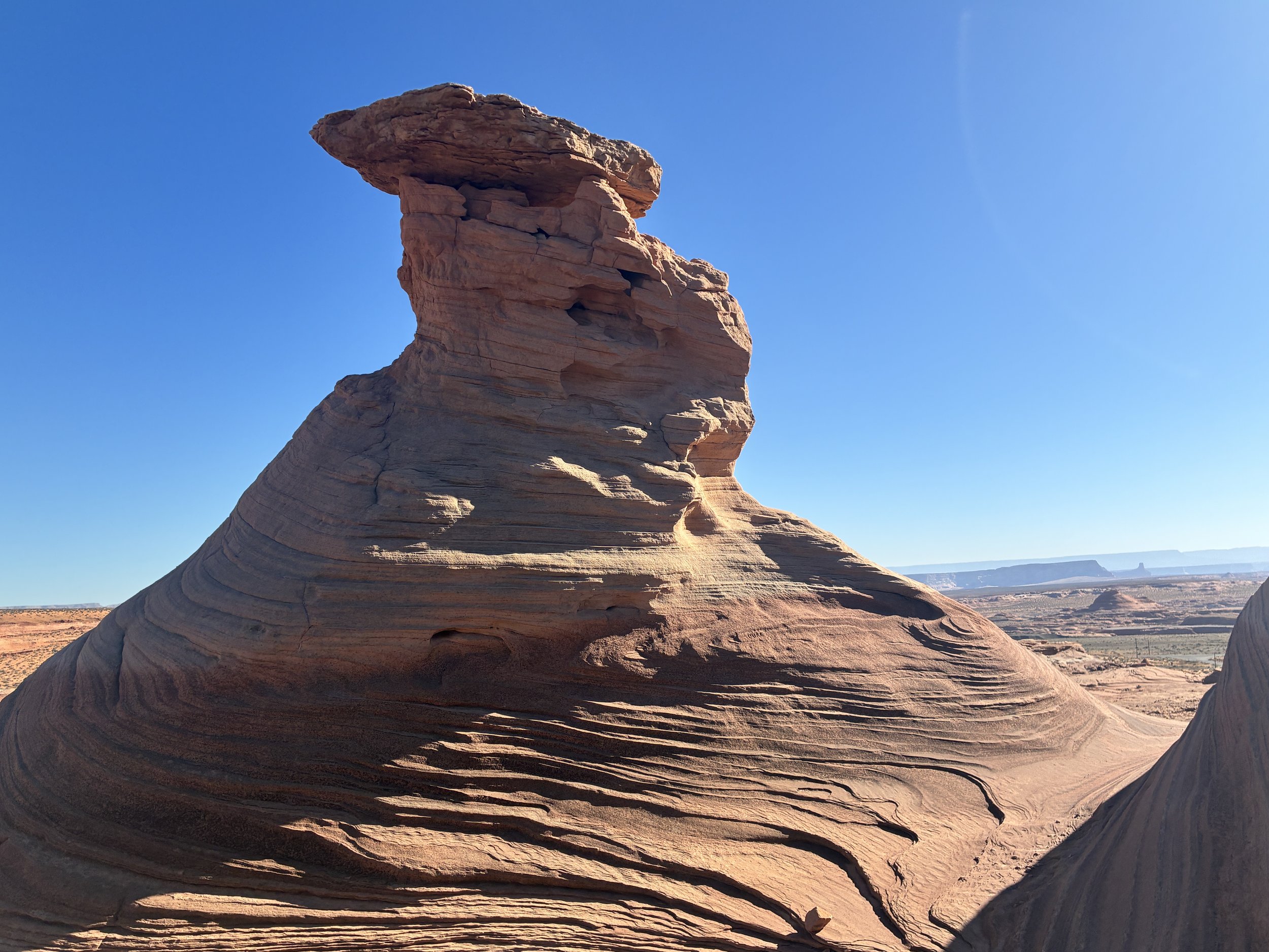
Beehive Loop Rock Formations
The marked trail just goes around this rock formation above. It’s pretty, and also pretty boring. I was by myself on this hike. The day before, my family was at the Grand Canyon, and we’d hiked 17 miles down to the river and back on the south rim. We spent the night in Page so we could just float in Lake Powell the day after such a hike. But I woke up early, thinking about this trail, since I hadn’t found it in 2019. I slipped quietly out of the hotel room in the morning and took the car, since this trailhead was less than 10 minutes from the hotel.
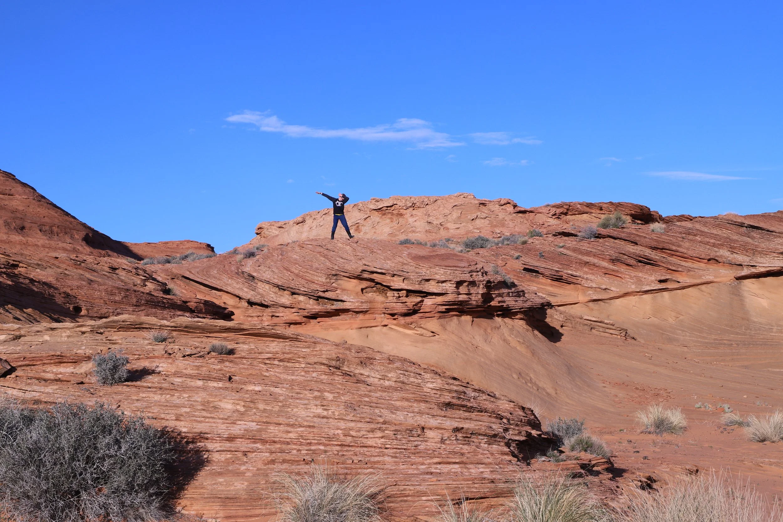
As I’m walking around this semi-boring trail, I realize that if my boys were with me, they would scampering up into the rock formation that I was walking around. Knowing I had a couple of hours before they’d wake up, I decided to do some exploring on my own. I would highly suggest to do the same thing, especially on the first side of this formation (I didn’t find too much on the return side of the loop).
First, I found a water tank.
Water Tank at the top of the Beehive Trail rock formation
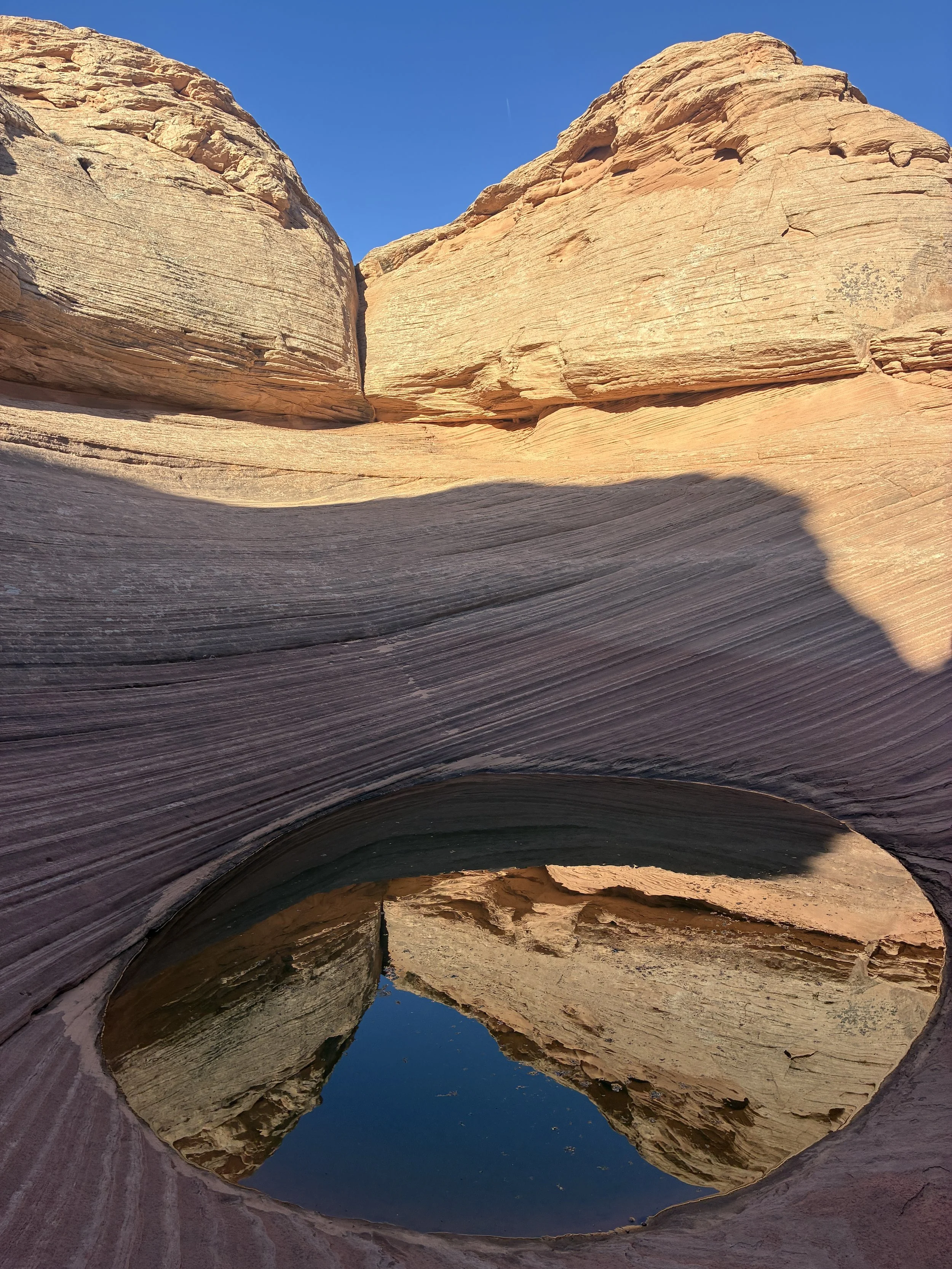
And then a whole lot of pretty formations.
The trail helps so you don’t get lost in the desert, but hop up into the rocks above you and see what you can find. This was the best part of the Beehive Trail.
I didn’t find much on the return side, but there were two other women hiking that I passed towards the end of the loop. They’d found a pretty spot and wanted to make sure I had a picture.
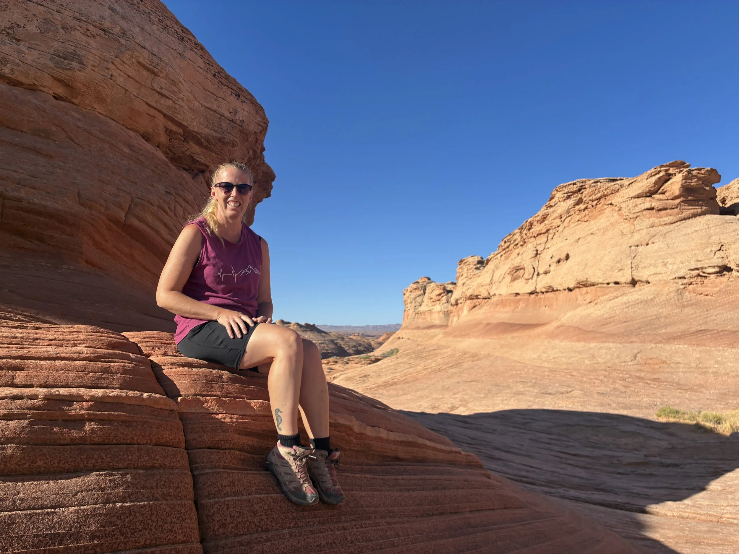
June 2026 - Hiking Beehive Loop
The hikers suggest that I checkout the viewpoint as well, a spur from the loop. I use the GAIA app while hiking, and where the spur was marked, there was a “trail closed” sign. I skipped this and continued to head down the main trail.
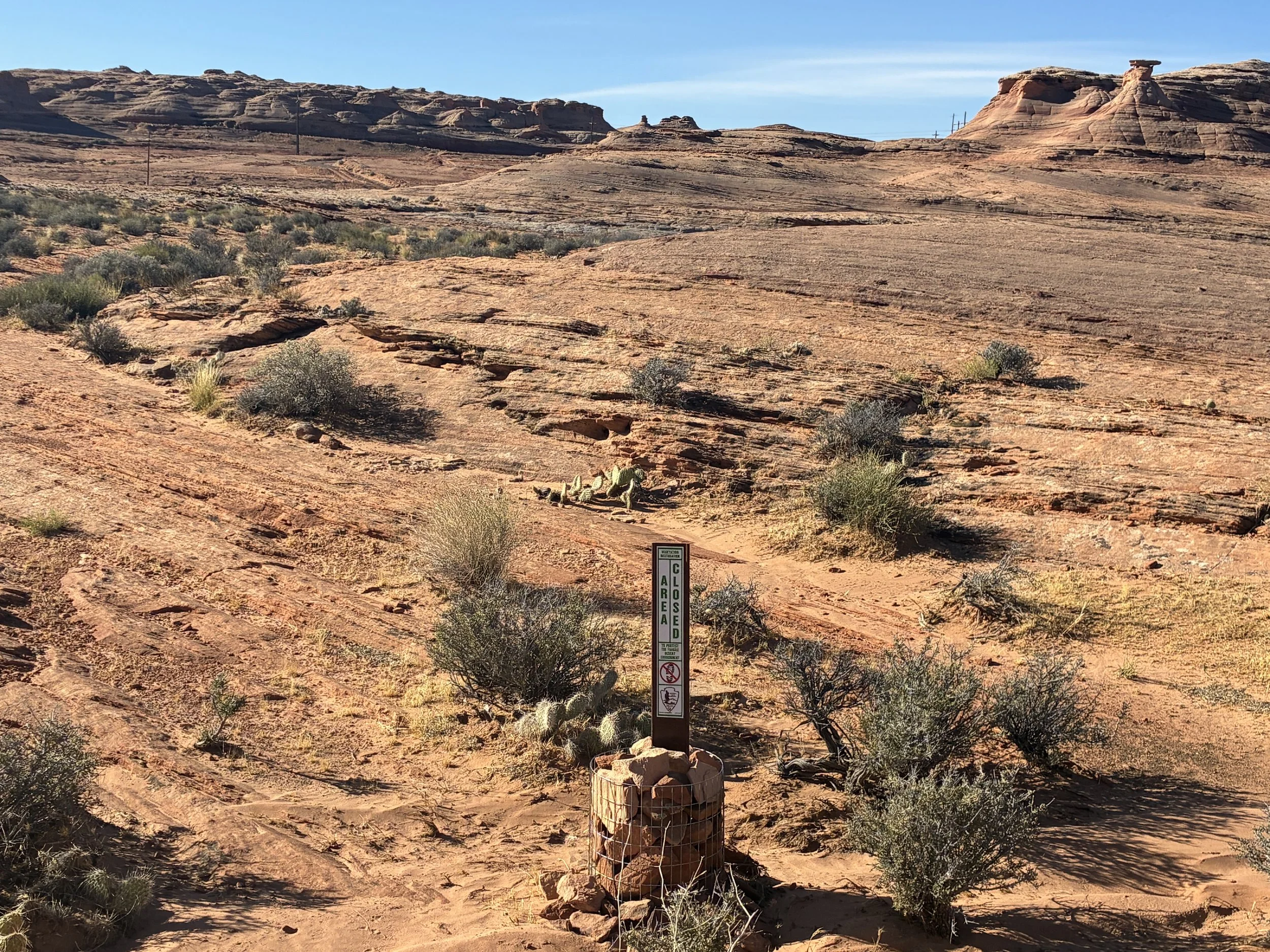
Viewpoint on Beehive Loop has been changed to protect the habitat
It’s not too far, and there is an obvious sign, and the trail to the viewpoint is also marked on both sides with small rocks. I had a little bit of time remaining before I thought I should get back to the hotel, so I went and explored the viewpoint.
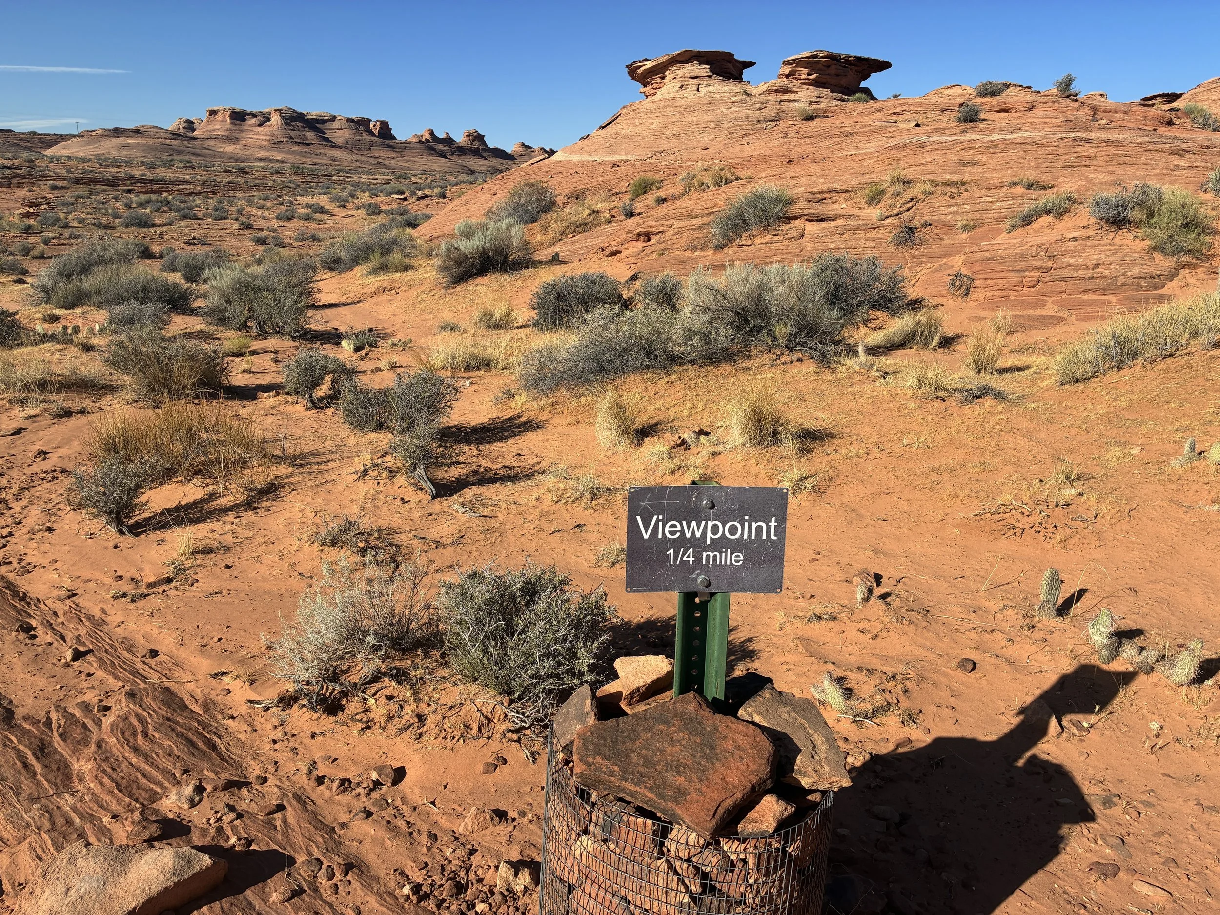
Spur to Beehive Loop Viewpoint
It was pretty early in the morning and the sun hadn’t risen very far yet. The view was tough to capture with the lighting, and I was rushing by this point to make it back before my family woke up and realized I’d left them. As such, I kind of thought of the viewpoint as “meh”. My favorite spot was climbing up into the rocks and finding the water tank.
Beehive Viewpoint
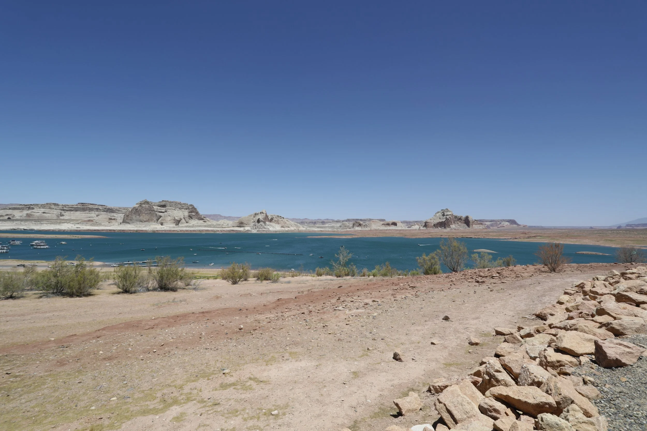
Lake Powell
The Glen Canyon Dam created Lake Powell, a flooded section of the Colorado River just upstream of Grand Canyon National Park. The purpose of the dam was to regulate water usage from the river, to ensure enough water flows to the lower states of Arizona, Nevada, and California. The creation of this dam was / is controversial, and this was the last large-scale dam constructed along the Colorado River.
Recreational boating within Lake Powell
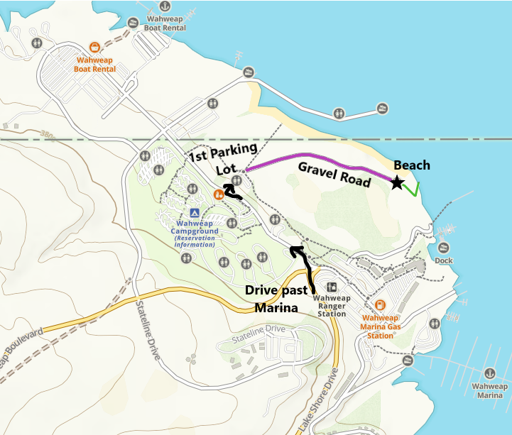
Map to the Wahweap Swim Beach
There is a fantastic swim beach on Lake Powell. Take the main road past both the marina and the picnic area. There will be a sign for a swim beach. Turn right and drive through the parking lot to a gravel road. If you need to use the bathroom, first stop in this parking lot. There isn’t one closer to the beach.
Gravel road to Wahweap Swim Beach
Drive through the parking lot and enter a short gravel road. Take it to the end. There is a short trail down to the beach (0.1 miles) with a little bit of elevation that will need to be climbed to get back to your car.
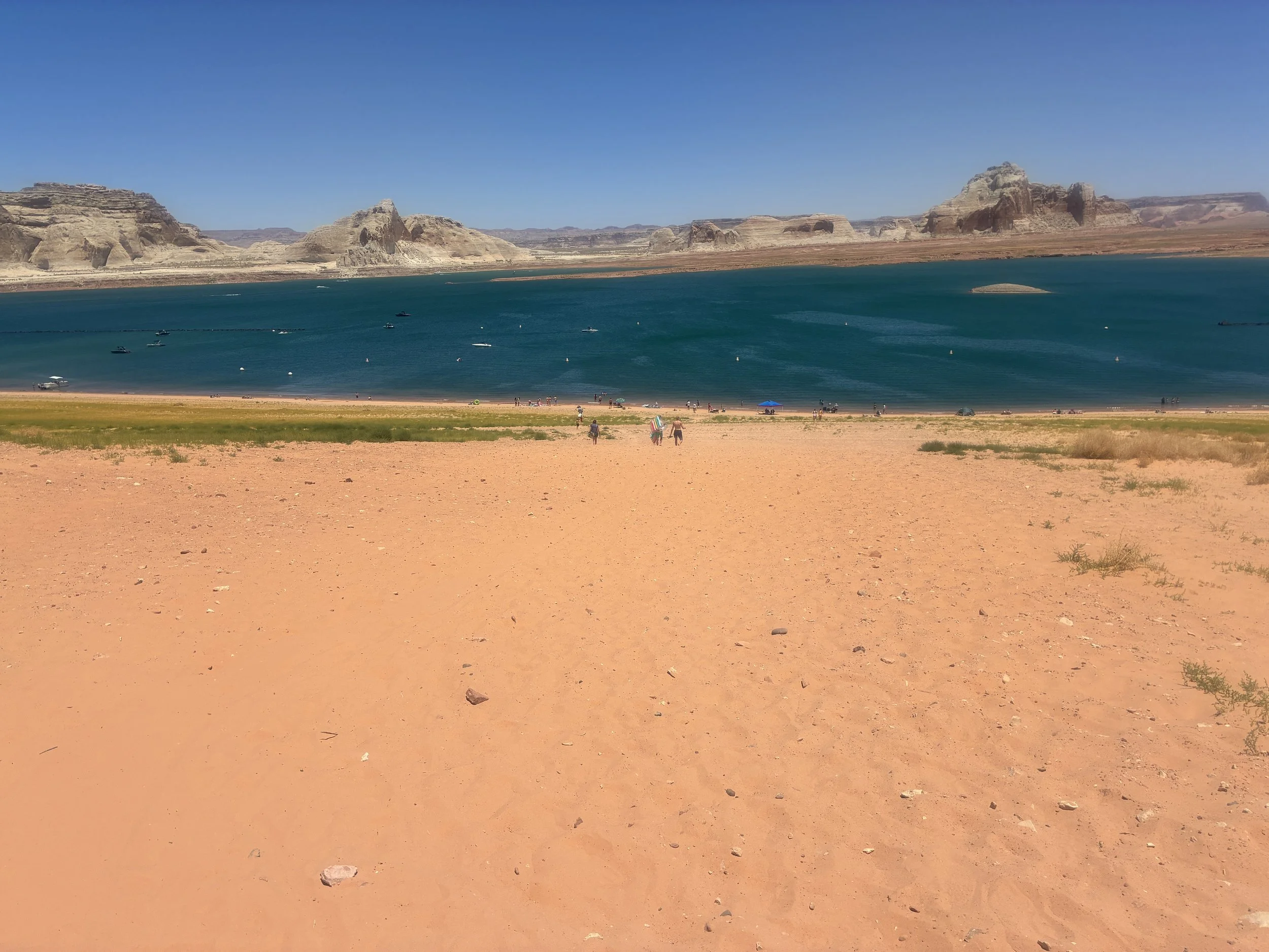
Walking down to the Wahweap Swim Beach
The beach is large and sandy. Plenty of space for everyone. We were there in June 2026, so it was pretty hot. Several people had thought to bring shade tents, which seems like a smart idea. We packed floaty mats, so we stayed in the water for an hour or so. The water was pretty cold. This was a perfect way to relax after an extremely hard day of hiking the day before, and canyons are so beautiful to swim in.
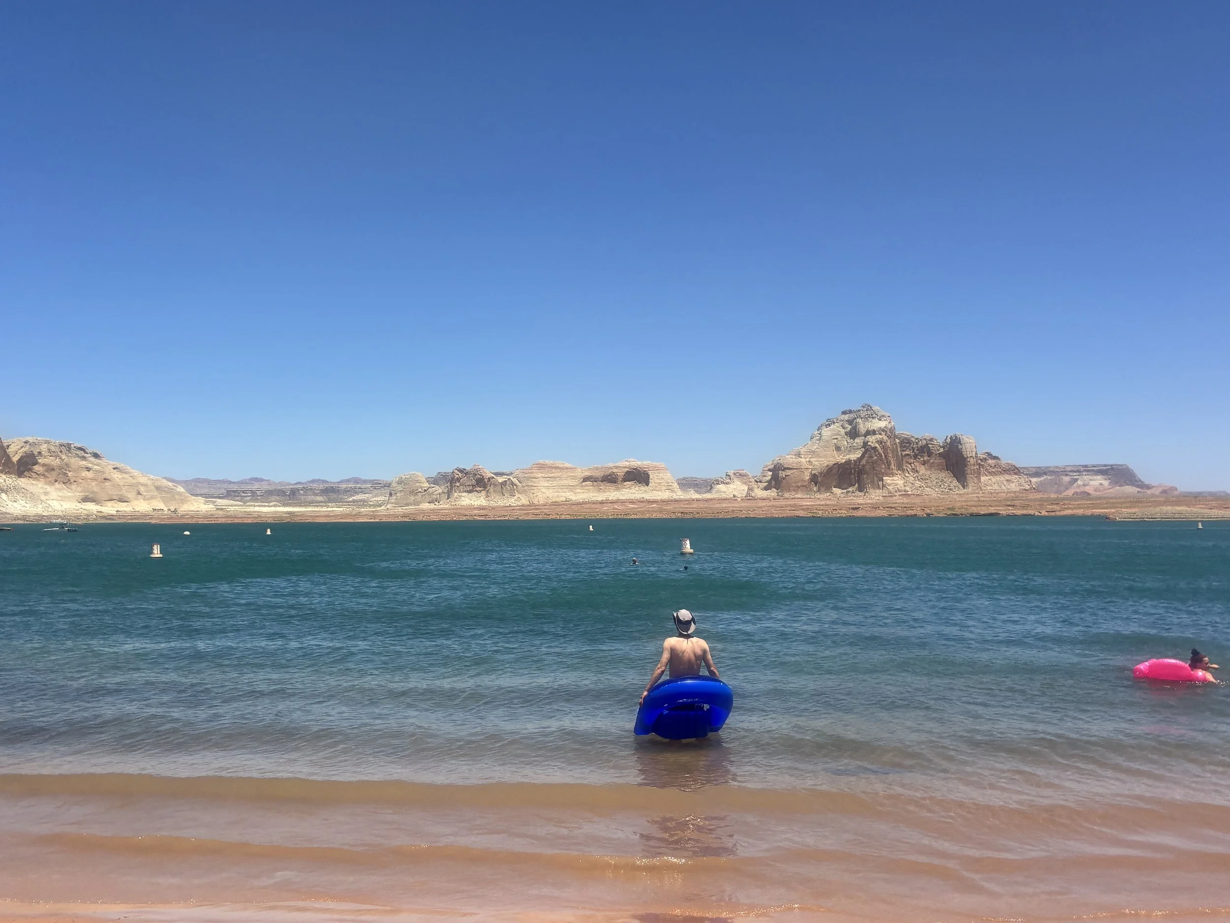
Chillin’ on Lake Powell with our floaties
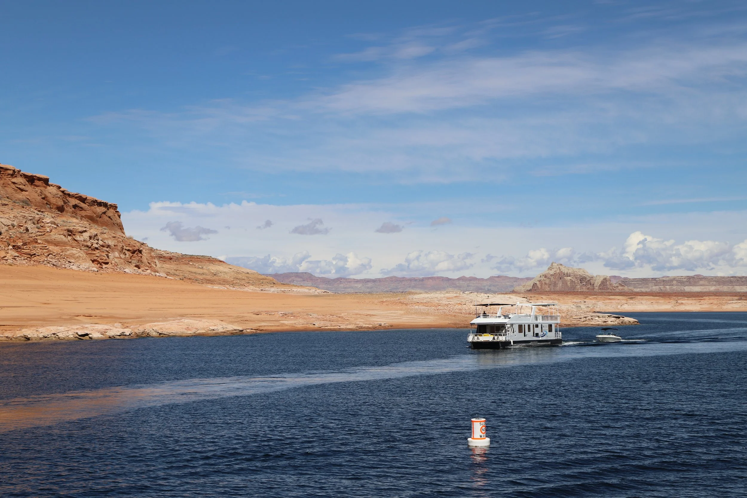
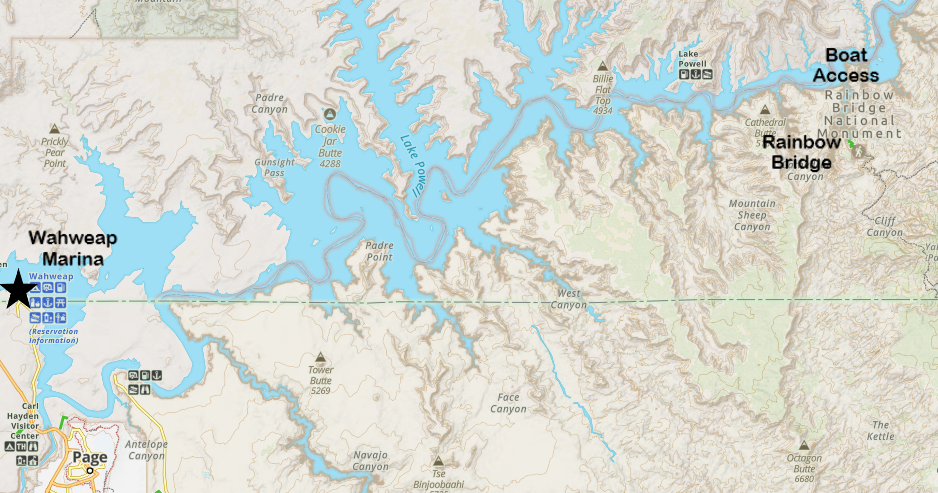
You can bring your own boat to Lake Powell if you have one, or you can rent boats (including kayaks) or take boat tours. Options are available in different locations along Lake Powell. We took a boat tour in March 2019, using Lake Powell Resorts & Marinas. Reservations can be made from the linked website. We picked the 2.5 hour Canyon Adventure tour.
Boat Ride through Lake Powell and into Antelope Canyon
Boat rentals and tours take off from the Wahweap Marina. The Wahweap Marina is within the Glen Canyon National Recreation Area, therefore, there is a vehicle fee. If you have the America the Beautiful Pass, parking is free.
This was a bit weird to me, but to get to the boat tours, you go into the Lake Powell Resort (hotel) using the main parking lot. Go inside the main building of the resort, and there will be a desk for boat tours.
We enjoyed the boat tour. It was relaxing, and fun to see the dam and canyon from within the river. My boys were pretty young though, and 2.5 hours on a boat that wasn’t very big did feel long by the end. For kids under 10, I would recommend the short 1.5-hour Antelope Canyon Tour. At least, that’s what I was wishing I had done by the end of the tour.
Just upstream of the Glen Canyon Dam - viewed from the Colorado River
There was a pre-recorded audio tour that was an option to listen to along the boat tour. It was interesting at the beginning. Eventually my boys were wiggling, and we took off the headphones and just walked around the boat, enjoying the views of the canyons as we explored the boat.
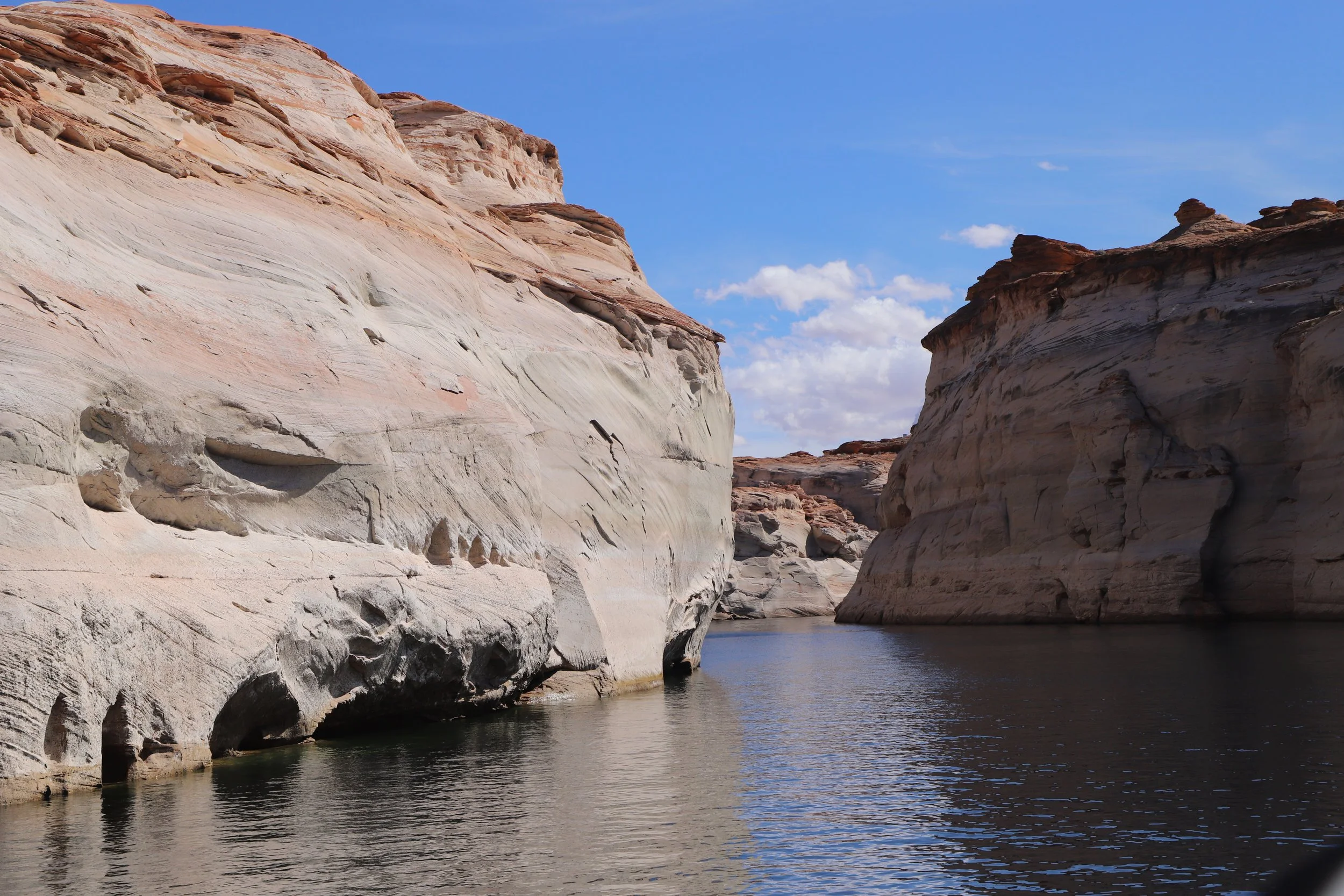
The boat tour included a ride into Antelope Canyon
Kayaks can also be rented on Lake Powell (as well as house boats). I would think kayaking would be a fun way to spend a day on the lake. Kayaks can get to Antelope Canyon, but start at the closer Antelope Point Marina. There is a 3-mile paddle, each way, to get to a hiking option. We haven’t had a chance to return to Lake Powell to try kayaking.
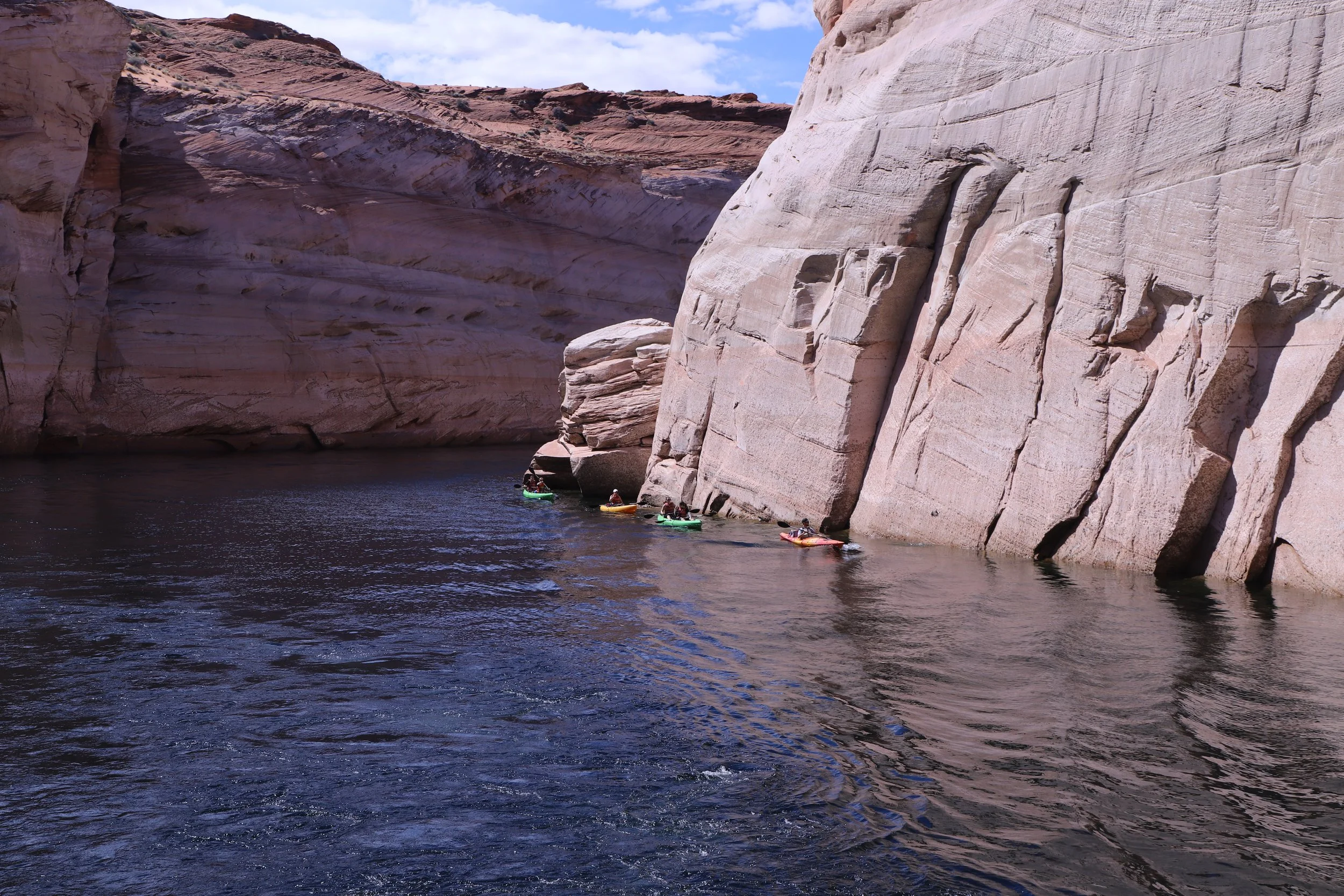
Kayaking into Lake Powell
This was about as far into Antelope Canyon as the tour boat could fit and then we turned around.
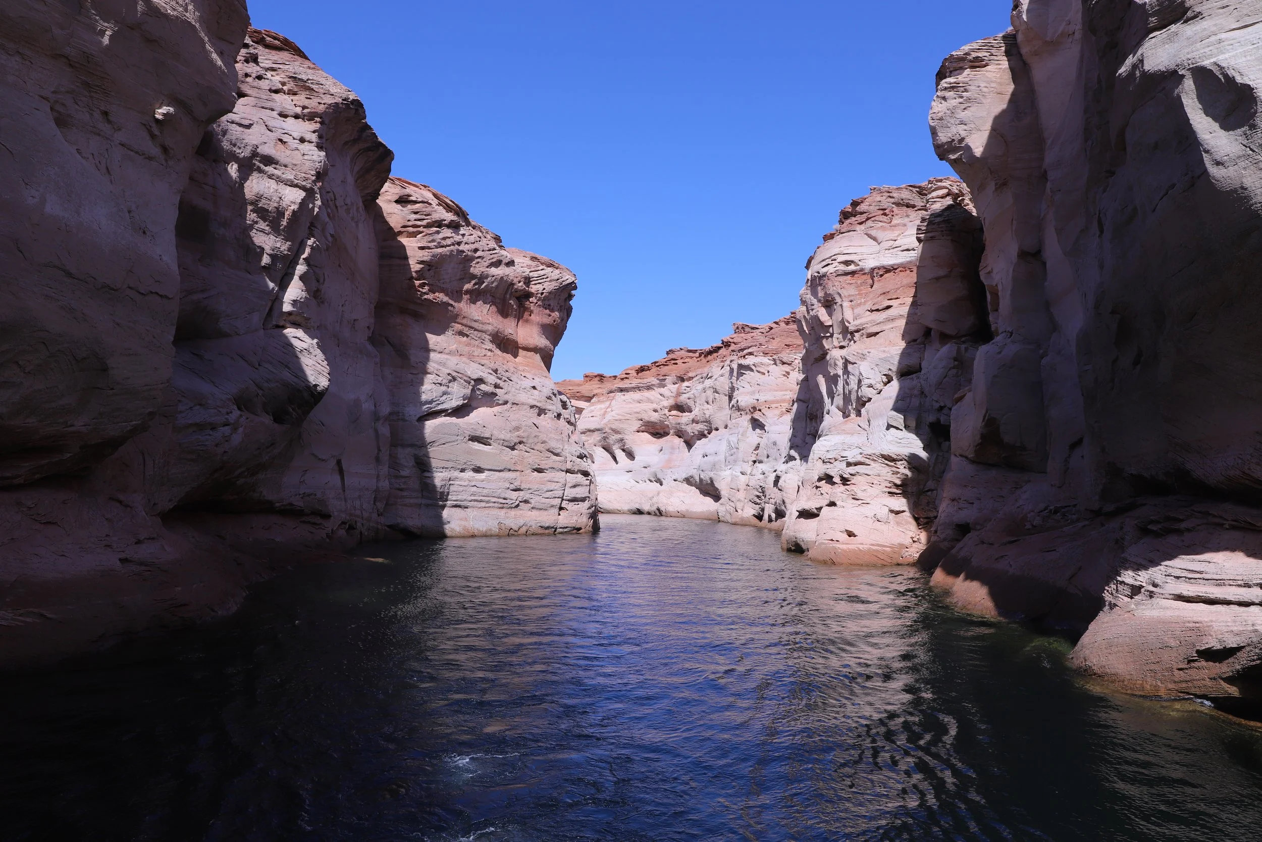
Boat tours into Antelope Canyon
March 2019 - On the Canyon Adventure Tour from the Wahweap Marina
Rainbow Bridge
Distance / Elevation - Approximate 2 miles total (out-and-back with a loop) / 450ft
Getting to Rainbow Bridge by Boat
When water levels in Lake Powell are high enough, there is an option to take a boat tour from the Wahweap Marina (same company as linked above) to a boat dock about 50 miles away, near Rainbow Bridge National Monument. From the dock, it’s approximately 2 miles to hike out and back to one of the largest bridges in the world. The tour lasts about 6 hours. Although this hike has been on my wish list since before 2019, I know that was much too long for two squirrely boys to sit still on a boat. Someday though, I’d love to return to Page to see Rainbow Bridge.
Nearby Things to Do
Antelope Canyon
Antelope Canyon is an incredibly beautiful slot canyon in Page, Arizona, about 30 minutes from the Wahweap Marina. There are three entry options - Lower Antelope Canyon, Upper Antelope Canyon, and Rattlesnake Canyon. All entries are on Navajo Tribal Land and therefore all three places require both admission to enter the park and a pre-purchased ticket for a tour at a specified time.
Wahweap Hoodoos
The Wahweap Hoodoos is another “wish list” future hike. The trail head is about 30 minutes west of the Wahweap Marina (past Big Water). According to AllTrails, this is an 8-mile out-and-back hike, with minimal elevation gain.
Toadstool Hoodoos
The Toadstool Hoodoos are further west of the Wahweap Hoodoos (about 30 minutes from the Wahweap Marina). This is an easy 1.8-mile out-and-back hike to other-worldly rock structures.
Buckskin Gulch
The turn-off road for Buckskin Gulch (the longest known hikeable slot canyon in the world) is just a couple of minutes past the Toadstool Hoodoos. I’d recommend the Wire Pass Trailhead (which takes about 30 minutes to get to from Toadstool Hoodoos). One-way, it’s 1.7 miles to get to Buckskin Gulch from Wire Pass. Then hike into Buckskin as far as you’d like. Note that there will likely be water you need to walk through in this canyon. You can go left or right once you get to the canyon.
White Pocket
White Pocket is free, does not require a permit, and is a relatively easy 2-ish mile hike (poles may help as the hiking surface is mainly rock). To get to White Pocket, you'll need a 4x4 vehicle, knowledge of how to drive in the sand, and pre-downloaded GPS maps to navigate the 4x4 intersections. Or skip that and hire a tour guide. We used Paria Outpost and Outfitters. To get to White Pocket, you will keep driving on the same road as the trailheads to Buckskin Gulch. The 4x4 roads add quite a bit of time to get to the trailhead - expect a little over 2 hours to the trailhead from Page (if you have a 4x4 vehicle).
Kanab, Utah
Kanab, Utah, is another fun town to visit and stay in. It’s about 75 minutes west of Page, but quite a bit smaller. Kanab is much closer to Zion National Park. If you want to hike more than a day in Zion, I recommend switching hotels to either Kanab, Springdale, or St. George. Or stay in Kanab and do a day trip out to Page.
All Ways Adventures
My first shout-out for things to do in Kanab goes to All Ways Adventures. We booked a day excursion with them in March 2023 and tried out canyoneering for the first time - ropes, harnesses, helmets (the whole shabang) - and so much easier than rock climbing since gravity does all of the work. My boys loved it! Our tour guide, Brett, made it fun, not scary, and it didn’t seem overly complicated. Two years later, we hired a guide in Minnesota to teach us how to canyoneer, and we ventured out on our own in June 2025. Here’s our story. I couldn’t recommend this tour group enough for anyone looking to try something new that will be a day you’ll remember forever!
Kanab Sand Caves (Moqui Caverns)
The Kanab Sand Caves (also known as the Moqui Caverns) is a short hike (little less than a mile out-and-back) with a very steep and somewhat sketchy sandstone hill to climb to get to a manmade cave. The best time for pictures is late in the afternoon. The trailhead is about 90 minutes from Page. Probably not worth it on its own, but a nice add on for a day of hiking on the eastern side of Zion. This is a free place to hike and park
Belly of the Dragon
Just a bit west of Kanab Sand Caves (on the way to Zion’s East Entrance), Belly of the Dragon is a fun place to stop. Pictures on the internet are a bit confusing though. I just want to set expectations appropriately… This is an amazing manmade water culvert under US-89 that is being carved slowly into a slot canyon by the water moving through the sandstone. The water culvert is under US-89 and parking is free. Roundtrip trail is 0.25 miles. It’s not a natural cave or canyon - it’s a water culvert, but a pretty cool water culvert.
Red Canyon (Peekaboo Kanab)
The 4x4 trailhead to Red Canyon (also known as “Peekaboo” but not to be mistaken by the more impressive Peekaboo Cayon in Esclante, Utah) is between the Kanab Sand Caves and the Belly of the Dragon. This slot canyon requires a 4x4 to visit. Another shout-out to All Ways Adventure - we had a bit of time left over after canyoneering, so we had a chance to explore this canyon.
Coral Pink Sand Dunes
Coral Pink Sand Dunes State Park is about an hour 40 minutes from Page. The turn-off to the park is between Kanab Sand Caves and Belly of the Dragon. If you haven’t ever seen a sand dune, this is worth the drive (although the sand is going to be extremely hot in the summer… Pick a cooler season to explore the sand dunes). The state park has an entrance fee, and sleds can be rented at the visitor center. Yep, I said sleds… It’s kind of like snow sledding, but not cold… however sand will get everywhere. Bring quarters to wash out clothes at the hotel afterwards to keep sand out of everything else you’ve packed with you on your vacation.
Water Canyon
Water Canyon is a two-hour drive from Page (not on the way to Zion National Park), although it is also west of Page. There is a two mile out-and-back hike to the waterfall, a 6 mile out-and-back hike to White Dome, or an option to hike up into Water Canyon and rappel out. This wild, rugged canyon has something for all adventurous souls. If “adventurous soul” doesn’t describe you, that’s ok. Skip this park. Stick to Zion National Park - there are lots of amazing trails with various difficulty.
Zion National Park
Zion National Park is incredible and one of my favorite National Parks. There are so many fantastic hikes for all types of hikers - beginners through advanced. The east entrance is not quite 2 hours west from Page. If you want to hike in Zion for more than a day, I recommend switching hotels to something closer in Kanab, Springdale, or St. George.
Monument Valley Navajo Tribal Park
Switching directions - Monument Valley is 2 hours east of Page. This is also an incredible place to explore. Visiting Monument Valley Tribal Park involves a 17-mile loop drive that requires a higher clearance vehicle. If you don't have the right kind of car, you can book a guided tour. There is also a 4-mile loop hike trail - Wildcat Trail, which is not well marked, but fun to explore.
Grand Canyon
It’s a bit funny to me that I don’t have a blogpost yet for visiting the Grand Canyon, when hiking the Grand Canyon rim-to-rim-to-rim is what started my blog. It’s coming… But there are several posts in Utah still ahead of it. The Grand Canyon Village (best place to get a hotel on the south rim…. which is the only current option as much of the north rim burned down in the summer of 2025) is about 2.5 hours southwest of Page. It wouldn’t be worth it for a day trip back and forth from Page, but it’s a great destination on the same vacation as a trip to Page.
If you’d like to read out my rim-to-rim-to-rim hike and see pictures of the Grand Canyon, this was my first blogpost. Not a hike I would recommend for most people due to the immense amount of training required, but it was a hike that changed my life.
More from www.NatureImpactsUs.com
In the map below, there are additional posts I’ve written attached to each pin. Use two fingers to move around within the map.